Monthly Archives: March 2023

North Toronto Station

Sunday, March 26, 2023

Railways began to arrive in Toronto in 1853 and by 1858 it was necessary to have a central station where passengers and freight could switch between different lines. This led to the construction of a Union Station that was shared between the different railways. The original wooden structure was replaced in 1873 with a much larger station. In 1905 it was decided to replace this station with a new Union Station, which is the structure we now have on Front Street. Although it was proposed in 1905 construction didn’t begin until 1914 and the shortage of construction materials during World War 1 meant that it wasn’t until 1920 that the structure was largely completed. This station wouldn’t open to the public until August 10, 1927.

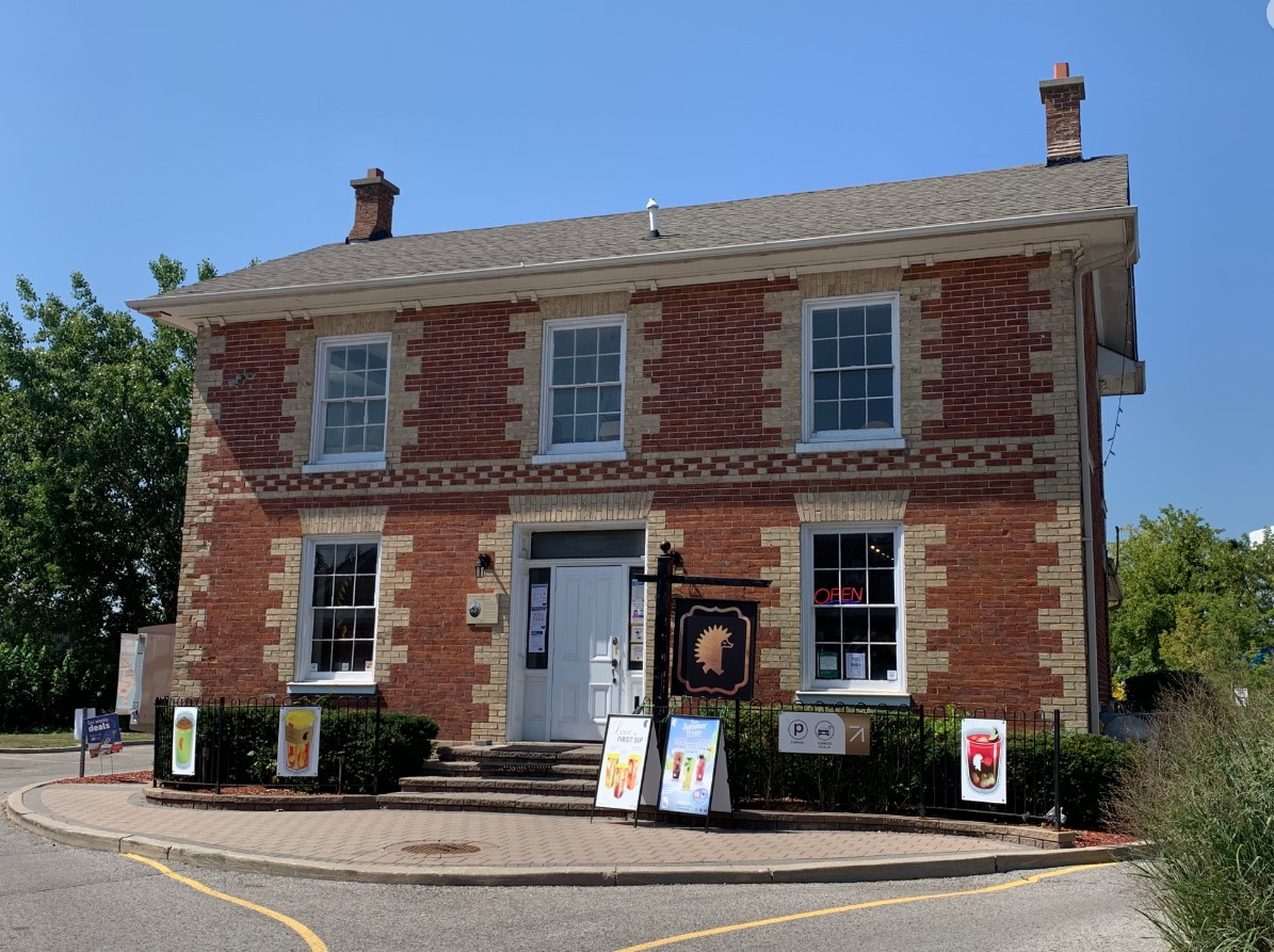
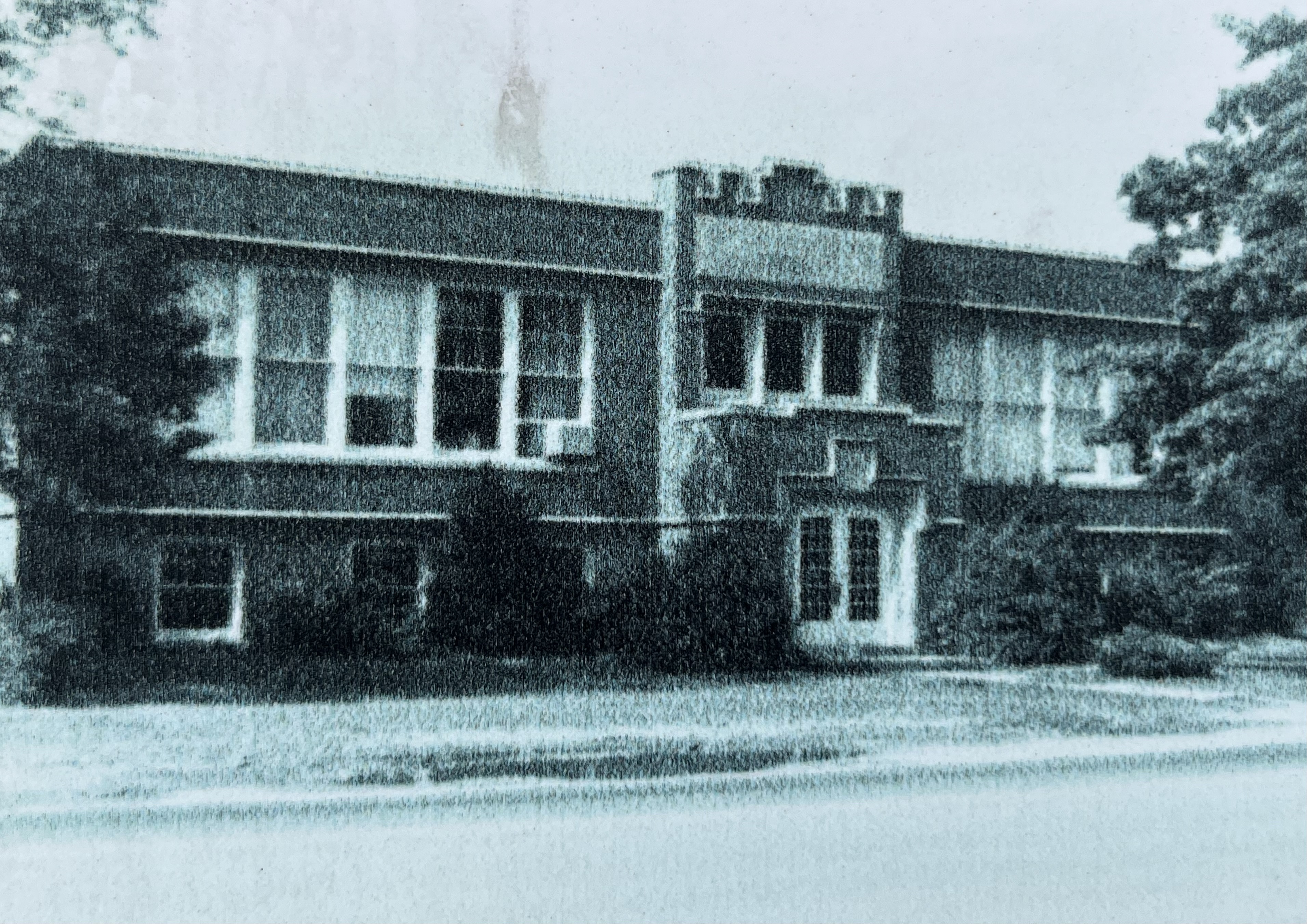
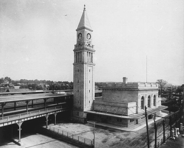
Meanwhile, the Canadian Pacific Railway had a line that ran through North Toronto and was serviced by a modest station on the west side of Yonge Street. The delays in completion of the Union Station led them to decide to replace their existing station with a much grander one on the east side of the road. Toronto mayor Tommy Church laid the cornerstone on September 9, 1915 and the station opened for service on June 14, 1916. The archive photo below shows the station shortly after completion.

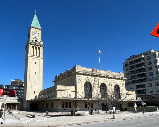
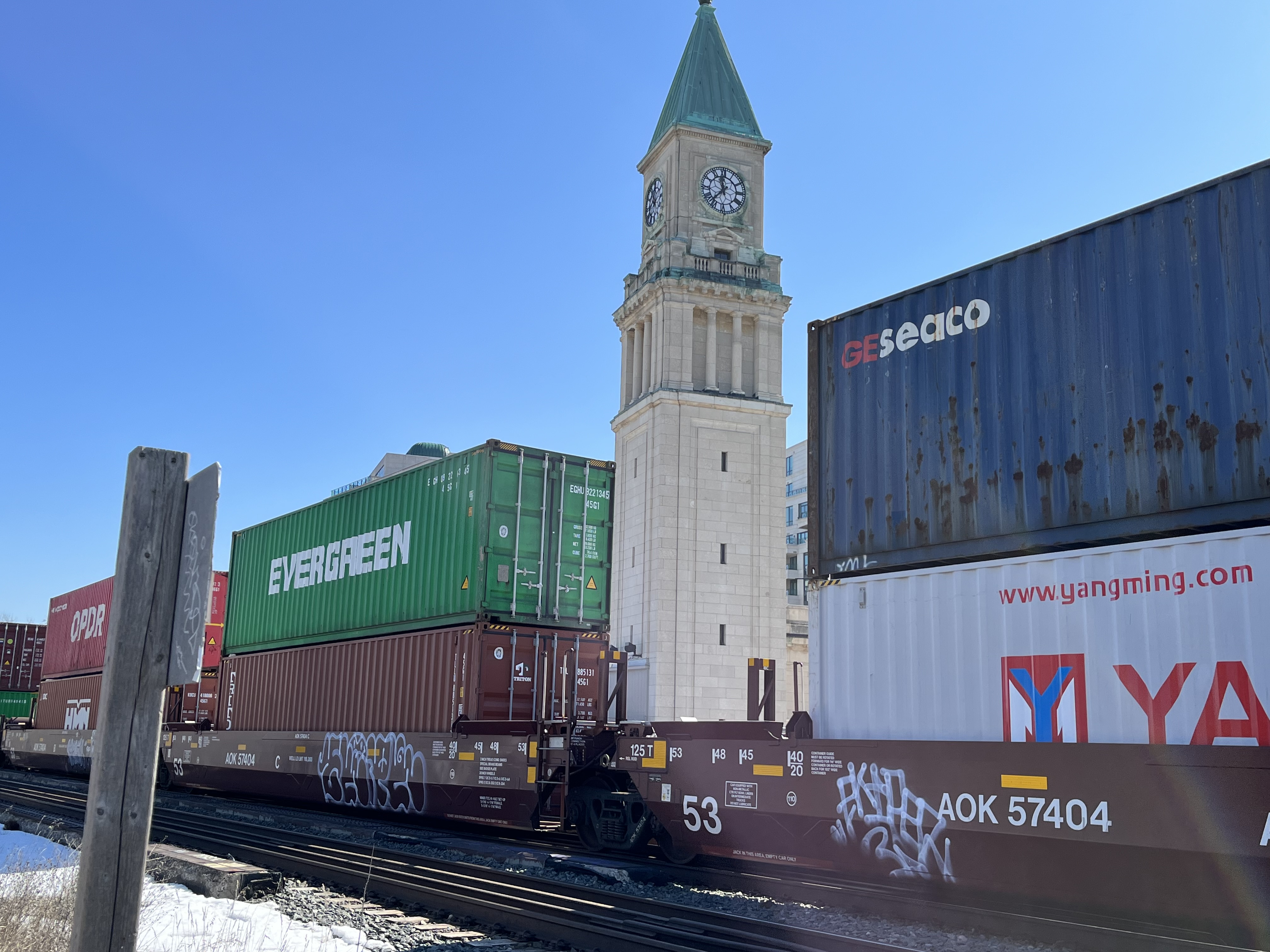
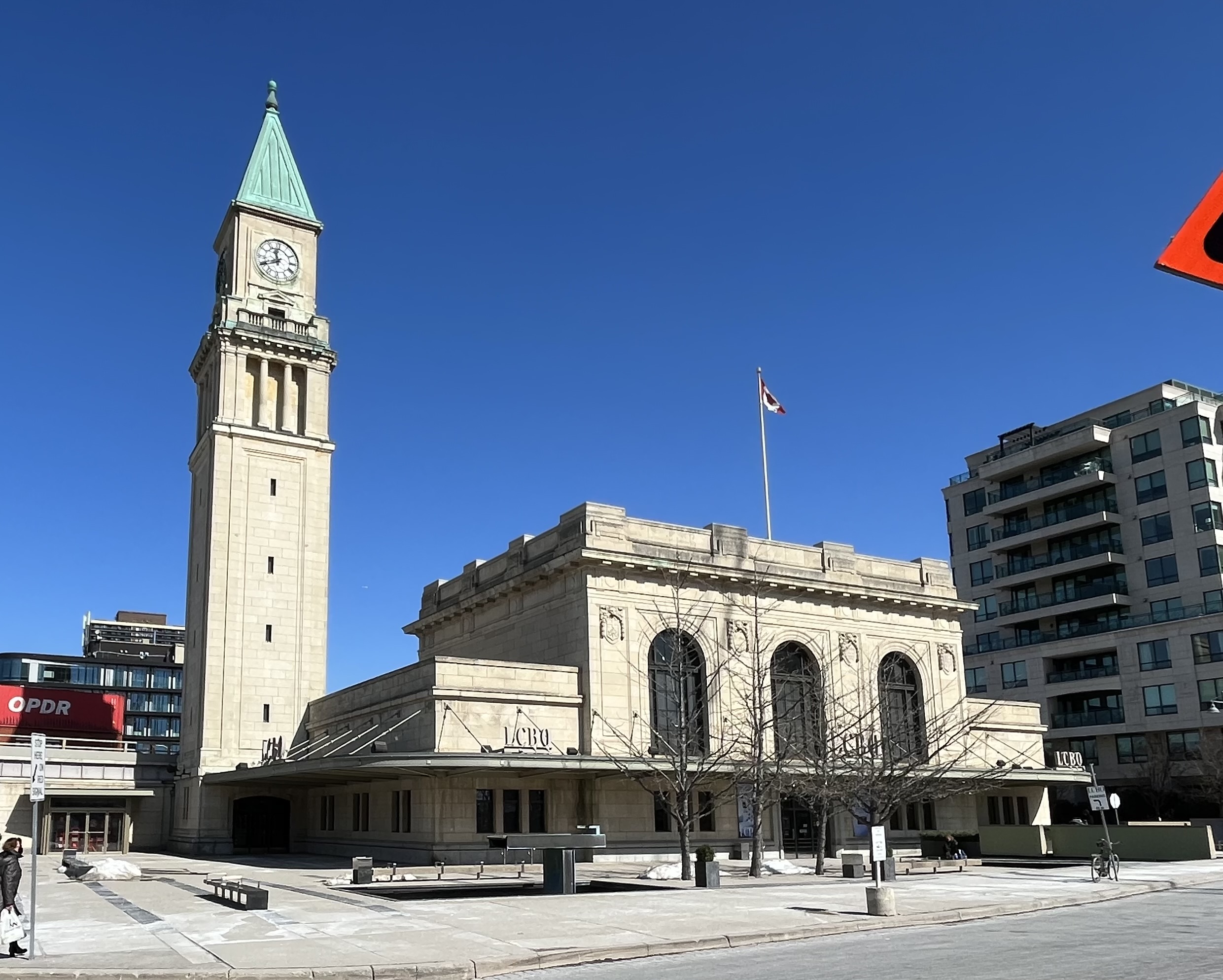
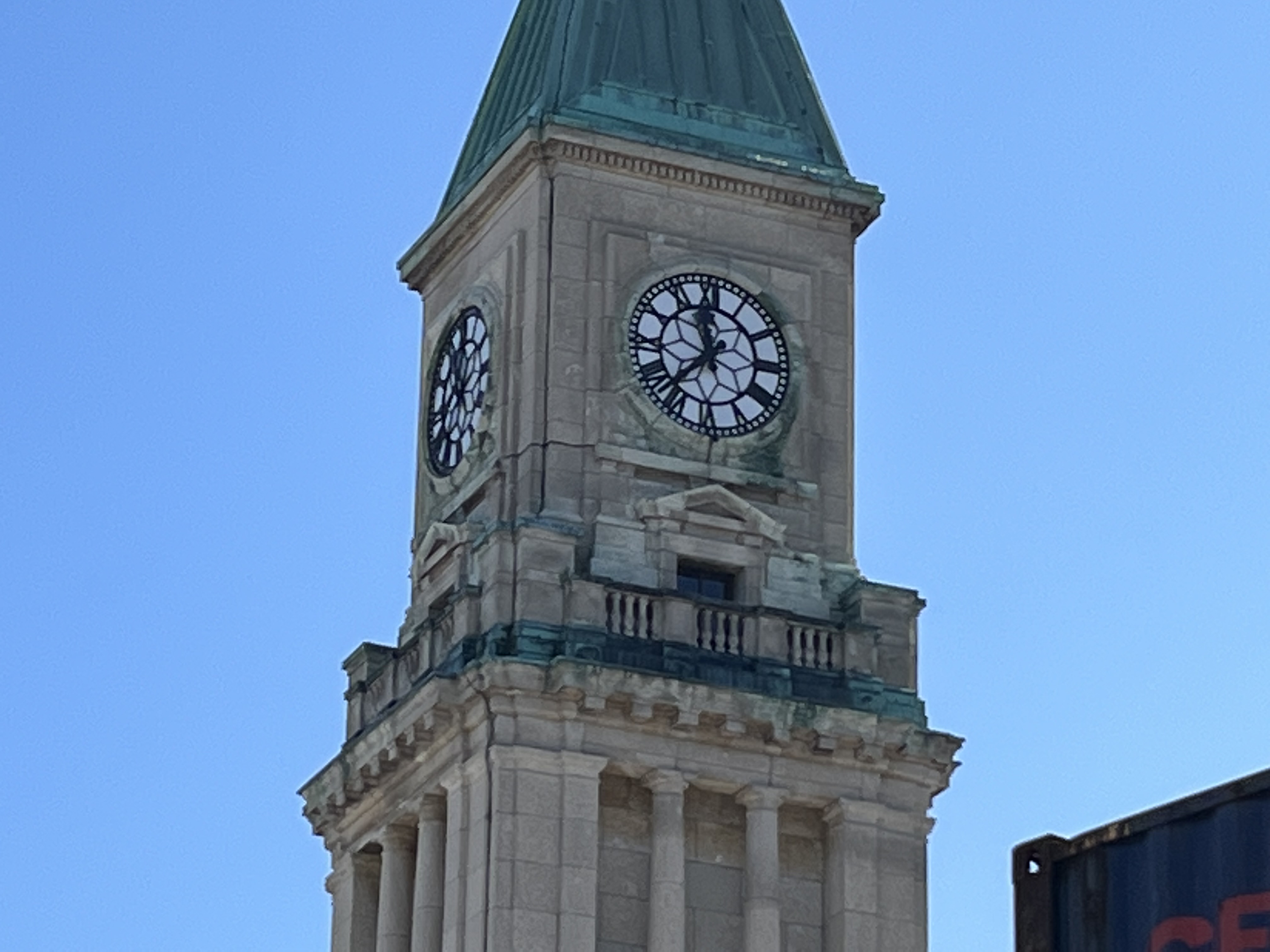
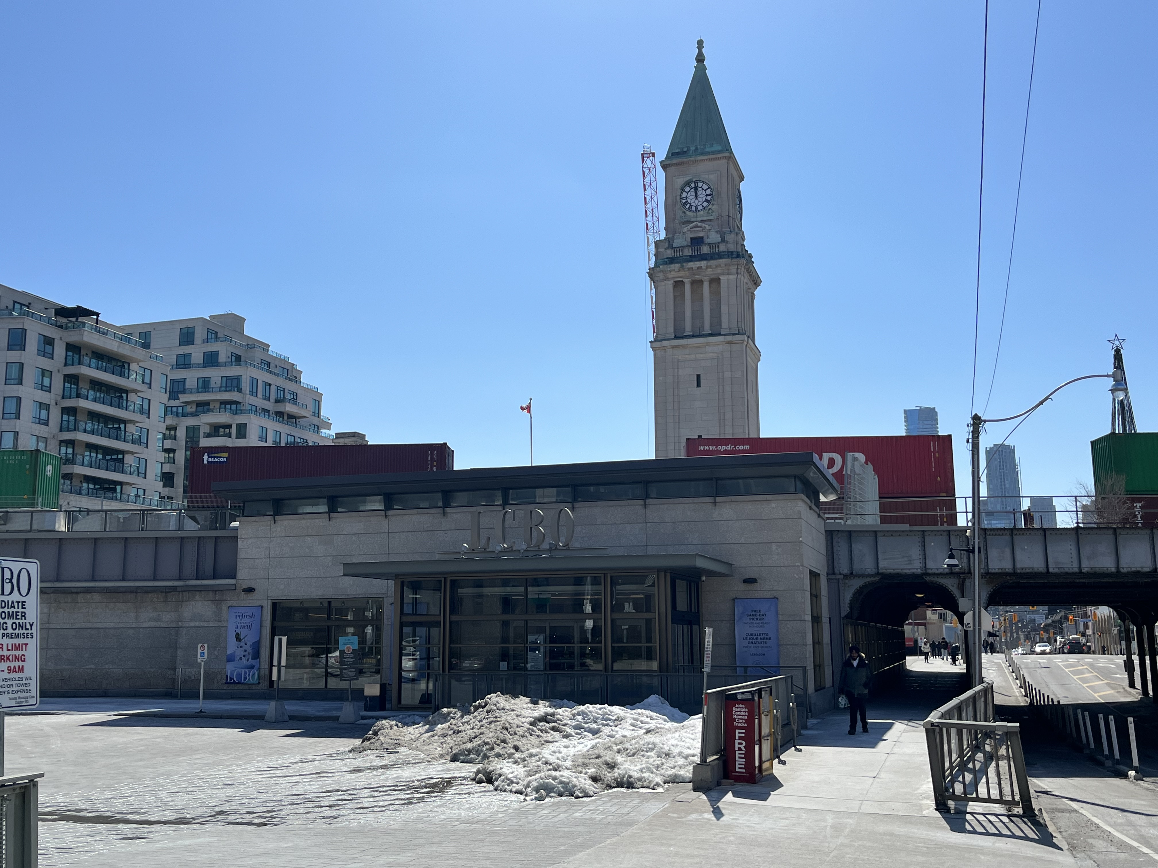
The station served passenger traffic until September 27, 1930 when the CPR decided to route through the recently opened Union Station downtown and North Toronto Station closed. It reopened for a day on May 22,1939 for the royal visit when King George VI and his consort Queen Elizabeth passed through during their visit to Toronto. Canadian soldiers returning from World War 2 also passed through the station even though the Brewers Retail had moved into the north side of the building in 1931 and the LCBO had moved into the south side in 1940. One of the dominant features of the new station was its 43-metre (141 feet) clock tower as seen in relation to the active rail line that still runs behind the building.

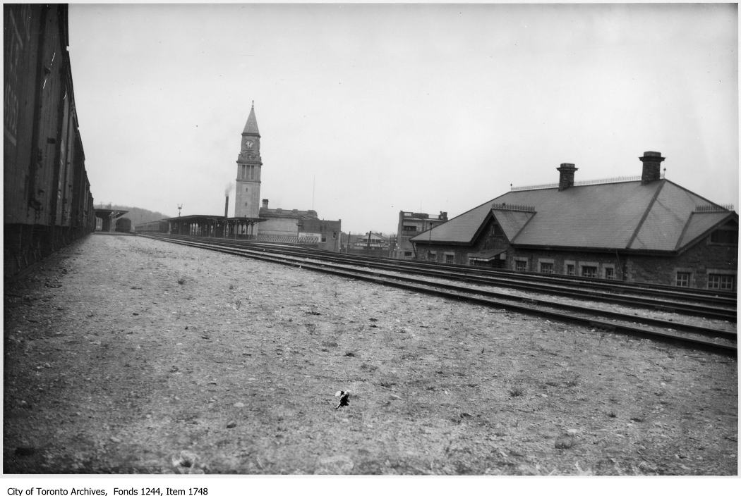
The new station replaced an older one which stood on the west side of Yonge Street. The Toronto Archives picture below shows both the old and new stations.

The three story building was the first in the city to be built out of Tyndall Limestone imported from Manitoba and is designed in the Beaux Arts style. This limestone is known for it’s durability as well as the fossils that are embedded in it. The theme of three floors is repeated in the three large windows on the second floor as well as the three distinct sections of the clock tower.

During the years that the station was in use the clocks were always illuminated at night.

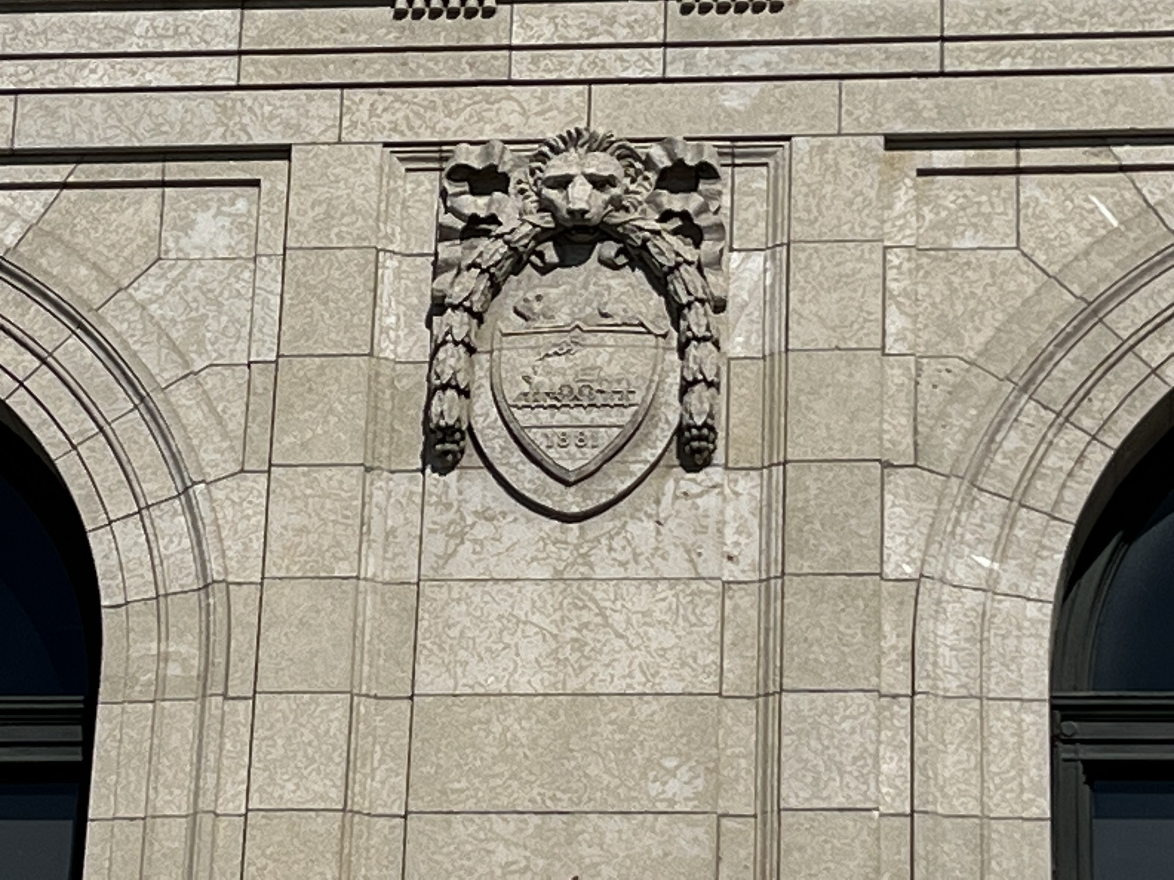
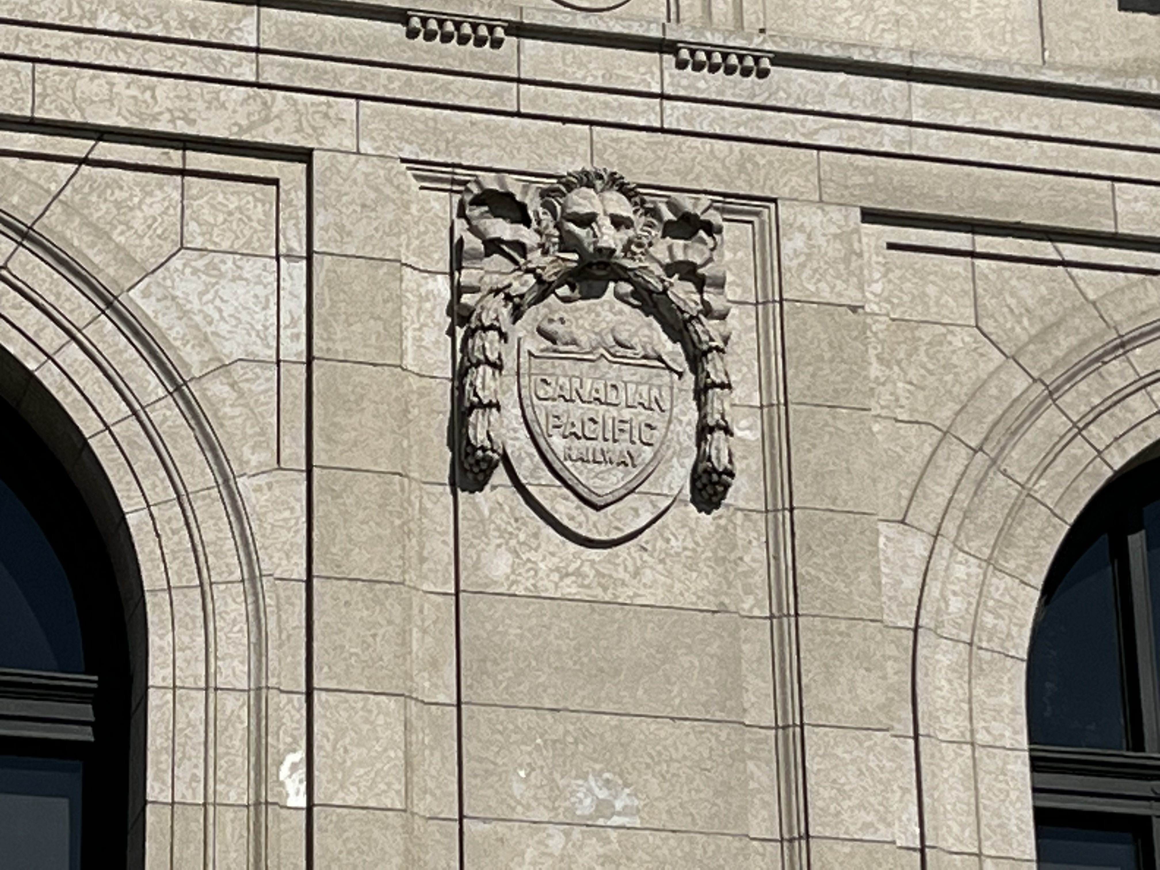
The Canadian Pacific Railway was incorporated in 1881 as noted in the emblem near the main doors on the south side of the building. The line was built between eastern Canada and British Columbia between 1881 and 1885 as part of a commitment to build Canada’s first transcontinental railway. This promise had been part of the agreement with British Columbia when it joined confederation in 1871.

The Canadian Pacific Railway (CPR) was completed on November 7, 1885 with the last spike being driven in by Donald Smith. British Columbia now had a land link to the eastern provinces and the 4-month sea voyage was now reduced to 7 days by rail between Port Moody and Montreal.

Sometime between 1948 and 1950 the clocks were removed from the tower leaving openings behind that became the entryway for generations of pigeons to take up residence. By 2004 when restoration was undertaken there were over 4,000 kilograms of pigeon feces lying in the base of the tower. This had to be removed and disposed of as part of the restoration. The original clocks were recovered and restored and now have resumed their duty of keeping time for those who pass by on Yonge Street. Inside the old station the bottom of the tower has been turned into a tasting room where people can try some of the various alcohol available at the store.

The inside of the clock tower reveals the use of marble and the ornate doors that led into the building.

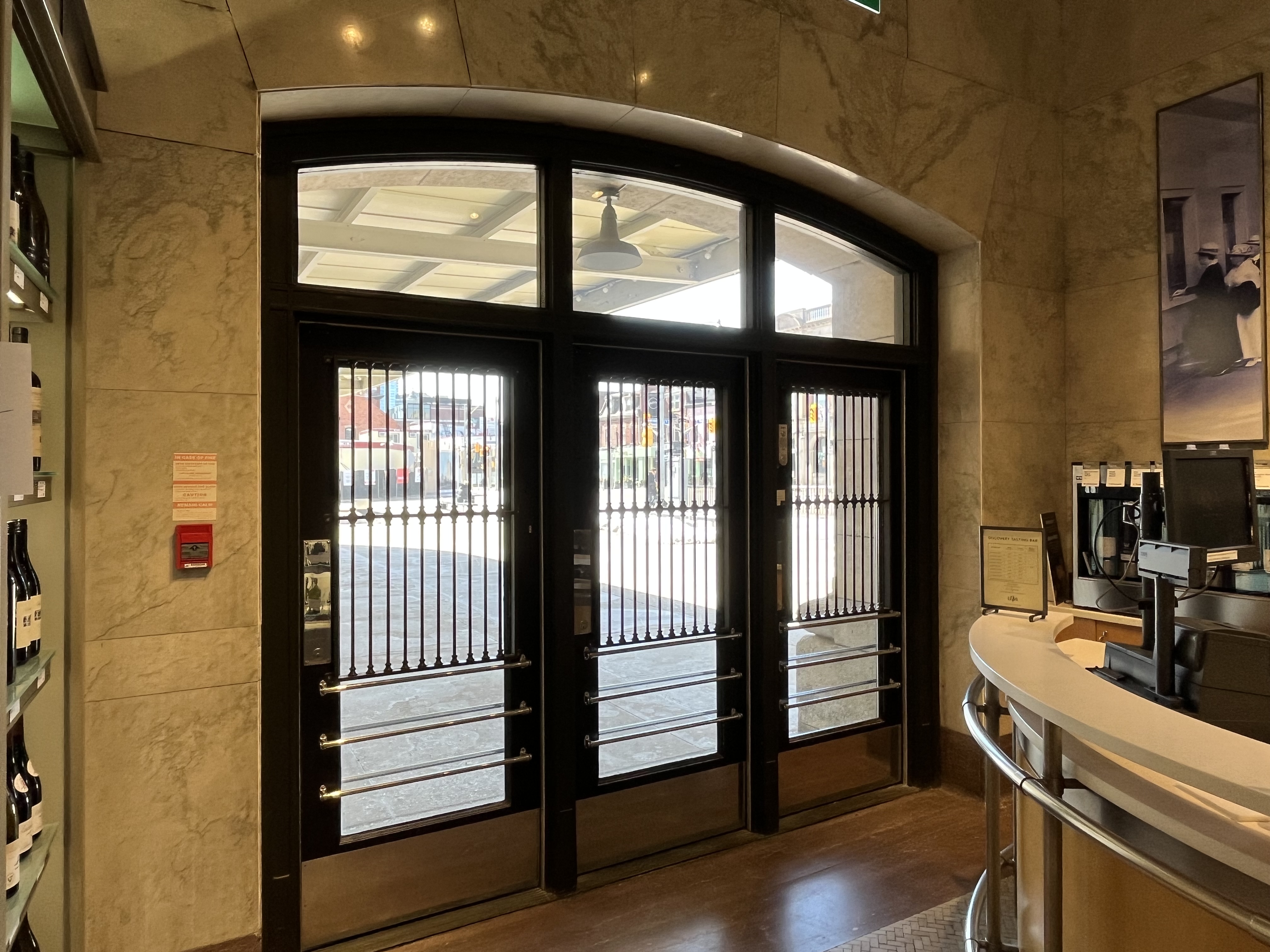
The main terminal gallery, or waiting area, had 38-foot (11.6 metres) high ceilings complete with brass lights designed to look like train wheels. Drop ceilings and walls had hidden many of the architectural features inside the building since it had been in use for retail purposes.

Restoration of the inside was undertaken in 2004 and all of the original interior was exposed again for the first time in over 60 years. A time capsule was uncovered in the cornerstone of the tower and was opened on the 100th anniversary of the laying of the stone. It contained newspapers from September 9, 1915, various coins, and a city map among other things. A new time capsule was put there to replace it. This one contains newspapers from September 9, 2015, the September issue of Toronto Life, some bottles of liquor from the store as well as an iPhone and a Blackberry. The picture below shows one of the original ticket windows that had been hidden for decades.

Other features of the old waiting area include a wooden bench that passengers sat on 100 years ago while they waited for their train to arrive or for passengers to show up.

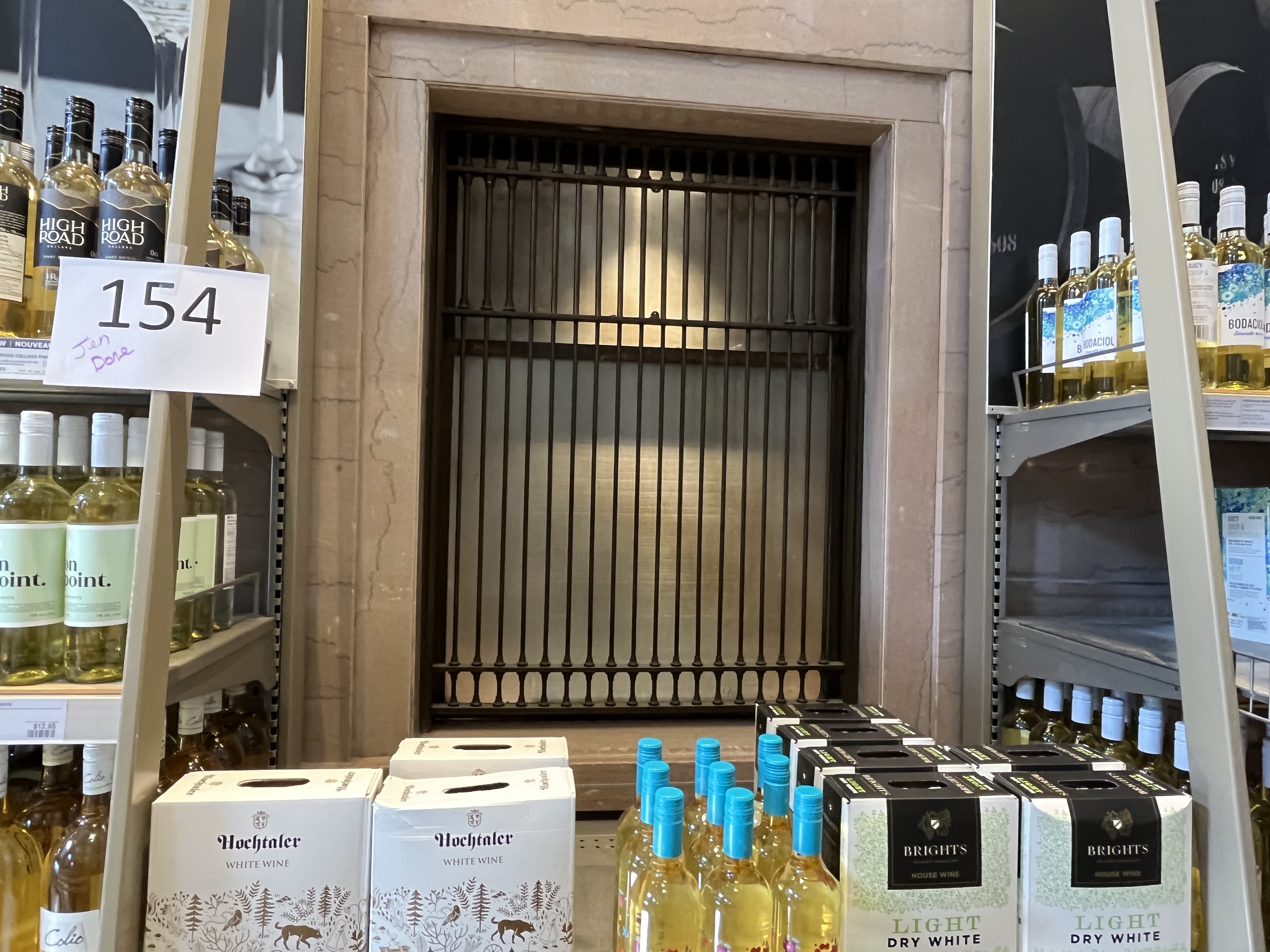
The rails ran over Yonge Street on a trestle bridge that remains in place today. The station windows can be seen in the picture below, which was taken from across Yonge Street.

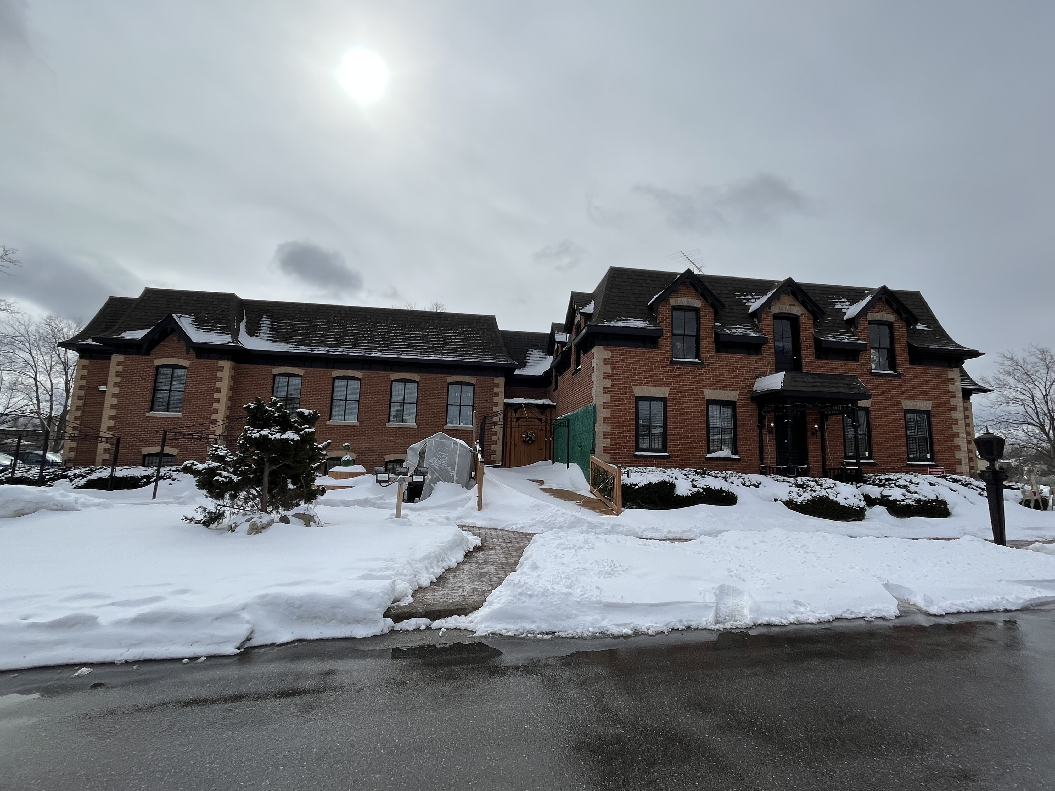
With the tracks passing through the centre of the building there had been stairs that led from the inside up to the track level. The picture below shows the north part of the building that served as a beer store starting in 1931. The entire building is currently home to the LCBO and is the largest liquor store in Canada.

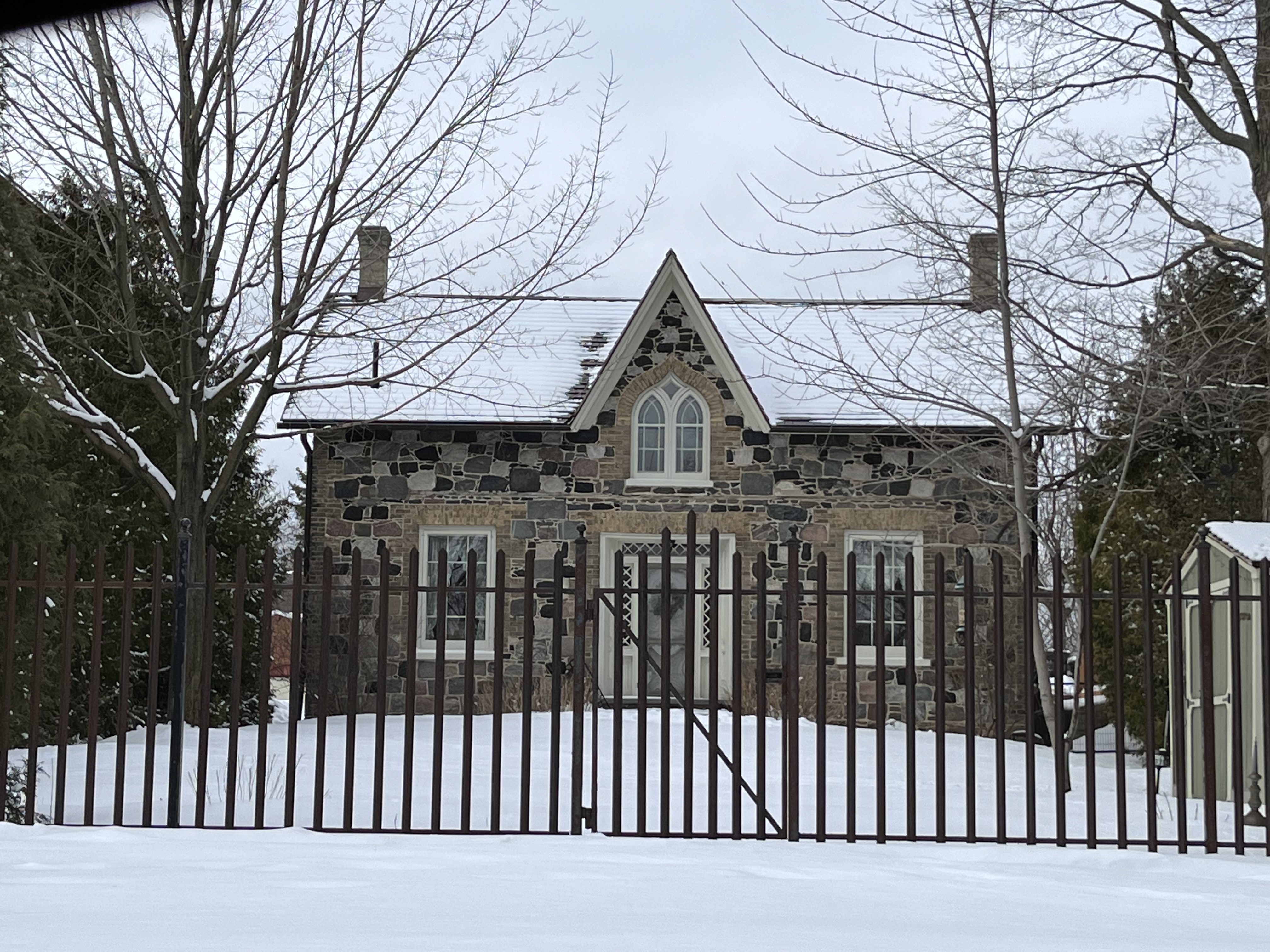
At one time there were hundreds of railway stations across Ontario but many of them were demolished to lower property taxes and prevent the possibility of injury and lawsuits from trespassers. Fortunately, a few still survive and we will be looking at some of them over the coming months and years. You can see a few of them in the links below.

Related Stories: Roundhouse Park, Richmond Hill Station

Google Maps Link: North Toronto Station

Like us at http://www.facebook.com/hikingthegta

Follow us at http://www.hikingthegta.com

Also, look for us on Instagram

Milliken – Ghost Towns of the GTA

Sunday, March 12, 2023

The community of Milliken was located at the intersection of Steeles Avenue and Kennedy Road. Part of it was in Scarborough and part in Markham as Steeles Avenue is the dividing line between the two townships. The area was first settled by Europeans in 1798 and Norman Milliken arrived around 1807 and set up a saw mill and lumber business. It was known as Milliken Corners and got a post office in 1858 when it became a postal village. The post office was located just west of the present United Church.

The map below was taken from the 1878 county atlas and shows the Scarborough portion of Milliken. The homes of William Hood, Marshal Macklin and George Stonehouse are circled in green as is the original location for the Methodist Church. These will be covered in more detail below as they are the remnants of the original community.

The Stonehouse-Lawrence house was built in 1871 and formerly fronted onto McCowan road although this is now the back yard of the home. When the farm was developed for housing access was cut off from McCowan which became a four-lane road. Delburn Drive was cut through the back yard and now this is the main entrance and driveway for the home.

The most visible reminder of Milliken is Ebenezer United Church at the corner of Brimley Road. The 1878 county atlas for Scarborough Township shows a Methodist Church on the south side of Steeles while the one for Markham Township places it on the north side of the road as it is today. This happened because 1878 was the year the congregation decided to replace their original building with with this brick one constructed in the gothic revival style. They worshiped in the first church while they erected the new one across the road.

Marshall and Mary Macklin purchased their lot facing Brimley Road in 1830. The stone house was completed in 1851 and was used to raise their family which included 17 children. A small creek used to run between the house and Brimley but it was replaced with a drainage ditch many years ago. The house remained in the Macklin family for over a century.

William Hood emigrated from Scotland in 1831 with his wife, mother and two young sons. In 1839 they purchased a farm lot in Scarborough and in 1850 they built a one-story brick farm house in the Georgian style. The original five-bay house was very symmetrical with a plain central doorway and transom window above it to let in some light to the main hallway. As the family grew a second story was added to the home along with a Second Empire style of roof.

William’s youngest son, Thomas inherited the property in 1892 and remained there for the next ten years with his family. William Francis Gough bought the estate in 1920 and he and his wife renamed it Devonsleigh after their homestead in England. They farmed the land until 1954 and lived in the house until 1966. In 1982 the home was renovated and enlarged again and preserved as Devonsleigh Place. For awhile it was used as a steakhouse. Today the 170 year old home is used as Casa Imperial, an upscale Chinese Restaurant.

The map below was taken from the Markham County Atlas of 1878 and shows that portion of Milliken. Circled in green are the homes of Benjamin Milliken II which was owned by William Milliken at the time, William Macklin house and the site of Ebenezer Primitive Methodist Church.

Benjamin Milliken II was the son of the founder of Milliken and he built this home in 1855. It now stands behind the Dairy Queen near Hagerman’s Corners and is used as Milliken Pub.

The first school to serve the community of Milliken Corners was established in 1838 not far from the school pictured below. Initially the school had 26 students under the teaching of William Galloway. When newer schools were opened a little north in Haggerman’s Corners and south at L’Amoreaux students were transferred to these schools. In 1929 two acres of land were sold for $600 by L. E. Morgan to the school board for the construction of a public school. The cost of the school, including the land and all of the furnishings was $28,000. Milliken Public School was known as a union school because it served students from both Scarborough and Markham townships. The school operated until 1968 when newer schools were built and it was closed. The building was then used by the Richmond College of Liberal Arts and then Scarborough Christian High School. The picture below shows how the school looked in 1977.

In 2010 the building was demolished except for the front facade which was incorporated in the Milliken Centre development.

The William Macklin house was built in 1840 at 2501 McCowan Road and has since been expanded and now houses a daycare. Recently it has been designated as 2501 Dennison Road as the laneway is now accessed from this street rather than McCowan.

Milliken Corners and Milliken Mills were rural communities but in the 1970s and 1980s were swallowed up by development, leaving only these few traces of the former farming communities.

Related stories: Milliken Park, Haggerman Corners

Google Maps Link: Milliken

Like us at http://www.facebook.com/hikingthegta

Follow us at http://www.hikingthegta.com

Also, look for us on Instagram

Conboy Carriage Company

Sunday, March 5, 2023

The Conboy Carriage Company Limited started in Vallentyne Ontario in 1860 before moving to Uxbridge. In 1884 it moved again, this time to Toronto to take advantage of the local market and the easy access to all the rail lines on the waterfront that allowed export of its products to other markets. The town of York had started as just ten blocks in 1793 but by 1797 it had started to expand beyond that to the north and west of the original site. When the town was founded, it was guarded by Fort York which was established along with the Garrison Common, a large military reserve land between it and the town. By 1833 the War of 1812 was a fading memory and plans were put into place to develop part of the Garrison Common for additional housing plus some estates for the wealthy along the lakeshore. When the railways arrived in the period between 1850 and 1880 much of this area was redeveloped for industrial purposes. In 1884 Daniel Conboy purchased Lot 3 and built an industrial building for his company the Conboy Carriage Company. The map below shows the area as it appeared on the 1884 Goads Fire Map. Also shown here is the Military Burying Grounds featured in a separate blog post. The map was taken from the submission to the city for historical designation of the Conboy building. The blue arrows shows the location of the building.

Conboy bought the one-story rough cast house at 413 King Street West and had the three story carriage factory built on the vacant lot at 407 King Street West. The business did very well and in 1897 Daniel commissioned a new home at 493 King Street West which was designed by the architect James Augustus Ellis. By this time the street had been renumbered and the factory was known as 485 King Street West.

In 1900 he had the original factory extended and added a new building at the rear of his house running perpendicular to the original building. The new structure is formally known as 495 King Street West and is currently being retained as part of a development being completed on the front of the property.

It wasn’t long before the business outgrew the original building and Conboy built a new factory on the east side of the Don River near Queen Street. The building suffered a fire in the 1920s and was restored a few years later. Unfortunately, it has been demolished and replaced with a condo development. When automobiles became more popular the company changed its production to manufacture auto bodies for Buick, Hudson and Rolls Royce. It was the first company outside of Britain to build the body of cars for Rolls Royce. In 1914 the company produced the most expensive car built in North America up to that time. It was called The Swan and sold to a Toronto client for $13,000. The image below is from their 1915 catalogue and was taken from the submission to the city for historical designation of the Conboy building.

It was constructed on the east side of the property to leave room for an alley along the west side of the building. Two delivery doors faced the alley and broke up the the sets of windows which lined all three floors. Originally the interior was lit by gaslight and so windows were provided to increase the amount of natural light available. The joists stretched across the building leaving no interior support and allowing a large amount of open space inside for moving materials around. When Conboy moved out of the building it was occupied in 1907 by the Imperial Paper Box Company.

Daniel Conboy died in 1917 from the Influenza epidemic and his company was taken over by his three sons. It was unable to survive the market turbulence of World War 1 and closed in 1918. Meanwhile, the same year saw the building on King Street taken over by The National Cabinet Company. They would change their name to The National Radio Cabinet Company before vacating the building in 1957. In 1958 the building was under the ownership of Pauline Pattenick who renovated the front face and interior of the structure. Between 1960 and 2014 it was occupied by the Du-Sel Importing Company under the ownership of the Pattenick family. The original windows were two over two sash windows with arched heads. The only adornment was a brick pediment on the top of the King Street face of the factory. In 2013 the front windows were boarded over and the side windows had previously been filled in with concrete blocks. White paint had been added to the front and part way down the west side.

The building has had an historic designation and has now been restored. Although the building is almost 140 years old and the Imperial Paper Box Company only occupied it for 11 years they are commemorated on the side rather than the Conboy Carriage Company.

Fortunately the King-Spadina Heritage Conservation Area has protected the row of historical factory buildings along this section of King Street.

Associated stories: Military Burying Grounds,

Google Maps Link: Conboy Carriage Company Building

Like us at http://www.facebook.com/hikingthegta

Follow us at http://www.hikingthegta.com

Also, look for us on Instagram