Category Archives: Sixteen Mile Creek

The Old Dam – Oakville

Saturday, February 4, 2017

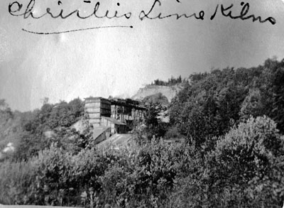
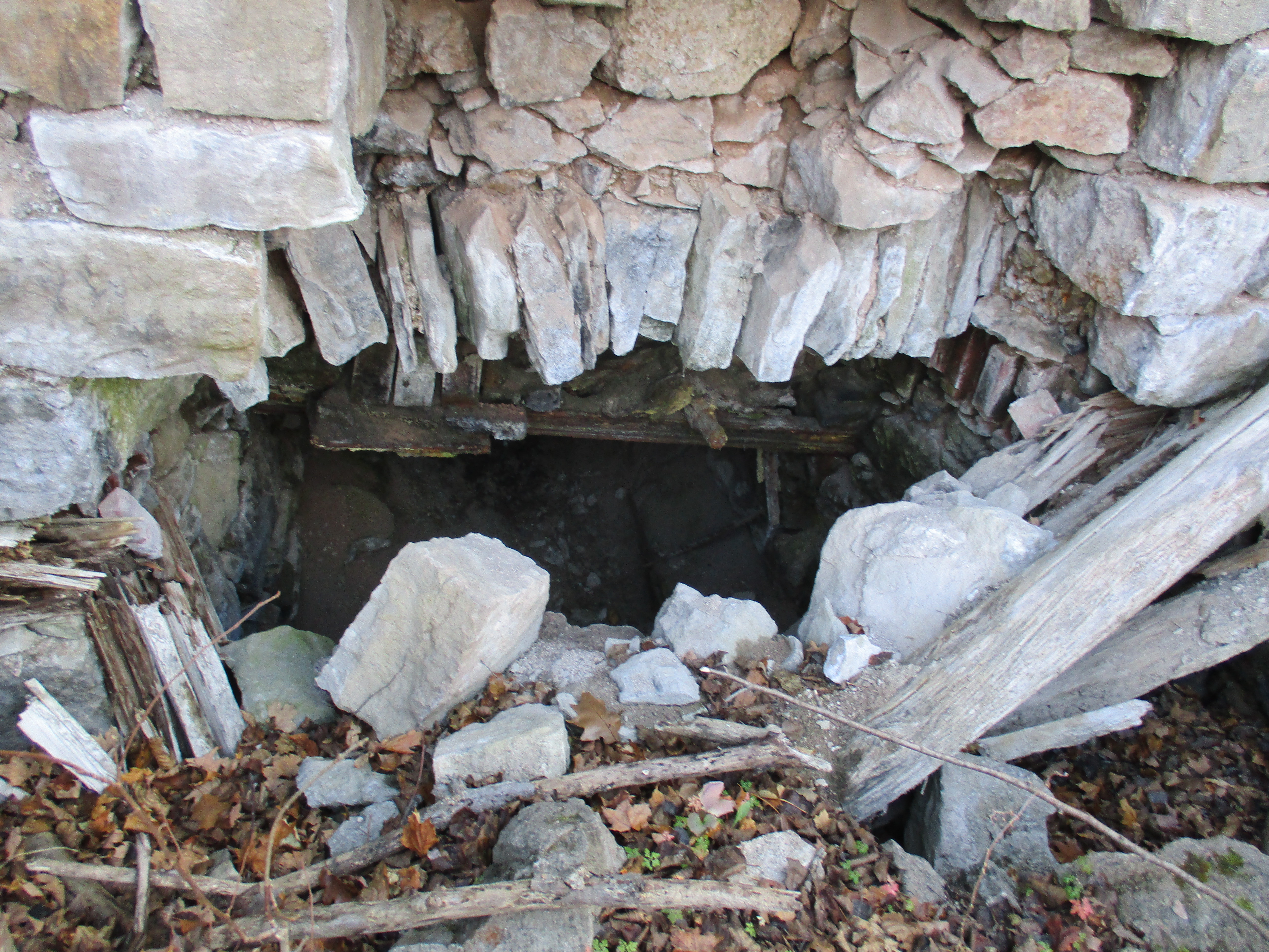
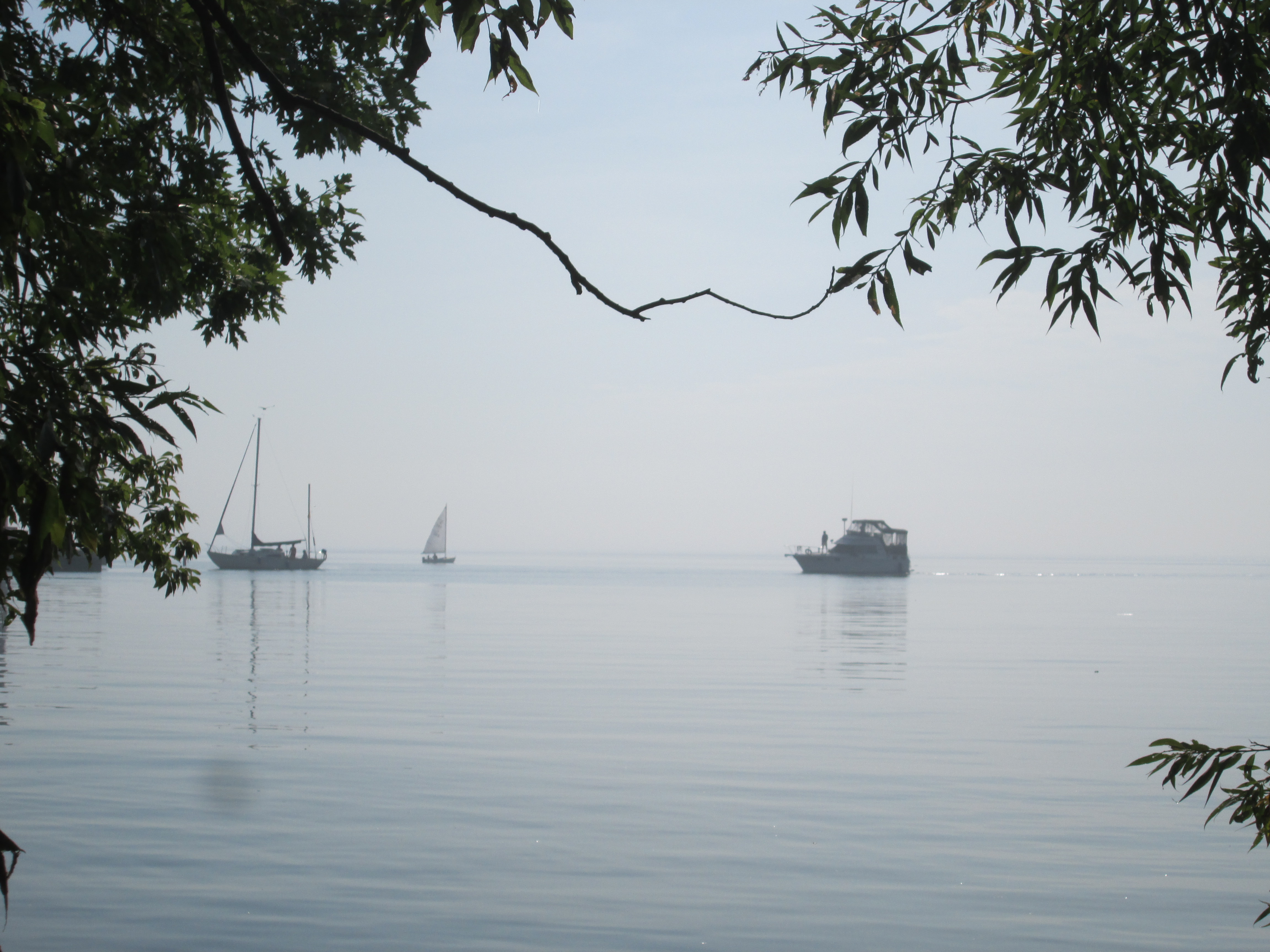
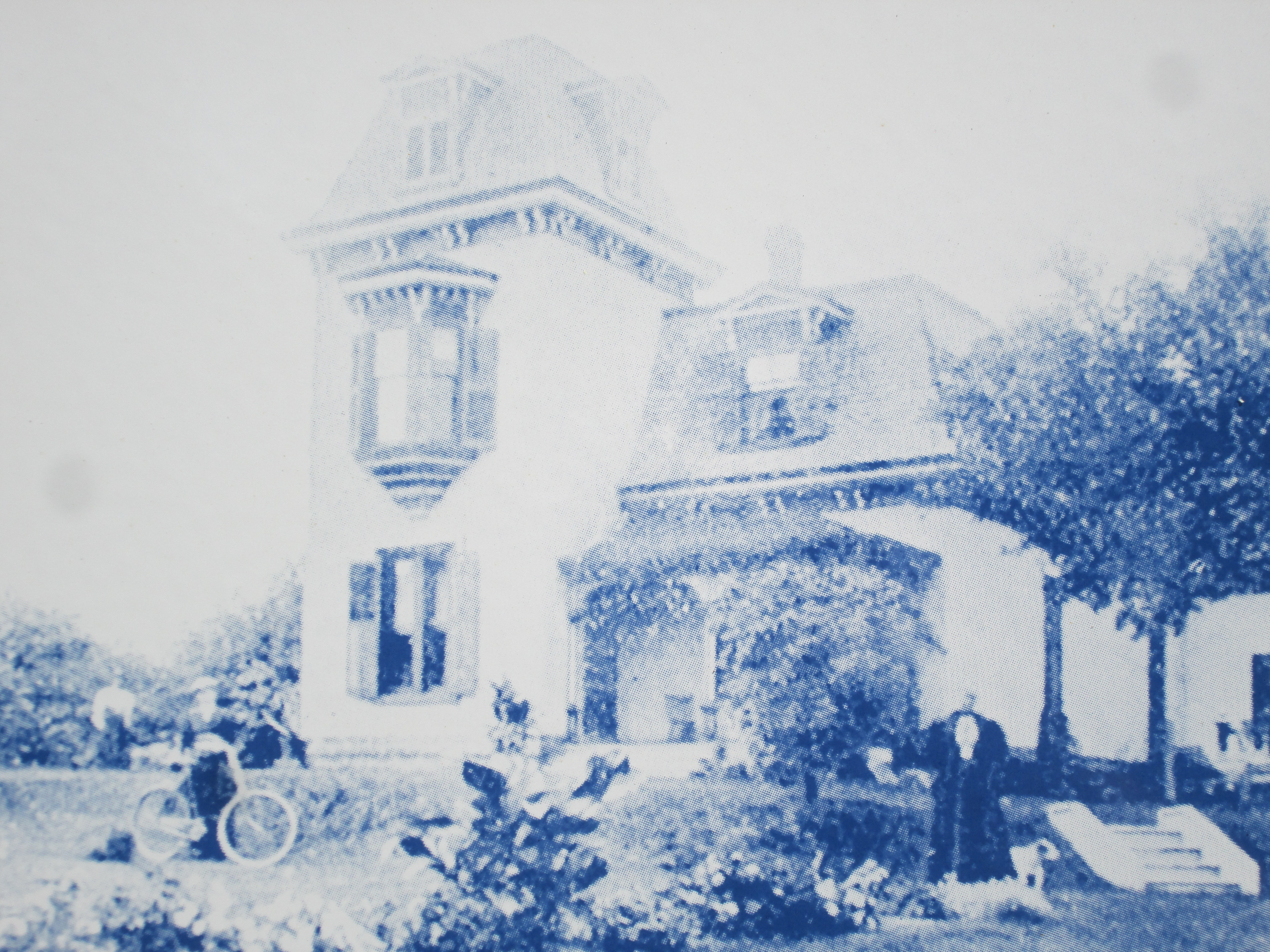
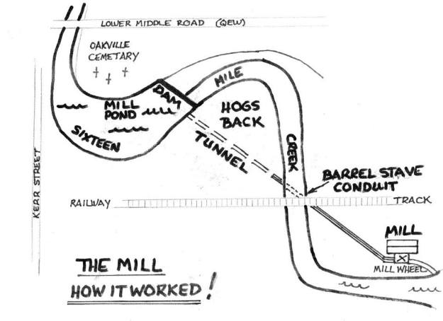
Last week we explored Sixteen Mile Creek on the west side looking for evidence of the old tunnel through the Hog’s Back.  We found an old stone structure that looked like a tunnel entrance that had been filled in.  Owing to the fact that it wasn’t in the location we expected, we determined that it was not the tunnel we sought.  Having circumnavigated the hog’s back we had determined that the openings on either side had been closed off, either intentionally for safety or through a mud or talus slide.  This week we returned to have a look on the east side of the creek for the remains of the old dam.  The post card below is over 100 years old and shows Sixteen Mile Creek with the dam intact on the left of the photo.  The earth and stone berm can be seen running out toward the creek where the water spills over the dam.  The creek flows around the hog’s back and then under the railway bridge.  The wood stave flume passes under the railway bridge on its way toward the mill.

mill-dam

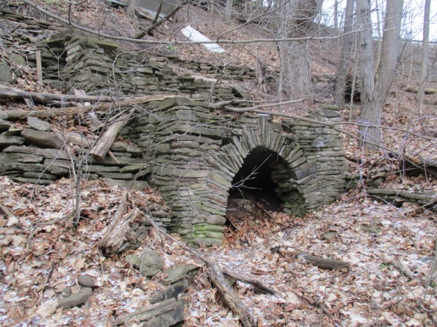
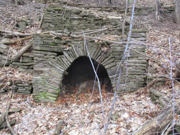
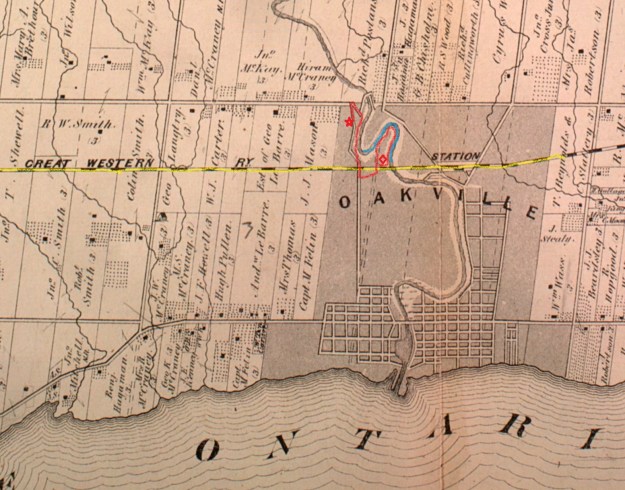
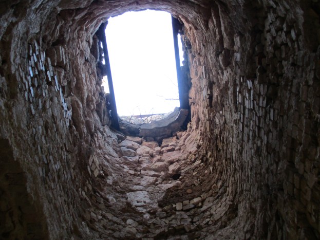
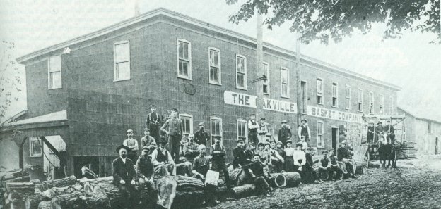
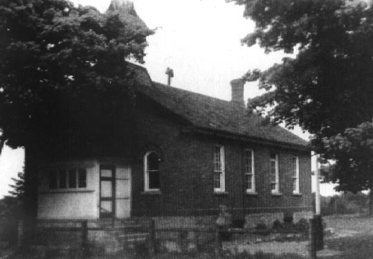
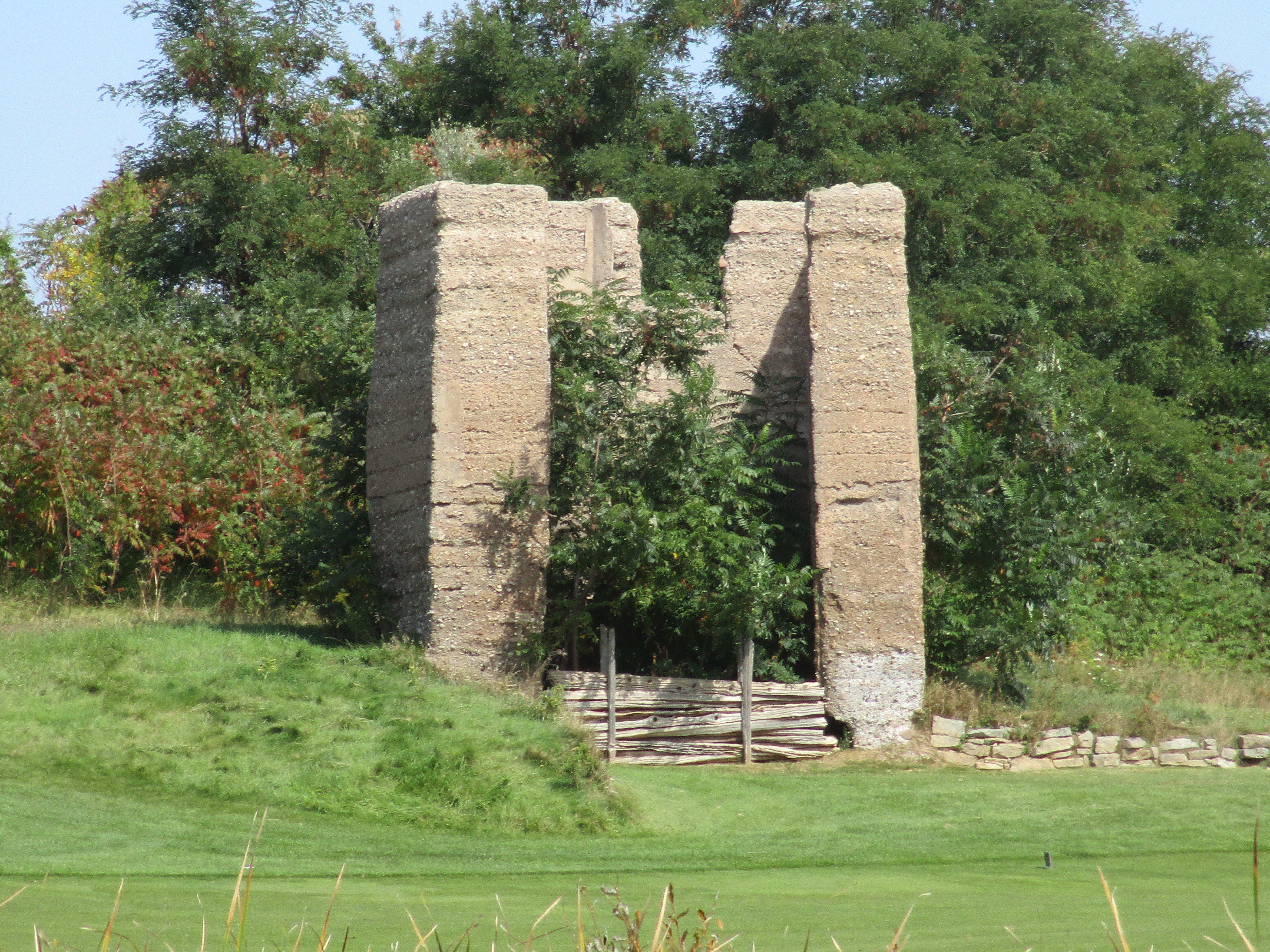
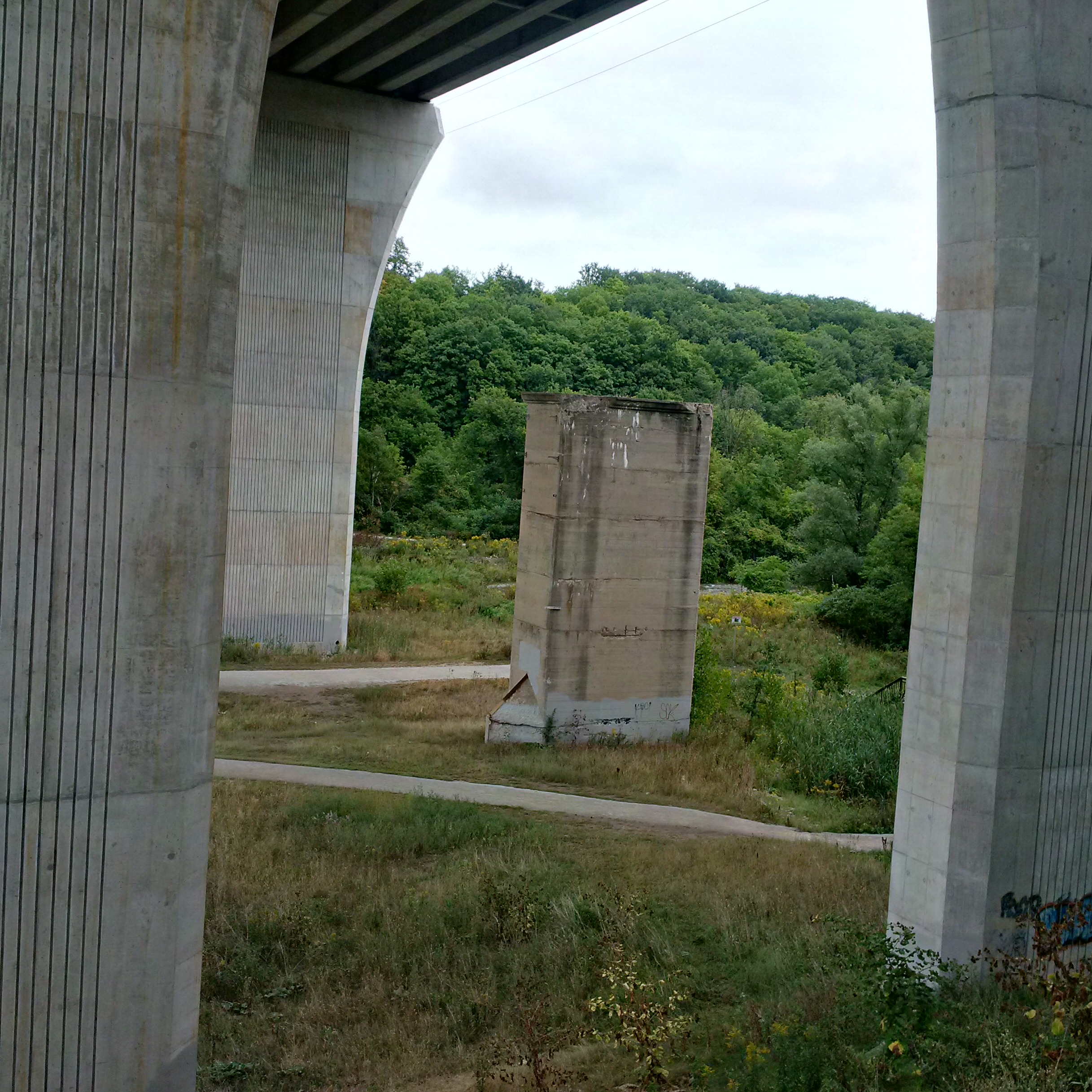
William Chisholm purchased 960 acres of land at the mouth of Sixteen Mile Creek in 1827 with the plan to create ship building yards there.  Another of William’s early ventures was the construction of saw and grist mills both of which were completed by 1833.  The grist mill was located downstream from the Hog’s Back but the mill pond was on the opposite side of this geological feature. The solution was to bring the water through the hog’s back in a tunnel.

mill-sketch

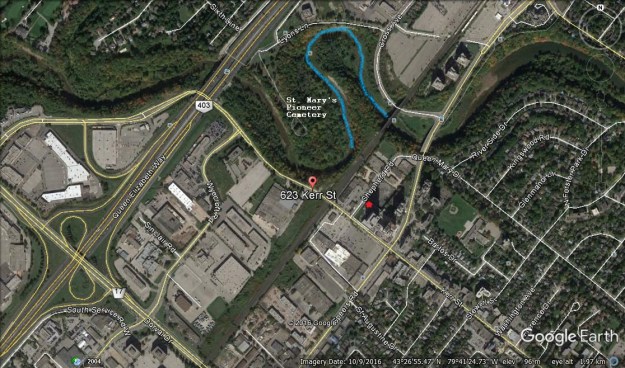
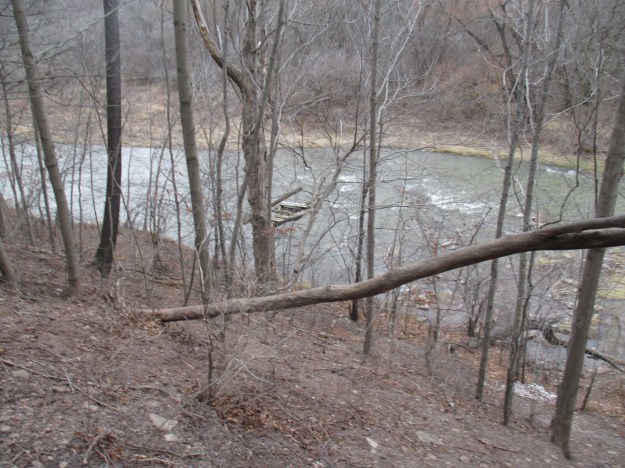
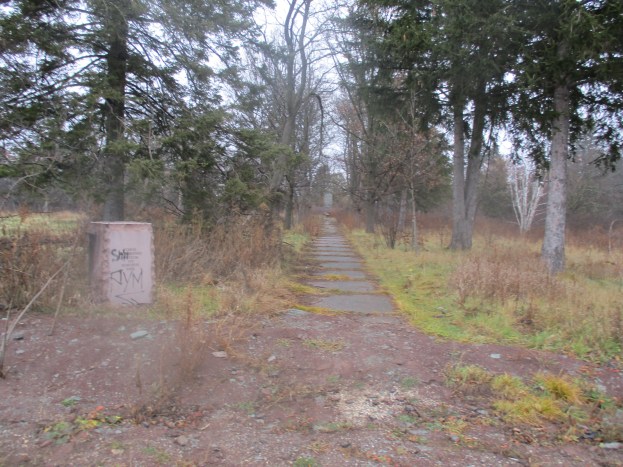
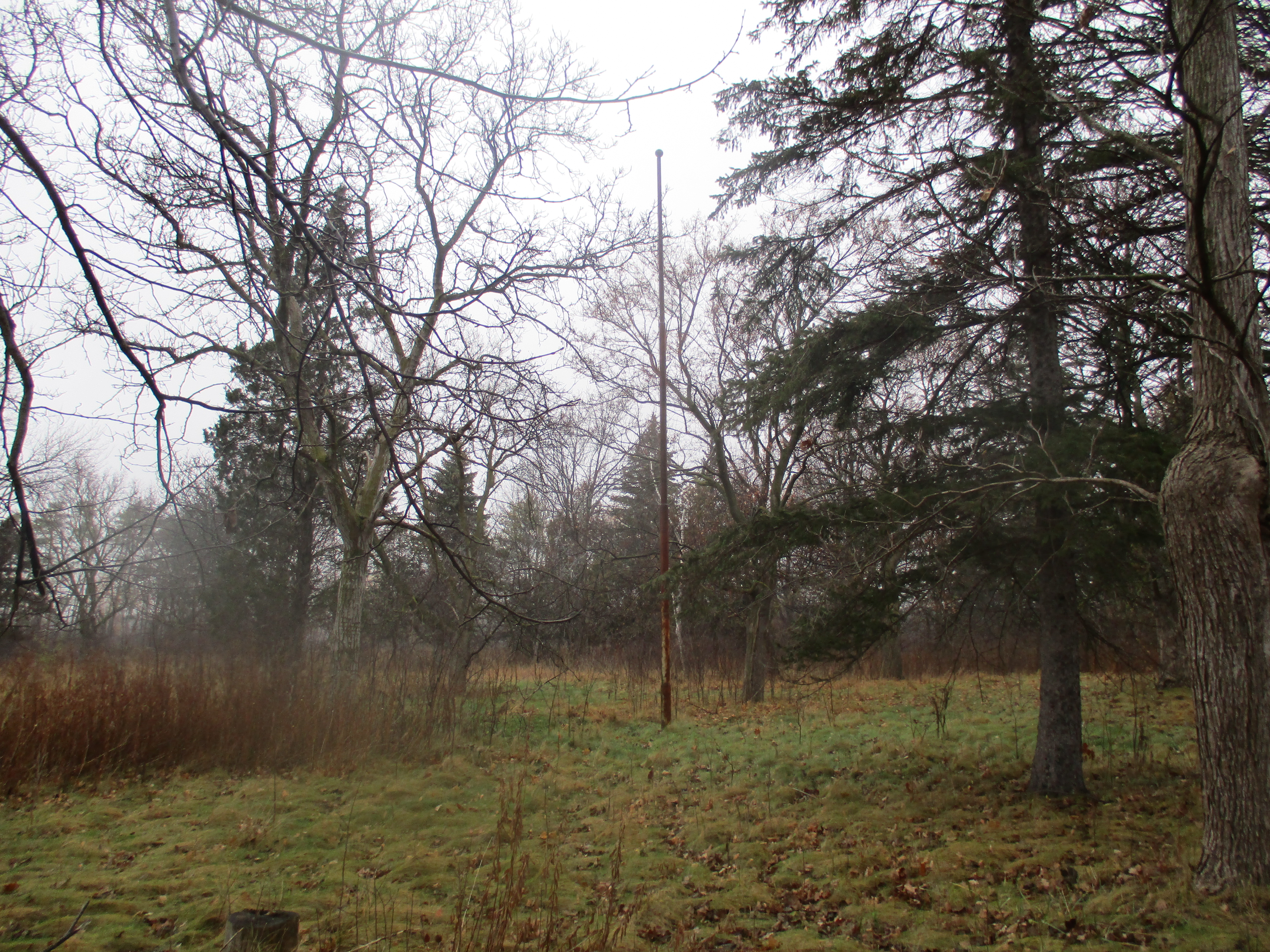
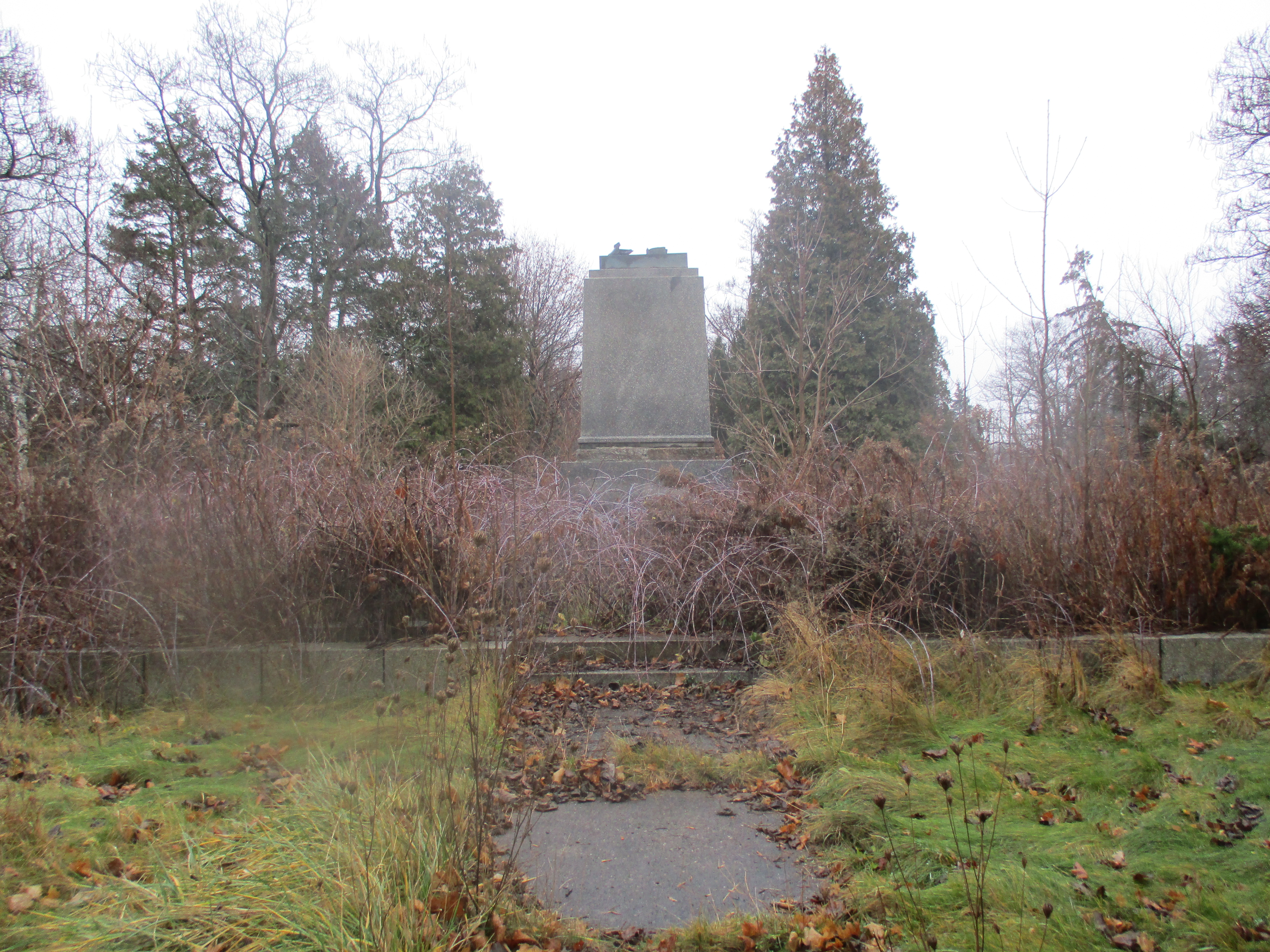
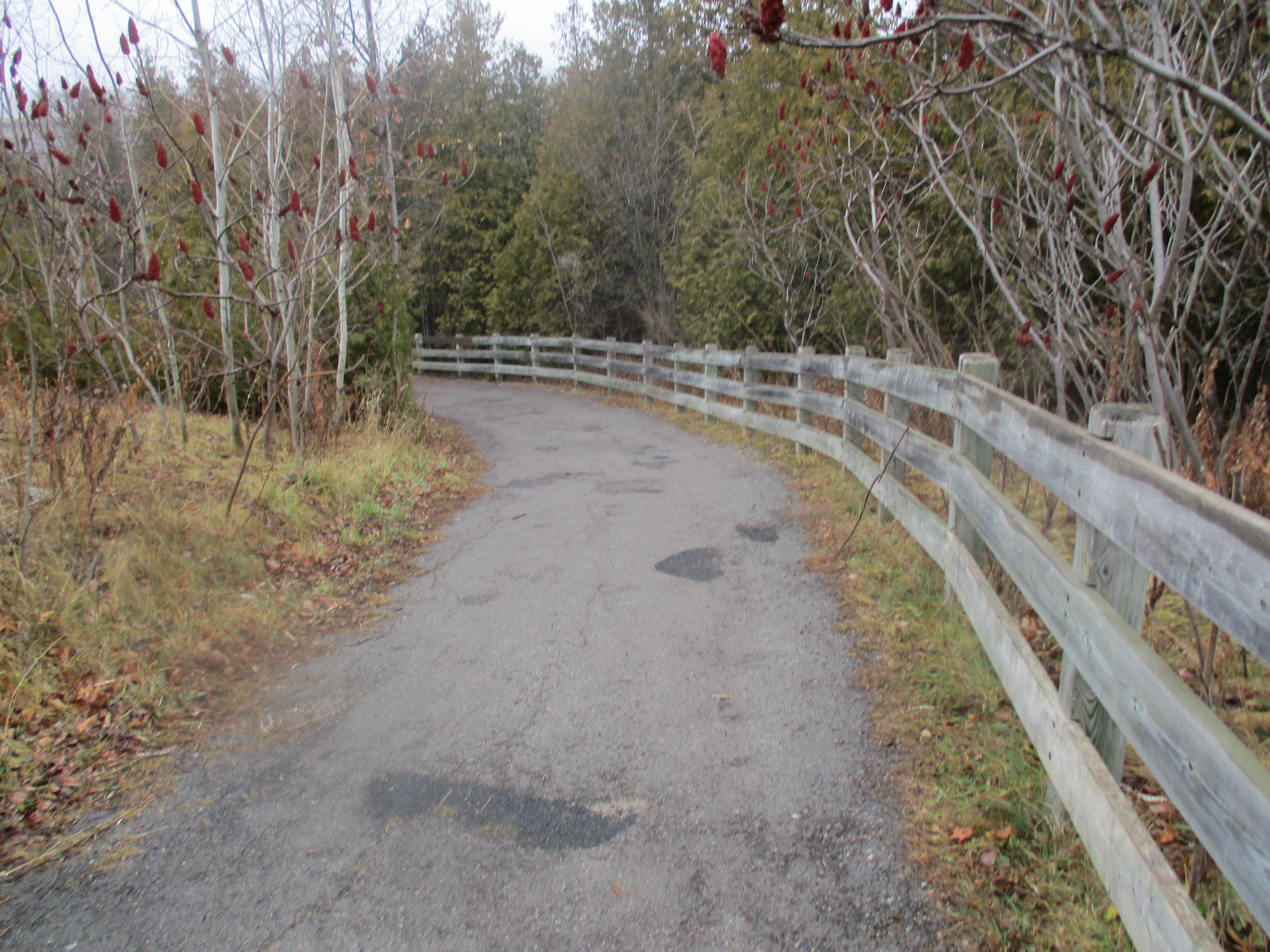
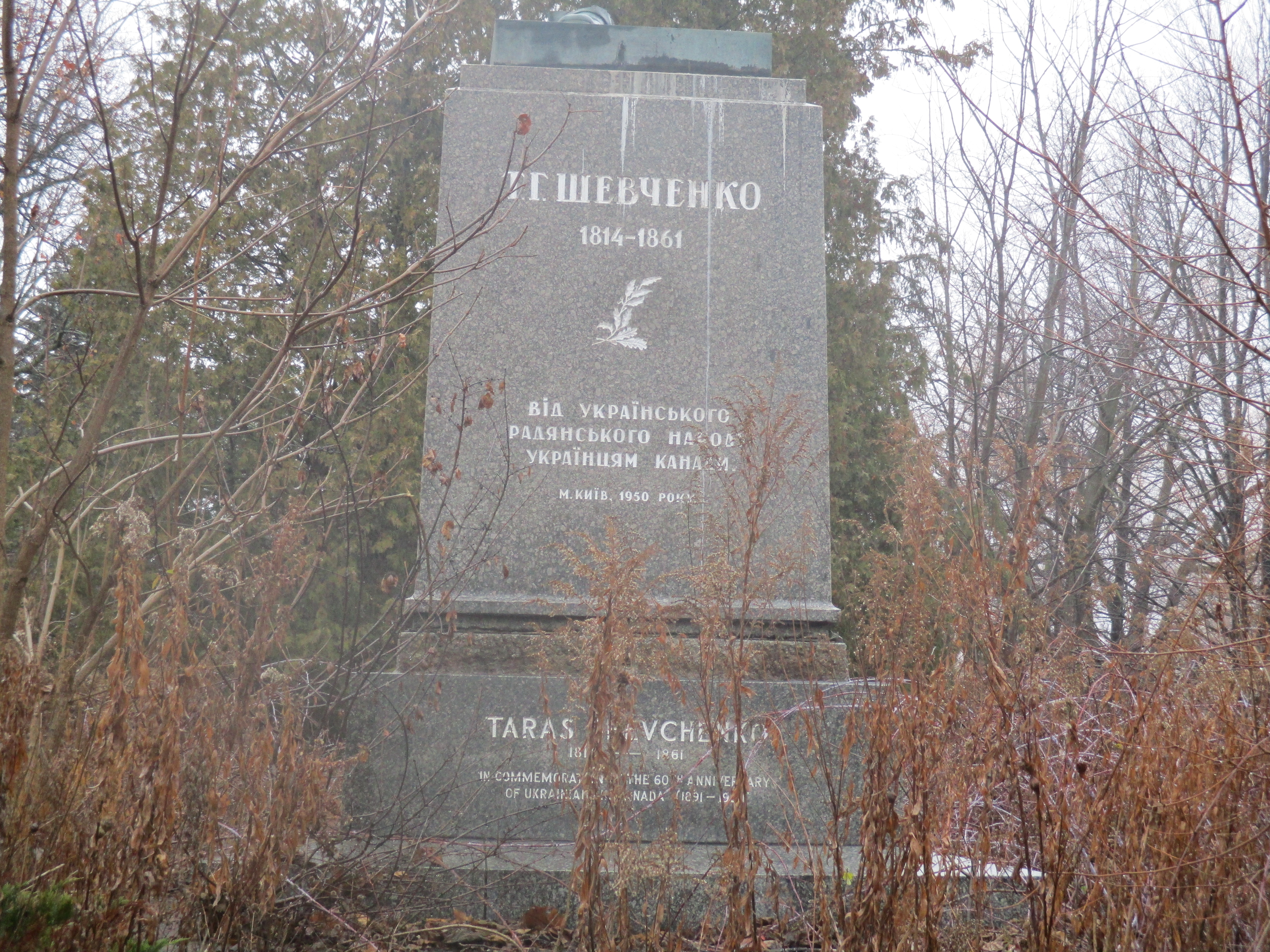
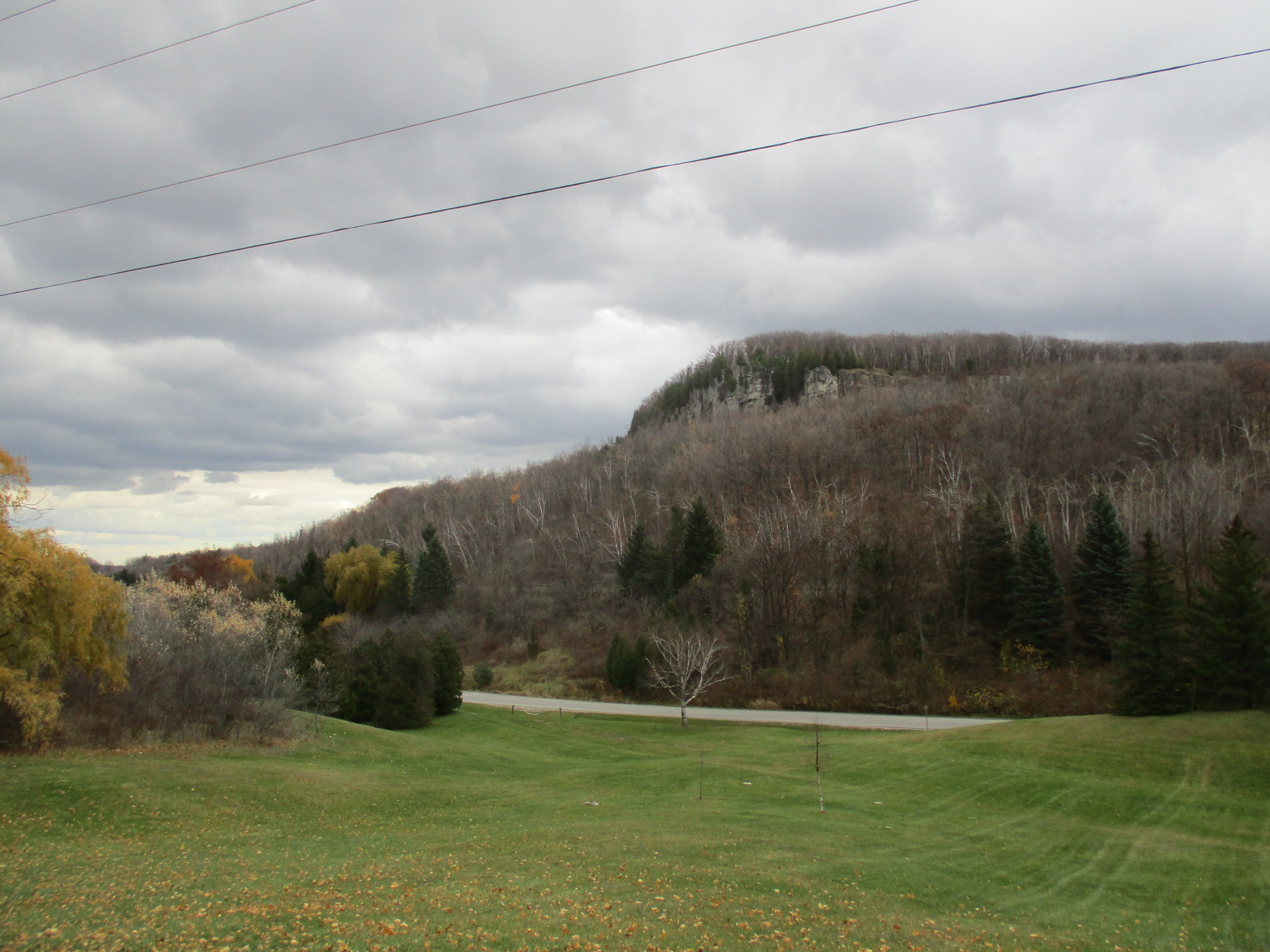
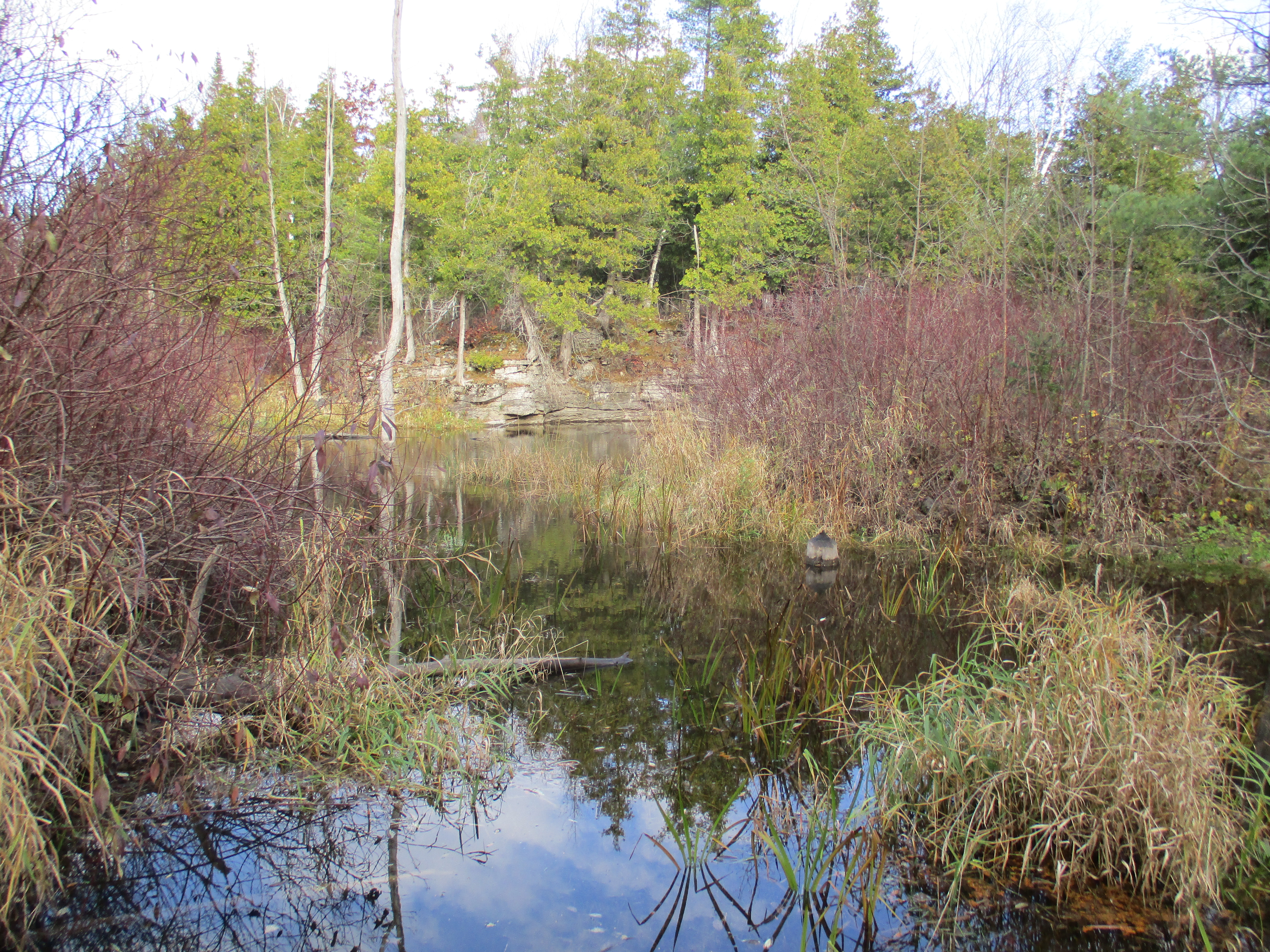
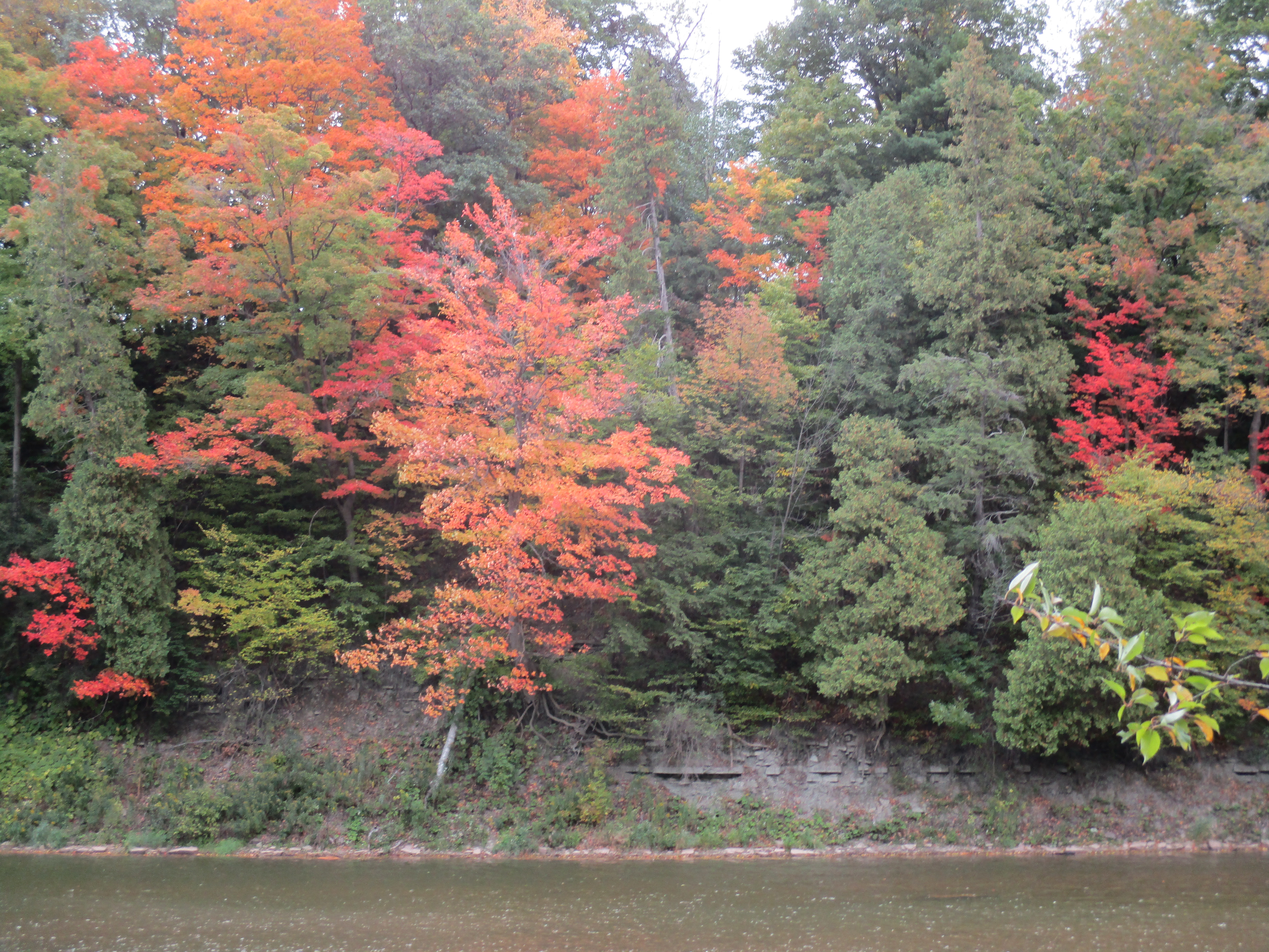
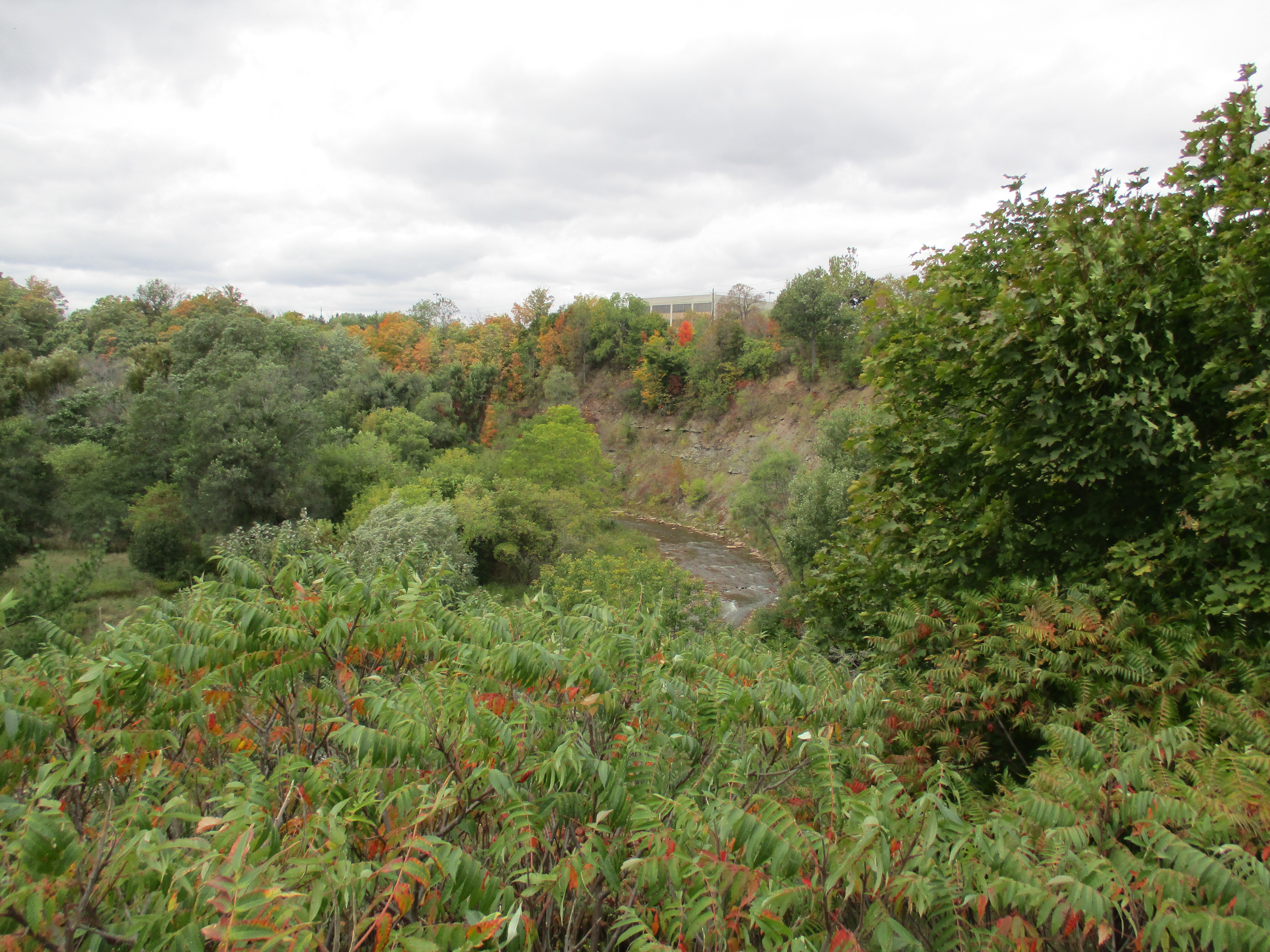
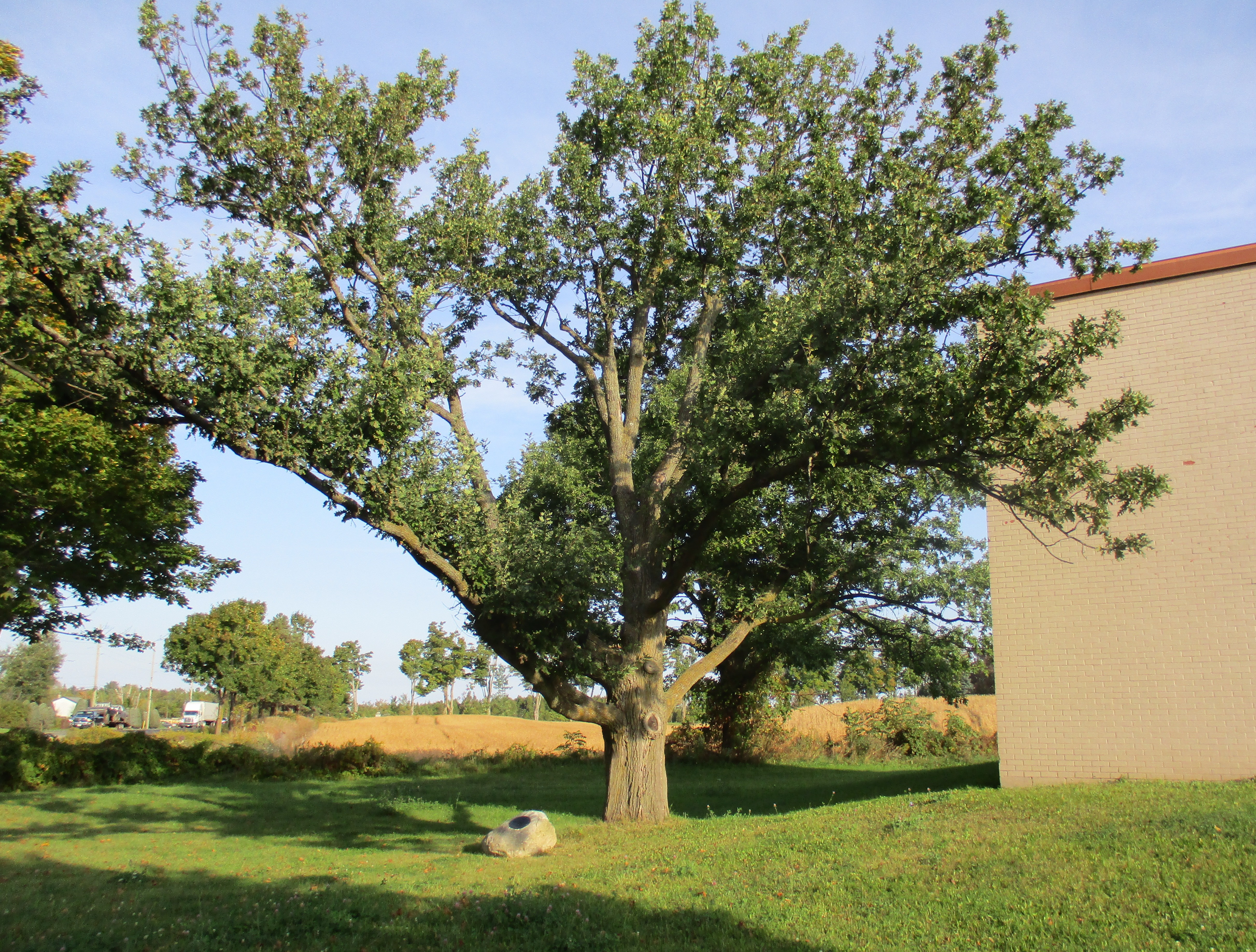
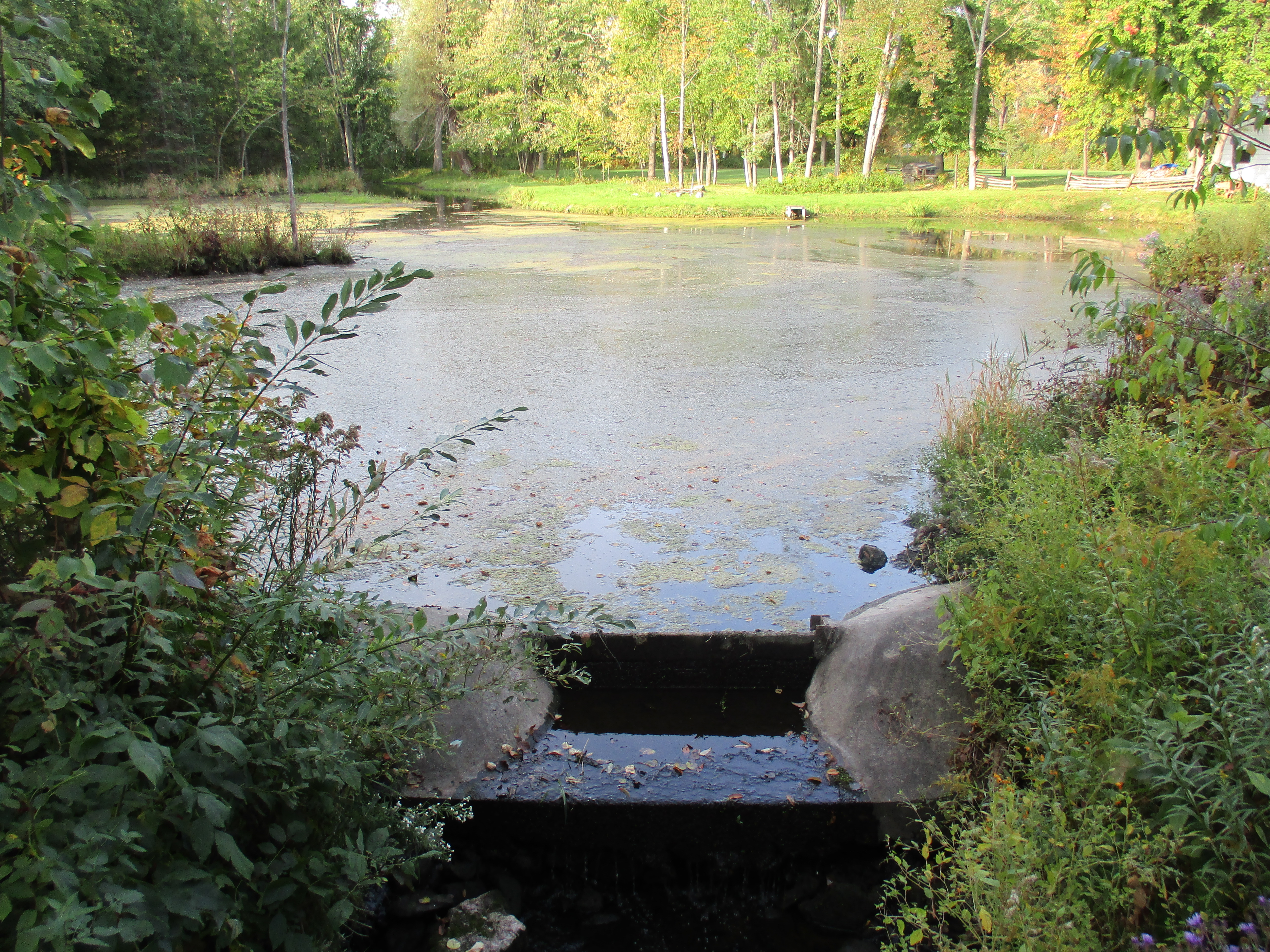
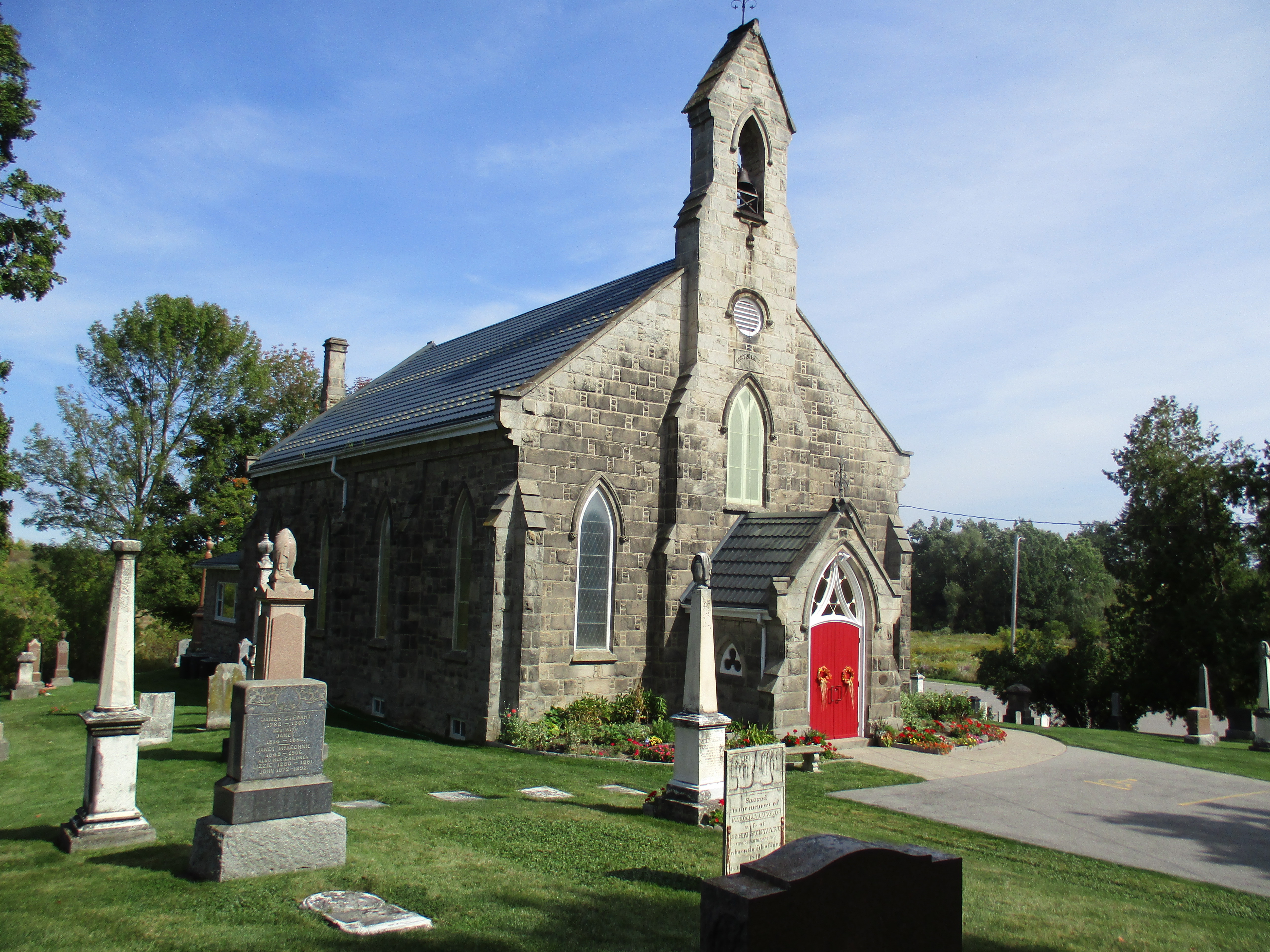
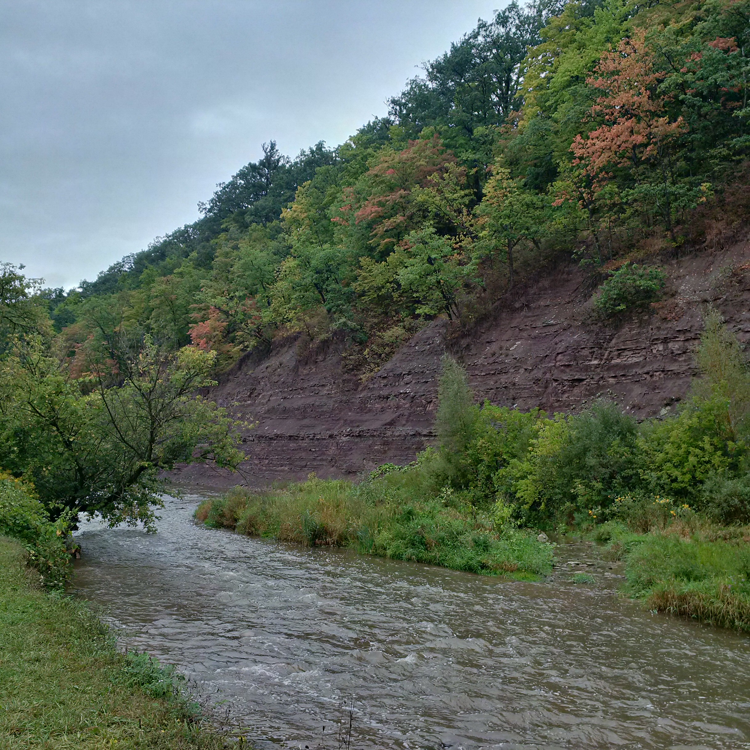
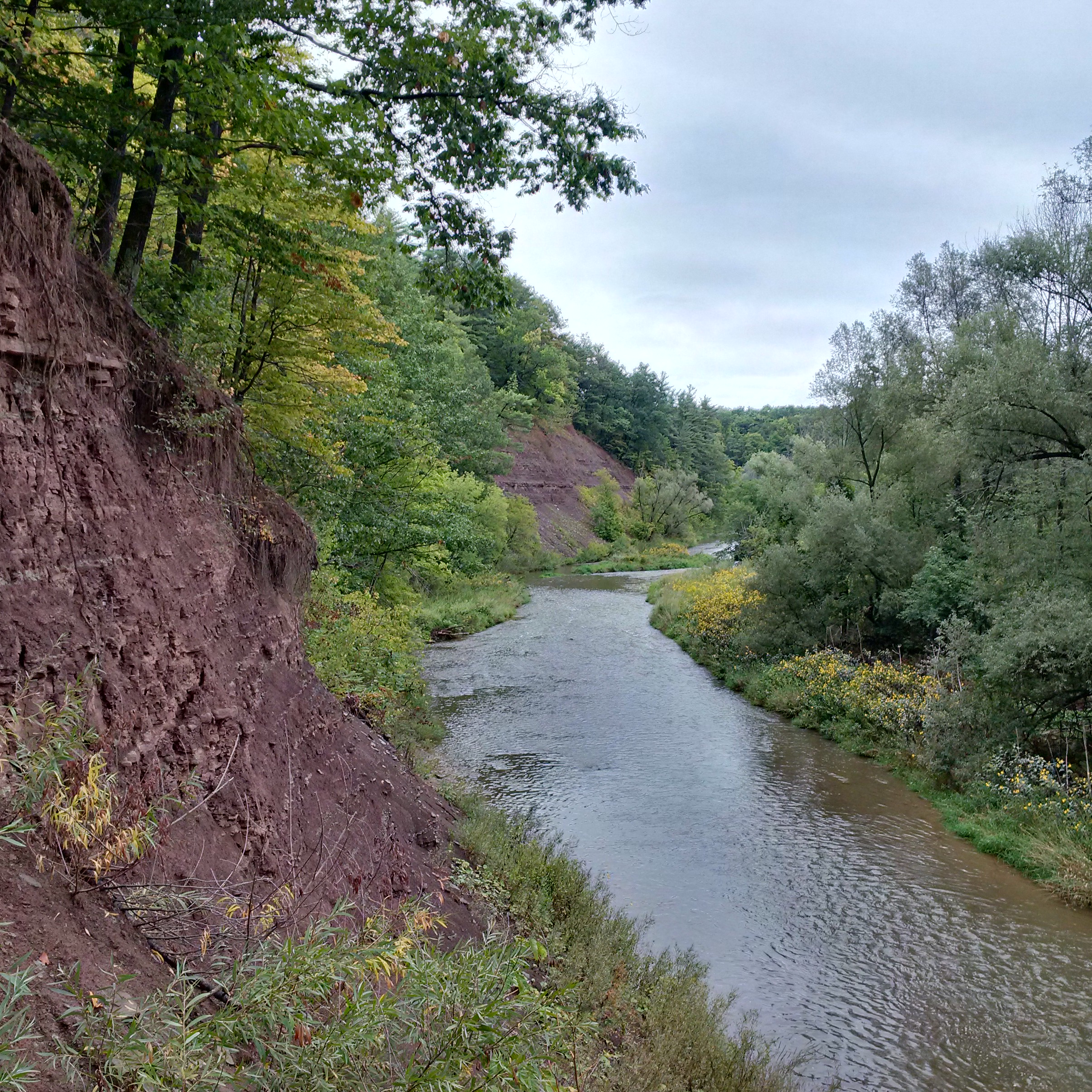
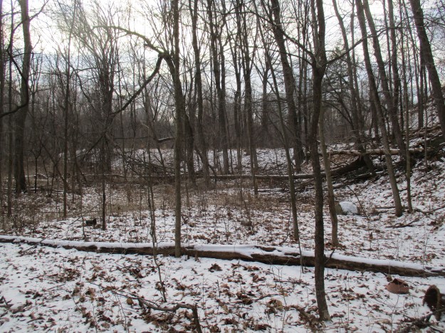
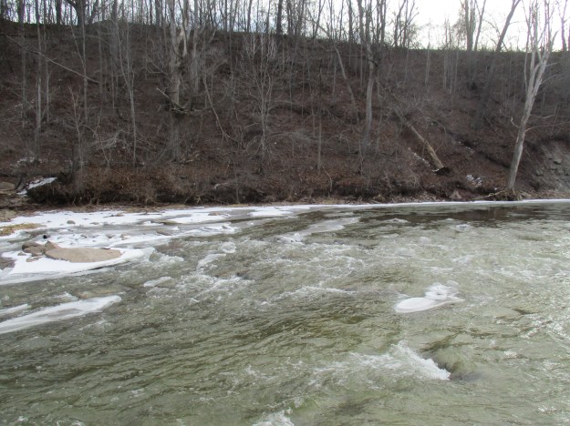
St. Mary’s Pioneer Cemetery contains the city’s earliest founders including William Chisholm.  There are a few parking places on Lyons Lane near the entrance to the cemetery.  Just inside the gate there is an opening in the fence and a small path.  It is possible to descend to the creek level but caution is required as the footing is loose.  The large “S” that Sixteen Mile Creek forms as it rounds the hog’s back makes directions a little odd when you reach the creek.  You are on the east side of the creek but west of it.  You’ll walk south toward Lake Ontario as you make your way upstream toward the old dam.  The dam can be seen in the picture below as the white line running horizontal through the trees in the middle of the photo.

img_6123

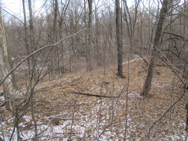
Looking back along the dam you can see where it met the embankment with St. Mary’s Pioneer Cemetery at the top of the hill.

img_6128

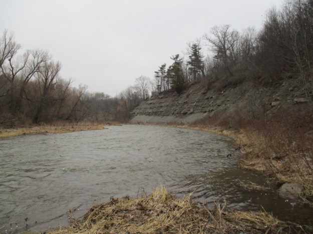
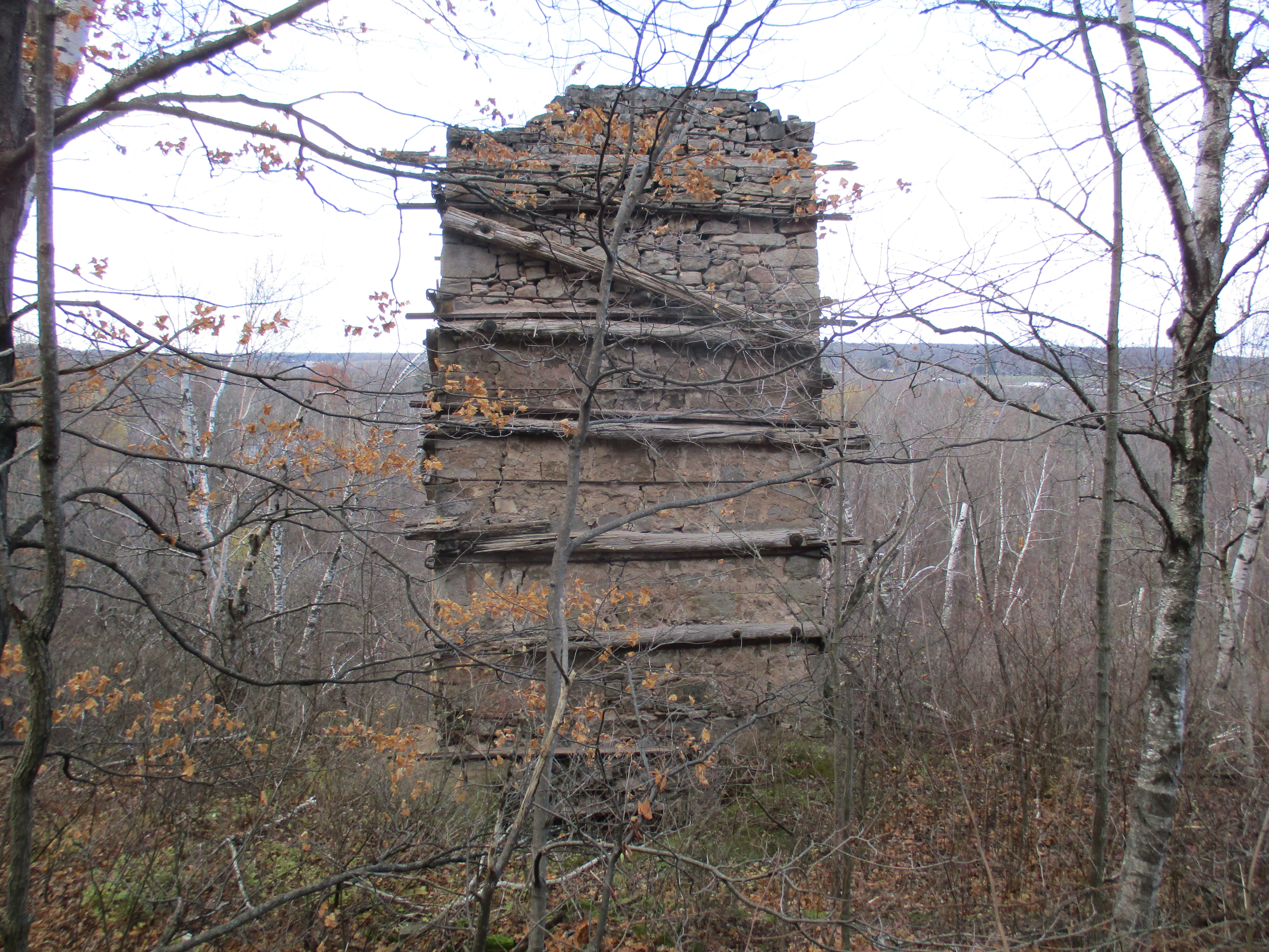
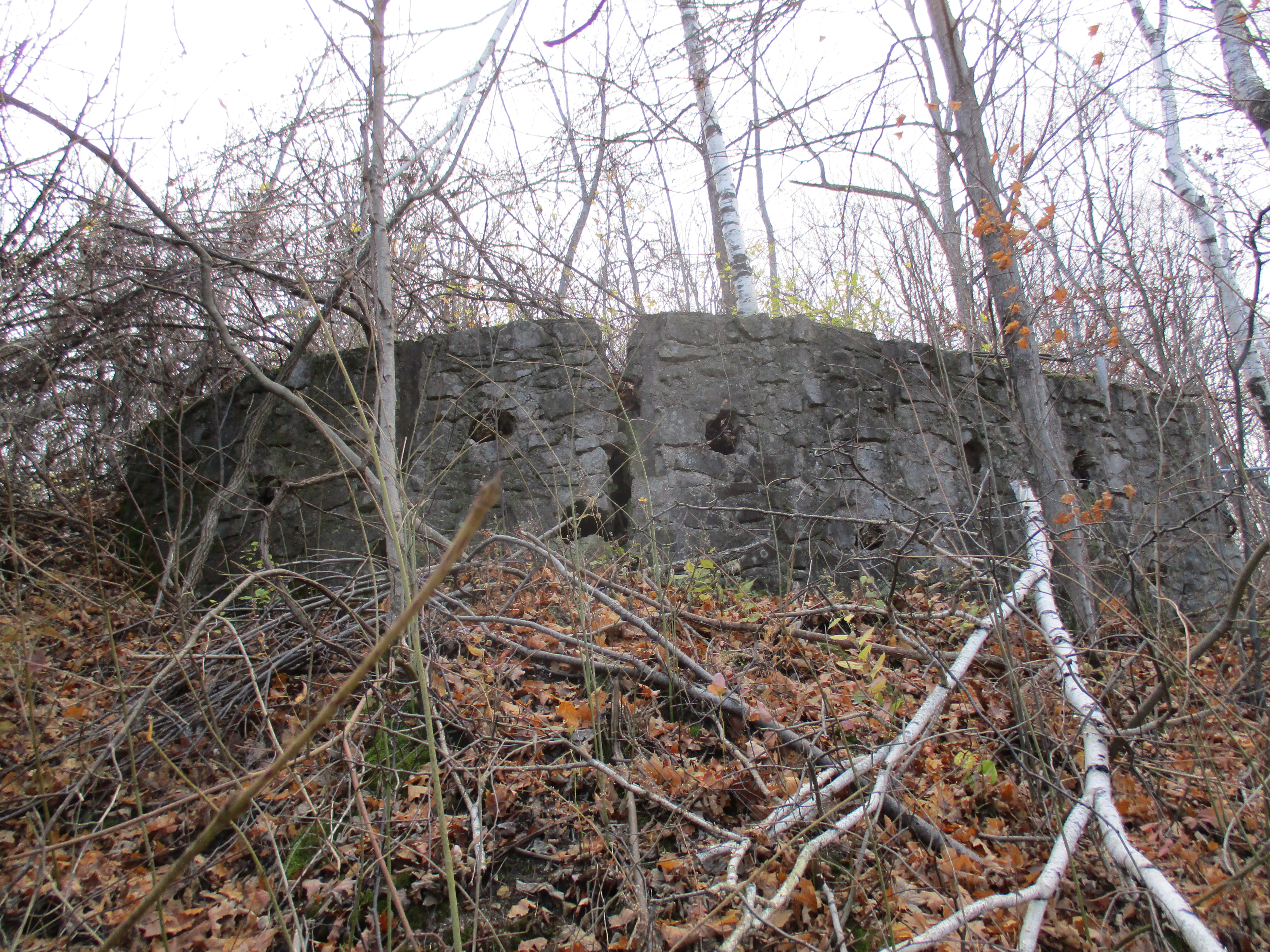
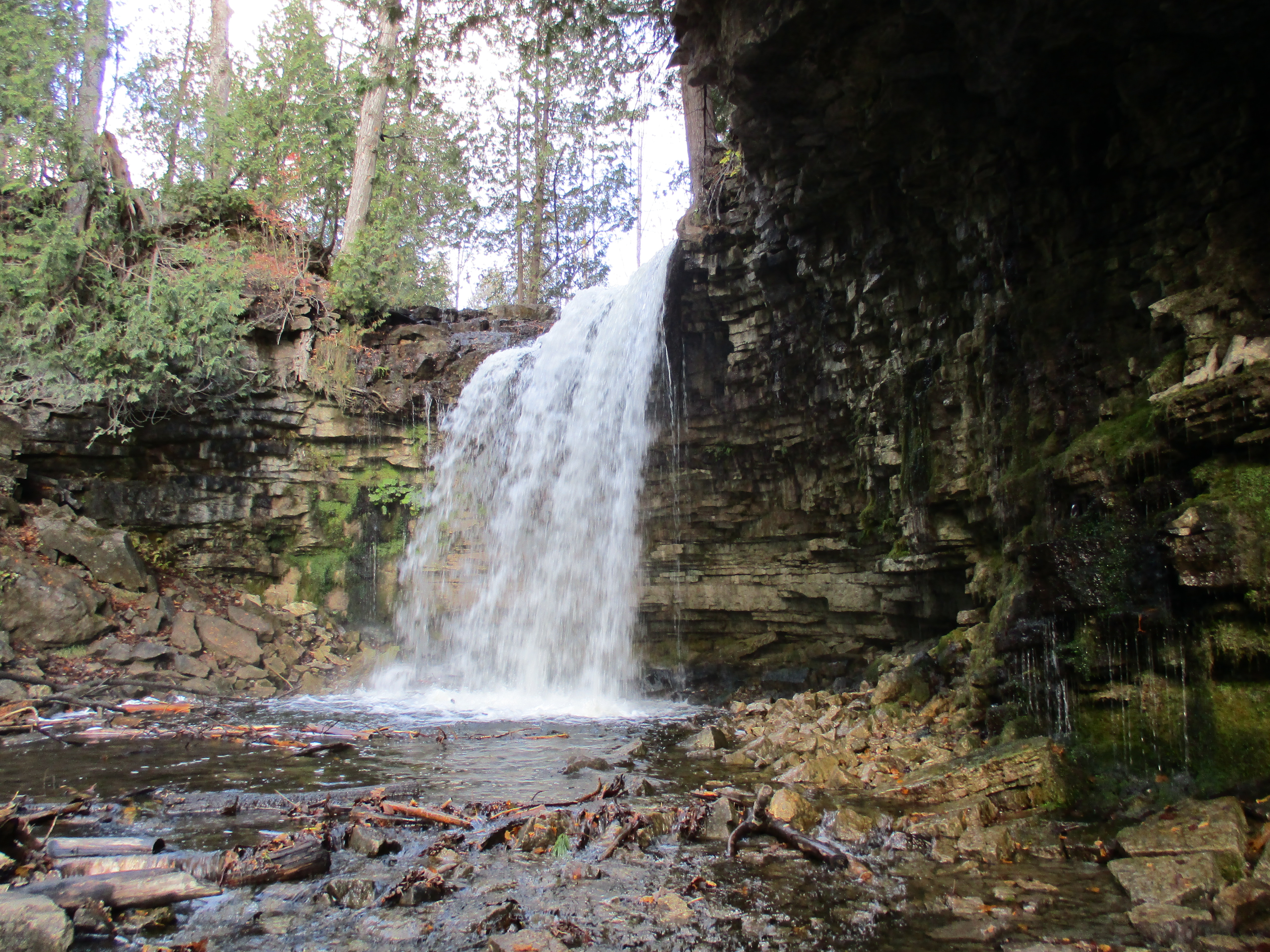
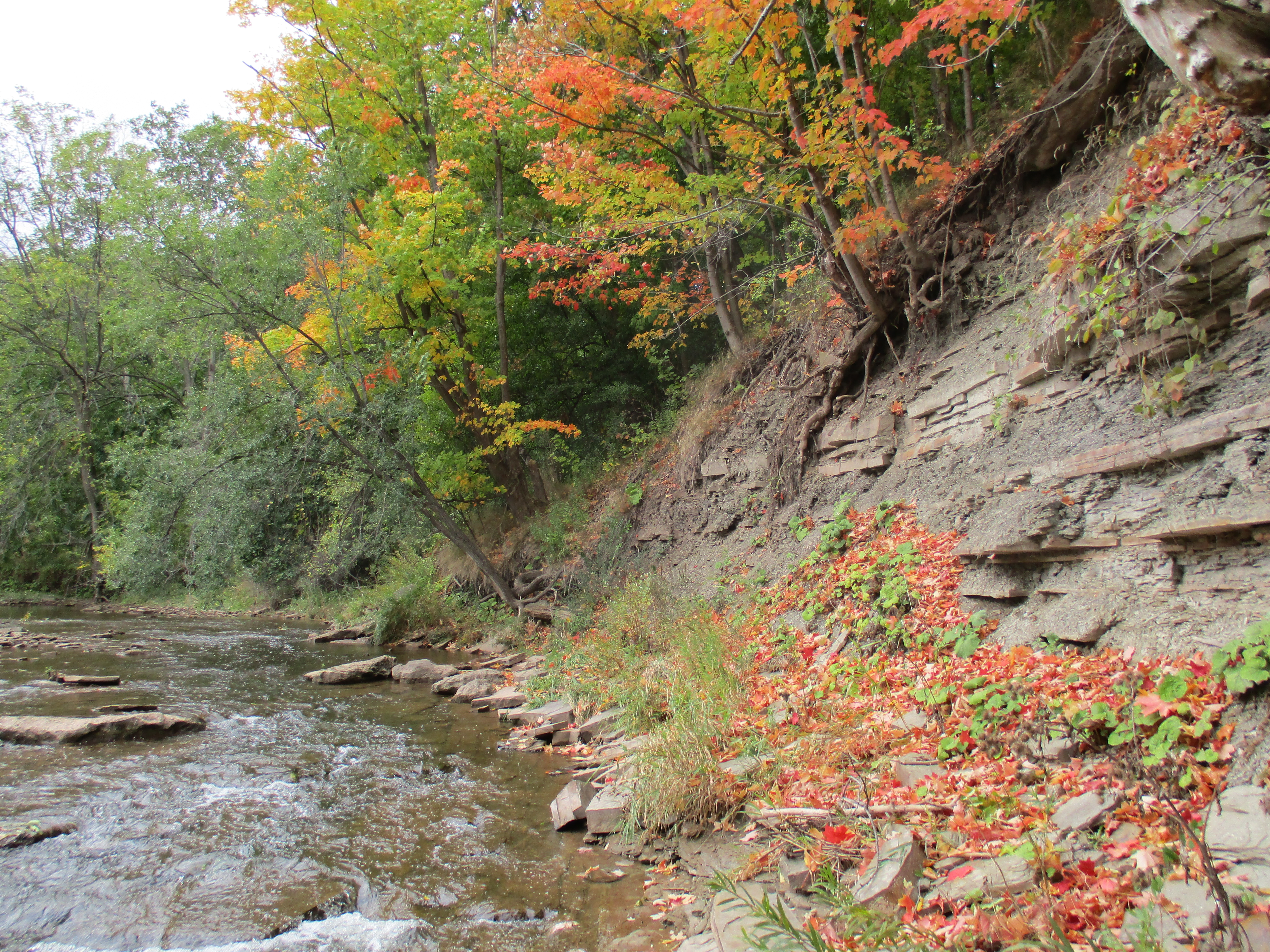
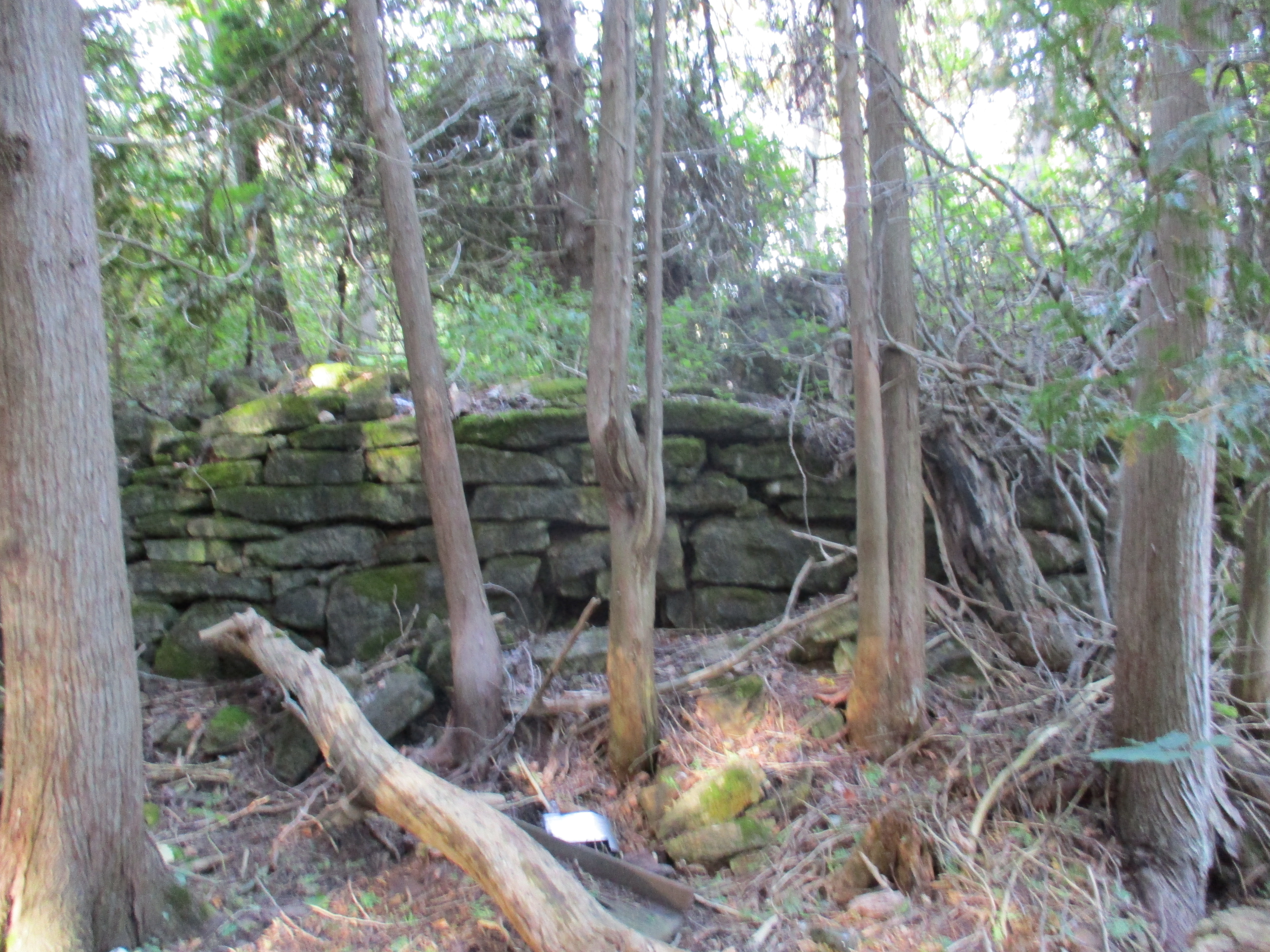
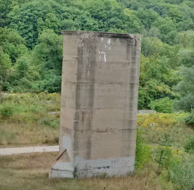
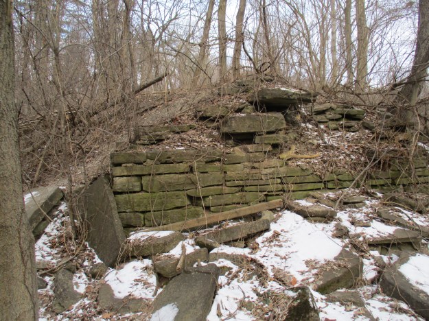
The dam stands eight to ten feet off of the creek floodplain.  A cross section of the dam can be seen by walking out to the end and climbing down the side.  Large pieces of dolostone were layered to form a sturdy wall.  A layer of soil was scooped up off the floodplain to deepen the mill pond and provide a covering for the dam.  A wooden crib filled with stone was used to span the creek.  The dam was built in the winter when water levels were low and maintenance was also done during these months.  The dam has been removed from the creek to help prevent flooding and reduce the danger downstream should it eventually fail.

img_6129

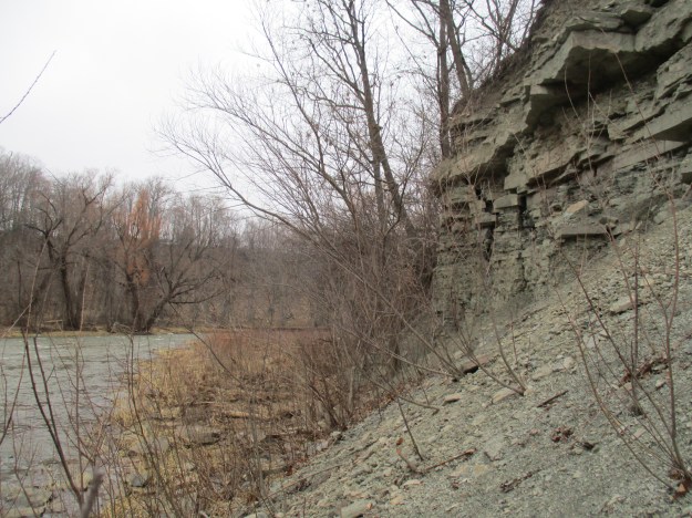
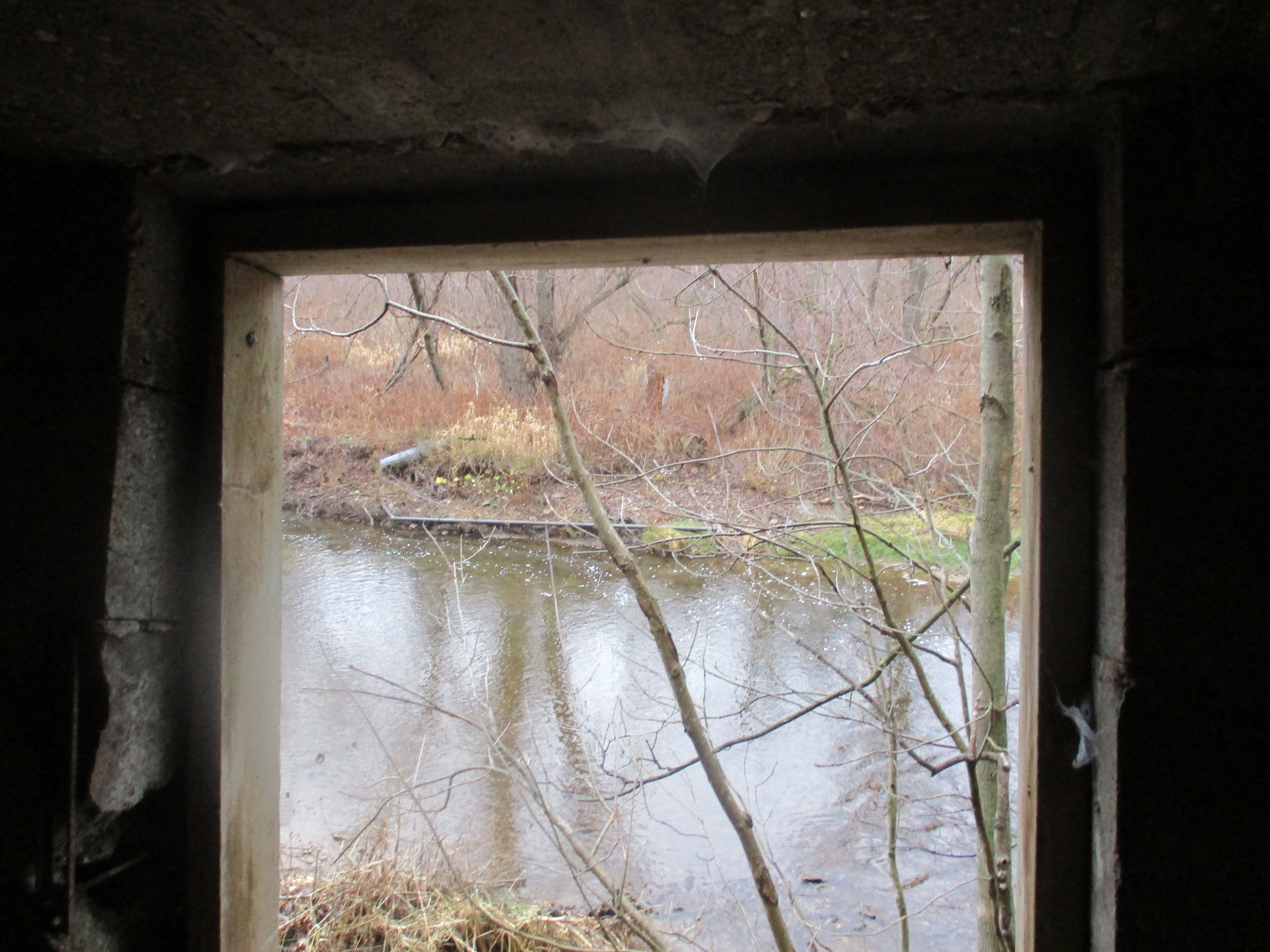
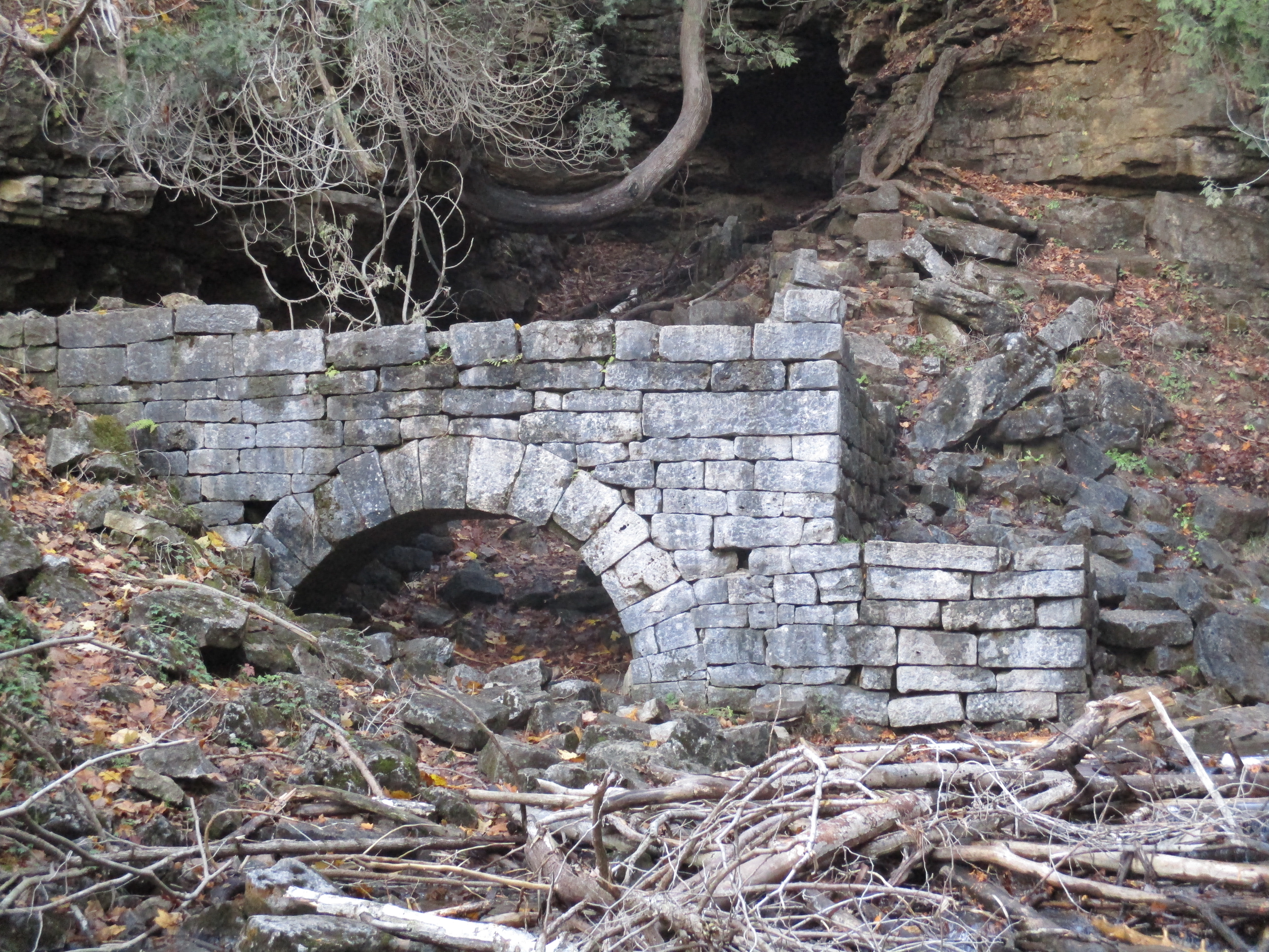
Tracing the line of the old dam to the creek’s edge you can see the stone in the water and on the far embankment that marked the dam’s east end at the hog’s back.  The dam met the hog’s back at the extreme left in this photo. The now closed entrance to the water tunnel would have been along the embankment in this picture, perhaps near the large tree with the platform in it.

img_6151

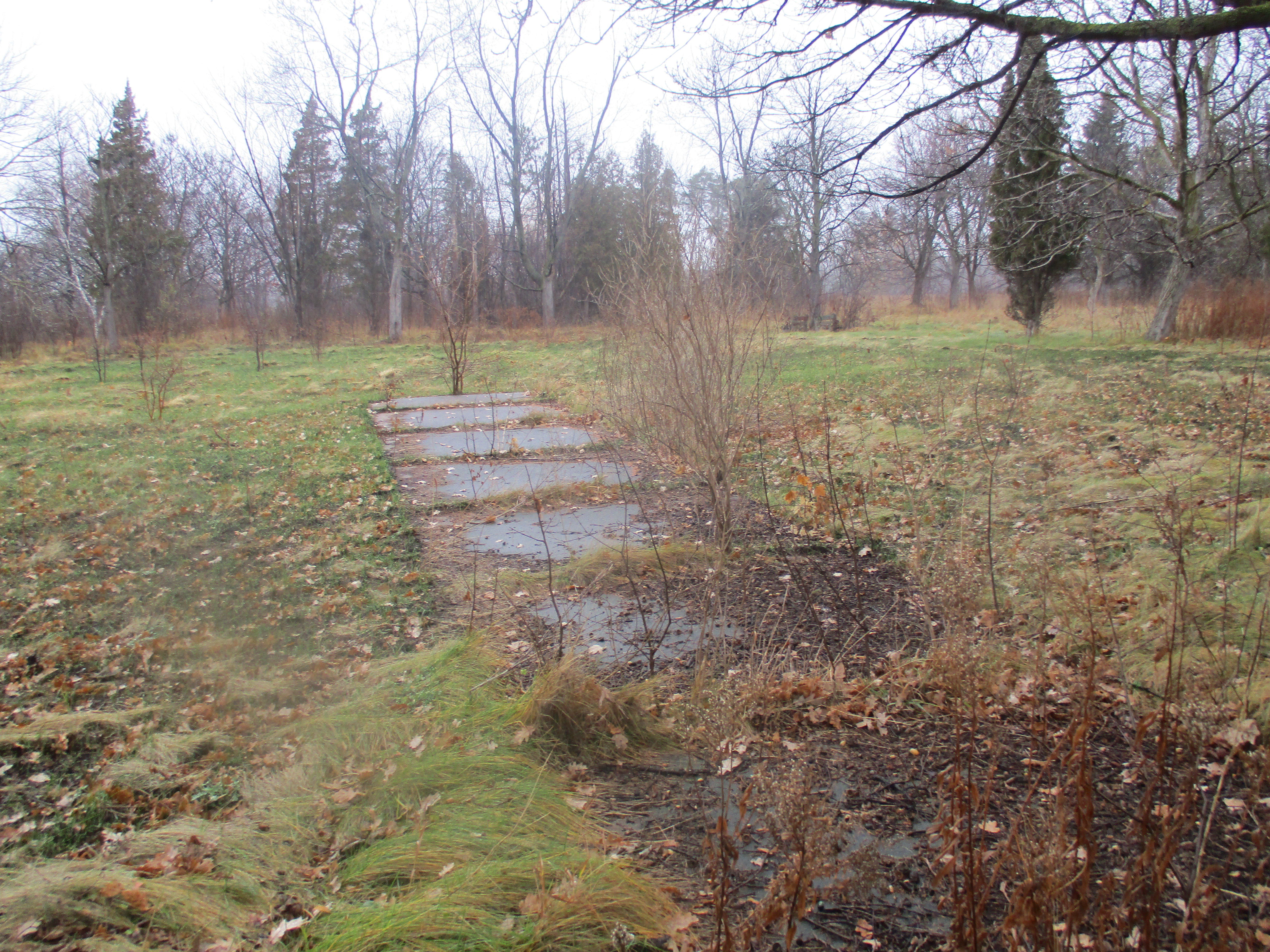
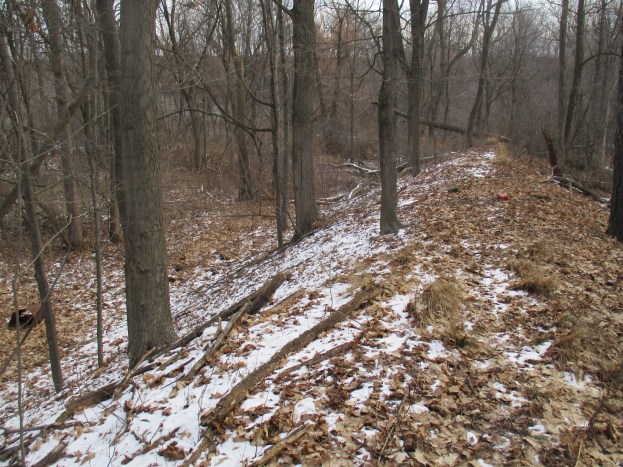
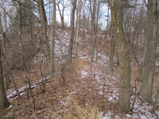
Following the dam back to where it meets the ravine side you will find a small path that leads back up to the cemetery.  The picture below shows how obvious the dam is when seen from above, once you know that it is there.

img_6153

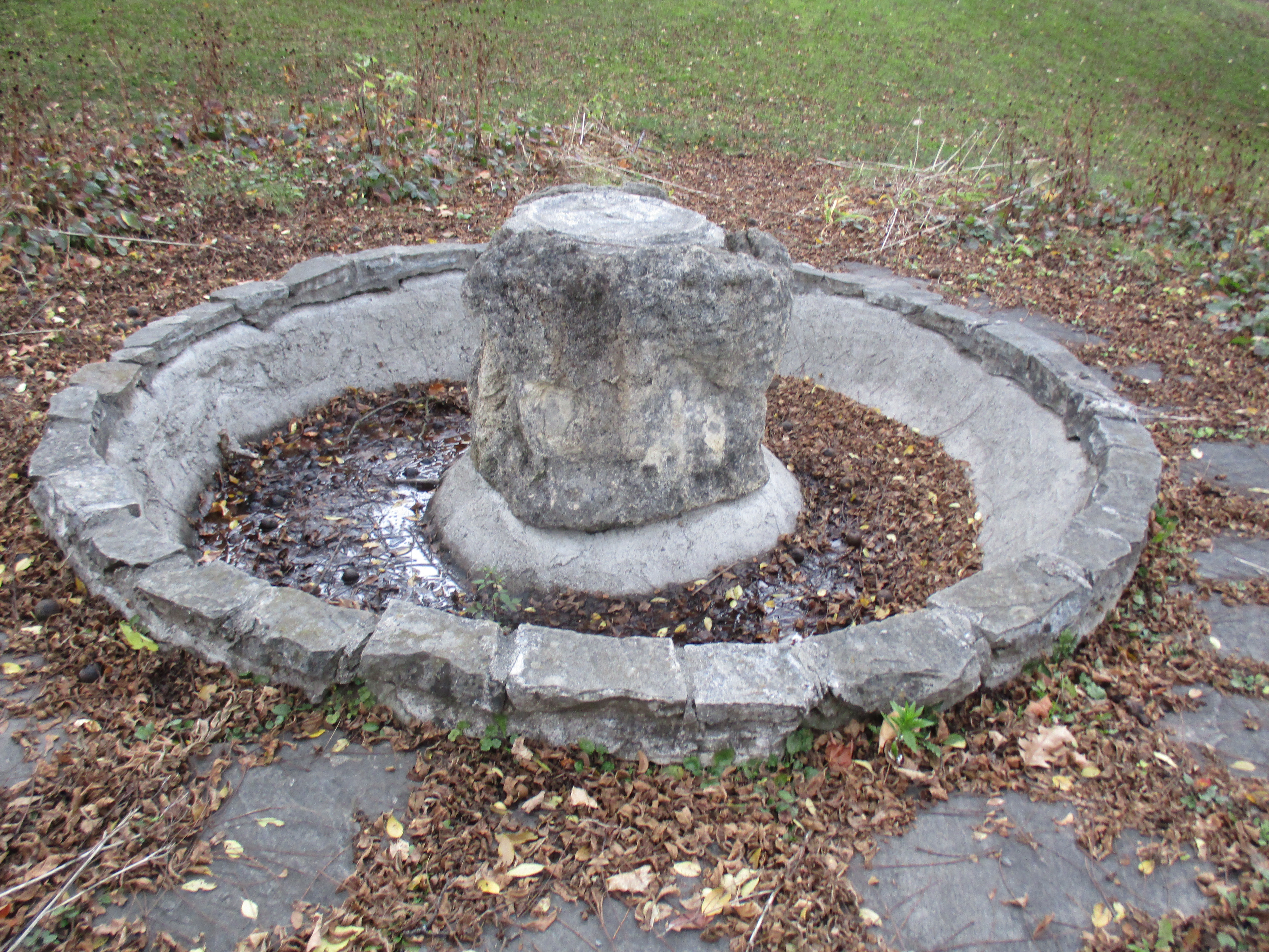
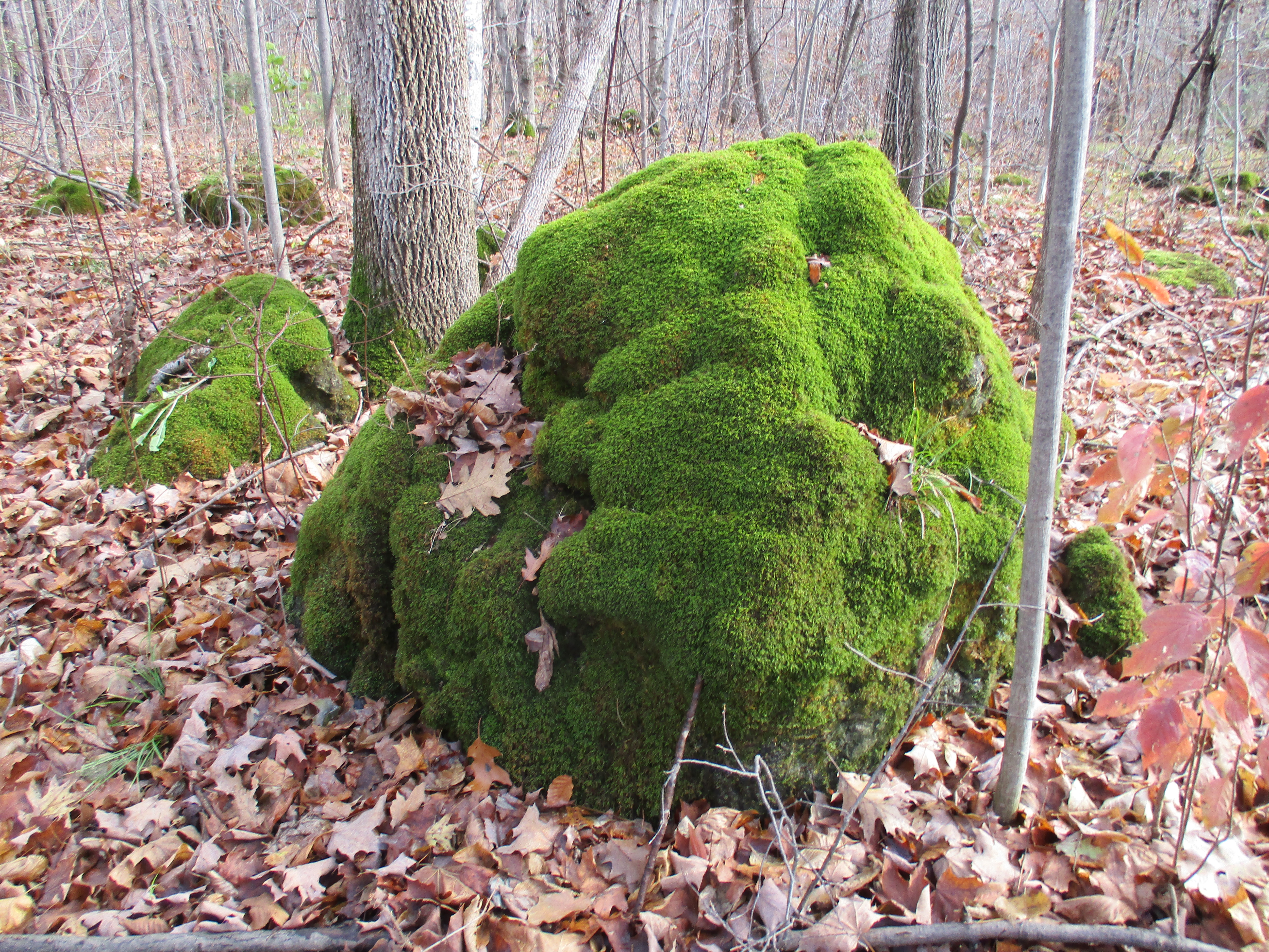
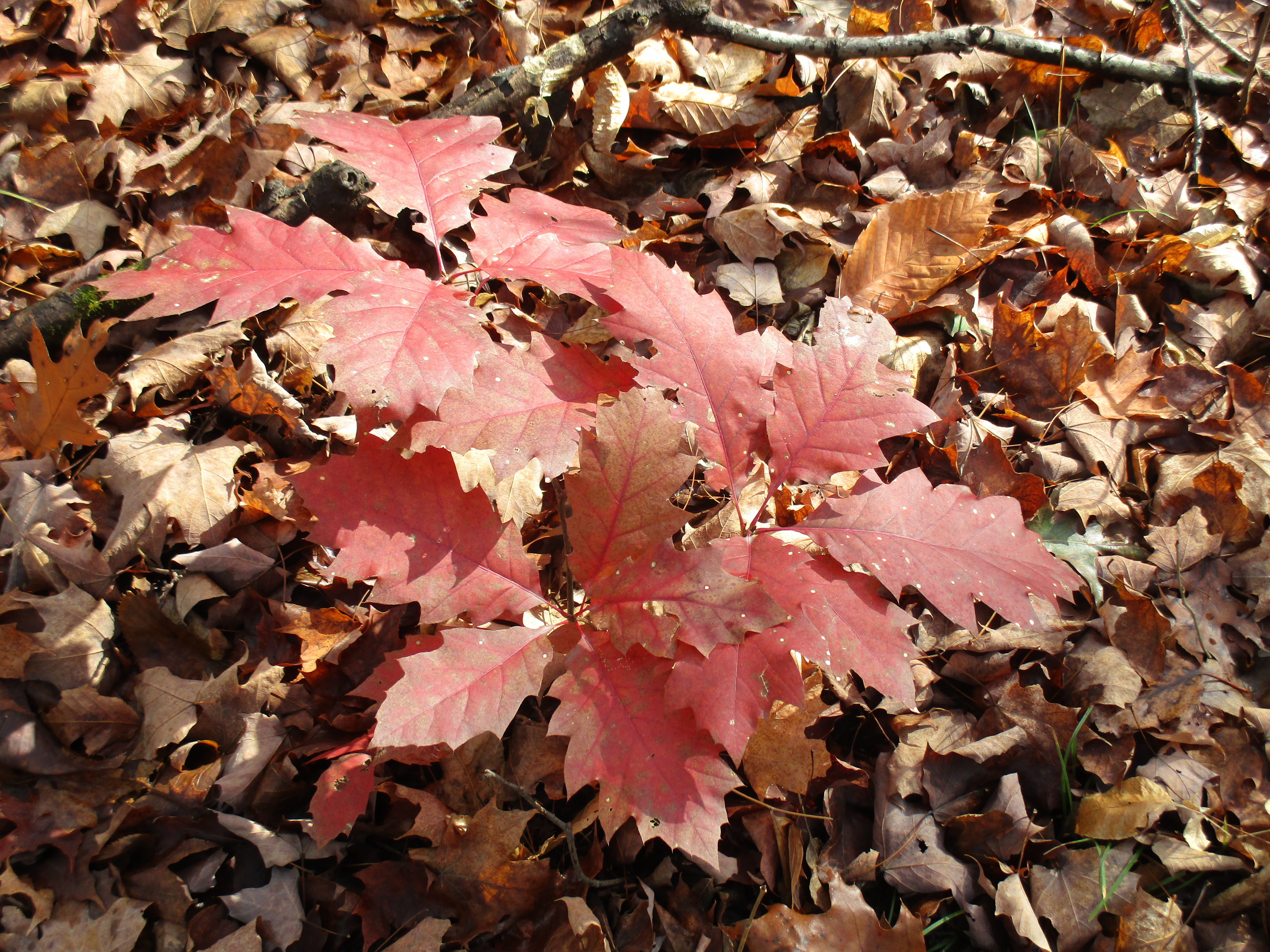
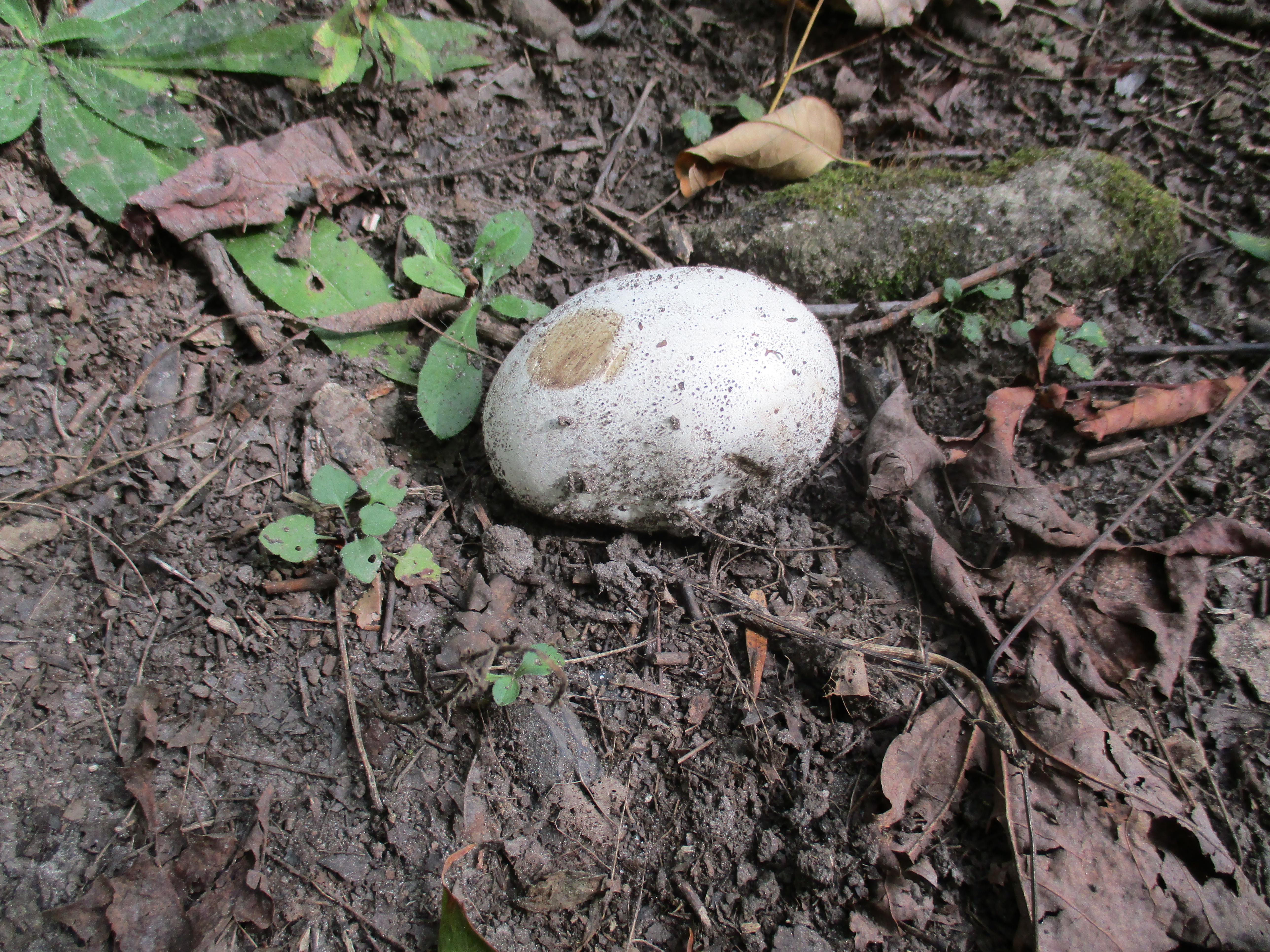
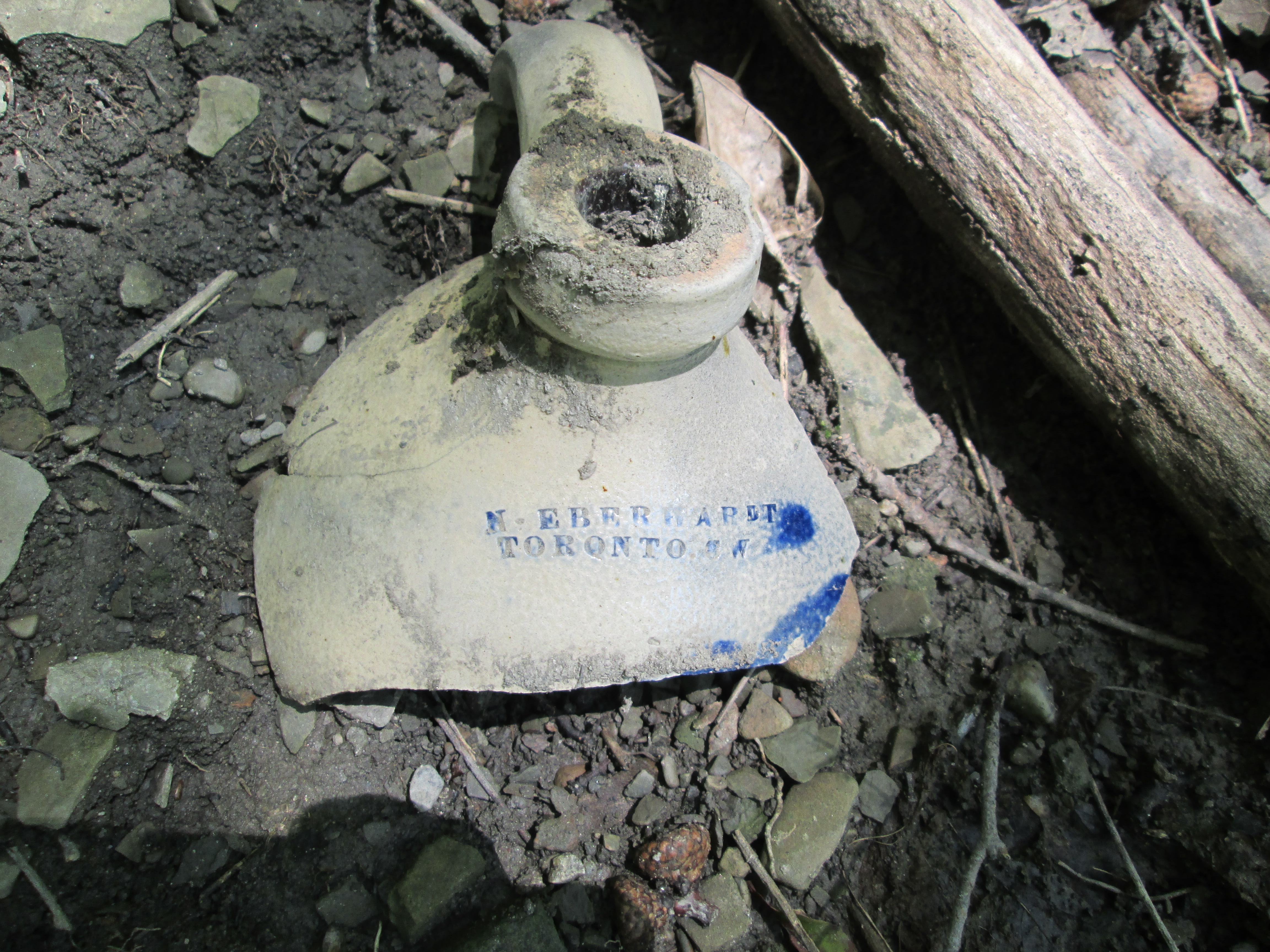
Keep your eyes open as you walk through places where there is a lot of limestone because it can often be found with fossils in it.  The piece pictured below has fossil worms and twigs and what appears to be a moth near the middle.

img_6154

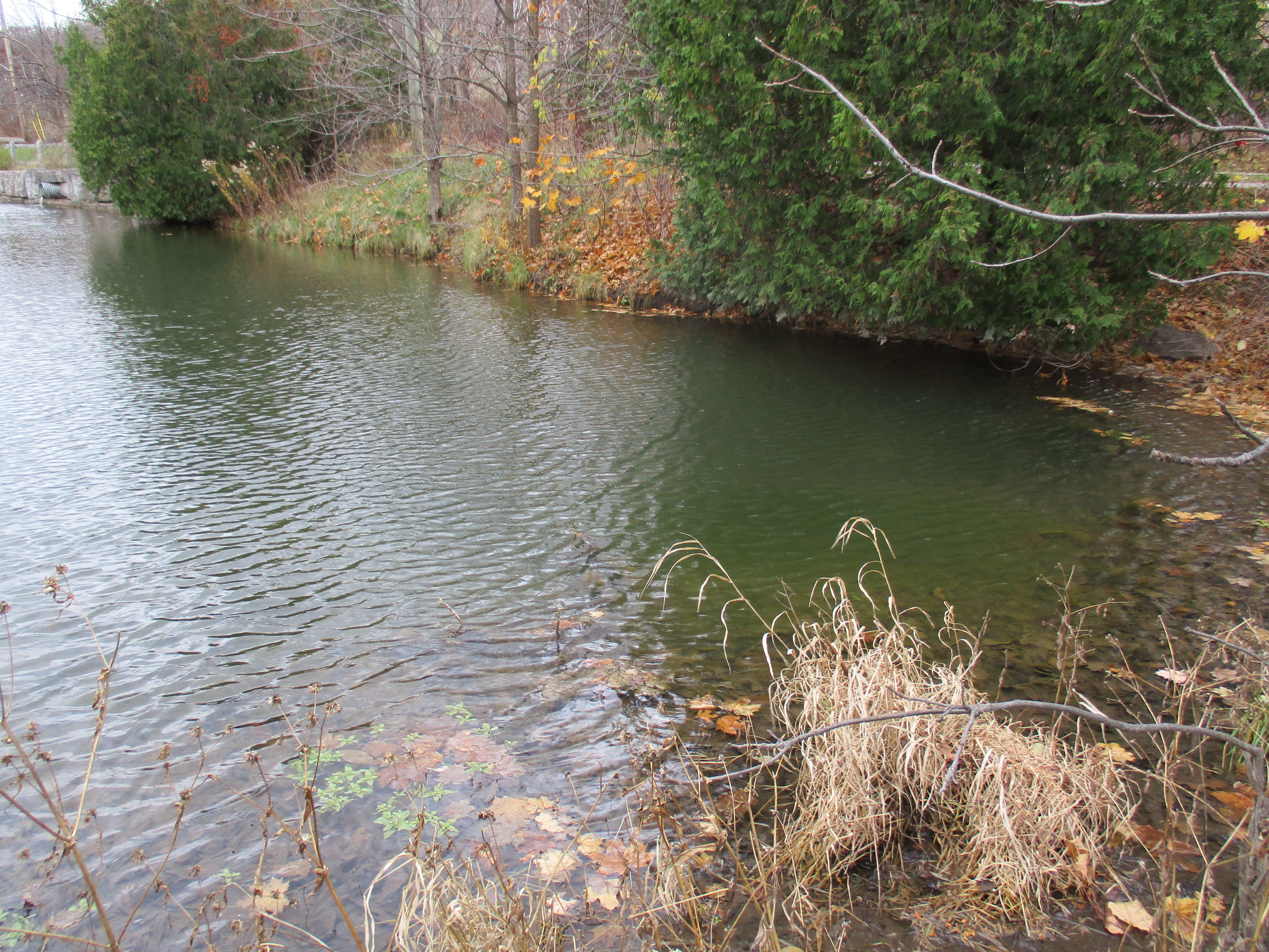
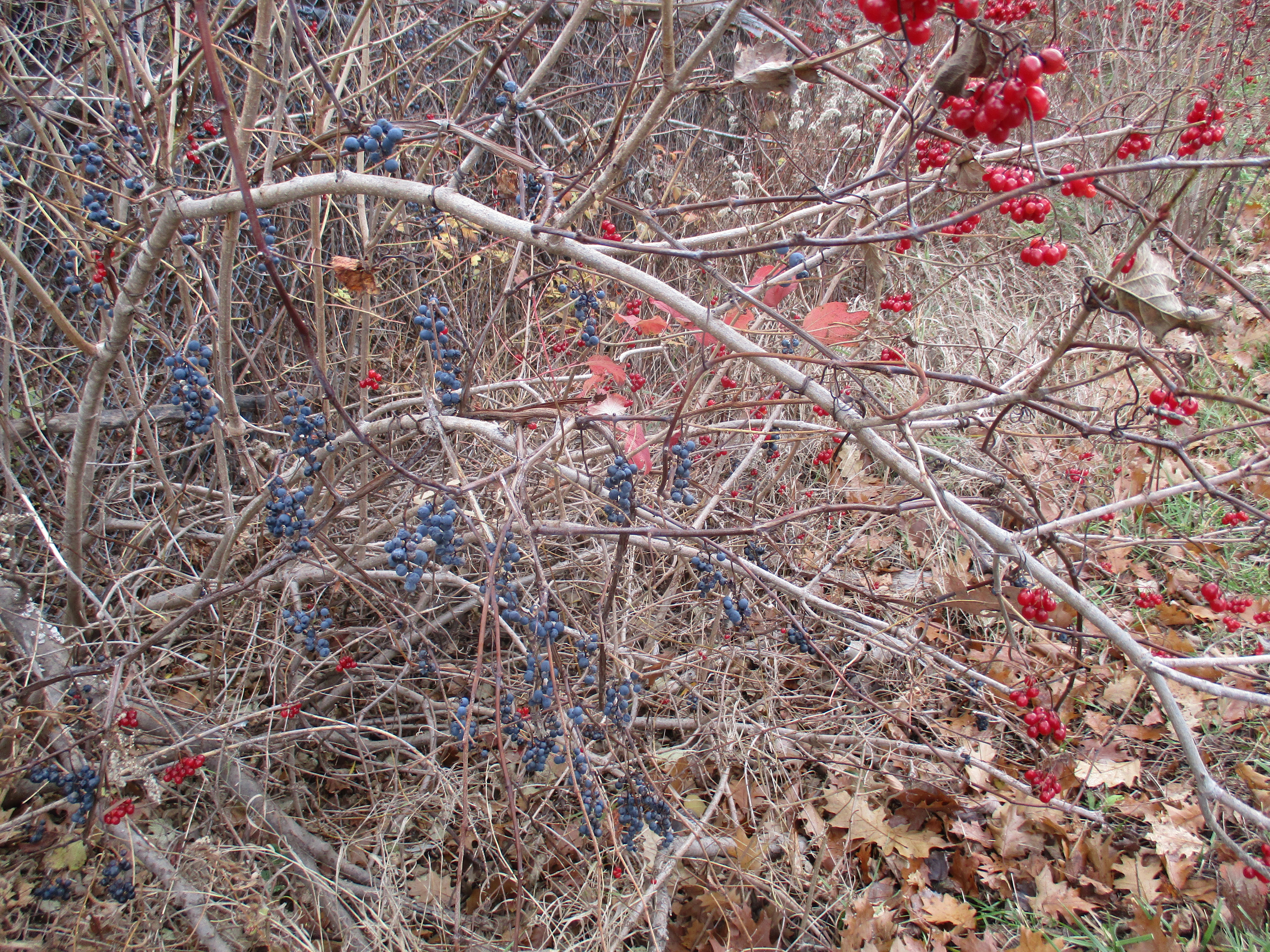
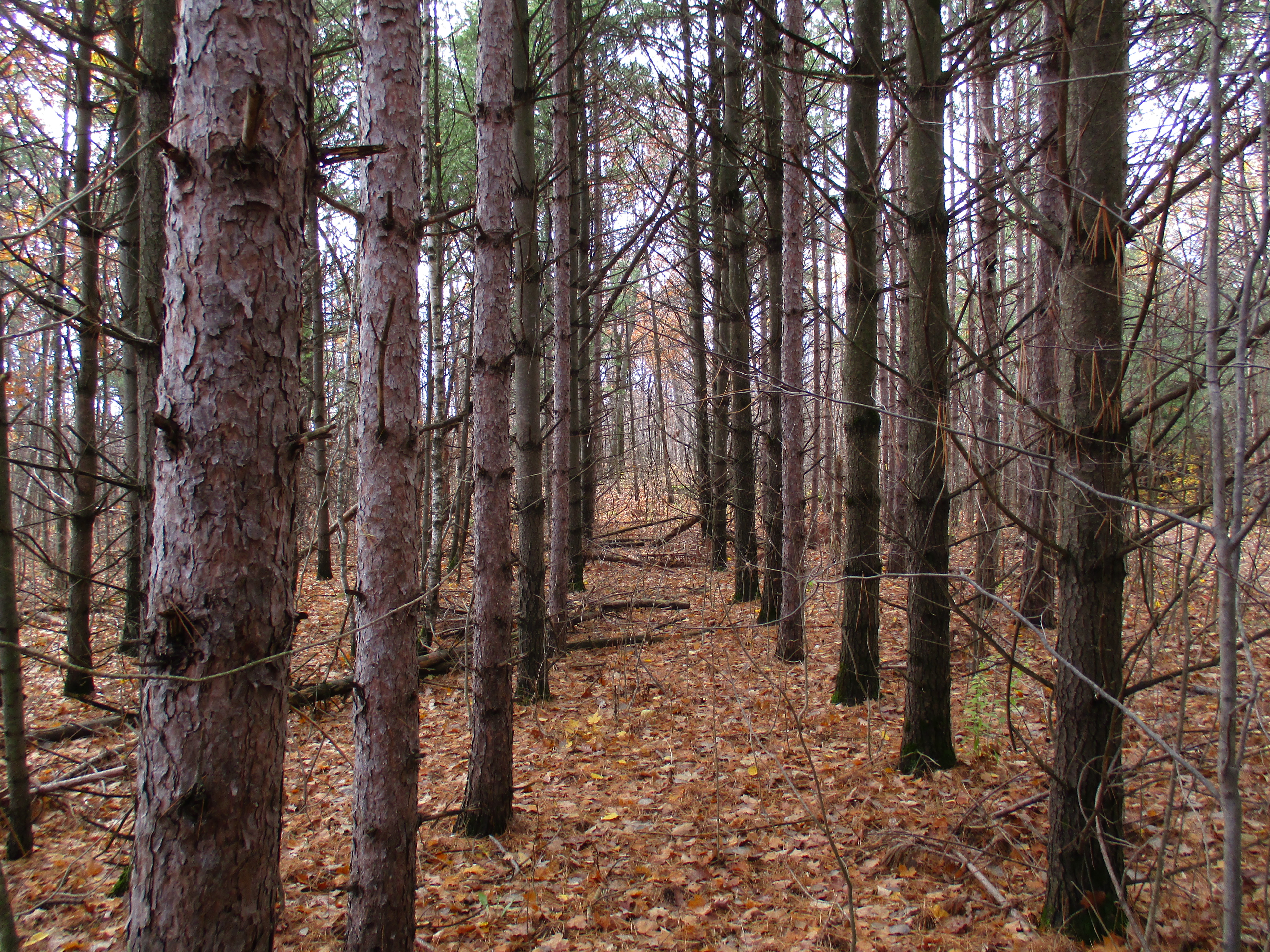
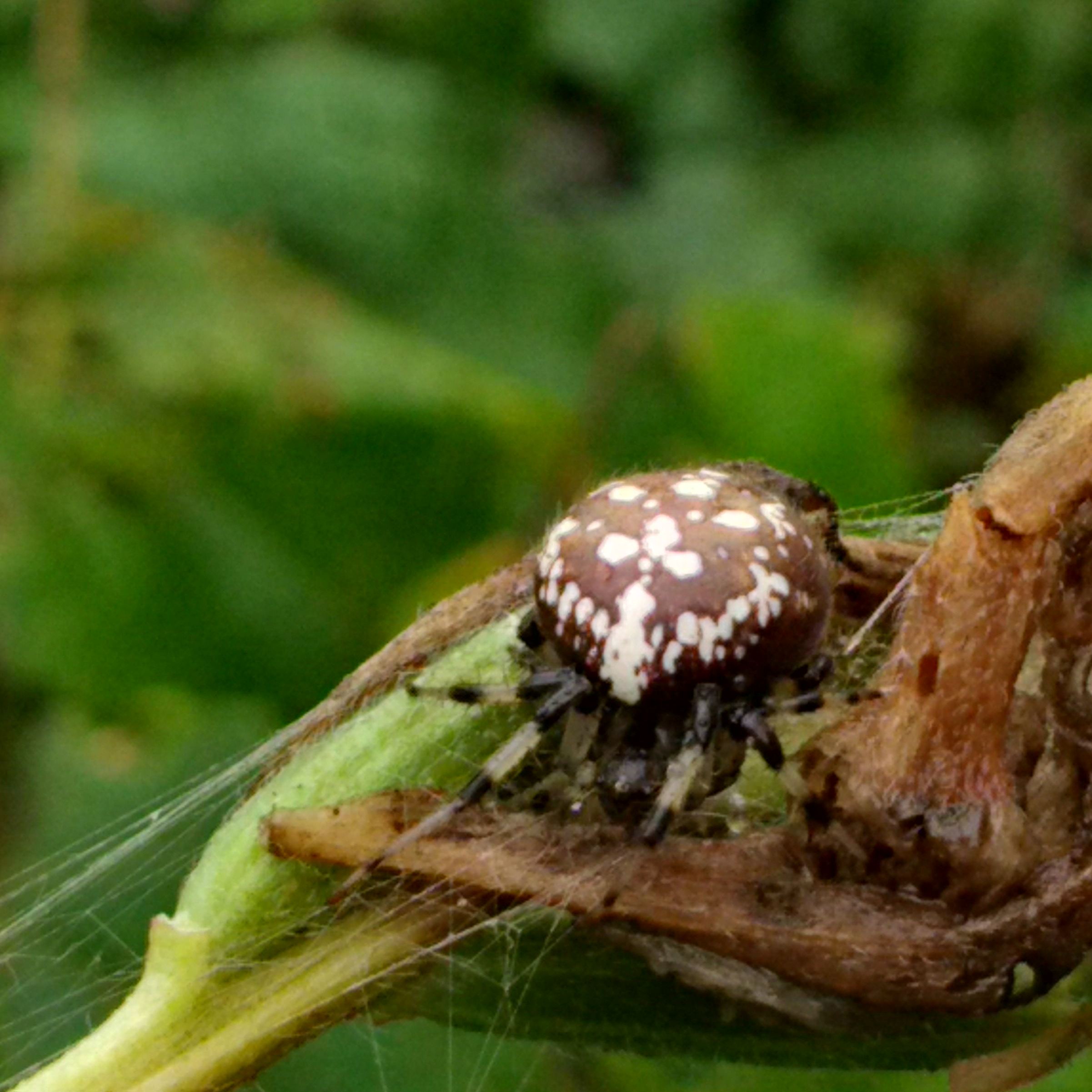
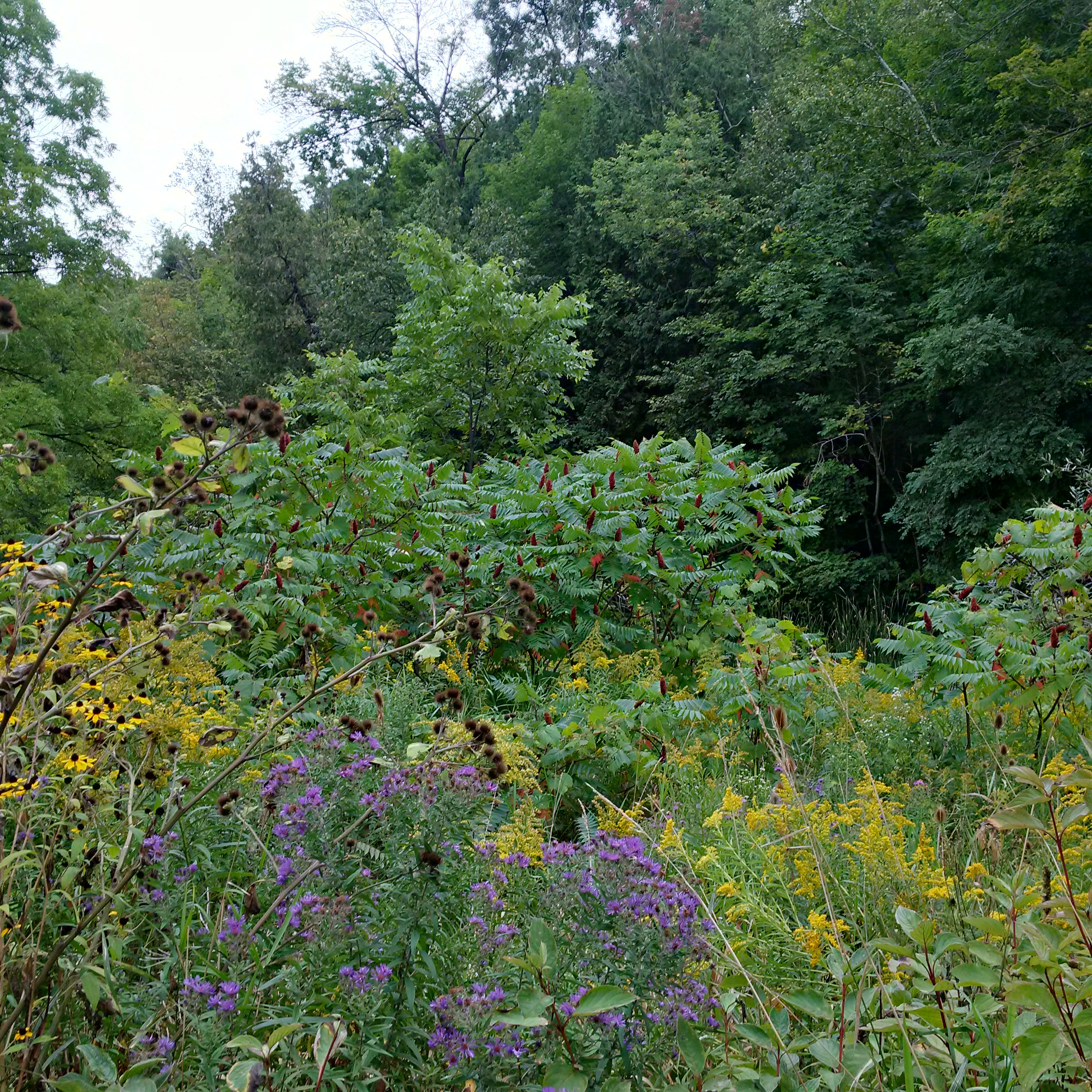
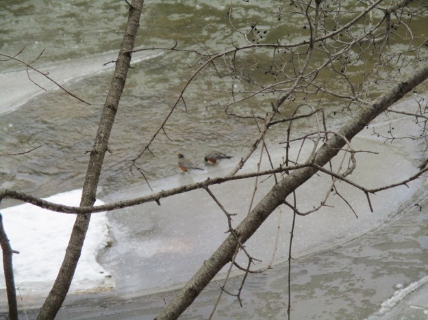
The woods near Sixteen Mile Creek were alive with robins.  Groups of birds are not always called flocks and a group of robins is known as a “round”.  In England, they are also known as a breast and in the USA they are called a wave.  Perhaps this is where the term “round-robin” comes from.  The round of robins by the creek was fat and obviously well fed. It is most likely that these birds have returned from their migration south, perhaps pushed north by storms below them.  Two robins stop for a drink from the creek in the picture below.

img_6158

Our fifteen all-time most popular hikes are featured in this special presentation.

Google Maps Link: St. Mary’s Pioneer Cemetery Oakville

Like us at http://www.facebook.com/hikingthegta

Follow us at http://www.hikingthegta.com

Hog’s Back Park – Oakville

Saturday, January 28, 2017

A hog’s back is a narrow ridge of steeply inclined rock strata that is resistant to erosion. In Oakville, the Sixteen Mile Creek forms a hog’s back at St. Mary’s Pioneer Cemetery. The Google Earth picture below shows how the hog’s back is surrounded on three sides by water (blue).  Following a story last year on the east side of Sixteen Mile Creek we received a tip about an artifact on the other side.  The entrance to a tunnel that used to run under the hog’s back aparently still remained on the west side of the creek across from St. Mary’s Cemetery. Initially, it was used to carry a wooden flume which supplied water to power the first mills in Oakville.  There is limited parking in the area and in some places, you risk towing.  We found limited free street parking on Kerr Street south of the 403. Access to the bottom of the ravine can be gained off of Kerr Street adjacent to the highway bridge.

623-kerr

The bridge replaces an earlier crossing at river level.  Today’s Kerr Street used to have a switchback that led down to the ravine floor and this was eliminated when the high-level bridge was installed in the 1930’s.  There is still an obvious roadway that has been cut down the side of the ravine although it is becoming overgrown with hawthorn and other first generation growth.  There were signs that going down this way wasn’t a good idea, due to trees that had fallen across the roadway and so we returned and descended beside the bridge.

Two types of bridge construction can be seen from the ravine floor.  In the foreground are the graceful arches of the earlier bridge of the Middle Road Highway.  When it opened in 1937 between Toronto and Burlington it was the first inter-city divided highway in North America.  The lamp posts featured “ER” in wrought iron for Elizabeth Regina or Queen Elizabeth, giving the highway the longest stretch of illumination in the world at the time. The second bridge, on straight pillars in the background, was opened in 2011 when the addition of HOV lanes required that a second structure was built to cross the creek. Notice how the new construction was built with room for another expansion in the future.

img_5991

The west creek bank has an open floodplain until you reach the major curve in the river near the railway tracks.  At this point, the creek edges up against the ravine wall.  Before the curve extensive work has been done on the embankment with shale.  We found the opening with its crude arch that can be seen in the photo below.  The embankment is shored up with additional shale to support the entrance to a tunnel which has recently been filled in.  The bottom of a wheelbarrow remains in the opening to attest to the deed and give an indication of scale.

img_6004

On the top of the ravine above this inlet are the remains of some extensive stonework. Arches and columns support other arches and these, in turn, support the deck of a more modern house.  Following the creek ceases to be an option at this point and you are forced to retreat or climb the side of the ravine.

img_6016

Stonehooking was performed between about 1830 and World War 1.  Shale was collected from the lake bottom and used in construction projects.  Two examples of this kind of construction formerly stood on Kerr Street just south of the railway tracks.  They have since been moved onto Shepherd Road to make space for the highrise building that can be seen in the corner of the picture below.  The two houses were built in 1911 and 1930 respectively.  Three triangular dormers grace the two-story 1911 home which has been restored with new cedar shingles.  The story-and-a-half 1930 home can be seen on the left in this photo.  Their location has been marked with a red asterisk on the Google Earth picture above where they sit in the shadow of the building that they were moved to accommodate.

img_6018

At the end of Shepherd Road is a small park that has a sign welcoming you to West River Community.  Here, contrary to trespass laws, an obvious trail leads across a triple-tracked and very active railway line.  This trail leads out onto the top of the hog’s back.  In an effort to fully explore this section of the creek we had to descend back to creek level.

img_6025

Backtracking upstream, it was confirmed that there is just a short section along the base of the railway line that cannot be traversed safely at water level.  The view south from here reveals the layers of shale that make up the hog’s back.  Extensive talus slopes at water level contain the loose clay, sand and shale that has fallen from the cliff face.  A thin strip of vegetation along the edge of the water gives a faint hope of being able to get past.

img_6027

It turns out that there were sufficient places to step to allow us to slowly work past all the talus. Rapidly changing water levels could make this quite dangerous at times.

img_6029

At the end of the hog’s back we found a camp site.  We are either very early or much too late for breakfast.

img_6030

Once around the tip of the hog’s back, we saw two GO trains pass each other in opposite directions on the rail bridge over Sixteen Mile Creek.  The 1877 county atlas shows the rail line (yellow below) passing through Oakville as the H & T Branch of the Great Western Railway (GWR).  In 1834 the GWR was the first railway in Canada West (Ontario) to receive a charter, as the London and Gore Railway.  It was rechartered in 1845 as the GWR.  When it opened in 1853 it connected Niagara Falls with Windsor.  In 1855 the line was extended with the Hamilton & Toronto (H&T) branch.  The rail bridge over Sixteen Mile Creek was built of cut blocks of limestone.  When it was triple-tracked the new section was made of poured concrete with a pattern that mimics the cut stone blocks beside it.

img_6034

The historical atlas below shows the journey starting at the parking spot which is marked with a star.  The trail is marked in red and the end is marked with a diamond.  Having hiked all the way around the hog’s back at creek level we are forced to conclude that the shale structure featured in the cover photo is the only candidate to be the remains of the mill flume intake tunnel.

oakville-3

Google Maps link: Hog’s Back Park

Like us at http://www.facebook.com/hikingthegta

Follow us at http://www.hikingthegta.com

The Vandalized Memorial – Taras Shevchenko Museum

Dec. 13, 2015

On the side of Sixteen Mile Creek stand the remains of a memorial park that has been vandalized on multiple occasions. The scattered remnants stand abandoned waiting to see if they will fall victim to land developers or be restored as a public park. We parked on the fourth line where it dead ends south of Dundas Street and set out in the light rain and 6 degree temperatures.
Taras Shevchenko was born in Ukraine in 1814 in the feudal system of the era. He was orphaned at the age of 11 and went on to become one of the country’s most prolific writers composing over 1000 works. Some consider him to be the Ukrainian version of Shakepeare. When his writing was seen as agitating against the czarists regime he was sentenced to serve in a military outpost and banned from writing. Although he could have lived in luxury from his work he chose to live humbly like the people he loved.  He died in 1861 just the day after his 47th birthday.  Ukrainians began to emmigrate to Canada in 1891 and by 1939 there was already a plan to erect a statue in honour of Taras. The Second World War prevented the community from getting things started but in 1950 it was picked up again. The plan was revised this time with a park and statue envisioned for the following year. Ten thousand people attended a performance in Maple Leaf Gardens on June 30th, 1951 which featured 1,500 performers. The following day the park was opened with up to 45,000 in attendance. An archive picture from the opening ceremonies is shown below.

mem_ph4

The 15 foot tall statue stood on top of a 70 tonne granite monument. It was a gift to Canada from Ukraine and was shipped here in 121 pieces which included the pedestal and garden stones. The total weight was 51 metric tonnes and the assembly work was completed by two local brothers. The statue was controversial from the start with a split between Communist and Czarist Russia causing the statue to be under 24 hour guard for some time after it opened. The Taras Shevchenko monument is seen below as it looked when the park opened on July 1, 1951.

Tass

The Taras Shevchenko Museum opened a year later on July 1, 1952.  It housed over 500 exhibits, mostly from the museum in Kiev.  It included 23 of Taras’ oil paintings as well as carvings and Easter eggs.  On September 16, 1988 the museum was destroyed by an arson. The death mask, an original bronze copy of the mold was the only thing rescued from the museum. It has been moved to the new museum which was opened at 1604 Bloor Street W.  Today an old sidewalk runs to the field where the museum stood until 27 years ago.

IMG_1904

Park benches are scattered around the formerly landscaped park. 16.5 acres were planted with over 600 trees and 500 pounds of grass seed. The grass near the bench shows signs of a recent grass fire that threatened to consume the remnants of the park.

IMG_1925

The old flag pole still stands in the open field near the monument.

IMG_1908

Sometime around Christmas 2006 thieves drove a truck up to the statue. They attached ropes to the statue using a ladder stolen from the caretaker’s property and pulled it to the ground. The scrap value was estimated at $20,000 by police and only the head was recovered. It alone weighs 170 lbs and has been placed in the new museum on Bloor Street.

IMG_1912

There was a smaller statue of Taras sitting in a chair reading a book near the entrance to the park but it was stolen in 2001 just a few days after the July 1st celebration of the park’s 50th anniversary. There also used to be ornate iron gates that welcomed visitors off of Dundas street but they too appear to have been stolen for their scrap value. The cover photo shows the entrance to the park with the broken monument in the background. Even the granite marker naming the park has been vandalized by graffiti.

We followed the trail to where an old access road leads down to the level of Sixteen Mile Creek. There is a limited range one can travel upstream on this side before you must climb the ravine to cross a shale cliff. Near here is an old pump house on the side of the creek. There are intake pipes in the river as well as pipes running to the top of the hill. The pump house appears to have been associated with a children’s campground that occupied 47 acres adjacent to the Memorial Park. The children’s campground was closed in 1998.  The picture below shows the view through the open door facing the creek.  Pieces of PVC pipe can be seen on the far embankment and in the water.

IMG_1879

The eastern red-backed salamander lives in woodlands and is considered to be the salamander species of least concern for preservation in Southern Ontario. They typically breed in the fall but can also breed in the spring. They can reach population densities as high as 1,000 salamanders per acre. This salamander has a short hibernation period compared with other salamanders and have been known to be seen even in winter. The slow start to the winter season this year seems to have kept this one still active.

IMG_20151213_124021 (2)

Before the current Dundas Street bridge was built the road used to climb the side of the ravine in a switchback that connected with the fourth line. That road was closed to traffic and now provides a link to the hiking trails. We previously visited this site when investigating the Ghost Town of Sixteen Hollow.

IMG_1930

The future of the Taras Shevchenko memorial park is uncertain. The park owners had been in negotiations with the City of Oakville to donate the property as a city park when the statue was stolen. At the same time the surrounding land from the children’s camp has been bought by developers who plan 205 single family homes and 125 townhouses on their land. They have been actively trying to acquire the memorial site for part of their development. I’m not sure what is in store for this repeatedly vandalized memorial.

IMG_1916

Like us at http://www.facebook.com/hikingthegta

Also visit:

https://www.facebook.com/ShevchenkoMuseum/

Adam Alexander Homestead – Halton Region Museum

Saturday, Nov. 7, 2015

Four different men, all named Adam Alexander, owned and operated this innovative family farm between 1836 and 1961.  Today it has been converted to house the Halton Region Museum.  Having visited Kelso’s Kilns we made our way through the conservation area toward where we had parked on Kelso Road.  Light rain was falling but we took the time to look around the outside of the buildings.

In 1826 Aberdeen in Scotland experienced a severe drought that led to some of the worst crops in the previous sixty years.  Potatoes and turnips didn’t form at all and many people left for greener places.  Among them were Adam and Margaret Alexander who decided to move to Upper Canada.  They brought their four children, including Adam Alexander II,  with them on the voyage to Montreal which typically would have lasted about 44 days.  From Montreal, it was on to Ancaster which had become Upper Canada’s second largest town, next to Kingston.  The Alexanders lived in Ancaster for ten years and Adam was able to ply his trade as a stone mason. One significant project that he worked on was Dunburn Castle built for Allan McNabb between 1832 and 1835.  The old postcard below shows the castle around the turn of the century.

Dunburn

In 1836 Adam purchased this 200-acre lot of land at near the foot of the escarpment just west of Milton.  The land was covered in a forest of trees that were up to 200 feet tall and four feet across at the base.  The trees that were cut down to make the first clearing were used to build a log cabin for the family.  The original log house has been removed.  A different log house has been moved to the approximate location of the original one.  This cabin was found in a forest tract north of Campbellville and the details of its construction are not known.  It has two rooms inside and is typical of first homes built by Scottish and Irish settlers.

IMG_1282

Clearing the land was a major chore and it took over 25 years for the Alexanders to slowly cut down all the original forest cover.  Trees were normally cut during the winter when other farm work was greatly reduced.  As soon as the frost was out of the ground the work of grubbing the stumps would begin.  A grubbing axe was used to dig around the stump and cut off the smaller roots.  Pulling oak tree stumps was hard work and would often take a whole day to remove a single stump.  It was normal to leave the stumps in the ground for a few years to let the roots rot and crops were grown around the stumps while they waited. The Alexanders saved and bought a stump puller to ease the work.  The walnut tree in the picture below was planted in 1893 to celebrate the birth of Adam Alexander IV.

IMG_1270

When the family had been settled long enough to have a productive farm they turned their attention to a more comfortable dwelling.  Adam Alexander used his skills as a stone mason to build a home out of local limestone.  The style was Gothic Revival which was popular from 1830 until about 1900.  One of the most common elements of the style is the pointed arch, often used in windows.  The original home is seen in the cover photo and these pointed window arches are seen on all the second story windows.  The house was damaged by fire and rebuilt in 1918 at which time the windows were changed to the more vernacular ones seen today.  Steeply pitched roof lines with front facing gables are also common to the Gothic Revival style.  This element used to adorn the centre of the original house but was removed after the home was rebuilt.

IMG_1277

The family prospered selling cash crops like wheat, butter, potatoes, timber and wool.  They also raised cattle sheep and pigs.  The family was self-sufficient and built their own blacksmith shop for shoeing the horses and making repairs to equipment.

IMG_1264

By the 1880’s they family had built a large Pennsylvania style barn.  The barn was renovated in 2001 and a third story was added.  The barn can be seen in the photo above of the walnut tree. In 1898 Adam Alexander III tapped into a stream flowing in the escarpment above the property. He piped the water to the barn and house where he installed water motors.  These motors created electricity to power farm and household equipment.  In the barn a fanning mill, circular saw and grain crusher were a few of the automated devices Alexander ran.  In the house, the chores were simplified with an electric washing machine, cream separator, butter churn and meat chopper.  While other local farms were lit with kerosene and run by manual labour the Alexanders had comparative luxury.  The water was also used for a small fountain in the yard of the house.

IMG_1269

Parts of the farm were sold off over the years including a small piece for the erection of a one-room school.  When the Credit Valley Railroad was being constructed the Alexanders sold a strip of land for its construction.  Finally, in 1961 Adam Alexander IV retired and sold the farm to the Sixteen Mile Creek Conservation Authority for use as a park and flood control facility. Starting the following year the farm buildings were slowly converted to house the Halton Region Museum.  The pond was created in 1967 to feed the snow making machines but it was soon discovered that it was far too small and now has been left to develop a more natural condition.

IMG_1287

Travellers have always needed service centres to keep the fluid topped up in their vehicles.  The stone trough pictured below was supplied by Halton County and carved out of local limestone. Originally located on Steeles Avenue west of Hornby it was provided for horses to get a drink along the road.  It has been moved to the Alexander farm as part of the museum display.

IMG_1256

Old millstones were sometimes converted into tire setting stones.  They would be used to hold a wooden wagon wheel while an iron tire, shaped like a loop, was slipped around the outside. The heated metal was allowed to cool on the wheel leaving it set in place.

IMG_1252

There are plenty of other trails remaining in the area for possible future exploration.

Like us at http://www.facebook.com/hikingthegta

Follow us at http://www.hikingthegta.com

Kelso’s Kilns

Saturday, Nov. 7, 2015

Near Kelso are several abandoned lime production facilities that preserve part of our industrial heritage regarding the extraction and processing of construction materials.  We decided to look for evidence of two of these plants that operated between the south side of the Credit Valley Railway (CVR) and the edge of the escarpment.  We parked on Kelso Road and set off to make our way to the foot of the escarpment with our eyes set on the vertical cliff face that shows up in archive photos of the kilns.

The area around Milton has always been known for aggregate extraction and the production of lime, limestone and bricks.  It was settled beginning in 1819 by Scottish immigrants to the extent that the area became known as the Scotch Block.  In 1844 Alexander Robertson settled in the area of Milton and began raising his 8 children.  His son, David, started Milton Pressed Brick and Sewer Company as seen in Pine Point Park.  Another son, Duncan started the Robertson Lime Company in the 1880’s on a strip of land between Kelso Road and the escarpment.  The company was operated by him and then his son Donald until 1929 when they sold the business to Gypsum Lime and Alabaster Limited.  Robertson built his company on the embankment along side the CVR (now CPR).  Original stone construction and later concrete additions and repairs remain near track level while the remains of kilns stand slightly uphill.

IMG_1196

Gypsum Lime and Alabaster Limited sold to Dominion Tar (Domtar) in 1959 and they closed the facility a few years later.  Two concrete silos stood on the west end of the structure joined by a bridge across the top.  Birch trees are growing in and around the structures, which look like a giant pair of sunglasses.  These were possibly used in the production of quick lime by adding water to the burnt lime from the kilns.

IMG_1191

The picture below is credited to Robert Sandusky and is from 1957.  It shows the Gypsum Lime and Alabaster Limited facility in the background.  The three lime kilns are in operation and one of the two silos can be seen on the right.  The location of this bridge on Sixteen Mile Creek is now lost under Lake Kelso.

1957 lime kilns

The view from near the foundations of the Robertson Lime Company.  Lake Kelso can be seen between here and the 401.  A dam and flood control facility for Sixteen Mile Creek created this lake in 1962.  It was a mostly cloudy day which gave way to light rain toward the end of our hike. There is still some colour left in the trees but mostly in the willows and oak trees.

IMG_1180

We ended up on the wrong side of the fence and had to walk down the tracks to Appleby Line. This isn’t recommended.  From here we made our way south and found an entrance behind the site of the Christie lime kilns.  David Christie built two draw kilns each 55 feet tall on the site. The first was completed in 1883 and the second in 1886.  The cover photo shows the view up inside one of these kilns.

IMG_1226

The picture below shows the furnace where the wood was burnt to provide heat to break down the limestone.  Temperatures in the oven could reach as high as 1800 degrees F.  The person who filled the furnace was known as a fireman and he made $1.00 per day.  He had to load about 8 cord of wood into the two kilns each day.  The four quarry workers each made $1.25 daily.  The foreman was paid $400 per year.  Workers got Sunday off and many of them attended the church building on the corner of the Christie Homestead.  It has since been converted into a house.

IMG_1220

Chunks of limestone were moved from the quarry behind the kilns to the kiln site.  From here they were dumped into the top of the kiln to be burnt into lime.  The picture below shows the top abutment for the bridge that carried the limestone to the kiln.  There are still pieces of the log supports in the holes in the side of the abutment.

IMG_1227

The archive photo below shows the Christie Kilns in 1911.  Notice the bridge running from the top of the kiln to the embankment behind. The supports and trusses for the bridge can be seen behind the kiln.

Christie Lime Kilns

A small tramway was installed to bring limestone to the kilns and it was opened in July 1922.  Rock could be brought from the quarry to the kiln in under 2 minutes via a steel rope half the size of the one we found on The Cox Property.  This was a marked improvement over the previous method using horses to haul the stone to the kiln.  The horses were suitably impressed too!

IMG_1207

Between the two draw kilns and slightly to the rear are the remains of a third kiln.  This kiln is shorter and of a different construction.  This set kiln was used by loading limestone in and packing firewood around it.  The method was slow and required a cool down period before the product could be removed.  This kiln was likely abandoned when the draw kilns were installed.

IMG_1230

There is a footbridge to get across the CPR tracks and so we took it back into the park.  From here we could see the vertical cliff face that we had been close to after exploring the Robertson Lime Company foundations.

IMG_1290

Growing along the side of Kelso Road are some wild grapes.  Care should be taken to ensure that you are in fact looking at wild grapes and not moonseed, which is poisonous.  One way to tell is to look at the seed shape which predictably looks like a moon in the moonseed plant.

IMG_1293

Google Maps Link: Kelso

Like us at http://www.facebook.com/hikingthegta

Follow us at http://www.hikingthegta.com

Hilton Falls

Sunday November 1, 2015

Hilton Falls makes a scenic 10 metre drop over the escarpment beside the ruins of a thrice abandoned saw mill. We decided to visit the falls and investigate a section of the escarpment we had never been through before. We parked on the sixth line at the parking lot for the Halton Regional Forest Britton Tract and set off on an extended hike to the falls.

The Britton Tract has been managed by Halton Region since 1952 and contains the Bruce Trail as well as several side trails.  The escarpment here is dolomite which can hold water in pools close to the surface providing a large amount of water in streams and wetlands.  It also leads to the growth of extensive amounts of moss on the rocks.  The trees don’t tolerate the wet conditions and many fall before they reach their full size giving the forest a youthful appearance.

IMG_1018

The autumn meadowhawk, as implied by it’s name, is seen in late summer or fall.   However, the name may suggest a bird rather than a dragonfly.  This dragonfly has relatively large eyes as compared to most members of the genus.  They feed on insects including the beloved mosquito and they themselves are eaten by fish.  Large Mouth Bass are known to catch them as they touch the water when the male and female are locked  in the process of mating.  It’s Latin name means “with rock” and refers to their habit of sunning themselves on the rocks along the shoreline of lakes and steams.

SAMSUNG

Along the side of the blue trail we found a glacial pothole. These potholes generally are wider in the middle than either the top or bottom. Early concepts of their creation suggested that aboriginal people had carved them. Smaller ones supposedly being used for cooking. They are also called “Moulin Potholes” and are now believed to have been formed when water poured through a hole in a melting glacier and eroded the stone beneath. They range in diameter to over 25 feet and the one pictured below is about 15 feet deep.

IMG_1048

As we made our way through the woods we saw an old stone wall on the left of the path.  Stone fences were the easiest solution for disposing of rocks during the annual clearing of farmland. This particular tract of land was difficult to farm and the fields have been left to go wild again. Now the stone walls are running through the forest where once they would have divided fields.  Like other surfaces in the area the stone fence is covered with a thick layer of moss.

IMG_1069

The water in the wetlands is controlled by means of a modern sluice gate.  The pipe on the top houses the cylinder that presses a metal plate down to seal the flow of water.

IMG_1073

Following Sixteen Mile Creek we came to a place where the sunlight sparkled on the water as it vanished over the crest of a waterfall.

IMG_1092

In 1830 Henry Young gained title to lot 8 in the fifth concession.  He allowed Edward Hilton to build a saw mill in 1835 which Hilton operated until 1837.  This was when he decided to leave to fight in what came to be known as the Upper Canada Rebellion of 1837.  The mill was left to rot and it appears Hilton didn’t return for about twenty years.  Hilton gave his name to the falls although he only operated a mill here for a short time.  Hilton Falls plunges over the escarpment and provided the power to turn the water wheel for the saw mill.

IMG_1114

In 1856 the site was purchased by Dr. George Hamilton Park who had the mill rebuilt.  He likely bought it under speculation and it was operated under several names until 1863 when it burned down.  At the foot of the falls stand the remains of the water wheel housing from Dr. Park’s mill.  This cut stone structure supported a wood and iron wheel that was reported to be 40 feet in diameter.  Estimations of the site suggest that 26 feet was more likely the size.  The water was brought from a mill pond above the falls through a flume to the top of the wheel.  The stone arch provided an exit for the water after it turned the wheel.  The wheel housing and the mill were solid construction.  The saw mill was 30 feet wide, 50 feet long and stood 18 feet tall.  The wheel housing can be seen below as well as in relation to the falls in the cover photo.

IMG_1110

Along the way back we decided to take a brief trek along a side trail near the sluice gates. Here we discovered this small pond.  The white rock along the far shore of the pond is another large glacial pothole.

IMG_1122

Ontario’s crown forests cover almost two thirds of the province.  When almost all of the original tree cover was harvested in the first century of settlement the government set out a program to encourage reforestation.  Tax grants were made available to people who planted a portion of their land with forests.  The land in the escarpment was poor for farming and was often reforested with trees planted in straight rows as seen below.

IMG_1054

This small red oak tree has it’s bright red leaves shining in the fall sunlight.  This tree can grow very fast and in 10 years can reach up to 20 feet tall.  As noted earlier, the growing conditions here will likely cause it to die before it reaches it’s potential of 500 years old.

IMG_1015

The Niagara Escarpment was named a World Biosphere Reserve by UNESCO in 1990. Development and land use are strictly controlled along the escarpment.  Mineral extraction is one of the permitted uses of the escarpment under tightly controlled conditions.  The Milton Quarry is across the street from where we parked and has filled up with water.  On the far side of this photograph is a white building.  Behind it a foot bridge carries the Bruce Trail across “The Gap” in the escarpment.  This gap can be seen from the 401 and was created in 1962 when the quarry was opened.  The trail over The Gap makes for a fun hike that I hope to repeat soon.

IMG_1124

Taking the scenic route it was 5.9 km to the falls but the more direct route back was only 4.26 km for a total hike of 10.25 km.  This is a lengthy hike but there is a shorter means to access the falls from Hilton Falls Conservation Area.

Like us at http://www.facebook.com/hikingthegta


The Strawberry Fields Weren’t Forever

Saturday October 3, 2015

The Trafalgar, Esquesing and Erin Road Company established a toll gate on Trafalgar Road in Oakville near the present site of Inglehart Street.  Tolls were collected to pay for the maintenance of the plank road that was to be built from Oakville to Fergus.  We decided to return to Sixteen Mile Creek and continue north from Kerosene Castle, hiking on the east side of the creek.  We parked on Inglehart street near Trafalgar.  It was cloudy and windy with a temperature of only 7 degrees.

The Hamilton Radial Electric Railway Company was chartered in 1893.  In 1905 it was extended to Oakville and a large steel bridge was constructed across Sixteen Mile Creek.  The Oakville station is seen in this archive photo as it appeared in 1908 with one of the electric cars in front.

RadialStationhistoric1

The Oakville station is the only remaining one on the line but the building is abandoned today and has some broken windows on the front.  We took a short trip down to the site of the old station before starting our hike.  Some windows have been added to the rear portion of the building but otherwise it retains it’s original charm.

IMG_0412

Directly across the street from the train station is the Scout Hut built in 1926.  The location is perfect since Scouts were expected to be well trained.

IMG_0414

John Cross introduced the growing of strawberries to Oakville.  He found that the fruit grew wild in the area and was easily cultivated.  Soon others were following suit and by the mid 1870’s Oakville was the primary strawberry production area in the Dominion of Canada.  The delicate fruit was easily damaged and so to support it’s storage and transportation a local basket industry developed.  Cross designed a wood veneer basket that he produced.  Soon John A. Chisholm opened his own basket factory and expanded operations in 1874.  His son, Charles, invented a machine to slice wood veneer for the baskets.  By 1877 there were almost 750,000 fruit baskets being produced each year in Oakville.  In 1889 he sold the business which was re-named the Oakville Basket Company  three years later.  Although it was destroyed by fire twice it was rebuilt each time.  It operated until 1984 when it was finally shut down.  In it’s later years all the local strawberry fields had been subdivided for housing and so the factory produced Popsicle sticks and tongue depressors.  The drive wheel from the steam generator has been preserved and is located in Old Mill Parkette.

IMG_0504

We descended to the level of the creek soon after we crossed Trafalgar and began to make our way upstream. It was a windy morning and we were watching the wind burst in sudden swirls on the surface of the water.  Suddenly we heard a loud crack from directly across the creek and looked in time to see three quarters of a large tree collapse to the right.  As it came to rest the remaining section topped in slow motion to the left.  In all my time spent hiking in the woods this is the only time I’ve witnessed a tree fall and it most certainly does make a noise.  The broken and twisted remains of the tree stump can be seen in the picture below.

IMG_0418

Cormorants were fishing in the Sixteen Mile Creek.  The rock on the right in this picture had three of them standing on it at one point.  As they flew away they almost skipped across the top of the water like a flat stone.  The bird on the wing below slapped the water fast enough that the spray from the previous two impacts hasn’t settled back into the creek yet as it reaches for the next wing flap.

IMG_0437

The fall colours are still not at their prime but there are places where the display is beginning. The trigger for change is the shorter hours of daylight which causes the change to happen at nearly the same time each year, regardless of the temperature.

IMG_0448

The yellow iris has seed pods that contain rows of brown seeds.   These seeds react to the freezing and thawing cycle in the spring to wake them from their dormant state.

IMG_0479

We made our way along the shale embankment on the east side of the creek.  There were many places where we had to go part way up the embankment to get around a fallen tree or a place where there was no footing at the water’s edge.

IMG_0481

It’s quite common to find the remnants of some person’s temporary shelter in the woods. Seldom do they take the time to build from shale and have a more durable home complete with a fire place.

IMG_0482

A little past the shale home in the woods we decided to climb the hill where we found the Oakville St. Mary Pioneer Cemetery.  This cemetery contains Oakville’s founder William Chisholm and the first mayor George King Chisholm in a separate family plot surrounded by a wrought iron fence.  Like most pioneer cemeteries there is a tale of premature death and the loss of infants.  There are several stones here that record the tragic loss of multiple children within a family.  Weather has eroded some of the earliest stones until they’re almost illegible but the bold and deep carving of this one will last for many more centuries.

IMG_0492

We walked along the historical trail on the way back to the car.  It follows the street and is far less challenging than the arduous journey along the edge of the creek. Looking down at the curve in the creek where we had been climbing it was obvious that this is not a hike to be undertaken alone or by those just starting out.

IMG_0503

Much of the industry in Oakville was located on the west side of the creek and so a future journey may undertake to see what remains from this period.

Like us at http://www.facebook.com/hikingthegta

The Royal Oak Of Speyside

Saturday Sept. 26, 2015

Speyside is a ghost town.  Of the once thriving village only the corner store remains, and the closed building is starting to decay.  Many such communities dot rural Ontario but what makes Speyside different is it’s Royal Oak tree.  Fall started in a glorious way with sunshine and the early morning temperature of 12 degrees rising quickly.  It made for a perfect morning to go and check it out.

There were five one room schools in the area of Speyside.   These School Sections (SS) were SS #5 Waterloo, SS #8 Dublin, SS #10 Dufferin, SS #12 Lorne and SS #16 Stone.  In 1960 these 5 schools were replaced with the Speyside Public School.  This served until 1986 when it was closed and the students were dispersed between four other local schools.  The building now sits abandoned and is for sale.  The picture below from 1967 was supplied by Marion Frank-Rice who attended the school and can be found along with other memorabilia at   http://www.facebook.com/groups/SpeysidePS

Speyside 1967

The school as it stands today with the addition of extra rooms and wire mesh on the windows.

IMG_0305

The story of the Royal Oak of Speyside actually starts in England in 1651.  England was near the end of their civil war and King Charles II was trying to escape with his life after the battle of Worcester.  He later reported that he had hid in an English Oak tree all day while parliamentarian patrols searched for him.  This tree became known as the Royal Oak tree and the English Oak got a new nick name.  May 29th was celebrated as Royal Oak Day for centuries in England to mark the restoration of the monarchy.  In 1937, to celebrate the coronation of King George VI on May 12th, acorns from Windsor Park in England were sent all across the commonwealth.  A one room school stood on 22 side road north of Speyside and a 1944 picture of the school is seen in the cover photo.  Students at SS #8 Dublin planted their acorn in a special evening ceremony in that year.  Marion’s father was among the group of students involved. When the school closed in 1960 they raised the money to have tree surgeons move the 20 foot high oak tree.  They planted it beside the gym at the new school where it continues to grow.  When the school closed in 1986 acorns were brought from England to plant “cousin” oak trees at Brookville, Limehouse, Pineview and Stewarttown where the Speyside students were transferred.  The Royal Oak of Speyside received an heritage designation in 2007 for it’s cultural significance.  The tree is expected to live for up to 500 years and the owner of this property is required to maintain it during it’s lifetime.

IMG_0309

Speyside grew into a considerable community as the street plan in the 1877 Halton County Atlas shows.

plan

The village had two hotels, two general stores, a tannery, a large stone quarry and a village hall. The picture below shows the only remaining building from the original Speyside.  Newer homes have been added over the years.  This structure operated as a store under many names and was even moved back from the road 17 feet in 1942 when the highway was paved.  Today it is closed and a few modern homes provide the only hint of the former life of Speyside.  Directly across the street from the store stood the original log cabin that served as a post office from 1873 until 1914.  The first postmaster is rumored to have been illiterate and relied on the school children from SS #10 to help him sort the mail.The post office closed in 1914 when rural mail delivery made it obsolete.

IMG_0311

We parked off 15 Sideroad in the Bruce Trail parking lot and went for a walk in the Speyside Resource Management Area.  Not far from the parking lot stand the remains of two kilns. These were used by Alexander Livingstone to dry the hops he grew when this was a farm.

IMG_0317

There is a pond along the trail which has a small sluice gate maintaining the water level.  It has been created by damming the tributary of the Sixteen Mile Creek that passes through town.

IMG_0313

Puff balls are one of several genera of fungi that do not have open caps or external gills to distribute their spores.  They form their spores in the centre of the fruit body.  When the fruit dries out it turns brown and the skin ruptures releasing a puff of spores from the ball.  When harvested around this time of year then sliced thinly and fried in butter and garlic they become quite tasty.  This one was too small to be bothered with but they can get to be nearly the size of a soccer ball.

IMG_0344

Along the side of the trail a series of hoses run between trees and end in this shed where maple sap is collected and boiled down to make maple syrup.

IMG_0345

Butter and Eggs flowers, also known as yellow toadflax, are related to the snapdragon. The flowers are often added to arrangements because they last for a long time after cutting. This plant has been used for an herbal remedy in teas for both diuretic and laxative effects.  This little flower has the power to make you go.

IMG_0304

The Glencairn Golf Club is just south of Speyside near the old school.  The concrete remains of a kiln can be seen from the roadside.

IMG_0375

Near the 1873 school was a quarry which came to be known as Scotch Block.  Stone from this quarry was used in several local bridges for piers and abutments.  In 1868 the Presbyterians used this stone to build their Boston Church on the 3rd line.

IMG_0383

There are plenty of nice weekend days left this year to get out and enjoy.  Fifteen of the top hikes are listed here.

Like us at http://www.facebook.com/hikingthegta


Sixteen Hollow – Ghost Towns of the GTA

Saturday Sept. 12, 2015

The area known as Sixteen Hollow was home to an industrial community that became a ghost town by the 1880’s.  We decided to ignore the light rain that was falling, don a light jacket for the first time in months, and go to check it out. There is free parking in the parking lot under the Sixteen Mile bridge on Dundas Street.

Dundas Street was surveyed in 1795, two years after the founding of York (Toronto), as a link to Hamilton.  The road was opened in 1806 after the Mississauga Purchase transferred the land to the British.  George Chalmers arrived in 1825 and opened a merchant shop where Dundas Street met Sixteen Mile Creek.  Next, he built a dam on the creek north of Dundas and opened both a saw and grist mill.  Sixteen Hollow was known for awhile as Chalmer’s Mills and was a thriving community with a tavern, stables, a distillery, a blacksmith shop several houses and an ashery.  In the early 1840’s Chalmers over-extended himself and became bankrupt.  He ended up selling everything to John Proudfoot and the community briefly became Proudfoot’s Hollow. The town continued to grow and a three story inn catered to stagecoach and weary traveler alike. Tailors and weavers as well as the makers of barrels, wagons and footwear all called The Hollow home. When the railroad bypassed the town, and Oakville grew, Sixteen Hollow suffered a fatal blow in the collapse of the grain market.  By the 1880’s the mill was closed and only two houses and the church remained.  The map below from the National Archives is dated 1847 with a question mark but show’s the community early in the days of John Proudfoot.

TTHS002288517f

North of the bridge, in the area that was once covered by mill pond, we observed a female cross orbweaver spider.  This large specimen was riding out the rain curled up in a plant stem.  This species of spider is known to be mildly venomous with bite reactions lasting from 2 days to three weeks.  It takes it’s name from the cross shaped markings on the body near the head.

IMG_20150912_092518_hdr

The first reliable bridge to replace the mill dam crossing was built in 1885 and was a steel truss bridge. It was replaced in 1921 with a concrete bridge that rose in elevation as it went westward eliminating the need for the switchback on the ravine side.  A four lane bridge was built in 1960 which replaced it.  The bridge decking was removed from the 1921 bridge but the piers were left standing.  Notice in the picture below, and the cover photo, the metal capped point of concrete on the front side of the pier.  This was on the upstream side and used to break up ice during the spring thaw to protect the bridge from damage.  It indicates that the creek flowed around this pier in the 1920’s.  Today the creek runs well to the east of here, just above the goldenrod field, and is visible in the cover photo.  in 2008 another four lane bridge was added running along the line of the 1921 bridge piers.

IMG_20150912_113941_hdr

The historical county atlas shows the grand detour that Dundas Street took as it passed through Sixteen Hollow and crossed the creek.  The road passes across the middle of the map from the right to the left as one travels westward.  Just before the mill pond the road takes a curve and descends the hill behind the Presbyterian church (still a wood frame structure in 1877).  It crosses on or near the dam and then does a long hairpin curve south and back as it climbs the west ravine.  By 1877 there are few buildings shown on the map and only one mill, near the church.

Sixteen hollow

Fall was in the air and there are trees that are starting to change colour.  The process of changing colour actually starts in the spring.  The tree has a relatively short growing season which usually ends in about June.  At this time they already have the bud for next year’s leaf ready but dormant until the spring thaw.  Chlorophyll in the leaves is constantly being broken down by sunlight and replaced.  As the day light hours grow shorter and the nights longer the tree prepares for winter.  It starts to form a kind of scab between the leaf and the branch which cuts off the transfer of nutrients to the leaf.  When the green chlorophyll is no longer replaced the yellow, red and orange pigments in the leaves are exposed.  They too break down in UV light and eventually only the brown tannins are left as pigments.

IMG_20150912_093333_hdr

Yellow and purple flowers paint a picture of late summer.  Black-eyed susan, also known as brown-eyed susan, are related to the sunflower and provide the yellow on the left below. New England asters like a lot of sunshine and their purple flowers colour the open areas throughout The Hollow. The yellow goldenrod plants on the right are also a member of the aster family and they are often mixed with their distant cousins.  The sumac trees in the background have not started their change to bright red yet.  This is one of the first and brightest transformations of the fall.  The word sumac comes from the ancient word used for red in several languages.

IMG_20150912_115600_hdr

Sixteen Hollow is a quiet place today but it’s past history was much different.  Humans put a dam across the river and built an industrial community which has now vanished.  The Sixteen Mile Creek is also much shallower today than when Upper Canada was settled.  Clearing of the land led to lower water levels in Ontario.  Water levels at the end of the last ice age were much greater as can be seen in the depth of the creek bed relative to the shale embankments along the sides.

IMG_20150912_125720_hdr

One of the central meeting places in an early community was the church.  Sixteen Hollow had a Presbyterian church on the east bank of the river by 1844 and it is the only remaining building from the historical village.  This frame structure was 40 feet long, 30 wide and 18 tall.  The building was expanded  in 1899 and given a brick veneer on the outside.  Electric lights were installed in 1943 in time for the centennial celebrations the following year.  The basement was added in 1994 for it’s 150th anniversary.

IMG_20150912_135748_hdr

Sixteen Hollow is no longer a thriving town but there is a lot of space to hike along the Sixteen Mile Creek.  We had previously looked at a small section going north from here on Canada Day.

Like us on Facebook at http://www.facebook.com/hikingthegta


Kerosene Castle – Oakville

Saturday Aug. 15, 2015

This hike examined some of the early history of Oakville as well as the Kerosene Castle.  It was another of those very hot and humid summer days when the morning temperature read 21 but felt like 28.  Having parked on the end of King Street we set off to look at the mouth of 16 Mile Creek where it empties into Lake Ontario.  The picture below shows the view looking downstream toward the harbour break wall with it’s lighthouse.  Note the masts to the many ships that dock in the harbour.

IMG_7341

William Chisholm was born in Nova Scotia in 1788 and in 1827 he purchased 960 acres of land at the mouth of 16 Mile Creek.  William Chisholm’s nickname was White Oak and it is thought that the name Oakville may come from this.  Chisholm quickly established a shipbuilding business and had the first privately owned harbour in Upper Canada.  The large supply of white oak trees supported the shipbuilding industry and may also have been the source of the town’s name.  In 1834 the harbour was officially recognized as a port of entry for Canada and Chisholm became the first customs inspector.  The building on the right in the picture below is the 1856 Customs House and Bank of Toronto Building. The left part of the building is known as Erchless Estate and was home to the Chisholm Family.

IMG_7347

Behind the Customs House is an art exhibit called the Moose and Wolves.  It was donated by the people of Neyagawa Japan, which is the sister city to Oakville.

IMG_7353

This building served as the post office from 1835 until 1856 with William Chisholm as post master.  A lower mill stone is being used as a landing at the bottom of the stairs.  William died in 1842 and his son Robert Kerr Chisholm became post master and customs inspector.

IMG_7367

Electric lighting arrived in Oakville in 1892.  An old paint factory from 1870 was converted into a generating station.  There were 152 street lights in Oakville in the early days running for 7 hours per night at a daily cost of $3.50.  The generator experienced ongoing problems and was replaced with power generated in Niagara Falls in 1909.  The building was later used as a tea room under the name of The Electric Light Cottage.  It currently serves as a private residence.

IMG_7362

Many of the early homes in Oakville belonged to people in the shipbuilding or sailing business. The smaller homes on Thomas Street from 1852 belonged to Duncan Chisholm, shipbuilder, and were known as the workmen’s houses. This 5 bay home pictured below was built in 1835 by David Patterson who was also a shipbuilder.  He apprenticed in Dublin but moved to Oakville in 1827 to work at the Chisholm Shipyard.  In 1857 Patterson was appointed “pathmaster” which meant that he was in charge of the roads.  Men had to work an annual amount of statute labour maintaining roads or pay a fee instead.  Patterson organized the labour and collected the fees to pay for materials. When he died in 1877 the house was sold and the brick veneer was added to the outside in the early 1880’s.

IMG_7374

George and Mary Lyon were married in England in 1868 and sailed for Canada that same summer.  They bought 50 acres of land on Trafalgar Road near the Oakville Townhall.  This cabin dates to about 1810 and was already standing on the property.  George added a lean-to for his buggy and 9 children to the tiny home.

IMG_7386

This is the home as it looked in 1973 when construction workers found it while clearing the property for new development.

IMG_7387

We sat for a few minutes on the rocks along the side of Lake Ontario in Lakeside Park and enjoyed the morning activity on the lake.  A swim club was doing laps around a floating marker and boats were coming and going through the mouth of 16 Mile Creek.  Along with canoes and kayaks there was also one guy on a stand up paddleboard.

IMG_7398

We moved the car to Inglehardt street so that we could investigate the Kerosene Castle as well as look for evidence of the Oakville Oil Refinery.  Richard Shaw Wood built a coal oil refinery on the side of 16 Mile Creek to convert coal to kerosene.  It quickly became one of the largest kerosene refineries in Canada.  Kerosene had been around for centuries but burned with a black smoke that made it useless for interior lighting.  In 1846 a Canadian named Abraham Gesner perfected a method of distilling it into a clear liquid that would burn cleanly. In 1856 Wood built a mansion across the street from the refinery. The mansion would take on the name of the Kerosene Castle and would serve as a family residence until the mid 1900’s.  The house was then divided into a nursing home on one side and apartments on the other.  In 1978 it was converted into MacLachlan College.

IMG_7404

When I was reviewing the pictures I took I found that one of the eight that featured the tower has what appears to be a face covering the entire centre window on the front of the tower. This is especially creepy when blown up a bit.  Another picture taken seconds later from a slightly different angle shows nothing abnormal.  This window is known as an oriel window and along with the tower was the main reason for the property to gain an historical designation.

IMG_7400 faceIMG_7401 no face

On July 13, 1866 the refinery burned down, likely as a result of a faulty new still that had just been installed.  Burning oil floated on 16 Mile Creek and lit the water up all the way to the harbour.  Oil seeped out of the ground for more than a century afterward.  We were unable to access the creek area where the refinery stood as it has been redeveloped for private housing. The picture below shows the Kerosene Castle around 1890.

IMG_7416

We found the neck of a clay jug on the creek embankment.  This jug was known as a blue flowered jug and was produced by Nicholas Eberhardt.  Eberhardt came to Canada in 1860 from France.  Between 1863 and 1865 he worked for Toronto’s Don Bridge Pottery.  After 1865 he operated his own pottery making business.  The fragment we found contains the markings N Eberhardt, Toronto CW.  The CW is interesting because it identifies the jug with Canada West, a title used for the area of Ontario between 1841 and 1867.  Following 1867, and Confederation, the name was changed to Ontario.  This jug was therefore manufactured between 1865 and 1867.

IMG_7410

Richard Shaw Wood operated the Oakville Oil Refinery on the side of 16 Mile Creek across the road from the Kerosene Castle.  Although it was destroyed and not rebuilt it was not the end of the oil industry in Oakville.  Just east of here along the Lakeshore is the Suncor Refinery.  Two other refineries along the lake shore have been closed in recent decades.

IMG_7428

Why not enjoy a summer hike in one of the top 15 places as selected in this special edition.

Like us at http://www.facebook.com/hikingthegta