Monthly Archives: March 2021

Ghost Towns of Peel Region

Sunday, March 28, 2021

Peel County has changed over the years since it was created, even taking on the name Regional Municipality of Peel. Some communities were founded that flourished and others that have failed. As time goes on and developers do their work some of these former communities are being eliminated, all except for a ghost of the original community. This blog collects 9 of the ones that we have visited and arranges them in alphabetical order. Each has a picture that represents the community as well as a brief description. The link for each will take you to a feature article on the community which has the local history as well as pictures of any surviving architectural features. At the end of each feature article is a google maps link in case you should wish to explore for yourself someday. Future companion blogs in this series will cover the ghost towns of Halton Region, York Region, and the City of Toronto.

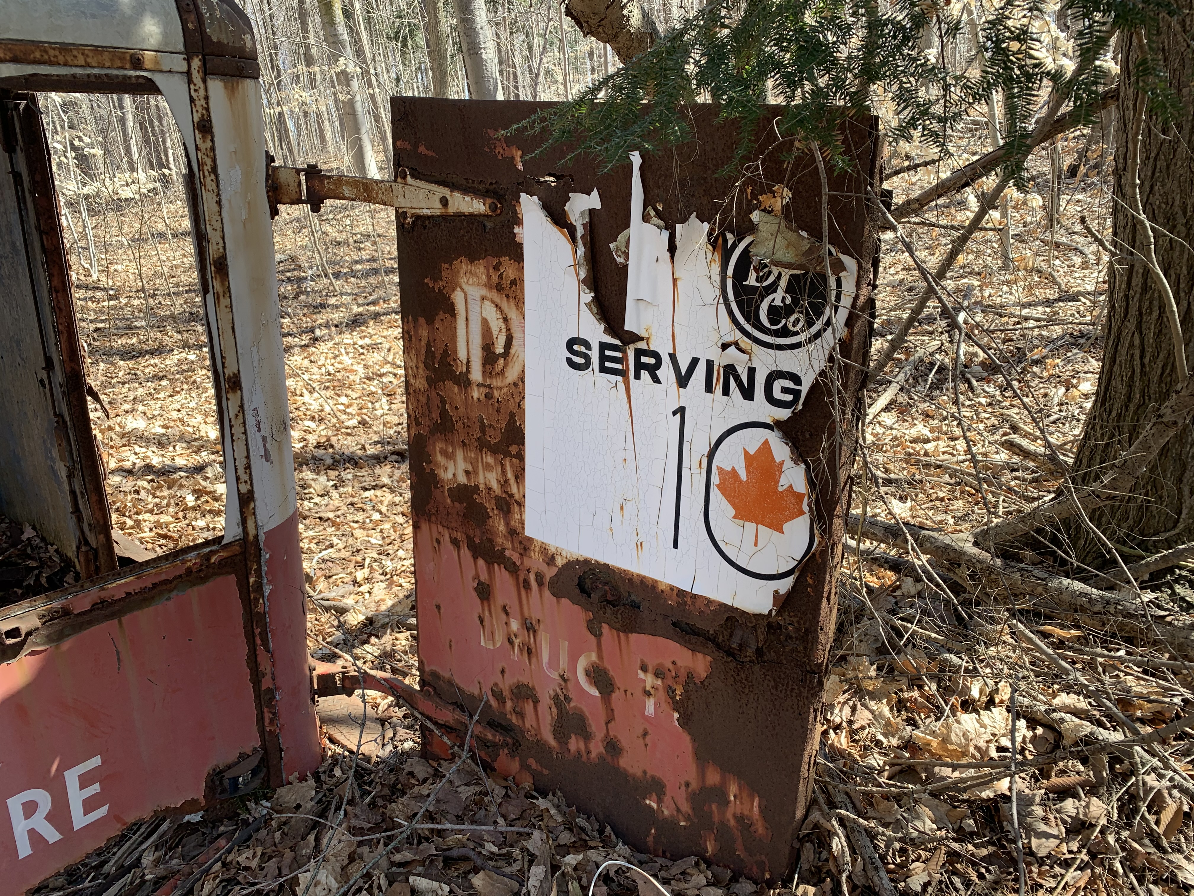
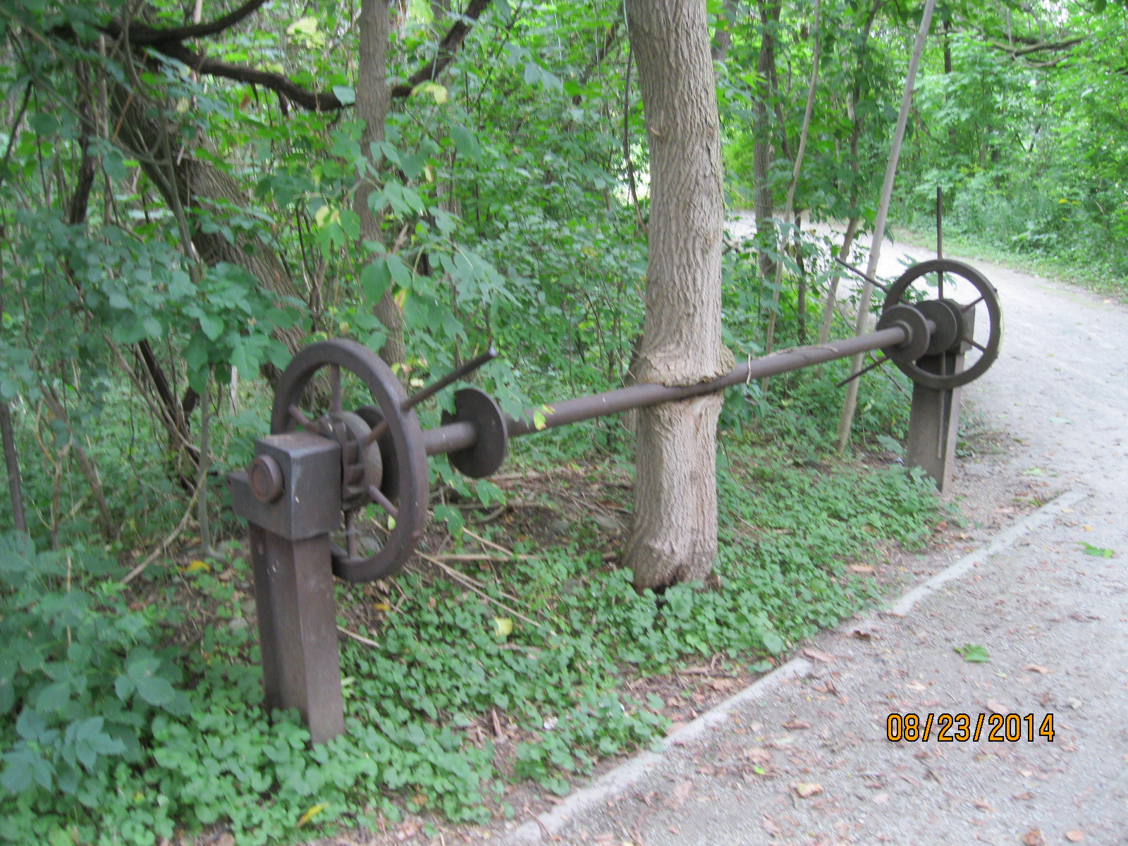
Barbertown is the site of an old mill that is still operating. It has been clad over, hiding its original stone construction. The mill is no longer powered by water and the old sluice gate has been filled in. A tree is growing where the water once ran and it has taken a solid hold on the old crank assembly.

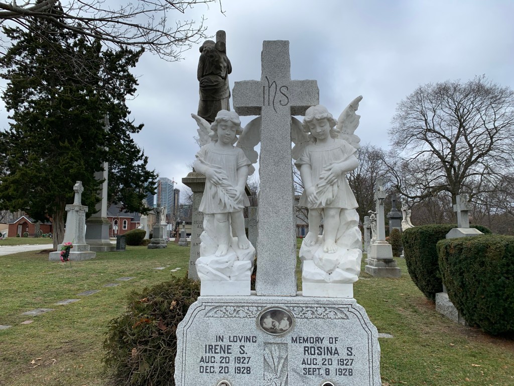
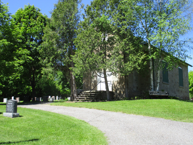
It is common to find an old church standing beside a graveyard. Boston Mills has its old school in its graveyard. That is quite unusual. The railway through town has been closed and turned into a hiking trail and the group of small cottages that once stood on the end of the golf course are falling in on themselves.

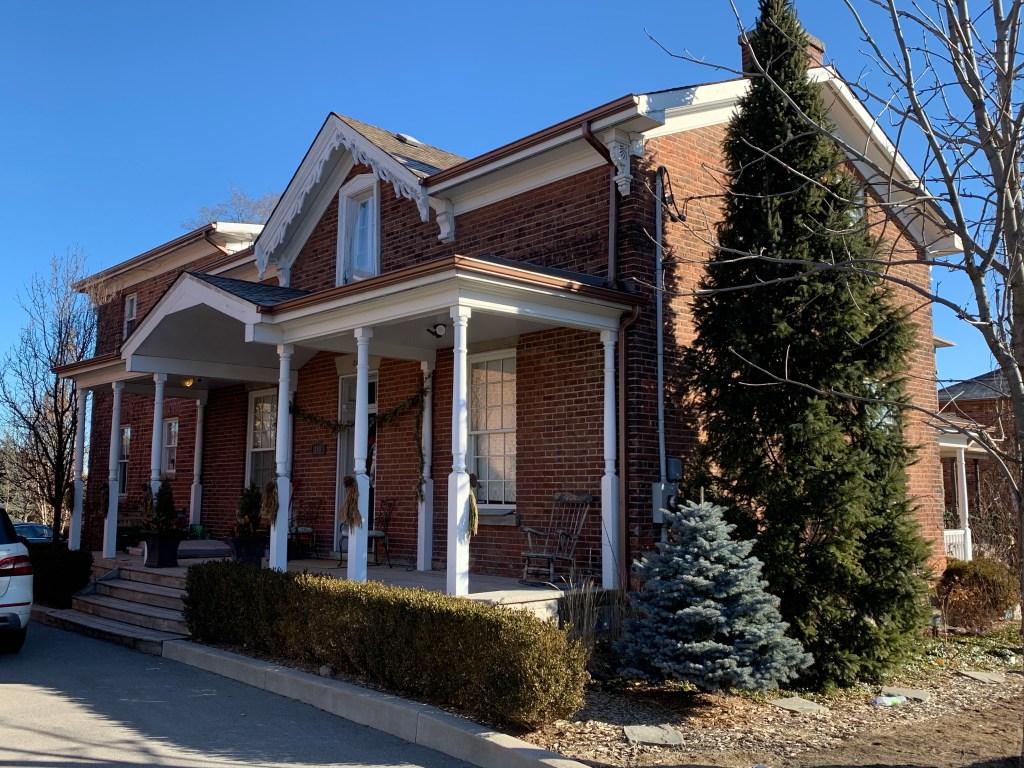
Britannia still has several original buildings although like the Gardner home below some no longer stand in their original locations. This 1840’s house has been moved about a kilometer south on Hurontario Street.

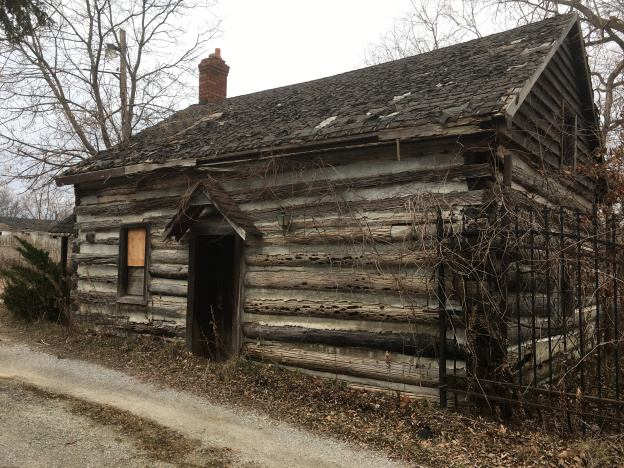
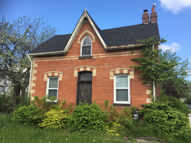
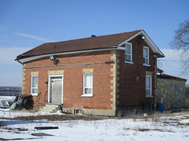
Burnhamthorpe reached a maximum of about 100 people in the 1870’s and then began to decline. Several houses and an old church remain and the one shown below was built in 1882. Between 1897 and 1912 it served as a store and the community post office.

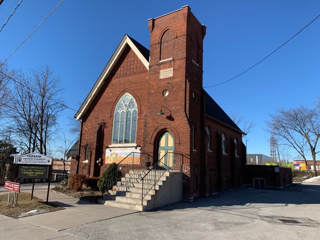
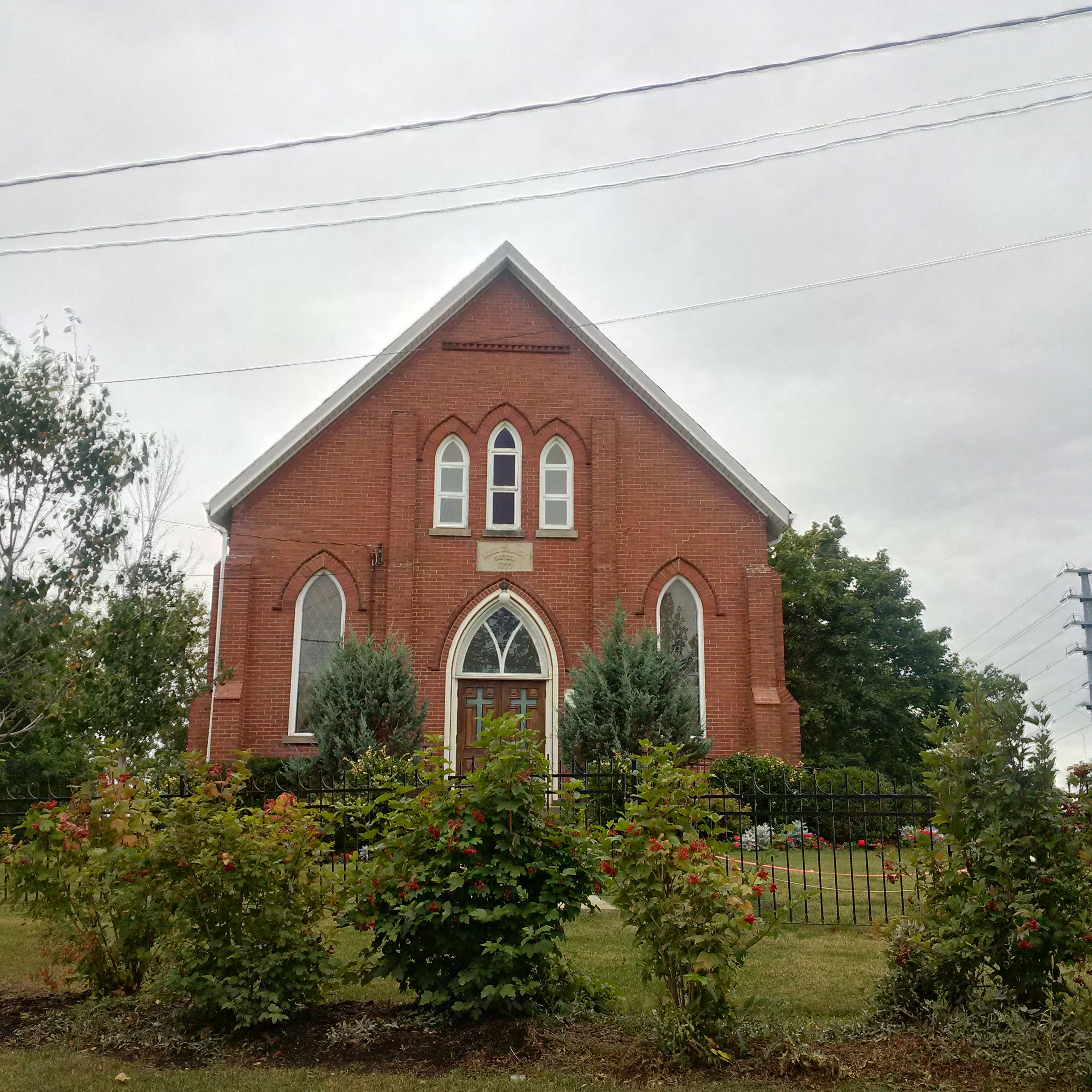
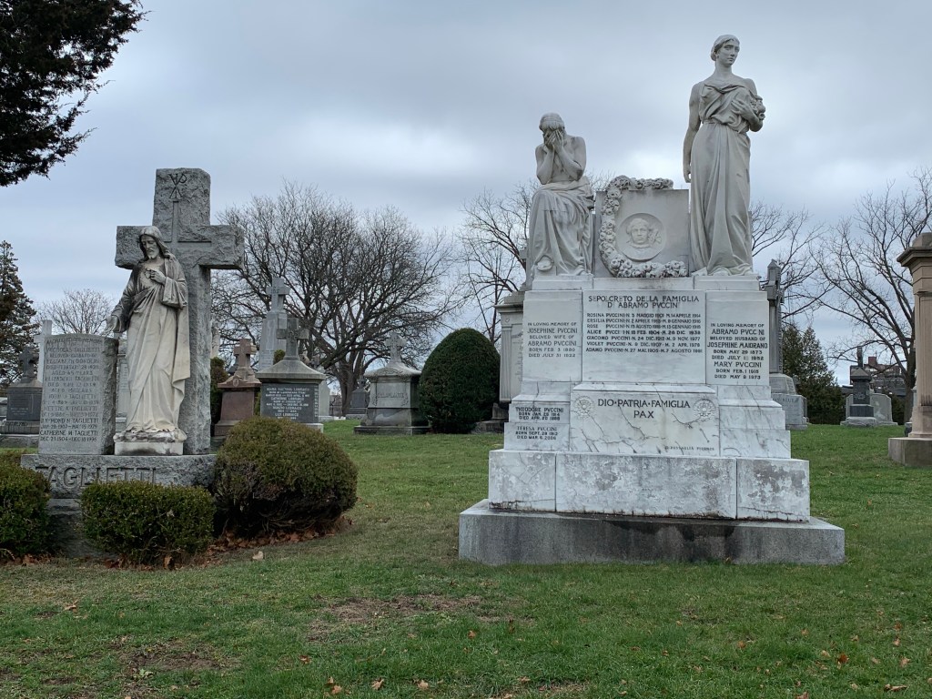
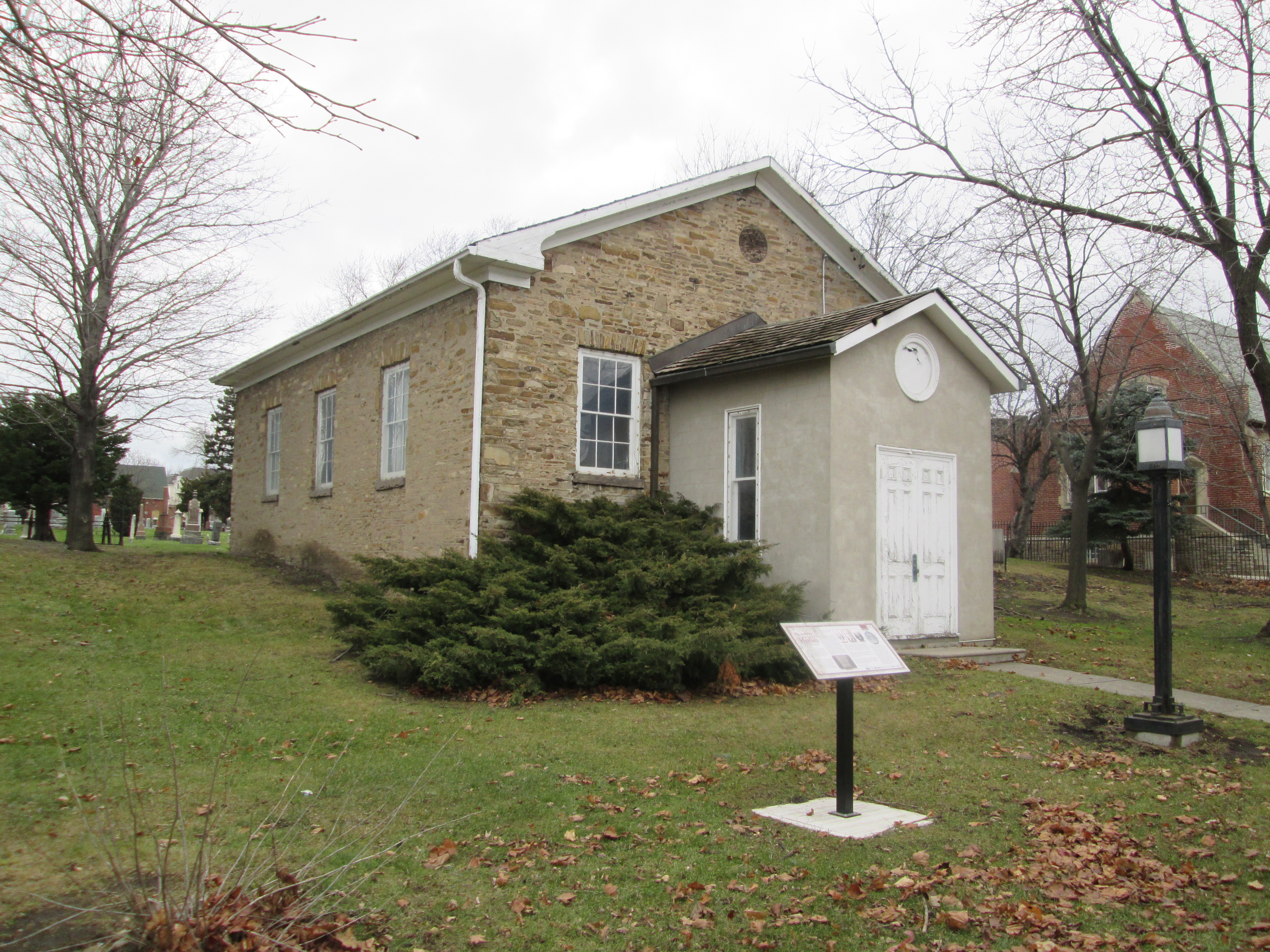
Dixie was a small community where each church denomination was too small to afford their own building. The solution was to get together and build a chapel that they all could share. Later they would each grow large enough to erect their own church building and move out of the Union Chapel.

Humber Grove was built in the scenic hollow around Duffy’s Lane and the Humber River. When Hurricane Hazel flooded the rivers in the GTA the government developed a flood control plan that would have built a dam north of the community. Since the valley would have been flooded the existing houses were bought up and removed. The dam was never built and now Humber Grove is now a community of streets and bridge abutments with no residents.

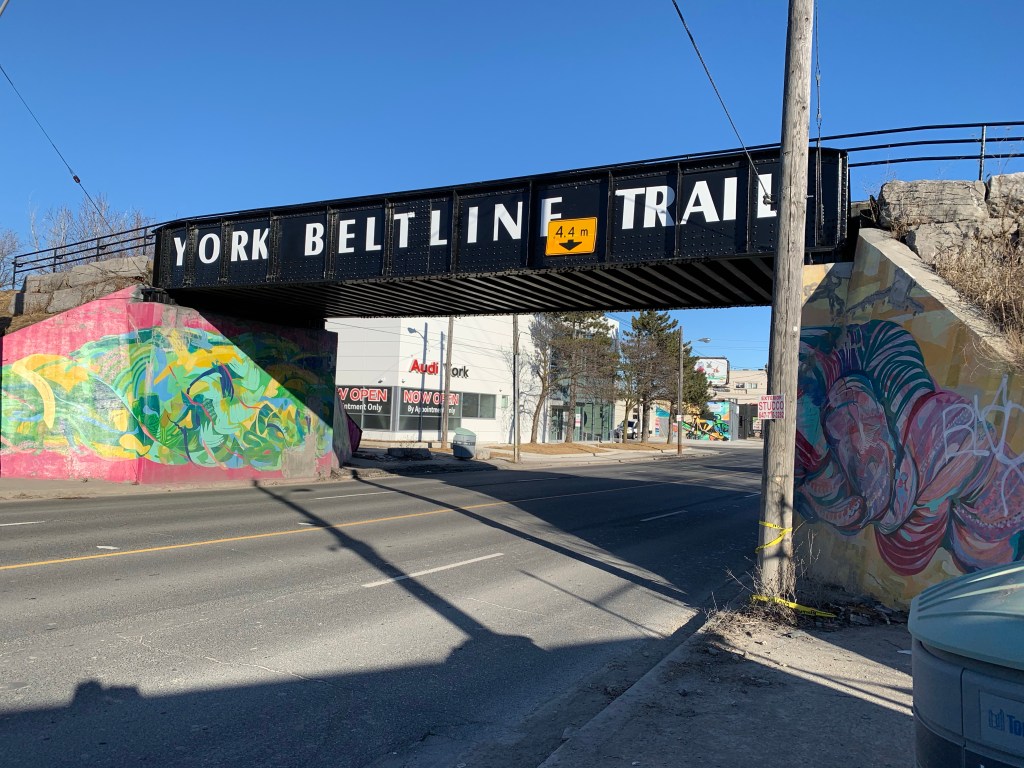
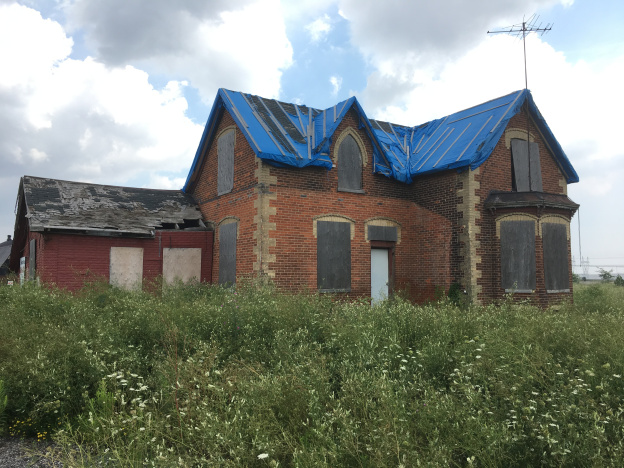
Malton isn’t a true ghost town because there’s still a thriving town, just not the original town where 500 people lived. After the community declined it was overrun by the airport and its associated sprawl. It still has some vintage homes and interestingly enough the empty ones have the windows boarded up and then painted to look like windows.

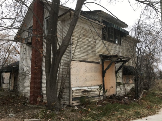
Mt. Charles is another community that was over-run by the airport and it’s supporting industries. Until recently there were several other buildings, including the blacksmith shop but these have been demolished. John Dale’s house, below, and a few others still survive, as does the cemetery.

Palestine was founded in 1823 but never grew beyond a church, school and a few houses. At one time the Etobicoke Creek ravine held a wastewater treatment plant that has also been removed.

There are still several ghost towns in Peel that we haven’t photographed yet and we’re looking forward to exploring them one day.

Like us at http://www.facebook.com/hikingthegta

Follow us at http://www.hikingthegta.com

Also look for us on Instagram

The Drug Trading Company

Monday, March 15, 2021

Todays post is evidence that you need to keep your eyes open when you’re driving around. On my lunch I decided to drive through the area of the former community of Purpleville to see if there was a potential pioneer community story. Out of the corner of my eye I saw a vehicle in the woods a short distance from the road. Naturally, I found a place to turn around and went back to see what had caught my attention.

The cab and chassis is missing and all that remains is the enclosed cargo area of the vehicle. The sides and any windows have been broken out but fortunately the printing is still clearly legible. In Canada we have two main independent drug stores. Guardian and IDA are owned and operated by their pharmacists.

The Drug Trading Company was founded in 1896 to supply independent pharmacies with medications and other products. This was one of their delivery trucks but as the front view reveals, the engine and passenger compartment is no longer here.

Both sides of the vehicle carried a slogan trying to attract customers into their stores. “For friendly service and economy shop your independent drug store.” In 1962 Shoppers Drug Mart was founded as a national chain and it soon dwarfed the smaller independent pharmacies. While the bigger chains evolved into grocery and cosmetic shops and moved the pharmacy into the rear of the store, the smaller pharmacies kept a more personal touch with their clients.

One of the rear doors has been propped open but the other one isn’t opening any time soon without a lot of WD40.

When viewed together the two halves of the door read “DT Co” in the black circle which stands for Drug Trading Company. Then it says “Serving Pharmacy 100” which would suggest a date of 1996. Therefore this vehicle was still in service just 25 years ago. Most of the trees in the woodlot appear to be young and may have grown after the Drug Trading vehicle made its last delivery. Faint lettering can still be seen from the original Drug Trading Company logo on the rear doors.

The inside might have been protected against the elements when it was left here but there’s no longer any roof and both sides are wide open. While this may have once been a relatively unique piece of Canadian history it looks to be suffering an all too common fate. Neglected and soon forgotten. However, its memory will live on in these photos.

This old vehicle is visible from the road and although there isn’t any fence, the property is obviously owned by someone and needs to be respected as such.

Google Maps Link: Respectfully withheld.

Like us at www,facebook.com/hikingthegta

Follow us at http://www.hikingthegta.com

Also look for us on instagram

Fairbank – Ghost Towns of the GTA

Sunday, March 14, 2021

The community of Fairbank was established in 1835 at the intersection of Dufferin Street (brown), Eglinton Avenue (purple) where Vaughan Road (black) intersected from the southwest. Today, the ghost of this little farming community has almost faded with only two buildings remaining from before 1900. There is some parking on Hopewell Avenue across from Walter Saunders Memorial Park. From here you can access the York Beltline Trail and the other places in this story are just a short walk north and then south on Dufferin Street. The map below was taken from the 1877 County Atlas and marks the location of the two remaining buildings with circles.

Jacob P. Ross owned the property outlined in blue on the map above. The house was built in 1855 and is the last surviving original house in the former community of Fairbank. The pediments on the west side mark it as neoclassical in style. It is a one and a half story farm house clad in brick, stone and wood. There have been several additions to the house over the years but the original home can be identified by the four quarter-round brackets set in the corners. Standing in a modern subdivision the house appears to be facing the wrong way compared with its neighbours, although it directly faces Dufferin Street

One of the interesting features of this house is the doorcase. Very often in early architecture in Ontario the face of the house was very plain with just the doorcase being more intricately detailed. In this home it is recessed from the front wall leaving no sidelight windows. There’s a plain set of windows in the transom and the date in the lintel above the door.

The Fairbank Village BIA uses the following picture in their promotions of the local business district as they recall the town history. The left side of the picture shows three streets from top to bottom. These are Dufferin Street, Vaughan Road and Eglinton Avenue. On the southeast corner of Eglinton and Dufferin is what appears to be a small Tollkeeper’s Cottage. Dufferin Street was formerly known as the Gore and Vaughan Plank Road and would have had toll gates at major intersections.

Matthew Parsons was just 19 when he arrived and bought York West Concession 3 Lot 3 which he developed into his family farm. He named his property Fairbank Farms (outlined in green above) and from this the community took its name. Then in 1837 he was arrested as a rebel and accused of supporting William Lyon MacKenzie in his rebellion. Parsons was never charged and his good name was restored when he donated land in 1844 to the Methodist Congregation who had been meeting in the local school. They built a frame structure which was replaced in 1889 with the brick building that has continued to serve the United Church since the name change in 1925.

Fairbank Presbyterian Church began in 1889 on Fairbank Avenue but moved to a new larger building at the corner of Eglinton and Dufferin in 1914. The building bears a two date date-stone marking both of these milestones. In 1925 it joined the United Church and in 1931 took the name St. Cuthbert’s United Church to distinguish itself from he Fairbank United Church a little north on Dufferin Street. It closed in 2001 and the building has been occupied ever since by the British Methodist Episcopal Christ Church. This denomination started in Toronto in 1845 as a church founded by freed slaves. There are only 9 churches of this denomination in Ontario and only one other in Toronto. When they lost their building to fire in 2001 they were able to move into the old Fairbank Presbyterian Church which was recently vacated.

Fairbank got a post office in 1874 and quickly developed into a crossroads community with Francis McFarlane running one of the hotels and serving as postmaster. In July of 1890 Fairbank Village Parish was set up to provide Anglican services for the community, meeting in the ballroom of McFarlane’s Hotel. In 1893 they opened their own church on Vaughan Road at the intersection with Dufferin Street. St Hilda’s church is pictured below in a 1934 photo from the Toronto Public Library.

In the early 1970’s the congregation decided to build affordable housing for seniors and three towers and a new church building were constructed.

By the late 1880’s the city was booming and land speculation along the edges of Toronto began. One creative scheme involved building a commuter line to join the suburbs with the downtown core. Known as the Belt Line Railway the developers proposed to build houses in the areas of Forest Hill and Fairbank. The line began operations in 1892 with a fare of 5 cents between each of it’s stops. However, the timing was bad as a recession meant that the houses weren’t built and the passengers never showed up. Service only lasted for 28 months before it was closed. Some sections continued to be used for industrial purposes but eventually all the tracks were removed. Today, the old Belt Line has been converted into a ribbon park with a multiuse trail. We’ve reviewed the Beltline in three sections previously telling its history and showing the areas where it ran. From the Fairbank end moving east then south the stories are: York Beltline Trail, Kay Gardiner Beltline Trail and Moore Park Beltline Trail.

The steel bridge over Dufferin Street is the third structure that survives in Fairbank from the 19th century. Only two original bridges survive from the Beltline with the other one being at Yonge Street where the old railway goes by the name of The Kay Gardner Beltline Trail. The trail passes through Fairbank on a raised berm and provides a trail that connects the west end of Fairbank with the Don Valley Brick Works and then on to the Lower Don Trail.

Fairbank was filled in with development between the two world wars erasing much of its original character. The fact that it was developed in the inter war period is perhaps apropos considering that it’s known for Prospect Cemetery where many military veterans are buried.

Google Maps Link: Fairbank

Like us at http://www.facebook.com/hikingthegta

Follow us at http://www.hikingthegta.com

Also look for us on Instagram

Ghost Towns of Halton Region

Someday

Halton County was one of the earliest settled in the region as United Empire Loyalists began arriving in the 1780’s. They started Oakville and Burlington as well as Georgetown and Acton. Along with some of the familiar names are those of small communities that are only a shadow or ghost of what they once were. These small hamlets and towns dotted the crossroads around the county. This blog collects 5 of the ones that we have visited and arranges them in alphabetical order. Each has a picture that represents the community as well as a brief description. The link for each will take you to a feature article on the community which has the local history as well as pictures of any surviving architectural features. At the end of each feature article is a google maps link in case you should wish to explore for yourself someday. Future companion blogs in this series will cover the ghost towns of Peel Region, York Region, and the City of Toronto.

Glenorchy was never large community and it has lost pretty much all of the original buildings that it once had. Of note is the local disaster that happened in 1964 when a truck loaded with potatoes took a detour that carried it over Sixteen Mile Creek near the community. The truck was too heavy and the bridge collapsed under the weight leaving just a bridge abutment as a reminder. This three room home was built in 1835 by George and Francis Ludlow.

Hornby was stretched out along Steeles Avenue to the point where it was considered Hornby and West Hornby. A brick one room school building from 1870 and a church remain as well as a few houses. One of the early farm houses belonged to Samuel Brooks and although it has been assessed for its cultural significance it has also been damaged by fire and neglect.

Omagh still has enough of its rural character that it is being considered for designation as a cultural heritage district. It still has two churches and cemeteries as well as the general store. The school is gone and the old Devlin house is starting to suffer. It’s too bad because it’s got a rare example of an eyebrow window.

Palermo still has one of the largest collections of historic homes of the former communities in the region. Although many of them are vacant or abandoned it looks as if only two of them have historic designations and it will be up to developers to remove or incorporate the remaining homes. Past history hasn’t been kind to the homes in these situations.

Sixteen Hollow was an industrial hub that developed where Dundas Street crossed Sixteen Mile Creek. It was vacated by the 1880’s very little remains except for the Presbyterian Church which was built in 1844. In 1899 it was expanded and given a veneer of bricks. An older set of bridge abutments crosses the hollow and marks a former course for the creek.

The County of Halton, now known as The Regional Municipality of Halton, had other historic communities that are yet to be explored. It’ll be interesting to see what secrets they still hold and to document before they change too much.

Another selection of Ghost Towns can be found in our companion blog Ghost Towns of Toronto

Like us at http://www.facebook.com/hikingthegta

Follow us at http://www.hikingthegta.com

Also look for us on Instagram

Mount Hope Cemetery

Someday

The first Catholics in the city attended St. Paul’s Parish and were buried in the large lot behind the church. In the 1840’s the Irish Potato Famine brought large numbers of Catholic immigrants and before long the parish cemetery was filled. In 1855 St Michael’s Cemetery was opened near Yonge and St Clair but just a few decades later it was also filled. With the cost of land in Deer Park it was decided to look for another place to open a new cemetery. A location was found just north of Yonge and Eglinton and in 1900 Mount Hope Cemetery opened.

In the 1890’s the area around Yonge and Eglinton was quite different than it is today. Mount Pleasant Road had not been built yet and many of the local streets had different names. Victoria Avenue near the top of this old map from the Beltline Railway is now known as Blythwood. The area which is now Mount Hope Cemetery has been outlined in green. Notice that Erskine Avenue and Woodward Avenue (now Keewatin) meet on the east end at Greenwood Avenue which joined the East York Line (now Bayview). When the cemetery was opened the portions of these roads that were within the cemetery vanished except for perhaps the curved connection that may still be in use as part of the cemetery roadways.

The cemetery gates can be found on Erskine Avenue and there is also a pedestrian gate on the east end for access off of Bayview Avenue. Starting with the gates, it soon becomes obvious that crosses are everywhere. Catholic cemeteries require a cross or some other select religious symbol on every marker which sets them apart from nondenominational or even Protestant ones.

Just inside the gates is a small chapel and administrative building which wouldn’t be complete without a cross on top of the bell tower.

There’s a section in the cemetery for the Loretto Sisters, also known as The of The Blessed Virgin Mary. They lie in rows marked by rows of identical iron crosses.

Friars are male members of a religious order and they have their own section in the cemetery. Like the nuns, they are buried in neat rows, each with the same style of headstone.

John B Murphy was born on March 1, 1850 and went to Norwood High School and St. Michael’s College in Toronto. At 26 he graduated in medicine from Queens University after which he ran a family practice in Brockville until 1890. That was the year he took the position of resident physician at Mimico Asylum when it opened. In 1894 when the Brockville Asylum was opened he was promoted to Medical Superintendent. He died at the age of 54 on January 17, 1904 and is buried in one of the few mausoleums in the cemetery. He was also one of the early interments in the cemetery.

George Foy was a liquor and tobacco salesman for over 40 years and when he passed a 12-metre tall cross was erected in his memory. It is said to be the tallest family monument in Ontario and is carved out of a single piece of granite. It was moved from Union Station to the cemetery with a team of 24 horses.

Frank O’Connor, who founded Laura Secord Chocolates, is buried along the south fence. He opened his candy shop in Toronto in 1913 at the same time as the city was commemorating the 100th anniversary of the Battle of York. Building on the hype he decided to use a war hero who was a household name. Laura Secord had walked under cover of darkness to bring a message to The British forces at Beaver Dams that led to a decisive victory for the defenders. You can read more about Frank O’Connor and see his estate by following the link.

There are 147 servicemen from both world wars buried in the cemetery. I notice these two stones which commemorate two Privates who were killed on Dec. 6, 1941. Canadian Expeditionary Forces were active in Hong Kong in December 1941 but the fighting started on December 8th. It is unclear at this time why these two soldiers died on the same day, or if there is any relationship other than coincidence.

We’ve featured several cemeteries over the years but Mount Hope has to be one of the best ones if you are interested in carvings and other religious symbols and artwork. The sadness expressed in this angel pretty much sums up the feelings of anyone who has lost a loved one

There are several other angel statues throughout the cemetery. The figure of Jesus is also frequently featured. There are also saints that may have had a specific meaning to the dearly departed or their families. Marble can be easily carved but is also susceptible to acid rain and weather. Several of the marble monuments in Mount Hope have become unstable and are laid on the ground for safety reasons. Catholic cemeteries no longer allow marble carvings.

The passing of a child is always tragic but losing twins must be even harder to bear. This pair of small angels mark the graves of a pair of girls who were born on August 20, 1927. Rosina passed away less than three weeks after her first birthday and her sister Irene followed a little more than three months later.

In the 1960’s and 1970’s the cemetery was having around 4,000 burials each year but with the rising popularity of cremations that number has dropped to only 1,200. Even so, the cemetery quickly started to be filled. In the early years Burke Brook formed two ponds on the north side of the property. To make more room, the ponds were drained and Burke Brook was placed into a culvert. A row of trees (marked with dark blue arrows on the Google Earth capture below) still marks the former northern limit of the burial grounds. When this was filled they turned to closing some of the roads and turning them into additional space. At least six of these short connector roads have been indicated with light blue arrows below.

Mount Hope is the only functioning Catholic Cemetery within Toronto City limits and it makes a quiet place to walk and reflect on life and the remembrance of it.

Other cemetery stories: Mount Pleasant, The Necropolis, Prospect Cemetery, Pioneer Cemetery Cairns

Google Maps Link: Mount Hope Cemetery

Like us at http://www.facebookcom/hikingthegta

Follow us at http://www.hikingthegta.com

Also look for us on Instagram