Saturday, October 21, 2017
The remains of a ghost town lie along the Humber River on Duffy’s Lane just north of Bolton. The property of George Elliot on the county atlas below was in the Elliot family from 1855 until 1929. During this time a few homes were built along Duffy’s Lane with views of the river. Only two are shown at the time the atlas was drawn in 1877. By 1909 there were half a dozen homes with a small community forming around the bridge over the river. In 1929 the 100-acre half lot was sold to Bertram Realty Company who planned to capitalize on the quiet setting along the river. They divided the land into small parcels and started selling them for cottages. People began to buy the lots and build on them and by the early 1950’s there were enough children to support the construction of a new school at the corner of King Road and Duffy’s Lane.
In October 1954 Hurricane Hazel hit the GTA killing 81 people and changing the way we managed our floodplains. Local conservation authorities across the GTA began to buy properties and remove houses that were considered at risk. They also developed a plan that called for the construction of 15 major flood control dams and reservoirs including one on the Humber River just north of Bolton. Of these dams only Claireville, G Ross Lord and Milne Dam were constructed. The Glasgow dam would have been 29 metres high and Humber Grove would have been under the new flood control lake. Slowly the houses were moved or demolished until by 1977 there were no buildings remaining.
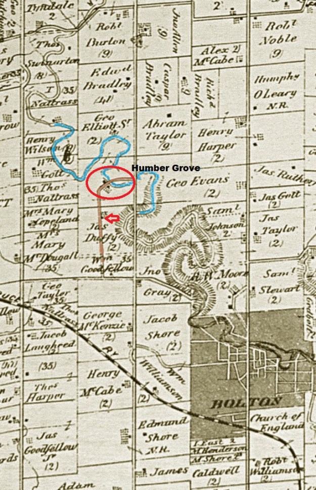
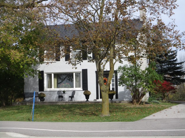
Duffy’s Lane is exactly that, their original laneway. This is what is known as a “given road” because it is not part of the original grid of the township survey. It is a privately constructed road, on private land, that was given for the use of the public. For reference, Duffy’s Lane has been coloured brown on the map above. The Duffy house was built in the 1840’s and has been given a historical designation by the township of Caledon. It is seen in the picture below and marked with a red arrow on the map above.
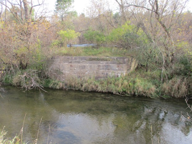
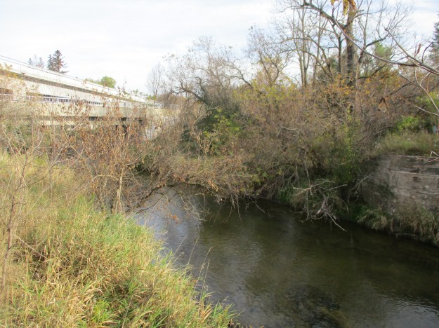
Duffy’s Lane has had many alignments in the area where Humber Grove was and there have been at least four bridges over the river. The county atlas above shows a bridge over the west branch of the Humber River that predated the use of poured concrete for bridge construction by 20 to 30 years. Therefore, the abandoned bridge in the cover photo has to be at least the second bridge at this location. The picture below shows the abutment for the old bridge in the lower right corner. This bridge was likely built at the time that a subdivision plan was put forward in the 1920’s. A new bridge would have been helpful in persuading people to buy a lot this far outside of Bolton. On the left in this picture are two newer bridges, the lower one from 1985. In 2013 work began on the Emil Kolb Parkway as a bypass to keep the increasing flow of traffic from going through downtown Bolton. The new multi-lane bridge was built in 2014 and the older one converted to a pedestrian trail. It is likely that some of the original Humber Grove foundations were lost during the construction of these various bridges.
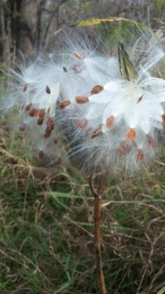
Milkweed pods have started to break open exposing their seeds to the wind. Each tiny, flat seed is carried on the breeze by hundreds of tiny filaments attached to it.
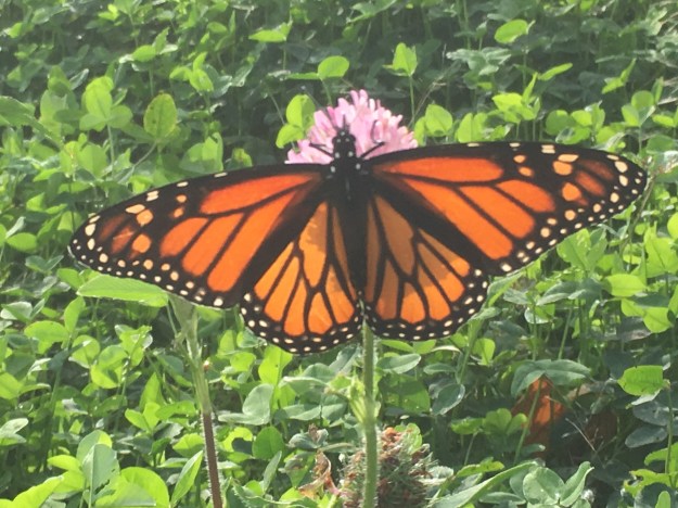
Milkweed is essential in the lifecycle of the monarch butterfly. There were many of these orange beauties flying around and it seems like it is late in the year for them. This is the fourth generation of monarch born in Ontario this year and it is programmed to fly to Mexico to spend the winter. The example in the picture below is a female because it lacks the two little black dots on the hind wings that mark the male scent glands.
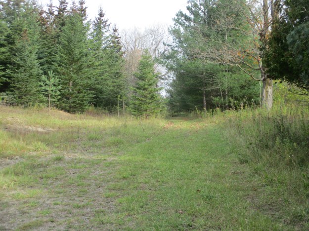
Throughout the woods, there are several obvious laneways, most often marked with a double row of trees that lined either side of the old roads. In a couple of places, there are old hydro poles in the woods that have the wires cut from them because the homes they once served no longer exist.

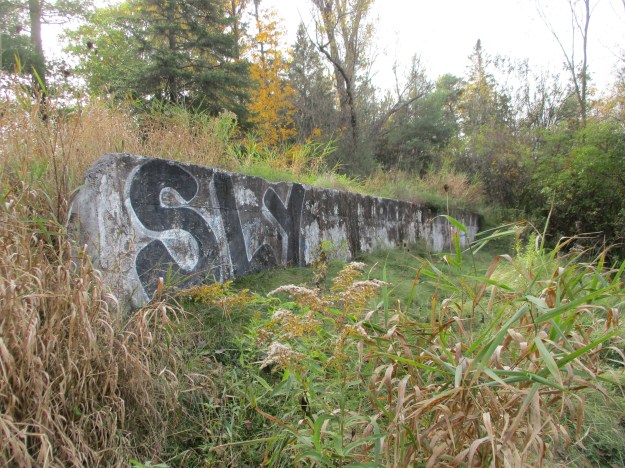
At the end of the laneway above is an obvious clearing where a house once stood. The back end of the property has been reinforced with a concrete wall.
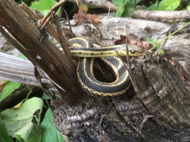
A garter snake was sitting on a fallen branch taking in the late October sunshine. These snakes don’t actually hibernate unless they are in a climate where it goes below -40 Celcius. In reptiles, hibernation is normally referred to as brumation. In most cases, the garter snake is awake through the winter with a 77% reduced heart rate and minimal oxygen intake.
The original alignment of Duffy’s Lane can still be found running north from the earlier bridge abutments at the river. Former laneways extend into the woods along the sides of the road. We found an old concrete foundation a few feet into the first of these laneways. The woods have been regenerating for 40 years and most of the former entrances can only be made out due to the parallel rows of mature trees that line either side.
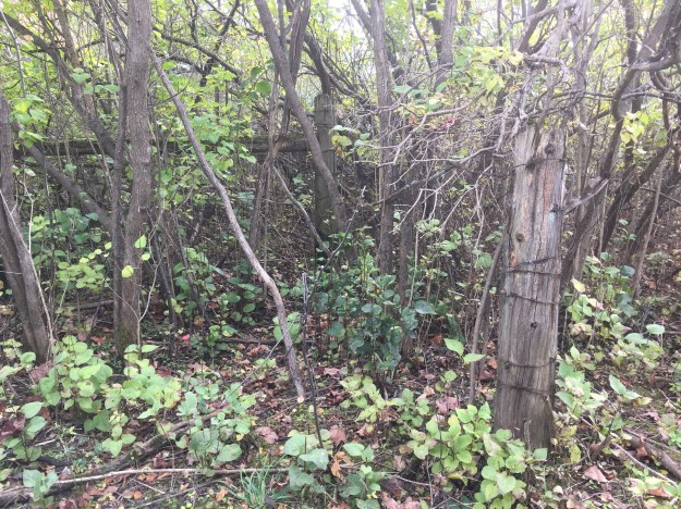
Old fence lines mark the edges of the various properties that used to line both sides of old Duffy’s Lane.
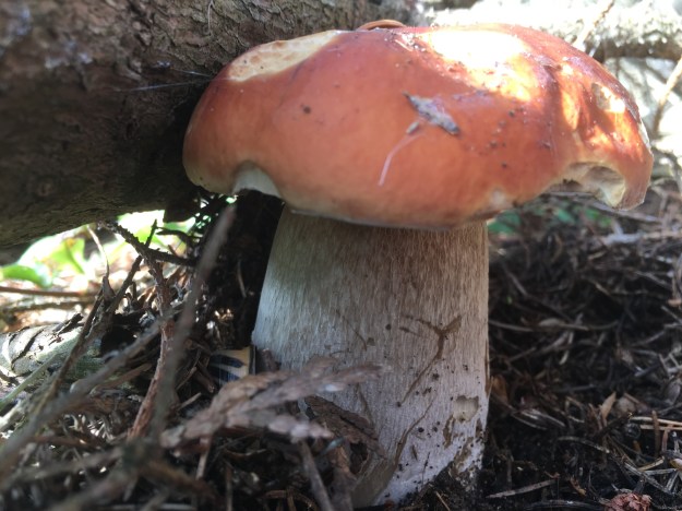
The boletus family of mushrooms includes over 100 varieties, many of which are edible. They can be distinguished by the tubes that carry the spores under the cap rather than the gills that can be found on many other types of mushrooms. Make sure that you never touch or eat any mushroom that you cannot positively identify. There are often similar looking species where some are edible and some are poisonous and can kill you.
There is a lot of tall grass, dog-strangling vines and undergrowth throughout the area. There are plenty of foundations remaining to be found, perhaps when there is less foliage. Humber Grove can be accessed from the Humber Valley Heritage Trail. We explored part of this trail in a previous post called Humber Heritage Trail Bolton.
The Toronto Region Conservation Authority has an informative article on Humber Grove with historic maps that can be found here.
Google Maps Link: Humber Grove
Like us at http://www.facebook.com/hikingthegta
Follow us at http://www.hikingthegta.com

Beautiful photos and extremely interesting information. Thanks for posting
Pingback: The Best of 2017 | Hiking the GTA
Pingback: Greatest Treks 3 | Hiking the GTA
Pingback: Ghost Towns of Peel Region | Hiking the GTA