Monthly Archives: March 2019

Old Albion Road

Saturday, March 23, 2019

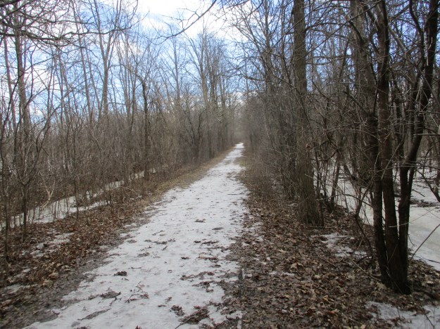
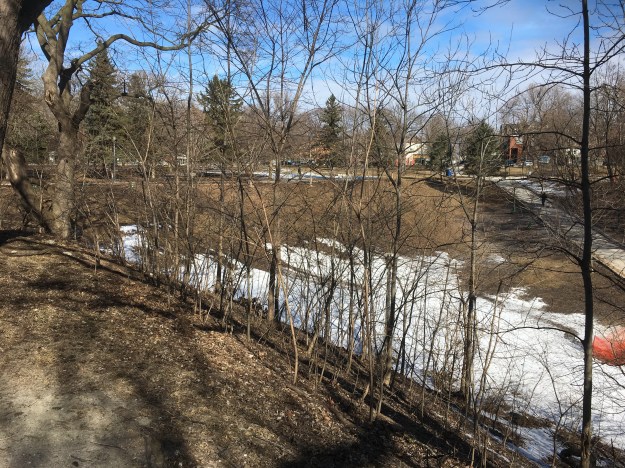
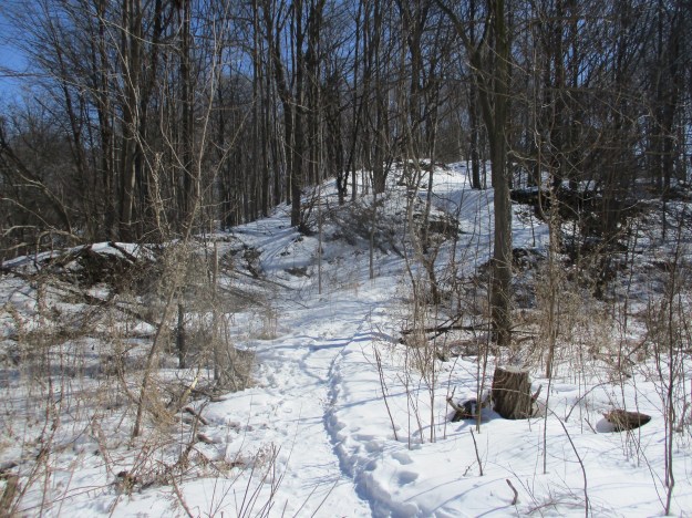
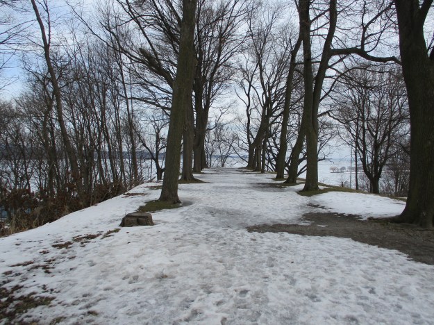
The Humber Recreational Trail is pretty much continuous through Toronto from Lake Ontario to Steeles Avenue.  It has a short section on the road where a golf course restricts passing.  We chose to explore a section north of the 401 so we could look for the remains of Old Albion Road.  Free parking is available at Pine Point Park at the end of Hadrian Drive.

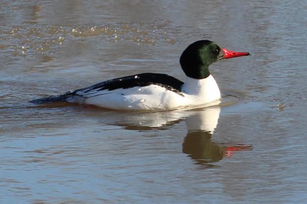
Staying close to the river, we were treated to several Mergansers who were playing in the slushy waters.  The males were attempting to impress a group of seemingly bored females.  In breeding season the male Merganser gets a glossy green tinge.  Later in the summer and fall both he and the females will be mostly a dull grey.  The diet is mostly fish and so their bills have serrations to help with holding onto their slippery prey.  For this reason they are also sometimes known as “sawbills”.


Merganzer

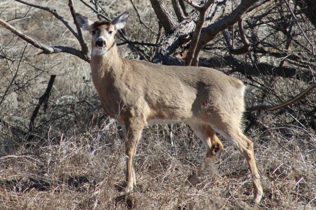
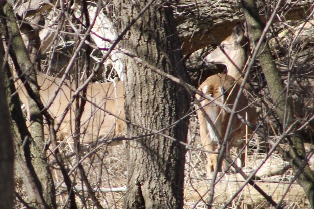
Male whitetail deer rapidly grow their antlers for three or four months during the summer when their testosterone levels are high.  Following the rutting season the testosterone levels drop quickly which activates specialized cells called osteoclasts at the point of connection of the antlers.  These cells eat away at the pedicle, where the antlers grow, until the connection becomes so weak the antlers are simply shed to make way for new ones.  Depending on the age and health of the animal as well as their local climate they shed their antlers between January and April.  This young buck has clearly visible pedicles, just waiting for new antlers to begin to grow.

IMG_2559

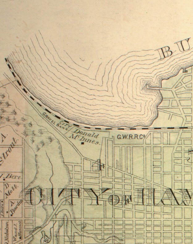
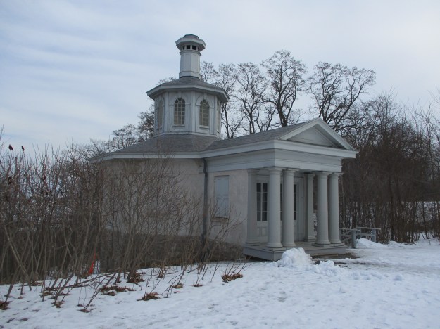
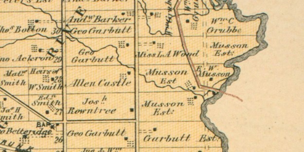
Albion Road was originally a private road built for a French teacher named Jean du Petit Pont de la Haye and ran to his estate at Indian Line and Steeles Avenue.  The settlement he founded there was named Claireville after his daughter Claire.    In 1846 the road was upgraded from Musson’s Bridge at the Humber River all the way to Bolton by The Weston Plank Road Company.  At this time the road was named Claireville Road and there was a toll booth in Claireville to help pay for maintenance of the road.  It is believed that the white house that can be seen from Steeles Avenue is the old toll house.  Claireville Road is coloured brown in the 1877 County Atlas image below.

Musson

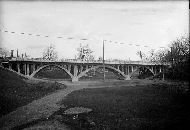
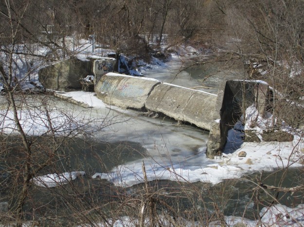
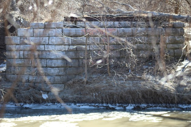
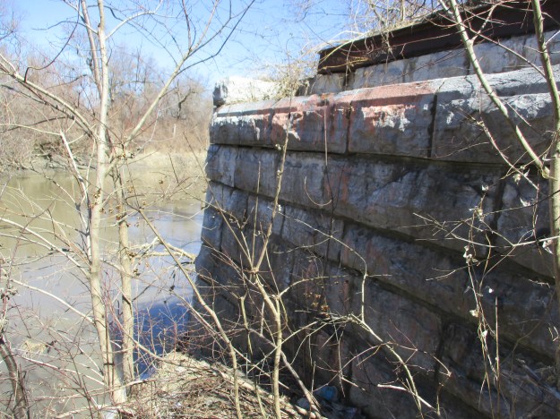
Early bridges were built of wood and seldom lasted more than 20 years.  Flooding would often destroy them even earlier than that.  By the time of the County Atlas, Claireville Road was likely on its second bridge across the Humber.  In 1905 the bridge was again in need of replacement and Octavius Laing Hicks was commissioned to build the new one.  The bridge was his first and also the first all-riveted steel bridge to have a permanent deck.  Hicks built it on cut stone abutments instead of concrete that had started to become popular in construction at the time.  As his next bridge was a concrete bow bridge it is clear that Octavius was familiar with concrete as a bridge building material.  This suggests that he built his bridge on the abutments from the previous one.  The bridge became known as Musson’s Bridge because the family owned several pieces of property on the Etobicoke side of the river.

When the remnants of Hurricane Hazel swept down on the city on October 15, 1954 they destroyed or severely damaged 40 bridges.  Musson’s bridge had already been replaced with the new alignment of Albion Road and was no longer as critical to transportation as it had once been.  The bridge wasn’t badly damaged and remained on site until it was removed in 1962.

Albion Road Bridge Hurricane hazel

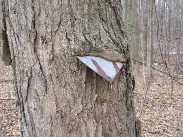
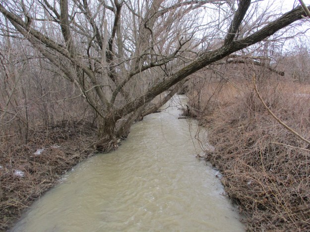
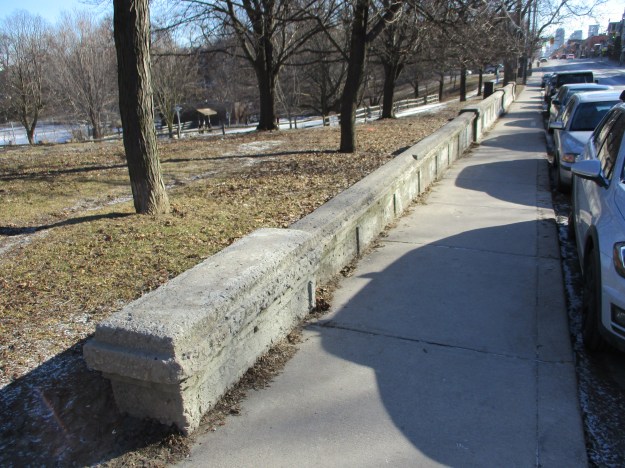
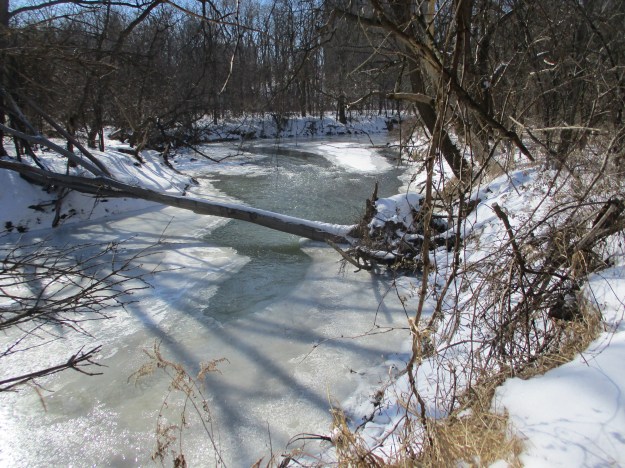
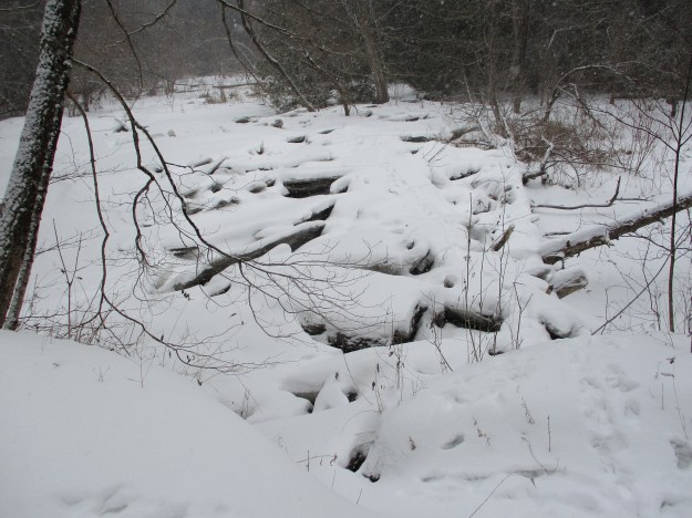
The bridge abutments on the west side of the river were removed in 1963 but the ones on the east side remain, and we can see them but for the moment there’s still an icy river between us.

IMG_2569

We followed the edge of the Humber Valley Golf Course until the river doubled back on itself leaving us to also turn back.  Just as we were about to do so, we caught sight of a coyote who saw us at about the same time.  Unfortunately, he didn’t hang around to get his picture taken.  Soon, movement in the trees across the river alerted us to the presence of at least two more deer.  These two were likely females who will be giving birth to their fawns in late Spring.  The deer were keeping the swiftly flowing river between them and the coyote.

IMG_2588

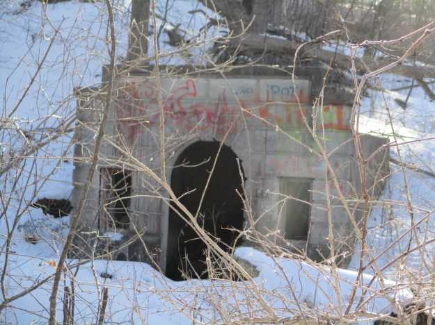
We retraced our steps to a pedestrian bridge we had seen earlier in Louise Russo Park and made our way back to the abutment on the east side of the river.  The steel beam is still in place that anchored the bridge to the abutment, however it may have been added by Octavius in place of a previous wooden span.

IMG_2556

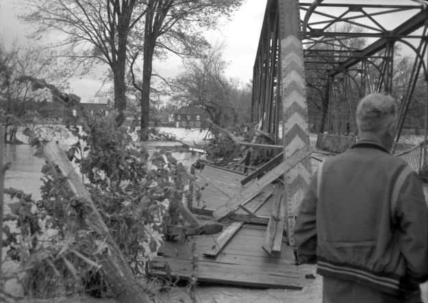
One thing that never changes is human interest in seeing the damage that storms can cause.  Ice, wind or water can all inflict a lot of damage and this 1954 picture from the Toronto Public Library shows us the curious ones out to see the damage from the hurricane.  This view is from the east side looking toward Musson’s bridge and the river.

Old albion road bridge 1954

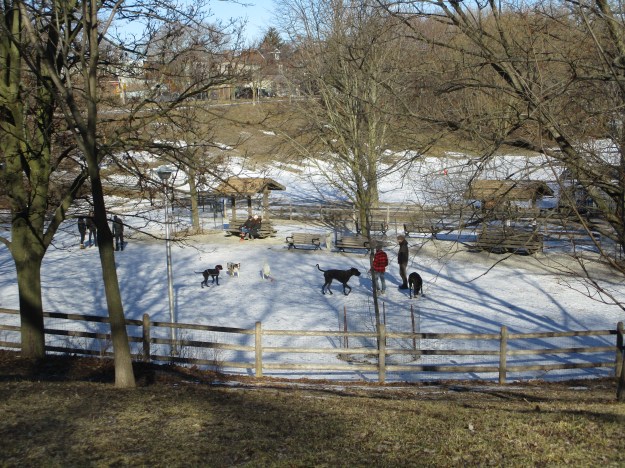
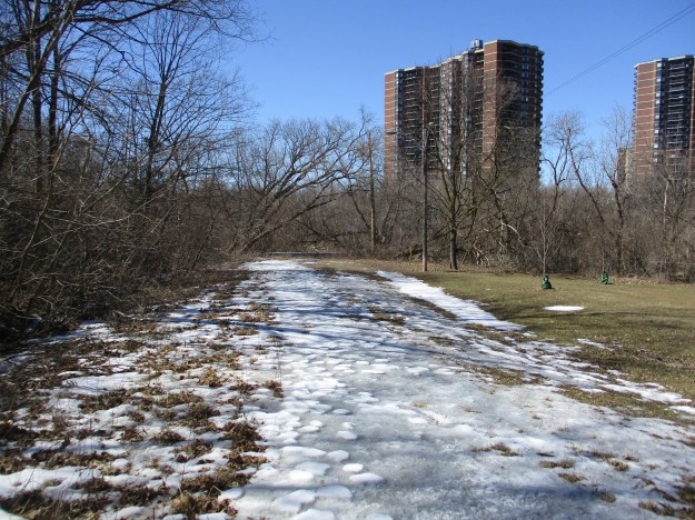
The street view today is much different with the road closed off and the bridge missing.  The embankment on the left of the picture has grown over with trees and there is a park on the right side.  The road crossed the river and then angled north-west  right where the apartment is today.  The small section of Albion Road that ran between Weston Road and the river still provides access to a few houses under the name Norris Place.

IMG_2559

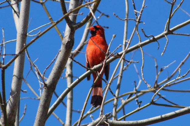
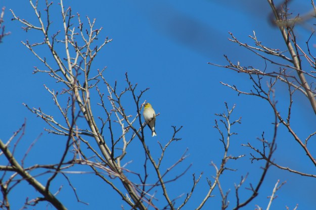
It was nice to see so many birds this weekend along with the other wildlife.  It’s a certain sign of warmer days ahead.

Google Maps Link: Pine Point Park

Like us at http://www.facebook.com/hikingthegta.com

Follow us at http://www.hikingthegta.com

Dofasco 2000 Trail

Saturday, March 16, 2019

When we previously visited The Devil’s Punchbowl we had noted the Dofasco 2000 trail that runs east from the falls.  With all the rain and melting snow it seemed like a good time to revisit the falls and hike a section of the Dofasco 2000 Trail.

For parking you have several options.  The Devil’s Punchbowl Conservation Area has parking for $5.00.  Alternately, there is parking for at least a couple of cars where the Dofasco 2000 Trail crosses each of the four roads east.  Depending on the length of walk you desire you can continue on Ridge Road as far as Tapleytown Road.  Second Road East has the most parking places.  We decided to walk the full four side roads to the Punchbowl and back.

Dofasco 2000 Trail

This was our final hike of winter and the day wanted to prove that the season wasn’t over yet.  The trail was hard packed with ice in a few places and open in others but the fresh snow made the walking challenging.  The trail follows an unopened road allowance and was pretty much ours alone with the exception of a couple of dog walkers.  While we’re on the subject of dog walkers, do people really think that dog poo will just melt away with the snow?  This trail was marked with several months of deposits as well as dozens of Tims cups.  Certainly one of the messier trails we have visited in recent times.

IMG_2489

An old building stands in the woods along the side of the trail made out of prefabricated concrete blocks that were designed to look like cut stone.  There is a date of 1943 etched into the concrete in the doorway and inside it appears to have been used to house a generator.  More recently it housed someone who slept in one corner and kept a small fire in the other.

IMG_2478

Sections of the forest have been tapped for maple syrup production and both new and old equipment is strung through the trees.  Nature has a way of adapting and has started to grow around this old metal sign on this tree.  We saw plenty of evidence of last year’s fungi which suggests a healthy forest as this is the natural way of breaking down the wood as it begins to decompose.

IMG_2476

As we continued along we were treated to patches of blue sky and sunshine.  Spring is just around the corner and the weather was attempting to give us a preview of the new while reminding us of the old season.

IMG_2471

Half a dozen old tires are rotting on the roadside with rusted rims and degrading rubber.  The rubber will take between 50 and 80 years to disappear but the metal rims are destined to be there for up to 200 years.

IMG_2467

The path runs through a vineyard with rows of grape vines stretched out on either side of the trail.  Ridge Road is home to several wineries as is the entire southern portion of the Niagara Escarpment.  There are an average of 205 frost free days per year in the region allowing production of 71,000 9-litre cases of wine annually.

IMG_2461

A small bridge carries you across Stoney Creek.  This is only a short distance above the waterfalls at The Devil’s Punch Bowl and the high water levels in the creek suggest that the falls might have a good flow of water going over.

IMG_2459

The Devil’s Punch Powl Conservation Area provides the most scenic point on the trail.  Recent weather conditions suggested that the water flow might be near the peak level.  It turned out that there was quite a bit more water plus a bonus ice formation in the bottom of the cone.  The falls are interesting from a geological point of view because they expose all the layers that make up the Niagara Escarpment.  The geology of the falls along with plenty of other pictures, including the lower falls, can be found in our story The Devil’s Punch Bowl.

IMG_2455

Given the 37 metre height of the falls, the ice cone at the bottom has to be about 20 metres tall.  This is truly spectacular to behold but is limited to late winter and early spring viewing, depending on the type of winter season that we get.

IMG_0105

The Dofasco 2000 Trail continues east of the fourth road on pavement for one concession before entering a closed road allowance again for another five side roads.  It passes through the Vinemount South Swamp on a 1.7 kilometre boardwalk that likely needs to be explored before or after mosquito season.

Google Maps Link: Dofasco 2000 Trail

Like us at http://www.facebook.com/hikingthegta

Follow us at http://www.hikingthegta.com

Trinity Bellwoods Park

Sunday, March 17, 2019

Trinity Bellwoods Park is one of the busiest in the city with thousands of visitors on a sunny summer day.  It also has an interesting history as the home of Trinity College from 1852 until 1925.  Not much remains today to mark the history of the site except the old gates on Queen Street.  They can be seen in the cover photo.

Trinity College was founded in 1851 by Bishop John Strachan to be closely aligned with the Church of England.  Strachan had made a name for himself as the civil leader of York when the British abandoned the town following the Battle of York in the war of 1812.  The gates bear his name and the Roman numerals MDCCCLI for 1851.

IMG_2523

The building was Gothic Revival and operated from 1852 until the school relocated with the University of Toronto in 1925.  The buildings then became city property and were demolished in the early 1950’s.  The archive picture below shows the college in the early days.

TrinBellwood

Today there are walking paths among the many mature trees in the park.  There are tennis courts, children’s play areas and an outdoor skating rink.  There’s also summer picnic areas and lots of off leash areas for dogs to play in.

IMG_2505

A paved trail leads down into the lower bowl where Garrison Creek used to flow.

IMG_2509

Female students began to attend Trinity College in 1884.  By 1888 the female student population was still only 2 but it was decided they needed a dedicated building.  Euclid Avenue was the first location for the new facility but after moving a few times it settled in 1903 into a new building on campus.  This building has had several uses since 1925 including the current role as John Gibson House.  It is the only remaining building from the Trinity College campus.

IMG_0073

Although St. Hildas opened for students in 1903 the cornerstone shows that construction began in 1899.


IMG_0074

From behind St. Hildas College you can see the rise of land that marks the sight of a buried bridge.  This artificial hill has become a popular tobogganing slope.

IMG_0070

The Crawford Street Bridge was built in 1915 to replace the 1884 wooden bridge that previously crossed Garrison Creek.  The triple span arch bridge was influenced by designs of R. C. Harris, Public Works Commissioner.  It bears a lot of resemblance to the Bloor Viaduct, a contemporary Harris design.  This archive photo is from 1915.

CrawfordStreetBridge1915

By the 1880’s the city was expanding westward and Garrison Creek was already badly polluted.  A solution was put forth to bury the creek in a sewer pipe.  This got approved and Garrison Creek disappeared from the surface in 1884 when the previous bridge was installed.  In the 1960’s the city was digging the Bloor subway line and looking for places to dump the soil they were removing.  It was decided to fill in the ravine on either side of the Crawford Street Bridge saving upcoming maintenance costs on the bridge.  Maintenance work in 2004 has identified the former course of the creek as well as illustrating the types of fish that used to swim through here.  These included Pumpkinseed, Brown Bullhead, White Sucker, Bowfin and Northern Pike.

IMG_2513

North of Trinity Bellwoods Park at Harbord Street there is a second buried bridge on on the former watercourse of Garrison Creek.  The Toronto Archive photo below shows the bridge nearing completion in 1910.

Harbord-street-bridge_1910

This bridge was likewise buried with subway diggings except that in this case they left the railing on the north side.

IMG_2499

Looking down into Garrison Creek ravine you can get a feeling for the way things used to be.  The people in the dog park are standing above the buried creek where it runs through the old sewer pipes.

IMG_2492

It really is too bad that the city of the 1950’s didn’t put more emphasis on heritage because we might still have the grand old building of Trinity College.  Perhaps it could have been turned into the community centre instead of building a new one.

Google Maps Link: Trinity Bellwoods Park

Like us at http://www.facebook.com/hikingthegta

Follow us at http://www.hikingthegta.com

Betty Sutherland Trail

Saturday, March 9, 2019

The Betty Sutherland Trail runs for 1.83 kilometres from Leslie Street and Sheppard Avenue to Duncan Mills Road and Don Mills Road.  The park is named after a long time city councilor who was active in supporting Toronto’s recreational areas and trails.  She was also a member of Toronto Region Conservation Authority.  The park runs through an area known as Henry Farm.  The farm was settled in 1806 by Henry Mulholland and was later owned by George Stewart Henry who was the 10th Premier of Ontario.  To explore the trail we parked near the corner of Duncan Mills Road.  The formal trail runs on the west side of the river at this point but we chose the less traveled east side of the river.

The cover photo shows one of the stone buildings associated with Duncan Mills which used to operate at this site.  In 1935 a pump house was built to bring water from the river to Graydon Hall at the top of the ravine.  This water flowed through terraced gardens as it returned to the river.  These two old buildings greet you as you enter the trail and their story can be read in more detail in our story Graydon Hall.

IMG_2374

The East Don River runs along side of the trail.  The river was frozen over in many places but still had open water where the ice hadn’t formed.

IMG_2376

The trail passes under the 401 where the steel girders are marked Bridge & Tank.  This company has its roots in Hamilton in 1872 as the Hamilton Tool Works.  It went under several names until the Second World War when it began manufacturing tanks for the military.  In 1954 they became the Bridge and Tank company and continued operations until 1984.

IMG_2400

A series of side trails form a loop extending the trail and providing access to a couple of ravines

IMG_2382

The Betty Sutherland Trail is well known to bird watchers as a place to see a multitude of species.  This late in the winter there are relatively few but that is about to change very soon.  We saw several cardinals standing pretty in the trees and singing to their females.

IMG_1416

On the west side of the river stands the North York General Hospital.   The idea for this hospital began in 1960 when a group of local citizens met to explore the possibility of building a 70-bed community hospital.  On March 15, 1968 the new hospital was dedicated by the Premier of Ontario.  The present building includes a major expansion that was completed in 2003.

IMG_2384

The trail ends at Sheppard and Leslie which was the former community of Oriole.  We crossed the road to have another look at the old dam that marks the site.  Click on the link to read the story of Oriole – Ghost Towns of the GTA.

IMG_2388

The trail is wide and had three clear paths running along it.  Ideally the walkers would take the middle path while skiers would go single file in the two outside lanes.  If the outside paths were once ski trails they have been over-run with footprints of pedestrians.  With a little luck pedestrians will be sharing the path with cyclists instead of skiers in the next couple of weeks.

IMG_1404

Pine Grosbeaks are normally a northern bird and are uncommon in Southern Ontario and we were lucky to see this female in the top of a tree along the trail.  Pine Grosbeaks move south in the winter looking for food at which time they will feed on buds in maple trees.  They are a member of the finch family but are one of the larger, plumper species.

IMG_1375

The Betty Sutherland Trail is just part of the extensive trails that follow the East Don River.  At this time they are not continuous but each section is well worth the visit.

Google Maps Link: Betty Sutherland Trail

Like us at http://www.facebook.com/hikingthegta

Follow us at http://www.hikingthegta.com

Greenwood Conservation Area – North

Saturday, March 2, 2019

Greenwood Conservation Area is 283 hectares and after seeing a visitor post from #hikingblogto about it, we decided it was time to check it out.  A quick look told us that there are three parking areas, all of them free.  The park is split in two by the fifth concession and we decided to start with the section north of it.

We decided to start with the trail that follows Duffins Creek and along the way we saw several of these nests hanging from the forked branches of trees.  These nests are carefully woven of twigs and branches as well as pieces of paper wasp nests.  Nests like this are likely from Red-eyed Vireo.

IMG_2307

Ever since Groundhog Day we have had a series of snow storms and very cold weather.  This isn’t the time of year that you expect to see spider webs but we found several funnel spider webs on the underside of a large tree branch.  The warmer weather of the past couple of days has woken the spiders up but I’m not sure they will have found too many insects to break their fast on.

IMG_2335

From the trail you can see a straight line in the trees which always indicates a man-made object.  Upon closer inspection we found a foundation for farm building.  A old roadway is visible running from the foundation back toward the fifth concession.

IMG_2312

The park is well posted to inform pet owners that dogs are welcome but must be on a leash.  We saw several people walking dogs but not one of them was on a leash.  From the looks of things, this trail will be quite a mess in the spring when the snow melts but the poo doesn’t.

IMG_2326

Duffins Creek flows through the conservation area and the ice has broken up a few times previously.  The creek was full of Atlantic Salmon when the Europeans arrived in the area.  Atlantic Salmon were also one of the first species to disappear as a result of human activity.  The Duffins Creek watershed is being restocked in an effort to revive the species.  The creek meets the waterfront after flowing through Alex Robertson Park where there are multiple enchanted carvings.

IMG_2328

There are a couple of places along the trail where someone has decorated trees for Christmas.  I find this to be in very poor judgement.  It may look cute for a short time leading up to Christmas but unfortunately, no one comes back to clean it up.  The ornaments get broken and become so much litter in the woods.  There are a couple of broken ornaments on the tree pictured below.

IMG_2330

Trails in the park are multi-use.  There are several kilometres of mountain bike trails and The Great Trail passes through the middle of the park.  As with all multi-use trails it is important to respect the other users.  One of the key ways of doing this in the winter is to allow cross country skiers to have their own trail.  Don’t walk where they ski as it makes it very difficult to ski.

IMG_2337

The snow was gently coming down as we made our way through the forest.  Winter hiking can be quite enjoyable but by this time of the season we begin to get a little tired of white and brown blogs.  We received 63.4 cm of snow in January 2019.  This was the most in a single month since February 2014 when we got 65.3 cm.

IMG_2339

The trail leads toward Highway 7 where we came across several buildings elated to Pickering Museum Village.  This is the largest pioneer village in Durham Region.  There are close to twenty buildings in the village which tell the story of life in the area prior to about 1910.  The Puterbaugh House has been made over to represent a one room school house similar to the ones that Pickering children would have been educated in during the early 1800’s.

IMG_2350

With the village closed for the season, we decided to return via another route.  This time we passed the shell of an old barn.  The side panels look to have been scavenged because the frame and roof appear to be in pretty good condition.  The outside of the barn can be seen in the cover photo.

IMG_2360

We followed the upper trail on the return trip along several different bike trails.  We came to the other end of the road that leads to the foundations we had seen on the way in.  It’s always interesting when the guard rail closes a road that can no longer be seen because of the new growth on the right of way.  This road can still be seen from the creek side trail as a straight line through the woods.

IMG_2370

Downey Woodpeckers are the smaller of the common woodpeckers on Ontario.  They very closely resemble the larger Hairy Woodpecker but are not related to them.  These little birds are among the more common woodpeckers in the area.

IMG_1357

Greenwood Conservation Area is large enough that it will take several visits to explore the whole park.  It also seems that a trip to the Pickering Museum Village might be in order.  You can see some pictures of early Pickering in our post Duffins Creek.

Google Maps link: Greenwood Conservation Area

Like us at http://www.facebook.com/hikingthegta

Follow us at http://www.hikingthegta.com

Dundurn Castle

Saturday, February 23, 2019

This post is technically GTHA (Greater Toronto and Hamilton Area) as it takes us to Hamilton.  For those who live in the west end of the GTA, Hamilton is only a short drive and it shares some of our War of 1812 and Rebellion of 1837 history.  Dundurn Castle is linked to both.  The property originally belonged to Richard Beasley who owned it from the early 1800’s.  It then belonged to Allan MacNab from 1833 until 1862 when he died.  The 1877 map below shows it as Donald McInnes who bought it in 1872.  When he was finished with it in 1899 it was given to the City of Hamilton.

Dundurn Map

When Richard Beasley’s farm was commandeered during the war of 1812 the military built earthworks to hide their canon behind.  Burlington Heights gave a great view out over the bay and was a strategic point at the western end of Lake Ontario.  Since the war, maple trees have been planted down both sides of the berm and the area has become known as maple walk.

IMG_2256

In 1833 Allan MacNab bought the Beasley property and started to build his own estate home on the site.  He believed the future should be built on the foundations of the past and so he had the new house constructed to share the basement of the former house.  The house ended up being narrow as a result but is spread over three floors.  The servants lived and worked in the basement except the male servants who were housed separately.  The house was designed so as to impress those who would see it from the bay.  When MacNab brought the railway to Hamilton in the 1850’s he sold the strip of property along the waterfront, cutting himself off from it.

IMG_2258

One interesting building facing the lake is the cockpit.  It was likely built to give the gentlemen of Hamilton a place to engage in the “sport” of cock fighting.  There is no record that it was ever used for that and may have just provided a conversation piece or a place to escape for awhile.  There was a fashion in the early 1800’s of adding fake Romanesque ruins in the gardens of great houses to make them look more historic.  This building really was abandoned and had fallen into ruin.  A great restoration has been done to return it to a more original state.

IMG_2261

Dundurn had always been intended to be seen from the bay and the rear faced York Boulevard.  Allan MacNab became the Premier of the Canadas between 1854 and 1856, during which time he led a coalition government of moderates.  In 1855 his daughter Sophie was to be wed and so he decided to spice up the home and added a colonnade facing York Boulevard.  MacNab hadn’t referred to his home as a castle until this addition was made.

IMG_1266

MacNab built a dovecove at the castle to raise doves.  These were kept for their eggs and meat and the droppings were collected and used for fertilizer.  It may have been used for doves but it was undoubtedly built to show MacNab’s status as Laird of Dundurn.  The dovecove features a severed head over the doorway, which is the family crest.  It is a reflection on the historic feud with the clan MacNeish.

IMG_2301

The coach house and stables were built of wood and housed the male servants, with the exception of the butler.  He was the only male servant to live in the main house.  The coach house was destroyed by fire and in 1873 the new owner,  Donald, McInnes, built new ones of cut stone.

IMG_1265

Battery Lodge was built on top of earthworks left from the war of 1812 and was in place prior to the Rebellion of 1837.  William Lyon MacKenzie led the rebellion which came to an open battle on Yonge Street at Montgomery’s Tavern.  MacNab was supportive of the Family Compact and gathered men to cross the lake in support of Sir Francis Bond Head.  MacNab led the loyal forces up Yonge Street to engage in the successful battle.  Battery Lodge was later used as a guest house and a home for the live in teacher.  Today it houses the Hamilton Military Museum.

IMG_1258

In preparation for Sophie’s marriage in 1855 the house was upgraded and new gates were erected at the entrance off York Boulevard.  The gates were built for George Rolph who was a prominent reformer and political opponent of MacNab.  It was alleged that MacNab was one of the Tory faithful who tarred and feathered Rolph in 1826.  If so, MacNab likely felt some sense of irony when he passed through the gates.

IMG_2275

The castle gardens were instrumental in helping the house be self sufficient.  Milk was collected and dairy products produced by the servants.  Gardens were laid out to grow food and herbs for use in the kitchen. Plants with medicinal properties were also grown, especially those that would help ease Mary MacNab when she was suffering from what was likely tuberculosis.  Both Sophia and Minnie had their own garden plots to help keep them occupied during their mother’s illness.  The gardens are still operative and a small garden shed stands at the west end of the garden.

IMG_1240

The grounds of Dundurn Castle also feature several historic plaques as well as cannon placements.  Admission to the house is $12 for adults but you can wander the grounds and visit the gift shop for free.

Google Maps link: Dundurn Castle

Like us at http://www.facebook.com/hikingthegta

Follow us at http://www.hikingthegta.com