Monthly Archives: January 2022

Pioneers of the GTA – The Ashbridge Family

Sunday, January 30, 2022

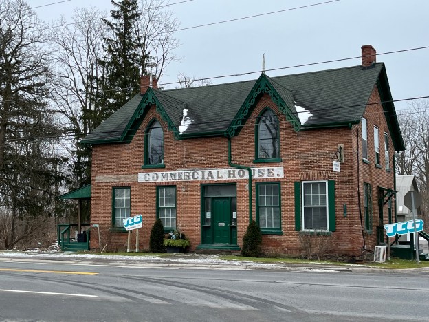
Sarah Ashbridge was a widowed Quaker from Pennsylvania who emigrated to York (now Toronto) in 1793, the year that Lieutenant-Governor John Graves Simcoe founded the community. The next year she settled on 200 acres on the east side of The Don River. Her family at the time consisted of her sons Jonathan and John as well as her two daughters Elizabeth and Mary along with their husbands and children. The land was fully forested and they set out to clear a farm and built a log cabin to live in. In 1809 both John and Jonathan were married and they each built a two-storey frame home for their new families to grow in. Jonathan had a son named Jesse who commissioned a new home for himself in 1853 and had it designed by local architect Joseph Sheard. He built a five-bay, Regency-style cottage with Neo-classical elements added to the design. Joseph Sheard would go on to be the Mayor of Toronto from 1871-1872.

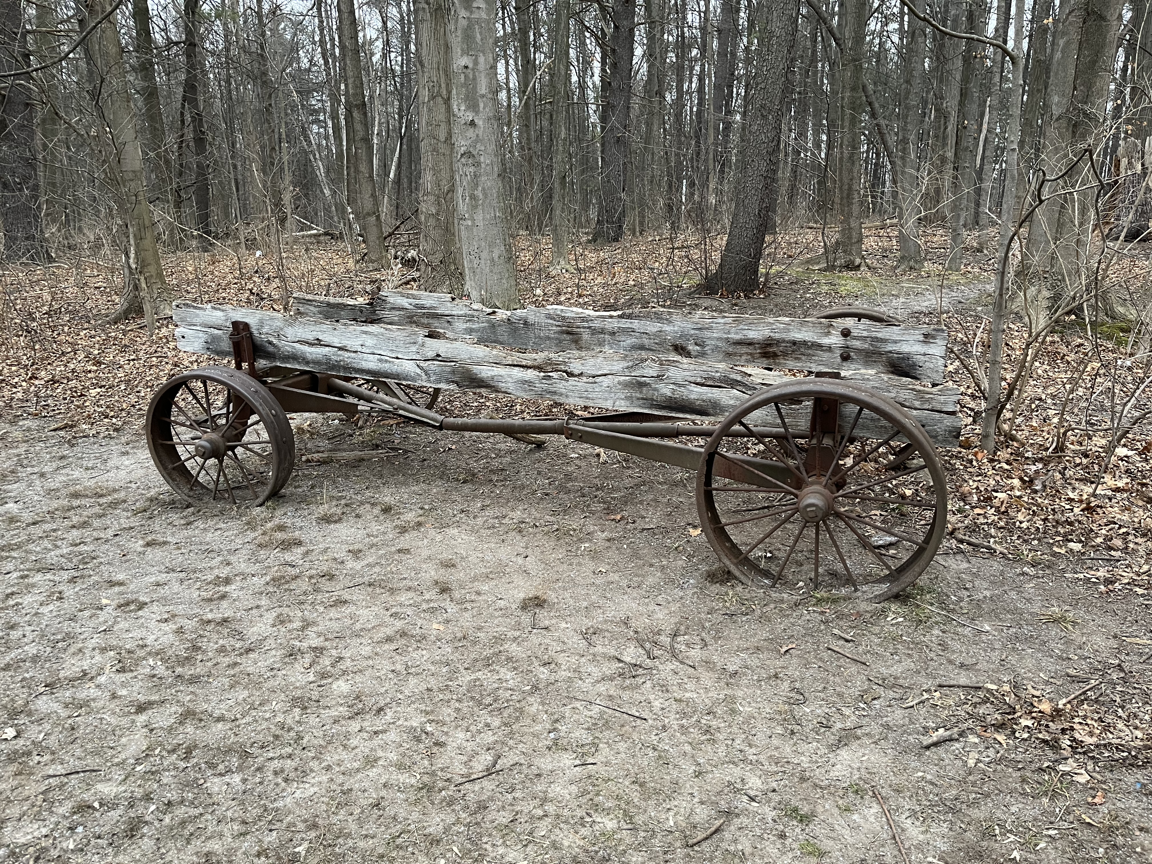
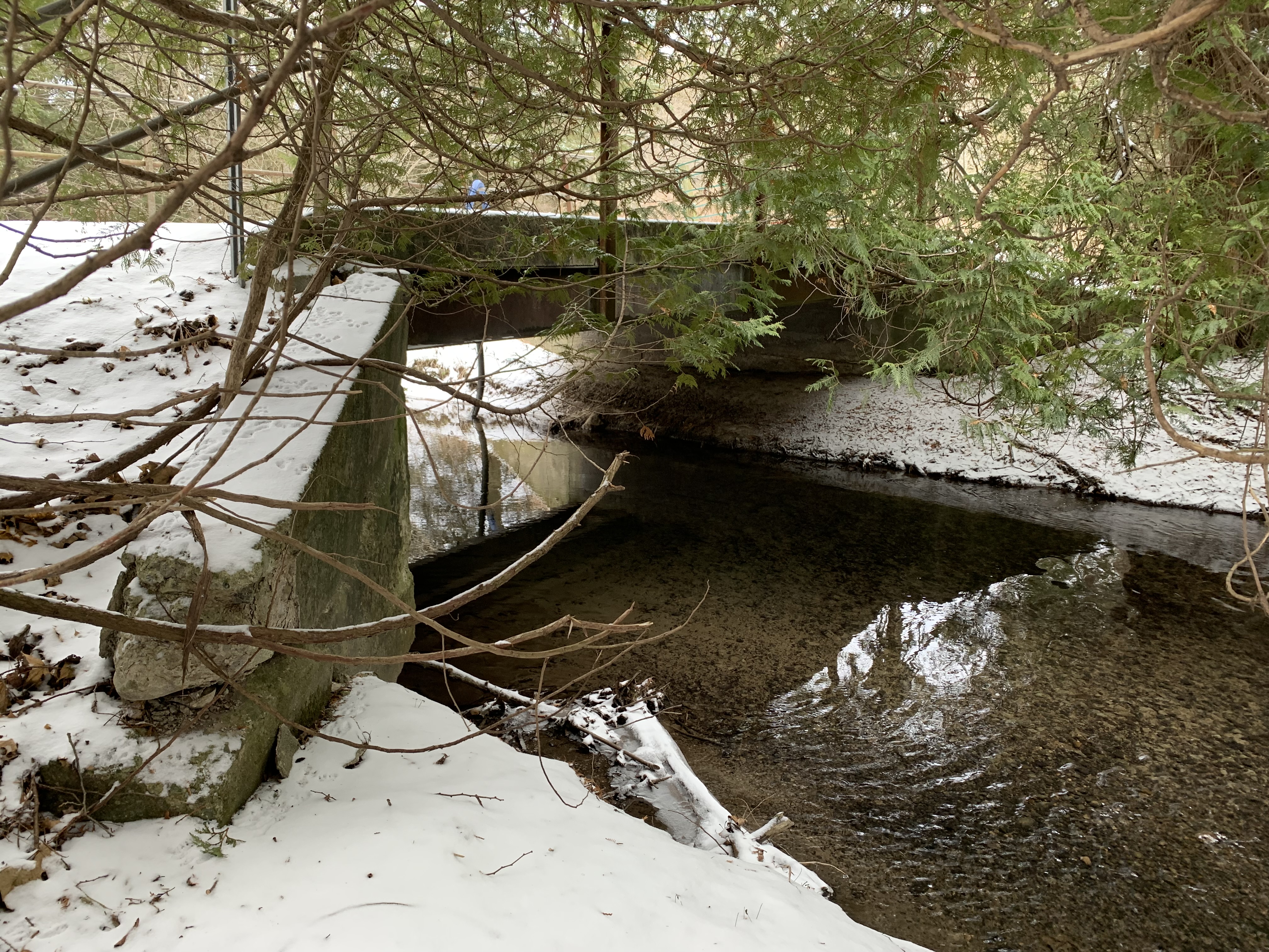
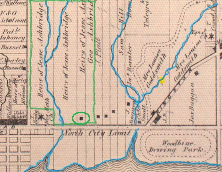
This capture from the County Atlas of 1877 shows the properties that were still under the Ashbridge family at that time. I’ve also circled the Jesse Ashbridge home in green. Ashbridge Creek is shown flowing through the property and in the early days, it was used to take a boat down to the lake and back. It has since been filled in and is represented by a depression on the grounds of the Ashbridge Estate property.

Sarah’s husband, Jonathan had been disowned by his local Quaker Meeting after the Revolutionary War in the USA and had died in 1782 in Pennsylvania. As United Empire Loyalists the extended family had been granted 600 acres (240 ha) which fronted on the bay that bears their name. Sarah Ashbridge died in 1801 but her sons John and Jonathan served as pathmasters on the Kingston Road from 1797 until 1817. This meant that they were responsible for maintenance and improvements on the dirt path in front of the homestead which became Kingston Road and is now Queen Street East. They also served in the War of 1812 and again during the Rebellion of 1837.

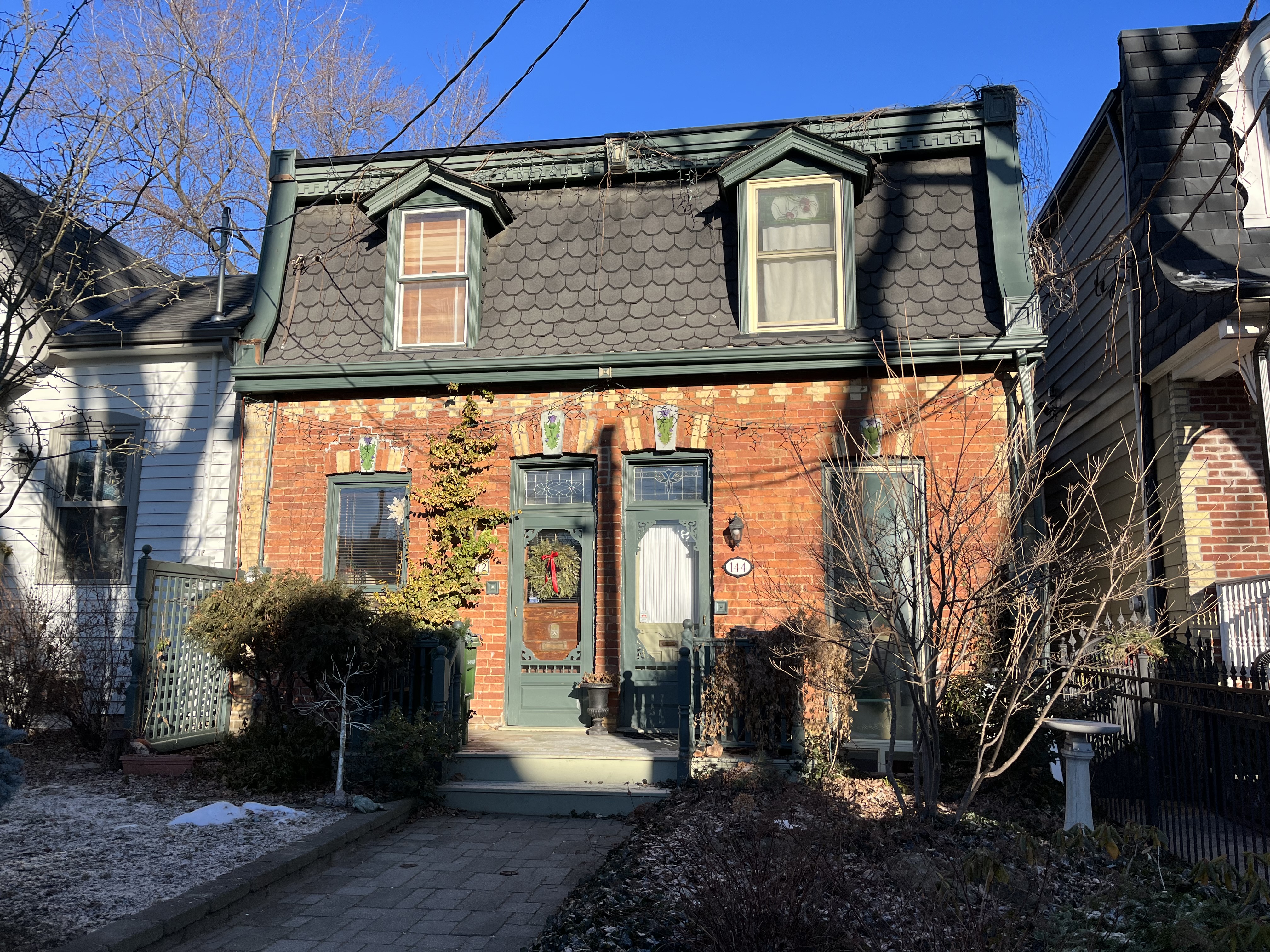
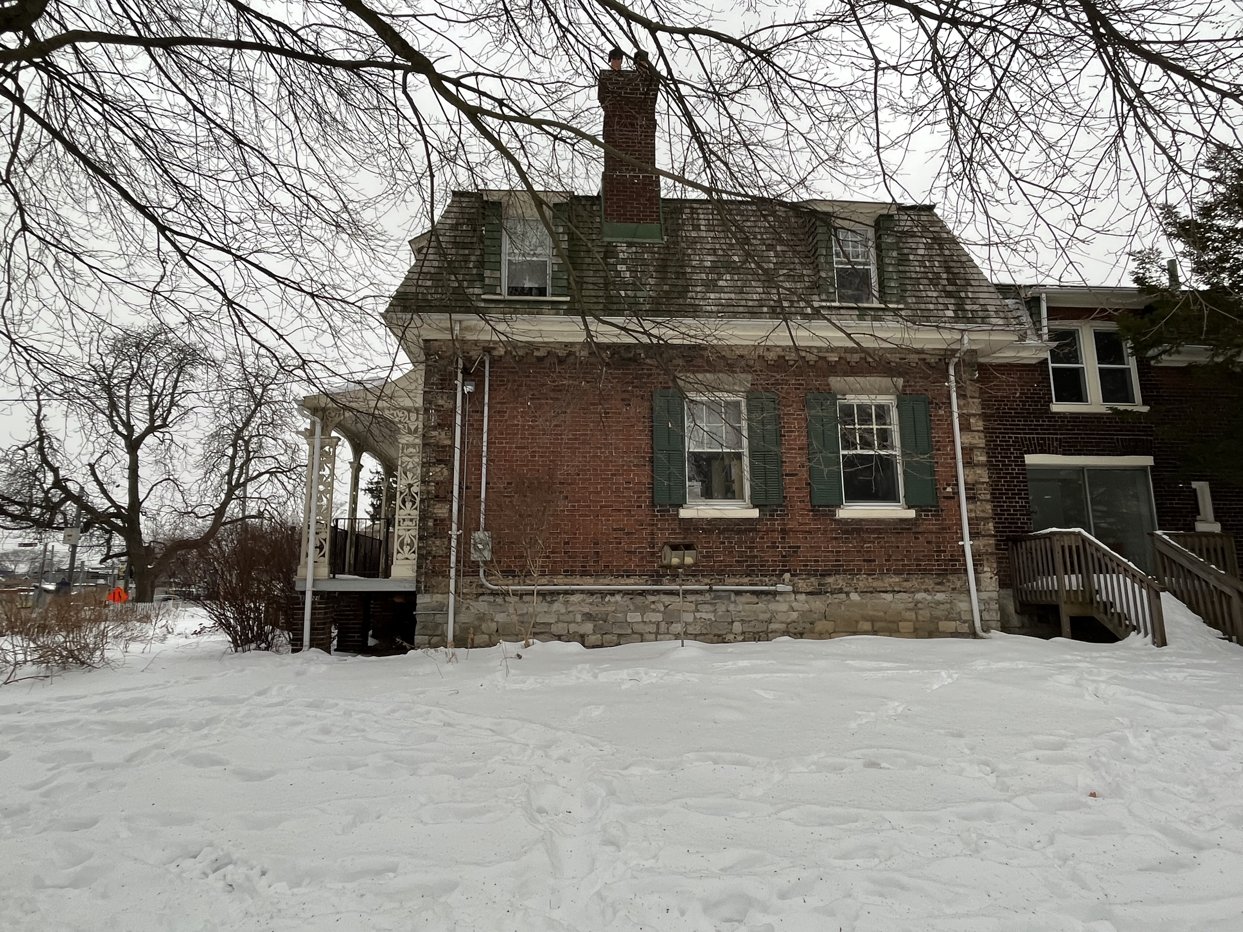
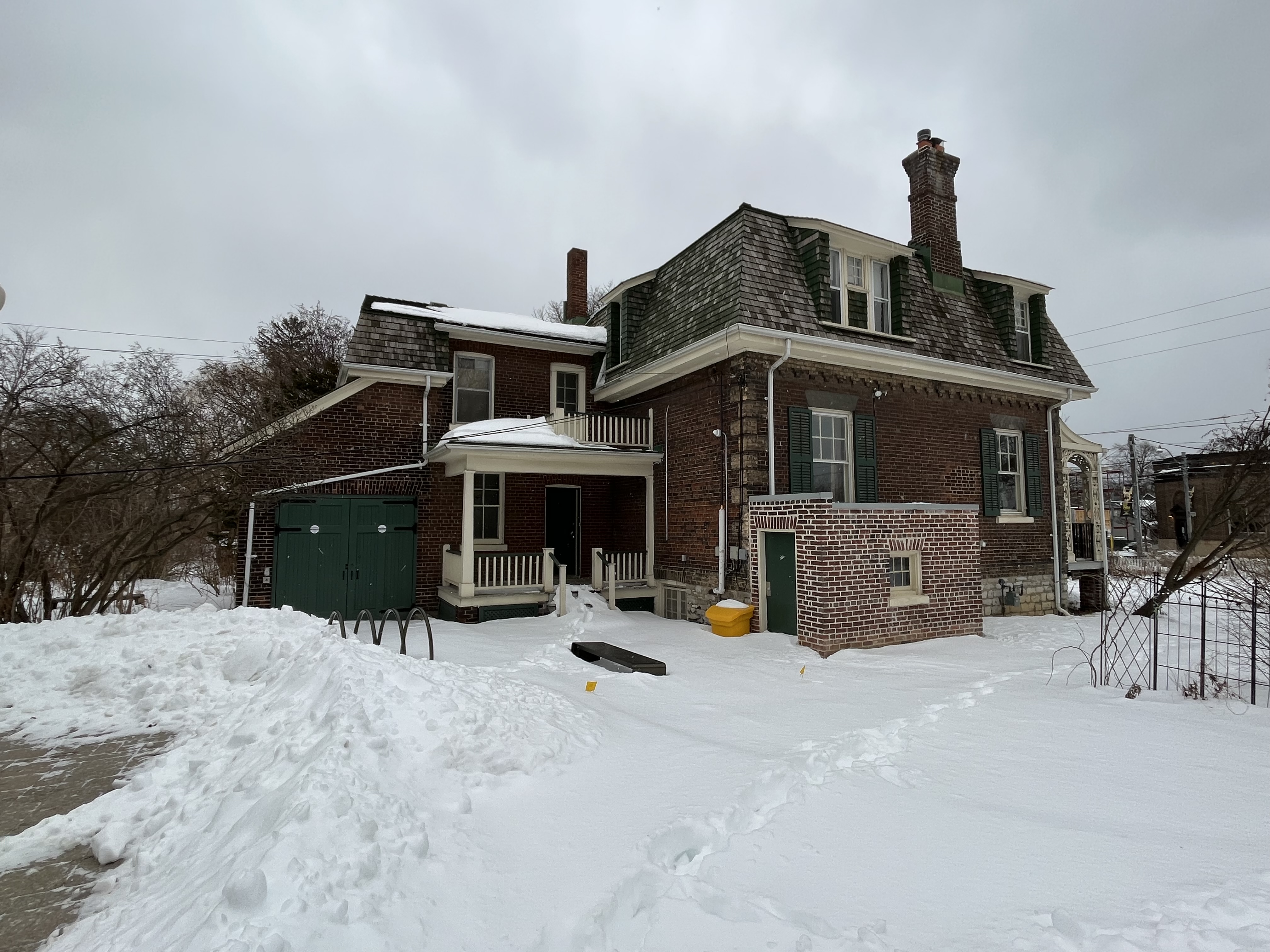
The Jesse Ashbridge house still stands on what remains of the property. Over the years, almost all of the property was sold off until there is only 2 acres left now. The house has also been altered on several occasions, the most obvious one being the addition of a second floor in 1899. The original home was built on tall foundations made of stone and included the full length veranda.

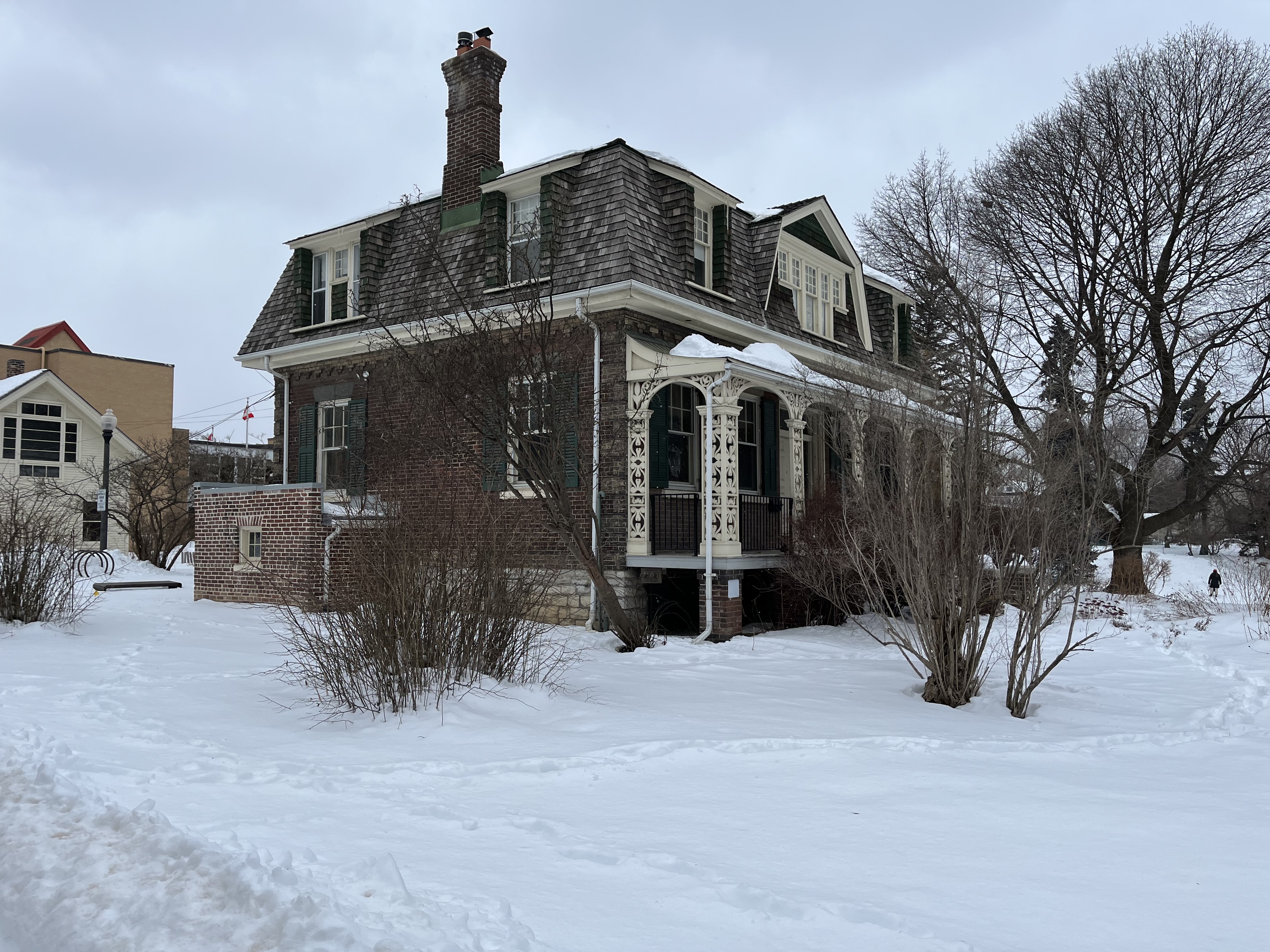
The side view shows the six over one double-hung sash windows that have been on the original house since it was built. The bricks were from a local brickyard and when the second floor was added the problem of matching brick colour was avoided by adopting a Second Empire mansard roof.

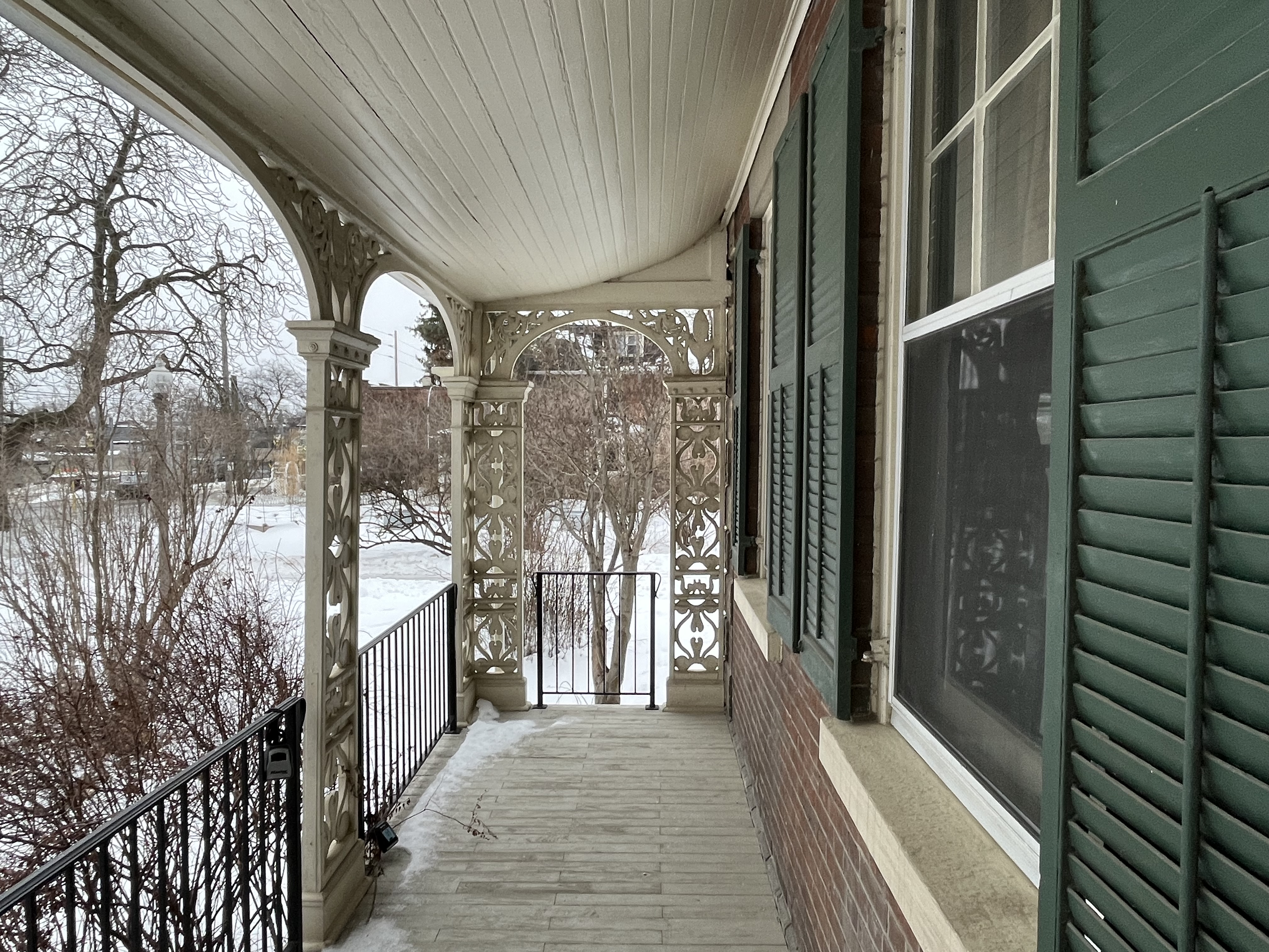
The woodwork on the veranda is known as “arcaded treillis” which refers to the arches supported by piers and the intricate carvings designed to encourage vines to grow up them. Fortunately, no vines have been allowed to obscure the details of this woodwork. The front door is designed to bring lots of light into the centre hallway. The two windows on either side of the door are known as “side lights” while the transom window above may also have opened to let in some fresh air.

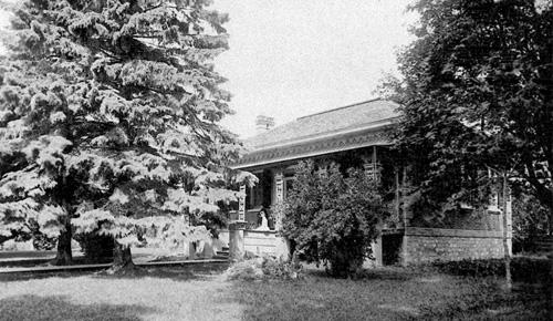
The archive photo below was taken by Elizabeth Ashbridge before the 1899 second floor was added. Notice that the front porch was part of the original structure.

Inside the veranda you can really see the bell shape that the roof has. You also notice how badly the floor boards have warped and are starting to deteriorate. The house remained in the Ashbridge family until 1972 when it was donated to the Ontario Heritage Foundation. Dorothy Ashbridge continued to live here until 1997.

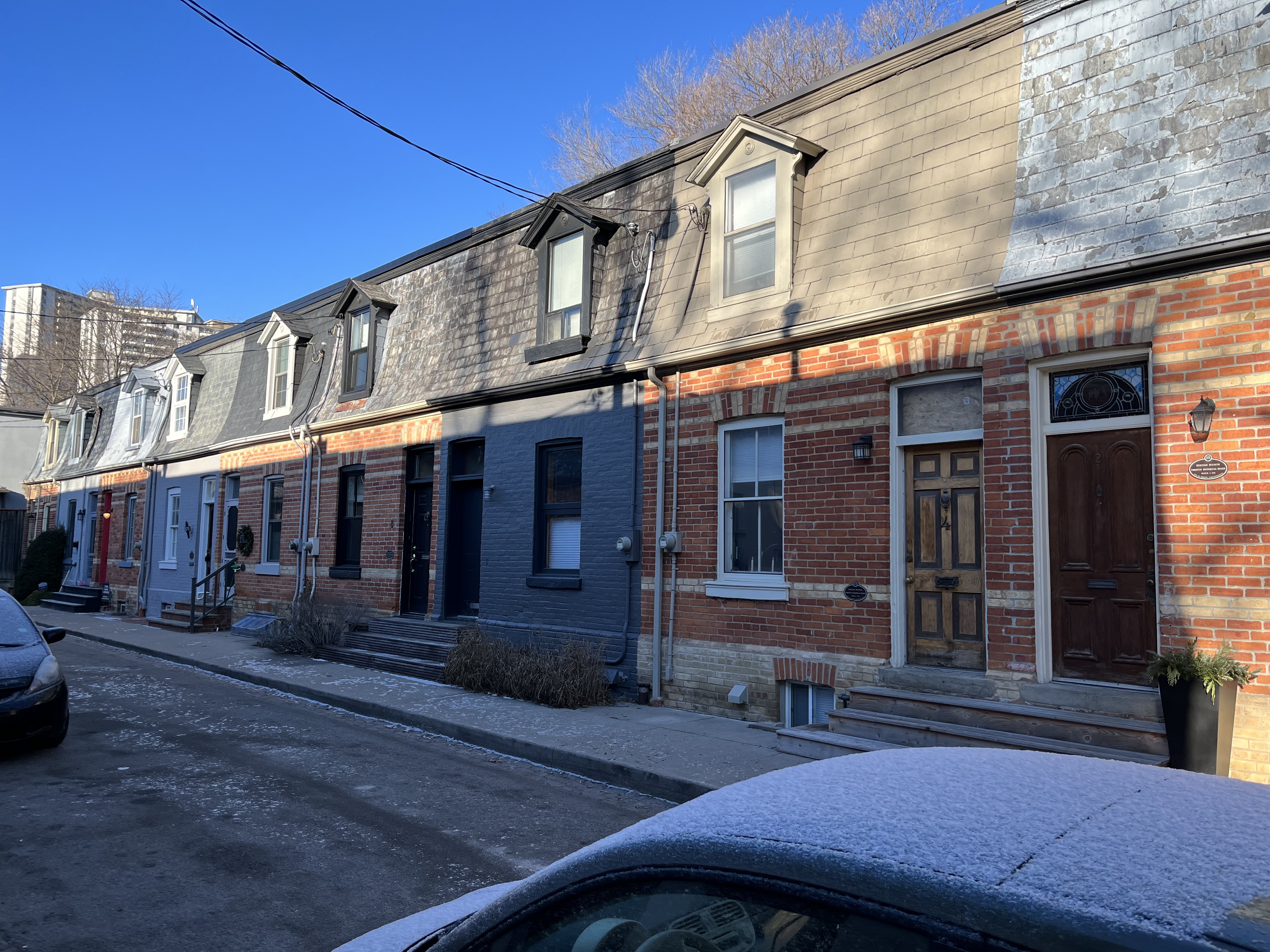
Another addition to the house was completed in 1920 on the north side of the building. This section lacks the patterned brickwork and has no quoins on the corners and no shutters on the windows. It’s also made of darker bricks but is hidden from the street.

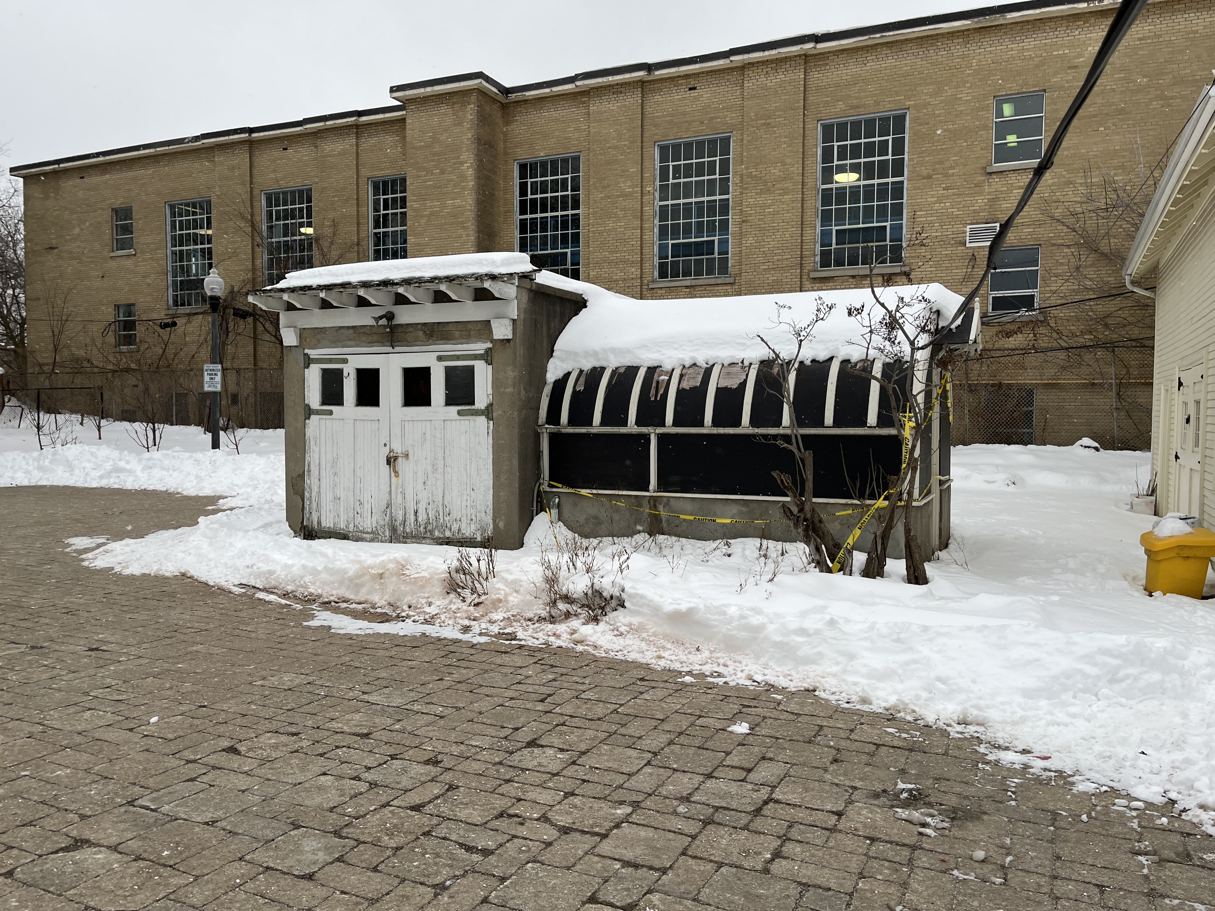
A small potting shed and a greenhouse stand behind the house as a reminder of the fabulous gardens that previousy surrounded the estate.

Of the original families that arrived to settle the town of York, only The Ashbridge family stayed for a full 200 years on their original property. When they were finished with it, they left it as a legacy for the city to enjoy for generations to come.

Related Blogs: Toronto Port Lands

Google Maps Link: Ashbridges Estate

Like us at http://www.facebook.com/hikingthegta

Follow us at http://www.hikingthegta.com

Also, look for us on Instagram

Second Empire Worker’s Cottages

January 23, 2022

Many Irish immigrants arrived in Toronto starting in 1847 because they were trying to escape desperation and famine in their homeland. They took the work that they could find and lived in shared accommodations while they saved money to buy a place of their own. Many of these would end up in the small community of Don Vale which stood just outside the early city, on the west side of the Don River. It is said that poverty led to growing cabbages on the front lawns for food and this is where the area took the name Cabbagetown from. This part of town has an amazing collection of Victorian architecture including different styles of worker’s cottages. We previously featured some of the One-Storey Worker’s Cottages that can be found in the Leslieville area of the city. I parked near Wellesley and Sumach and went for a walk around the area. You could do this almost anywhere in Cabbagetown and see similar beauties.

Second Empire architecture was also called Napoleon III and became popular in the second half of the nineteenth century. The most obvious feature is the mansard roof which is often convex or concave and usually cut with ornate dormers. These are often curved and frequently have ornate pilasters and lintles. It’s also common for the eves to be supported by brackets, especially on the larger homes. Second Empire construction only lasted a few decades and all the examples in this post were built within a couple of years of each other in the late 1880s. More recently, the style has gained negative exposure as both The Munsters and Addams Family lived in Second Empire homes which looked a little forboding during lightning storms.

The homes at 454-456 Sumach Street were built in 1886 by Josiah Bulley with the first resident of 456 being a painter named John Bolton. These two houses have a side hall plan with a living room at the front of the ground floor and a kitchen at the back. Upstairs are the bedrooms with the larger front one having a window with a dormer. These dormers are quite plain without the arched windows that were common to this architectural style.

Looking south along Sumach Street there’s a row of cottages similar to the one above. The first two buildings are semi-detached that were built in 1886. The last building in the picture is a row of three cottages that were built two years later.

126-128 Amelia Street was built as semi-detached in 1878 while number 130 to the right was built the next year. The addition of the front porch makes this cottage stand out.

142-144 Amelia is another semi-detached but it still has its slate shingles on the mansard roof. This one is also interesting for the keystones in the arches above the doors and windows which have a purple thistle carved in them.

My personal favourite in these few blocks is the one at 146 Amelia Street. This one is a little bigger and has a centre hall plan which allows for four rooms on each floor. The dichromate brickwork around the windows is partially hidden by the heavy gingerbread on the porch. The two dormers on the upstairs bedrooms are curved with interesting woodwork along the sides and stained glass in the tops.

Alpha Avenue is filled with second empire styles worker’s cottages arranged in a “U” shape down each side of the street and at the end. These cottages were built in 1888 and most have had their original slate roofing replaced with shingles. A few have had the dichromate brick patterns painted over which is unfortunate given the context of the street. The north side of the street contains even-numbered houses.

The south side of Alpha Avenue continues the same style of cottages, again with a few of them having been painted over. The two cottages at the end of the street can also be seen in this picture. There are still a couple of hitching posts for visitors to tie up their horses but most of these residents would not have owned one. People walked to their workplace as they tended to live close to their employment. Long commutes were still almost a century away.

438- 440 Wellesley Street presents another row of Second Empire cottages where the first one might have original windows while the other three all have had their windows replaced.

323 Wellesley was built between 1888-1889 and is an interesting little cottage with two dormers on the second floor. The front still has slate shingles with a red circle and dot pattern between the dormers. There’s a beautiful stained glass window in the transom above the door that contains the house number. Transom windows were often designed to open and allow air to come into the long, narrow structure. I wonder if this one was designed to open and if it is still functional.

These little cottages have become popular again and many of them have been upgraded and restored. I can just imagine what the original occupants would think of their value in today’s real estate market.

Related blogs: One-Storey Worker’s Cottages, Unionville – Dating By Design Styles

Google Maps Link: Cabbagetown

Like us at http://www.facebook.com/hikingthegta

Follow us at http://www.hikingthegta.com

Also, look for us on Instagram

Riverwood – Armstrong Wild Bird Trek

January 16, 2022

The Riverwood Conservancy is located on 150 acres of an original 200 acre land grant that was part of the territory of the Mississaugas of the Credit First Nation. We’ve covered the history of this property in detail in previous stories about Riverwood and a full set of links will be provided at the end of this post. There’s lots of free parking on site although sometimes it can be busy on the weekends.

I always have to stop and admire this century old home that was built with stone carried up from the river below. An old set of stairs still leads from the back yard down to the trails below but it has been blocked off by a fence at the top. From the back yard you can also see the remains of the first man-made swimming pool in the present city of Mississauga and admire the old stone cistern.

The surrounding land was used for farming purposes and there’s still several old agricultural items strewn around the property. All of them are in an ongoing state of deterioration. This wagon has seen considerable rot since we published a picture in our 2014 post of Riverwood.

The Riverwood Conservancy has been in an ongoing state of development with new gardens and features being added over the years. One of the newest attractions is the Armstrong Wild Bird Trek. It was founded in 2017 and features a number of bird feeders along the Red Trail. Armstrong Milling in Hagersville provides birdseed that is placed in the feeders by volunteers. In the fall and winter, this attracts a lot of birds and subsequently a lot of bird watchers. The trail follows the edge of the valley and uses boardwalks to pass over wetlands and streams.

Most of the bird feeding stations have a sign identifying various species that can be found in the local habitat. The Conservancy claims 180 species of nesting and migratory birds can be seen in the park. There are fewer species in the winter but the ones that stay are more dependant on the feeders and become quite used to humans. This isn’t necessarily a good thing but at least they are getting nutritious food. For this reason, it is recommended that people not bring anything to feed the birds. Feeding them bread and domestic bird food is actually harmful to them. This male Cardinal was one of several that was waiting for a turn at the feeders.

The Blue Jay is one of the largest song birds in Canada and there are four sub-species of which ours is known as the Northern Blue Jay. They tend to mate for life and can become aggressive if people approach their nest, especially in breeding season. Blue Jays can immitate the call of various hawks. A technique which they use to test and see if there are any in the area. They can become prey to hawks when alone but in groups will attack a hawk and drive it away.

This male White-breasted Nuthatch can be distinguished from his female counterpart by the black cap on his head. The female has a cap which is a lighter shade of gray. If you take a few seeds from one of the feeders and hold them in the palm of your open hand it’s quite likely that a bird will come and land on you to feed.

Black-capped Chickadees are cute little birds that appear very friendly because they have very little fear of humans. It’s pretty easy to get one to sit on your hand if you have a few seeds in your palm.

There’s an abundance of squirrels due to the free food but in most cases, they can’t get into the feeders. They hang around below them and eat the seeds that are thrown out by the birds. Where branches hang close enough to the feeder they will climb and jump into it. This is bad news because they are quite greedy, literally stuffing their faces.

This little female Downy Woodpecker is happy to come and get a few seeds. These tiny woodpeckers are able to feed in places that the larger Hairy Woodpeckers and other species can’t get to. This includes eating insects from plant stems and pecking holes in goldenrod galls to get the larvae inside. These woodeckers can often be seen in mixed species flocks among the tall grasses with the other birds because there’s protection in numbers.

American Robins fly south to keep ahead of the frost line so that they can get adequate food. Those that stay behind switch their diet to berries and seeds and we saw several that were hanging around the trail. They tend to look fat in the winter but it is just the way that they fluff up their feathers.

You have several options for a route back to the parking lot including retracing your steps along the Red Trail. The Culham Trail passes through Riverwood and can be used to create a return loop. We chose to take the smaller “fisherman’s trail” along the side of the Credit River. This will allow you to see some of the water birds that don’t use the feeders. On this day there were lots of Mallard Ducks and a pair of Mergansers and at times you could see a Kingfisher. We also caught a quick glimpse of a coyote trying to sneak past us unseen and were able to watch three White-tailed Deer browsing on the other side of the river.

Although there appears to be an increased number of Great Blue Herons that stay for the winter, I was a little surprised to step around a fallen tree and see one. Almost as surprised as it was to see me and my camera. With a loud honk, it was gone.

We’ve been through Riverwood many times over the years and there’s always something interesting to see. No doubt we’ll be back.

Related blogs: The Culham Trail, Riverwood – Bird Property, Riverwood Estate, Riverwood – Zaichuk Property

Google Maps link: Riverwood Conservancy

Like us at http://www.facebook.com/hikingthegta

Follow us at http://www.hikingthegta.com

Also, look for us on Instagram

Brougham – Ghost Towns of the GTA

January 9, 2022

Brougham existed for 150 years as a quiet rural community that supported agriculture on the surrounding farms. Brougham had one claim to historical fame that came from a local man named Peter Matthews. The veteran of the War of 1812 was well respected in town and also a vocal supporter of democratic reforms. On December 2, 1837, Peter led a group of local men to join William Lyon Mackenzie in an armed rebellion against the government in Toronto. The rebellion failed but Matthews and another rebel named Samuel Lount were convicted of treason and publicly hanged. Matthews and Lount are buried in The Necropolis in Toronto.

When the excitement died down, Brougham went back to being a quiet hamlet where not much ever happened. That suddenly changed in 1972 when the Federal Government of Pierre Trudeau expropriated the entire community for an airport that it claimed would be operational by 1979. That airport was never built but the lands have been held in trust for a potential future airport.

William Bentley became one of the founders of Brougham after he emigrated from New York State in 1839 and settled in Pickering Township. Along with his brothers, he established a general store as well as a patent medicine factory. William built this house in 1853 at the main intersection of town and it quickly came to represent the prosperity of the community. The home boasts Italianate styling in the architecture including the belvedere on the roof. It’s interesting to see it sitting empty while carrying a Federal Historic Register designation and sitting on a potential airport flight path leading to a runway.

Constructed in 1854 as Pickering Town Hall, this wood-framed building was designed as an open concept meeting area for making community decisions. As such, it is fitting that it became the site of community meetings in 1972 to fight the federal government’s decision to expropriate the community in the name of a new airport. People Or Planes was a larger citizens group from throughout the original expropriated lands and beyond. They banded together and fought to stop the government from going ahead. Their success has kept these lands from being destroyed for the past half a century. For years it read “Pickering Community Hall” but the name has been changed above the entrance to reflect the community that it represented. This building also has a Federal Historic Designation, this one given in 2009. Just beside the community hall is a one-storey Georgian home with dichromate brick veneer that was built in 1860. As I was photographing the community hall the two residents next door asked me what I was doing. When I explained that I was photographing historic buildings we got into an interesting conversation about the community and the airport plans. I haven’t included their home out of respect for them, but it is listed on the Pickering Municipal Heritage Register (PMHR).

Brougham decided to replace their original wooden schoolhouse with a new brick one in 1859. It served the children of the community for 100 years before being closed. Recently it has been used as an art gallery and the building appears on the Federal Heritage Register.

The Wesleyan Methodists came to town early but the small size of the congregation didn’t allow them to have their own full-time pastor. Records indicate that in 1870 they were part of the Pickering circuit in which they shared a pastor on a rotation that included Claremont, Glen Major, Greenwood, and Kinsdale. By 1890 they were able to erect this handsome brick building at the main intersection in town. After 1925 it was known as St. John’s United Church. Today it carries on ministry as Pickering Standard Church and is listed on the PMHR.

The Temperance hall was built in 1880 and is listed on the PMHR. The Temperance Movement sought to restict or ban the consumption of alcohol and got started around 1820. Through various successes and failures they eventually managed to see legislation passed in both Canada and the United States that prohibited the sale of alcohol. The Temperance Hall in Bougham appears to have been raised at some point and a second floor added beneath. This could account for the fact that the brick butresses are not continued on the lower floor making them essentially useless. Early pictures of the main street show the building as it looks today but the windows are not bricked shut.

The former Commercial Hotel was built as a private home in 1860 and later converted into a hotel. It faces Highway 7 on the east end of town and is the last of three hotels that used to serve travelers through the hamlet. The former hotel has some interesting Gothic Revival architectural features. The pointed arch windows in the two second-storey gables are augmented by the decorative bargeboard or gingerbread trim. Each is topped by a finial (the pointed decoration) that makes it distinctive. In 2009 this building was added to the Federal Heritage Register which seems at odds with the plan to level the town for an airport.

The Miller Residence was built in 1880 and is the fifth building in town to appear on the Federal Heritage Register. This house was occupied by several leading families in the community over the years including the Bentleys, Hubbards, and Millers. The house is representative of late Victorian architecture in that it includes several styles such as Gothic Revival bargeboards and Italianate windows with rounded arches.

On the north side of the community hall is this 1 1/2- storey house which was built in 1860. It is typical of many homes that were built in this era with its centre gable and pointed arch window. This house is listed on the PMHR.

Just on the north edge of town, there stands a house that is also listed on the Pickering Municipal Heritage Register. It was built in 1860 and is shown on the County Atlas as being on the property of R. Lambert. The register lists it as the ex-Vanderligt home but on March 16, 2021, a fire broke out in the house. The two occupants were able to escape, but the fire department reported “extensive damage”. It’s unlikely that the federal government will want to restore the building because it solves the problem of yet another building on the PMHR.

Brougham is a community of driveways that go nowhere and vacant lots. With the government owning every property in town with an undisclosed demolition date no one wanted to invest in maintenance. Slowly people moved on and buildings were demolished as they became increasingly dilapidated.

In March of 1972, the federal government announced plans to build a major airport in Pickering to take the expected overflow from Malton Airport (Pearson International). they went ahead and expropriated 18,600 acres (7,530 hectares) and began making plans for construction. By 1975 construction was halted and the farmlands and houses were leased out for interim use. Recent studies suggest that the airport might be needed between 2027 and 2037, but might never be, and the federal government has given two large portions of the land to create Rouge National Urban Park. A study by KPMG concludes that it will not be necessary and Covid may have a lasting negative effect on the airline industry as well. The government remains committed to developing an airport on the reduced lands which include Brougham. The Transport Canada map below shows the original airport site in yellow and the reduced one in purple. Brougham is located in the extreme lower right-hand corner of the site but would be under an approach flight path. Land Over Landings carries on the work of People or Planes in fighting to save not only the communities involved but the farmland as well. There’s a great deal more information that’s available on their website Land Over Landings.

While the government is still actively talking about building the airport, the locals have slowly gone about the job of obtaining historical designations. With almost every property in Brougham listed on one heritage register or another, it will be interesting to see how the Federal Government goes about building an airport in the face of the existing local history.

To read more about the Rebellion of 1837 check out our story Rebel Rebel. You can also check out our story The Necropolis.

Google Maps Link: Brougham

Like us at http://www.facebook.com/hikingthegta

Follow us at http://www.hikingthegta.com

Also, look for us on Instagram

Enniskillen Conservation Area

January 2, 2022

Enniskillen Conservation Area is a 65-hectare park in Durham Region that has 5.5 kilometres of trails. The conservation area is mostly forested but has diverse forest cover and some wetlands. Be aware that there is a $6.00 parking fee that can only be paid by Visa or Mastercard. Cash is not accepted, so follow the map link at the end of the post but come prepared.

The Google Earth capture below shows the conservation area with an old mill pond outlined in blue while the current pond is just a small blue dot. The yellow line roughly follows the figure eight of the trails I took around the outer edge.

The conservation area has a network of five trails that are each loops, which share some common sections where they intersect. From the lower parking area, you can either choose the Turtle Trail, which takes you through a wetland around a small pond, or the Moorey Mill Trail which connects you to the other trails in the northern part of the conservation area. Not expecting to see very many turtles on this visit, I chose the Moorey Mill Trail. This trail is a 1.2 kilometre loop that takes you up one side of Bowmanville Creek and then down the other side.

Near picnic area 3 the trail crosses Bowmanville Creek on a small footbridge. This is also where the Moorey Mill Trail Meets up with the Cedar Trail. The Moorey Trail from this point heads back toward the car and so I saved it for the return trip.

The remnant of the millpond has a thin layer of ice on it but during the summer is likely alive with activity. A much larger mill pond existed here between 1874 and 1954 but we’ll get to that later.

For now, I turned and followed the Cedar Trail up the hill and into the cedar forest. This 1-kilometre trail winds through a dense forest which, in places, shows the obvious straight lines of having been planted. In other places, it appears quite random and grows very close together. You could be just a few feet away from something in the forest and never see it.

We have reviewed the trails in several parks over the years and some of them are quite well marked while others seem to invite you to get lost. The trails at Enniskillen Conservation Area are very well marked. The trail marker below indicates that the Cedar Trail turns here or that you could choose to follow the Ruffed Grouse Trail. This is what I decided to do.

The cedar forest gives way to a mixed coniferous one which is suitable habitat for roughed grouse. In the winter they will eat seeds and the buds of deciduous trees. I didn’t see any roughed grouse or very many birds at all. The forest was silent except for the approach of a lone hiker clacking along with his walking poles and disturbing the wildlife.

The Roughed Grouse Trail carries you out of the woods and returns south on a trail along the edge of a field. This part of the conservation area provides habitat for a whole different range of plants and grasses, insects, and the small birds that feed on them. None of which were to be seen today but it won’t be long before they start to return. The fields have been planted with trees by Forests Ontario as part of their 50 million trees project. Through sponsorship from the Federal Government, landowners have been able to plant over 34 million trees at greatly reduced costs. This is part of Canada’s response to the global Trillion Tree Campaign which has planted over 14 billion trees since the fall of 2018 in an attempt to restore the global forest cover. This grassland habitat will slowly be returned to forest just as the rest of the conservation area has. The butterflies and a host of other pollinators will have to find somewhere else to hang out, but not for several years.

Within the present confines of the park, a 4-storey grist mill was built by Alexander Secord in 1874 which was known as the Boyne Water Mill. The wooden building had the unusual configuration of a horizontal water wheel that turned two sets of millstones. In 1914 James Moorey bought the mill and upgraded the sluice gates at the mill pond to concrete. These concrete gates stand along the creek however, at least one set and probably two have been washed out and have collapsed into the creek. This could have happened during any flooding event but Hurricane Hazel in 1954 fits the right time frame. The mill was closed in 1953 and dismantled in 1956, the wood is reused in several local homes.

The earthen berm of the dam is cut by the trail near a verticle slab of concrete where something was once mounted with large bolts. Perhaps the flume used to carry water from the pond to the water wheel at this location. The berm is still quite distinguishable as it crosses the ravine floor marking the forward edge of the former millpond.

The trail continues south toward the parking lot following an old access road that led from the dam to the mill. The concrete bridge is still in use for pedestrians and maintenance vehicles.

Although I didn’t see much wildlife in the conservation area during this visit it seems likely that there’s plenty to see at other times. This will be an interesting place to visit again in the future.

Google Maps Link: Enniskillen Conservation Area

Like us at http://www.facebook.com/hikingthegta

Follow us at http://www.hikingthegta.com

Also, look for us on Instagram