Tag Archives: Ghost Towns

Brougham – Ghost Towns of the GTA

January 9, 2022

Brougham existed for 150 years as a quiet rural community that supported agriculture on the surrounding farms. Brougham had one claim to historical fame that came from a local man named Peter Matthews. The veteran of the War of 1812 was well respected in town and also a vocal supporter of democratic reforms. On December 2, 1837, Peter led a group of local men to join William Lyon Mackenzie in an armed rebellion against the government in Toronto. The rebellion failed but Matthews and another rebel named Samuel Lount were convicted of treason and publicly hanged. Matthews and Lount are buried in The Necropolis in Toronto.

When the excitement died down, Brougham went back to being a quiet hamlet where not much ever happened. That suddenly changed in 1972 when the Federal Government of Pierre Trudeau expropriated the entire community for an airport that it claimed would be operational by 1979. That airport was never built but the lands have been held in trust for a potential future airport.

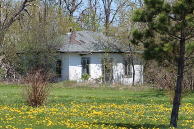
William Bentley became one of the founders of Brougham after he emigrated from New York State in 1839 and settled in Pickering Township. Along with his brothers, he established a general store as well as a patent medicine factory. William built this house in 1853 at the main intersection of town and it quickly came to represent the prosperity of the community. The home boasts Italianate styling in the architecture including the belvedere on the roof. It’s interesting to see it sitting empty while carrying a Federal Historic Register designation and sitting on a potential airport flight path leading to a runway.

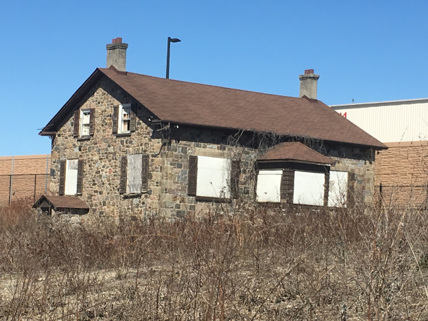
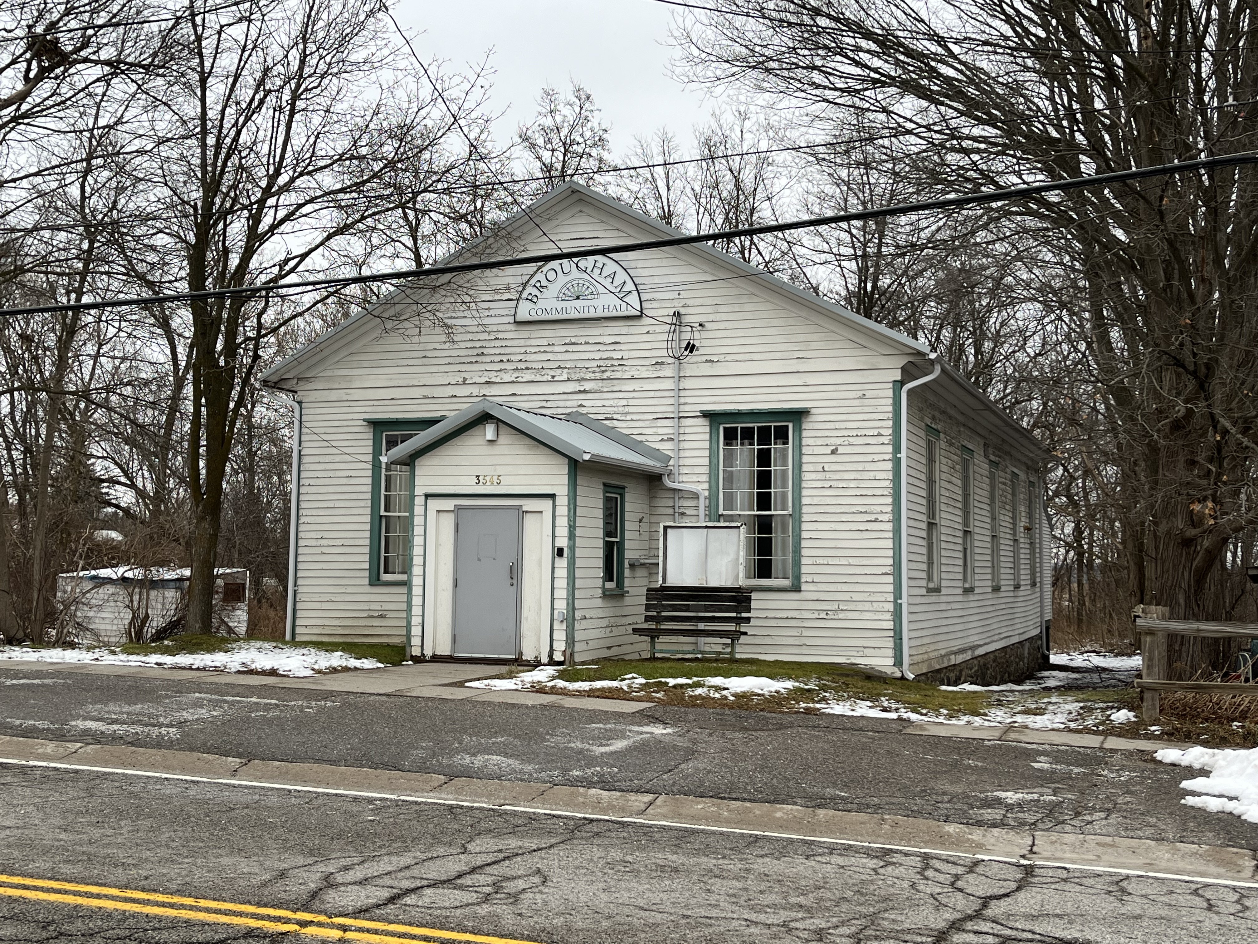
Constructed in 1854 as Pickering Town Hall, this wood-framed building was designed as an open concept meeting area for making community decisions. As such, it is fitting that it became the site of community meetings in 1972 to fight the federal government’s decision to expropriate the community in the name of a new airport. People Or Planes was a larger citizens group from throughout the original expropriated lands and beyond. They banded together and fought to stop the government from going ahead. Their success has kept these lands from being destroyed for the past half a century. For years it read “Pickering Community Hall” but the name has been changed above the entrance to reflect the community that it represented. This building also has a Federal Historic Designation, this one given in 2009. Just beside the community hall is a one-storey Georgian home with dichromate brick veneer that was built in 1860. As I was photographing the community hall the two residents next door asked me what I was doing. When I explained that I was photographing historic buildings we got into an interesting conversation about the community and the airport plans. I haven’t included their home out of respect for them, but it is listed on the Pickering Municipal Heritage Register (PMHR).

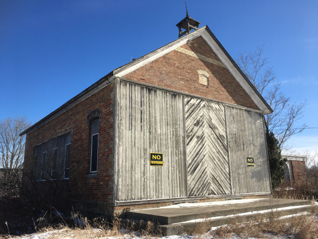
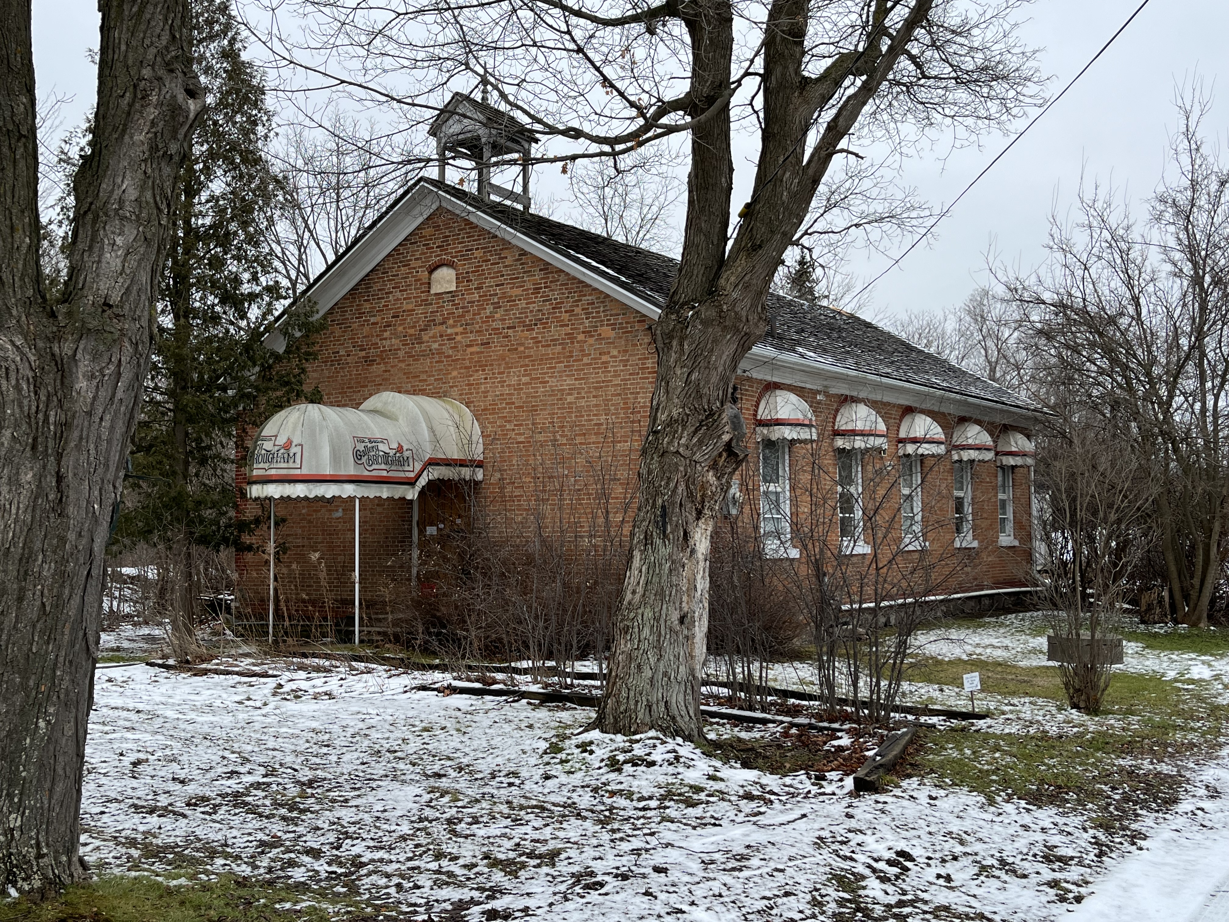
Brougham decided to replace their original wooden schoolhouse with a new brick one in 1859. It served the children of the community for 100 years before being closed. Recently it has been used as an art gallery and the building appears on the Federal Heritage Register.

The Wesleyan Methodists came to town early but the small size of the congregation didn’t allow them to have their own full-time pastor. Records indicate that in 1870 they were part of the Pickering circuit in which they shared a pastor on a rotation that included Claremont, Glen Major, Greenwood, and Kinsdale. By 1890 they were able to erect this handsome brick building at the main intersection in town. After 1925 it was known as St. John’s United Church. Today it carries on ministry as Pickering Standard Church and is listed on the PMHR.

The Temperance hall was built in 1880 and is listed on the PMHR. The Temperance Movement sought to restict or ban the consumption of alcohol and got started around 1820. Through various successes and failures they eventually managed to see legislation passed in both Canada and the United States that prohibited the sale of alcohol. The Temperance Hall in Bougham appears to have been raised at some point and a second floor added beneath. This could account for the fact that the brick butresses are not continued on the lower floor making them essentially useless. Early pictures of the main street show the building as it looks today but the windows are not bricked shut.

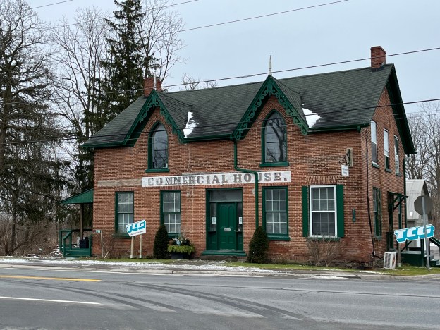
The former Commercial Hotel was built as a private home in 1860 and later converted into a hotel. It faces Highway 7 on the east end of town and is the last of three hotels that used to serve travelers through the hamlet. The former hotel has some interesting Gothic Revival architectural features. The pointed arch windows in the two second-storey gables are augmented by the decorative bargeboard or gingerbread trim. Each is topped by a finial (the pointed decoration) that makes it distinctive. In 2009 this building was added to the Federal Heritage Register which seems at odds with the plan to level the town for an airport.

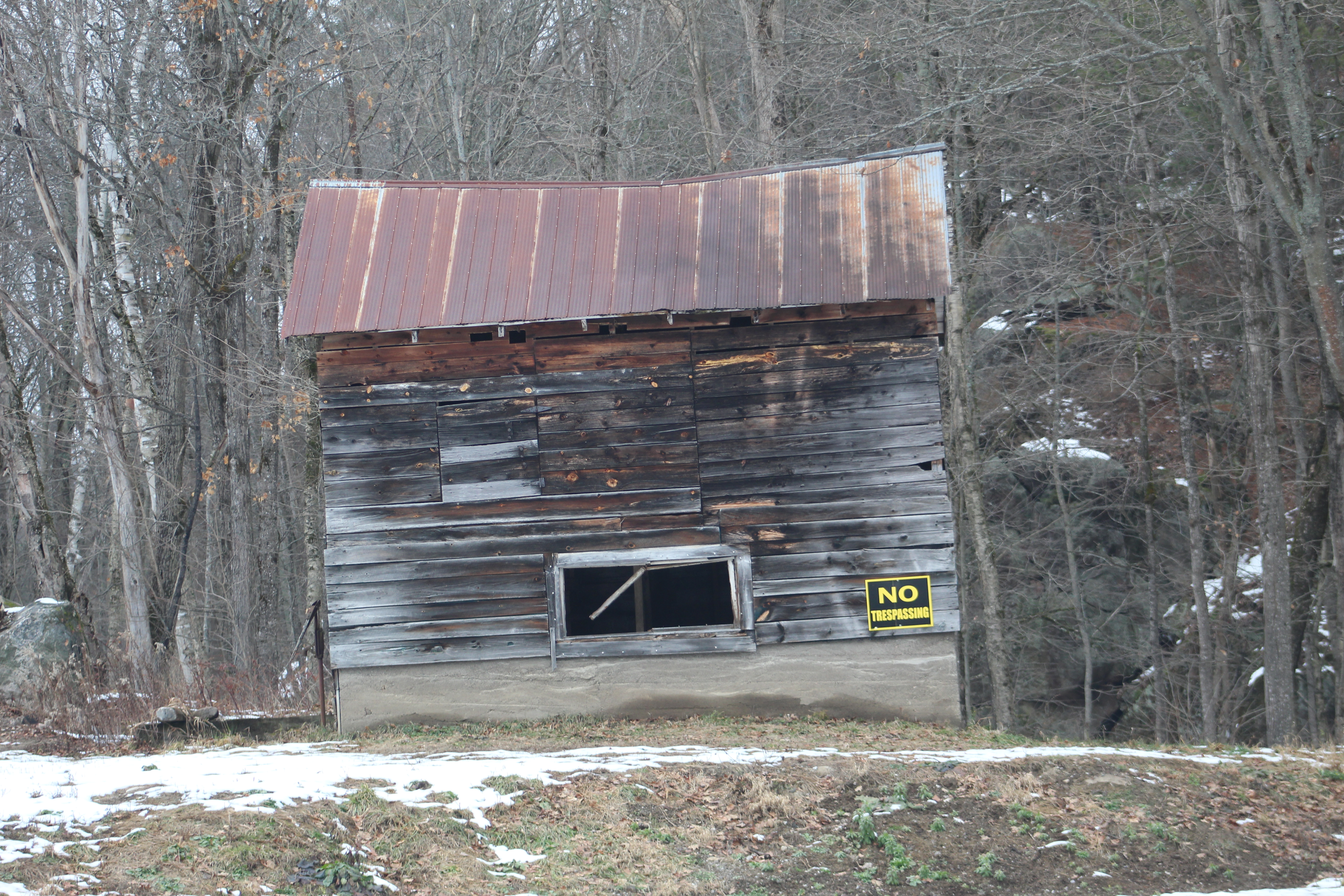
The Miller Residence was built in 1880 and is the fifth building in town to appear on the Federal Heritage Register. This house was occupied by several leading families in the community over the years including the Bentleys, Hubbards, and Millers. The house is representative of late Victorian architecture in that it includes several styles such as Gothic Revival bargeboards and Italianate windows with rounded arches.

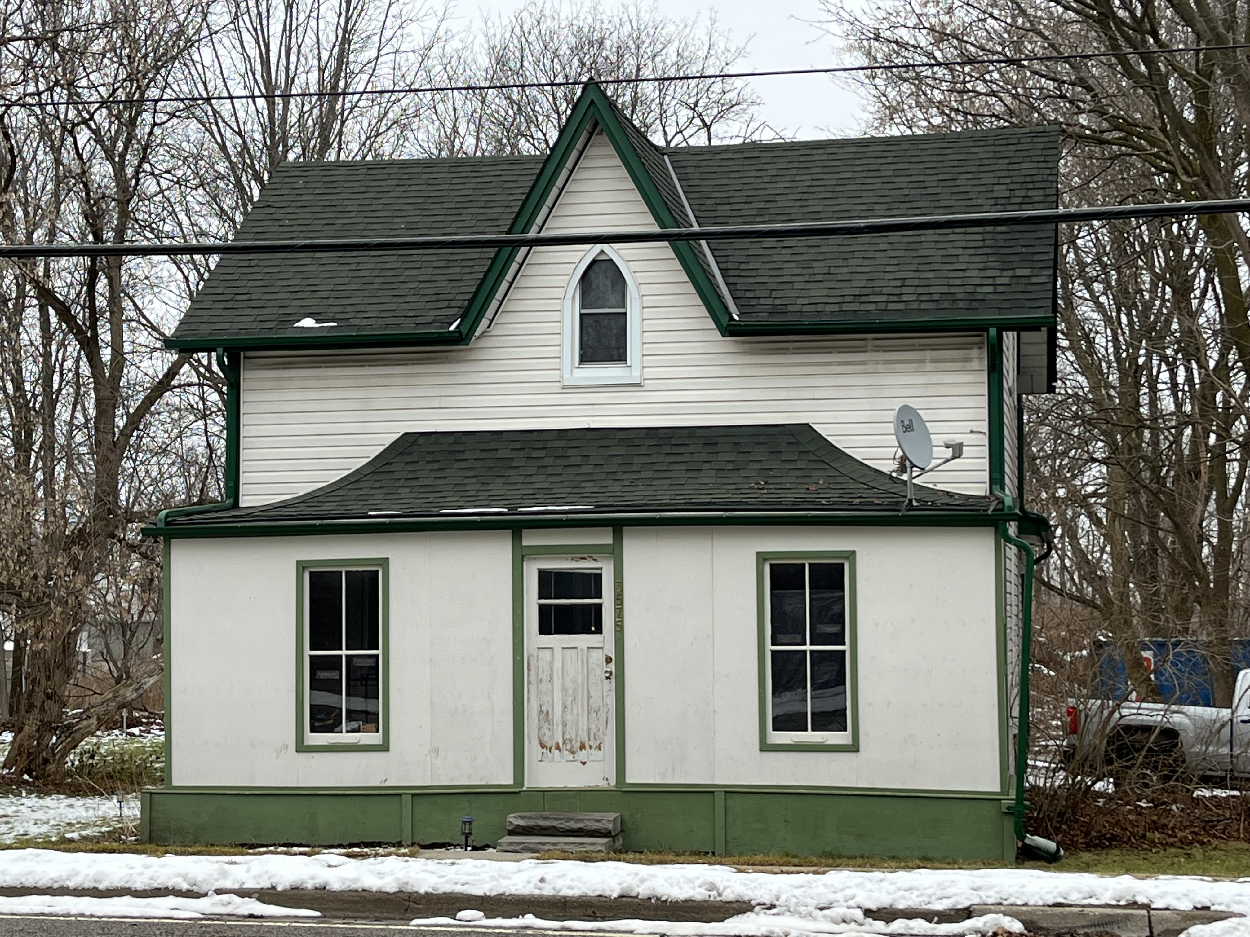
On the north side of the community hall is this 1 1/2- storey house which was built in 1860. It is typical of many homes that were built in this era with its centre gable and pointed arch window. This house is listed on the PMHR.

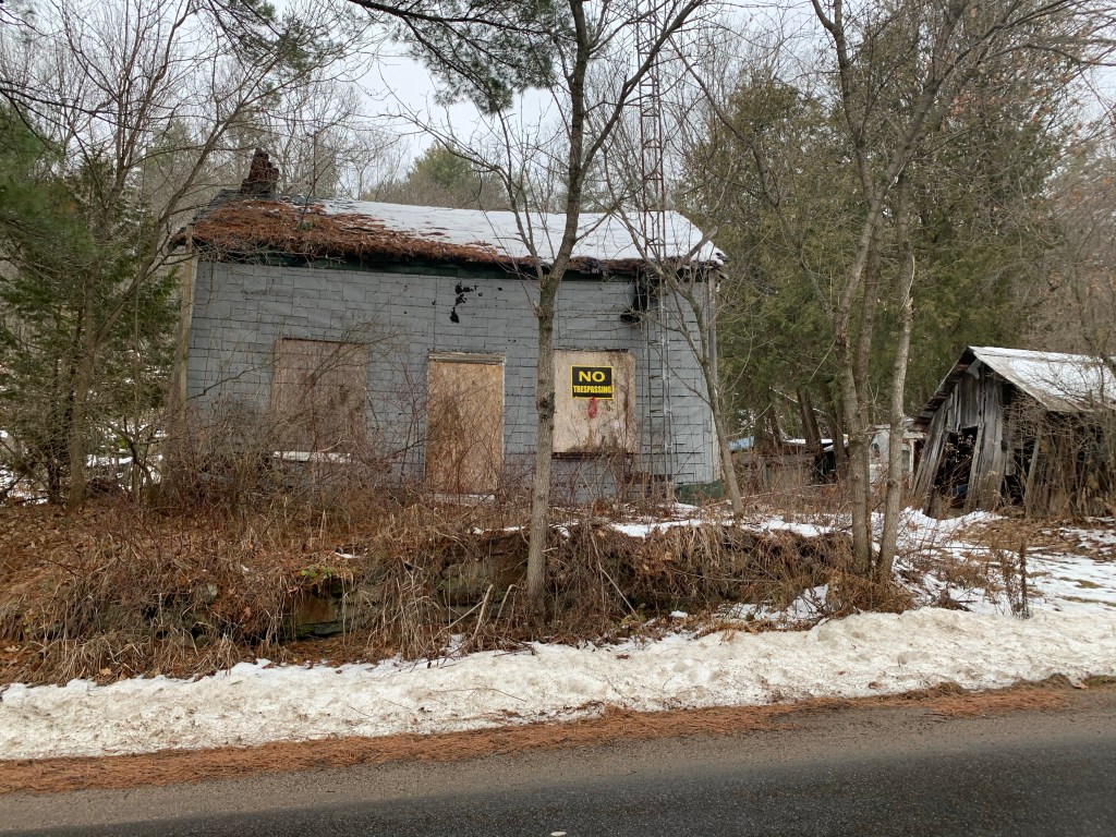
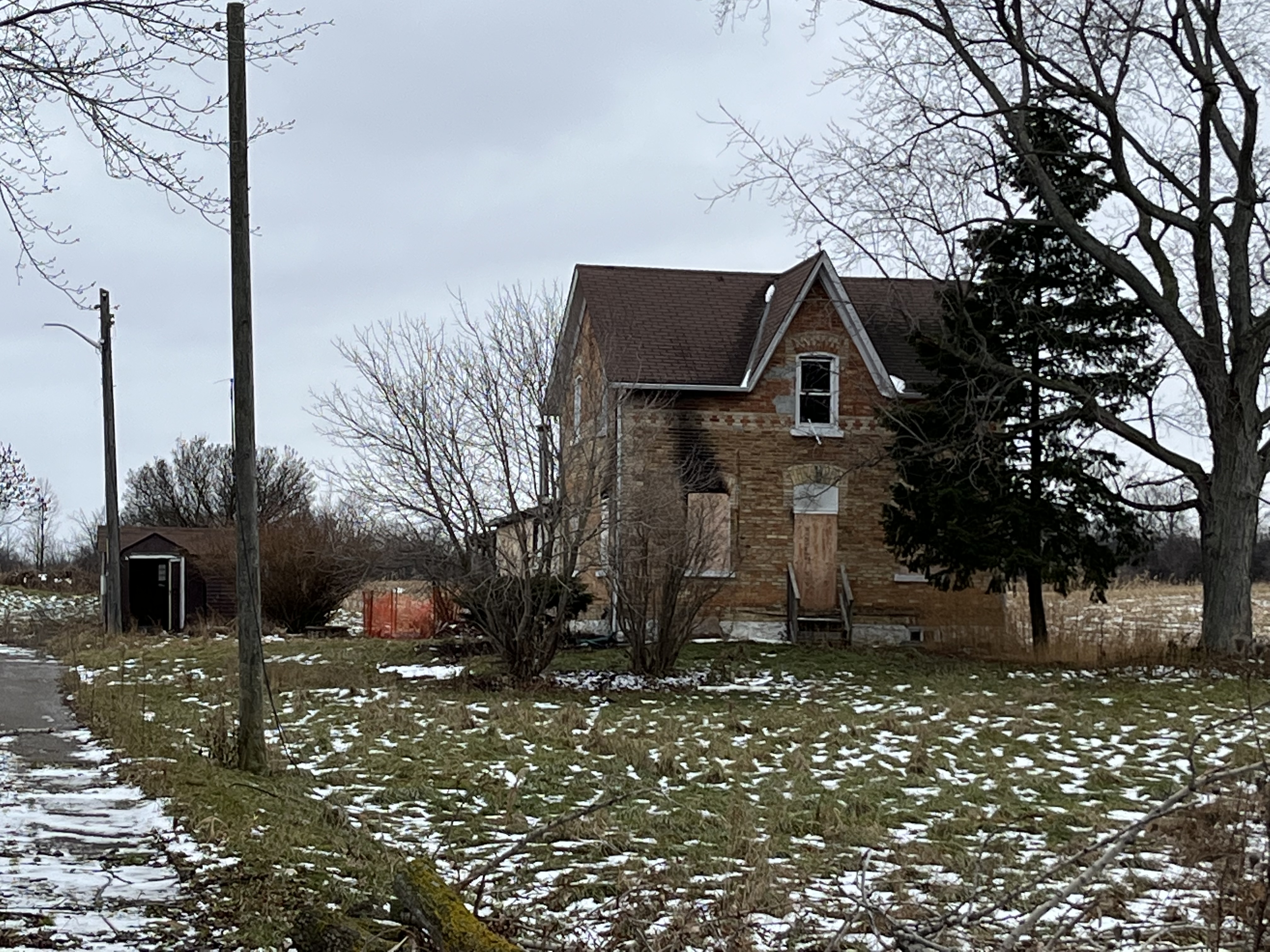
Just on the north edge of town, there stands a house that is also listed on the Pickering Municipal Heritage Register. It was built in 1860 and is shown on the County Atlas as being on the property of R. Lambert. The register lists it as the ex-Vanderligt home but on March 16, 2021, a fire broke out in the house. The two occupants were able to escape, but the fire department reported “extensive damage”. It’s unlikely that the federal government will want to restore the building because it solves the problem of yet another building on the PMHR.

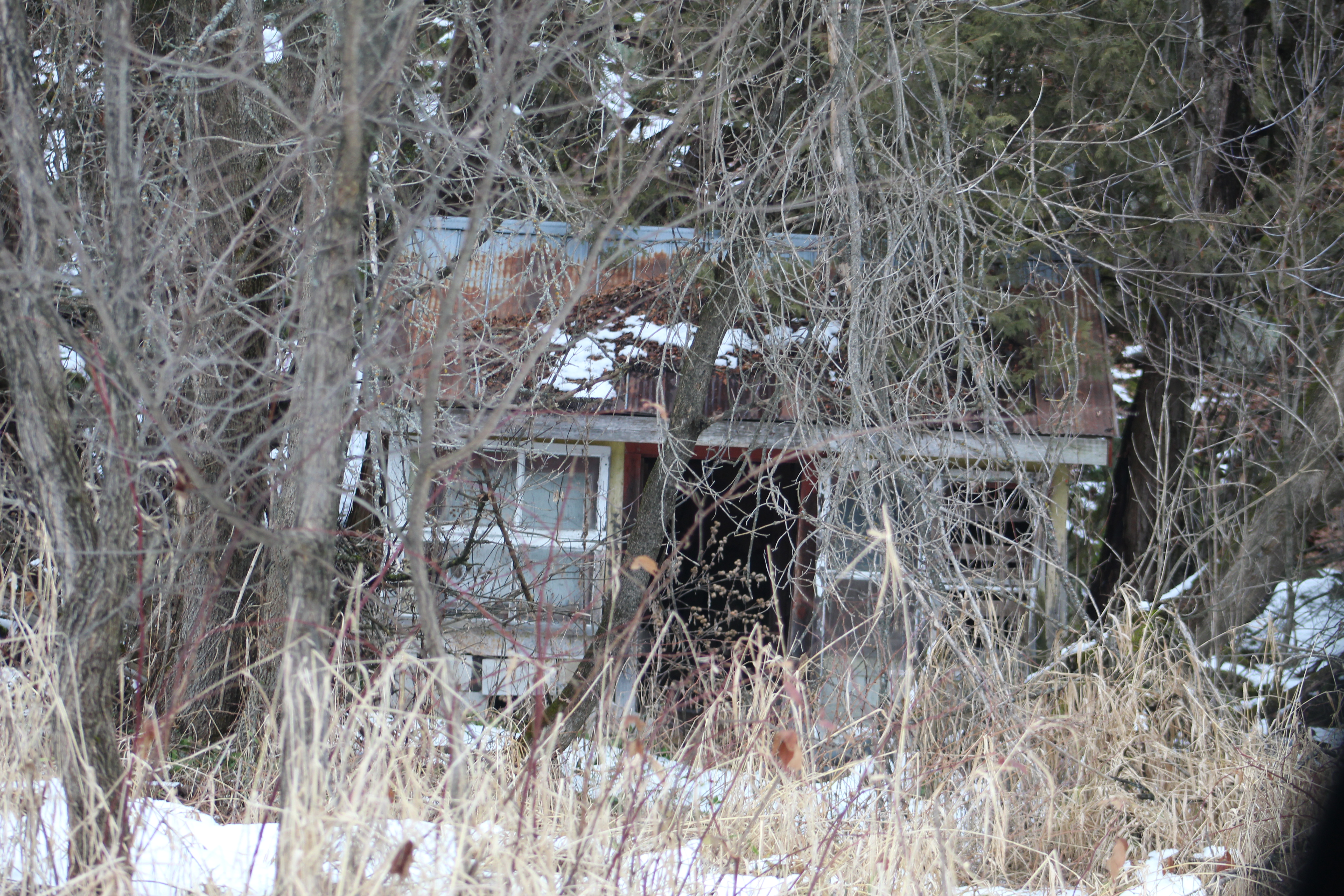
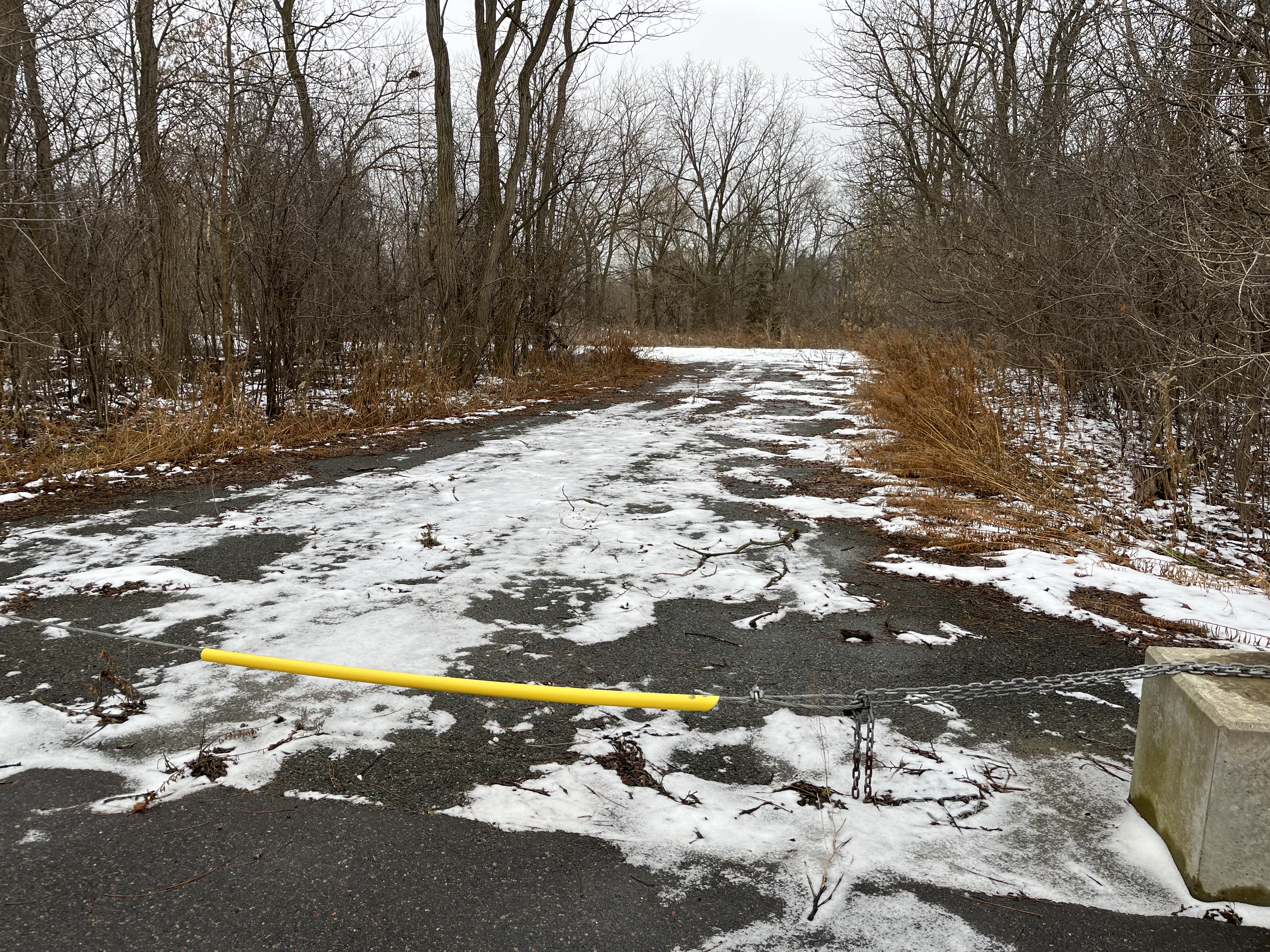
Brougham is a community of driveways that go nowhere and vacant lots. With the government owning every property in town with an undisclosed demolition date no one wanted to invest in maintenance. Slowly people moved on and buildings were demolished as they became increasingly dilapidated.

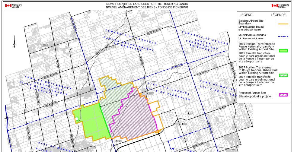
In March of 1972, the federal government announced plans to build a major airport in Pickering to take the expected overflow from Malton Airport (Pearson International). they went ahead and expropriated 18,600 acres (7,530 hectares) and began making plans for construction. By 1975 construction was halted and the farmlands and houses were leased out for interim use. Recent studies suggest that the airport might be needed between 2027 and 2037, but might never be, and the federal government has given two large portions of the land to create Rouge National Urban Park. A study by KPMG concludes that it will not be necessary and Covid may have a lasting negative effect on the airline industry as well. The government remains committed to developing an airport on the reduced lands which include Brougham. The Transport Canada map below shows the original airport site in yellow and the reduced one in purple. Brougham is located in the extreme lower right-hand corner of the site but would be under an approach flight path. Land Over Landings carries on the work of People or Planes in fighting to save not only the communities involved but the farmland as well. There’s a great deal more information that’s available on their website Land Over Landings.

While the government is still actively talking about building the airport, the locals have slowly gone about the job of obtaining historical designations. With almost every property in Brougham listed on one heritage register or another, it will be interesting to see how the Federal Government goes about building an airport in the face of the existing local history.

To read more about the Rebellion of 1837 check out our story Rebel Rebel. You can also check out our story The Necropolis.

Google Maps Link: Brougham

Like us at http://www.facebook.com/hikingthegta

Follow us at http://www.hikingthegta.com

Also, look for us on Instagram

Ghost Towns of York Region

Sunday, June 20, 2021

York Region has many small communities that have shrunk from their late 1800s sizes and faded almost into oblivion. They have lost their industry, blacksmiths and hotels and usually their stores as well. We refer to these as ghost towns although in the strictest sense they aren’t really. This blog collects 7 of the ones that we have visited and arranges them in alphabetical order. Each has a picture that represents the community as well as a brief description. The link for each will take you to a feature article on the community which has the local history as well as pictures of any surviving architectural features. At the end of each feature article is a google maps link in case you should wish to explore for yourself someday. Future companion blogs in this series will cover the ghost towns of the Peel Region, Halton Region, and the City of Toronto.

Cedar Grove still has it’s historic school and Lapp’s Cider Mill but the real treasure is Cedarena. The skating rink operated from 1927 until 2015 and now it sits waiting for skaters who never show up.

Elders Mills formed around a crossroad and thrived for a couple of decades before it went into decline. Several of the original houses and the 1872 school house still remain. A couple of the houses as well as the school have been incorporated into new structures which has saved them from demolition. The homes on the farms around the town have been removed as the land has been cleared for housing.

The former community of Laskay has declined considerably and now the old Methodist Church is a home. A few historic buildings still line the street but the best preserved of all is the old Laskay Emporium which serves as an fine example of a country store and post office at Black Creek Pioneer village. Filled with period merchandise it is a real blast from the past.

Maple has grown into a larger community but there’s still lots of older homes and the historic train station to remind us of the small town that started in the early 1800s. There’s also this amazing log home built with massive timbers that hides in a woodlot on the edge of town.

Ringwood has a lot of abandoned buildings including this 1887 school house which has some interesting wood paneling on the front. At that time, the population was 300 but began declining almost right away until within a few decades there were only 13 students in the school.

Sherwood was larger than Maple at one point but quickly faded into a couple of churches and a few homes. Most of these have since been demolished in order to build a large train switching facility. The Zion Evangelical Church still holds services and has an extensive pioneer cemetery.

Every Ghost Town has its pioneer cemetery where you can check out the old grave markers and remember the people who lived there a couple of hundred years ago. Some even have markers or cairns for Indigenous Peoples who lived here centuries ago and are buried within the community. Teston has both types of burial grounds but neither is well marked and even the pioneer head stones are missing.

Compared to Toronto and some of the other surrounding areas, York Region has still got quite a bit of its pioneer heritage in place.

Other ghost town collections: Ghost Towns of Toronto, Ghost Towns of Peel Region, Ghost Towns of Halton Region.

Like us at http://www.facebook.com/hikingthegta

Follow us at http://www.hikingthegta.com

Also look for us on Instagram

Cooper’s Falls – Ghost Towns of Ontario

Sunday, December 13, 2020

Cooper’s Falls has a few newer homes that appear to be occupied, but nearly all of its historical buildings have been left to the elements. It isn’t that far off of highway 11 north and can make an interesting side trip on your way north of Orillia. At Hiking the GTA we typically explore the places in our area since this is where we spend most weekends but not all of them. These pictures were taken on a trip to visit my mother for her birthday back when that was still a good idea.

Thomas and Emma Cooper were each 27 in 1864 when they arrived at Washago. From there they made their way through the woods to the location of their land grant. After building a log school house in 1874 and donating land for a church and graveyard Thomas opened a general store in 1876. A post office was added on April 1, 1878 and he was postmaster until March 1905. Two generations later his grandson would close it on April 30, 1968. In the picture below a line in the bricks just below the second story windows shows the position of a former front veranda sheltering the door and the display windows. The general store also sold gasoline with the Esso pump being featured in the cover photo. The family home is attached on the side and back with the front porch being seen behind the gas pump in that shot. In 1968 gasoline went to $0.33 per gallon, or 8 cents per liter, for the first time.

Across the street from the general store is a building which was the town hall and was locally known as the courthouse. A string of coloured lights extends across the road to the old general store and can be seen below. There are fourteen of these lights which are maintained by Frank Cooper who was born on the second floor of the general store. He claims to have strung them up sometime after the Second World War when electricity was being extended across the street. He decided to decorate the wire and as of 2011 had still been lighting it nightly.

The first church in town was St. George’s Anglican Church which was built around 1884 a couple of kilometers outside of town. This building is still maintained and is used for the occasional service and as a funeral chapel.

By 1921 William, son of Thomas, had converted the saw mill to steam power. When he had a fatal accident at the mill in 1925 it closed because the lumber supply was depleted and the family didn’t have the will to continue. The Anglican cemetery is just east of the church and contains many early gave markers including those of the several of the Cooper family including William. Although the town began a rapid decline when the lumber mill closed it is clear that a large number of people have lived here and in the surrounding area over the years. This one of two cemeteries in the community.

A second church was added by the Free Methodists in 1894 when the town was booming. This denomination remained separate from the Methodist Church when it was united in 1884 and then didn’t participate in the formation of the United Church. Cooper’s Falls Free Methodist Church has been closed for years but there is still one in Armadale that is the oldest continually serving one in Canada. You can read about it in our story Armadale Free Methodist Church. The Cooper’s Falls Free Methodist Church stands right beside the Anglican Cemetery with its own cemetery on the other side.

In small communities the blacksmith was an important tradesman because you couldn’t run to Walmart when something broke and these people kept horses, buggies and much more going. As the town declined and Washago and Severn Bridge grew, the need for a blacksmith disappeared. After the mill closed his shop wasn’t far behind. Today it has a distinct lean to it.

The buildings along Cooper’s Falls Road are in various states of decay and most of them have either the walls or roof opened up. Even if these buildings were not marked as No Trespassing it would be an exceptionally risky thing to get too close, let alone go into them.

Around Ontario we seem to have kept a fair amount of our grist mill heritage compared to our saw mill history. Perhaps this is because the grist mills operated for a few decades after the last of the lumber supplies forced the closure of most of the saw mills in the province. Lumber camps and their supporting towns seemed to have fared poorly and this part of our heritage seems to be vanishing.

Thomas Cooper served the workers who lived in local lumber camps by providing them with supplies through his general store. He also provided for the people of his community including ensuring they had places to live. The men who worked in Cooper’s Lumber Mill, the blacksmith shop or the cheese factory likely lived in small workers cottages like the one rotting in the trees in the picture below.

There’s no shortage of old homes in the community but unfortunately most don’t have any ongoing maintenance to keep the weather from destroying them. Without the interest and interaction of a local historical society the lumber era portion of Cooper’s Falls is being felled by nature.

The Black River was pretty calm on this particular afternoon when this picture was taken upstream from the falls where Thomas Copper built his sawmill. The waterfall is on private property behind the former general store but can be seen from the road during the winter if you know exactly where to look.

Cooper’s Falls Trail is an 8 kilometer hike which is listed as challenging featuring 100 meters of elevation changes. It includes parts of The Great Trail but the entrance off of Cooper’s Falls Road doesn’t have parking. For that you need to enter off of Housey’s Rapids Road.

Google Maps Link: Cooper’s Falls

Like us at http://www.facebook.com/hikingthegta

Follow us at http://www.hikingthegta.com

Also look for us on Instagram