Monthly Archives: June 2020

Sir Oliver Mowat

July 1, 2020

HAPPY CANADA DAY EVERYONE!

Sir Oliver Mowat was born in Kingston, Upper Canada in 1820. Mowat was called to the bar in 1841 but had joined the law firm of John A Macdonald in 1835. Macdonald would be an ally of Mowat in forming Confederation but an adversary in determining what powers the federal government would have compared to the provinces.


IMG_3935

Mowat attended the Quebec Conference on Confederation in 1864 where he took charge of forming the committees decisions into a legal format.  He is credited with helping to write the Articles of Confederation.  In 1856 Oliver Mowat purchased one of the estate lots on Jarvis Street from Samuel Jarvis and built this two story, 3 bay house in a Georgian Style.

IMG_3958

Mowat was elected as the Premier of Ontario on October 25th 1872, a position which he held for the next 24 years.  Oliver was the longest serving Premier in the history of the province winning six majority governments in a row.

The house that he built before going into politics reflects the simplicity and symmetry of design that is typical of Georgian architecture.  They style always tends to put the most emphasis on the entrance and this house is no exception.  Today it bears a name related to the National Ballet School which occupies it.

IMG_3951

While serving as the Premier Oliver Mowat had to face a fellow Father of Confederation and business partner in John A Macdonald.  Mowat was responsible for challenging the federal government and securing powers for the provinces.  When Mowat left provincial politics he went on to a position as Leader of the Government in the Senate for 2 years.  Then on November 18, 1897 he became the 8th Lieutenant Governor of Ontario.

The picture below shows the detailed carvings on the columns that support the entrance porch as well as below the transom window.

IMG_3954

Oliver died on April 19, 1903 at the age of 82 while still in office as the Lieutenant Governor of Ontario.  Mowat was buried in Mount Pleasant Cemetery.

IMG_3947

Oliver Mowat was a significant figure in the founding of Canada and the Province of Ontario but is somehow less known than his political rival Sir John A Macdonald.

Google Maps Link: Oliver Mowat House

Like us at http://www.facebook.com/hikingthegta

Follow us at http://www.jikingthegta.com

Look for us on Instagram

Armadale – Ghost Towns of the GTA

Sunday, June 21, 2020

Armadale sat on the border between Scarborough and Markham at the intersection of Steeles Avenue and Markham Road.  Originally named Magdala, the community was a typical crossroads hamlet.  It had a couple of general stores on the west side of Markham Road just south of Steeles Avenue.  There was also a blacksmith shop and brick yards as well as a post office.  When the post office opened in 1869 the name was changed to Armadale.  Oddly enough the small community had two buildings seemingly in competition, a tavern and a temperance hall.  The county atlas below was drawn in 1877 and shows three of the homes featured below as well as the location of the church and parsonage on Passmore Avenue that would be built three years later.

armadale

James Weir was born in Scotland in 1814 and came to Canada in 1833, arriving in Scarborough.  During the Rebellion of 1837 he sided with the Loyalists and helped to put down William Lyon MacKenzie.  He arrived in the area of Armadale in 1840 and settled down to raise a family of 13 children.  As his wealth grew he built a three bedroom home so his boys could have a room as could the girls.  James and his wife kept their own room, hence the thirteen children.

IMG_3662

The walls are made of sixty centimeters of field stone while the lintels and quoins are made of Limestone shipped from quarries in Kingston.  The house was built in 1861 and James took the unusual step of having his name included on the date stone above the door.

IMG_3659

The house has three chimneys, including the one on the kitchen at the rear, which was a sign of wealth.  The house was in danger of being demolished but was saved by the land developer in 1975 and moved closer to the road.  The inside is currently in the midst of some kind of restoration.

IMG_3667

Just west of Markham Road stands the oldest continually serving Free Methodist Church in Canada.  The church was built in 1880 on land bought from Francis Underwood for $1.00.  The church denomination started a year before the American Civil War and was part of an organized movement to abolish slavery that helped people to freedom through the underground railroad.  There is a separate story with more details about the Armadale Free Methodist Church.

IMG_3671

The church cemetery lies to the east of the sanctuary.  Among the people interred here are William Stonehouse and Francis Underwood.  William is laid to rest under one of the flat limestone grave markers in the centre of the cemetery.  Francis is remembered by the single example of the tall round monuments that became popular in the late Victorian period.

IMG_3676

Just to the west of the church stands the former parsonage where the pastor and his family lived.  Daryl Holton confirmed that his father was the pastor of the church between 1959 and 1962 or 1963.

IMG_3670

Francis Underwood bought lot 19 in 1875 and lived in the earlier farmhouse until he died in 1890.  His son, Richard, then owned the property until 1907.  He replaced the original house with a story and a half home built in an L shape.  The west elevation has a central door between two windows.  The north side has another entrance and the chimney while a rear entrance is found on the south elevation.

IMG_3692 (1)

The house is marked “No Trespassing” but that hasn’t kept people from breaking into it and throwing everything around.  Hopefully the developers will keep their commitment to restore this house and feature it as part of the mall that is being developed on the property.

IMG_3703 (1)

William Stonehouse lived on the farm to the east of the Underwoods.  His house is a regency cottage style house which is one of the early form of architecture in Ontario.  I found that there is some conflicting information on the internet that shows this house as belonging to Francis Underwood.  This is in conflict with the city bylaw 107-2007 which describes the Underwood house for its historic designation.  Unfortunately, the confusion about the Stonehouse home has been  increased when the Architectural Conservancy of Ontario picked up the mislabeled picture and republished it.

IMG_3697

This is the historical photograph that is causing the confusion.

stonehouse

William Stonehouse lived from 1817 to 1886 and passed the small home on to his son William  Stonehouse.  The home originally stood slightly farther to the east but was in the way of redevelopment.  The developers originally wanted to demolish it along with the Underwood home but they are both listed on the historical register for Toronto.  In the end they decided to save them both for future restoration.  The Stonehouse home was lifted and moved.  It still sits on a series of yellow steel beams and could be relocated again quite easily.

IMG_3699

Unfortunately, the home has been compromised and trashed inside.  Smoke stains on the underside of the eaves in a few placed suggests that there was a fire in there at some point.  I hope it hasn’t been destroyed beyond the point of restoration.

IMG_3706

James Daniels was one of the earliest settlers in the Markham area and appears in William Berczy’s 1803 census.  In 1818 he bought the farm at the north west corner of Steeles and Markham Road in what would become “downtown” Armadale.  They lived in a small brick home that had been built in the 1830’s and raised their children there.  In 1840 they sold the farm to their son John who build a new home in 1851 in the Georgian Style.  His home is one of the few remaining in the community that is in livable condition.

IMG_3713

Armadale wasn’t served by the railroad when one was constructed nearby and this caused it to decline in relative importance.  The post office closed in 1917 when rural mail delivery began and eventually most of the buildings in the original core of the town were demolished.  The archive photo below shows the post office and general store as it once appeared.

Beare

The town of Armadale was an important local community that has been all but forgotten.  Don’t forget to check out our story on the Free Methodist Church for more details.  Also, large portions of Passmore Avenue have been abandoned.  Follow the link to read about Abandoned Passmore Avenue or Passmore Forest.

Google Maps Link: Armadale Methodist Church

Like us at http://www.facebook.com/hikingthegta

Follow us at http://www.hikingthegta.com

Look for us on Instagram

Armadale Free Methodist Church

Sunday, June 21, 2020

The former community of Armadale has the oldest continuously serving Free Methodist Church in Canada. The local Free Methodist congregation was founded in 1874 in the nearby hamlet of Ellesmere. They originally met in a Meeting House provided by a former Primitive Methodist pastor named Robert Loveless. A second congregation was soon formed at Armadale in the home of Silas Phoenix. The congregation grew until 1880 when they purchased land and built this simple board and batten church. It has since served the combined congregation of Ellesmere-Armadale.

Benjamin Titus Roberts was a minister in the Methodist Episcopal Church and as early as 1852 started to have conflict with his church elders over the system of charging fees for the pews.  This meant that the wealthy could get the best seats and the impoverished might not be able to afford to come at all.  He advocated for a goodwill offering in place of pew fees.  Eventually the church got annoyed and stripped him of his membership.  In 1860 he formed the Free Methodists, a movement that quickly spread.  Roberts was a staunch abolitionist and to him the word free also meant freedom from slavery.  The Free Methodists were very active in the underground railroad and it is possible that this church or its members helped some people to gain their freedom.

Above the front door is a sign that simply says “Free Methodist Church”. Perhaps the lettering was originally black but at some time the church was given a fresh coat of white paint and the writing was covered over.

On the west side of the church stands a house that appears to be from the same time as the church. Neither the home or the church appear on the county atlas from three years earlier. It’s possible that this house was built as a parsonage for the pastor to live in.

The cemetery stands to the east of the church and contains relatively few of the flat limestone markers because these were largely replaced with granite markers after 1880.  There are two in the cemetery and both belong to the people who owned the next farm to the west.  The two Stonehouse markers are dated 1886 and 1889.

Francis Underhill sold the church a small parcel on the rear of his property with an entrance off Passmore Avenue. Francis himself was buried in the church cemetery along with his wife, several children and even some grandchildren. Many of them are commemorated on a single marker.

I came across the reference to the Free Methodist Church being anti-slavery while doing research for a forthcoming addition to our collection of Ghost Towns of the GTA. Look for “Armadale” coming on June 28th.

Passmore Avenue has been abandoned in several sections near here.  The story can be found at this link:  Abandoned Passmore Avenue

Google Maps Link: Armadale Free Methodist Church

Like us at http://www.facebook.com/hikingthegta

Follow us at http://www.hikingthegta.com

Look for us on Instagram


Britton Tract – Halton Region Forest

Saturday, June 13, 2020

Halton Regional Forests have saved over 1,700 acres of land in the past 75 years that are split into fourteen separate tracts that create a green corridor for wildlife.  The tracts consist of a wide variety of habitats that includes forests, wetlands and meadows.  Five of these tracts make up the Britton Complex and preserve land along the north and west sides of Hilton Falls Conservation Area.  The Britton Tract has parking in two places on the Six Line Nassagaweya.  We parked in the first lot north of Campbellville Road where there is only room for about 8 vehicles in official spots with maybe four more squeezed along the entrance.  Parking on the road will likely result in a ticket.  We set out to follow the trail north toward the second parking lot before heading west.  Our intention was to follow the outside loop of trails and explore side trails as the urge hit us.  We suggest you take a picture of the trail map as you begin your hike.

The Britton Tract sits on a section of the escarpment where there is a lot of hard dolomite near the surface.  Karst action has left many places where water collects leaving a lot of surface water and wetlands.  This is also displayed in areas where the water at surface level supports considerable moss growth.

IMG_3491

It was one of those hikes where there was an abundance of insects but fortunately not many of the biting kind.  Butterflies, moths, dragonflies and damselflies were everywhere, a small selection  of the variety is represented in this post.  The Tawny Crescent butterfly is fairly small and has black and white knobs on the antennae.  They are partial to asters which provide shelter for the eggs, food for caterpillars and nectar for the adults.

IMG_0256

There were several Red Admiral butterflies along the trail, some of them brightly coloured and some more subdued.  They are one of the butterflies in Ontario that migrates for the winter.  They are often found around stinging nettle, a plant that I avoid because it lives up to its name.  This Red Admiral was making the rounds of the local wildflowers.

IMG_0214

The Silver Spotted Skipper are a type of butterfly known as a nectar thief because they feed on the plant without pollinating it.  They tend to probe the innermost parts of the flower which are male without contacting the outermost florets which are the female portions.  Therefore they don’t transfer the pollen and fertilize the plant.

IMG_0261

The trail is 3 meters wide in many places but the side trails are smaller and can be muddy in some seasons.  The trail we were following came to a place where there is a stream to cross.  Passage was easy on this day but there will be times when there is no way across here.

IMG_3498

The Ebony Jewelwing is a damselfly that likes to rest in sunny places on leaves.  Damselflies rest with their wings closed and the female Ebony Jewelwing can be identified by the large white spot on the end of the wings.  The male pictured below has an all-black wing.

IMG_0264

The Britton Tract has a wide variety of forest types including evergreens, birch thickets and mature stands of hardwoods.  In areas where the water is retained close to the surface some trees have a hard time breathing and tend to fall over and die before they reach the normal size for their species giving the forest a perpetual young look.

IMG_3517 (1)

Asters are a part of a large family that includes daisy, asters and sunflowers.  The family contains over 32,000 species, many of which are native to North America.  They attract a large selection of pollinators including butterflies and bees.

IMG_3523 (1)

Common Whitetail dragonflies are highly territorial and the males will lift their abdomens in a display of power.  Dragonflies sit with their wings open when at rest.

IMG_0231

The Britton Tract is full of trails and we kept mainly to the ones that circled the outside of the tract.  There comes a point where you will have to make a choice to turn and head back to the parking lot or to carry on into the Robertson Tract.  This option will take you out to the fourth line and add another hour or more to your hike.

IMG_3524

As we were following the trail we disturbed a toad and possibly saved its life.  When it jumped the garter snake that was hunting it moved quickly and caught our attention.  Unfortunately we didn’t see that unfolding or we might have been able to capture some interesting shots of a snake having dinner.

IMG_0227

Dryad’s Saddle is one of the edible mushrooms that is often seen but seldom picked.  When it is young and fresh it can be quite good and apparently has a slight lemon flavour.  When they get larger, up to 30 centimeters, they become very woody and are only good for boiling into a broth.

IMG_3534

The eight spotted Forester is a moth that is seen between April and June.  The larvae feed on the leaves of Virginia Creepers and River Grapes which are found in the tract.  They are distinctive for the coloured spots on their wings.  The fore wing has two large cream coloured patches while the hind wing has two white patches.  They have tufts of orange on the front and middle legs.  This moth is often mistaken for a butterfly because it visits flowers during the daytime.

IMG_0240

Halton Regional Forests have lots of trails and the potential for many interesting hikes.

Google Maps Link: Britton Tract

Like us at http://www.facebook.com/hikingthegta

Follow us at http://www.hikingthegta.com

Look for us on Instagram

Frank P Wood – Estates of the GTA

Sunday, June 14, 2020

The wealthy have always been looking for a way to escape the core of the city to enjoy their money.  In the early 20th century the area of Bayview and Lawrence was farm country which provided plenty of gorgeous ravine lots overlooking The Don River.  In 1924 Edward Rogers Wood bought the property on Bayview on the south side of the bridge over the Don River.  After the one lane bridge was replaced with six lanes in 1928 the lands north of the river became prime estate lands.  His brother Frank Porter Wood bought the 30 acres north of the bridge in 1928 on which to build his estate.

IMG_3564 (2)

Frank had been born in Peterborough in 1882 and spent his working career as a financier in various firms.  One of these firms was the National Trust Company which had been incorporated by his brother Edward Rogers Wood.  The estate that Frank built on his property incorporated the Georgian style along with some Beaux-Arts architecture.  The cupola provides a little touch of Renaissance to the structure.

IMG_3569

The house has seven bays and dominates the landscape with two and a half stories.  Built of smooth limestone great attention was given to the entrance facing the street.

IMG_3570

Wood was a lifelong collector of fine art and amassed a collection that he donated to the Art Gallery of Ontario when he died on March 20, 1955.  To this day his bequest remains the largest single donation in the history of the gallery.  Near the front entrance to the mansion is an ornate fountain.

IMG_3571

A solarium extends from the south elevation of the home.

IMG_3573

The property became home to Crescent School in 1970, beginning fifty years of teaching boys in grades 3-12.  Wood gave as much attention to the rear entrance to the home as he did to the street facing one.

IMG_3575 (1)

The far end of the back yard was turned into the Century Garden in 2013 to mark the 100th anniversary of the school.  The sundial shows that it was around 1:30 when I was there.

IMG_3578

After struggling for its first 20 years the school was donated the property known as Dentonia Park Estate that had belonged to the Massey Family.  They were prominent in Toronto being involved in several industrial ventures including farm implements.  When the park was sold for development in 1970 the school moved to the present location on Bayview Avenue.  They brought the columns that supported the front entrance to Dentonia Park and set them up in the garden as a memento to the time spent there.

IMG_3580

The school has expanded the site adding several buildings including a gym and library as well as a science and technology wing.  From the Centennial Garden the rear of the house is still imposing when compared to the other structures.

IMG_3582 (1)

Attached to the front of the house is an extension that may have served as both the drive shed and perhaps a tack shed as well.

IMG_3585

When I visited I simply parked in the parking lot and walked around like I was allowed to be there.  I’m not sure that was true but the gentleman who was entering as I was leaving gave me only a quick glance.

Several other estates in the area can be seen in our story Bayview Estates

Google Maps Link: Crescent School

Like us at http://www.facebook.com/hikingthegta

Follow us at http://www.hikingthegta.com

Look for us on Instagram

Walker Woods

Saturday, June 6, 2020

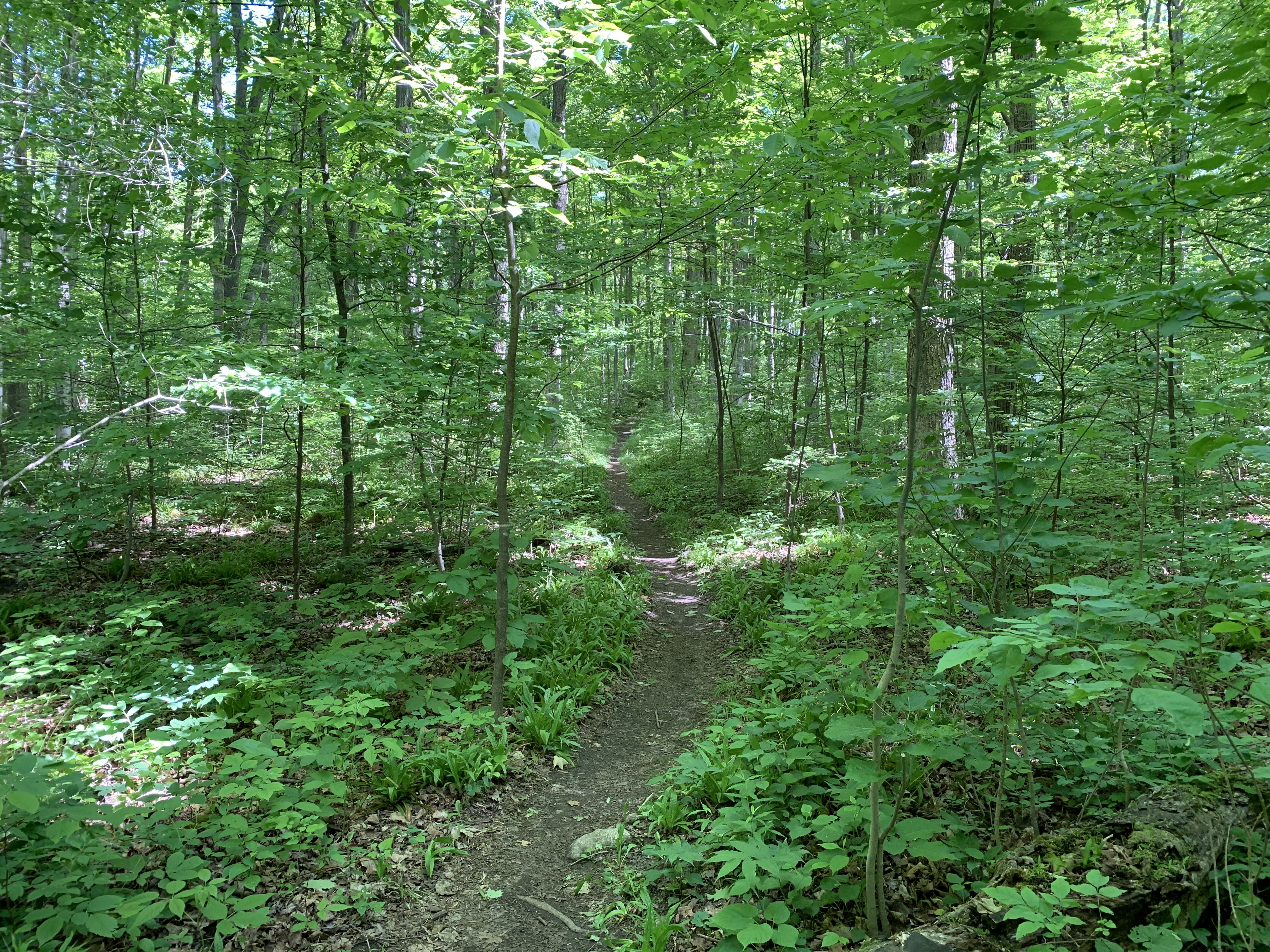
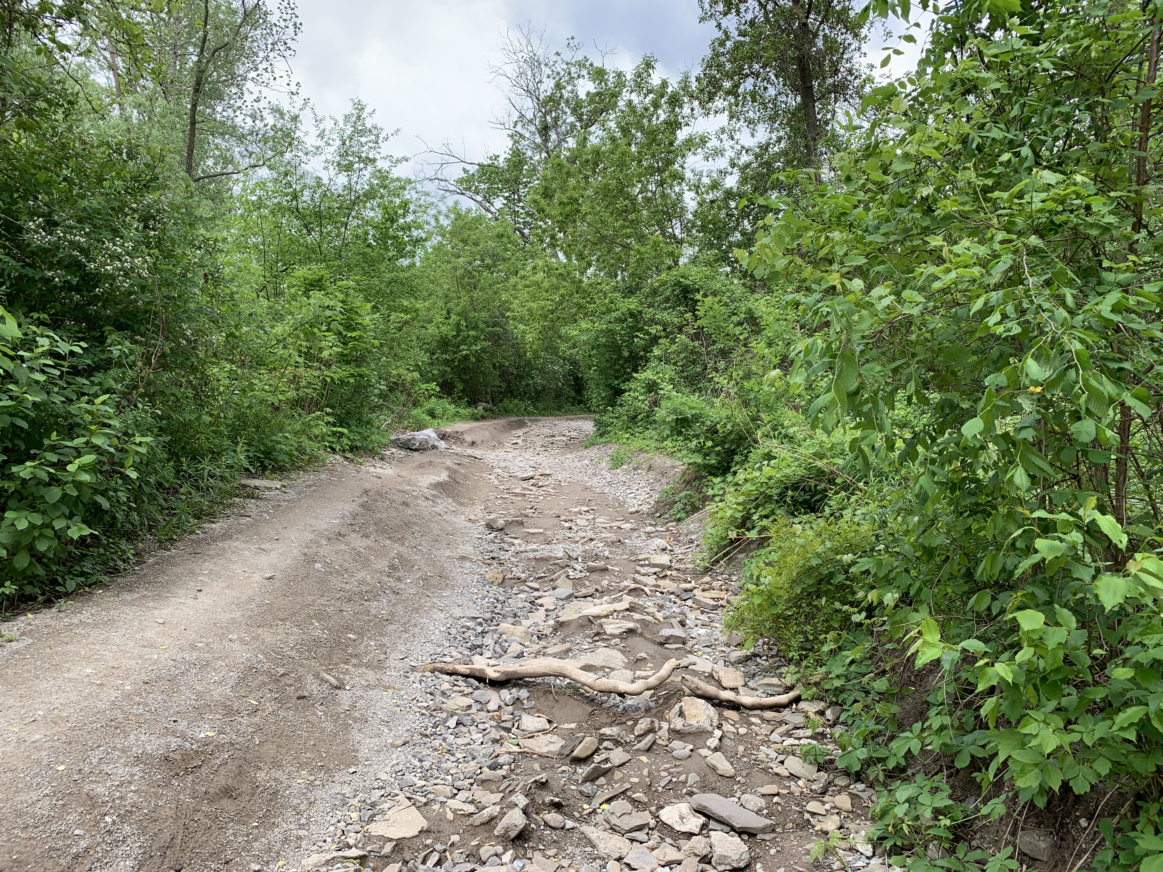
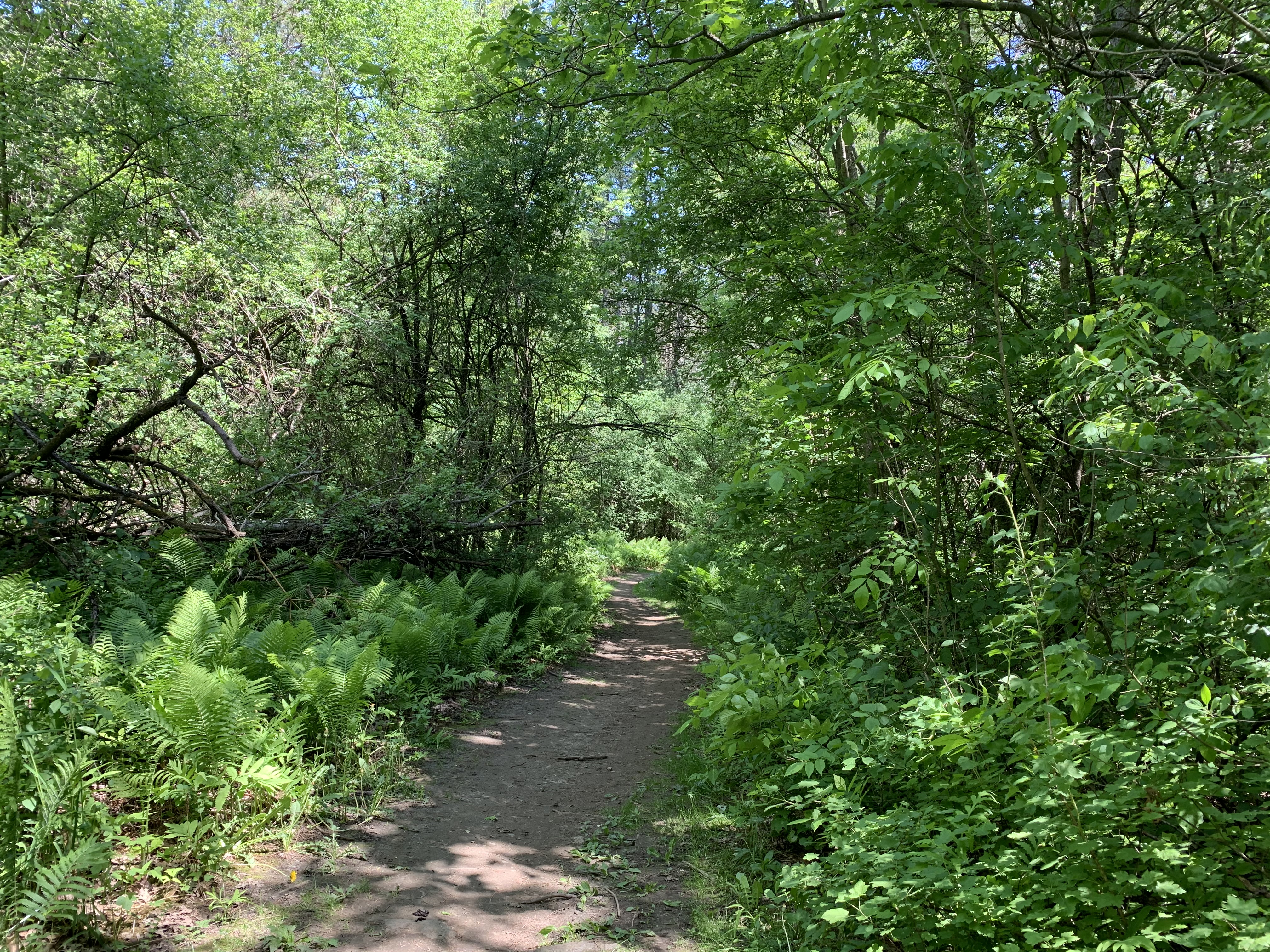
Uxbridge is known as the trails capital of Canada because of the 220 kilometres of trails that they manage near the community.  Of particular interest on this gorgeous Saturday morning was Walker Woods.  To explore we chose to park in the Glen Major Forest parking lot on 6th Concession so that we could do a brief exploration there and then follow the trail system north to Walker Woods.  The trails in the forest are fairly well marked with numbered posts that each have a map on top.  If you are following a specific route beware of side trails that are not marked as they will lead you astray.

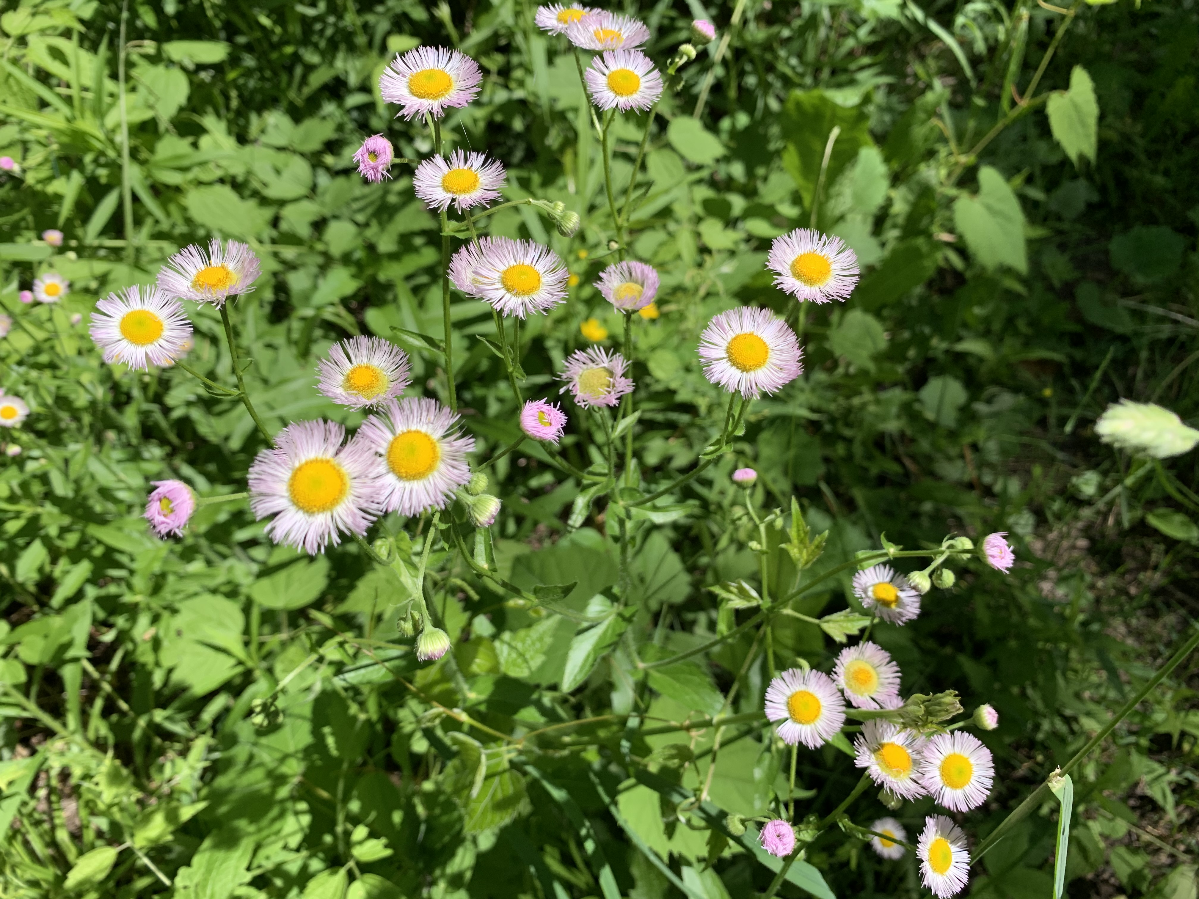
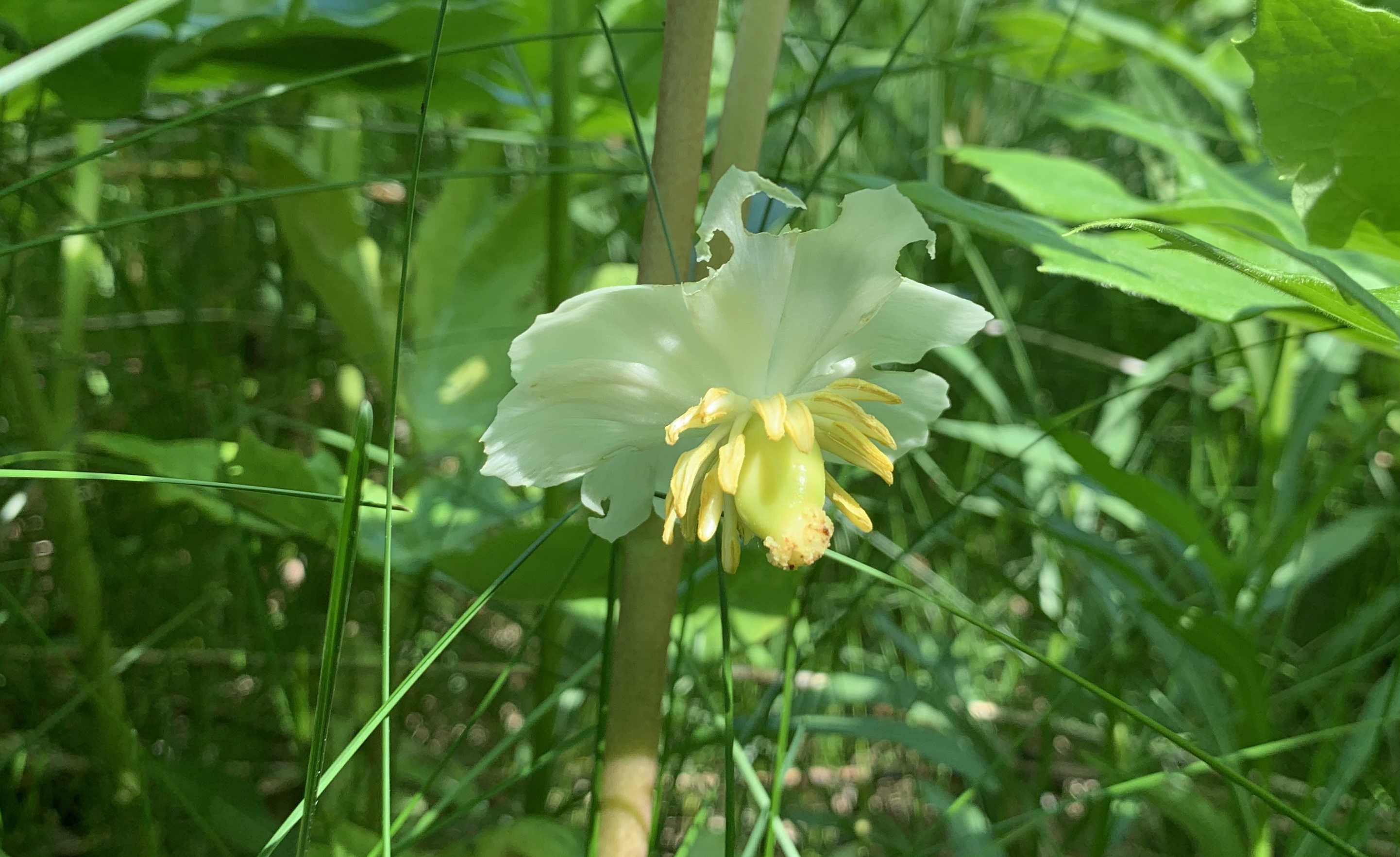
Throughout Glen Major Forest there are extensive patches of Mayapples.  It appears that many of the flowers either failed to open or were never pollinated because they have shriveled up.  There are a few plants that have their single flower in full bloom.

IMG_3326

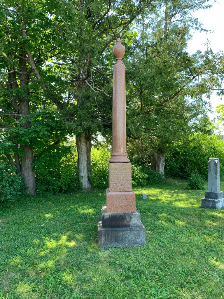
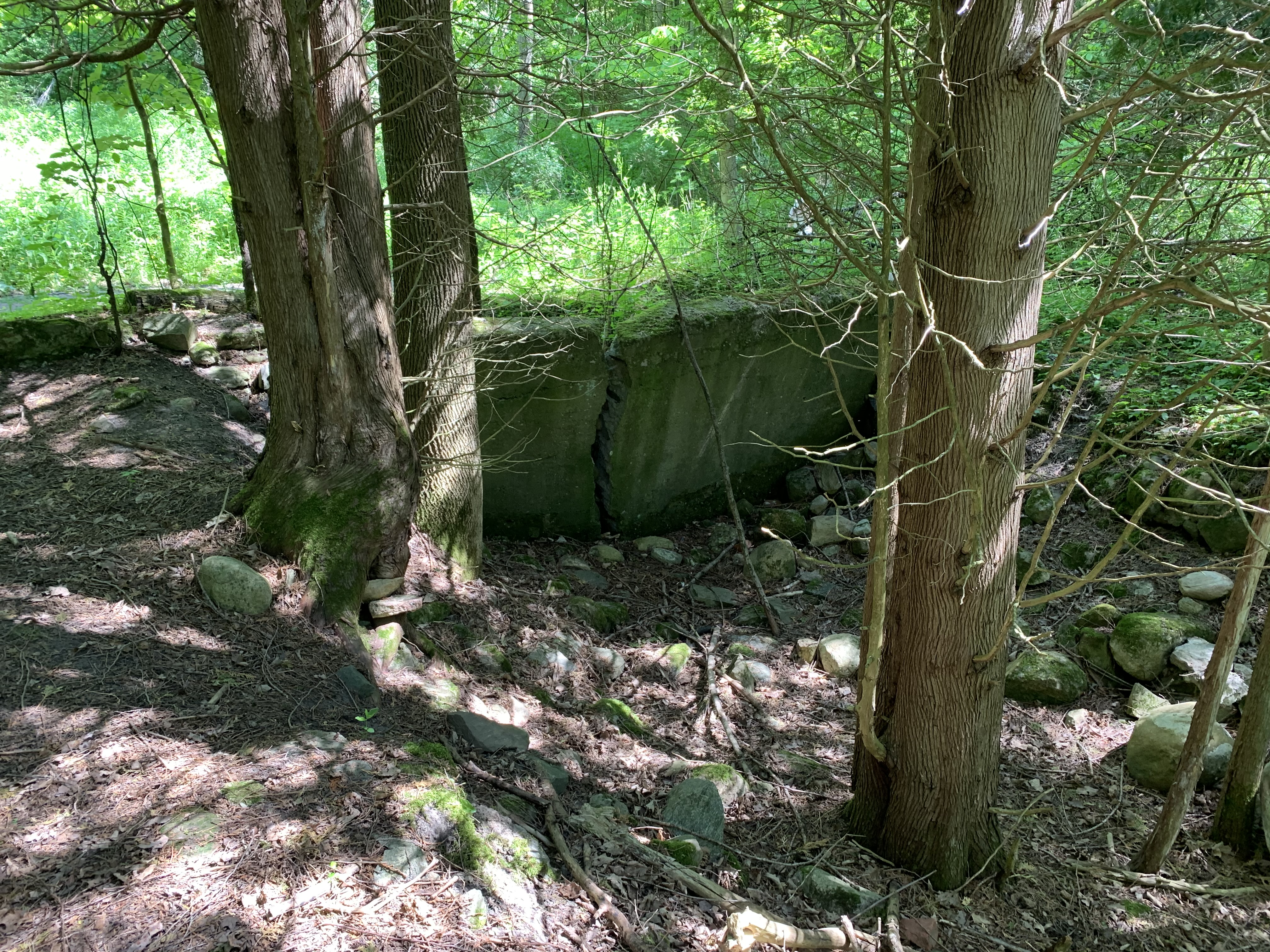
George Hopkins lived from 1818-1905 and in 1850 purchased 50 acres of land on Concession 6 in what is now Glen Major Forest.  He cleared most of the land and began growing potatoes, turnips, peas, carrots, wheat and oats.  He and his wife Margaret had nine children which they raised on the farm along with a variety of farm animals.  Only foundations remain of their buildings.

IMG_3316 (2)

We then started to follow the trails north toward Walker Woods.  The whole area had been open farmland at the turn of the twentieth century.  Thin soil and poor farming practices had left much of it underutilized.  James Walker was a Toronto lawyer who came to the area to ski in the 1930’s and took an interest in the abandoned farms in the area.  He bought his first four acres on the 6th concession in 1934 for $350.00.  When Walker returned home after the Second World War he started buying more properties in the area, eventually amassing 15 of them and 1,800 acres of land.  He then began the process of planting forests on the property to help curb the erosion that was taking place.

IMG_3342 (1)

Red Columbine are highly toxic if eaten and it is even recommended that you handle them with gloves.  The flower shape gives it the nick name Rock Bells.  They are also known as Canada Columbine or Aquilegia Canadensis.

IMG_3352

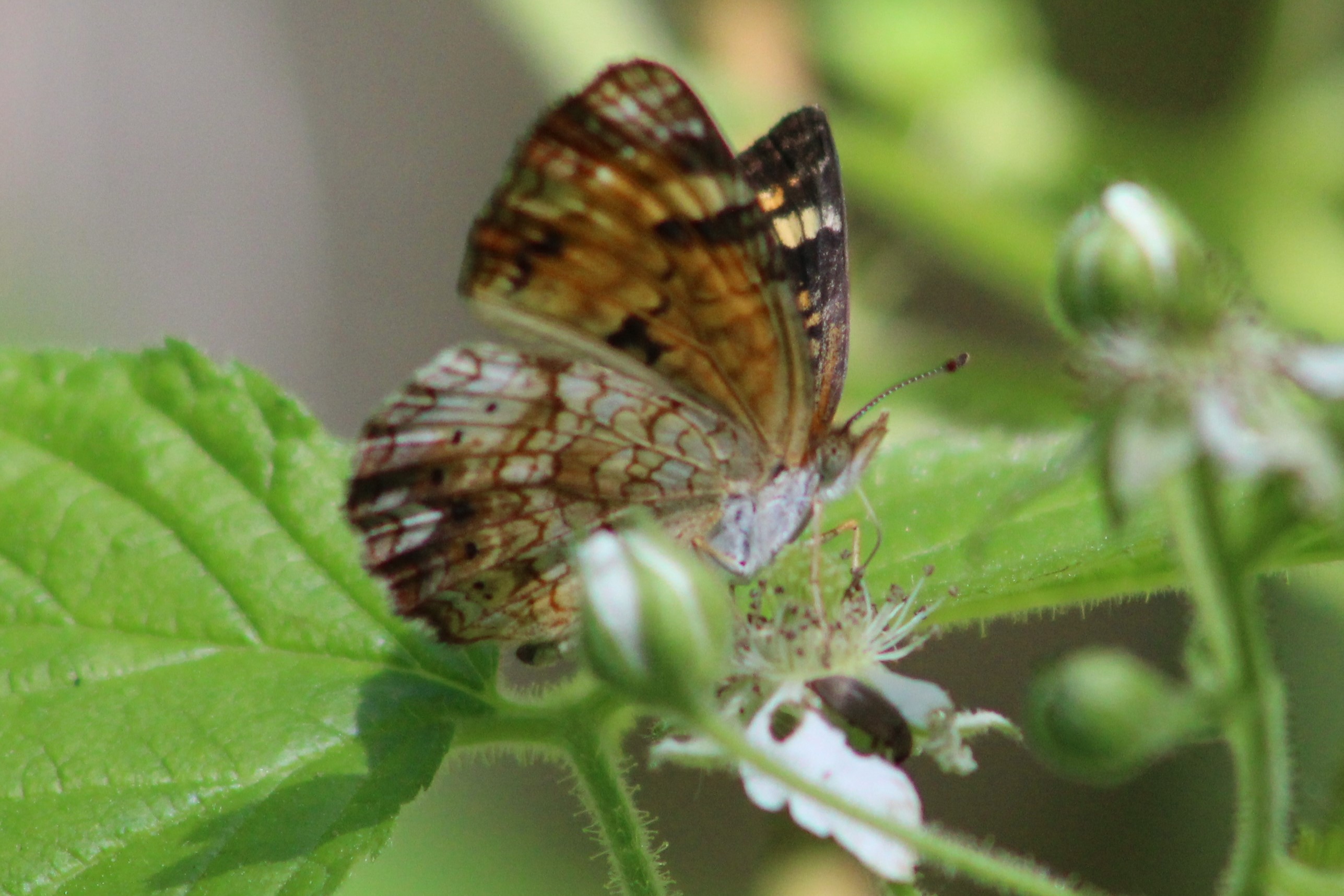
The bell shaped tubes, or spurs, are connected at the bottom and contain a sweet nectar that attracts hummingbirds, bees and hawk moths.

IMG_3362

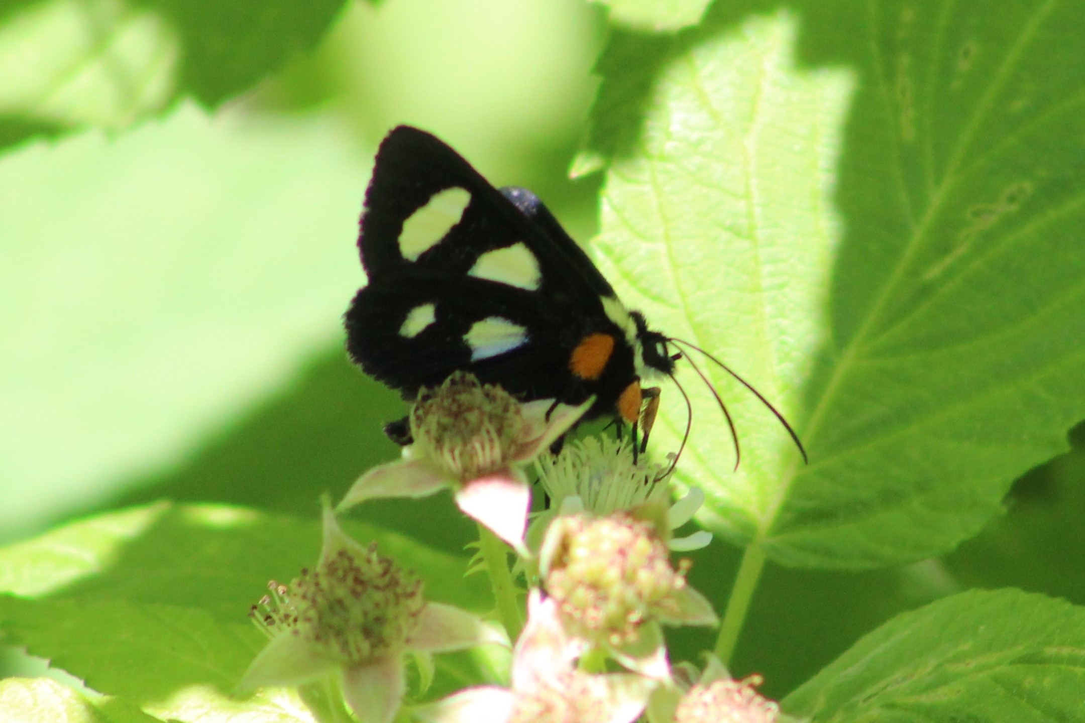
Hawk Moths are a family that includes 1,450 species that can be found all around the world.  They are known for their rapid flying abilities which includes hovering.  This makes them perfectly adapted for getting at the nectar in Red Columbine flowers.

IMG_3337

Seeing a Canadian Flag hanging above the trail inspires a sense of patriotism even though anything else would be considered to be litter and make me upset.  It is interesting how a piece of cloth with this specific pattern can provoke pride in the country we live in.  For more on the design of our flag please see our National Flag Day post.

IMG_3345 (1)

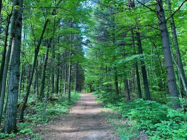
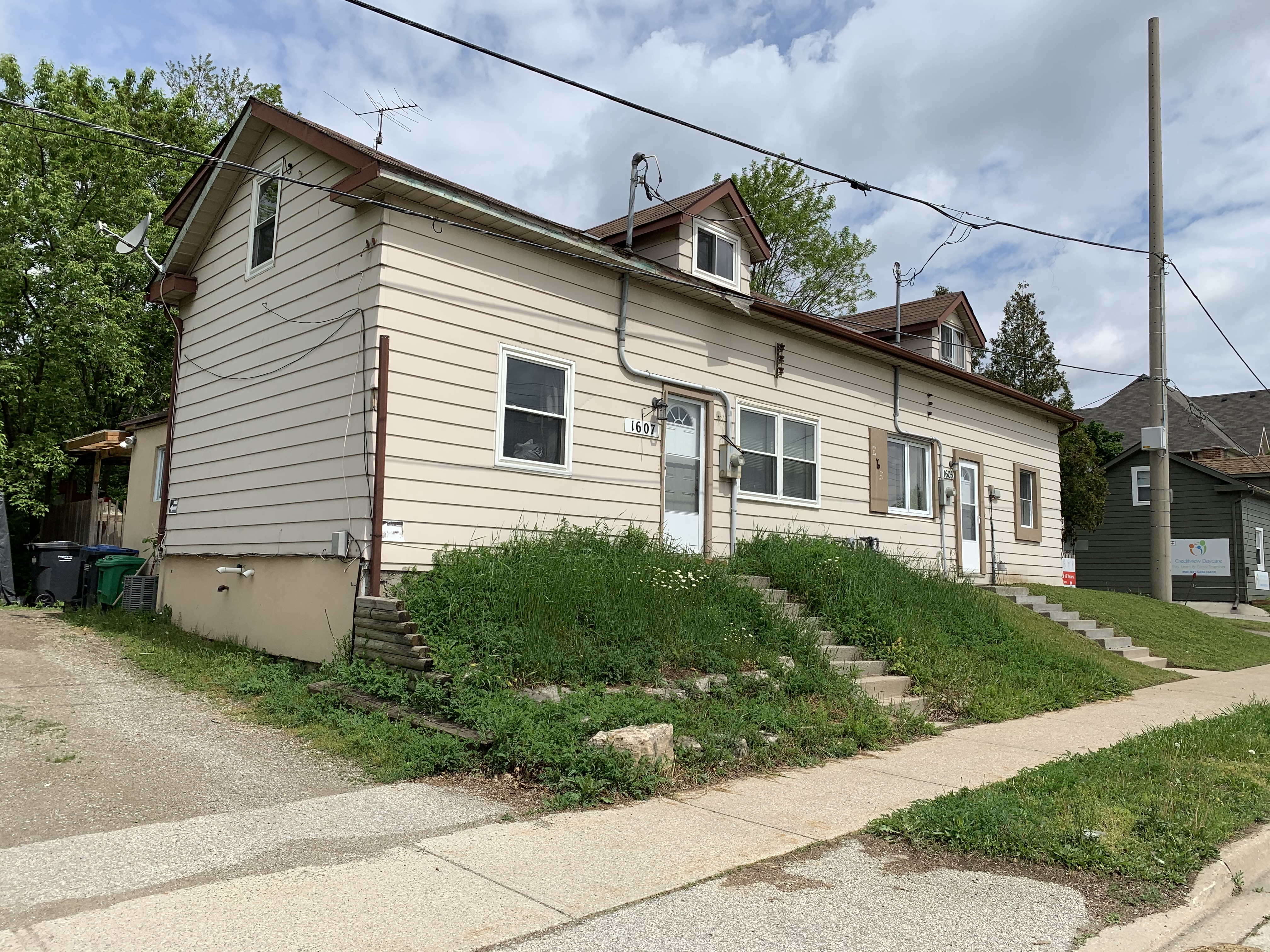
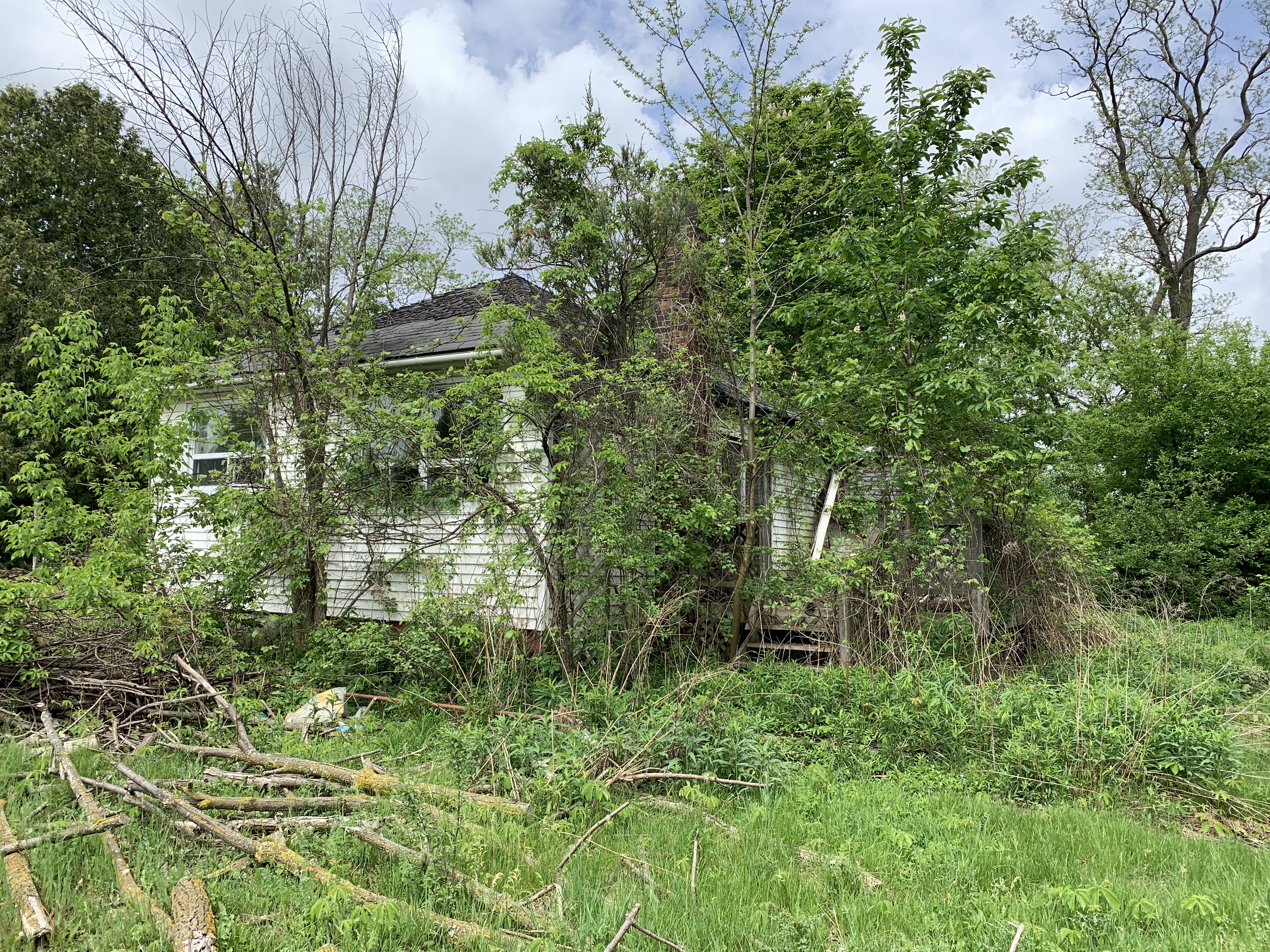
James Walker turned his properties into a forest by planting over 2,500,000 trees eventually starting a nursery and planting over 300,000 of his own saplings.  He planted both Scotch and Red Pine as well as Maple, Beech, Black Walnut and Oak trees.  Many parts of the trails make their way through straight rows of trees and follow old logging roads.  Eventually the forest was mature enough that James started to make a profit out of it,  He started selling Christmas Trees, fire wood, hardwood boards, cord wood and pulp wood.  He build several structures for his venture that still remain in the forest including the drying shed where wood was left to dry.

IMG_3380

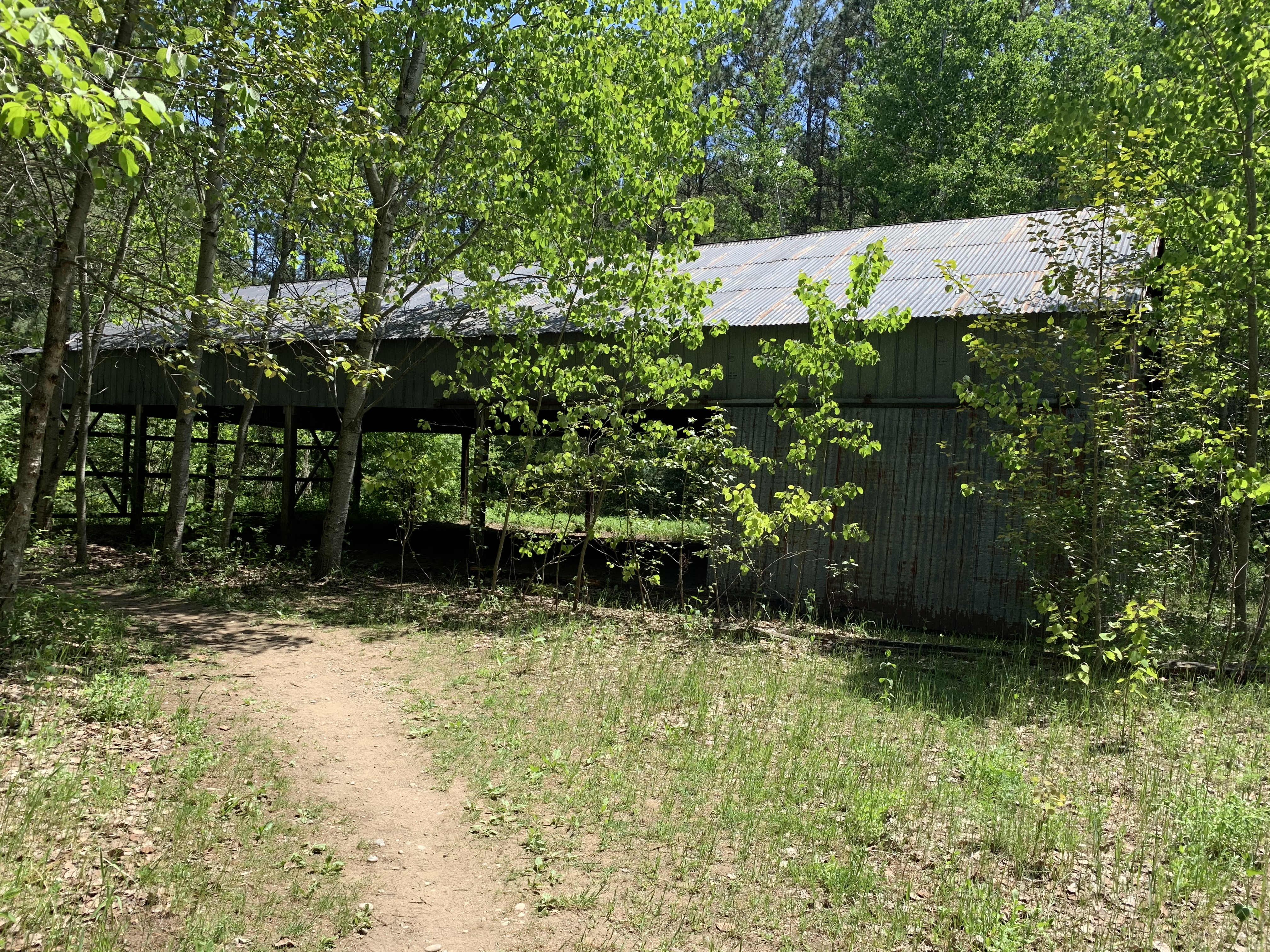
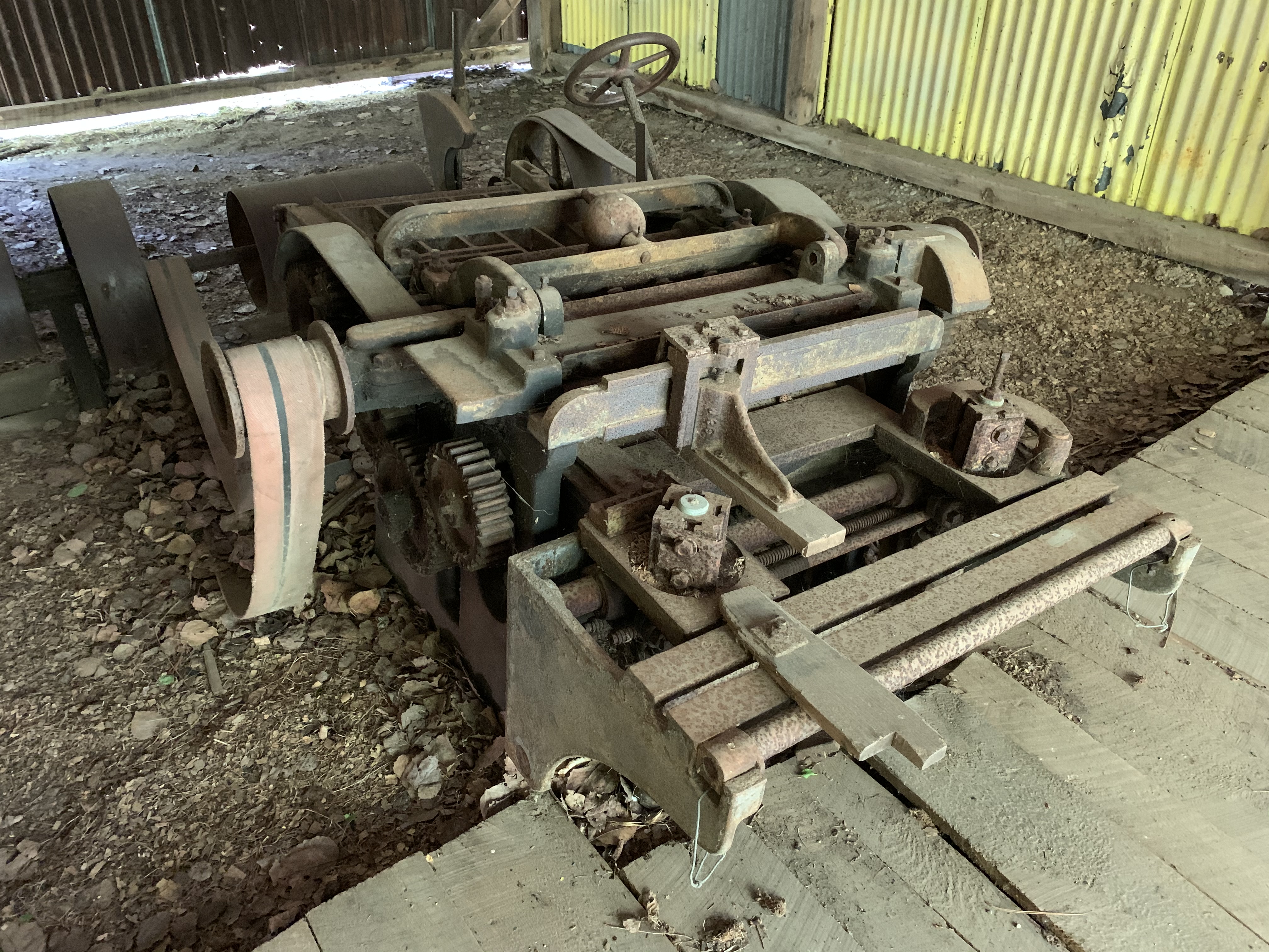
Walker created some of his own equipment including an early home made version of a log-splitter.  Inside the old drying shed is a single piece of equipment.  Belts ran on both sides of the device which may have been used for finishing boards.

IMG_3379

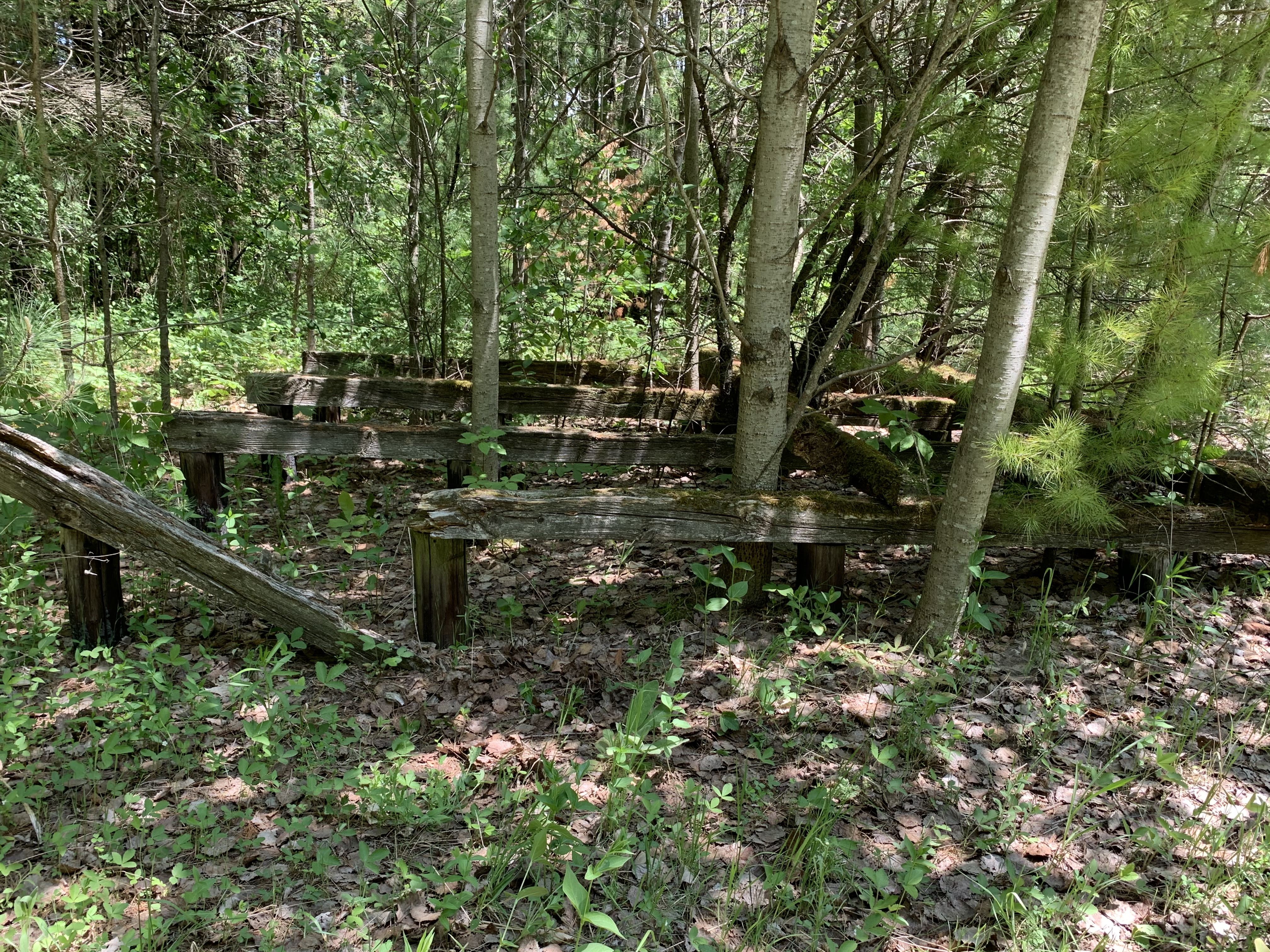
Outside the drying shed there are four cribs that were set up for drying wood on.  These  have been out of service for so long that new trees are growing up out of the middle of them.

IMG_3382

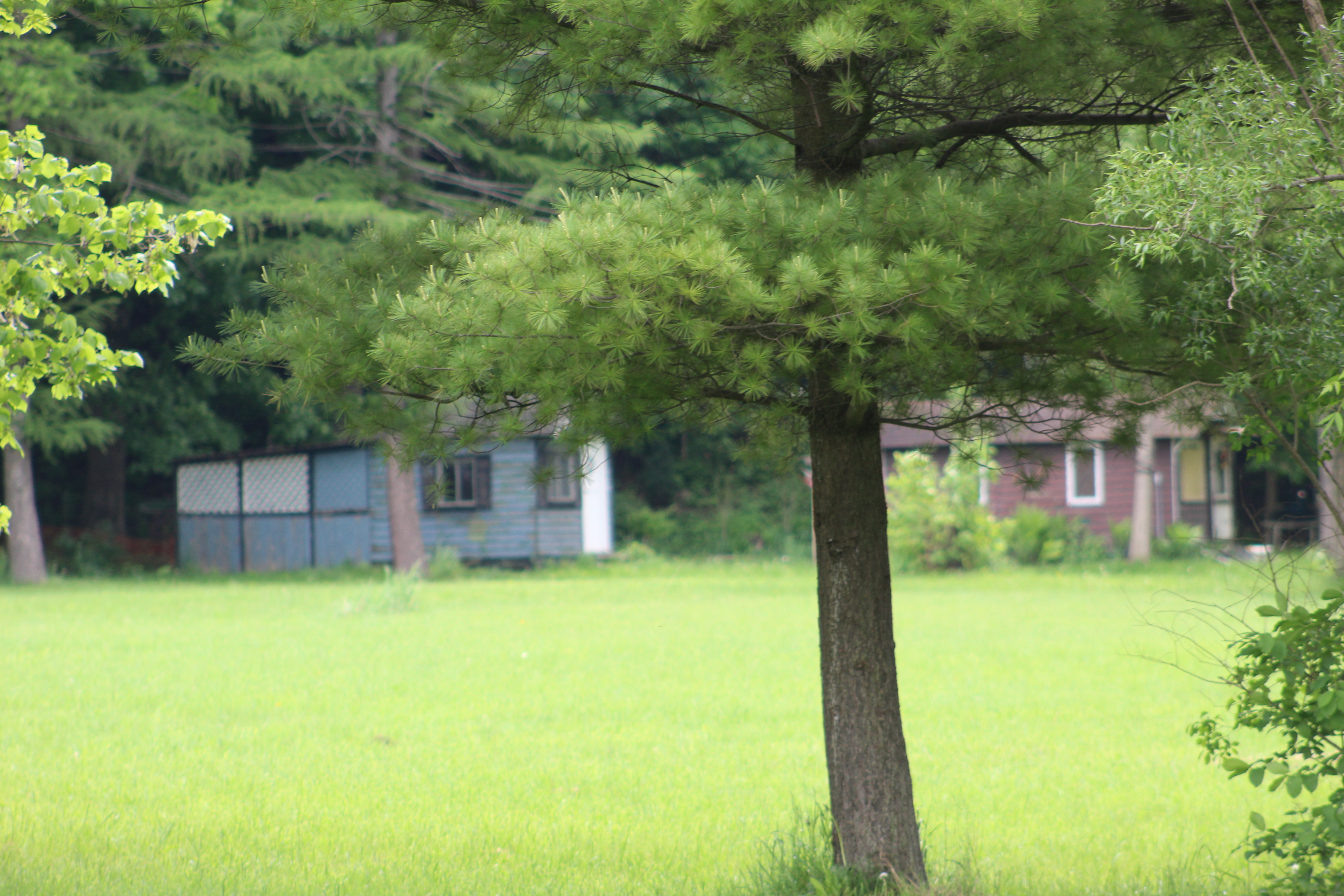
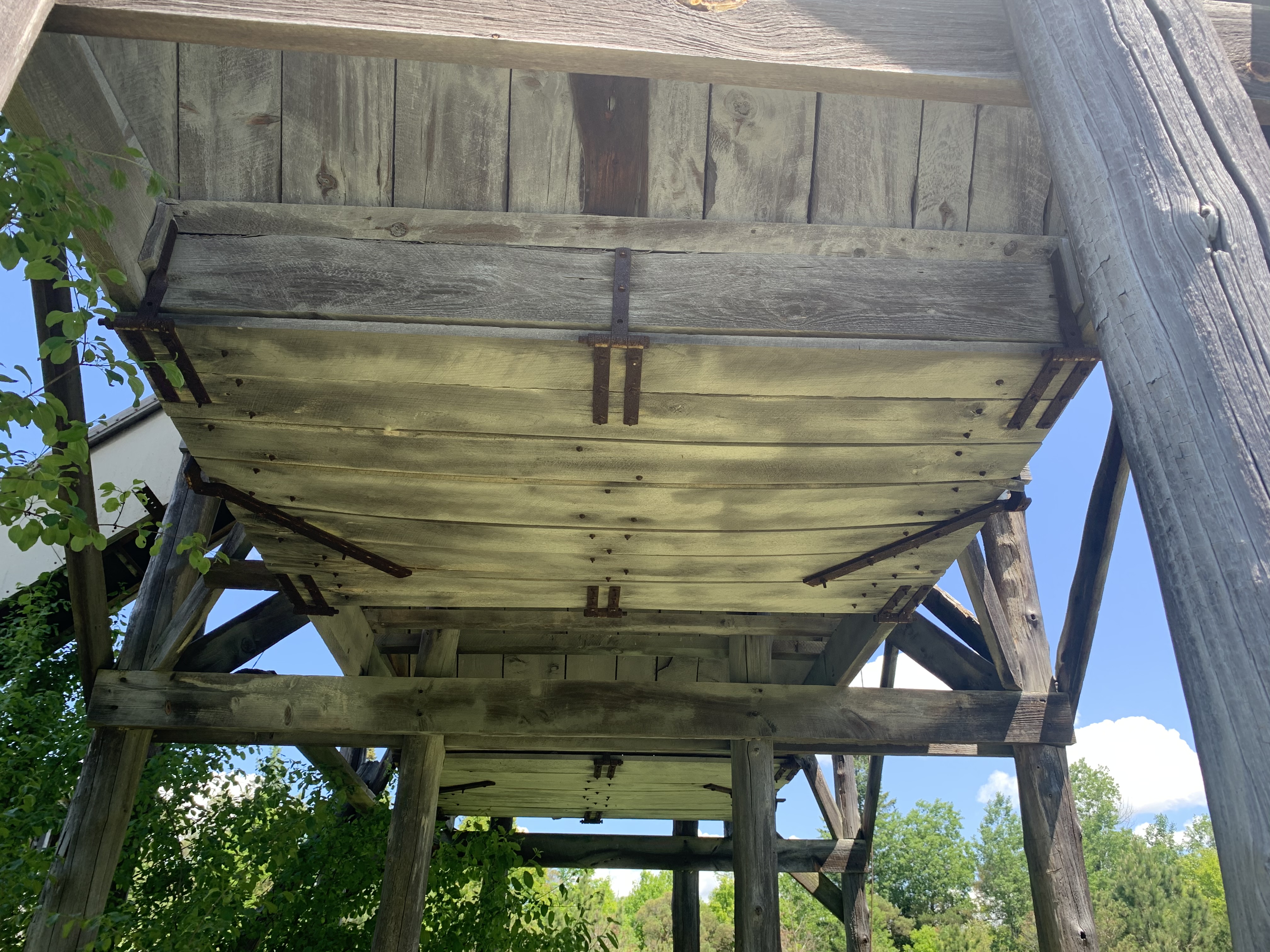
He had his own saw mill to cut the wood and it still stands a short distance away from the drying shed.  Several other of Walkers buildings are in use by the Toronto Region Conservation Authority as equipment sheds and they stand just off the trail on a bit of property that is off limits to the public.  The mill is interesting because it has a structure at the rear that resembles a grain elevator.  It contains two bays that were fed by a single conveyor belt.

IMG_3403

The elevator was likely used in the pulp wood side of the business.  Trap doors on the bottom of each bay could be opened to allow the pulp wood to be dumped into trucks or trailers.

IMG_3410

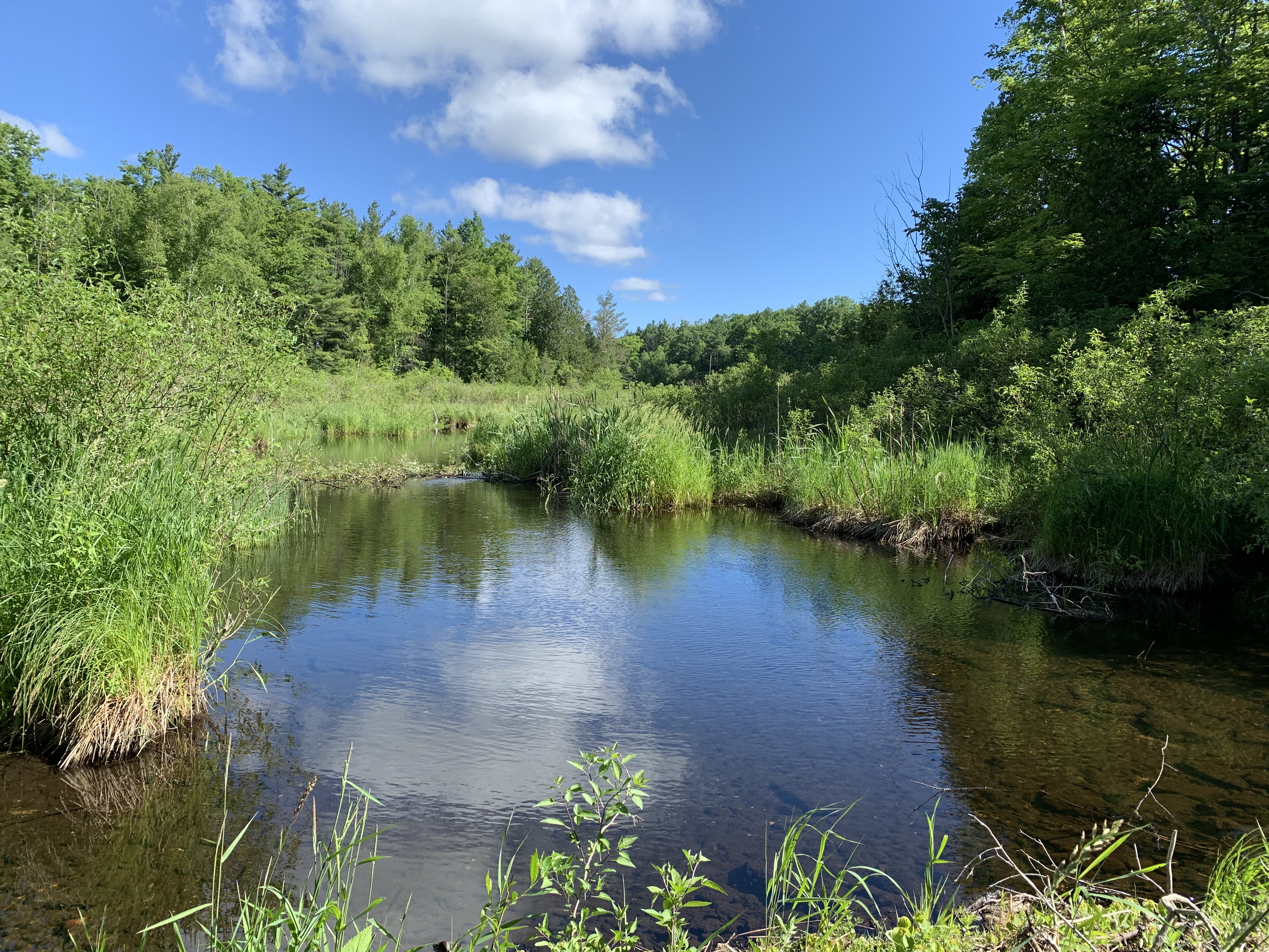
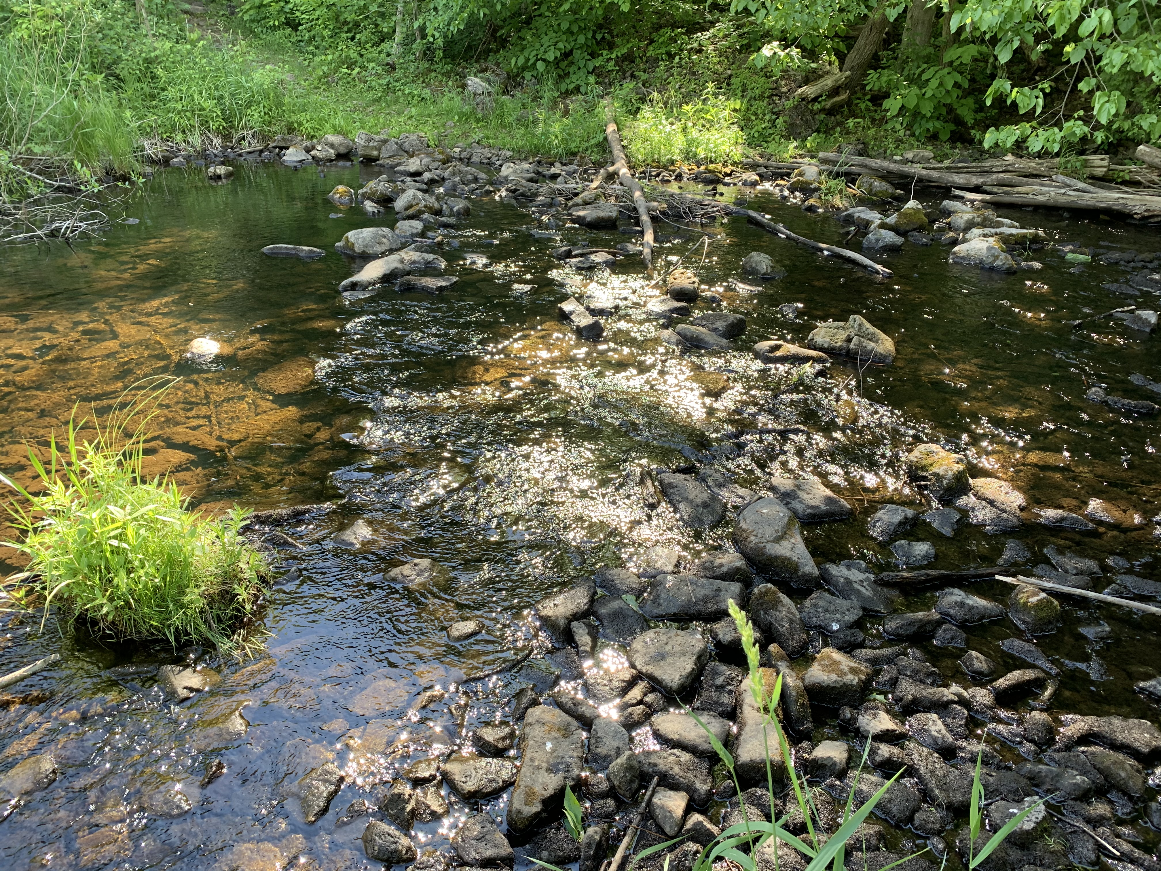
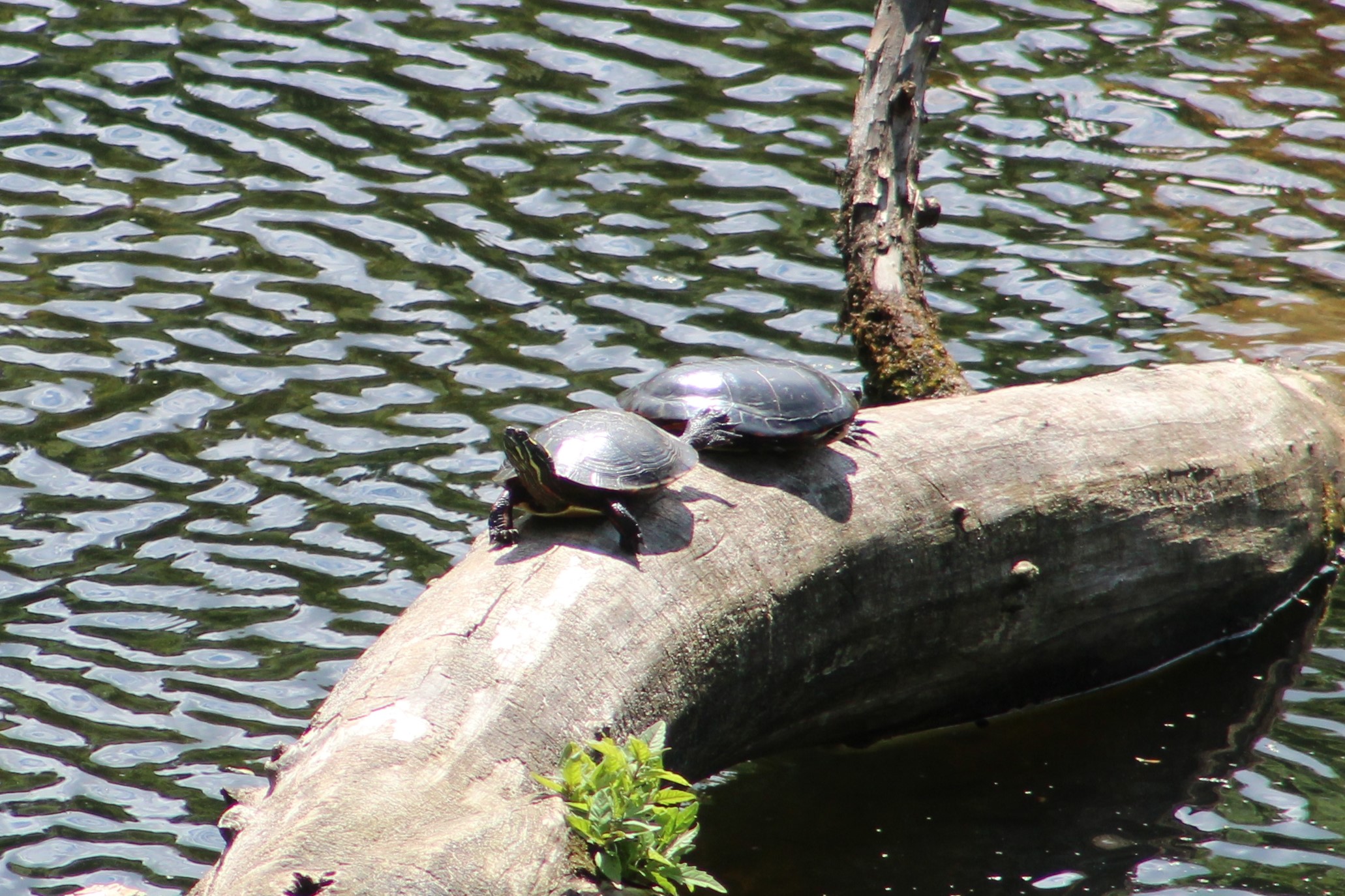
We returned to the drying shed and followed the trail west because we had decided to make our way back to the parking lot using the road.  Along the way there are several wetlands and ponds and we saw these two painted turtles sunning themselves on a log.

IMG_0186

Walker Woods and Glen Major Forest contain many trails, including some on the west side of Concession 6, which means that there is a lot more to explore on some future visit.

Here’s a link to the trail guide for all the local trails near Uxbridge.

Google Maps Link: Walker Woods

Like us at http://www.facebook.com/hikingthegta

Follow us at http://www.hikingthegta.com

\Also look for us on Instagram

Koliba Park

Saturday, May 30, 2020

There is an interesting enclave in Mississauga in the area of Barbertown and Streetsville.  In 1945 three Slovakian farmers were returning to Canada after serving in World War 2 and together they purchased 10 acres of land just north of Eglinton Avenue.  The little park they established was given the nick named “Midgetville”.  There is no parking close by and so we parked some distance down river and made our way north toward the site.  The trail along the river has become quite naturalized through the section known as Hewick’s Meadows.

IMG_3133 (1)

Heavy rains have caused the Credit River to flood its banks and divert a large flow of water onto the walking trail.  This has led to some major erosion of the path.

IMG_3146

On the north side of Eglinton Avenue you join Barbertown Road to make your way toward Koliba Park.  Barbertown Road used to contain many houses built for the people who worked in the various mills in Barbertown.  Most of these old workers cottages have been replaced with modern homes but there are still a couple remaining from the mid-1800’s.  The picture below shows a typical duplex of the era, although it has been covered up with siding.

IMG_3175

A little farther along Barbertown Road you will find another small abandoned home that housed a single family. Likely a new home will fill this site in the near future.

IMG_3171

Koliba is a Slovak word that means “Shepherd’s Hut” and it suits the small cottages that were built in the valley at the bottom of Barbertown Road.  Over the years most of the 10 acres of the original property was sold of and has been developed but the small park with its cottages and playgrounds has been retained.  It hosts several Slovak events each year as well as being rented out by Slovakian churches for their services in the summer months.  Due to the fact that the site is isolated there has been a number of cases of vandalism over the years and so the gates are kept locked.  We were forced to take our pictures through the fencing.

IMG_0129

Under normal circumstances the park hosts an opening weekend banquet on the first Saturday in May but that was cancelled this year due to the pandemic.  The Slovak Canada Day picnic that normally happens at the end of June will likely not happen either.  Instead of the park being filled with weekend campers the swing sets sit idle this year.

IMG_0134

The Barbertown bridge was originally built to bring the mill workers from the houses on Barbertown Road to the mills that still line the east side of the river as it flows though Streetsville.  More information on the mills can be found in our post on Barbertown.  We decided to stay on the west side of the Credit River to see if we could make our way upstream to the Streetsville Dam.

IMG_0128

Oyster Mushrooms are one of the most commonly harvested wild mushrooms in Ontario.  During the First World War the Germans began to cultivate Oyster Mushrooms for food and today they are commonly cultivated around the world.

IMG_0096

As we made our way along the river bank we disturbed a family of Canada Geese with their five goslings.   The jumped in the water and began to cross the river with the two adults keeping the little ones safe between them.

IMG_0144

Along the side of the river we found a dead Sea Lamprey.  Their mouth is as large or larger than the head and has no jaw.  The circular rows of teeth and suction cup mouth allow it to attach itself to fish where it slowly kills the fish by draining its blood.  Lampreys spawn in fresh water after which the adults die.  The larvae burrow in the silt at the bottom of the river and live in fresh water for several years.  They then undergo a metamorphosis that allows them to switch to salt water and they migrate to the sea.  A year and a half later they return to the fresh water rivers to span and die.

IMG_3205

The view inside the Lampreys mouth is like something out of an old horror movie.

IMG_3202

A pair of Turkey Vultures were circling above the river.  Perhaps one of them will eat the remains of the Lamprey.

IMG_0151

We reached a point where the river flows beside a steep embankment where we were forced to turn back.  It might be interesting to return to Koliba Park when they are participating in Doors Open Mississauga so that we can get a look inside the buildings.

Google Maps Link: Koliba Park

Like as at http://www.facebook.com/hikingthegta

Follow us at http://www.hikingthegta.com

Look for us on Instagram