August 20, 2016
In 1998 the Hamilton Conservation Authority (HCA) was called to a construction site to examine a hole in the ground. They discovered a geological feature known as a karst cave. The Toronto Caving Group was called in to examine the cave and they identified a whole series of sinklholes, dry valleys, underground streams and springs.
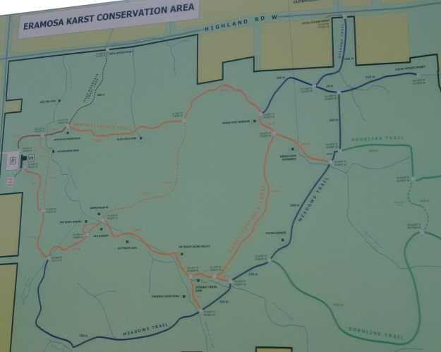
Ben Vanderberg founded the HCA in 1966 shortly after joining the Spencer Creek Conservation Authority. Ben recognized the significance of the area and started working toward acquiring the property for preservation. Vanderberg retired from the HCA in 2002 and MPP Brad Clark gave him a gift he really wanted at his retirement party. He announced that the Ontario Government would transfer ownership for 180.5 acres of Eromasa Karst lands to the HCA. The karst was designated as an Area of Natural and Scientific Interest (ANSI). The map below shows the trail system that has been put in place to allow the general public to locate the various karst features in the park.
Animals create carbon dioxide when they exhale and machines emit it into the air. When rainwater picks up this carbon dioxide it becomes a weak form of carbonic acid. Decaying plant matter also puts into the soil where it can attach to the water molecule. This carbonic acid can slowly dissolve the carbon based bedrock of the escarpment creating features known as karren. These little pockets and grooves make places for the carbonic acid to sit and eat away over time. This creates sinkholes, underground streams, caves and springs.
The Nexus Cave is 335 meters long, making it the 10th longest cave in Ontario. It begins where the Nexus Creek drops through a sinkhole into the underground cave. The picture below shows Phoenix Creek dropping into it’s sinkhole. Nexus Creek goes underground in a similar fashion.
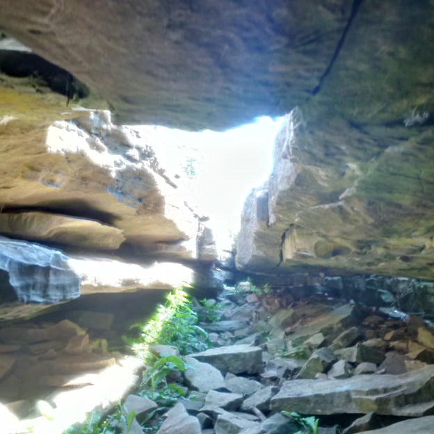
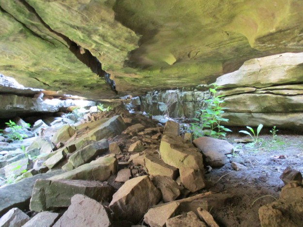
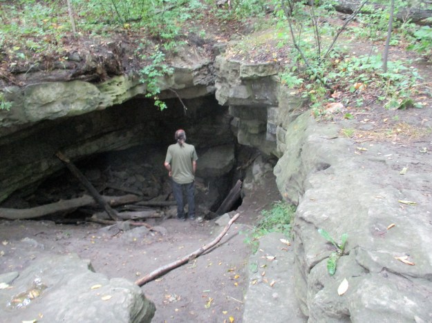
The entrance to Nexus Cave is seen in the picture below. The harder dolomite on the surface has been cut through in several long cracks. This is the capstone for the Niagara Escarpment and is known as the Lockport Formation. This dolostone is made of magnesium carbonate and is harder than the calcium carbonate shale just below it. This shale is known as Rochester Shale.
The entrance to the cave is not very tall but it is possible to see the gap that has been created between these two layers of stone. The cover photo shows the entrance to this cave looking out from the inside. This cave is considered to be the most accessible dolostone cave in Ontario.
Walking farther along the orange trail will bring you to the Nexus Window. A karst window is a place where the roof of a cave has collapsed allowing access into the cave. Quite often it is possible to look in through a karst window and see the underground stream flowing across the floor of the cave. This summer has been too dry and there is no water flowing through the cave today.
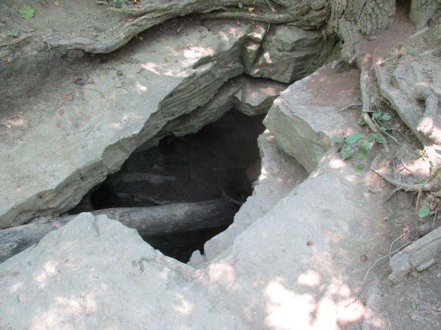
When it is dry it is possible to get a look down inside where the water has cut a passage through the limestone.
Stewart Creek has a sinkhole as well. Scientists injected biodegradable dyes into the streams above the various sinkholes in the park so that they could monitor down stream to see which spring was the output of each underground stream.
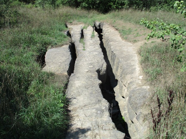
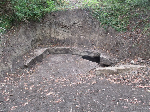
The Pottruff Blind Valley is an example of place where a creek no longer flows above ground. This ravine was cut through the escarpment by water at the end of the last ice age. Since then the carbonic acid in the water has dissolved a hole where the water disappears into an underground channel. The ravine still bears the original sink hole but the water now goes below ground farther upstream at the Phoenix Creek and Stewart Creek sinkholes. Water only reaches here when the flow is too great for the previous sink holes to handle.
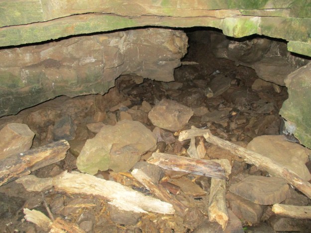
Pottruff Cave very likely started off like the Nexus Cave entrance. A series of deep fissures in the dolostone over a sink hole eventually collapsed leaving the cave mouth open. The entrance to Nexus Cave, like all the karst features, is still growing as the stone continues to dissolve. Nexus too will eventually collapse leaving it looking more like Pottruff Cave. The state of decay for each of the karst features gives scientists a way of estimating their relative ages.
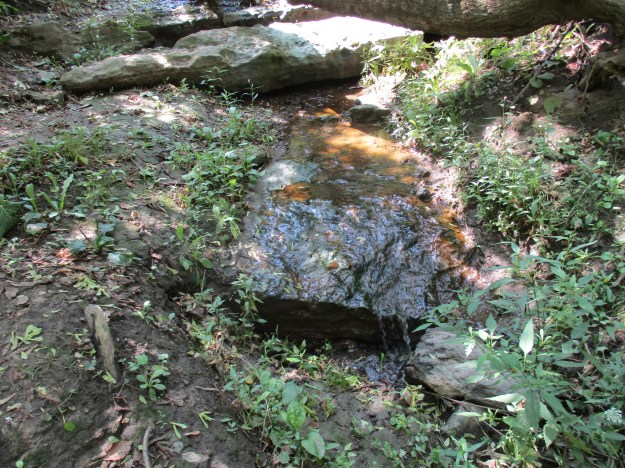
Pottruff Springs marks the location where the creek re-emerges from underground. The creek flows underground until it reaches the base of the Eramosa Escarpment which is a 3 meter slab of dolostone that sits on top of the Lockport Formation of the Niagara Escarpment. The pool of water forms here and continues as a stream on its way toward Lake Ontario.

Limestone is a prime construction material and the Niagara Escarpment provides good quality stone near the surface. When this part of the province was surveyed for settlement in the late 1790’s the land grants were generally 200 acres. These lots varied greatly in the nature of the land and not all of it was ideal for raising crops or livestock. The pioneers learned to take advantage of the resources their property offered and so limestone was quarried here. The original Pottruff homestead was built out of limestone blocks cut from this location.
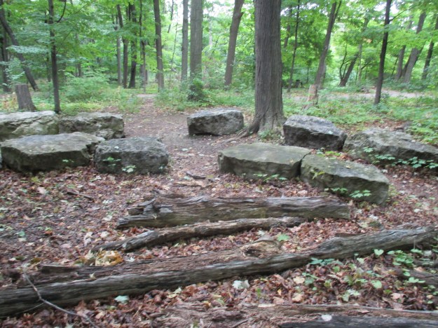
Near the old quarry is a grouping of limestone slabs that are laid out like the seats in an amphitheatre.
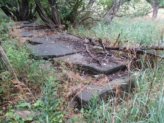
Near the old foundations for the Pottruff home there are the remains of a paved driveway.
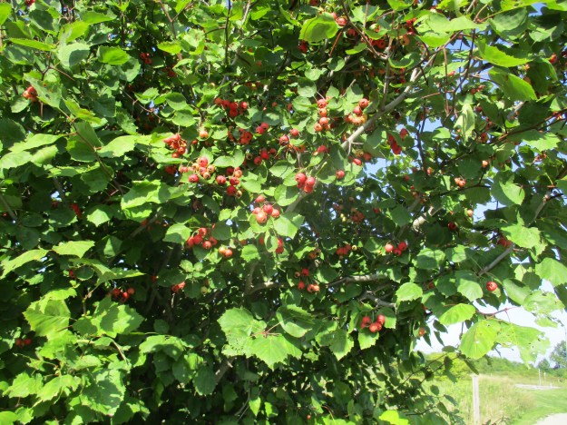
Some of the rose hips in the conservation area are still quite green but this bush is getting it’s prime conditions and is turning red already. Rose hips are the fruit of the rose plant that forms after successful pollination of the rose flowers. They have been used in many ways over the centuries and have one of the highest concentrations of vitamin C available. Fresh rose hips are a great source of vitamin C as they carry 25 times as much as citrus fruit. Dried rose hips can lose a great deal of their nutritional value.
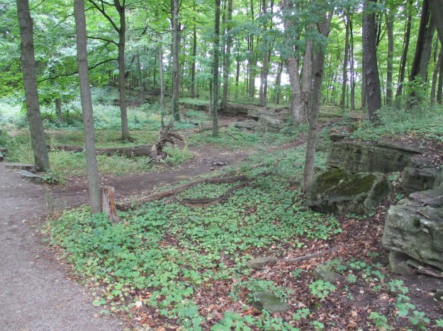
The trails at the Eramosa Karst are a little confusing and it is easy to get turned around because the orange trail has orange side trails on it. I suggest that before you leave the parking area you take a picture of the main map on your cell phone so you have a reference while on the trails.
Google Maps link: Eramosa Karst
Like us at http://www.facebook.com/hikingthegta
Follow us at http://www.hikingthegta.com

Pingback: Ball’s Falls | Hiking the GTA
Pingback: Fallbrook – Silver Creek Conservation Area | Hiking the GTA
Very interesting. Wish I was young again (40 instead of 69), I would do some hiking and exploring! Thank you for the pictures, beautiful!
Pingback: The Devil’s Cave | Hiking the GTA
Pingback: Felker’s Falls | Hiking the GTA
Pingback: Elora Gorge | Hiking the GTA
Pingback: Bruce Trail – Crawford Forestry Tract | Hiking the GTA
Pingback: Hole In The Wall | Hiking the GTA
Pingback: Britton Tract – Halton Region Forest | Hiking the GTA