Monthly Archives: August 2017

Road Trip – Camp Calydor and Marchmont Grist Mill

Sunday, August 27, 2017

People who live in the GTA and enjoy exploring our local history are often looking for excursions for when they’re away from home.  This road trip is for those headed up the 400 and Highway 11 with a destination in Gravenhurst and one just outside of Orillia. This post combines the WW2 Prisoner of War camp in Gravenhurst and the historic mill in Marchmont, starting with the former.

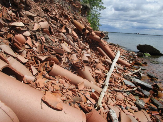
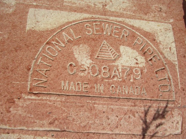
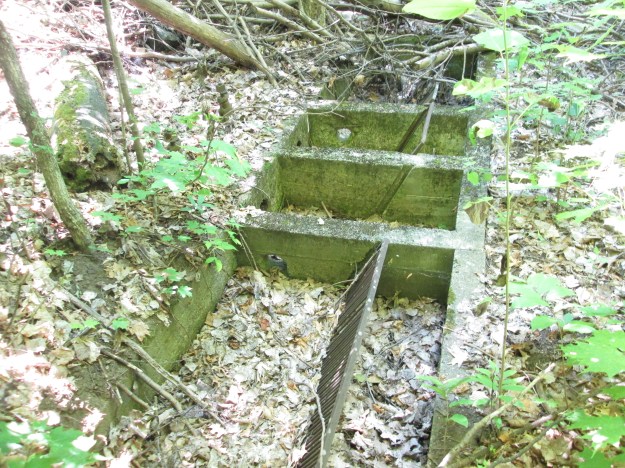
When the Germans began to bomb Britain the allies became concerned that the island might fall into Nazi hands.  If this were to happen thousands of POWs that were interred in England would be released and allowed to return to combat.  It was decided to move them to places such as Canada, for safe keeping.  An old tuberculosis hospital in Gravenhurst was selected as the home for Camp 20, also known as Camp Calydor.  June 30, 1940, was the opening day of the prison camp and there were 476 prisoners and 109 guards on hand to mark the occasion.  The picture below shows modifications made to the sewage system to prevent prisoners from being able to fit through the pipes.

IMG_7079

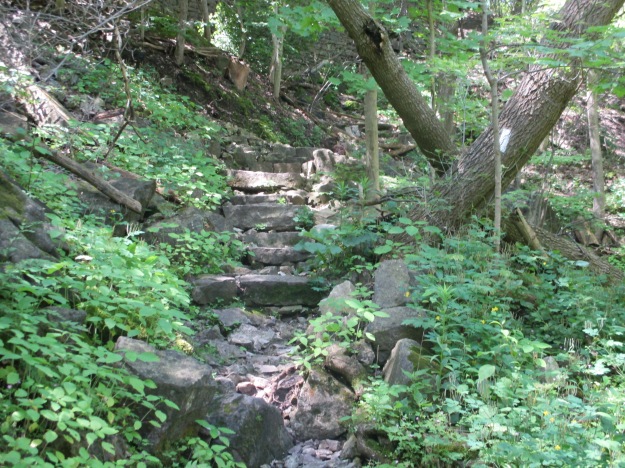
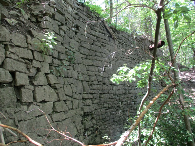
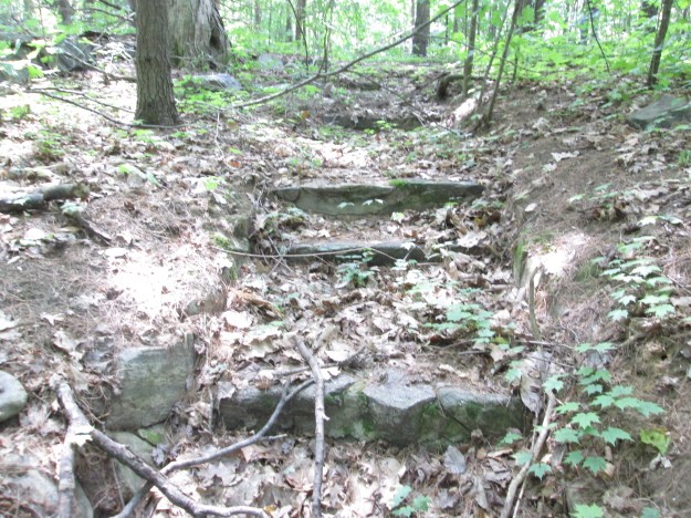
The camp was fenced in on all sides, including a fence that enclosed part of the lake so the inmates could swim in the summer.  When they arrived in town they were marched from the train station, down Lorne Street, and into the compound.  The sole entrance and exit for inmates was up this set of stairs.

IMG_7096

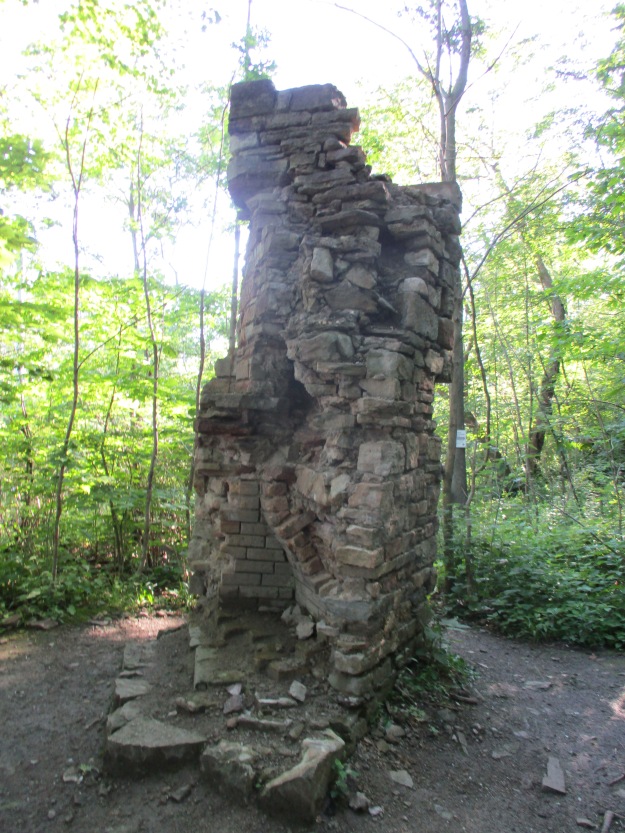
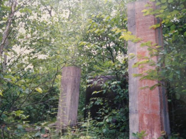
Most of the old concrete foundations have been removed in the name of progress so that a new subdivision can be created.  The picture below shows some of the foundations for the main building and a boiler as they existed in the late 1980’s.

Calydor8

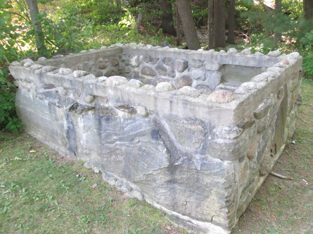
The POWs built an aquarium and stocked it with fish they caught in the lake.  This little reminder of the lives of the residents of Camp Calydor has been rescued and put on display in the little parkette at the end of Lorne Street.

IMG_7069

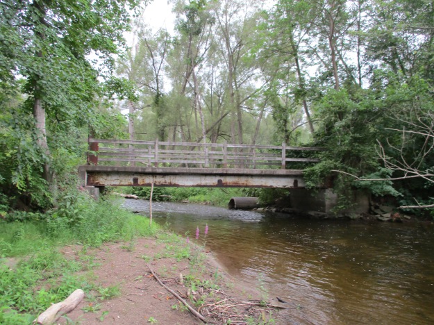
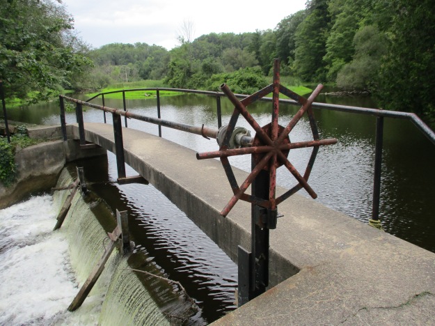
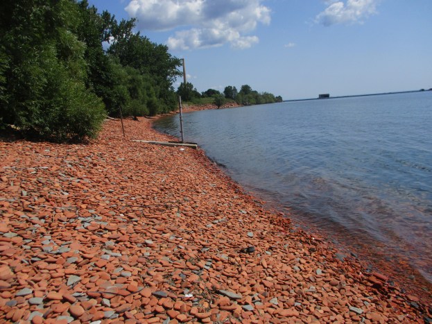
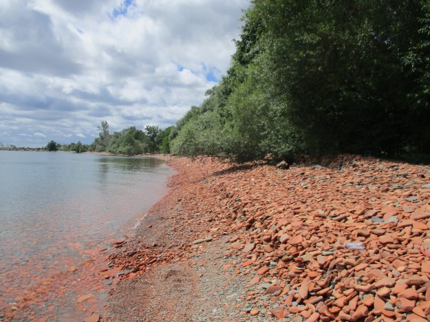
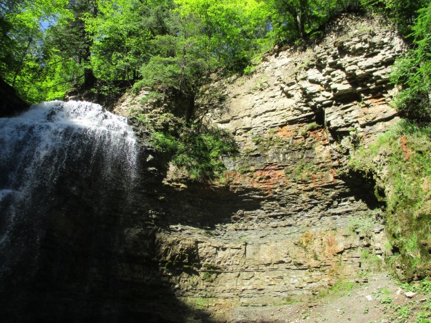
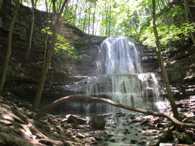
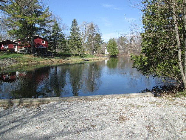
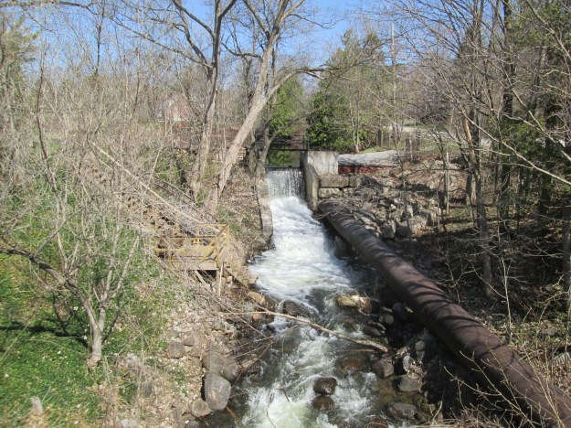
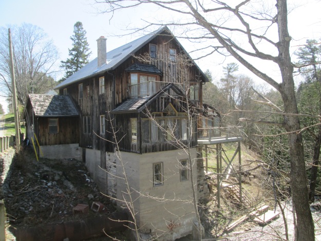
On either the northbound or southbound trip you may want to take a ten-minute detour to see the old mill in Marchmont.  Coldwater Road heading out of Orillia will lead you to the town of Marchmont.  The mill pond is still in place as is the old metal penstock that began to draw water from the pond in 1910 when it replaced the original wooden one. Since the mill is no longer in service the flume is no lo longer repaired and has several large holes rusted through it.

IMG_4055

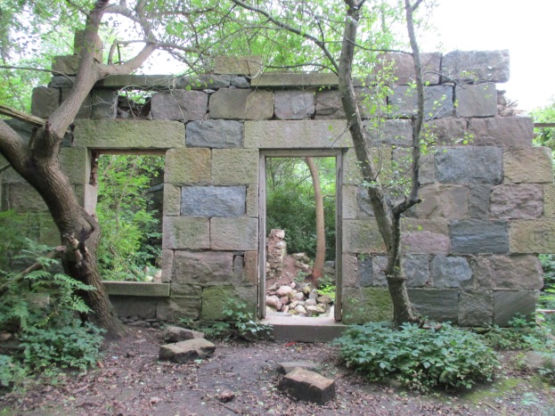
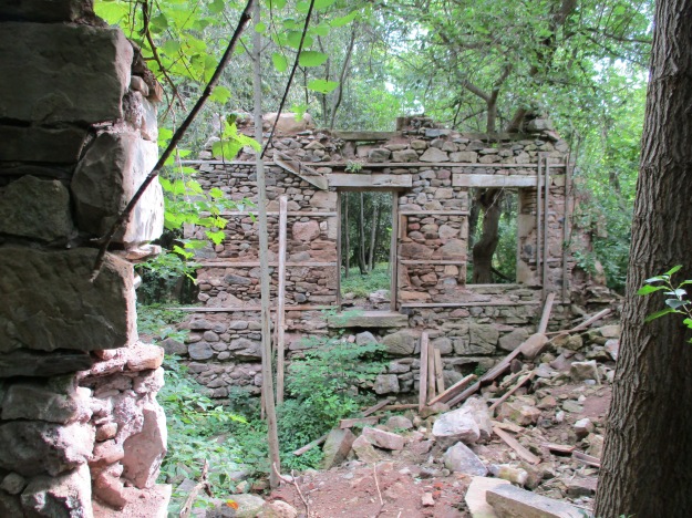
The grist mill in Marchmont was built in 1834 and was initially intended to provide work for local natives.  It operated until 1884 when it was destroyed by a fire.  The town went without a grist mill for three years until a new one was built in 1887.  For the next 60 years, it ground flour and then it was converted into a feed mill in 1947.  In 1987, for its 100th anniversary, it was closed and converted into a private residence.

IMG_4057

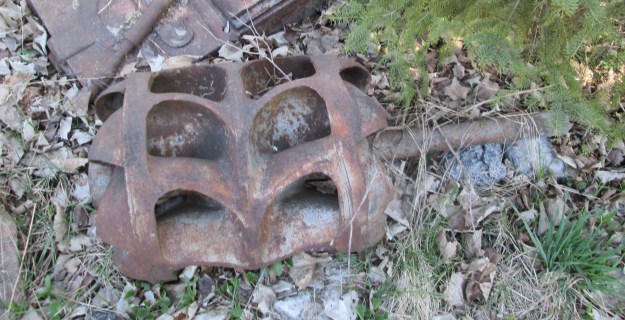
Parts of the old turbine are laying on the corner of the property.  The spiral casing is also nearby.

IMG_4070a

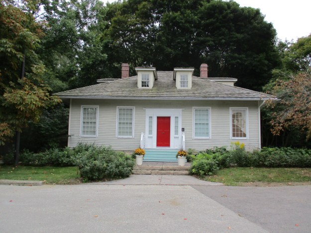
Marchmont has several historic buildings as it still retains much of the old Victorian era charm.  As for Gravenhurst, it has many stories left to tell.

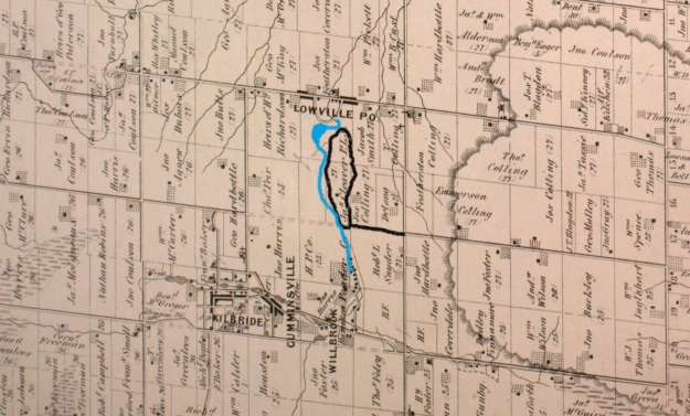
Google Maps links: Marchmont Grist Mill and Camp Calydor

Like us at http://www.facebook.com/hikingthegta.com

Follow us at http://www.hikingthegta.com


River and Ruin Side Trail

Saturday, August 19, 2017

The River and Ruin Side Trail explores the property that formerly belonged to James Cleaver.  James built the mill in Lowville and a stone house for his family.  The mill still exists as a private residence but the house has been ruined for many years.  There are four or five official parking places along the side of Britannia Road at the intersection with the Blind Line.  The Bruce Trail follows the right of way for the Blind Line and it descends to the level of Twelve Mile Creek.  Just before you reach the creek you will come to the River and Ruins Side Trail which is marked with blue blazes on the trees.  It is a 2.5 km trail that wanders through some heavy patches of Wild Parsnip, a poisonous plant.

Lowville RnR

James Cleaver was born in Pennsylvania on January 30, 1800, and was 5 when his family moved to Upper Canada.  In 1813 James went with the family horses when they were conscripted for use in the War of 1812.  It is said that James and his team were at the Battle of Stoney Creek.  It was around this time that he took an interest in becoming a Public Land Surveyor and started to attend school to qualify for this occupation.  He was 20 years old and teaching in the Lowville one room school house when he completed his studies.  The County Atlas pictured above shows the land as belonging to Cleaver PLS or Public Land Surveyor.  It was uncommon for a land owner’s occupation to appear on the map and perhaps James put this here himself.

The house was added onto at least once and it appears that there was certainly a need for it.  James married Angeline DeMond on November 3, 1827, and they had 7 children before she died in 1841.  James took Jane Watson as a second wife and had 11 more children with her.  Cleaver died March 30, 1890, leaving his land holdings to his sons. Instructions were given for the leasing of the Cleaver Grist Mill in Lowville with the money being divided among the seven living daughters.

IMG_0943

The stone that James used to build his house was taken from the property.  Larger pieces of dolomite were used for the front walls as an expression of the status and importance of the occupants.  The rear and side walls were made of smaller pieces of limestone.  The front walls had dolomite window sills and lintels while the back of the house had rough-hewn logs for the window framing.  The cover photo shows the front side of the house and the second story can be seen in the form of window sills along the top of the wall. The walls are about 20 inches thick with wood strips set into the inside of them to allow for the application of the inner wall coverings.  These can be seen in the picture above which looks at the front wall from the inside.  The door easily accommodated James’ six-foot two height.  The story circulates on the internet that the house burned down in the 1920’s but there appears to be no physical evidence of this. All of the wood framings are free of char marks that would indicate a fire.  The limestone pieces that have fallen down contain many interesting fossils including the crinoids in the sample pictured below.

IMG_0934

Following the trail will eventually bring you to Twelve Mile Creek, otherwise known as Bronte Creek near an old concrete and steel beam bridge.  The opposite side of the creek is clearly marked as no trespassing and the bridge claims to be under video surveillance. Both ends of the bridge are closed with steel gates.  Notice the large concrete culvert in the creek, just behind the bridge.

IMG_0976

The Cleaver Mill Pond has been drained but a concrete dam still remains in place, close to Guelph Line in Lowville.  The approach along the river follows a well-used trail that likely represents the old Cleaver laneway.  Once you cross over the dam you will find that you are on the wrong side of a no trespassing sign that blocks access from the road.

IMG_0985

The river portion of the River and Ruin Side Trail splits at one point to provide a winter and early spring trail called the High Water Trail that keeps you out of the mud and water along the side of the creek.  The Low Water Trail is more scenic and is the one to follow in the summer and autumn months.  When you get back to the point where the side trail connects with the main Bruce Trail you will find an elevated bridge that carries the Bruce Trail across Bronte Creek.

IMG_1009

There are several historic buildings in Lowville including the old grist mill, churches, and the pioneer cemetery.  Lowville Park stands just beside the old school house built in 1889 and pictured below.  This is a replacement for the school that Cleaver once taught in.

IMG_1020

The Bruce Trail and its side trails around Lowville make for an interesting outing and are close to several other great hikes including the following:

The Longhouse People Of Crawford Lake

Nassagaweya Canyon

Rattlesnake Point 

Mount Nemo

Kelso’s Kilns

Google Maps Link: Lowville

Like us at http://www.facebook.com/hikingthegtaFollow us at http://www.hikingthegta.com

Follow us at http://www.hikingthegta.com

Lakeside Park

Saturday, August 5, 2017

Lakeside Park in Mississauga isn’t the one made famous by the Rush song of the same name, but it does have its own claim to fame.  Lakeside Park has a unique red shingle beach.  The area was originally known as Marigold’s Point and was settled beginning in 1808 by United Empire Loyalists, many of whom came from New Brunswick. The properties slowly switched from agricultural uses to industrial as Toronto Township was developed.  Early industry in the area included an oil refinery, cement company and a sewer pipe company.

IMG_0833

The Hamilton and Toronto Sewer Pipe Company built a factory in Clarkson in 1955 with the idea of operating a state of the art facility.  The press release claimed that the new building would accommodate every new advance in pipe technology, manufacturing and installation.  For the next 25 years, the facility would produce various sizes of baked clay pipes.  As with any manufacturing, there were often pieces that didn’t meet the company’s quality standards.  These pipes were piled up at the edge of the property along the shore of Lake Ontario.

IMG_0850

The pipes were buried and forgotten.  Slowly, the embankment has been eroding and the pipes are being exposed to the weather and water.  As they break up and fall into the lake they get tumbled by the waves until they become small rounded shingles.  They mix with shale from the lake bottom to form a shingle beach.  The tiles on the east end of the site are the least broken up and as you walk west along the shore they become smaller and more rounded.  This is due to the natural counter clockwise east to west rotation of the lake.  Water that flows over Niagara Falls supplies most of the water to Lake Ontario and it causes the currents in the lake.  The pipes that have been in the lake the longest end up slowly being pushed west along the beach and tumbled into smaller, more rounded pieces.  The former industrial uses for the land have manifested themselves as a unique beach with some unusual opportunities for wildlife habitat.  The pipe section shown below was likely made in 1979 and is slowly making its way toward to crashing of the waves.

IMG_0841

The shores of Lake Ontario are lined with shingle beaches that are formed when the lake throws broken shale onto the shoreline during times of heavy waves.  Just east of Lakeside Park is Rattray Marsh. This marsh only exists because a shingle beach keeps the land behind from draining completely.  Between Lakeside Park and Rattray Marsh is Bradley House Museum which makes an interesting place to visit because it showcases four historic buildings, three of which are designated as Heritage Houses.  One of these is a regency style cottage called The Anchorage, which is pictured below.  It stood near Lakeside Park from the 1830’s where it was home to a Commander John Skynner who had retired from the Royal Navy. It is said that when John retired to the home he wrote in his journal that he was now retired and the home would become his anchorage.  The Anchorage was moved to Bradley Museum in 1978.

IMG_0182

Lakeside Park boasts one of the most unique beaches in the GTA and is an interesting example of nature making something beautiful out of an industrial garbage dump.

Google Maps Link: Lakeside Park

Like us at http://www.facebook.com/hikingthegta

Follow us at http://www.hikingthegta.com

Tiffany Falls

Saturday, July 29, 2017

Tiffany Falls is named after Doctor Oliver Tiffany who was the first medical doctor in an area that included Hamilton, Burlington, Ancaster, Guelph, and Galt.  Oliver was born in Massachusetts in 1763 and graduated from Philadelphia Medical College.  He came to Upper Canada in the 1790’s and settled in Ancaster in 1796.  There is a small paid parking lot on Wilson Street East where you can access both Tiffany Falls Trail and the Bruce Trail.  The main trail leads to the falls while a second one will take you to the remains of an old kiln.

IMG_0478

Doctor Tiffany was known to keep horses stabled around the countryside so that he could always have a fresh mount wherever he was in the case of an emergency.  For forty years he looked after the needs of the people in his vast community.  He kept a medical ledger where he recorded the services that he performed at each household. The doctor prescribed quinine for malaria and kept laudanum for pain.  The rest of his treatment tended to be naturopathic and compounded from things he grew in his herb garden.  His ledger records payment in the form of pumpkins or the mending of a pitchfork.  Four days worth of ploughing was given in exchange for the doctor’s services as well as whiskey, hay and oats.  Oliver Tiffany was so well loved that when he died on May 7th, 1835, the buggies of 600 people who attended the funeral made a historic traffic jam.  Tiffany Falls, as seen in the cover photo, is a ribbon falls 21 metres tall and 6 metres wide.  The various layers of the escarpment can be seen beside Tiffany Falls in the picture below.

IMG_0495

Across Wilson Street, The Bruce Trail continues to make its way toward Sherman Falls. The parking situation is poor at this second attraction and will possibly leave you with a ticket. Therefore, we suggest parking at Tiffany Falls and hiking to Sherman Falls.  The area around Ancaster was one of the earliest settled in Upper Canada and the land shows signs of many different uses over the years.  A set of old stairs leads up the side of the escarpment.

IMG_0501

Along the Bruce Trail between Tiffany Falls and Sherman Falls, there has been an extensive retaining wall installed.  The wall is made from local limestone blocks like many of the older buildings in Ancaster.

IMG_0509

Sherman Falls is 17 metres high and is classified as a terraced ribbon waterfall.  A ribbon waterfall is much taller than it is wide, in this case, only 8 metres.  Sherman Falls was featured as one of seven falls we visited on the coldest day in February 2016 in a post called Frozen Waterfalls of Ancaster.  This tributary of Ancaster Creek is spring fed and so the falls have a much more consistent flow of water than some of the other local ones. Sometimes known as Angel Falls or Fairy Falls it takes its name from Clifton Sherman who once owned the property and was the founder of Dominion Foundry and Steel Company (Dofasco).

IMG_0515

Google Maps Link:  Tiffany Falls

Like us at http://www.facebook.com/hikingthegta

Follow us at http://www.hikingthegta.com