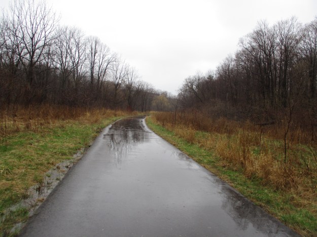
Monthly Archives: April 2019

The Leucistic Robin

Sunday, April 28, 2019

For the second year in a row I have had the pleasure of seeing a leucistic robin along the East Don River.  This is the same bird I photographed last year living in the same small area between the Rainbow Tunnel and the DVP Tunnel along the East Don Trail.

Leucistic animals have a genetic disorder that causes pigmenattion to not reach some of their feathers or fur.  Unlike albinos they do not have pink eyes or skin.

IMG_3478

The cover photo shows that the leucistic bird still gets the worm.  In this picture the worm has been swallowed and the bird has turned an ear to finding another one.

IMG_3493

Leucism can result in a great variety of white colouring but the skin and eyes are always normal colour.

IMG_3487

Unfortunately, prejudice exists in the wild as well and leucistic animals are less likely to breed because they get shunned during mating season.  This one was feeding among a group of other robins as if it was part of a flock.

IMG_3476

The feathers on the back of the neck of this robin are pure white and when in flight the wings show a great deal of white as well.

IMG_3486

Robins do not use the same nest every year but they may return to the same area if the food and nesting sites were plentiful.

IMG_3481

A robin can live for up to 14 years in the wild but the average is only two years.  It was very cool to see this one again, assuming the white headed robin in the picture below is the same bird.

img_4060

Check out our top twenty stories from the first five years as reviewed at this link.  Back Tracks – 5 Years of Trails

Google Maps Link: Moccasin Trail Park

Like us at http://www.facebook.com/hikingthegta

Follow us at http://www.hikingthegta.com


Etobicoke Creek Trail

Saturday, April 20, 2019

When it is completed the Etobicoke Creek Trail will stretch for 50 kilometres from The Waterfront Trail at Lake Ontario to the town of Caledon.  It will connect Mississauga, Brampton and Caledon with a multi-use trail system.  The 11.2 kilometres in Mississauga still has one informal section of undeveloped trail as well as a small section of residential street included.  Sections of the trail run on either side of the creek with pedestrian bridges providing access.  When on the east side of the creek you are in Toronto while the west side is in Mississauga.  The Toronto Region Conservation authority are developing the sections in their mandate.  Most of the trail through Brampton has also been completed adding another 14.5 kilometres.  Please note that while bridge restoration is ongoing on the 401 over the Etobicoke Creek the trail is closed through this portion.  We parked on Sismet Road near the creek where there is a formal access path.

IMG_2770

The trillium was adopted as Ontario’s floral emblem in 1937.  The three leaves are followed by a flower with three petals which can be one of four varieties.  The white being the most common in the GTA followed by the red one.  Painted and nodding trillium are much less common. They flower and disappear before the trees gain their leaves and block the sunlight from the forest floor.

IMG_2694

One of the true oddities along any river or creek in the GTA is the presence of an old car.  These can be found quite often along the Bruce Trail but except for near the Hyde Mill in Streetsville where there are two of them, they are not to be found.  This one turns out to be a 1975 Chevy Vega.  The final detail of the year was found on a plastic part which contained the molding date.  Why this car was not removed when the trail was recently upgraded is a mystery.

IMG_2707

This car will take a little work to get back on the road as the 2.3 litre engine has been partially disassembled.  They came with an inline four cylinder engine with a diecast aluminum alloy cylinder block.  All four cylinders were mounted on the same side of the crank case.  The firing order has been recorded to assist you when you start to refurbish this car.

IMG_2757

Several varieties of plants have recently emerged to welcome the spring sunshine, if we ever get any.  Chives are an edible plant which are closely related to Leeks and Garlic.  They produce edible flowers which are listed as one of the top ten plant for production of nectar to attract pollinators.  These plants are essential to helping us restore the habitat for bees.  The loss of bees threatens our entire food chain.  When thinking about harvesting a small amount of any wild food, please be sure not to damage the patch or over harvest.  Make sure there is some left there to grow for years to come.

IMG_2695

The average garden snail moves at the rate of 0.047 k/hr which means that this snail will take about 40 minutes to cross the three metres of paved trail on the Etobicoke Creek Trail.  During this time it will risk becoming a snack for one of the robins that were out in full force.  When the weather is better and the trail gets busy it will be at even greater risk from cyclists and pedestrians.

IMG_2700

Residential oil storage tank are used for home heating and often come in a 910 litre size (200 imperial gallons).  There are two of them in a small ravine along the side of the trail.  This is another item that is uncommon along the developed park system in the GTA.

IMG_2788

Mayapples were just poking their stems through the ground.  The flower will appear and bloom in May but the single fruit won’t be ripe until later in the summer.  The fruit are poisonous until they turn yellow when you can remove the seeds and safely eat one.  Experience shows that raccoons keep a close eye on them and pick the fruit as it ripens which means you’ll be fortunate to find a ripe mayapple fruit to sample.

IMG_2738

Leeks are related to the chives we saw earlier and likewise can make a good stir-fry ingredient.

IMG_2705

There are several other sections of the trail that are completed and we will certainly be exploring them one day but we have already visited the Ghost Town of Mount Charles

Check out the top 20 posts from our first five years at this link: Back Tracks – 5 Years of Trails

Google Maps Link: Sismet Road

Like us at http://www.facebook.com/hikingthegta.com

Follow us at http://www.hikingthegta.com

Back Tracks – 5 Years of Trails

April 20, 2019

Hiking the GTA photographed their initial blog on April 20, 2014.  In the five years that have passed since then we’ve released over 350 stories which include over 4,000 pictures.  We’ve had the opportunity to explore most of the Credit, Humber and Don Rivers as well as the Lakefront Trail and large sections of the Bruce Trail.  We’ve explored most of the parks and ravines in the area.  Our posts explore the areas as they exist today and by looking at the local history we discover how they came to be this way.  Many people have gone exploring after reading about an area in their neighbourhood and we’ve had some amazing feedback.  Thank you for all the encouraging comments, they mean a lot to us.

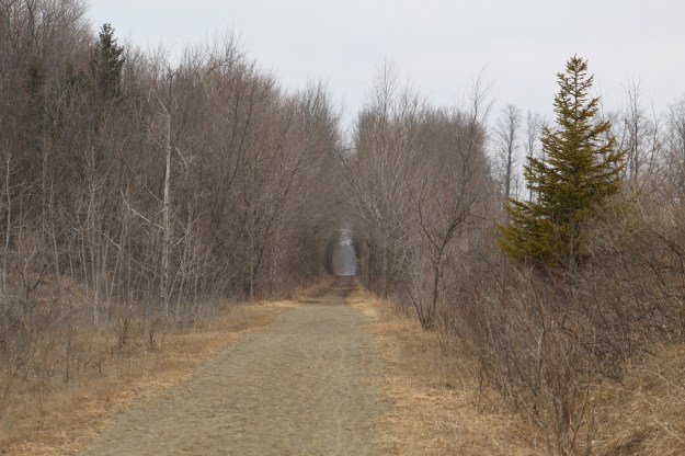
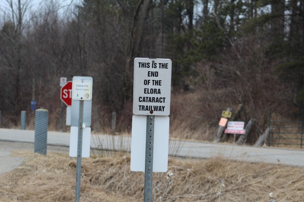
Here, then are the top twenty stories from our first five years, as selected by readers.  Click on the title of each story to get to the original post for more details about each location, including Google Maps links.  Pick a couple that look interesting and plan your summer trips in advance.

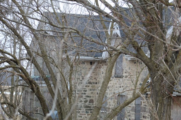
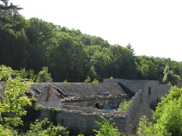
20) Barber Paper Mills – Georgetown

One of the most picturesque sets of mill ruins in the GTA is located on The Credit River in Georgetown.  Parts of the building date back to 1820 and the founding of the town.
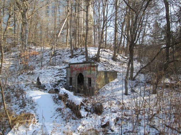
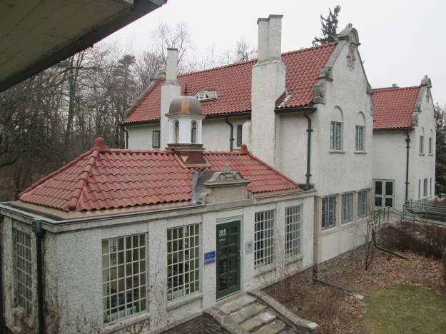
Barber paper

19) Graydon Hall

One of Toronto’s rich elite built this estate complete with terraced gardens and cascading fountains.  The old pump house still remains near the Don River.

img_1977

18) Adamson Estate

This estate was built in 1920 on the lake shore in Mississauga.  It is linked with the Cawthra Estate because it was a wedding gift for their daughter Mabel.

img_2163

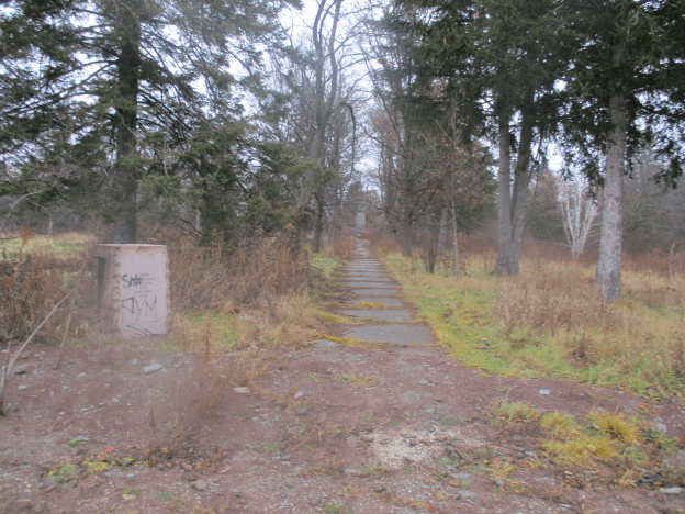
17) The Vandalized Memorial

This little park contained a memorial to Taras Chevchenko but it was vandalized many times and now is slated to be replaced with a subdivision.  Check it out before it is gone forever.

vandal

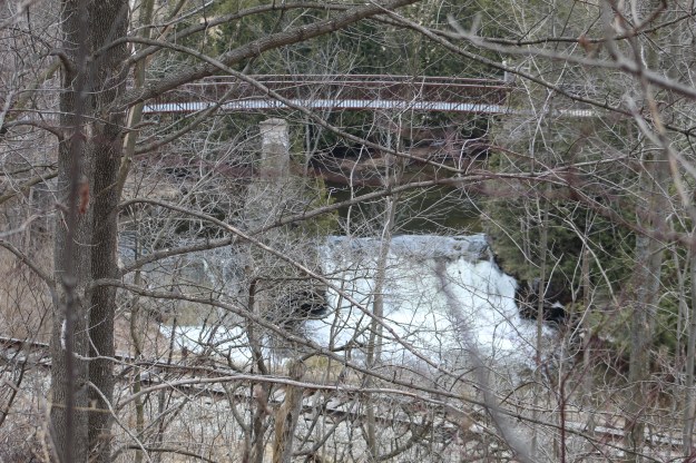
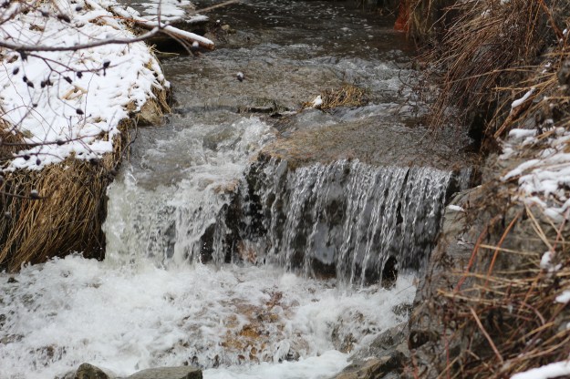
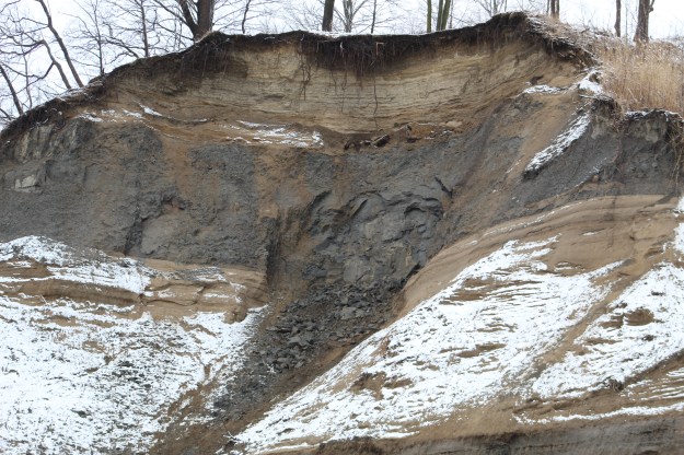
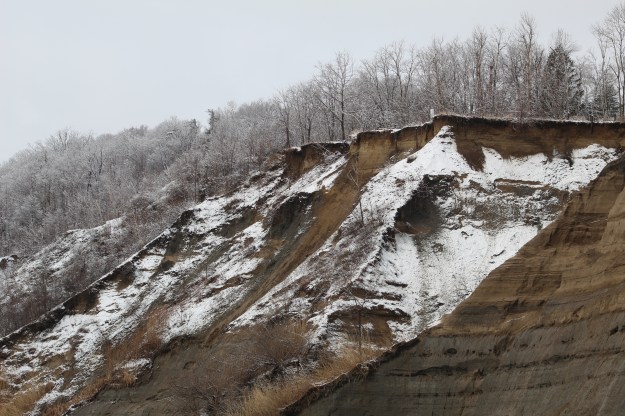
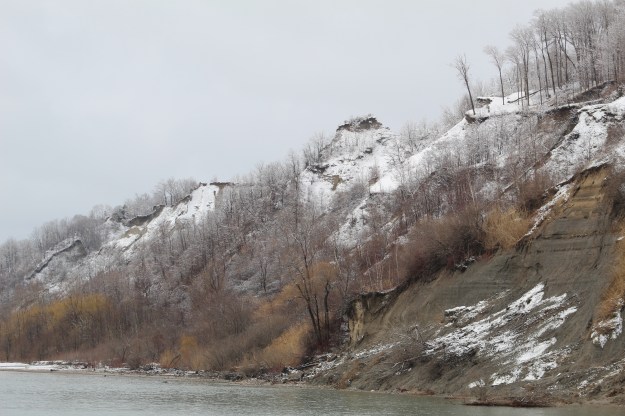
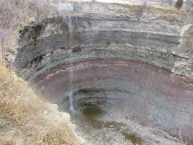
16) The Devil’s Punch Bowl

The Devil’s Punchbowl is one of the most interesting waterfalls in the GTHA.  This post got Hiking the GTA mentioned on Wikipedia for the detailed description of the geological strata revealed here.

punch bowl

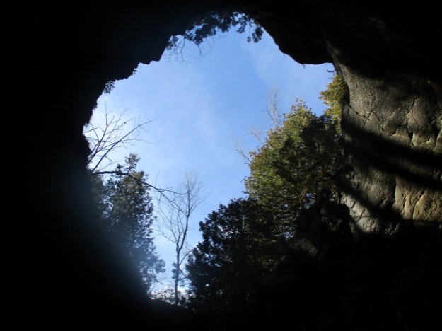
15) The Devil’s Well

This huge glacial pothole is the last of a series that have collapsed.  This one can be entered through a small crack at the bottom.

img_1719

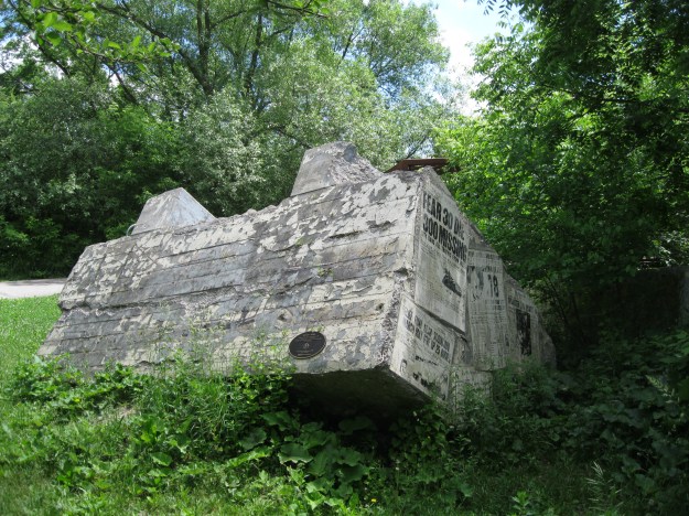
14) Camp Calydor – German POW Camp

Located in Gravenhurst, this is one of the POW camps used by the Allies during World War Two to house German prisoners.

calydor8

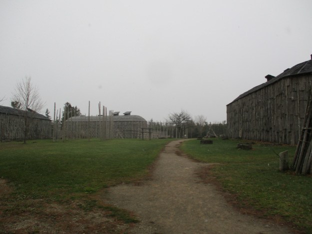
13) The Longhouse People Of Crawford Lake

Crawford Lake is meromictic, which means that the bottom is never disturbed.  Corn pollen in core samples taken from the bottom of the lake showed an agricultural society was living here 500 years ago.  This led to the discovery of thousands of artifacts and a village of longhouses.

img_1571 (1)

12) Mimico Branch Asylum

When Mimico Branch Asylum opened in 1889 it was thought that mental patients would benefit from the cottage style atmosphere rather than the hospital nature of the asylum at 999 Queen Street in Toronto.  It closed in 1979 and sat empty until recently being re-purposed as a campus for Humber College.

img_5560

11) Raymore Drive

Raymore Drive was the site of a small community of houses until Hurricane Hazel destroyed it, killing many residents.

img_2231

10) Merritton Tunnel (Blue Ghost Tunnel)

This railway tunnel under the Third Welland Canal was replaced with a swing bridge.  The abandoned tunnel has been bricked closed on one end but people still go inside, claiming to see a blue ghost in the dark.

img_2981

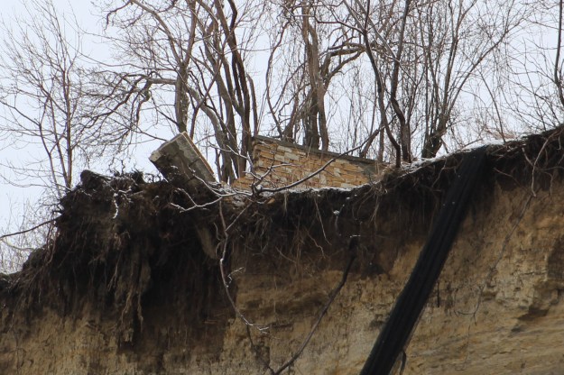
9) Toronto’s Abandoned Roads

A city is living entity and as such is always evolving, changing and growing.  Most often roads are widened and extended but sometimes they are cut off and abandoned.  This post looks at a number of those closed roads in Toronto.

Bayview bridge

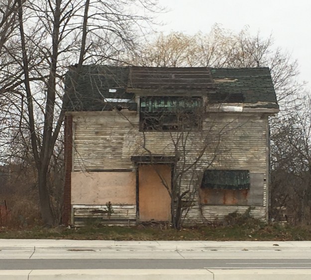
8) Palermo – Ghost Towns of the GTA

The expansion of Oakville threatens the remains of this former community.  Like many of Ontario’s early towns, this one has become a sign on the road and a bunch of abandoned houses waiting for demolition.

img_1211

7) Joshua Creek

The Harding House was built in 1938 near the mouth of Joshua Creek and must have been quite the estate when it was more isolated.
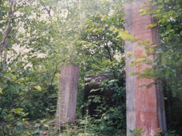
img_7160

6) Bond Lake

Bond Lake is the site of  a former railway amusement park.  The Toronto & York Radial Railway built a transformer station beside the lake and then turned the area into a money making tourist trap.  Only scattered remains can be found around the lake.

3658

5) Lotten – Cawthra Estate

The Cawthra Estate was built on lot ten and their driveway is now Cawthra Road.  The house was built in 1926 and sits in a wood lot that is full of clues to the former estate.

img_0383 (1)

4) Ringwood – Ghost Towns of the GTA

We have published an ongoing series of Ghost Towns of the GTA which has proven quite popular.  Ringwood has been the most successful of these stories, perhaps because it has so many buildings remaining.
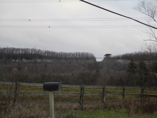
img_2326

3) The Gap

This hole in the side of the escarpment can be seen from the 401 near Milton.  It is the opening cut by an aggregate company in the 1960’s.  The Bruce Trail crosses the bridge over the gap.

img_1300

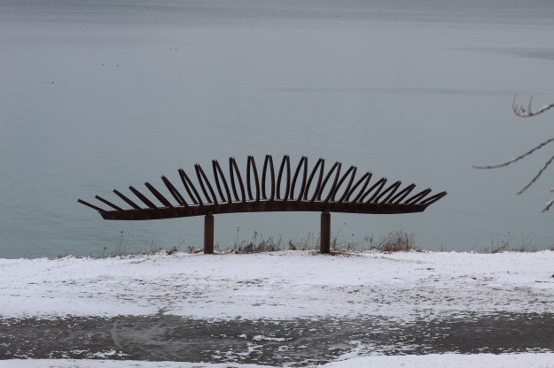
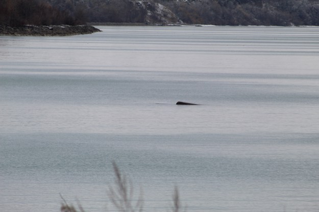
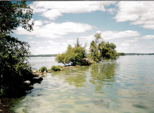
2) Rice Lake’s Sunken Railway

In the 1860’s this railway crossed Rice Lake on an extensive trestle.  When it was abandoned the rail line was left just below the surface of the water. It has been the ruin of many a propeller on an unwary boat.

harwood-1 (2)

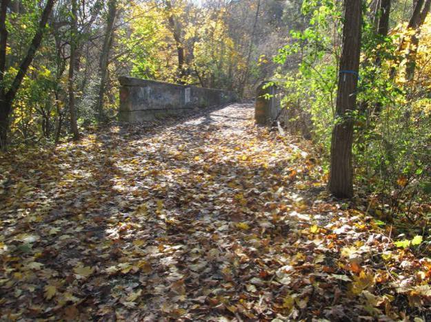
1) Newmarket Ghost Canal

Our all time most popular post features the abandoned remains of one of the GTA’s biggest engineering projects of the early 20th century.  New evidence suggests that this attempt to link Newmarket with Lake Simcoe could have been successful.

img_5850

We’re looking forward to the next five years of exploring the GTA and discovering what is out there to be found.

Like us at http://www.facebook.com/hikingthegta

Follow us at http://www.hikingthegta.com

Elora Cataract Trail – East End

Saturday, April 6, 2019

The weekend seemed like a perfect one to go for an extended hike using two cars.  We chose to complete about a third of the Elora Cataract Trail running between Hillsburgh and Cataract, a distance of about 18 kilometres.  The east end of the trail can be found at Mississauga Road although the former right of way continues east from there.  Based on the trail map we determined that we should leave one car at The Forks Of The Credit Provincial Park.  The roadway into the park is in horrible shape and the pot-holes will threaten to rip the front end out of your car.  Having braved the lane way you will find that $14.50 is the full day parking fee.

The Credit Valley Railway was built in 1879 to connect Toronto with Orangeville.  A branch line was also built between Cataract and Elora but it was only operated under the original name for four years before it became part of the Ontario & Quebec Railway.  In 1884 it was leased to the Canadian Pacific Railway where it became known as the Elora Subdivision.  A hundred years later in 1988 it ceased to operate and the rails were removed. It only sat abandoned for five years before it was purchased by the Grand River and Credit Valley Conservation Authorities.  They have developed 47 kilometres of the right of way into the Elora Cataract Trailway.  We parked the second car for free at the trail head on Station Road in Hillsburgh, the site of the former railway station in town.  The Hillsburgh Pond was originally created to serve the two grist mills in town.  The Caledon Mountain Trout Club bought the pond in 1902 and sold it to the Guelph Fishing Club in 1946.  Today there is an ongoing debate about the future of the pond and dam as restoration is required and the pond may be drained instead.  This old green shed, like the boathouse in front of it is collapsing into the pond.

IMG_2879

The property beside the train station used to have a set of ramps for loading livestock onto rail.  A wind mill can be seen in the back of the old Awrey house which has recently been expanded to become the new library.

IMG_2880

Although we had chosen a stretch of trail that ran for 17.5 kilometres it was all pretty level as long as we were following the railway right of way.  Only later when we got back to the Forks of the Credit Provincial Park and found an extensive set of stairs to climb did we realize that starting at Cataract would have allowed us to descend those stairs instead of climbing them at the end of the hike.  The trail still had snow and ice on it where the hard packed trail was sheltered from a lot of direct sunlight.

IMG_2909

The red squirrel uses his tail for balance and to control his jumping.  When they are upset or feel threatened they also use it for communication.  When it gets cold and they need a blanket to snuggle up with they use their tails for this too.

IMG_2931

After leaving Hillsburgh the trail crosses a couple of side roads before coming to the town of Erin.  The railway ran along the northern edge of town where the rail station used to stand.  At Shaws Creek Road you come to the old Pinkney Farmhouse which was built in 1886.  Fifteen acres of the Pinkney property was used for a large gravel pit and the current owners are Lafarge Canada who might be interested in restoring the house in exchange for increased quarry rights.  The Pinkney barn was in poor shape and was demolished last year.

IMG_2940

The trees are growing back in so that in some places they may offer a little shade on the summer.  When this was a active steam railway the trees would have been kept trimmed back for the full property width to help discourage fires caused by errant sparks.

IMG_2948

The trail ends at Cataract Road but we were still several kilometres from the car.  Based on the signs at Mississauga Road you could park there and walk the short section to the end of the trail.  This would be a lot shorter and considerably cheaper as well.

IMG_2951

The Credit Valley Railway line continued east to connect with the Orangeville line.  Where it is not used as the trailway it isn’t maintained or improved but it is still quite passable.

IMG_2952

Two of our previous posts, Forks of the Credit Provincial Park and Cataract Electric Company, tell the history of the mills in the park.

IMG_2956

A few signs of the old railway still remain including old sleeper ties thrown along the sides of the trail to rot.  For long sections of the trail some of these ties have been used for fence posts by the local farmers.  Inside the Forks of the Credit Provincial Park an old telegraph pole still marks a bygone era.

IMG_2957

Coltsfoot looks similar to a dandelion but has no leaves at the time of the flowers.  Once the flowers have faded the leaves will come out for the summer.

IMG_2963

Having covered about one third of the Elora Cataract Trailway we intend to return a couple more times to complete the trail in its entirety.

Google Maps Link: Cataract

Like us at http://www.facebook.com/hikingthegta

Follow us at http://www.hikingthegta.com

The Hilarious House of Frightenstien

Sunday, March 31, 2019

A fresh fall of snow overnight left us with white trees which are always beautiful, even as we look forward to getting some warm weather.  One of the great places to view something like this is the Doris McCarthy Trail in Scarborough.  This trail follows Gates Gully down the side of the Scarborough Bluffs and gives you access to the lake.  Just to the west of here a cottage is slowly slipping over the edge and it was time to have a look and see what was left of it.  I parked on Ravine Drive just off of Kingston Road and made way down the side of what was once Doris McCarthy’s property.

IMG_2704

The ravine, like the Leslie Street Spit,  is a migratory route for over 100 species of birds but today there were only cardinals and a few robins.

IMG_2725

At the bottom of the gully is a sculpture designed to look like the rib cage of a fish or canoe.  Perhaps it looks more like eye lashes from this angle.

IMG_2728

The water in Lake Ontario was very calm as you look toward the east and the sunken wreckage of The Alexandria.

IMG_2732

Belamy Ravine Creek drops 90 metres as it follows Gates Gully to the lake below.  In several places blocks of armour stone have been added to the creek bed to slow down erosion.  The Doris McCarthy Trail runs along the lake in both directions.  We turned to the west and crossed the creek and carried on along the beach.  The trail through here was very muddy and partially under water that was running off the bluffs in a few places.  I was glad for my winter boots, now serving as my mud boots.

IMG_2734

Keep an eye on the top of the bluffs as you walk along.  Not only might you see some wildlife but you may also notice man made objects that are in the process of being sucked over the edge as the sand is carried away from underneath them.  Here a wall is being broken away, section by section.

IMG_2740

On a previous visit only the top portion of this pipe stood out of the sand.  Since that time four more sections of corrugated steel pipe have been exposed.  I’m interested to see what is in there.

IMG_2744

If you grew up in Ontario in the 1970’s you likely remember The Hilarious House Of Frightenstein.  The comedy show was aimed at children and featured short educational skits as well as comedy.  All 130 episodes were filmed at CHCH in Hamilton in 1971.  Toronto comedian Billy Van won the lead part as Count Frightenstein.  He also played eight other recurring characters and several minor ones.

Top-Banner-3

Billy Van owned a cottage on lakefront property on the former McCowan estate which looked out from on top of the Scarborough Bluffs.  At one time this blue cottage sat a good distance back from the edge of the bluffs but by 2008 it was starting to fall over.  Most of the cottage has collapsed now and wood and doors fill a small ravine below the house.  Inside, the concrete blocks in the basement are exposed and have been cracked in several places.  Billy Van’s cottage is one of the last original homes along this stretch of the bluffs.  This is The (not so) Hilarious House Of Frightenstein.

IMG_2759

Several times I heard the rumble of the sand as additional parts of the bluffs broke away in the ongoing erosion.  Ground water seeps out of the sand and flows across the beach carrying more of it away and destabilizing the rest.  In the picture below, a fresh slide has covered over last the fresh snow from last night.  A previous blog looked at the effects of weather and water on the bluffs and shoreline at the Cathedral Bluffs.

IMG_2761

The full magnitude of the Scarborough Bluffs is a wonder to behold at any time of the year.  With the fresh snow on the trees above and the slopes below it was well worth the kilometre hike down the hill and back.  Geologists  around the globe recognize them as one of the most valuable records of glacial sedimentation available.  More of the geology of the Bluffs can be found in our story Sand Castles.

IMG_2768

The fourteen kilometre stretch of bluffs will continue to be interesting for generations to come because of the change it represents and the constant reminder that we really don’t control everything.  Places where the shoreline has been hardened with armour stone or construction rubble only serve to separate the lake from the bluffs.  They continue to recede at their own pace anyway.

IMG_2771

When we last visited this cottage in May 2016 for our post Gates Gully the walls were still standing at the back of the house.  Trevor Harris owned the cottage in 2002 at which time he was able to drive a lawn mover in front of it however the city decided that demolition was unsafe and made Harris fence the area off and post it.  Later that year he lost 10 feet of property in a single drop and it looks like one more event like that and the whole thing will be gone.

img_1370

The escarpment is ever changing, even in places like this where there is a fairly wide beach and the water never impacts the base of the bluffs.  However, the Scarborough Bluffs were eroding for thousands of years before Elizabeth Simcoe named them on August 4, 1793.

Google Maps Link: Gates Gully

Like us at http://www.facebook.com/hikingthegta

Follow us at http://www.hikingthegta.com