Monthly Archives: November 2014

High Park – Zoo

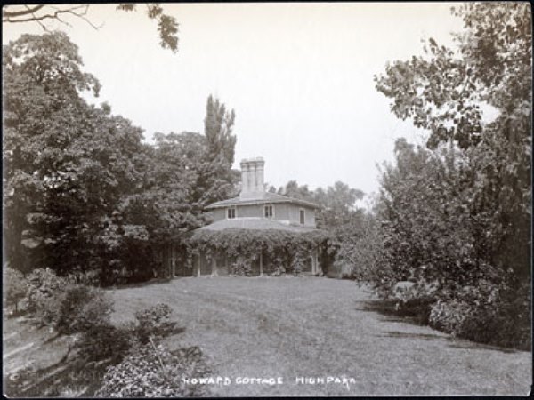
Saturday Nov. 29, 2014

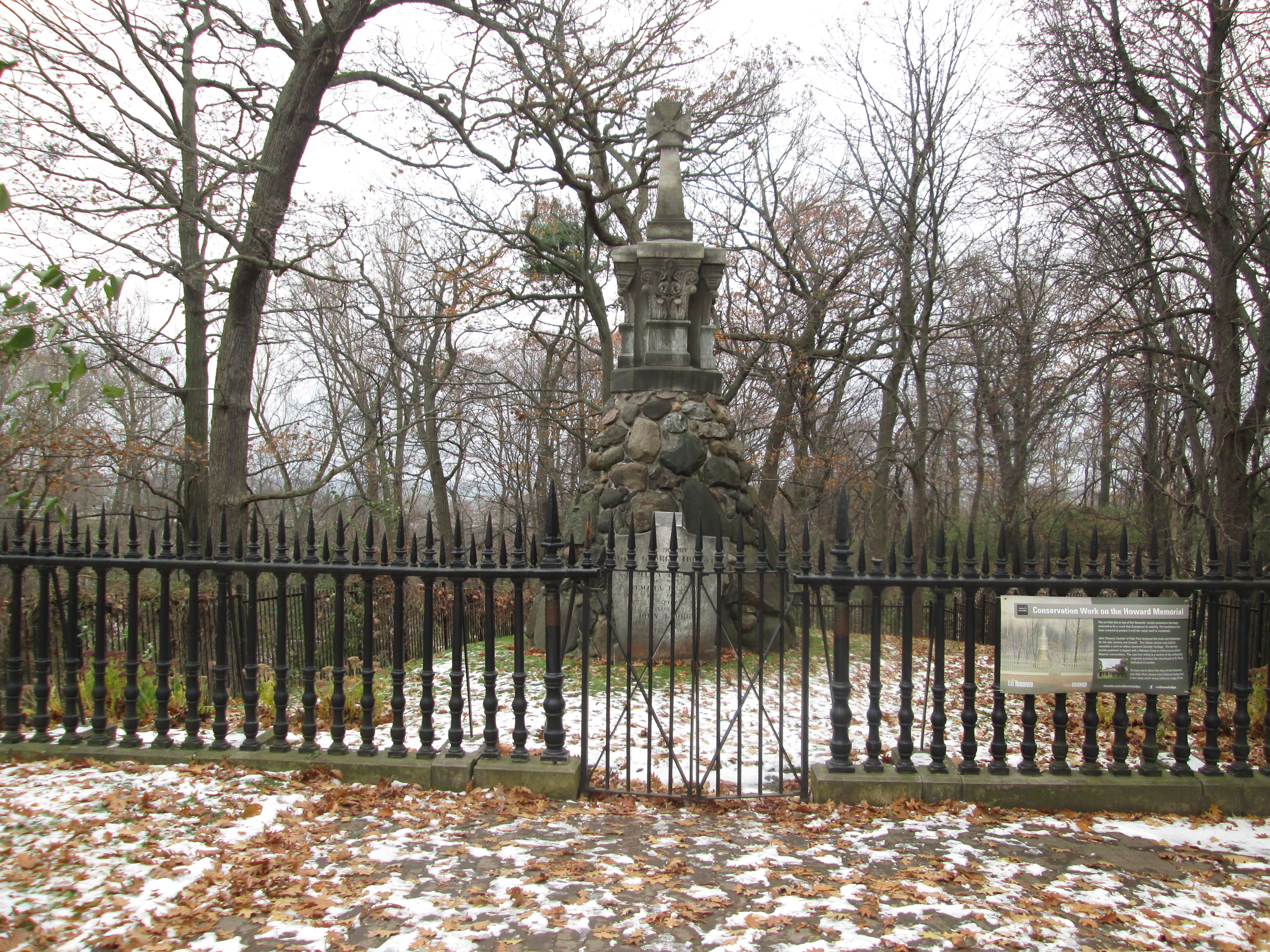
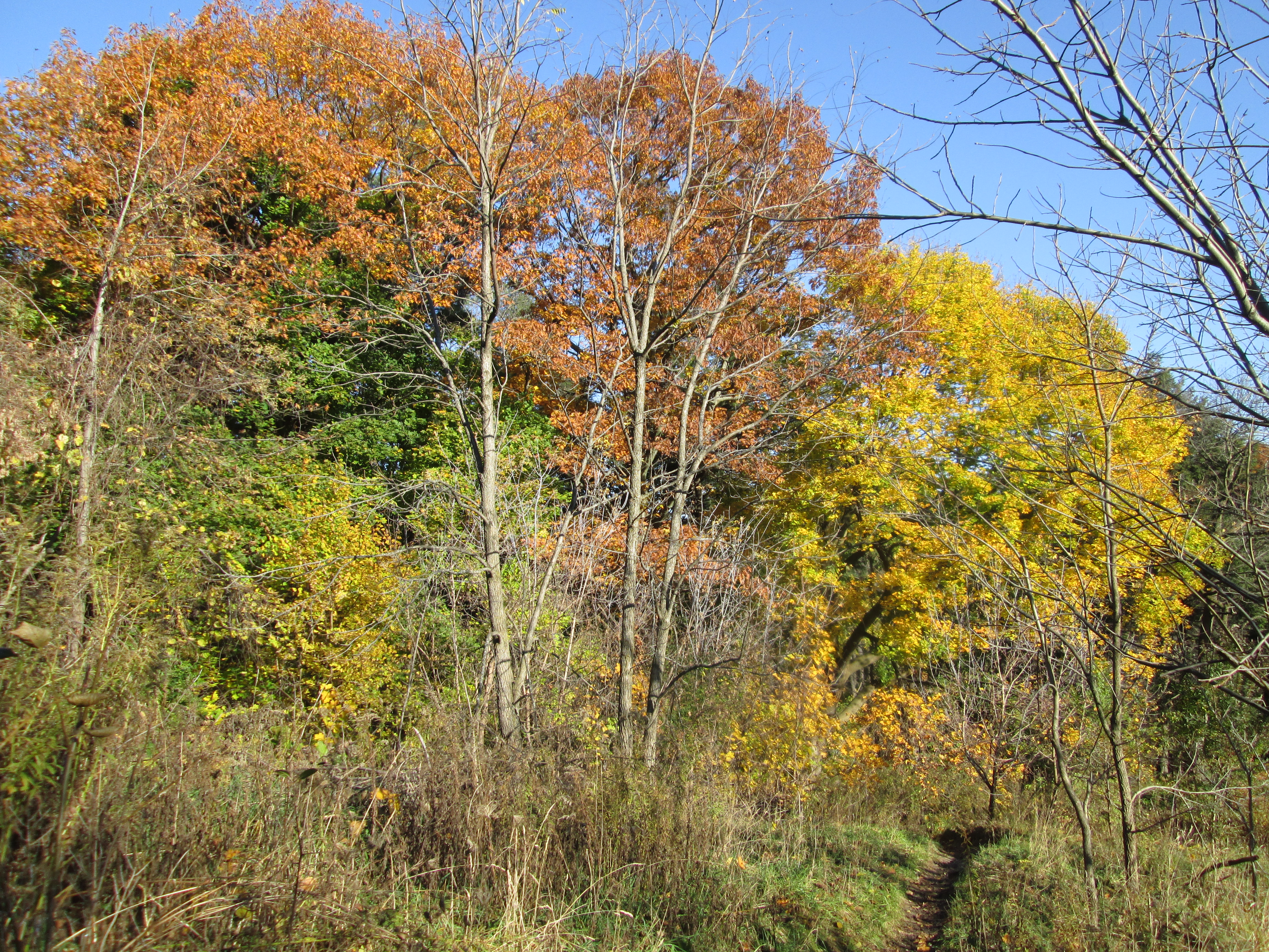
It was zero degrees and quite nice when the sun was out.  We parked in the parking lot near the Grenadier restaurant where there is plenty of free parking.   High Park is too big to be explored in a single session so we returned to pick up from where we left off at Colborne Lodge last week.  John George Howard had donated 120 acres of his land to the city for High Park in 1873. His remaining 45 acre estate, including Colborne Lodge, had been added to the park in 1890 when he died.  The city has acquired two other parcels of land to bring the park up to almost 400 acres.  We went down the hill past the area known as the dream site.  Here there is an outdoor theatre.

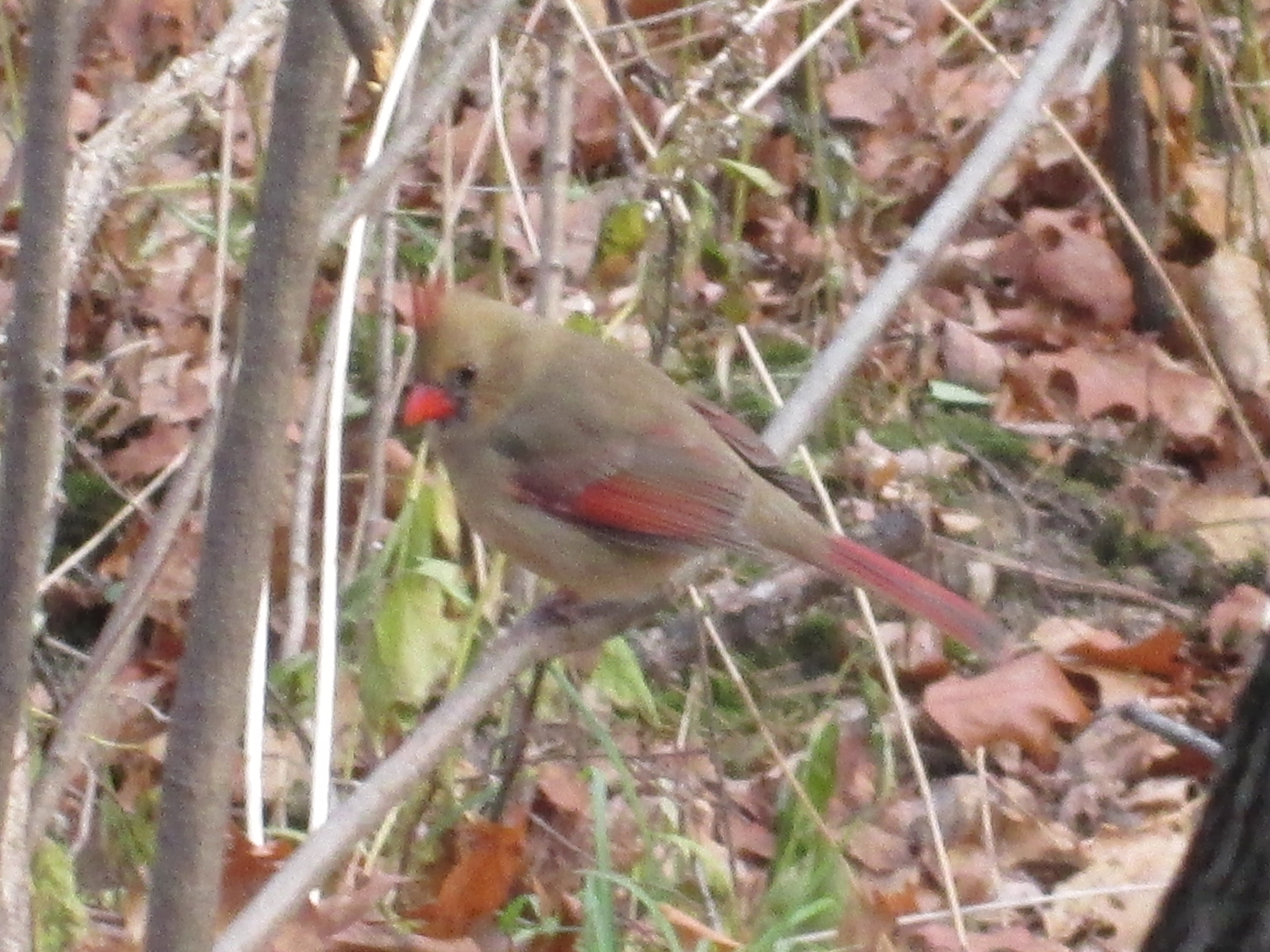
Along the way we found a place where a group of cardinals were feeding.  In most bird species the males are brightly coloured while the females have more earth colours. This helps the female hide in the nest to protect the eggs.  This was a rare group of cardinals that actually sat still long enough to get their picture taken.  The female has a little red on her wings and tail feathers as well as a red beak and crest.

IMG_1295

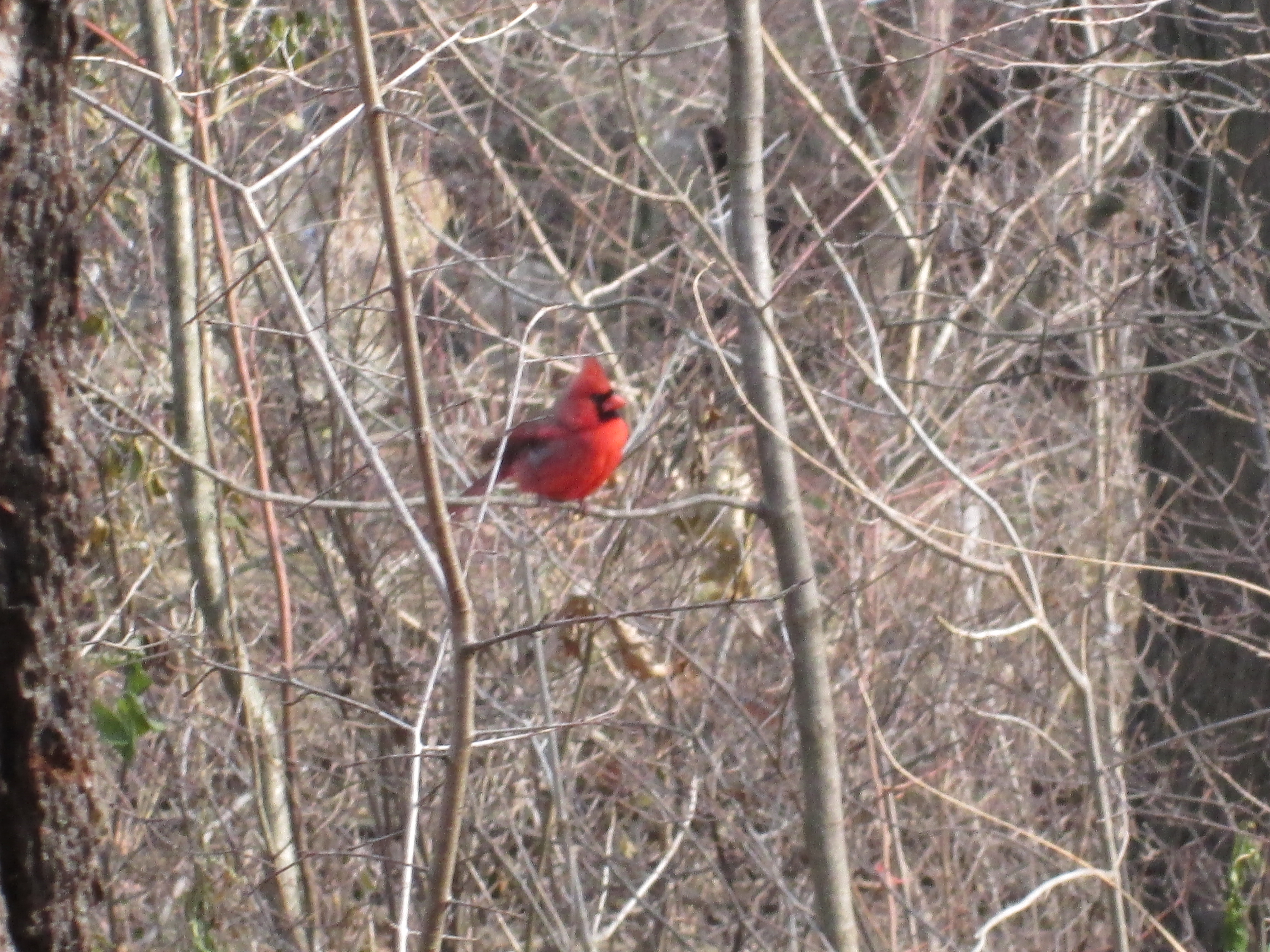
The male cardinal is bright red all over except a little black around his beak.  Male cardinals will use themselves as a distraction to keep you from finding the female during nesting season.  The male will attract your attention and then deliberately lead you away from the nest.

IMG_1305

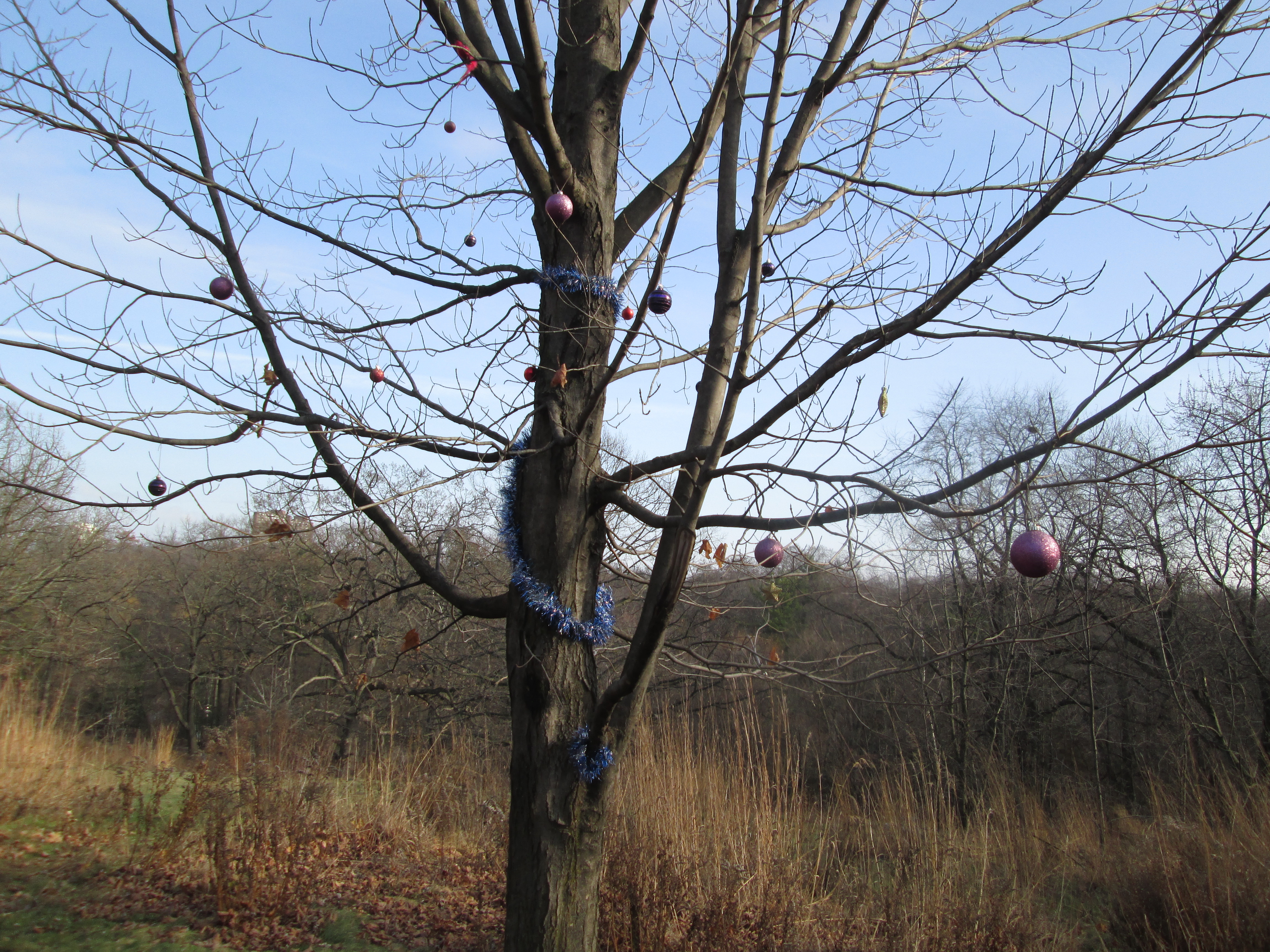
We found a random tree in the park that has been sparsely decorated for Christmas.

IMG_1318

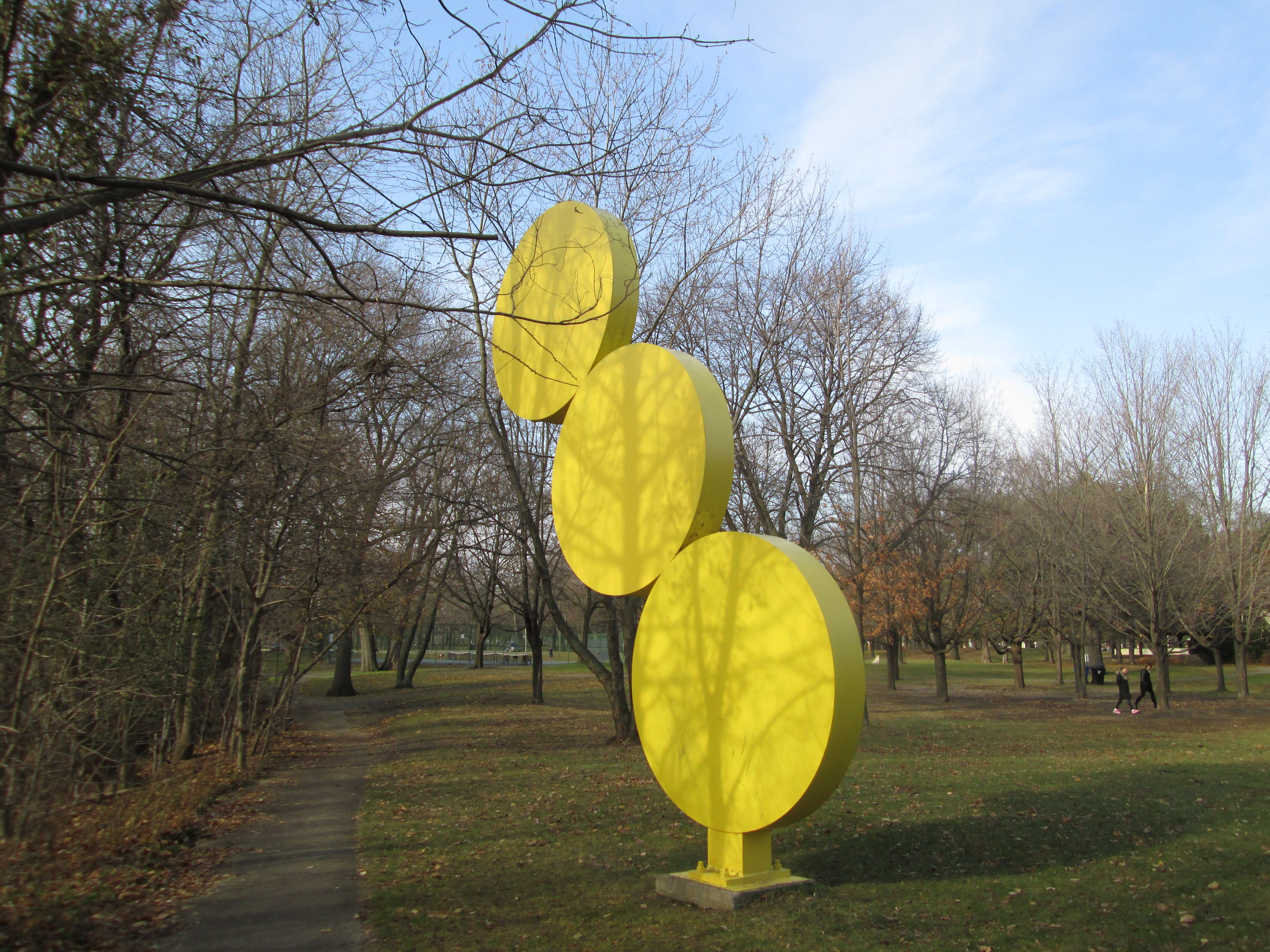
In 1967 the Toronto International Sculpture Symposium was held in the park.  It was located not far from the swimming pool and ice rink.  Of the 10 permanent sculptures there are still 5 remaining.  One of these is known as Three Discs and was created by Menashe Kadishman who is a world famous Israeli artist.  This is the only one of his sculptures in Canada.  Standing beside it the height appears to be between 25 and 30 feet.

IMG_1321

In 1893 a zoo was added to the public attractions at High Park making it one of the oldest continually running public zoo’s in North America.  Originally the zoo area contained pens for deer.  Over the years the zoo has contained specimens of animals from all over the world. Today it is home to emu, highland cattle, sheep and peacocks as well as the animals pictured below.  Admission is free making it a great place to visit often.

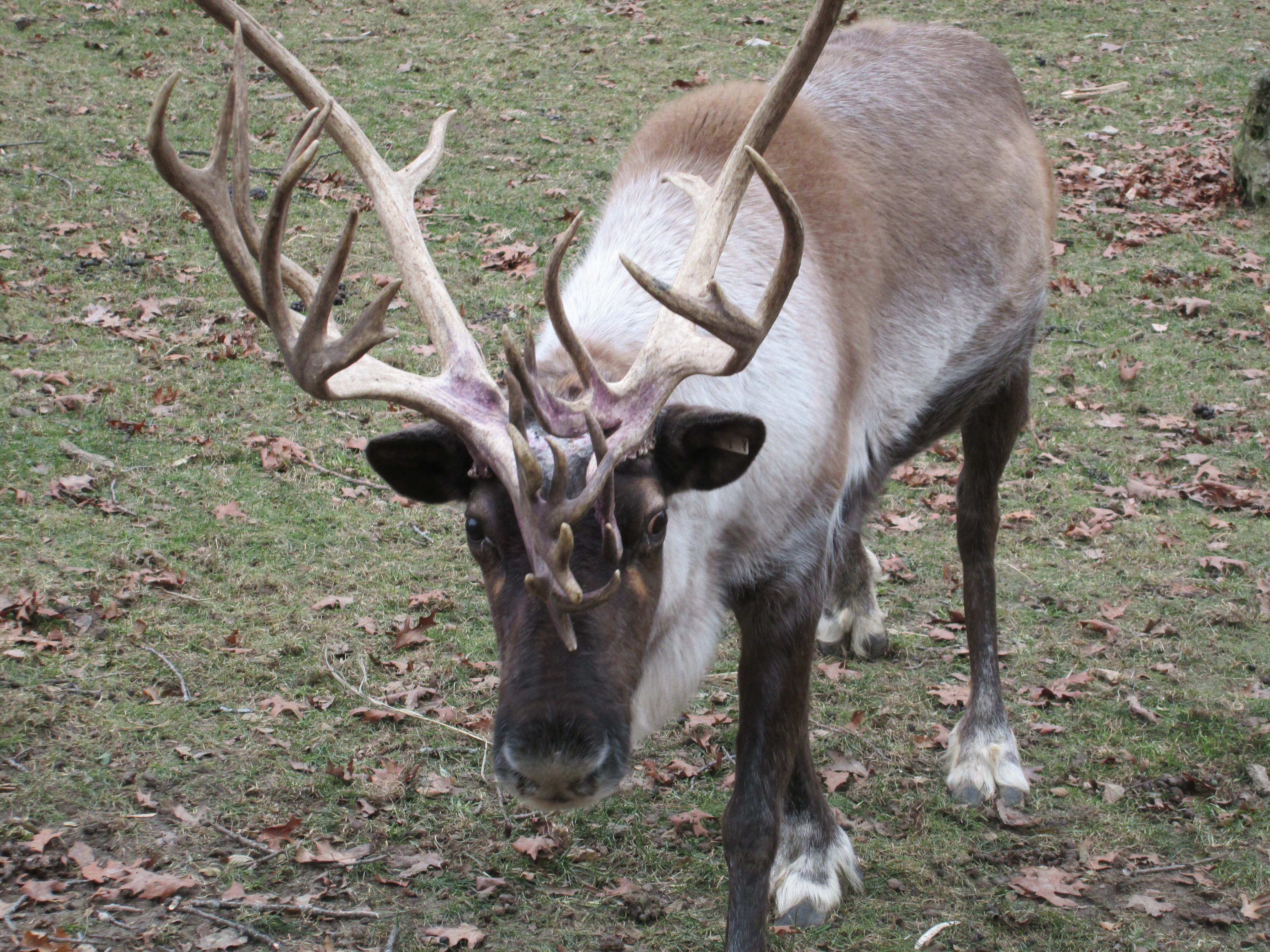
The zoo still houses a form of deer, this northern species is commonly called reindeer. Reindeer are also known as caribou and are featured on the back of the Canadian 25 cent coin. They are unique among the deer family in that they are the only ones where both the male and female grow antlers.  The male antlers, like the ones below, tend to be grander and more complex.  The female antlers are thinner and simpler.  The male in the picture below had an injury on his forehead that is currently healing.  The medication has caused his fur and parts of his antlers to turn purple.

IMG_1354

The Yak is native to the Himalayas.  It is designed for cold weather, being able to easily withstand -40 C.  It’s lungs are large and it’s blood is designed for high elevations.  This is the smelliest animal in the zoo, another feature that makes it suitable for the Himalayas.

Yak

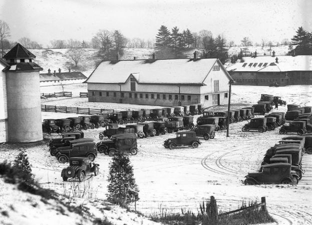
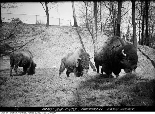
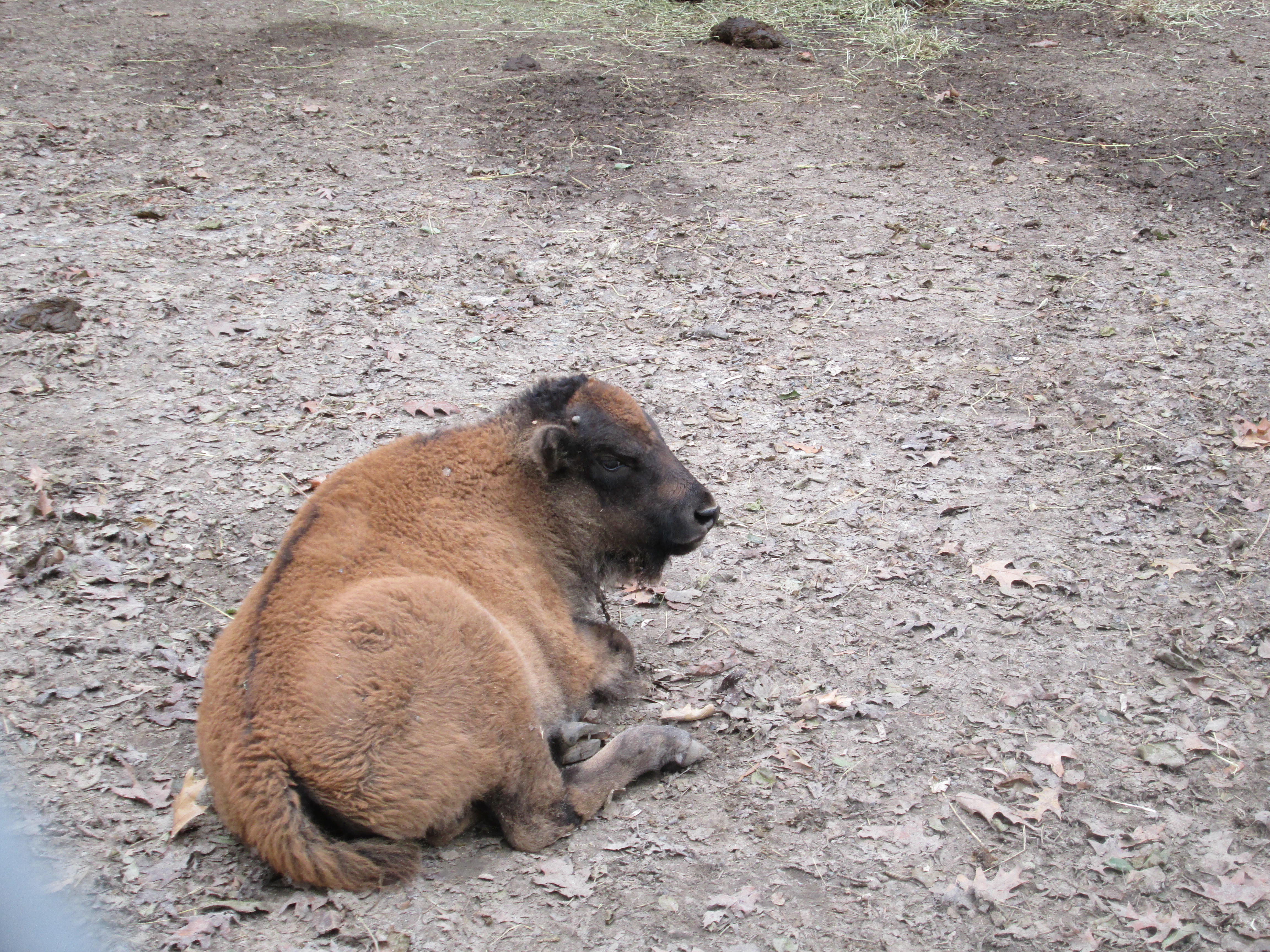
In the early 1800’s it was estimated that there were 60 million bison in North America.  By 1900 that number had dropped to as low as 1,000 animals.  Preservation efforts have restored their numbers to about 350,000.  American Bison are often called Buffalo but are in fact only distantly related to the buffalo. High Park has had bison for over 100 years, meaning that they have been part of the conservation effort from the earliest days.  The cover picture shows the bison as they appeared in 1926.  This little female bison was born this spring and can live for 25-30 years.  It’s possible that she is one of a long line of bison born in High Park and descended from the bison in the cover photo.

IMG_1387

The archive photo below shows a buffalo pen at the zoo in 1908.

High Park zoo. - [1908?]

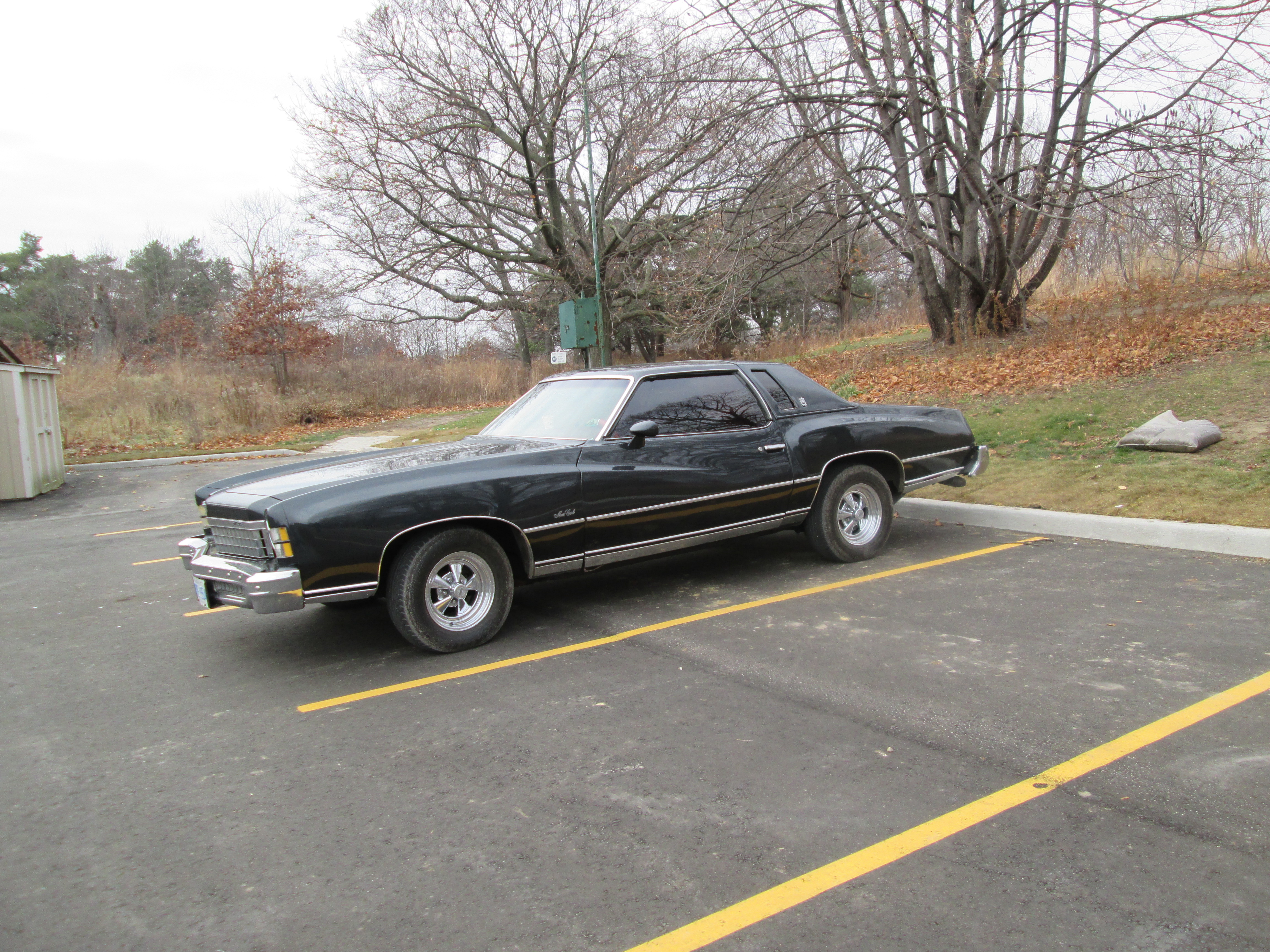
When we got back to the car we found a 1974 Monte Carlo in the parking lot.  These cars were one of my favorites back when they were new because I always like the exaggerated folds on the side panels.  In 1973 the US federal government had mandated a 5 mph front bumper and extended it to include the rear bumper for 1974. This car features both and the tail lights are date coded 74.  The idea was that a car should be able to withstand a 5 mph impact without damage to the lights, engine or safety equipment.

IMG_1394

Much of High Park remains unexplored, awaiting future expeditions.

Like us at www.facebook.com/hikingthegta for a gallery of unpublished photos.

High Park – Colborne Lodge

Saturday November 22, 2014

Colborne Lodge was built by the founder of High Park and is tied to the Upper Canada Rebellion of 1837.  It was the first hike of the season with snow on the ground.  At minus 2 it wasn’t very cold but proper winter hiking clothes, and boots with good treads were required.  You can park on West Drive in the north east corner of the park just south of Bloor street.  At 398 acres, High Park is the largest park in the City of Toronto.  John Howard created the park in 1873 with a grant of 120 acres.  Another 40 acres, including his home, passed to the city in 1890 upon his death.  The city purchased two other adjacent parcels of land to create the modern park.

Wendigo creek rises in this corner of the park and flows into Grenadier Pond.  Along the edge of the creek we walked through a patch of tall grasses known as Invasive Phragmites, or European Common Reed.  These grasses were about 12 feet tall and can grow to 15.  They choke out native plants and release toxins into the soil.  The heads of the reeds look fluffy at this time of year but are actually quite coarse.  In these reeds we disturbed an American Bittern.

IMG_1171

Near where Wendigo creek empties into Grenadier Pond we saw these circles in the newly forming ice.  One possible explanation for the circles is rising water from springs below the pond.

IMG_1176

John George Howard came from England with his wife Jemima in 1832.  He was Toronto’s official surveyor and was the first professional architect in Toronto.  He designed many of Toronto’s early buildings including banks, jails and the provincial lunatic asylum.  In 1836 he purchased a 160 acre property which included Grenadier Pond.  In 1837 John built a house named Colborne Lodge on the highest point of land on his property along the lake Ontario shoreline.  This was the same year as the Rebellion of Upper Canada.  By naming his home after Lieutenant Governor John Colborne, who was commander-In-Chief of all British armed forces in North America, Howard was making a bold statement about which side of the rebellion he stood on.  In 1855 they moved here full time and he began a series of expansions and modifications that would continue until the time of her passing in 1877.  The picture below shows the house as it appears today, virtually unchanged from the 1890 photo in the cover picture.

IMG_1199

Built in the 1850’s the indoor washroom is the oldest in Toronto.  The idea of indoor washrooms was not immediately accepted because people saw them as unsanitary and likely to lead to cholera.  The outside of the washroom door was wall papered like the hallway and guests would not be told that it was there.  This is a picture of the oldest flush toilet in the city.

IMG_1245

The shower was gravity fed from a heated tank on the second floor.

IMG_1248

Jemima was one of the first recorded cases of breast cancer in Toronto.  She retired to the second story  bedroom where she was kept sedated with medication, mostly consisting of heroin.  Several times she wandered off and was lost in the park for up to a day at a time.  Early on, she was almost transferred to the provincial lunatic asylum, but she stayed in this room from 1874 until her death at the age of 75.   A night table is set up in the room with some typical medicine bottles from the 1870’s.

IMG_1243

The house contains almost all original furniture, much of it made by John himself.  When his wife got sick he made a commode for her and disguised it as an elegant chest of drawers.

IMG_1244

In 1874 John began to build a double tomb to memorialize his wife’s grave and eventually his own.  He built a 10 tonne monument and topped it with a Maltese Cross.  He purchased a piece of the 1701 wrought iron fence that had surrounded St. Paul’s Cathedral in London until a road widening made it obsolete.  Paying $25 to use the trans-Atlantic cable, he secured the purchase only to have the ship sink in the  St. Lawrence River.  John then paid for divers to salvage the gates from the shipwreck.  The tomb is visible from Jemima’s bedroom window and it was John’s way of showing her that although she would be leaving first, they would be together for eternity.  She died Sept. 1, 1877 and he followed on Feb. 3, 1890 at the age of 86.  John left provision that the servants be allowed to remain in the house for as long as they lived.  Their respect for the Howard family is shown in the fact that they maintained the property until the First World War.  The Howard family tomb and it’s 300 year old gates is pictured below.

IMG_1187

James Rogers Armstrong opened a dry goods store in York in 1828.  By the 1840’s he had established a foundry named J. R. Armstrong and Company specializing in stoves.  In 1856 he retired at the age of 69 and left his foundry under the management of his son, James Rogers Armstrong.  The stove in the Howard house is a model known as The Royal and was manufactured by Armstrong in 1874.  This can be seen in front of the oven door when the picture below is enlarged.

IMG_1253

Bees stop flying when the temperature goes below 10 degrees C.  The queen bee huddles in the centre of the nest and the worker bees crowd in around her to keep her warm.  The bees rotate through the nest during the winter so that no bee gets too cold.  They consume their honey for energy to allow themselves to shiver and produce heat.  The nest in the picture below had fallen out of the tree and you can see bees still inside.  These ones likely won’t be making it through the winter because the nest is badly broken open.

IMG_1209

Like us at http://www.facebook.com/hikingthegta for a gallery of unpublished photos.

Don Valley Brick Works

Sunday, Nov. 16, 2014

It was minus two with light snow flurries but one of those pleasant days when fall is trying to be winter. There is plenty of pay parking on the site of the brick works (Google Maps link).

In 1882 William Taylor was digging holes for fence posts on his farm when he uncovered some good looking clay.  Checking with a local brick maker, he was told that the clay was ideal for bricks.  William and his two brothers operated the paper mills at Todmorden.  By 1889 they had opened up the Don Valley Pressed Brick Company.  By the early 1890’s they were winning international awards for the quality of their bricks.

There were earlier wooden buildings but the oldest of the 15 remaining ones, and the first one made of Don Valley bricks, is the 1891 dry press brick plant.  This building held most of the early production and was built in the first two years of operation.

IMG_1121

This is the view from the top of the quarry looking down on the last remaining kiln chimney, built in 1906.  This chimney, as well as three others, provided a continuous draft over a series of kilns. As can be seen in the cover photo each chimney contained one word that together spelt out Don Valley Brick Works.  Only the “Valley” chimney remains.

IMG_1073

On April 19, 1904 a great fire destroyed much of the downtown of Toronto.  When it was over, there were 104 buildings which had burnt down.  The city enacted new laws to reduce the risk of another serious fire and these included a move toward more brick construction.  Over the next few years much of the Toronto skyline would be built using Don Valley bricks.  Some of the major buildings constructed of their bricks include Sick Kids Hospital, Toronto General, Osgood Hall, Massey Hall, and Old City Hall.  The fire proved to be a major boom for the brickworks and they expanded quickly over the next few years.  By 1907 production was up to 100,000 bricks per day.  The picture below from the Toronto Archives shows Front Street after the fire.

800px-4TorontoFire

In 1909 the business was sold by the Taylor brothers to their brother-in-law Robert Davies. Davies invested a lot of money into the brickworks and erected four of the buildings that remain today.  In 1910 he built the sales office pictured below.

IMG_1048

That same year another production facility was added beside the 1891 building where soft mud, stiff mud and dry bricks were produced.  It still houses the original shakers, dust collectors and sieves as pictured below.

IMG_1134

In 1912 a sand and lime storage facility was added.  The picture below is taken from the rear of the building.  This building features prominently in most old photos, including the aerial ones, of the 43 acre site due to the conveyor belt that always runs into a window on the back.  In the cover photo the conveyor on the right is carrying raw materials from the quarry into this building.  The picture of the complex in the cover photo includes the Half Mile Bridge which is described in a separate post.  We can date the photo to the early 20’s by the buildings and the steel construction of the half mile bridge.

IMG_1083

Large quantities of water are essential for the production of bricks.  The Taylor brothers diverted nearby Mud Creek to flow through their brick factory site.  In the picture below  there is a water channel that runs down the centre of the picture.  A rock wall lines the left side of the channel. The 1926 water treatment plant is the single story building that actually straddles the waterway. The front view of the 1912 sand and lime storage shed is on the right with the flower art sticking out of one third story window.

IMG_1100

During the second world war there were many German soldiers taken captive.  It was feared that if Germany invaded England these prisoners would be freed to fight again on the side of Germany.  A shortage of food and people to guard the prisoners led to the decision to inter some of them in prison camps in Canada.  One of these camps was at Todmorden and the inmates were forced to work at the Don Valley Brick works.  If you own a brick home built in the early 1940’s chances are that German POW’s made the bricks.

The business was sold again in 1956, this time to United Ceramics of Germany who went on an expansion program.  Seven new buildings were added between 1956 and 1961.  These included another dry press brick production building and in 1956 a building with 3 rows of kilns.  These kilns were fired at 1800 Fahrenheit and it would take a cart of bricks 2 days to pass through the 5 stages of the oven.

IMG_1060

An old brick press machine still sits in the welcome centre.

IMG_1091

The view from near the front of the pit looking north to the back.  In the early 1900’s the north face became an international geological site when it was discovered that there were fossils indicative of warmer climates.  From this they deduced that there was more than one ice age.  To get perspective on the size of the pit take notice of the person walking on the trail below.

IMG_1077

I climbed the hill on the north face to get a clear view back across the quarry to the cluster of old buildings.  The Bloor Viaduct (1918), also known as the Price Edward Viaduct, can be seen just beyond the compound.

IMG_1081

When the clay and shale were exhausted the pit was shut down and some of the equipment was sold off. The site sat abandoned for close to 20 years while the weather and lack of repairs took it’s toll on the buildings.  Wild parties and graffiti artists left their marks in the various facilities as well.

Starting in the mid 1990’s the site has been under restoration.  The quarry was partly filled in using excavations from the towers downtown including the Scotia Bank tower.  Mud Creek has been used to form 3 ponds and native vegetation has been re-established.  The site is now managed by Evergreen which has transformed it into an environmental showcase.  The building below was constructed to qualify for LEED platinum status as a building with one of the smallest carbon footprints in the world.  It uses part of the old holding building where bricks were kept before they went to the kilns.

IMG_1141

There is much more to be seen at the brick works and more opportunities to explore.  The guided tour sounds interesting but was not operating when I was there.

A list of our top 15 stories can be found here.

Google Maps link: Don Valley Brick Works

Like us at http://www.facebook.com/hikingthegta

Follow us at http://www.hikingthgta.com


Fisherville – Ghost Towns of the GTA

Wed. Nov. 12, 2014

Fisherville was named after the Fisher family. Jacob Fisher emigrated from Pennsylvania with 22 members of his family in 1797. They were granted a tract of land which was on both sides of Steeles, east of Dufferin Street. They ran a sawmill on the West Don River and later a grist mill which operated with different owners until about 1912.  This property was instrumental in the distribution of Insulin throughout Canada under the name of Connaught Labs.

Two mills are marked on the 1887 map of the park area, along with their mill ponds.  A grist mill located on the second property south of Steeles Ave. is the site of Jacob Fisher’s original mill.  I have been unable to find any trace of the saw mill on the second property north of Finch and believe that it was removed during construction of the flood control pond in G. Ross Lord Park.

Fisherville Mill

The cemetery from the Presbyterian Church stands on a little rise of land between the East Don River and the retirement home that stands on the former church property. Several stones have been rescued and placed in a common monument.  Isabella Watson, whose marker is seen below was born in 1793.  That’s the same year that Toronto was founded as York.

Fisherville stone

Perhaps the only surviving building from Fisherville is the Presbyterian church which was built in 1856.  The cover picture features a painting of the church as it appeared when it was still located near the north east corner of Dufferin and Steeles.  The church cemetery remains but the former church site is now a retirement home.  Below is a picture I took of the church in 2006 in Black Creek Pioneer Village where it was moved in 1960.

OLYMPUS DIGITAL CAMERA

I parked in the back of the second parking lot in G. Ross Lord Park.  I had only a half hour to explore before I needed to be on my way back to work.  The main trail leads past the park facilities and down the hill toward the East Don River.  At the bottom of the hill, I made a left and crossed two foot bridges over the river.  Around the bend, a single row of pine trees marks the earthen wall of the old dam.  The row of trees is broken in the middle of the picture and this is where the river flows through.  At this point the earth wall has been removed and the dam in the river destroyed.  In the middle of the picture is an old chimney typical of a coal fired steam plant that would have been common around the turn the last century.  I believe this is part of the Sanofi Pasteur facility that occupies a large farm in former village of Fisherville.

IMG_1035

Jacob Fisher, after whom the village was named, set up a mill on the East Don River as early as 1797.  Considering that Lieutenant Governor Simcoe had only arrived in Upper Canada in 1793 to begin settlement, this is a very early date.  Jacob Fisher constructed the earthen berm across the valley to retain the river water and create a mill pond.  A wooden dam would have been built across the river itself.  The concrete dam in the picture below would have been introduced in the late 1800’s or early 1900’s to prevent the ongoing repair that a wooden dam required.  It was dynamited after the flood of Hurricane Hazel. (All traces of the old dam were removed from the river in the spring of 2017.  The earthen berm still runs across the floodplain with a row of pine trees growing on top to mark the site.)

IMG_1036

Backtracking to the nearest bridge I entered the woods and climbed the little hill on my right.  A deer trail runs along the park side of the Sanofi Pasteur fence.  Following this trail, I made my way to the line of pine trees.  Where the mill pond berm meets the park embankment there is a section of the earthen wall that is cut away.  This is where Fisher drew the water from the mill pond to turn the water wheel on his grist mill.  The picture below is taken from the outside of the pond looking up the old raceway.  The two larger trees just to the right of centre are growing in the raceway.

IMG_1027

Just behind where this picture was taken is a square area outlined by pine trees that are growing on the valley floor.  The mill was located inside this area.  It was common to plant trees around buildings to provide shelter from winter winds and summer sun.  From aerial photos I have determined that the mill was removed between 1962 and 1971.  There is nothing left of the original foundation but this strip of concrete that would have supported a later addition or repair.

IMG_1032

Returning to the trail I took another picture which more clearly shows the location of the old mill.  Just to the right of centre the pine trees dip down and there is a darker area of trees where they are deeper than a single line.  This is the location of the mill as seen from the west side of the river.

IMG_1039

I first explored this park and found the remains of the old dam in 1997 when I started working in the neighbourhood.  It took 17 years to finally stand where the mill once stood.

Google Maps Link: Fisherville

Like us at http://www.facebook.com/hikingthegta

Follow us at http://www.hikingthegta.com

Rowntree Mills

Saturday, Nov. 8, 2014

It was overcast and 5 degrees with occasional light drizzle.  Parking is available on Hathor Crescent just before Rowntree Mills Road descends the hill to the river.  The road is closed at the bottom of the hill and from here the bridge across the Humber river can be seen.  The bridge is a steel girder construction and has been fitted with new wood decking to convert it into a safe pedestrian bridge.  It’s construction likely dates to around 1900.  The bridge can be seen crossing the river in the lower corner of the cover photo, which is an aerial shot from 1953. The photo below of the bridge is taken from the west bank of the river.

IMG_0923

Joseph Rowntree arrived in Canada from England in 1830 and set himself up in an area known as Pine Ridge, just outside of Thistletown.  In 1843 he built a saw mill on the east side of the Humber river and in 1848 he built a grist mill on the west side.  A road was built to access the mill which we now call Rowntree Mills road.  A bridge was built across the river and he named it all Greenholme Mills.  In 1870 Joseph added the Humberwood Mills, a mile down river, to the family holdings.  The cover photo shows the grist mill as it appeared in 1953. Rowntree Mills road crosses the bridge and passes to the west of the mill.  A laneway completes the loop on the river side of the mill.  Today the area where the mill stood 60 years ago has become completely overgrown.  All that could be found was this square area of concrete in the woods and many piles of bricks, stone and concrete.

IMG_1017

From the east side of the river the former mill site can be identified by the row of pine trees that ran along side of the lane way that lies between the mill and the river.  They show up as the dark strip to the right of the road, adjacent to the mill, in the cover photo.  I can picture Joseph planting these pines along the ridge in honour of the community of Pine Ridge where he lived. The mill stood about 20 feet above the current water level of the river.  It isn’t immediately obvious how Joseph used the water power from the river to turn the grinding wheels in his grist mill.  It may have initially been an undershot wheel sticking out into the river.

IMG_1024

It was a morning full of various birds.  At one point a migration of cardinals passed through but none sat still long enough to get their picture taken.  There were also flickers, herons, and large birds of prey.  Some of the trees in the area display the straight rows of tiny holes that are typical of a yellow-bellied sap sucker.  These woodpeckers drill little holes from which they feed on the sap that flows out.  The tree in the picture below had these rows of holes extending for as far up the tree as the eye can see.

IMG_0930

This plant is known as tall thimbleweed.  The single head on a tall stem contains tiny nubs that make it look like a thimble.  When the seed heads burst open they look and feel like cotton. Native peoples used the plants for medicinal purposes but we now know that the leaves are toxic in large doses and so the plant is used mainly for decoration.  The picture below shows both a closed pod and one that has blown open to spread its seeds to the wind.

IMG_0937

This very large red tailed hawk didn’t seem to mind posing for the camera.

IMG_0993

Rowntree Mills Park and the surrounding ravines have been taken over by white tail deer.  In one spot I was able to see 8 females at one time plus at least one male.  Mating season is known as rutting season for these deer.  Males begin their part of the rut in the fall when the velvet is falling off of their antlers.  In North America this lasts for several weeks with the peak being on average, November 13th.  The male’s part in the reproductive act lasts for exactly one thrust.  Ho-Hum.  Females go into rut for periods of up to 3 days at a time and can do so 7 times over the rutting season, or until they conceive. The picture below has at least 4 deer looking at the camera plus 4 others hiding in the background.

IMG_1005

In October 1954 the area on the east bank of the river just north of Rowntree Mills road was home to a small community of houses.  On the morning of October 16, 1954, there were 12 less of them there because Hurricane Hazel had swept them away.  Two people died in this area as well when they were trapped in their car as the river washed it down stream.  Today the area has been cleaned up and there is no trace, other than in old aerial photos, to show where the homes were. Rowntree Mills Park was named after Joseph in 1969 but was closed in 2009 due to wild parties that trashed the park.  Today it is basically abandoned although the grass is cut and the leaves are cleaned up.  The picture below is taken from the front yard of one of these former homes looking along the street where others once stood.

IMG_1023

At the corner of Rowntree Mills Road and Islington Avenue is a pioneer cemetery.  This land was donated in 1848 by Joseph Rowntree to be used for Pine Ridge Methodist Church and its cemetery.  There are many grave markers in here that commemorate the lives of various members of the Rowntree family.  Although it seems likely that Joesph was laid to rest here, I was unable to locate his grave marker.

IMG_1026

Google Maps link: Rowntree Mills Park

Like us at http://www.facebook.com/hikingthegta

Follow us at http://www.hikingthegta.com


Bayview Estates

Sunday Nov. 2, 2014

It was bright and sunny but cold, minus 1 on the thermometer with a wind chill of -9.  Warmly dressed I set off from home on foot.  I headed to Sherwood Park to cut out to Blythwood Ave.  A few trees in the park are holding onto their leaves.  These three trees are distinctive in their colouring.  The yellow one on the right is a maple, the rusty one in the middle is an oak and the orange on one the left is an aspen.

IMG_0857

In the early 1920’s it became fashionable for Toronto’s wealthy to want a country estate on the edge of the city.  The area of First Line East (Bayview Avenue) and 5th Side Road (Lawrence Ave) was ideal with Don River Ravine lots.  One of the largest tracts was 175 acres which belonged to Alice and Joseph Kilgour.  It is at the end of Blythwood and stretched from Bayview to Leslie. Many original buildings including the barns and stables remain in use.  The cover picture shows the estate as it looked in the 1920’s.  When she passed away in 1928 Alice gave the property to the city on condition that it never be developed.  The influx of injured soldiers during the second world war created a need for a new hospital which was originally to be called Soldier’s Military Hospital. Today it is known as Sunnybrook Health Sciences Centre. Tucked away in behind the newer hospital is the original building with it’s clock tower.  The date stone shows that it was laid on Nov. 10, 1945.  As we come to Remembrance Day 2014 it is fitting to think of the sacrifices that so many made to secure our freedoms.  Sometimes we remember the dead but forget that so many were injured that we needed a new hospital just to cope with them all.

IMG_0858

In 1928 James McLean, the president of Canada Packers, bought 50 acres of land overlooking the Don river on which to build his estate.  He called the property Bay View, leading to the changing of the name of First Line East to Bayview Avenue.  When McLean and his family moved into the house in 1931 they employed 4 gardeners for the upkeep of the grounds.  Today the home is known as McLean house and it is on the grounds of Sunnybrook Hospital.

IMG_0867

Many of the Bayview Estate owners had horses and McLean was no different so a separate coach or carriage house was built to store the carriage and the tack.

IMG_0865

John James Vaughan was the vice president of T. Eatons Company in 1930 when he had Donningvale built on 31 acres of land on the Don River.  It was grandly appointed with mahogany and large fireplaces.  It too is now located on the property of Sunnybrook Hospital.

IMG_0870

In 1920 Edward Rogers Wood purchased 85 acres of land nestled into a glen on the Don river where he set about creating the aptly named Glendon Hall. Wood had made his fortune as president of the Bank of Commerce and Canada Life starting when he was just 30.  The property had been in use as a farm and the land was fully cleared of trees.  Wood brought in mature trees and built gardens that became internationally known for their beauty and the speed with which they were built.  Wood had spent forty years as a millionaire quietly donating his fortune to hospitals, churches, and universities.  In 1959 when his wife Agnes passed away it became known that they had made their last and greatest gift by leaving their estate to the University of Toronto.  In turn, U of T gave it to York University in 1961.  The property now is in use as York University Glendon Hall.

IMG_0882

Bayview Avenue was originally known as First Line East and then later as East York Line because it divided Toronto from East York.  Until 1929 it was a dirt country road which crossed the West Don River on a single lane bridge.  When Bayview  was widened it was also moved to the west and given a new bridge across the valley.  The first Bayview  Bridge was built in 1891 and has been abandoned for 85 years and the old road allowance is becoming grown over.

IMG_0886

Just past the new Bayview bridge on the west side of the river is the full contents of an old home. A fridge, stove, washing machine, and many other items have been thrown down the embankment.  Lying among the oak leaves I found a 1944 Coke bottle.  This is the oldest soft drink bottle that I have brought home so far this year.

IMG_0894

Clifford Sifton was influential in Canadian politics at the turn of the twentieth century.  He was the minister of immigration and was key in the development of the Crows Nest Pass agreement. American railways were extending their lines into southern B.C. to take advantage of the minerals that had been found there.  At the same time, prairie farmers were complaining about the high rates charged for moving their grain.  This made it political suicide for the government to fund the railway expansion.  Sifton negotiated a deal that funded the Canadian Pacific Railway extension through the pass and secured permanently lower rates for the farmers.  This also served to protect Canadian interests in lower B.C.

In 1923 he built this 22 room mansion on 26 acres of land on the former Lawrence property on the north west corner of Lawrence and Bayview.  Like the other estate owners in the area, Sifton was into his horses and kept riding stables on the property.  The area just north of here is known as The Bridle Path because of it’s horse trails that used to cater to the Bayview Estate owners.  Sifton only got to enjoy his dream of living on a country estate for a few years as he died in 1929.

IMG_0920

This house was built for Clifford’s son, Clifford Sifton Jr.  It was complete with a swimming pool.

IMG_0918

A third house was built on the estate for his other son, H. Arthur Sifton.  These three homes are now part of the Toronto French School.

IMG_0917

For about 30 years from 1925 to 1955 the Bayview and Lawrence area was a pastoral country home to many of Toronto’s most influential people.  Today, their grand homes are almost forgotten in the bustle of mid-town Toronto.  Toronto’s millionaires have located onto The Bridle Path making it the most affluent community in Canada.

According to my pedometer I made it back home after 16173 steps.

Looking for places to explore?  Check out Greatest Treks and Greatest Treks 2 for 30 of the most popular hikes.

Like us at http://www.facebook.com/hikingthegta

Follow us at http://www.hikingthegta.com