Monthly Archives: October 2019

Haunted

October 31, 2019

There’s quite a few places that we’ve visited that have a record of being haunted.  It seems that almost every place that has a long history also has some stories of paranormal sightings over the years.  Even though no spirits have chosen to reveal themselves to us when we visited, there are many who claim to have had experiences in these locations.  In the Spirit of Halloween we present links to half a dozen hot spots in the GTA plus a couple more outside of it.  In each case we’ll give a brief description of the location as well as the haunting.  A picture of the place and a link to a more detailed story will be included.  Google Maps links for the actual sites are included in the longer posts.

1) Mimico Branch Asylum.

The remains of over 1500 patients who died at the asylum and were never claimed lie in a small graveyard near Kipling and the Gardiner Expressway.  It is said that some of their spirits haunt the tunnels between the buildings at the old hospital.

img_5582

2) Merritton Blue Ghost Tunnel

This railway tunnel under the Third Welland Canal is said to be haunted by a blue ghost.  Perhaps a railway fatality or a spirit from the graveyard that was flooded during canal construction.

img_2981

3) The Devil’s Punch Bowl

Over the years there have been several suicides at the Devil’s Punch Bowl and it is said that the spirits of the love lost remain at the waterfall, seeking their lovers.

img_2077

4) Bronte Creek’s Haunted House

Henry Breckon died in 1931 and his body was laid out in the front parlour for days while a wake was held.  Many people claim to have seen his spirit which remains in the house opening and closing doors for fun.

img_2216

5) Old Finch Avenue

The story of a girl who was murdered on her birthday is attached to the Old Finch Avenue bridge and it is said that if you call happy birthday on the bridge that she will respond.

img_88491

6) Ghastly Tales of Sawmill Valley Creek

With an elephant buried in a community park and a ghost that still tends the fire in Glenerin Inn, this is one of the stranger places in the group presented here.

img_0128

7) The Hermitage

Does the ghost of a jilted lover still haunt the ruins of this estate in Ancaster?  Many claim this to be one of the most significant places for paranormal activity in the area.  After committing suicide, the body of John Black could not be buried in the cemetery and so it was transported to an unmarked grave via a manure cart.

img_0693

8) The Bloor Viaduct

The Bloor Viaduct has been the site of nearly 500 suicides over the years.  I don’t know of any specific haunting, but this would stand to be a place of potential paranormal activity.  This bridge is near the downtown core of Toronto.

img_4768

Happy Halloween from Hiking the GTA.

Like us at http://www.facebook.com/hikingthegta

Follow us at http://www.hikingthegta.com

Now also look for us on Instagram

Midland Railway

Friday October 4, 2019

While in the area of Port Hope on a vacation day I decided to check out the remains of one of the first railways in Ontario, then known as Upper Canada.  Port Hope had originally intended to build a rail line to Peterborough but was beaten by Cobourg who launched the Cobourg and Peterborough Railway in 1854.  The remains of this rail line can still be found in our post Rice Lake’s Sunken Railway.  The plans were changed and the Port Hope Lindsay and Beaverton Railway was born.  In 1869 the name was changed to the Midland Railway.  Passenger service ended in the 1950’s and most of the line was abandoned by 1970.  The conversion of the line to a hiking trail marks one of the earliest rails to trails projects in Ontario.  Part of the old main line is now used as the Ganaraska Hiking Trail.

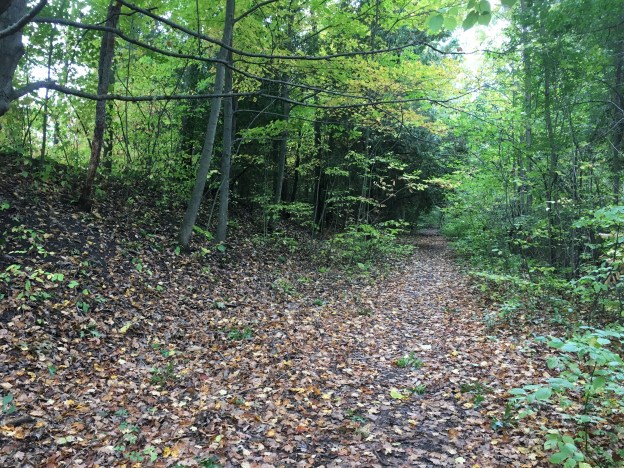
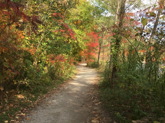
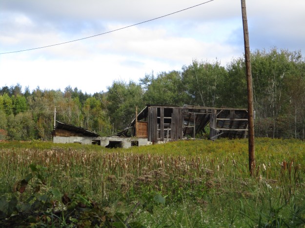
My exploration began in the Port Hope Conservation Area.  One of the hiking trails following the north side of the river follows the old right of way for the railway.  As you walk along the trail you will see that you are following a berm that is occasionally replaced by wide embankments where the rail line cut through small hills to create a level roadway.  Material taken from the cuts was used to build the berm through the hollows.  The picture below shows some of cut embankment on the right of the shot.

IMG_7405

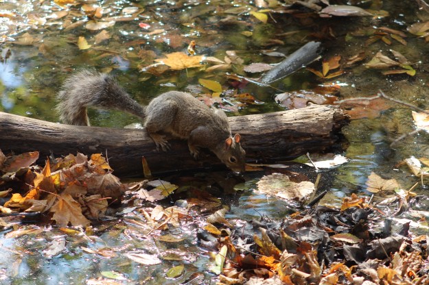
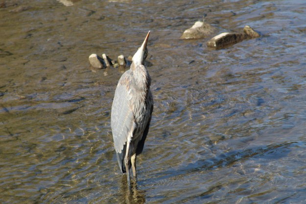
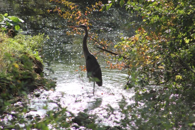
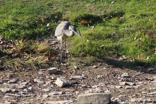
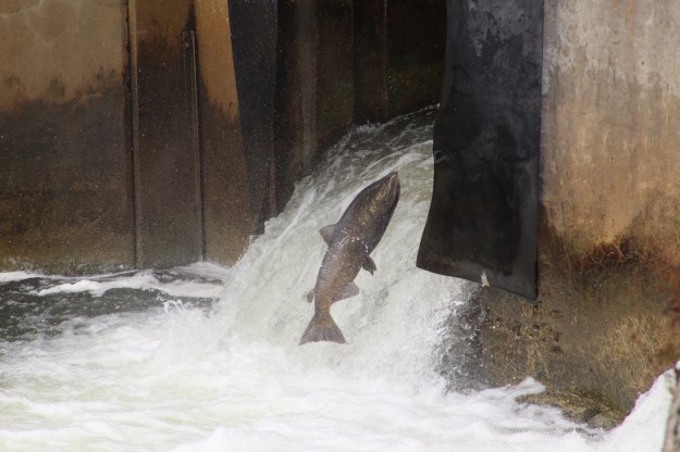
Corbett’s dam stands on the site of an earlier dam that was built in 1889 by Doctor John Corbett.  It was expanded in 1893 to produce electricity which it continued to do until 1912.  A fish ladder was added in 1973 to facilitate to migration of Rainbow Trout in the spring and Salmon in the fall.  On the day that I visited there were countless salmon in the river all trying to make their way up the fish ladder.

IMG_7594

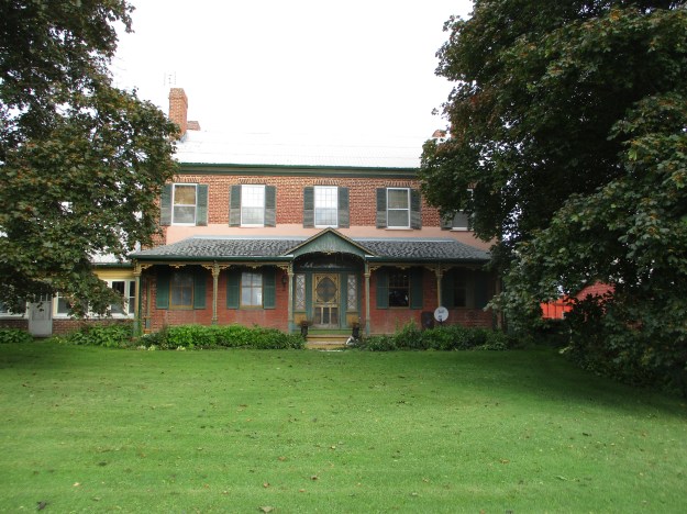
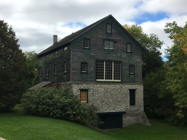
As the railway continued downstream it passed the industrial heart of Port Hope.  Some of the earliest enterprises in many communities were the lumber and grist mills.  The grist mill in Port Hope is one of the few surviving examples of post and beam construction of a mill.  It stands on a foundation of river rock.  In 1851 John Molson wanted to expand his brewing empire into Upper Canada and so applied to Toronto for a permit.  He was rejected due to local competition and so he looked to the second largest port in the province which was Port Hope. He purchased a piece of property on the river about a mile outside of the downtown area.  The purchase included a grist mill, saw mill and a stave factory.  The mill had six runs of stones and was capable of producing 300 barrels of flour per day.  The mill operated until 1924 when it became a studio of Group of Seven artist J. W. Beatty.

IMG_2320

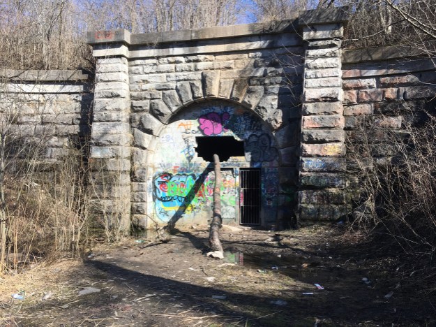
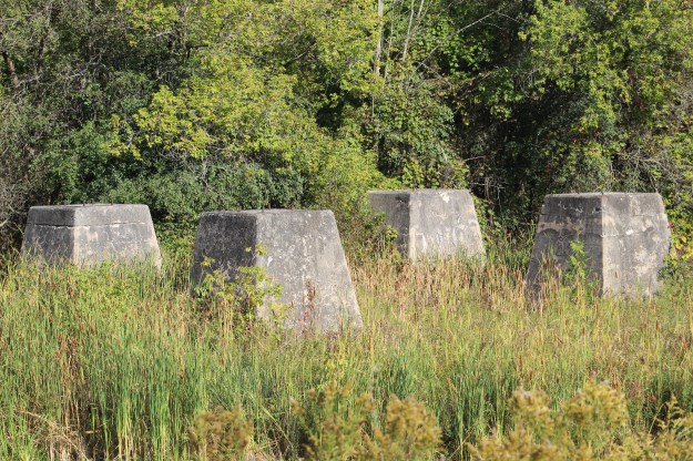
The Canadian Northern Railway also followed the Ganaraska River into Port Hope.  The line opened in 1911 and crossed the river on a series of concrete piers with steel truss bridge spans.  The bridge has been removed but the poured concrete piers still stand on the far side of the river.

IMG_7669

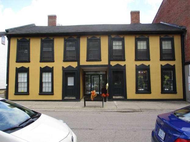
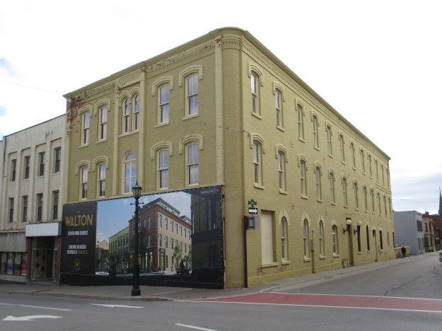
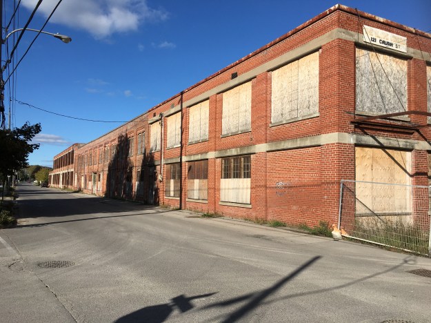
Cavan Street was home to much of the early industry in Port Hope because of the easy access to water power supplied by the Ganaraska River.  The old Globe Factory building at 121 Cavan Street is perhaps the best remaining example of a large scale operation.  Several others exist but have been reduced to single buildings.  The Globe Manufacturing Company started in Port Hope as early as 1830.  The first section of this building was constructed in 1853 and is the middle section.  Later additions were made as the building continued to be a manufacturing site until 1976.  Various tools were produced here including files and related hand tools.

IMG_2346

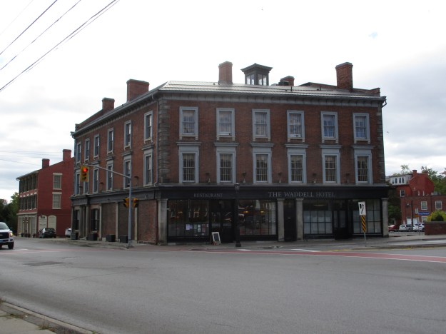
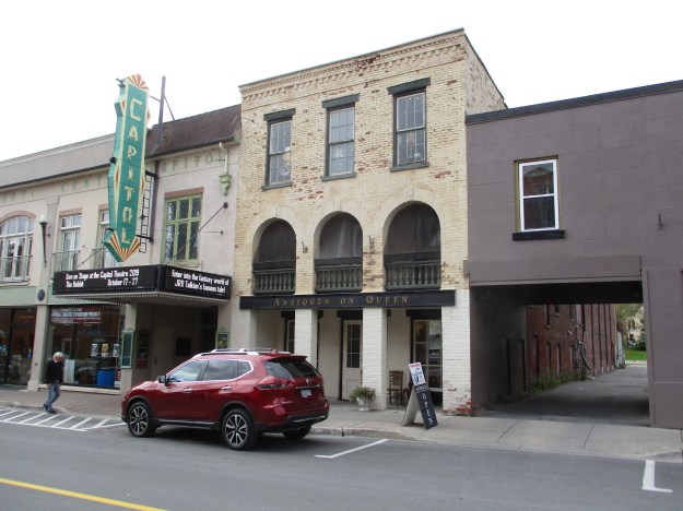
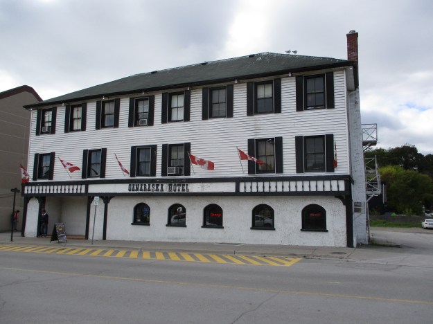
After crossing the Ganaraska River the railway tracks ran up the middle of Ontario Street where they passed the front door of the Ganaraska Hotel.  This was just one of 13 hotels that were in town at the time of the arrival of the railway.  Many of the other ones can be seen in our companion post Port Hope – Historic Hotels.

IMG_7456

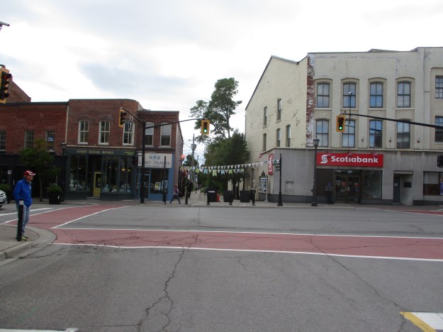
The rail line crossed Walton Street and followed a lane that was granted to the rail line.  The name Lent Street is quite appropriate and remains to this day.  Lent Travel now operates from the small building south of the old rail line while a branch of Scotia Bank leases the historic building that stands to the north.

IMG_7460

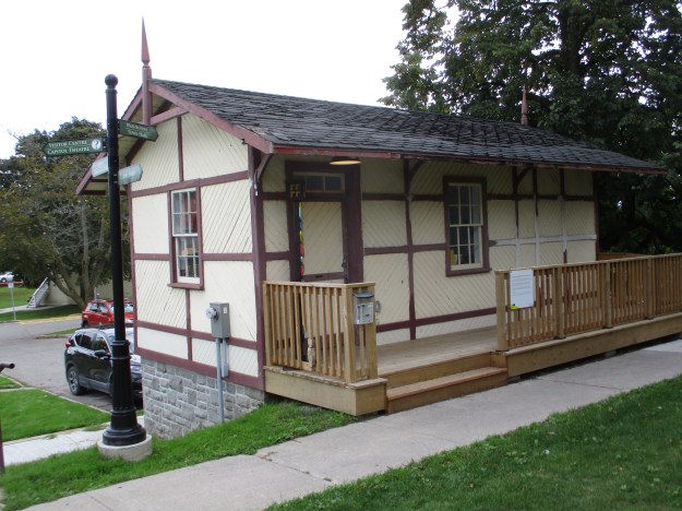
There is a little train station that was built around 1855 and is believed to have been a whistle stop for the Port Hope, Lindsay and Beaverton Railway.  The station was later moved to where it stood beside the Grand Trunk Railway for years.  It was later moved for an employee to use for personal storage.  The building eventually became slated for demolition  but was given to the Architectural Conservancy of Ontario, Port Hope Branch.  They restored the building and moved it to its present location on Lent Street beside the right of way for the Midland Railway.

IMG_7434

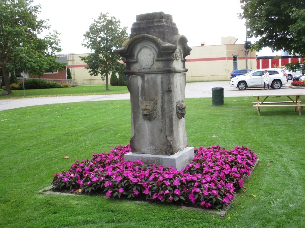
Sitting behind the old town hall is an object that looks like an old tomb stone at first glance.  In 1878 there was no access to drinking water in the town market.  The mayor was William Craig and he paid for the erection of a water fountain on the condition that the Market Committee provide the connection to the water source.  Water flowed from each of the lion heads on the four sides of the fountain for the benefit of the townspeople and their horses.

IMG_7437

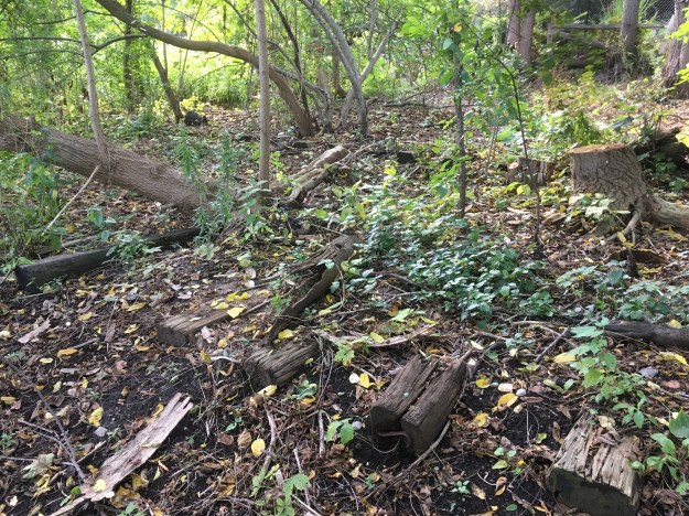
The right of way followed Lent Street as it approached the harbour area.  There are still some sleeper ties that are rapidly becoming overgrown along the old rail bed.

IMG_2324

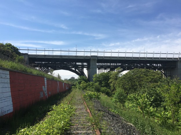
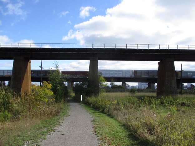
The Midland Railway was crossed by two further rail lines as it neared the harbour.  A single track on concrete piers stand in the front of this picture while the Grand Trunk Viaduct supports a passing train on the old Grand Trunk Line.

IMG_7469

There are so many things to see in Port Hope that it almost begs a return trip to this community on the eastern edge of the GTA.

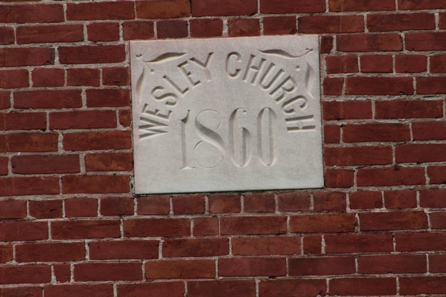
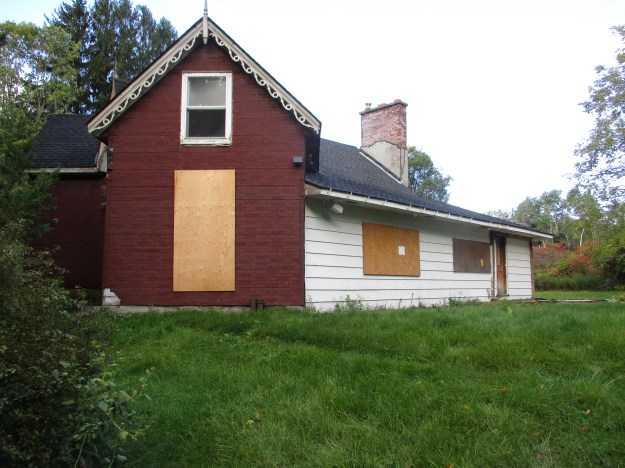
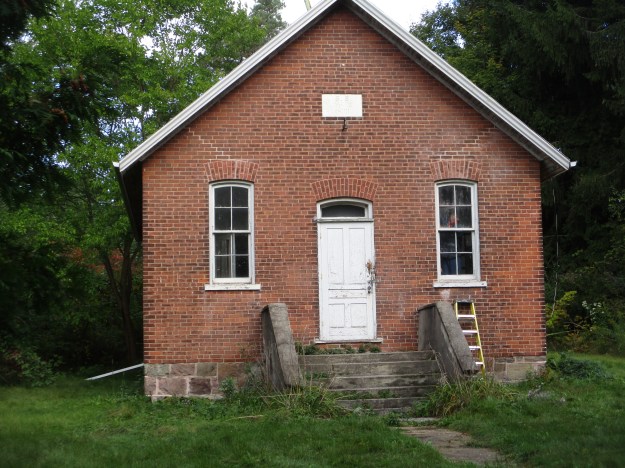
For additional blogs on the area check out Port Hope – Historic Hotels and Wesleyville Ghost Town

Google Maps Link: Port Hope

Like us at http://www.facebook.com/hikingthegta

Follow us at http://www.hikingthegta.com

Also look for us on Instagram

Culham Trail – Eglinton to Burnhamthorpe

Tuesday, October 15, 2019

The Culham Trail runs along the Credit River through Mississauga.  The trail will become part of the Credit Valley Trail when it is completed.  The Culham Trail runs for 12 kilometres but as I had a day off work it seemed like a god time to explore part of the trail.  I parked near Barbertown in a free parking lot at the foot of the bridge that carries Eglinton Avenue across the Credit River.  Barbertown is the site of a ghost town that once served a milling empire in the south end of Streetsville.

From this parking lot I headed south along the river through Hewicks Meadows.  I was quickly treated to the sight of a grey squirrel drinking from a pool of water beside the trail.

IMG_8003

There were several great blue herons on the river and this one was putting on a display for me.  It was pruning its feathers and making funny faces and head motions as if it was trying to make me laugh.  It worked.

IMG_7991

It will soon be time for snakes to prepare to hibernate for the winter.  This common water snake was taking advantage of the nice weather to soak up a little heat and some vitamin D which is used to keep its bones strong.  Snakes will lie in the sun and then move into the shade to regulate their body temperature.  If they get too hot or cold they become sluggish and some body functions, such as digestion, cease to function.

IMG_8012

It was a great day to view herons along the river.  There is a small outfall near the power corridor that carries water from the storm drains in the subdivision above.  As I approached, a small black-capped night heron flew out.  A great blue heron remained in the water as he was more concerned with getting lunch then with me and my camera.

IMG_8019

As I made my way along the side of this outfall I saw the reason for the herons to be hanging out here.  The pool at the mouth of the outfall was full of small fish just waiting to become someones dinner.

IMG_8001

It was a beautiful fall day with the leaves turning colour a little slower this year than normal.  There still seems to be quite a bit of green in the forest.  There is no formal trail through this section of Hewicks Meadow and one can follow the sidewalk through Credit Point subdivision until it enters the park again.  For those who don’t care for sidewalks there is also a path along the side of the river where you can make your way toward the bridge for the 403 and join the formal trail again.

IMG_2525

After you pass the 403 you enter Riverwood Park which includes the former Zaichuk Property.  Several old pieces of farm machinery are scattered throughout the fields and trees.  The house known as Riverwood is the centre piece for the park and this former estate included the first swimming pool in the area that would become Mississauga.  The house was built with stone that was carried up from the river below.  There is a set of old stairs that lead up to the back of the house.  They make an interesting climb but you will find a fence at the top.

IMG_8004

Salmon are making their way up the Credit River in their annual spawning run.  The salmon spend at least three years maturing in the cold deep waters of Lake Ontario.  Then in September or October they make their way back into the river or stream in which they were themselves spawned.  They return to the same spawning beds where they hatched and lay their eggs.  The salmon stop eating when they enter the rivers and expend all of their energy getting back upstream.  After they spawn they have no energy for the return trip and so they die.  Seagulls were feasting on the bodies of dead salmon in the river and other scavengers are attracted by the smell of rotting fish.  There were several turkey vultures circling over the river and a few were resting in the trees along either side.

IMG_8036

As I was making my way back toward the car I saw a Police vehicle at the base of the Burnhamthorpe Bridge.  Three officers got out of the car and made their way toward the river.  I thought this was a little unusual and wondered if someone had been lost or had fallen from the bridge.  I carried on and was surprised to see another Police vehicle at the 403 bridge.  This car had three more officers who were busy inflating a raft.  As there were no incidents on the Police reports for the day it is likely that this was some kind of a training exercise.

IMG_8015

Across the river from the trail is the Croatian Parish Park and there was another great blue heron on the grass.  It was going along and picking up sticks that were in the grass and carrying them over to the river bank where it would drop them on the stones.

IMG_8040

It was nice to see that the local animals help to keep the place tidied up.

IMG_8046

The Culham Trail is an interesting place to explore and it will only become better as the Credit Valley Trail is completed.  An extended look at the trail can be found in our post Culham Trail Mississauga.

Google Maps Link: Hewicks Meadows

Like us at http://www.facebook.com/hikingthegta

Follow us at http://www.hikingthegta.com

Also look for us on Instagram

Port Hope – Historic Hotels

Friday, October 4, 2019

The 1840’s and 1850’s were a prosperous time for the town of Port Hope.  With steamers coming into the harbour and then the arrival of the Grand Trunk Railway and the Port Hope Lindsay and Beaverton Railway in the 1850’s there was a great need for accommodation in town.  The business directory of 1857 lists 13 hotels or inns for the thirsty traveler to choose from.  Several of these historic hotels are still in town and are listed on the roster of Heritage Buildings.  While visiting town I set out to look for a few of them.  Most of the downtown is composed of original architecture and it is a great place to explore.  You can do so on foot after parking for free near the town hall on Queen Street.

1825 – The Marsh Inn served as a stagecoach inn between 1834 and 1854.  It is one of very few original stagecoach inns that have been preserved.  The veranda is not part of the original inn and draws attention away from the door which was the original focal point for the building.   The door appears to have molded columns but these are actually ten inlaid panels that are placed in a detailed surround.  The door has a full-width fanlight that is partially hidden by the veranda.  This inn is on the former Danforth Road, now known as County Road 2, just west of Welcome.  I checked it out on the way into town by going north at the Wesleyville exit from the 401.  A brief side trip south on the same road brings you to the ghost town of Wesleyville.

IMG_7398

1837 – The Ganaraska Hotel was originally opened and was named the Railway Hotel from 1856-1857 when the Midland Railway ran down Ontario Street and past the front door.  Starting in 1864 it went through a series of owners who each applied their name to the hotel.  In 1947 it once again became the Ganraska Hotel and it continues to operate after 182 years.

IMG_7456

1844 – The North American Hotel was built in a prominent position on Walton Street, intended to be the focal point at the end of Queen Street.  It served as a hotel until 1911 also providing stagecoach and livery services.  The stables were kept behind the hotel and could be accessed via the alley between the hotel and the building next door.  The hotel was converted into a pair of street level stores with apartments on the upper two floors in 1919.

IMG_7441

1845 – The piece of land that the Waddell Hotel was built on was formerly an island in the middle of the Ganaraska River.  After the river was diverted into the single channel the area of Mill Street was infilled from marsh land to form another access route to the harbour.   The building originally had retail on the ground floor and a two story hotel above that was reached through a central door off Walton Street.  A Bank of Montreal and a Toronto Bank were located on the Mill Street side of the block.  It remained with the Waldell Family until 1899 and was later converted to residences above ground floor retail.  It has a unique feature in the lantern on the roof top that served as a lighthouse for the harbour.

IMG_7448

1845 – The British Hotel is extremely narrow at just twenty-four feet wide encompassing the three bays.  The front has been altered several times over the years including the fact that the original openings were two stories tall.

IMG_7440

1845 – Midland Hotel was erected in 1845 but as only the first three bays on the right hand side of the building.  When the Midland, Lindsay and Beaverton Railway passed behind the hotel in the 1850’s a second wing with three more bays was added to the north.  A carriage way with another unit above it was used to connect the two sections.  The railway never made it to Georgian Bay so it failed to produce the ridership expected and with the advent of personal automobiles the hotel industry faded from prominence.  In 1917 the hotel was converted into three apartment units.  The carriageway was covered up and forgotten until renovations in 1984 revealed its presence.

IMG_7461

1853 – St. Lawrence Hotel Block is perhaps the largest hotel structure to survive as it is four stories tall and seventeen bays long.  One interesting architectural feature is the detail in the cast iron window heads which changes with each floor level.  The entire block was damaged in a fire in 1965 and was nearly demolished.  In the end it was restored and is now in use as apartments.

IMG_7452

1870 – The Walton was originally named The Queens Hotel when it was built and was a single story tall.  A second story was added in 1876 and a third one in 1907.  Today the hotel is closed awaiting renovations into residences.

IMG_7450

Port Hope prospered because of the railways that passed through town and a companion post will soon be published on the history and relics of the Midland, Lindsay and Beaverton Railway.  A post on the local Ghost Town of Wesleyville can be found at the link.

Google Maps Link: Port Hope

Like us at http://www.facebook.com/hikingthegta

Follow us at http://www.hikingthegta.com

Also, look for us on Instagram.


Google Maps Link: Port Hope

Like us at http://www.facebook.com/hikingthegta

Follow us at http://www.hikingthegta.com

Follow us on Instagram

Wesleyville – Ghost Towns of the GTA

Friday, October 4, 2019

A Friday off work is a good excuse to go exploring.  With a plan in mind to visit Port Hope to look for the remains of the Midland Railway, I decided to stop off the highway one stop earlier and visit Wesleyville to photograph the old church I knew was there.  To my surprise I found an abandoned village as well.

In 1797 Jonathan Brown became the first settler in the town.  He was quickly joined by others and early church services were held in the home of the Barrowclough family.  Soon the family donated land for a church and cemetery and a frame building was constructed.   The present brick church was built in 1860 to replace the frame church.  The Wesleyan Methodist congregation became part of the United Church in 1925 and this church held services until the late 1960’s.

IMG_7385

Wesleyville was a growing community in the 1860’s when it had attracted various tradesmen including a blacksmith, a tavern owner and machine shop operator.   Like many early communities there were a few name changes before the coming of the post office.  When one was opened in the hotel the name was established as Wesleyville in honour of the Wesley Methodist Church.

IMG_7497

The cemetery records show 107 burials between 1860 and 1935.  Burials continued until the 1970’s when the town was abandoned.

IMG_7389

Thomas and Selinda Oughtred arrived in town around 1850 and lived as tenants until 1855 when Selinda was granted 65.5 acres of land.  It is unclear why she received the grant and not her husband.  The house was likely built in 1858 and has a unique design where the front door is set between two angled sections.  The main portion of the house extends to the rear giving it a unique Y shape.  The house was used as the local post office from 1911 until 1944.  The house was sold to Ontario Hydro in 1978 and has been empty for the past forty years.

IMG_7375

Ontario Hydro constructed a large oil-fired generator on the edge of town after purchasing nearly 2,000 acres of land in the 1970’s.  The generator was never finished and has never been put into service.  The OPEC energy crisis hit just in time to ensure the project never got off running.  It stands behind a tall fence topped with barbed-wire.  The Oughtred barn stands on a foundation of field stone behind the house.

IMG_7380

The first school was further west along Lakeshore Road and was a one room log school house.  In 1866 the old frame church building was relocated to the school site which had been purchased for $20.  This old church building served as the school until 1899 when it burned down.   It was replaced with the existing building that served as a focal point in the community until it was closed in 1967.

IMG_7381

John Barrowclough purchased 100 acres of land in town in 1847 and his family continued to farm here until 1992.  The property was then sold to Ontario Hydro and the house has sat empty since then.

IMG_7392

Several outbuildings remain behind the main house, one of which was used as a blacksmith shop.  The Barrowclough family lived here for several generations and was active in the church as well as occasionally serving as teachers in the school.  There was a period of time when the post office was located in the house but in 1911 it was moved to the Oughtred house.

IMG_7395

The Barrowclough barn is quietly rotting away and large sections of it have already collapsed.  It may be too late to save this structure.  The town of Wesleyville has been abandoned for so long that most of the buildings have disappeared.

IMG_7394

The Friends of Wesleyville have done a great job of preserving the few remaining buildings in the town.  The church has been restored and the school is under renovation as well.  It remains to be seen what will happen to the two houses.

Google Maps Link: Wesleyville

Like us at http://www.facebook.com/hikingthegta

Follow us at http://www.hikingthegta.com

Also follow us on Instagram