Monthly Archives: September 2018

Toronto Zoo

Tuesday, September 28, 2018

One hundred years ago people in this city had two options if they wanted to take their children to see wild animals from around the world. The zoo at High Park was smaller then the Riverdale Zoo but both presented some interesting collections.  These two Victorian zoos paid little attention to the habitat in which the animals were housed. The picture below is from the Toronto Archives and shows the polar bear display at Riverdale. The empty cage and concrete pool do not reflect a natural setting and was likely stressful to the animals.

A private citizen’s brief in 1963 made the proposal to build a new zoo which resulted in a recommendation for a location in Don Mills.  This site is now E. T. Seton Park and a location was selected in Scarborough on the Rouge River.  A master plan was created in 1969 and construction began in 1970.  On August 15, 1974 The Metropolitan Toronto Zoo was opened.  It greatly expanded the 7.4 acres of Riverdale Zoo being 100 times the size at 710 acres.  Care was taken to enhance the living conditions for the animals as well as the public’s viewing pleasure.  The hippopotamuses have a nice pond to cool off in and living quarters that are far more comfortable than the polar bear exhibit at Riverdale shown above.

The zoo participates in several breeding programs with other accredited zoos.  Animals that are considered to be endangered in the wild are bred and where possible, the offspring are released back into the wild.  There are several species of wild cats at the zoo and I tried to see all of them.  The clouded leopard is considered vulnerable and there are only about 10,000 of them remaining worldwide.  The tail is very long with some males having up to three feet of tail.  The canine teeth are also very long being 1.4 inches and the longest in any modern feline.  They are considered to be the modern saber-tooth cats for this reason.

Sulawesi Babirusa is considered to be a pig but scientist say that it may be more closely related to the hippopotamus.  The name comes from the Malay words Bibi meaning pig and Rusa meaning deer because the tusks are said to look like antlers.  The tusks continue to grow for the 10 years the animal lives in the wild.  Specimens in zoos can live up to 20 years and if the tusks are not broken or ground down they will eventually grow to the point where they pierce the skull.  Zoo workers have to keep them trimmed.

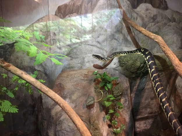
The zoo is home to snakes from all around the world including pythons and cobras.  They have participated in programs to help protect the Eastern Massasauga Rattlesnake which is considered vulnerable to extinction.  The population is in decline due to decreasing habitat and loss of genetic diversity in isolated populations.  The snake cannot be moved from one population centre to another as transplanted snakes tend to die.  The zoo now works on genetic diversity in the species through breeding programs at the zoo.

The zoo is divided into seven sections arranged by the geographic region that the animals are native to.  There are both indoor and outdoor displays with some animals having the ability to move indoors or out at will.  Many of the species that come from hot climates have now been at the zoo long enough that the current animals were born here and are somewhat used to our winters.  The bats made me think of all the vampire shows that are popular these days.  I think the red lighting was used to good effect in making the bats look creepy.

The zoo tries to be educational and to inspire city children to have a love and respect for wild animals.  The information displays for each animal usually speak of the status of the animal in the wild was well as any threats to survival.  Practical examples are given of ways in which we can help protect the species we share the world with.  For example, the Sumatran Tiger is threatened by loss of habitat.  This habitat is being destroyed for the harvesting of palm oil.  Therefore we are being encouraged not to buy products that contain palm oil unless it is certified as coming from sustainable sources.  As part of the educational program they sometimes have displays of skeletons.  This hippopotamus skeleton shows just how scary those teeth can be.

Cheetahs are the fastest land animals but are considered vulnerable as far as conservation status is concerned with only about 7,100 animal in the wild.  They have a very high infant mortality rate with some estimates being that only 4.8% of cubs survive until they are weaned.  Three quarters of those killed as infants fall prey to lions.

It was interesting to watch how the animals reacted to their human keepers.  I was beside the lynx when the keeper arrived to feed him and clean up his droppings.  The lynx had been sitting in the shade when he heard the keeper’s keys in the lock.  He moved closer to the door and then sat down to watch.  The keeper entered the cage and replaced the old food with fresh meat.  The lynx watched this but did not go straight for the food, instead waiting for the keeper to leave and return with a shovel and rake.  It waited while the man cleaned up the piles of droppings in the enclosure and left again.  It then moved over to the feeding platform and began to eat.  The keeper never spoke to the animal but it was clear that he was unafraid of being attacked.

There is always some debate about keeping wild animals in captivity.  Some will say that wild is wild and there is no responsible way to keep them in captivity.  I personally think the animals in the zoo are comfortable, well fed and taken care of.  They typically have longer life spans than those in the wild and are free from predators and illnesses.  The specimens at the Toronto Zoo appear quite relaxed and happy if this otter is any example.

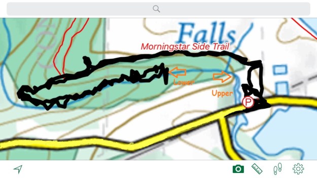
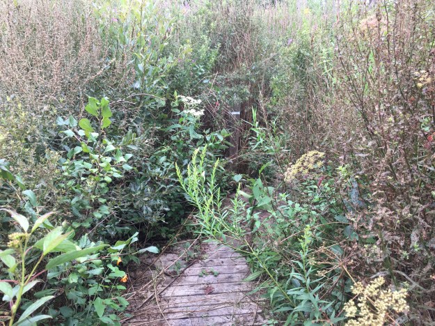
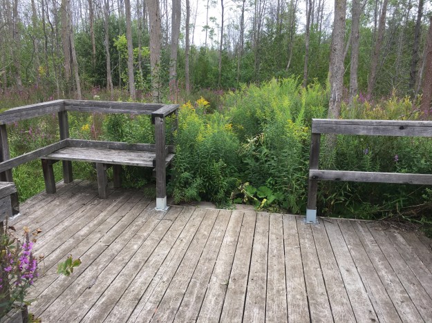
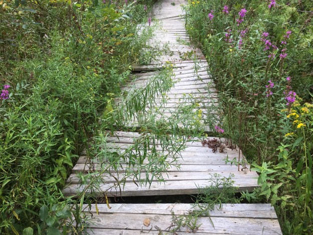
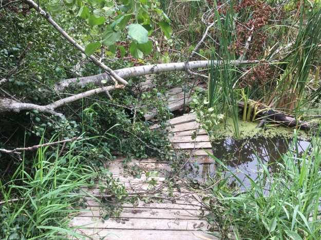
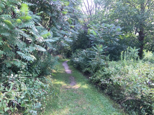
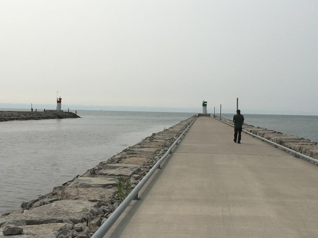
The zoo has over ten kilometres of trails that wind past the enclosures for over 5000 specimens.  It is the largest in Canada and one of the biggest in the world.  It is constantly going through improvements and expansions of the displays.  In the near future the Canadian section is scheduled to be moved from the Rouge Valley back up onto the table lands above.

The zoo is a place that needs more than a few hours to explore and fully appreciate.  At $41 for parking and single admission it is a little expensive but by becoming a member or adopting an animal you can get free admittance.

Google Maps link: Toronto Zoo

Like us at http://www.facebook.com/hikingthegta

Follow us at http://www.hikingthegta.com

Richview – Ghost Towns of the GTA


Thursday, September 20, 2018

The farming community of Richview got a formal start in 1852 when a post office with that name was opened.  After several post masters it was closed in 1887 and moved 2 miles east to the home of David Watt.   His house stood on the corner just north of the Union Chapel and cemetery.  With the post office and chapel in place, a town soon grew which came to include two shoe makers, two wagon makers, two churches,  two cemeteries as well as a blacksmith shop, a school and a green house complex.  However, without rail service the community became isolated and by the turn of the century it had begun to shrink.  The image below is from the Toronto Archives and shows Richview as it appeared in 1953 when it was still a rural community but greatly diminished from the former glory days.


Richview 1953

William Knaggs owned the south west corner of the intersection and in 1853 he sold a small piece for the purposes of a non-denominational church and cemetery.  The church became known as Union Chapel because it eventually housed three different congregations.  For a time the community was referred to as Union, prior to the arrival of the Richview Post Office.  The community of Dixie is another example of a very early Union Chapel, this one still stands alongside the oldest graveyard in Mississauga.  Knaggs’ son William donated additional land south of the cemetery in 1888 for the construction of a Primitive Methodist Church.  It can be seen along with the driving shed for the horses in the picture above.  William Knaggs died in 1853 and was buried as the first official interment in the cemetery, although not the first in actuality.  That had occurred in 1846.

IMG_7077

The county atlas below shows the Union Chapel and marks the cemetery as Primitive Methodist instead of non-denominational.  In 1877 the church had not yet been built but a town hall stood just south of the future location.  The school can be seen just east of the community almost on the Fourth Line (Martin Grove).  This had been the site of the first log school house in 1838.  When it was replaced in 1846 the school was moved to the east side of the fourth line.  In 1874 the school on the map below was opened and it remained in service until 1915 when a fourth school was built.

Richview new

The 1906 sketch below shows the south west corner with the post office in the house of Will Watt on the right.  The blacksmith shop of David Watt is in the middle of the picture while the family barns are on the left.  The gentleman plowing in the foreground is on the property that would later host a turkey farm and Bert’s Turkey Palace.  The Turkey Palace was demolished for the building of a ramp for the 427.

richview1

Richview Cemetery has the remains of about 300 early settlers from Etobicoke, many of them lacking markers.  Many of the other markers are damaged and there is no money in reserve for repairs.  The remains of two other small community cemeteries have also been moved here.  The Willow Grove Burying Ground and The McFarlane Family Cemetery were relocated in the 1970’s.

IMG_7086

Andrew Coulter lived from 1793 until 1857 and owned a sawmill on Mimico Creek where West Deane Park is located today.  His farm was run by his four sons after his death.  More information about Coulter as well as historic and modern pictures of the house he built in 1852 can be found in the post for West Deane Park.  A second surviving house from Richview is that of Robert Coulter and it can be seen in the same post.

IMG_7075

Although the farm was passed on to the four boys as an inheritance not everyone was fortunate to survive in those harsh times.  Elizabeth Coulter died in 1852, the same year that the family upgraded from their first home to the grander brick home.  Young women often perished in childbirth but there is nothing on the stone to indicate that she was married.  Pregnancy outside of marriage was less common 150 years ago and so it is more likely that poor Elizabeth got sick and had inadequate medical treatment.  She only lived to 22.

IMG_7076

Starting with the construction of the 401 and later the 427 the farms around Richview were taken over for highway use.  The community of Richview was in the way and everything except the cemetery was removed.  The United Church that had begun as Primitive Methodist was closed and demolished in 1959.  The capture below is from Google earth and shows Richview today as a mass of highway interchanges.  The cemetery is circled in red and can be accessed from Eglinton Avenue.

Richview 2018

This small section of road on the east side of the cemetery is a remnant of the third line which later became highway 427, seen on the right.

IMG_7089

There is still an option to be buried at Richview Cemetery if you have relatives buried there.  Victor Kimber took care of the grounds for several decades until his death in 2005 and he is the most recent interment.  His first wife and then his parents are buried in the graves to the south of his.  His second wife, Ethel, will be buried on the north side of him when she passes on.  Victor will be surrounded by his two wives for eternity but hopefully the sound of the highway will drown them out, should they get to fighting over him.

IMG_7080

Richview cemetery provides a small reminder that the bustle of the city hides a very different the rural past.

Google Maps Link: Richview Cemetery

Like us at http://www.facebook.com/hikingthegta

Follow us at http://www.hikingthegta.com


Ajax Waterfront Park

Saturday, September 15, 2018

The busiest highway in North America runs parallel to the shore of Lake Ontario and the strip in between is mostly developed through the entire GTA.  However, the lake shore itself is a small oasis that is too often broken by private property.  The Waterfront Trail stays off road as much as possible but usually has to take side streets to go around these little enclaves.  Ajax has a lengthy section of beach that can be followed, as I did from Duffins Marsh on Duffins Creek, Rotary Park, through Ajax Waterfront Park and beyond. To begin, I parked in Rotary Park off of Lake Driveway West.  The marsh was calm and several egret and a heron were seeking their breakfast along the water’s edge.  Where Duffins Creek empties into Lake Ontario a foot bridge carries the trail west toward Alex Robertson Park and Frenchman’s Bay.  The picture below shows Duffins Marsh just north of the lake.

I decided to follow the shore line east with the idea that I could return using the paved trail.  It wasn’t long before I attracted the attention of this Trumpeter Swan who swam along beside me for awhile before deciding that I hadn’t noticed it there, supposedly starving.  It came out of the water and started to follow me along the beach.  I noticed that it was tagged and numbered “T61”.  These swans were nearly extinct along the shores of Lake Ontario until about 30 years ago when they were reintroduced with eggs taken from other places in Canada.  The tagged birds are monitored for their movements based on where they are reported.  It also serves to indicate how many swans are being born in the wild as the percentage of tagged swans continues to decrease over the years.  Researchers are monitoring this closely and now estimate the local population in the GTHA to exceed 1000 birds.

There seems to be a lot of apple trees growing along the top of the embankment.  Slowly the ground is being washed away from under these trees and some are in danger of falling over the edge.  Then I came across an apple tree that was growing on the beach.  That seemed a little puzzling as to how it came to be there.  The most likely explanation for the tree on the beach is that an apple fell there and grew.  It’s surprising that it survived the waves that must have beaten upon it as it grew.

IMG_6917

Like the Scarborough Bluffs, the sand along the shore of the lake is eroding away.  Large eratic boulders left behind during the last ice age are slowly being exposed and will eventually end up on the beach.  The rock in the picture below looks like it is about to fall but it is hard to tell how much of the stone may yet remain in the sand bank.

September 15th was the date for The Great Canadian Shoreline Cleanup.  The good people of Ajax were cleaning the shore as I made my way past.  This year there were 1714 different teams across Canada that cleaned 2,679 kilometres of shoreline and removed 58,226 kilograms of trash.  We salute all these people.

Zebra Mussels were first seen in North America in 1988 in Lake St. Clair.  The are believed to have come in the ballast water of a ship from Europe and have since spread into all of the Great Lakes, the St. Lawrence River and many smaller lakes.  One female Zebra Mussel can produce up to a million eggs per year and they can live up to five years.  They are spread from lake to lake on boats and trailers of people who don’t take the time to clean them off their equipment after a day in the water.  Their shells have washed ashore and in some places lay in drifts a foot deep.

There are several metres of sand bank along the shore in most places.  I found it interesting that the swallows seemed to place their nests in just the lighter layer of sand.  The nests are naturally not to close to the top or too close to the bottom so that they provide safety from predators.

IMG_6909

There is a great section of beach along here that hasn’t been artificially protected from erosion.  No armour stone and no break walls have been added to keep the waves from doing what comes naturally.  Some sections have shingle beach features with stone washed in from the lake or eroded out of the embankments along the shore.  Other sections have sand and could make suitable spots to spend an afternoon with the kids.

One rock on the shore was not like the others and appears to be rusting like a giant chunk of iron ore.  This single rock looks so out of place that it makes me wonder how it got there.  Was it ship’s ballast that was later dumped?  Ore headed for Hamilton for smelting, perhaps.  Or was it left there by ancient aliens as a clue that we’d been visited?

The shore line eventually came to a point of land that made access to the top of the embankment quite easy so it seemed like a good place to turn around.  Having walked the shore on the way east, I returned along the paved trail that follows the edge of the lake from a few metres above.  This path provides many great views out across the lake.

I hadn’t seen very many Monarch Butterflies but at one point I came across a patch of goldenrod that had several on it.  I snapped a few pictures and every one had at least two of the colourful insects in it.

Various pleasure craft were seen making their way up and down the lake.  Sometimes one or two larger tankers could be seen off in the distance against the skyline.  The boat in the picture below stopped and executed a turn in front of us as if someone was taking practice on doing so.

The tracker I use indicated that the total loop I made was about 7.4 kilometres.  It was a hot day and there was little shade anywhere along the trail.  I wish I had brought more cold water with me.

IMG_7303

The Waterfront Trail continues in both directions from where I was today so it’s safe to say that there will be more trips to this area.

Google Maps Link: Waterfront Trail Ajax

Like us at http://www.facebook.com/hikingthegta

Follow us at: http://www.hikingthegta.com

Mica Cap Mushrooms

Saturday September 22, 2018

Mica Cap Mushrooms are one of the more common urban fungi and are a choice edible as well. These examples were going in great numbers around the base of a large Black Willow tree.  The mushrooms are egg shaped when they first appear.

IMG_7058

As they grow a set of radial furrows appear that run the length of the cap.  As the cap becomes more bell shaped it will split along some of the radial lines.

IMG_7054

The mushrooms were growing in several thick clusters with a distinct pattern to their aging.  The mushrooms on one side of the tree were black and rotten with the newly risen ones being on the far side of the tree.

IMG_7061

The stems of the Mica Cap are hollow and thin making them quite fragile.  There is no veil on the stem because these mushrooms have a universal veil which looks like specs of mica on the cap.  These vanish quite quickly and may be hard to identify.

IMG_7056

They have close gills which are attached to the stalk and turn darker as the mushroom grows.

IMG_7060

Mica Cap mushrooms grow between April and October.

Like us at http://www.facebook.com/hikingthegta

Follow us at http://www.hikingthegta.com

Decew Falls

Tuesday, September 11, 2018

Having a couple of weeks off work in September allows the opportunity to stray a little farther from home than can be done on a regular weekend.  Decew Falls has been on the short list of places that I wished to visit for quite awhile and so off I went on an hour and a half drive down the QEW.  Decew Falls and the two mills are quite easy to find and there is free parking on site.

John DeCou bought the property in 1788 and originally operated a saw mill to which he added a grist mill in 1814.  Both were powered by overshot water wheels that turned on either side of the upper falls.  A blacksmith shop, carpenter shop, school and church were soon added and the little community became known as Decew Town.  After 1883 the saw mill was powered by one of three turbines at the grist mill and a set of gears can be seen crossing above the falls.

IMG_6783

Ice was harvested from the mill pond every winter and stored in an ice house behind the main house.  It was used in the summer to keep food from spoiling.  An orchard beside the saw mill along with a few farm animals helped feed the family.  Water to run the mill was greatly reduced in 1834 when the First Welland Canal was built and the mills were subsequently sold and closed.  By 1860 the grist mill was in ruins but in 1872 Robert Chappell rebuilt it naming it Mountain Mills and installed a turbine instead of a water wheel.  The picture below shows the turbine shed and the metal penstocks the supplied water from the mill pond.

IMG_6784

When the City of St. Catherines initiated a waterworks project on the creek just above Mountain Mills in 1875 they bought the mills so there wouldn’t be any claims of water shortages.  They rented the mills to different tenants for a few years before selling them to Wilson Morningstar in 1883.  Morningstar ran the mills until his death in 1933.  When Wilson bought the property the saw mill was in use as a community centre and dance hall.  After a brawl one night he closed and converted it back into a saw mill.  After he died it fell into disrepair and was eventually dismantled.  The saw mill now on site was reconstructed in the 1990’s and is not operational.

IMG_6782

Wilson and Emma Morningstar bought the mills and property for $3,500 on their first anniversary, February 7, 1883.  Emma hated the original wooden frame house which was small and the agreement was to replace it eventually.  This was done around 1895 with the house that still stands on the property.  John DeCou had joined the military during the War of 1812 and his field stone house in Thorold was used as a command centre for the British.  When Laura Secord made her famous 12 mile hike through the woods and swamps to inform the British of an impending American attack she arrived at John’s house.  The subsequent battle was known as the Battle of Beaver Dams.

IMG_6789

Upper Decew Falls is a 22 metre ribbon falls with a deep plunge pool at the bottom.  The best views, save going to the bottom, will likely be had after the leaves have fallen.  There are several vantage points from along the side of the ravine but it looks like people have been leaning out over the cliff by clinging to trees.  There is also a place where people have installed a small rope to allow access to the bottom but it didn’t look very safe.  in 1890 a spiral staircase was built around a giant tree that was growing from the floor of the ravine.  it provided safe access, for a fee, to the bottom of the falls.

IMG_6787

The blue side trail that connects Decew Falls with The Bruce Trail is known as Morningstar Side Trail and it runs for only 700 metres.  Along the way I found the remnants of a very large cluster of Northern Tooth fungus, Climacodon Septenrionale. These polypores derive their name from the words “climac” meaning ladder and “odon” meaning teeth.   They have hundreds of fine tubes, looking like teeth, that grow out of the underside to release their spores.  Once the spores are finished the fungus rots away in a matter of a couple of days.  These ones are well decayed but the “teeth” are still quite visible on many of the plants.  While not poisonous, they are considered inedible because they are tough.  The fungus rots maple trees from the inside eventually killing them.

IMG_6794

The side trail follows an ever narrowing ridge of land which comes to a point after the trail ends.  This area is private property and the owners ask that people do not trespass.

IMG_6796

Beaverdams Creek has a trail that runs along the side however this too is on private property.

IMG_6800

Lower Decew Falls can be heard for quite a distance before it begins to poke out of the trees as you round a bend.

IMG_6802

The lower falls are 8 metres high and form a steep cascade with several distinct steps.  The trail climbs back up the side of the ravine to make a passage around the lower falls.  With all the recent rain this part of the trail was very muddy and being by myself it wasn’t practical to attempt it.  I’d rather not be blogging about a rope rescue.

IMG_6805

It was time to make my way back to the car and return home ahead of the rush hour traffic.  The trail tracker below shows the route of the hike with the Bruce Trail meeting the side trail at a near 360 degree turn.

Decew

It would have been interesting to get pictures from the bottom of the upper falls but perhaps another time.

Google Maps Link: Decew Falls

Like us at http://www.facebook.com/hikingthegta

Follow us at http://www.hikingthegta.com

Carbon Balls

Saturday September 8, 2018

Carbon Balls (Daldinia Concentica) are known by several names.  Coal Balls, Cramp Balls and King Alfred’s Cake are also localized terms for the mushroom.  The latter name being perhaps the most interesting.  Alfred the Great lived from 849 to 899 and at one point was in exile.  While in hiding he was left in charge of the cakes which burned after he fell asleep.  While hiking on Saturday we encountered this tree with black stains like spray paint on it.  Closer inspection revealed the black to be a stain from spores of the carbon ball fungus that is growing there.

IMG_6679

Carbon balls prefer dead ash trees and with the amount of damage done by the emerald ash borer there should be plenty of habitat for them now.  The blacker examples make great fire starters.  Once split they start smoldering from a spark and will carry on burning for an extended length of time.  Various cultures have used them as a means of carrying fire from one location to the next.

IMG_6736

They grow to just under two inches and there were a couple of examples close to that size.

IMG_6680

These mushrooms survive over the winter with a reduced growth rate that results in a series of concentric rings that are described by the Latin name.  The growth rings suggest that this example is about 12 or 13 years old.  The ostilole can be seen like a crack in the cross section and is used for the release of spores.  This mushroom is inedible.

IMG_6732

Like us at http://www.facebook.com/hikingthegta

Follow us at http://www.hikingthegta.com


The Bruce Trail – Speyside to The Gap

Saturday, September 1, 2018

Having previously visited Speyside to see a Royal Oak tree that has a historic designation we had covered a small section of the Bruce Trail in the Speyside Resource Management Area.  We had also been to a large gap that is cut in the escarpment by Dufferin Quarries.  We decided to hike the trail between these two locations.  There is free parking at the resource management area.  Near the start of the trail we found a place where people had been dumping garbage in a hole in the middle of a pile of rocks.  This is a shameful way to use one of two historic kilns on the property.  These were used by Alexander Livingstone to dry the hops he grew when this was his farm.

IMG_6496

Sometimes you see the least expected things in the woods if you slow down and take notice.  We covered the first kilometre or two of this hike in a record long length of time, but we found some interesting things we may have otherwise missed.  For example, the peeling bark on this dead Paper Birch looks like an alien or a skeleton.  These trees are also known as White Birch or Canoe Birch.  This example could make an interesting picture if photographed just at dusk when it might look even spookier.

IMG_6497

Mushrooms often come in look-a-likes that can be very different in toxicity.  For instance, the mushrooms below could be either Pholiota Squarrosa or Pholiota Squarrosoides.  A minor difference in spelling (“oides” as a suffix means “looks like”) and also a minor one in appearance.  The Shaggy Scalycap Mushroom (P Squarrosa) is dry between the scales on the cap and has a green gill below. It is considered poisonous and appears to be more dangerous when mixed with alcohol. The P Squarrosoides is sticky between the scales, has a whiter flesh with white gills and no smell.   I believe these mushrooms here are the P. Sqarrosaoides but as I didn’t touch the cap or get a shot of the gills I can’t be certain.

IMG_6509

Chocolate Tube Slime is another of those curiosities that can easily be missed.  This is found in my National Audubon Society field guide for mushrooms but it isn’t really a true mushroom.  It forms spore bearing clusters that can produce an incredible number of spores.  Slime molds start off as plasmodia that creep over surfaces and absorb food sources.  It takes less than 24 hours for the slime to transform into the chocolate coloured tubes that will spit out spores and then vanish almost as fast.

IMG_6511

Cup fungi are usually small and grow in clusters.  Some of the bigger ones can be up to 4 inches across and often grow individually.  This common brown cup fungi was a couple of inches across.

IMG_6538

These hairy white caterpillars are the larvae of the Hickory Tussock Moth.  Near the front and rear of the caterpillar are a couple of black tufts of hair.  These are part of a venom delivery system that the insect uses in self defense.  If these are pressed, a poison is injected that will feel much like stinging nettles.  The sensation will last for about 20 minutes for the average person and can range from a burning feeling to severe pain and nausea.

IMG_6527

As you cross a little stream on the trail you can see the Cardinal Flowers that are just beginning to bloom.  They live in shallow wetlands and provide a bright splash of red in the late summer and early fall.  Some native tribes used the plant in a plaster to be applied to swelling and to reduce the pain of rheumatism.

IMG_6535

We followed the trail until we came to the place where Dufferin Quarries has cut an opening in the side of the escarpment.  We’ve covered this in more detail in our second most popular post, The Gap.  The picture below shows the workings of the quarry.

IMG_6548

We made our way back from the quarry as the heat of the day climbed and our water disappeared.  When we reached the closed end of St. Helena Road we elected to follow the roads back to the car to take advantage of some even footing and reach our stash of cold water quicker.  It is quite common to see little book exchange boxes in the city but it was unexpected when hiking the Bruce Trail.  This one is near the little parking area along St. Helena Road.

IMG_6549

Speyside has been reduced to a ghost town.  The gas station and general store have been closed for years and almost all other early buildings have vanished.  The price of gas was 79 cents per litre when these pumps were last used.  It’s closing in on double that now.

IMG_6550

We used the Bruce Trail app to track our hike and had lost the first part of the trek through Speyside Resource Management Area when I closed the app by accident.  I’ve drawn that part back in on the map below.  The tracker shows 12 kilometres and with the additional section, the hike was about 14 kilometres.

Speyside to Gap

Google Maps Link: Speyside

Like us at http://www.facebook.com/hikingthegta

Follow us at http://www.hikingthegta.com

Altona Forest

Saturday, August 25, 2018

Altona Forest is located in Pickering and at 102 acres is large enough to have one of the few interior forests in the GTA.  Interior forests create habitat for creatures that do not survive on the forest edge or in the small clumps of trees left along waterways.  Interior forests have at least 300 metres of forest between the forest edge and the interior section.  Since 1982 the forest has been designated an environmentally significant area but that didn’t stop developers from buying up the land.  In the 1990’s after much lobbying the park area was set aside as part of the Toronto Region Conservation Authority (TRCA) lands.  The southern portion of the park was most recently owned by Dr. J. Murray Spiers and was donated in 1996 upon the condition that it remain a nature preserve.  This portion of the park is off limits to the public.  We parked on Altona Road in the small Altona Forest parking lot.  The trail immediately gives a feeling of not being used very much.

Petticoat Creek flows through the western edge of the park.  It was named by the French as Petite Cote and was slurred into the current name after the English arrived.  The wind has recently brought down several large trees in the top end of the park.

One of the truly great things about Altona Forest is the downloadable trail guide.  It describes the various features along the trail with reference to the guide posts.  Post 32 is shown below along with a little bench, one of many scattered throughout the trails.  Post 32 is found in a mature white cedar forest.  These trees spread to form a dense canopy that very little direct sunlight gets through.  This, along with a mat of cedar needles on the ground, combine to create a forest with very little under story.

Altona Forest has a series of ever changing habitats moving from different types of forest cover to open meadows and wetlands.  This encourages a wide variety of wildlife, some locally rare examples, to inhabit the park.  We saw coyote paw prints but didn’t see any of them as we made our way through the forest.  They share the forest with white tailed deer, fox and opossum, just to name a few.

Overgrowth has choked out the boardwalk in several places and the purple loosetrife and goldenrod flowers were buzzing with bees.  The number of honey bees was very encouraging but it could be a little stressful for those with a bee phobia or allergy.  We found that although we brushed through the bees as we passed they ignored us and returned to their bee business.

The wetlands were filled with the sounds of frogs and last years bulrushes hang like shrouds on the old stocks.

Near post 29 a large section of the forest has been given over to a wetland restoration project.  Until the 1940’s these were farmers fields and many of the wetlands had been drained.  Small mounds of dirt along the sides of the Rosebank Creek tributary remind us of the efforts of the farmers to increase drainage and make the most of some poor farmland.  Ghost wetlands are areas that were drained but can be encouraged to return to their former status thus providing much needed wetland habitat.  An observation deck overlooks the wetland restoration.

We were quite surprised at the condition of the boardwalk in the northern section of the park.  It soon became clear that the vegetation overgrowth was the result of a general lack of use due to the deterioration of the trails.

Chicken Mushrooms are one of the fine edible ones, if harvested when they are young.  They tend to become indigestible as they get older.  They start as bright orange, salmon or sulfur yellow and as they weather they turn white.  They are also called Sulfur Shelf and can grow in overlapping clusters of fifty or more with shelves that weigh up to a pound.  Many people claim that they taste like chicken.

img_6348

Near post 12 is Lacey’s Pond but it has become inaccessible as has the observation deck located there.  Some of the downed trees are the result of wind storms while the local beaver has also brought down some onto the boardwalk.  This effectively cuts the northern section of the park off from the one to the south.

Having blogged about nearly every destination in the list of TRCA properties several things become obvious.  Firstly, the GTA has an incredible network of ravines and parks that form natural wildlife corridors through the urban area.  Much of this is the legacy of Hurricane Hazel and the movement to secure our flood plains from development.  Secondly, our parks are incredibly free of garbage and generally well maintained.  Altona Forest appeared to be an obvious exception with regards to maintenance.  Hiking the GTA contacted the TRCA to see what was happening with the trails in the forest.  They replied that the boardwalks deteriorated because of the wet conditions and that they are being replaced with materials made of recycled plastics.  Supplies for the restoration, which should last for many many years, have been ordered already.  When they arrive in six to eight weeks the restoration project will begin.  Very soon Altona Forest will boast a new set of boardwalks giving it a new lease on life.

This Hairy Woodpecker is similar to a Downy but larger, with the adults being about 25 centimetres long.  Downy Woodpeckers are only about 15 centimtres long.  Both of these woodpeckers leave small random holes in trees where they dig for insects.  If the holes in a tree are dug in straight lines it is the work of a Yellow Bellied Sapsucker.

Large holes in trees are the work of pileated woodpeckers.  These are the largest woodpecker that you will see in Ontario with the adults being about 50 centimetres long.  The name comes from the Latin word “pileatus” which means capped, in reference to the prominent red cap that the bird has.

We were only able to explore the northern section of Altona Forest and will need to return to check out the other end of the park. We also look forward to seeing the upgrades and repairs that TRCA will be making this fall.

Google Maps Link: Altona Forest

Like us at http://www.facebook.com/hikingthegta

Follow us at http://www.hikingthegta.com

Frenchman’s Bay

August 18, 2018

The original inhabitants of the Pickering area were the Senecas who had a settlement named Gandatsetiagon.  Frenchman’s Bay in Pickering was so named because of Francois de Salignac de Fenlon who arrived in Montreal in 1667 and came to Gandatsetiagon in 1669 to work as a missionary with the native people.  After 1791 when the British opened Upper Canada for colonization the area soon became home to settlers who started the settlement of Pickering.  We parked on West Shore Boulevard beside the Rotary Frenchman’s Bay West Park for our exploration of that park.   The county atlas picture below shows the area as it appeared in 1877.

Frenchman

Very shortly after we entered the trail we came across a rose bush that is very well covered in rose hips.  These seed pods often require a winter season of freezing, known as stratification, before they can germinate.  Some species require two seasons of freezing.  The rose hips are frequently used in jams and teas because of their relatively high levels of vitamin c.

IMG_6158

Several types of bee structures have been placed in the park to help encourage the bees that pollinate the wildflowers growing in the park.

IMG_6159

Several trails cut their way through the park leading to the Beachfront Promenade as well as the bay.

IMG_6162

Cucumber beetles come in two groups, striped and spotted.  The striped one has three rows of black stripes on the abdomen while the spotted one, seen below, has 12 black spots.  The striped one feeds exclusively on cucurbits like cucumber, pumpkin or squash while the spotted on is less picky and will feed on other plants too.  Aside from often killing the host plant when the larvae feed on the roots these beetles carry bacterial and fungal diseases from one plant to another.

IMG_6171

This year there appears to be a lot of monarch butterflies.  The section of the Waterfront Trail that surrounds Frenchman’s Bay is known as the Monarch Trail.  This 4.7 kilometre trail section commemorates the monarch butterfly and the annual stop they make at the bay on their return flight from the south.

IMG_6182

We saw the following sign and wondered who defines what constitutes an offence.

IMG_6186

The park is home to the Pickering Rouge Canoe Club.  Canoes, kayaks and dragon boats all belong to the club.  Sculling is also done on the bay with the main difference between sculling and rowing being the use of two oars by a sculler and only one per rower.

IMG_6188

Frenchman’s Bay has a protected harbour with lengthy breakwalls protruding into the lake.  A small green lighthouse guards the west point while a red one is positioned on the east side.  The original channel into the harbour was dredged in 1843 and wooden piers were built to protect the entrance to the bay.  Looking to the east of the harbour you can see the towers of Pickering Nuclear Generating Plant.  The plant was built starting in 1966 and it is one of the oldest nuclear generating stations in the world.  Ontario has committed to continued use of the facility until 2024.

IMG_6193

In 1843 a set of piers was constructed at the north end of the bay with a wharf extending into the middle of the bay.  The wharf was built of hand hewn timbers that were dovetailed and connected much the same way as a log cabin.  The sections were built in shallow water and then towed to their individual locations.  Using stone they were sunk to the bottom, which had been leveled already, and then filled with more stone.  The decking was placed on top and a hand rail was attached completing the structure.  The picture below shows a replica built to the dimensions of the original as measured from sections the archaeological society had recovered.

IMG_6199

During the Second World War the production facilities of Cadillac were used for the manufacture of warplanes.  After the war they incorporated the concept of the wings into tail fins.  If I had an option to buy a classic car it would be a late 50’s Cadillac.  As we were returning from our hike we shared the highway with a string of antique cars.  Many of them had the words “RIP Paul Fernley” written in the rear window.  By having the person driving attain a similar speed to these cars I was able to get several great pictures of each car.

IMG_6226

There are three trails that wrap around Frenchman’s Bay and we will need to return to visit the others.  On the east side of the bay is Alex Robertson Park with a unique set of carvings on the trees, including Merlin, that give the park an enchanted feeling.

Google Maps Link: Frenchman’s Bay

Like us at http://www.facebook.com/hikingthegta

Follow us at http://www.hikingthegta.com