Monthly Archives: June 2018

Greatest Treks 3

Sunday, July 1, 2018

Hiking the GTA recently passed a couple of milestones having released over 300 stories with over 500,000 reads.  This post gives a quick look at some of the most popular posts from the past 12 months.  A short description of the blog as well as a picture and a link are provided.  If you represent one of those half-million reads we owe you our gratitude and present this summary as our way of saying “Thank You”.

15. River and Ruin Side Trail 

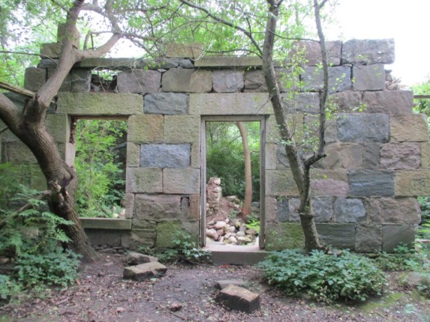
The River and Ruin Side Trail allows you to visit the ruins of James Cleaver’s house.  The mill that he built still stands in Lowville as a public residence.

14. Griffin House

Eneral Griffin came to Canada via the undergound railroad that helped runaway American slaves find their way to a new life.  Griffin set up home in this house in 1834 in a white community where he lived as a welcome member of society.

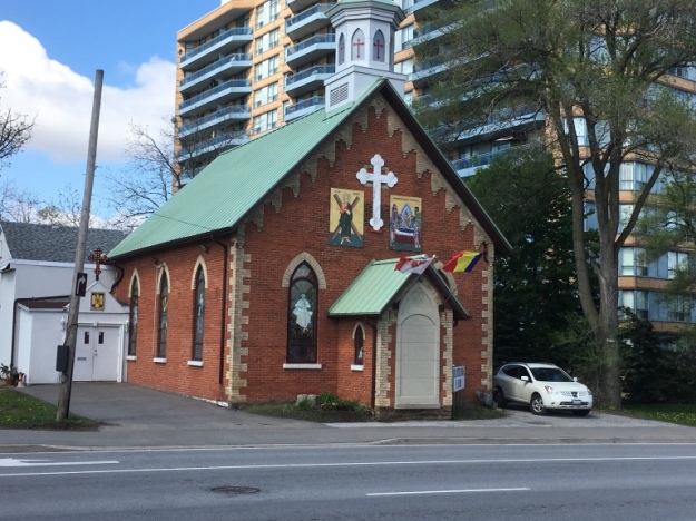
13. Burnhamthorpe – Ghost Towns of The GTA

Only four buildings survive in the former community of Burnhamthorpe, one of which is the old Methodist Church built in 1874.

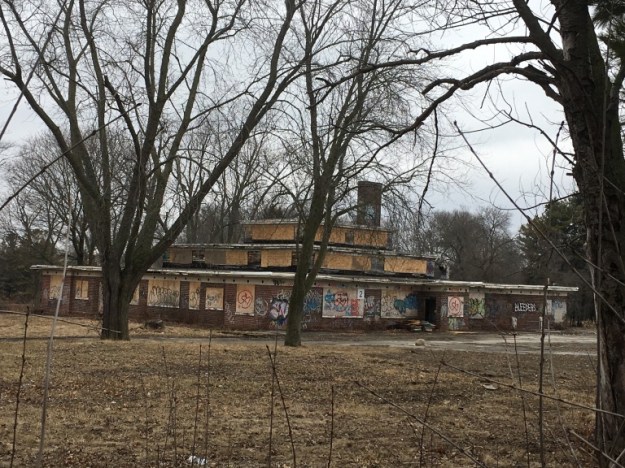
12. Camp 30 – Bowmanville POW Camp

Built as a boys school in the 1920’s these buildings, and several others, were taken over for use as a prisoner of war camp in 1941.  The buildings have since been abandoned and although they have heritage value are being allowed to deteriorate to the point where they may no longer be salvageable.
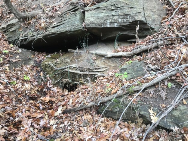
11. Devil’s Cave

The cave entrance has collapsed but it used to be wide enough to slide through into the cavern beyond. It is said that William Lyon Mackenzie hid in here when he was fleeing after his failed rebellion in 1837.

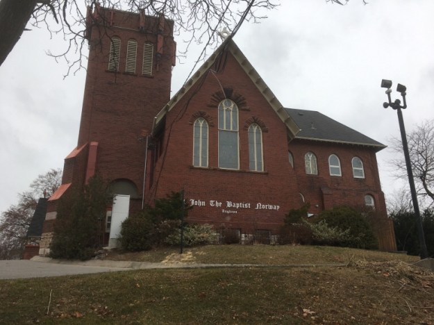
10. Norway – Ghost Towns of The GTA

A community formed along the Kingston Road in the area of the beaches that had 80 residents.  The early name was Berkley but it was later changed to Norway.

9. Abandoned DVP Ramp

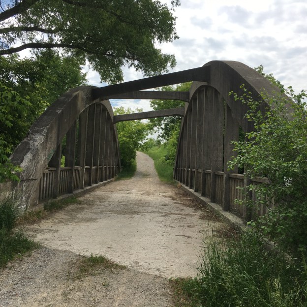
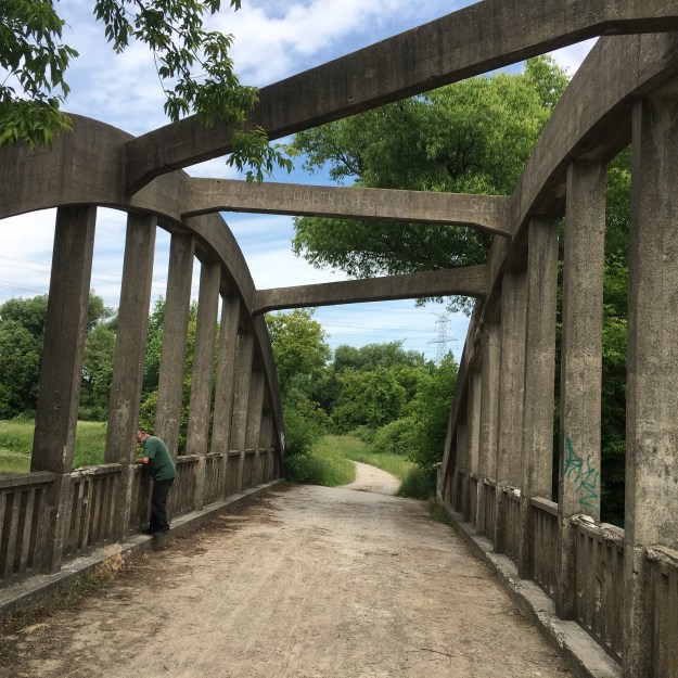
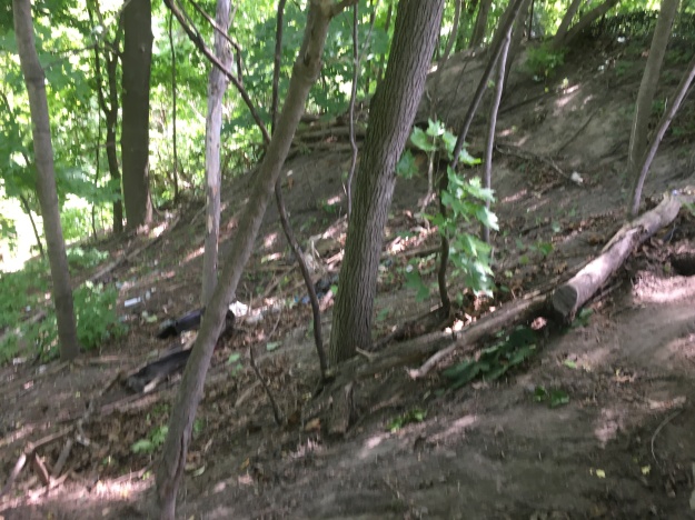
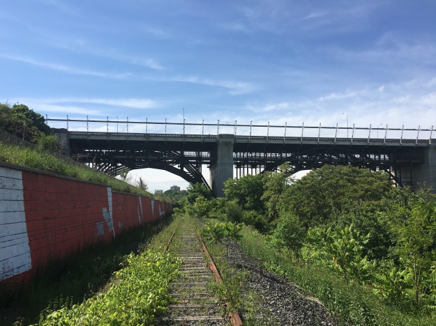
Nature is reclaiming this former on ramp for the DVP.  It was closed in 2005 because it was the site of multiple accidents over the years.  It was too close to an exit ramp and cars were speeding up and slowing down on the same short stretch of highway.

8. Glenorchy – Ghost Towns of The GTA

The community of Glenorchy is probably best remembered for the collapse of the local bridge under the weight of a fully loaded potato truck.  This 1835 log cabin is one of the few remaining buildings from Glenorchy.

7. Massey – Golding Estate

Hart Massey was Canada’s first major industrialist.  His family built an empire around the manufacture of farming equipment.  The family house still stands in Taylor Park and the family is remembered through Massey Hall and the new Massey Tower downtown.

6. Humber Grove – Ghost Towns of The GTA

Humber Grove was a quiet community just north of Bolton on the Humber River until 1954 and the arrival of Hurricane Hazel.  The town was in the flood plain and were deemed to be at risk of future flooding.  The conservation authorities across the GTA were authorized to buy the houses in the various flood plains and have them demolished.

5. Rosetta McClain Gardens

Rosetta McClain turned her 40 acre property overlooking the Scarborough Bluffs into a beautiful flower garden.  When she passed away in 1940 her husband wanted to commemorate her and in 1959 he gave the property to the city as a park.  Her house is in ruins but adds a certain charm to the park.

4. The Bloor Viaduct

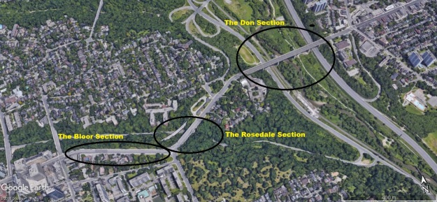
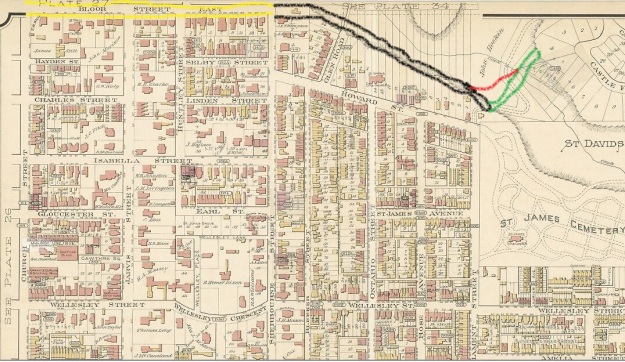
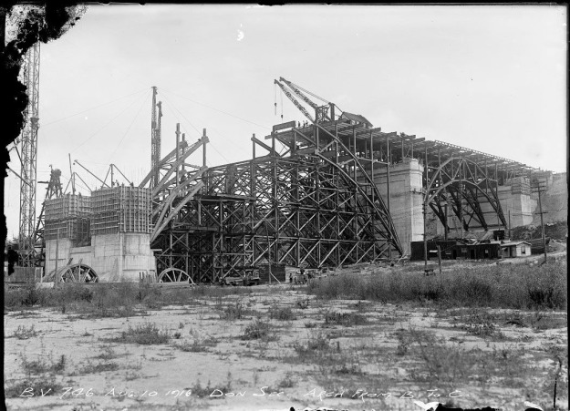
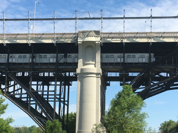
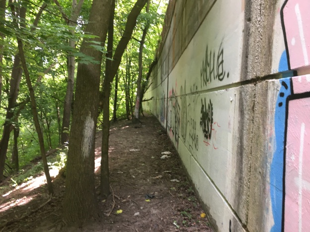
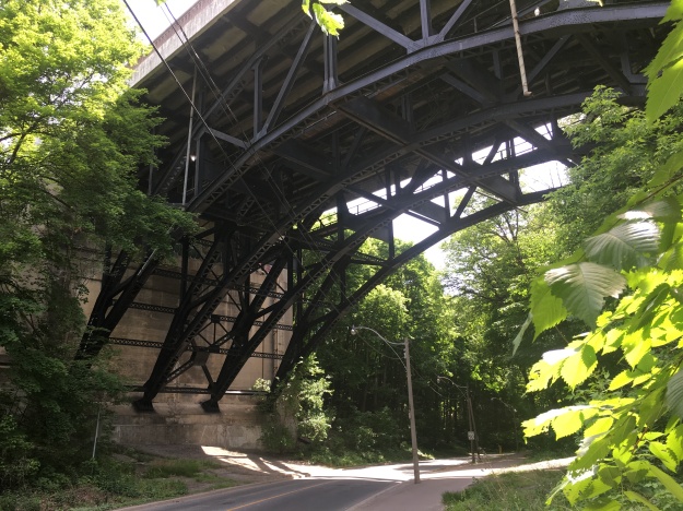
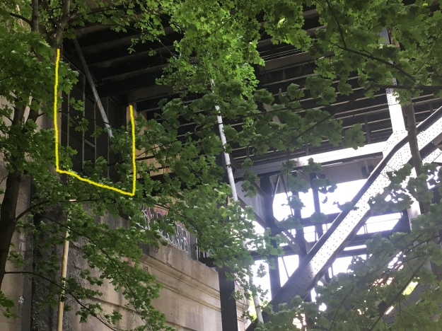
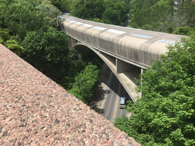
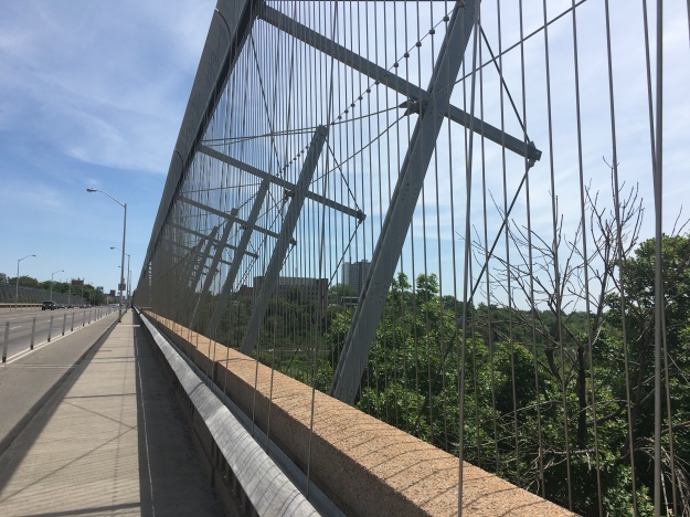
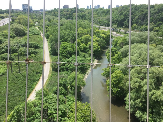
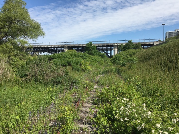
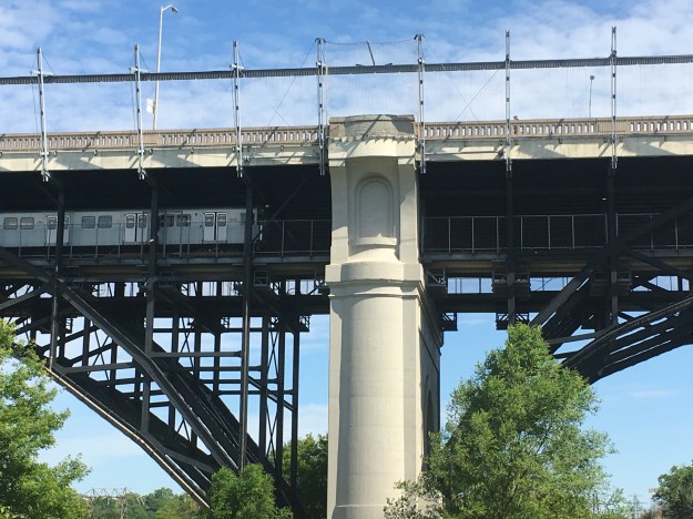
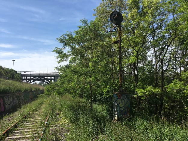
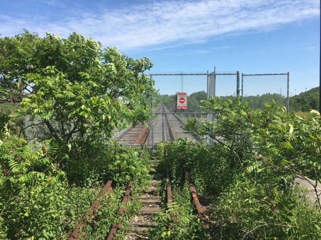
The Bloor Viaduct opened 100 years ago and was built with provisions for a subway that wouldn’t be added for 50 years.  The section in the Rosedale Ravine has subway tunnels that were never used.

IMG_4768

3. Palermo – Ghost Towns of The GTA

On the northern edge of Oakville, Palermo has become a collection of empty houses waiting for restoration or demolition.  Redevelopment all around has left these historic buildings in a context that the three hundred residents that lived here in 1869 would find most peculiar.

IMG_1211

2. Rice Lake’s Sunken Railway

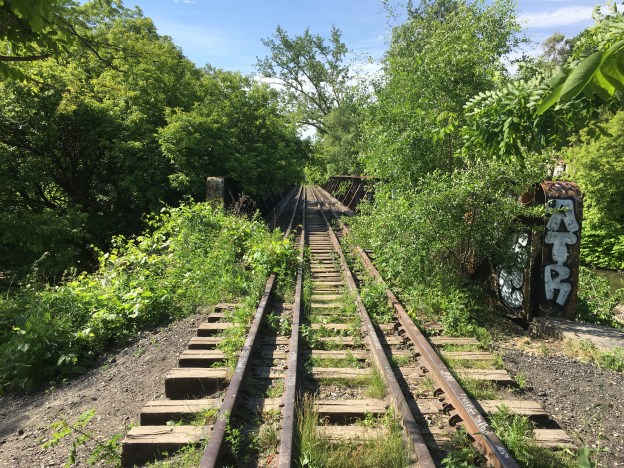
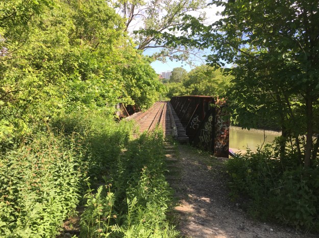
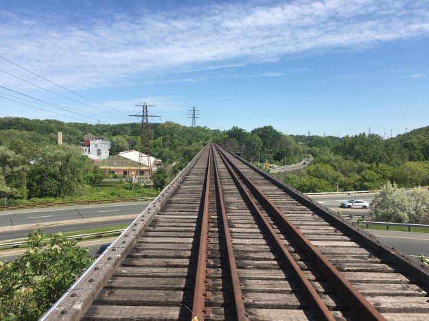
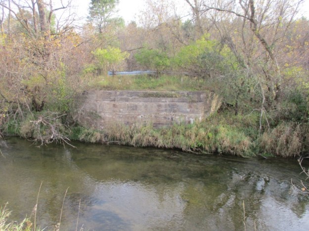
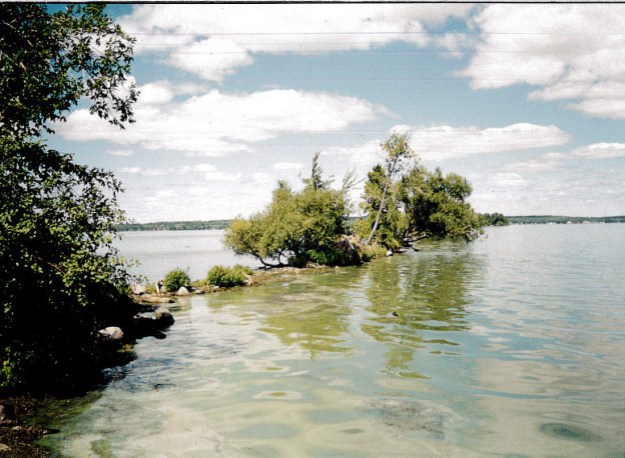
Built in 1853 the Cobourg and Peterborough Railway included a trestle across Rice Lake.  It was nearly 5 kilometres long but was damaged annually by winter ice until it was closed in 1866.  Much of the old railway still lies just below the surface of Rice Lake.

harwood-1

1. Ringwood – Ghost Towns Of The GTA

Ringwood proved to be one of the most popular in our series of ghost towns in the GTA.  It has several abandoned houses as well as the school pictured below.

IMG_2326

For our greatest treks from the earlier blogs please see:

Greatest Treks

Greatest Treks 2

Google Maps links are contained within each story.

Like us at http://www.facebook.com/hikingthegta

Follow us at http://www.hikingthegta.com

Claireville Conservation Area

Saturday, June 16, 2018

Claireville Conservation Area is nestled between four major communities in the GTA.  A gore is a triangular piece of land and Gore Township is shaped like this.  It means the  conservation area is easily accessible from Toronto, Brampton, Mississauga and Vaughan.  There is free parking in a small lot off Highway 50 just north of Steeles Avenue.

As soon as we stepped out of the car we spotted a female white tailed deer in the field beyond.  A healthy looking deer she wasn’t too keen on a photo shoot and quickly disappeared.  There are sightings of a leucistic deer in the park.  We didn’t see any white deer on this expedition. but they are seen regularly by visitors to the park.

IMG_4858

Orchard Grass grows in the old farmstead.  They don’t grow from underground rhizomes but rather spread through a process known as tillering.  The subsequent stalks are produced off the original root, having been established from an original seed.  The flowers on these examples were in full bloom and producing a pollen that I am allergic to.

IMG_4865

There is a main trail through the park but we found that it was used by cars who drove quick enough to stir up a choking cloud of dust.  As usual the secondary trails were much better.

IMG_4864

Pearl Crescent butterflies have a wide range of habitat throughout North America.  It is quite common throughout the United States but in Ontario it is not as common as the Northern Crescent.  The main distinguishing feature between the male and female is the colour of the antenna knobs.  The males usually have black ones while the female seen below has white antenna knobs.

IMG_4881

Claireville Conservation Area features a tree caching trail.  Nineteen trees along the trail have been tagged so that hikers with smartphones can access information about the tree species in the park.  With my phone I only had to take a picture of this tag to find out that it is an American Beech.  The link provides considerable information about the tree including the fact that it could live for 300 years.  For those with an understanding of environmental concerns they also tell you that this tree is storing over 2000 kilograms of carbon.

IMG_4869

John and Rebecca Wiley emigrated to Upper Canada in 1836 and settled in Gore Township.  Their one hundred acre farm was called River-view Farm and was divided between their two sons when John passed away in 1864.  The two properties of Leonard and William are outlined in yellow on the 1877 county atlas below.  The Wiley family operated the farm until 1962 when it was sold to the Metropolitan Conservation Authority.  The bridge over the West Humber on Gorewood Drive was named after the family.

Wiley

Wooden bridges were built across the many streams and rivers in Ontario using timber from trees that were cut to clear the road.  These bridges were in constant need of repair and early in the 20th century concrete bridges became popular.  Concrete bowstring bridges were popular because they were able to use local materials and labour.  By the 1920’s there were about 65 concrete bowstring bridges in Canada, almost all of them in Ontario.  Only a few of these remain in place and even less of these remain open to vehicle traffic.  There are only two remaining in Brampton, the other one being on Creditview Road near Eldorado Park.

IMG_4892

The Wiley Bridge was named after the local family and built in 1924 from materials likely quarried on the property.  It was built on a bias, which means that it crosses the river on an angle.  The bridge was reinforced with three overhead concrete girders that join the two bowstring arches.  These run on opposing angles as can be seen in the preceding picture.  All this combines to give the bridge an odd appearance as if one side is longer than the other, or that it is wider at one end than the other.  The bridge has a continuous span deck and concrete hangers and parapet, all of which is still in very good condition.  The bridge was given heritage protection in 2013.

IMG_4895

Claireville Conservation area also includes the reservoir south of Steeles Avenue that was featured in the post Claireville.  With 848 acres to explore and a rare white deer to be seen, there is plenty of reasons to return to Claireville Conservation Area.

Google Maps Link: Claireville Conservation Area

Like us at http://www.facebook.com/hikingthegta

Follow us at http://www.hikingthegta.com

The Bloor Viaduct

Sunday June 10, 2018

When people think of the Bloor Street Viaduct they usually think of the bridge over the Don River and Don Valley Parkway.  Or, thoughts of Toronto’s suicide bridge may come to mind.  Few people realize that the viaduct is comprised of two bridges and a length of landfill.  These are known as the Don Section which spans the Don River and is 1620 feet long and 131 feet above the river.  The Rosedale Section is another bridge, this one over the Rosedale Ravine while the Bloor Section is landfill along the side of the Rosedale Ravine, connecting the original portion of Bloor Street with the Rosedale Section.

Bloor Viaduct

In 1899 when the fire map below was created, Bloor Street ended at Sherbourne Street and there was no easy access across the Rosedale Ravine and the Don River Valley.  A plan was put forth to build bridges across the two waterways and connect Bloor Street with Danforth Avenue on the east end.  The existing section of Bloor Street is coloured yellow.  The Bloor section of the Bloor Viaduct is coloured black while the Rosedale Section is coloured green with the eventual TTC bridge in red.

Bloor 1899

By 1901 the city was expanding to the east but the only two bridges across the Don River were on Queen Street and Gerrard Street and they were unable to handle the increased traffic that expansion brought.  A proposal was put forward to survey the best route for connecting Bloor Street with Danforth.  Although the proposal would come up again in 1906 and 1907 it wasn’t until the area of Danforth was annexed to the city in 1909 that things got serious.

To investigate the viaduct in its entirety I had to do it in two portions, starting below the Don Section.  This was accessed from Riverale Park using a combination of The Lower Don Trail and the abandoned Canadian Pacific tracks that run from Half Mile Bridge.  The picture below shows the viaduct looking south.  The abandoned railway and the Don Valley Parkway run between piers A and B.  The Lower Don Trail runs between B and C.

IMG_4768

On January 1, 1910 the people voted No to a referendum but the need for a bridge didn’t go away.  City Council hired a firm of traffic consultants to see if a subway might be the answer to their traffic problems.  Their report of August 25th, 1910 suggested a Yonge Street, Queen Street and Bloor Street subway line.  They proposed a double deck bridge over both the Don Valley and Rosedale Ravine with a subway on the lower deck.  On January 1, 1913 the people approved construction on the viaduct on an altered route that required an angled bridge across Rosedale Ravine and landfill between Sherbourne and Parliament Streets.

Seen from the opposite direction the archive picture below shows construction of the Bloor Viaduct.  Pier C is in the foreground with the crane sitting above pier B.  A series of falseworks were constructed below the bridge to support the steel structure during assembly and later removed.  The steel girders of the bridge can be seen extending out from each pier to an eventual connection in the middle.  Each girder has three hinges, one on either end and one in the middle.

Falsework 2

Rolland Caldwell Harris was Commissioner of Public Works and he supported the idea of including the subway decks for eventual use.  The sod turning ceremony took place on January 16, 1915 with construction of the piers beginning immediately.  Four of the piers across the Don River section are sunk over 40 feet below the river to sit on the bedrock.  The subway line along Bloor Street didn’t open until February 26, 1966 but the lower deck saved the TTC millions of dollars in construction costs.  A subway train makes its way east under Don Section in the picture below.

IMG_4757

Having explored below the viaduct I wanted to examine the Bloor section and the Rosedale Section.  I was able to find parking on Bloor Street right near Sherbourne and so I set off to explore the section of landfill that now carries five lanes of traffic and two bicycle lanes.  The side of the embankment down to Rosedale Valley Road is steep in places but has developed a mature tree cover.

IMG_4799

During construction the viaduct was opened in three phases with the Bloor Section opening to traffic last.  The Rosedale Section being the shortest was completed and opened in October of 1917 and the Don Section was opened on October 18, 1918.  As the fill settled in the Bloor Section it continued to crack and it wasn’t until August 23, 1919 that this last section was opened.  A long portion of the embankment has been supported with concrete and provides an easy way down.

IMG_4802

The Rosedale section is 190 feet long and stands 90 feet above the ravine floor.  There is only one span in this section and the steel beams were assembled on the ground and then hoisted into position.  This eliminated the need for falsework under this bridge.

IMG_4807

When it came time to build the subway it was decided that the curve created by the Rosedale Bridge was too severe for safe operation of the trains and so the subway deck was never used.  From below the bridge you can still see the screened off openings for both the east and west lines.  The eastbound lane is marked in yellow on this picture of the west abutment.

IMG_4813

A new covered bridge for the subway was installed beside the Rosedale Bridge in 1966.

IMG_4832

After passing Castle Frank and its subway station you come to the longer Don Section of the viaduct.  The bridge had become the most popular place in Toronto to commit suicide and by 2003 nearly 500 people had jumped to their deaths.  The city approved a barrier in 1998 but delayed 5 years over funding issues.  Meanwhile, over 48 more people jumped creating  a hazard to traffic below.  The Luminous Veil was installed at a cost of $5.5 million dollars and has put an end to the unfortunate use of the bridge but suicide rates in the city remain unchanged .

IMG_4823

The view south from the bridge shows the DVP in the left corner and the Lower Don Trail beside it.  The river separates the trail from the Canadian Pacific tracks and the Bayview Avenue Extension.  The Luminous Veil does mess up the view to a large degree.

IMG_4826

The Bloor Street Viaduct was officially named Prince Edward Viaduct when it opened in 1918 although it retains the more popular Bloor Street Viaduct as a common name.  The abandoned railway under the viaduct belongs to Metrolinks and would make a good footpath between several downtown parks, even if only temporary.  We make the proposal in our post Half Mile Bridge Trail.

Google Maps Link: Bloor Viaduct

Like us at: http://www.facebook.com/hikingthegta

Follow us at: http://www.hikingthegta.com

Half Mile Bridge Trail

Sunday June 10, 2018

When the Canadian Pacific Railway was built through the GTA in the 1880’s it passed through Leaside and The Junction but didn’t run south to Union Station.  In 1888 they were given approval to build a spur line through the Don Valley and into downtown Toronto.  The line was in use until 2007 when it was closed and the right of way is currently owned by Metrolinx with an unspecified plan for potential future use.  Hiking the GTA proposes that this old rail line would make a perfect hiking trail connecting several parks that will soon be joined under the name of Wonscotonach Parklands.

Starting at Riverdale the trail would pass under the Bloor Viaduct and on toward the Half Mile Bridge.  The Don Valley Brickworks with a large park in the former quarry is located at the far end of the bridge.  This park links to The Belt Line Trail that runs through Mount Pleasant Cemetery and into midtown.  The trail then would pass under Bayview Avenue and on toward Crother’s Woods where it would end at the trail head behind the Loblaws.  A short side trail could be constructed on the right of way for the closed section of Pottery Road that would connect to Todmorden Mills, an 18th century paper mill.

Half Mile Trail


I parked on Carlton Street at Riverdale Park and took the stairs to the bottom of the hill.  There is access to the Lower Don Trail from the pedestrian bridge over the Don Valley Parkway.  Turning north you quickly come to a pedestrian bridge over the Don River and a small side trail that leads to the old Canadian Pacific Railway bridge over the Don River.

IMG_4668


There are plenty of places where the rail line has all but vanished into new growth in the past ten years.

IMG_4673

The old railway passes under the Bloor Viaduct, one of Toronto’s best known bridges.

IMG_4676

From the railway you will have the chance to watch TTC subway trains running below Bloor Street.  The eastbound train above is running on a subway deck that was built into the bridge 50 years before it would host the first commuters.

IMG_4756

A bumble bee was collecting pollen from some late apple blossoms and storing it in pouches along its rear legs.  The myth that bumble bees defy the laws of physics by being able to fly seems to date back to 1934 and a book called Le Vol Des Insects.  There’s obvious flaws in the calculations that claim the wing size is too small to lift the weight of the creature.  If this were true I saw dozens of physics defying bees just on this brief hike.

IMG_4761

Just north of the Bloor Viaduct is an old switch light for directing train traffic.  This light would inform the engineer of the presence of other trains on the same track.

IMG_4771

In recent times the half mile bridge over the DVP and Don River has been gated and posted No Trespassing.  There is also a help line number on the fence for those who have approached the bridge in a state of depression, thinking about ending it all.

IMG_4775

Someone has cut the fence to gain access to the bridge but several people have reported being stopped by police for being on the bridge and, luckily, they were only given warnings.  One of the main attractions is the spectacular view of the city from the bridge.  The Don Valley Brick Works (now Evergreen Brickworks) can be seen to the left of the tracks.  Beyond here, the line carries on toward Crother’s Woods.

IMG_4777

With a small investment for safety on the half mile bridge, a new rail trail could be established linking several existing parks and pathways which would help to integrate our network of trails in the city.

Google Maps Link: Half Mile Bridge

Like us at: http://www.facebook.com/hikingthegta

Follow us at http://www.hikingthegta.com


The Great Trail – Caledon East

Saturday, June 9, 2018

The idea for a Trans Canada Trail was given birth at the time that the country was celebrating 125 years of Confederation.  The plan was to complete a trail that would link all the provinces and territories by 2017 when the country celebrated 150 years.  In a quarter century a trail was created that extends over 42,000 kilometres and is the longest multi-use trail network in the world.  The trail passes directly through the GTA and then curves back along the top again as it heads north.  The map below was snipped from the official map https://thegreattrail.ca/explore-the-map/

Great Trail GTA

A non-profit organization called The Trans Canada Trail was established to raise funds for the creation and maintenance of the trail.  All levels of government contributed to the project and donations were sought from corporations and individuals.  The province of Prince Edward Island was first to complete their section which is known as Confederation Trail.  To explore the original section of the trail we parked in the small lot on The Gore Road just north of Old Church Road.  After a short walk east toward Mill Lane and Humber Station Road we made our way west to Caledon East.

IMG_4477

Pavilions have been established along the route where donors are recognized.  The first pavilion to be created is the one in Caledon East.  An inscription program was put in place for individuals who donated to finance a metre of the trail.  An inscription would be added to the pavilion of your choice.  My family had a inscription placed in the Calgary pavilion, the city where our late brother was born.  The inscription program was officially terminated in 2012 when it was determined to be a drain on resources that was hindering the actual development of the trail.  If you donate today, the federal government will give 50 cents on the dollar as donation matching.

IMG_4647

The trail has been established using existing trails as a foundation.  The first section to be opened was the Caledon Trailway in 1995.  When the trail was connected from The Atlantic to The Pacific and Arctic Oceans in 2017 a new stone and pavilion were placed in Caledon East where The Trans Canada Trail was first opened.  The stone bears the new name of the trail.

IMG_4648

The trail has been connected from coast to coast but it is far from completed.  Large sections follow roadways which in some cases are temporary until green-ways can be developed.  In other areas the trail may always be stuck on the side of roadways, mostly rural but also including some busier sections.  Some portions, such as one in New Brunswick on the Saint John River cannot be hiked or cycled, but must be completed in a boat or canoe.  The trail is intended to promote six main activities: walking/hiking, cycling, paddling, horseback riding, cross-country skiing and snowmobiling.  Along the trail near Caledon East we found a single True Morel growing.  These fungus are edible and can be distinguished from similar inedible ones by the fact that they are hollow inside, from stem to tip of the mushroom.

IMG_4471

The section of trail that passes through Caledon East follows the route of the Hamilton and North Western Railway which was later amalgamated into the Canadian National Railway.  It was abandoned in the 1980’s and Caledon purchased the right of way in 1989.  In 1994 they started to convert it into a multi-use trail which opened the following year.  The trail along here continues to use the old rail bridges to cross streams and roadways.  This is the bridge over Mill Lane.

IMG_4460

Dragonflies rest with their wings open while damselflies rest with them folded on their backs.  There are about 5,000 species of dragonflies in the world and 130 of these have been identified in Ontario.  We saw half a dozen different ones along the way.  This male Chalk Fronted Corporal was one of several that were soaking up the heat on the trail.  They tend to follow humans as they hike because they like to eat the mosquitoes and biting flies that are attracted to people.  For this reason it is always nice to see these insects.

IMG_4455

We found a patch of gooseberries growing along the trail.  They are not native to North America but have become naturalized, likely from garden escapees.  The fruit is cultivated and is an excellent source of vitamin C.  It can be eaten as is, cooked into pies or preserved in jams.  It is also used to flavour wines, sodas and teas.

IMG_4630

The Humber Valley Heritage Trail along with The Bruce Trail are accessible from the Great Trail near Caledon East.  In other places The Great Trail shares pathway with The Lakefront Trail and The Pan Am Trail.  The pedestrian bridge crossing the mouth of Highland Creek is one example of a shared trail.

IMG_4474

Based on the amount of fur in this scat it appears that someone is not doing the stoop and scoop after their coyote.

IMG_4643

Along the trail we saw several chipmunks and squirrels as well as this rabbit.  The hunting seems to be pretty good for the local coyote population.

IMG_4629

We’ve visited several sections of The Great Trail along the Waterfront Trail as well as on The Caledon Trailway.  At 42,000 kilometres in length, this is one trail that few will be able to complete end-to-end.

Google Maps Link: Caledon East

Like us at http://www.facebook.com/hikingthegta.com

Follow us at http://www.hikingthegta.com

Islington – Village of Murals

Sunday, June 3, 2018

The village of Islington was originally called Mimico when it was founded in 1814.  Dundas Street was the main route between York and the western part of Upper Canada. It became an important stopover on the stage coach route that ran along Dundas Street.  The village has been absorbed into the city around it but it’s original charm is being captured in a series of murals along Dundas Street.  The Islington Business Improvement Area (BIA) is a group charged with making the area attractive and preventing graffiti.  In 2004 they began to set aside a portion of the local taxes to be used to create outdoor murals that depict some of the history of the community.  To date there are 26 murals that cover over 25,000 square feet of public art.  Many of the murals were painted by John Kuna although several were painted by Sarah Collard and also Arts Etobicoke.  Each painting takes between 300 and 400 hours of work.

The paintings cover 5 blocks along Dundas Street and they are mostly painted on the sides of buildings.  The first two murals, however, are painted on bridges over Mimico Creek.  These young ladies are singing a welcome to visitors as they enter the community.

IMG_4499

This mural depicts golfing in Islington in the 1920’s.  The Islington Golf Club was established in 1923 on the old Appleby Farm.  Notice the ball collector in this painting who is wearing a protective wire cage.

IMG_4501

The old Islington Hotel is seen in this mural that depicts Islington in 1912.  The drive shed where horses were stabled can be seen in the foreground and Clayton’s Butcher shop is just beyond the hotel.  This mural is part of a pair that together depict the street view of the town a hundred years ago.

IMG_4523

Gordon’s Dairy was a big part of everyday life in Islington.  Their milk wagons, and later milk trucks, delivered dairy products on a daily basis to homes in town.  The dairy was in a building that featured yellow tiles on the outside and had a lunch counter inside.  This mural shows the dairy as it existed around 1940.

IMG_4519

The Royal Conservatory of Music had a branch in Islington between the 1950’s and the 1980’s.  This mural features Glenn Gould who was one of the most famous people to come through the conservatory.

IMG_4533

This mural depicts a father fishing with his children in Mimico Creek near the old rail bridge.

IMG_4525

This is my personal favourite of all the murals in the collection and that is why it is also featured as the cover photo for this post.  It depicts the old swimming hole near the mill.  The bathers are dressed in fanciful bathing suits and are climbing on the waterwheel for the mill.

IMG_4541

This colourful mural depicts fishing in the creek.  The water below the children with their fishing lines depicts several of the species that were common in Mimico Creek a century ago.

IMG_4535

The Guelph Radial Line ran through the community on it’s way between Lambton Mills and Guelph.  The line opened in 1917 and ran until 1931 when it was closed due to the increase in popularity of the personal automobile which made the trip to Guelph along Highway 7.  The radial line ran behind the building with this mural on it.

IMG_4536

The Gunn House was also known as Briarly and was built in the 1840’s as a single story regency style cottage.  In the 1850’s it was expanded and given Italianate touches that were popular at the time.  The house was owned by the Montgomery family from 1870 until 1985.  It was demolished in 1989 to make way for some badly needed townhouses.  The house originally stood just east of Montgomery’s Inn.

IMG_4546

One of the more unique murals is painted on the side of the building that served as the  manse for the Weslyan Methodist Church.  The building has been painted in a manner that appears to have removed the outer wall and allowed us to view the interior as it may have looked around 1888.  The pastor is seated at the table while a committee of women from the church inspect the house with white gloves to ensure that the housekeeping is up to par.

IMG_4562

Montgomery’s Inn was built in 1830 by Thomas and Margaret Montgomery.  When Margaret died in 1855, Thomas stopped operating the inn and concentrated on farming the property instead.  The building was sold in 1945 to the Presbyterian congregation who used it as a church from 1946 until 1962.  The building sat abandoned until 1975 when the Etobicoke Historical Society managed to save it from demolition.  It has been turned into a museum and remains a valuable example of Georgian style architecture.

IMG_4486

The old community of Islington has been swallowed up by the city but through the display of public art it has managed to preserve the historical charm of a previous century.  This is just a selection of the beautiful artwork and one only need take a quiet stroll along Dundas Street from Islington to Kipling to appreciate the beauty that has been created here.

Google Maps link: Islington

Like us at http://www.facebook.com/hikingthegta

Follow us at http://www.hikingthegta.com

The Crothers Woods Stairs

Sunday, May 26, 2018

Previous posts on Crothers Woods and the Beechwood Wetlands have covered much of the early history of this area but we’ll touch on it briefly as we set the scene for the present story.  The valley was a much different place in 1929 than it is today but to understand one of the prominent features of the valley we need to step back nearly a century.  At that time most of the tree coverage had been removed from everywhere except the ravine slopes.  A saw mill had been in operation in the area shown as Cottonwood Flats on the map below until the local supply of lumber was exhausted in 1858.  After that, Cottonwood Flats was home to manufacturing with Domtar operating an insulation factory there until 1965.  The area known as Sun Valley had been home to a brick factory since 1900 and by 1929 there was a large strip mine where the clay had been removed.  The Don River had become one of the most polluted rivers in Canada by this time but it formed a natural border to the floodplain.  The area bounded by the ravine, the large clay mine and the river was chosen as the site for Toronto’s newest sewage treatment plant.

Crothers Woods

North Toronto was annexed to the city of Toronto in 1912. This led to the rapid infill of an area that had largely been farmland until that time.  With the influx of affluent people came an outflow of effluent.  Hooking up to the existing city sewer system was impractical because of the Yellow Creek Ravine and so a new sewage system and treatment plant was needed.  A site was selected in the industrial area we now call Crothers Woods because it was lower in elevation and no pumping was required to bring the sewage to the plant.  The close proximity of the Don River was a deciding factor as was the concept that the discharge was downstream from any agricultural or drinking water uses.

IMG_4382

The whole facility sits in the floodplain and at the time was bounded by the ravine, a deep pit and a dirty river.  R. C. Harris was the commissioner of public works in 1926 when the project was approved by city council.  Harris was a man of foresight and when he built the Bloor Street Viaduct (1918) he installed a lower deck for a subway that wouldn’t use it until 1966.  When he built the R. C. Harris Filtration Plant he designed it so that it could be expanded by 50% when the time came.  When he commissioned the North Toronto Water Treatment Plant he was decades ahead of his time in ensuring worker safety.  An escape route was planned to allow employees to get out of the valley if an emergency occurred.  A wooden boardwalk leads to a set of wooden stairs then to the road above.  A small section has no hand rails to allow cyclists to enjoy one of 9 kilometers of trails that weave their way through the 52 hectare park.  There are two places where the trails cross the stairway.

IMG_4383

As the boardwalk approaches the ravine wall it starts a fairly steep climb.  This section of the woods is full of birds and the stairs provide an excellent place to find some quiet time when you can sit and watch for them.

IMG_4386

In the fall these stairs also provide excellent views of the changing colours in the Don River Valley.  About half way to the top is a bench for those who need a rest or just want to sit for awhile.

IMG_4390

One hundred ninety-five steps separate the wastewater treatment facility and the road at the top of the ravine.  The top of the stairs are almost hidden in the intersection of Millwood Road and Redway Road.  The stairs are obviously maintained because the deadwood has been removed and broken boards replaced.  Much of the blue paint is peeling from the structure and the new boards are still raw.  I wonder if a paint job is scheduled for the near future.

IMG_4388 (1)

When we visited Crothers Woods in December 2016 the stairway hadn’t seen much recent use.  Fresh snow covered the stairs at that time.  Today, there was only one other person using the stairs but dozens of others on the trails either hiking or riding their mountain bikes.

img_5175

It turns out that the set of stairs designed in 1929 to allow the water treatment plant workers to escape functions very well today as a place for personal escape.

Google Maps Link: Crothers Woods

Like us at http://www.facebook.com/hikingthegta

Follow us at http://www.hikingthegta.com