Monthly Archives: May 2021

Dominion Wheel and Foundry Company

Sunday, May 30, 2021

Revised August 23, 2021

(The City, Province and community groups have reached an agreement that will retain the machine shops while the offices and warehouses will be demolished.)

The Dominion Wheel and Foundry Company supplied railway components to the Canadian Northern Railway and in 1914 started an operation in the industrial zone near Gooderham and Worts Distillery. They made car wheels, brake shoes, the nickel iron centres for passenger wheels and other cast iron car parts. Cone valves for stop and check, pressure regulating, liquid level and altitude controls were also made on site. Outside of the railway industry they were also involved in the manufacture of parts and equipment for paper mills and printing presses. They were originally owned by the Canadian Northern Railway and later by the Canadian National Railway.

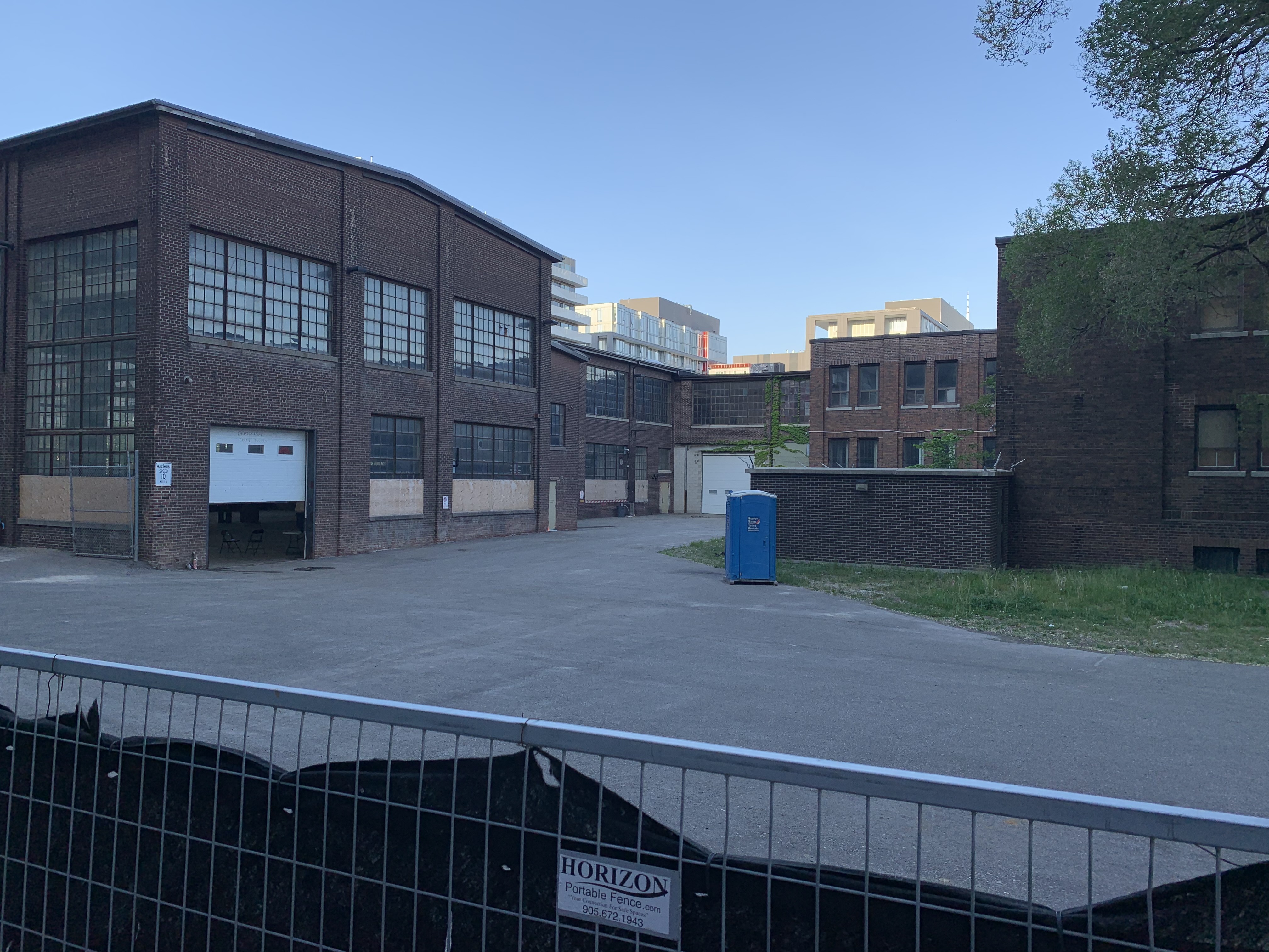
The photo below was taken from the Toronto Archives and shows the extent of the operation in 1947 when it reached all the way to Cherry Street. The buildings outlined in green have already disappeared leaving only the four outlined in blue. These are the foundry, warehouse, offices and machine shop.

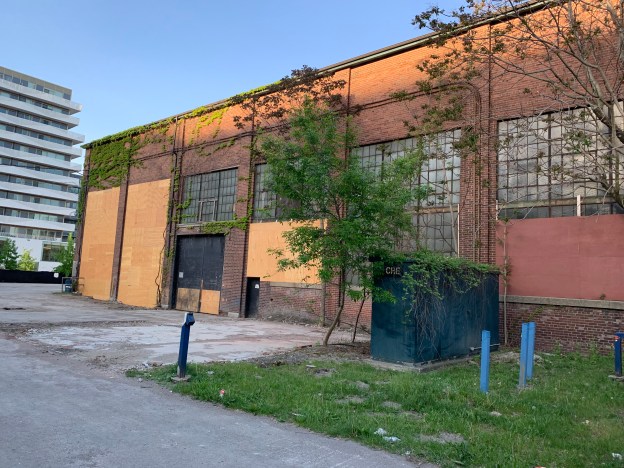
The foundry building was where metal ingots were heated and poured into molds to produce the parts for repairing the rolling stock of the railway. The foundry has a low pitched gabled roofline that is less common in industrial buildings.

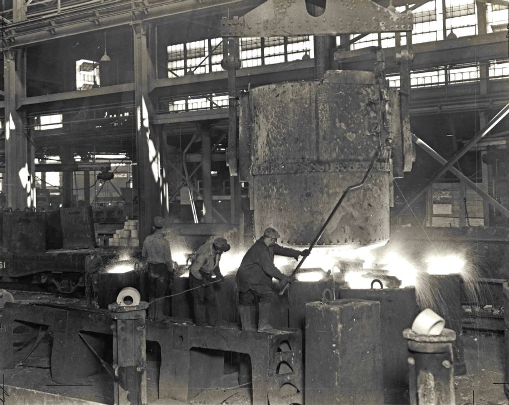
This undated photo from Friends of the Foundry shows the interior of the foundry when it was in operation. I can only imagine the heat in this place in the middle of the summer.

The entrance to the office building was located on the north wall and had single story pilasters on either side. Unfortunately, It can’t be appreciated because of the hoarding that was recently installed.

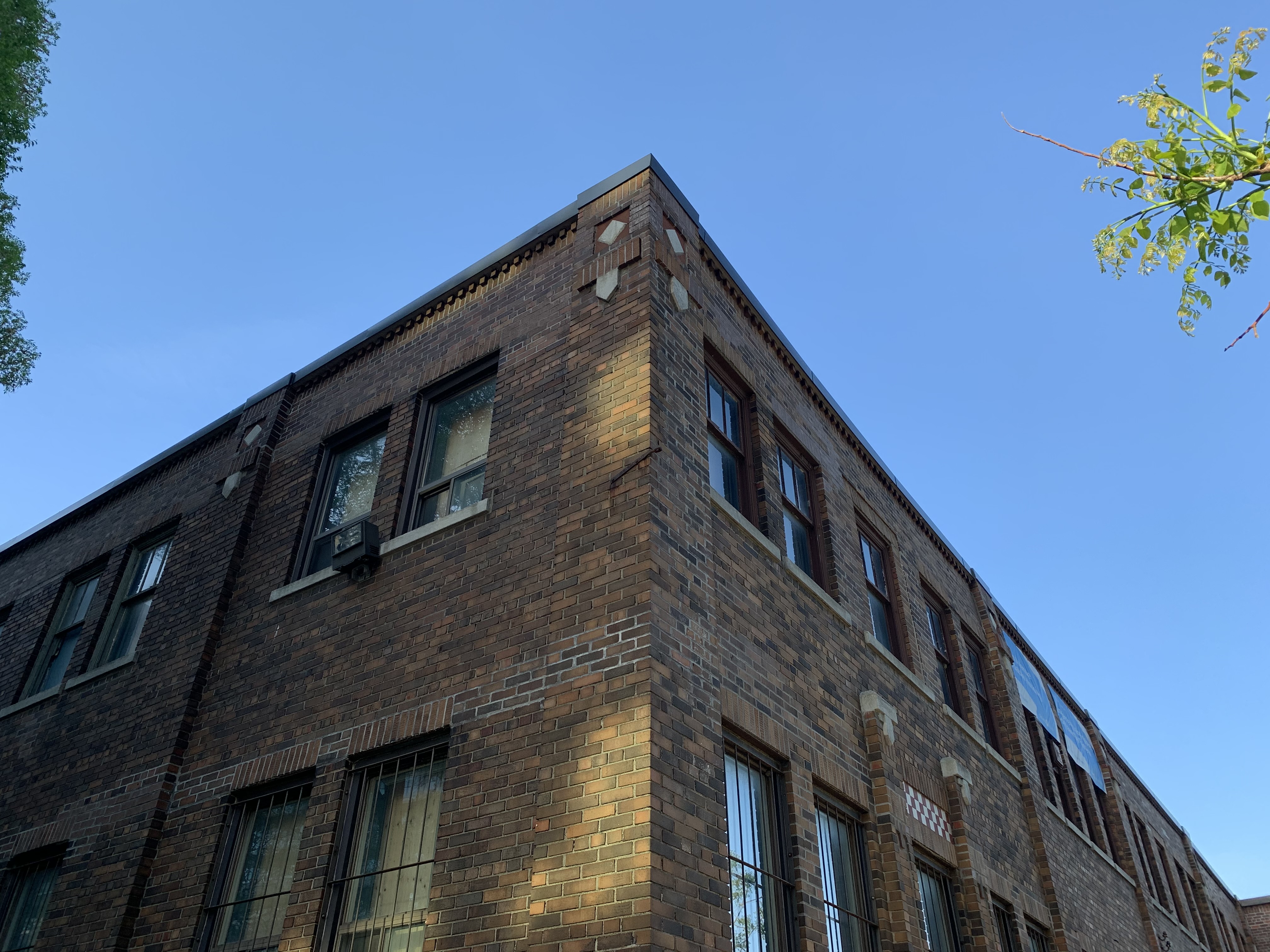
The office building is the only one that has any type of extra ornamentation. The walls are buttressed with brick piers that have small cut stone detailing at the tops. There’s also brick corbelling along the roofline with small stone details worked in.

When the foundry closed down the buildings were temporarily occupied by MSR Inc. into the late 1980’s. Since then it has stood empty while debates over the future of the entire 80 acre industrial zone went on. The City and Province proposed to develop the entire area for affordable housing in 1988. It is located in the flood plain for the Don River and so flood control and years of contamination required extensive remediation before development could begin. This new community would have been called Ataratiri after the Huon village that was destroyed near Midland in 1649. In this plan, the entire area would have been razed and all the buildings lost. Property values declined in the early 1990’s and along with skyrocketing remediation costs led to the project being cancelled.

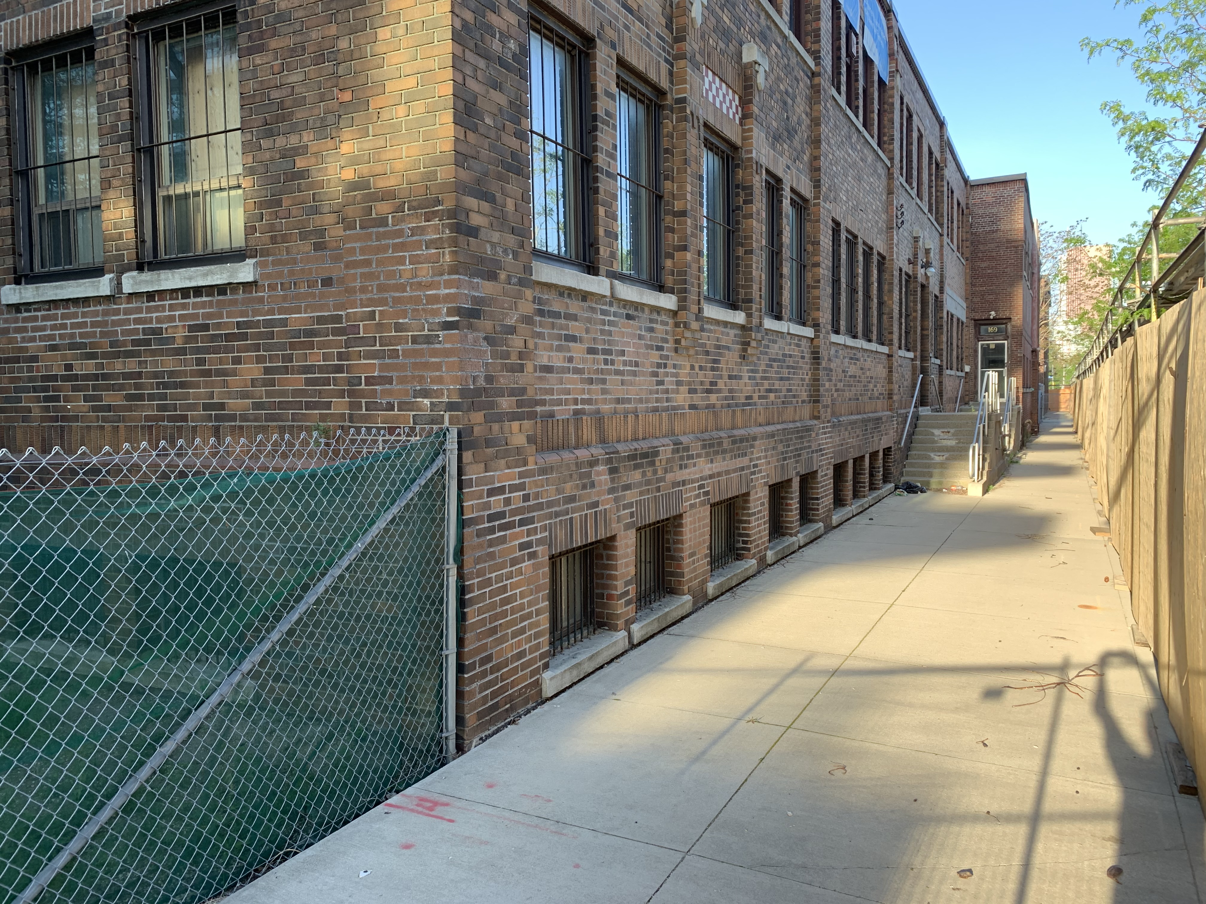
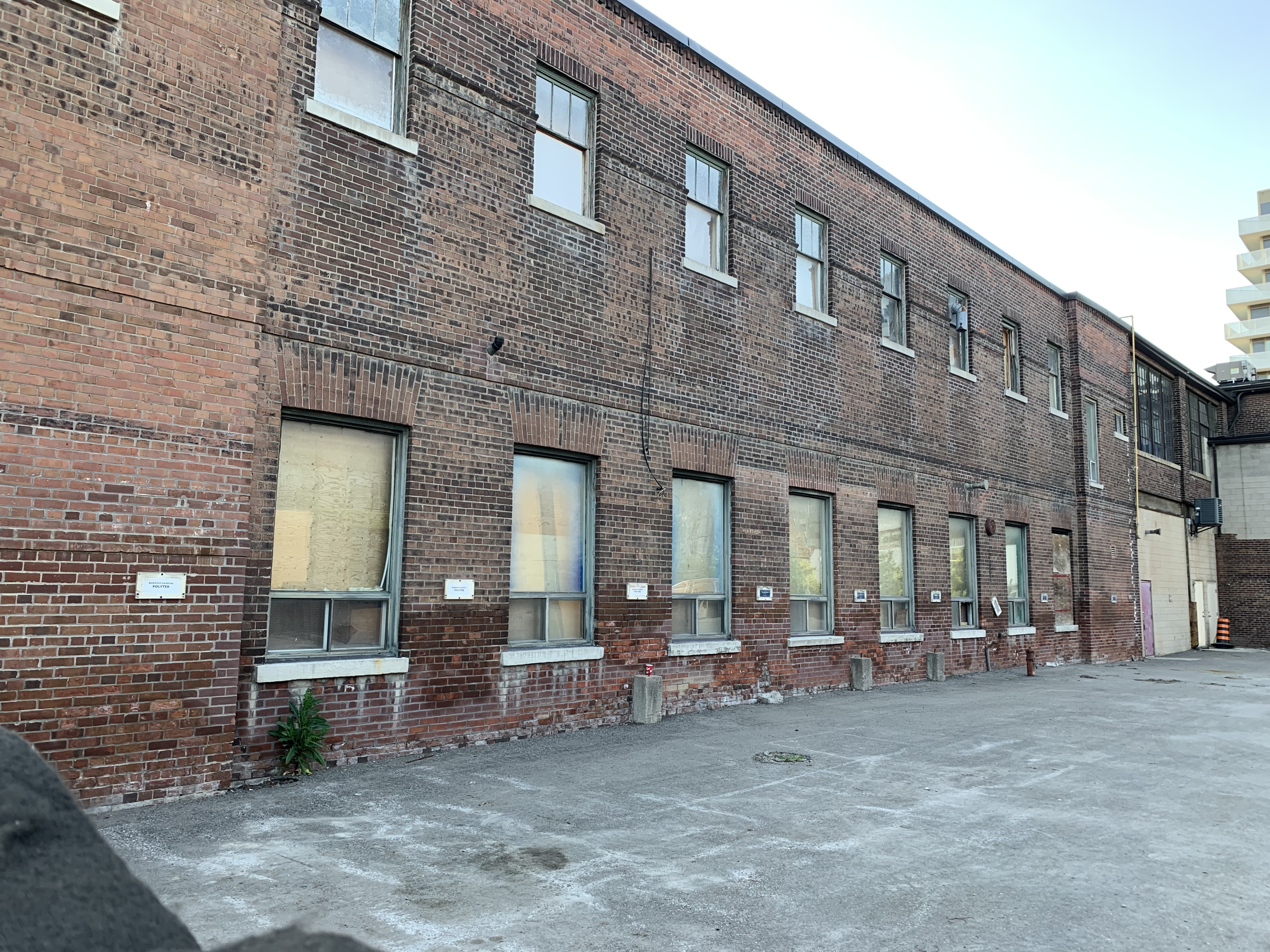
The picture below shows the side of the warehouse with its double rows of windows and lack of any ornamentation, except for a single row of corbel under the roofline.

The city added the four remaining buildings to their heritage inventory in 2004 and a plan was put forward that would have developed them into a community hub with a musical theme. There would have been studios and places to jam as well as community kitchens and meeting areas. This also didn’t happen.

The machine shop had a full wall of two story windows that let a lot of morning light in through its five bays.

The Pan Am Games were held in Toronto in 2015 and the 80 acre industrial zone became a new project. Now known as the West Don Lands, it was partially redeveloped as housing for the athlete’s village. When the games were being planned the foundry buildings were used for this purpose and during this time Prince Charles visited them. Since then, development has continued unabated with the whole area east of the old Canary Restaurant being turned into midrise condos .

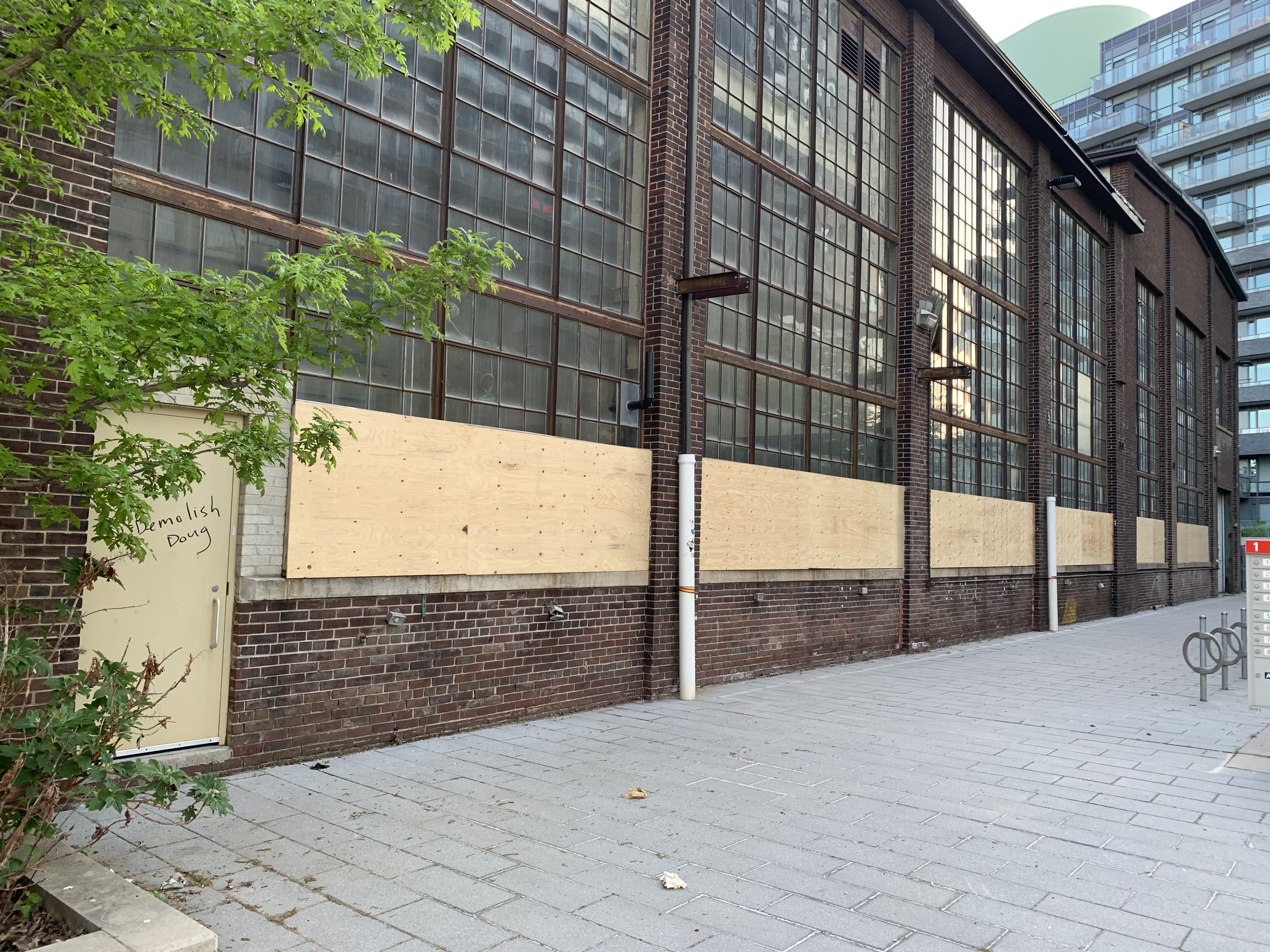
In 2020 the foundry site was announced as the future home of Eastern Avenue Affordable Housing. In January 2021 the Provincial Government invoked a Minister’s Zoning Order (MZO) to allow the development to proceed without delay or further community consultation. Demolition began almost immediately. So did the public outcry. Within days the demolition was put on hold and the damaged sections of the foundry building were boarded over.

The southern elevation of the Machine Shop shows a lot of new wood that has been installed to replace the original window boarding on the buildings. This was done at the specific request of the provincial government who found the anti-demolition graffiti on the older boards to be disturbing. The local community had left chalk and encouraged anti-demolition comments which support the preservation of this part of our railway heritage. It appears from the door in the picture below that the city workers have left a few pro-demolition comments behind.

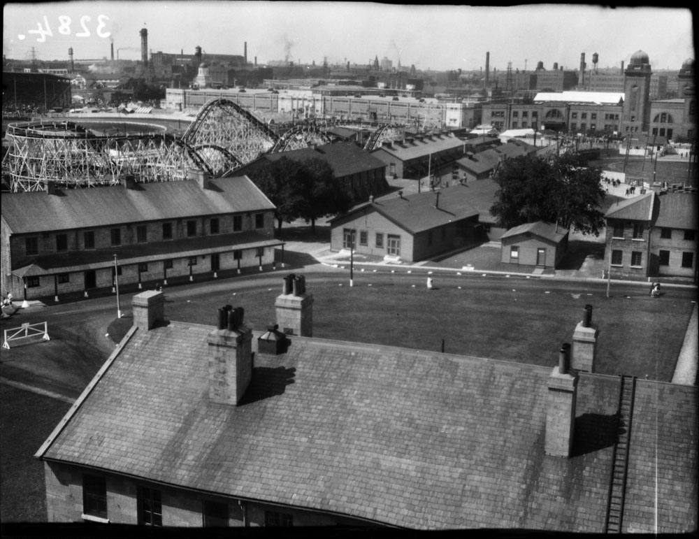
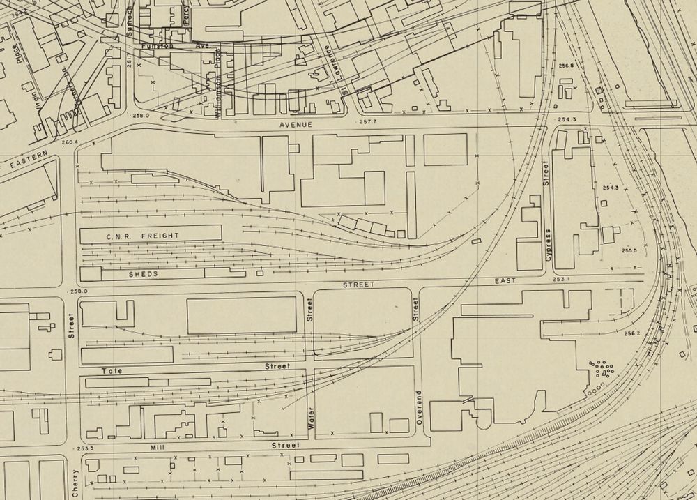
The 1959 surveyors map below shows the industrial area and how it was completely intertwined with the railways. Much of this railway heritage has already been lost to redevelopment and it remains to be seen what happens to the remnants. The Smithsonian Institute has recognized the cultural heritage of the industry and has one of Dominion Wheel and Foundry’s catalogues in their collection.

A few decades ago this would have vanished without thought but the tide has turned and people are more aware of the diminished cultural heritage that we retain. Hopefully we can continue to influence how it is retained and maintained.

Relevant Blogs: The Distillery District, Canary Restaurant

Google Maps Link: 153 Eastern Avenue

Like us at http://www.facebook.com/hikingthegta

Follow us at http://www.hikingthegta.com

Also look for us on Instagram

Toronto’s Early Banks

Sunday, May 23, 2021

Lots of history

Yonge Street has become the main street of Toronto but the city didn’t start there. The original town of York started in a small ten block section east of there. The town of York was bounded by George, Berkley, Adelaide and Front Streets and the oldest bank building in the city is to be found there.

The Bank of Upper Canada opened in 1821 in a local store and they began work on their new building in 1825. It opened in 1827 and because it was owned and operated by The Family Compact it came under constant attack from reformers. It was a target of the failed Rebellion of Dec. 1837. The building housed the bank until it failed in 1866 after which it had several uses before being abandoned by the late 1970’s. It was restored in 1982 and now serves as office spaces. The bank issued bank notes between 1822 and 1861 and ones in poor condition can sell for $750 in today’s market. More about the building can be found in our story Toronto’s First Post Office.

The Bank of Toronto was founded in 1855 by a group of grain dealers and flour mill operators including Gooderham and Worts. Throughout most of the 19th century the bank had farmers as their primary customers. By the 1880’s and 90’s they had started to extend loans to manufacturing, utilities and natural resource companies. Between 1856 and 1937 the bank issued several series of bank notes that continue to be collected today. In 1856 the bank opened their first branch at 78 Church Street. It was located in the building which is now numbered 80 Church Street and has the three small dormers on the top floor in the picture below.

The archive photo below was taken from the York University Library collection and is dated July 7, 1956. At this time the building was still numbered as 78 Church Street and the bank had recently merged with the Dominion Bank in 1955 to form the Toronto Dominion Bank (TD).

The Bank of British North America was founded by Royal Charter in London in 1836. It opened its first branch in Toronto in 1845 on the corner of Yonge Street and Wellington Street. Thirty years later it opened a new building at 49 Yonge Street and issued its own bank notes from 1852 until 1911. It merged with the Bank of Montreal in 1918.

The Bank of Montreal was founded in 1817 and was the first chartered bank in Canada. It served as the central bank for the country until the founding of the Bank of Canada in 1935. Legislation in 1824 prevented the bank from serving the town of York but it got its break in 1840 when it took over The Bank of The People. This was a reformer bank started in 1835 to provide loans to farmers that the Bank of Upper Canada wouldn’t serve. The Family Compact didn’t like the direct competition of reformers and plotted to have the bank taken over by the Bank of Montreal. In 1885 they opened a branch at Yonge and Front Streets and this building is one of the few in this area that survived the great fire of 1904. The building was designated in 1976 for its heritage value as one of the finest examples of 19th century bank buildings in Canada. It is now home to The Hockey Hall of Fame.

A little farther north on Yonge Street the Bank of Montreal opened another branch in 1887. Somewhat less ornate than the one built at Front Street two years earlier it survives today as an A & W restaurant.

Traders Bank of Canada was formed in Toronto in 1885 and survived until it was acquired by the Royal Bank of Canada in 1912. It was popular in rural Ontario but built a 15 story skyscraper on the corner of Yonge and King Streets in 1905. It was the tallest building in the British Empire upon completion, a title it would only hold until 1911. It was the first skyscraper in Toronto and one of the few remaining from the early 20th century. It is currently undergoing some restorations.

The Canadian Bank of Commerce was founded in 1867 by a group of Toronto businessmen. It grew rapidly and by 1907 had 172 locations across Canada. In 1961 they merged with The Imperial Bank of Canada to form the Canadian Imperial Bank of Commerce or CIBC. In 1905 they built this impressive 4 story building at 199 Yonge Street which has been preserved as part of the Massey Tower condos.

The Bank of Toronto erected a building at 205 Yonge Street in 1905 to a design by Toronto architect E. J. Lennox. He is famous for designing Old City hall and Casa Loma. This small building looks more imposing than its four stories because of the dome on top.

The Dominion Bank was founded in Toronto in 1869. In 1914 they constructed The Dominion Bank Building at the corner of King and Yonge Streets to replace the head office that had been located there since 1879. The building is 12 stories tall and was one of the earliest skyscrapers in the city. It was designed in the Beaux-Arts style with Renaissance Revival detailing.

On June 19, 1929 the Canadian Bank of Commerce started construction on their new 34 story building. When it was completed in 1931 it was the tallest building in the British Empire, a status that it held for the next 30 years while it served as head office for the bank. The site was originally home to a small wood chapel for York’s first Wesleyan Methodist Church starting in 1818. In 1887 the Canadian Bank of Commerce demolished a theatre on the site and built a 7 story head office which stood until 1927 when it too was razed for the current building.

The Dominion Bank built a new branch in 1930 at the corner of Yonge and Gerrard Streets. The building was designed in a simplified classical style is the work of prominent Toronto architect John M. Lyle and has fine detailing on the front and sides. Images of native plants and animals along with Canadian history adorn the building.

Following the Second World War designs had been simplified when the Bank of Nova Scotia built this branch in 1949. The Modern Classicism is enhanced with the rounded corner and smooth cladding.

In 1975 the Bank of Montreal completed their 298 metre tall building called First Bank Building in honour of the banks status as Canada’s first bank. It is the tallest building in Canada and only two metres short of being classified as our only Supertall Building. Two Supertalls are under construction and four more are in the planning phases. When they are completed it will be the first time in over 100 years that a bank building hasn’t been the tallest on Toronto’s skyline.

The banks have always held some of the most prominent buildings in the city, either in architectural design or for their height. It is only in the next couple of years that new condos will surpass the bank buildings in height but who knows how long that will last before a grander bank tower is constructed.

Associated blogs: The Rebellion of 1837, Toronto’s First Post Office, The Distillery District.

Google Maps Link : Yonge and Dundas

Like us at http://www.facebook.com/hikingthegta

Follow us at http://www.hikingthegta.com

Also look for us on Instagram

Trafalgar – Ghost Towns of the GTA

Sunday, May 16, 2021

Most people are familiar with Trafalgar Road but it could just as easily been named Postsville Road. That’s because the early name for the community of Trafalgar was Postsville. The Post Family settled at the intersection of Trafalgar Road and Dundas Street sometime shortly after 1807. Ephriam Post owned two lots #12 NDS (North Dundas Street) on the north east corner and lot 13 SDS on the south west corner. He built an inn on lot 13 and Posts Inn was a busy place serving as a change house for horse drawn stagecoaches that used to operate along Dundas Street. Hiram Post took over the Inn in 1841. The community was known as Posts Corners from 1815 until 1851 when it became Postsville. By the time of the 1877 County Atlas below it had been renamed Trafalgar. The points of interest in the story below have been circled on the map.

The community grew slowly and by 1869 had about 80 residents. There were two hotels, a butcher shop, a grist mill and carriagemaker as well as a blacksmith. It was in 1834 while James Thompson owned the north west corner of Governor’s Road (Dundas Street) and 7th line (Trafalgar Road) that small lots began to be sold for homes along both street frontages. These few homes formed the nucleus of the hamlet of Post’s Corners. The house just north of the corner was built around 1850.

The house next door is one of my personal favourites because although it is simple, and lacks extensive ornamentation, it has a quite unique look to it. The clipped gable on the front might be the only one of its type in the hundreds of historic homes featured in blogs so far. The style is Queen Anne and it was built around 1890 for Dr. Johnstone and his family while he worked as the veterinary inspector for Halton County. He was also the deputy reeve of Trafalgar Township. He died September 3, 1959 and was buried in Munn’s Cemetery where his wife is also interred. The family had been supporting members of Munns Methodist Church. This property is designated for condos but the current plan calls for the preservation of this house. I hope it is restored and put to good use.

James Appelbe came to Canada in 1815 from Ireland and by 1831 had married and settled in Postsville. For a few years he taught school at Munns Corners before becoming a merchant and postmaster. Locally, Appelbe was known as The Squire and was a justice of the peace. He also served as one of the first directors of The Bank of Toronto. Appelbe eventually acquired most of the land around Trafalgar and was one of its best known residents. His 1850 home used to stand closer to the intersection but it has been restored and moved by Great Gulf Homes after it was nearly destroyed by vandals. The house has four full length windows that reach from the floor to the ceiling on the main floor giving it a unique look and plenty of light.

Lot 12 on the North East corner was patented to Hugh Howard in 1807 and by 1820 he was able to build the wood frame house that stood on the property until just recently. John Clements bought the property in 1831 and when he passed away in 1873 it went to his son Matthew. The 1877 county atlas shows the property as M. Clements with two houses on it. This earlier house was lived in recently enough that the picture below shows a window air conditioner. By 2013 when the Cultural Heritage Assessment of Trafalgar Road was conducted the roof had caved in as had some of the walls. It has since been completely demolished.

The second farmhouse on the Clements property was built in the 1870s, likely by Matthew. This stucco farmhouse has been vacant long enough that the front yard is overgrown with hawthorn and other first generation regrowth trees that mask it from the road.

John Clements also owned the property across the road in the 1850’s but by 1877 had sold it to James Morrison who lived here until 1907. The house has belonged to the Bentley family since then but now sits empty waiting to find out what fate the developers have planned for it.

An old blacksmith shop still stands at the corner of Trafalgar Road and Burnhamthorpe Road but it is well on its way to becoming just another foundation in a field. Which means that when the developers arrive in a few years it’ll be gone completely.

John Jones owned the property with the blacksmith shop in the 1880’s and the family house still stands next door. It looks to have been recently abandoned and could be restored easily enough and I wonder what’s behind the siding? Does that gable window have the typical pointed arch of a gothic revival home?

Daniel Munn arrived in 1803 and took possession of the lot at the corner of sixth line and Dundas Street and began clearing his farm. That same year he set aside a small corner of the lot for a church but Methodist preachers would continue to hold meetings in the family home until 1844 when the first frame building was erected. A cemetery was opened across the road and in 1898 the present brick building was consecrated. In 1925 the congregation voted to join the United Church of Canada. When Dundas Street was widened in the 1970’s the church was moved 40 feet back from the road.

Munns Corners cemetery has a lot of older markers as it was also the primary cemetery for Trafalgar. Munn’s Church can be seen across the road.

Daniel Munns grave marker has faded to the point of being unidentifiable but you can still note the names of many of the pioneers on the county atlas above.

The south west corner of Trafalgar is being developed with high rise condos and the remaining farmlands are all owned by developers. It doesn’t seem likely that very much of the original community will remain in ten years time.

Also see our feature Ghost Towns of Halton Region

Google Maps Link: Trafalgar

Like us at http://www.facebook.com/hikingthegta

Follow us at http://www.hikingthegta.com

Also look for us on Instgram

What’s In Your Ravine?

Sunday, May 9, 2021

When the last ice age retreated about 12,000 years ago each of the rivers and streams that drain into Lake Ontario were swelled with meltwater. The Rouge River, Don River, Humber River and Credit River along with all the little creeks in between carved deep ravines. These are much wider than the modern rivers that flow through their valleys. After Hurricane Hazel in 1954 these ravines were transformed into conservation areas and parks. They have become greenbelts and migration corridors for the local wildlife. With ongoing travel restrictions it is important to remember that there is some good hiking with plenty of wildlife available right in our own part of the city. This post features a selection of the plants and animals we saw in a few hours on Saturday, May 1, 2021 along a section of Etobicoke Creek.

Most ravines will have more than one type of habitat and you should explore each one, slowly. Rivers and their banks will have a distinct group of plants and animals which they may share with local wetlands. Grasslands provide habitats to pollinators and small birds while new and old growth forests will each have their own distinct species. We customarily head for the water first, but move quietly or you might not see the heron, if there is one, until it’s in flight.

Mallard ducks and Canada Geese can be found almost anywhere there’s water. However, there’s lots of other types of waterfowl that you can watch for. The picture below shows a female (left) and male (right) Merganser. Their young will feed themselves a day or two after hatching and will be able to fly after about ten weeks.

An American Mink came running along the opposite creek bank and down a fallen branch to quietly slip into the water. After a moment it emerged with a small fish in its mouth which it then carried away out of sight.

As we watched, the mink returned and went back into the same quiet pool behind some larger rocks. After coming up a couple of times to catch a breath it eventually came out with another fish, this one a little smaller. The mink kits will still have their eyes closed and won’t be weaned for a few weeks yet. As soon as their teeth start to come in their mother will feed them small bits of ripped up fish or mouse to get them started on solid food. The kits will eat every 90 minutes or so which means she will need extra food intake herself to be able to supply the milk they require.

Last April 24th we witnessed a mother mink carrying her kits across Etobicoke Creek and into a den on the other side amongst the rocks. In all, we saw her carry four kits across the creek. The picture below was taken last year while she carried the first one. There’s lots more pictures of the other mink babies in our story Mink Kits.

As we were watching the mink fishing a small heron flew upstream and briefly rested in a tree before moving along. It landed in another tree a little farther upstream. It seemed likely that people using the trail would scare it and there was a reasonable chance it would come back our way, which it did. The Green Heron is smaller than other herons and has a short stalky neck that is usually drawn down toward the body. The green on their back and head is set off by the chestnut colour of their chest.

The grasslands, especially tall grass prairie areas support a wide variety of flowering plants and grasses which attract birds and pollinators. On a sunny day you might see one of several, harmless species of snakes taking advantage of the sun to regulate their body temperature. Garter Snakes give birth to a litter of 20-30 live young in the late summer. This little one was likely born last year and will have a life expectancy of two years in the wild. Garter Snakes are sometimes kept as pets and average ten year life spans in captivity.

Butterflies and moths can be spotted on most days. The picture below shows a Compton Tortoiseshell butterfly which finally rested long enough for a photo op.

Eastern Cottontail Rabbits were not known in Southern Ontario until about 1860. Rabbits never stray far from a hedgerow, woodpile or burrow where they can escape their many predators. This is known as edge habitat and prior to the settlers cutting the forests there weren’t any of these places where fields gave way to shrubs. Their slow migration north didn’t bring them to the Ottawa area until as recently as 1931. They molt twice per year and this one is in the middle of its spring molting.

Not everything you see in your ravine belongs there. Unfortunately invasive species have taken over some areas of our parks and ravines. They grow quickly and overtake the natural species and eventually choke them out. Dog-strangling Vines are a key example of an invasive species as they routinely choke out the milkweed our Monarch Butterflies need. Garlic Mustard, pictured below, is another invader which is doing overly well. Once it gets going, Garlic Mustard will choke out the Trilliums and Trout Lilies (Dog’s-toothed Violet).

The Mayapples are just starting to form the bud that will open into the flower. Plants with a single leaf won’t flower but the colony along this stretch of the creek is almost all female. They have a pair of leaves and a flower bud forming in between. This particular patch appeared to be mostly flowering this year. These plants grow in patches from a single rhizome and will be found in the same location year after year.

Violets are a large family of plants that have over 525 species. This time of the year they form a purple or blue carpet on the forest floor. Many violets are perennials which means that the plant will live for more than one year.

Experience has shown that almost every ravine in the GTA has both coyote and deer. The Etobicoke Creek is no exception. Although the local coyote didn’t make an appearance on this Saturday, the deer showed up in force. While walking a side trail a flash of white in the trees betrayed the presence of a White-tailed Deer. Upon closer examination a small herd of five was detected. Three of them went off along the ridge while the other two continued to browse. The pair are shown in the cover photo and the smaller of the two was very curious. It walked to within a few metres of where we were sitting as it casually munched leaves and grasses.

July 27, 2020 while taking an observation break, a fawn walked right up to us and pretty much said “Hello.” Its mother was nearby and called it back when she thought it was getting a little too curious. From the way the deer approached today, it was almost as if it was the same one with its mother and that it recognized a friendly acquaintance.

This male Hairy Woodpecker is in the process of digging some little snack out of a dead tree. The term “snag” applies to a standing dead tree and they make up an important part of the local ecosystem. They provide unobscured views for raptors such as the pair of hawks we saw circling high above at one point. Snags also provide homes for wood and bark boring beetles and their larvae. This is what attracts the woodpeckers and serves as a source of food for them. Small animals will nest in hollow snags and they’ll continue to serve as housing even after they fall.

Once you know where to look for Jack-in-the-pulpit you should be able to go back every spring and see the same plants. This is because they can grow from the same underground corm for up to 100 years. It’s quite possible that this little plant in the picture below will outlive everyone reading this article today.

This is just a sample of the types of things you can expect to see in almost any ravine, watercourse, or major park in the GTA. So, the question is, “What’s in your local ravine and when are you going exploring?”

Related blogs: Mink Kits, Etobicoke Creek Trail

Google Maps Link: Etobicoke Creek

Like us at http://www.facebook.com/hikingthegta

Follow us at http://www.hikingthegta.com

Also look for us on Instagram.

The C.N.E.

Sunday May 2. 2021

The Canadian National Exhibition (C.N.E.) started as an agricultural fair in 1846. It rotated between cities in Upper Canada and was hosted by Toronto in 1846, 1852, 1858 and again in 1878. The city decided it needed its own showcase and so the Industrial Exhibition was opened for the first time in 1879. There’s still one building from that original exhibition and several other interesting structures and monuments and so I went for a walk around the 192 acre site. Many buildings have come and gone on the grounds of the C.N.E. but its development can be traced roughly from the west end toward the east.

The first European uses of this piece of property date back to 1750 when the French built Fort Toronto, which was called Fort Rouille after 1752. The fort only lasted until July 1759 when the British were defeating the French. As their hold in North America was lost they evacuated the fort and then burned it. An obelisk monument was erected in 1887 to mark the site of the old fort. Excavations in 1979, 1980 and 1982 revealed many details of the fort and now the outline is marked by a cement walkway that can be seen in the picture below.

Following the Battle of York and the Rebellion of 1837 it was decided to build a new fort at Toronto. New Fort York was built in 1840-1841 and was later renamed Stanley Barracks. It was used by the British until 1870 when it was turned over to the Canadian Military. Troops were trained here for several wars in which Canada participated concluding with the Second World War after which the fort was no longer used by the military.

The archive picture below shows the fort with the C.N.E. buildings in the background. This picture was taken in 1931 and by the 1950’s all the buildings except the Officers Barracks, in the foreground, were demolished to create parking lots for the Exhibition.

The first annual Industrial Exhibition opened in 1879 and was graced by the arrival of Scadding Cabin. The cabin had been built in 1794 on the east side of The Don River and was later disassembled and moved to the grounds of the fair. This early act of preservation allowed the cabin to survive and today it is the oldest building in the city.

Fifteen permanent buildings were erected on the western end of the site between 1903 and 1912 while the eastern end was still used primarily for military purposes. Over the years all but five of these have been lost to fires or the construction of the Gardiner Expressway. The oldest of these is the Press Building which was completed in the Beaux-Arts style in 1904. It was originally used as the Administration Offices for the Exhibition until it was moved into the new Queen Elizabeth Building in 1957. After that the building played host to the media and the name was changed to The Press Building.

The Music Building was originally constructed as the Railways Building in 1907 and employed the Beaux-Arts Style that G. W. Gouinlock used on all twelve buildings except the fire hall. The building is made up of three 40 foot tall domes each 54 feet in diameter. The Horticultural Building was also completed in 1907 but is surrounded by a fence and temporary structures making it difficult to get a worthwhile picture.

In 1911 The Government Building was added, also constructed in the Beaux-Arts Style. It was originally used for government displays at the exhibition and later became the Arts, Crafts and Hobbies Building. It later served as barracks for Canadian soldiers during World War One. Since 1993 it has hosted Medieval Times where you can enjoy dinner and a nice jousting match.

The Fire Hall and Police Station were built in 1912 and remain in service as active detachments to this day. This was the last of the 15 permanent buildings and marked the year that the name was changed to the Canadian National Exhibition. These five remaining buildings were added to the heritage list in 1988 collectively as an historic site.

The Government of Ontario building was added in 1926 to provide permanent exhibition space for the province. This was transferred to Ontario Place in the 1970s and the building was largely vacant for a number of years except during the C.N.E. when it hosted displays. Since 2001 it has been home to Liberty Entertainment which has several banquet and ballrooms in the building.

In the 1920’s the eastern end of the park was under redevelopment and a new set of gates was planned. Work began in April 1927 and was completed in August. The plan called for a celebration of the 60th anniversary of Confederation and the gates were to be called the Diamond Jubilee of Confederation Gates. However, on August 30, 1927 they were officially opened by two princes. When Edward, Prince of Wales and Prince George, Duke of Kent presided over the opening it was suitably renamed Princes’ Gates. It is also featured in the cover photo where the inscription Canadian National Exhibition 1879 – 1927 can be read.

The Shriners Peace Fountain started in 1930 as a memorial to a century of peace between Canada and The United States of America. The surrounding gardens and fountain were developed in 1958 by the Toronto Parks Department.

By the time the Horse Palace was built in 1931 the architectural style had shifted to Art Deco with its crisp clean lines. Originally the Toronto Police kept a mounted unit here during the C.N.E. and again during the Agricultural Winter Fair. Since 1968 there has been a permanent unit stationed here and in 2000 all of the Toronto Police Mounted Units were housed in this building.

A wooden entrance was built in 1895 to greet visitors who entered the park off of Dufferin Street, the main entrance at the time. In 1910 it was demolished and a set of Beaux-Arts towers with a festive arch was constructed at the western entrance to the park to match the buildings. The archive picture below shows the gates during the First World War.

Unfortunately, it and several buildings were in the way of the Gardiner Expressway and so it was demolished in the 1950s. The parabolic arch that replaced it in 1956 will remind people of the more famous St. Louis Arch, however that one wasn’t built until 1963.

Between 1955 and 1985 the Shell Tower, later Bulova Tower, stood tall above the C.N.E. at 120 feet in height. It was closed in 1983 because of continued issues with the elevator and various other structural concerns. Two years later it was demolished to make way for the first Toronto Indy Course. Today we have a smaller clock tower which stands behind the cherry trees which are just starting to blossom.

I enjoyed a two hour exploration of the grounds of the C.N.E. but when the Ex is actually on, it takes much more than that to see everything it has to offer.

Related Blogs: Battle of York, Rebellion of 1837, Scadding Cabin, Ontario Place

Google Maps Link: C.N.E.

Like us at http://www.facebook.com/hikingthegta

Follow us at http://www.hikingthegta.com

Also look for us on Instagram