Saturday, April 20, 2019
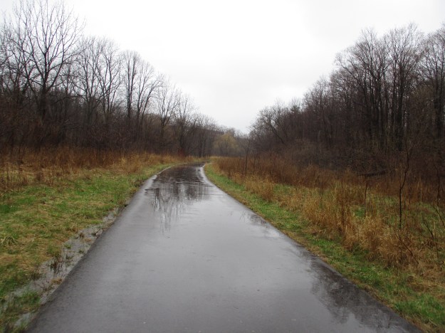
When it is completed the Etobicoke Creek Trail will stretch for 50 kilometres from The Waterfront Trail at Lake Ontario to the town of Caledon. It will connect Mississauga, Brampton and Caledon with a multi-use trail system. The 11.2 kilometres in Mississauga still has one informal section of undeveloped trail as well as a small section of residential street included. Sections of the trail run on either side of the creek with pedestrian bridges providing access. When on the east side of the creek you are in Toronto while the west side is in Mississauga. The Toronto Region Conservation authority are developing the sections in their mandate. Most of the trail through Brampton has also been completed adding another 14.5 kilometres. Please note that while bridge restoration is ongoing on the 401 over the Etobicoke Creek the trail is closed through this portion. We parked on Sismet Road near the creek where there is a formal access path.
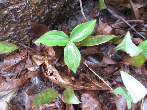
The trillium was adopted as Ontario’s floral emblem in 1937. The three leaves are followed by a flower with three petals which can be one of four varieties. The white being the most common in the GTA followed by the red one. Painted and nodding trillium are much less common. They flower and disappear before the trees gain their leaves and block the sunlight from the forest floor.
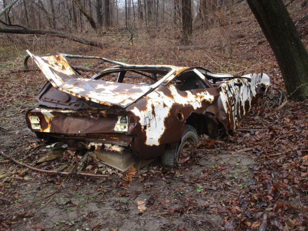
One of the true oddities along any river or creek in the GTA is the presence of an old car. These can be found quite often along the Bruce Trail but except for near the Hyde Mill in Streetsville where there are two of them, they are not to be found. This one turns out to be a 1975 Chevy Vega. The final detail of the year was found on a plastic part which contained the molding date. Why this car was not removed when the trail was recently upgraded is a mystery.

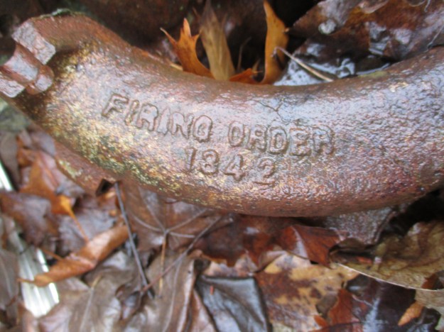
This car will take a little work to get back on the road as the 2.3 litre engine has been partially disassembled. They came with an inline four cylinder engine with a diecast aluminum alloy cylinder block. All four cylinders were mounted on the same side of the crank case. The firing order has been recorded to assist you when you start to refurbish this car.
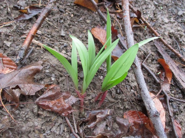
Several varieties of plants have recently emerged to welcome the spring sunshine, if we ever get any. Chives are an edible plant which are closely related to Leeks and Garlic. They produce edible flowers which are listed as one of the top ten plant for production of nectar to attract pollinators. These plants are essential to helping us restore the habitat for bees. The loss of bees threatens our entire food chain. When thinking about harvesting a small amount of any wild food, please be sure not to damage the patch or over harvest. Make sure there is some left there to grow for years to come.
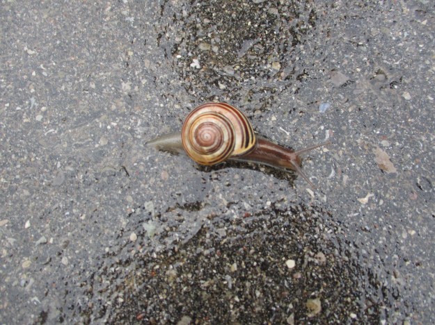
The average garden snail moves at the rate of 0.047 k/hr which means that this snail will take about 40 minutes to cross the three metres of paved trail on the Etobicoke Creek Trail. During this time it will risk becoming a snack for one of the robins that were out in full force. When the weather is better and the trail gets busy it will be at even greater risk from cyclists and pedestrians.
Residential oil storage tank are used for home heating and often come in a 910 litre size (200 imperial gallons). There are two of them in a small ravine along the side of the trail. This is another item that is uncommon along the developed park system in the GTA.

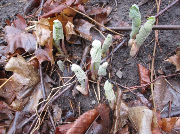
Mayapples were just poking their stems through the ground. The flower will appear and bloom in May but the single fruit won’t be ripe until later in the summer. The fruit are poisonous until they turn yellow when you can remove the seeds and safely eat one. Experience shows that raccoons keep a close eye on them and pick the fruit as it ripens which means you’ll be fortunate to find a ripe mayapple fruit to sample.
Leeks are related to the chives we saw earlier and likewise can make a good stir-fry ingredient.
There are several other sections of the trail that are completed and we will certainly be exploring them one day but we have already visited the Ghost Town of Mount Charles
Check out the top 20 posts from our first five years at this link: Back Tracks – 5 Years of Trails
Google Maps Link: Sismet Road
Like us at http://www.facebook.com/hikingthegta.com
Follow us at http://www.hikingthegta.com

Interesting. Thank you.
Pingback: The Auto Graveyard | Hiking the GTA
Pingback: Used Cars | Hiking the GTA
Pingback: Antlers | Hiking the GTA
Pingback: What’s In Your Ravine? | Hiking the GTA
Cool post. I’m a big fan of the trail, especially the northern part up from Burnhamthorpe. The southern part is really nice, but still a bit short for a cyclist to make good use of, especially while it’s closed under the QEW. I know this is an older post, but do you, or anyone, have detail on the supposed plans to connect the southern portion that ends north of the QEW with the northern leg? I can’t even imagine who would take that on, given the size of the gap, and the fact it skirts both Mississauga and Toronto. The TRCA is mentioned, but I don’t see any specifics on their site about doing so. Thank you!
Back in the 60’s (1960s) we used to spend so many summer days on and in Etobicoke Creek… long before the trail. Sailing a small boat in the waters south of Lakeshore Road, playing on the dam and fishing at the dam that used to be part of the old road into The Toronto Golf Club, caddying there then running trails at the bottom of the cliffs on the Mississauga side. We waded through the creek, went up the big drainage tunnel under Alderwood, threw rocks at rat nests, climbed the cliffs with just a few lengths of rope, played army in the woods… it was a great playground. Once we even made it all the way up to the old bridge at the end of Sherway Drive when there was still a road from Dixie to Sheridan Gardens and there was a horse farm in the valley. My parents moved from Lakeview to the Sherway neighbourhood in the ’70s and I didn’t revisit the Creek till my daughter was old enough in the ’90s to explore up to and above the new Queensway Bridge. After all the efforts to redirect the flow of the creek, which ultimately proved fruitless, no matter how they tried to enhance and preserve the curves of the creek. Spring flooding and major thunderstorms would just straighten the course of the creek till it became almost straight from the Queensway to south of the QEW. Riprap and boulders are no match for the forces of big water over time.