Monthly Archives: April 2017

Beechwood Wetlands

Sunday, April 23, 2017

In 1826 The Taylor Family moved to the property that today we know as Crother’s Woods. Beechwood Drive is the road that led to the homestead they built and for decades was one of only a few places where you could travel across the Don Valley. Parshall Terry owned the property that became known as Terry’s Field and was the next property north of the Taylor property.  To check out this 11-hectare area I took advantage of free parking on Beechwood Drive just off of O’Connor Drive.

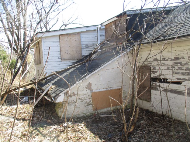
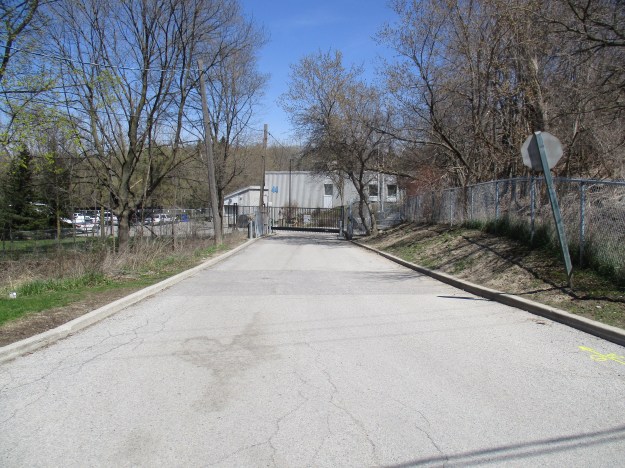
Around 1900 the Taylor family purchased Terry’s Field to make bricks from the clay that had been located there.  They already had an extensive industrial empire to which they kept adding.  The colony was offering a bounty for the first industrialist to open a paper mill and the mill at Todmorden had opened although it did not win the title.  That went to the paper mill in Crook’s Hollow.  The Taylor Paper Mills were a success and they eventually operated three of them.  The one at The Forks of The Don was the most northerly of the trio with Todmorden being at the south.  The Taylors opened Sun Valley Bricks which operated in the valley into the 1930’s.  This was in addition to the Don Valley Brick Works which they managed just south of Todmorden.  Later Domtar opened facilities here that left the land contaminated when it closed in the 1980’s.  After removing truckloads of soil and most of the buildings the land was deemed safe for use again.  Toronto Police Services is using the only remaining facility to train their canine units.

IMG_7938

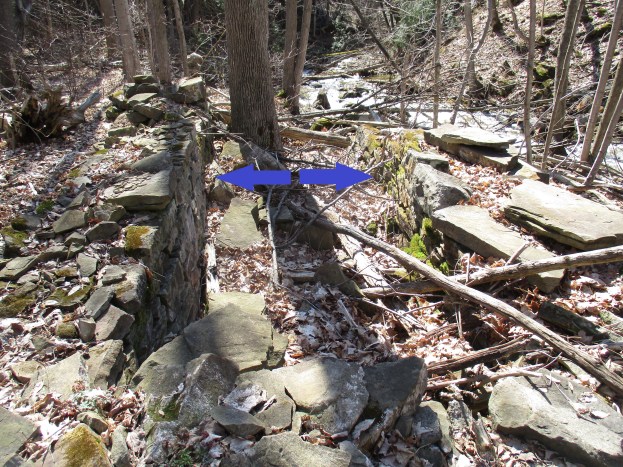
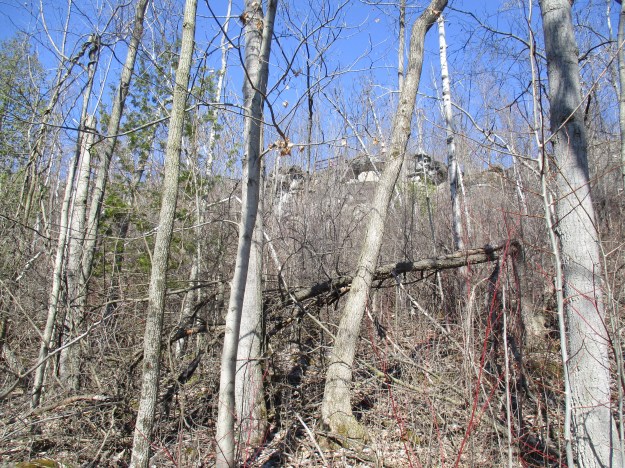
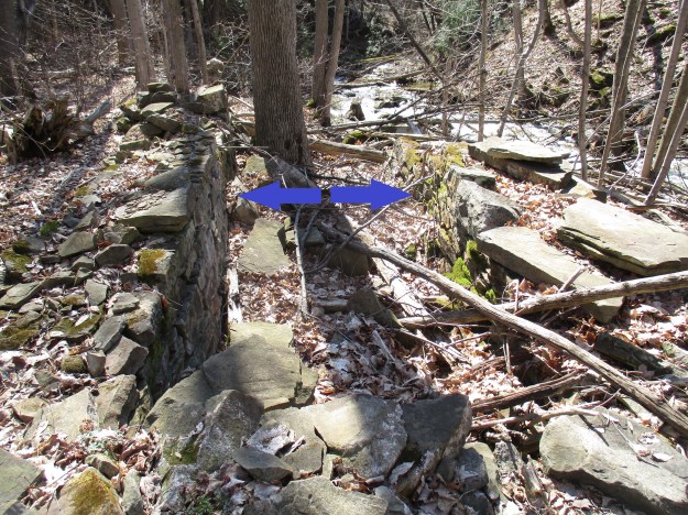
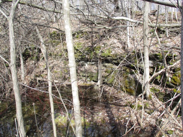
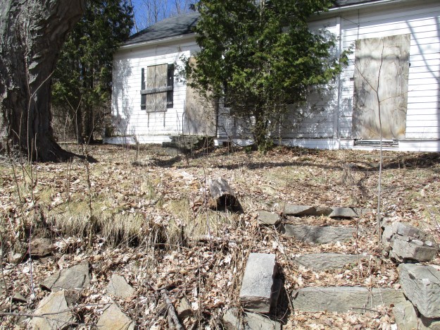
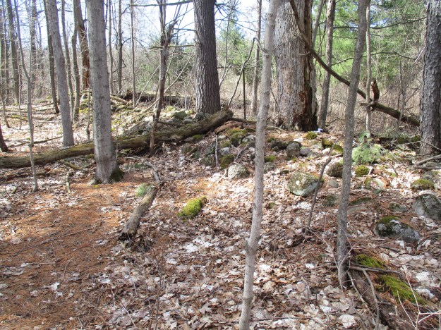
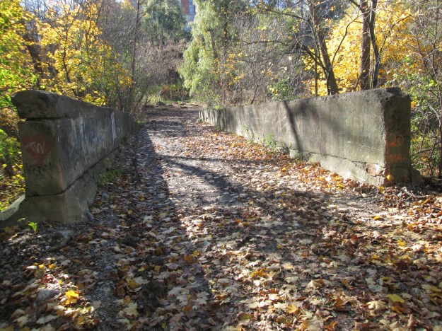
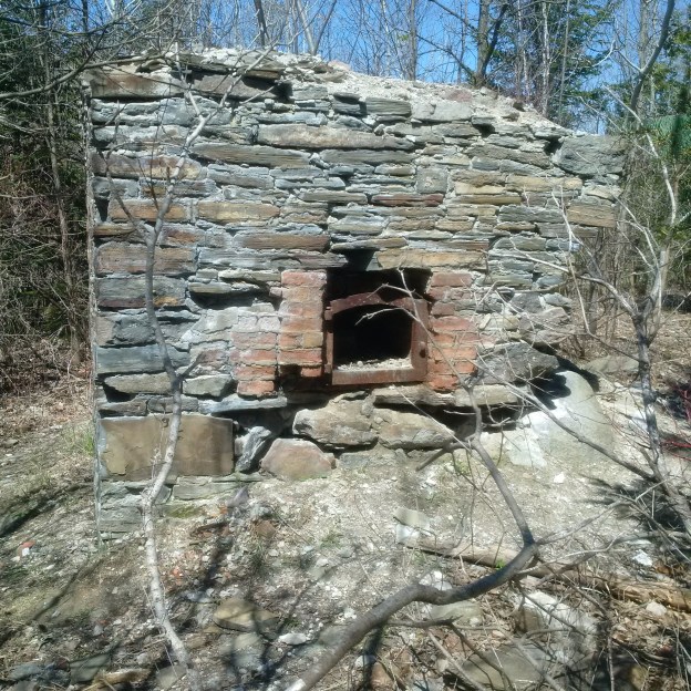
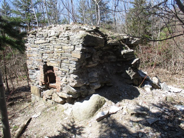
Near the site of the old Taylor house stands the crumbling remains of an old kiln.  This likely predates anything else remaining on the site.  The cover photo shows the kiln from a little different angle.  As can be seen from the picture below the kiln is crumbling on one corner and it is surprising that the city isn’t taking steps to keep people off of the kiln.  There is also a couple of trees growing on top of the structure.  I believe that it should be restored and given a proper interpretive sign as it may be the best example of an old kiln in the city.

IMG_7937

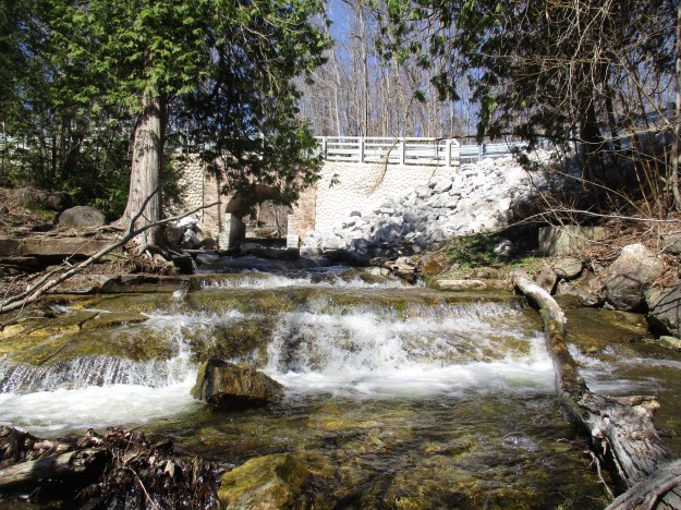
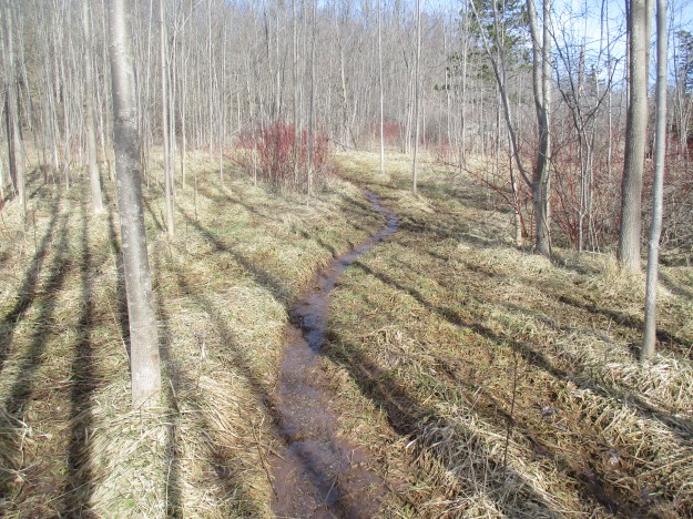
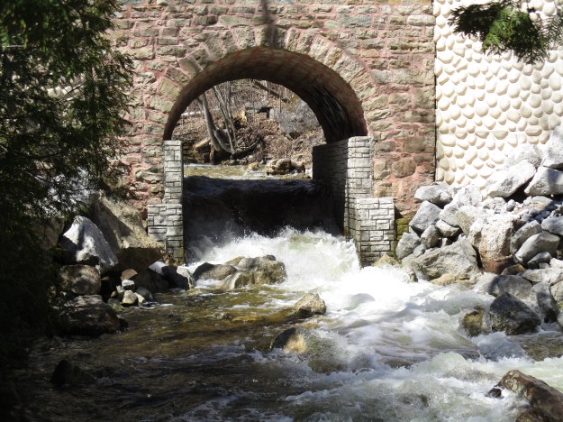
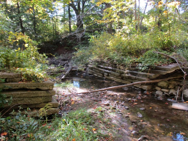
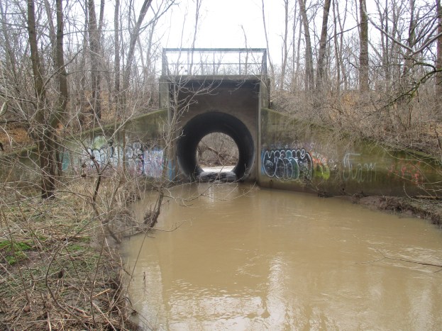
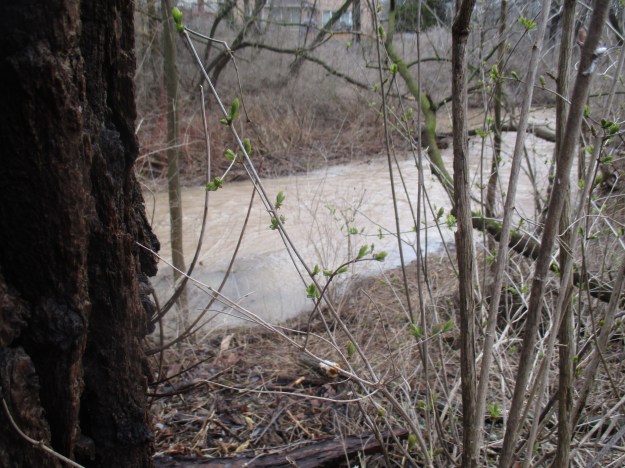
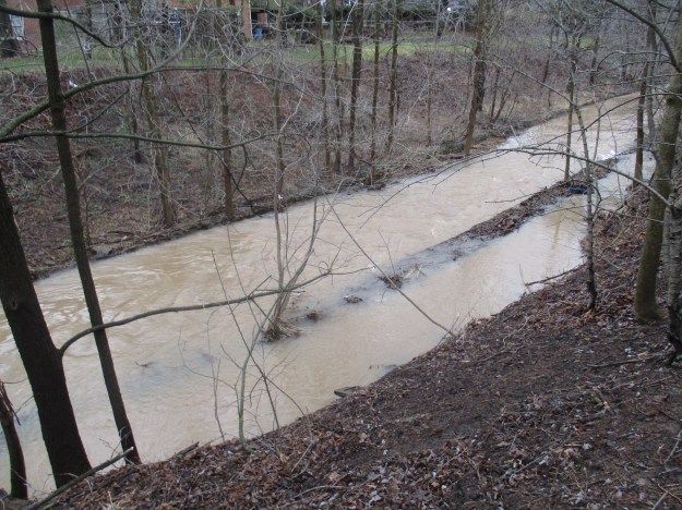
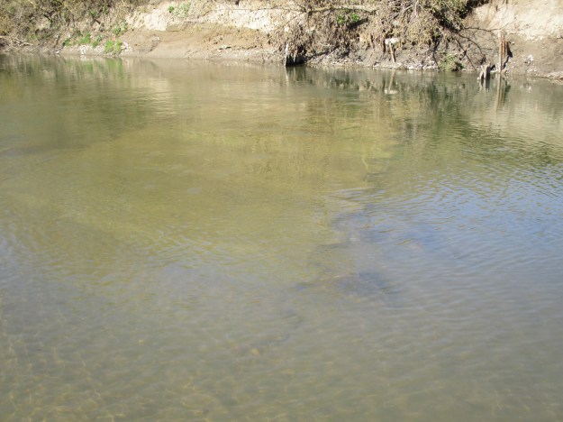
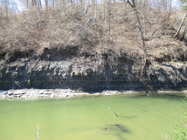
The river shows many signs of its past usage including a narrow pond which is likely the remains of a 19th-century mill raceway.  Outfalls line the river including two that come directly from the North Toronto Sewage Treatment Plant which was opened on August 1, 1929.  There is also evidence in the river of a past dam, the crib can be seen below the water in this picture.

IMG_7834

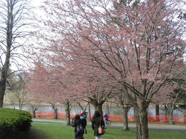
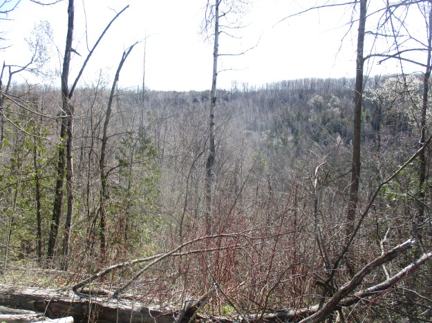
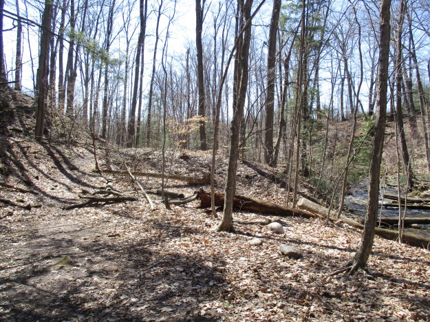
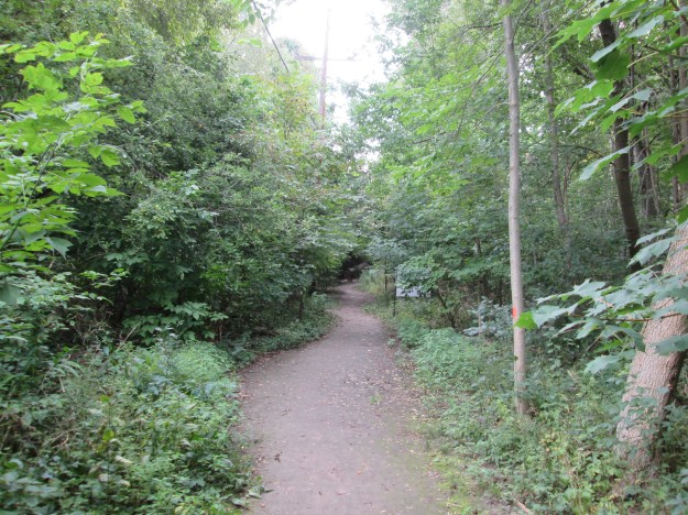
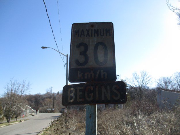
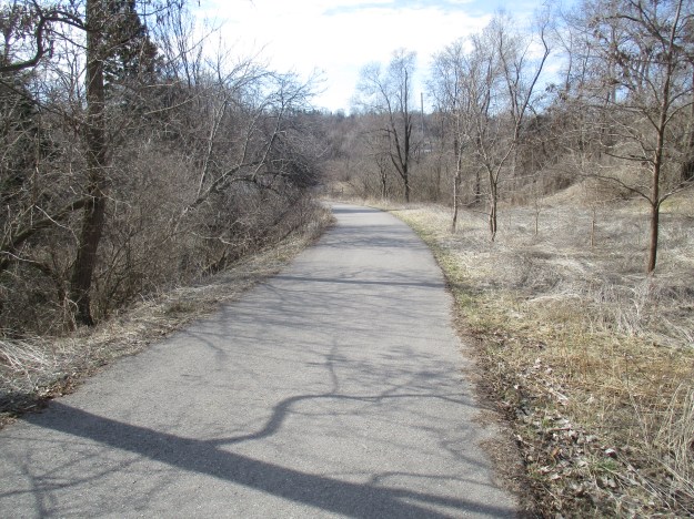
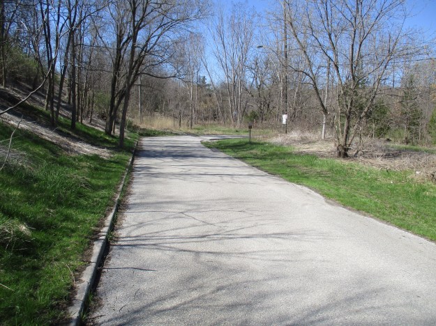
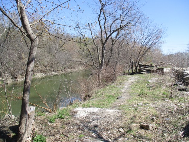
Beechwood Avenue is now closed to through traffic but formerly curved to meet the CNR tracks just before it reaches the river.  The Lower Don Recreational Trail runs parallel to this section of roadway.  Directly in front lies the Beechwood Wetlands and to the right, Cottonwood Flats where the city dumped snow until 2004.  Sun Valley, former home to Sun Brick Company and the Sun Valley Land Fill lies beyond in Crothers Woods.

IMG_7866

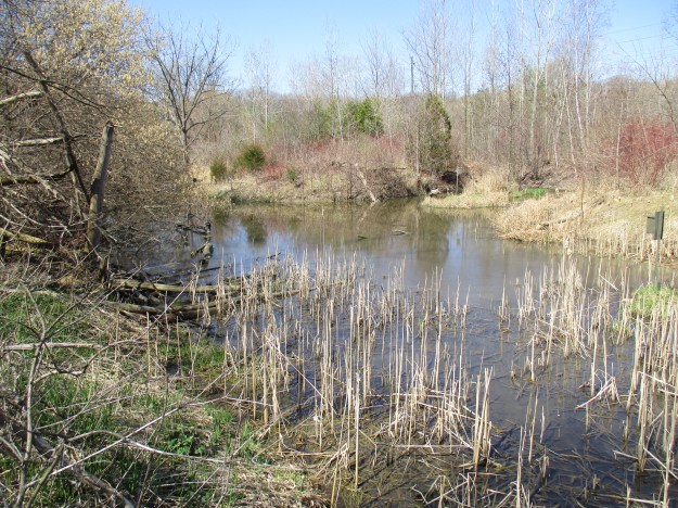
Beechwood wetlands was built in 2002 and 2003 in a joint effort by the Task Force To Bring Back The Don, Toronto Region Conservation Authority, Toronto City Parks and several others.  They  used heavy equipment to recreate the landscape and eliminate the damage done by years of use as an industrial site.  Volunteers planted 6500 native trees, shrubs and wetland plants and maintained them twice a week for the following year to ensure they got off to a good start.  The wetlands are now home to frogs, snapping turtles and various wetland birds and are considered one of Toronto’s most successful restoration projects.

IMG_7869

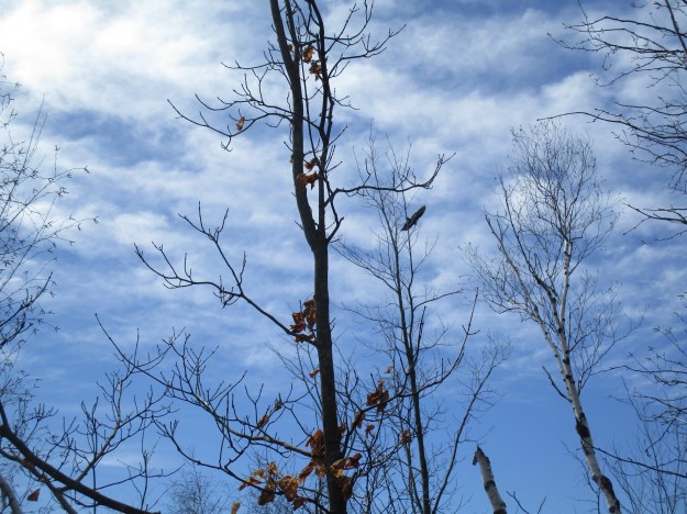
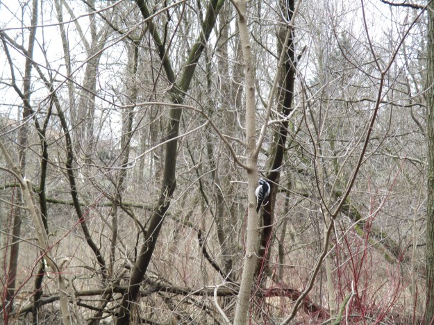
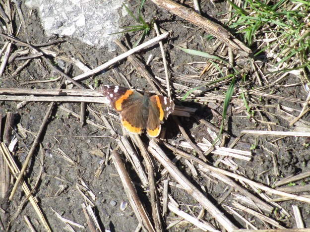
The Red Admiral butterfly makes a migration north each spring to recolonize most of North America.  It will have two cycles per year, one in March which spends the summer in Ontario.  A second brood is hatched in October that flies south to spend the winter months in south Texas.  Red Admirals have a red/orange band that encircles both wings and prominent white spots on the front of each forewing.

IMG_7900

The Lower Don River has cut through layers of shale that can be seen near the waterline and perhaps this is what was being burned down in the kiln.

IMG_7906

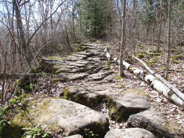
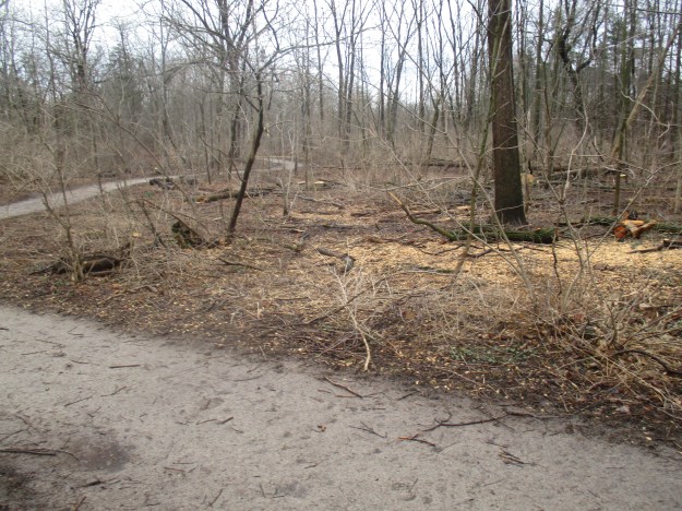
After the buildings were demolished piles of construction rubble were dumped along the side of the river.  These piles in many places have become habitat for the various species of wildlife that inhabits the parkland.  Throughout the concrete slabs can be seen the wrought iron reinforcing bars that were used prior to tied rebar used today.

IMG_7920

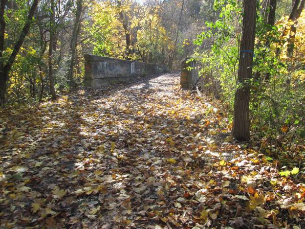
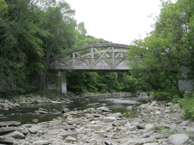
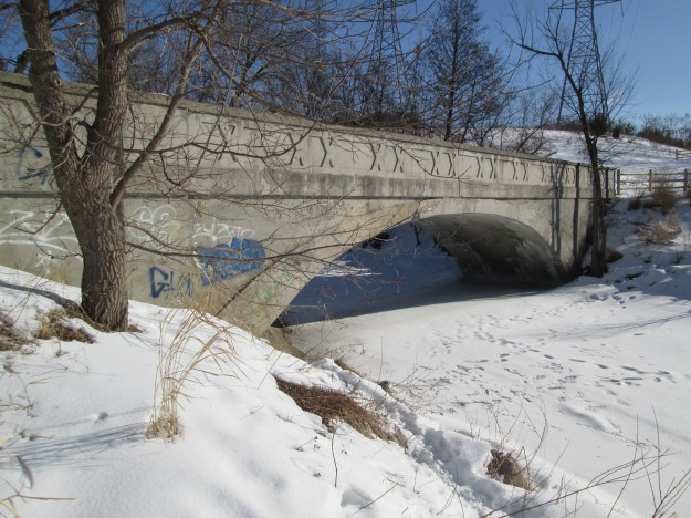
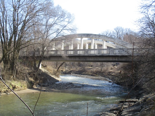
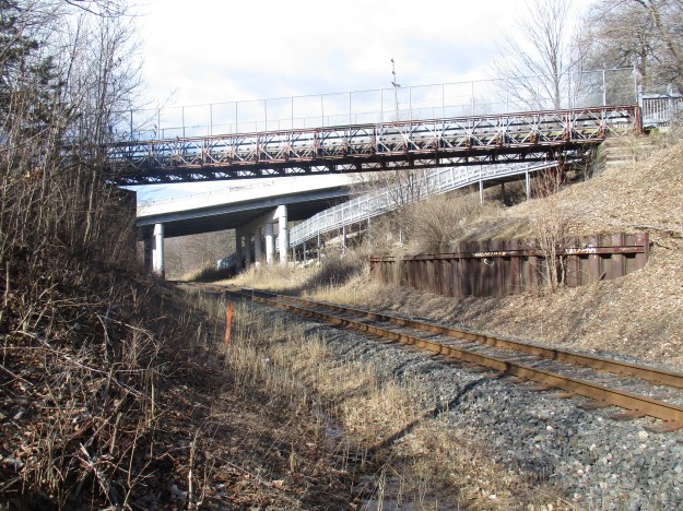
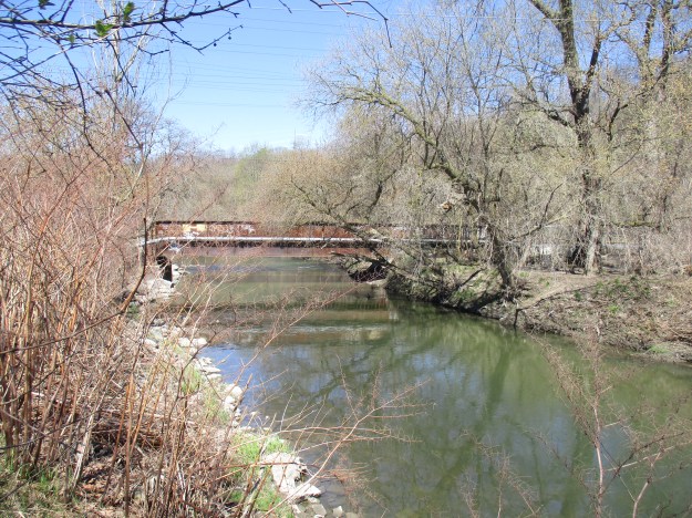
The Canadian National Railway line cuts through the property and the winding nature of the Don River required the railway to build two bridges.  The bridges are nearly identical in construction and the railway is still active.  The former Beechwood Road crossing has signals and caution should be exercised when making your way from the Cottonwood Flats into Crother’s Woods on the other side.

IMG_7881

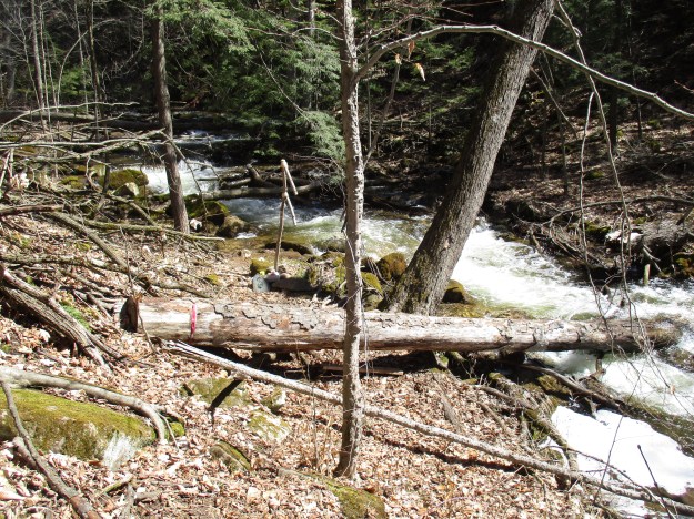
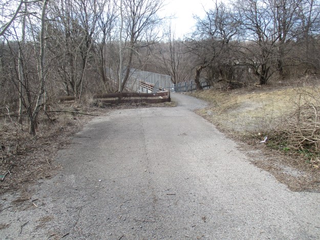
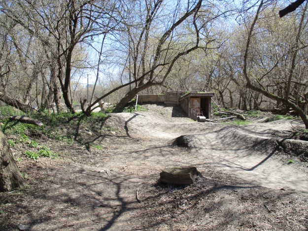
The other side of the Don River can be accessed via a footbridge just beyond the train bridge.  Therefore, there is no excuse for crossing the river on the rail bridge like I observed several people doing.  There’s a sign by the rail bridge that gives a number to call if you are feeling suicidal.  I wonder if they too saw someone taking their bike across?  A mountain bike park has been set up along the trail near the rail bridge. There’s even a small place where you can step out of the weather for a moment.

IMG_7887

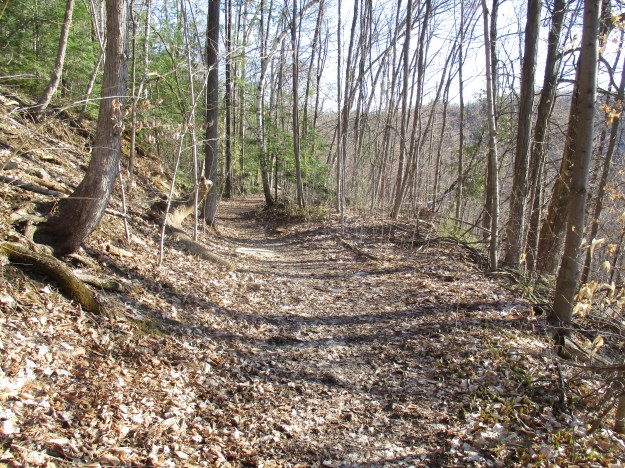
Sun Valley and Crothers Woods still have areas that I haven’t explored.  Perhaps one day…

Google Maps Link: Beechwood Drive

Like us at http://www.facebook.com/hikingthegta

Follow us at http://www.hikingthegta.com

Japanese Cherry Trees – High Park

Saturday, April 22, 2017

April 19, 2017, marked the first official day of the cherry tree blooms in High Park. Photographers converge on the park for a week to ten days each spring to see the blossoms.  Heavy rain can wash the petals away leaving a window of opportunity to see the flowers that can last for only a couple of days some years.  Since the climate in Toronto is close to the limit that the trees can endure, there are occasional years where the trees never blossom at all.  There are several large parking lots in High Park but unless you come early you won’t get a spot in any of them during this time.  To ensure that we had a place to park that was hassle free we parked in the free parking just east of Sunnyside Bathing Pavilion and walked north to the park.  Several cherry trees are in bloom near Grenadier Pond.

IMG_7763

The Japanese Cherry Tree blossom is known as Sakura to the Japanese who have adopted it as their national flower, a position it shares with the chrysanthemum.  Many of the ornamental varieties of cherry trees do not produce fruit and are grown for the beauty of their blossoms.

IMG_7767

The trees are related to almonds, peaches, plums and apricots as well as being distant cousins to apples, pears and roses.  Signs throughout the park remind people to stay off of the cherry trees when taking pictures so that no branches will be broken.

556

Somei-Yoshino cherry trees are the earliest to bloom and High Park has many of these that were donated in 1959 by citizens of the city of Tokyo.  Another 34 trees were donated in 2001.  There are over 2,000 ornamental cherry trees in several locations around the city.  Exhibition Place, York University and The University of Toronto all have cherry tree plantings.  The blossoms are host to countless insects who are busy pollinating the trees.  Two different species of bees are seen in the picture below.

IMG_7794

The squirrels in the park have become quite used to people and behave as if they expect to get a peanut or some other treat.

IMG_7806

The woodlands are blue with the flowers of scilla which are an early spring perennial.

415

Downey woodpeckers were especially common throughout the park but a bird watcher could collect many different species for their lists by sitting still for a few minutes.

IMG_7803


The High Park website provides a map to show where the main cherry tree locations are.

cherry-trees-here

If you want to avoid the crowds at High Park you may choose to look for the 30 Japanese Cherry Trees on Toronto Islands.

There are three previous stories that cover other aspects of High Park.  Colborne Lodge, High Park Zoo and the Eastern Ravine.

Google Maps Link: High Park

Like us at http://www.facebook.com/hikingthegta

Follow us at http://www.hikingthegta.com

Irwin Quarry – Silvercreek Conservation Area

Friday, April 14, 2017

The Niagara Escarpment stretches between Niagara Falls and Tobermory and is the most prominent geological feature in Southern Ontario.  Early settlers who received land grants along the escarpment found it difficult to farm and often looked to their natural resources as a source of income.  This was true for those who took possession of land in Esquesing Township along the edge of the escarpment.  Today the area is known as Silvercreek Conservation Area and we returned to carry on from last week’s exploration of Fallbrook Farm.  This time we made our way along the bumpy and curving road known as Fallbrook Trail to where there is free parking at the Bruce Trail crossing near 27 Sideroad.  One objective of today’s exploration was the Irwin Quarry which now is traced by a Bruce Trail Side Trail.  The trail is marked with blue slashes and in many places follows the old access road for the quarry.

IMG_7660

By the 1960’s there were 13 large quarries producing construction materials from the Niagara Escarpment.  Nearly 50 other, smaller quarries had come and gone.  There are three factors that determine the economic success of a quarry and these are 1) proximity to the market, 2) quality of the stone and 3) the ability to access the stone easily.  The escarpment around Hamilton and Toronto was found to meet all of these requirements in many places.  The cost of shipping stone products determines the competitiveness of a quarry.  If it costs 10 cents per kilometre to ship the stone, then a producer of a million tonnes annually spends $100,000 per year in transportation for every extra kilometre away from the job site he is located.  The quality of stone in many places along the escarpment is excellent. Finally, the soil that has to be removed to access the stone is known as the overburden. The limestone and dolomite are often very near to the surface along the escarpment leaving little digging to be done and in general no quarry will be started where there are more than 6 metres of overburden. The picture below shows a view of the exposed limestone in the former Irwin Quarry and the relatively little soil that is on top of it.

IMG_7661

The site of the Irwin Quarry is formally known as lot 26, Concession 9 in Esquesing Township.  Samuel Irwin owned the property for a short time around 1877 and it may have been his lime kiln that still stands near the quarry.  At the time of the county atlas, the property belonged to George Ackert and it was located directly across the road from William McClure’s property with the two mills marked on it.  The quarry has been outlined in red and is a piece of the escarpment known as the Glen Williams Outlier.

Silver Creek (2)

Life can grow in the harshest conditions and trees have taken root in small pockets of soil between the layers of dolomite.  The white birch tree below has a precarious hold on the rocks on which it grows.

IMG_7667

The Industrial Sand and Gravel Company Limited operated the quarry in the exposed Amabel dolomite formation.  This 30-foot formation exposed white to buff dolomite on the top with light grey to dark grey Reynales Dolomite below this.  The quarrying operation was conducted in the mid-1960’s and used for local road construction.  It is quite likely that the base of Fallbrook Trail is made of gravel extracted from Irwin Quarry.  The quarry has been closed for about 50 years and has a full forest cover in most areas.  The picture below shows the view from about halfway up the side of the ravine looking up at the metal railing of the lookout from last week.

IMG_7670

Silver Creek flows in a deep ravine through the escarpment that is far in excess of the channel needed for the amount of water it carries today.  During the retreat of the last ice age, the deep ravine was cut exposing the rock face for the quarry.

IMG_7672

Last week we featured the house at Fallbrook Farm and noted that the house had been added onto by extending it to the east end.  Here is another look at the house, this time looking at the additions from the rear of the building.  This must have been interesting for the kids who could come and go through their bedroom windows!

IMG_7686

This time we ventured down the east side of the creek where the mills were located.  The saw mill was built where the stone has been placed to protect the embankment from erosion.

IMG_7691

The grist mill was built on the flats about 130 metres downstream from the mill pond. This allowed for a drop of 11 metres from the pond to the waterwheel.  There isn’t very much left of the mill anymore except the foundations for the wheelhouse.  Based on the footprint of the housing the wheel is estimated to have been 1.3 metres wide by 4 metres tall.  When the water flow was good it would have produced 25 hp of power to operate the mill.  The two sides of the wheelhouse are indicated by arrows in the picture below.

Wheelhouse

Upstream from the bridge, the creek drops over several little steps creating multiple little waterfalls as it rises 11 metres to the old dam.  The dam was built where the ravine is narrow and a small floodplain was available to create a pond.  The early dam was made by filling a wood crib across the creek with rocks.  The portion of the dam that was built on land was created by scooping dirt into a mound.   In the picture below, the trail climbs over the mound of the old dam while a hollow behind the dam marks the site where the earth was extracted.

IMG_7718

Garter snakes mate soon after waking from hibernation.  The female can produce up to 80 snakes in a single litter.  In the wild a garter snake will live for about 2 years but can survive up to 10 years in captivity.

IMG_7726

Once again we left Silvercreek Conservation Area with large portions left unexplored.

Google Maps Link: Silvercreek Conservation Area

Like us at http://www.facebook.com/hikingthegta

Follow us at http://www.hikingthegta.com

Taber Hill Ossuary

Saturday, April 15, 2017

On August 17, 1956, the farmland of Scarborough was being transformed into subdivisions and the 401 was being widened to accommodate the increased traffic that the expanding city was faced with.  A large mound stood in the middle of a field near Lawrence Avenue and Bellamy Road and the 60-foot tall hill was scheduled to be loaded into trucks and delivered to the site of a 401 overpass that was under construction.  After removing nearly 100 feet of the side of the hill a scoop of earth came away full of human bones.

The park isn’t very large but it is unique and worth exploring briefly.  There is free parking on Indian Mound Crescent which is an aptly named street as it wraps around the mound.  Ongwe-Oweh is the native word for Iroquois and a sign welcomes you to the park.

IMG_7741

Work on removing the mound was stopped immediately while an examination of the find was conducted.  Initially, there wasn’t any pottery or arrow heads uncovered and the early suspicion was that the mound contained victims of a cholera epidemic from 1870.   The purple flag in the tree in this picture has the same native symbols on it that are found below the peace pipe on the park sign in the previous photograph.

IMG_7740

Walter Kenyon was brought in from the Royal Ontario Museum who discovered that there was a second burial pit.  The site is an ossuary which is a place where the bones of people are placed after they have been removed from their initial burial plot and collected into a community of the dead.  The ossuary at Taber Hill was about 15 metres long, 2 metres wide and 0.3 metres deep.  The number of skeletons uncovered in the two pits was revised from 472 to 523.  A new burial chamber was dug five feet deep and the bones were reinterred. The 35-acre park is managed by the City of Toronto and is thought to be the only First Nations Ossuary to be protected as a cemetery in Canada.  In 1961 a stone memorial was placed on the top of the mound.  It can be seen clearly in the cover photo.

IMG_7739

Burials at this site were conducted around 1250 AD and it is thought the ossuary may be related to two longhouse sites in the area.  The Alexandra site near Passmore Forest may have contained up to 1000 residents.  When the archaeological dig was completed the bones were buried again in a ceremony known as the Feast of the Dead.  Natives held this ceremony at the mound every year until 1966.  A group of First Nations peoples were holding a memorial ceremony on the top of the mound today and so out of respect I did not climb to the top to see the two historical markers installed there.  On one side is a Scarborough historical marker describing Taber Hill. The other side of the marker has a plaque containing an Iroquois prayer.

IMG_7744

This post is presented with the greatest of respect for those whose remains lay buried under this mound.

Google Maps Link: Taber Hill Park

Like us at http://www.facebook.com/hikingthegta

Follow us at http://www.hikingthegta.com

Fallbrook – Silver Creek Conservation Area

Saturday, April 8, 2017

Silvercreek Conservation Area was, at one time, home to a village of Iroquoian longhouses. They hunted and farmed the area along the edge of the escarpment for generations before the arrival of Europeans in the area.  William McClure bought the land in 1854 and started to clear it for a farm. His first chore was to cut enough wood by hand to build a sawmill.  From there the log cabin, barn and grist mill soon followed.  To investigate we parked on the 10th line where there is free parking for the Bruce Trail.  The trail runs to the east into Terra Cotta Conservation Area and to the west into Silvercreek Conservation Area.  Entering the conservation area on the Bruce Trail proved a bit of a challenge due to the wet conditions. In the picture below, the trail is a flowing creek while further along, it turned into a mess of mud.  Dry footwear with good treads is as critical at this time of year as it is during the winter months.

IMG_7579

Marsh Marigolds also go by the name of cowslip although what they have in common with the lip of a cow is unclear.  Marigolds like marshy ground but can also grow where it is wet for only a few weeks of the year.  They flower early in spring and are related to the buttercups that they resemble.  Although the whole plant is considered an irritant, the leaves can be boiled and eaten like spinach.

IMG_7597

The Bruce Trail through Silvercreek has several side trails marked in blue which will require further exploration.  Along the way, we passed Roberts side trail which is 1.3 kilometres long and forms a 2.6-kilometre loop with the main trail.  The Irwin Quarry side trail is 1.2 kilometres long and forms a 1.4-kilometre loop.  The trail also passes a poorly defined glacial pothole that can be seen in the picture below.

IMG_7604

The trail becomes much less muddy, but not less tricky when you reach the stone path. The limestone along here has been broken up and cut with deep fissures by karst activity.  The caution here is that some of these stones move as you step on them.

IMG_7622

A small guardrail protects a lookout point along the ravine.  Hiker graffiti has been left on the railing.

IMG_7625

Several turkey vultures were circling overhead.  Turkey vultures are protected under the Protection of Migratory Birds act in Canada and similar legislation in Mexico and The United States where a fine of $15,000 and six months in jail can be levied for killing or possessing one.  This is in spite of the fact that they are considered a species of least concern because populations are stable.  A threatened species shows a decline in the population of 30% over ten years or three generations.

IMG_7629

Examination of the logs used in the cabin shows that they were cut with a saw rather than hewn by hand.  The old-growth red pine logs used for the cabin were cut from the front lawn and trimmed at McClure’s sawmill.  Using a process known as dendrochronology the growth rings on a tree can be studied to determine the years in which they grew, allowing for a reliable date when the tree was cut.  When the cabin was expanded by the McKay family in 1877 they built on the end rather than adding a second floor or extending behind the original as was common.  The addition can be identified by a vertical line beside the cedar tree on the right.  The log cabin was three rooms like the home the Stongs built that stands at the heart of Black Creek Pioneer Village.  Nine people lived in the cabin where there were two bedrooms and a kitchen/living room.  This cabin is likely the oldest surviving cabin in Esquesing township.  It has been the centre of a controversy surrounding whether it should get a heritage designation or a wrecking ball.

IMG_7638

The farm was briefly owned by John McDonald who sold it to Donald McKay in the 1870’s.  Donald and his wife, Jessie, had come from Glasgow, Scotland in 1869 and had landed in Toronto.  After operating a horse-drawn taxi for a short while McKay bought the farm and moved his family there.  The McKays operated the farm until 1943 when it was sold to the Vaughn family who had made their wealth in the Eaton Company.  They added it to their estate holdings where it stayed until the Credit Valley Conservation Authority bought it in 1973.  The name Fallbrook has been applied to the farm and a look at the steps Silver Creek takes as it flows past the house reveals why.

IMG_7647

One of the defining features of the farmstead is the old stone arch bridge.  The bridge was originally built in the 1870’s from stones salvaged from the sawmill downstream. The 27th sideroad was opened in 1872 and this is likely the first bridge on this site.  When the local supply of wood was exhausted the focus shifted from cutting wood to grinding grain.  The bridge allowed customers from Balinafad and the surrounding area to bring their grain to the mill.  By 2008 the bridge was suffering from mortar deterioration and stone loss.  The road deck and railings didn’t meet current safety standards and the bridge, as well as the road, was intended to be closed.  A study found that four hundred people used the bridge daily and the surrounding roads didn’t need the additional traffic and so a plan was made to restore the bridge.  The restoration was completed in 2015.

IMG_7651

Downstream from the bridge, the creek continues to cascade over the rocks as it makes its descent.  The other side of the creek needs to be explored in a future visit because the remains of the sawmill and the grist mill are yet to be examined.  There is also the partial remains of an ice house waiting to be photographed.

IMG_7654

Rows of stones running through the trees mark the outlines of former fields.  When the land was cleared the stones were moved into these rows so that they wouldn’t need to be dragged great distances to be disposed of.  This was an annual task until the fields were allowed to regenerate into forest.

IMG_7659

As you enter and exit the trail from the 10th line you pass this little post with a camera in it.  Don’t worry, you won’t be videotaped.  It’s only a system to count the number of trail users so that funds can be used where the most people will benefit.

IMG_7576

Silvercreek Conservation area is definitely on the list of places that need further exploration.  The many side trails, as well as the historical remains on the site, make it a must visit.

Google Maps Link: Silver Creek Conservation Area

Likas at http://www.facebook.com/hikingthegta

Follow us at http://www.hikingthegta.com

Toronto’s Abandoned Roads

Sunday, April 9, 2017

Toronto has 5604 kilometres of roads and 9500 streets, according to Transportation Services.  The city covers over 630 square kilometres and within that area, there are only a few kilometres of abandoned roads.  Hiking the GTA has been able to explore over a dozen of them and in this post we provide links to the various stories.  Hopefully, you’ll be able to get out and explore one or more of them.

Indian Line

Indian Line started off as a First Nations trail along the shore of the Humber river.  When the land survey was made it was part of the border between Peel County and York County. When highway 427 was extended north it became part of an off and on ramp to the highway. In 1992 when the highway was further extended it was closed off and abandoned.  Indian Line campground used to be accessed from just south of the river off of this road but is now accessed off of Finch Ave.

Indian

Pottery Road

Pottery Road likely started off as part of an east-west Indian trail that crossed the city along the present route of Davenport Road.  Today only about a third of the original Pottery Road remains.  When the Bayview extension was built in 1959 Pottery Road was cut in two and the portion that climbed the hill along the Cudmore creek was cut off and abandoned.

Pottery

Milkman’s Lane including Park Drive

Seen on historic maps since at least 1890, Milkman’s Lane is an abandoned roadway in Rosedale that now serves as a pathway connecting one of Toronto’s wealthiest communities with the Rosedale Ravine, the Don Valley Brick Works and the Lower Don trail system.  Milkman’s lane ran down the side of Osler’s property and carried traffic into the Rosedale Park Reserve.  Park Drive made its way through the bottom of the ravine.  The property belonged to Thomas Helliwell in the 1820’s and provided access through Park Drive to his mills at Todmorden.

Milkman

Post Road

Post Road was formerly part of a series of trails that the wealthy estate owners on Bayview Avenue used for equestrian pursuits.  When the planned community of Don Mills was started in the 1950’s the crossing over Wilket Creek was removed and a section of road was abandoned.

post road

Passmore Avenue

Passmore Avenue was never opened as a continuous road but it has become even more fragmented with sections having been closed for decades.  This post hikes through those sections that were once opened but are now abandoned.  The picture below shows the former crossing over Petticoat Creek.

passmore

Middle Road

Middle Road got its name from the fact that it ran in the middle between Lakeshore Blvd and Dixie Road.  When the QEW was opened it replaced Middle Road with its narrow single lane bridge.  Middle Road Bridge can be seen in the picture below.

Middle

Lake Shore Avenue

The Toronto Islands had been home to over 8000 people in the 1950’s when the city decided to remove the residents and turn the islands into a park.  The main roadway across the island was Lakeshore Avenue and it ran the full length of the island along the lake coastline.  The road now serves as the trail through the islands and today a boardwalk has been built along part of the old roadway.

Lake Shore

Old Cummer Road

In 1819 Jacob Cummer built a saw mill on the East Don River.  To allow people to access his mill he built a road along the north edge of lot 22 from Yonge Street to Leslie Street which we call Cummer Road today.  A grist mill was built to the north on lot 23 and a woollen mill was added as well. When the surrounding farmland was developed the one-lane bridge on Cummer Road was restrictive and a new piece of road and a four-lane bridge were built.  A section of the old road was cut off and abandoned.

cummer

Old Eglinton Avenue

Until the 1970’s Eglinton Avenue wasn’t a continuous strip of road in spite of being the Base Line from which the townships were laid out.  When the road was extended and completed the tail end down the hill was left abandoned.  Today it is becoming grown over with small trees.

Eglinton road

Bayview Avenue

In 1929 Bayview Avenue got a new bridge over the West Don River.  The old road alignment down the ravine and across the single lane bridge was closed and forgotten.

estates

Gore and Vaughan Plank Road

The Gore and Vaughan Plank Road Company was established in 1855 to build a plank road along Dufferin Street. Plank roads were used to improve muddy conditions and were later replaced with asphalt or crushed stone surfaces.  When Dufferin Street was straightened and widened across Dufferin Creek and through Finch Avenue the plank road was left to rot in the ravine.

plank

South Marine Park Drive

An old roadway used to install erosion control along the Scarborough Bluffs has been turned into a linear park known as South Marine Drive Park.  It runs for several kilometres along the south edge of the bluffs.

marine

Country Hospital Road

In 1926 The Hospital For Sick Children was looking for a country location to build a satellite facility.  They found a location at Finch and Islington.  Although this is not a public road the long laneway has become a piece of abandoned road.

country hospita;

Google Map links are provided in each of the stories.

Like us at http://www.facebook.com/hikingthegta

Follow us at http://www.hikingthegta.com

Abandoned Don Mills Road

Sunday, April 2, 2017

Don Mills Road, or part of it, played an important role in early York (Toronto)  and has been under constant change ever since.  The decision to make Don Mills Road a major thoroughfare led to a new alignment and the abandonment of a section in the heart of the city making it one of only a very few pieces of abandoned roadway in Toronto.  Links to the others ones that we’ve investigated will be provided at the end.  As you drive north on Don Mills Road, just north of the interchange for the Don Valley Boulevard (DVP) an unmarked road exits to the right.  This is the old alignment of Don Mills Road.  Follow it over the bridge to where there is free parking.  An old sign, just off the new Don Mills Road suggests we slow down and see what’s around us.

IMG_7486

The mills at Todmorden on the Don River were the second to open in York after The Old Mill had opened on the Humber River.  In the 1820’s a paper mill was built at Todmorden and in 1846 the Taylor Brothers added a paper mill to the saw and grist mills they owned at the Forks of The Don.  This was the third paper mill along the river that belonged to the Taylors and was known as the upper mill.  The Mill Road was built to join the mills and provide access for the public and workers.  For a long time, the road only served the mills but the farmers to the north got together and extended the road to York Mills and south to the St. Lawrence Market.  The road then became known as the Don Independent Road because it was built on land that was given by the property owners.  In 1954 it was decided that Don Mills Road would become one of the major arteries in the city and it was widened to 4 lanes.  It was given a new alignment through the Forks of the Don so that a new bridge could be built.  The picture below shows the berm that the old road used to climb from the river valley to the tablelands above.

IMG_7451

The elevated wetlands are a familiar site to people who use the DVP to get in or out of downtown Toronto as they have stood on either side of the highway since 1998.  The three elephantine sculptures were created by Canadian Artist Noel Harding who works on large scale public art that has an environmental component. Harding, working in conjunction with the city and the Canadian Plastics Industry, created the wetlands.  They are made from recycled plastics and serve to purify the water that flows through them.  A solar panel on the rear sculpture pumps water from the river.  That water flows into the next planter and finally into the third one before falling into a natural wetland in front. The cover photo shows another view of the elevated wetlands.

IMG_7480

The rainbow arch bridge over the West Don River was built in 1921 to replace an earlier bridge.  Toronto has several of these concrete bowstring bridges but this one is in particularly good condition with little or no restoration.

IMG_7496

There are a couple of architectural features that make this bridge unique among the local bowstring bridges.  First, each end of the bridge has extended parapets on it that are decorated with diamond patterns.  Also, the last two panels on each end of the bridge are filled in to create a solid wall from the arch to the deck of the bridge.  Concrete railings provide protection for pedestrians on either side of the bridge.

IMG_7473

From the arch bridge looking north, the old roadway has been well maintained and is in use as a walking trail.  There is a small parking lot on the side of the roadway, just south of where this picture was taken.  The bridge over the Canadian Pacific tracks can be seen in the distance.

IMG_7503

When the road was closed in 1961 the original bridge over the railway was removed. A new pedestrian bridge was installed in 1972 when the Lower Don Recreational Trail system was set up.  The picture below shows the railway crossed by the pedestrian bridge with the new Don Mills Road bridge in the background.  An elevated boardwalk joins the trails in ET Seton Park with the bridge over the rail line and the Lower Don Recreational Trail.  This trail connects to a series of trails that will take you all the way to Lake Ontario.

IMG_7512

Just north of the bridge is the old railing that was installed for safety when the road was closed.

IMG_7520

Looking back you can see that the new bridge is not in the same alignment as the earlier one.  It ends at the same location on the southern abutment but starts slightly west of the original and runs on a different angle.

IMG_7564

The section of the roadway north of the bridge has been overgrown in places by 50%. Grass, moss and sizeable trees sprout through the pavement on both sides of the road.

IMG_7557

This large tree has burst through the asphalt pushing pieces of pavement up all around the tree.

IMG_7541

The view looking south from near Gateway Boulevard.  Behind here the traces of the old road have been obliterated by an apartment building.

IMG_7575

Google Maps Link: Don Mills Road

Like us at http://www.facebook.com/hikingthegta

Follow us at http://www.hikingthegta.com

Joshua Creek – The Emerald Ash Borer

Saturday, April 1, 2017

Joshua Valley Park has seen a lot of change over the course of the two centuries since Joshua Leach arrived.  Leach was just 21 when he arrived in the brand new town of York in 1897.  As a carpenter, he found plenty of work building many of the first homes in the town.  By 1822 Joshua had saved up enough money to buy 200 acres of land which he took possession of on the creek that would later bear his name.  Joshua built a home for his family and dammed the creek to power a saw mill and a thrashing mill.  These were located near where Maple Grove Arena stands today.

This hike follows Joshua Creek through three contiguous parks: Joshua Valley Park, Maple Grove Park and Dunvegan Park.  These parks run from Cornwall Road in the north all the way past Ford Drive to where we connected with the trail from last week’s story.  For convenience, we took advantage of the free parking at Maple Grove Arena which is about midway along the journey.  Cut lengths of ash tree logs were stacked in a pile at the side of the parking lot.  This was a hint of what we were about to find in the valley.  The forest is wide open now that all the ash trees have been removed.

IMG_7301

The emerald ash borer is a beetle that is native to Asia.  It was first seen in Ontario in June of 2002 near Windsor.  The beetle most likely entered Ontario from Detroit where it arrived in wood packaging from Asia.  The emerald ash borer is invasive as it meets both accepted criteria.  It is outside of its native habitat and threatens the environment, economy or society where it is invading.  The City of Oakville estimates that it has 45,000 ash trees and that most, if not all, will be destroyed by the beetle.  In Toronto, the situation is even worse with an estimated 860,000 ash trees in the city.  Every one of which will be destroyed if not treated with appropriate pesticides.  The picture below of an emerald ash borer was taken from Wikipedia.

agrilus_planipennis_001.jpg

All ash trees in Ontario are susceptible to the attack of the emerald ash borer.  Our ash trees are named after colours and we have black, white, red, green and blue as the primary ones.  The female beetle will lay 60 to 90 eggs, individually, in the crevices in the bark.  The larva tunnel under the bark, eating curved galleries.  These galleries girdle the tree and prevent the flow of food and water from reaching the tree.  The larvae overwinter under the bark and pupate in the spring.  The adults spend their lives on the outside and must eat the leaves in order to reach reproductive maturity.  Looking at the ash trees that have been piled up you can easily find examples that are 50 years old.  The one pictured below appears to have 47 rings.

IMG_7339

After a tree has been assessed and found to be clean or in the early stages of infestation it can be treated in one of three ways.  Each of the pesticides is intended to target either the larva, adult or both.  The soil around a tree can be drenched with the insecticide which is carried throughout the tree by the vascular system.  This method won’t work if the tree has too much damage already and it is unable to spread water and nutrients throughout.  Another method of distributing the pesticide is to inject it into the tree.  Lastly, when the adults are newly hatched and are feeding on the leaves they can be sprayed directly, killing them before they can lay eggs. The cost of treating a tree can be estimated at about $10 per inch of diameter.  The picture below was taken last week near the mouth of Joshua Creek and shows a tree that is being treated for emerald ash borer.

IMG_7179

Other invasive species, like the honeysuckle, will prosper now that the canopy has been opened up and they won’t have the competition.  They are already present in the understory and can be seen because they are the first shrubs that get their leaves in the spring.

IMG_7300

A thin trail runs along the back of the houses on Duncan Road.  Old sets of stars can be found leading off of this trail and directly into a solid fence.  The row of trees that has been planted along here seems to be older than the trail which was constructed in 1983. Straight rows of trees often indicate old laneways or roads.

IMG_7308

This section of Joshua Creek has been protected from erosion by the use of gabion baskets filled with stones.  The creek is prone to flooding and when it does it runs brown with soil being carried downstream.  In several places, the creek has overrun the gabion baskets and they are no longer serving a purpose.

IMG_7310

At Cornwall Road we turned back, leaving the northern reaches for another time.  A small bridge crosses the creek just south of Maple Grove Arena and beyond here the ash tree removal is in full swing.  Heavy equipment stands among the trees and there are fresh piles of logs along the sides of the trail.  In many forests, these are being left behind as future habitat but they are being removed from this park system.

IMG_7342

Crews have preceded the cutting teams and have assessed each tree and coded them. Yellow slashes or dots mark trees that are to be removed.  Orange or red dots indicate that a tree is to be pruned.

IMG_7350

We found an area where there were a lot of clam or mussel shells.  The ones below are placed beside a golf ball to give the perspective of their size.

IMG_7371

The wheat market fell after the Crimean War and at the same time, England removed tariffs that protected Canadain suppliers.  The area around Oakville was hit hard and many farmers turned to fruit production. Orchards of apple, plum and cherry trees took over where fields of grain once grew.  In the 1940’s the creek was dammed to create a pond for irrigation of a large orchard that stretched from Royal Windsor Road, all the way to Lakeshore.  The earth and concrete wall still forms a bridge from Devon Road to Deer Run Avenue.  There are two open spillways and a round culvert.  The culvert had a sluice gate on the front end to allow for control of the water level.  The cover photo shows the culvert from the upstream side.  Two spillways and the culvert can be seen in the picture below.  The spillways are about eight feet tall while the culvert is about ten.

IMG_7405

The forest was alive with birds and one particular area was full of woodpeckers.  Both Hairy and the smaller look-a-like Downey woodpeckers were moving through the trees. This female Hairy woodpecker stopped on the side of the tree to do a little preening of its feathers.

IMG_7421

The Joshua’s Creek Trail runs for 6 kilometres and is part of the Oakville Heritage Trails. The northern reaches of the creek still require exploration.

Last week we explored the mouth of Joshua Creek and that post can be found here.

Google Maps Link: Maple Grove Arena

Like us at http://www.facebook.com/hikingthegta

Follow us at http://www.hikingthegta.com