Sunday October 11, 2015
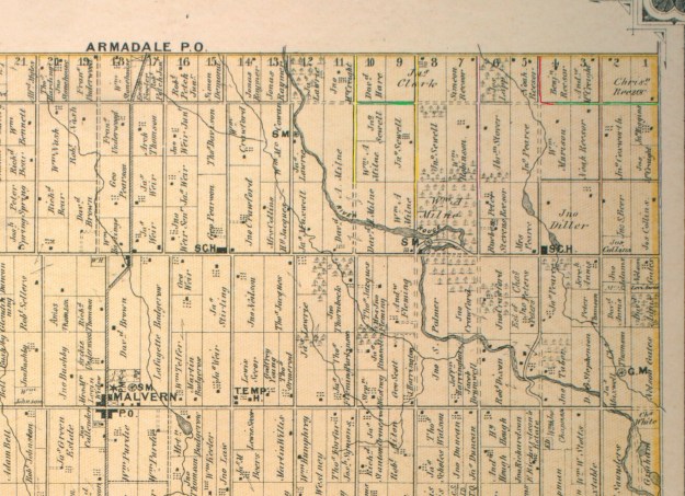
Passmore Avenue was never completed as a continuous road but today it has become even more fragmented. I set out on Sunday afternoon to hike through the sections which had once been opened and are now closed (marked in green on the map below). Passmore Avenue , also known as the 5th Concession, ran from The Scarborough – Pickering Townline to where the 404 now lies. Parts of it are still open under other names, including Gordon Baker Drive which lies on the old roadway. From Kennedy Road to Midland it still bears the name of Passmore Avenue. At Markham Road there are still sections running both east and west known as Passmore Avenue.
Steeles Avenue runs across the top of the 1877 historical atlas pictured below. Passmore Avenue runs one lot below except where the line is dotted indicating that the road allowance was never opened. The Rouge River cuts through the centre of the map between lots 12 and 13 (numbered along the top). Between lots 10 and 11 runs Littles Road (yellow) which has also been recently closed. It is shown extending one lot beyond Passmore Avenue but the southern portion has been closed so long the farmer has taken it back as part of the field. The area east between here and the Rouge River is now Cedar Brae Golf and Country Club.
This picture looks from the end of Littles Road along Passmore Avenue toward the golf course.

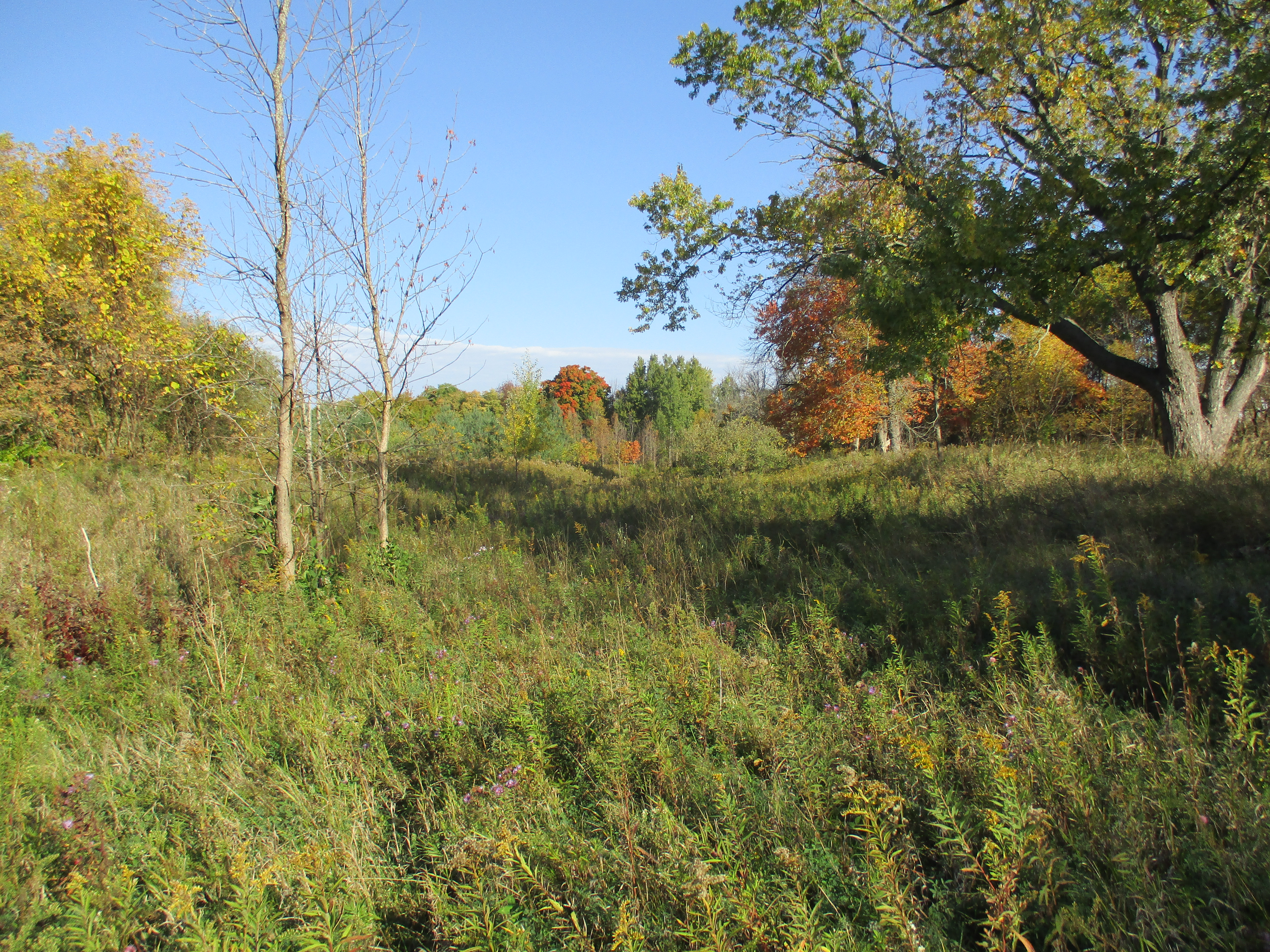
In the field just before the golf club are the remains of a race track for horses. It was built in 1966 and within 20 years it was gone. From the ground little can be seen except the remains of the barn and the foundations of some out buildings. The last three structures on the property were removed in 2002. This picture is taken from standing on the racetrack looking north to where it curves left just before the trees at the horizon. The outline of the oval track is still clearly visible from Google Earth.
Passmore Avenue used to run east from Littles road. On the county atlas there is a road which runs between lots 8 and 9 and divides John Sewells properties. Today we call this Sewells Road (orange) and where it crosses the Rouge River on the map is the site of Toronto’s only suspension bridge. The section of abandoned Passmore Avenue (green) between Littles and Sewells roads has become fully overgrown. It is little more than a strip of trees one chain wide (66 feet) along the end of the farmer’s field.

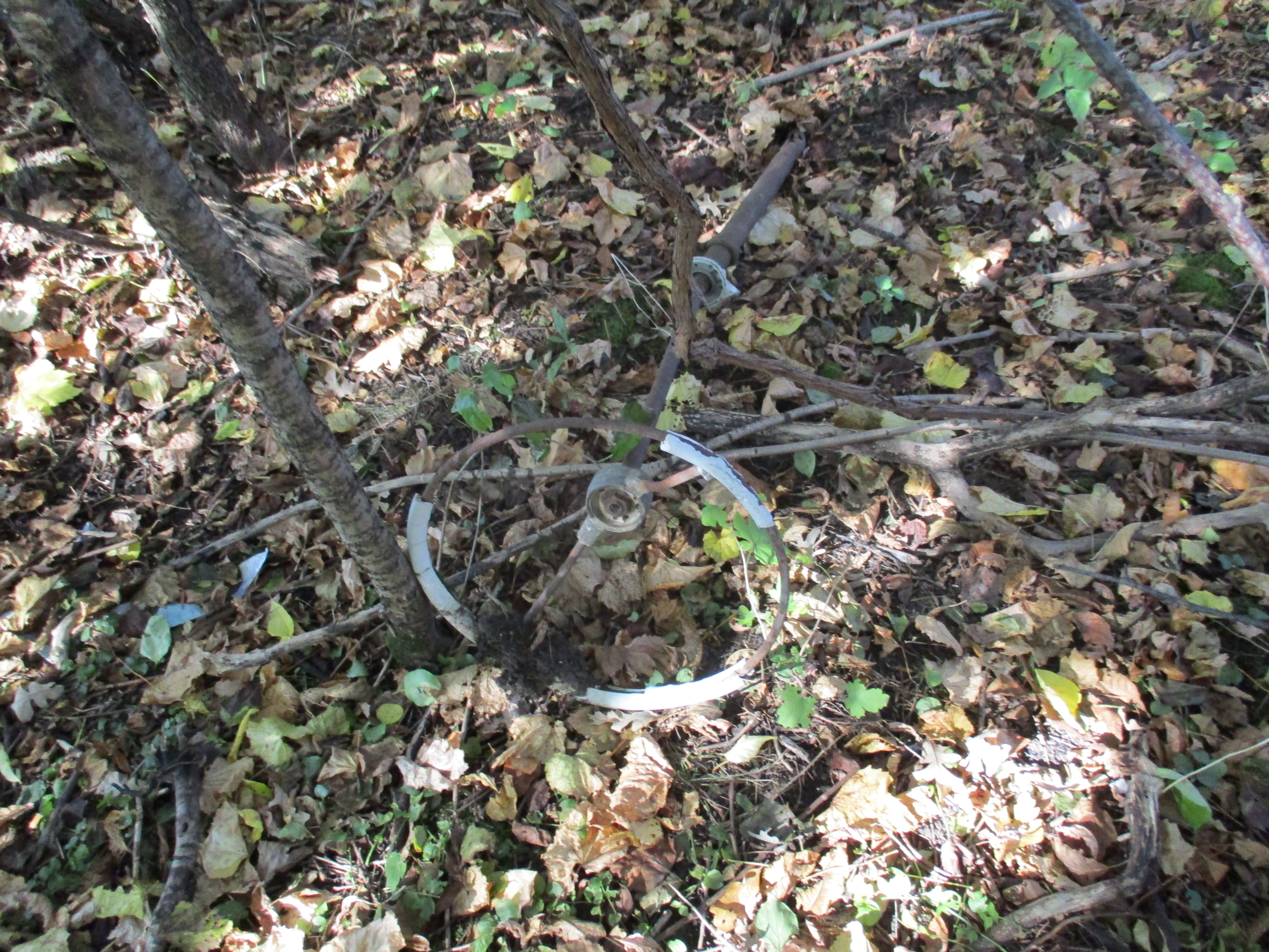
I have walked through this section several times over the years and always find old pop bottles along here. Today I found a 1962 Pepsi bottle but the condition was poor and I already have a better example. Like all closed roads they seem to attract people with garbage. There are the parts of an old truck scattered along the old road allowance. The steering wheel is seen in the picture below.
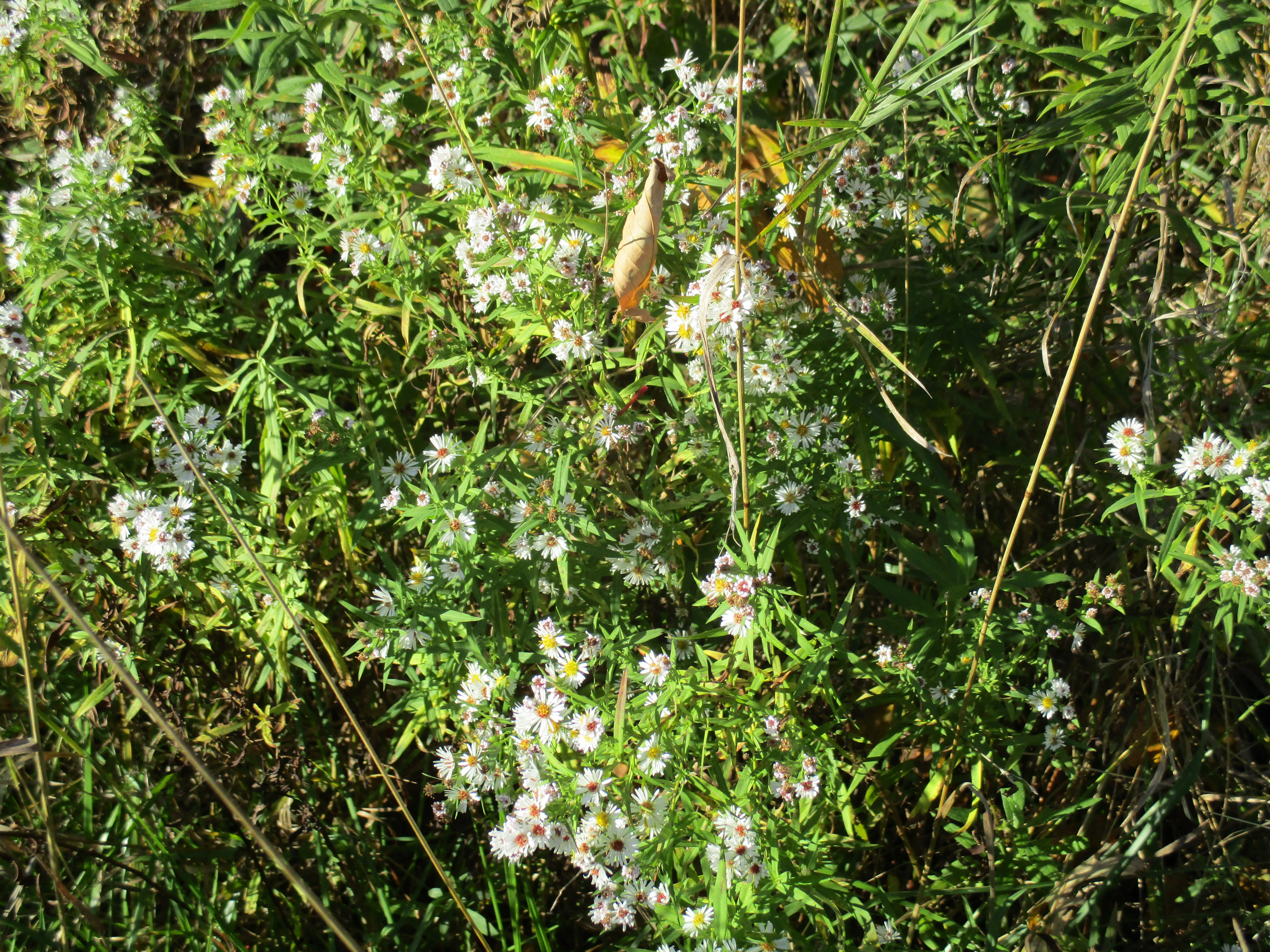
White asters bloom in places along the roadway. These examples are smaller in size than their purple cousins that are common at this time of year.
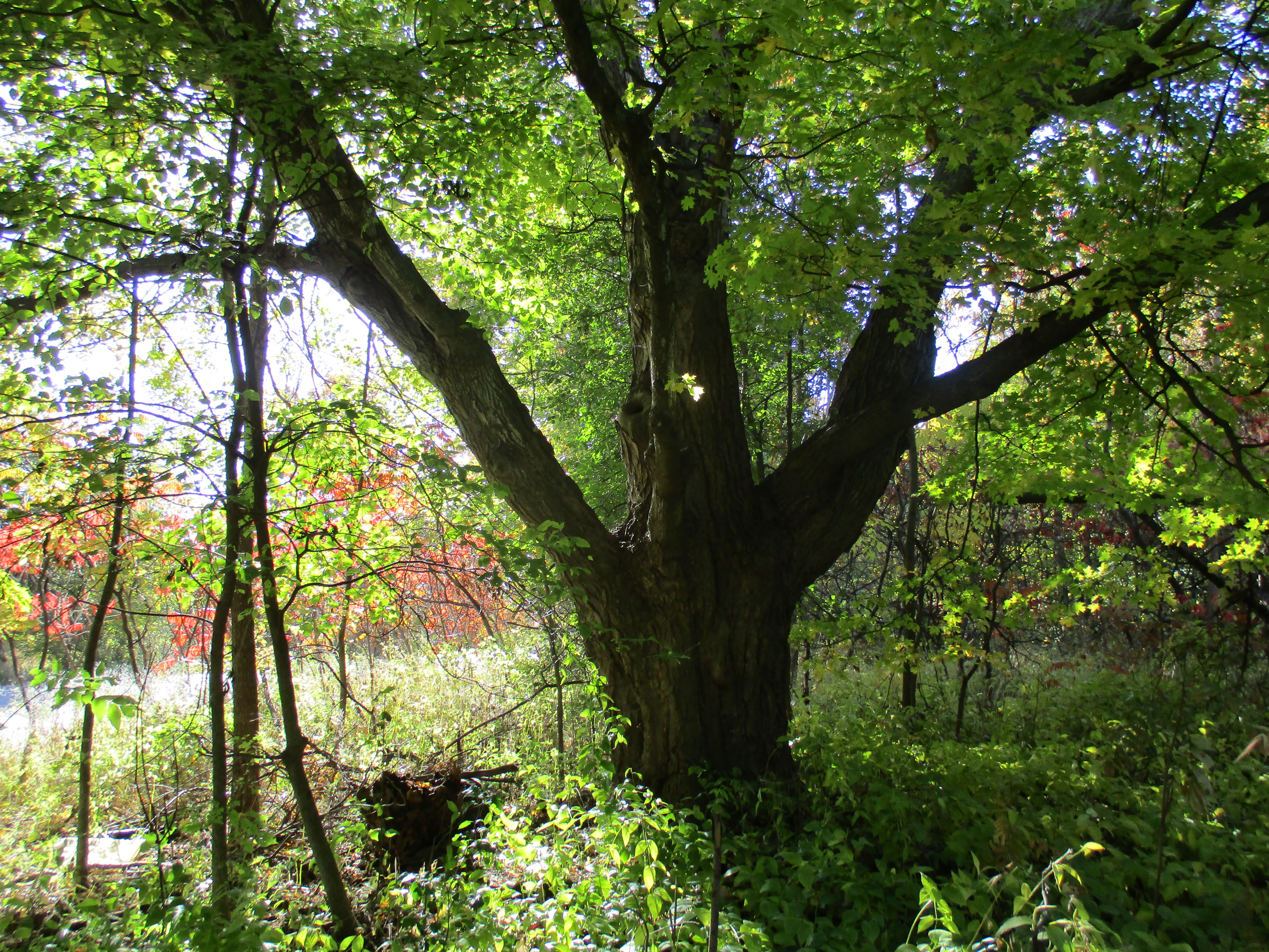
Motorists driving down Sewells Road would never see where Passmore Avenue emerges from the woods. Two large trees stand guard over either corner of the former roadway and it’s intersection with Sewells Road. The tree featured below is the southern of the two and has seen the transition from horses to model T’s and now to only the occasional hiker.
The section of road along lots 7 and 8 was never opened but lot 7 was one of several owned by the Reesor family who lend their name to Reesor Road (pink). I returned to the car and moved it to Gordon Murison Lane (red) which runs between lots 4 and 5 and leads to William Murison’s farm on the county atlas. At the curve it joins Passmore Avenue and I parked where the maintained road ended. I spoke briefly with the people who live in the old Murison home and they feel that the old roadway is now private property but have not posted it as such. I walked from here through to the town line which is on the right side of the atlas pictured above. The road allowance from the Murison’s through to Beare Road (brown) is a regularly used trail with the eastern section servicing a few houses.

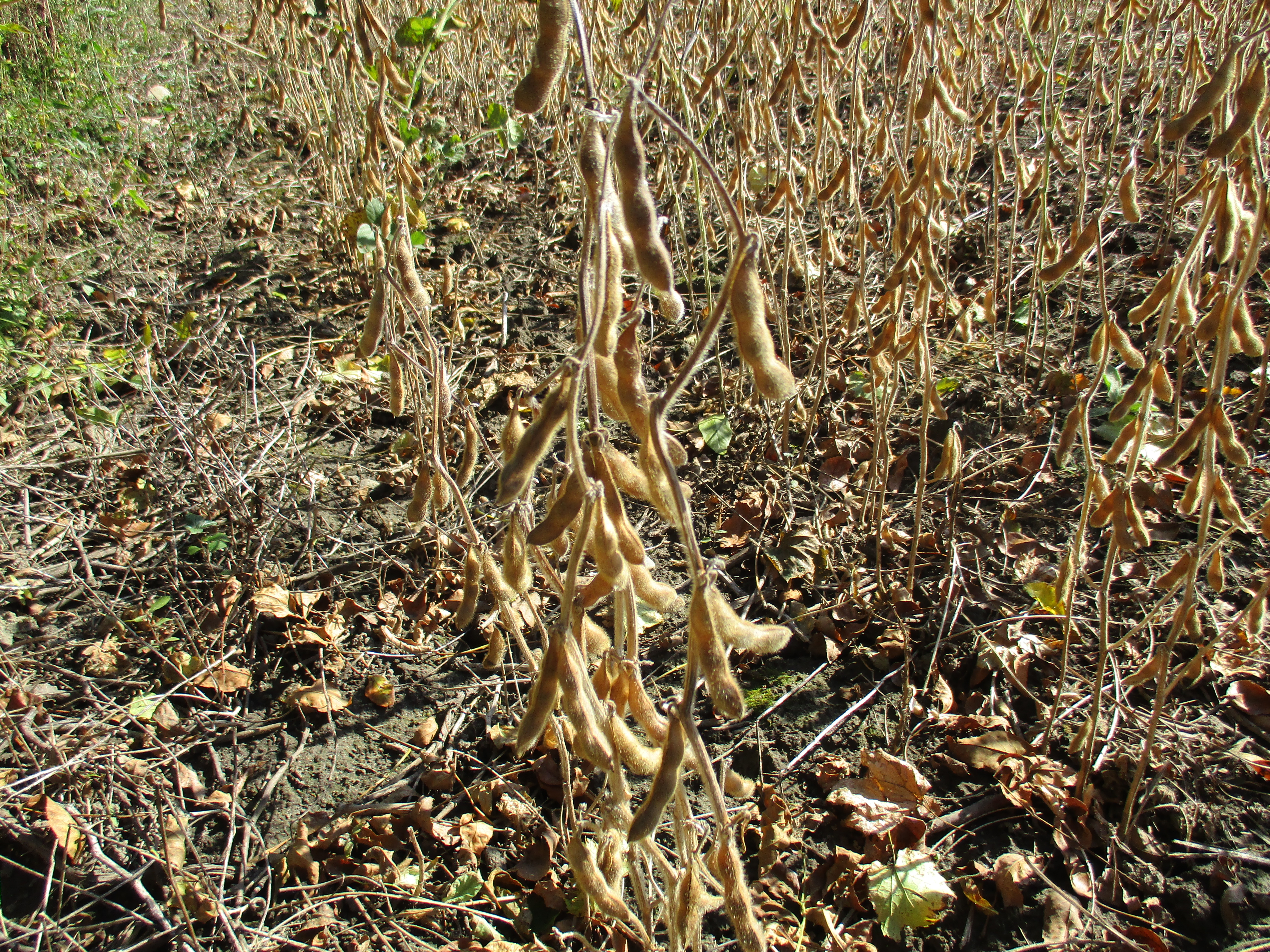
The final section between Beare Road and Town Line (grey) is almost impassible. Dog Strangling Vine has taken over the most of the old road allowance. This invasive weed wasn’t here when I last hiked this section in 2011. I decided to make my way along the edge of the roadway because walking through the vines at this time of year helps spread the seeds. Soybeans are being grown in the adjacent field. Per acre, soybean produces more protein than most other land uses. Some studies suggest that men who eat a lot of soy products may have a lower sperm count and it is not recommended for those hoping to conceive.
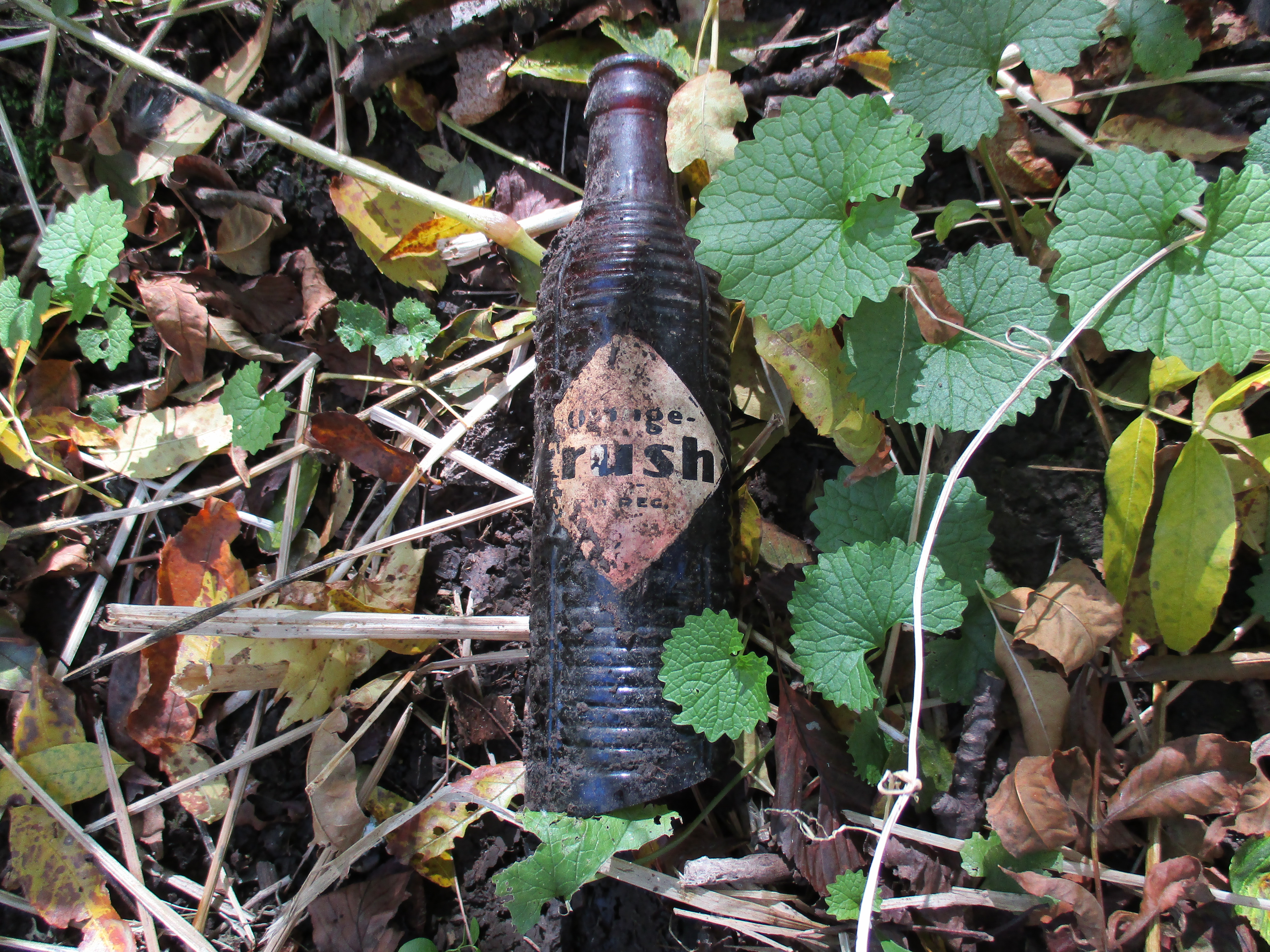
Orange Crush was sold in small brown bottles following World War two until 1958 when the new clear Marilyn Monroe bottles were introduced. These brown bottles were described as able to “protect the fresh fruit flavor from the harmful effects of light.” I found a bottle that was, unfortunately, missing the bottom. The applied colour label was badly faded on the side that was facing down (shown) and completely missing on the exposed side.
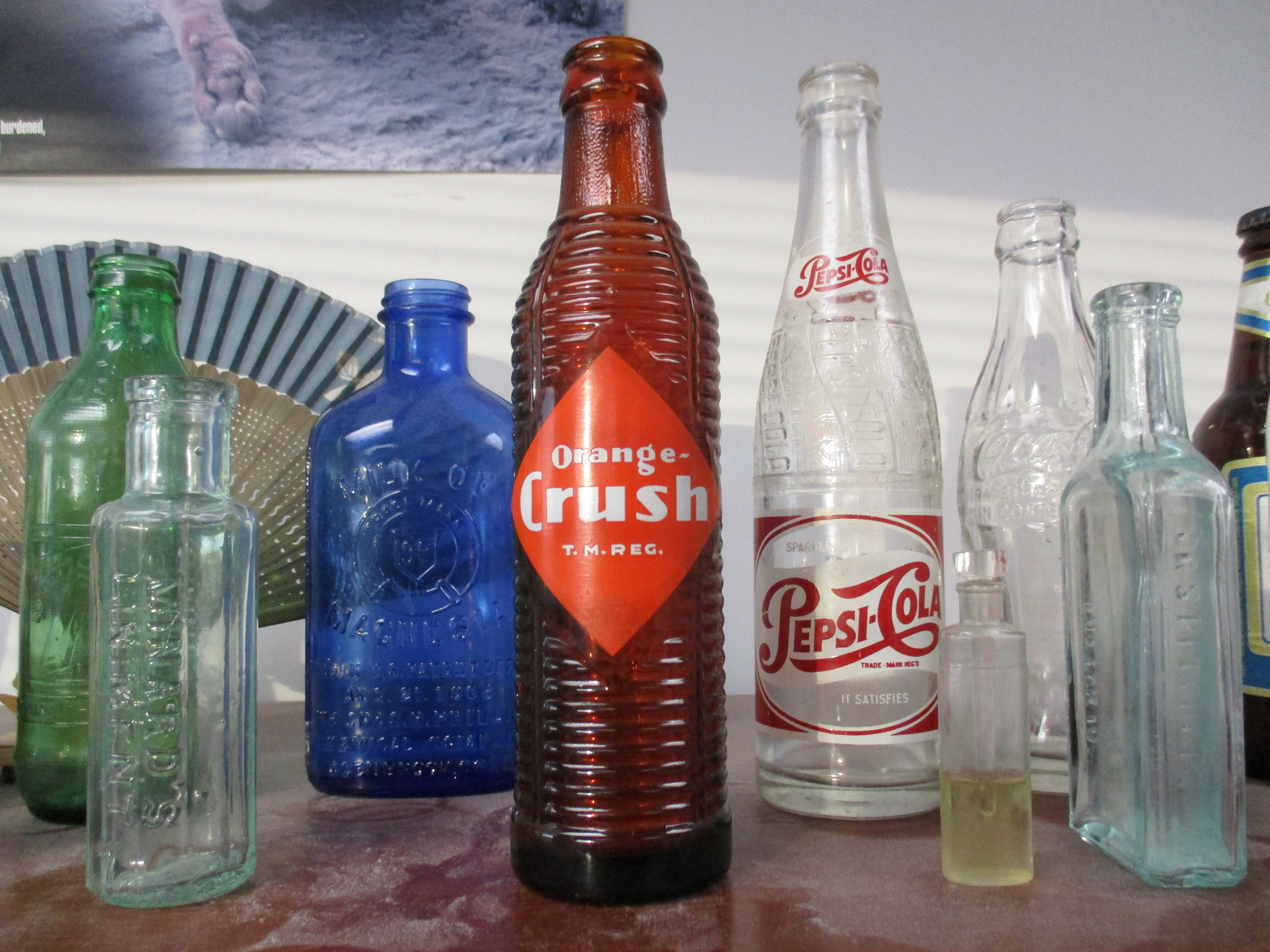
When it was new the Orange Crush bottle would have looked like the one I have on my desk at work. From left to right a 1970 no return 7-Up, 1860’s Minard’s Linament, 1906 Milk of Magnesia, 1949 Orange Crush, 1953 Pepsi, 1880’s perfume sampler, 1956 Coke, 1860’s Pitcher’s Castoria and a 1984 Labbatt Blue bottle complete this picture.
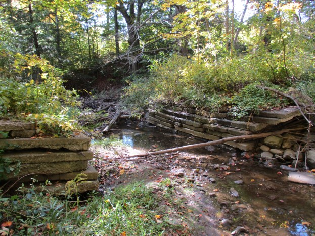
A pair of abutments is all that remains where Passmore Avenue crossed Petticoat Creek. There isn’t much water in here at the moment but at times there must be a fair bit. The short span of the bridge can be seen in the cover photo.

Passmore Avenue never ran the full length of Scarborough Township and several sections have since been closed. Those sections make for an interesting hike where I always see something new each time I explore.
Like us at http://www.facebook.com/hikingthegta

Very cool read! Came across the interesting history of Passmore Ave recently. Blogged about too – just linked you in it.
Pingback: Scenes From L’Amoreaux Park | Scenes From A City
Pingback: Passmore Forest | Hiking the GTA
Pingback: Maxwell’s Mill – Rouge Park | Hiking the GTA
Pingback: Toronto’s Abandoned Roads | Hiking the GTA
my family went down Passmore, when it was closed for about 3 years…it was still walkable like a street..we walked all the way to the end…it was pretty cool.
I drove by what used to be Passmore a couple of days ago doing a Courier delivery on Tapscott. WOW, is all I can say. The road is all gone 😦 TOO much construction nowadays. What was the name of the old racetrack?
In my younger days i used to hike a lot on closed roads in SE Michigan where I’m from. I started doing that after being harassed for trespassing a couple times. At least in Michigan, roads whether closed or open, are still public right of ways, like rivers. Adjacent landowners can’t just claim them as their own property. Occasionally an old abandoned road is re-opened when adjacent land is sold for development.
Pingback: Armadale Free Methodist Church | Hiking the GTA
Pingback: Armadale – Ghost Towns of the GTA | Hiking the GTA
Pingback: Our Favourite Hikes | Hiking the GTA