Monthly Archives: March 2020

Rivermede – Marian Shrine Of Gratitude

Saturday, March 21, 2020

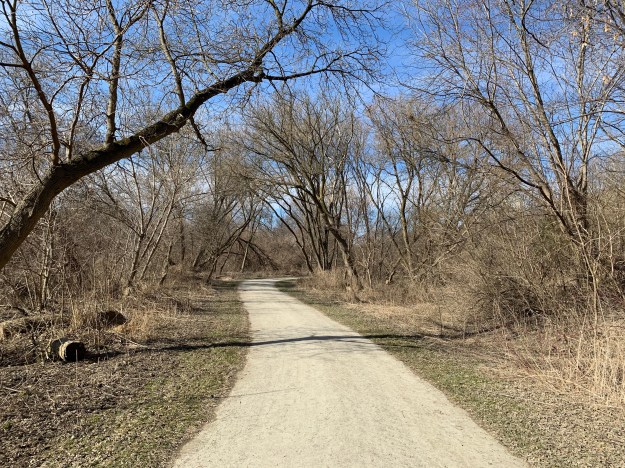
The world was changing rapidly every day with the ongoing spread of COVID-19. Almost everything was closed to the public except for parks and hiking trails.  We decided to take the hike along the Humber River from Pine Point Park north to an old estate named Rivermede.  Along the way we noticed a few extra people but there wasn’t an unusually large number of park users and we were able to have the trail pretty much to ourselves.

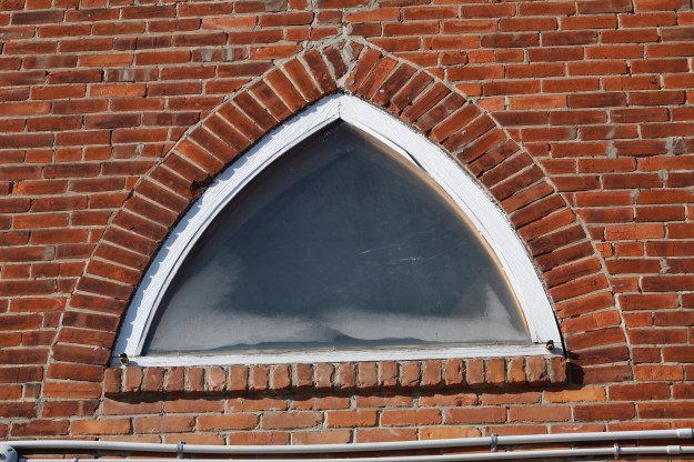
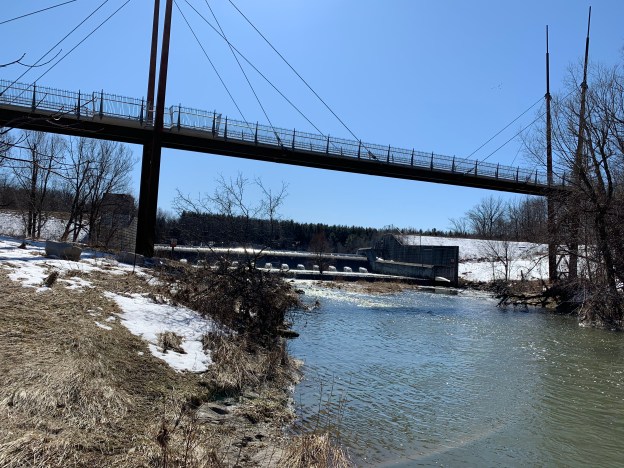
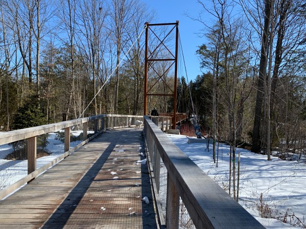
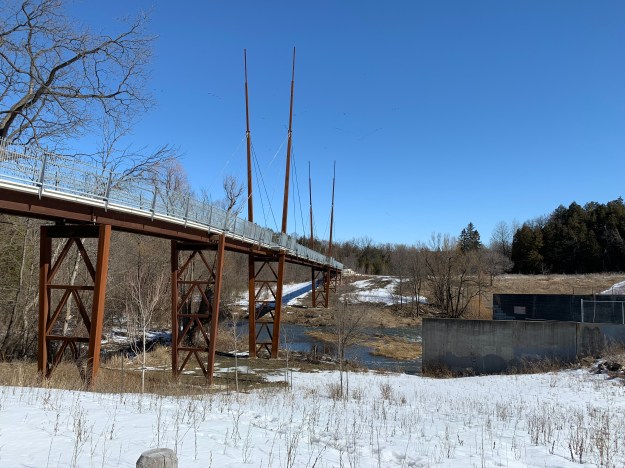
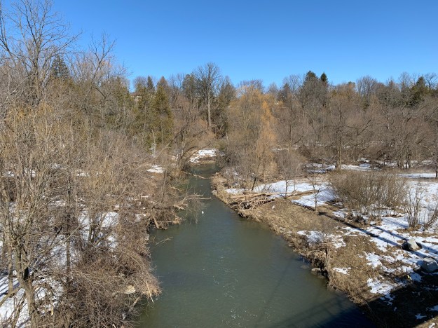
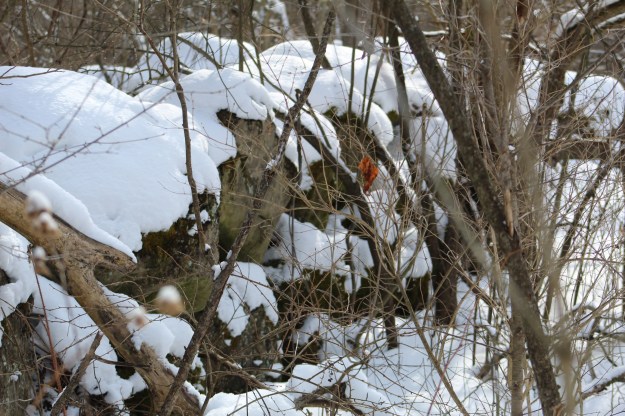
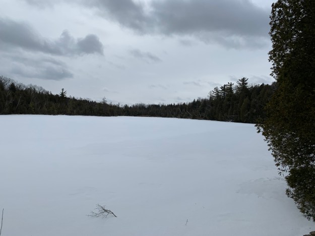
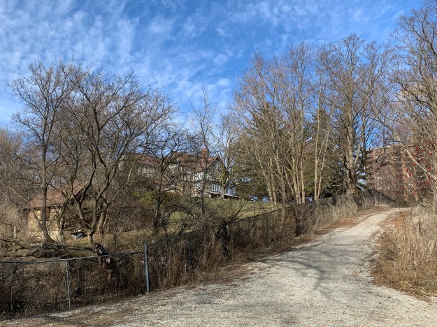
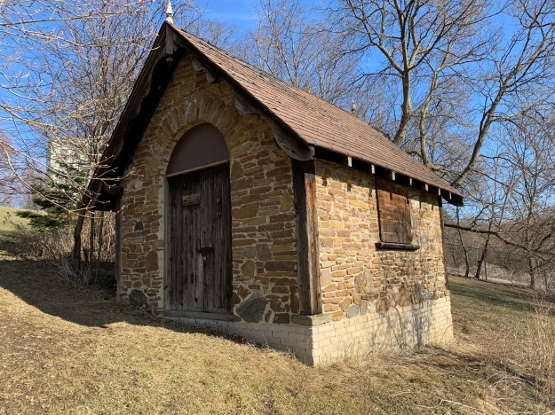
The trail follows the Humber River which it eventually crosses on a pedestrian bridge.  After crossing under Albion Road we saw plenty of deer and coyote tracks but the animals were in hiding.  Presently we came to the plot of land in old Emery Village which we had been seeking.  From the trail we could see the old lane way that once led to the river as well as the pump house and the main cottage on the hill top.

img_1758

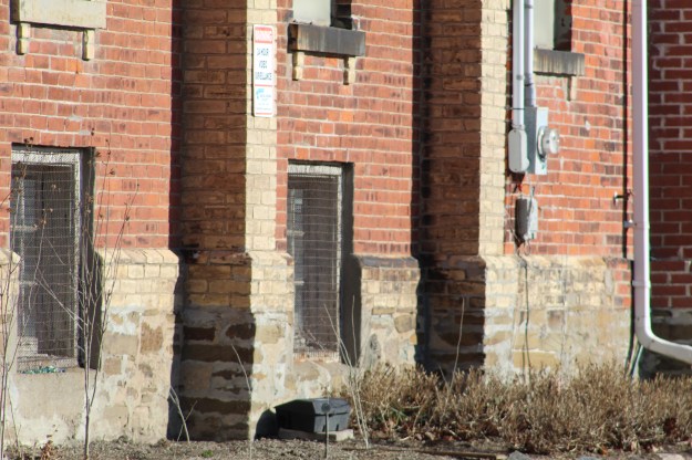
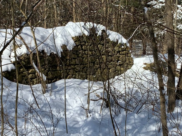
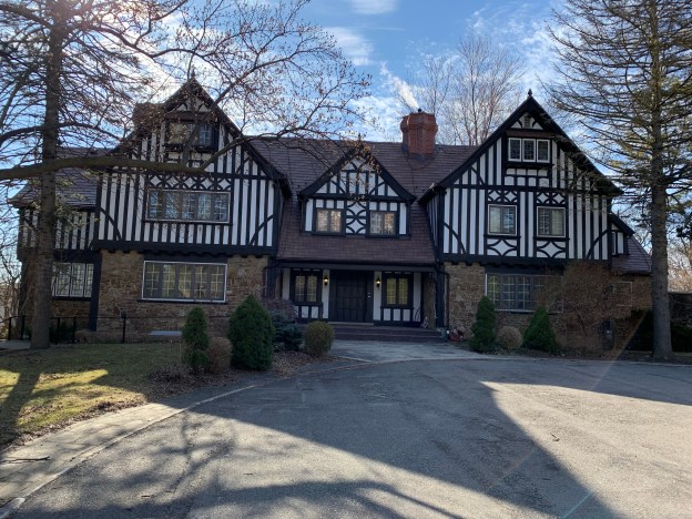
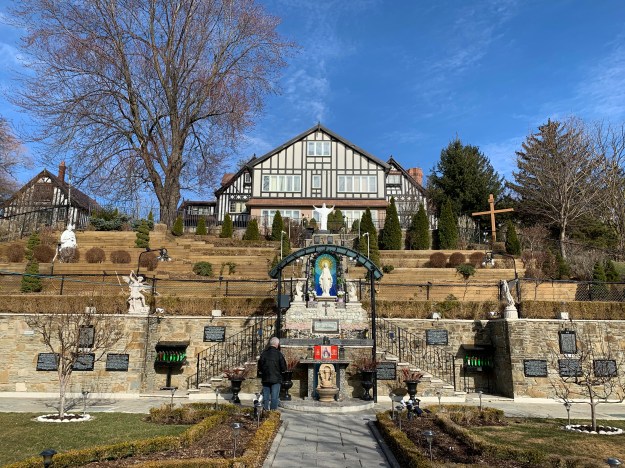
Percy Gardiner made his fortune manufacturing brass and later as a principal in the Toronto Stock Exchange.  In 1927 he bought 57 ares of land where he built a summer cottage for himself and his wife Gertrude.  They named their lavish cottage Rivermede and hosted parties for Toronto’s elite.  The house included tennis courts and a $75,000 swimming pool.  One of the first structures you see on the property is the old pump house for the swimming pool.  Even a simple building like this has been created with great attention to detail.

From the side of the hill you can look down into the former swimming pool area.  The pool was filled in but the rectangular outline can still be seen and the pool area has the only grass in the prayer garden.

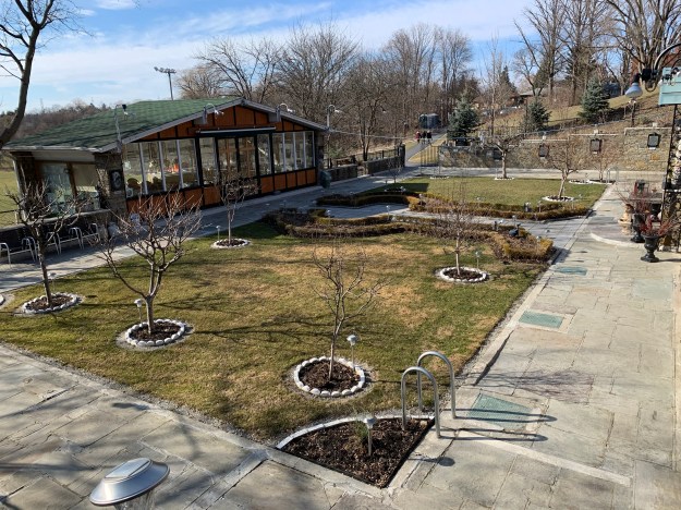
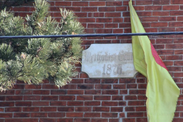
in 1961 the Basillian Fathers bought the property and turned it into the Marian Shrine Of Gratitude.  They converted the property into a monastery and the swimming pool into a prayer garden.  Originally there were several Fathers who lived in the house and maintained the property.  They took turns praying over the faithful who visited the prayer gardens.  Today the house is kept by a single Father who has been practicing social distancing since long before it became mandatory.

img_1740

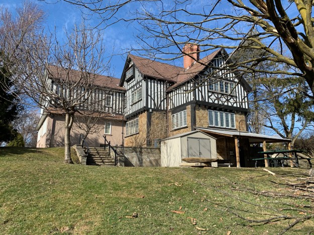
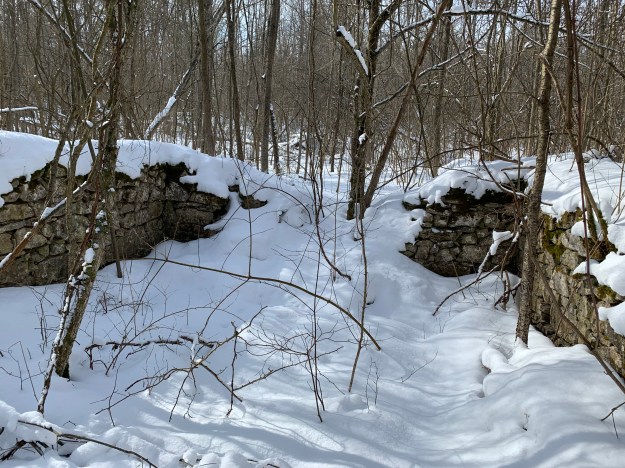
The cottage had a barn attached to the side which looks like a second cottage.

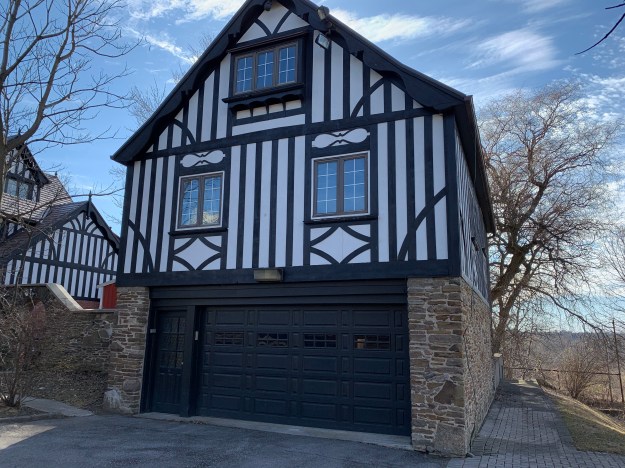
A stone arch separates the barn from the house and after passing through it you come to a set of stairs which leads down to the prayer gardens.  Crang’s Pond can be seen in the background.  In the 1950’s a large gravel quarry was operated on the property which supplied gravel for construction of the local section of the 401 when it was under construction.  The pit eventually filled with water to create the pond.

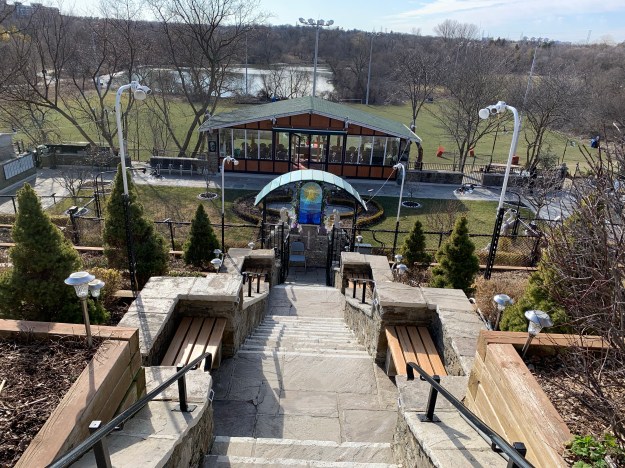
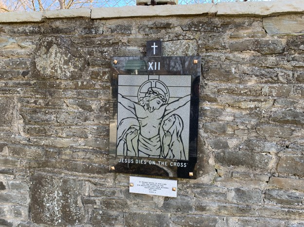
The lower walls of the prayer garden feature a series of carvings that depict the stations of the cross.  Most years at Easter the gardens are full of people but this year they will likely be silent for the first time in decades.

The prayer garden with all of its religious symbols has taken on an air of spirituality that I could feel as I walked slowly around the grounds.

When the swimming pool was in use bathers would have two sets of ladders to enter the water with.  One on the deep and a second set of steps on the shallow end.  Today, the hand rails for the steps stand in memory of swimmers soaking up the sun at a summer cottage party.

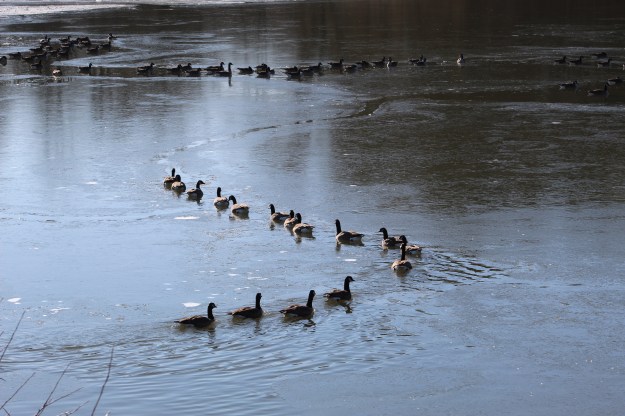
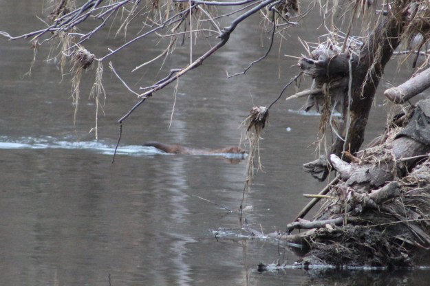
The trail along the river provides opportunities to see the local wildlife.  We were lucky enough to spot an American Mink swimming in the river.  All the mink that we see in the rivers around the GTA are related to a group that was released from captivity by animal rights activists.  Several of whom have been convicted of terrorism.

IMG_9463

As we close this blog we have no idea when the trails will be open to allow new blogs to be photographed.  We have several places that were photographed in the last few months that were not published.  Perhaps there may be a few new blogs with original content yet.  In an era where things change by the day, we’ll see what comes next when we get there.

Google Maps Link: Pine Point Park

Like us at http://www.facebook.com/hikingthegta

Follow us at http://www.hikingthegta.com

Look for us on Instagram.

Emmanuel Harrison – Pioneers of the GTA

Saturday, March 21, 2020

The County of Chinguacousy was surveyed in 1818 and the land grants were quickly given out to Loyalists from the War of 1812-1814 as well as emigrants from the British Isles.  Emmanuel Harrison arrived in December of 1820 and bought part of Lot 9 in the 5th Concession.  Here he built a log cabin and encouraged the local Wesleyan Methodists to meet on his property.

Harrison (2)

On May 20th, 1840 he ceded an acre of land for the use of the church.  They established a burial ground and built a frame church which was 40 X 60 feet.  During the early years the men sat on one side of the church with the women and children on the other.  Newly married couples were allowed the pleasure of sitting together for the first three weeks.  It was used until 1876 and then converted into a dance hall for the next few years.  It was demolished in 1880.

IMG_1719

A project was begun in 1875 to build a new church and a site was chosen on the opposite side of the road.  By 1876 the new brick structure was opened with the original vestibule having a flat roof.  The two front corners were adorned with small steeple shaped towers.  In 1925 the Methodist Church joined with some of the Presbyterian Churches to form the United Church of Canada.

IMG_1718

Renovations in 1947 raised the structure by 35 inches and dug the basement down an additional 3 feet.  The walls were originally buttressed with pale coloured bricks.  The dichromatic pattern was continued at ground level with four rows of bricks for trim.  The new foundation can be seen below this row in the form of new flagstones.  The church continued to serve the community until 1983 when it was sold.

IMG_9378

The building was bought by the Jewish Reform congregation Har Tikvah.  They modified it by installing new windows on the east wall and a custom built Ark of the Covenant to house the scrolls of the Torah.  A close up of the east wall wall window reveals a plain plate glass.  The earlier stained glass depicting a Christian motif is long gone.

IMG_9372

The original date stone is hidden behind a new flag but when the wind moves it the right way you can still read Wesleyan Church and the date 1876.  I fully support the re-purposing of historic buildings.  It is much more desirable than the demolition of them to build expressionless replacements.  This one has the unique privilege of having served three different faiths.  It’s just unfortunate that the full history of the structure isn’t being celebrated as one faith superimposes its symbols over the earlier one.  Perhaps they could have been expressed side-by-side rather than in competition.

IMG_9376

Emmanuel Harrison Sr. was buried along with his wife Rachel in the cemetery that he founded.  Rachel passed away on June 14, 1871 at the age of 81 years and 10 months.  Emmanuel followed her just five months later on December 11, 1871.  He was also 81 years old at the time.

IMG_1716

Emmanuel and Rachel had one of their children in 1828 and decided to name him after his father.  Emmanuel Harrison Jr. lived until 1920 and was married twice.  Both of his wives and two of his children are commemorated on his family stone.  His first wife was Everilda Hagyard and she died on May 28, 1885.  The couple had lost a daughter on July 25, 1875 named Mary Beatrice who was only 4 months old.  In 1883 their first son, Frederick C. Harrison died at the age of 12.

IMG_1717 (1)

Emmanuel Harrison is remembered along with his wife, at least one son, two daughter-in-laws and two grandchildren in the cemetery he founded and the church that he started is remembered by a building that was completed five years after his passing.

Google Maps Link: Harrison’s United Wesleyan Methodist Cemetery

Like us at http://www.facebook.com/hikingthegta

Follow us at http://www.hikingthegta.com

Also look for us on Instagram

Milne Dam Bridge

Saturday, March 7, 2020

Following Hurricane Hazel in 1954 a plan was developed that called for several dams to be constructed to provide flood control on the major waterways throughout the GTA.  Only three were actually built, including the one at G. Ross Lord Park on The Don River, the one at Claireville on The Humber River and Milne Dam on The Rouge River.  Until recently there was no access across The Rouge River in Milne Dam Conservation Area but a new set of bridges has changed that.  Our excursion to check out these new bridges began with a visit to Milne Dam Conservation Area.

IMG_1348

Closer to the dam the ice on the lake was much thinner.  Canada Geese are known for the “V” formation in which they fly which demonstrates a high level of social organization by providing support for the weaker birds in the tail of the formation.  The birds had cleared a winding path through the ice that they kept open simply by being organized enough to all use the same route.  It’s always interesting to observe the behaviour of the wildlife around us.

IMG_9273

Male red-winged blackbirds can be easily identified by the red epaulets on their shoulders.  The spring migration of these birds begins in mid-February and continues through to mid-May.  The males and females migrate separately with the males returning first in the spring and leaving last in the fall.

IMG_9275

Before you reach the dam you come to the newly constructed Milne Creek Bridge.  It is 42 metres long and helps connect the Markham Rouge Valley Trail which begins in Unionville at Toogood Pond.  The new bridges in the Milne Dam Conservation Area were officially opened on September 21, 2019.  The first three phases of the 15 kilometre trail are completed with the final phase currently under construction.

IMG_1350

The bridge is a multi span, cable-stayed design with a fanned-cable system.  From the middle of each of the main pylons the cables extend to three anchor points along the bridge decking.  Cable stayed bridges have several advantages over suspension bridges.  The cables allow the horizontal forces to balance which reduces the need for large ground anchorage points.    The cables provide a much stiffer structure to the bridge so that deformations of the deck under live loads are reduced.  The cables also work during construction of the bridge to allow spans to be cantilevered out from the pylon, providing both temporary and permanent support.

IMG_1361

The bridge is 143 metres long with the main section over the river being 45 metres.  It was built in sections off site and brought into the environmentally sensitive area ready to be installed.  The precast concrete decking was detailed to match the curvilinear approach on the west end of the bridge.

IMG_1376

The sunshine was sparkling on the waters of The Rouge River as they flowed over the Milne Dam.  The smaller concrete piers below the dam act to dissipate the energy the water gains as it drops over the falls.

IMG_9291

From below the bridge the view up to the little observation platforms is actually more breathtaking than the view from the platforms themselves.

IMG_1400

From the bridge you get a nice view of the dam in one direction and the Rouge River in the other one.  The bridge passes over the river at a height of 20 metres.

IMG_1390

This bridge provides the link to a much longer hike along the newly connected trail system, and a reason for a potential return visit.

Check out this link for our previous post on Milne Dam Conservation Area.

Google Maps Link: Milne Dam Conservation Area

Like us at http://www.facebook.com/hikingthegta

Follow us at http://www.hikingthegta.com

Look for us on Instagram

Crawford Lake Trails

Saturday, February 29, 2020

February 29th falls on a Saturday once every 28 years with the next one coming in 2048.  To mark this rare occasion we decided to explore the area around Crawford Lake.  We had been here about 5 years ago to explore the longhouses and the meromictic lake that helped modern scholars locate the site.  It isn’t possible to see everything in one trip because the park is 232 acres in size and full of trails.

Having recently heard about stone foundations on the property, we set out to have a look for them.  There is plenty of parking near the re-created Indigenous Village but you have to pay using an envelope and drop-box so no change can be expected.

IMG_1124

Crawford Lake has more than 15 kilometres of trails, including the Bruce Trail.  After parking near the longhouses we followed the Nassagaweya Canyon Trail until we came to The Bruce Trail.  This allowed us to connect with the Escarpment Trail and make our way over to the lookout across the canyon.  From there we used The Woodland Trail to reach The Crawford Lake Trail.  Like most parks, we recommend that you take a picture of the trail map in the parking lot.  This will help you keep track of where you are  in the park and which turns to take at each trail connection.

IMG_1129

After passing several trees with very large woodpecker holes in them it wasn’t surprising to see a Pileated Woodpecker.  We saw one land on a nearby tree while a second one could be heard hammering away on a tree in the distance.  A nesting pair will take turns incubating 3 – 5 eggs until they hatch in about two weeks.  The young may take about a month to fledge after which time they can live for up to 12 years.

IMG_9218

As you follow the trail you will see several large walls of stone that have been put up by the farmers as they cleared the land in an attempt to farm it.

IMG_9231

When the settlers arrived they tried to become self dependent as quickly as possible.  They would raise animals during the summer when feeding them was easy and then slaughter them for food before the winter set in.  The livestock would be kept in a barn to protect it from the worst of the weather.  As we neared the escarpment edge we came to the stone foundations of an old barn.  The barn that was originally built on this property was small with an overhanging porch along the east side.  Wagons didn’t fit in the barn so they were likely stored under the overhang.  A few feet to the east of the barn stands the remains of another one of the stone walls that run across the property.  It provides some shelter to the items stored on this side of the barn.  Close examination reveals a single man-door and a larger animal-door.  These days the barn is used as a shortcut by white tailed deer that shelter among the rows of evergreens near the barn foundations.

IMG_1137

A few metres away from the barn are the foundations of the small house the family lived in.  When settlers cleared the land they used the materials at hand to build their homes and the barns where they kept their livestock.  The house was built on a foundation of field stones collected when the land was cleared.  The trees that were cut down became the logs that were used for the house and barn.  The log house would often have three rooms inside, two of which were bedrooms.  By the middle of the 1800’s the log house would be often be outgrown and the family would build a new home out of bricks.

IMG_1148

Crawford Lake Conservation Area covers several former land grants including that of Mrs. Allan White.  The log house built by her husband can be seen on the county atlas map marked with a green circle.  At the time the county atlas was drawn in 1877 the house was already reaching the end of its normal lifespan.

hal-m-nassagaweyaSmith (2)

Crawford Lake Conservation Area and The Bruce Trail Association are working on removing Ash Trees from the park, especially along the Bruce Trail section in the park.  Emerald Ash Borers have decimated the forests around the GTA with estimates reaching as high as 99% of all ash trees being infected with the beetles.

IMG_1152

Emerald Ash Borers live in the layer between the bark and the core of the tree.  The phloem is the layer directly below the bark and it is responsible for passing nutrients and hormones between the ground and the leaves of the tree.  The larvae of the beetle eats extensive pathways under the bark and leaves the tree without the ability to feed itself.  The places where the bark has fallen off the stumps below reveal the extend of damage on these trees and the reason for their destruction.

IMG_9236

The trail leads to a lookout where there are several information plaques about the history and wildlife of the area.  The canyon below is known as the Nassagaweya Canyon and it separates the Niagara Escarpment from a small section known as the Milton Outlier.  Rattlesnake Point is at the southern end of the outlier and it can be reached by following the Nassagaweya Canyon Trail which is paired with the Bruce Trail through this section.

IMG_1160

Limestone Creek flows through the bottom of Nassagaweya Canyon but it took a much larger force of water to cut the canyon through the limestone and dolomite layers of the escarpment.  Melting ice sheets at the end of the last ice age were able to move large amounts of stone and till.  Much of this material was deposited at the mouth of the canyon and is currently being mined by aggregate companies.  In a couple of months, when they return from warmer climates, Turkey Vultures will fill the skies above the canyon.

IMG_1162

Near Crawford Lake is the Hide and Seek trail which features wood carvings of several of the nearly 200 species that are at risk in Ontario.  The wood carvings were made by Robins Amazing Art.

IMG_1172

Originally the lake was known as Little Lake but when George Crawford bought it in 1883 he started a business called the Crawford Lake Company which ran a mill at the end of the lake.

IMG_1181

A cottage and boathouse were included in the sale of the property to the conservation area in 1969.  The house has since been demolished with only the front porch remaining.

IMG_1183

Crawford Lake is an interesting place to explore and we’ll likely be back.  We have previously posted about the longhouses in the conservation area as well as the Bruce Trail south of the park in the Crawford Forestry Tract.

Google Maps Link: Crawford Lake

Like us at http://www.facebook.com/hikingthegta

Follow us at http://www.hikingthegta.com

Look for us on Instagram