Monthly Archives: July 2020

William T. Foster Woods

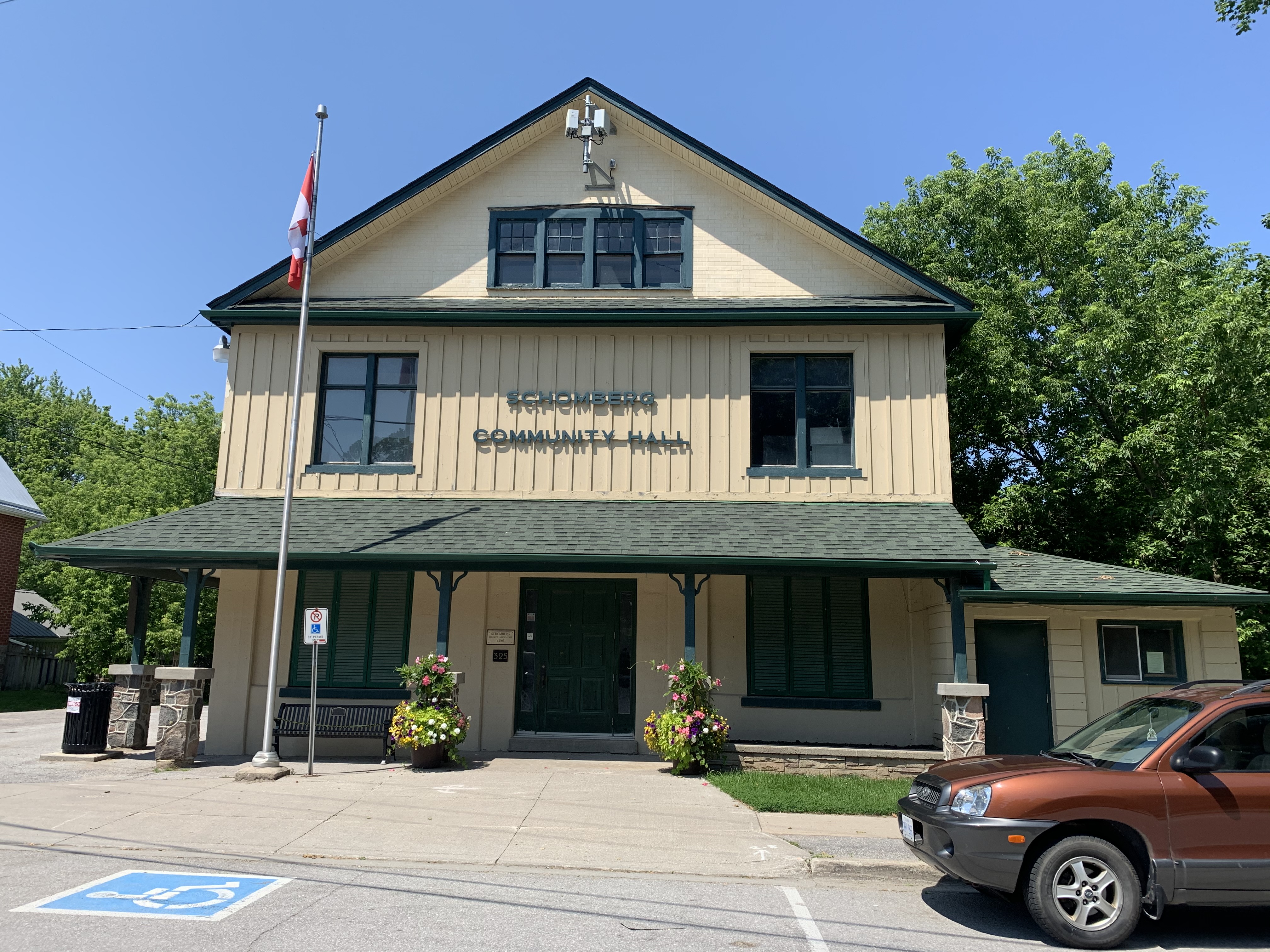
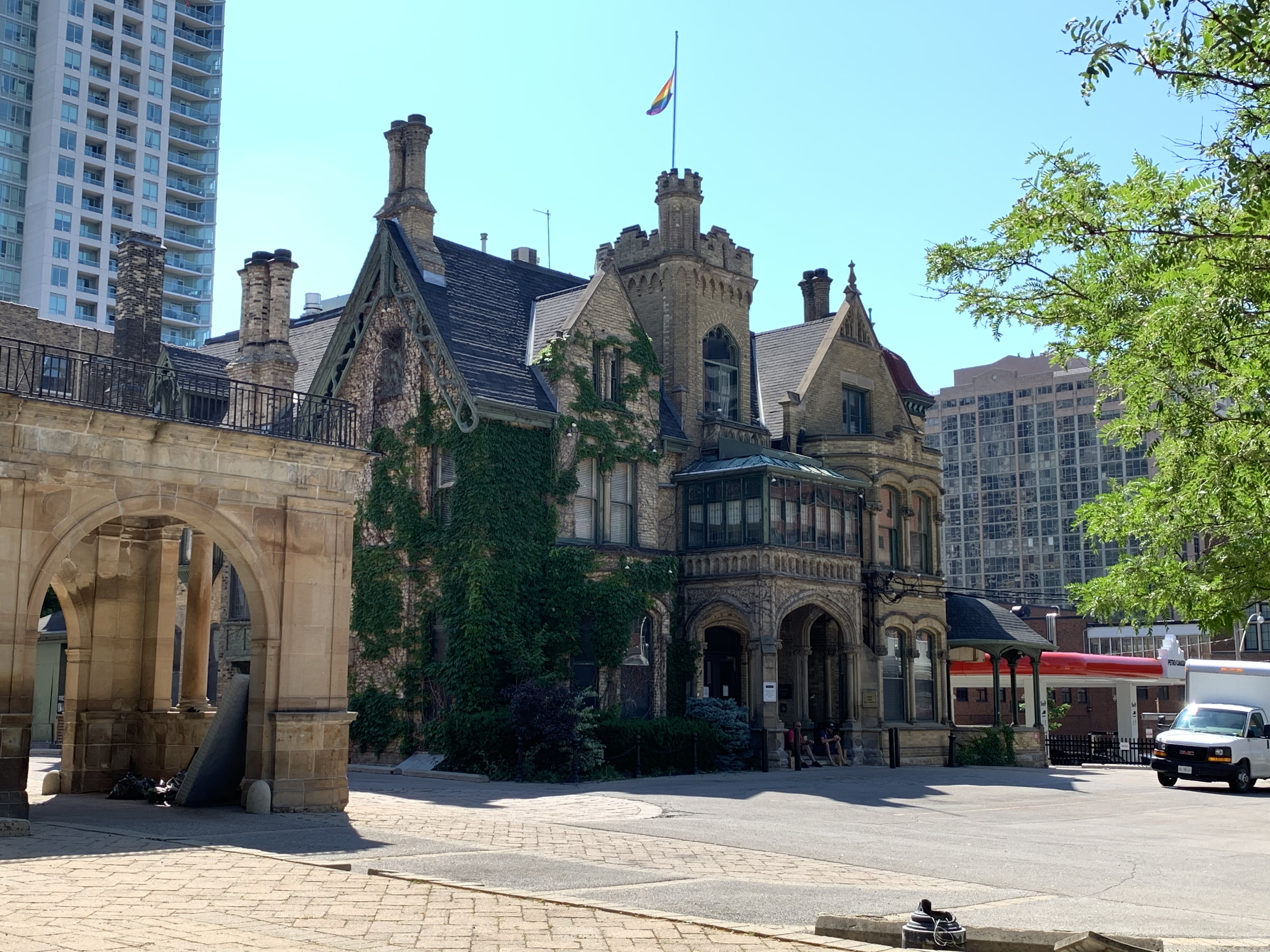
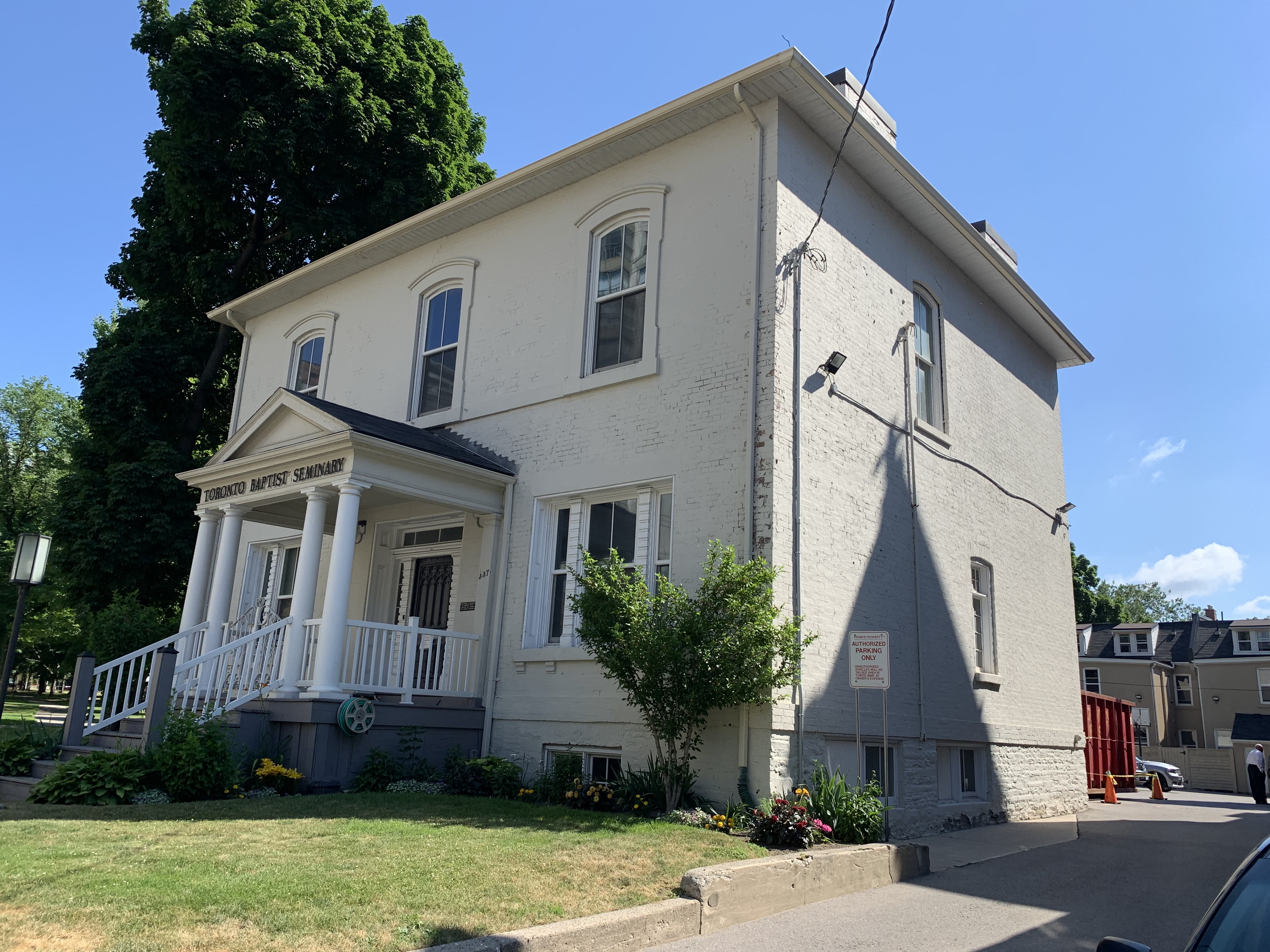
Saturday, July 18, 2020

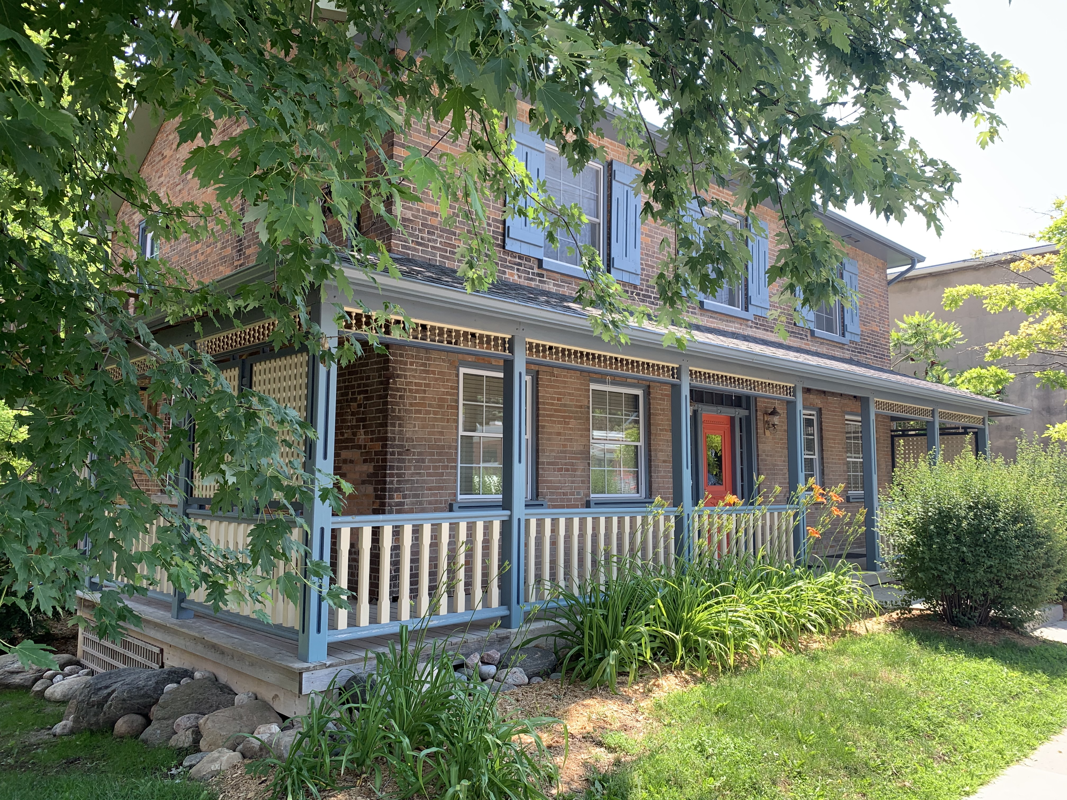
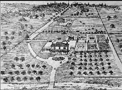
William T. Foster Woods is located on Islington Avenue, just north of Major Mackenzie Drive.  The parking lot is easily overlooked and like the trails, completely underutilized.  This little nature preserve is named after a man who spent 36 years working in forestry, including a stint as Deputy Minister of the Ontario Ministry of Natural Resources.  At the time of William’s passing in 1989 he had been chairman of the Metropolitan Toronto and Region Conservation Authority for the previous 4 years.  William T. Foster Woods is located on the eastern part of the original homestead of Joseph Capner.  When Capner and his wife Charlotte arrived from England in 1830 they settled on lot 21, just outside of Kleinburg.  The 1880 county atlas below has their property outlined in green while Islington Avenue is shaded brown.

Capner

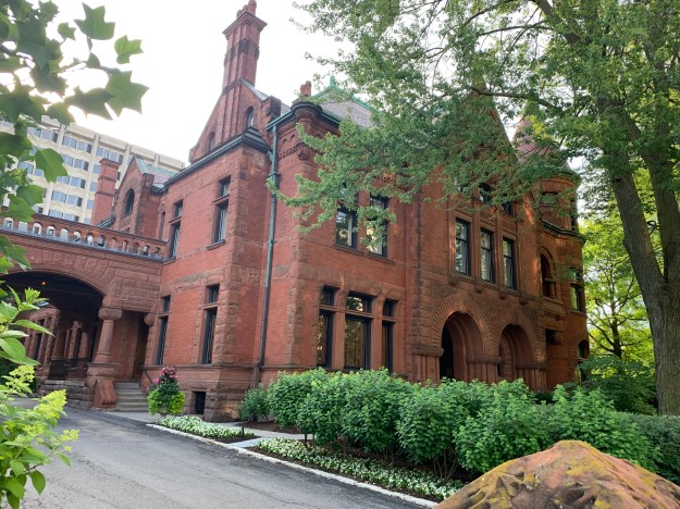
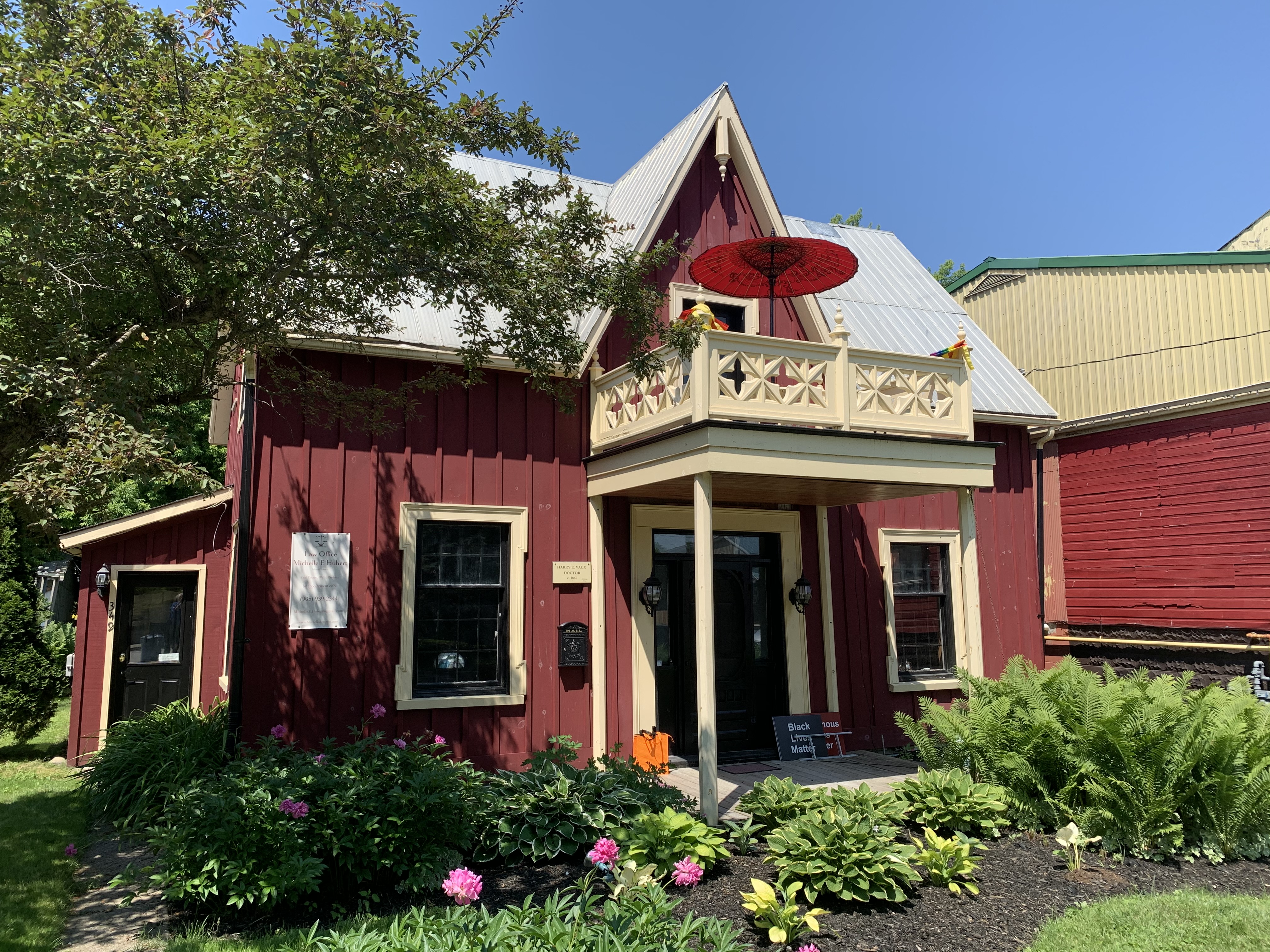
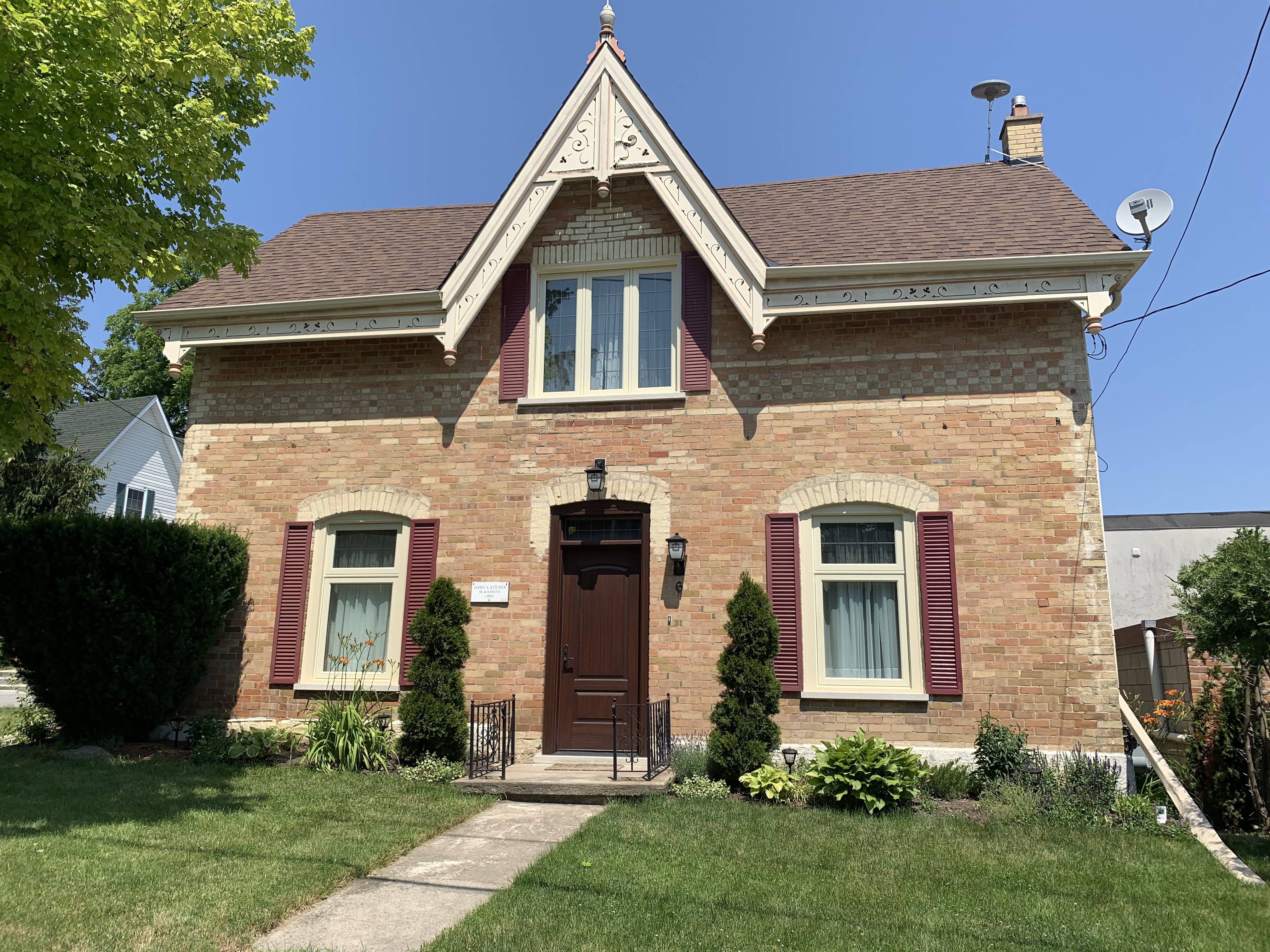
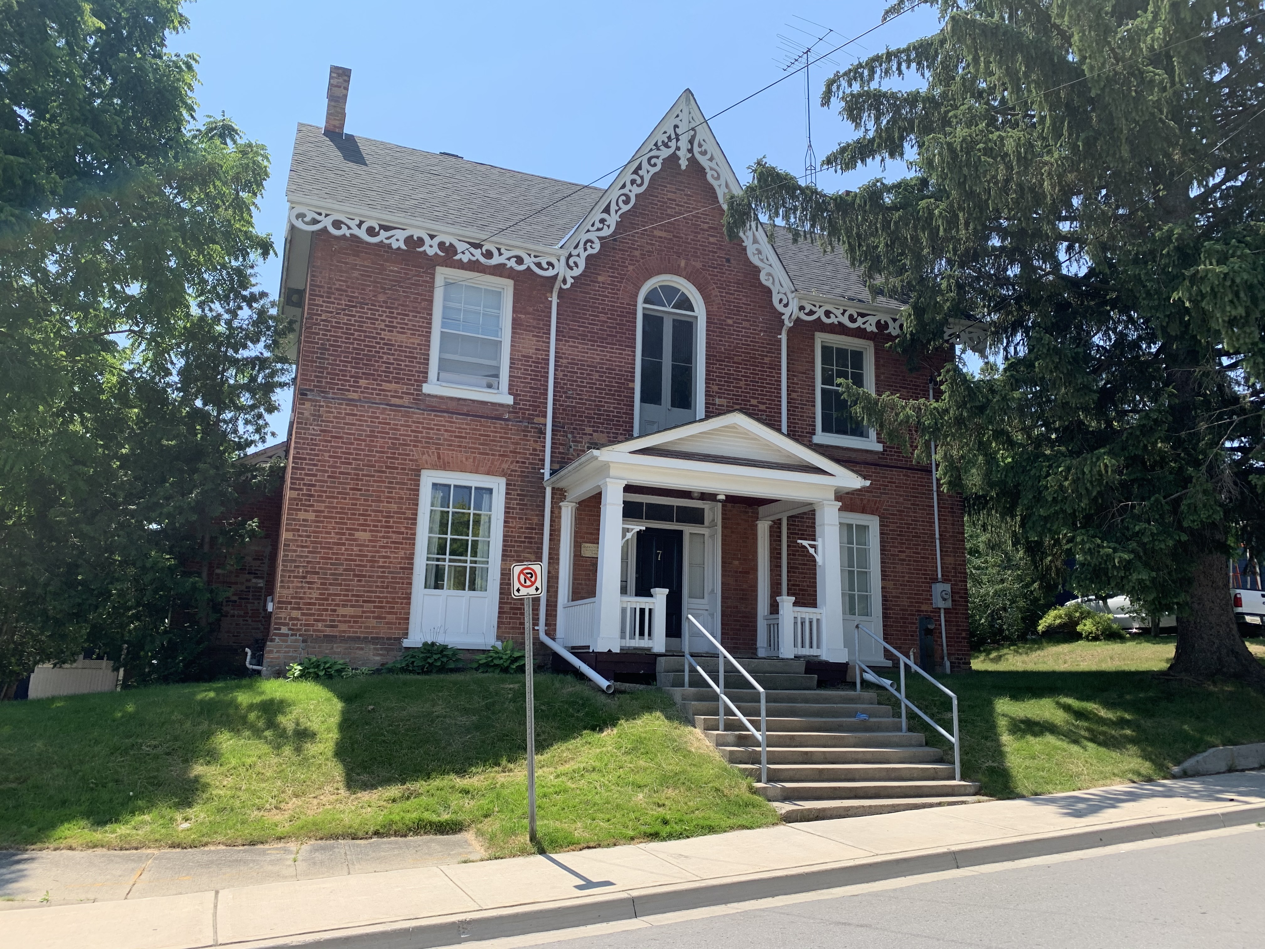
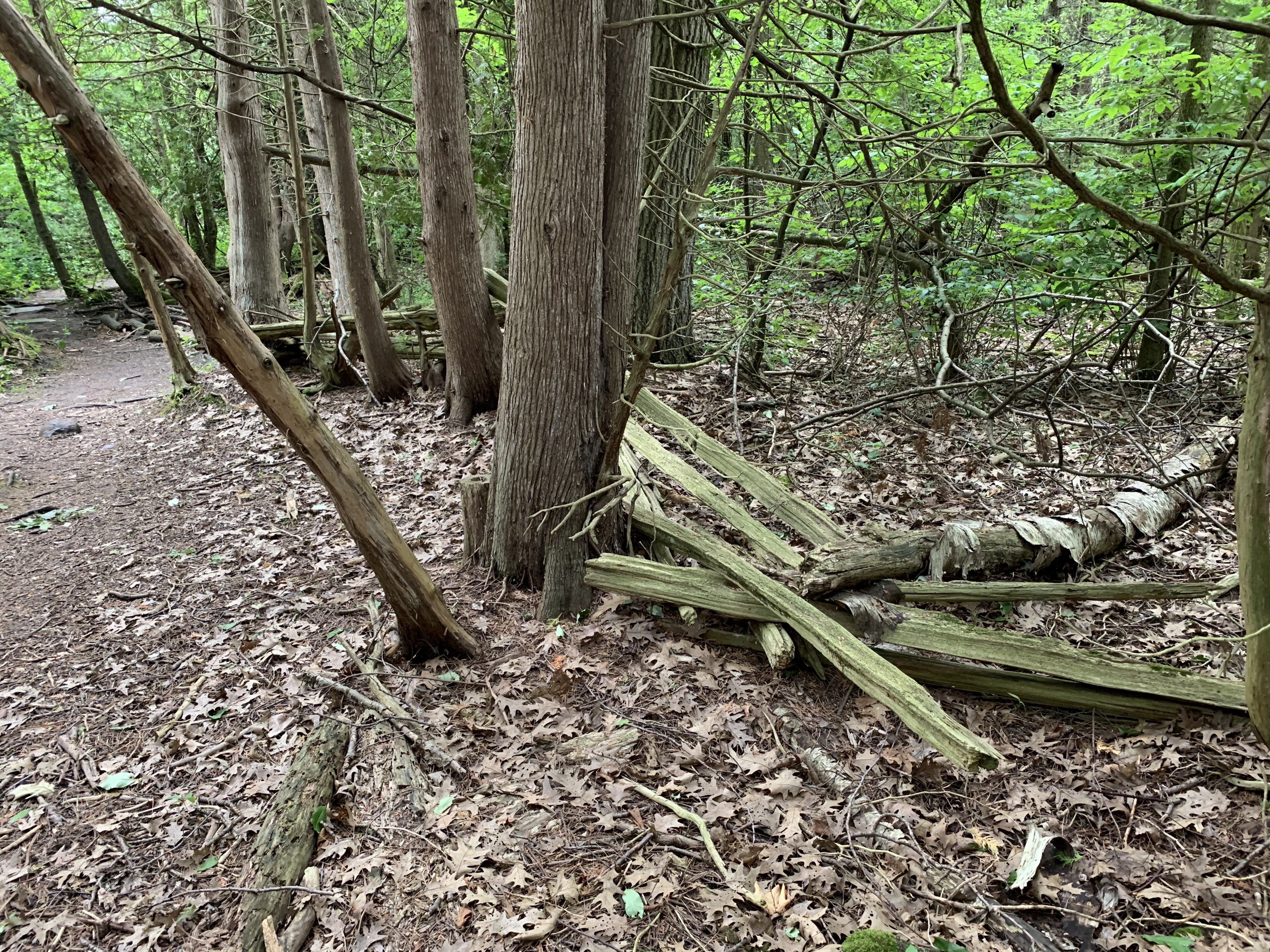
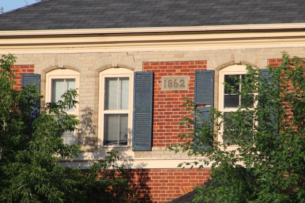
In order to claim the title for their lot early farmers had to clear at least 5 acres of land and fence it. The logs from the trees they removed were used to make the original log home and rail fencing.  The Capners raised 10 children in their first home.  In 1862 they got around to building the present house to replace the log cabin.  The bricks for the home were made on the property as were some used in the Kleinberg train station when it was built in 1870.

IMG_8255

I always think that people who take the time to put a date stone on their homes are showing their pride of workmanship.  Their expectation must be that it’s going to last long enough for people to appreciate the passage of time.  This one is approaching 160 years and looking fine for the age.

IMG_8256

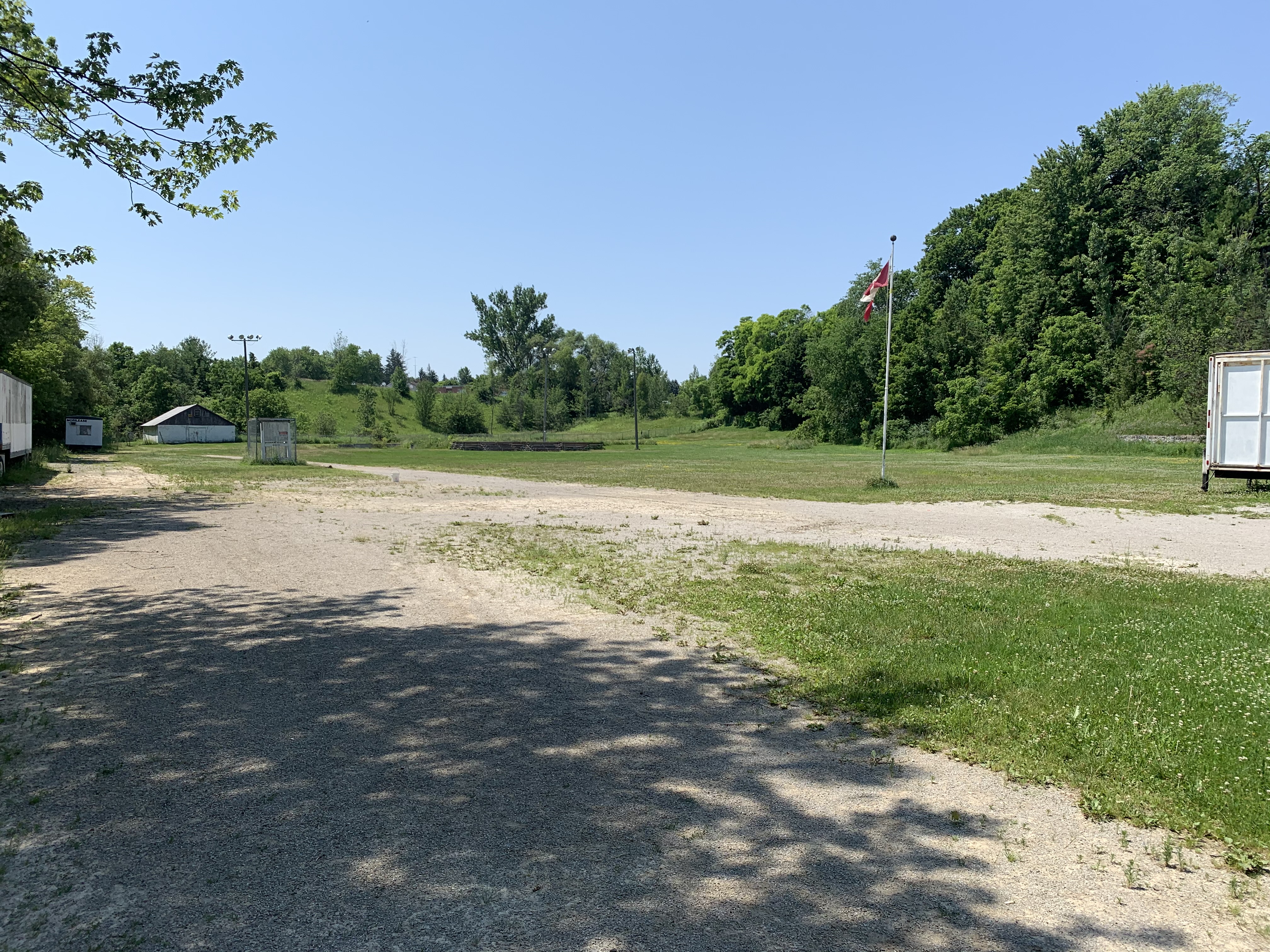
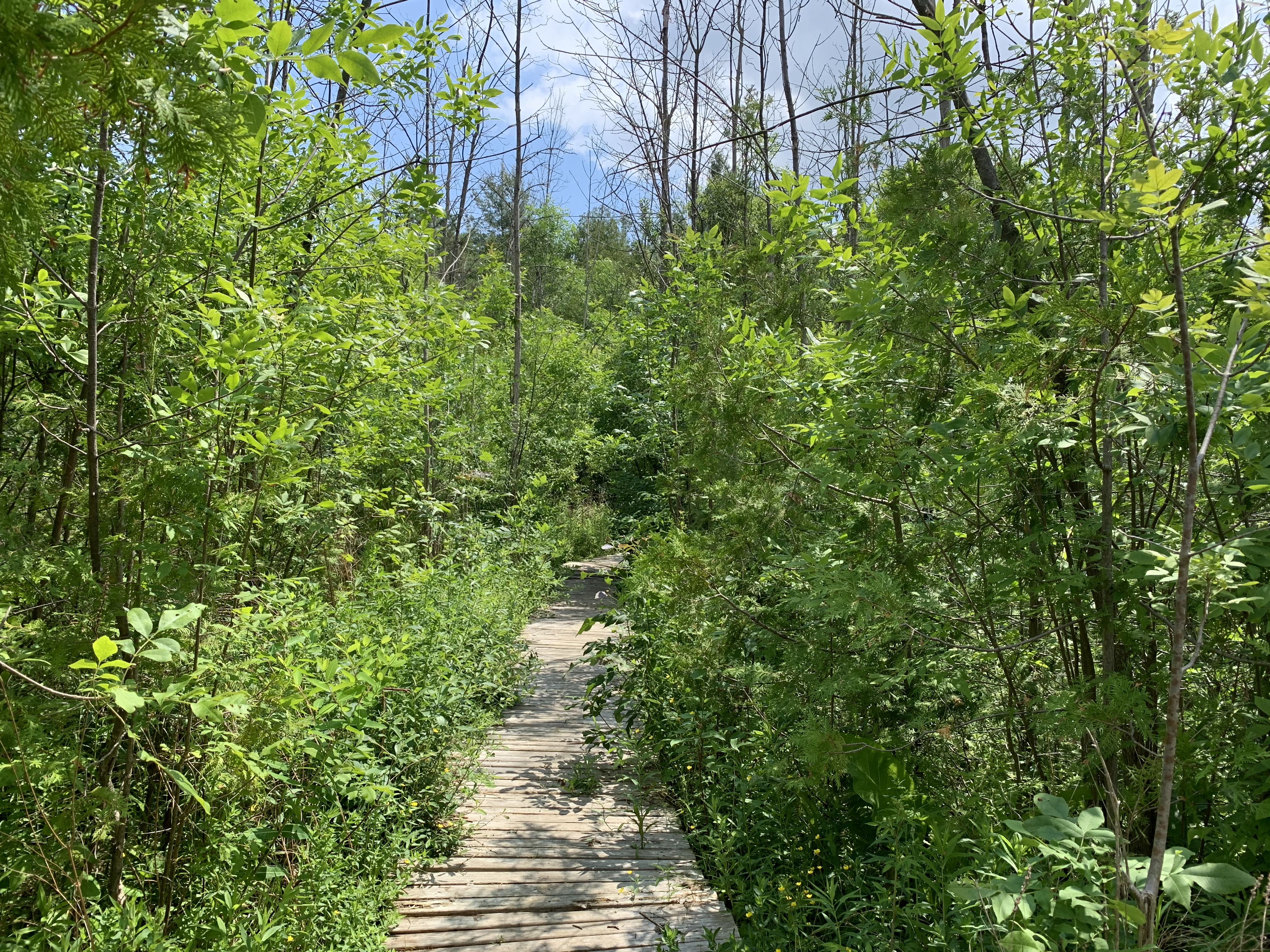
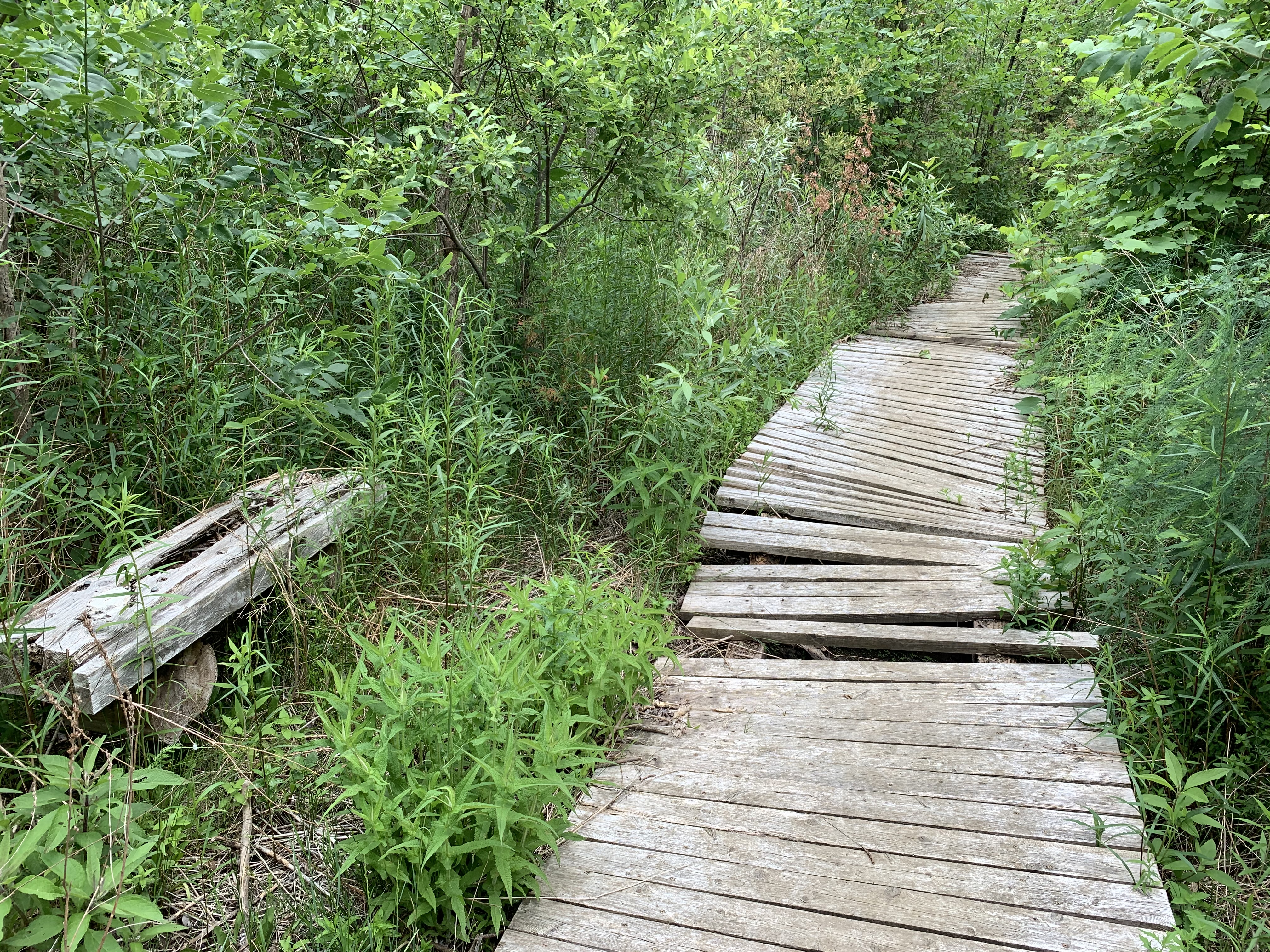
From the parking lot there are several trails that you can follow, the first one being a circle around a large stone that bears a plaque in honour of William T. Foster (1925-1989).  This pathway is getting overgrown but it may just be that the strange times were living in causes a lack of maintenance.

IMG_4331

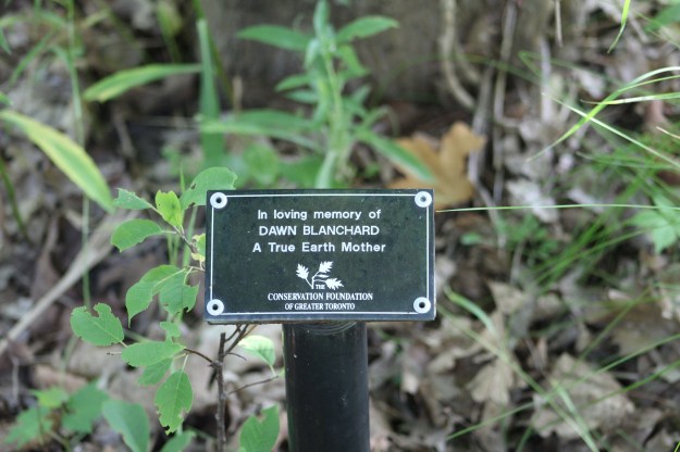
Many of the trees near the parking lot have been marked with little plaques that have been placed in memory of individuals.   Dog Strangling Vines and other weeds have filled the spaces between the trees and obscured the memorials.

IMG_8259

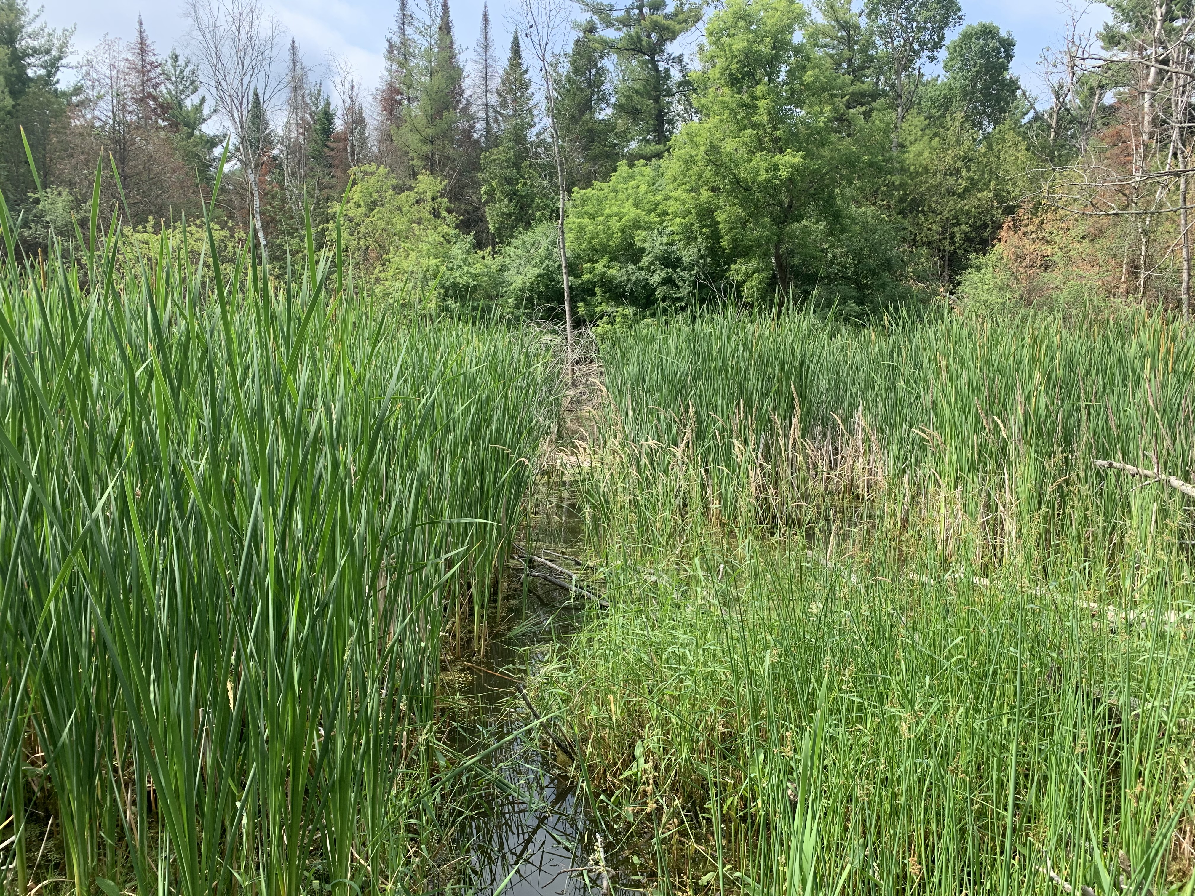
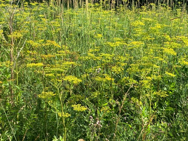
Wild parsnip has invaded the park and has taken over the fields under the hydro corridor.  This part of the trail needs to be hiked with caution because these yellow plants can cause severe burns if you get the sap on you.  Some people will still collect them because, like other members of the parsnip family, the roots are edible.

IMG_4334

The male black swallowtail has a series of pronounced yellow spots on the upper side of the wings.  They spend much of their lives on members of the carrot family such as parsley and Queen Anne’s Lace.  In their caterpillar stage they are bright green with bands and yellow/orange dots.  These butterflies are great pollinators and this pair was working its way through a patch of teasels looking for nectar.

IMG_8281

The picture below shows the female black swallowtail with her smaller yellow spots on the upper wing.  While the yellow spots may be smaller, the blue band between the yellow rows is much brighter on the female.  The cover photo shows the female under wing with its black dot in a red circle.  The picture also features a bumble bee that was just cruising in to check out the pollen on the teasel.

IMG_8280

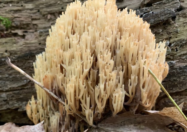
Clavoroid Fungi is the name given to a group of ground forming fruit bodies that are also known as coral fungus.  These are considered choice edibles but the examples that we saw in the forest were a couple of days past their prime.

IMG_4458

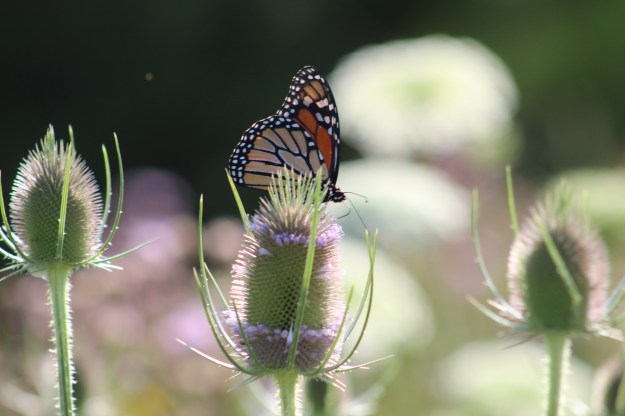
Monarch butterflies were out in full force and there is plenty of milkweed in the area to support them.  Caterpillars should be out now but we didn’t see any.

IMG_8265

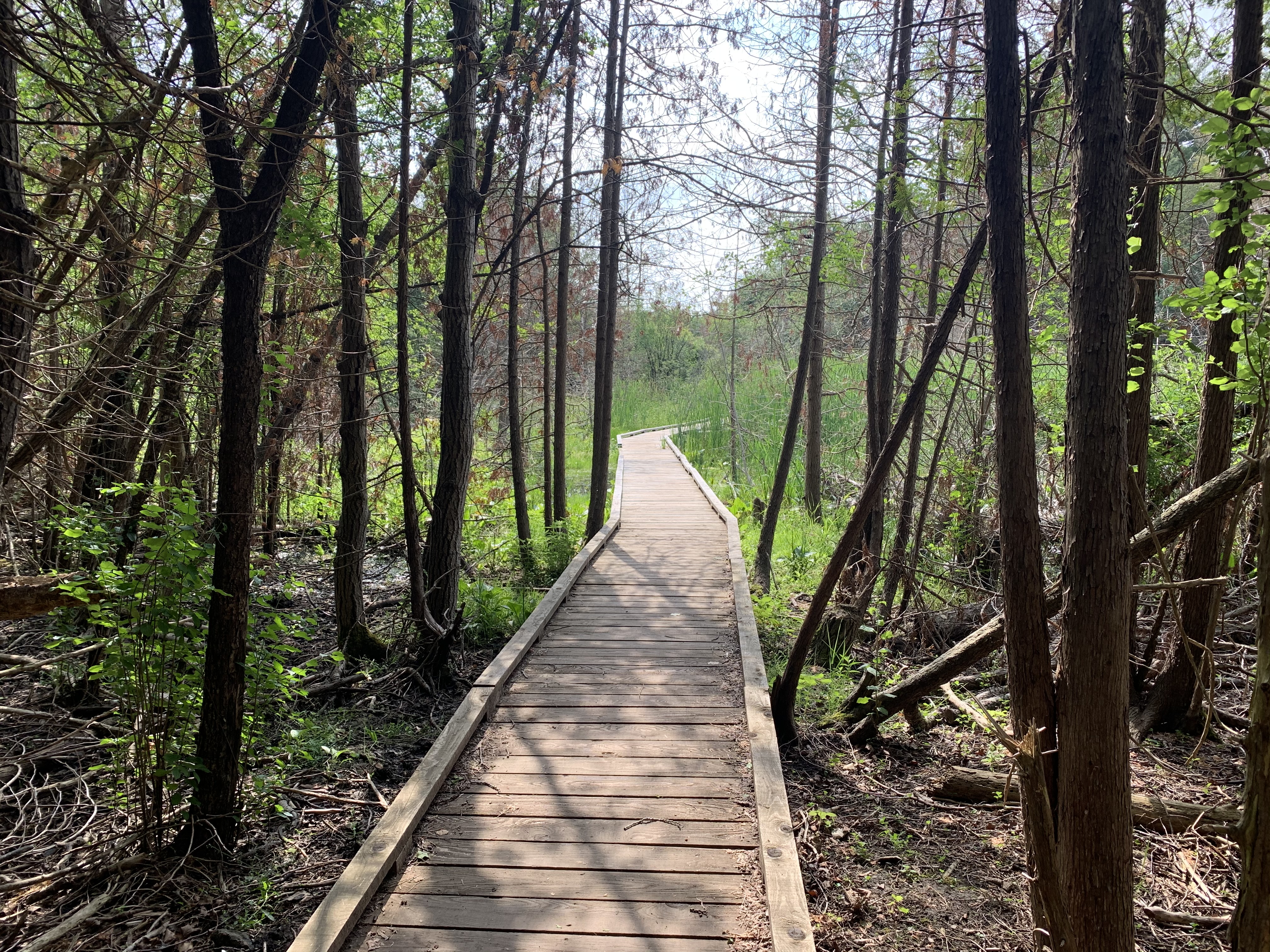
We didn’t explore the full extent of William T Foster Woods because it was simply too hot in the open areas.  After wandering through the wooded ravine we made our way back to the car expecting to return on a cooler day to investigate the rest of the area.  There are many trails some of which form connections to Boyd Conservation Area.

Google Maps Link: William T Foster Woods

Like us at http://www.facebook.com/hikingthegta

Follow us at http://www.hikingthegta.com

Also look for us on Facebook


Gooderham Architecture

Sunday, July 18, 2020

Three generations of the Gooderham Family made their mark on Toronto through the distillery of Gooderham and Worts.  Their factory is remarkably well preserved in The Distillery District but they also left their mansions and some major projects, including the King Edward Hotel built in 1903.

The oldest surviving architecture that can be attributed to the Gooderham Family is the church at 245 King Street East.  Situated just a little north of the Gooderham and Worts distillery the church was founded because many of the factory workers and others in the community couldn’t afford to pay pew fees to attend Bishop Strachan’s Anglican Church.  With the assistance of these two families the Little Trinity Church was built in 1843.

IMG_4359

The four buttresses that form the corners of the bell tower are repeated at the rear of the original church.

IMG_4362 (1)

Beside the church stands the rectory that was home to the priests who served the congregation over the years.  The rectory was built in 1853 and is an example of Romanesque and Gothic Revival architecture combined.

IMG_4369

Charles H Gooderham was the eighth, and youngest son of William Gooderham and in 1882 he had a home built at 592 Sherbourne Street.

IMG_4355

George Horace Gooderham built the house at 504 Jarvis Street in 1891 in the Romanesque Revival style that was popular with the family architect David Roberts.  Roberts and his son would design the majority of the buildings at Gooderham and Worts Distilery. George H. was the grandson of the company founder and added his home to a growing list of The Mansions of Jarvis Street.

IMG_4075

The Gooderham Building is one of the best known structures from the early days of Toronto.  It is also known as the Flatiron Building after the more famous one in New York City.  Interestingly, the Gooderham Building predates the NYC one by a decade.  It was built to house the offices of Gooderham and Worts when the business was booming and had outgrown the offices at the distillery.

IMG_4372

George Gooderham took the office in the top of the five story building where he had a commanding view east along Front Street toward the distillery and the Don River.

IMG_4378 (1)

The Gooderham Building was completed in 1892 and was adorned with plenty of carved stone.  It was built for $18,000 and served as the offices Gooderham and Worts until 1952.  It has been protected by a heritage easement since 1977.  Heritage easements are agreements that are placed onto the title for a property and set out details of building which must be maintained in perpetuity.  They may also spell out conditions for renovations.

IMG_4386 (1)

The Flatiron Building has one central window on each floor on the back end of the building.  In 1980 a Canadian artist named Derek Besant won a competition to create a public mural for the building.  He chose to paint a reflection of the Perkins Block across the street which gives the building the appearance of having more windows that it actually does.

IMG_4390 (1)

The Perkins Block was designed as a warehouse extension and storefront for a wholesale grocer named Frederick Perkins.  It was completed in 1875 and faced the original three story building named The Coffin Block that stood where the Gooderham Building would be constructed.  Notice the Italianate brickwork with multiple arches on the fourth floor windows.  These can be seen on the Flatiron Building mural.

IMG_4389 (2)

Between 1890 and 1892 George Gooderham built an imposing mansion on the corner of Bloor Street and St. George Street.  He had inherited the distillery when his father passed away in 1881 and was involved in the world of finance.  He founded the Bank of Toronto which is now the TD Bank.

IMG_4401

The house features a domed witch-hat tower, similar to the one on the Gooderham building.  Fancy brickwork on the chimney is complimented by the carvings around the tower base.  When George passed away in 1905 his widow Harriet sold the house and it has been home to The York Club since 1910.

IMG_4408

By the turn of the century the affluent neighbourhood had moved north of Bloor Street and the area of Rosedale became home to the new rich families in the city.  Edward D. Gooderham was one of the sons of William George Gooderham and he built his home in 1907 on Sherbourne Street North among the mansions of Rosedale.

IMG_4418

Built in 1908 the home at 112 Waren Road in Forest Hill represented a presence for the  Gooderham Family in the next wealthy neighbourhood.  The house features seven bedrooms in its two and a half storys.

IMG_4415

Albert Edward Gooderham was a grandson of the founder and had joined Gooderham and Worts as a clerk in 1879 at the age of 18.  When his father passed away in 1905 he became the Managing Director. In 1915 he bought 85 acres at Dufferin and Steeles.  Here he built and equipped Connaught Labs to produce tetanus antitoxin.  The labs later became the production facility for Toronto Insulin which benefited countless diabetics.  The buildings below are part of the Gooderham architectural legacy.

img_2793

Both the buildings that George Gooderham completed in the early 1890’s are adorned with conical towers but also fantastic details that present little surprises as you study them.  The red stone from The Credit Valley has been intricately carved such as this example above a window opening on George’s home.  A pair of lion heads and the head of a man who looks a little surprised to see them there.

IMG_4412

The Gooderham Family has made a lasting impact on the architecture of the city with another forty-five buildings in The Distillery District that bear exploration.

Like us at http://www.facebook.com/hikingthegta

Follow us at http://www.hikingthegta.com

Also look for us on Instagram

The Distillery District.

Sunday, July 12, 2020

The story of the Distillery District starts in 1832 with the idea for a grist mill on the east end of York (Toronto) harbour.  James Worts had been a miller in Suffolk, England before moving to York.  He built a 70-foot tall windmill that was a prominent feature on the York skyline and started a milling business with his brother-in-law William Gooderham.  Together they started a business that led to the largest distilling operation in Canada.  However, disaster struck in 1834 when James Worts lost his wife in childbirth.  Distraught, he jumped in the well at the mill and drowned himself just two weeks later.  Gooderham adopted his children and raised them along with his own thirteen.  Among the adopted was James Gooderham Worts who would become his partner in the business.

Their position on the waterfront provided easy access to large quantities of grain and so Gooderham decided to use some of it to make whiskey.  The distillery began in 1837 and being an entrepreneur, Gooderham began selling the spent grain wash to local farmers as feed.  Over the next four years he set up 9 acres of cattle sheds on the east side of Trinity Street and started a dairy operation as well.  The company kept fantastic records and appreciated their own history and so they retained the original millstone that was shipped from England in 1832 and used at the windmill.

img_4222

The Toronto Archives photo below shows the distillery as it appeared in the 1890’s on a post card.  It gives an idea of the scope of the enterprise that developed from that humble beginning with a windmill and a millstone.

Captions/Presentation slides. - 1903-1982, predominant 1978-1982

 In April of 1859 work started on the first wave of expansion for the company.  They began to build the most ambitious industrial building in the city, up to that time.  Built of Kingston limestone it is 80 feet wide and 300 feet long.  One half is five stories high to contain the mill while the west end is a story and a half and contained the distillery.  Working with lanterns in a dusty environment creates a serious fire hazard and many grist mills burned down because of it.  Gooderham has his constructed to be fire proof and when it burned in 1869 only the interior was lost.  This was quickly rebuilt and it is said that the grain that fell from the upper floors protected the milling equipment below and saved it from burning.  The cover photo shows the south side of the building which originally faced the Grand Trunk Railroad Tracks.

IMG_4237

The Boiler House is known as building number two and it is attached to the north side of the mill.  It was originally a single story limestone building but it has been radically altered overt the years.  When the boilers were upgraded in the 1880’s the limestone wall was removed to accommodate the equipment and was replaced with the present brick structure.  Just behind the smoke stack is building number four which was part of a major expansion in 1863.  The boiler house was using 30 tons of coal per day to fire the 100 horsepower engine in the mill.  The ashes from all this coal were taken and spread around the neighbourhood streets leading to some of the best packed streets in the young city.

IMG_4226

Several buildings were added to the north of the mill and west of Trinity Street in 1863 including new offices, cooperage buildings and the four story rectifying house for the purification of alcohol.   The modest offices pictured below served the growing business until they were replaced with a new office building on Wellington Street in 1892 known as the Flatiron Building.

IMG_4224

David Roberts Sr. was the architect for most of the early buildings in the compound while his son oversaw the construction of the later ones.  They were also responsible for designing several Gooderham family homes as well as the Flatiron Building.  Although the buildings served a utilitarian manufacturing function, Roberts made sure to include some purely aesthetic features.  Most of the brick buildings were set on limestone foundations so they would tie in visually with the stone mill.  The Rectifying House still has its decorative cupola and patterned brickwork.  This design is known as “arcaded corbelling” with a saw-tooth surmount.

IMG_4201

In the 1870’s another round of expansion took place.  The cattle sheds on the east side of Trinity Street were torn down and replaced with new ones on the east side of The Don River.  The Pure Spirits building, tank houses and store houses were built on their former site.  The Still Houses featured in the picture below were used to adjust the proof level of the spirits to ensure a consistent 40% alcohol.

IMG_4217

A dozen Tank Houses were added throughout the 1880’s for the storage of copper tanks of whiskey and later some were converted to hold up to 5,000 barrels per building.  

IMG_4166

Tankhouse Lane runs from Cherry Street to Trinity Street and is lined on both sides by these storage buildings.

IMG_4169

A shipping building was added in 1883 to store cases and barrels of whiskey that were ready for distribution to the markets.

IMG_4184

Meanwhile, the cattle sheds continued to function across the river and fifty years of disposing of the manure into Ashbridges Bay had contaminated it to the point where it was decided to fill it in and it was turned into The Port Lands.  During the First World War the company converted to producing acetone for the military under the name British Acetone.  The picture below is from the Toronto Archives and is dated November 30, 1916.

Acetone

After the war was finished the temperance movement succeeded in implementing Prohibition.  The company survived by distilling whiskey for export, although much of it passed through Quebec where it was legal and back into Ontario.  In 1927 the business was sold to Hiram Walker and continued to operate in a lesser fashion until the complex was closed in 1990.  

IMG_4192

The entrance to the Rectifying House was deliberately made grand to allow light into the interior of the building but it also has some awesome woodwork.  Two wooden arches support a circular oculi.  The original windmill was removed after the factory was converted to steam power and the site partially built over with the Rectifying House.  The semicircle of brighter red bricks in the lower corner of this picture marks the site of the windmill that started the enterprise.

IMG_4228

Rather than being turned into a museum like Black Creek Pioneer Village the site has been developed into The Distillery District which preserves the heritage in a unique way.  The factory buildings are full of interesting shops and activities that bring new life to one of the most complete Victorian Industrial Complexes in Canada.  The map below provides some insight into what awaits visitors to the area.

IMG_4162

The view below looks east along Gristmill Lane with the Stone Mill on the right and the chimney for the boiler room in the background.  The Coopers Shops and Rectifying House are on the left.

IMG_4239

This is one historic site that definitely needs another visit when I can go into the buildings and look around.

Just across Cherry Street stands the Palace Street School which was built in 1859 and served the children of many distillery workers.

Google Maps Link: Distillery District

Like us at http://www.facebook.com/hikingthegta

Follow us at http://www.hikingthegra.com

Look for us on Instagram


Schomberg

Saturday, July 4, 2020

Schomberg sits on the northern edge of the GTA in King Township.  The community got its start around 1830 when John R Brown emigrated from Pennsylvania to the area and settled on lot 26 in the 9th concession.  Three of his brothers also arrived in the area over the next couple of years, taking up adjacent farms.  The earliest name for the town was Brownsville but residents had to go to nearby Lloydtown for their mail so they applied for a post office of their own.  That was 1861 and the application was denied because there was already a Brownsville post office in York County.  The following year the name was changed to Schomberg, after The Duke of Schomberg, and the post office was finally opened.

An orange grain elevator stands on the side of Highway 9 close to Highway 27 that used to have the Shur-Gain symbol on the side.  Shur-Gain was introduced in 1937 as a brand name by Canada Packers.  They provided feed for animals and livestock.  Today there appears to be renovations going on at the old feed mill.

IMG_4003

Schomberg developed a little west of the road that we call Highway 27 today on a small given road.  The town retains many of its historical buildings and so I parked and went for a walk.  Although the Shur-Gain feed mill on Highway 9 might be better known to people who pass by on the highway there is an older feed mill in town.  In 1884 Anderson Tegart built the Schomberg Feed Mill on Main Street where it had direct access to the railway.  It operated until 1927 before it shut down.  Since that time it has housed a variety of businesses including The Scruffy Duck Restaurant which is still in business.  The cover photo shows the feed mill from the south view in contrast to the view from the north presented below.

IMG_4052

Beside the old feed mill is a small house built in the year of Confederation that belonged to one of the town doctors.  Harry E. Vaux would have served the community out of his home rather than some office in a clinic when he wasn’t visiting the homes of those who were too sick to come to him.

IMG_4012

Schomberg has done a great job of identifying their historic buildings.  Most of the buildings on Main Street and along Church Street have little plaques attached giving the date and historical uses.

IMG_4013

In 1905 you would have been able to walk into this building with the false front and purchase your family meat from Adam J. Smart who was the butcher at that time.

IMG_4007

The first commercial bank in Schomberg didn’t arrive until 1902.  That was the year that the Trader’s Bank of Canada opened a branch in town.  The bank was headquartered on Yonge Street in downtown Toronto and would later become part of the Royal Bank of Canada.  The Traders bank opened in the left half of the building featured below.  The right side of the building had a grocer and general merchant in it, Wm. Leeson McGowan was proprietor of the store in 1924.

IMG_4018

The Schomberg Agricultural Society had been meeting since 1851 and was very active in the lives of the local farmers who were served by the town.  Schomberg was well known for its produce and drew people from miles around for its farmers market.  In 1907 the Market Association was formed and they built a community hall which was used as a market.  In 1922 they added a second story to serve as a full time community hall.  The hall is currently being upgraded to make the second floor accessible and restore some of the worn out infrastructure in the building.

IMG_4016

At one time Schomberg had its own railway line, the Schomberg and Aurora Railway which was intended to open the successful produce markets up to a larger customer base from Toronto.  It connected to the Toronto & York Radial Railway with construction beginning in 1899 at Bond Lake.  The railway operated from 1902 to 1927 bringing people to town who would have visited the markets in the community hall.   A little pathway beside the community hall building leads into the fair grounds where I found a clever use for a repurposed shipping container.  By taking the ends out it has quickly become a covered bridge over a small waterway.

IMG_4051

It’s hard to say what will happen to the fall fairs across Ontario in 2020 with the threat of an ongoing pandemic but it might be fun to visit the one in Schomberg sometime.  The fairgrounds were pretty deserted on this hot morning.

IMG_4050

The Baptist church in Schomberg had stopped using their building and left it vacant on Main Street.  Meanwhile, about three and a half miles away a Presbyterian congregation had been meeting since 1891 without a building of their own.  In 1907 it was decided to purchase the old church and dedicate it for their use.  They held their first services in June 1907 and continue to meet there at the present.

IMG_4017

The archive picture below shows the old Baptist Church (now Presbyterian) and the community hall at the time before the second floor was added to the hall.  This is apparently from a postcard from the 1910’s.

Schomberg Community Hall Bill Foran_Super_Portrait

Fred and Emma Sparling ran a bakery and confectionery on Main Street in the 1890’s in this building with the cute little quarter round gable windows.

IMG_4022 (1)

Levi Denis was the town miller in 1875 and lived in this two story home.  The ground floor has five bays while the second story has only three sets of windows.  This lack of symmetry suggests that the second floor may have been added at a later date.

IMG_4045

Just around the corner on Church Street is the old home of one of the town blacksmiths. This story and a half house was built in 1891 for James A. Kitchen and has some interesting patterns in the brickwork.  James and Elmira had a son named Percy who served in the First World War and then returned to live with his parents in Schomberg where he also took up the blacksmith trade.

IMG_4046

Garrett Brown was one of the four founding brothers who started Brownsville and he built this house on Church Street in 1871.  He owned several businesses and opened the first bank on Main Street in 1885.  His bank didn’t face competition from the larger chartered banks until 1907 when the Traders Bank arrived.

IMG_4047 (2)

Church street continues out of Schomberg and into Lloydtown which is another interesting little rural community with a unique heritage.

Here’s the link to our story on the Toronto & York Radial Railway. and the one about Bond Lake.

Google Maps Link: Schomberg

Like us at http://www.facebook.com/hikingthegta

Follow us at http://www.hikingthegta.com

Also look for us on Instagram


The Mansions of Jarvis Street

Sunday, June 28, 2020

William Jarvis was granted 100 acres of land just east of Yonge Street and running between Queen Street and Bloor Street.  Jarvis was the first Secretary and Registrar for Upper Canada.  When the property passed to his son Samuel, he began to clear the southern 50 acres and built himself an estate which he called “Hazel Burn”.  When Samuel got into financial trouble with the government he was forced to divide the property into lots and sell them off to pay his debts.  He laid out a new street which he called Jarvis Street and sold smaller, working class lots closer to Queen Street and larger lots to the wealthy farther north.  The drawing below shows the original Jarvis estate.

Jarvis estate hazel Burn

Many of the original homes have been lost to fires or redevelopment.  Several of the ones that remain are involved in development proposals at this time.  I decided to get some pictures and record the state of this once grand street as it exists today.  In the future there will likely be even less of the original glory remaining.  I found a parking place on the side of Jarvis Street, they’re free on Sunday mornings, and walked up and down both sides of the street.  The mansions are presented from the north end of the street walking south.

Arthur MacMaster was a dry goods magnate in Toronto and he built a Gothic style house in 1868.  MacMaster envisioned a type of medieval castle and completed his home with a crenellated tower.  Hart Massey, of the Massey-Harris Company, bought the home for $12,500 in 1882 when MacMaster passed away.  Massey renamed it Euclid Hall and enjoyed the fully landscaped grounds.  In 1947 the trees along the boulevard were cut down so that Jarvis Street could be widened and soon the trees and flowerbeds at the corner were removed in favour of a gas station.  Most recently the estate has been used as The Keg Mansion.

IMG_3897

Chester D Massey (1850-1926) built his house in 1887 on the corner of the Euclid Hall property.  The concrete porte-cochere was added in 1910 as it had become fashionable to have a covered porch for vehicles to take on or discharge passengers under.

IMG_3894

William R Johnston made his fortune as a clothing merchant.  In 1875 he added his mansion to the growing list of mansions on Jarvis Street.  It remained in the family until 1941 when it became the national headquarters for the YWCA.  Today the building is home to Casey House which was the first independent AIDS/HIV hospice in Canada.  A matching home was built by Johnston’s business partner but like so many of the grand mansions on Jarvis Street it has been demolished.

IMG_3907

Thomas B Taylor had the house at 510 Jarvis built in 1888.  Taylor had been involved in three paper mills along the Don River including the one at Todmorden.

IMG_3910

The house at 471 Jarvis Street was built for Thomas Thompson in 1874.  The house goes by the name Elderslie and was owned at one time by Alexander Morris who served as a Conservative for Toronto East.  He was in opposition to the government of Oliver Mowat who lived at 372 Jarvis Street.

IMG_3886

Oliver Mowat bought a lot at 372 Jarvis Street in 1856 to build a home for himself.  Mowat was one of the Fathers of Confederation and later served as the Premier of Ontario.  His six consecutive majority governments sets a record of 24 years in power and speaks of how well loved he was.  This Georgian style house was only his for six years before he sold it.  Over the years it has belonged to several people as well as being headquarters for CBC for awhile.  It currently serves as Canada’s National Ballet School .  There are further pictures and details in our blog celebrating Sir Oliver Mowat and his contributions to Canada.

IMG_3877

Beside the Jarvis Street Baptist Church, at 337, stands a house that was built in 1849 for Samuel Platt.  Samuel had made his fortune as a brewer until he went into politics in 1845 as a city councilor.  In 1872 he became involved in planning the young city waterworks before being elected as an independent MP for Toronto East, a position he held until 1882.  His house now serves as the Toronto Baptist Seminary, also known as Church House to the pastors who visit there.

IMG_3864

The house at 314 Jarvis Street was built in 1865 and is known as the Sheard House.  The house was in the family for decades with some prominent members of the community living here.  Joseph Sheard was the mayor of Toronto from 1871 to 1872.  In 1901 his son Dr. Charles Sheard renovated the house.  Dr. Sheard was Toronto’s Chief Medical Officer of Health and was an MP from 1917-1925.  During WW2 the home was divided into apartments and eventually it was sold to developers.  The original proposal for a 43-story condo was rejected by the city.  The home was gutted by a fire in January 2016 and now the redevelopment of the site is going ahead.  It looks like the new proposal is going to incorporate part of a wall.

IMG_3856

The building at 290 Jarvis was built in 1890 and is a style known as Richardsonian Romanesque.  It appeared for only about 20 years and is attributed to an architect named Henry Richardson.  It is known as the William Carlyle House and there is a mirror image home at 280 Jarvis Street from 1891 that is also sitting empty and boarded up.  The two of them have historical designations and are intended to be incorporated into a new 25 story condo development.

IMG_3865

My personal favourite Jarvis Street mansion is found at number 504 and so it is presented out of sequence and as the cover photo.  This Richardsonian Romanesque house was built in 1889 for George H. Gooderham.  The Gooderham family owned the Gooderham and Worts distillery that dominated the waterfront and today is known as the Distillery District.  At least half a dozen family members owned mansions within a few minutes walk of George’s new mansion.  The conical tower on one side is paired with a bald gable on the other end.  Accents are cut from Credit Valley stone that could have come from the Willoughby Property.

IMG_3899

There are several other interesting old homes along this stretch of Jarvis Street which are worth checking out if you’re passing through this part of town.

Google Maps Link: Jarvis Street

Like us at http://www.facebook.com/hikingthegta

Follow us at http://www.hikingthegta.com

Look for us on Instagram

Altona Forest 2020

Saturday, June 27, 2020

Altona Forest in Pickering is known to have a wide variety of wildlife but when we visited in August of 2018 we found the park to be deteriorating badly.  Garbage abounded in the parking lot, the trails were overgrown and most of the boardwalks had become broken and dangerous.  Laceys Pond was impassable because the water level was up from beaver activity and the boardwalk was broken in several places.  I sent the Toronto Region Conservation Authority a link to the blog we published with the pictures of the park’s conditions.  The TRCA responded that they had already purchased materials to repair the boardwalk through Lacey’s Pond but that some sections of the trail in the north woods might be closed permanently.  Nearly two years later we decided to return to see how things had developed.

It’s a good sign when you see interesting wildlife the moment you park the car.  A pileated woodpecker was making its way around the telephone pole a few feet away.  The easiest distinction between the male and females of this, the largest woodpecker native to Ontario, is the red stripe on the cheek.  It looks like a red mustache on the males, which identifies this bird as a female.

IMG_0439

The mushroom shown below was one of a couple dozen that were growing in a rough circle around the base of a large tree.  There are several varieties of mushrooms that have scales on them and most of these are poisonous.  Any time the exact identification of a specific mushroom can’t be made it is best to leave it alone and not even touch it.

IMG_3822

When we came to the trail that leads toward the pond in the forest we found the newly repaired section of boardwalk.  They’ve done a nice job of weaving the trail among the trees.

IMG_3799

Lacey’s Pond refers to a pond that used to exist on the property when it was a farm belonging to the Lacey family.  At that time it was much larger than today and encompassed some of the area where nearby houses stand today.  When developers bought the land they drained the pond and built houses where they could.  Part of the land was still unsuitable for houses and was left fallow until the TRCA bought it in 1995.  They made efforts to re-establish the pond by building a retaining berm.  The pond refilled to about one third the original size.  Further flooding has been caused by beaver who moved into the new pond.  There is no evidence of recent beaver activity as all the stumps appear to have been chewed some time ago.  There is still a series of trails that have been made through the wetlands and some of them had the mud recently stirred up in them.

IMG_3800

Lacey’s Pond has an observation deck where you can watch the pond during some seasons.  At the moment the bull rushes are growing tall enough to obscure most of the water in the pond.

IMG_3801 (1)

On both sides of Lacey’s Pond the forest is full of cedar trees.  The area was likely a cedar forest when the land was cleared for farming,  One of the advantages of having a lot of cedar on the property is the availability of cedar rails to make fences from.  The Lacey family has used slit rails to make zig-zag fences that now have forest growing up along both sides of the fence and in every corner.

IMG_3809 (1)

When we returned to Lacey’s Pond we found that a flock of Cedar Waxwings had arrived.  These are majestic looking birds with yellow breasts and a black mask on a peach coloured head.  They have a crest which sometimes lies flat against the neck.  The tips of the wings are red and their tails are squared off with a bright yellow tip.  Males tend to have a larger dark area under the chin and unless seen in a larger group it can be hard to identify the sexes.

IMG_0481

After making our way back north from the pond we set out looking for post number 33 that would lead us to the northern parts of the forest.  The map at the gate shows this part of the forest as being open and the posts are numbered to help guide you through the trails.  The maps haven’t been updated yet but the northern part of the forest is intended to be closed permanently.  The blockade at this end isn’t obvious anymore.

IMG_3837

When you come to the section of boardwalk it becomes plain that this section was not repaired.  It has some loose boards and places where it rocks underfoot.  There are also sections where the rebar that holds it in place stands above the surface of the boardwalk presenting a real trip hazard.  When we reached the other end we found that the trail had been closed off and marked as dangerous.  Please don’t use this section of the trail and allow it to become fully overgrown.

IMG_3842

Baltimore Checkerspot butterflies were seen a couple of times before one paused long enough to get photographed.  The eggs are laid in bunches between 100 and 700 on the underside of leaves.  The caterpillars go through four stages during which time a high percentage is lost to wasps that lay eggs in them.  The ones that survive to the fourth stage over-winter in leaves on the ground.  In the spring the caterpillars molt and a single fly of Baltimore Checkerspots grace the landscape.

IMG_0495

Altona Forest looks like it could be very interesting in every season and we look forward to enjoying a fall day and perhaps a winter day here in the near future.

Our previous feature on Altona Forest can be found at this link: Altona Forest

Google Maps Link: Altona Forest

Like us at http://www.facebook.com/hikingthegta

Follow us at http://www.hikingthegta.com

Look for us on Instagram