Sunday, July 12, 2020
The story of the Distillery District starts in 1832 with the idea for a grist mill on the east end of York (Toronto) harbour. James Worts had been a miller in Suffolk, England before moving to York. He built a 70-foot tall windmill that was a prominent feature on the York skyline and started a milling business with his brother-in-law William Gooderham. Together they started a business that led to the largest distilling operation in Canada. However, disaster struck in 1834 when James Worts lost his wife in childbirth. Distraught, he jumped in the well at the mill and drowned himself just two weeks later. Gooderham adopted his children and raised them along with his own thirteen. Among the adopted was James Gooderham Worts who would become his partner in the business.
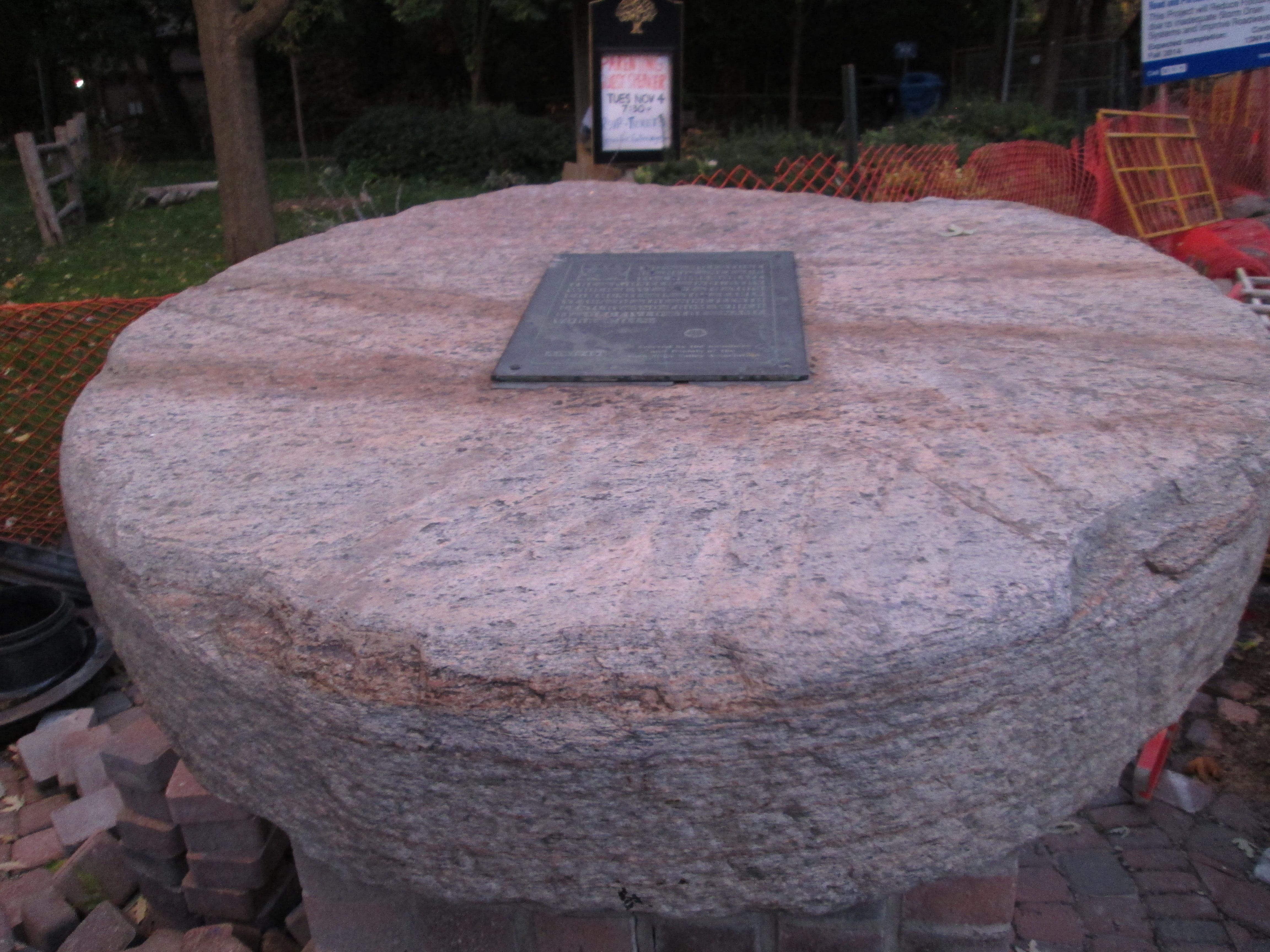
Their position on the waterfront provided easy access to large quantities of grain and so Gooderham decided to use some of it to make whiskey. The distillery began in 1837 and being an entrepreneur, Gooderham began selling the spent grain wash to local farmers as feed. Over the next four years he set up 9 acres of cattle sheds on the east side of Trinity Street and started a dairy operation as well. The company kept fantastic records and appreciated their own history and so they retained the original millstone that was shipped from England in 1832 and used at the windmill.

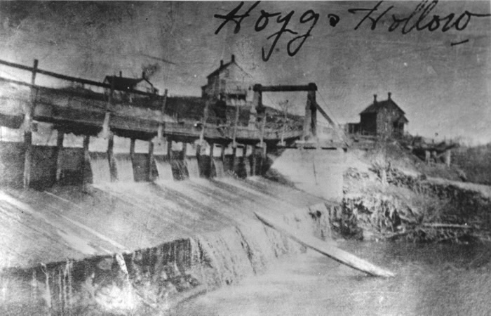
The Toronto Archives photo below shows the distillery as it appeared in the 1890’s on a post card. It gives an idea of the scope of the enterprise that developed from that humble beginning with a windmill and a millstone.

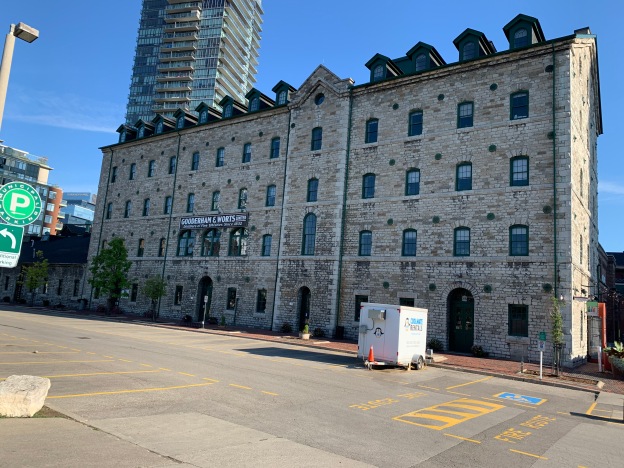
In April of 1859 work started on the first wave of expansion for the company. They began to build the most ambitious industrial building in the city, up to that time. Built of Kingston limestone it is 80 feet wide and 300 feet long. One half is five stories high to contain the mill while the west end is a story and a half and contained the distillery. Working with lanterns in a dusty environment creates a serious fire hazard and many grist mills burned down because of it. Gooderham has his constructed to be fire proof and when it burned in 1869 only the interior was lost. This was quickly rebuilt and it is said that the grain that fell from the upper floors protected the milling equipment below and saved it from burning. The cover photo shows the south side of the building which originally faced the Grand Trunk Railroad Tracks.

The Boiler House is known as building number two and it is attached to the north side of the mill. It was originally a single story limestone building but it has been radically altered overt the years. When the boilers were upgraded in the 1880’s the limestone wall was removed to accommodate the equipment and was replaced with the present brick structure. Just behind the smoke stack is building number four which was part of a major expansion in 1863. The boiler house was using 30 tons of coal per day to fire the 100 horsepower engine in the mill. The ashes from all this coal were taken and spread around the neighbourhood streets leading to some of the best packed streets in the young city.

Several buildings were added to the north of the mill and west of Trinity Street in 1863 including new offices, cooperage buildings and the four story rectifying house for the purification of alcohol. The modest offices pictured below served the growing business until they were replaced with a new office building on Wellington Street in 1892 known as the Flatiron Building.

David Roberts Sr. was the architect for most of the early buildings in the compound while his son oversaw the construction of the later ones. They were also responsible for designing several Gooderham family homes as well as the Flatiron Building. Although the buildings served a utilitarian manufacturing function, Roberts made sure to include some purely aesthetic features. Most of the brick buildings were set on limestone foundations so they would tie in visually with the stone mill. The Rectifying House still has its decorative cupola and patterned brickwork. This design is known as “arcaded corbelling” with a saw-tooth surmount.

In the 1870’s another round of expansion took place. The cattle sheds on the east side of Trinity Street were torn down and replaced with new ones on the east side of The Don River. The Pure Spirits building, tank houses and store houses were built on their former site. The Still Houses featured in the picture below were used to adjust the proof level of the spirits to ensure a consistent 40% alcohol.

A dozen Tank Houses were added throughout the 1880’s for the storage of copper tanks of whiskey and later some were converted to hold up to 5,000 barrels per building.

Tankhouse Lane runs from Cherry Street to Trinity Street and is lined on both sides by these storage buildings.

A shipping building was added in 1883 to store cases and barrels of whiskey that were ready for distribution to the markets.

Meanwhile, the cattle sheds continued to function across the river and fifty years of disposing of the manure into Ashbridges Bay had contaminated it to the point where it was decided to fill it in and it was turned into The Port Lands. During the First World War the company converted to producing acetone for the military under the name British Acetone. The picture below is from the Toronto Archives and is dated November 30, 1916.

After the war was finished the temperance movement succeeded in implementing Prohibition. The company survived by distilling whiskey for export, although much of it passed through Quebec where it was legal and back into Ontario. In 1927 the business was sold to Hiram Walker and continued to operate in a lesser fashion until the complex was closed in 1990.

The entrance to the Rectifying House was deliberately made grand to allow light into the interior of the building but it also has some awesome woodwork. Two wooden arches support a circular oculi. The original windmill was removed after the factory was converted to steam power and the site partially built over with the Rectifying House. The semicircle of brighter red bricks in the lower corner of this picture marks the site of the windmill that started the enterprise.

Rather than being turned into a museum like Black Creek Pioneer Village the site has been developed into The Distillery District which preserves the heritage in a unique way. The factory buildings are full of interesting shops and activities that bring new life to one of the most complete Victorian Industrial Complexes in Canada. The map below provides some insight into what awaits visitors to the area.

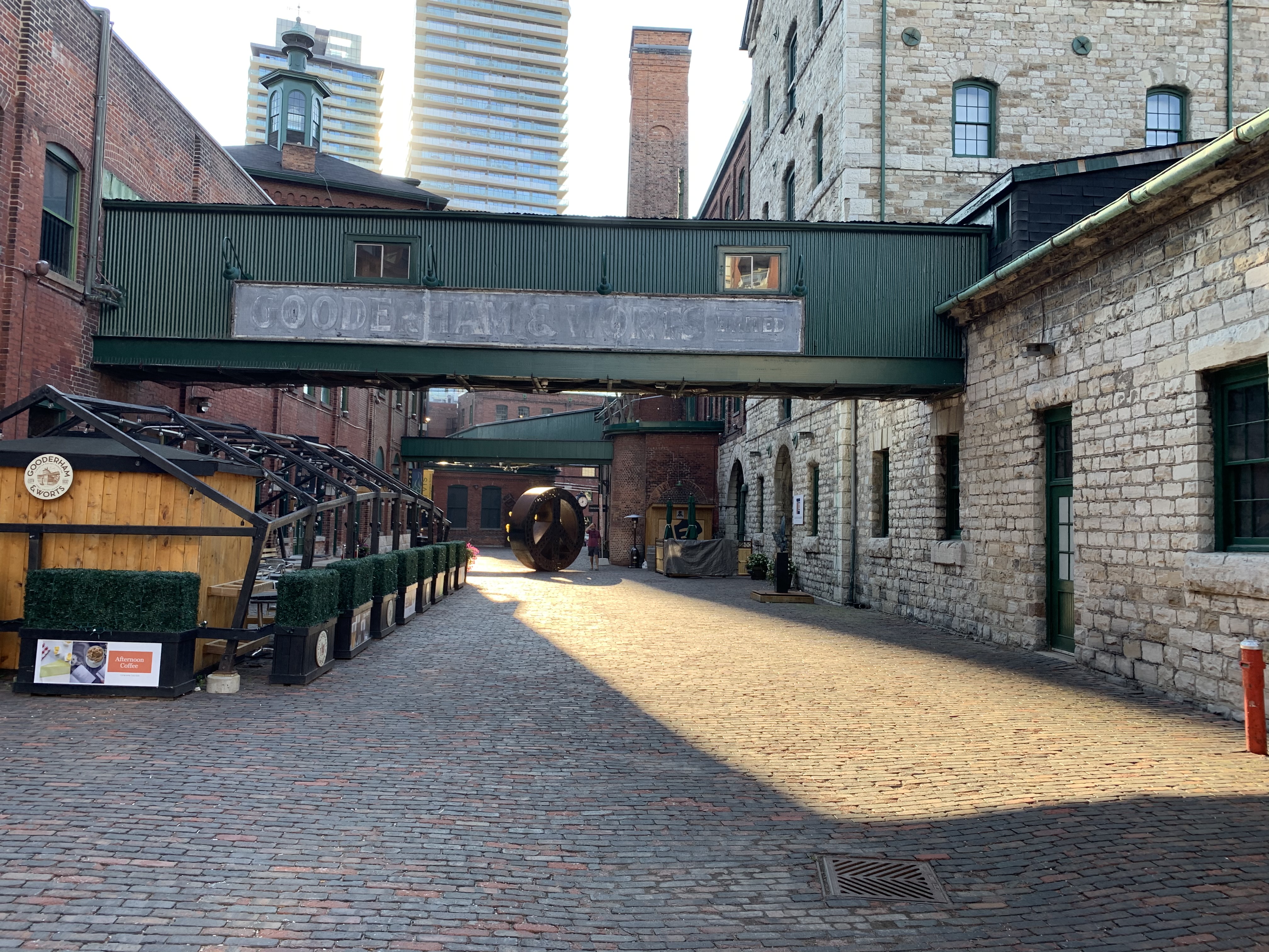
The view below looks east along Gristmill Lane with the Stone Mill on the right and the chimney for the boiler room in the background. The Coopers Shops and Rectifying House are on the left.
This is one historic site that definitely needs another visit when I can go into the buildings and look around.
Just across Cherry Street stands the Palace Street School which was built in 1859 and served the children of many distillery workers.
Google Maps Link: Distillery District
Like us at http://www.facebook.com/hikingthegta
Follow us at http://www.hikingthegra.com
Look for us on Instagram