Saturday, Oct 18, 2014
When Yonge Street was cut through the forest by The Queen’s Rangers in 1796 it opened up the area for settlement. Small towns formed at almost every intersection. An intersection such as Yonge Street and York Mills Road where a river passed through with good mill sites was assured of attracting industry. This area is known as York Mills after it’s post office but is also well known as Hoggs Hollow.
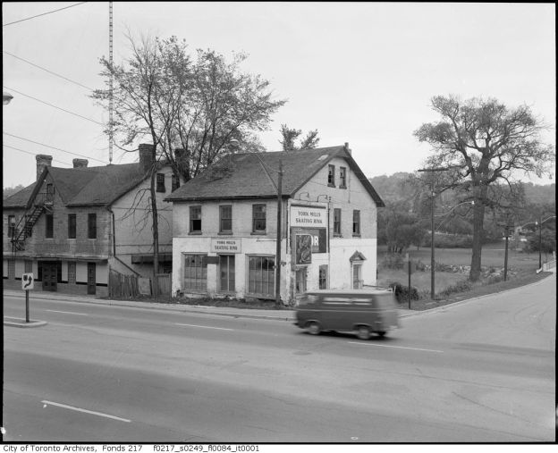
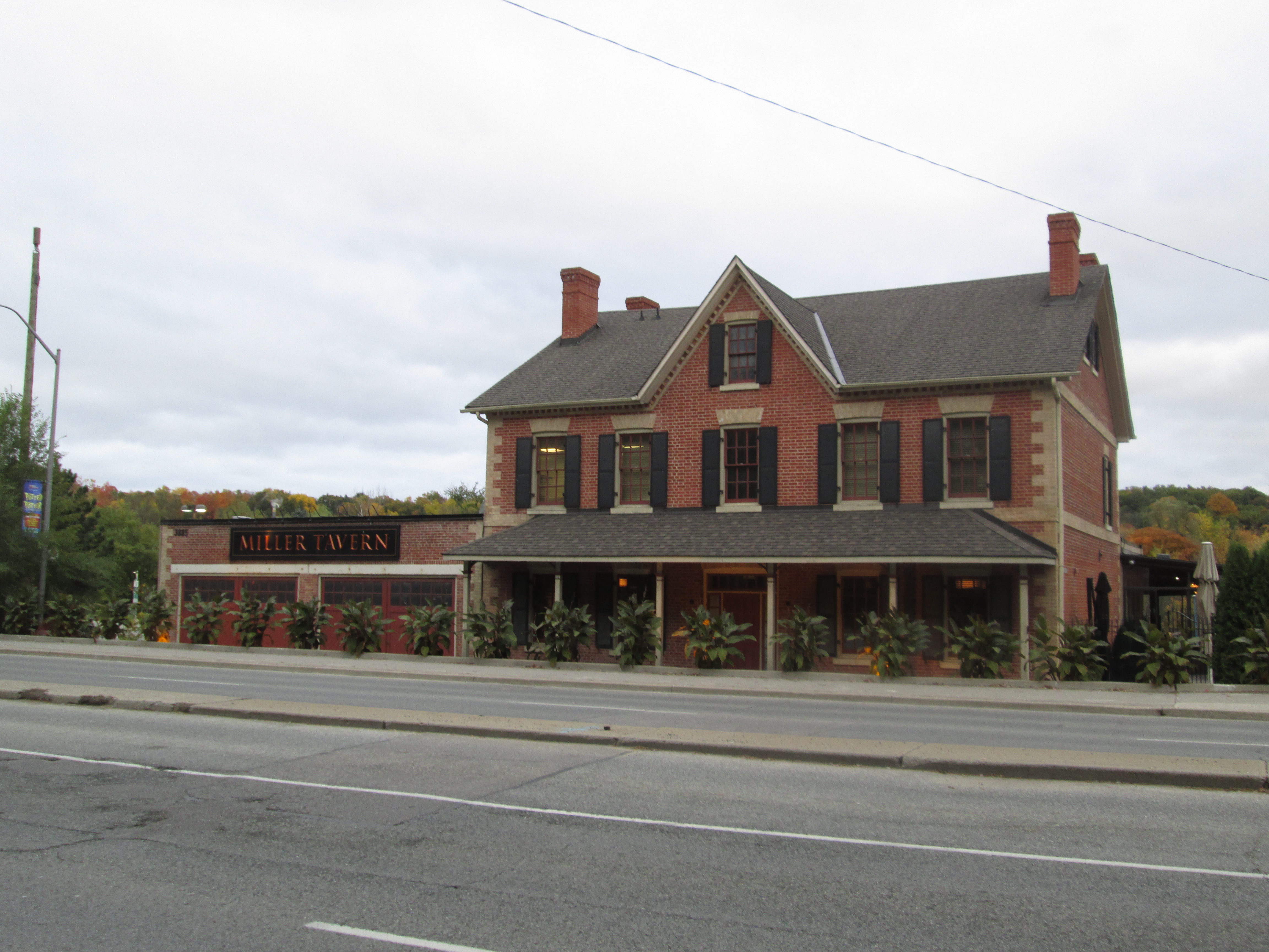
I parked on Mill St. in the parking lot on the east side of the West Don River. It was overcast and 7 degrees. The first mill was opened as early as 1804 by Samuel Heron. Millford Mills was opened in 1817 and supplied the first name to the town. This mill was bought by James Hogg in 1824. In 1856 a subdivision plan was developed for Hoggs property by his sons which was to be called Hoggs Hollow. Only a few houses were built at this time and the lots were not all built upon for over 100 years. James Hogg built the York Mills Hotel in 1857 and it is one of only half a dozen remaining original buildings in the community. Having changed hands many times, today it serves as the Miller Tavern. Hogg added a general store beside it on the south. He also had a tannery and a distillery. The general store served for awhile as a change room for skaters using the York Mills Skating Rink which was formed each winter on the site of today’s parking lot. The cover photo shows the tavern and the general store, turned change room, as it appeared in the 1950’s. Today the tavern has been restored to it’s original brickwork and the old store is gone, having been destroyed by fire.
The York Mills Presbyterian church was built on the east side of Yonge Street on land provided by James Hogg. When the family developed the subdivision plan the church was moved across the street on the hill side, directly opposite of the tavern. The church was closed and demolished in 1889 and the cemetery was eventually forgotten. It was rediscovered in 1955 when the area was being developed for residential use. Twenty five graves were uncovered with two of them belonging to members of the Hogg family. A historical plaque marks the spot today. In the 1877 Historical Atlas the church is marked by “Pres” right below the name York Mills. Their cemetery is marked with an asterisk just above it. Too bad no one checked the old map before they dug.

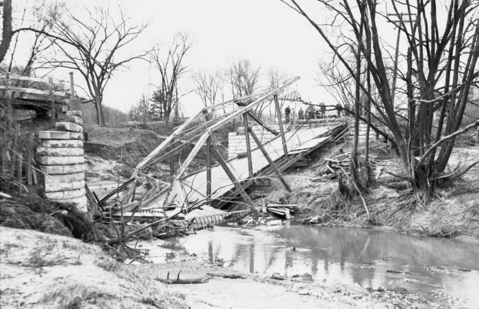
The Yonge Street bridge in Hoggs Hollow was destroyed in 1954 during Hurricane Hazel and was replaced with a wider one a year later. The archive photo below shows the bridge following the hurricane.
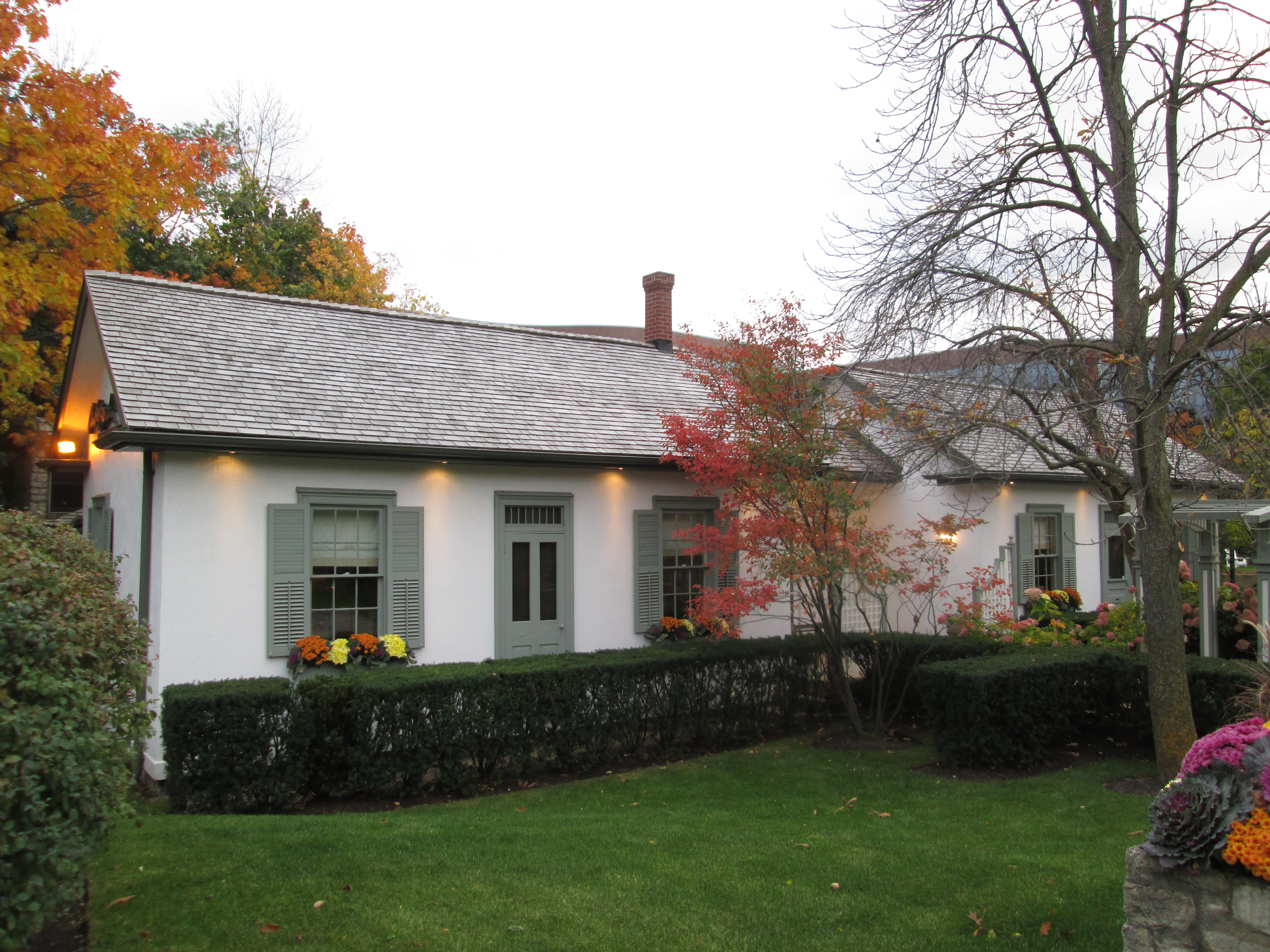
North of York Mills Road are two of only three mill worker cabins that were built in the Hoggs Hollow subdivision. They have been preserved and moved to their current location on Yonge Street where they guard the entrance to a fancy restaurant. Ironically, it is a place the original inhabitants of these homes likely couldn’t have afforded to eat at.
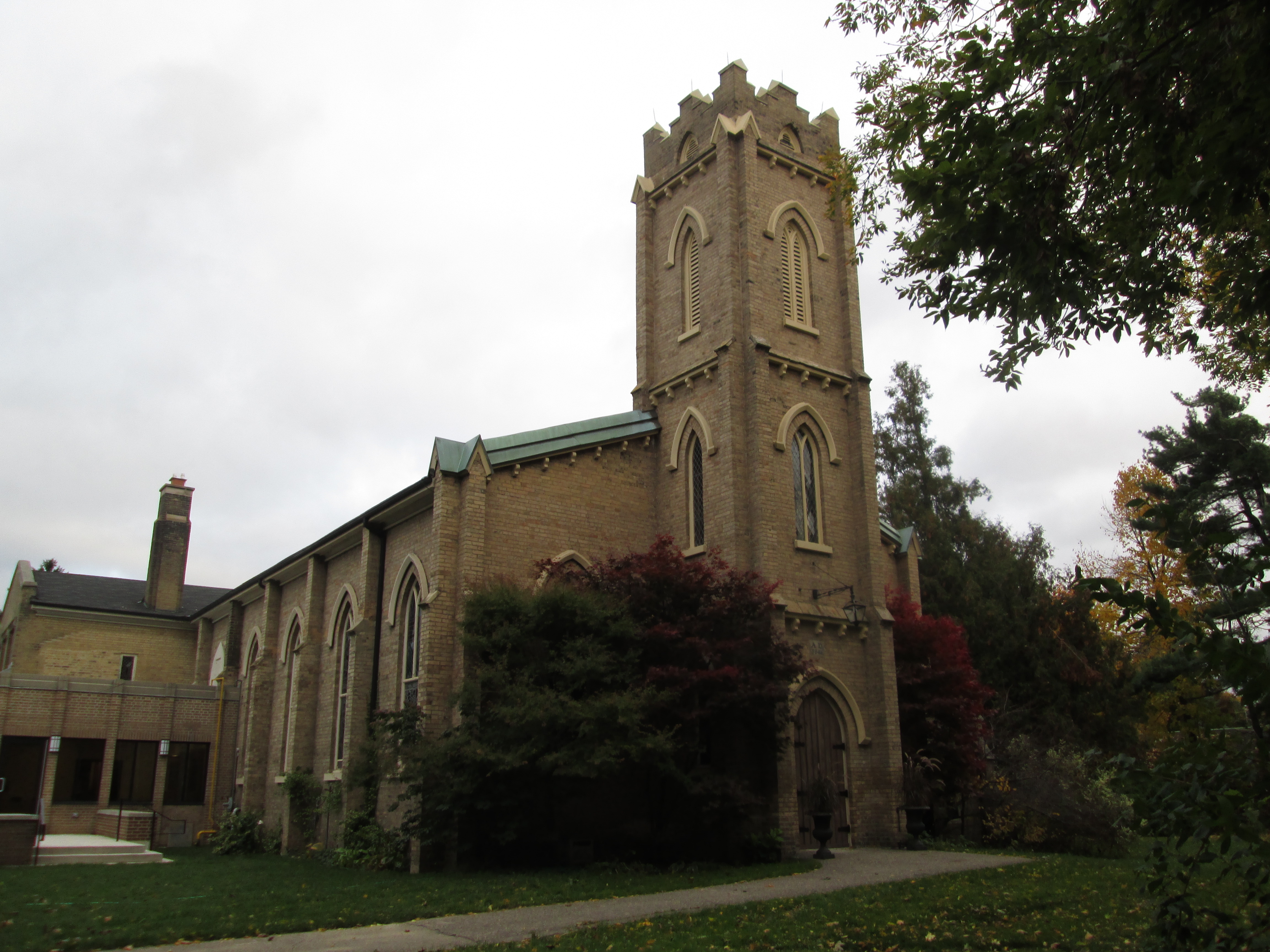
On the east side of Yonge just north of York Mills Road is the old walkway up the side of the hill to St. John’s Anglican Church. The church was started in 1816 and the present building was erected in 1843. The church has the only active cemetery in York Mills and there are many prominent early settlers buried there. I saw one grave marker dated 1820. This church is marked as EC in the historical atlas for England Church and an asterisk marks the grave yard.
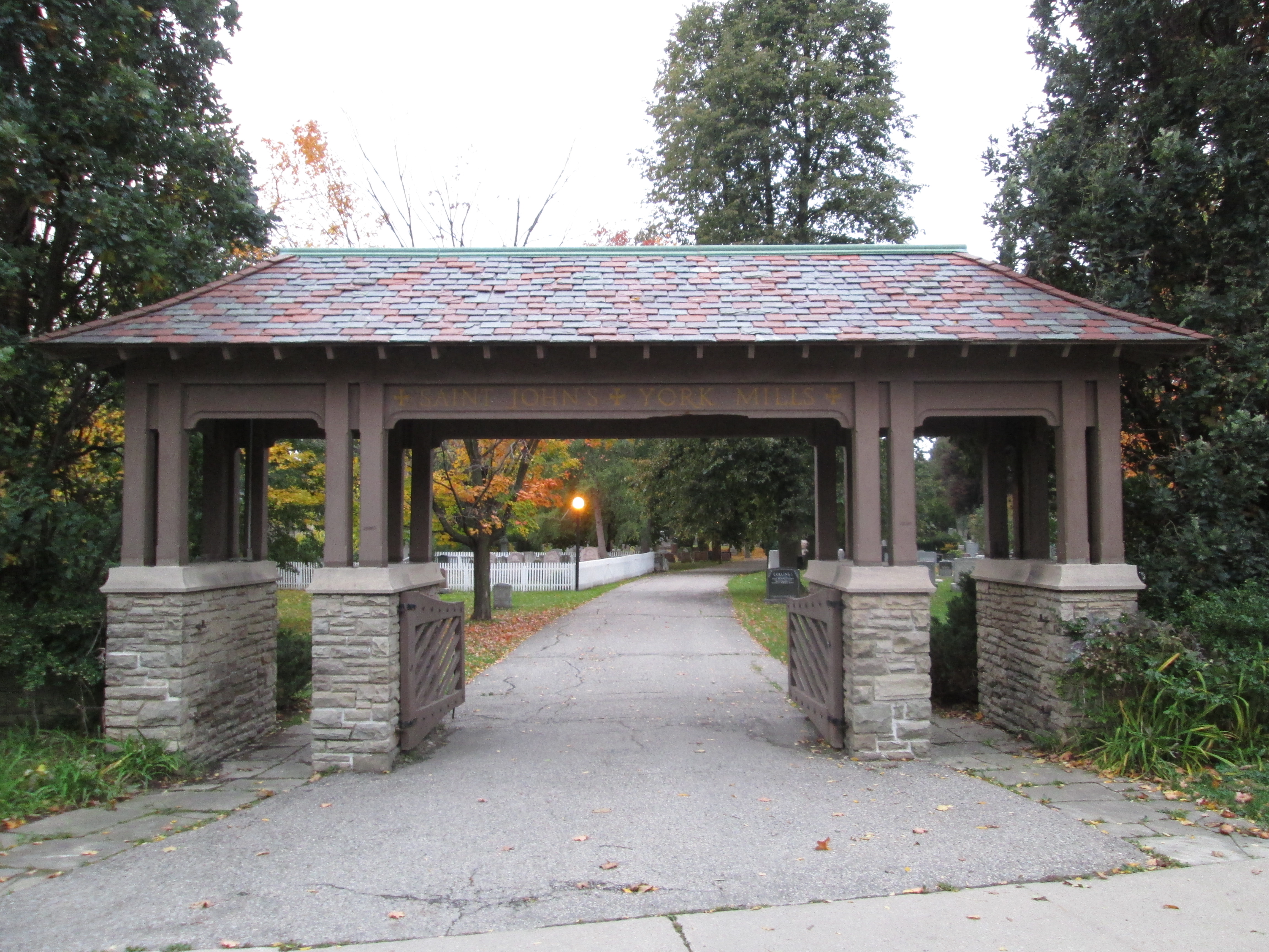
Walking through the cemetery brings you to the Lychgate. A lychgate is a roofed gate found on traditional English churchyards. The word lych come from the Saxon word for corpse. The corpse would rest under this roof while part of the service was read before advancing into the grave yard for burial.
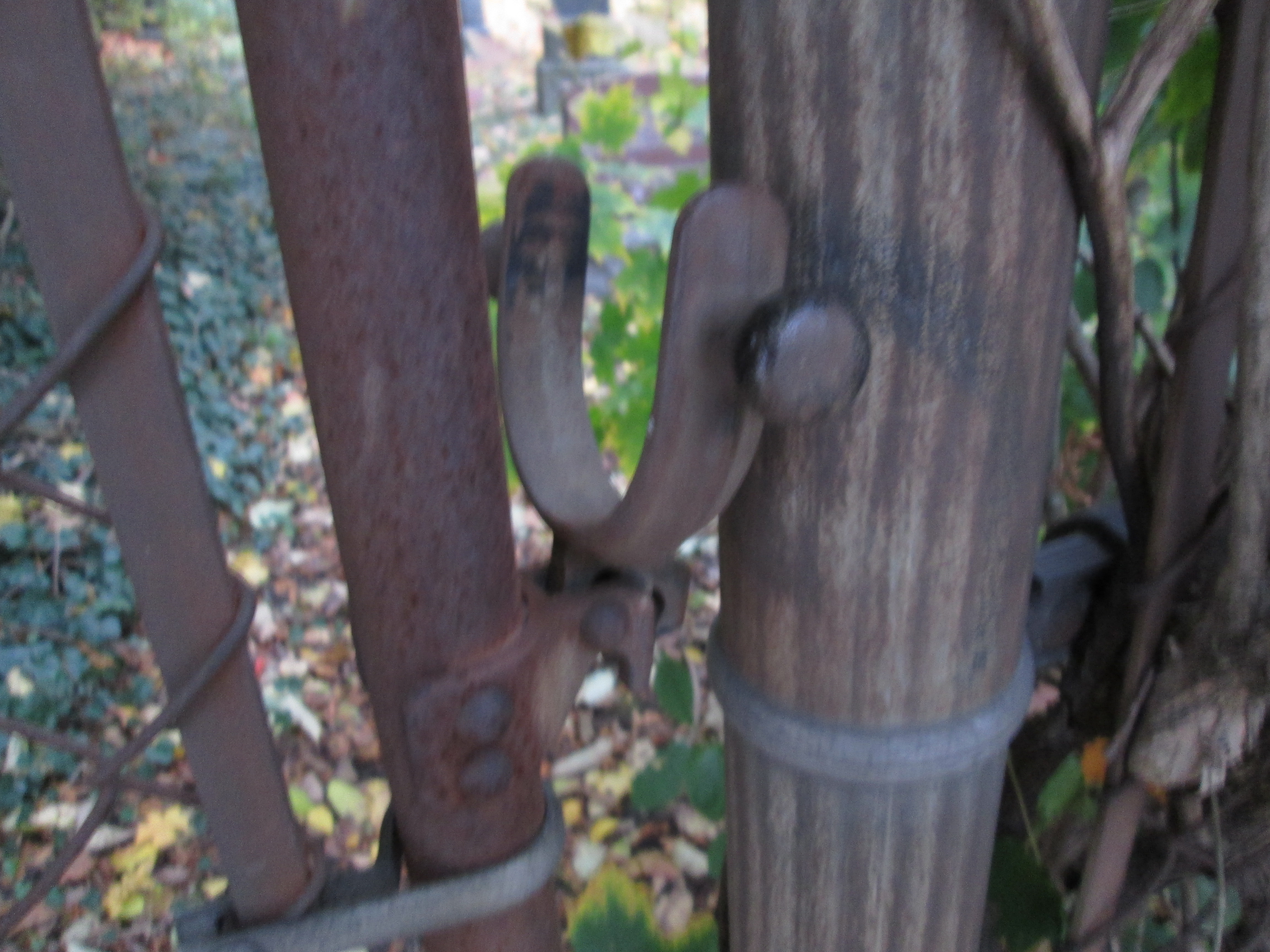
When Yonge street was built in 1796 it was thought that the valley was too steep and so the old road runs across the eastern rim of the valley. When Yonge Street was straightened a few years later this became known as Old Yonge Street. Turning to the right will bring you back to York Mills road. Just to the east is the former site of the York Mills Baptist Church erected in 1833. The church was closed in 1945 and demolished in 1948. The cemetery was just to the east of the church and it remains today, tucked in a small lot behind a hedge. The church is marked as BC in the atlas and has the usual asterisk to mark the graveyard. The gate has a unique old latch that drops over the gate post.
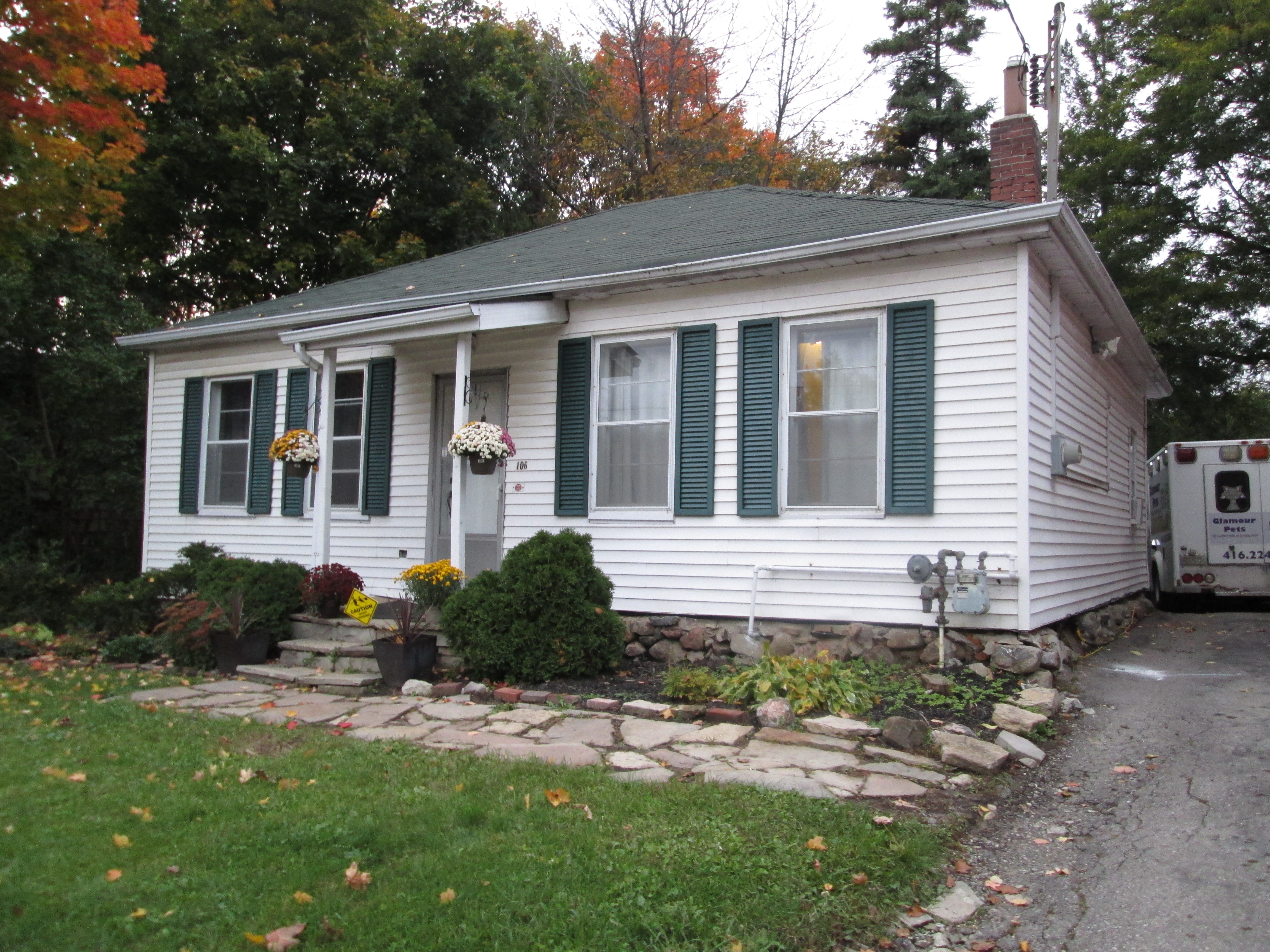
The church built a manse for their pastor’s family in 1840 on the lot to the east of the cemetery.
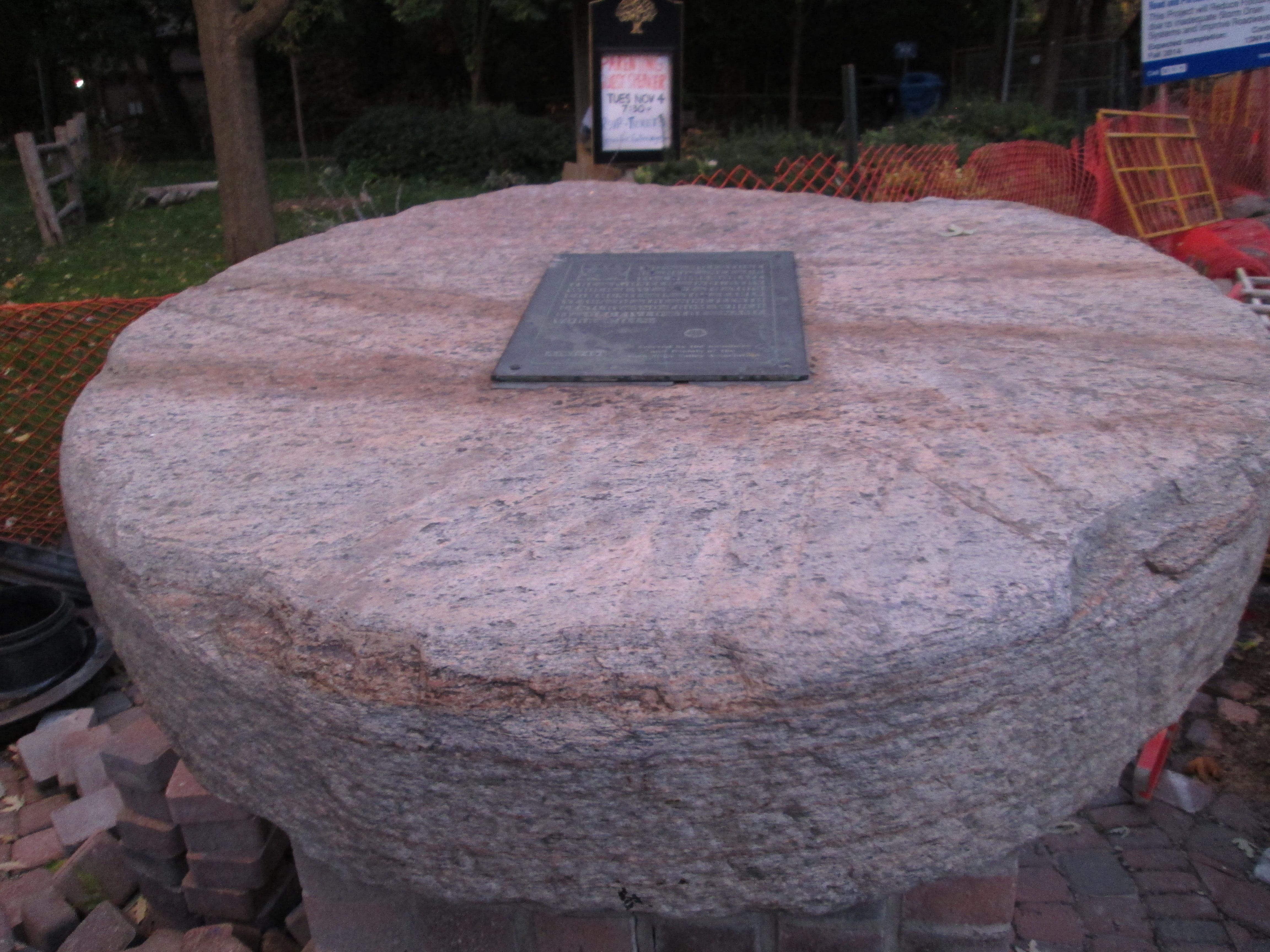
Returning to Old Yonge Street you can follow it back to Mill Street where the name changes to Donino street. A couple of short blocks later is a memorial to the towns milling past. The grinding wheel from the last mill to close in the valley (1926) is preserved here.
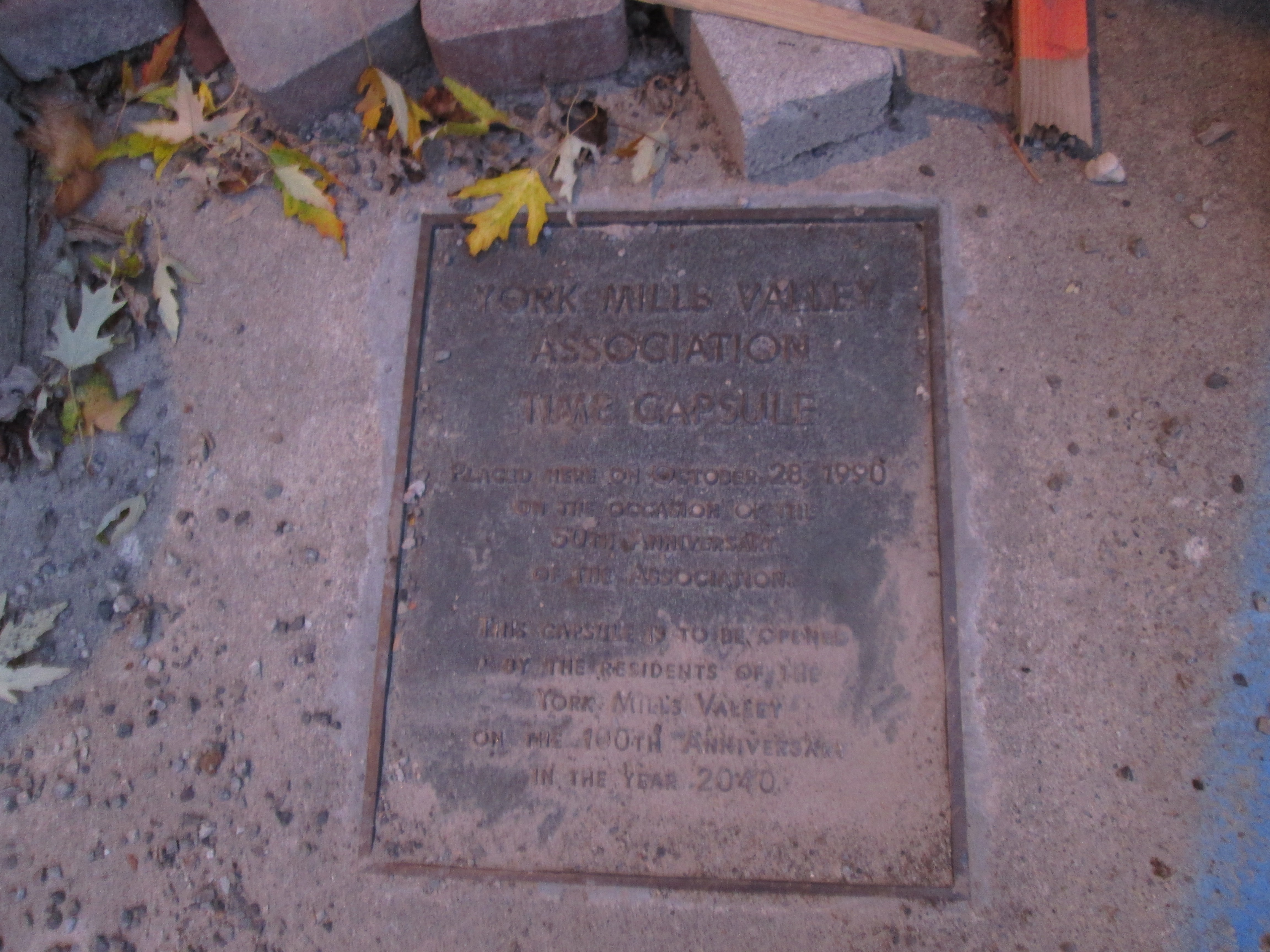
A time capsule has also been buried in the parkette. It is set to be opened in 2040.
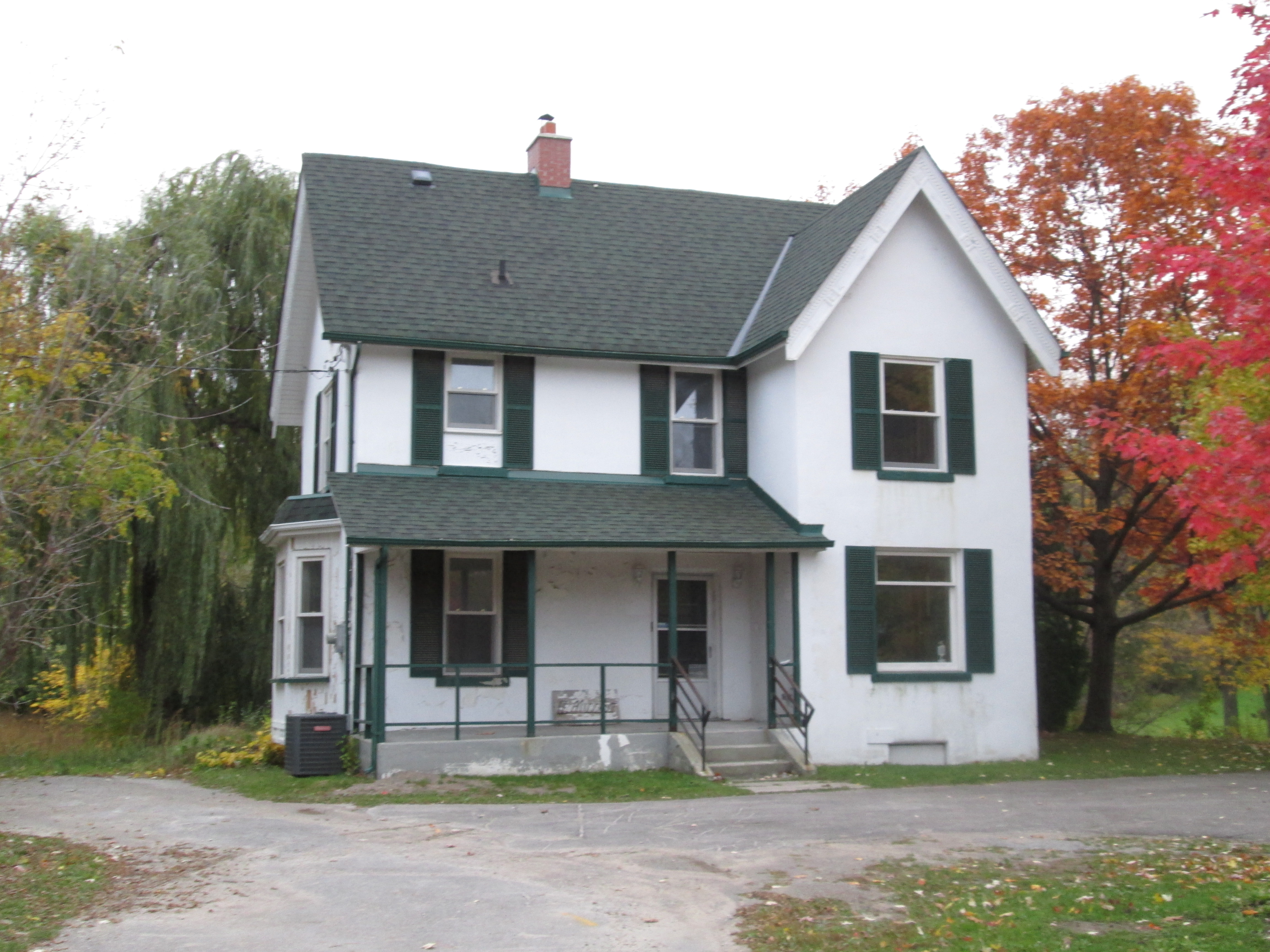
As you return to the car you reach the house of George Pratt. George ran a mill in the area of York Mills park. He built this house in 1886.
The old mill dam is almost under the Mill Street bridge.
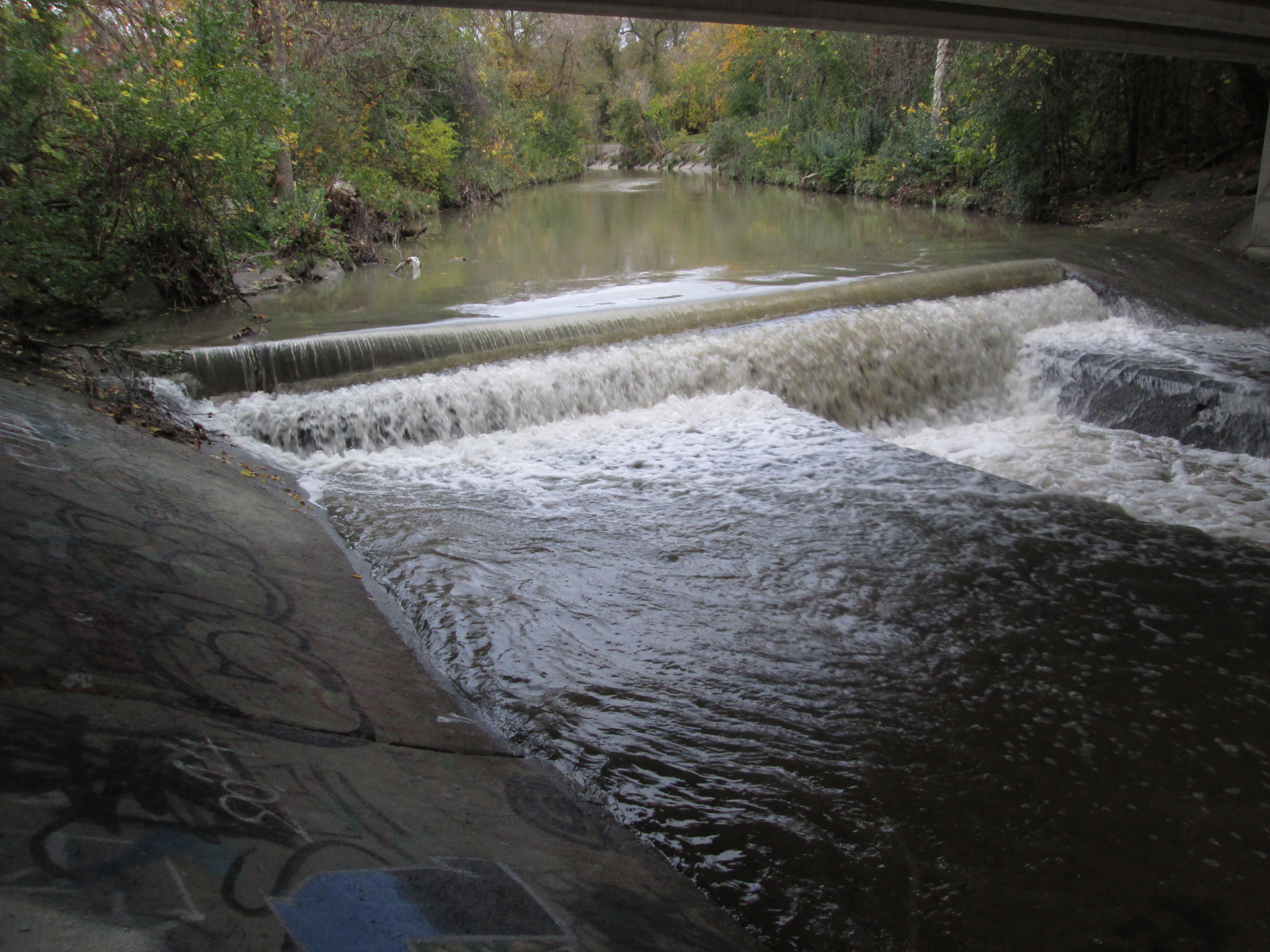
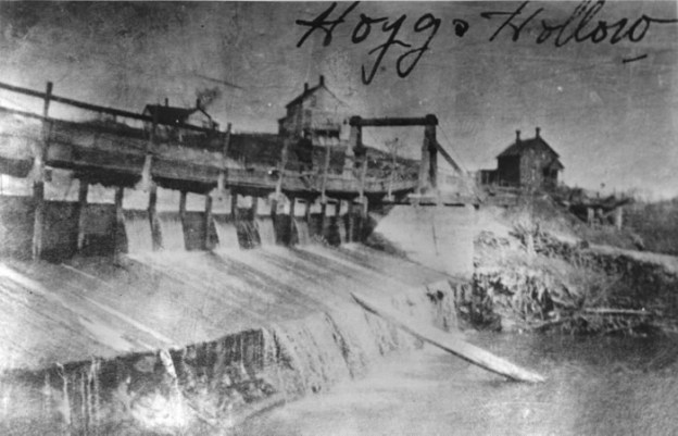
Old photos show a large wooden dam in Hoggs Hollow.
Like us at http://www.facebook.com/hikingthegta

Pingback: Gore and Vaughan Plank Road | Hiking the GTA
This was a wonderful read. The Miller tavern was once called “The Jolly Miller” if I am not mistaken. It had an outdoor skating rink and a place to change skates and get a warm cocoa for the kids. My dad used to drop my sister and I there to skate on Friday nights. Music blared from the outdoor loud speakers. ie “Smoke Gets in Your Eyes” the Platters and other popular songs of the 1950’s while we skated round and round.
Never thought of it at the time but perhaps many parents used it as babysitting while they went for a drink at the tavern.
Brings back fond memories.
In college it became a popular bar “the Algonquin” for the young crowd.
I lived in Willowdale in the 1950’s and the only Algonquin Tavern I knew of in the 50’s was located approximately at the the south west corner of Cummer and Younge Street. I believe this was torn down in the late 60’s or early 70’s to make way for Newtonbrook Plaza.
It was not the Algonquin in the 50’s. That was when it was the Jolly Miller. It was the Algonquin in the late 60’s early 70’s.
Yes, that’s the Algonquin I knew too. RIP Mr. Wilf Crump with whom my friend and I had an interesting conversation about his “war years” in the early 1970s while enjoying 20-cent (maybe 25-cent by then!) draft beer.
Old Yonge Street follows the west rim of the valley.
Old Yonge Street is on the east side of Yonge Street and I believe also on the east rim of the valley. Yonge Blvd is on the west rim of the valley.
very nice to read I could just keep reading all night I like things like this
My friends and I would skate in the parking lot of the Jolly Miller! I don’t believe that the Jolly Miller was ever known as the Algonquin Tavern which was located at the east side of Yonge & Cummer It was still there in the early to mid 70’s when I hung out at the Big A!
A little trivia – behind Miller Tavern is the only right-angled intersection in the city where 4 different streets meet: Mill, Brookfield, Donino, Old Yonge
Pingback: Ghost Towns of Toronto | Hiking the GTA
Fond memories of skating at the Jolly Miller rink! There was a delightful old fashioned stove in the changing room to keep skaters warm.
What a great read. I grew up here and didn’t know most of this history. Skated on the rink and hung out with friends later at Jolly Miller, have met up with old friends at the renovated Millet Tavern. Lots of wonderful memories. Thanks for sharing this.
Anyone remember the wall of cartoon art in the upper Jolly Miller Tavern room? It was drawn by the fellow named Niblock who grew up on the west side of Yonge St. near Yonge Blvd.
I really enjoyed your well researched article. I had to do a piece of original research on any town/village I wanted to. I chose York Mills. I found it very difficult to find any information on it