Monthly Archives: June 2019

Western Counties Occupational Centre

Friday, June 14, 2019

This post is part two of a road trip out of the GTA and down the 401 to London.  While in the city we took the time to visit the abandoned London Asylum for the Insane.  From there we went to investigate the trails and abandoned buildings around the kettle lakes known as Westminster Ponds.

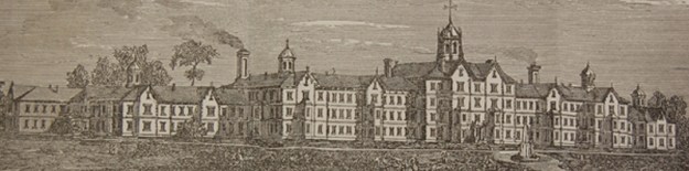
There are five kettle ponds, a beaver pond and several smaller ponds in the conservation area that were formed when the last ice age retreated about 12,000 years ago.  They were formed when chunks of ice broke off of the glacier and were buried in till.  When they melted it left the holes that have filled up to become Westminster Ponds.  Several archaeological digs have been held around the ponds where evidence of first nations camp sites date back over 4,500 years.  European settlers arrived in 1815 and started to clear the land for agriculture.  In 1910 the first section of the park was acquired for conservation and it has been added to several times since.  In 1920 Westminster Hospital was established nearby for the treatment of mental and nervous casualties of the First World War.  In 1940 the federal government purchased an additional 418 acres of land to expand the hospital.

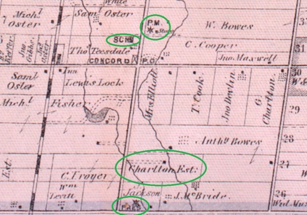
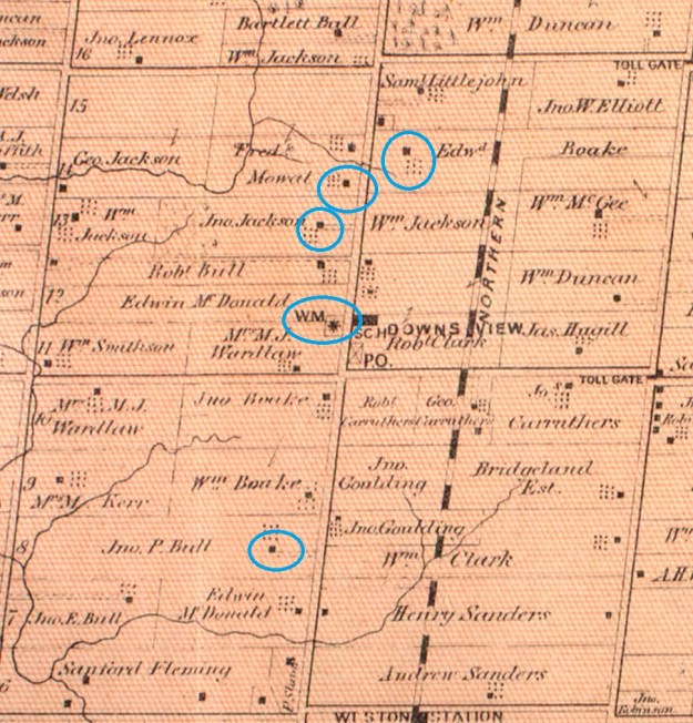
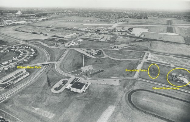
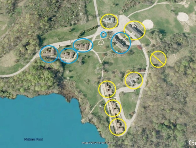
The capture below is from Google Earth in 2004 and shows the relative locations of the various buildings at the Western Counties Occupational Centre.  The ones circled in blue are still on site while the ones in yellow have been demolished.  The yellow circle with the slash through it indicates the site of the one building that had already been removed in the late 1990’s.

Westminster 2004

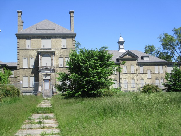
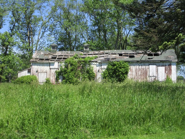
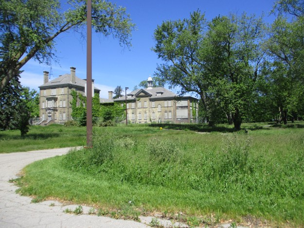
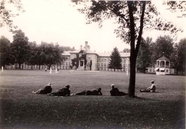
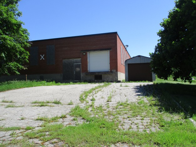
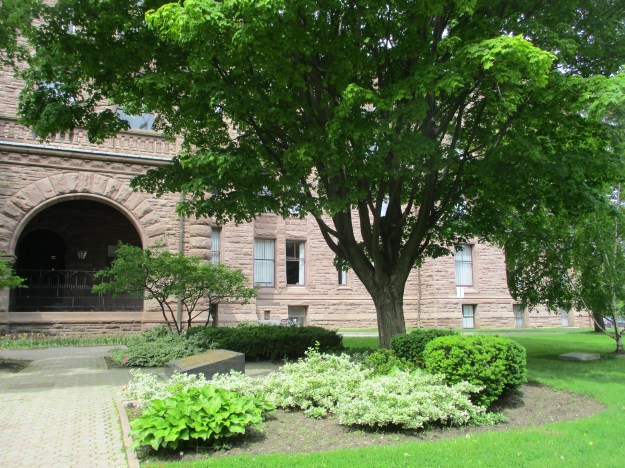
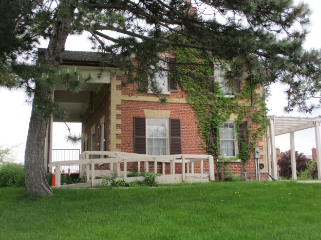
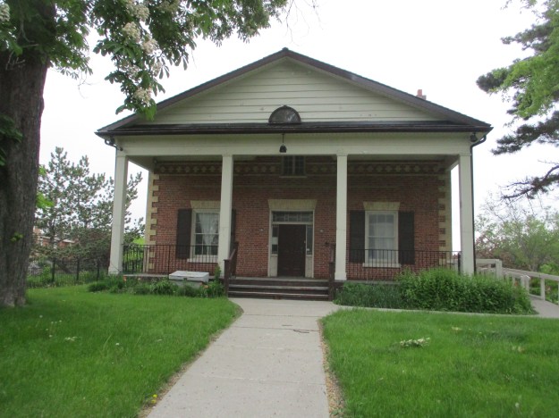
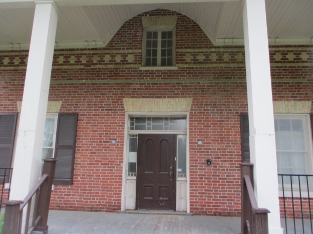
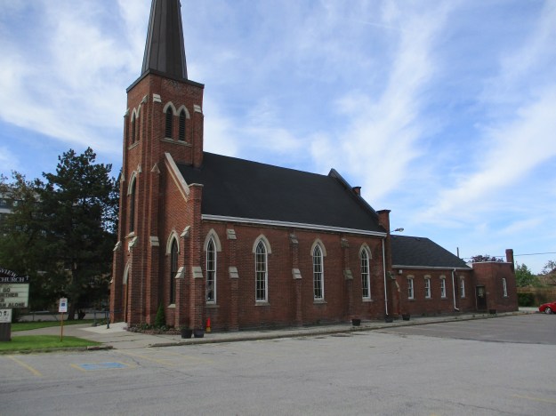
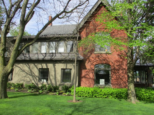
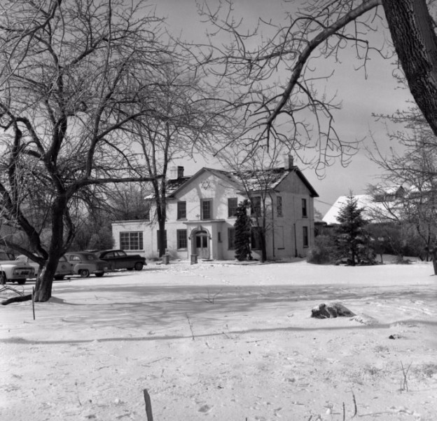
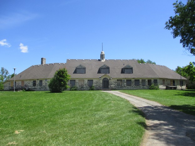
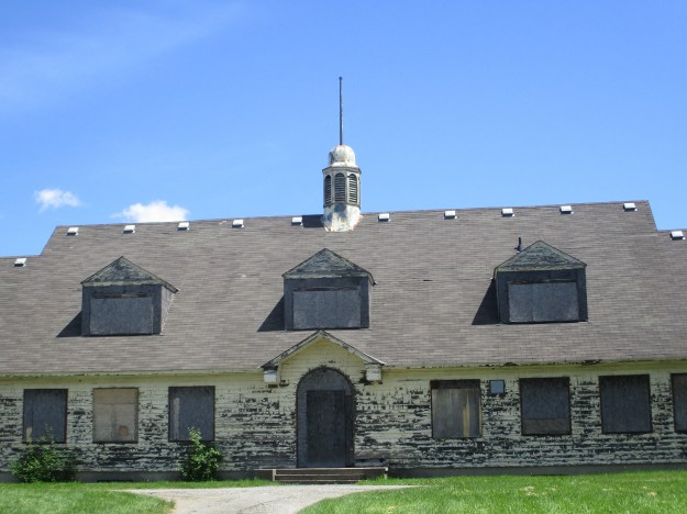
In 1946 the Department of Veterans Affairs opened a rehab facility for soldiers returning from the Second World War.  Originally the centre was home to 6 patients but quickly reached the maximum of 196.  The Western Counties Occupational Centre had eleven buildings, each named after one of the counties in South Western Ontario.  Of these, four were demolished by the City of London and three others by the Westminster Hospital.  The Wellington Pavilion is seen in the cover photo and is currently vacant.  Running west from there you have the Perth, Huron and Bruce Pavilions.  The Huron Pavilion is shown below.  It has been re-purposed into The Secrets of Radar Museum.

IMG_4046

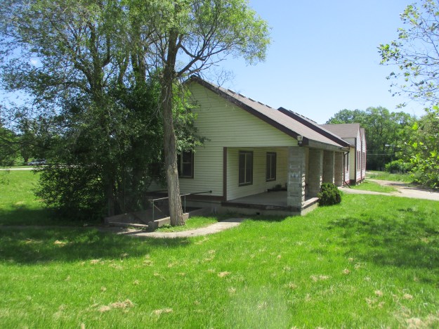
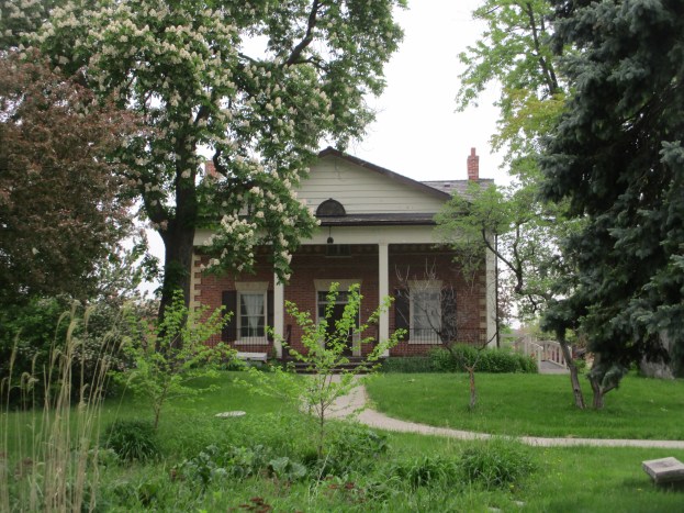
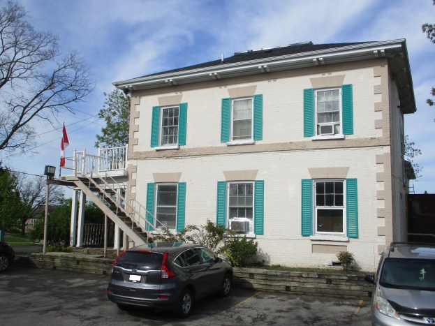
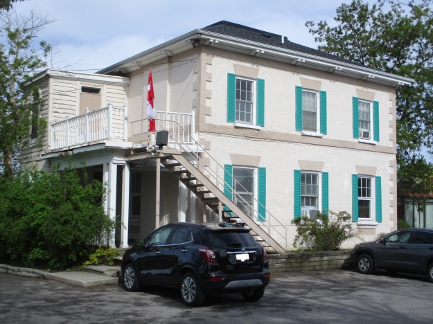
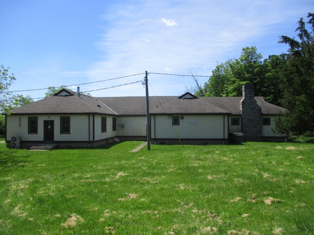
The Wellington Pavilion can be seen in the cover photo and is the only non-dormitory building that is left in the compound.  It was built as the administration building and has two floors and a basement.  The two wings are set at an angle to the building and single story construction.  The cupola is still in the middle of the roof but the columns have been removed from the front door and placed into storage.  In 1984 funding was secured for a new Veterans Wing and this marked the end of the facility.  Within five years all the patients were transferred away and the first demolition began.

IMG_4050

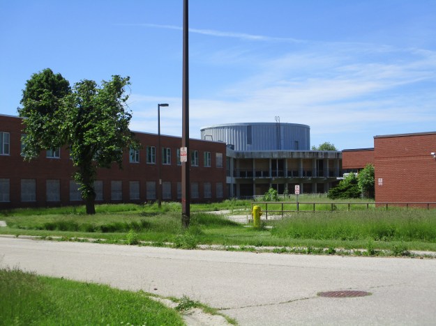
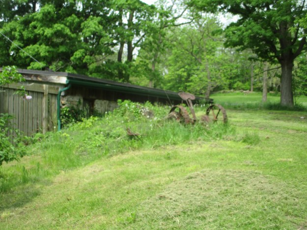
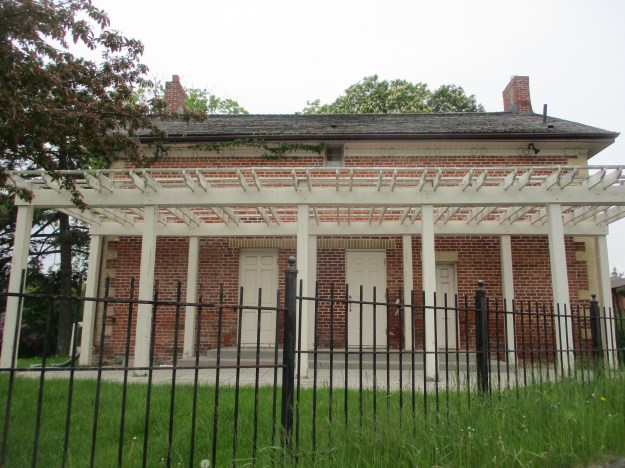
The four pavilions on city land were demolished and the basements filled in with soil.  The ground inside the concrete outline of the building was then seeded with clover.  The chimney was removed from one of the buildings but the other three were reduced to 8 feet tall and capped off.  Steel grates were installed in the front of the fireplace for safety.  One of the demolished buildings that was on the hospital property had an indoor swimming pool and another housed a print shop for training purposes.  These have been removed without a trace being left behind.  Another of the buildings had a bowling lane in the basement but this has been filled in.

IMG_4089

This picture shows the back of one of the remaining pavilions and you can see the comparison with the previous photo showing just the outline of the building on the ground.

IMG_4045

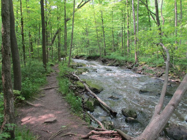
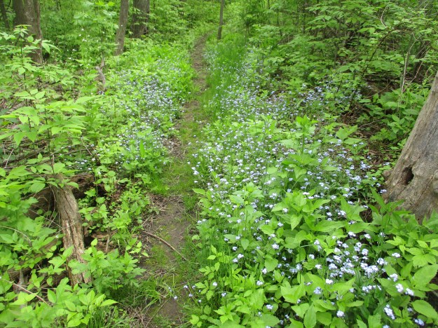
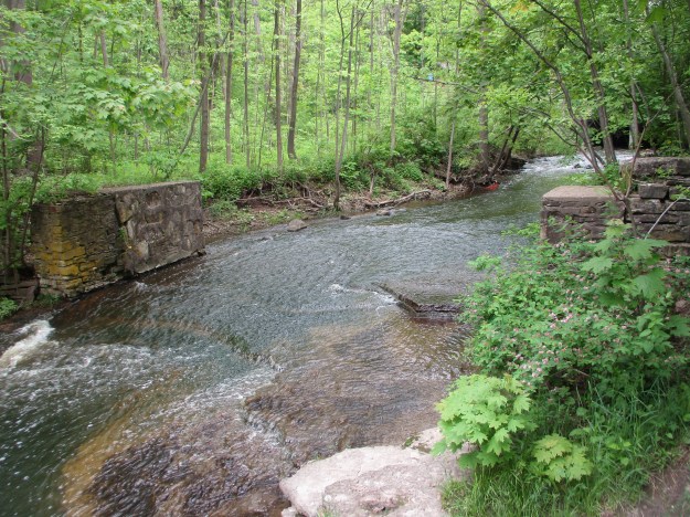
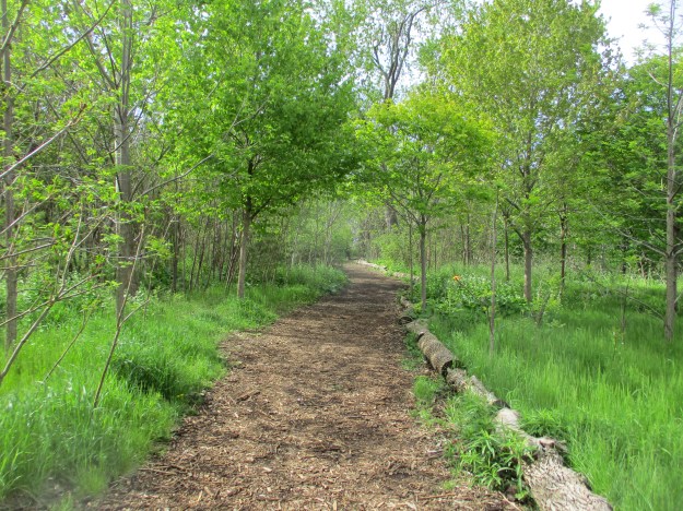
Most of the trails in the park are packed earth but there are several places where boardwalks carry the trail through a wetland.  There are over ten kilometres of walking trails in the park but they are all marked with yellow slashes.  They intersect with other yellow trails and it is quite easy to become disoriented.

IMG_4066

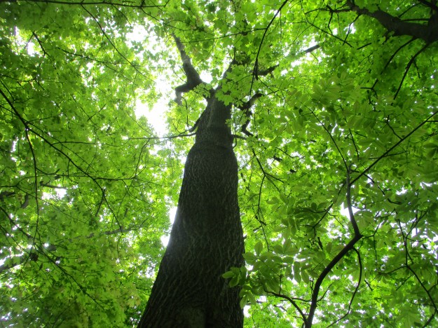
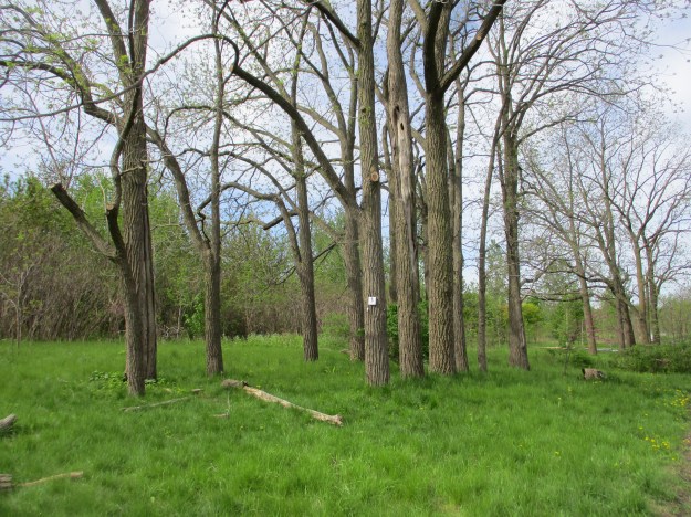
Several trees along the trails have been tagged as heritage trees and are protected.

IMG_4058

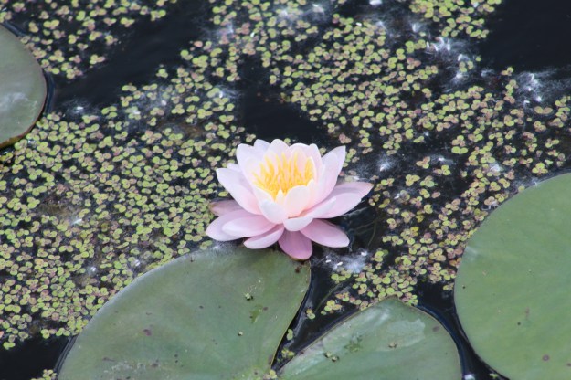
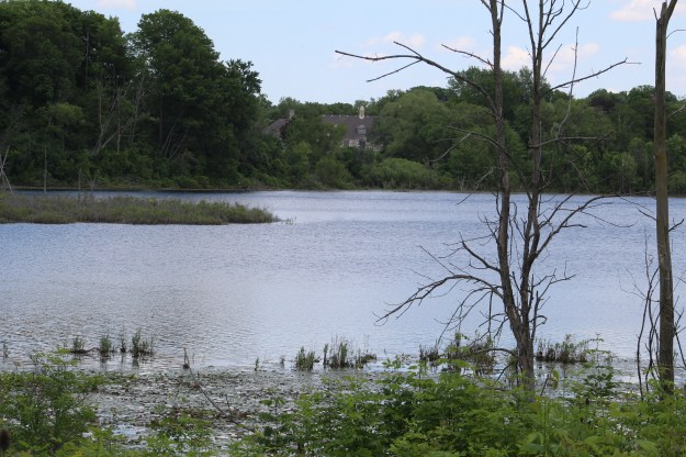
Saunders Pond has become overgrown with algae and water lilies.  The water lilies on the pond are primarily white with a few pink flowers scattered throughout.

IMG_4689

The Wellington Pavilion can be seen from across Saunders Pond.  Before the trees were allowed to grow each one of the pavilions had a clear view of the pond.  This was to be part of the therapy that was being provided to the recovering soldiers.

IMG_4680

The Rotary Club of London West has taken an interest in the ESA and has initiated several stewardship programs.  One of these programs included the building of several boardwalks with the donor’s names engraved on the boards.  Some of these boards have a memorial to a person’s life and record the dates of their birth and passing.

IMG_4081

There are several kilometres of trails and at least three kettle lakes yet to be explored in this park.  For those who live in the area this is quite a neat little park in the middle of the city.  Be sure to check out our other London post at this link.  London Asylum for the Insane.

Google Maps Link: Westminster Ponds

Like us at http://www.facebook.com/hikingthegta

Follow us at http://www.hikingthegta.com

London Asylum for the Insane

Friday, June 14, 2019

The 160-acre property that houses the former London Psychiatric hospital has been sold to a local developer for 17 million dollars.  Most of the buildings will likely be demolished with the exception of three historically designated ones.  So, with a Friday off work I decided to go on a road trip outside the GTA and see what is there and get some pictures while they can still be taken.

The original name for the facility was The London Asylum for the Insane when it opened in November of 1870.  The original building had 500 beds and these were filled almost immediately.  In 1928 it was renamed the Ontario Hospital for the Mentally Ill.  It became The London Psychiatric Hospital in 1968.  The Western Archives photo below shows the main building before it was demolished to make way for more modern buildings that stand at the front of the lot today.  The remaining historical buildings are all at the rear of the property.

old-asylum

The original idea for the asylum included various types of therapy.  Natural surroundings were considered ideal to medical recovery in the late Victorian Era.  The hospital also applied various work programs to the patients to help prepare them to be integrated back into society when they were well.  Men worked at farming and gardening while the women were taught sewing.  The wings of the replacement facility extend from a round central hub.  This building was opened in 1968.

IMG_4044

Insanity was a simple diagnosis that could be applied to any socially unacceptable behaviour including masturbation, depression or senility.  Patients were not always treated in ways that we would find acceptable today.  Some of the treatments were considered too much, even in those days.  Between 1895 and 1898 one doctor performed over 200 surgeries on women’s reproductive systems to help try and cure hysteria.  Apparently an hysterectomy would be a suitable cure.  The buildings on the site are a mix of the mid-20th century replacement structures and the original buildings from the 1870’s and 1880’s.

IMG_4638

This building will need to be removed as it appears to have been allowed to deteriorate to the point of self-demolition.

IMG_4030

The redevelopment plan calls for the preservation of the old recreation hall.  Also known as the assembly hall, this building was erected in 1920.

IMG_4031

The infirmary for the asylum is still standing and is also featured in the cover photo.  It was built in 1902.  There is a central administration block and two wards on either side.

IMG_4035

Patients sit on the lawn in front of the infirmary in this historical photo from the Western Archives.

patients-on-the-lawn

The non-denominational chapel on the hospital grounds was built partly using labour from the patients.  It was constructed in 1884 in the Gothic Revival style that was popular for churches in that era.

IMG_4036

The church was known as the Chapel of Hope and was used for thousands of weddings in recent years.  The last wedding was held here on September 30th, 2014.  With the land sold for development it is unclear what the future of the chapel is but is is protected under a heritage designation.

IMG_4635

The modern buildings will likely all be removed in the name of progress and residential, office space and a large component of  park land will replace them.  Several of the older buildings may be incorporated into the development due to their designation as historic structures.

IMG_4634

There are several of these unremarkable building on the site that were built during the 1964 renovation of the property.

IMG_4028

Unfortunately I didn’t get a picture of the stables so it is a good thing that they will be preserved in the redevelopment.  It will be interesting to see what becomes of this piece of property.  In the GTA we had a similar hospital at the Mimico Branch Asylum

Google Maps Link: London Psychiatric Hospital

Like us at http://www.facebook.com/hikingthegta

Follow us at http://www.hikingthegta.com


Queen’s Park

Sunday, June 9, 2019

The land that we know as Queen’s Park actually belongs the The University of Toronto and the name is often used to mean the Ontario Legislative Buildings which occupy the centre of the park.  The City of Toronto has leased the land from the university for 999 years at the rate of $1.00 per year.  The grounds to the north and south of the buildings contain many statues and other historic artifacts as well as providing green space for local residents to enjoy.  The park grounds have also served as a place for peaceful protesting over the years,  I decided to walk around the park and enjoy the statues and information plaques as well as the interesting architecture of the legislative buildings.

King Edward VII ruled from the time of Queen Victoria’s death in 1901 until he died in 1910.  The statue of Edward on his horse was originally located in India but when the Indian Government decided to get rid of symbols of British rule they elected to give it to Toronto.  Edward had visited Toronto in 1860 as the Prince of Wales and had officially opened Queen’s Park.  In 1969 it was installed in the north end of Queen’s Park.  Due to restorations the north end of the park is currently closed except for the major pathways.  It isn’t possible to get close enough to the statue to read the inscriptions.

IMG_4533

The picture below is from the Toronto Archives and shows the building as it looked in 1903.  The three front arches over the main entrance would be featured on the front cover of the album Moving Pictures by Rush.

Parliament Buildings, Queen's Park

When the legislative assembly buildings were designed there was intended to be a clock in the tower on the left side of the main entrance.  The clock turned out to be more expensive than planned and the funding was withdrawn.  The end result was a pair of ornate round windows.

IMG_4558

Sitting on the south lawn of Queen’s Park is a pair of cannons that were captured during the Crimean War.  The war was fought over the rights of the Christian minority in the Holy Lands which was under the control of the Ottoman Empire.  The war lasted from 1853 to 1856 with the British and French supporting the Ottoman Empire against Russia.  The two cannons were sent to Toronto in 1859 as a gift from Queen Victoria.  Many of the captured cannons were melted down to make Victoria Cross medals for heroic soldiers.

IMG_4566

Oliver Mowat was the third premier of Ontario, a position that he held for nearly 24 years.  Mowat was the premier from 1872 until 1896 which included the period of time that the legislative assembly buildings were under construction.  He was the first person to sit as premier in this building.  Mowat was also one of the Fathers of Confederation and as a Liberal was a political rival of Sir John A MacDonald.  This monument has stood near the front entrance since 1905.

IMG_4567

Carvings adorn the building and all sorts of fanciful gargoyles can be found as you walk around the structures.  Some of them are funny, some are lifelike while others are a little on the macabre side of things.  This image shows how painful it can be to have your head eaten by a demon.

IMG_4575

In other cases the faces are very lifelike.  It is speculated that since the stone masons were not allowed to sign their work they may have decided to include an image of themselves.  If this is true then the four faces near the front entrance may reveal the identity of some of the men who spent countless hours carving the tons of stones that make up the building.

IMG_4560

There is also a suggestion that the face on the east side of the building may be a parody of Queen Victoria.

IMG_4589

Carvings of dragons and lions are found all around the exterior of the building.

IMG_4577

On the east lawn of the legislature is a maple tree that was planted on November 14, 1968.  It represents the one billionth forest tree seedling that was distributed from the Ontario Government Nurseries since the program had begun in 1909.  Ontario has provided incentives to farmers to turn their unused lands back into forest.  This is one of the main reasons that you will find fences running through the forest.  They mark previous field divisions.   In 2008 the Ontario Government began a program they called 50 Million Trees which has seen over 27 million trees planted to date.  In reversal of a 110 year history of planting trees, the Ontario Government recently cancelled the 50 Million Tree program.

IMG_4009

Queen’s Park has been used for the provincial seat of government for the Province of Ontario where a beautiful building stands in the middle of a beautiful park in downtown Toronto.  It is certainly an interesting place to wander around.

Google Maps Link: Queen’s Park

Check out our reader selected top 20 stories from the first five years of blogs at this link:

Back Tracks: The First 5 Years

Like us at http://www.facebook.com/hikingthegta

Follow us at http://www.hikingthegta.com

The Bruce Trail – Waterdown

Saturday, June 1, 2019

We had previously visited the falls in Waterdown in the winter and decided to return to see what the summer was like on the local trails.  There is free parking right beside the waterfalls which have gone by several names over the years including The Great Falls, and Grindstone Falls.  Our earlier story featured slackliners walking across the gorge above the falls and we called it Slacking in Smokey Hollow.  We followed Grindstone Creek downstream until we came to the Norman Pearson Side Trail.  This connects to the McNally Side Trail and returns you to the main trail.  There is an additional little side trail called the Upper Grindstone Side Trail that was part of the package.

Image-1 (6)

The Smokey Hollow Side Trail is only 50 metres long and connects the main trail to a viewing platform for Grindstone Falls.  The platform can be seen in the picture below and it provides an interesting view of the crest of the falls.  The Bruce Trail follows Grindstone Creek and has a set of stairs built into the side of the ravine to allow easier descent.  From the bottom a short trail leads back toward the bottom of the falls but be careful, we witnessed a guy showing off for his girlfriend who fell into the creek and got completely soaked.  If he would have been injured he’d have required a complicated rescue.

IMG_0605

From there we followed the main trail along side Grindstone Creek.  This trail gives plenty of great views of the creek as it cascades over the large chunks of dolomite that have been eroded over the past 12,000 years since the last ice age retreated.

IMG_3904

When you reach more level ground you can depart from the main trail onto the Norman Pearson Side Trail.  This 1.4 kilometre blue trail will bring you out to Waterdown Road where you can connect with the McNally Side Trail.  Both of these side trails are marked with blue blazes on the trees.  There’s also a couple of places where the trail is ablaze with blue from forget-me-nots.

IMG_3925

Lily of the valley is a highly poisonous plant that is native to Asia and Europe and has been introduced to North America as a garden plant.  It does well and can grow into large clusters under the right conditions.  The scent of the flower has been imitated for perfume and Kate Middleton carried lily of the valley in her bridal bouquet when she married Prince William.

IMG_3915

The Mayapples are finally in bloom with a single flower on each fertile plant.  These flowers will close up in a few days and begin to develop into the fruit.  The fruit will turn yellow when it ripens later in the summer.

IMG_0604

Near Waterdown there is a Bitternut Hickory tree that is estimated to be 128 years old and has a lifespan of 200 years.  It produces a large amount of very bitter tasting nuts that even the squirrels will only eat during food shortages.  There are 16 Bruce Trail heritage trees that have been identified along the route.  Their GPS locations can be found at this link.

IMG_3922

The properties that the trail runs through are mostly private farms and access is allowed by the good graces of the land owner.  Some of the land grants were poor farming land and have been allowed to return to forest.  Other areas are still operated as family farms, some of them into the fourth and fifth generations.  Many of these farmers still have old farm implements from their father or grandfather.  Somehow the seat on the old plow below doesn’t look very comfortable nor do the steel studded wheels look like they absorb much shock.

IMG_3914

The McNally Side Trail is only 0.48 kilometres long and brings you back to the main trail above Waterdown.  The Upper Grindstone Side Trail follows a lightly used path through a grassy field and back into the forest.  When you come to the little loop you can go left and down to the creek or you can go to the right and climb higher onto the ridge before descending to creek level.  It will then return you to the main trail very near to the parking lot.  Evidence of a former dam at the top of the falls is a reminder of the industrial past of this site.  Hidden among the trees on both sides of the creek are other traces of previous buildings, just waiting to be discovered and explored.

IMG_3930

This set of side trails along with the accompanying main trail make for an interesting loop which has the equivalent of 41 flights of stairs as it goes up and down the sides of the ravine.

Google Maps Link:  Great Falls Smokey Hollow

Check out the top 20, reader selected stories from our first five years: Back Tracks: 5 Years of Trails.

Like us at http://www.facebook.com/hikingthegta

Follow us at http://www.hikingthegta.com


The John Charlton House

Monday, June 6, 2019

Situated at 220 Charlton Avenue is a very unique house in a subdivision of cookie cutter homes built in the late 1980’s.  The John Charlton House faces the wrong way on the street as the lane way was formerly known as 7281 Dufferin Street or Lot 2, Concession 2 in the Town of Vaughan.  It was placed on the historic register as having been built in 1861.  As this house is situated between my workplace and Swiss Chalet, I decided to stop and get some pictures to record this small part of the local history.  The 1877 county atlas shows the estate as just above the Presbyterian Church from the ghost town of Fisherville.

Charlton Estate

A large front porch was added in the 1940’s which radically changed the story and a half house.  It looks a little overwhelming on the front of the house.

IMG_3946

The rear of the house has three doors, two of which share a common lintel.  There is also a tiny window just below the roof which likely marks the top of the hallway.  In a modern house this would often be a washroom window but this house likely didn’t have indoor plumbing when it was built.  An outhouse would have served the family needs.

IMG_3939

A large fireplace is located on the west face of the house.  The quoins are made of a lighter colour brick as is the stretcher course along the top of the first story.

IMG_3940

The front of the house shows the three bay construction.  A single window faces Dufferin Street from the second floor.

IMG_3943

The porch was added with a curved ceiling so as to allow light to still get into the upper window.  Below the window a line in the brickwork reveals an earlier, smaller, front porch.  The four panel door detailing is repeated in the panels on either side of the door.  The transom window above the door also has fine detail in the glass.  These are some of the details that have led to the preservation of this house.

IMG_3942

The historic designation suggests that there may be a date in the white circle under the east gable that is covered over with paint.  Upon closer examination I suggest there is no date and no paint either.  There is a a series of three short horizontal lines bisected by a vertical line up the middle.  This is most likely a signature of the builder.  In the same document there is belief that the builder was Isaac Hafenbrach who built the Octagonal Barn on Lot 1 Concession 3.  That barn was disassembled in 1978 and moved to the Country Heritage Park in Milton.

IMG_4424

Throughout the GTA there are too few of these old houses that survived from our pioneer era.  Some are moved into strip mall parking lots and repurposed while others get to remain on their original sites.

Google Maps link: Charlton House

Here is a readers choice listing of the top 20 stories from our first 350 posts.

Back Tracks : The First 5 Years

Like us at http://www.facebook.com/hikingthegta

Follow us at http://www.hikingthegt.com

Downsview – Ghost Towns of the GTA

Sunday, May 26, 2019

The intersection of Keele Street and Wilson Avenue was home to the community of Downsview although most of the original settlement has been erased through road widening and urban sprawl.  The name has become attached to the de Havilland Aircraft plant and later the Downsview Air Force Base that came to the northern edge of town in 1928.  The 1878 county atlas below shows the five remaining points that we set out to visit. Starting at the bottom with John Perkins Bull who named his home Downs View because it was on the high point of some flat land, leading to the name of the community.  The local flat land would attract the aircraft industry to the area.

Downsview 1878 map revised

John Perkins Bull was born in Toronto on April 30, 1822 and when he turned twenty he received Lot 8, Concession 4 from his father as a coming of age gift.  He immediately started clearing some of his 200 acres and in 1844 built the house that he named Downs View.  Bull took on the nick name Squire after he served as Justice of the Peace, served as Deputy-Reeve, was prominent in promoting the agricultural welfare of the area.  He was also an active and influential member of the Wesleyan Methodist Church which originally met in his home.  Squire Bull didn’t like the commute on those early roads which were either a muddy disaster or were plank roads with tolls on them.  See the upper right corner of the map for the Dufferin and Sheppard toll gate and click on this link for more information.  Squire Bull decided to work from home and often had to lock up the guilty in the basement of the house.  He married twice and was father to three boys and three girls who grew up in this house.

IMG_3864

This picture of the house is from the Toronto Library and is dated 1955.  This is before rapid development took the house out of the country and planted it in the middle of a subdivision.  Before long it would become a retirement home as it remains today.

Perkins Bull House 1955

The Downsview United Church began as a Wesleyan Methodist Church around 1830.  By 1844 services were being held in the home above where they continued until the first frame church was constructed around 1850.  It was replaced with the current brick Gothic Revival church in 1870.  A small addition was made on the chancel in 1882.  From the side you can see the other major additions.  A Sunday School was added in 1937 where you can see the section with the lower roof.  A Christian Education Wing was added at the back in 1955 and the original spire was replaced after it was damaged in a storm.  The building has just completed a restoration and is the most recognizable building in the former community.

IMG_3868

The George Jackson House was built some time after 1885 when he inherited the property from his father.  The Jackson family owned the property from 1830 until 1967.  The house was briefly used as a nursing home before being converted to professional offices in 1981.

IMG_3875

This is one of only three heritage buildings left from the community with the other two presented above.   The Jackson house was designated, in part, because of the basket weave brickwork pattern under the steep gables.  This mixing of Queen Anne with Romanesque styles was popular in the late 1880’s.

IMG_3871

This 1976 aerial photograph of Downsview Airforce Base shows the Edward Boake House before it was demolished.  It was built in 1860 by Edward and Sarah Boakes who called it Locust Lodge.  It remained in the family for generations until it was expropriated by the Air Force who already owned the family farm surrounding it.  On the left side of the picture you can also see the officer’s housing known as William Baker Park.  It has also been demolished.  In front of the Boake house is a double row of trees which are the only mature trees in the immediate area.

Boake House

These are the trees that the Boake family looked out upon from their windows.  Today they stand in an area known as Boakes Grove where no grove has stood for 150 years.

IMG_3877

Downsview Park has done a great job of planting trees that will one day form a mature forest in this part of the park.  This trail runs roughly along the former fence line that separated the house from the fields of the family farm.  The park has also installed a new multi panel interpretive centre near this site to explain the history of the area.  Unfortunately they chose to etch the information into stainless steel plates that were quite hard to read with the sun on them.  They do contain a wealth of information that is worth the time to read on a cloudy day.

IMG_3880

In 1954 a local group decided that a synagogue and Jewish school were needed in the area and before long had a potential congregation of 200 families signed up.  The property that belonged to Fred Mowatt at the time of the county atlas had now become the Ness Estate and it was purchased for $35,000 to serve as their synagogue.  The picture below shows the home in 1956 as the Conservative Beth Am Synagogue.

Downsview synagog

The farmhouse was integrated into a new building and the congregation made several further expansions including the large front building in 1965.  By the mid-1970’s the congregation was shrinking as the area of Bathurst Street became a larger Jewish community.  In 1977 the last 228 families decided to close the synagogue and merge with the Beth David B’nai Israel congregation on Bathurst.  The ceremonial transfer of the Torah from Beth Am Synagogue took place on January 28, 1978.  The Rameses Shriners used the building next and it appears that during 1984 or so the original house was either demolished or reduced to a single floor.  Today the building serves as a sales centre for a 12-story condo development called The Keeley that will soon replace it.  There was a brief attempt to designate the building as an example of modernist architecture, mainly because of the front entrance to the 1965 addition.  A 45-foot mural had remained across the front of the building that was specifically created for the synagogue but this was moved to the Beth David Synagogue in 2013.

IMG_3893

That effort failed and this week a sod turning ceremony was held in front of the building.  Which means that as soon as the developers get the demolition permit the building will be gone.  What I’d like to know, based on reviewing a couple dozen annual aerial photos of the site is this.  What lies behind this door and is it a Shiner addition or was it put on the original house by the synagogue?  Is there still part of the original farmhouse inside the building?  As I work close by, I hope to see for myself if I can.

IMG_3891

The former town of Downsview still has a few traces left in spite of the rapid development of the area in the 1960’s and 1970’s.

Google Maps Link: Downsview

Explore our top 20 posts with this retrospective: Back Tracks: The First 5 Years

Like us at http://www.facebook.com/hikingthegta

Follow us at http://www.hikingthegta.com