Sunday, April 5, 2020
With restrictions in place that are intended to prevent the spread of COVID-19, Hiking the GTA is looking into our collection of unpublished pictures to see what new stories we can bring you. We hope to keep ourselves entertained, and perhaps you as well, while we wait for the parks and trails to be opened up for us again.
These pictures were taken on September 19, 2019 with the idea of a possible post about the destruction caused by Hurricane Hazel in the area of Raymore Drive. We had previously featured some information in our post Raymore Drive and so we won’t cover all that material again. As we walked along the Humber River on a beautiful Saturday in September we stopped to watch the ducks and admire one that was a little different. It may be just a variegated mallard as it doesn’t seem to match any duck in the National Geographic bird book.

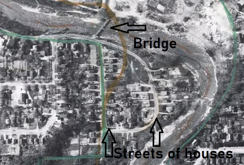
The picture below shows Raymore Drive in Etobicoke in 1953, about a year before Hurricane Hazel struck. When the hurricane paused over the GTA on October 15, 1954 it dumped so much rain that the rivers all flooded their banks and 81 people were killed. Notice the pedestrian bridge that crossed the Humber River and the two streets of houses that were tucked into the curve of the river.
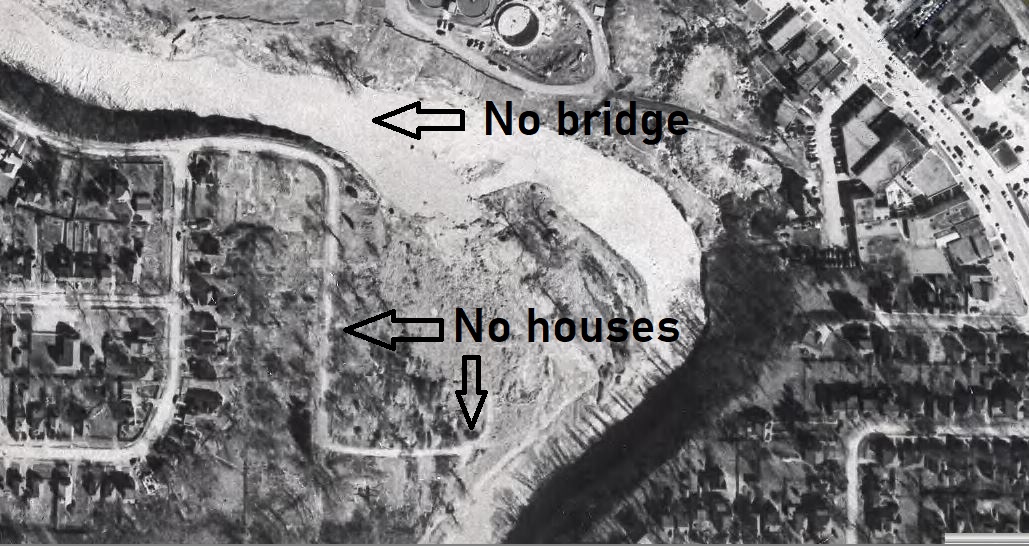
When the water levels rose on the river the bridge was swept off of the west abutment and began to deflect the flow of the river into the housing development. With the full flow of the river rising by 20 feet there were 14 homes washed away and 35 people lost their lives in this small enclave. In the 1956 picture the bridge is gone and so are the houses on the two streets closest to the river.
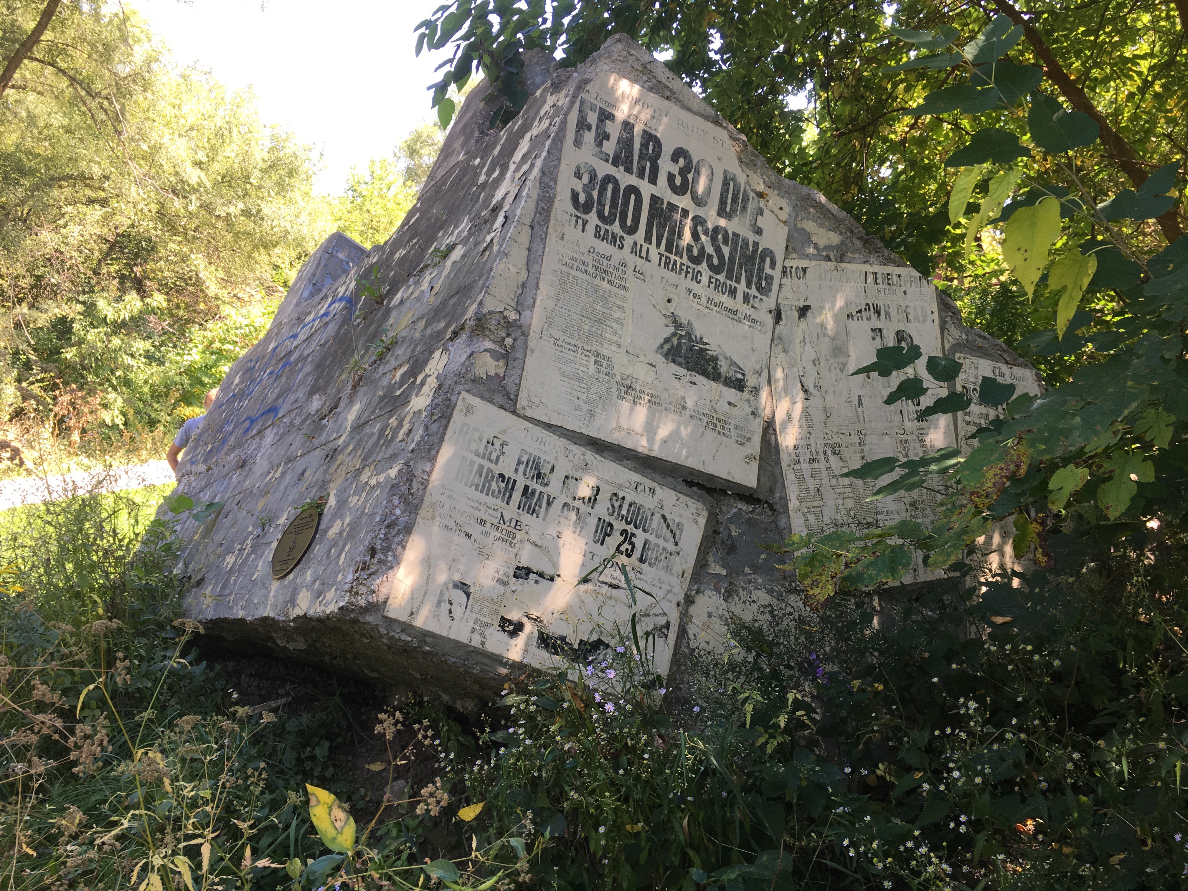
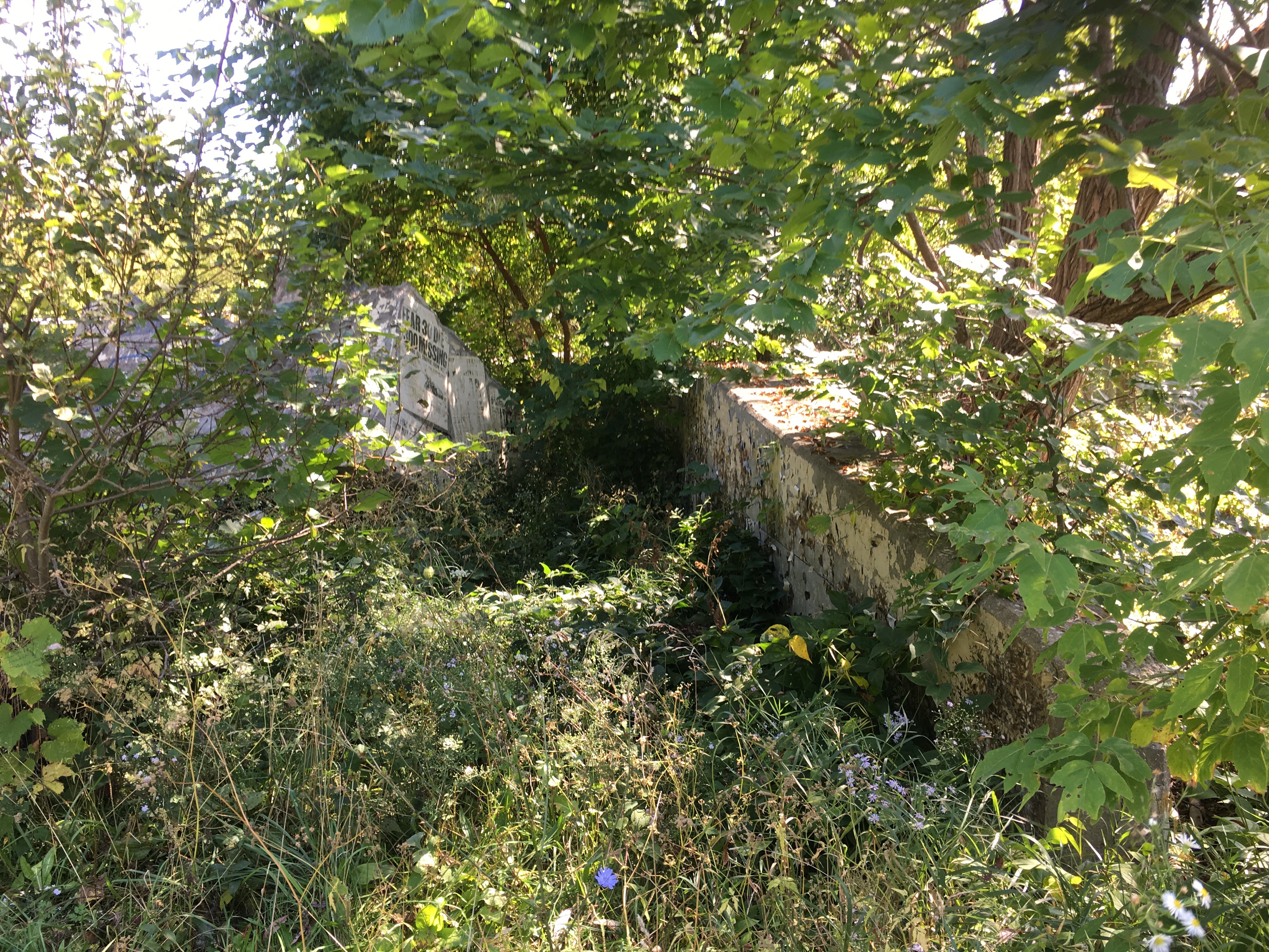
The east bank of the river still has the remains of the bridge abutment and, as a memorial, it has been plastered with replicas of the news papers that came out following the storm.
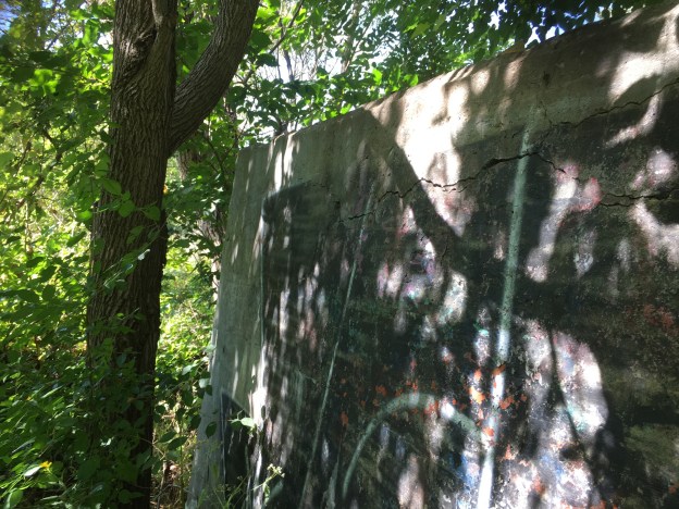
There is a set of concrete walls that surrounded the old bridge abutments. Just for fun I walked through the grasses and shrubs that surrounded the old structure. That was a big mistake because I ended up with hundreds of little seed pods stuck to my clothes that had to be picked off one-by-one.

The whole structure has been overgrown during the past 65 years and it is difficult to imagine exactly what it may have looked like when it was in use.
This willow tree will eventually push over this section of the wall as nature slowly reclaims its own space.

Some parts of the old bridge foundations have been washed into the river where they now provide some shelter and habitat for the blacknose dace that live in the river.

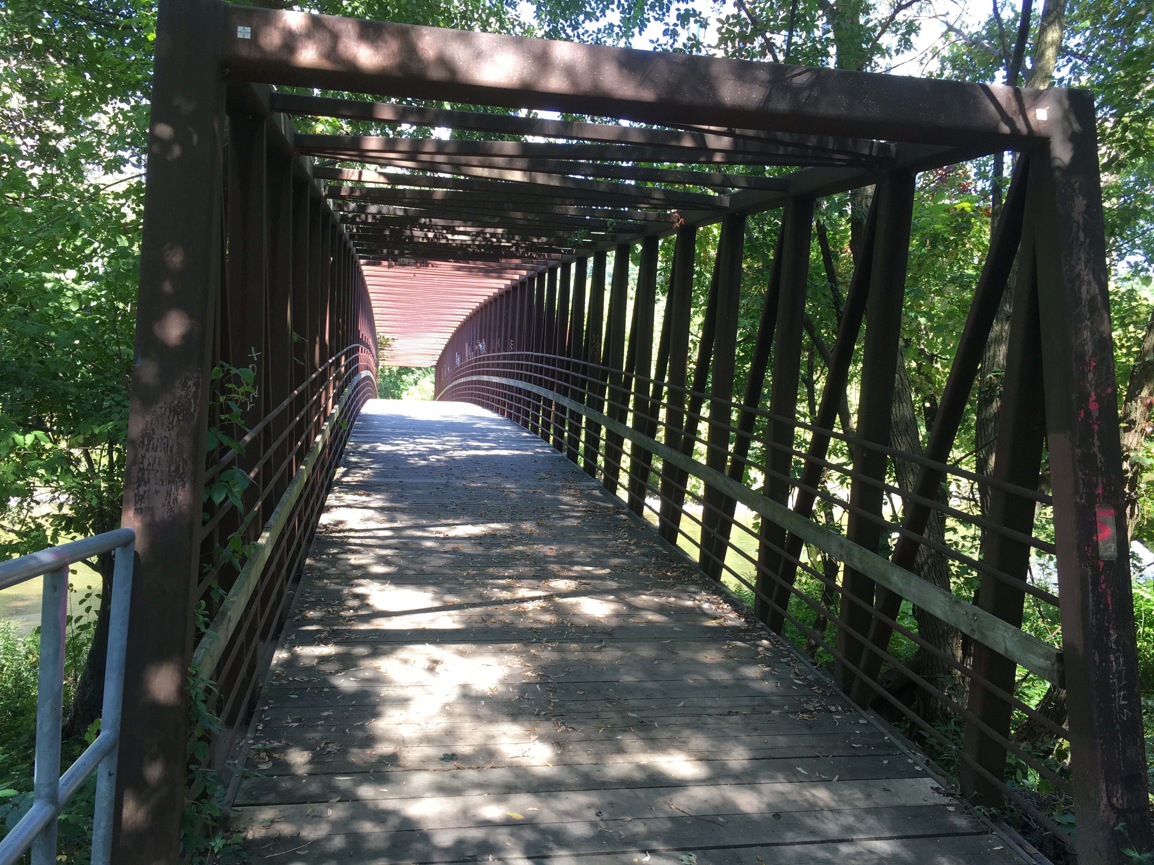
A new pedestrian bridge has been built across the river to link two sections of the Humber River Trail.
A large section of the west abutment can be seen in the river where pieces of wood and tree branches have been washed onto the top by high water and then left stranded there.

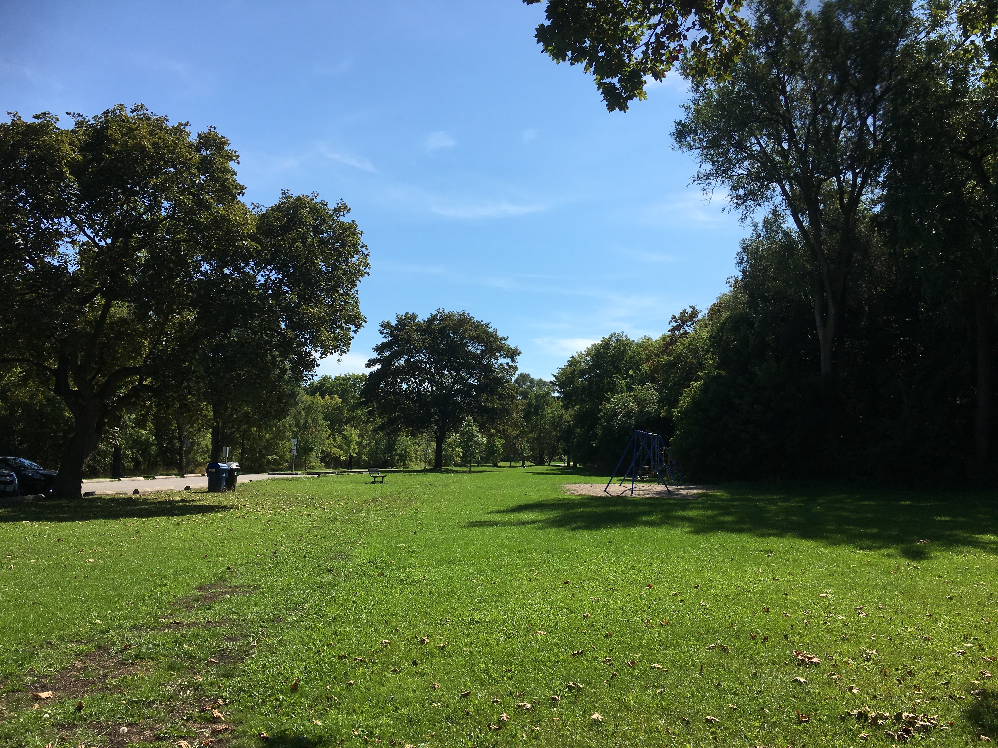
The former residential streets have been retained and are now in use as the main hiking trails through Raymore Park. Many of the homes in the various flood plains around the city were washed away or damaged beyond repair. In the aftermath of the hurricane it was decided that no homes would be allowed on the flood plains of any watercourse in the GTA. Homes that survived Hazel were bought up by local conservation authorities and soon demolished. This led to the creation of many of the ravine trails and parkland that we enjoy in the city today.
The Old Albion Road bridge across the Humber River was destroyed on the night of October 15, 1954 along with another 40 bridges in the GTA. A short piece of the former road allowance and the old cut stone blocks of the east bank abutment mark one side of the old road alignment. On the west bank of the river all traces of the former road have been removed.

Over on The Rouge River the storm washed the Old Finch Avenue bridge away and shifted the abutment so that the new bridge appears to be on a new alignment.

It’s tragic to think of the destruction that nature can cause but there have been several steps take to reduce the risk in the future. Flood control dams were built on each of the three main rivers. Milne Dam on the Rouge River, G. Ross Lord Dam on the Don River and Claireville Dam on the Humber River.
Google Maps Link: Raymore Drive
Like us at http://www.facebook.com/hikingthegta
Follow us at http://www.hikingthegta.com
Look for us on Instagram
