Monthly Archives: April 2015

Victoria Square

April 26, 2015

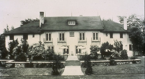
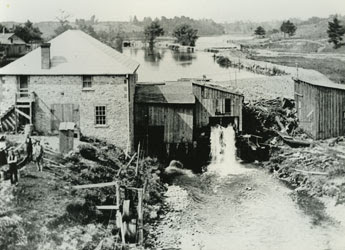
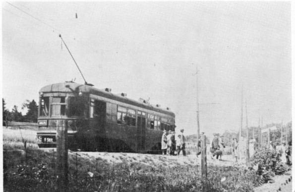
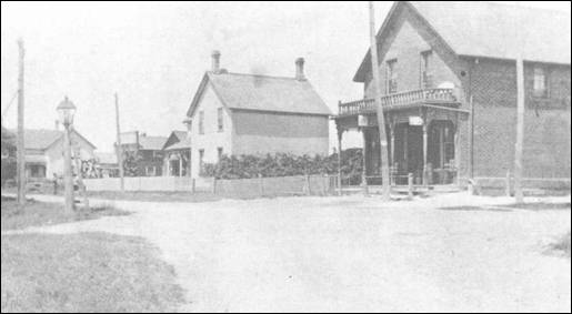
It was mostly sunny and 10 degrees and I decided to investigate the proposed cultural heritage site of Victoria Square.  Unlike many of the communities in rural Ontario that grew up around a mill site, Victoria Square was established in 1805 as Reid’s Corners at a crossroads and served the local farmers. The 1901 census shows 117 people, most of them farmers or retired farmers and children.  The businesses in town tended to be those that supported that local industry. The cover photo shows the hamlet around 1900.

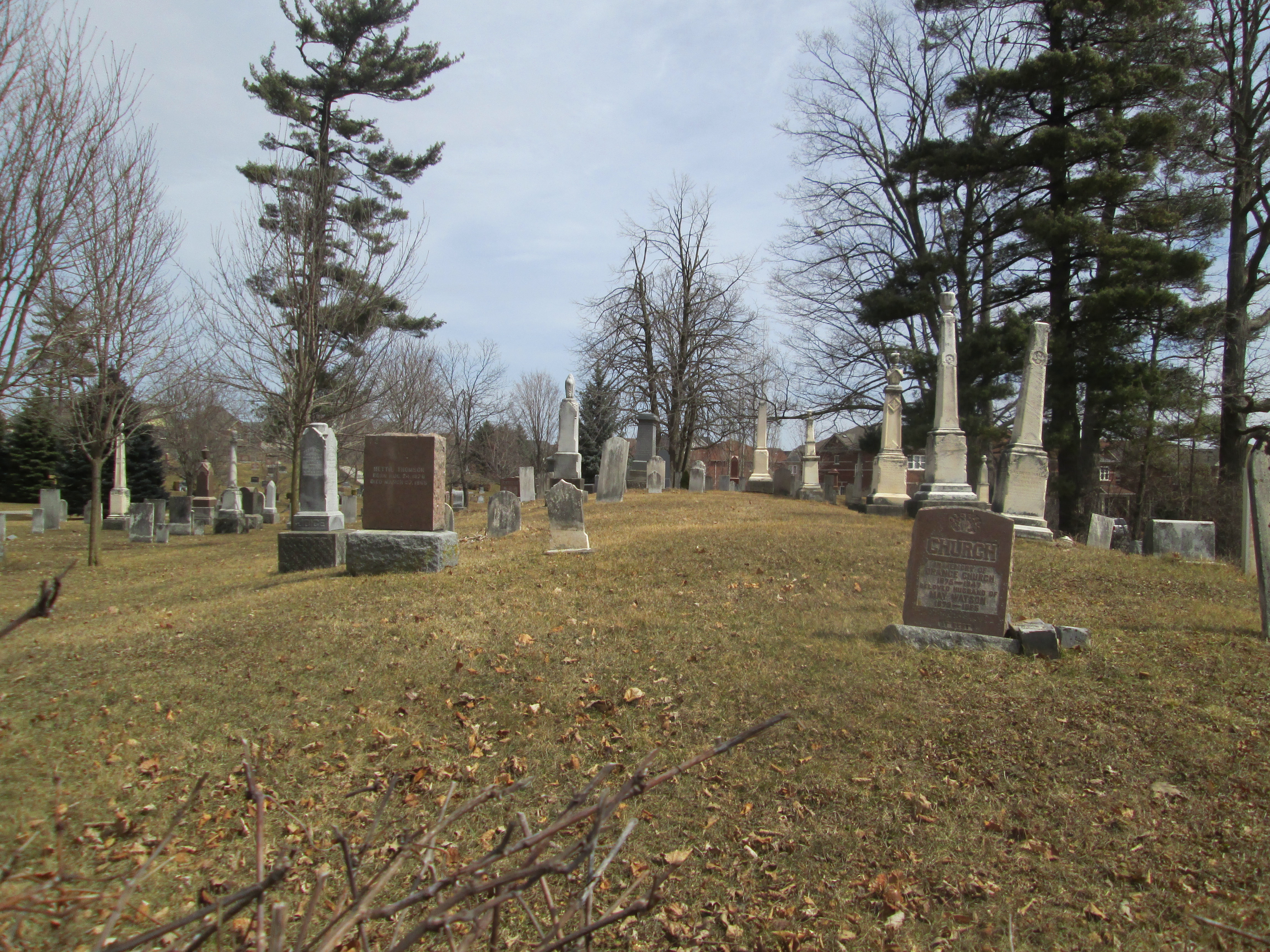
It was centered around two churches, both of them Methodist.  In the historical county atlas shown below they are shown as PM (Primitive Methodist) and WM (Weslyan Methodist).  The Methodist congregation had split in 1807 over the issue of Calvinism vs Arminianism a theological issue which centres around free will vs predestination. (Did they split of their own free will or did they do it because it was predestined to happen?  Hmmm…)

Victoria Square

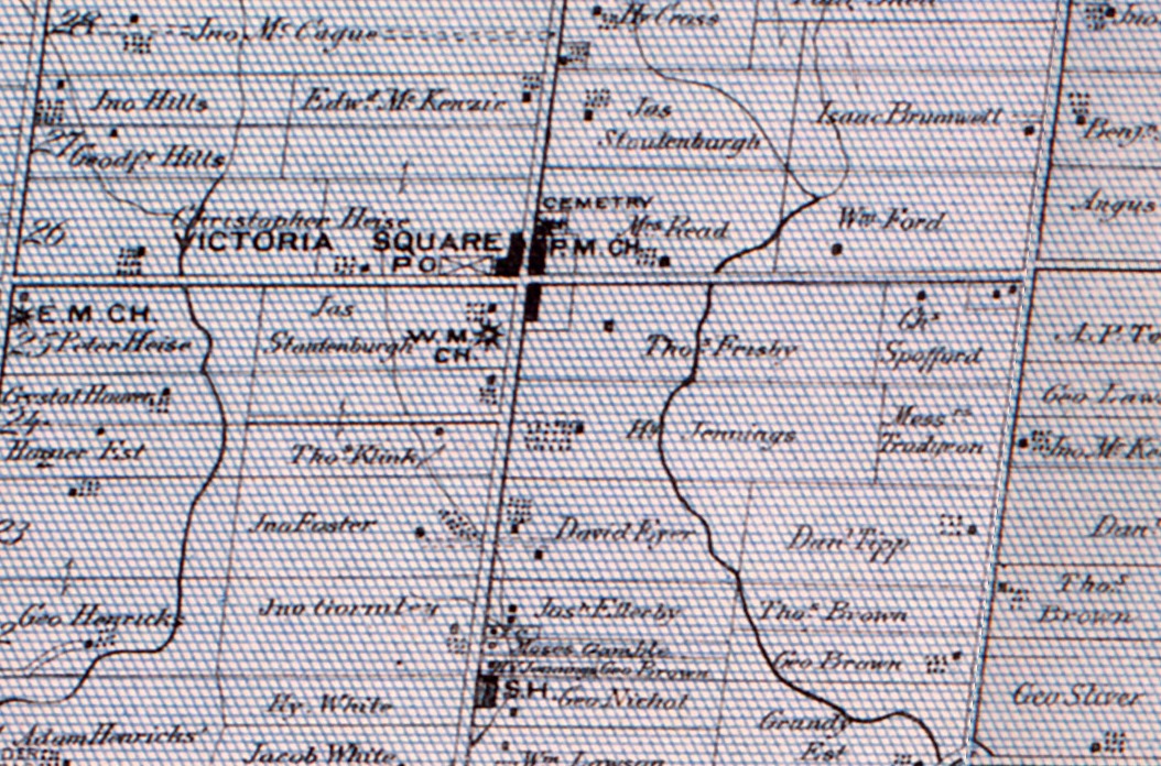
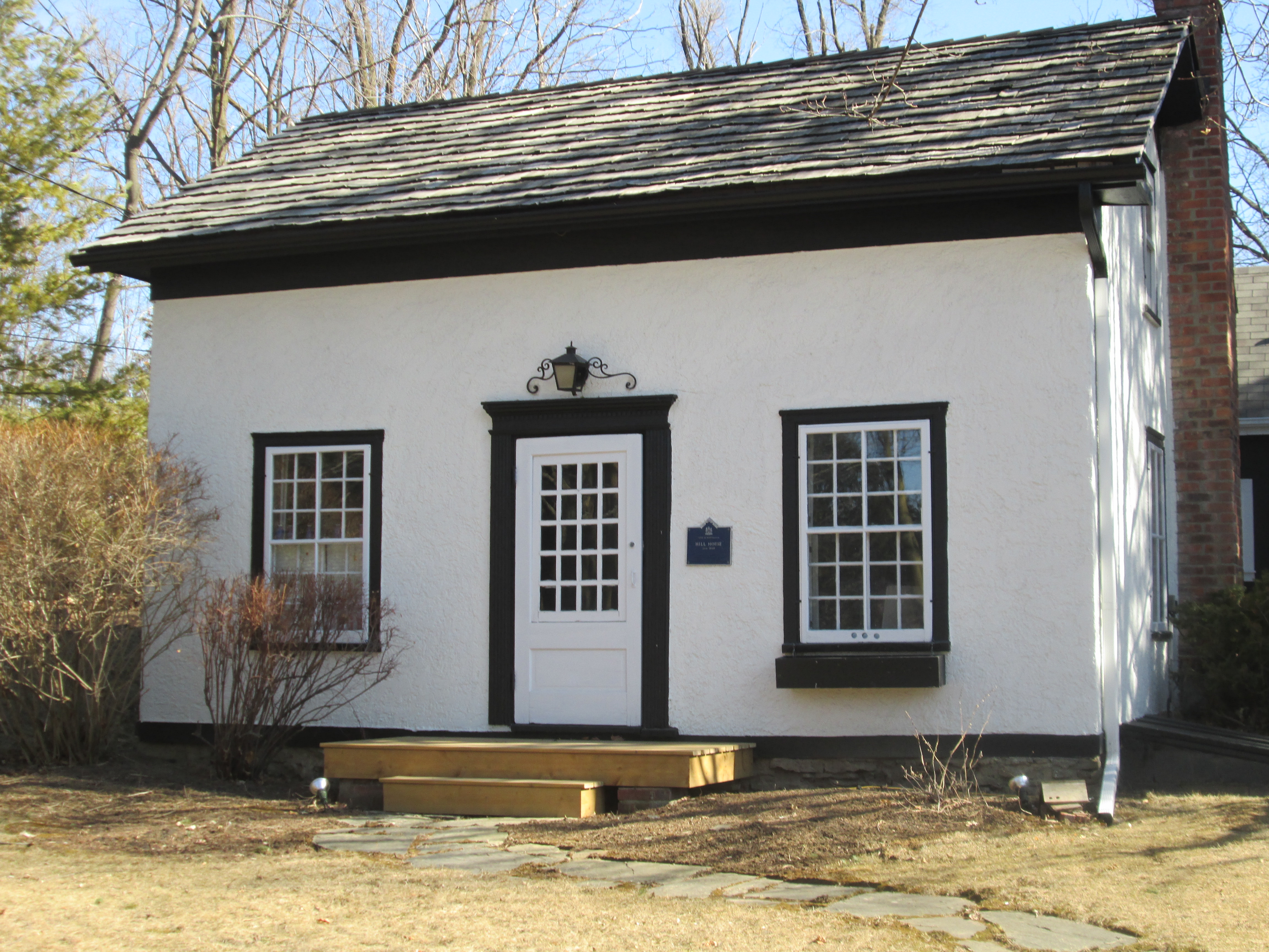
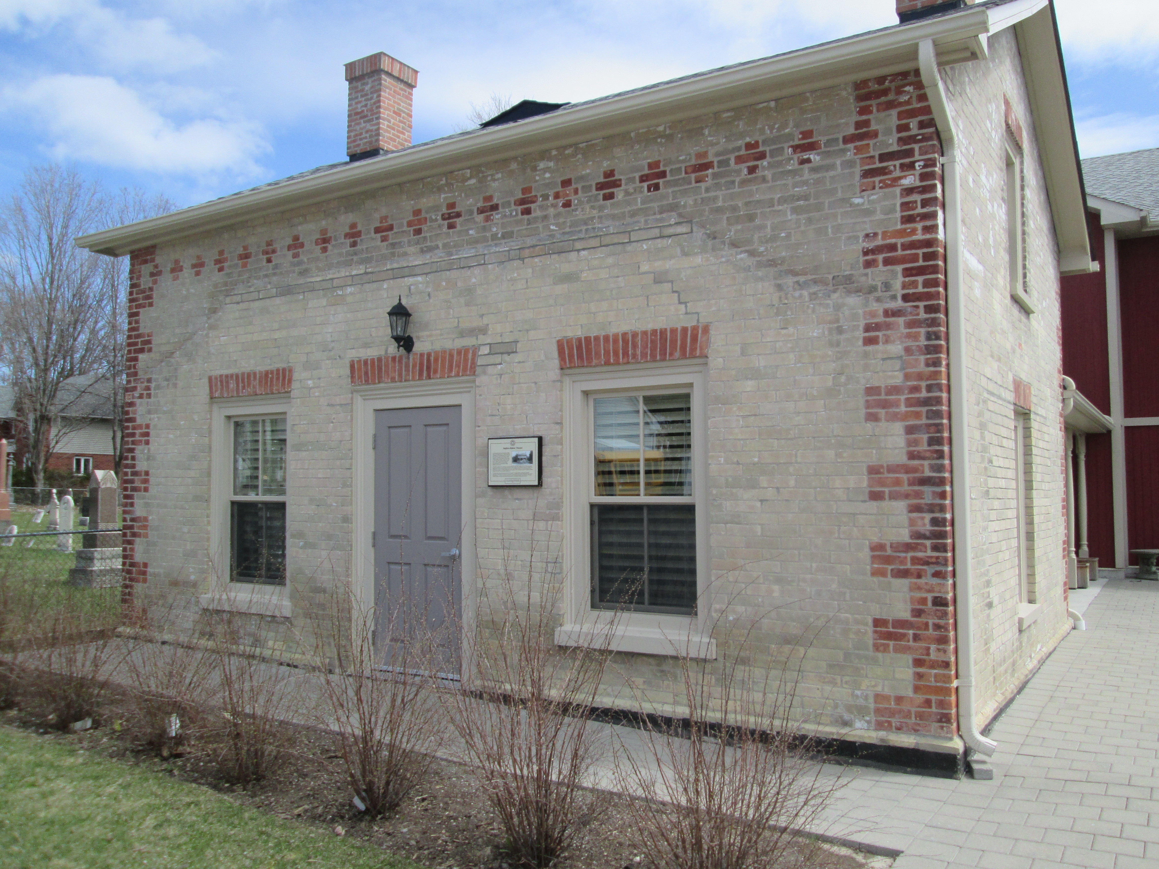
The Primitive Methodists built their church north of Elgin Mills road on the east side of Woodbine Avenue around 1830.  Their cemetery remains but the church is gone.  William Hatton was the first leader of the congregation and built his first house at 10754 Woodbine avenue in the 1830’s when the road was known as 3rd line.

IMG_3894

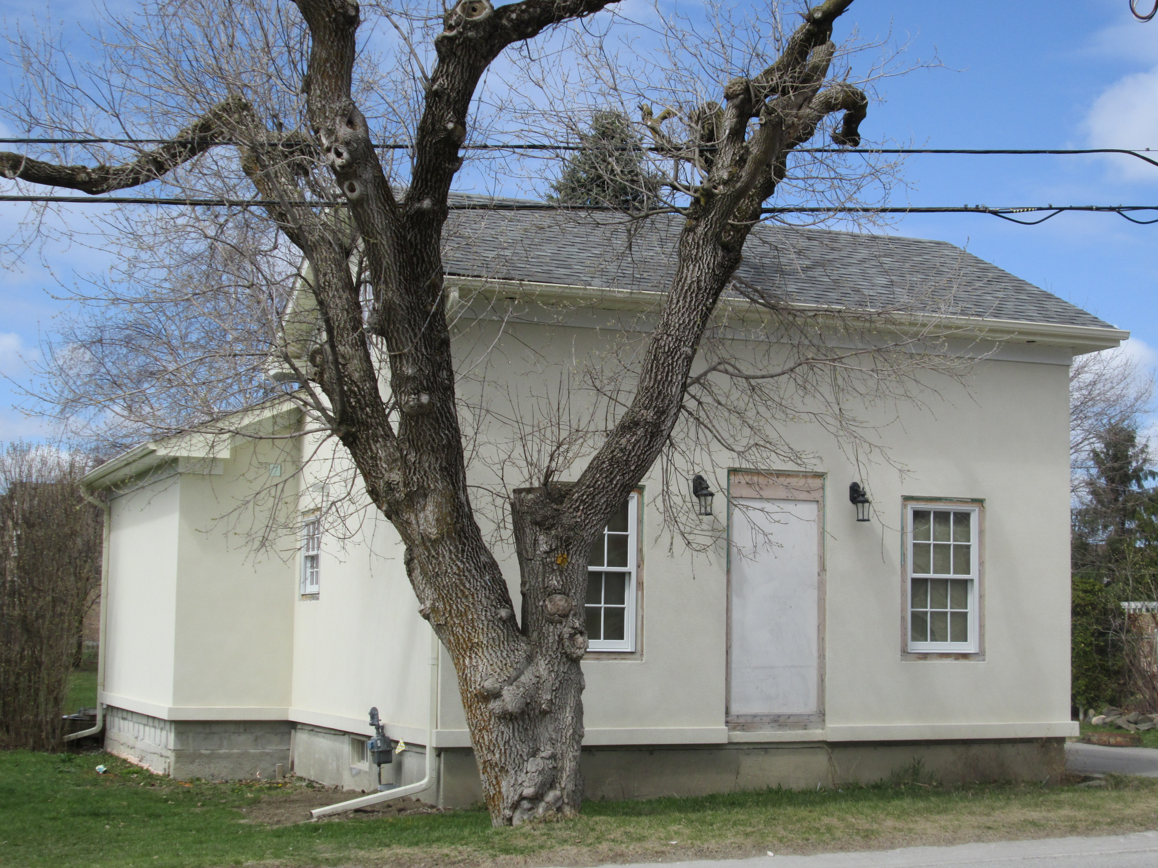
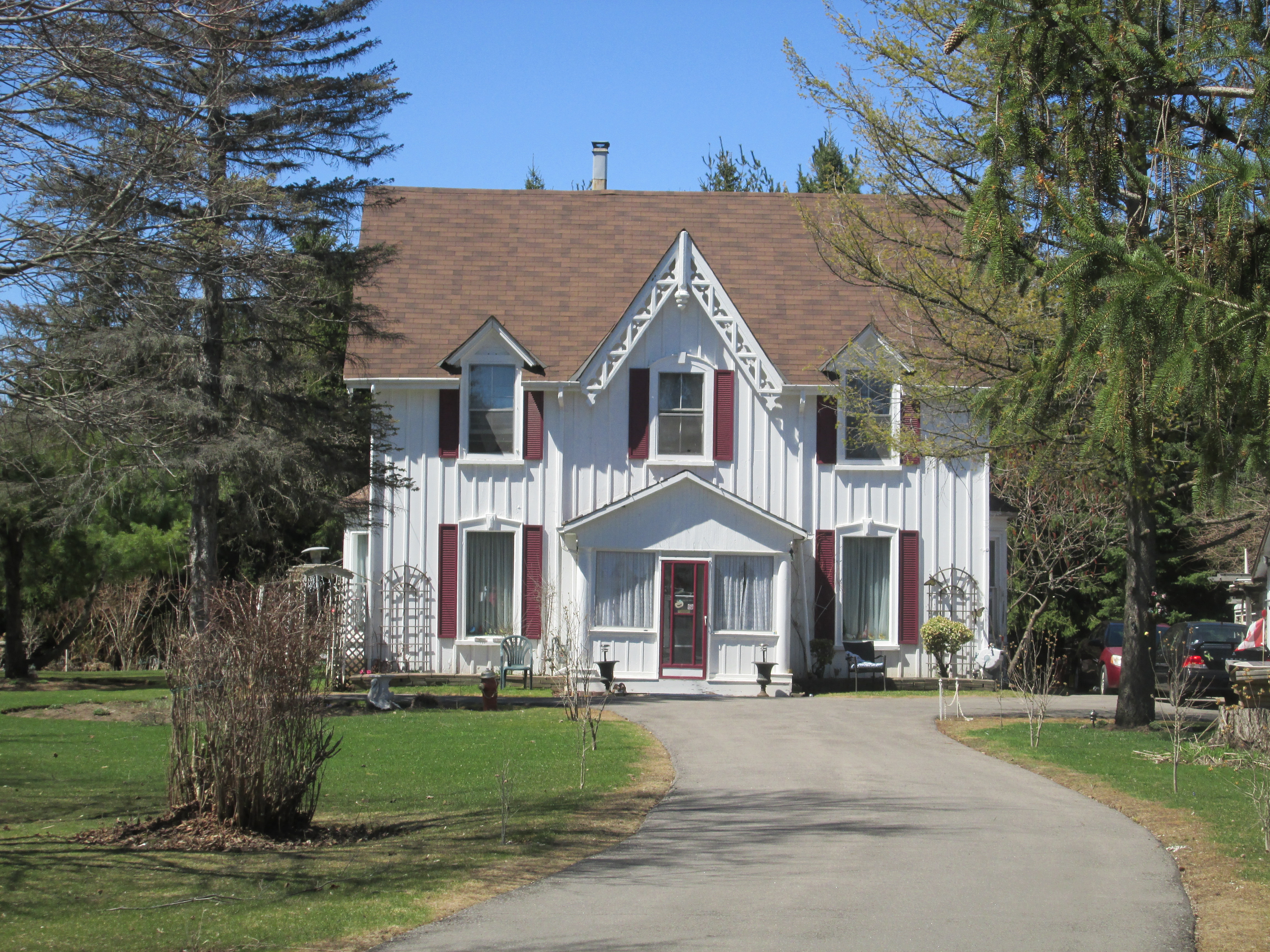
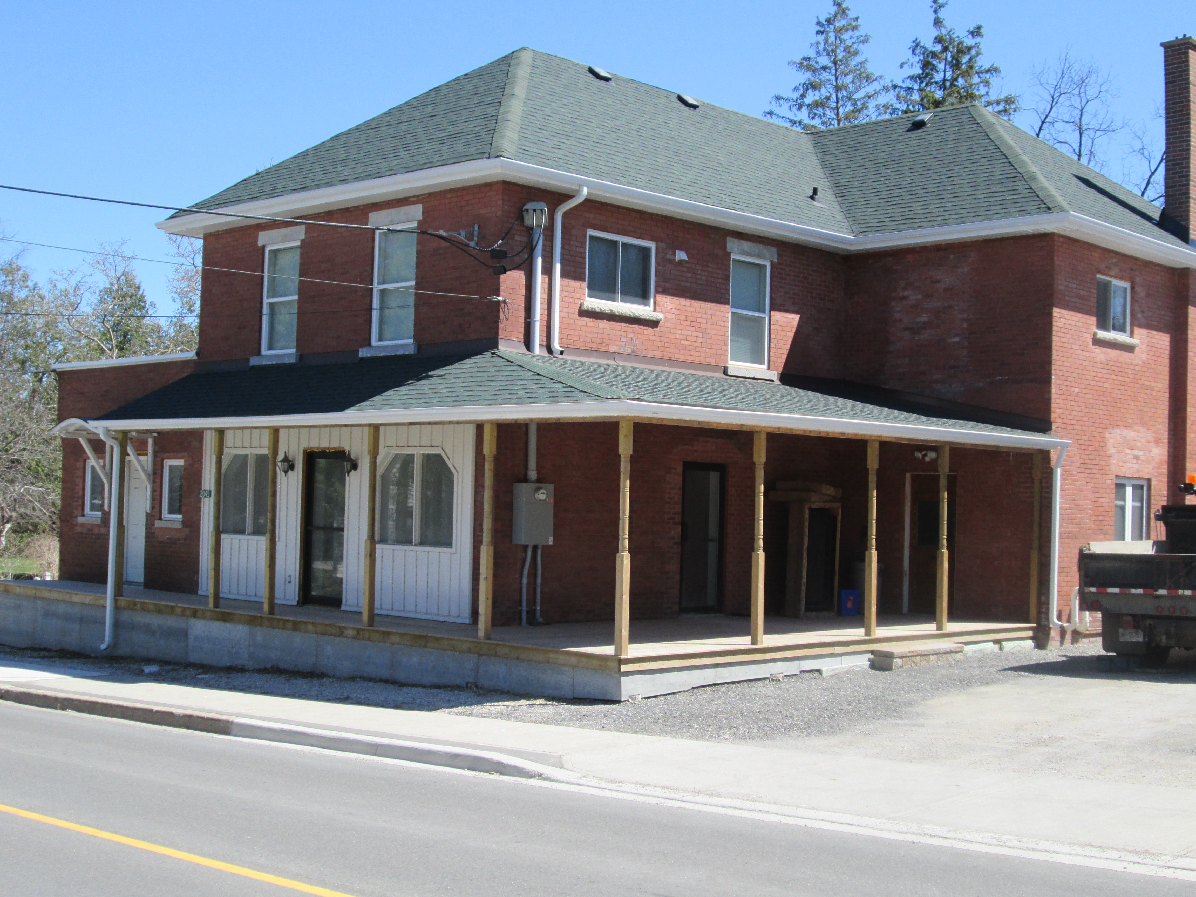
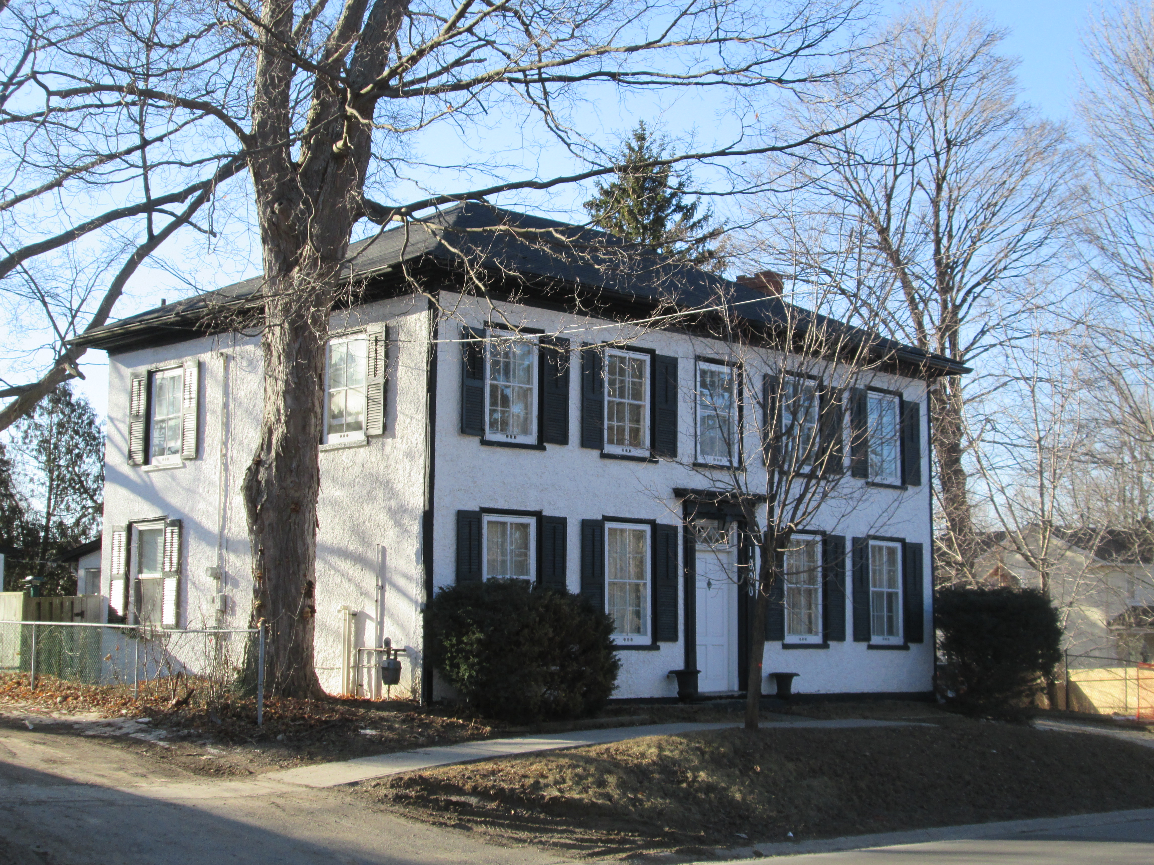
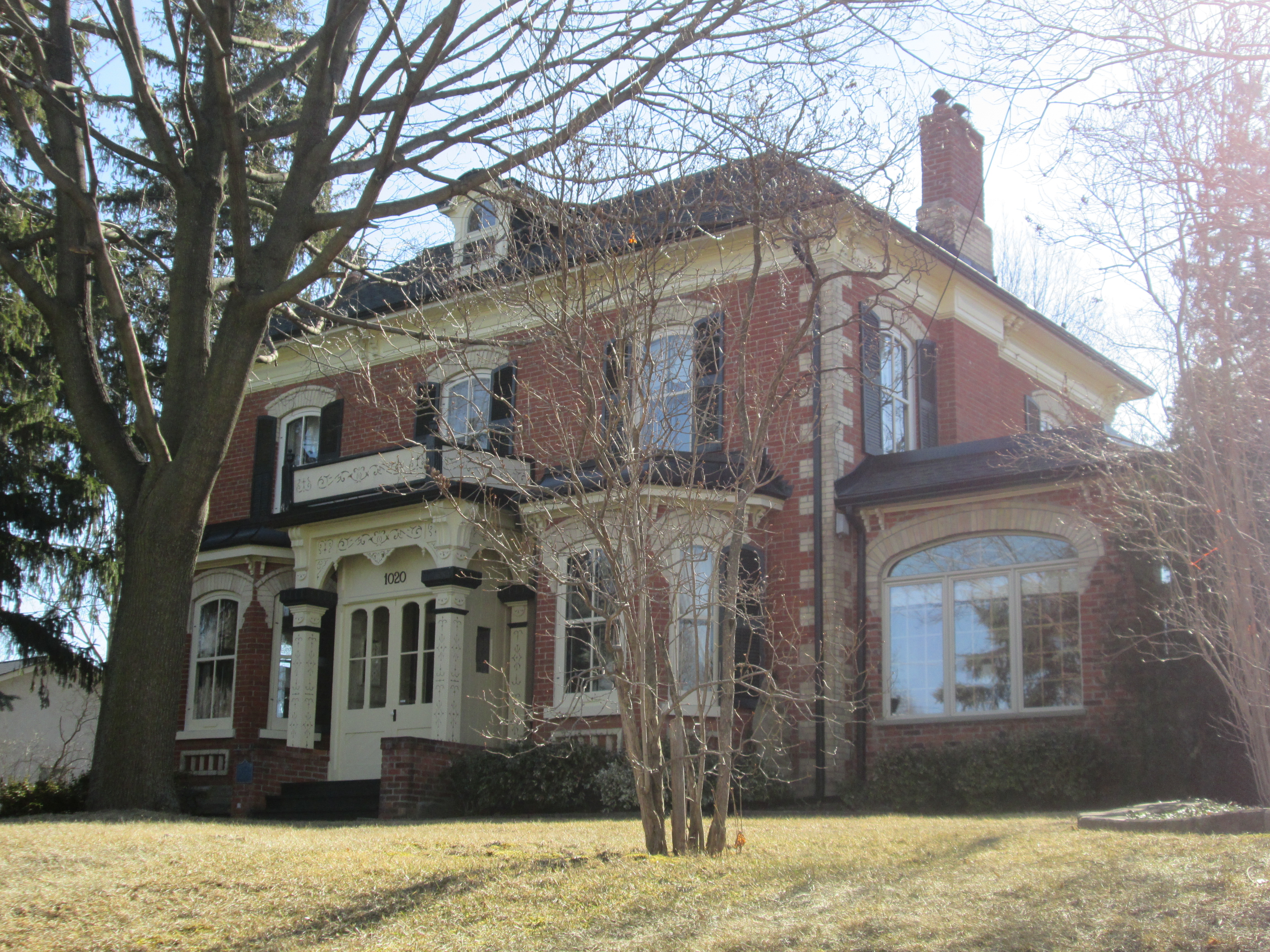
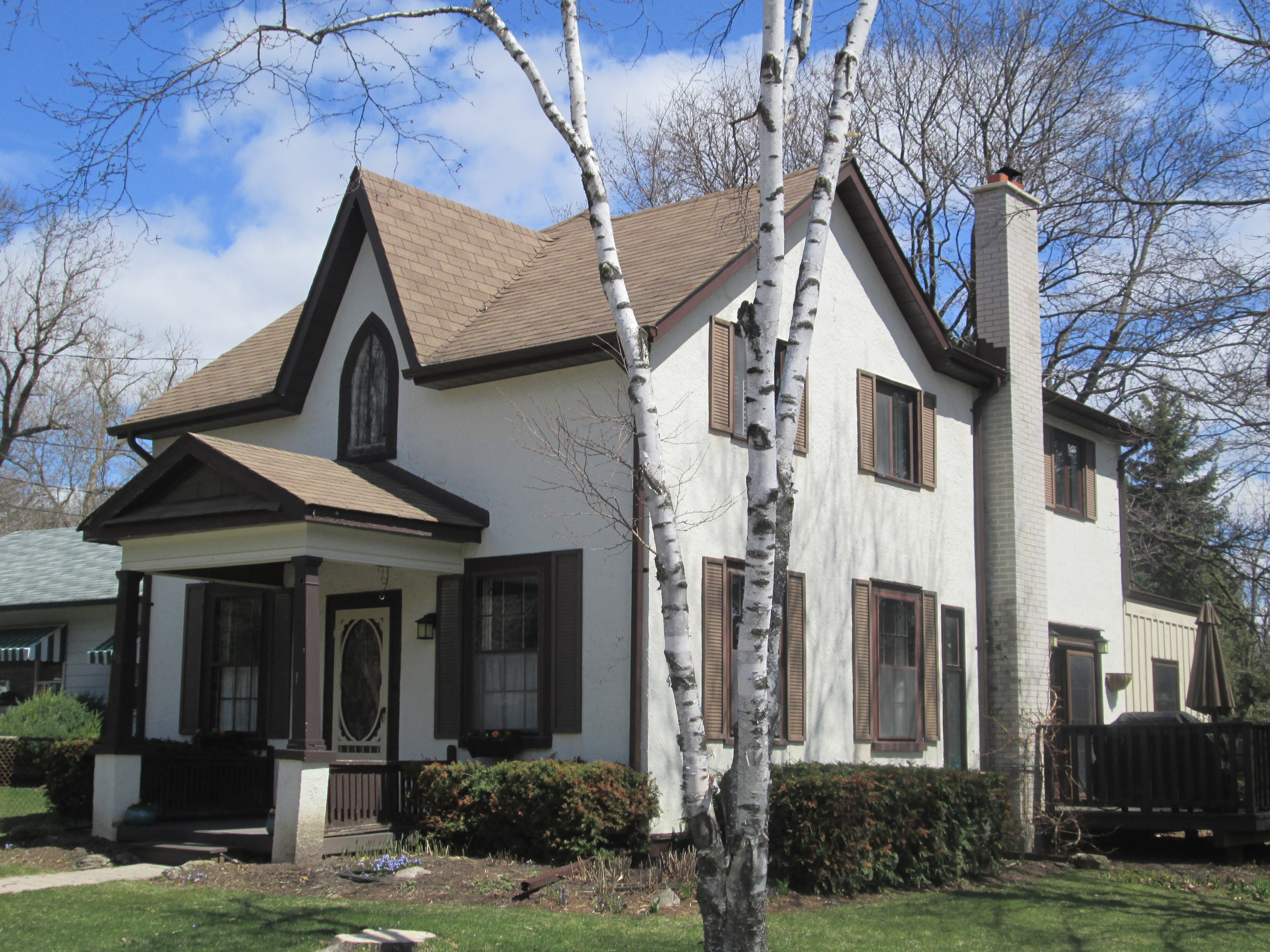
About 1850 Hatton built the house at 10761 Woodbine road.  A carpenter named Jacob Baker owned the house in the 1880’s and he added a veneer of patterned brickwork as well as a veranda.  He replaced the original 6 over 6 windows that were typical of mid-1800’s small panes of glass to the 2 over 2 windows.  During the mid-20th century Gord Mortson operated a bus line from this location.  The outline of the veranda can still be seen in the picture below.

IMG_3897

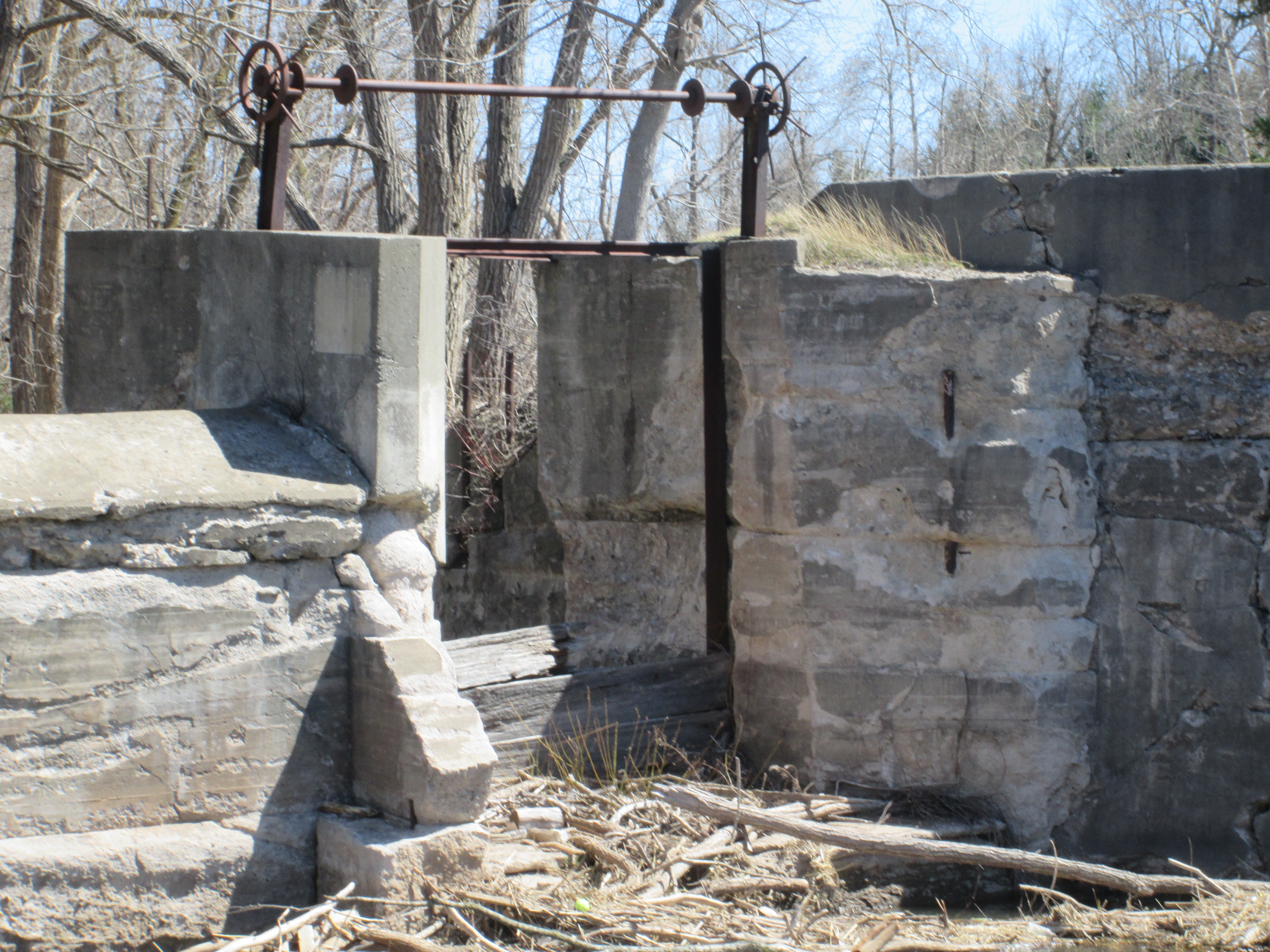
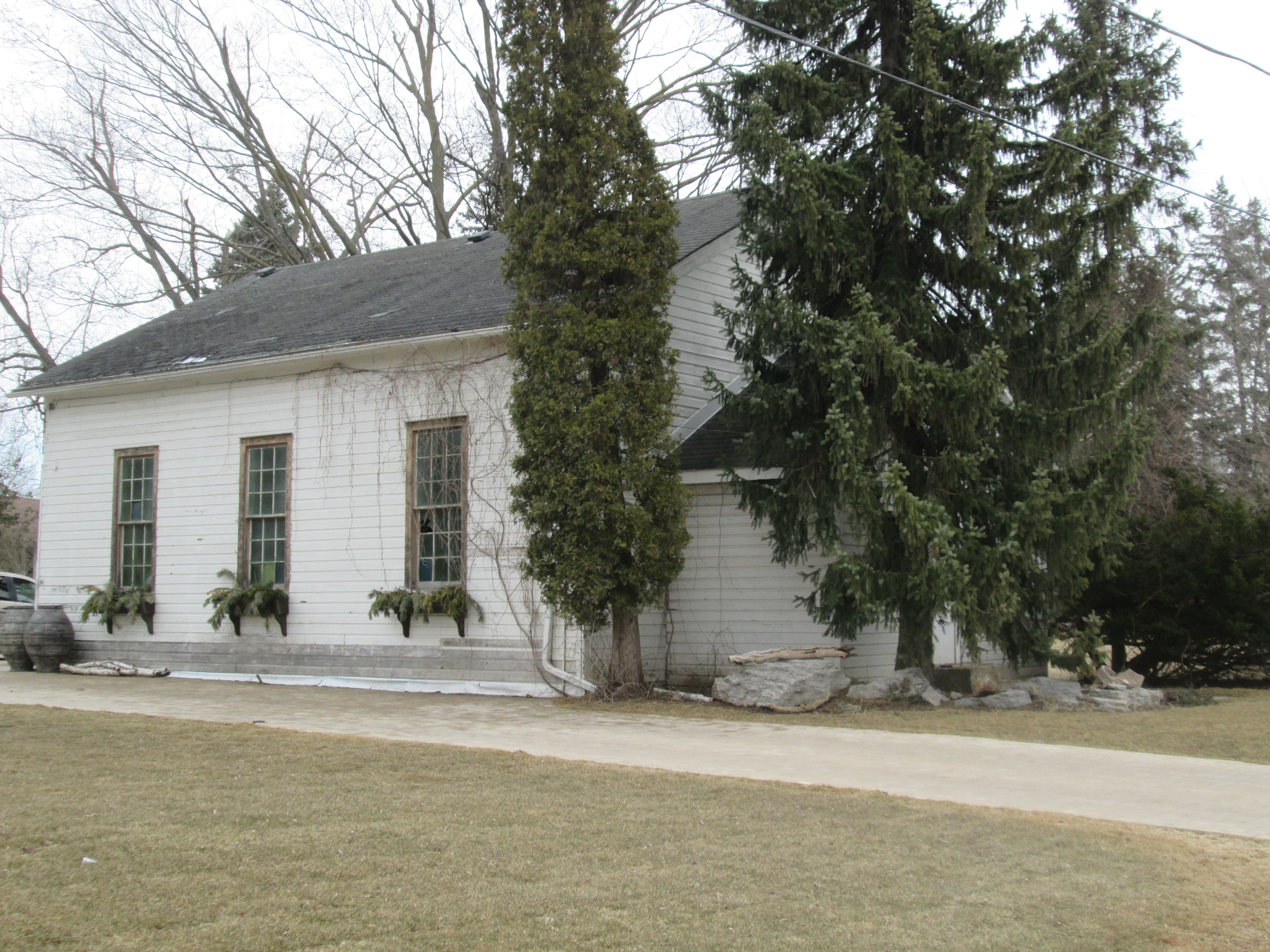
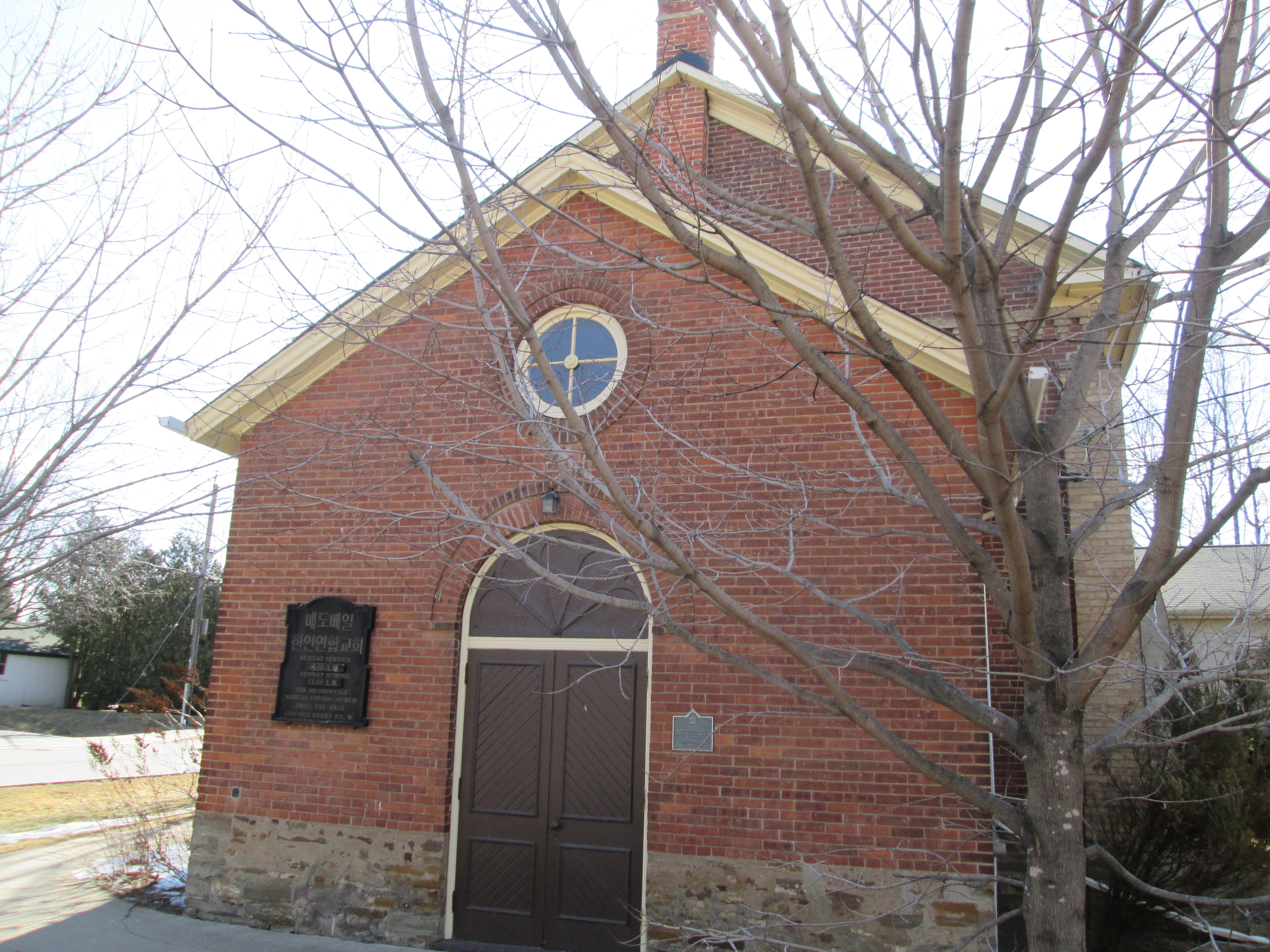
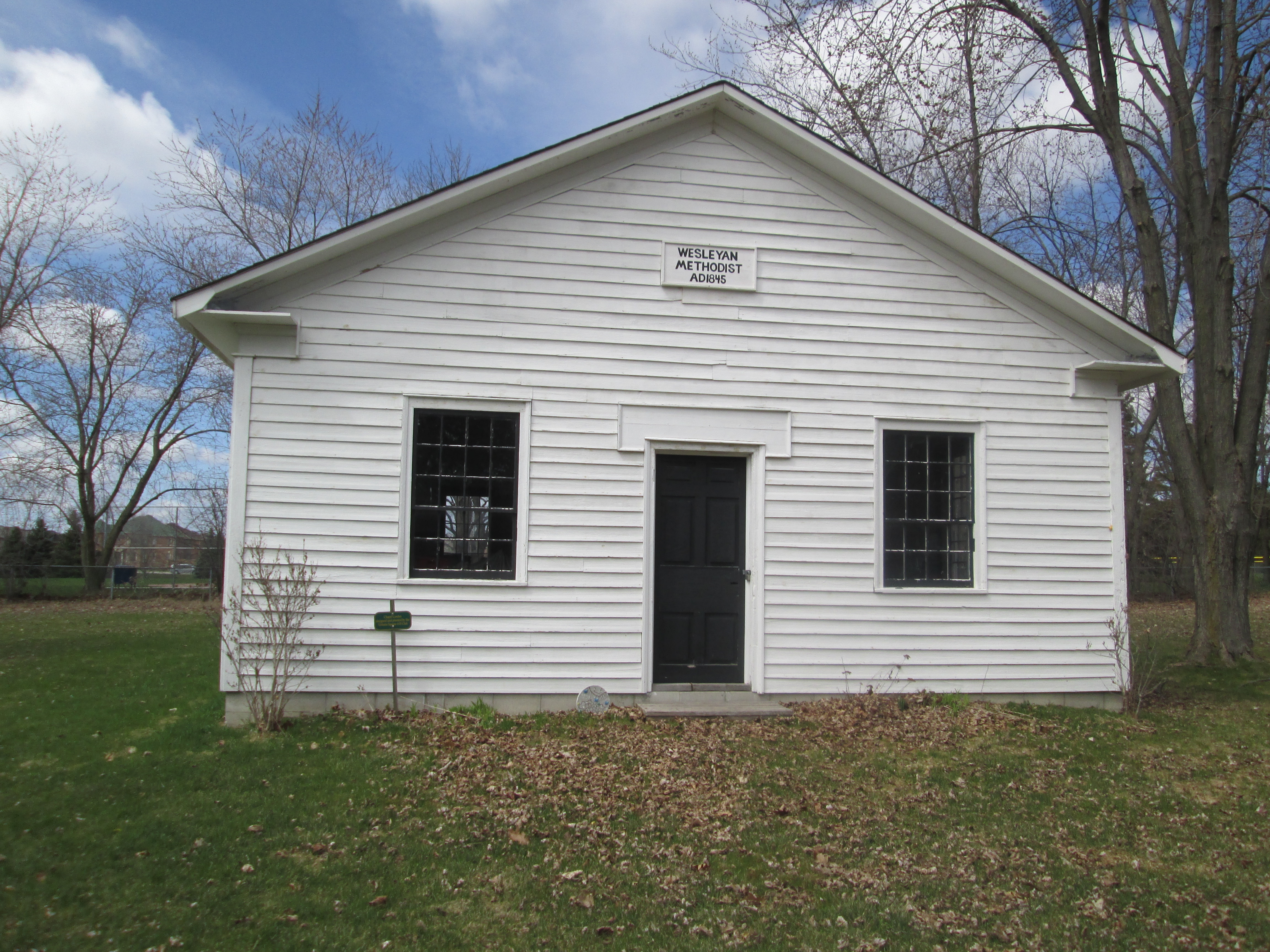
The Weslyan Methodists built their first building on the west side of Woodbine, south of Elgin Mills road around 1845.  After a new building was constructed this was sold to William Frisby who used it as his blacksmith shop for many years.  It now stands at the back of the cemetery where it is being restored.

IMG_3876

In 1880 a new brick church was built and the old one moved off site.  In 1925 the Methodists were part of a four church merger that created the United Church.  This is how both cemeteries in town came to be under the control of the United Church.

IMG_3884

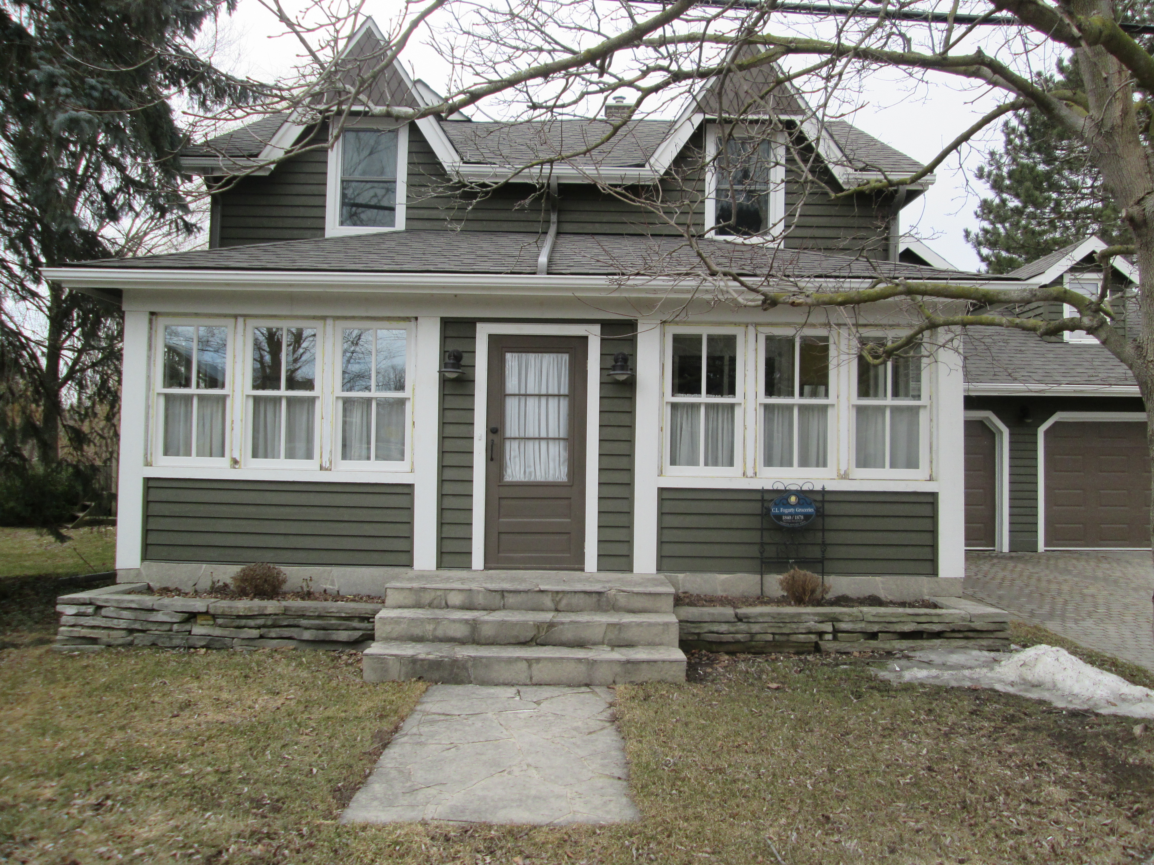
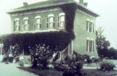
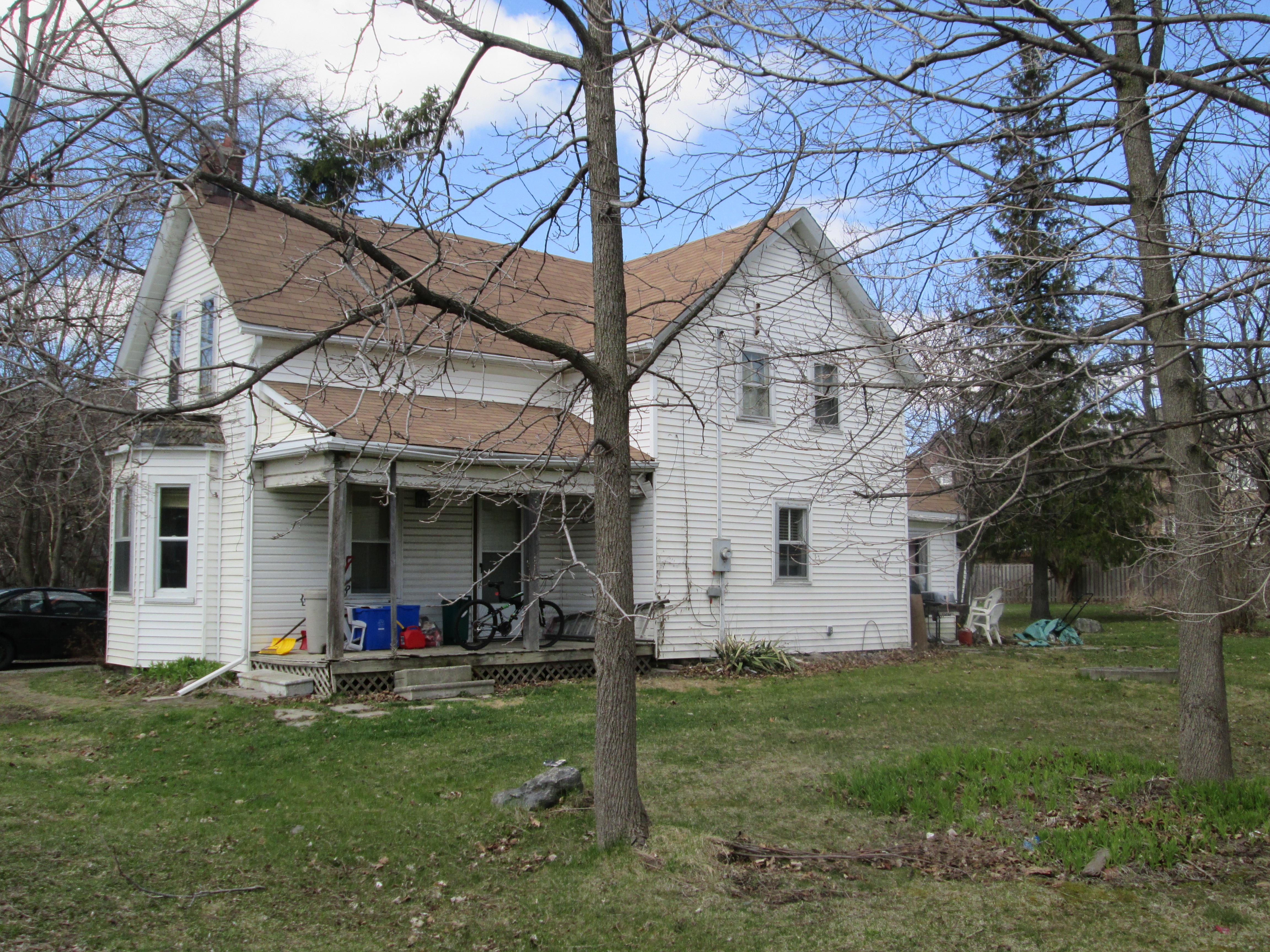
Victoria Square was typical of small cross-roads communities that served their local farmers. People lived there for generations and everyone knew everyone else (and their business). William Boynton is shown in the 1901 census as the town butcher.  William’s youngest son Charles Stanley would carry on in his father’s business renaming it C.S. Boynton and Sons. William and Donald bought the business when C.S. retired and their children also worked there. After four generations of Boyntons worked there the business was sold and a butcher still continues to operate it today.  The picture below shows the first Boynton house built by William in the 1850’s or 60’s and was occupied by the family into at least the 1980’s.  The buildings of the butcher shop were expanded in the 1960’s and can be seen in the rear of the photo.

IMG_3905

This house is also in front of the butcher shop and was built by William’s oldest son Herman, likely in the early 1900’s.  Charles Stanley lived here for a time and eventually it was split into two apartments, both of which were occupied by Boynton families.

IMG_3907

The property on the south east corner of town is lot 25 con. 4 and was owned by Thomas Frisby (b. 1851).  His father, John (Thomas) Frisby (b. 1822), had emigrated in 1850 and farmed the lot before retiring.  Their house and drive shed are shown on the historical atlas above and stand today on Victoria Street.

IMG_3942

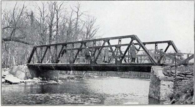
The building of a barn was also a community social event where the structure would be raised in a matter of days.  All the men in town would gather to build the barn and their wives would prepare food and swap stories.  The picture below is of a barn raising on the Klink property just south of town.  Notice the near identical form of the house to the Frisby one in the previous picture.  Take away the chimneys and veranda’s and you have twin houses.  The town carpenter’s handiwork.

Barn_raising_supper_at_the_Klinck_home_in_Victoria_Square,_Markham_Township,_Ontario,_Canada

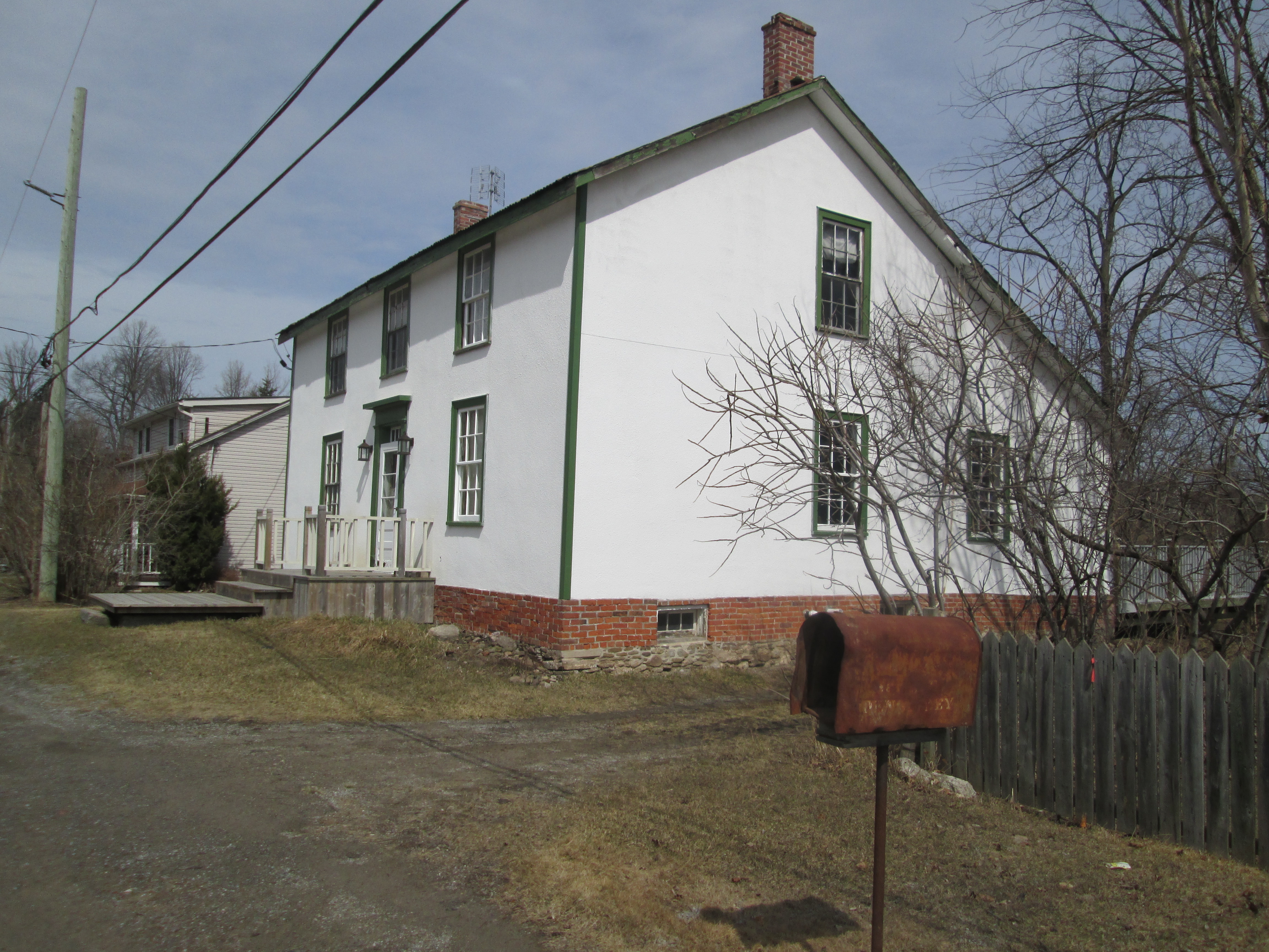
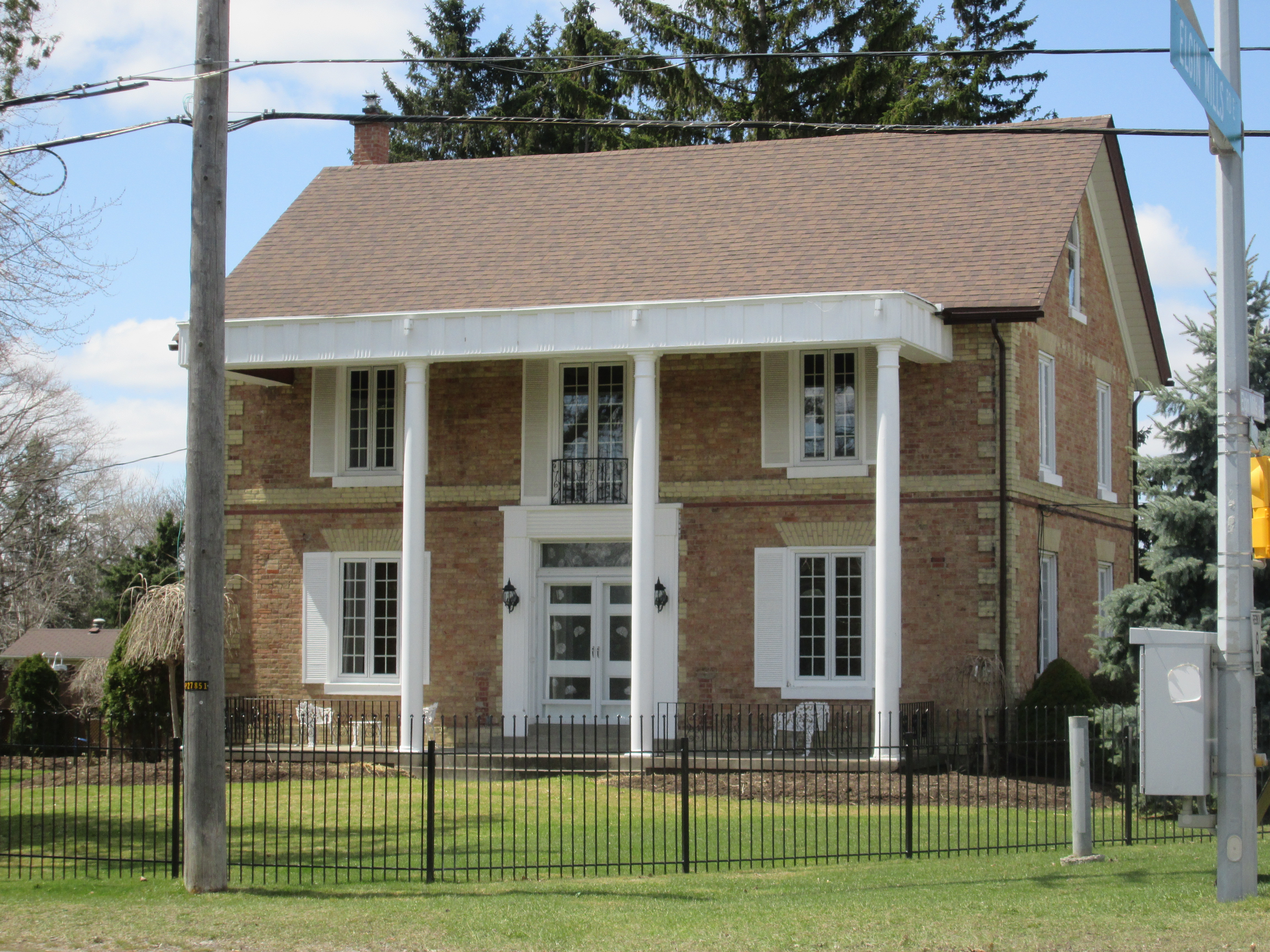
William Frisby (b. 1855) left the farm to his brother Thomas and became the town blacksmith, a position he held for forty years. His business was so successful he hired another blacksmith who lodged with him and was paid $276 in 1901,  Frisby’s shop was located at 2992 Elgin Mills and his house remains in use today.

IMG_3953

John Rowbotham was the town carriage maker at the turn of the century.  Like many local businesses his son worked for him as a carriage painter earning $240 in 1901.  Their business was at 2972 Elgin Mills where the shop stood in the open space beside the house.

IMG_3954

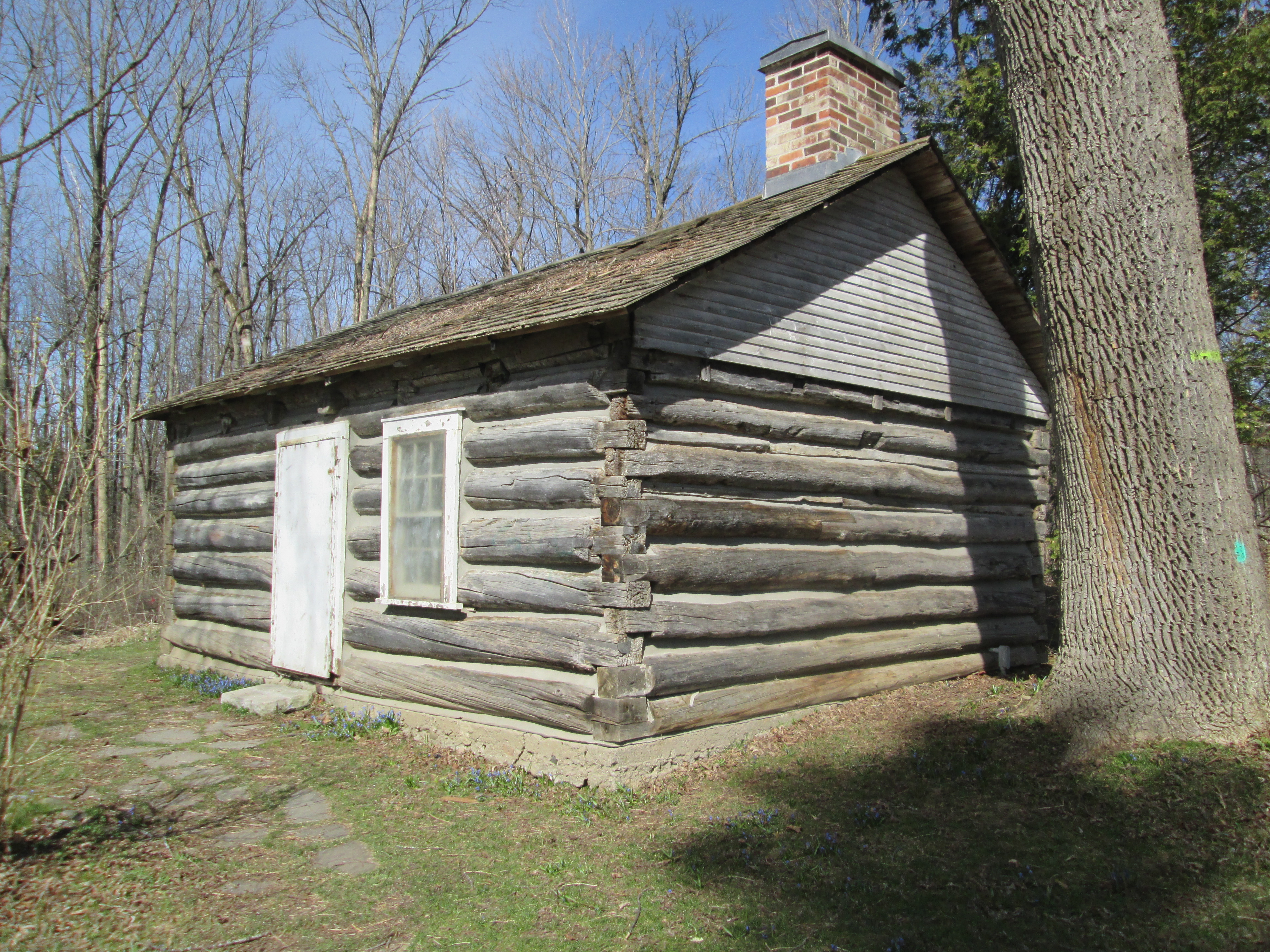
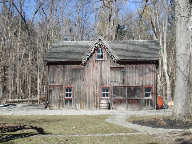
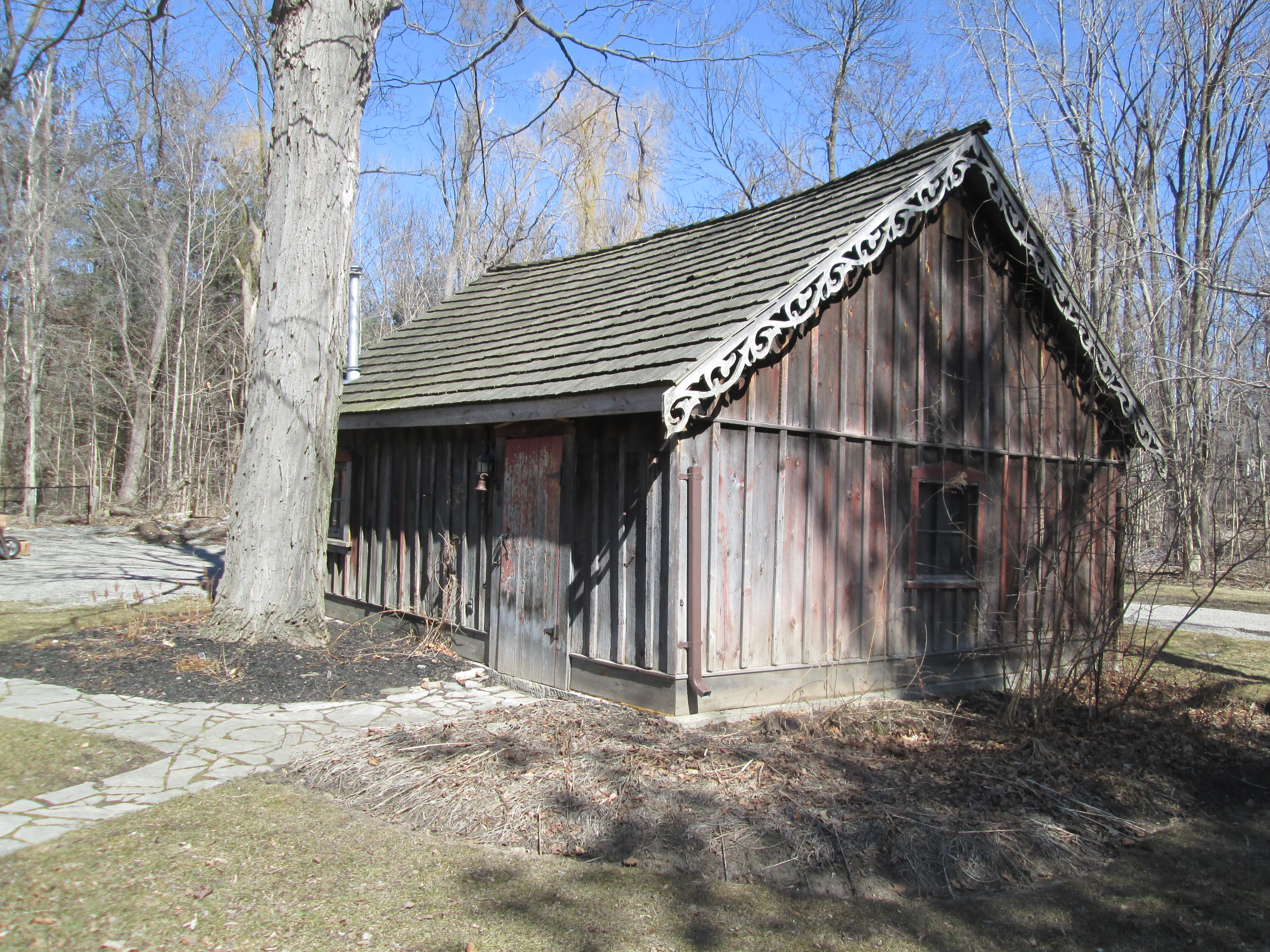
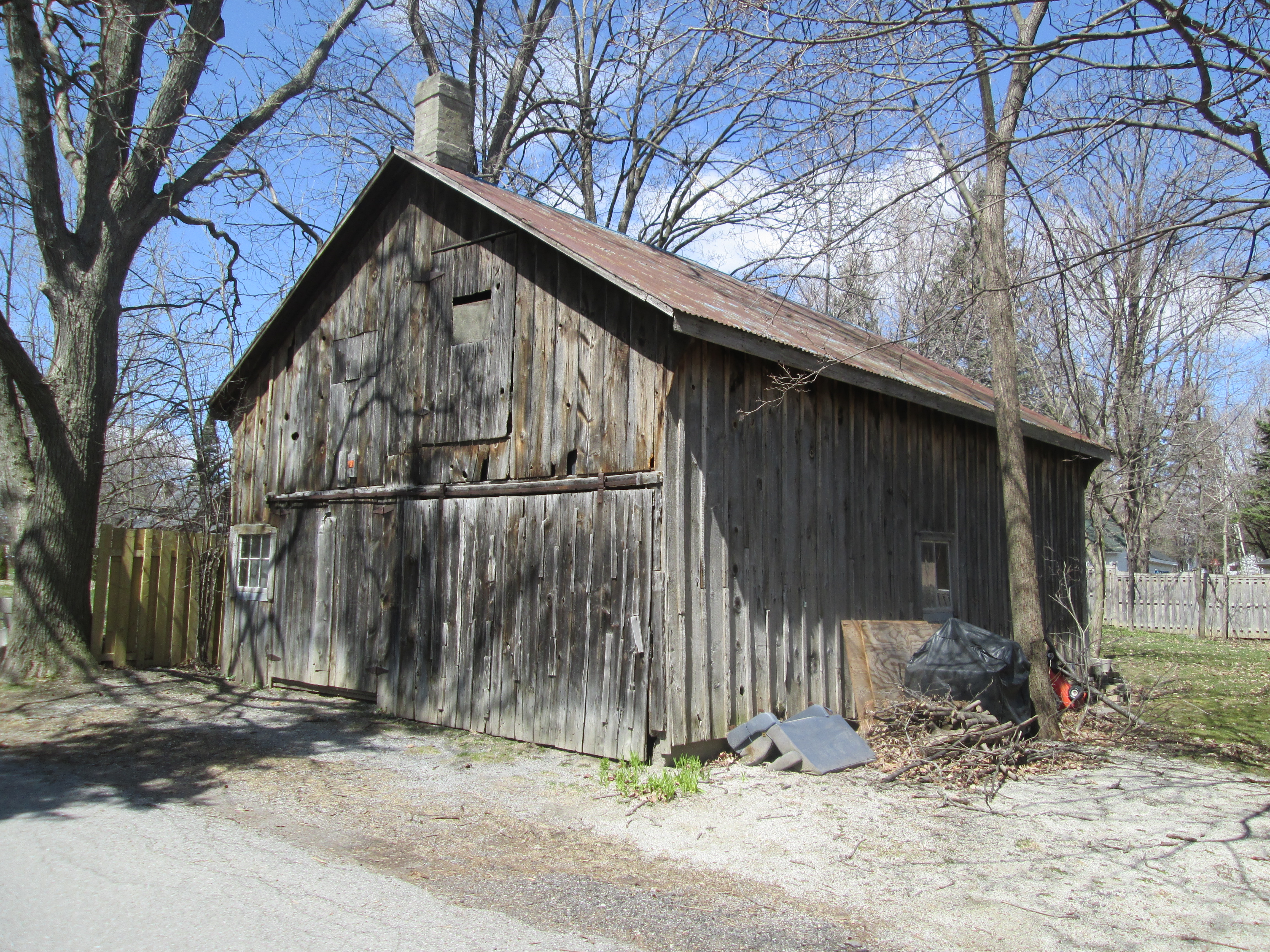
True to it’s small town heritage Victoria Square has several barns in what would have been it’s downtown.  This one was William Macey’s workshop.

IMG_3937

This house has had many uses over the years.  In 1853 Thomas Farmer operated a cobbler shop here.  James Stoutenberg bought it in 1860 and converted it to a general store where the post office would later be housed.

IMG_3950

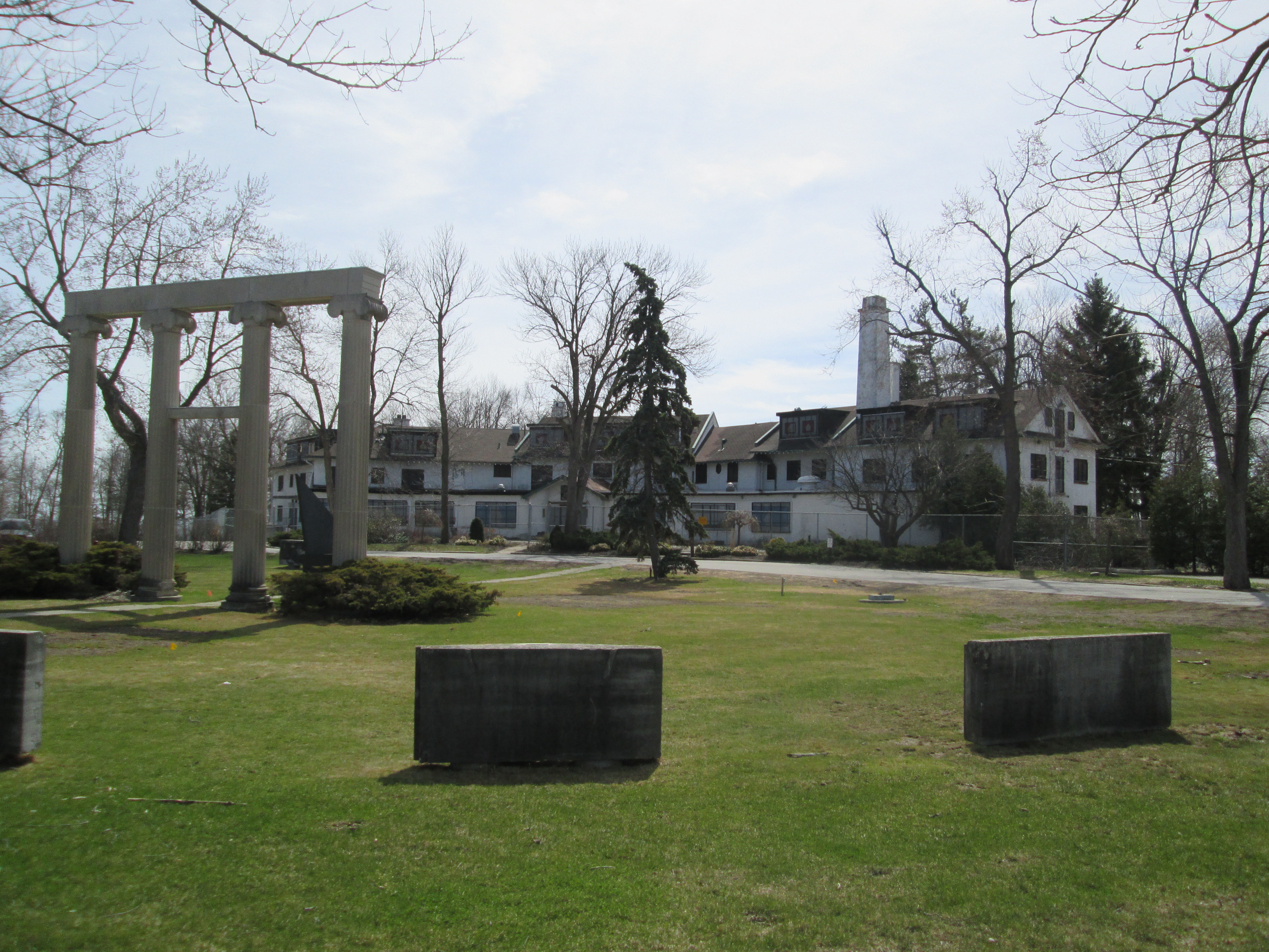
The farms to the north of town are being developed for townhouses including the property of George and Isabelle Pear.  Their late 1840’s home is slated for restoration.

IMG_3910

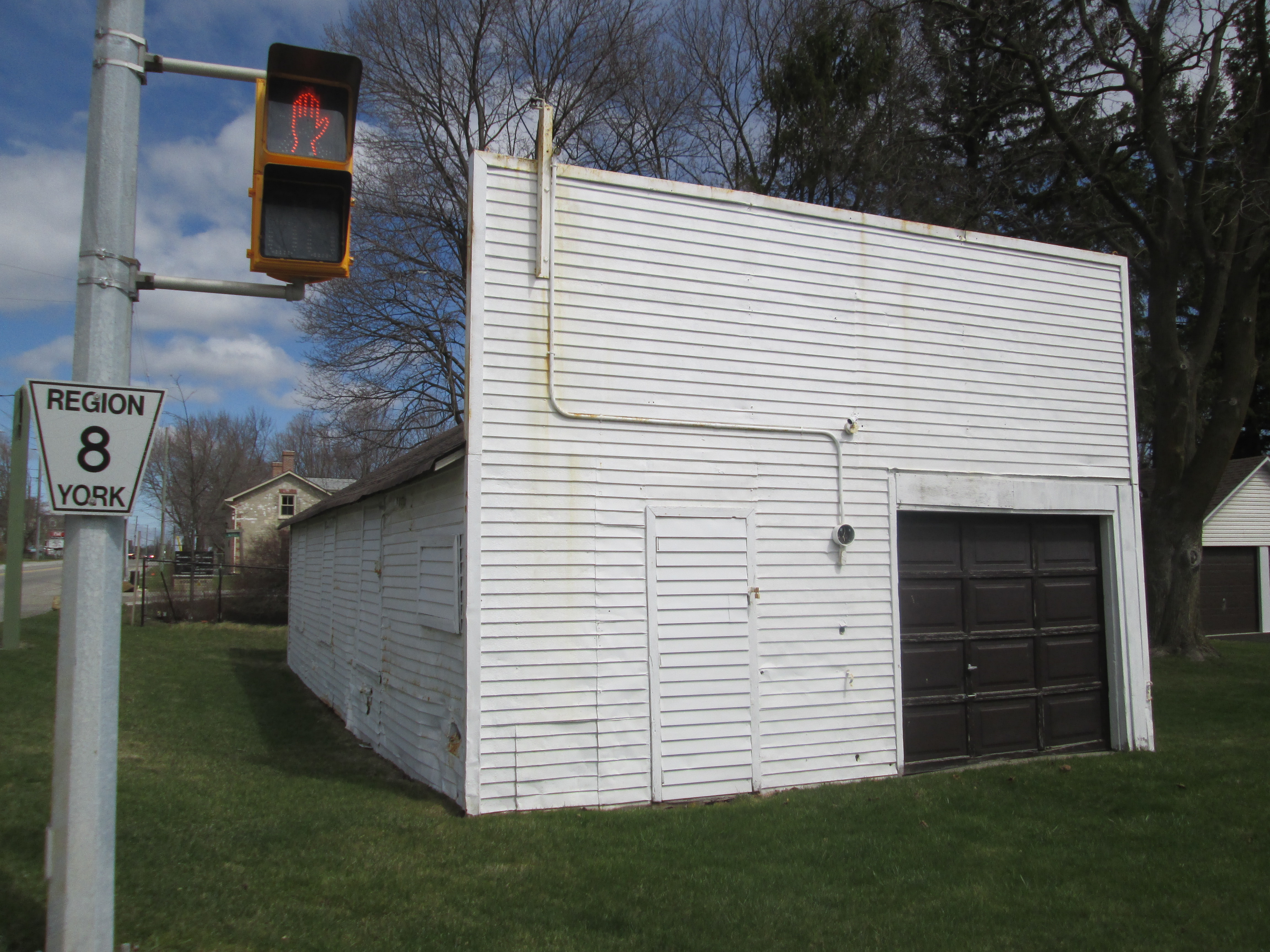
An old garage which formerly contained two gas pumps stands at the main intersection.   This was Louis Stoutenberg’s garage and his house stands beside it.  It sports a false square front and evidence of several car impacts on the side of the building.

IMG_3892

There are 22 buildings in Victoria Square which are either listed or being considered for heritage preservation.  Thanks to Deborah Boynton Robbilard who’s great grandfather William was the butcher at the turn of the last century.  Her insights into the community were invaluable in preparing this brief history.

Other pictures of heritage properties will be posted at http://www.facebook.com/hikingthegta


Guildwood Park

Sunday April 19, 2015

I went to Guildwood park because the second oldest house in Toronto is preserved here.  I found the house and a whole lot more.  I parked in the parking lot of the former Guild Inn and went for a walk in the cool sunshine.

In 1795 Augustus Jones, who had surveyed Yonge Street, was commissioned to survey Scarborough.  It is said that Jones built the log cabin on the property for his crew to live in during the work but records show that his men lived in tents at this time.  Regardless of the details it is generally accepted that this is the oldest house in Scarborough and the second oldest in Toronto.

IMG_3806

The property was originally granted to William Osterhout in 1805.  Over the next 100 years a series of owners lived on the property.  In 1914 Colonel Harold C. Bickford built his country estate on 40 acres of land with a view over lake Ontario.  His 33 bedroom mansion, known as Ranelagh Park, is featured in the cover photo.  Bickford fought in the Boer war, was a Brigadier General in the First World War and then led anti-Bolshevic forces in Russia following the war.  He and his family enjoyed the view from atop the Scarborough Bluffs for only a few years before the house was sold in 1921 for use by an order of Catholic Missionaries.  Over the next ten years it also served as a home for a wealthy business man and finally it sat empty for a couple of years.

In 1932 Rosa and Spencer Clark took over the property and started the Guild of All Arts.  Under their management the property was expanded with additions to the house being made throughout the 1930’s and 1940’s.  A 6 story hotel tower was added in 1965 to accommodate all the people who were visiting the artist colony.  The tower sat empty from 2001 until 2009 when it was demolished.  The picture below shows the sprawling mansion as it looks today with all of its additions.

IMG_3833

In 1940 a sculpture studio was built.  Various artists worked here over the years including Dorsey James who created the Norse carvings on the door and along the roof line in 1970.

IMG_3770

The Guild sits on top of the Scarborough Bluffs with beautiful views out over the lake.

IMG_3809

During World War II the property was operated by the Women’s Royal Navy Service.  In 1947 it was returned to the Clarks who picked up where they had left off.  They became concerned that much of the late 19th and early 20th century artwork that decorated buildings in Toronto was being destroyed to make way for new development.  They started to collect or buy interesting parts of demolished buildings and move them to the Guild Inn property where they had them re-assembled.  Today there are parts of over 30 buildings on display on the grounds.

The four Corinthian columns in the picture below stood at the entrance to the Banker’s Bond Building at 60 King Street West.  The Banker’s Bond building was constructed in 1920 and demolished in 1973.

IMG_3760

The building originally looked like this.  The street address sign stood over the doorway but was placed in the middle when the columns were put back together.

Banker's Bond

The Bank of Toronto stood on the south west corner of King and Bay streets from 1912 to 1966. The bank was founded in 1857 by George Gooderham, son of William Gooderham who owned Gooderham and Worts distillery in Toronto.  The bank merged with The Dominion Bank on Feb. 1, 1955 to form the Toronto Dominion Bank.  The columns in Guildwood Park have been set up in a different configuration than the original building.  The three arched entrances have been split up and placed on three sides of the monument.

IMG_3801

The Bank of Toronto building in 1915.  The three arches were located side by side at the entrance to the bank.

Bank_of_Toronto_Building_1915

The Canadian Bank of Commerce has stood on the north west corner of Yonge and Bloor for over a century.  This ornate date stone was rescued from the 1899 building.  It was removed in 1972 to make way for the new 34 story tower that CIBC built at Two Bloor West.

IMG_3795

The building as it appeared in 1922.

urbantoronto-7438-25493

The Temple Building was constructed in 1896 on the corner of Bay and Richmond Streets.  It was built as the international headquarters for the Independent Order of Foresters who claim to have originated in the 14th century in England as a friendly society caring for the sick.  I love the horses head on the top of this piece.

IMG_3763

At 12 stories it was the tallest building in the city upon completion.  It was demolished in 1970.

templebuilding

The Royal Conservatory of Music was founded in 1886 as the Toronto Conservatory of Music. Their building at College Street and University Avenue was built in 1897 and demolished in 1968.

IMG_3824

A trail winds it’s way down the hill to where an old construction road leads to the edge of Lake Ontario.  It practically cries out to be explored.  Perhaps another time.

IMG_3832

Today the Guild Inn sits empty once again.  The signs in the window declare it to be a hazard due to asbestos and mold.  It’s future is in question.  Will it get cleaned up or demolished?

Like us at http://www.facebook.com/hikingthegta

Huttonville

Saturday April 18, 2015

It was a beautiful sunny day with the temperature climbing to 20 degrees as we walked.  Hiking north on the Credit River from where we left off last week in Eldorado Park isn’t possible.  The river flows through Lionshead Golf Course which is considered to be Canada’s most difficult course.  The course extends across 520 acres all the way to Mississauga Road.  Huttonville grew around mills that were established on the Credit River at Mississauga Road.  Today the river through town is clearly posted as no trespassing.

When the area was first settled around 1820 it was called Brown’s Mills after the grist mill.  The locals also tended to call it The Wolf’s Den after the creatures who lived in the forests and hunted their livestock.  James Hutton bought the mills in 1855 and renamed them Hutton’s Mills. When he opened the town’s first post office the name Huttonville was adopted.

We parked on the small section of old Mississauga Road where Queen Street dead ends just above Huttonville.  There are a couple of abandoned houses rotting in the woods here whose pictures will be presented on our Facebook page.  We went for a walk along River Street where you can see the old mill dam in a few places.  We stopped to talk to the property owners who were tending their gardens.  They told us that Hurricane Hazel (Oct. 15, 1954) had done some serious damage to the dam.  They graciously allowed us access to take a few pictures.  The picture below shows the dam with the sluice gates on the right.  The dam has a distinct lean to it as it reaches out into the river.  It was built in 1923 it was the fourth dam constructed at this site.

???????????????????????????????

Sluice gates are the part of the dam used to control the flow of water out of the mill pond.  The miller wants to have a consistent flow of water to turn the wheel or turbine at a steady pace in the mill.  By raising or lowering the sluice gates he can continue to operate the mill at times of either high or low water levels in the river.  The sluice at Huttonville is an excellent example of how this worked.  The steel cranking system still stands above the gateway while the remains of some of the boards are in the bottom.  Behind this gateway is the head race that carried the water to the mills on Mill Lane.

IMG_3719

The American Bullfrog lives an average of 8 years in the wild. During the winter they lay on the mud at the bottom of the river.  They can’t dig in the mud like turtles do for the winter because they don’t actually hibernate.  Instead, they turn the body fluids in vital organs into glucose so that it doesn’t freeze.  If it gets too cold they will stop breathing and their hearts will stop beating.  When they warm up above freezing their bodies start to function again. As we were enjoying the old dam we saw many pairs of cormorants flying up the river.  Cormorants usually eat small fish but if one of them spots this frog sunning itself on the concrete of the old dam, this is one frog that won’t make it to 8 years old.

IMG_3715

In 1887  John McMurchy built a woolen mill that was powered by its own private powerhouse. Built of red brick it has since been painted over in a drab grey.  With a staff of 30-35 employees, the mill’s main product was socks.  During the first world war, it produced the socks used by the military.  After 65 years of production, the mill was closed in 1953.  The following year Hurricane Hazel would destroy its dam.

IMG_3727

The original signage still stands on the roof of the building facing Mississauga Road.  The cover photo shows the mill during it’s prime.

IMG_3728

A powerhouse was built onto the grist mill in 1885 by Hutton to power his mills.  It generated 100 horsepower of electricity and was considered an engineering marvel at the time.  Along with the mills, it provided power to Huttonville and Brampton.  When John McMurchy bought the plant in 1903 he increased its production to 300 hp.  It provided power to Brampton until 1911 when the town went onto the public grid originating at Niagara Falls.  It continued to be a personal power supply to the mills until 1953 when they closed.

IMG_3743

The historical photo below shows water flowing from the Huttonville mill pond through a shed where it is turning a turbine.  The little waterfall drops it into a settling basin before the tail race returns it to the river.

Huttonville ph

Bloodroot is the white flower in the foreground of the picture below.  It is one of the first flowers in spring but it’s flowers last only a couple of days after being pollinated.  It gets its name from its blood red roots.  Sprinkled in among a sea of bluebells they bring the lawns to life for a short period each spring.

IMG_3747

James Hutton’s house still stands at 2072 Emberton Road, a short walk from his milling empire.

IMG_3752

Across the street from Hutton’s house he donated land for the Methodist Church.  In 1885 it was decided to combine the nearby congregations in Page and Springbrook.  The Page church was demolished and the wooden church in Springfield was moved to Huttonville.  It was placed on a stone foundation and extended by 10 feet.  Then a brick veneer was added to the outside. In 1925 it became a United Church when the Methodists joined the new congregation. Today it is rented on Saturdays by the Seventh Day Adventists.

IMG_3744

Beside the church stands this building which was likely the Queens Hotel.

IMG_3753

A truss bridge used to carry Mississauga road across the Credit near the end of Emberton Road. The foundations remain on the east side of the river but have been removed on west side for road widening.

IMG_3754

For more pictures of Huttonville, it’s mills and dam please visit us at:

http://www.facebook.com/hikingthegta


Garbage Park Toronto

Monday April 13, 2015

Over the past year I have posted over 700 photos taken in various parks around the Greater Toronto Area (GTA).  Hiking through diverse parts of the city one thing is common, there is very little litter in the parks.  This is not the case for the park on the south east corner of Finch Avenue and Dufferin Street.  I don’t know if it has a formal name, I have seen Dufferin Park on some maps, but I feel it should be renamed Garbage Park.  Have a look at the pictures below and see how sick you feel.  Then re-post this where the most people will see it until we get the attention of the city.

???????????????????????????????

Walking down Dufferin along the side of the ravine on my lunch I was disgusted at the amount of garbage.  I know from working in the area that the city never cleans this woodlot.  The garbage runs the entire length of this park along both Finch and Dufferin streets.  This is the view from the street into the ravine.

???????????????????????????????

There is an environmental disaster rotting on the hillside and leaching into Dufferin Creek and then the Don River.

???????????????????????????????

Toronto has a beautiful park system in our ravines.  This should also be a part of that network of wildlife habitats.

???????????????????????????????

Toronto is busy cleaning up for the 2015 Pan Am games why not invest a bit somewhere other than the downtown core?  That isn’t snow in the woods, it hasn’t melted all the years it’s lain there.

IMG_3593

If you think the city’s neglect of Garbage Park needs to end please post this where people will see it.  Spread it around Facebook.  Email it to your city councilor.  The more people requesting action the better.  I would love to come back here and show pictures of the cleaned up park. There is a history here and the foundations of at least four former homes.  There’s a better story waiting to be told.

For hundreds of pictures of beautiful parks in the Greater Toronto Area please go to:

http://www.hikingthegta.wordpress.com

http://www.facebook.com/hikingthegta

Eldorado Park

Saturday April 11, 2015

Winter has a way of hanging on and at 3 degrees we were being subjected to small pellets of ice as we started out.  Eldorado Park is the next stop northward on the Credit River following the visit to Churchville last week.

Eldorado park sits on lots 2 and 3 in the 4th concession west in Chingoucousy Township in what is now the city of Brampton.  Lot 2 was settled by Jacob Snure who built a grist mill which he called Eldorado Mills.  For lot 3, Mary Anne Forest is shown as a saw mill owner, likely after the loss of her husband.  The area has had several owners since this time.  In the 1877 historical Atlas the property is shown as belonging to Kenneth Chisholme.  The mills closed and by the early 1900’s the area was converted to a large private park known as Eldorado Park.  In 1925 the Canadian National Railway (CNR) purchased the property to try to breathe some life into the struggling suburban railway it had absorbed in 1918.  They added a Ferris Wheel and Merry-Go-Round attempting to create the ideal day trip.

We parked in the Eldorado Park parking lot and crossed the bridge to the west side of the Credit River.  Just downstream from here is Brampton’s only outdoor swimming pool.  When the Toronto Suburban Railway was completed to Guelph in 1917 it passed through Meadowvale and Churchville before reaching Georgetown.  It passed through Eldorado Park which gave the railway the idea of creating it’s own tourist attraction to which it would provide transportation. The old right of way for the train tracks ran just along the edge of the swimming pool (long closed when the pool was built) and can be followed south from there.  The picture below shows the old rail bed which, since the removal of the rails for use in Europe during WWII, looks much like any other hiking trail.  The cover photo shows one of the streetcar-like trains unloading passengers at Eldorado Park.

IMG_3395

Along the old rail corridor we decided to follow a small ravine to investigate an older building. Before we reached it we came across an old soda bottle.  Polar Beverages was founded in 1882 in Worcester Massachusetts.  Now in it’s fourth generation, this family owned beverage company is the largest independent bottler in the USA.  Polar Beverages got themselves sued in 1994 by showing a polar bear throwing a Coke in a garbage bin marked “Keep the Arctic pure”. The bottle in the picture below is dated 1948 and was made in Salem Mass.

IMG_3404

During the Depression the CPR determined that rail line and ultimately the park were too expensive to maintain, closing them in 1931 and 1936 respectively.  The park area was purchased by a Jewish group for a summer camp called Camp Naivelt (New World).  For the first few years campers used tents but during the 1940’s and 50’s about 90 small cottages were built in what would be known as Hill 1, 2 and 3.  We had wondered into Hill 3 and found The Ritz and a small building holding a water tank.  Beside them stand two abandoned buildings that were the children’s infirmary.  The roofs are caving in and these will likely be pulled down before long.  The no trespassing sign on the building applies to the whole property and the owners ask that you take this article in the spirit of preserving history and that we do our part by not entering the property.

IMG_3410

The cottages along Hill 3 are at the western edge of the property and face the old infirmary.   In the 1960’s attendance at the camp declined and 52 acres were sold off to the township.  These form the public area of today’s Eldorado Park and have helped keep Camp Naivelt from being swallowed by urbanization.  The camp is now proposed for a Cultural Heritage Designation for it’s contributions to local culture.  Folk activist Pete Seeger hung around here regularily giving impromptu concerts.  He is remembered for writing songs such as “Turn, Turn, Turn”, “Where Have All The Flowers Gone” and “If I Had A Hammer”

IMG_3424

Returning to the old electric rail line we followed it along the river until we came to the place where the bridge is out,

IMG_3437

Beyond here the hillside is oozing mud and quickly becomes impassible.  The old rail line ran across the side of this embankment but much of the remains now lie in the bottom of the ravine under the muddy water.  Parts of rail ties may be strewn along the hillside.

IMG_3441

We returned to the bridge and crossed back to the east side of the Credit and started to follow it south.  After awhile we started to find concrete scattered on both sides of the river.  After passing a foundation for some former building we started to follow a concrete wall running somewhat parallel to the river and just inside an older earthen berm.  Broken in several places it no longer holds the mill pond from Eldorado Mills.  The view below is from inside the former pond looking out through the sluice gate.

IMG_3486

The disipator at the outflow of the sluice is rotting away.  Even so, the effect can be clearly seen in the picture below as it causes the water to lose kinetic energy.  The water is churning white after dropping over a small waterfall.  As it passes each row of posts it becomes noticeably calmer.  By the time it passes the fifth row it is almost totally smooth.

IMG_3492

When we came to cross the tail race on our trip south we found that the only way was use the fallen tree just before the river.  Someone had neglected to nail a hand rail on there for us like had been done at Playter’s Bridge on the Don River.

IMG_3502

Built in the 1930’s the Creditview Bowstring bridge is one of only two bowstring truss bridges in Brampton and the only one still part of a public roadway.  Along with the bridge in Churchville it is also one of only two one-lane public bridges in Brampton.  It had fallen into disrepair and by 2002 it faced closure.  When it was given an heritage designation in 2003 it got a $700,000 makeover.

IMG_3480

Eldorado Park hosts families on picnics and dogs chasing balls these days but the history of a milling centre and an amusement park remains in the old right of way for the electric railway and the remnants of the mill pond and sluice gates.

eldorado_park_ad

Like us at http://www.facebook.com/hikingthegta

Follow us at http://www.hikingthegta.com


The Don Narrows

Saturday April 4, 2015

When York (Toronto) was founded in 1793 the Don River was home to a wide variety of wildlife. The lower Don snaked it’s way through the Ashbridges Bay Marsh before reaching the lake. At night the marshes were alight with small boats spear fishing large salmon. After a snowfall in the winter the frozen river revealed countless tracks from many different species. This past winter’s pictures show that this is no longer the case.  The cover photo shows the marshes in 1909 before they started to fill them in.  This portion of the river flows slowly because it has a very gradual slope at only 4 meters for every km it flows.  Milling operations, industry and sewage caused the river to become horribly polluted by the mid 1800’s.  By 1890 the Don Improvement Plan had been implemented to straighten the portion of the Don river below Riverdale Farm.  This channelized portion of the river would become known as The Don Narrows.  What a change from yesterday.  At 2 degrees, I didn’t end up carrying my jacket today.  I started off at Riverdale Park where I used the pedestrian bridge to get access to the Lower Don Trail.s0725_fl0012_mt00092c_don-straightening

The first bridge across the Don river was a fallen tree with a hand rail attached which was known as Playter’s Bridge.  The drawing below was made by Elizabeth Simcoe, wife the Lieutenant Governor, in 1794.  It ran where Winchester Street  bridge used to stand.  This was the starting point for my hike down the Don River.

Playter's Bridge

The final curve in the river, before the narrows, runs under the former Canadian Pacific Railway bridge.  This abandoned bridge carried the Toronto to Montreal train out across the Half Mile Bridge.

IMG_3282

Just south of here is a pedestrian bridge that carries the Lower Don Trail over the river.  The picture above was taken from this vantage point.  The third bridge is the high green steel pedestrian bridge that backs onto Riverdale Park and Farm built in 1959.  At the base of this bridge is the abandoned abutments from a bailey bridge that stood here previously.  Princess Margaret visited Toronto on July 31, 1958.  She was introduced to the city from this former bridge, of which the concrete abutments stand on either side of the river.

IMG_3284

The bridge at Queen Street replaces a couple of previous bridges.  The first one from 1803 was designed by William Berczy, father of the post master in Toronto’s First Post Office and was a wooden draw bridge.  Today’s bridge was built in 1911and contains the phrase “This River I Step In Is not The River I Stand In” above a clock.  This phrase is taken from the Greek philosopher Heraclitus who is known for his doctrine of constant change.  It was only added in 1996 and the clock has been broken since 2010.

IMG_3287

The Consumer’s Gas Bridge (now Enbridge) carries a 30″ gas main across the river.  It was constructed in 1930 for this purpose and has never actually been used for either pedestrian or vehicular traffic.  Consumer’s Gas used to operate three coal gas manufacturing plants in the city.  Customers who are supplied from the Eastern Avenue facility have their gas carried across the river on this bridge.  At the time that it was constructed the former wooden bridge for Eastern Avenue was incapable of carrying the weight.  There is a current push to have the sides opened up so that it won’t become a dam during a flood, causing a Raymore Drive kind of disaster.

IMG_3301

The double span truss bridge that stands beside the Consumer’s Gas bridge replaces an earlier bridge that was damaged by ice flows in 1933.  This was the former bridge for Eastern Avenue before the opening of the DVP in 1964 and realignment of Eastern Avenue.

IMG_3295

The first rail crossing on the lower Don was built in 1856 as part of the Grand Trunk Railway’s Toronto to Montreal line.  In 1892 a new bridge was built on the existing abutments.  In 1930 the present bridge was built on higher abutments just to the south of the previous one.  The cut stone abutments from 1856 can be seen on the eastern river bank in the picture below.  When the river was widened in 2007 for flood control purposes the west bank abutments were pulled up and used for erosion control and distributed as casual seating.  Cedar pilings that lined the river bank following the 1890 straightening of the river can be seen in the water on the near shore line.

IMG_3385

The last abandoned bridge before the harbour belonged to the British American Oil Company and was used to transport pipes across the river.  It appears to have been closed when the DVP was completed in the 1960’s.

IMG_3314

The river makes a 90 degree turn after it passes under Lakeshore Drive as it enters Keating Channel on it’s way to the lake.  The picture below is looking back toward the curve in the river with the road on the left.  The British American Oil Company who owned the lands on either side of the river refused to allow access for the river to curve to meet the Keating Channel and so the right angled connection.

IMG_3319

Along the Keating Channel, just before Cherry Street, I watched this Canada Goose jumping into the river.

???????????????????????????????

The only bridge to cross the Keating Channel is the Cherry Street bascule bridge.  Built in 1968 it replaces an earlier swing bridge.  With plans to re-naturalize the mouth of the Don river a new channel will be created south of the Keating channel.  The Keating Channel will be retained for it’s historic value but this bridge is already scheduled to be replaced.  Note the operator’s control booth elevated above the bridge on the far end.

IMG_3347

The mouth of the Don where it empties into the harbour as seen from the control room on the Cherry street bridge.

IMG_3351

There is a plan to move the mouth of the Don river once again.  The present discussion involves taking the river a little farther south and then running a more natural channel west to the lake. The areas around the new channel would be planted with trees and made into parkland.  This strip of park would revitalize the Port Lands and reclaim a brown spot on the lake shore near downtown.  The picture below shows one of several proposals for the naturalization of the mouth of the Don River.

urbantoronto-4324-13122 (1)

Google Maps link: Lower Don Trail

Like us at http://www.facebook.com/hikingthegta

Follow us at http://www.hikingthegta.com

Churchville

Friday April 3, 2015.

It was by far the warmest hike of the year so far at 12 degrees feeling like 18.  Before we got back to the cars we were carrying sweaters and coats.  It was Good Friday and perfectly applicable that we should go to church.  So we went to Churchville to explore the historical little village and the conservation area that separates it from Meadowvale.  We parked in the same lot as last week where the Second Line dead ends below the New Derry Road.  Crossing under the bridge we made our way north intending to make it as far as Steeles Avenue.

One of the first plants to respond to the warmer days and increased sunshine is the dogwood. Also known as Cornus Sericea they grow wild in wetlands throughout Canada.  Their bark takes on a brighter red colour before the leaves come out.

IMG_3167

When the Derry Road Bypass (now just Derry Road) was built in the mid 1990’s the Second Line was closed where the bypass intersected it.  After investigating a woodlot just north of the bypass we headed west back toward the Credit River.  The picture below shows the closed second line looking south toward Meadowvale.

IMG_3181

The Credit Valley Railway (CVR) was incorporated in 1871 with a mandate to build a railway from Toronto to Orangeville with various branches westward to Waterloo.  The railway stopped at Meadowvale where the station was at the corner of Old Creditview and Old Derry (now marked by a single old telegraph pole).  It bypassed Churchville on the east and made it’s next stop in Brampton.  By 1881 the CVR was in trouble and was incorporated into the Canadian Pacific Railway.  We crossed the old CVR tracks where some of the tie down plates are dated 1921 as seen below.

IMG_3209

Perhaps the first new growth of the spring are these Coltsfoot flowers that are growing along the banks of the river.  Coltsfoot are unique in that the flowers appear without the previous formation of any leaves.  After the seeds are distributed the flower disappears and the leaves grow, making at appear to be a plant without flowers.  The name comes from two Latin words which mean to act on, or cast out, a cough.  We now know that the plant has certain toxic alkaloids that destroy the liver and some countries have banned it’s medicinal use.  The plant which is the first sign of new life this spring turns out to be toxic to life, if ingested.  In the picture below it looks like a dandelion but is too early and also lacks the green leaves.

IMG_3227

Built in 1907 the current one lane bridge over the Credit River in Churchville replaced several earlier wooden bridges that crossed the river in the centre of town.  The bridge style is known as a steel pony truss bridge.  A truss bridge is one of the earliest designs of bridges and was very common during the 19th and early 20th century.  A truss bridge uses a design of triangles to keep the elements of the bridge stressed either through tension or compression.  Where the sides extend above the roadway but are not connected across the top it is known as a “pony truss”. This bridge is one of only two single lane bridges remaining in Brampton.  A 1911 picture of the bridge is featured in the cover photo.  It was taken at about this time of year and large slabs of ice are melting beside the bridge abutments.  Of note are the three people who are standing on the outside of the bridge railing in the historical photograph.

IMG_3253

Amaziah Church founded the town in 1815 when he built mills on the Credit which were at first known as Church’s Mills.  With a population of 80 it got it’s own post office and the new name of Churchville in 1831.  By the 1850’s it had peaked at over 200 people and was home to 5 mills and over 20 small businesses plus three general stores.  The crash in grain prices following the Crimean War hurt the small milling community and between 1866 and 1877 all of the mills closed.   In 1875 a fire destroyed much of the town, which was never rebuilt.  The failure of the CVR to come into town in 1877 was a final blow to ensure it wouldn’t recover from it’s decline. Of the 98 homes that once stood in the village less than 20 remain.

This building dates to 1840 and may have originally been a wagon shop belonging to Thomas Fogerty.  It served as the final general store for the community and lasted until the 1960’s when it was converted into a residence.  The original store windows have been hidden when the front porch was enclosed.

IMG_3251

Formerly known as the May Hotel this 1830’s structure is one of the oldest surviving buildings in Churchville.

IMG_3235

At one time there were three churches in town.  The Anglican and Episcopalian churches have been lost and the only one remaining is the Weslyan Methodist, built in 1856.

IMG_3256

The old plow in the picture below has been sitting in one place for so long that a group of small trees is growing up in the middle of the frame.

???????????????????????????????

The first burial in the Churchville cemetery was Amaziah Church in 1831.

IMG_3244

The town of Churchville sits on the floodplain for the Credit River and has experienced repeated flooding over the years.  When the town was recognized as a Cultural Heritage District it was decided to do something to protect the historic homes in town.  In 1989 a protective berm was built between the river and the homes along it’s east side.  Behind houses it has been built with a concrete wall and between houses the gentle slope of the berm can be seen.  The picture below is taken from beside the former volunteer fire department station.

IMG_3249

Tagged on the plate as a 100 year vehicle it was appropriate that we saw it entering the 1907 bridge.

???????????????????????????????


Meadowvale Cultural Heritage District

Saturday March 28th, 2015

This is a second part to the post Silverthorne Grist Mill – Meadowvale.

In 1805 the “old survey” was completed in which the native people sold their lands except for 1 mile on either side of the Credit river.  When the “new survey” was completed in 1818 the river was ceded as well and this opened the area up to settlers who wanted access to the river to build saw or grist mills.  John Beatty arrived in 1819 and was the first settler in the area.  Huge pine trees lined the hill sides but a grassy meadow lay around the river.  From this came the name of the town, Meadowvale.  From 1819 until the mid-20th century the town changed very little.  It remained centred around a triangle of streets wedged between Derry Road, Second Line and the Credit River.  As the city of Mississauga started to grow wildly in the 1970’s the people of Meadowvale started to worry that their small town would lose it’s historical charm. They applied to have the town formally recognized as Ontario’s first Cultural Heritage District.

The following is a look at some of the heritage buildings in the village of Meadowvale.  Others have been featured in the post Silverthorne Grist Mill.

Known as the “Hill House” this little home was built in 1840 and is one of the oldest homes in the village.  It has always remained a private residence belonging to the Hill family after 1896. The early Methodist church meetings were held in this house until the church was built in 1863.

IMG_3115

George Bell (no relation to the famous Blue Jay) was the town blacksmith and in 1844 he purchased land from mill owner John Simpson on which to build the first hotel in Meadowvale.   Bell Hotel was built across the street from the grist mill at 1090 Old Derry Road.  For awhile it was also known as Temperance Hotel.  The building is currently in use as residential apartments.

IMG_2987

In 1852 the Brick Hotel was constructed at 1051 Old Derry Road by Matthew Laidlaw.  The stacked open veranda was on the original building but was removed before 1900.  Guests would sit out here to enjoy the evening and get coated with dust from the street in front of the hotel.  The veranda was replaced in recent years.

IMG_3097

In 1857 Meadowvale got it’s first post master in the person of Luther Cheyne.  The post office was operated out of Silverthorne’s store.  In 1860 Cheyne built a home at 7053 Pond Street that was sold to the Farnells in 1890.  In 1920 it was bought by two ladies who opened the Apple Tree Inn tea room in the house.  When this closed in 1944 the house again became a private residence.

IMG_3118

Weslyan Methodist was the primary denomination in much of early Upper Canada.  The 1863 church on the corner of Derry and Second line has had a front porch, or narthex, added to it over the years.  There is a trim of yellow bricks around the top of the older part of the building that can be glimpsed behind the tree on the right hand side.  In 1925 the Methodist church joined 3 other denominations to form the United Church of Canada.  Today it serves the United Church in town.

IMG_3102

The 1870’s were a period of prosperity for Meadowvale while the mills were under the ownership of Gooderham and Worts.  This photo shows the Gooderham Estate as it looked around 1900.  The current house is featured in the Silverthorne mill post.

Gooderham House c1900_th (1)

Around 1870 Johnson’s wagon and blacksmith shops were built at 1101 Willow Lane close to the grist mill.  The original 1870 house still stands on the property as well as a grand old fashioned mansion that was built in 1999 in a style that fits the character of the village.  The wagon shop is featured in the cover photo and the blacksmith shop is below.  Notice the two windows in the second floor of the wagon shop.  Painted parts would be left upstairs to dry.

IMG_3054

In 1870 the Graham house was built next to the Methodist Church on land donated by John Simpson for a home for his daughter Elizabeth and her husband.  This is one of the more ornate homes in town.

IMG_3098

In 1871 a second school was built to replace the old one that stood at the corner of Barberry Lane and Second Line.  The first one had been built in 1851 and was used as a private residence after the new school was built.  Barberry Lane was originally named second street but was renamed after the Barbers who lived in the old school house.  The old school house was lost to a fire in 1974.  The new school was built just behind the Methodist church on land donated by the Simpson Family. It has served as the town hall since 1968.

IMG_3103

In 1879 the Credit Valley Railroad came to Meadowvale.  The chief financial backer was George Laidlaw who was responsible for much of the rail system in and around Toronto.  The picture below shows the CVR station for Meadowvale around 1905.

LG_M319

The homes in the village were mostly built prior to the time of running water.  They would have had an outhouse for a washroom and a hand pump for their well.  Many of the homes in town still have their old pumps on the front lawn.  (Fortunately it looks like they all have indoor washrooms now making that cold winter trip a part of history as well.)

IMG_3122

Along Second Line stands this old post.  A reminder of the days when mail service was made to individual post boxes set at the end of a person’s driveway.

IMG_3130

Today people must go the a “super box” gazebo to collect their mail.  The mail gazebo is located on top of the ruins of the old mill. The old mixed with the new.  In the picture below the old mill ruins can be seen in the background behind the gazebo.

IMG_3147

Meadowvale is full of heritage houses only a few of which have been featured here.  It is a quiet community of narrow streets with no curbs or sidewalks.  A time capsule tucked in the heart of the city of Mississauga.

Like us at http://www.facebook.com/hikingthegta