Tag Archives: Toronto Suburban Railway

Hole In The Wall

Saturday, February 6, 2020

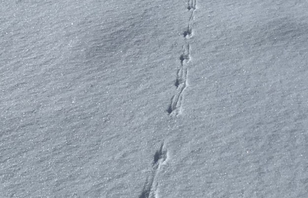
Saturday proved to be one of the coldest hike days of the year so far and we determined not to set ourselves up for too long of an excursion.  Arriving with two cars, we parked one beside the town hall in Limehouse.  The second car we moved to the point where the Bruce Trail crosses the 4th Line.  With fresh snow on the ground, it is always interesting to see the tracks of the animals we share the trails with.  This small set of tracks includes drag marks from the tail of the mouse that made them.

IMG_0633

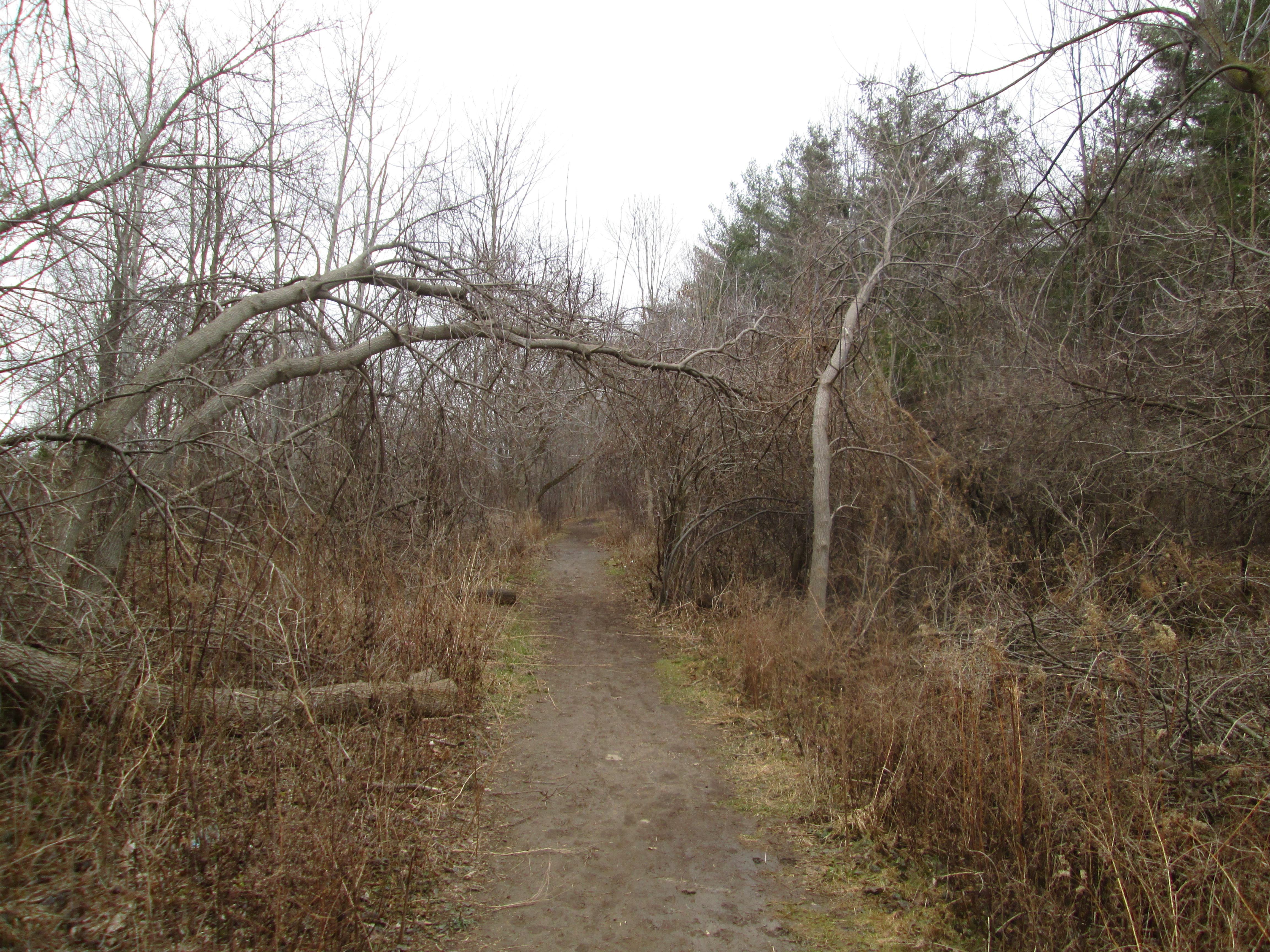
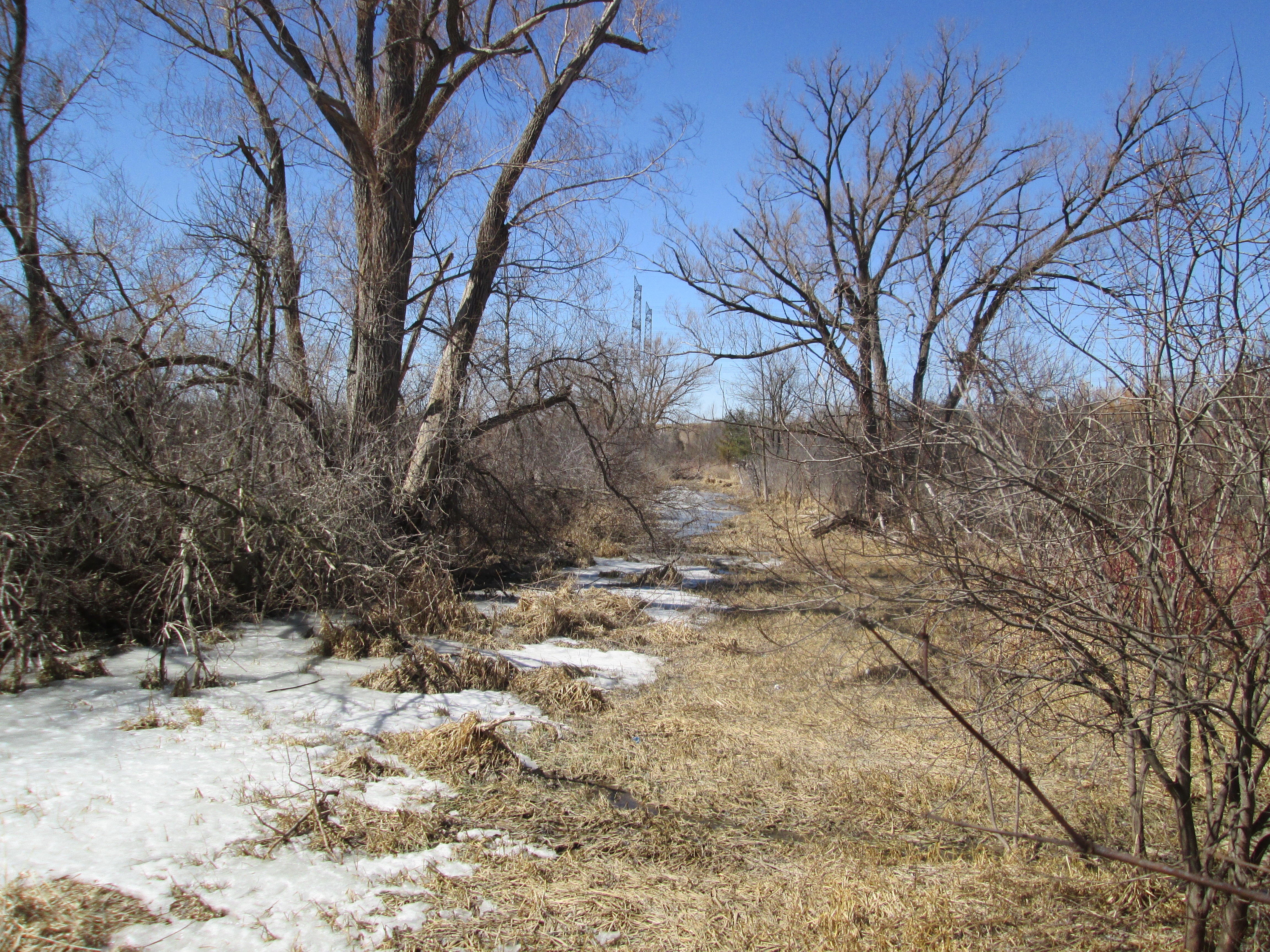
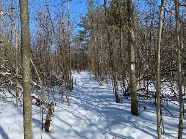
The Bruce Trail is a resource that many people seem to ignore in the winter months but each season has its own special beauty.  We saw very few other people until we reached the Limehouse Conservation Area, where dog walkers were taking advantage of the sunny day.

IMG_0639 (1)

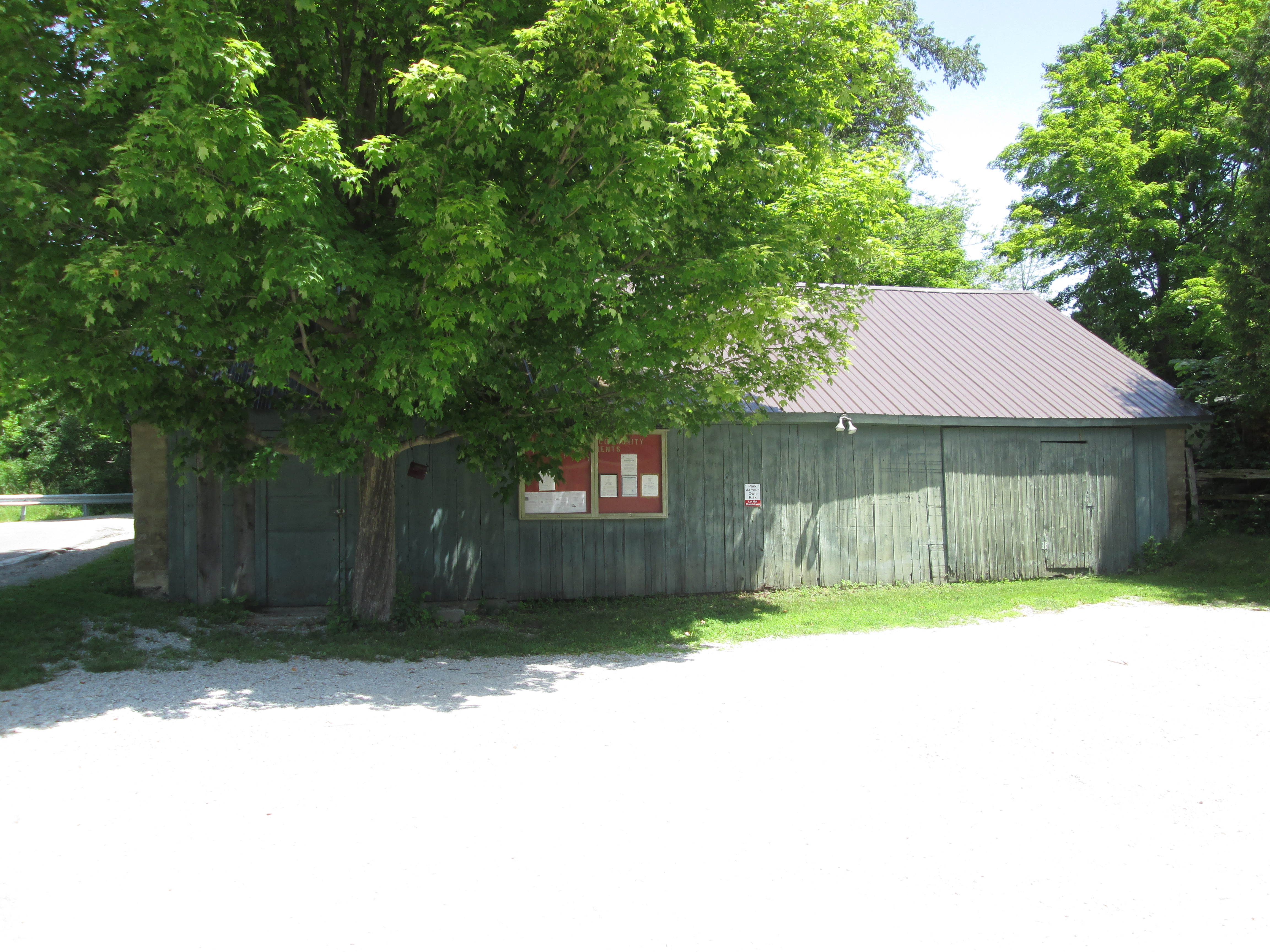
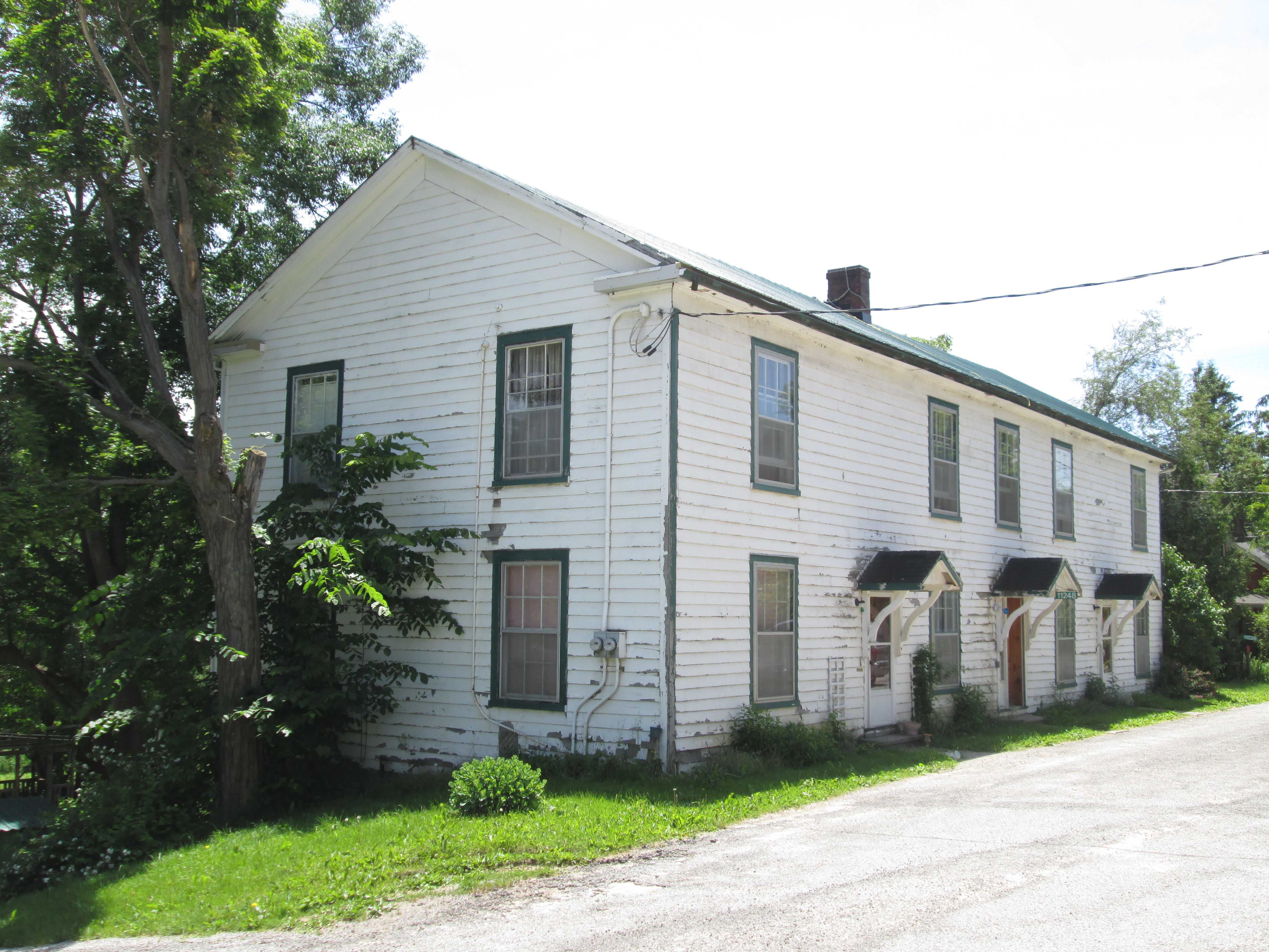
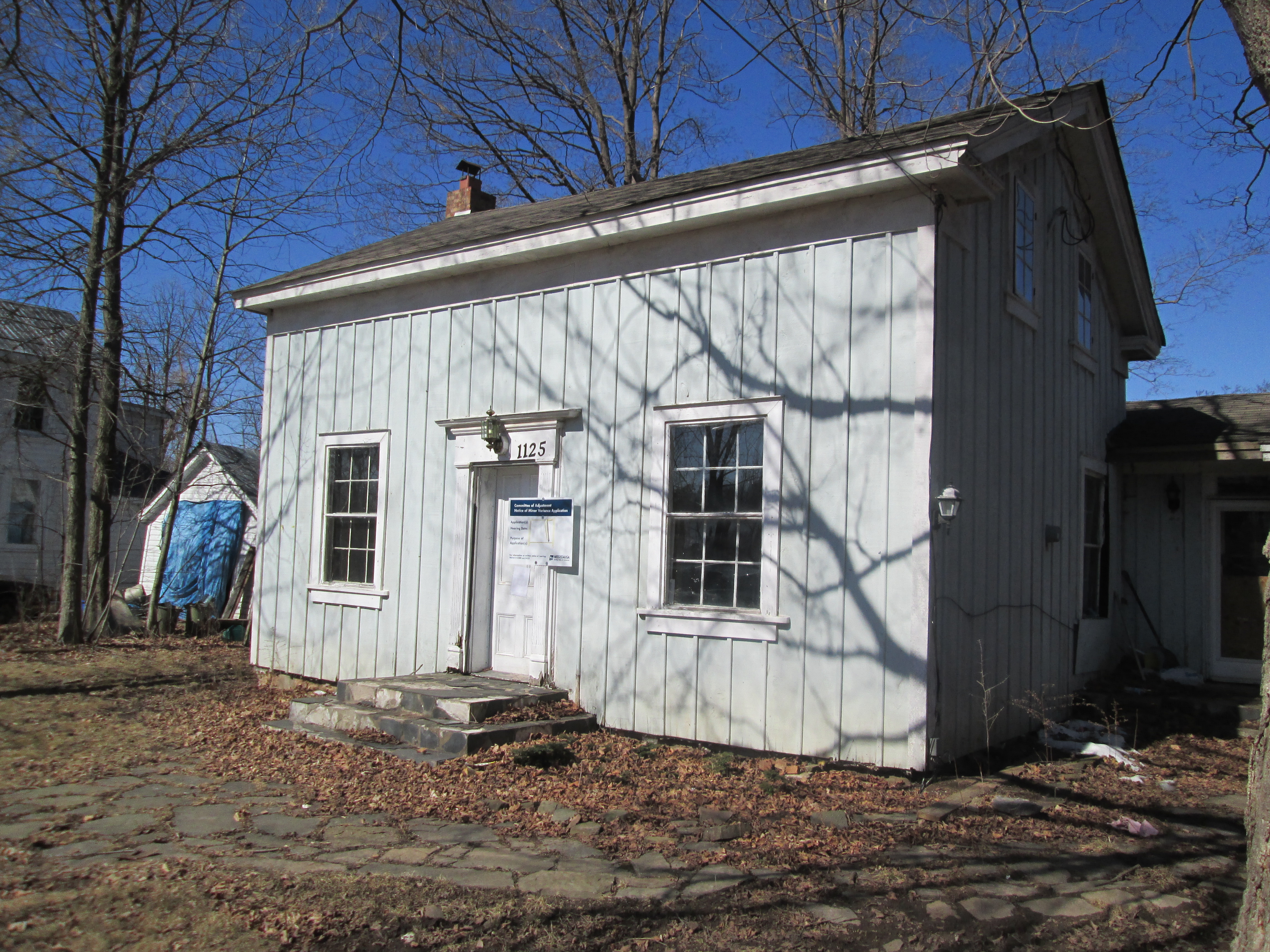
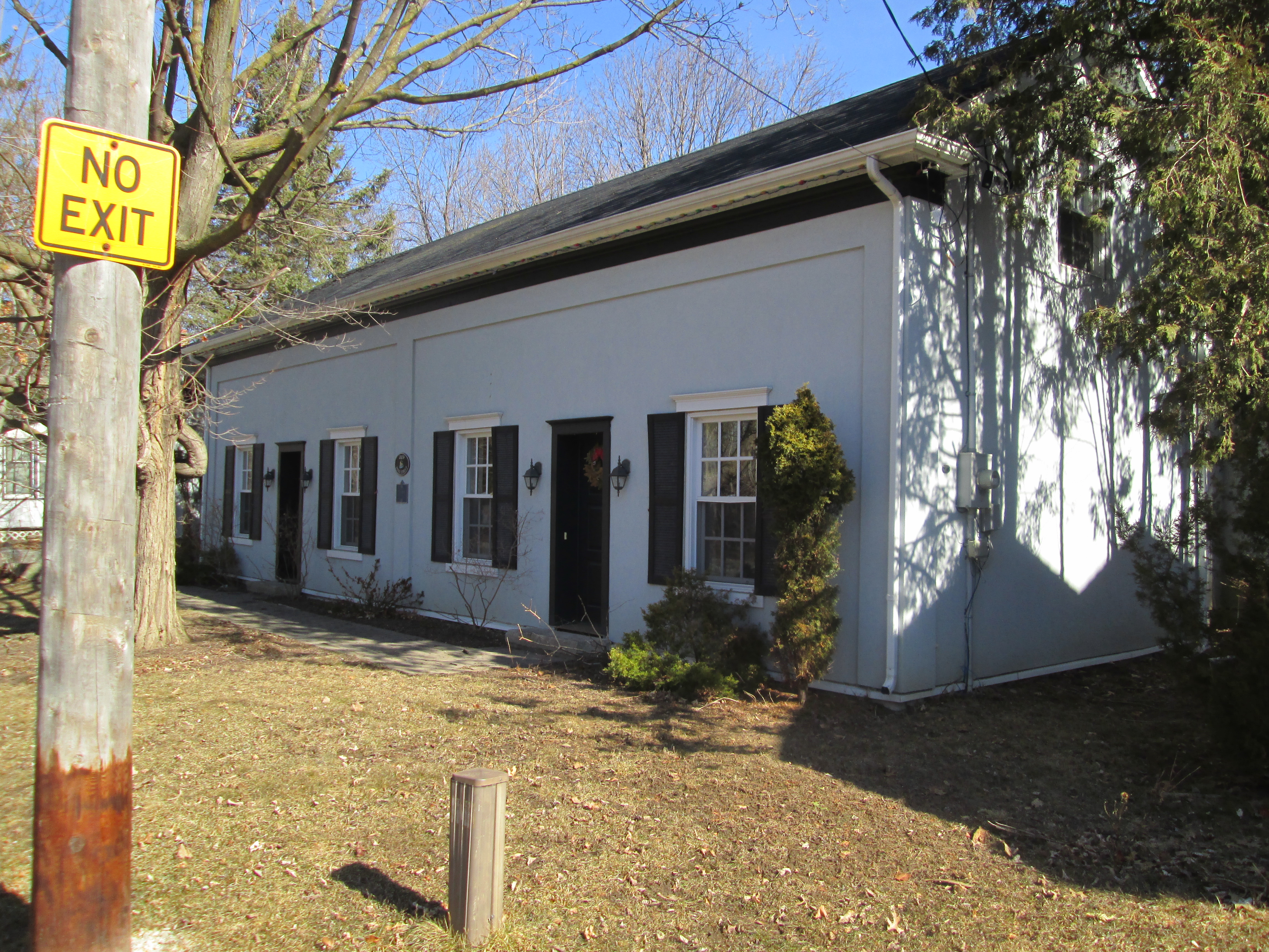
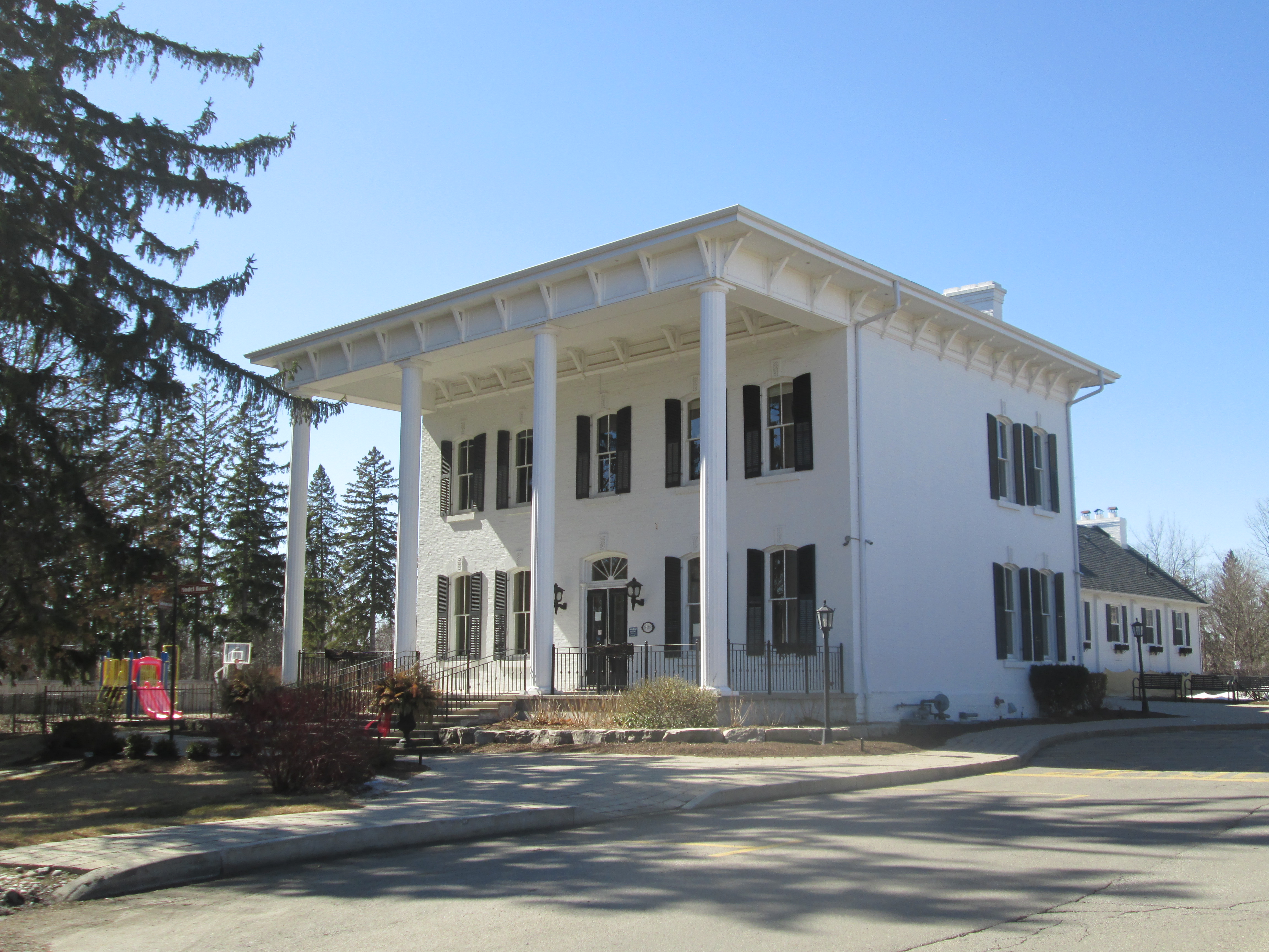
The first school in Limehouse was one room made of log construction.  It was replaced in 1862 with a one room stone building.  When the lime industry was prosperous the town grew fast so that by 1876 there were three hotels and three general stores.  That year, 4,130 tons of lime and lumber was shipped from the railway station in town.  A second floor was added to the school in 1875 but it was only used until 1890 when it was closed.  The room was opened again in 1954 and remained in use until 1962 when the school was replaced with a new one.  Today the building serves as a private residence.

IMG_0636

Eastern gray squirrels can move quickly when they are caught by surprise and are capable of clearing surprisingly large distances with each leap.

Resized_20200208_121253

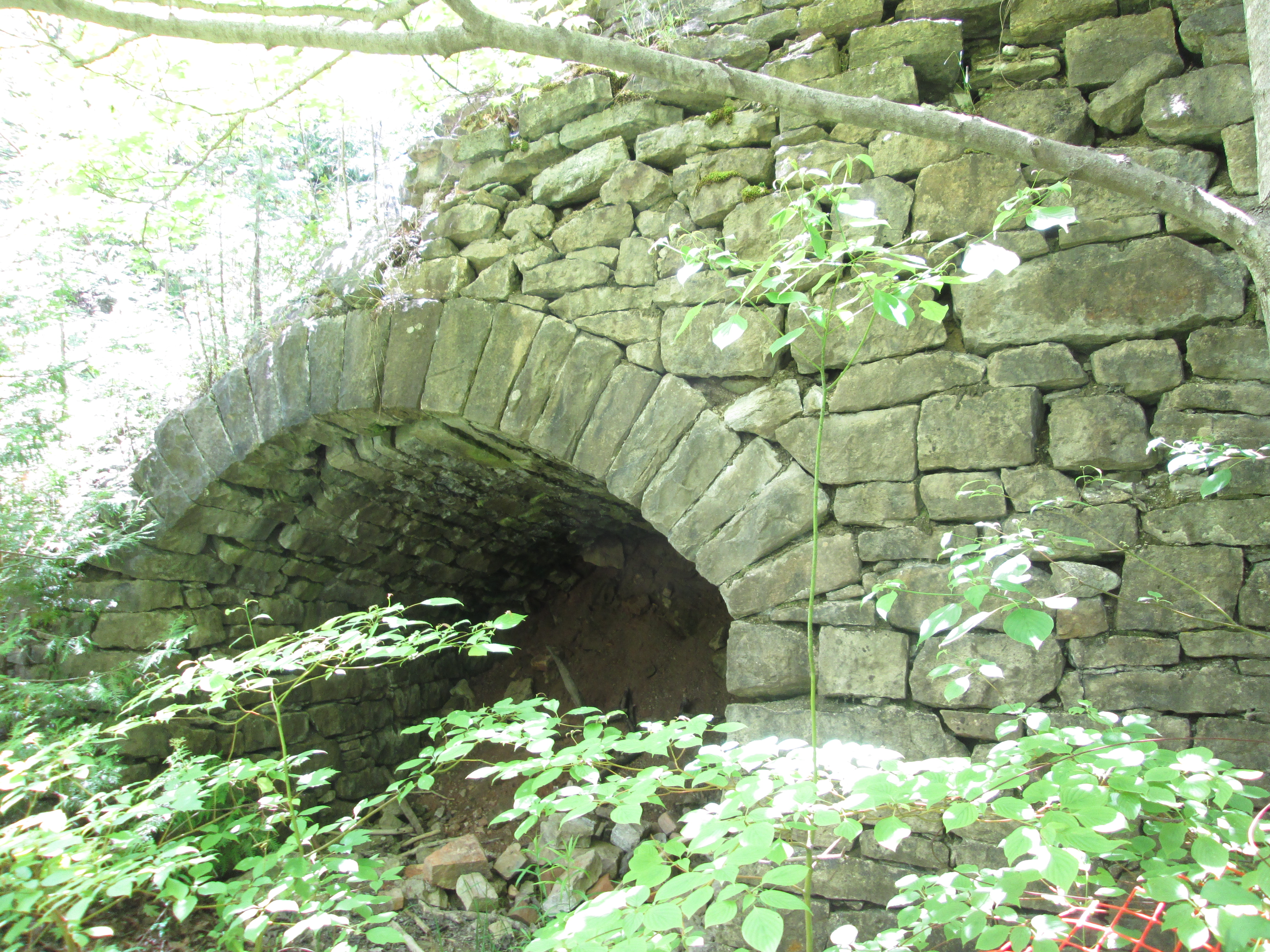
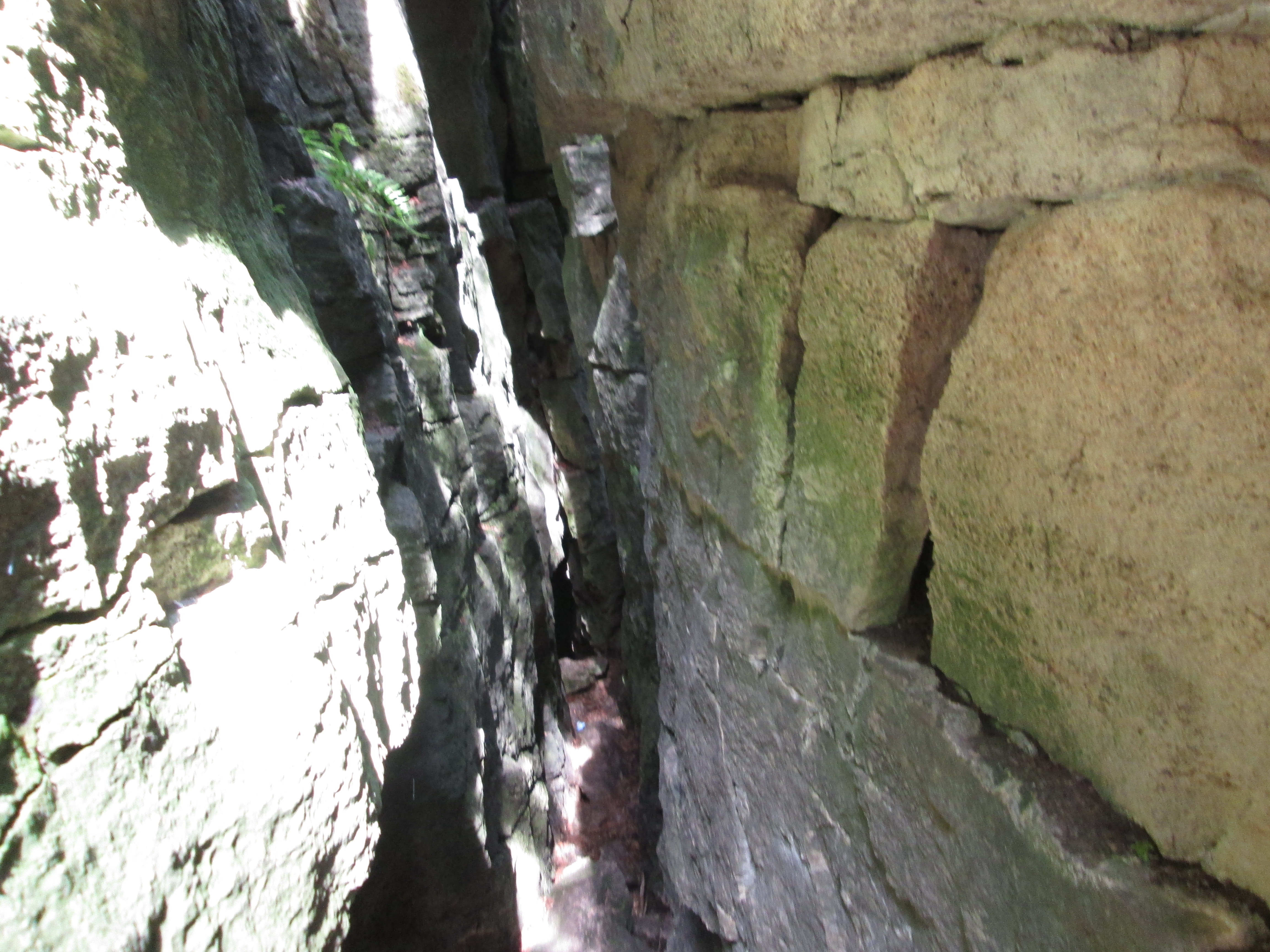
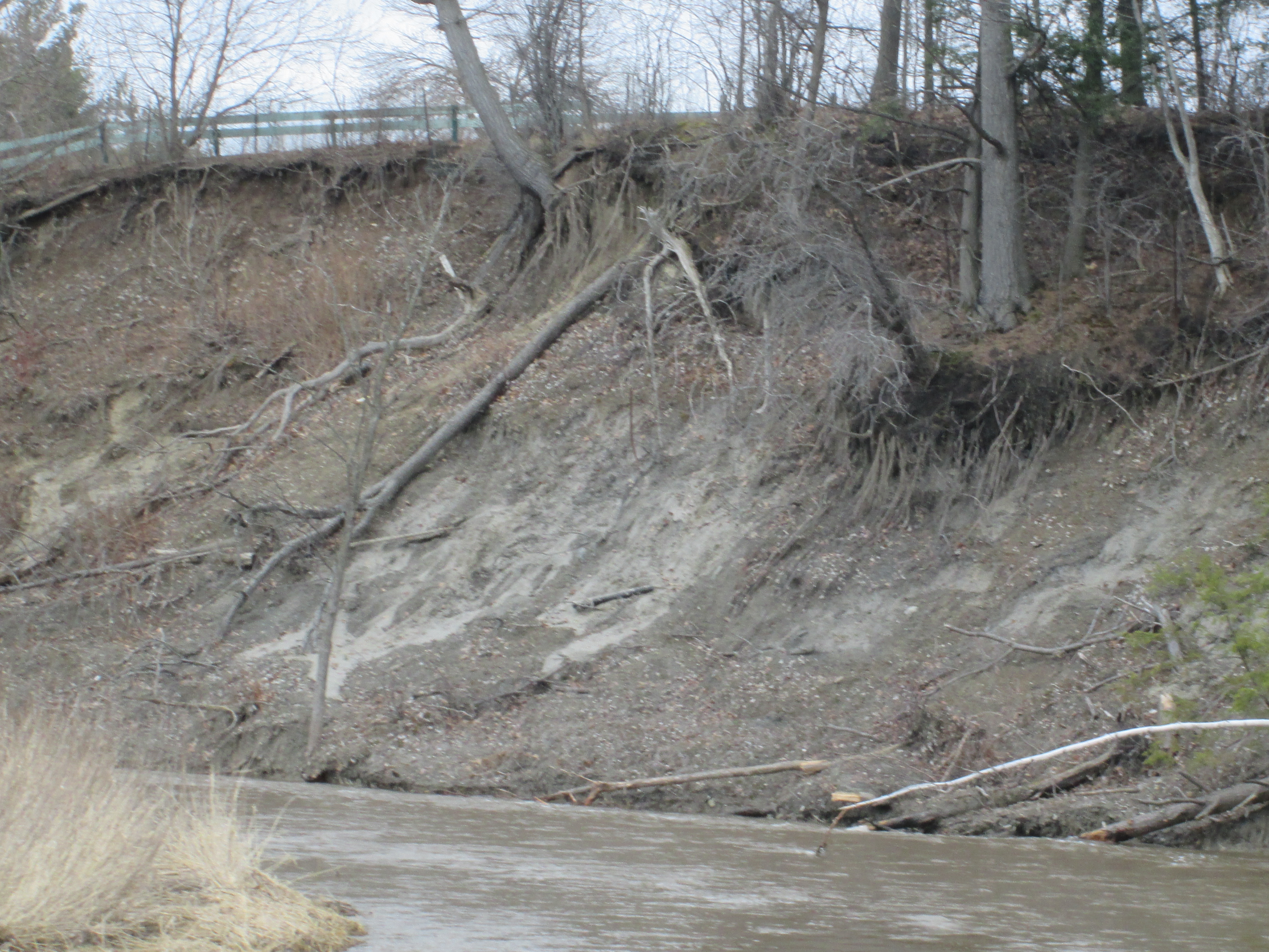
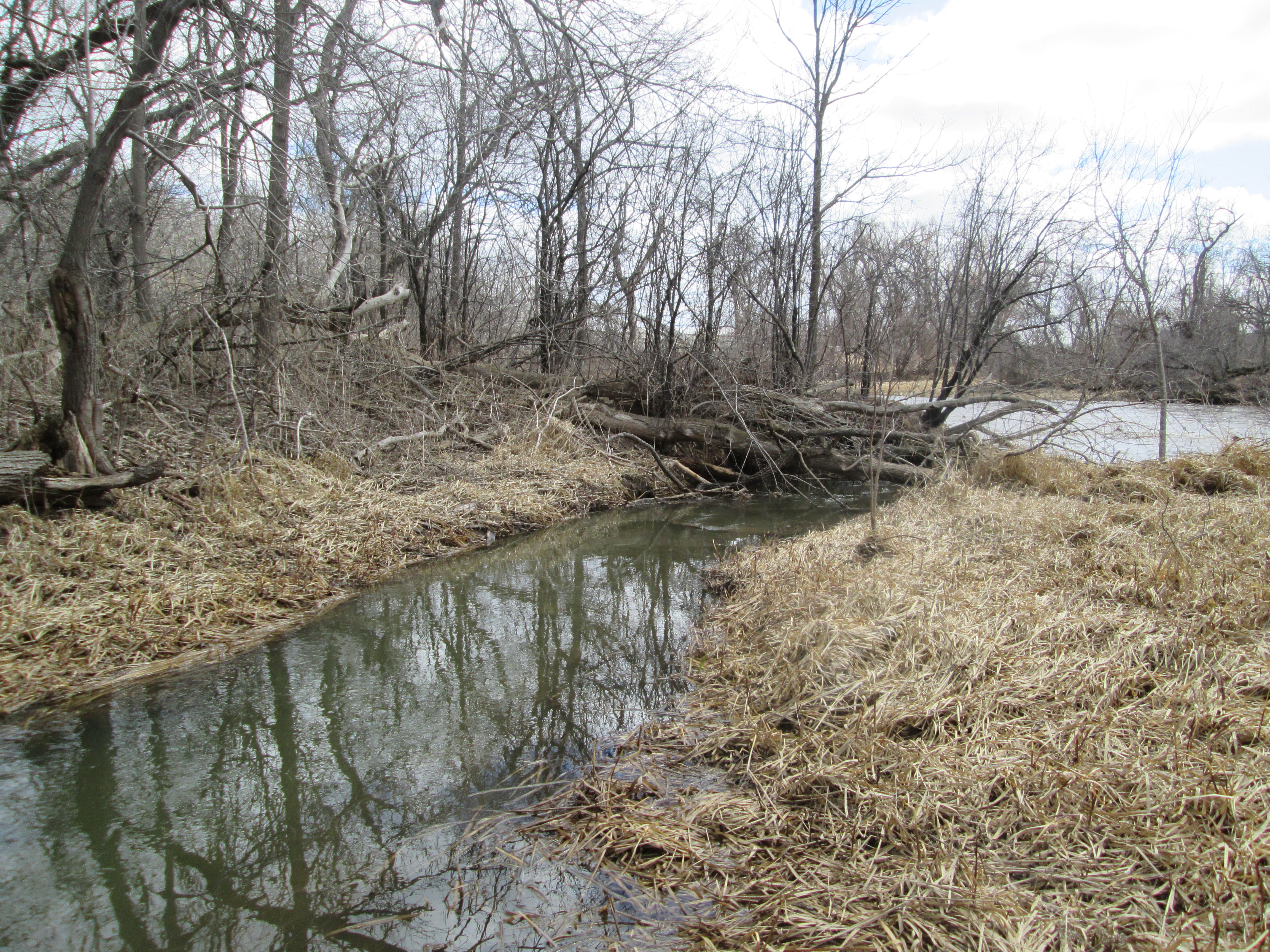
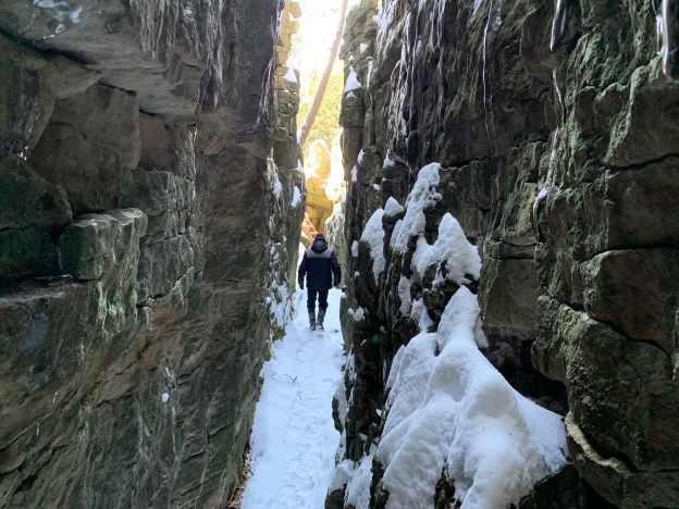
Acidic water breaks down carbonate rocks such as limestone by dissolving them.  This process is known as karst and is common throughout the Niagara Escarpment.  For more detailed information and pictures of this please visit our post on Eramosa Karst.  At Limehouse the Bruce Trail passes through a section of karst known as The Hole In The Wall.  Stairs allow you to access the bottom of these cracks in the limestone.

IMG_0645

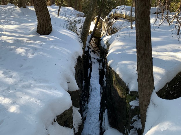
The cover photo shows the depth of the karst at Limehouse.  Small caves throughout the area are some of the most accessible caves in Southern Ontario.

IMG_0652

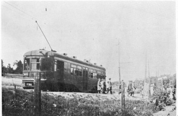
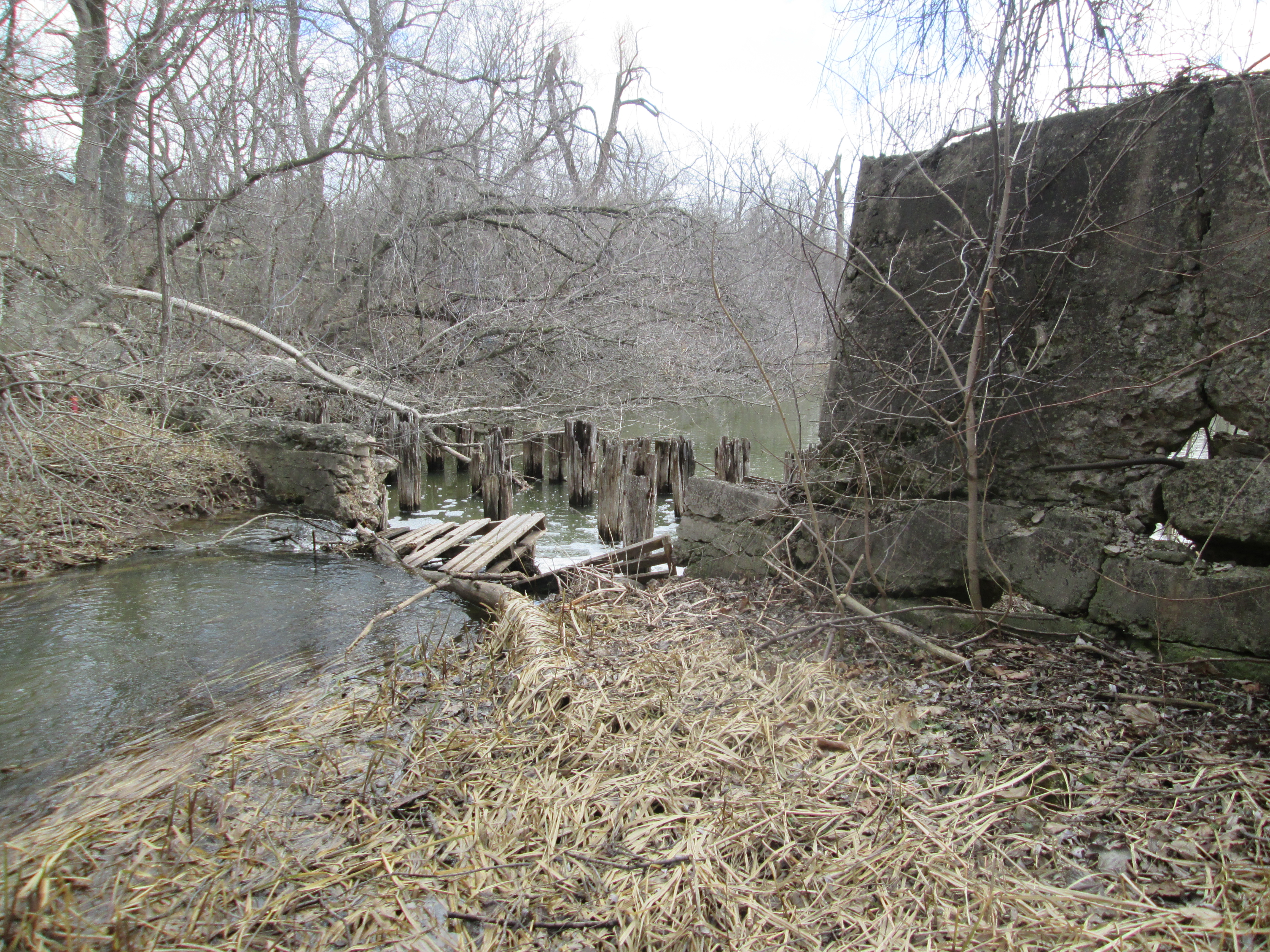
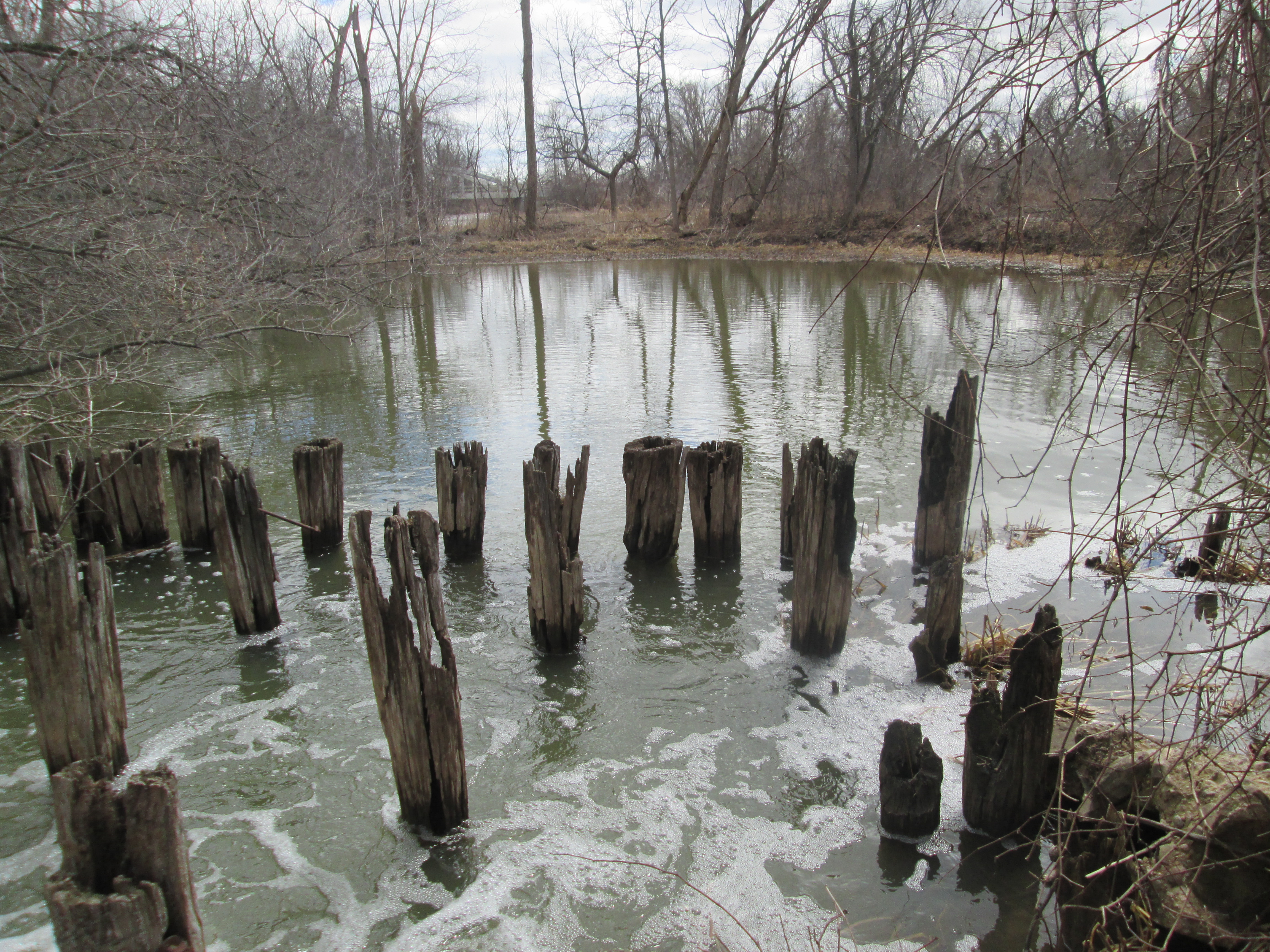
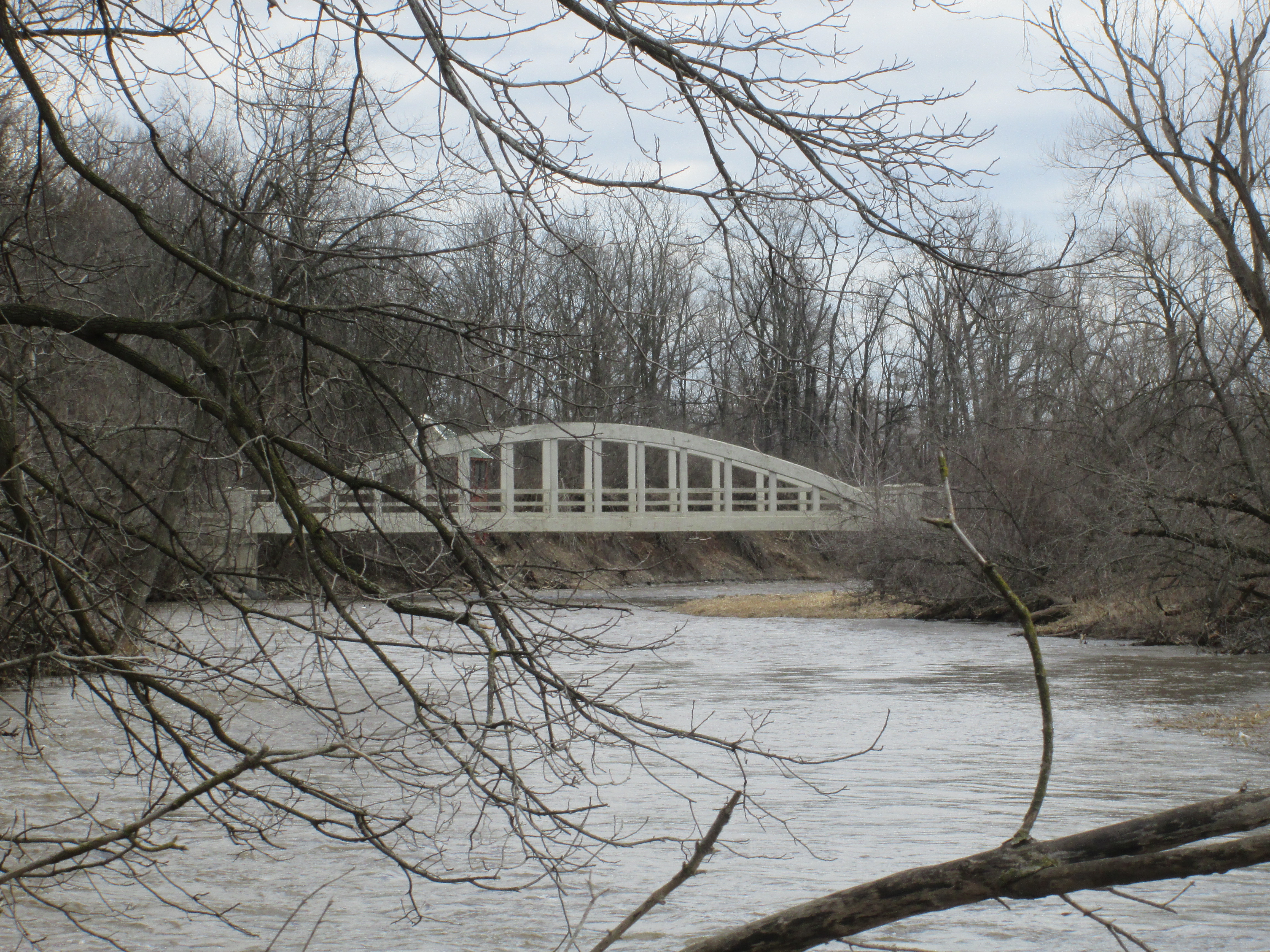
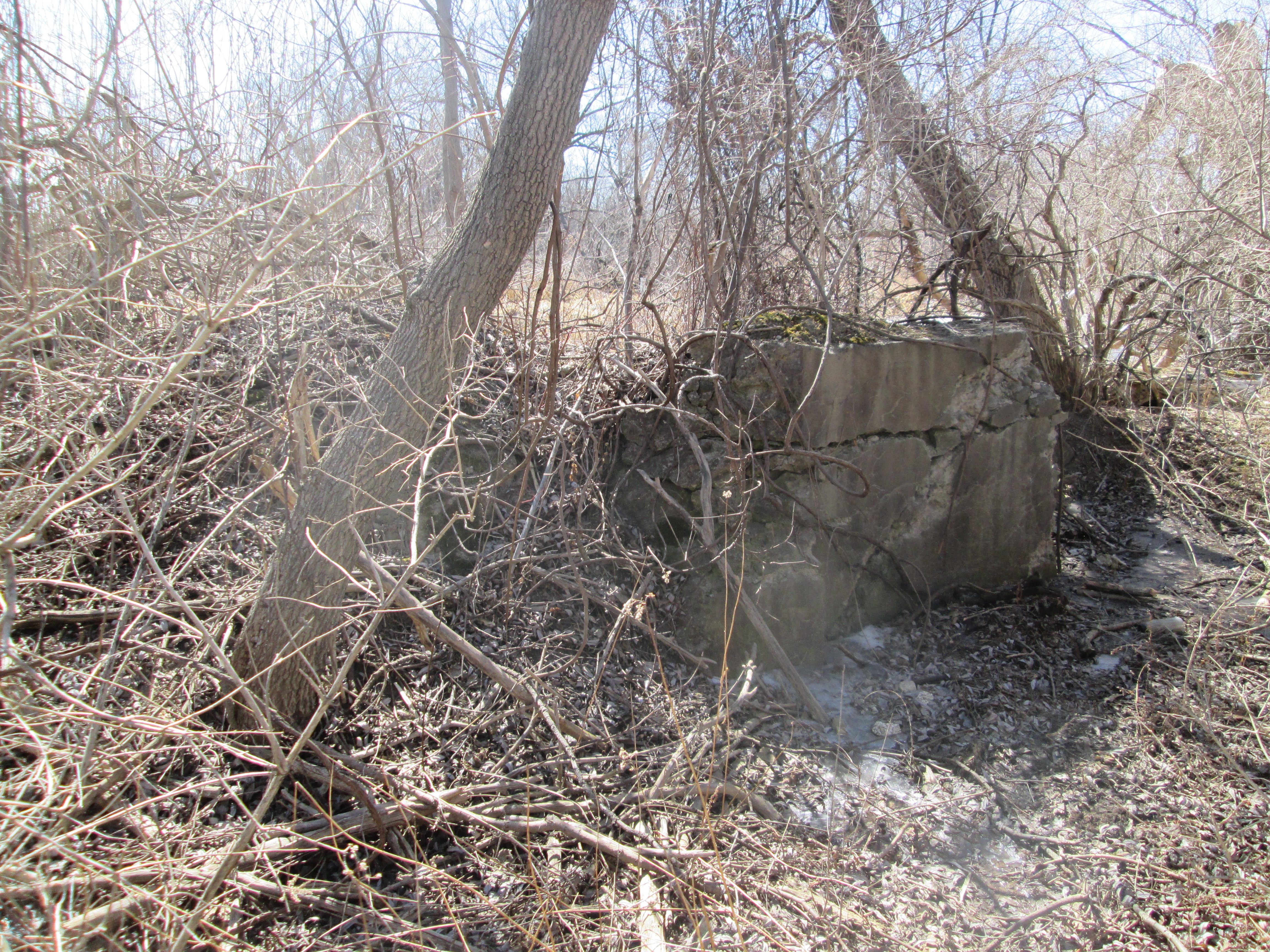
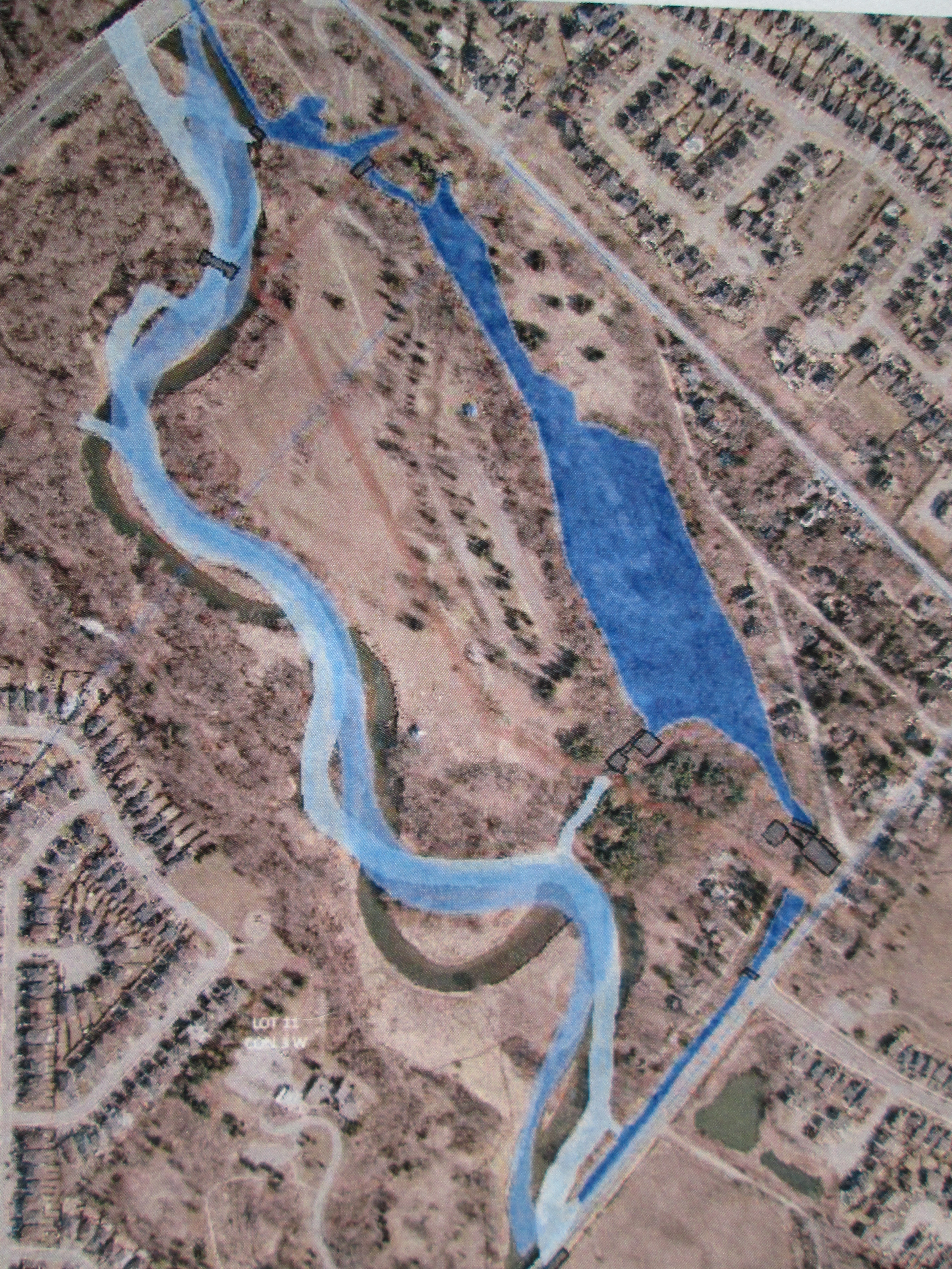
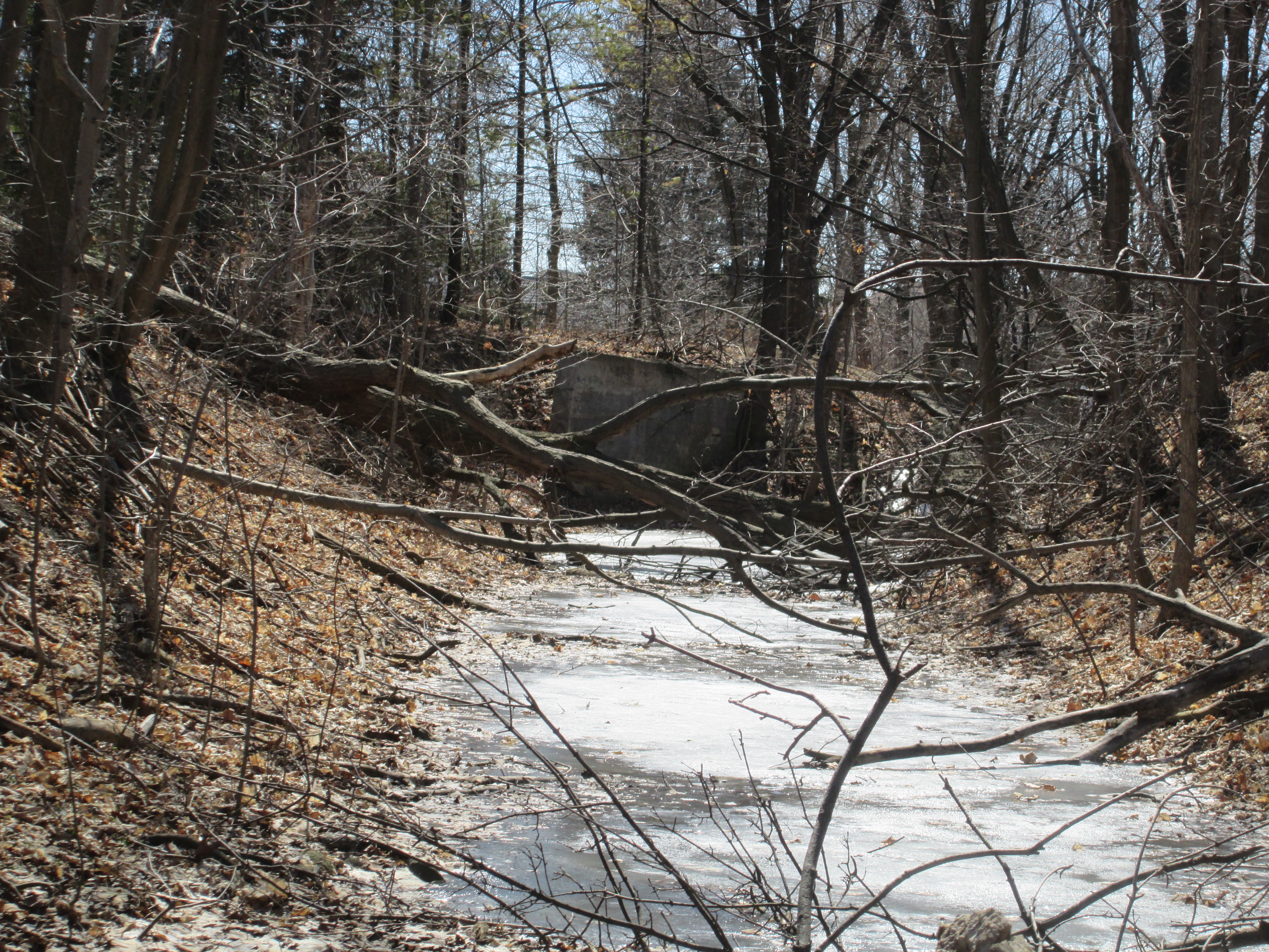
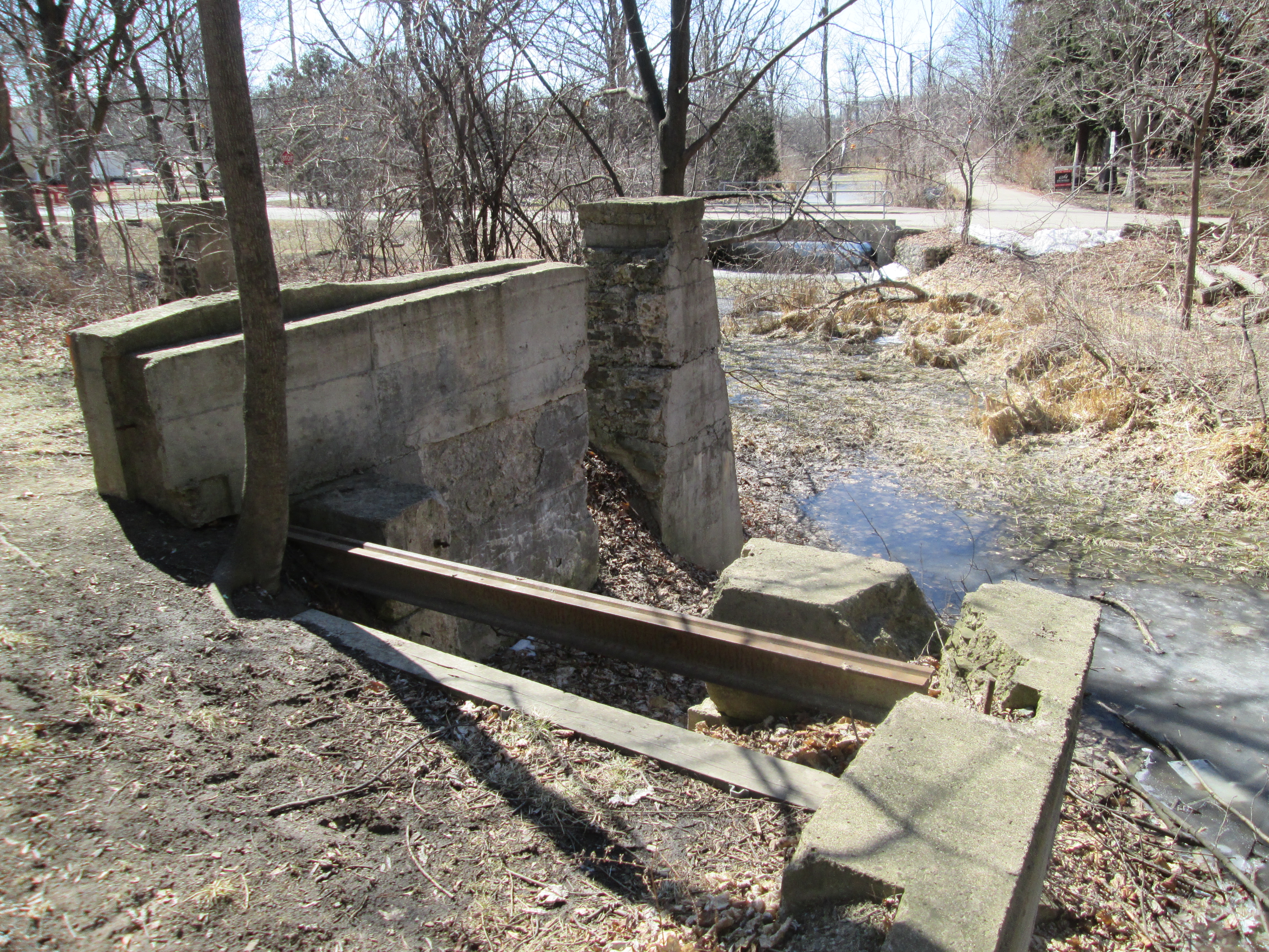
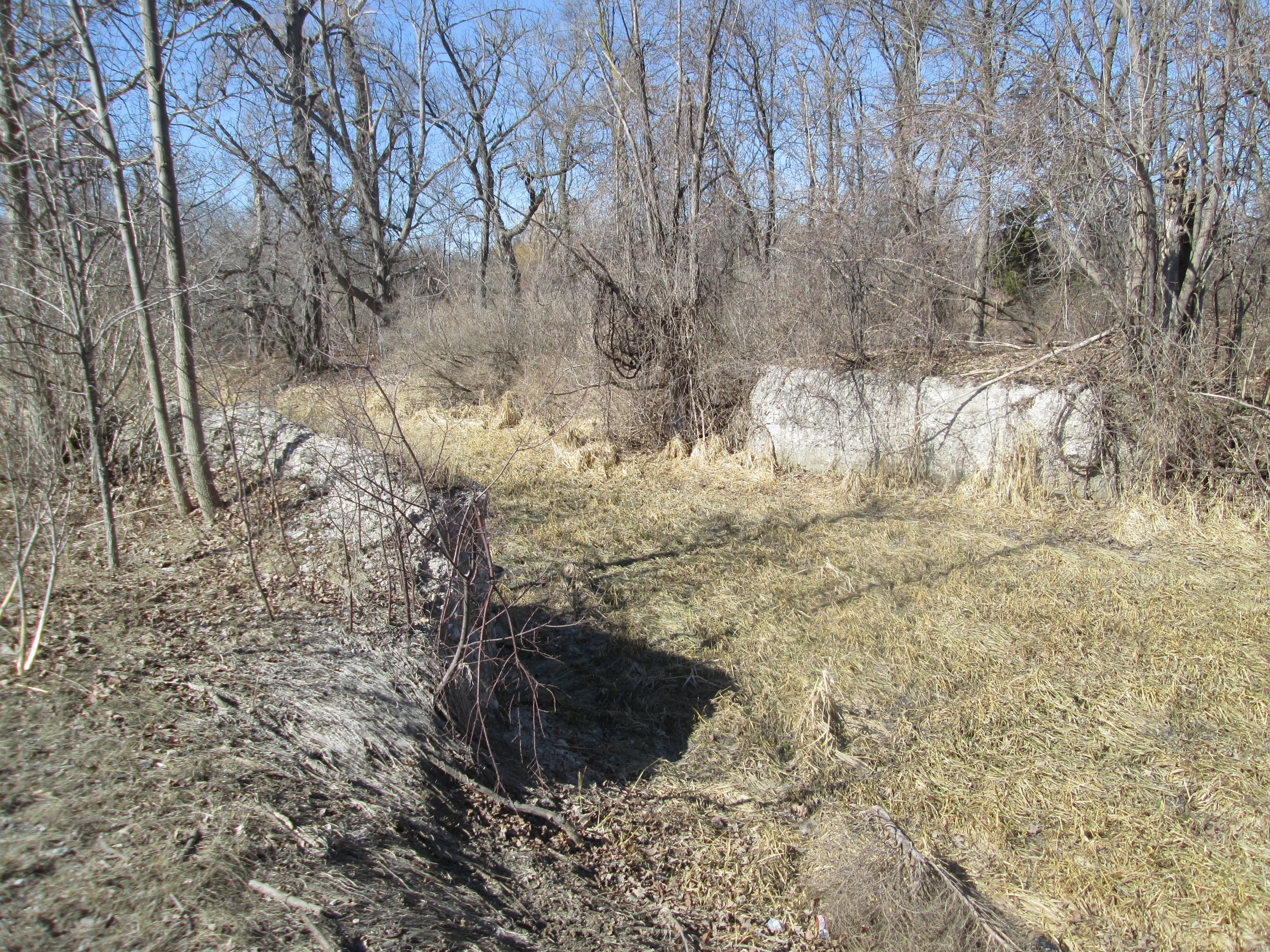
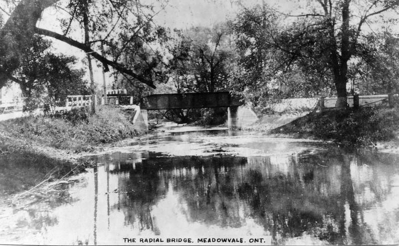
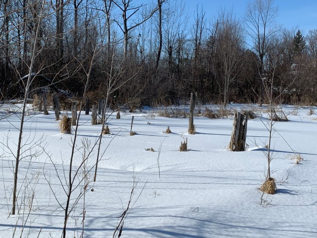
In 1917 the Toronto Suburban Electric Railway arrived in Limehouse with a stop on the 5th line at the foot of what is locally known as Gibraltar Hill.  The stop was convenient because it was located between the school and the heart of town.  The old line can still be traced from Georgetown through to Guelph by looking at Google Earth.  The rail line passed through the middle of the mill pond on a trestle.  Three rows of pilings for the trestle can still be seen crossing the drained pond.

IMG_0659

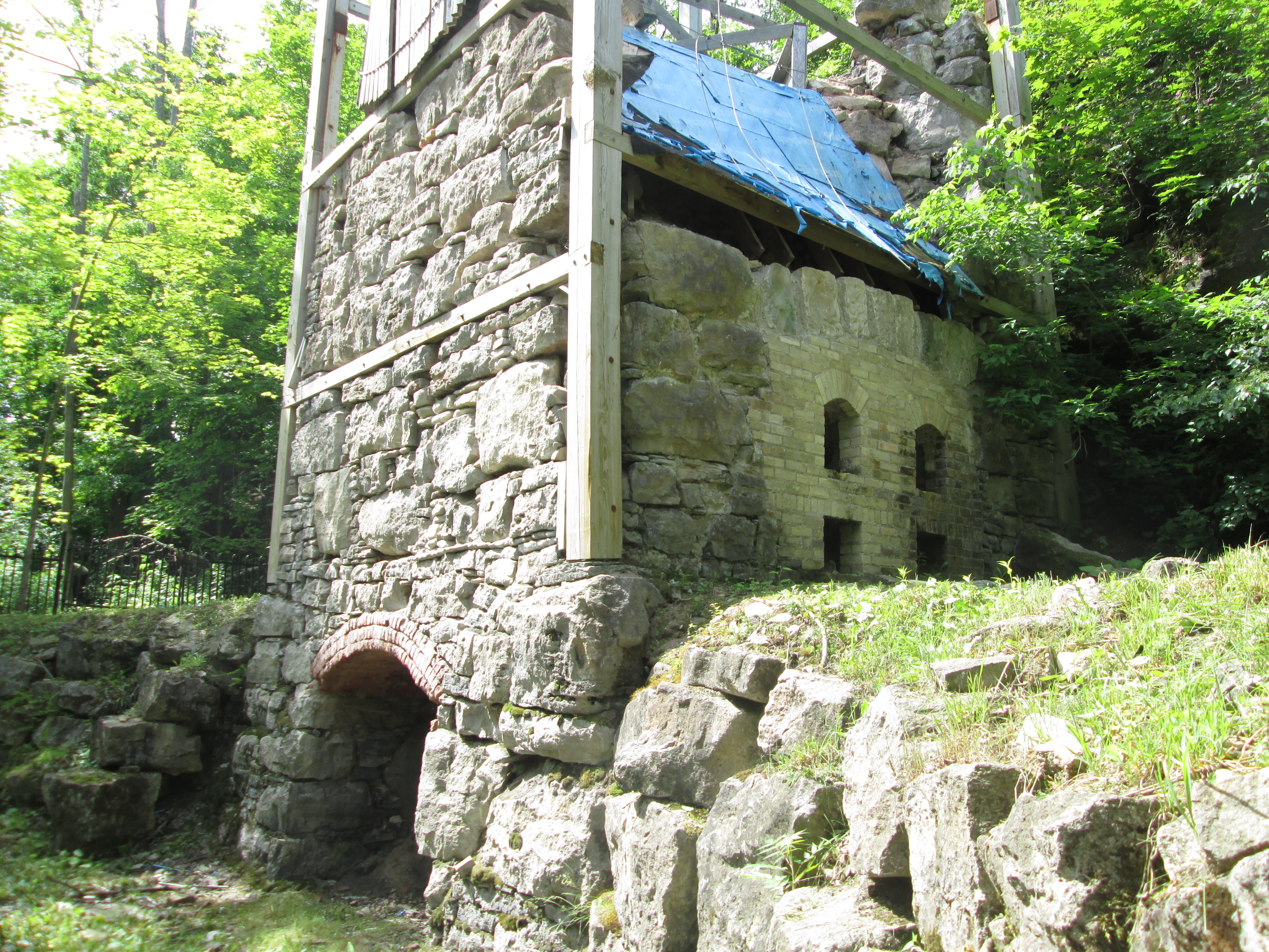
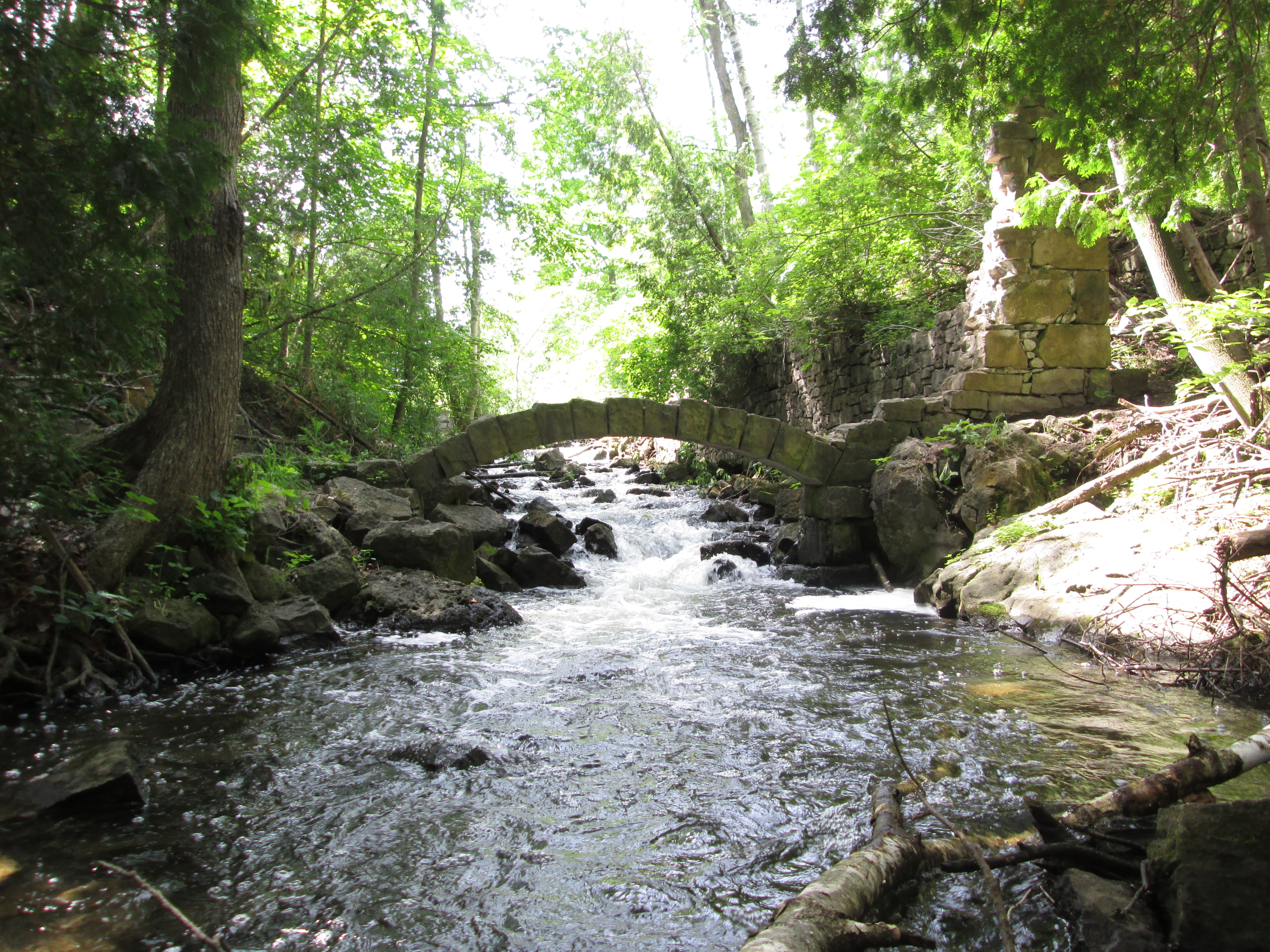
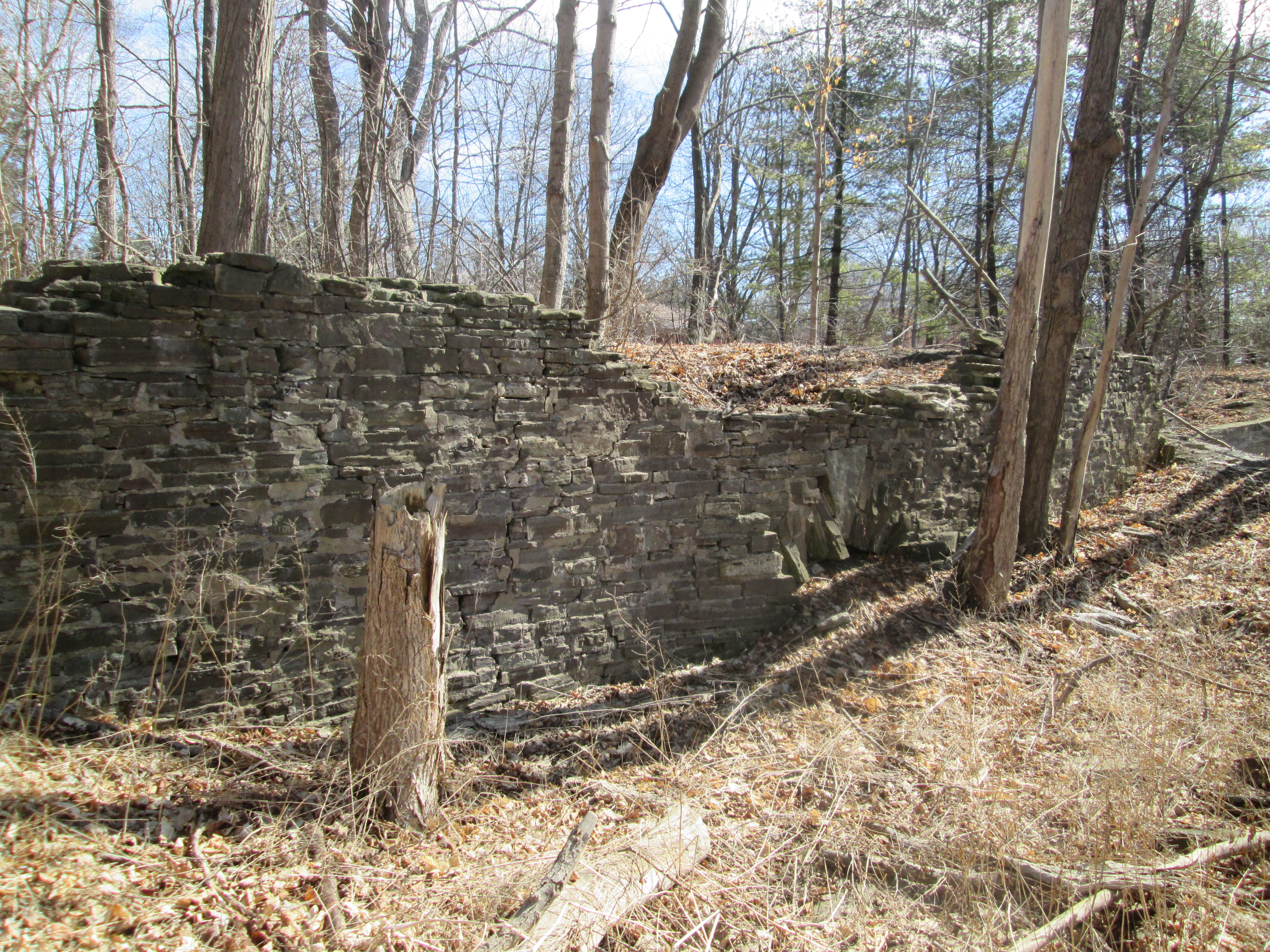
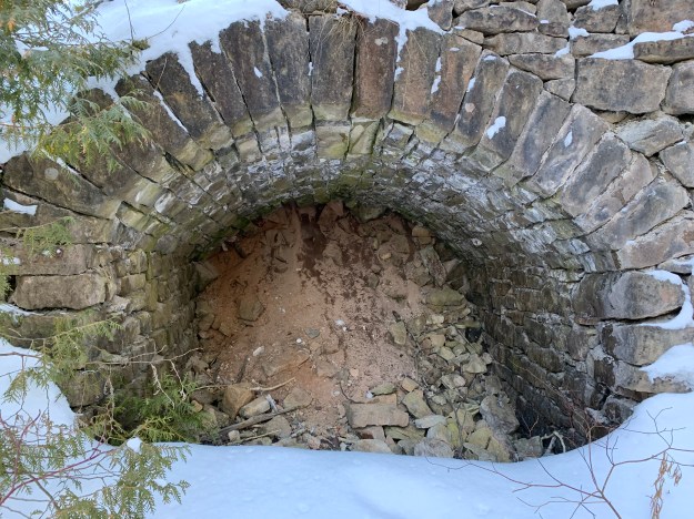
The lime mill was built by John Newton who took the burnt lumps of limestone and ground them into powder.  This was then “slaked” with water and mixed with sand and cow hair.  The resulting mixture was used as mortar in construction.  The mill ruins and the remains of the stone arch from the tail race are all that is left.  These have been deteriorating from people climbing on them and the arch has lost several rows of stones.  They have now been protected behind a recently installed fence.

IMG_0660

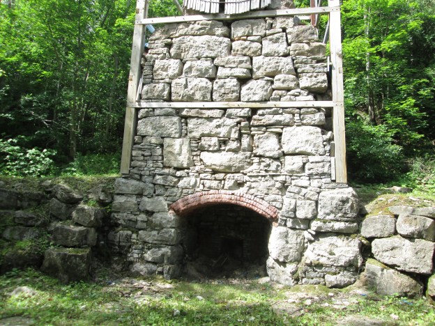
The big innovation in lime kilns came with the creation of the draw kiln.  The draw kiln at Limehouse was 16 metres high when it was completed in the 1860s.  It has since collapsed considerably in spite of restoration efforts.  Several of these kilns can be found scattered across the Ontario landscape, including two near complete ones at Kelso.

IMG_0668

The earliest kilns were set kilns where the limestone was placed in the kiln and packed in with wood.  Burning would take days and then it would be allowed to cool down before being unloaded.  There is a strip of seven set kilns that were built in the 1840s.

IMG_0670

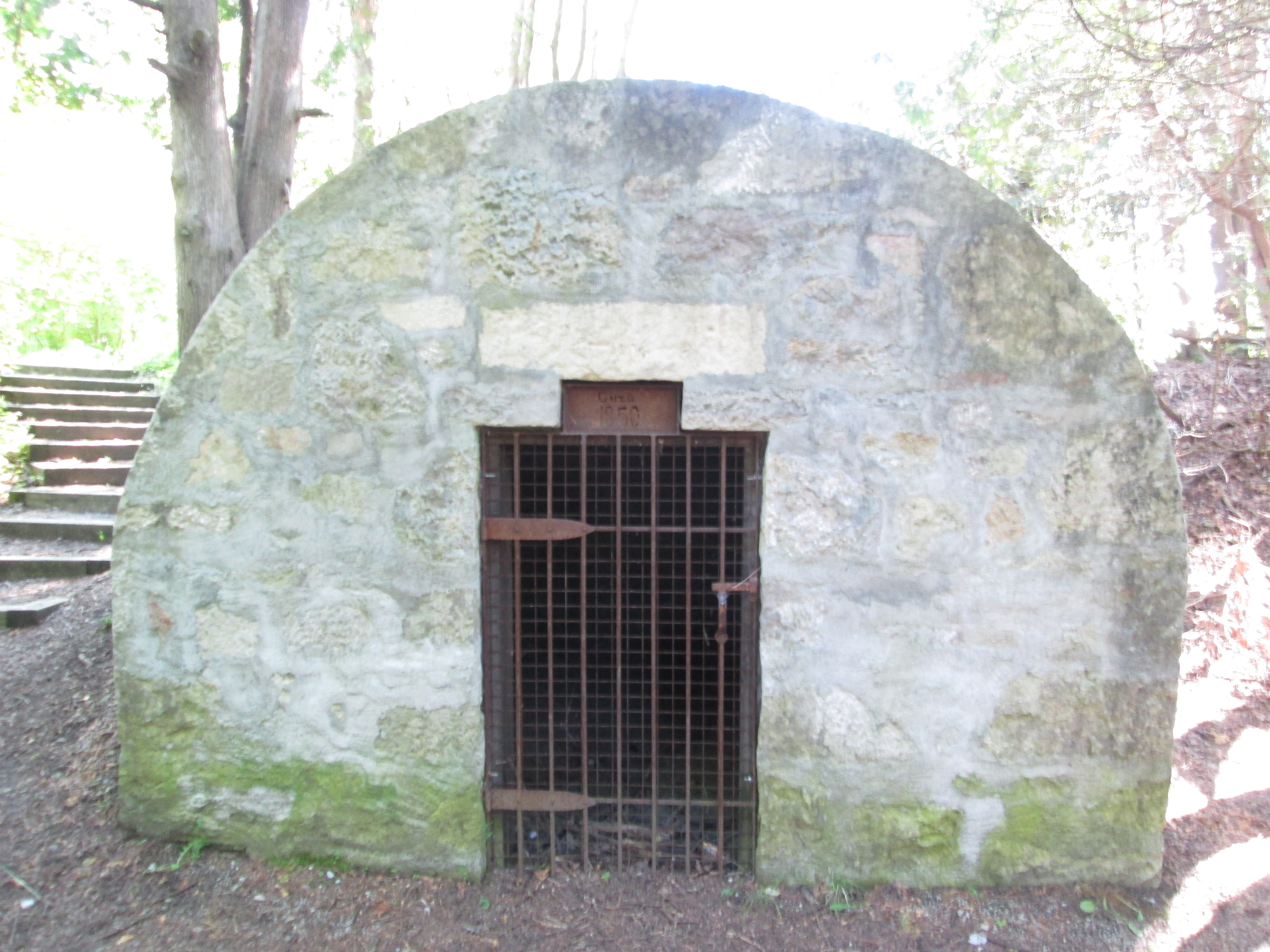
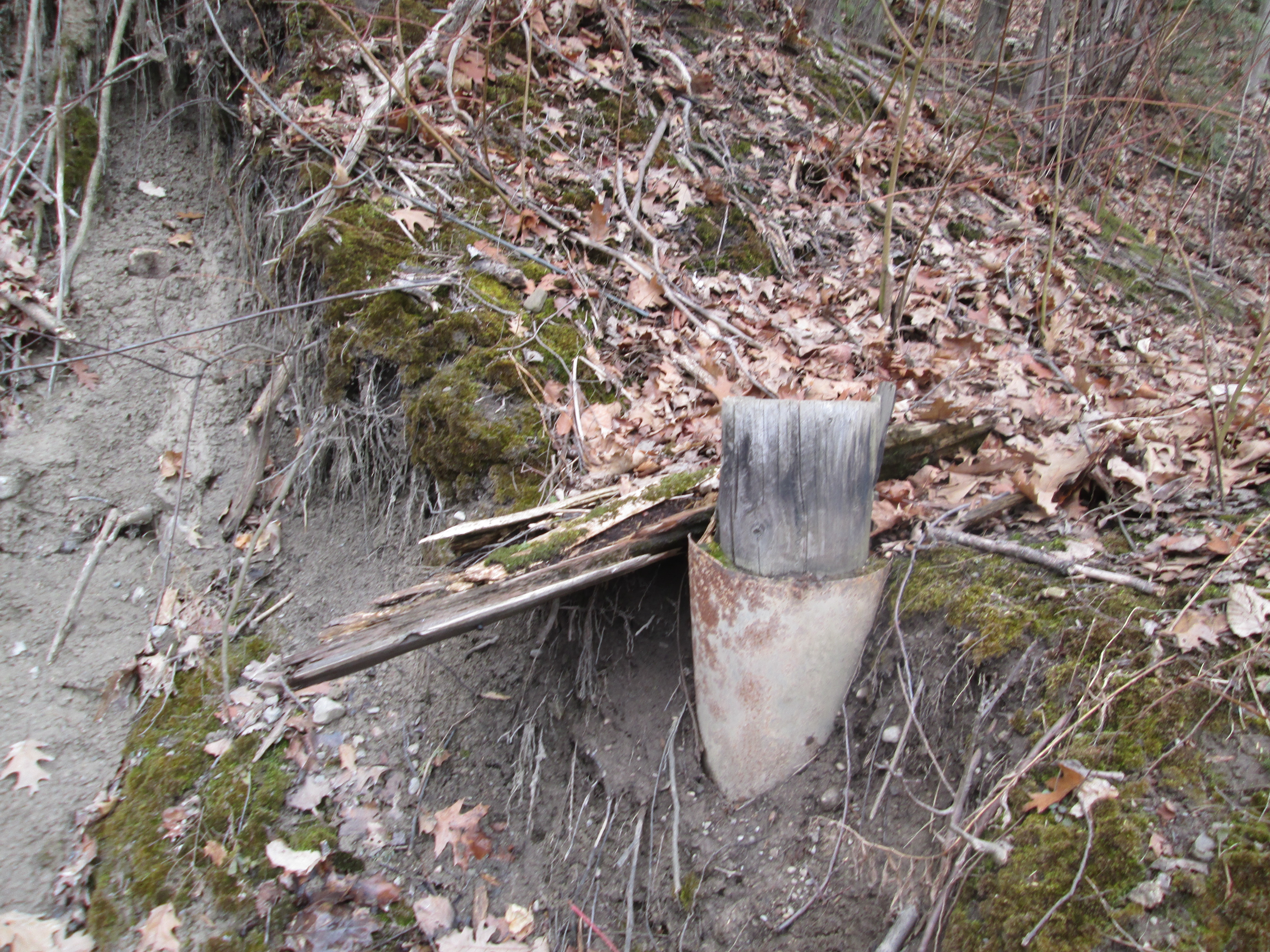
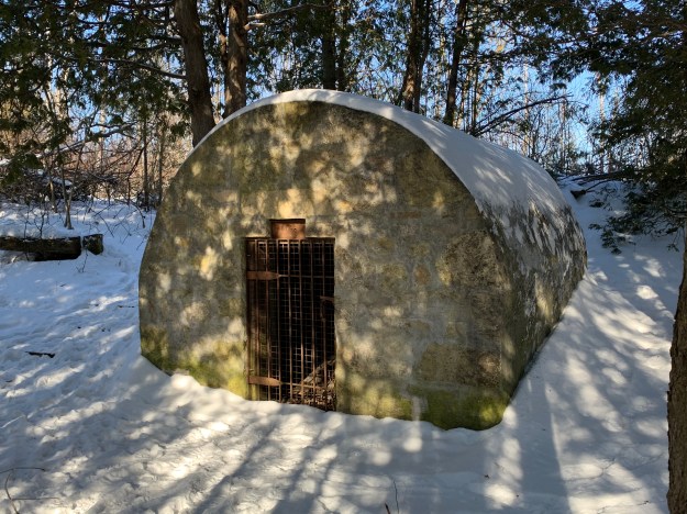
The powder house was added in the 1850’s to provide storage for the blasting powder that was used to break up the larger chunks of limestone.  Blasting was discontinued around 1917 as the quarry had expanded to the point where the local residents feared the explosions would damage their homes.

IMG_0675

Limehouse is one of our favourite places to explore because there is so much history that has been retained.  Fortunately, the local historical society is actively working on preservation of the kilns.

Read our other Limehouse blogs: Limehouse and The Bruce Trial – Limehouse

Google Maps Link: Limehouse

Like us at http://www.facebook.com/hikingthegta

Follow us at http://www.hikingthegta.com

Look for us on Instagram

Limehouse

Saturday June 20, 2015

It was a beautiful morning at 16 degrees with just a trace of clouds in the sky.  We set out for the village of Limehouse which is situated on the Black Creek, a tributary of the Credit River.

The village of Limehouse started off known as Fountain Green.  Limestone was easily accessed near the surface and was needed for mortar for construction materials.  By 1840 there were two separate lime manufacturing sites in the village.  When the Grand Trunk Railway came to town in 1856 the means of distribution came as well, and the industry expanded quickly.  Soon it was employing over 100 men in a 24 hour business.  The following year the town got a post office and took the name Limehouse.

The first mill in Limehouse was a saw mill built in 1820 and operated by Adam Stull.  The mill was owned by several people over it’s 120 year history before finally closing in the 1940’s.  The steel flume that carried water to the saw mill turbines is a later addition, likely sometime after 1900.

IMG_5732

The earliest lime kilns were the set kilns of the 1840’s which could burn 6 to 30 tons of rock in a 7 day cycle.  Lime would be added in along with wood and burned.  Wood had to be added through the sides for three or four days to keep the heat up.  The oven then needed a cool down period before the lime could be removed.  Set kilns were often built in rows or clusters. The one pictured below is part of a row which has two larger kilns on either end and five smaller ones in between.

IMG_5761

Blasting powder was used to break large chunks of rock out of the quarry.  Around 1850 a powder house was built in a slight depression on the quarry floor.  It was located here to limit the damage it would cause if there was ever an accident.  The walls are made out of limestone with a plaster coating on the outside.  Inside it would have had wooden shelves to store the dry powder on.  The powder house had deteriorated to half it’s height but was restored in 2004.

IMG_5636

Along the trail from the Powder House to the mill ruins grow woodland strawberries. Strawberries are members of the rose family and as such are not true berries.  Wild strawberry plants have been cultivated to grow the large plants with large juicy berries that we see commercially.  Wild strawberries seldom grow larger than 1 cm but they pack a lot of taste in a little bite.

IMG_5644

In the 1860’s a new style of kiln called a draw kiln was developed that could burn 6-18 tons of limestone per day.  The example in the picture below was 16 metres high and has four fireplaces on either side.    It was constructed of limestone masonry with a double layer of fire brick inside.  It took a day to heat the kiln up but after the interior was hot it could be run continually.  Limestone was fed in from the top, which was level with the edge of the quarry. The burnt lime was removed from the bottom of the kiln.  In 2009-2010 the fireplaces, where the fuel was burned, were restored but the fire brick lining from the stack of the kiln has since collapsed into them.  The rest of the kiln is braced to prevent further collapse until it can also be restored.

IMG_5666

Extensive ruins of the Lime-Mill cross the Black Creek just below the old mill pond.  The lime mill ground lime in much the same way a grist mill ground grain. This arch is an original feature of the mill race.  Older photos show at least two more rows on the top.  The Halton Hills Branch of the Architectural Conservancy Ontario asks that people please keep clear of the arch to assist in it’s preservation.

IMG_5685

The Widow Skimmer is a species of dragonfly found in Ontario.  The adult female has a yellow striped body and both sexes have black bands on the wings.  A dragonfly can be distinguished from a damselfly because it sits at rest with it’s wings spread open.

IMG_5691

In 1917 the Toronto Suburban Railway (TSR) came through Limehouse on the way to Guelph.  It passed over the mill pond and crossed the 5th line where there was a small station.  The railway was closed in 1931 and the railway pilings remaining in the former mill pond are about all that remains.

IMG_5700

Limehouse has a series of caves and cracks that have become known as the Hole In The Wall. We climbed in and out of them in several places.

IMG_5722

An upper mill stone, also known as a runner stone lays face down along the trail just beyond the mill ruins.  This stone was turned using the iron hook in the middle.

IMG_5749

The coach house behind the church likely dates to 1876 like the church building it served. Parking has always been a problem and is made even worse when your vehicle is a horse.

IMG_5772

The Methodist Episcopal Church in front of the coach house was built in 1876.  I can find no explanation for the word Horeb on the front of the church.  The Methodist congregation had been meeting in the Limehouse Presbyterian church which also housed the Episcopalian congregation before they moved into their own building.  The Presbyterian church was frequently referred to as the Limehouse Union Church, much like the chapel in Dixie.  We didn’t stop to photograph the 1861 Presbyterian church on the edge of town because of a two car crash in front of it’s cemetery.  I was in less of a hurry to get in than they were, or so it seemed.

IMG_5775

Limehouse had three hotels in it’s heyday.  The one in the picture below belonged to Miles Mcdonald who was a local carpenter.  He also built the Prebyterian church just up the street, helping it to open debt free in October 1861.

IMG_5779

The fire of 1893 that destroyed the woolen mill and blanket factory as well as a paint factory gave the town a major setback.  Lack of insurance led to the industries never being rebuilt.  The quarry was getting closer to the homes in town and so by 1915 the lime industry was closed down.  A major industrial hub was left to quietly decay.  The Credit Valley Conservation Authority purchased the area in 1967.  Since then they have begun raising funding for restoration with some projects already complete.  Interpretive signs are being added as well.

Like us at http://www.facebook.com/hikingthegta

Eldorado Park

Saturday April 11, 2015

Winter has a way of hanging on and at 3 degrees we were being subjected to small pellets of ice as we started out.  Eldorado Park is the next stop northward on the Credit River following the visit to Churchville last week.

Eldorado park sits on lots 2 and 3 in the 4th concession west in Chingoucousy Township in what is now the city of Brampton.  Lot 2 was settled by Jacob Snure who built a grist mill which he called Eldorado Mills.  For lot 3, Mary Anne Forest is shown as a saw mill owner, likely after the loss of her husband.  The area has had several owners since this time.  In the 1877 historical Atlas the property is shown as belonging to Kenneth Chisholme.  The mills closed and by the early 1900’s the area was converted to a large private park known as Eldorado Park.  In 1925 the Canadian National Railway (CNR) purchased the property to try to breathe some life into the struggling suburban railway it had absorbed in 1918.  They added a Ferris Wheel and Merry-Go-Round attempting to create the ideal day trip.

We parked in the Eldorado Park parking lot and crossed the bridge to the west side of the Credit River.  Just downstream from here is Brampton’s only outdoor swimming pool.  When the Toronto Suburban Railway was completed to Guelph in 1917 it passed through Meadowvale and Churchville before reaching Georgetown.  It passed through Eldorado Park which gave the railway the idea of creating it’s own tourist attraction to which it would provide transportation. The old right of way for the train tracks ran just along the edge of the swimming pool (long closed when the pool was built) and can be followed south from there.  The picture below shows the old rail bed which, since the removal of the rails for use in Europe during WWII, looks much like any other hiking trail.  The cover photo shows one of the streetcar-like trains unloading passengers at Eldorado Park.

IMG_3395

Along the old rail corridor we decided to follow a small ravine to investigate an older building. Before we reached it we came across an old soda bottle.  Polar Beverages was founded in 1882 in Worcester Massachusetts.  Now in it’s fourth generation, this family owned beverage company is the largest independent bottler in the USA.  Polar Beverages got themselves sued in 1994 by showing a polar bear throwing a Coke in a garbage bin marked “Keep the Arctic pure”. The bottle in the picture below is dated 1948 and was made in Salem Mass.

IMG_3404

During the Depression the CPR determined that rail line and ultimately the park were too expensive to maintain, closing them in 1931 and 1936 respectively.  The park area was purchased by a Jewish group for a summer camp called Camp Naivelt (New World).  For the first few years campers used tents but during the 1940’s and 50’s about 90 small cottages were built in what would be known as Hill 1, 2 and 3.  We had wondered into Hill 3 and found The Ritz and a small building holding a water tank.  Beside them stand two abandoned buildings that were the children’s infirmary.  The roofs are caving in and these will likely be pulled down before long.  The no trespassing sign on the building applies to the whole property and the owners ask that you take this article in the spirit of preserving history and that we do our part by not entering the property.

IMG_3410

The cottages along Hill 3 are at the western edge of the property and face the old infirmary.   In the 1960’s attendance at the camp declined and 52 acres were sold off to the township.  These form the public area of today’s Eldorado Park and have helped keep Camp Naivelt from being swallowed by urbanization.  The camp is now proposed for a Cultural Heritage Designation for it’s contributions to local culture.  Folk activist Pete Seeger hung around here regularily giving impromptu concerts.  He is remembered for writing songs such as “Turn, Turn, Turn”, “Where Have All The Flowers Gone” and “If I Had A Hammer”

IMG_3424

Returning to the old electric rail line we followed it along the river until we came to the place where the bridge is out,

IMG_3437

Beyond here the hillside is oozing mud and quickly becomes impassible.  The old rail line ran across the side of this embankment but much of the remains now lie in the bottom of the ravine under the muddy water.  Parts of rail ties may be strewn along the hillside.

IMG_3441

We returned to the bridge and crossed back to the east side of the Credit and started to follow it south.  After awhile we started to find concrete scattered on both sides of the river.  After passing a foundation for some former building we started to follow a concrete wall running somewhat parallel to the river and just inside an older earthen berm.  Broken in several places it no longer holds the mill pond from Eldorado Mills.  The view below is from inside the former pond looking out through the sluice gate.

IMG_3486

The disipator at the outflow of the sluice is rotting away.  Even so, the effect can be clearly seen in the picture below as it causes the water to lose kinetic energy.  The water is churning white after dropping over a small waterfall.  As it passes each row of posts it becomes noticeably calmer.  By the time it passes the fifth row it is almost totally smooth.

IMG_3492

When we came to cross the tail race on our trip south we found that the only way was use the fallen tree just before the river.  Someone had neglected to nail a hand rail on there for us like had been done at Playter’s Bridge on the Don River.

IMG_3502

Built in the 1930’s the Creditview Bowstring bridge is one of only two bowstring truss bridges in Brampton and the only one still part of a public roadway.  Along with the bridge in Churchville it is also one of only two one-lane public bridges in Brampton.  It had fallen into disrepair and by 2002 it faced closure.  When it was given an heritage designation in 2003 it got a $700,000 makeover.

IMG_3480

Eldorado Park hosts families on picnics and dogs chasing balls these days but the history of a milling centre and an amusement park remains in the old right of way for the electric railway and the remnants of the mill pond and sluice gates.

eldorado_park_ad

Like us at http://www.facebook.com/hikingthegta

Follow us at http://www.hikingthegta.com


Silverthorne Grist Mill – Meadowvale

Saturday March 28, 2015

(Revised March 31st)

It was minus 10 with a wind chill of minus 18.  This was one of the coldest morning hikes of the year, in spite of the date on the calendar.  We parked in the Meadowvale Conservation Area parking lot where the Second Line dead ends south of the new Derry Road.  We crossed under the bridge and walked north where the Meadowvale mill pond once connected with the river.

When John Beatty arrived in 1819 he brought the first settlers to the area.  He built mills along the Credit River and founded Meadowvale.  In 1831 Beatty sold his mills to James Crawford who opened saw and carding mills to compete with John Simpson who operated mills on lot 10 south of  Derry Road.  By 1836 Meadowvale had reached village status.  In 1844 Francis Silverthorne took over from Crawford and greatly expanded the mill complex building a saw mill.  In 1845 he added a large grist mill.  When it burned in 1853 he got backing from the Bank of Upper Canada and rebuilt.  During the Crimean War the price of flour had jumped from $1.50 per barrel to $3.00.  Silverthorne stockpiled grain in an effort to take advantage but when the war ended in 1860 the price fell to $1.00 per barrel.  When the Bank of Upper Canada foreclosed on his loan, William Gooderham, who was in charge of the bank, bought the property.  Gooderham and Worts had also purchased Alpha Mills, north of Streetsville, the same year.  Silverthorne retired to the family mansion, Cherry Hill.

After the Gooderhams the mill was owned by the Wheelers until 1895 when it was sold to Henry Brown.  Henry restored the mill and returned it to full production.  In 1906 he set about developing Meadowvale into a tourist attraction.  The first step was to increase the size of the mill pond and create what came to be known as Willow Lake.  He built a larger dam further north on the Credit to allow more water to be retained.  By following the western wall of the former Willow Lake we were able to locate the remnants of this dam.  Concrete remains can be found on both sides of the Credit River.

IMG_3079

Water is held in the western most parts of the old Willow Lake as we made our way along the berm toward the old mill.  The land along the western side of the old lake has been scooped out to create a retaining wall for the mill pond.

IMG_3077


After publishing this post I came across the following picture in the heritage assessment of 2014.  It shows an aerial view of Meadowvale with the old mill pond drawn in with dark blue and previous courses of the river in light blue.  Derry Road runs across the lower right corner and second line across the upper right corner.  Silerthorne’s grist mill is sketched in where the mill pond approaches Derry Road then follows along it in dark blue as the tail race.  His saw mill is drawn in a little above there where an old tail race returns to the river.

IMG_0101

As you approach old Derry Road concrete structures from the mill come into view.

IMG_3068

The mill stretched over both sides of the millway with the water wheel, and later the turbine, generating power to turn the grinding wheels to produce flour.

IMG_3030

The foundations on the west side of the millrace are pictured below.  Notice the stonework in the middle at ground level that marks a former water tunnel through the wall.

IMG_3137

This picture shows the main foundations for the water wheel.  Notice the bridge in the background where the tail race leads out along Willow Lane on it’s way back to the Credit River.

IMG_3064

The mill changed hands several times until it went out of production in 1950.  The Emersons owned the mill at the time and kept it for storage.  Fire is a common fate for grist mills and the community became concerned about its safety.  The wood was 100 years old, dry and full of a century of flour dust.  When Luther Emmerson was told he had to demolish it he did so himself.  Smashing it up in a fury and leaving the pieces where they fell.  The wood was carried away and the rest settled and was filled in.  They say the old turbines are still buried in the basement.

The mill stone has been preserved on the site of the Silverthorne Mill.  Mill stones come in pairs. The lower stone is stationary and is called the bedstone.  The upper stone, or runner, spins and does the actual grinding.  The grooves serve to channel the flour to the outside of the stones for collection.  The grain is fed through the eye in the centre of the runner stone to be ground between them.  Both upper and lower stones are preserved here.

IMG_2985

Willow Lane used to be known as Water Street and is home to some of the oldest houses in the village.  The house at 1125 Willow Lane is the oldest remaining building in town having been constructed in 1825 by John Beatty.  It later belonged to Crawford, Silverthorne and Gooderham as it seems to have changed hands with the ownership of the mills.

IMG_3058

By 1917 Guelph was linked to Toronto via the Toronto Suburban Railway line.  It ran from Lambton to Guelph, passing through Meadowvale.  The line ran from 1917 until it was shut down in 1931 when travel between Guelph and Toronto had switched to bus and car on highway 7.  The tail race from Silverthorne’s mill ran between Derry road and Willow Lane. The foundations of the old suburban railway line remain but are badly crumbling.

IMG_3041

The picture below shows the railway bridge over the tail race in 1915.  The past 100 years have taken their toll on the bridge.  The route of the train is even less easily distinguished as a flood control pond has been built on the old right of way south of Derry road.

Radial Railway Bridge, Meadowvale, c1915

Walking along the river back to the car you could hear the rustle of slush in the river as it rubbed along the river bank.  We weren’t the only ones hiking up the Credit River.

IMG_3024


By 1856 the mill was a major employer in the village and Silverthorne built cottages for his mill workers at 7077 and 7079 Pond Street.

IMG_3124

Charles Horace “Holly” Gooderham came to Meadowvale to run the mills on behalf of his father William Gooderham of Gooderham and Worts in Toronto.  In 1870 he commissioned a 21 room mansion that cost him $30,000.  The Gooderhams ran the mills, a cooperage and the general store in town.  When William Gooderham died in 1881 Holly left for Toronto and the estate was sold.  During the 1920’s it belonged to Samuel Curry whose brother, Walter, was a Member of the Legislative Assembly in Ontario from 1919-1923.  The house received several modifications over the years, including the oversized front portico and the white siding in the late 1970’s.

IMG_3094

Meadowvale was the first community to be honoured with the designation “Heritage Conservation District“.  The original community survives, largely intact, complete with it’s narrow streets designed for horse and carriage.  There are many historic buildings in town which will form the basis of a companion post.