Saturday, April 1, 2017
Joshua Valley Park has seen a lot of change over the course of the two centuries since Joshua Leach arrived. Leach was just 21 when he arrived in the brand new town of York in 1897. As a carpenter, he found plenty of work building many of the first homes in the town. By 1822 Joshua had saved up enough money to buy 200 acres of land which he took possession of on the creek that would later bear his name. Joshua built a home for his family and dammed the creek to power a saw mill and a thrashing mill. These were located near where Maple Grove Arena stands today.
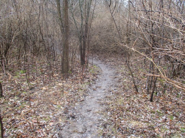
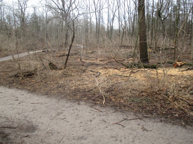
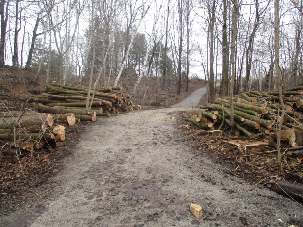
This hike follows Joshua Creek through three contiguous parks: Joshua Valley Park, Maple Grove Park and Dunvegan Park. These parks run from Cornwall Road in the north all the way past Ford Drive to where we connected with the trail from last week’s story. For convenience, we took advantage of the free parking at Maple Grove Arena which is about midway along the journey. Cut lengths of ash tree logs were stacked in a pile at the side of the parking lot. This was a hint of what we were about to find in the valley. The forest is wide open now that all the ash trees have been removed.
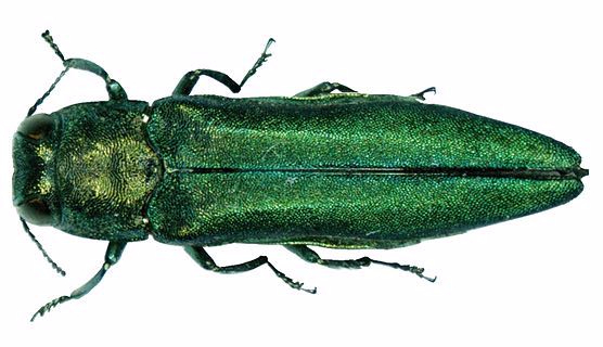
The emerald ash borer is a beetle that is native to Asia. It was first seen in Ontario in June of 2002 near Windsor. The beetle most likely entered Ontario from Detroit where it arrived in wood packaging from Asia. The emerald ash borer is invasive as it meets both accepted criteria. It is outside of its native habitat and threatens the environment, economy or society where it is invading. The City of Oakville estimates that it has 45,000 ash trees and that most, if not all, will be destroyed by the beetle. In Toronto, the situation is even worse with an estimated 860,000 ash trees in the city. Every one of which will be destroyed if not treated with appropriate pesticides. The picture below of an emerald ash borer was taken from Wikipedia.
All ash trees in Ontario are susceptible to the attack of the emerald ash borer. Our ash trees are named after colours and we have black, white, red, green and blue as the primary ones. The female beetle will lay 60 to 90 eggs, individually, in the crevices in the bark. The larva tunnel under the bark, eating curved galleries. These galleries girdle the tree and prevent the flow of food and water from reaching the tree. The larvae overwinter under the bark and pupate in the spring. The adults spend their lives on the outside and must eat the leaves in order to reach reproductive maturity. Looking at the ash trees that have been piled up you can easily find examples that are 50 years old. The one pictured below appears to have 47 rings.

After a tree has been assessed and found to be clean or in the early stages of infestation it can be treated in one of three ways. Each of the pesticides is intended to target either the larva, adult or both. The soil around a tree can be drenched with the insecticide which is carried throughout the tree by the vascular system. This method won’t work if the tree has too much damage already and it is unable to spread water and nutrients throughout. Another method of distributing the pesticide is to inject it into the tree. Lastly, when the adults are newly hatched and are feeding on the leaves they can be sprayed directly, killing them before they can lay eggs. The cost of treating a tree can be estimated at about $10 per inch of diameter. The picture below was taken last week near the mouth of Joshua Creek and shows a tree that is being treated for emerald ash borer.

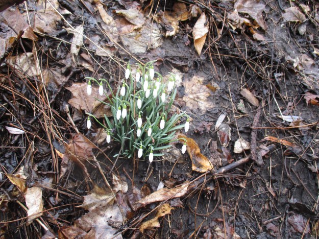
Other invasive species, like the honeysuckle, will prosper now that the canopy has been opened up and they won’t have the competition. They are already present in the understory and can be seen because they are the first shrubs that get their leaves in the spring.
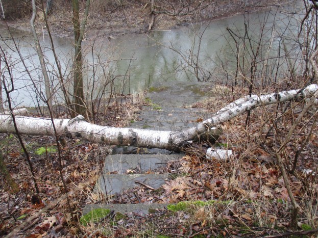
A thin trail runs along the back of the houses on Duncan Road. Old sets of stars can be found leading off of this trail and directly into a solid fence. The row of trees that has been planted along here seems to be older than the trail which was constructed in 1983. Straight rows of trees often indicate old laneways or roads.

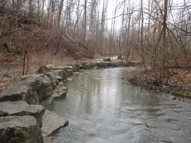
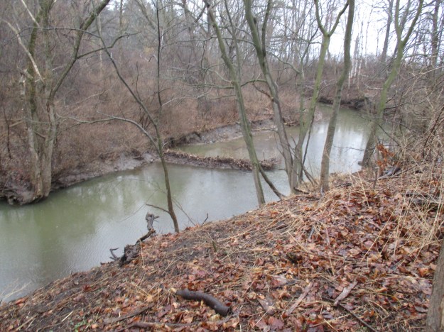
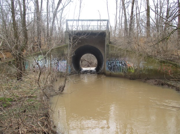
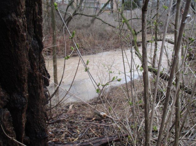
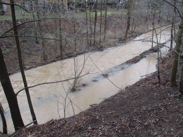
This section of Joshua Creek has been protected from erosion by the use of gabion baskets filled with stones. The creek is prone to flooding and when it does it runs brown with soil being carried downstream. In several places, the creek has overrun the gabion baskets and they are no longer serving a purpose.
At Cornwall Road we turned back, leaving the northern reaches for another time. A small bridge crosses the creek just south of Maple Grove Arena and beyond here the ash tree removal is in full swing. Heavy equipment stands among the trees and there are fresh piles of logs along the sides of the trail. In many forests, these are being left behind as future habitat but they are being removed from this park system.
Crews have preceded the cutting teams and have assessed each tree and coded them. Yellow slashes or dots mark trees that are to be removed. Orange or red dots indicate that a tree is to be pruned.

We found an area where there were a lot of clam or mussel shells. The ones below are placed beside a golf ball to give the perspective of their size.

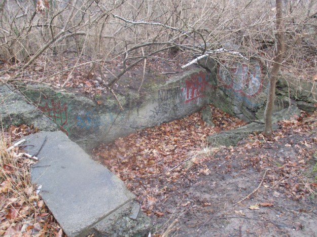
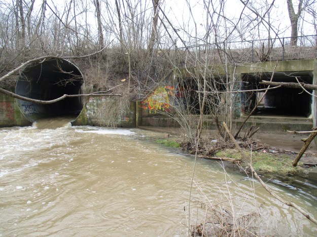
The wheat market fell after the Crimean War and at the same time, England removed tariffs that protected Canadain suppliers. The area around Oakville was hit hard and many farmers turned to fruit production. Orchards of apple, plum and cherry trees took over where fields of grain once grew. In the 1940’s the creek was dammed to create a pond for irrigation of a large orchard that stretched from Royal Windsor Road, all the way to Lakeshore. The earth and concrete wall still forms a bridge from Devon Road to Deer Run Avenue. There are two open spillways and a round culvert. The culvert had a sluice gate on the front end to allow for control of the water level. The cover photo shows the culvert from the upstream side. Two spillways and the culvert can be seen in the picture below. The spillways are about eight feet tall while the culvert is about ten.
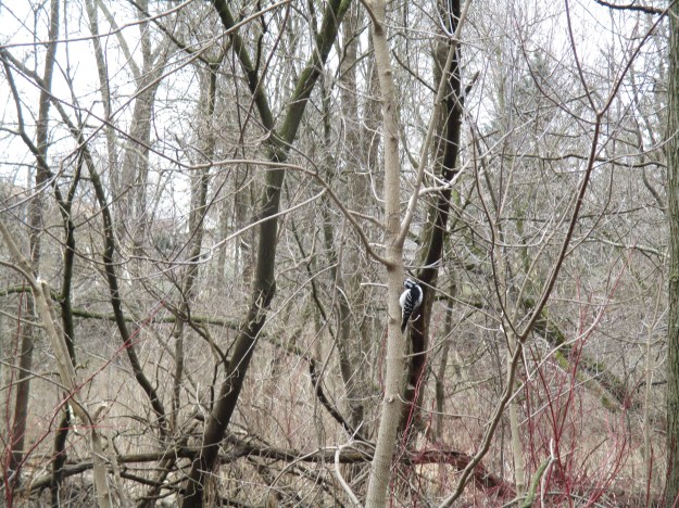
The forest was alive with birds and one particular area was full of woodpeckers. Both Hairy and the smaller look-a-like Downey woodpeckers were moving through the trees. This female Hairy woodpecker stopped on the side of the tree to do a little preening of its feathers.
The Joshua’s Creek Trail runs for 6 kilometres and is part of the Oakville Heritage Trails. The northern reaches of the creek still require exploration.
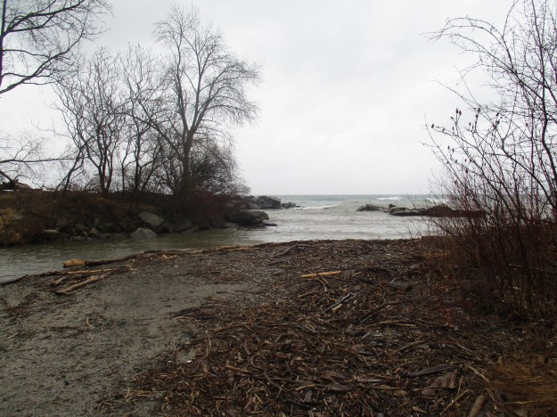
Last week we explored the mouth of Joshua Creek and that post can be found here.
Google Maps Link: Maple Grove Arena
Like us at http://www.facebook.com/hikingthegta
Follow us at http://www.hikingthegta.com