Monthly Archives: February 2024

Upper Beamer Falls

Feb. 24, 2024

John Beamer was born in Greenwich Township, New Jersey on November 27th 1759. He emigrated to Upper Canada in 1790 and took up 300 acres of land along the Niagara Escarpment near Grimsby. He passed away on February 9th. 1854 in his 94th year. A ripe old age for those days when hard, dangerous work and lack of medical attention often carried people away at much younger ages. His property included 40 Mile Creek and featured the place where it makes its decent over the escarpment. This water fall now bears his name.

The image below is taken from the 1877 County Atlas and shows the Beamer properties as related to the town of Grimsby. Beamer Falls is circled.

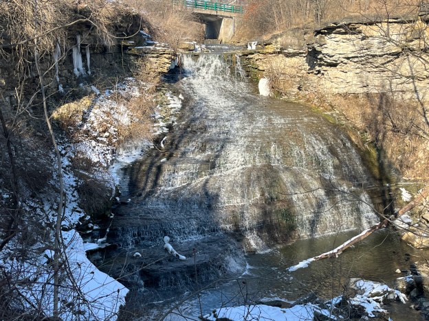
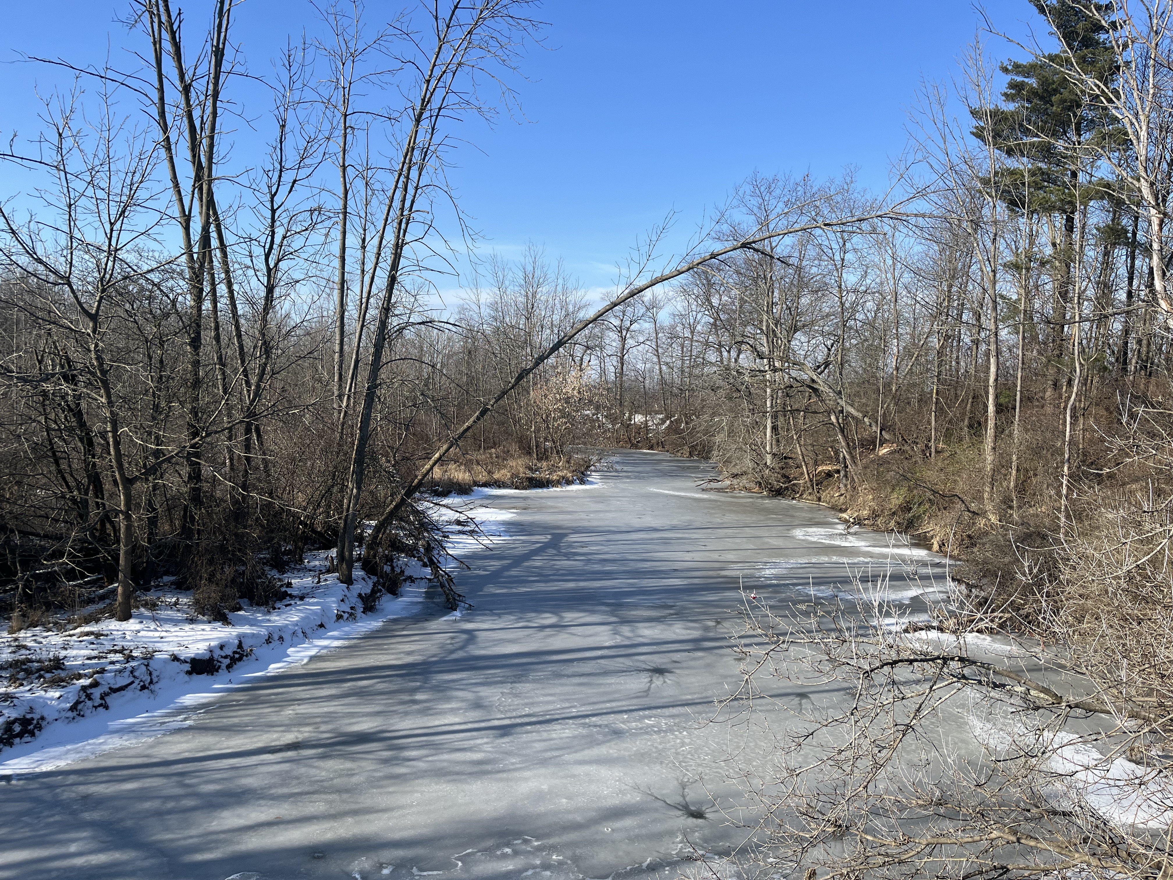
Elizabeth Simcoe was the wife of Upper Canada’s first Lieutenant Governor, John Graves Simcoe. She was known for her landscape paintings and the extensive diary that she kept. These combine to give some detailed insights into the area in the 1790s. Her diary entry for May 18, 1794 reads in part: “We coasted to the Forty Mile Creek forty miles from Niagara and passed in at three o’clock. The mouth of this creek forms a fine scene; a very bold spur of high land appears beautiful in the distance. It is about three miles off.” This describes the escarpment where the creek flows over forming Beamer Falls. During my visit the creek was frozen over above the falls.

Beamer Falls has a washboard formation and a drop of 45 metres. The crest is 20 metres wide.

There is a short trail along the north side of 40 Mile Creek that leads to Beamer Memorial Conservation Area. This 450 metre trail is a side trail to the Bruce Trail and is marked with blue blazes.

The area was the floor of a tropical sea that existed over 400 million years ago. Sediment accumulated and eventually created the Niagara Escarpment and the 40 Mile Creek ravine that we see today. Erosion following the last ice age, about 12,000 years ago was greatly enhanced by the flow of water created by the melting glaciers as the ice retreated. Alternating layers of dolostone and sandstone have been left and the dolostone is much more erosion resistant that the sandstone. This creates the steps that can be seen in the waterfall.

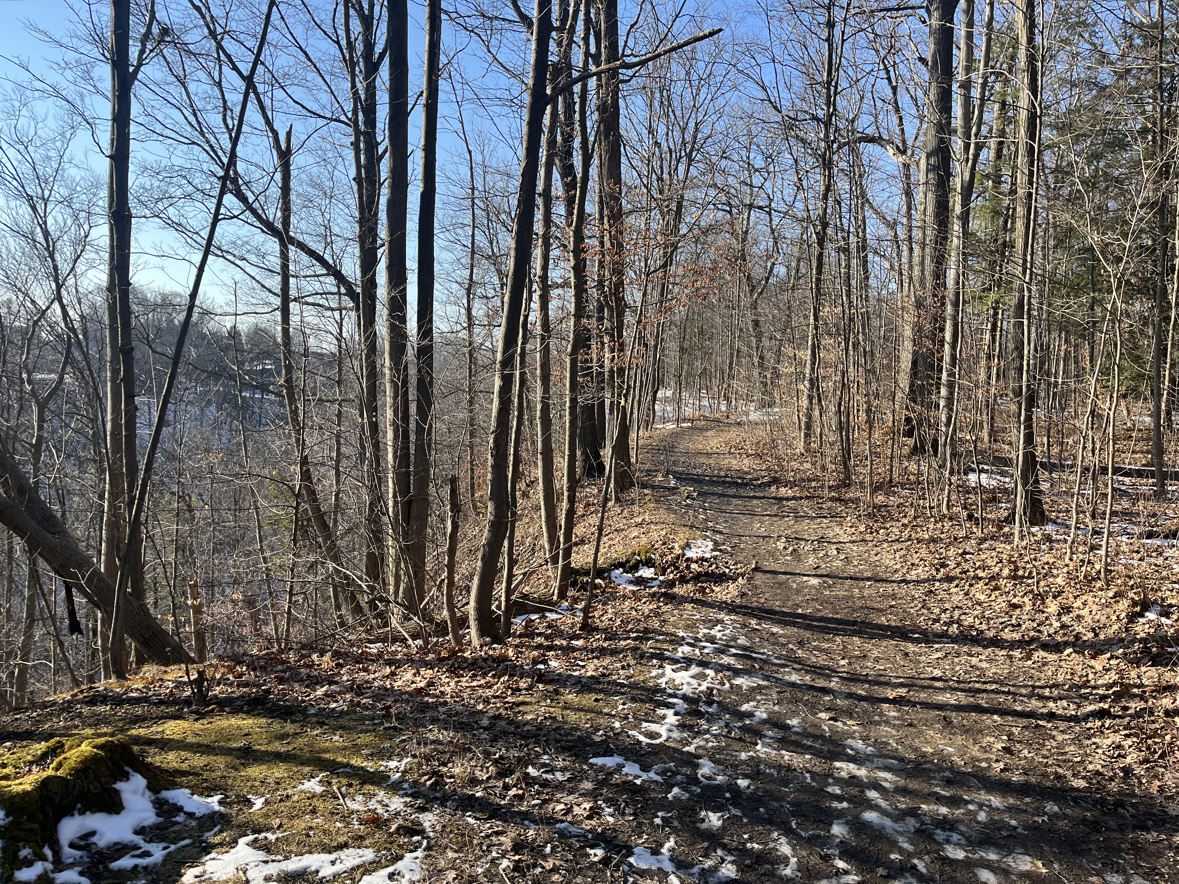
The trail follows 40 Mile Creek to an intersection with the Bruce Trail in Beamer Memorial Conservation Area. Starting in Queenston and running to Tobermory the Bruce Trail runs for over 890 kilometres. There are also over 400 kilomtres of side trails, such as this one. Many people record the sections of trail as they complete them so that they can get awarded end-to-end badges for each of the nine sections. When all sections have been completed you can get an end-to-end badge for the entire trail. I have a map and am in the process of highlighting various hikes but am nowhere near completing a section, let alone the entire trail. And, I’ve been at it for decades. But, then again, I’m all over the place when it comes to exploring.

Lake Ontario can be seen in the distance. This is the opposite view to what Elizabeth Simcoe described 230 years ago, although the forest cover is much different today than it was back then.

The falls have a moderate amount of water at this time of year but can be much more spectacular after a heavy rainfall when they carry a lot bigger flow. There’s parking off Ridge Road in two separate little lots that allow you to easily access the falls.

Beamer Memorial Conservation Area has several interconnected trails, including the Bruce Trail and will likely be the focus of a future exploration. The two closest waterfalls to visit if you are in the area are The Devil’s Punch Bowl to the north and Balls Falls to the south.

Google Maps Link: Beamer Falls

Like us at http://www.facebook.com/hikingthegta

Follow us at http://www.hikingthegta.com

Also, look for us on Instagram

Somerset House Hotel

February 10, 2024

The Somerset House Hotel was built on the south west corner of Church and Carlton Streets in 1895. It served as a hotel for 35 years until the building was sold. The hotel was renovated in 1930 by the architectural firm of Langley and Howland and was converted into a Bank of Commerce. In 1961 the largest merger in Canadian banking history took place and the Imperial Bank of Canada and the Bank of Commerce joined to become the Canadian Imperial Bank of Commerce. The CIBC branch at 436 Church Street lasted until a few years ago when it was closed and the structure’s future was in question. The building now houses a Pi Co pizza restaurant and bar. On March 15, 1974 the building was listed on the City of Toronto’s register of historic buildings.

The building was designed by Frederick Henry Herbert who lived from 1866 to 1914. He was born in Bath, England and landed in Toronto in 1887. He first apprenticed with Richard Ough but in January 1889 he set up his own firm. Herbert was responsible for many of the homes of the wealthy in Toronto over the next two decades. He made extensive use of the Queen Anne architectural style as well as the Richardsonian Romanesque. Herbert is credited with designing over 75 houses, 19 commercial buildings, 6 institutional buildings including the 3 story addition to Osgood Hall, and 24 industrial buildings during his career.

The Richardsonian Romanesque style models itself on ancient Roman architecture and Medieval structures. It makes use of solid masonry stonework and bricks. Windows and doors are wide round arches which are semi-circular and standing on columns. Windows are usually recessed into the masonry. The doorways are arched and set on the top of small columns. The Somerset House Hotel has a detailed doorway with carvings above and the name set into the lintel of the second story window.

There are many other Richardsonian Romanesque buildings remaining in the city and one of our favourites is close by at 504 Jarvis Street. That mansion can be seen in our post The Mansions of Jarvis Street. It was built in 1889 for George H. Gooderham of Gooderham and Worts whose family built The Distillery District.

The image below shows the view looking north up Church Street past the Somerset House Hotel to the former Maple Leaf Gardens.

The former Sumerset House Hotel stands across the street from Maple Leaf Gardens and the roof can be seen from the upper floor of the Gardens. I remember seeing the building many times as I went to Maple Leaf Gardens to see various concerts over the years. Rush, Triumph, Alice Cooper, Jethro Tull, Coney Hatch, Motorhead, Judas Priest, Red Rider, Payolas and Tragically Hip are just a few of the acts that brought me into the area and past the old Somerset House Hotel.

This building has so far escaped the ongoing redevelopment of the downtown core and hopefully will remain for generations to come.

Related stories: The Mansions of Jarvis Street, The Distillery District

Google Maps Link: Somerset House Hotel

Like us at http://www.facebook.com/hikingthegta

Follow us at http://www.hikingthegta.com

Oro African Methodist Episcopal Church

Feb.3, 2024

The Oro African Methodist Episcopal Church is a National Historic Site that was designated in 2000. It is the last remaining building in an African Canadian community that was developed in Oro Township between 1830 and 1850. The idea of such a community was first proposed in 1783 by Sir Guy Carlton who was the Commander-in-Chief of British forces in North America. It was thought that integrating African Canadians into a farming community would allow them to settle into a new life in British North America. Carlton had promised freedom to slaves of the American Revolutionaries who fought on the side of the British during the American War of Independence. Many of these people also fought during the War of 1812 under Captain Runchey’s Company of Coloured Men. The 1877 County Atlas image below shows the location of the church as well as a property owned by one of the members. In an apparent act of racism, only the white settlers names are recorded on the map and so I have marked the property of George A Darkman on it as he is featured in this story as an example of the individuals that made up the church. By the time of this map, it was no longer property of the family.

Between 1819 and 1826 twenty-five black men were granted 100 acre plots of land in Oro Township by the British. Eleven of these got their grants in acknowledgement of miliary services. Of these 25 only nine of them would take up their grants and these were along a section of land on Line 1 known as Wilberforce Road. This road was named after the British Abolitionist William Wilberforce who was a politician who fought in British Parliament for the abolishment of slavery in the British Empire. Between 1829 and 1831 another 30 families moved into the community.

A one-acre parcel of land was acquired for use as a burial grounds and to build a church for the community. The church was built in 1849 out of hewn logs which were covered on the outside with clapboard about 10 years later to help keep out the wind and cold weather. By 1900 the community had declined as many of the settlers took advantage of Lincoln’s Emancipation Proclamation. This allowed former slaves to return to the USA and many of the settlers went in search of long lost family members. The British Methodist Episcopal Church declared the building abandoned in 1916 although services were continued until the 1920s.

The building fell into a state of disrepair and by 1947 it was in such poor condition that the local descendants of the original settlers feared that this piece of history would be lost. Efforts were made to restore it with further repairs being made in 1956 and again after vandalism in 1981 when two stolen dump trucks were smashed into the building leaving it seriously damaged.

One of the members of this church was simply known as George. He was born into slavery in Virginia sometime around 1769 and came to Canada prior to 1812. He was one of the soldiers who served in Captain Runchey’s Company of Coloured Men. White settlers were granted 200 acres but black ones were only given 100 acres. George petitioned for a land grant based on his service in the War of 1812 and was granted Lot 15 on concession 2 in Oro Township. In order to receive the land patent it was required that he have a full name and so displaying a sense of humour, he chose George A. Darkman. George left his property to his wife and two children who still lived in the USA and his will is recorded as being the first will to be probated in Oro Township. The will stated that his family had to come to the property within five years and sadly they never made it. Perhaps they were still enslaved themselves. The provision was made that if they didn’t come it would go to a white friend of George, and this is what transpired.

The church was declared a National Historic Site in 2000 but was still left to slowly deteriorate yet again. A cultural heritage assessment was conducted in 2013 and a preservation plan was put into place in 2015. The floor needed to be stabilized and the ceiling joists were reinforced. New cedar shingles were put on the roof and some of the clapboard was replaced. One of the most interesting discoveries during this restoration project was the fingerprint of one of the original settlers which was preserved in the plaster chinking between the logs.

An unmarked graveyard lies in the south part of the property and a cairn was added in 1947 to identify the names of 24 families buried there. 

This church is perhaps the oldest surviving log church from a black congregation in North America and it is fortunate that it has been preserved to help maintain the memory of this important chapter in our shared history. For further reading on early black settlers, see our feature on Griffin House. Also, enjoy our story about Turner Chapel, another African Methodist Episcopal Church. 

Related Stories: Griffin House, Turner Chapel

Google Maps link: Oro African Methodist Episcopal Church

Like us at http://www.facebook.com/hikingthegta

Follow us at http://www.hikingthegta.com

Also, look for us on Instagram