Monthly Archives: December 2018

Bruce Trail – Highway 10 to Brimstone

Saturday, December 15, 2018

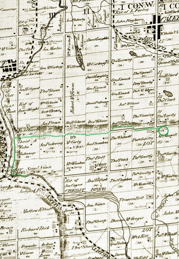
Over the years we have covered large sections of the Bruce Trail without recording where or when we went hiking.  In the past four years Hiking the GTA has blogged about most of the Toronto Section as well as other parts of the trail.  We have started to look at the portions we need to visit in order to at least complete this one section of the 900 kilometre trail.  Today we decided to hike the trail north of the Forks of the Credit as far as Hurontario Street.  We parked one car near Dominion Street and took a second one to Escarpment Sideroad on the east side of Hurontario Street.  This property belonged to Mrs. Maxwell in 1877 when the county atlas was drawn.  Her house is circled in green and the trail we hiked is also marked in green on the map below.

Brimstone

Mrs. Maxwell owned this little story and a half Georgian style house.  This design of house was popular from the 1790’s until about 1875.  This house likely replaced an earlier log cabin and was built around 1855.

IMG_1886

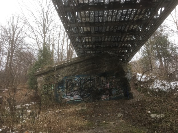
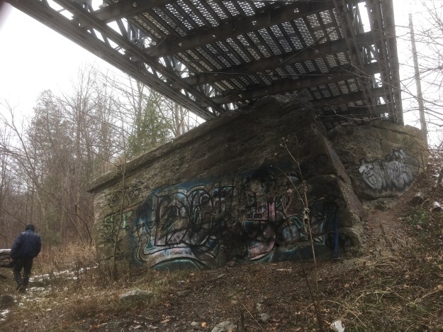
The Bruce Trail conveniently passes under the six lanes of Hurontario Street or Highway 10.

IMG_1887

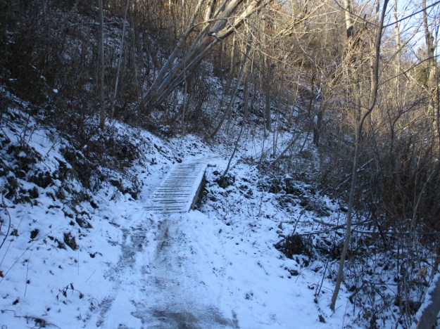
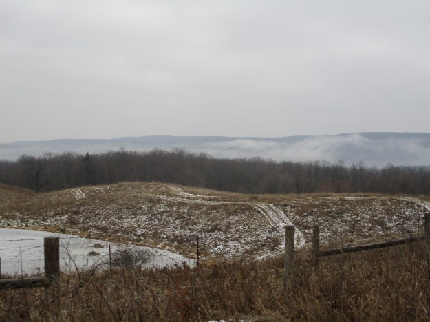
The trail follows Escarpment Sideroad for a half the concession before entering the bush on the north side of the road.  The view along the escarpment from here was enhanced by a low level air inversion that was holding fog along the side of the escarpment.  The fog makes the hills in the distance look like they are covered with snow.

IMG_1888

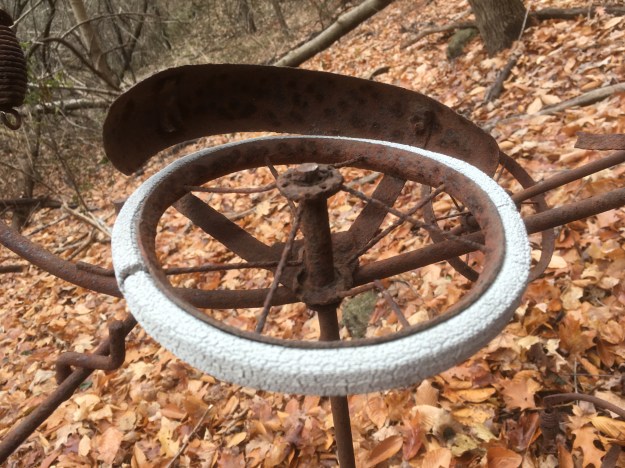
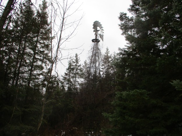
The trail passes through private property and it is clearly marked requesting that you stay on the trail.  One reminder of recent farming activity is this old wind mill that once drew water for livestock.  An old metal crib near the windmill may have served as a feeder.  It has been awhile since farm animals grazed in this area and the forests are taking back over.

IMG_1903

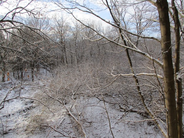
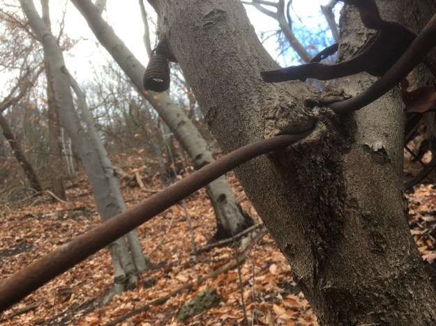
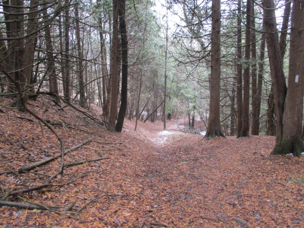
The trail follows the old road allowance and there is evidence of property lines marked with fences on either side.  The road allowance is one chain wide as per the original survey.  One chain is equal to 66 feet or 22 metres long.  The fences haven’t been maintained in a few years and there are many places where the trees have grown up around the wire.  Deer blinds in the trees indicate that the road is still used by the local wildlife.  The structure in the picture below was either an elaborate deer blind or a pretty cool tree fort.

IMG_1905

Polypore mushrooms get their family name from the thousands of little pores that cover the underside of the caps.  Many of these fungi can survive over the winter and will grow on favourable days all year around.  Some species can live for several years.  These bell shaped ones pictured below have a white ring around the outer edge and may be Berkley’s Polypore.

IMG_1917

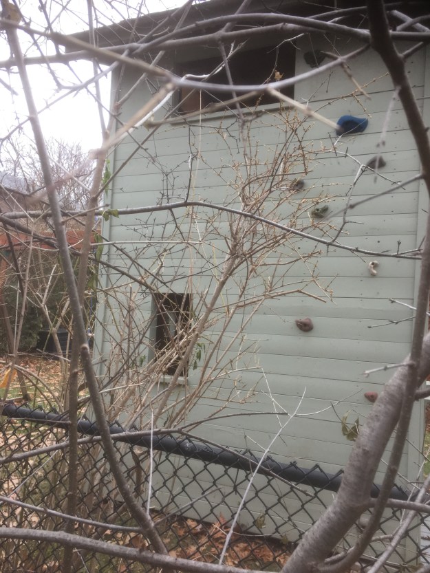
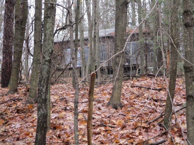
Standing in the woods some distance off the trail is an old cottage which can only be seen during the winter months.  It looks like it has been out of use for awhile but we didn’t go near it.

IMG_1967

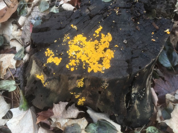
Mushrooms are one of the few sources of colour in the plant world at this time of year.  This Stalkless Paxillus has bright yellow gills.

IMG_1948

Pileated woodpeckers can dig large holes in a dead tree while they seek the bugs within.  The wood shavings on the ground in front of this tree reveal that the bird has been working here very recently.

IMG_1966

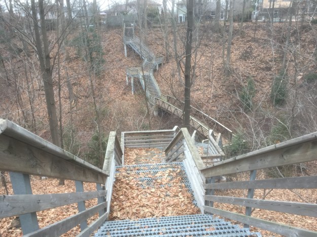
Following the main trail when you get to the Forks of the Credit Provincial Park will take you on a loop around the ponds and near the old mill in the park.  Since we had previously covered this section in the blog linked above, we decided to cross the Dorothy Medhurst Side Trail off our list.  This is a 440 metre trail that makes a quick decent to Dominion Road where it joins the main trail again.  This cuts about 3.5 kilometres off the hike compared to following the main trail.

IMG_1973

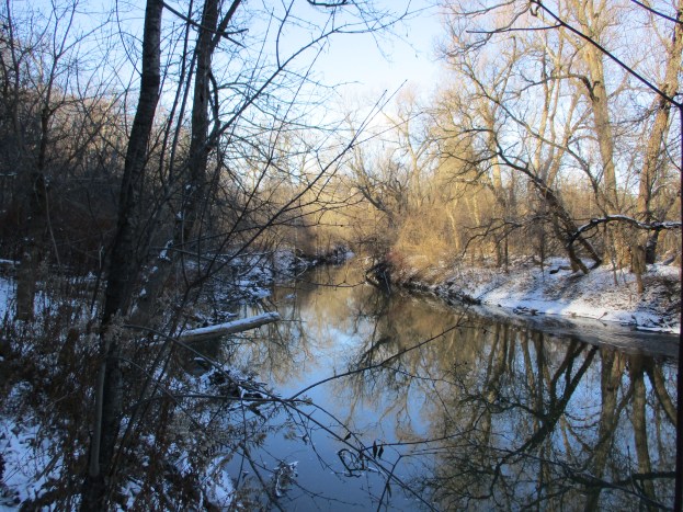
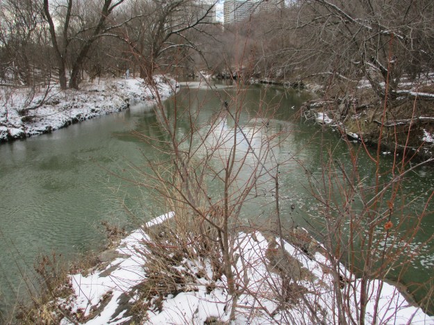
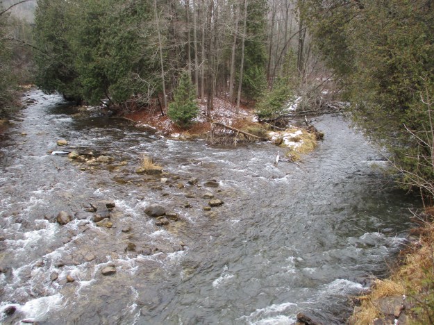
Following Dominion Road south will bring you through the hamlet of Brimstone.  This used to be a bustling community of quarry workers in the 19th century.  In those days Big Hill Quarry sent quarried rock to market by loading it on the Credit Valley Railway on the opposite side of the Credit River.  This was done using an aerial tramway.  The unloading end of the tramway was explored in our story on the Cox Property.  From the bridge on Dominion Road you can see the Forks of the Credit.  This is the opposite view from last week when we were at the point in the middle of the Forks of the Don.

IMG_1985

We arrived back at the car looking up at The Devil’s Pulpit and the trail toward Old Base Line.  This section of the Bruce Trail proved to be interesting and we can’t wait to check out another section in the near future.

Google Maps Link: Highway 10

Like us at http://www.facebook.com/hikingthegta

Follow us at http://www.hikingthegta.com


E. T. Seton Park

Saturday, December, 8, 2018

E. T. Seton Park is named after Ernest Thomson Seton who was born in England but moved to Canada with his parents in 1866 at the age of 6.  His father was abusive and he spent much of his time in the Don Valley near the park.  He became famous as an author, painter and a founding member of The Boy Scouts of America.  The park that was named after him follows the West Don River south and features an archery range, disc golf and extensive trails.  We parked for free in the lot that is south of Eglinton accessed off of Leslie Street.  We roughly followed the orange trail on the Google Earth capture below as far as the Forks of the Don.

Seton

The north part of the park has a couple of ponds that sit in the valley below the Ontario Science Centre.  Originally the Science Centre was planned in 1961 with an opening in 1967 for the Canadian Centennial celebrations.  The three pods were designed to match the contours of the Don Valley that it was built along.  Opening was delayed until September 2, 1969.  The ice may be thin on the pond but this was no obstacle to the local coyote.

IMG_1802

The fresh snow always looks so nice sitting on the tree branches.  As the morning progressed the brief periods of sunshine caused the snow to slide of the branches and created the occasional brief snow shower and even a nice dump of snow down the back of the neck just for laughs.

IMG_1786

E. T. Seton Disc Golf Course is 18 holes long, each one a par 3.  The course winds along the river in both directions so that you get to walk the length of the park as you play.  There are disc golf associations that play here but the course is open to everyone who wants to try.  Local rules require a spotter on holes 9 (two-way pedestrian traffic) and 10 (near the archery range) to avoid hitting someone from a tee shot.  The first disc golf course was built 1975 in California.  Today there are over 4,000 courses around the world with there being three free ones in Toronto.  The E. T. Seton Park course opened in 2001 but there is also a course on Toronto Islands and at Centennial Park.

IMG_1816

An old bridge crosses the Don River near where the Upper Mill was in the Taylor Paper making empire.  The Lower Mill was located at Todmorden.  The large parking area just north of the bridge was the site of the paper mill for over 100 years.  The main trial is paved and continues along the east side of the river while a smaller bicycle trail follows the west side of the river.  It passes under the railway tracks.

IMG_1846

Each of the major rivers in the GTA have a split or fork in them.  The West Don River flows through the heart of the park until it reaches the point where east meets west.  The East Don River was formerly known as the Middle Don.  At that time, Taylor-Massey Creek was known as the East Don.  The Forks of the Don can be explored from either side of the river but access to the middle of the forks is only possible by trespassing on the short but active railway bridge above and so we don’t suggest that you do this.

IMG_1838

From the tracks you can see the bridge where Don Mills Road crosses the ravine with the railway in it.  Behind the road is the bridge that carried an old section of Don Mills Road that has been abandoned when the new section opened.

IMG_1842

Two trails make their way up the west side of the West Don River.  The upper trail is known as Catalyst while Beaver Flats is the name of the lower one.  These trails appear to be primarily used by bicyclists and the sharp turns and sudden rises in the trail will require a sharp eye to avoid getting run over.

IMG_1871

I’m not sure if this is intended to be a piece of artwork but we do get tired of seeing tires in our parks and ravines.  They are great places for still water to sit in the summer and create breeding grounds for mosquitoes.

IMG_1877

The Canadian National Railway bridge spans the West Don River ravine in the distance.  This bridge sits on an old set of cut stone piers as well as a newer set that was made of poured concrete.

IMG_1881

The CPR bridge is seen in this 1955 photo.  Of note is the system of wires that along the poles beside the trestle.  Today there are only one or two wires and all the accessible glass insulators have been removed.

1955

The park continues to the south and links up with the Lower Don Trail as well as Taylor Creek Park.  There is plenty more to explore another day.

Google Maps Link: E. T. Seton Park

Like us at http://www.facebook.com/hikingthegta

Follow us at http://www.hikingthegta.com

Iroquois Shoreline Woods Park

Saturday, December 1, 2018

Lake Ontario has been in a constant state of change since the end of the last ice age.  When the ice was melting about 12,000 years ago the lake was much larger than it is today.  That lake had a shoreline that was farther inland that today’s.  The larger lake has been named Lake Iroquois.  The Scarborough Bluffs are part of the old shoreline as is the rise in land on Spadina near Casa Loma.  At the west end of the lake, the old shoreline is visible in places like Iroquois Shoreline Woods Park in Oakville.  There is a small parking lot and forest access on Joshua Creek Drive but it is gated at this time of the year.  There are also several places where you can park on the street and access the park, including Edgeware Road.

The old Iroquois shoreline is one of the major geological land forms in the GTA.  When Lake Iroquois covered the lower part of the park, the lake was at the largest it has been in recent history.  Suddenly, the lake drained away through the Hudson River leaving a much smaller lake known as Lake Admiralty.  This lake sat in the basin of modern Lake Ontario.  Over time the lake has slowly been filling back up so that it has reached the shoreline we know today.  Iroquois Shoreline Woods Park was one of the last large undisturbed Carolinian forests in the area.  Carolinian forests are climax forests and consist of red oak, white oak, various maple, hickory and beech trees.  The picture below shows the rise in land that marks the old shoreline.

IMG_8964

Several staircases provide access to the park and these all seem to be in a good state of repair.  The park had been shut down due to the condition of the forest but efforts to restore it have been successful and there are five sites where significant new plantings have taken place.

IMG_8969

Joshua Creek sometimes forms the border between Oakville and Mississauga and has headwaters just north of the 407.  The forest around the creek has been thinned out considerably by the removal of ash trees to deal with the problem of emerald ash borers which have killed almost all ash trees in the GTA.  Controlled burns in the park have also left a scattering of burnt tree stumps.  All the stumps and downed trees have been left because they form part of the ecosystem in the forest.

IMG_8972

Witches’ Butter is a golden jelly type of mushroom that can grow all year.  It appears on warmer days in the middle of winter but in the summer is found in cool places, usually at higher elevations.  It is considered edible and is sometimes added to soups but in my opinion it looks better on the stump than it would on my plate.

IMG_8988

Along the way we noticed the family in one house has added indoor rock climbing hand and foot holds on the back of their shed.

IMG_8993

Sheridan Valley Park connects the upper and lower sections of Iroquois Shoreline Woods Park and contains this extensive stairway that allows access to the park from the subdivision.

IMG_9001

Puffball mushrooms are named for the way in which they spread their spores.  These purple spored puffballs have developed a small hole on the top where the spores are released when the ball is hit by heavy rain drops.

IMG_8976

The short video below shows the spores being released from the opening on the top of each puffball.  Hitting the balls with a small stick created a cloud of spores which may serve to start another small colony of puffballs next year.


Iroquois Shoreline Woods Park is large enough, and has plenty of trails, making it an ideal place to visit multiple times.

Google Maps Link: Iroquois Shoreline Woods Park

Like us at http://www.facebook.com/hikingthegta

Follow us at http://www.hikingthegta.com

Abandoned Baby Buggy

Sunday, November 25, 2018

E T Seton Park runs all the way from Eglinton Avenue to the Lower Donlands and the Ontario Science Centre backs onto the park at the north end.  Near here I came across an old baby buggy that has become ingrown in a small tree.

IMG_8881

For as long as mothers have been having babies they have needed a method of carrying them around.  The first modern stroller was invented in 1733 in Devonshire and was intended to be pulled by a goat or donkey.  By the 1840’s preambulators, or prams, were becoming popular in England and production was beginning in America.

The buggy may have been placed in the tree or the tree may have grown up under the buggy.  It does appear that at some point someone decided to bend the front axle around the tree.  It has been a few years since this happened as the tree is enclosing the steel.

IMG_8912

Part of the mounting bracket can be seen where the baby seat was once attached.  Newer versions had a detachable carrycot while modern ones become a car seat when removed.

IMG_8892

The main frame of the carriage has been in this tree for many years as the tree has fully grown around it.  This may have already been well enclosed when the front axle was wrapped around the tree.

IMG_8888

A childhood rhyme was used to tease each other about liking someone.

“Jack and Jill sitting in a tree, K-I-S-S-I-N-G, First comes love, then comes marriage, Then comes Jill with a baby carriage.”  Someone forgot to tell them not to leave the carriage in the tree.

The carriage had a simple braking system.  By pressing the wire pedals under the carriage the end of the wire was pressed into the rubber of the wheel.

IMG_8890

Only one of the wheels still has the white rubber but it has split in several places and may not last another season of freezing water expanding in the gaps.

IMG_8893

E T Seton Park is a significant green strip along the Don River and will quite likely have a full length post one day.

Google Maps Link: Ontario Science Centre

Like us at http://www.facebook.com/hikingthegta

Follow us at http://www.hikingthegta.com


Old Finch Avenue


Saturday, November 24, 2018

Until 1954 Old Finch Avenue crossed The Rouge River on a steel truss bridge.  Hurricane Hazel demolished the bridge on October 15, 1954 and shifted the cut stone abutments to the point where they were no longer usable.  The quick solution was to install a temporary bailey bridge which we decided to visit.

The river has cut steep embankments through this area of sand and gravel that can be seen from Google Earth.  The capture below is taken from there.  The blue line roughly shows the areas we hiked.  There is parking for The Meander Trail at the turnaround on Old Finch Avenue beside the bailey bridge.

Old Finch Ave

The bailey bridge is 130 feet long and was constructed by the 2nd Field Engineer Regiment in just 3 days.  The Field Engineer Regiment dates back to January 14, 1876 when the unit was created.  They are based in Toronto and continue to parade at the Denison Armoury at Downsview Park every Friday night.  Following the hurricane, which claimed 81 lives, there was a need to rapidly repair infrastructure to keep people from being isolated from food and medical needs.

IMG_8838

After crossing the bridge we made our way into the bush on a worn trail that turned toward the river pretty quickly.  The picture below shows the river looking upstream toward the only suspension bridge in Toronto which is around the next bend on Sewell’s Road.

IMG_8797

It was a day for finding dead animals and we were surprised to find a dead deer that looked like it had been well scavenged.  It turns out that even small birds that eat suet at your feeder will pick at a deer carcass.  Within a couple of feet of each other we also found a dead crayfish and a dead salmon.  The salmon must have been one of the last of the fall spawning run.  It too has been well scavenged as nature feeds nature and nothing is left to waste.

IMG_8816

At the end of the last ice age, about 12,000 years ago, all of Toronto’s ravines were full of rushing melt water from the retreating glacier.  Ice had been a kilometre thick over the area and our extensive system of ravines was created as it melted.  Ravines and embankments were eroded that are way out of scale for the size of rivers that currently flow through them.  Where The Rouge River turned corners around this hogs back it carved the large embankments that can be seen in the Google Earth capture above.

IMG_8805

After we  had followed the river around we arrived back at the bailey bridge.

IMG_8836

It is an odd feeling standing below the bridge as a car rattles past overhead.  The bridge decking is in good condition and looks like it has been replaced at some point.

IMG_8847

This picture, as well as the cover photo, show the extent that the abutments were thrown out of alignment by the hurricane.  Bridges over the rivers in Ontario have gone through several phases with the early wooden ones lasting for only an average of ten years.  Later steel truss bridges were built on cut stone abutments which were themselves often replaced with concrete abutments and new bridges early in the twentieth century.  Old Finch Road wasn’t so old when the cut stone abutments were placed here but traffic and maintenance costs never mandated a new bridge prior to 1954.

IMG_8851

Looking from the inside of the abutment you can see why the military decided the abandon the stonework and install a temporary bailey bridge.  The field engineers who built it likely never expected it to last more than about 20 years, let alone nearly 65.

IMG_8853

Before returning to the car we made the quick walk around a short trail that is part of Rouge National Urban Park.  The Finch Meander Trail runs for 250 metres and lets you have a closer look at the river near the bailey bridge.  From here we went to the site of  Hillside Church and cemetery on Old Finch Road.  The church opened on November 18, 1877 as a part of the Scarborough circuit of the Methodist Church.  This meant that it didn’t have a permanent minister at that time and one would come for Sunday services.  The property was donated in trust to several local men for the purpose of the church and cemetery.  Among them was John Sewell (Sewells Road with the suspension bridge), Peter Reesor (Reesor’s Road) and George and James Pearse (Toronto Zoo property).  In 1925 they became part of the Mount Zion United Church and today the building is still the same inside and out as when it was first opened.

IMG_8860

The church cemetery is the final resting place for many of the early settlers from the community.  This includes members of the Pearse family who owned the house that is now the nearby visitor centre at Rouge National Urban Park.  You can read more about them and see the house by clicking here.  It is said that this cemetery is haunted and that the ghost of a girl murdered on her birthday still haunts the bailey bridge.

IMG_8862

The community of Hillside has become a vanished village where a few homes and the school remain along with the church.  Perhaps we’ll return one day for a Ghost Towns of the GTA feature.

Google Maps Link: Old Finch Avenue

Like us at http://www.facebook.com/hikingthegta

Follow us at http://www.hikingthegta.com