Tag Archives: Don River

Toronto Dry Dock Company Ltd.

August 22, 2021

When Toronto was founded (as York) it was located where it was because it had one of the best sheltered harbours on Lake Ontario. The ship building industry got started early and the nearly completed Sir Isaac Brock warship was a prime motivation for the Battle of York. When the Americans invaded on April 27, 1813 the British burned the ship rather than have it fall into enemy hands. Since that time there have been hundreds of boats and ships built by the dozens of companies that have come and gone. The straightening of the Lower Don in the 1880s followed by the transformation of Ashbridges Bay into The Port Lands after the turn of the century created further opportunities for industry. The Toronto Dry Dock Company Ltd. was one of those new enterprises.

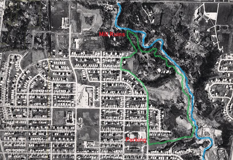
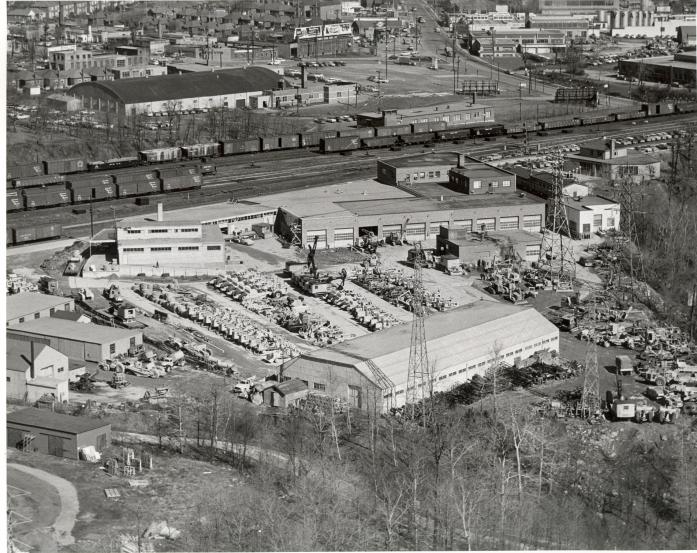
The aerial photograph below is from 1957 and was taken from the Toronto Archives. It shows the straightened Don River making a hard 90 degree turn into the Keating Channel. The buildings of the Toronto Dry Dock Company Ltd and Toronto Ship Building line the south side of the channel with the existing buildings circled in green. At the edge of the channel a ship is currently sitting in dry dock (also circled).

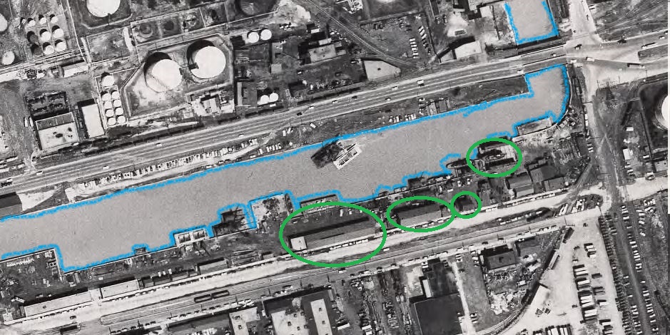
One of the earliest and most successful manufacturers of steam engines and ships was Polson Iron Works. They produced around 150 vessels and were intended to occupy Polson’s Pier in the newly created Port Lands but didn’t move there because of the First World War and then they suffered bankruptcy in 1919. Meanwhile, The Toronto Dry Dock Company and its co-owned Toronto Ship Building Company established themselves along side the Keating Channel. Three of their former buildings can be seen in the picture below.

While Polson was busy pumping out minesweepers for the military, the newly founded Dry Dock and Ship Building enterprise got a contract to build cargo ships for the military. War Ontario and War Toronto were their first two ships. Their facilities faced the Keating Channel with access to Lake Ontario and the Great Lakes but they also faced Villiers Road where a railway spur gave them access to the rest of the province.

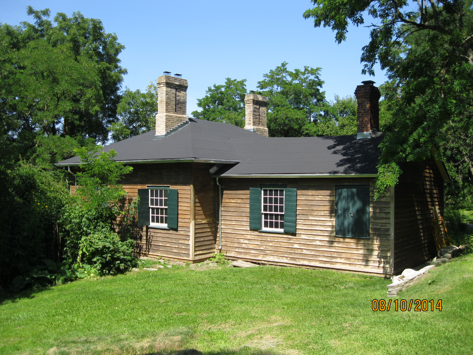
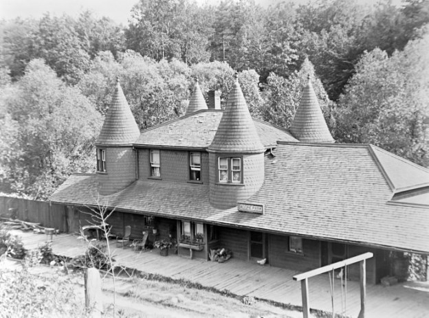
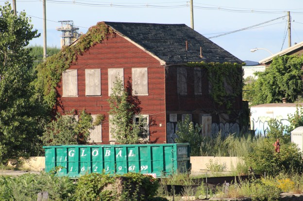
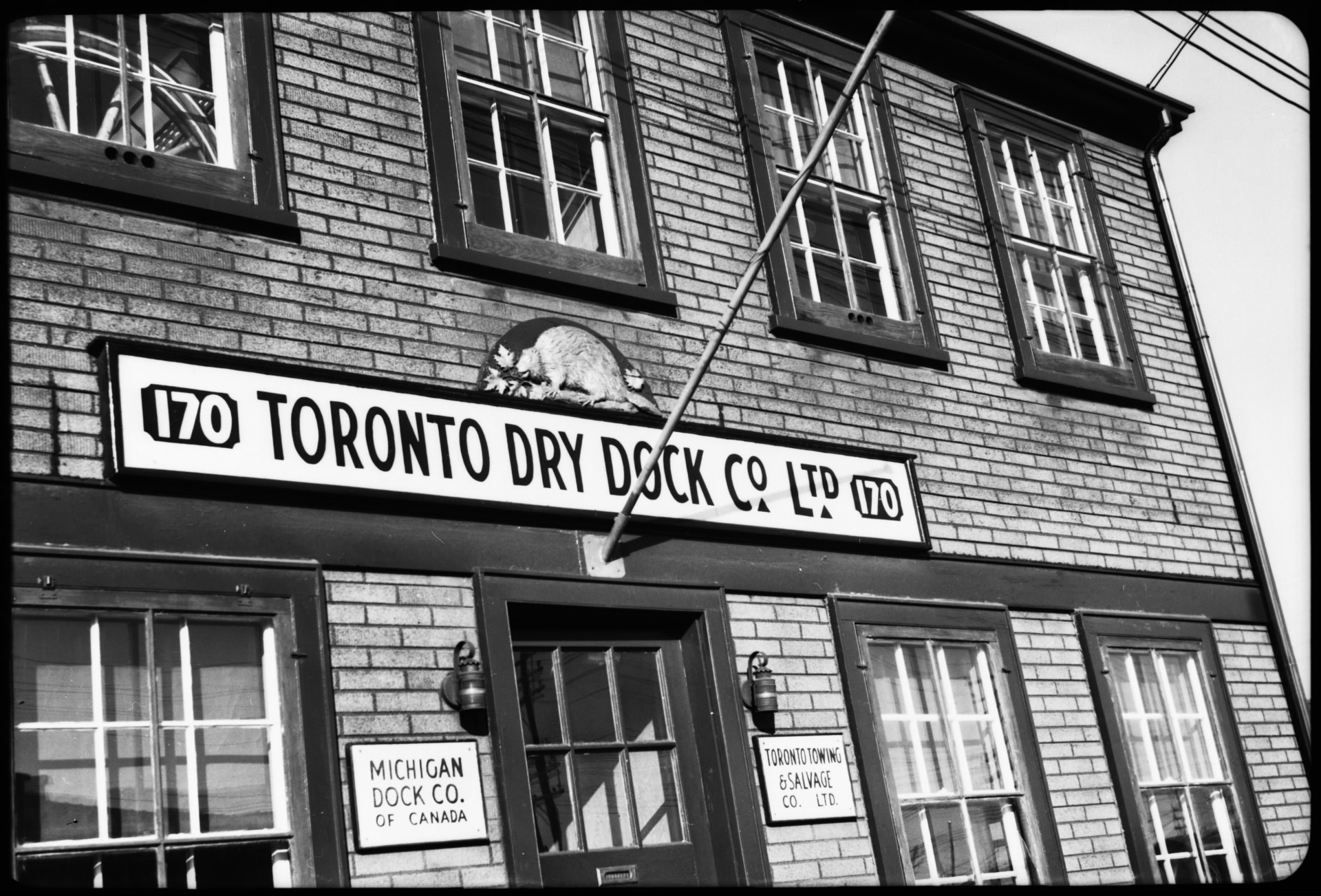
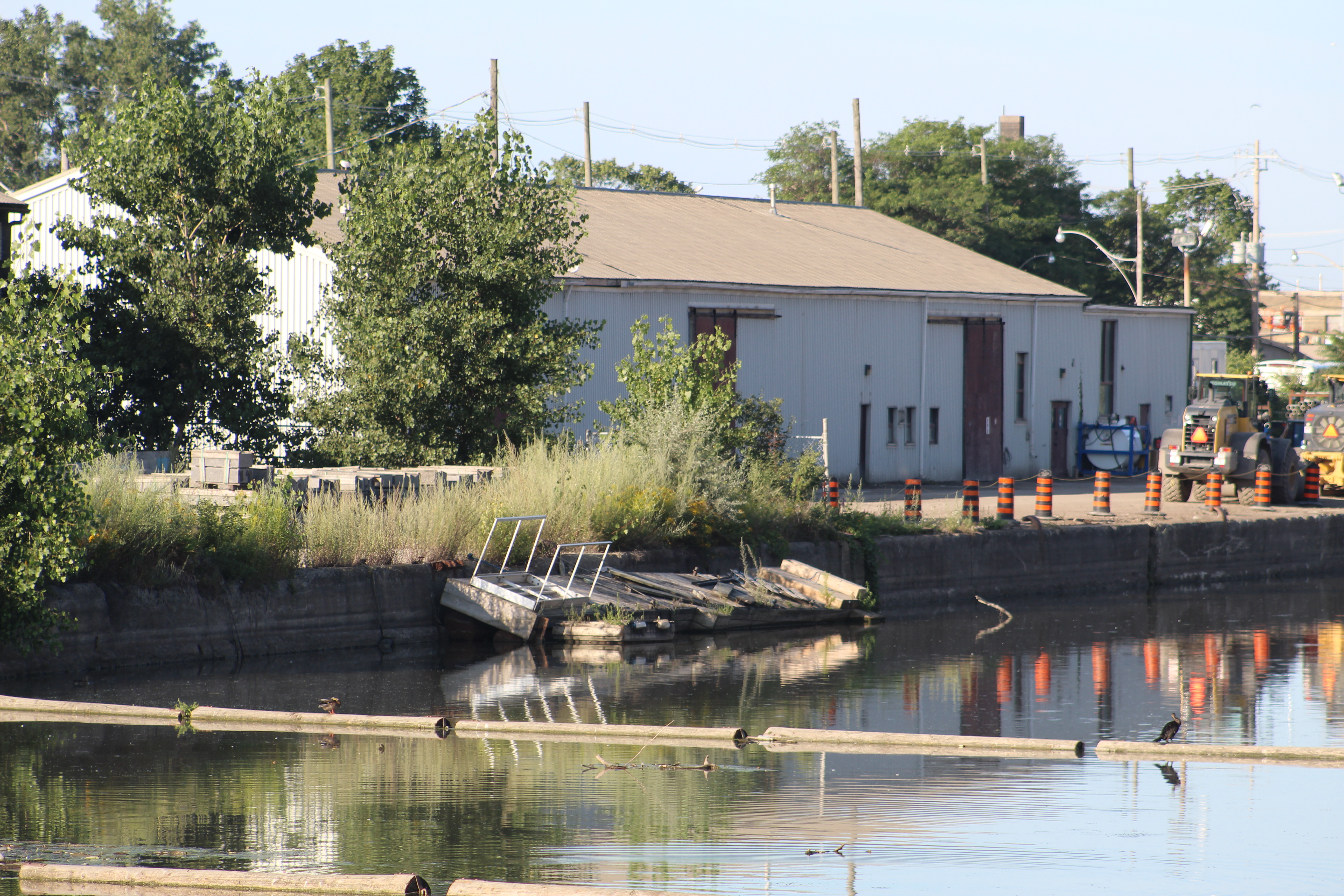
The building at 170 Villiers served as the front office of the business, greeting customers from the street side, rather than the rear which looked out over the work yard.

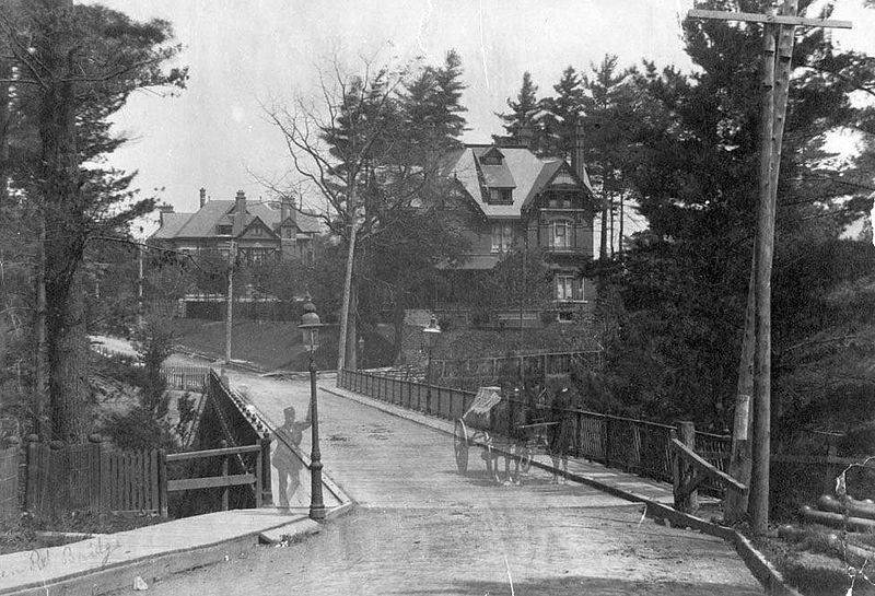
The side of the building facing Villiers Street was a lot more inviting in 1954 when this Toronto Public Library photo was taken.

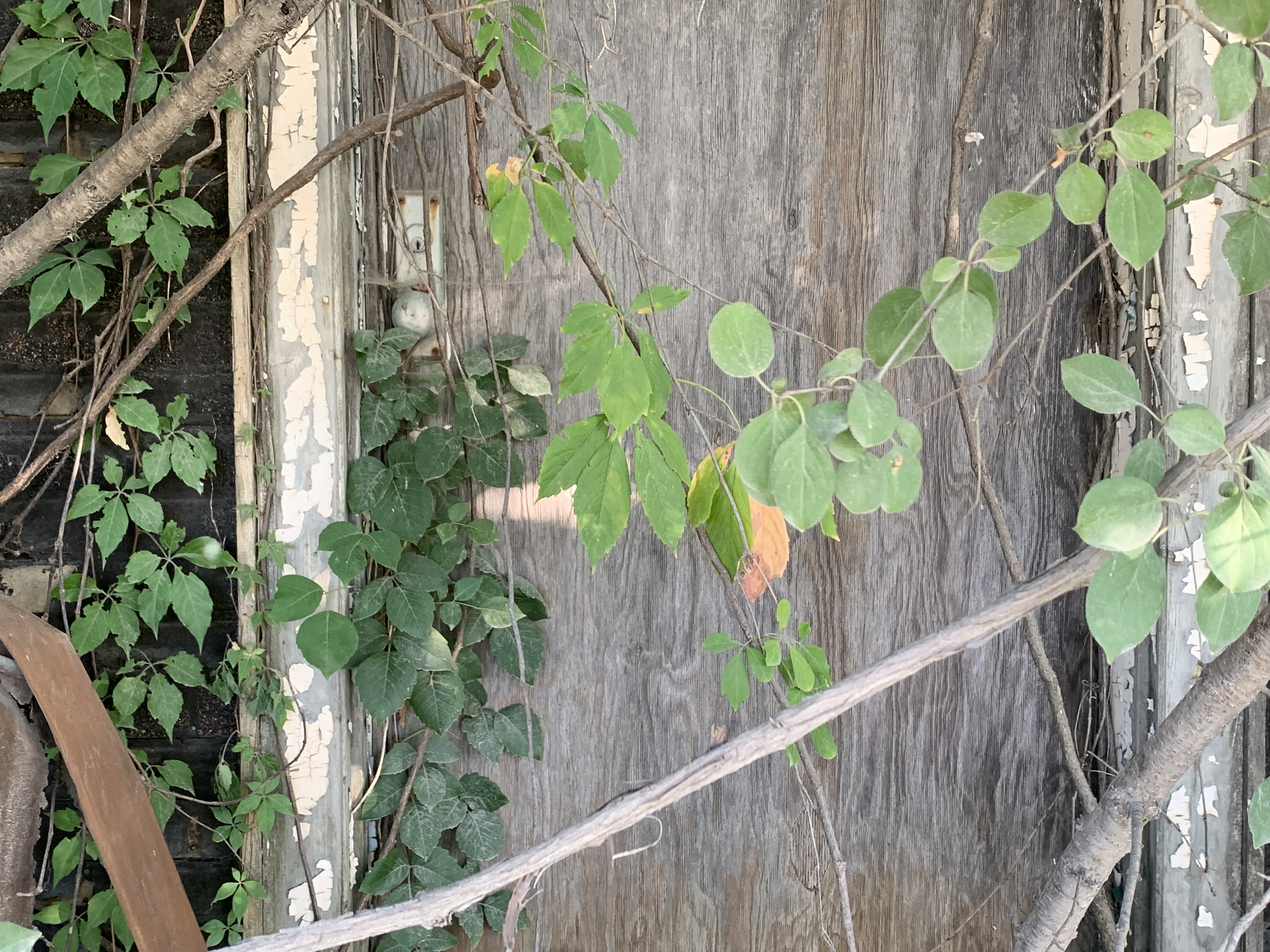
The business would continue until 1964 when it would become part of Port Weller Dry Docks. Following their demise, the property was sold to the Toronto Port Authority. Today, the windows are all boarded over and the front of the building is grown over in ivy.

However, the front door is still there, secretly waiting for dry dock customers who never arrive.

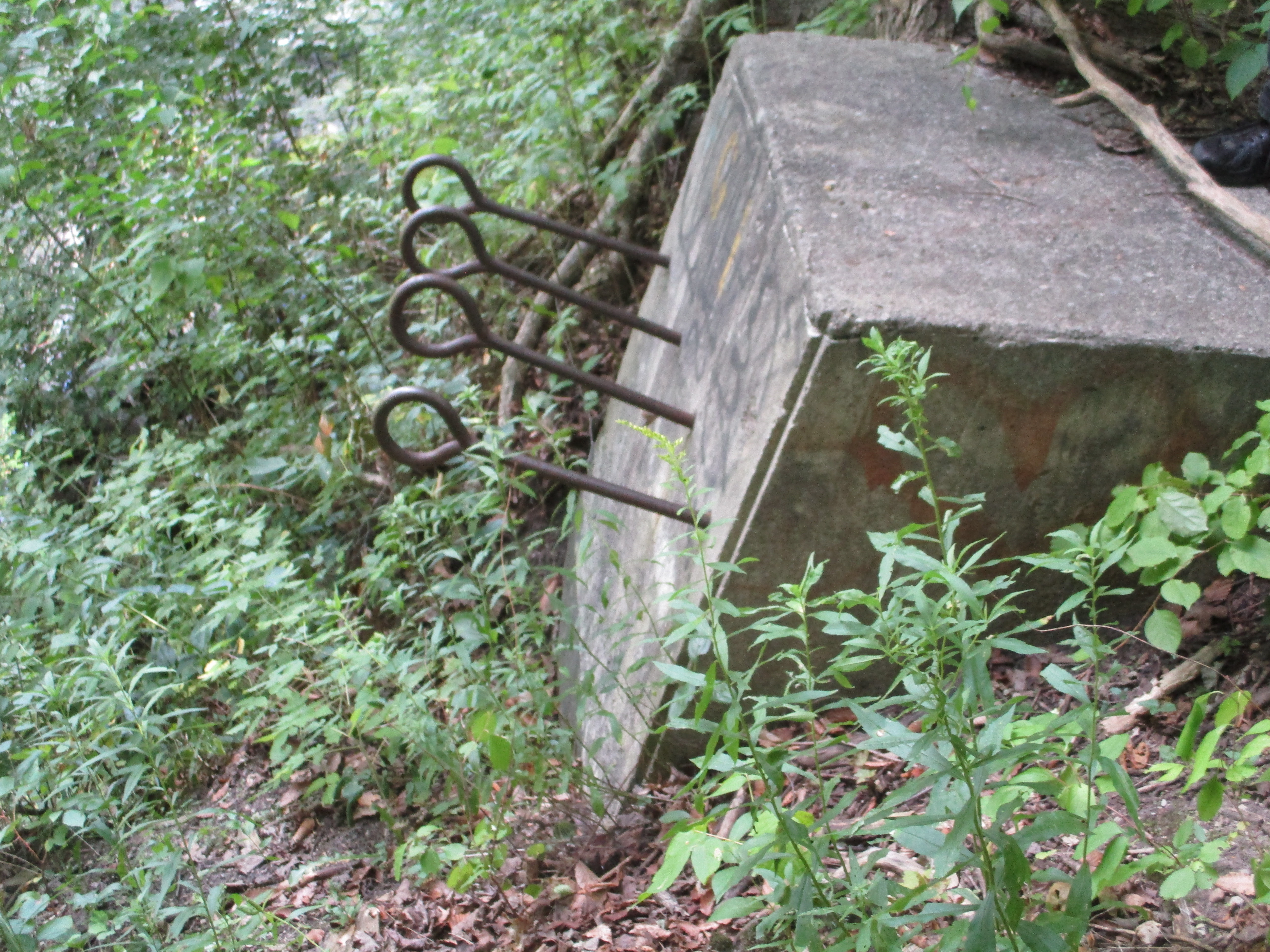
When Toronto Dry Dock Company Ltd. received its charter in 1917 as a vessel repair yards, C.S. Boone was the first president. It was an off-shoot of C.S. Boone Dredging & Construction, of which he was also the president. They started business with a floating dry dock that was 160 feet long that was tethered to the concrete wall in front of the office building.

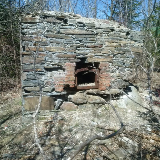
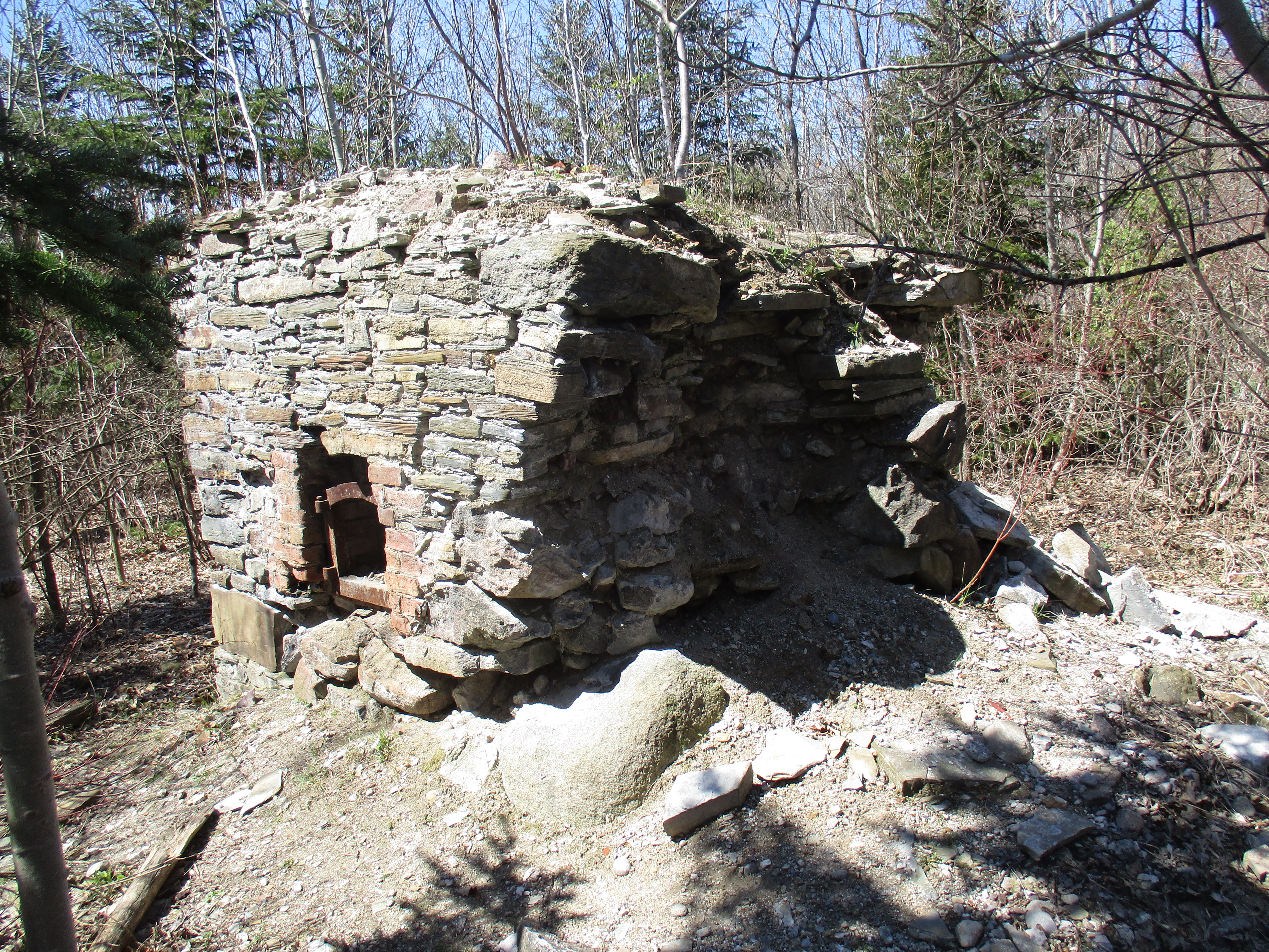
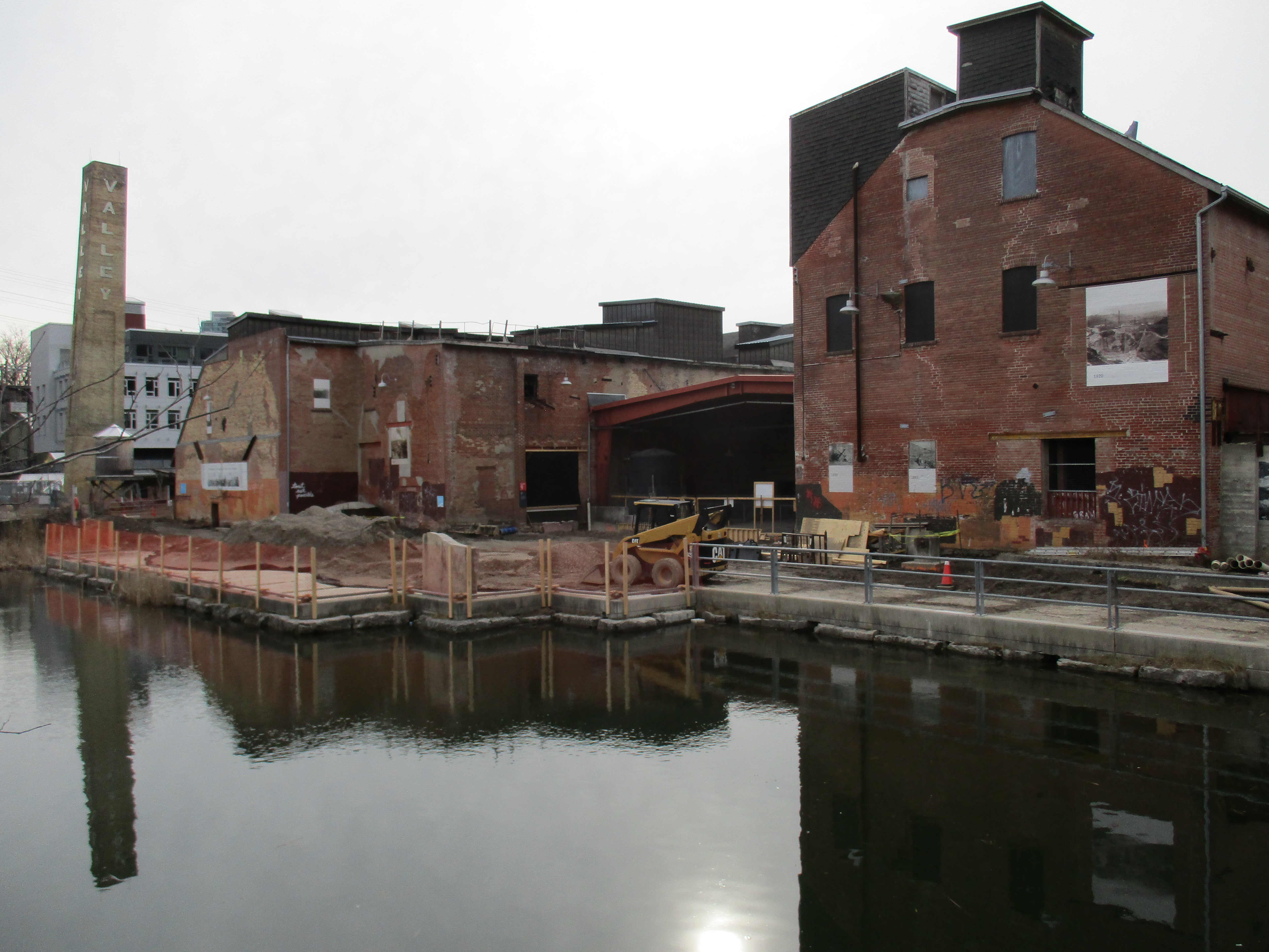
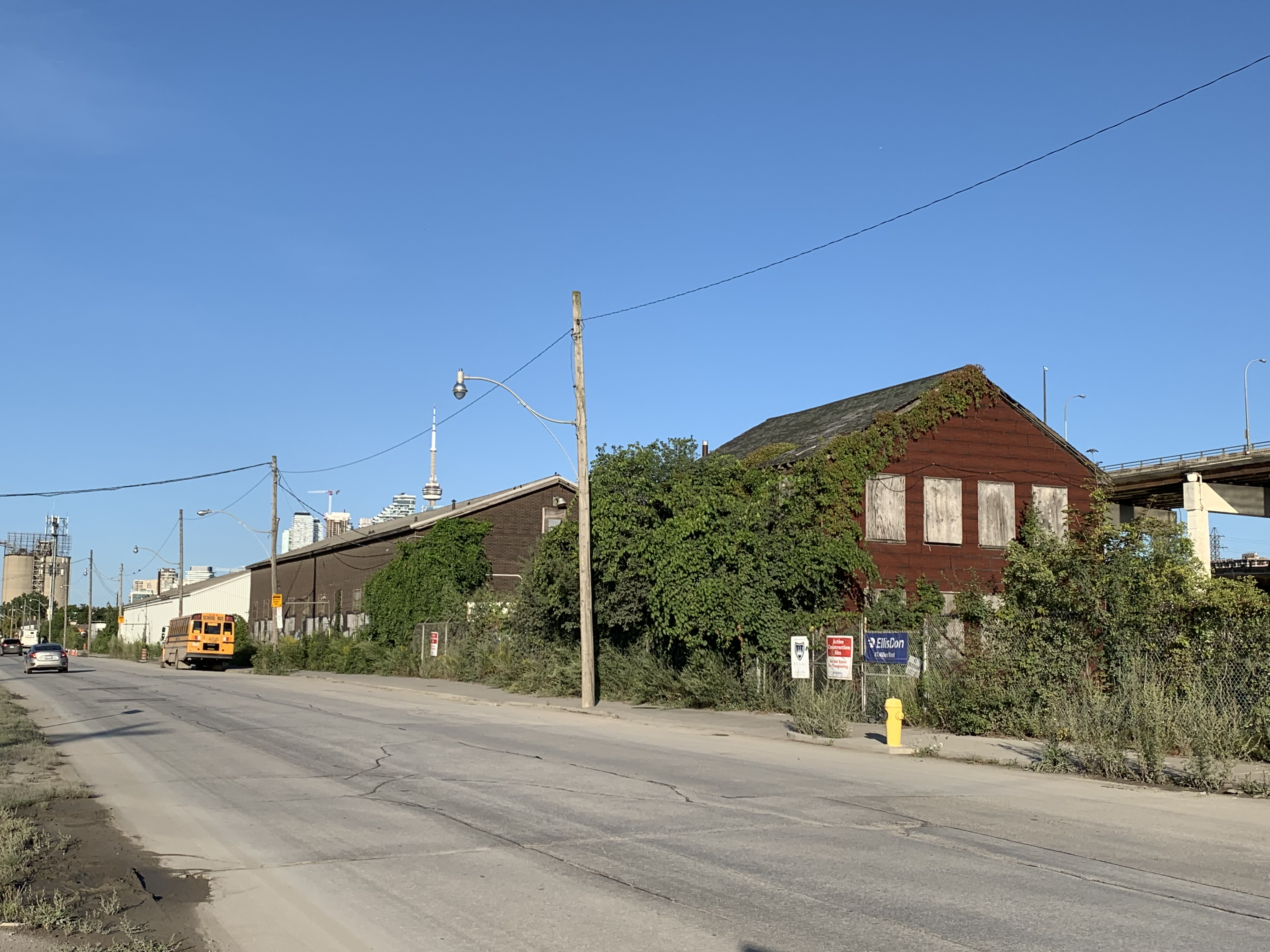
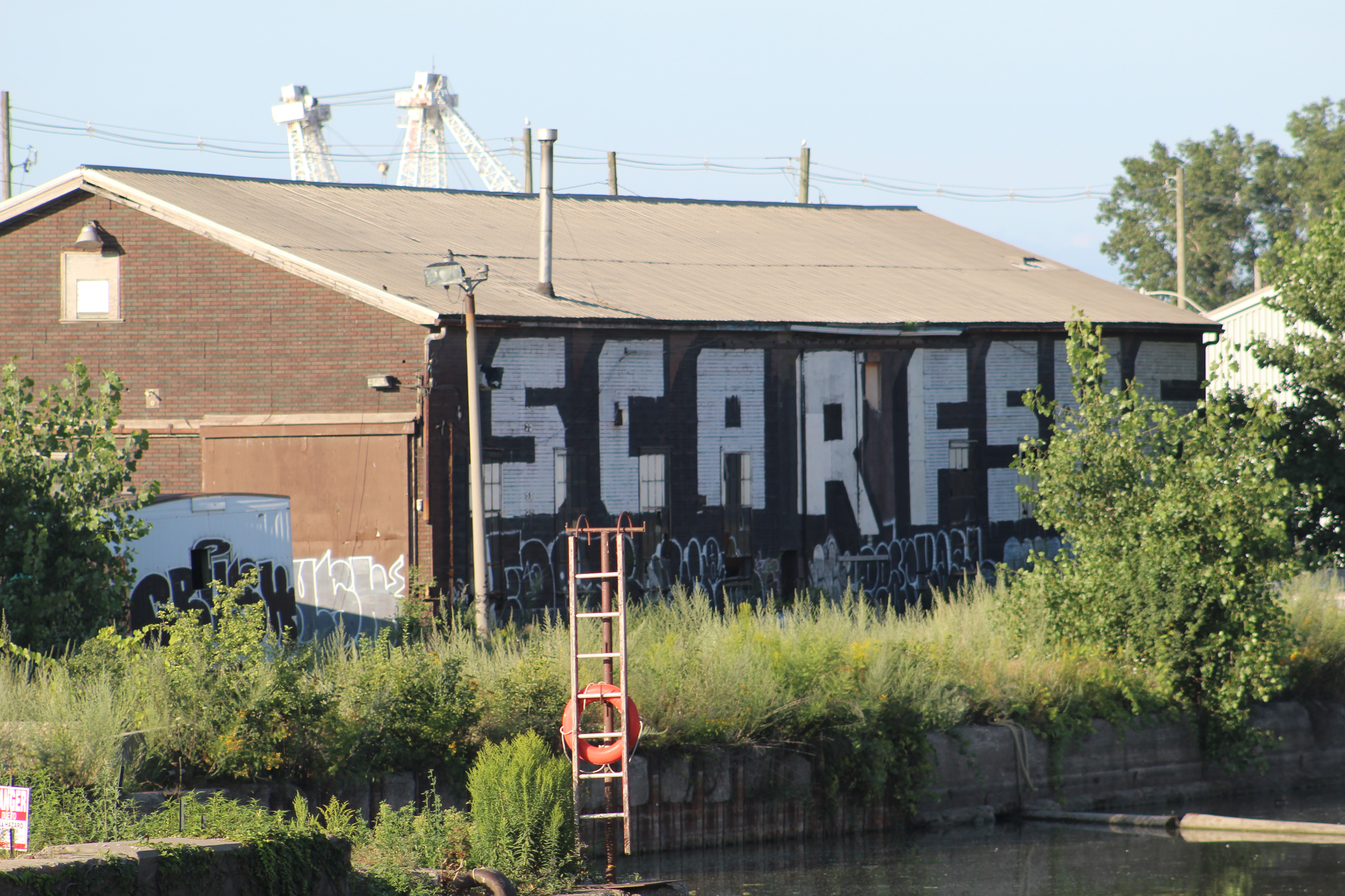
However, they soon found that it wasn’t large enough for many of the vessels they could have worked on. In 1920 they purchased another dry dock which was sitting in Montreal. It had been used during the war to re-assemble ships that had been taken apart and floated through various canals to the St. Lawrence River so that they could be added to the war effort. The dry dock was towed to Toronto where it was added to the existing one. This gave the yards the ability to work on the biggest ships on the Great Lakes. The building below was used to build and repair large boilers and steam engines. It has been the unfortunate victim of someone who doesn’t know how to spell “scarface” and chose to display it in ten foot letters.

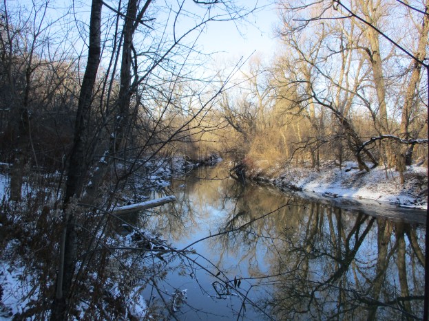
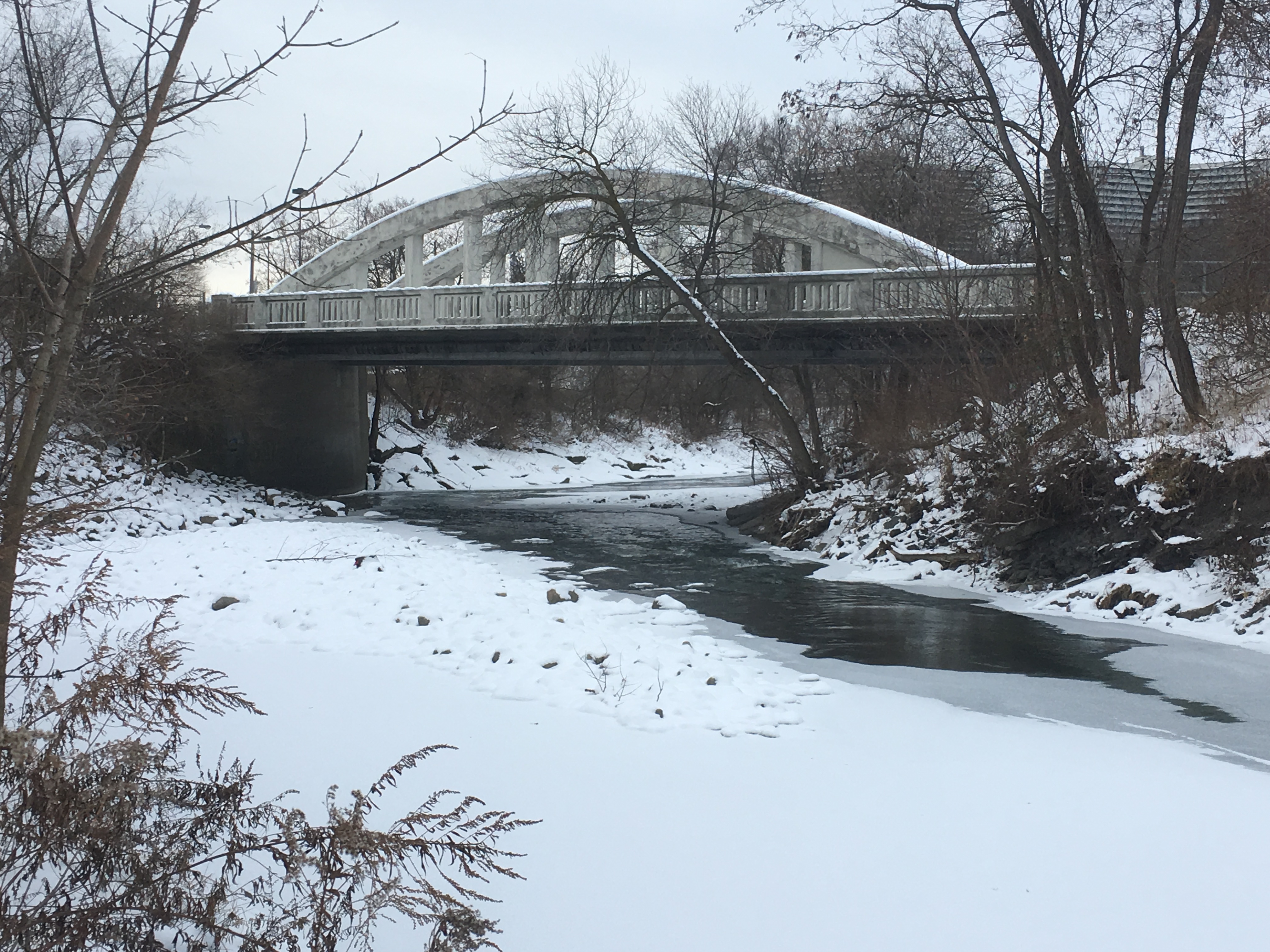
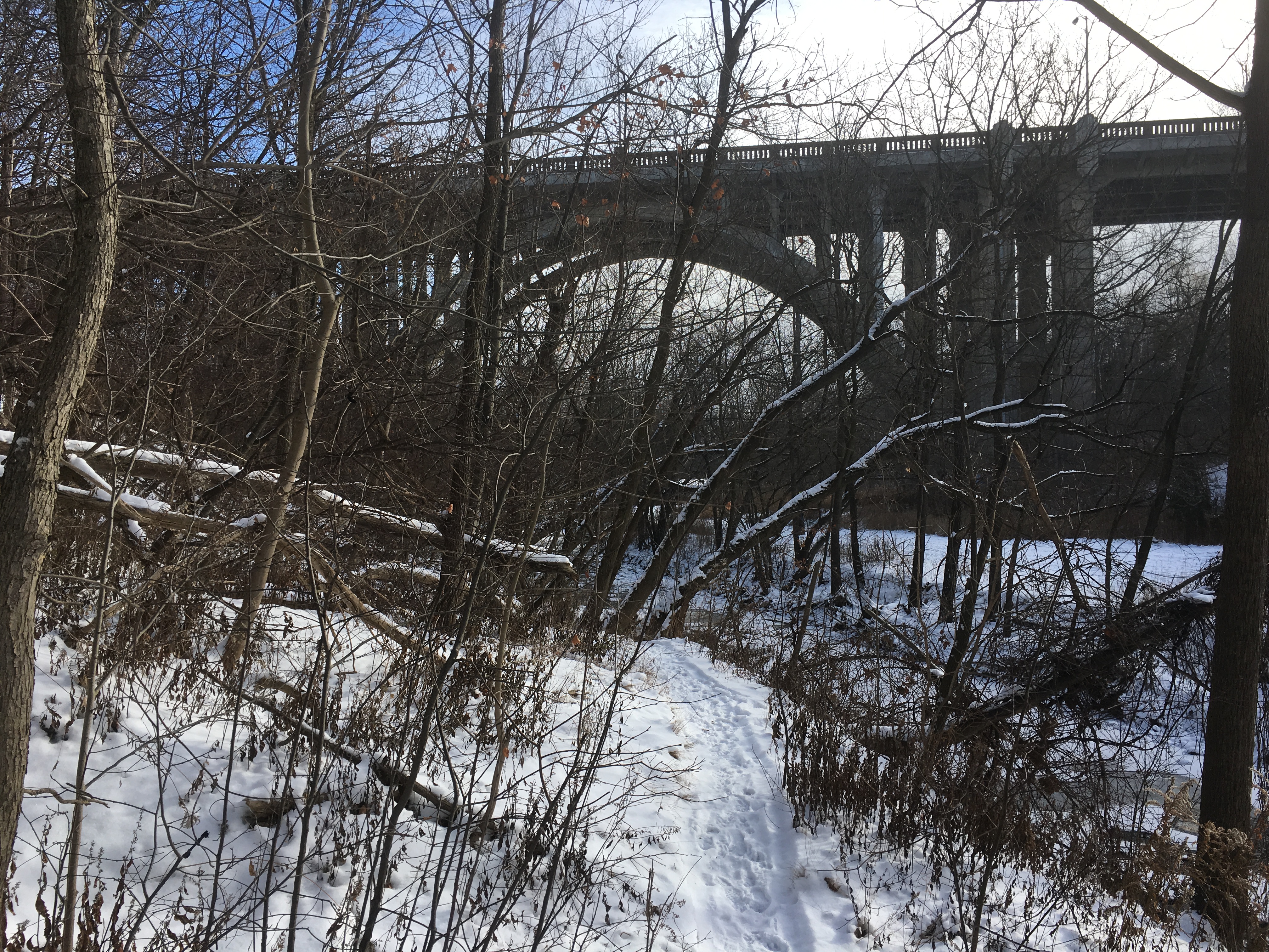
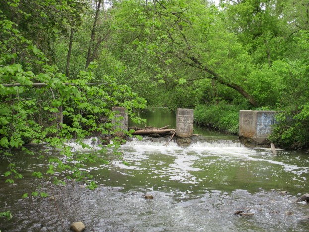
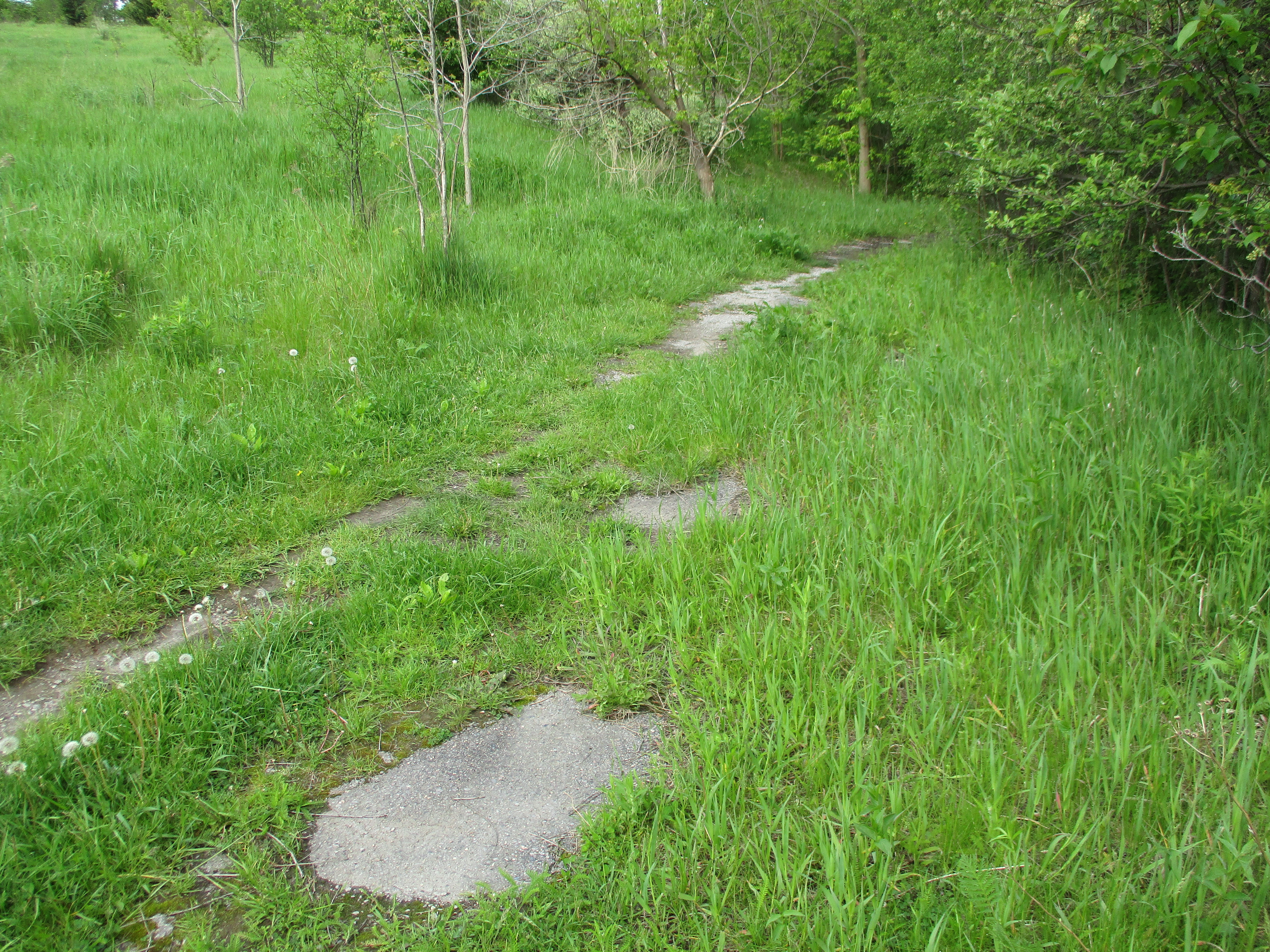
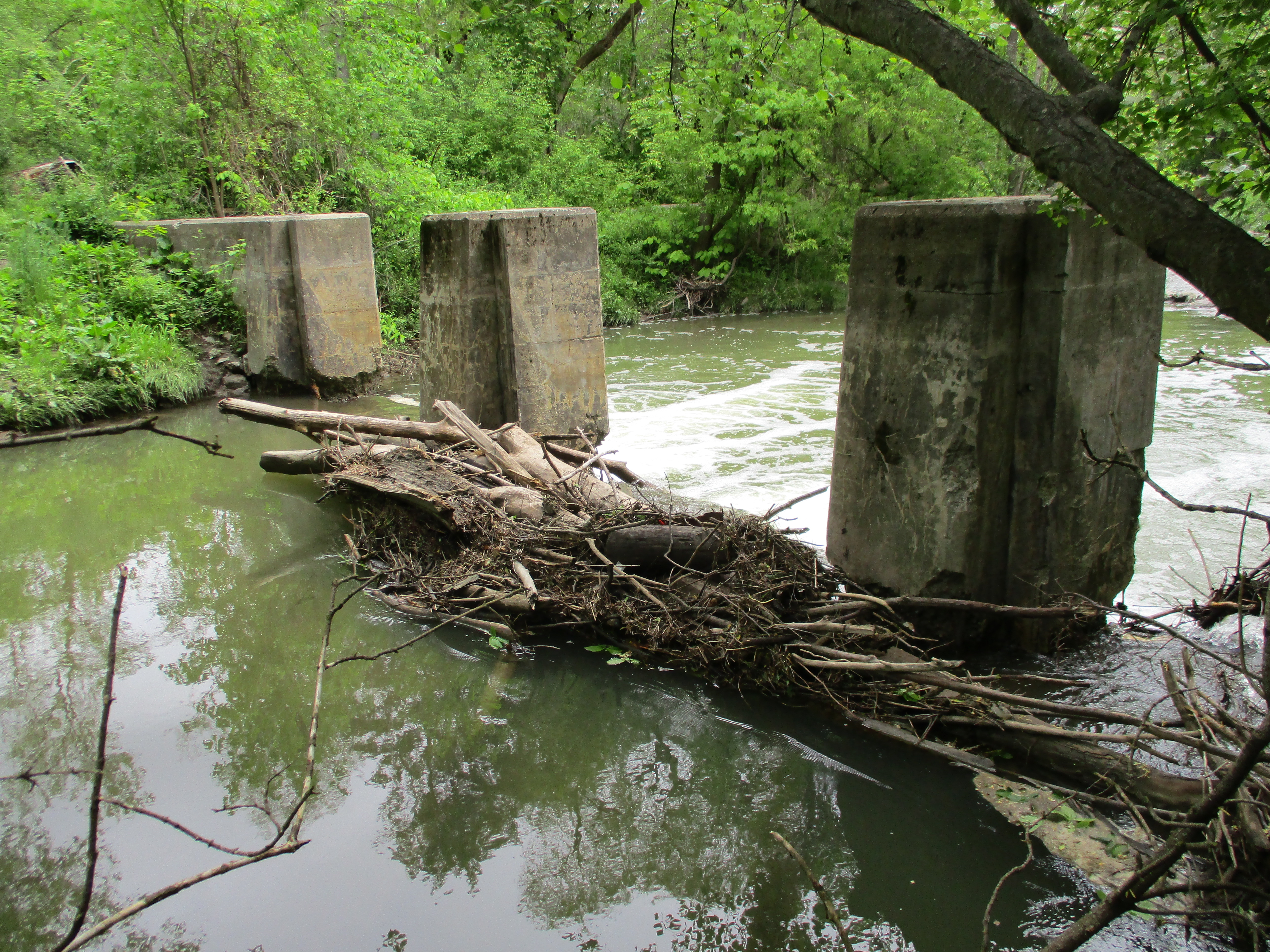
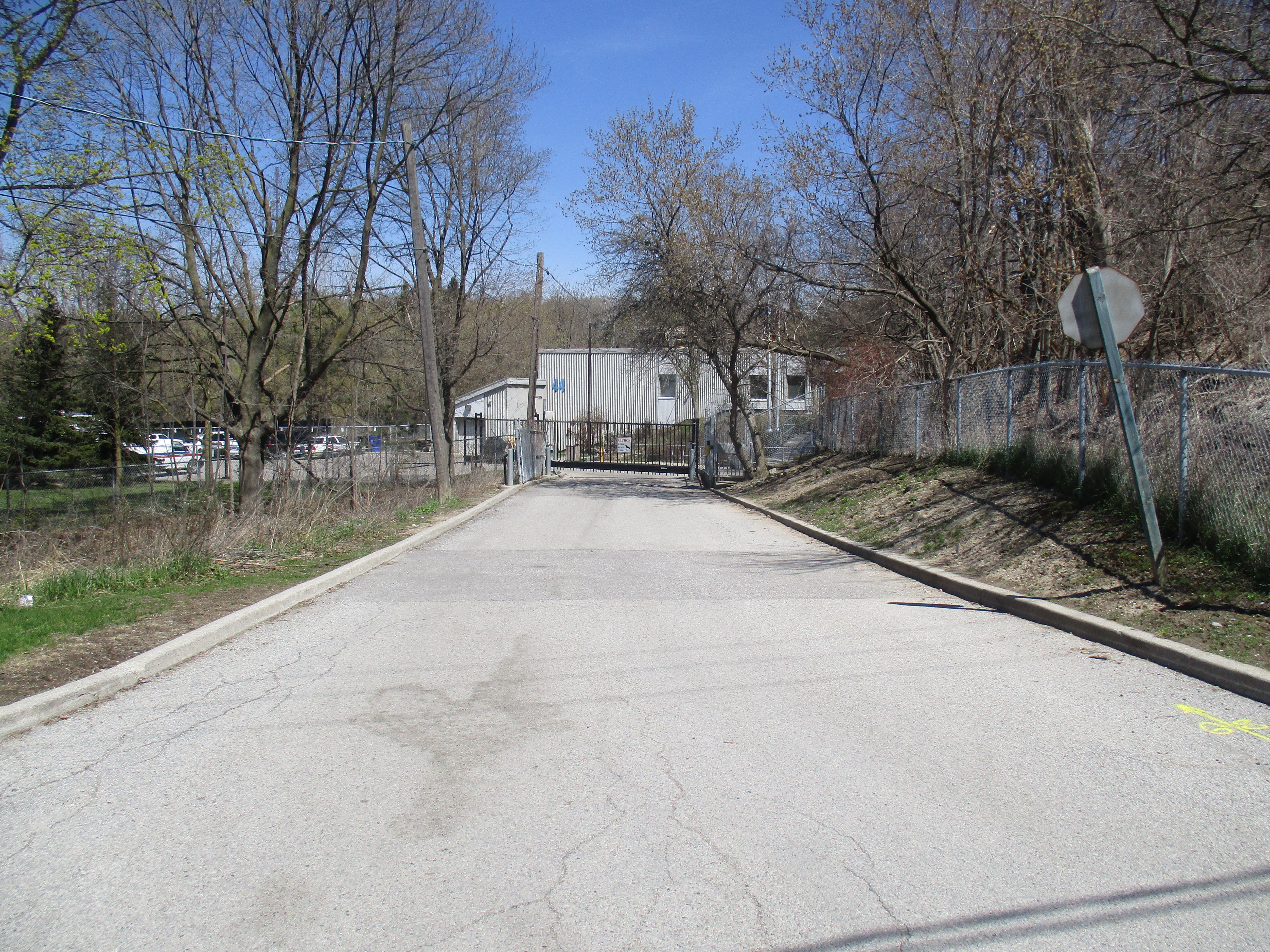
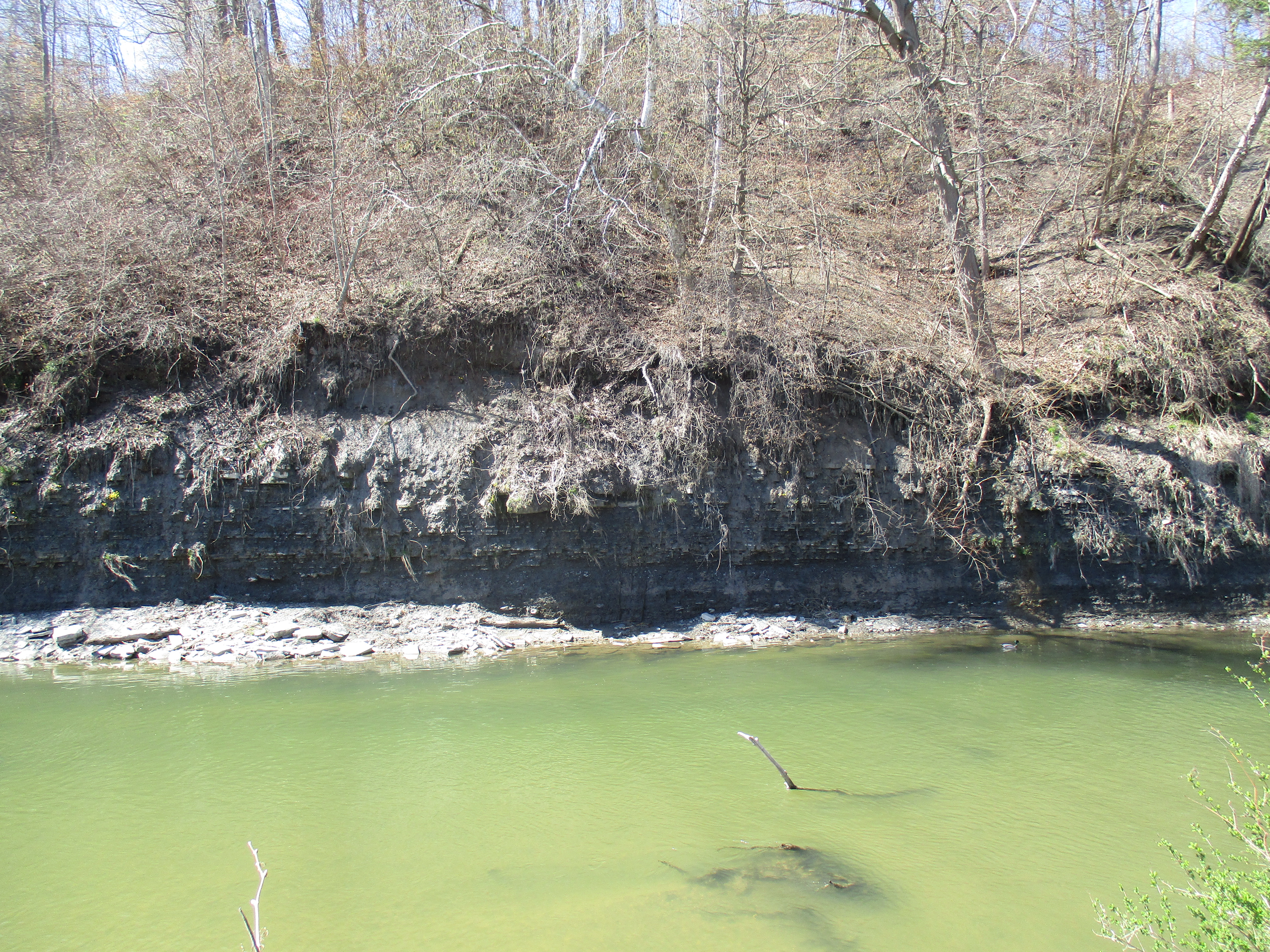
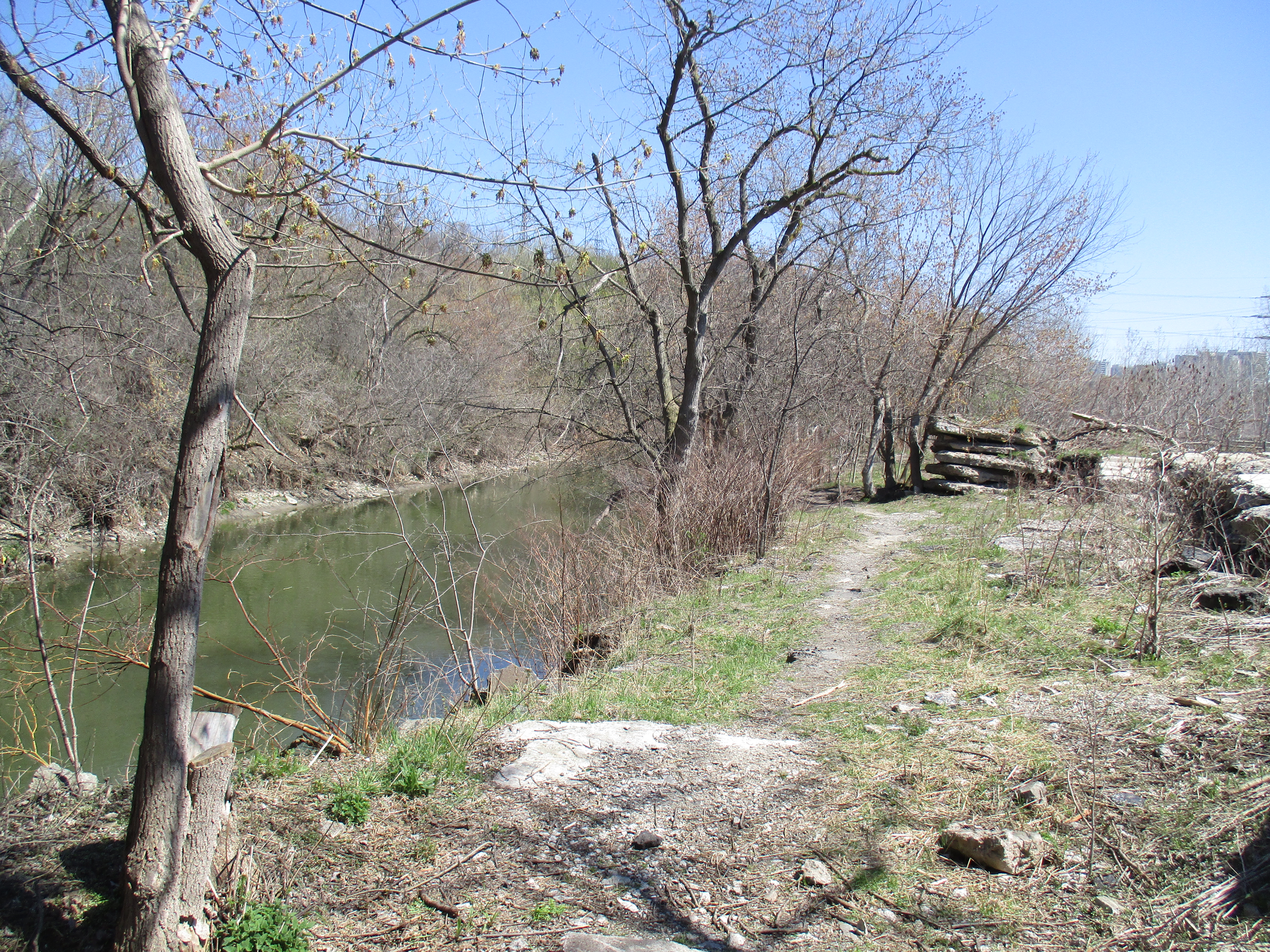
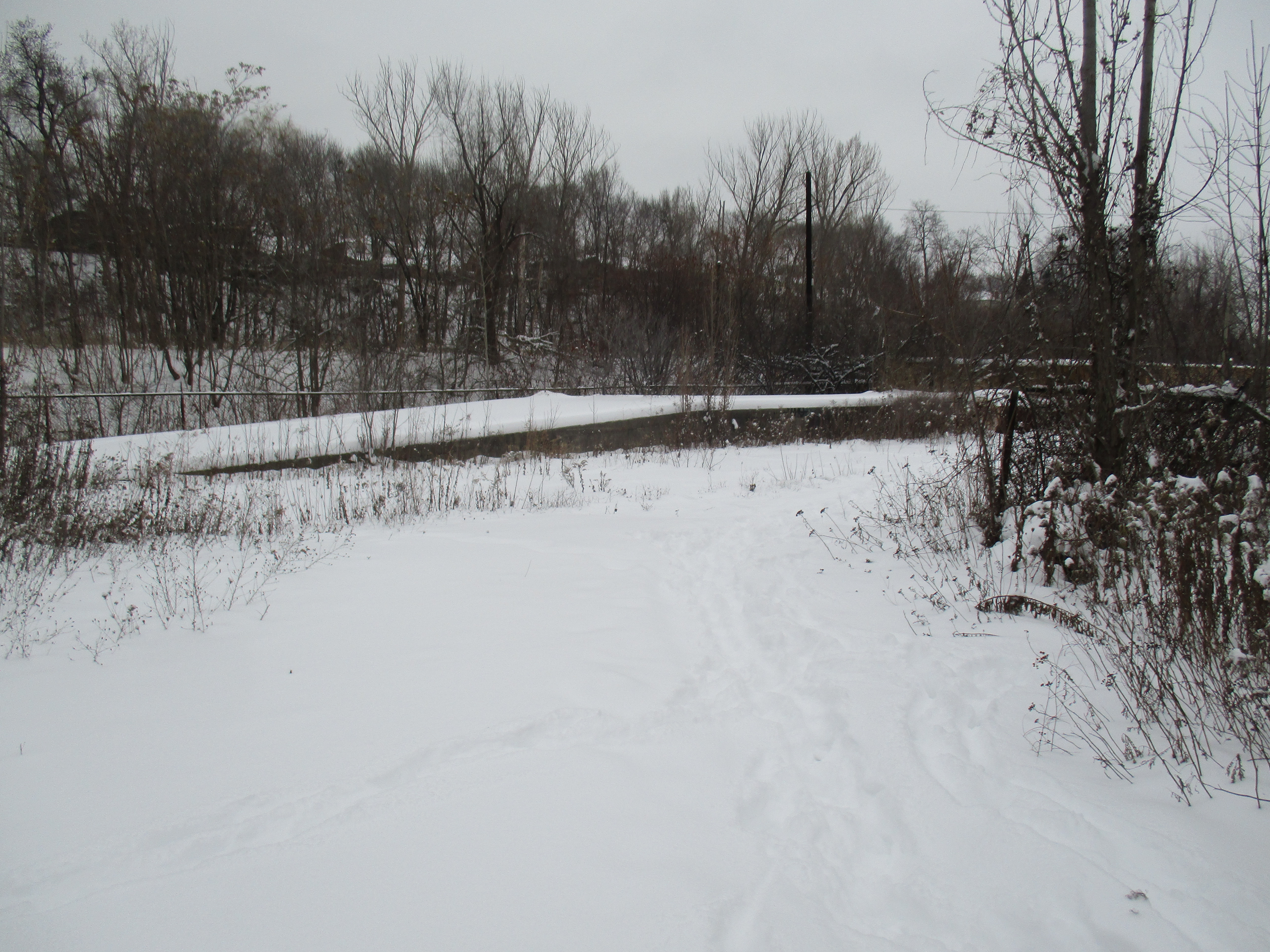
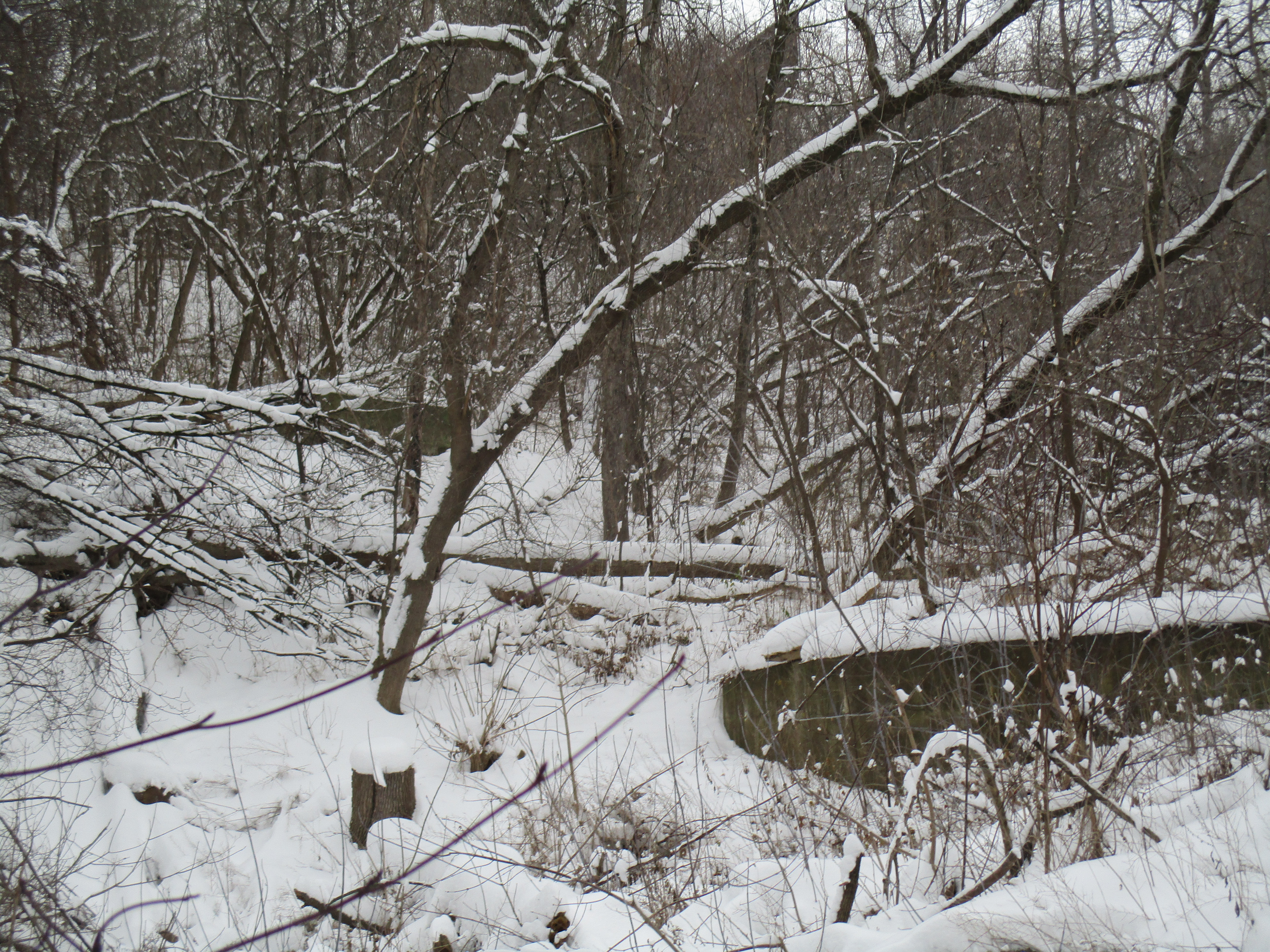
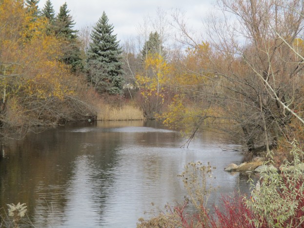
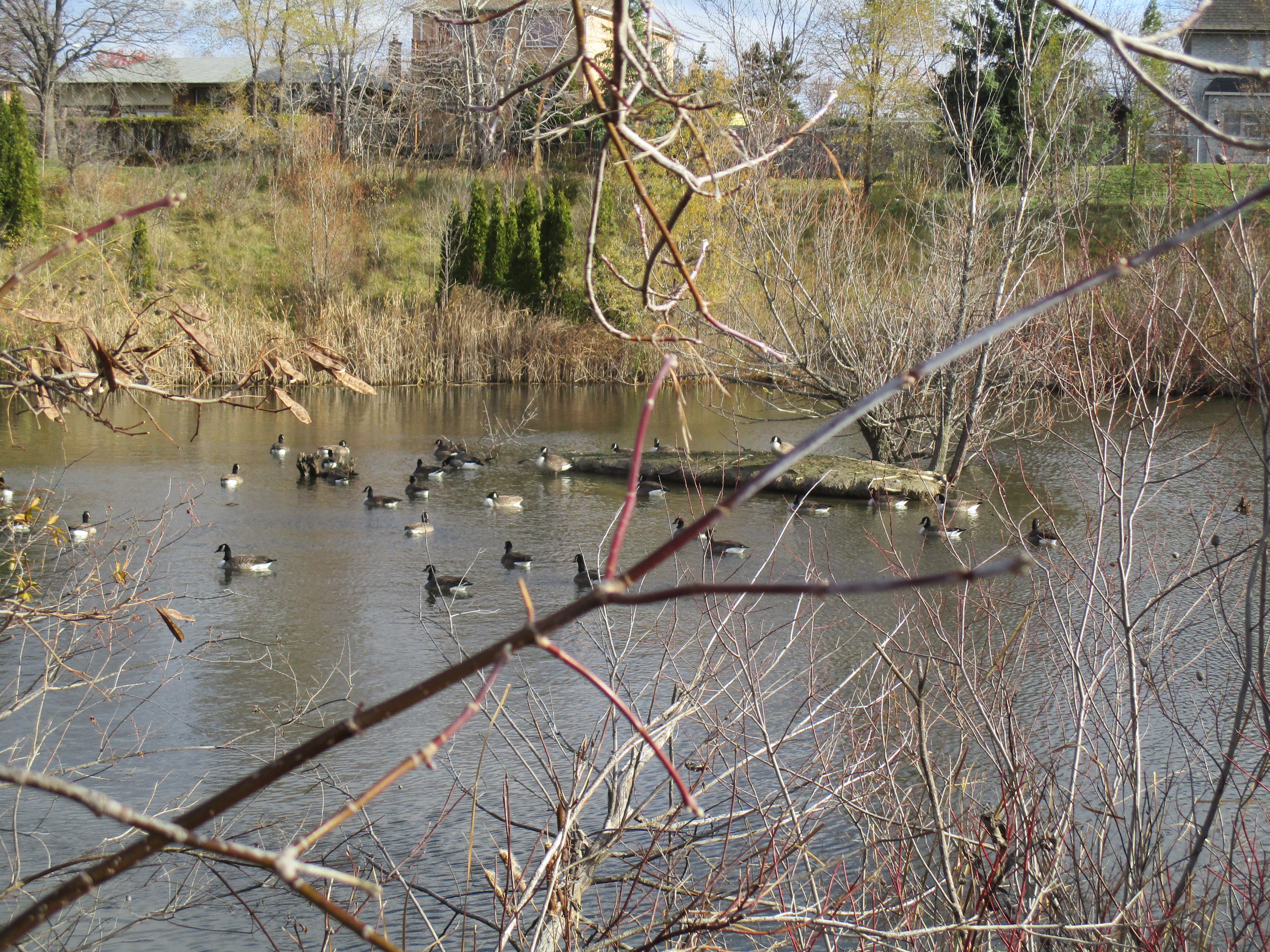
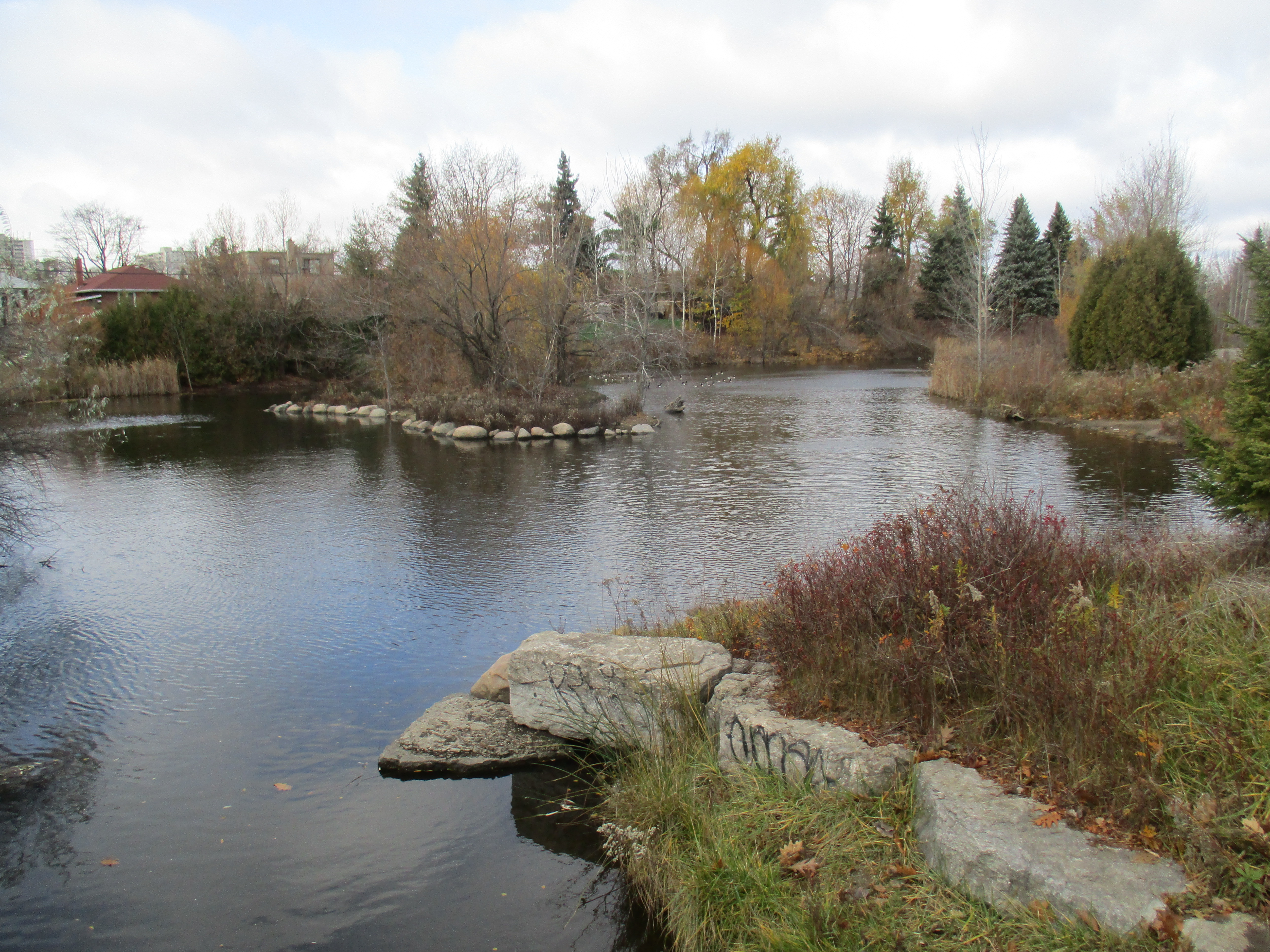
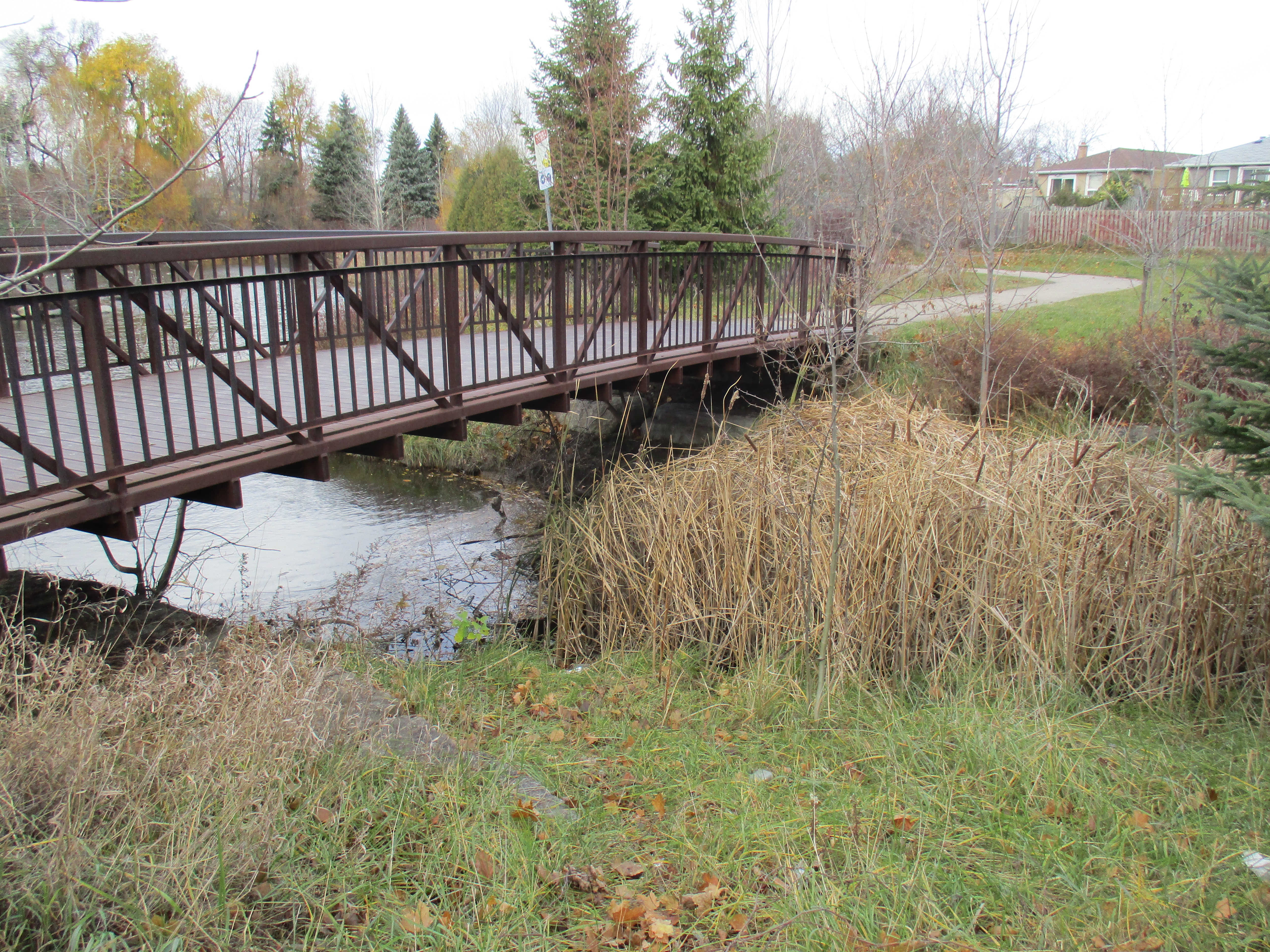
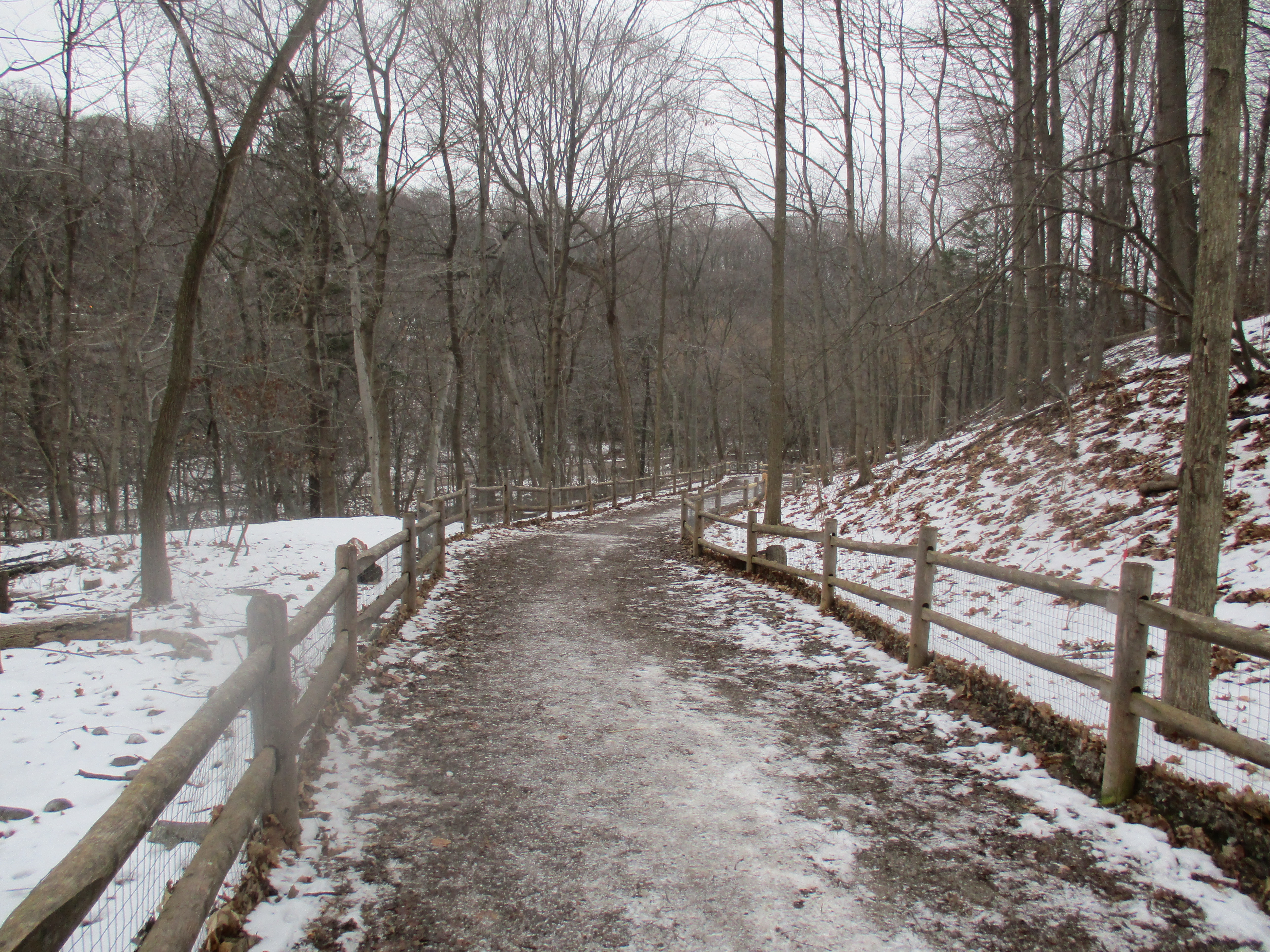
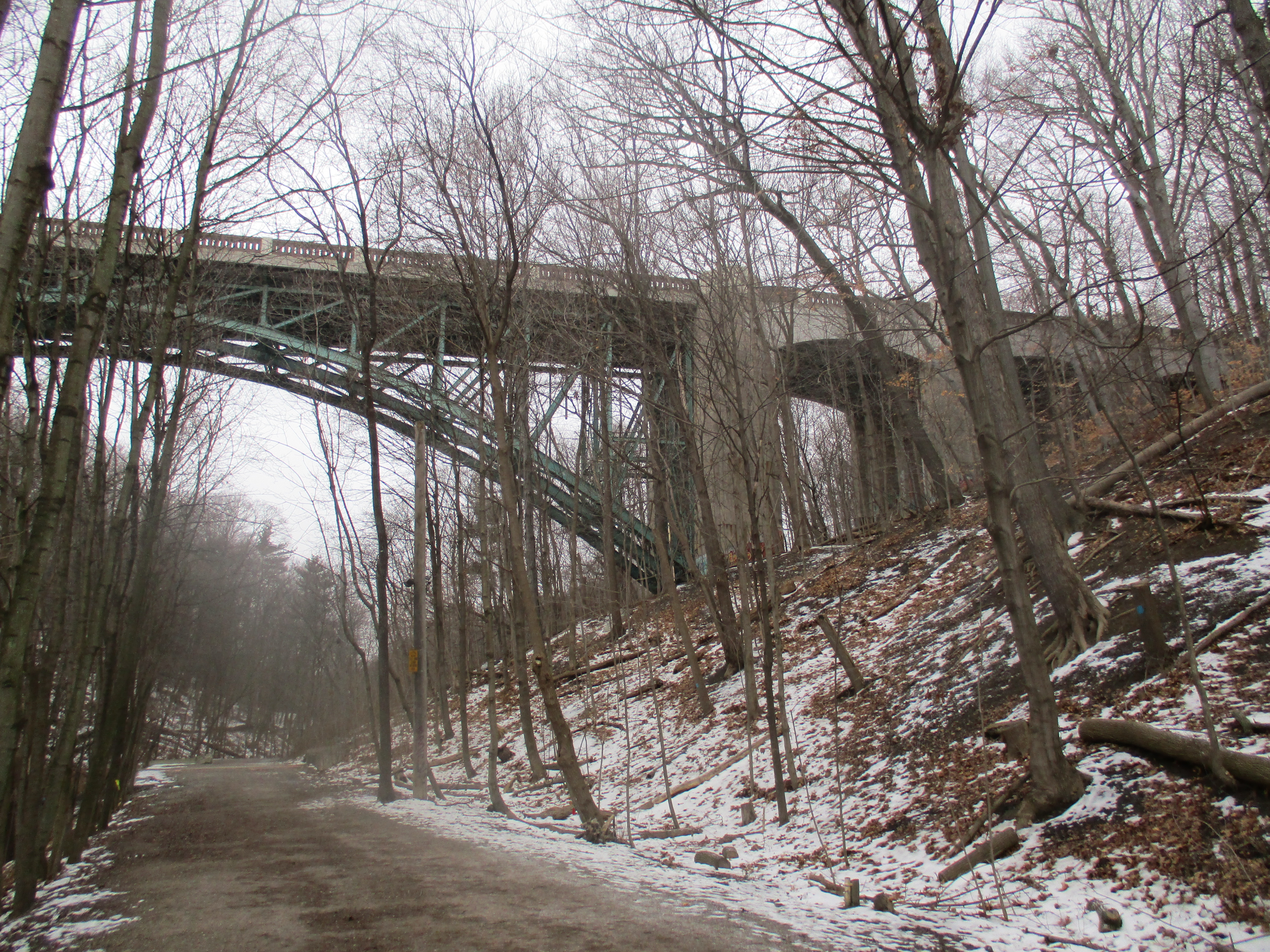
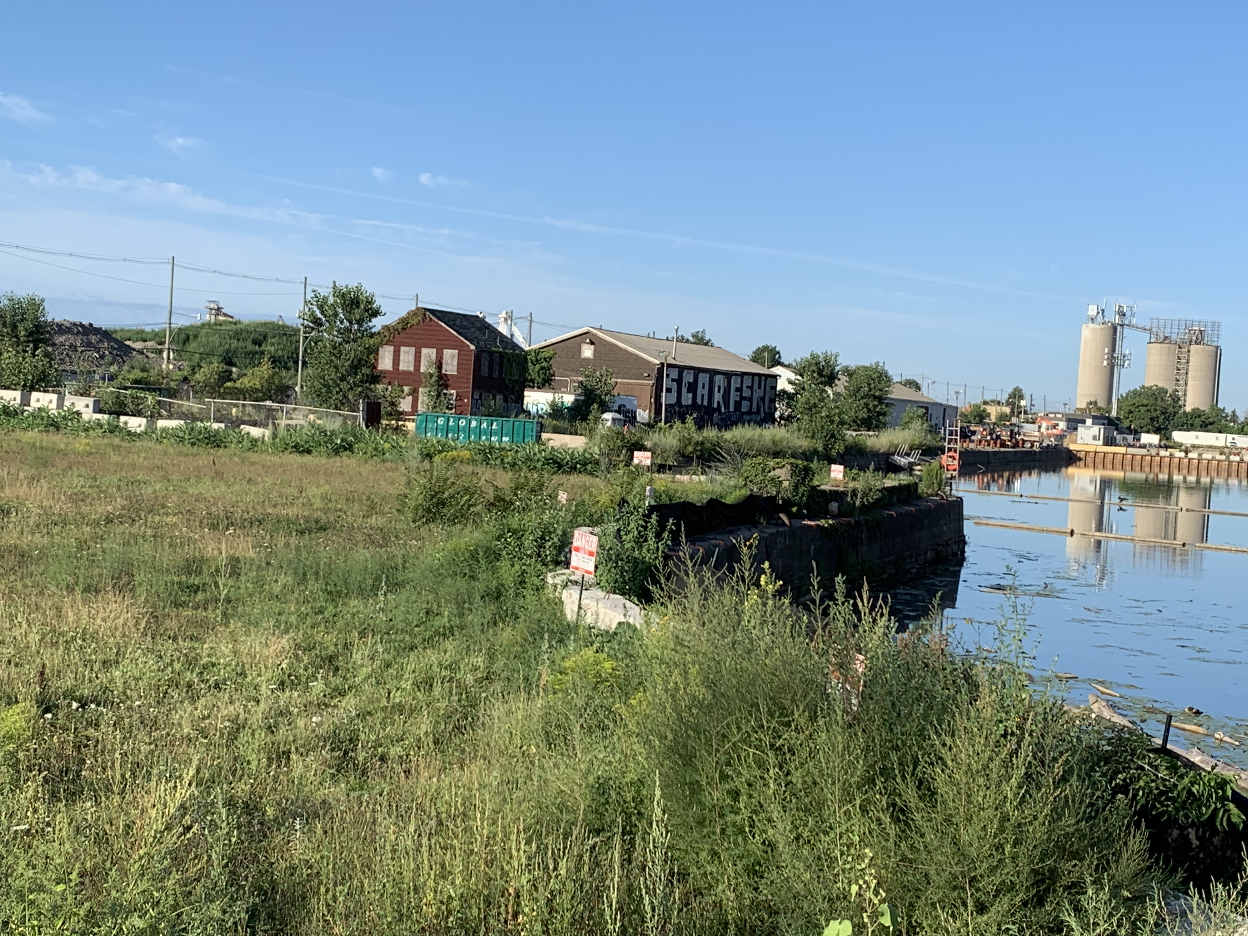
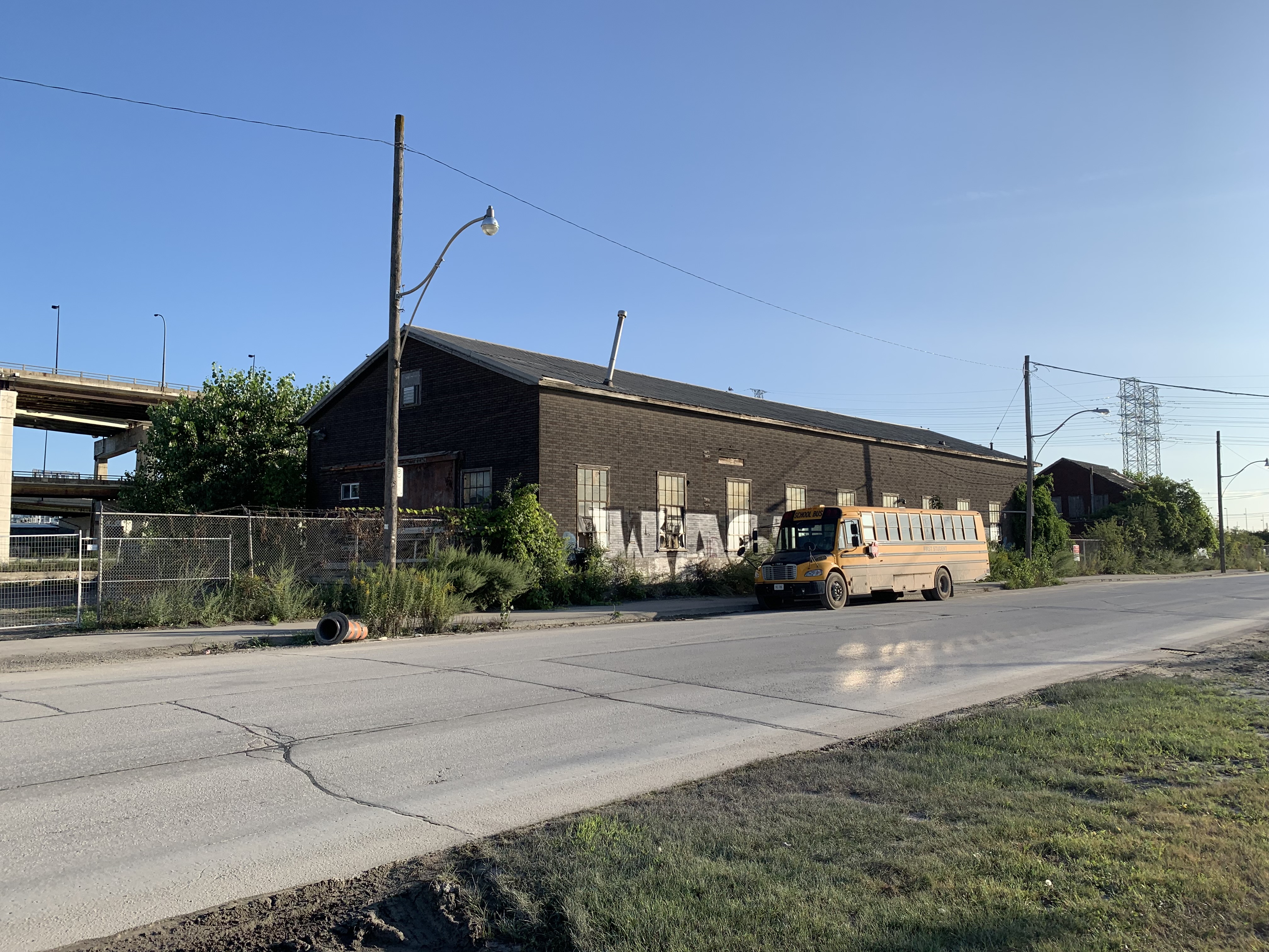
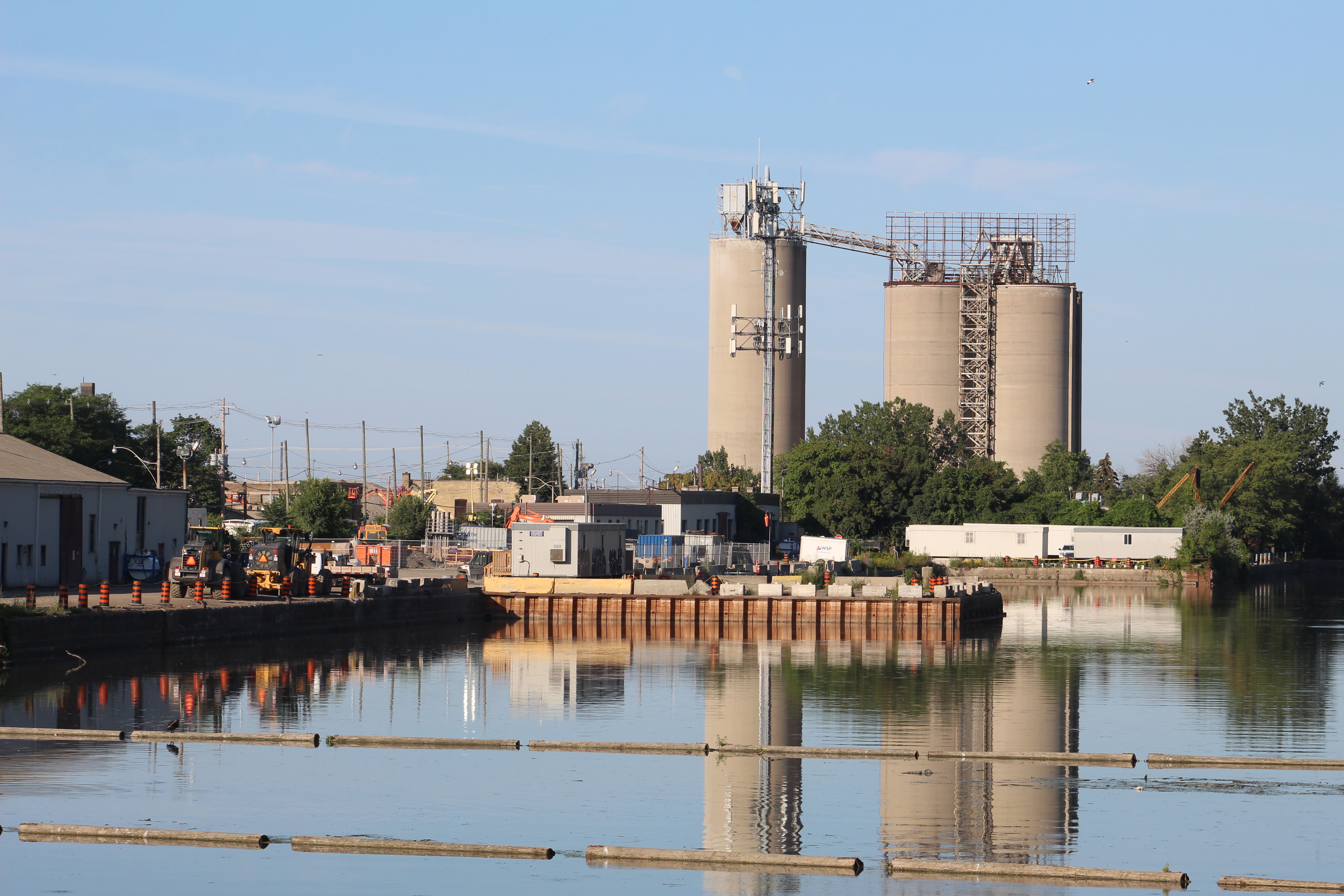
When The Don Narrows were created by straightening the Lower Don River one of the objectives was to create shipping to service the industries along the river. Instead, the 90 degree turn into the Keating Channel led to serious silting problems and the larger ships were often unable to reach the dry docks for repairs. By the early 1940s Henry J. Dixon had become the principal owner and he started Toronto Towing and Salvage Ltd. and moved away from the dry dock business. Villiers Street was formerly serviced by a rail line that ran down the middle of the street and it provides the vantage point for the picture below.

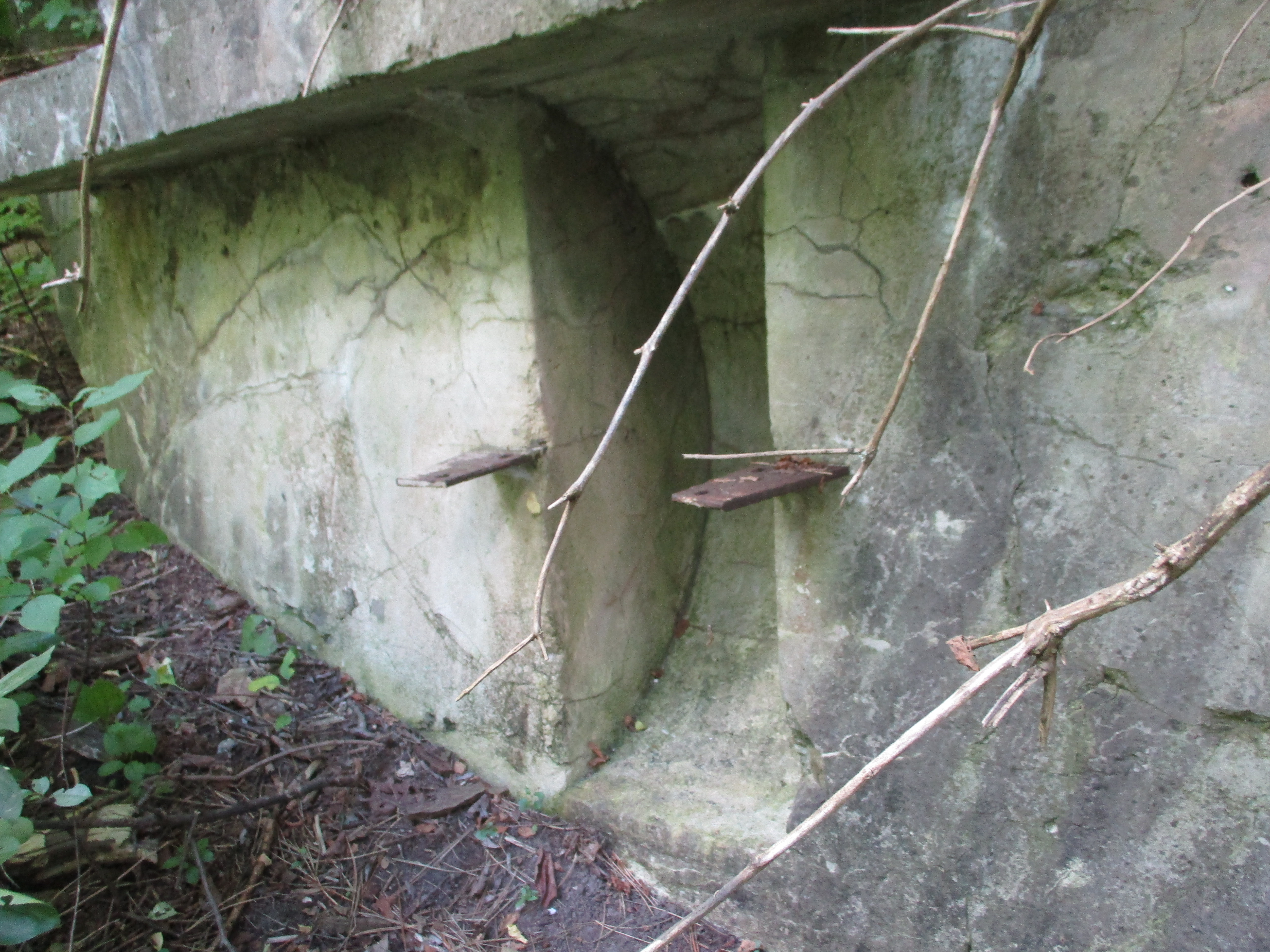
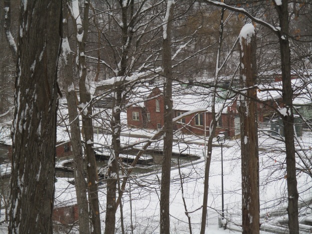
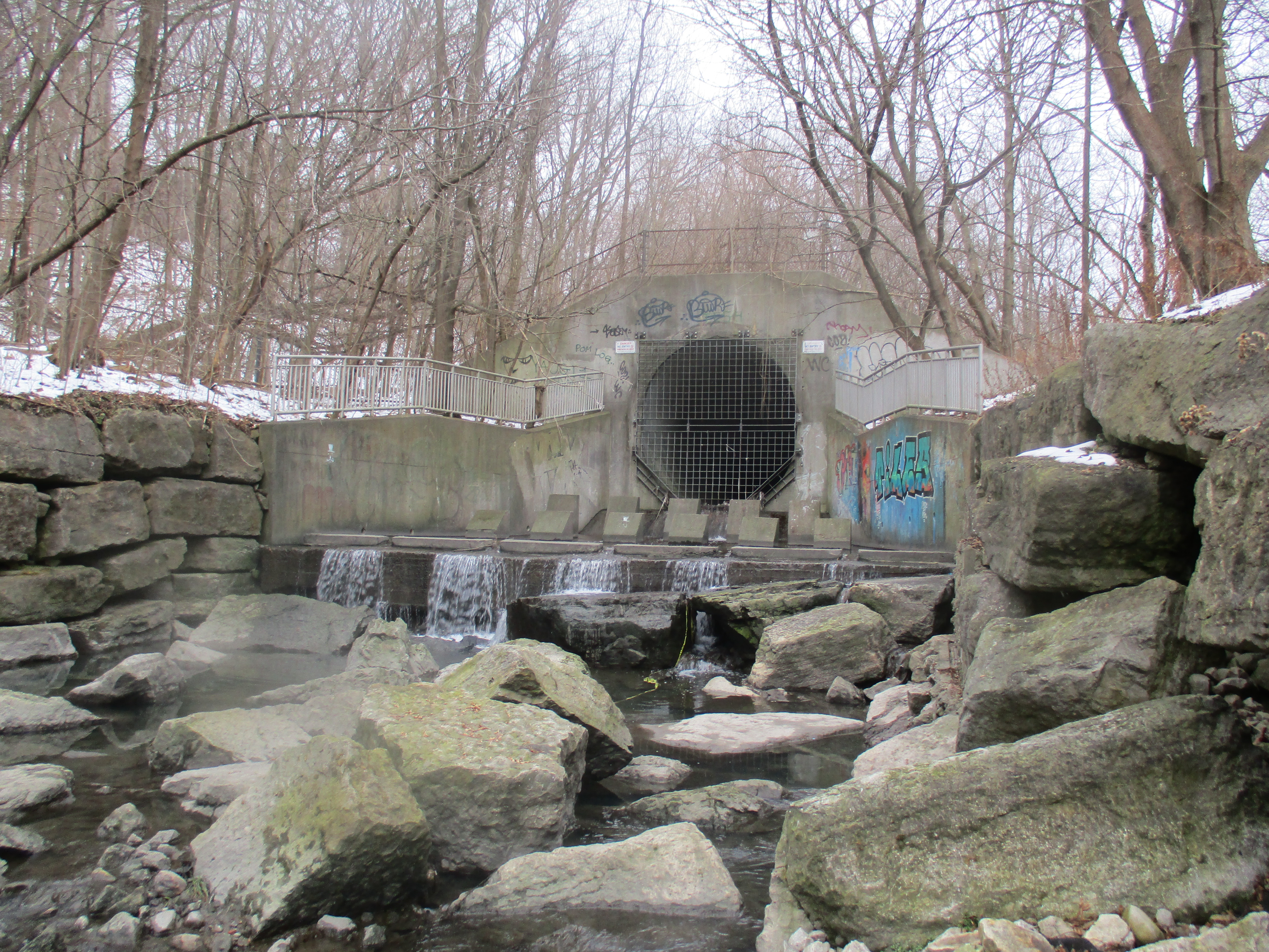
Over the years the company had bought up scrap vessels and salvaged a large number of parts which they used in repair of other ships. When the company went into liquidation in January 1964 a lot of the left over items were sold for scrap metal. The buildings became part of the Toronto Harbour Commission properties but the dock facilities on the Keating Channel in front of the third building have been left to deteriorate.

Fortunately, not everything in the yard was sold for scrap. The Marine Museum of Upper Canada had been opened in Stanley Barracks on the CNE grounds in 1957 and a large number of local marine artifacts were donated to the museum. In 2000 the museum, now known as Toronto Maritime Museum, was relocated to Pier 4 in Queens Quay West. In 2008 the museum was closed and all the artifacts have been in storage ever since.

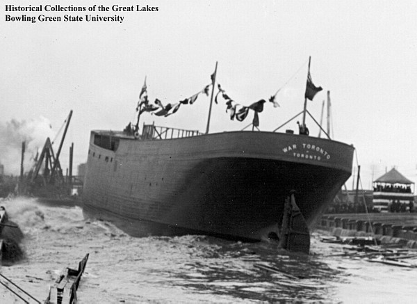
The first two ships built in the yards were sisters named War of Ontario and War of Toronto. Both were completed in 1918 in time for the last of the Great War in Europe. The picture below is part of the Bowling Green State University collection and shows the wooden hull of the War of Toronto as it was being launched into the Keating Channel.

The island Ferry “Sam McBride” was built in 1939 by Toronto Dry Dock Limited and remains in service to Toronto Islands today. Sam McBride was born in Toronto in 1866 and was mayor from 1928-1929 and again in 1936. He passed away before completing his second term. This image is taken from Wikipedia.

Toronto needs a new home for our Marine Museum and these few remaining buildings could be the perfect place for it. It would be a sort of homecoming for many of the artifacts and historic vessels could be tied up along the Keating Channel for museum guests to explore.

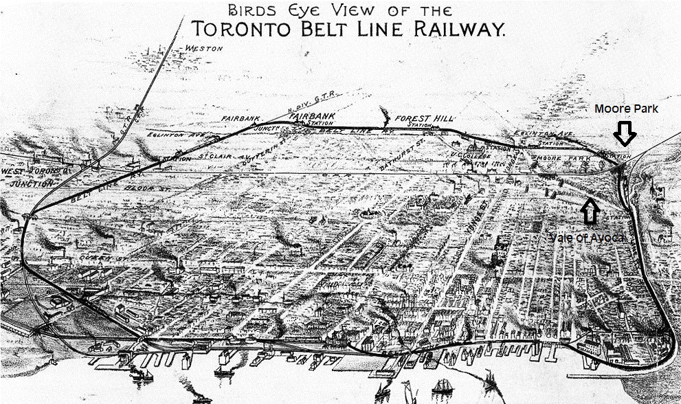
Related articles: The Battle of York, The Don Narrows, The Port Lands

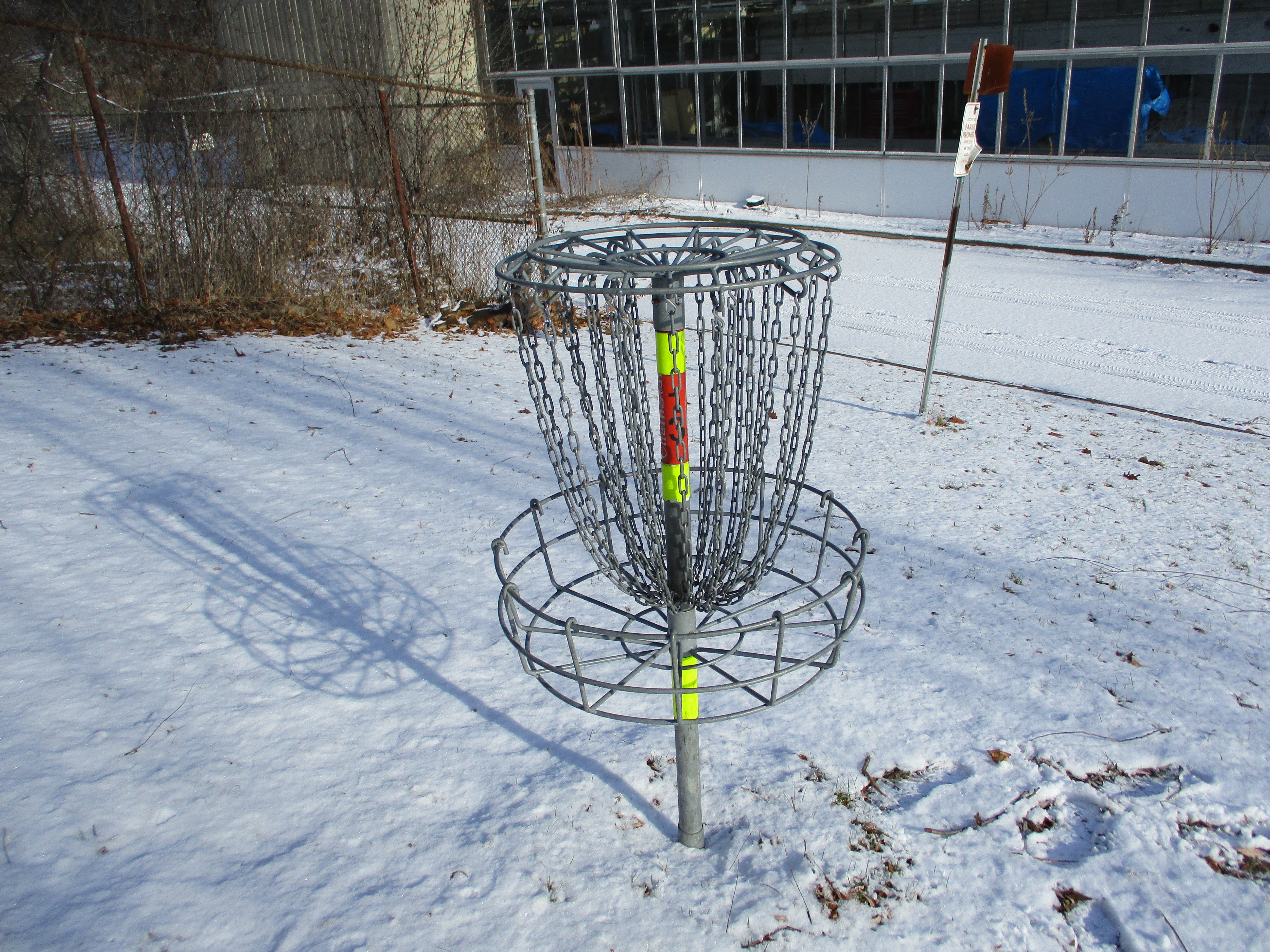
Google Maps Link: 170 Villiers Road

Like us at http://www.facebook.com/hikingthegta

Follow us at http://www.hikingthegta.com

Also look for us on Instagram

West Don Parkland

August 31, 2019

It was a perfect temperature for hiking and also for mosquitoes.  We decided to visit the West Don Parklands to explore the west side of the river and found parking on Maxwell Street where there is access under the power corridor.  We followed the West Don River north until we came to private property and were forced to turn back.  The picture below is a capture from the Toronto Archives of a 1960 aerial photograph of the area we explored.  Our trail has been roughly traced in green while the river is coloured in blue.

West Don

Japanese Beetles were plentiful in the field under the meadow that runs under the hydro corridor.  They are native to the islands of Japan and were first found in the United States in 1916 and in Canada in 1939.  Since then they have spread throughout North America.  The adults eat large amounts of foliage and severely damage over 250 different host plants that they feed on.  Although there are treatment programs designed to reduce the impact of these beetles the picture below gives a good indication of why they continue to thrive.

IMG_1642

At the bottom of the hill the West Don River flows over a small concrete dam and through a dissipator.  It is interesting to see the water that flows over the top of the dam and onto the concrete piers hitting them with considerable force and yet arriving at the bottom in a calm pool having dissipated all of the energy it gained through the drop.  The top of this dam has become clogged with branches and logs that have floated down stream and become caught up in the first row of piers.  Some of it has been there so long that it is silted up and vegetation is growing on the top.

IMG_6422

The valley floor has become overgrown with dog strangling vines and wild cucumber vines.  The wild cucumber is native to Africa but has become naturalized in the New World.  Unlike the dog strangling vine, the wild cucumber does not choke out and kill the vegetation that it grows along with.  The fruit are cultivated and eaten in many places such as Brazil where it is used in a meat and vegetable stew.

IMG_1644

The West Don River was running slow and at a very low level.  Just to the north of here G. Ross Lord Dam and Reservoir are used to collect storm water and release it slowly to prevent flooding in the lower reaches of the river.  Therefore, even after a heavy rainfall this section of the river will see a minimal rise in water levels.

IMG_6441

The chicory appears to have had a very good year and the plants and flowers were plentiful.  Chicory has been used for years as an alternative or additive to coffee.  Chicory is used during times of shortage such as The Depression and Second World War by mixing it up to 60% with 40% coffee.  It gives the coffee a slightly woody flavour.  Tender leaves can also be collected and added directly to salads.

IMG_1659

We came to a sign that said that if you find the log bridge to be impassable you should return and take an alternate side trail.  This naturally prompted us to go and have a look to see if the bridge was impassable.  It wasn’t in very good shape but we did manage to cross carefully.

IMG_6437

Once you clear the bridge there is an extended boardwalk that is not in perfect shape but is safe if you watch for the occasional broken board.

IMG_1664

The trail follows the river and leads to the Forest Valley Outdoor Education Centre which is operated by the Toronto District School Board.  The centre plays host to over 17,000 students each year from 170 different schools who come here to learn about and develop an appreciation for nature.  After you pass the buildings on this site you can follow the trail along the river which leads to a place where a pedestrian bridge once crossed the river.

IMG_6451

Orange Jewelweed has been used in traditional medicine for years as a remedy for poison ivy exposure.  The juice from the flower and leaves can be applied to skin that has been exposed to poison ivy and it has been proven effective at preventing a rash from forming.  The one caution is that some people are known to be allergic to jewelweed and can have an even more severe reaction to this plant than the one they may have had to the poison ivy.

IMG_1667

In the 1877 county atlas the property at the south east corner of modern Dufferin and Finch is shown as belonging to Mrs. E Reggett.  To the west of her property Dufferin street ran north on the Gore and Vaughan Plank Road of which there are still remnants in the valley where Dufferin is shown making its curve.  They can be seen at this link.  Interpretive signage in the park indicates that a grist mill was operated in this location but it wasn’t shown on the county atlas, indicating it was a later construction.

reggett

A little farther along the river we came to the location of the former Reggett grist mill.    The ruins themselves appear to be on a fairly small scale for an actual grist mill.  They are also made out of poured concrete which shows that they were built some time after 1900.  The mill has been gone for a long time but the ruins on the river can be seen in photographs that predate the construction of the outdoor education centre.  This suggests that they were not built as part of an educational display but were the actual Reggett mill ruins.

IMG_6473

Two steel brackets extend out of the concrete to mount the water wheel on.  The recess for the wheel is only a couple of feet in diameter which suggests that this was a very small wheel and was not used to generate significant power.

IMG_6472

The water was directed over the wheel or off to the side by moving a board from one channel to another in the head race.  Today the whole system is crumbling and a tree is starting to grow at the fork in the channel.

IMG_6477

We chose to follow the driveway from the education centre back to the road where we could make our way back to the car.  This is an interesting park and it would be cool to see what lies on the east side of the river.  Perhaps one day…

Google Maps Link: West Don Parklands

Like us at http://www.facebook.com/hikingthegta

Follow us at http://www.hikingthegta.com

E. T. Seton Park

Saturday, December, 8, 2018

E. T. Seton Park is named after Ernest Thomson Seton who was born in England but moved to Canada with his parents in 1866 at the age of 6.  His father was abusive and he spent much of his time in the Don Valley near the park.  He became famous as an author, painter and a founding member of The Boy Scouts of America.  The park that was named after him follows the West Don River south and features an archery range, disc golf and extensive trails.  We parked for free in the lot that is south of Eglinton accessed off of Leslie Street.  We roughly followed the orange trail on the Google Earth capture below as far as the Forks of the Don.

Seton

The north part of the park has a couple of ponds that sit in the valley below the Ontario Science Centre.  Originally the Science Centre was planned in 1961 with an opening in 1967 for the Canadian Centennial celebrations.  The three pods were designed to match the contours of the Don Valley that it was built along.  Opening was delayed until September 2, 1969.  The ice may be thin on the pond but this was no obstacle to the local coyote.

IMG_1802

The fresh snow always looks so nice sitting on the tree branches.  As the morning progressed the brief periods of sunshine caused the snow to slide of the branches and created the occasional brief snow shower and even a nice dump of snow down the back of the neck just for laughs.

IMG_1786

E. T. Seton Disc Golf Course is 18 holes long, each one a par 3.  The course winds along the river in both directions so that you get to walk the length of the park as you play.  There are disc golf associations that play here but the course is open to everyone who wants to try.  Local rules require a spotter on holes 9 (two-way pedestrian traffic) and 10 (near the archery range) to avoid hitting someone from a tee shot.  The first disc golf course was built 1975 in California.  Today there are over 4,000 courses around the world with there being three free ones in Toronto.  The E. T. Seton Park course opened in 2001 but there is also a course on Toronto Islands and at Centennial Park.

IMG_1816

An old bridge crosses the Don River near where the Upper Mill was in the Taylor Paper making empire.  The Lower Mill was located at Todmorden.  The large parking area just north of the bridge was the site of the paper mill for over 100 years.  The main trial is paved and continues along the east side of the river while a smaller bicycle trail follows the west side of the river.  It passes under the railway tracks.

IMG_1846

Each of the major rivers in the GTA have a split or fork in them.  The West Don River flows through the heart of the park until it reaches the point where east meets west.  The East Don River was formerly known as the Middle Don.  At that time, Taylor-Massey Creek was known as the East Don.  The Forks of the Don can be explored from either side of the river but access to the middle of the forks is only possible by trespassing on the short but active railway bridge above and so we don’t suggest that you do this.

IMG_1838

From the tracks you can see the bridge where Don Mills Road crosses the ravine with the railway in it.  Behind the road is the bridge that carried an old section of Don Mills Road that has been abandoned when the new section opened.

IMG_1842

Two trails make their way up the west side of the West Don River.  The upper trail is known as Catalyst while Beaver Flats is the name of the lower one.  These trails appear to be primarily used by bicyclists and the sharp turns and sudden rises in the trail will require a sharp eye to avoid getting run over.

IMG_1871

I’m not sure if this is intended to be a piece of artwork but we do get tired of seeing tires in our parks and ravines.  They are great places for still water to sit in the summer and create breeding grounds for mosquitoes.

IMG_1877

The Canadian National Railway bridge spans the West Don River ravine in the distance.  This bridge sits on an old set of cut stone piers as well as a newer set that was made of poured concrete.

IMG_1881

The CPR bridge is seen in this 1955 photo.  Of note is the system of wires that along the poles beside the trestle.  Today there are only one or two wires and all the accessible glass insulators have been removed.

1955

The park continues to the south and links up with the Lower Don Trail as well as Taylor Creek Park.  There is plenty more to explore another day.

Google Maps Link: E. T. Seton Park

Like us at http://www.facebook.com/hikingthegta

Follow us at http://www.hikingthegta.com

Taylor Creek Park

Saturday, December 16, 2017

Taylor-Massey Creek is one of the most significant tributaries of The Don River.  It joins the river near the Forks of the Don and was at one time known as the East Don River and today’s East Don was then known as Middle Don.  The county atlas below shows the extent that the Taylor family controlled the lands around the Don River and Taylor-Massey Creek.  They had a huge share in the early paper industry in York (Toronto) as they had opened the first paper mill in the city at Todmorden.  They eventually owned three paper mills with the upper mill being at the Forks of the Don.  The Taylors also formed the Don Valley Brick Works and were among the leading early 19th century industrialists in the city.  By 1877 most of the original forest cover had been removed but Warden Woods (circled in green) remained with Taylor-Massey Creek flowing through it.  As a point of interest, looking at the property owners on the left side of the map reveals the origin of the name “Leaside”.

Taylor Creek (2)

Taylor-Massey Creek joins the Don River just west of the old Don Mills Road.  This morning the ice was just forming on the confluence of the creek and river.  There is free parking in the Taylor Creek parking lot.  From the lot, we made the short trek back to the mouth of the creek before setting out to explore the unmaintained trail on the west side of the creek.  The Taylor Creek Trail forms a maintained path that runs for 3.5 kilometres along the creek.

IMG_1709

Old Don Mills Road is still used as a recreational trail and cars still cross the concrete bowstring bridge which was built in 1921.  The county atlas above shows the road in brown and a previous bridge to this one.  By 1877 it is possible the road was already using a second bridge to facilitate the traffic the paper mill brought.  The road was also the only concession that had been opened and all north-south traffic had to use this crossing.

IMG_1708

Also, near the parking lot are the elevated wetlands.  From this angle the structures look like they are walking along, following each other.  These sculptures turn art into habitat as they each contain a wetland, complete with all the wildlife they support, mostly birds and flying insects.  The water from the Don River is pumped into the wetlands by solar pumps and filtered through the wetland to be returned to the river cleaner than it began.  Each wetland features small ponds, a couple of small trees and wetland grasses.

IMG_1711

In 1994 the creek was assessed as the most degraded of the main tributaries in the Don Watershed.  The Underwriter’s Reach still shows many of the concrete channels that the creek was forced into when surrounding lands were developed for housing.  The Task Force To Bring Back The Don and other groups have put together a 40 step plan that includes restoring this watershed.  Some of this is discussed in our feature on Terraview and Willowfield Gardens Parks which showcase some impressive restoration projects.  In the picture below you can see the roadway that passes through the creek in the park.

IMG_1717

Stairways jig-jag up and down the sides of the ravine to provide access to the park from the communities on the tablelands.  The sets of steps tend to be 100-120 in length and provide good cardio workouts for those so inclined.

IMG_1798

The Musqueam people lived near the mouth of the Frazer River in British Columbia.  They were very accomplished weavers and their cultural heritage has been incorporated into paintings of five benches in Taylor Creek Park.  The benches were designed and painted by members of STEPS who as an organization attempt to revitalize public spaces and connect communities.  The final designs on the five benches incorporate elements from Musquean, Ojibwa from Southern Ontario, Northern Oaxacan (Southern Mexican), and South Asian culture.  There is other artwork in the park that includes a spiral mural in the parking lot that we couldn’t see due to snow cover.

2811

The benches were painted as part of the celebrations for the Pan Am games that were held in Toronto in July of 2015.  Also created for those games was the Pan Am Path which runs for over 80 kilometres through the city.  On one end it connects Clairville Dam and on the other Rouge Beach Park.  There is a second branch that runs to Centennial Park in Etobicoke.  The Alder Stairs are one of the connection points on the Path and the bench featured above is found at the top of these stairs.

IMG_1810

The ravine formed by Taylor-Massey Creek is cut through the side by another ravine that is separated from the trail by a wetland.  The ravine in the centre of the picture runs up the north side of Glenwood Crescent.

IMG_1812

The bridge on O’Connor Drive was built in 1932 as an extension of Woodbine Avenue and has the formal name Woodbine Bridge.  Later, O’Connor Drive was formed by piecing sections of unconnected road together, mostly under the guidance of Frank O’Connor, founder of Laura Secord Chocolates and the Frank O’Connor Estate.

IMG_1828

Having made our way up the less travelled side of the creek we crossed back to the paved trail.

IMG_1836

Taylor Creek Trail continues past this point but we left it for another day.  That part of the trail continues onto a property owned by the Massey family hat operated a huge farm equipment manufacturing plant in Toronto and lends their name to the creek along with the Taylor family.  There is an old mansion waiting at the other end of the trail.

Google Maps Link: Taylor Massey Creek

Like us at http://www.facebook.com/hikingthegta

Follow us at www.hikngthegta.com

Flynntown – Ghost Towns of the GTA

Saturday, May 27, 2017

Last week we visited the former community of Oriole at Sheppard Avenue and Leslie Street and made a short excursion north that only made it as far as Newtonbrook Creek.  To pick up where that hike left off, we took advantage of free street parking on Alamosa Drive and Gatehead Road where there is an entrance to the park.  The next community north along the river was known as Flynntown and was located around the intersection of Leslie and Finch.  Like Oriole, it formed around the mill sites that were prominent along the Don River in the first half of the 19th century.  It too was a name applied to a postal district in much the same way that we use postal codes today.

The 1877 county atlas below shows the area of the hike with the section of the East Don River that we covered being outlined in blue.  A small tip of German Mills Creek is coloured leading to the right near the top of the map.  We started at the former property of William Dunton where we looked for the remains of the saw mill built by Phillip Phillips. Old Cummer Road has been coloured in black and we followed the short piece that runs on an angle from the stream up to where it meets the grey line marking the new section of Cummer Road.  Cooper’s grist mill is shown where the new road meets the older section.

german (2)

Near the bottom of the hill when you enter the park off Alamosa Drive you will find a set of tennis courts.  Near the courts, beside the river, is a pole with life saving equipment on it.  That marks the spot where Philip Phillips built his saw mill in the early 1800’s.  The wood for the mill was rough hewn by hand indicating that it was prepared before the mill went into operation.  After the saw mill was up and running the wood produced displayed the obvious signs of being cut with a blade or wheel.  The houses and barns closest to the mill would have been constructed with wood that had been prepared at the saw mill.  The picture below shows the remains of what is most likely part of the wooden crib for the old mill dam.  The only other place we have seen the wooden crib preserved is at the Barber Dynamo.  One of the mill mapping sites reports that these are actual timbers from the saw mill.

IMG_0048

Tree Swallows are highly social birds and can form flocks of thousands around their nesting sites.  They breed in Canada and the United States but spend the winter in Mexico, the Carribean and throughout Central America.  Their genus name is tachycineta bicolor which comes from the ancient Greek for “moving quickly” and the bicolor from their two coloured markings.  The males have much brighter blue-green upperparts while the females tend to have duller colours.  The female needs to hide on the nest for two weeks before the eggs hatch and another three before the young ones are ready to leave the nest.  The brighter male likes to be obvious as he dive bombs intruders to protect the nest.

IMG_0052

Following the trail north of Finch Avenue brings you to the intersection of Old Cummer Road and the century-old bridge across the river.  The single-lane bridge was replaced when the surrounding farms were developed for housing.  In 1968 the new portion of Cummer Road (grey on the map above) was opened and this became Old Cummer Road and was closed to through traffic.

IMG_0135

The road north of the closed bridge has been largely overgrown and the former pavement has all but vanished.  Cummer operated a saw mill and a woollen mill on the river near his home but it closed in 1857 and all traces are now lost.

IMG_0060

Crossing under the new Cummer Road bridge, the trail quickly follows a pedestrian bridge to the east side of the Don River.  We chose a small path that led along the west side but after crossing a drainage ditch the trail quickly vanished.  Our intention was to find any evidence of the mill site or dam that was shown on the county atlas.  The mill appears to have been somewhere near the new bridge and no trace exists.  The concrete dam we found on Cooper’s property would have been built here long after the mill had closed and would have replaced a wood crib dam.  The mill pond shown on the map has been drained.  The cover photo shows the dam from the downstream side while the picture below shows the upstream side.

IMG_0081

This dam looks more like an electrical generating dam than one used to store water for mill operations.  A large building stood  near the end of the dam but all traces of it have vanished today.  What remains is an old utility pole that has a large transformer attached to the top along with several old light sockets.  A second electrical pole is leaning into the trees a little farther upstream.

IMG_0093

Returning to the main trail, we crossed the Don River and went up the east side to explore the dam from that vantage point.  Near this place, German Mills Creek empties into The Don.  German Mills Creek flows for about 10 kilometres as a left tributary of the East Don River.  It gets its name from the community of German settlers who, in 1796, became the first pioneers in Markham Township.  The settlement of German Mills fell apart after only a few years but the name has been preserved via this creek.  The bridge across the creek has been here for a long time and formerly provided access to the mills and other establishments in the valley.  Today this little bridge supports the traffic along the hiking trail that follows the former roadway.

IMG_0131

The picture below shows German Mills Creek and the confluence with the East Don River as seen from the old bridge over the creek.

IMG_0106

The Don River is interwoven with the early history of Toronto and York County and there will always be more to explore another day.

Google Maps Link: Flynntown

Like us at http://www.facebook.com/hikingthegta

Follow us at http://www.hikingthegta.com

Beechwood Wetlands

Sunday, April 23, 2017

In 1826 The Taylor Family moved to the property that today we know as Crother’s Woods. Beechwood Drive is the road that led to the homestead they built and for decades was one of only a few places where you could travel across the Don Valley. Parshall Terry owned the property that became known as Terry’s Field and was the next property north of the Taylor property.  To check out this 11-hectare area I took advantage of free parking on Beechwood Drive just off of O’Connor Drive.

Around 1900 the Taylor family purchased Terry’s Field to make bricks from the clay that had been located there.  They already had an extensive industrial empire to which they kept adding.  The colony was offering a bounty for the first industrialist to open a paper mill and the mill at Todmorden had opened although it did not win the title.  That went to the paper mill in Crook’s Hollow.  The Taylor Paper Mills were a success and they eventually operated three of them.  The one at The Forks of The Don was the most northerly of the trio with Todmorden being at the south.  The Taylors opened Sun Valley Bricks which operated in the valley into the 1930’s.  This was in addition to the Don Valley Brick Works which they managed just south of Todmorden.  Later Domtar opened facilities here that left the land contaminated when it closed in the 1980’s.  After removing truckloads of soil and most of the buildings the land was deemed safe for use again.  Toronto Police Services is using the only remaining facility to train their canine units.

IMG_7938

Near the site of the old Taylor house stands the crumbling remains of an old kiln.  This likely predates anything else remaining on the site.  The cover photo shows the kiln from a little different angle.  As can be seen from the picture below the kiln is crumbling on one corner and it is surprising that the city isn’t taking steps to keep people off of the kiln.  There is also a couple of trees growing on top of the structure.  I believe that it should be restored and given a proper interpretive sign as it may be the best example of an old kiln in the city.

IMG_7937

The river shows many signs of its past usage including a narrow pond which is likely the remains of a 19th-century mill raceway.  Outfalls line the river including two that come directly from the North Toronto Sewage Treatment Plant which was opened on August 1, 1929.  There is also evidence in the river of a past dam, the crib can be seen below the water in this picture.

IMG_7834

Beechwood Avenue is now closed to through traffic but formerly curved to meet the CNR tracks just before it reaches the river.  The Lower Don Recreational Trail runs parallel to this section of roadway.  Directly in front lies the Beechwood Wetlands and to the right, Cottonwood Flats where the city dumped snow until 2004.  Sun Valley, former home to Sun Brick Company and the Sun Valley Land Fill lies beyond in Crothers Woods.

IMG_7866

Beechwood wetlands was built in 2002 and 2003 in a joint effort by the Task Force To Bring Back The Don, Toronto Region Conservation Authority, Toronto City Parks and several others.  They  used heavy equipment to recreate the landscape and eliminate the damage done by years of use as an industrial site.  Volunteers planted 6500 native trees, shrubs and wetland plants and maintained them twice a week for the following year to ensure they got off to a good start.  The wetlands are now home to frogs, snapping turtles and various wetland birds and are considered one of Toronto’s most successful restoration projects.

IMG_7869

The Red Admiral butterfly makes a migration north each spring to recolonize most of North America.  It will have two cycles per year, one in March which spends the summer in Ontario.  A second brood is hatched in October that flies south to spend the winter months in south Texas.  Red Admirals have a red/orange band that encircles both wings and prominent white spots on the front of each forewing.

IMG_7900

The Lower Don River has cut through layers of shale that can be seen near the waterline and perhaps this is what was being burned down in the kiln.

IMG_7906

After the buildings were demolished piles of construction rubble were dumped along the side of the river.  These piles in many places have become habitat for the various species of wildlife that inhabits the parkland.  Throughout the concrete slabs can be seen the wrought iron reinforcing bars that were used prior to tied rebar used today.

IMG_7920

The Canadian National Railway line cuts through the property and the winding nature of the Don River required the railway to build two bridges.  The bridges are nearly identical in construction and the railway is still active.  The former Beechwood Road crossing has signals and caution should be exercised when making your way from the Cottonwood Flats into Crother’s Woods on the other side.

IMG_7881

The other side of the Don River can be accessed via a footbridge just beyond the train bridge.  Therefore, there is no excuse for crossing the river on the rail bridge like I observed several people doing.  There’s a sign by the rail bridge that gives a number to call if you are feeling suicidal.  I wonder if they too saw someone taking their bike across?  A mountain bike park has been set up along the trail near the rail bridge. There’s even a small place where you can step out of the weather for a moment.

IMG_7887

Sun Valley and Crothers Woods still have areas that I haven’t explored.  Perhaps one day…

Google Maps Link: Beechwood Drive

Like us at http://www.facebook.com/hikingthegta

Follow us at http://www.hikingthegta.com

Crothers Woods

Saturday, December 17, 2016

Crothers Woods has at least three access points, each with parking.  There is one parking lot at the Don Valley Mountain Bike Trailhead on Pottery Road (map link at end) just before the bow-string bridge over the Don River.  This parking lot sits on the old road allowance for Pottery Road, a section of which was abandoned when the Bayview Extension was built in 1959.  From the trailhead, the path leads north following the side of Bayview Avenue until it reaches the northern tip of the park where there are a couple of parking spots.  To the right along this trail is an area known as Sun Valley.  It was home to a small brick making company called The Sun Brick Company which operated until the late 1930’s.  The property had been home to the Taylor Family who built their homestead here in 1826.  The family owned the Don Valley Brick Works and Todmorden Mills where they ran one of their three paper mills. When the clay for the bricks was nearly exhausted the town of Leaside purchased the pit for a landfill.  Over the next few decades, they dumped garbage up to 25 metres deep in the pit.  It has now been capped with clean fill and is being restored as a meadow at this time.  The Taylor Family home has been moved to Todmorden Mills where it is being preserved.  The picture below shows the home, that once stood in today’s Crothers Woods, as it appeared in the summer of 2014.

terry-house

Following the trail into the woods leads to a slight diversion, the abandoned CPR tracks. The first train to roll across the tracks here was a freight train in 1891.  That train continued south along the Don Valley and into downtown Toronto.  Along the way, it passed over the Half-Mile bridge.   The first good snowfall of the season sits largely undisturbed on the tracks in the picture below. Due to the fact that the snow had fallen without much drifting the rails and ties can be clearly seen in spite of the fact that there is about a foot of fresh snow.  This is one of the few local abandoned railways that still has the rails and ties intact.  It is likely that Metrolinx, who owns the railway corridor, will incorporate it into some future passenger line.

img_5134

An active set of tracks belonging to Canadian National Railway runs parallel to the abandoned CPR ones as the Don Valley made a suitable access to the city.  Two freight trains passed along the other tracks while the lower ones were being briefly explored.

img_5144

Crothers Woods is one of the most bike friendly parks in the city.  Bikers are encouraged to use the trails although pedestrians still have the right-of-way. Winter biking has its challenges and a bike is normally fitted out especially for the season.  Fat tires and wider frames are matched with enclosed gears that prevent freeze up.  The tires may be inflated to as low as 5 pounds pressure.  A group of winter bike enthusiasts was using the park to get some exercise and enjoy their custom cycles.    It is always nice to see others who find a way to enjoy the winter weather.

img_5121

Crothers Caterpillar had a manufacturing plant in Crothers Woods until 1979.  Built by George W. Crothers it produced heavy equipment, primarily for the mining industry.  The plant backed onto the railway and the factory buildings on the site were removed by 1991. The site has recently been partially repurposed as a Loblaws store and parking lot.  There is a trail head here as well that was the starting site of the group of fatbikes we had seen earlier.  There is also lots of parking available in the back of the parking lot near the trailhead.

aerial-crothers

The loading ramp from the former Crothers Caterpillar plant still stands along the abandoned railway track.

img_5148

A lone hydro pole stands in the woods where it once was part of the Crothers Caterpillar plant.  What was an open field 30 years ago has grown back in quite well!

img_5157

In 1929 the city built the North Toronto Sewage Treatment Plant on the edge of Crothers Woods.  It processes the effluent from North Toronto and Leaside.  Personal experience indicated that the sewage system covers in North Toronto are mainly dated 1928 with a few from 1929.  The cover photo shows another view of the treatment plant.

img_5173

Crothers Woods was a farm for about 100 years before it spent the next century as an industrial site.  Today it still retains some areas of Carolinian Forest consisting of beech, maple and oak.  There are also a few butternut trees which are locally rare.  Crothers Woods has been designated as an Environmentally Sensitive Area (ESA) because it is a home to some rare undergrowth plants.  It is also a good place to see common spring flowers like trout lilies and trilliums.  The east ravine wall contains some climax forest which is the historical normal vegetation that exists in a stable condition in this part of the country.  New growth forest has taken over much of the rest of the 52-hectare park.

img_5158

An extensive set of stairs leads from the corner of Redwood Road and Millway Road down to the sewage plant.

img_5175

There are plenty of remnants from old land usage in the ravine.  A lengthy penstock runs down the hill behind the treatment plant while these concrete structures stand a little farther along.  They say that old relics from the Crothers Caterpillar plant are still dug up on occasion in the woods.

img_5179

Crothers Woods also includes the Beechgrove Wetland which is a successful restoration project.  The wetlands, Sun Valley and an abandoned road await a visit in the spring when the wetlands will be teeming with life.

Google Maps link: Crothers Woods

Like us at http://www.facebook.com/hikingthegta

Follow us at http://www.hikingthegta.com

Terraview & Willowfield Gardens Parks

Sunday, November 20, 2016

The headwaters of Taylor-Massey Creek were originally found in the area of Sheppard and Victoria Park Avenues. The area of the headwaters was approximately 150 hectares until the construction of the Toronto Bypass (401) was completed in 1964.  In order to reduce complications with the widening of the highway in the 1980’s, it was decided to divert the headwaters into Highland Creek.  As a consequence, the creek developed a new smaller source.  Now 18 hectares of natural springs mix with the polluted runoff of the sixteen lanes of highway that passes overhead.

When this area of Scarborough, known as Maryvale, was developed in the early-1950’s it was common to take the watersheds and re-route them through concrete channels. Taylor-Massey Creek begins in a collection of pipes and emerges from a headwall in the top of Terraview Park.  From there it used to proceed south in a curved concrete channel all the way to Ellesmere Road and beyond.  The parkland around these concrete channels was underused and the water in the channel often ran with ten times the city’s allowable levels of E-coli.  The picture below shows the concrete channel that the creek still flows through in the Warden Power Corridor south of the two parks.

img_4760

In 1992 the Metropolitan Toronto and Regional Conservation Authority created the Don Watershed Task Force to develop an ecosystem approach to managing the entire watershed.  At the time The Don River was one of the most polluted in Canada.  When 40 Steps To A New Don was published in 1994 it identified Terraview and Willowfield Parks as a concept site to prove the plan for regeneration.  Any benefits to water quality that could be made at this end of the watershed would benefit the entire system. The  aerial photo below shows the concrete channel as it passes through Terraview Park and under Penworth Road where it continues through Willowfields Gardens Park.  This picture was taken from the 40 Steps To A New Don final report.

willow


The plan called for the removal of the channel and renaturalization of the creek bed. Wetlands were developed because they act as a natural filter for suspended particles and contaminants.

img_4688

The soccer field at Terraview Park has an underground filtration system designed into it. Now that it has been in operation for nearly 20 years there is some data and a cost/benefit analysis is being conducted to see if other such systems should be constructed.  Oil and water separators and sediment pools are used along with French drains and storm water retention facilities are all part of the design.  Today, the water is still not as clean as the city bylaws require and a sediment pool at the headwall where the water enters the park needs to be expanded or replaced.

img_4697

When a concrete channel passed through the mowed lawns of the former parks there was little wildlife to be seen.  Today the two contiguous parks provide a welcome habitat in this part of the city.

img_4705

Tamarack is a species of Larch tree that is native to Canada.  Although they have needles and cones like an evergreen they lose their needles every fall.  The needles take on a beautiful shade of yellow before they fall off the tree.

img_4706

Along with the usual sets of swings and slides, the park also has a splash pad.  Water from the pad is filtered before it is let into the pond on its way out towards Warden Woods.

img_4709

After leaving Terraview Pond the creek flows through a section of new growth as it heads south.  The sides of the new creek channel have armour stone on them in places where erosion is likely but there has been no attempt to keep the new shrubs and trees from growing in the channel.

img_4721

South of Penworth Road Taylor-Massey Creek flows through a natural channel and into the newly created Willowfield Pond.  Where a lifeless concrete channel once existed a new aquatic habitat has been created.  Herons can be seen here in the summer hunting for lunch while ducks and geese find food among the marshes on the shore.  Muskrats have also been seen in the pond.

img_4728

Northern Red Oak, along with thousands of other trees and shrubs, have been planted in the two parks.

img_4739

Willowfield Pond has been designed with the local schools in mind.  There are observation stations where outdoor lessons are taught.  Students also monitor the water quality and help with planting programs.

img_4748

Water flows from Willowfield pond into a peat bog which also acts as a final filter to remove contaminants before the water makes it’s way toward the Don River.

img_4750

Water is still discharged directly into the creek but the local residents have removed their downspouts from the collection system.  By allowing the water to flow onto the lawn more of it is absorbed and slowly released into the creek which reduces flash flooding.

img_4757

There is plenty of work left to be done at these two parks.  Sections of the parks that were intended to be planted with Carolinian Forest have yet to be started.  Phase III of the project was never implemented.  It called for the hydro corridor to be naturalized as well. The concrete channel was to be removed and the area around the new stream was set to be densely planted.

img_4730

The renaturalization of these two parks won an award in 2002 from the Canadian Society of Landscaping Architects.

Google Maps link: Terraview Park and Willowfield Gardens Park

Like us at http://www.facebook.com/hikingthegta

Follow us at http://www.hikingthegta.com

Beltline Railway – Moore Park

Sunday March 13, 2016

Long before the discussion of subway vs LRT Toronto had it’s first commuter railway in service in 1892.  The Belt Line Railway was intended to take advantage of the building boom the city had been experiencing in the 1880’s.  The Belt Land Corporation was formed in 1890 and new communities named Moore Park, Forest Hill, Fairbank and Fairbank Junction were planned. They purchased large tracts of land and subdivided them into lots and then built a commuter rail system with 44 stops to service them.  Many of these stations were little more than a wooden shack similar to a bus shelter.  These were known as whistle stops and the train only stopped if requested.  The grand masterpiece of all the stations was the one at Moore Park.  It is seen in the cover photo and was intended to service the richest community on the line.  With four towers surmounted with conical roofs, often called “witches hats”, it was intended to speak of the elegance of the neighbourhood.  The fact that the station was really still on the edge of town can be seen in the presence of a chicken standing at the door waiting to get in.

The building boom came to a crashing end when a recession set in.  The lots stood empty and the speculators had their capital tied up without return.  The ridership never showed up and the company was unable to support the failing railway.  At 5 cents per station ($1.00 in today’s economy) it was too expensive and there was no way to continue beyond the first 28 months of passenger service.  Service was discontinued and the station was abandoned.  We started our exploration of this part of the old railway at the site of the Moore Park station on Moore Avenue where I parked on Brendan Road.  Today the former site can be seen clearly again because of the removal of ash trees in the wake of the Emerald Ash Borer’s devastation.  Notice also the steep slope of the rail line which was too much to haul freight up.  After passenger service ended this section of tracks was abandoned.  The rails were removed from this section of railway and shipped to France during World War 1.  After the war the station was demolished.

IMG_0417

The old map below shows the route of the railway with Moore Park being on the right hand side at the northern edge of the city as it existed in 1890.  The CPR bridge and the Belt Line station are also shown on the map.  The ravine with Yellow Creek that forms the western boundary is marked as Vale of Avoca.

Toronto_Belt_Line_Railway_Map

Moore Park was a land speculation concept of John Thomas Moore who envisioned an exclusive enclave for the very rich on the edge of Toronto.  Mud Creek and Yellow Creek each have a deep ravine and the table land between them remained undeveloped.  Moore built the original bridge east of Yonge Street on St. Clair (3rd Concession) over Yellow Creek to allow access to his subdivision.  He named that bridge the Vale of Avoca and the replacement one bears the same name.  To support his community he attracted the Belt Line Railway to the eastern ravine where Mud Creek flowed.  With the housing crash, most of the lots in Moore Park remained undeveloped until decades after the demise of the railway that was intended to serve it.  The railway lands lay abandoned until the city purchased them in 1990 with the intention of creating a linear park 4.5 kilometers long.  In 2000 the Beltline Park was renamed Kay Gardner Beltline Park after a local city councilor.

The Belt Line pond formed when the rail line was built and has been the site of recent restoration efforts.  The water level is low right now but ducks have begun to pair up in preparation for mating season and there were two pairs in the pond.

IMG_0410

As you progress south along the old rail bed there are seven circular stone formations along the east side of the trail.  They may have been old wells but if so, they have been filled in almost to ground level.  Their construction suggests that they may have been contemporary with the construction of the rail line and therefore could have been ash pits. Regardless of their historic use the abundance of plant pots and fertilizer products suggests that they may have gained a whole new purpose for some urban agriculturalist.

IMG_0405

Many of Toronto’s ravines have been altered over the years until they would hardly be recognized by the original land owners.  They have been used for landfill sites and many of them contain several feet of buried garbage in the bottom.  Along one area of Mud Creek the sides of the hill are covered with broken concrete from a building demolition.

IMG_0400

When the railway released its promotional schedules it began to refer to Mud Creek as Spring Creek because it sounded better.  In places where the creek has been left natural it it still a beautiful place in spite of its unflattering name.

IMG_0398

The North Toronto subdivision of the Canadian Pacific Railway (CPR) was the main line between Toronto and Montreal.  It passes over both the Vale of Avoca and the Belt Line railway and prior to construction of the Half Mile Bridge, trains had to back from Toronto Junction into downtown.  When the North Toronto Station was built at Yonge Street passenger traffic increased greatly and it was decided to double track the line.  In 1918 old steel trestles were replaced over both of these ravines with concrete ones which were built of similar construction.  The bridge over Mud Creek is 386 feet long and 80 feet high.

IMG_0395

Gabion is a word we borrowed from the Italian language and it means cage.  We use it as a term to describe a civil engineering feature that is used to control erosion.  A wire cage is filled with stones and placed along the banks of a stream.  In this case along Mud Creek the gabion on the right hand side of the picture is already drooping into the stream because the dirt has eroded away below it.

IMG_0399

Mud Creek was redirected from it’s natural course to flow through the Don Valley Brick Works to provide a source of water for use in the brick making industry.  Many of the bricks used in historic Toronto were manufactured at this site with clay that was dug out of the rear of the property.  When the clay was exhausted the factory was closed and left abandoned.  Recent efforts to rehabilitate the property have resulted in the partial filling in of the huge hole left from the open pit clay mine.  It has been turned into a park with ponds where people can walk and enjoy the wildlife that has made itself home here.

IMG_0389

The trail leads to the Don Valley Brick Works buildings which have been transformed into a farmer’s market, heritage museum and parkland.

IMG_0387

Beyond the Brick Works the trail connects to Milkman’s Lane.

Google Maps link: Belt Line Trail

Getting there by transit: From Davisville Station walk two blocks south past Merton to the trail.  The south end is accessible via route 28 which also runs from Davisville Station.

Like us at http://www.facebook.com/hikingthegta

Milkman’s Lane

Sunday January 3, 2016

Seen on historic maps since at least 1890, Milkman’s Lane is an abandoned roadway in Rosedale that now serves as a pathway connecting one of Toronto’s wealthiest communities with the Rosedale Ravine, the Don Valley Brick Works and the Lower Don trail system.  It has been given various names over the years and when it took on the name Milkman’s Lane is unknown, as is the reason behind the unusual name. The 1890 Goads Fire Map below is available in the Toronto Archives but the city was nice enough to add the red arrow on their parks page where this map can be found.  South Drive and Milkman’s Lane were known as Beau Street at the time.  I parked at the corner of Beau and Elm on the map below.

Rosedale 1890

The fire map shows the large property on the south side of Milkman’s Lane as Craigleigh and belonging to E. B. Osler.  Edmund Boyd Osler was born in 1845 and as a teenager began to work as a clerk at the Bank of Upper Canada which was featured in Toronto’s First Post Office. By 1901 he was president of the Dominion Bank as well as being in the fifth of his 21 years as MP for Toronto West.  Osler had a major impact on the city having helped fund Toronto General Hospital, he was also a trustee at the Hospital For Sick Children.  After a trip to Egypt in 1906 Osler became a founder of the Royal Ontario Musem.  Craigleigh was his family home from 1877 until 1924.  After his death his children donated the property to the city for a park.  The ornate gates to the park have the date 1903 in the metal work on either side of the centre.

IMG_2258

Milkman’s lane ran down the side of Osler’s property and carried traffic into the Rosedale Park Reserve.  Park Drive made it’s way through the bottom of the ravine.  The property belonged to Thomas Helliwell in the 1820’s and provided access through Park Drive to his mills at Todmorden. Horses and wagons, and possibly the milkman, once climbed the steep ravine side along the 300 metre lane. Today it is used by hikers, joggers and dogs walking their owners.

IMG_2265

Some time prior to 1875 Edgar Jarvis bought the property.  In 1854 at the age of 19 Edgar submitted what was known as plan #104, called “Plan of Rose Park”, to the city to subdivide Rosedale Estates.  He bought up land in the area through the 1860’s and 1870’s in support of this plan.  He had been living with his wife Charlotte and their 12 children in Glen Hurst, their home which still stands behind the stone gates of Branksome Hall.  Edgar built the first two high level bridges across the ravine and planted the trees that give Maple and Elm Avenue their names.  He also likely named Beau Street after his son.  In 1880 he built the home on the other side of Milkman’s Lane from Osler’s Craigleigh property.  Jarvis named his home Sylvan Towers and it can be seen on the map as well.  For awhile Yellow Creek was known as Sylvan Creek.  At the bottom of Milkman’s Lane runs Yellow Creek.  It lies buried for much of it’s 12 kilometers but in 1915 it had a bridge at the bottom of the hill.  The picture below is from the Toronto Archives and the road is labeled as Milkman’s Road.

f1231_it1975

In 1880 the right of passage for the land known as Milkman’s Lane was granted to The Scottish Ontario and Manitoba Land Company.  Today you are greeted at the bottom of the ravine with a place where the Yellow Creek is forced underground as it makes it’s way toward the Don River.  Near the bottom of Milkman’s Lane stand a pair of stone gate posts that now enter onto a tennis court.  In years gone by they led to the estate at the top of the hill on the other side, likely 4A on Beaumont Street. They are featured in the cover shot.

IMG_2267

The bridge over the ravine on Glen Road took on the name The Iron Bridge.  It was later replaced with the bridge shown below that is built in the typical City of Toronto style.  This type of architecture was promoted by Roland Caldwell Harris when he was city engineer.  He designed the R. C. Harris Filtration plant and commissioned the Prince Edward Viaduct on Bloor Street. That famous concrete and steel arch bridge style would be repeated many times in the city, including here.

IMG_2269

The picture below is from Wikipedia and shows the bridge on the lower end of Glen Road.  It was built by Jarvis and now serves as a foot bridge over Rosedale Valley Road.

South_Glen_Road_Bridge

Yellow Creek flows partly underground and partly above.  As you follow the trail toward Mount Pleasant Road you come to the place where the creek emerges from the underground pipe. Notice the concrete squares at the mouth of the pipe.  They are designed to dissipate the water’s energy before it is released into the channel.

IMG_2273

Partial walls and other concrete structures stand high on the hillside near Mount Pleasant Road. A couple of years ago I found an intact glass milk bottle here from City Dairy.  I didn’t realize at the time how fitting this was, so close to Milkman’s Lane.  On the other side of Mount Pleasant Road the trail continues into The Vale Of Avoca.

IMG_2277

Following the trail south again and back past Milkman’s Lane will bring you to a link with the Don River trail system.  Just south of the Don Valley Brick Works there is a patch of new pavement on Bayview Avenue.  It marks the former crossing for a side spur that carried rail cars to the brick factory for shipping purposes.  Hidden in the trees along the trail are a few exposed sections of the former rail line.

IMG_2280

The trail leads up the old right of way for The Belt Line Railway which looks down upon the structures of the former Don Valley Brick Works.  The straight line above the roofs in the picture below is the now abandoned rail bridge known as the Half Mile Bridge.

IMG_2282

Google Maps link:  http://www.google.ca/maps/@43.6780187,-79.3733876,16z

Like us at http://www.facebook.com/hikingthegta