Sunday March 13, 2016
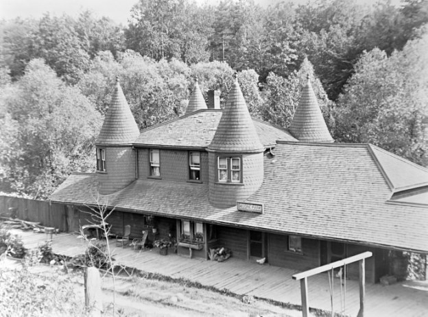
Long before the discussion of subway vs LRT Toronto had it’s first commuter railway in service in 1892. The Belt Line Railway was intended to take advantage of the building boom the city had been experiencing in the 1880’s. The Belt Land Corporation was formed in 1890 and new communities named Moore Park, Forest Hill, Fairbank and Fairbank Junction were planned. They purchased large tracts of land and subdivided them into lots and then built a commuter rail system with 44 stops to service them. Many of these stations were little more than a wooden shack similar to a bus shelter. These were known as whistle stops and the train only stopped if requested. The grand masterpiece of all the stations was the one at Moore Park. It is seen in the cover photo and was intended to service the richest community on the line. With four towers surmounted with conical roofs, often called “witches hats”, it was intended to speak of the elegance of the neighbourhood. The fact that the station was really still on the edge of town can be seen in the presence of a chicken standing at the door waiting to get in.
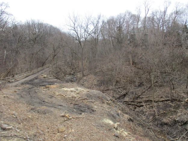
The building boom came to a crashing end when a recession set in. The lots stood empty and the speculators had their capital tied up without return. The ridership never showed up and the company was unable to support the failing railway. At 5 cents per station ($1.00 in today’s economy) it was too expensive and there was no way to continue beyond the first 28 months of passenger service. Service was discontinued and the station was abandoned. We started our exploration of this part of the old railway at the site of the Moore Park station on Moore Avenue where I parked on Brendan Road. Today the former site can be seen clearly again because of the removal of ash trees in the wake of the Emerald Ash Borer’s devastation. Notice also the steep slope of the rail line which was too much to haul freight up. After passenger service ended this section of tracks was abandoned. The rails were removed from this section of railway and shipped to France during World War 1. After the war the station was demolished.
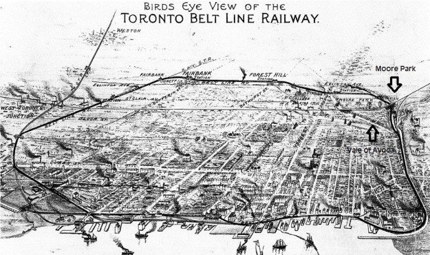
The old map below shows the route of the railway with Moore Park being on the right hand side at the northern edge of the city as it existed in 1890. The CPR bridge and the Belt Line station are also shown on the map. The ravine with Yellow Creek that forms the western boundary is marked as Vale of Avoca.
Moore Park was a land speculation concept of John Thomas Moore who envisioned an exclusive enclave for the very rich on the edge of Toronto. Mud Creek and Yellow Creek each have a deep ravine and the table land between them remained undeveloped. Moore built the original bridge east of Yonge Street on St. Clair (3rd Concession) over Yellow Creek to allow access to his subdivision. He named that bridge the Vale of Avoca and the replacement one bears the same name. To support his community he attracted the Belt Line Railway to the eastern ravine where Mud Creek flowed. With the housing crash, most of the lots in Moore Park remained undeveloped until decades after the demise of the railway that was intended to serve it. The railway lands lay abandoned until the city purchased them in 1990 with the intention of creating a linear park 4.5 kilometers long. In 2000 the Beltline Park was renamed Kay Gardner Beltline Park after a local city councilor.
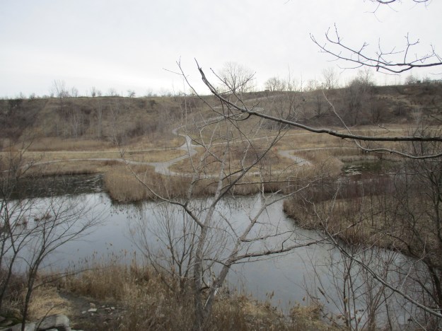
The Belt Line pond formed when the rail line was built and has been the site of recent restoration efforts. The water level is low right now but ducks have begun to pair up in preparation for mating season and there were two pairs in the pond.

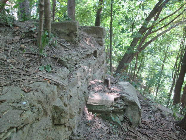
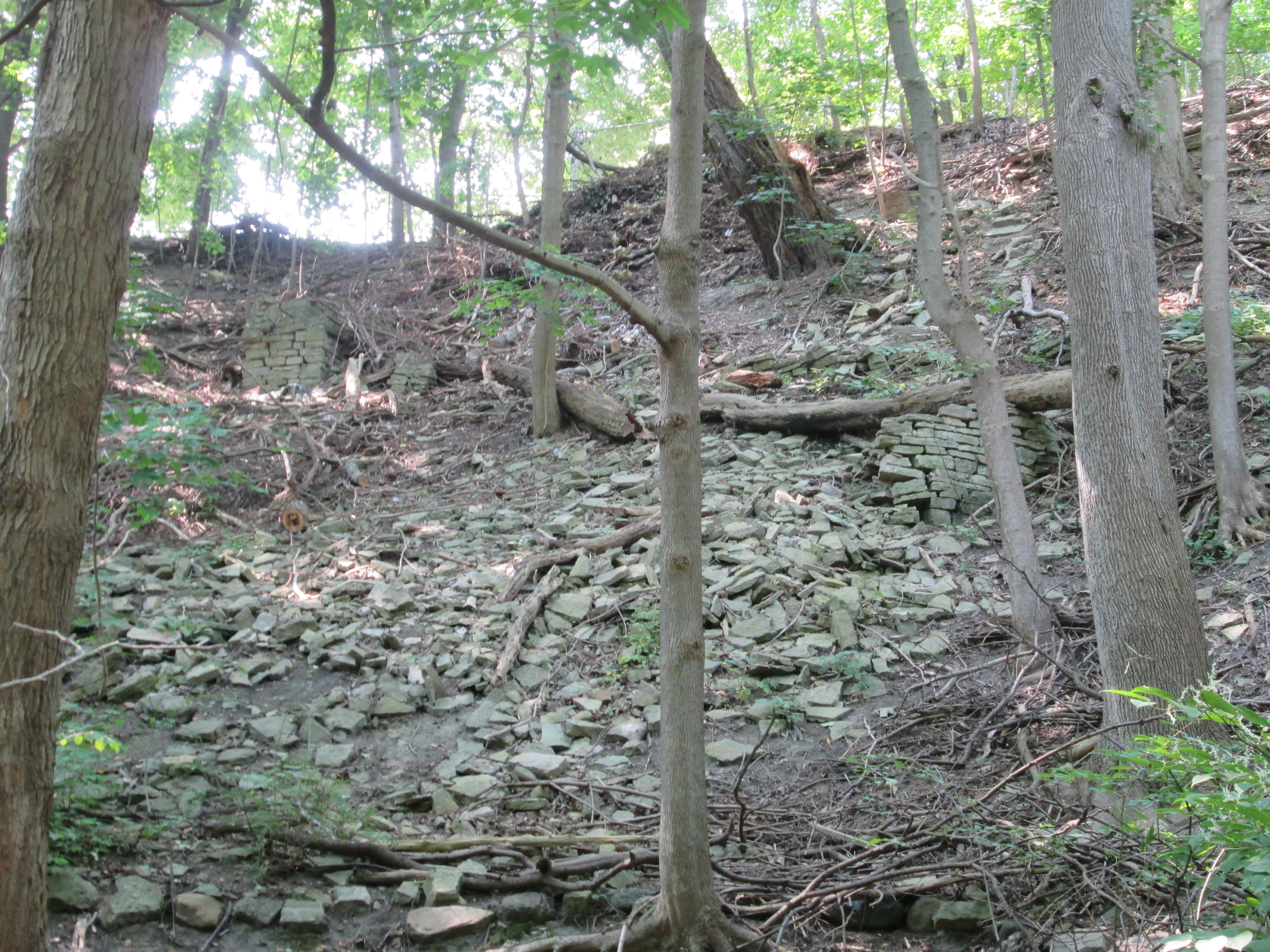
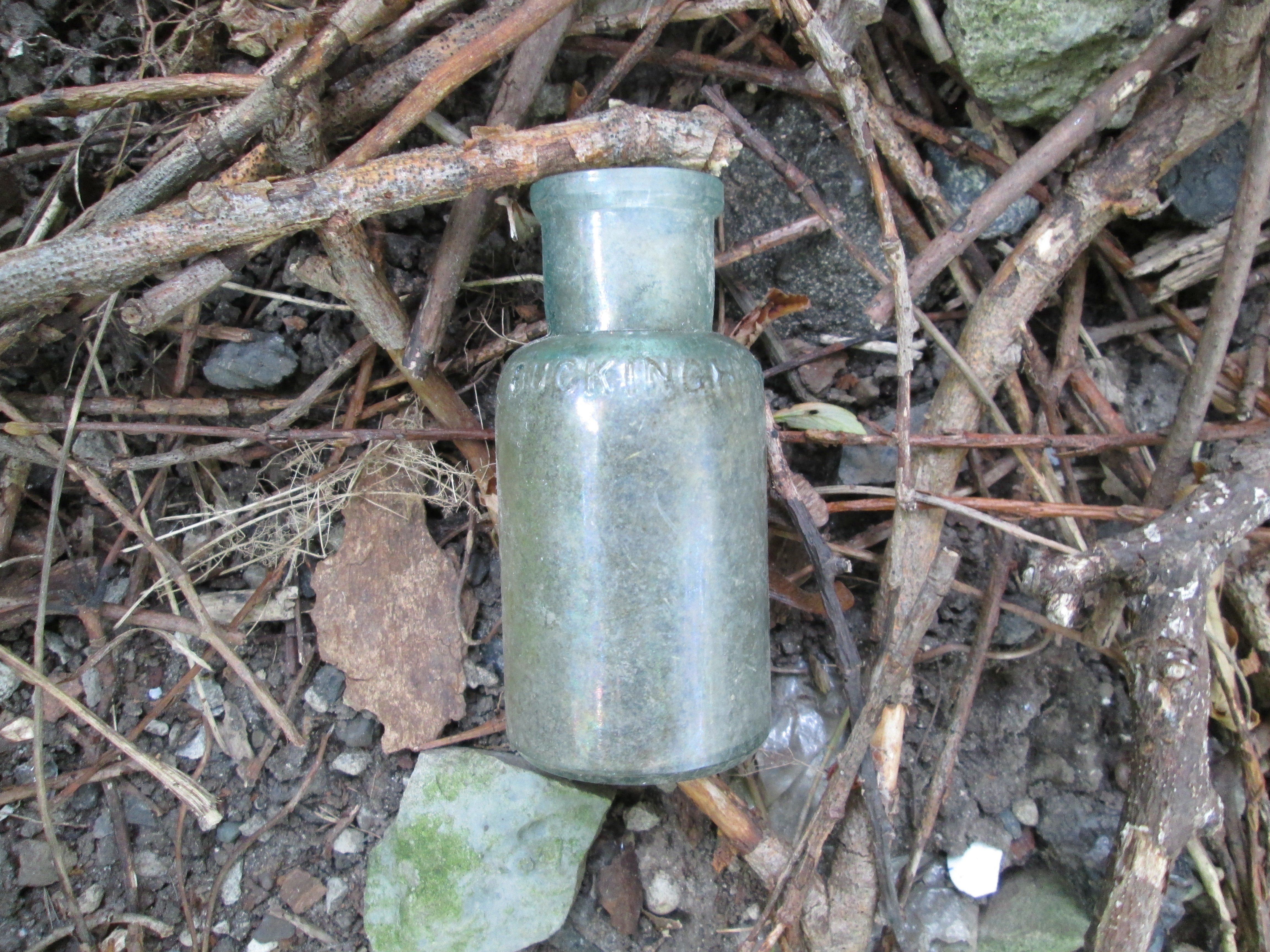
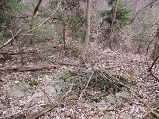
As you progress south along the old rail bed there are seven circular stone formations along the east side of the trail. They may have been old wells but if so, they have been filled in almost to ground level. Their construction suggests that they may have been contemporary with the construction of the rail line and therefore could have been ash pits. Regardless of their historic use the abundance of plant pots and fertilizer products suggests that they may have gained a whole new purpose for some urban agriculturalist.
Many of Toronto’s ravines have been altered over the years until they would hardly be recognized by the original land owners. They have been used for landfill sites and many of them contain several feet of buried garbage in the bottom. Along one area of Mud Creek the sides of the hill are covered with broken concrete from a building demolition.

When the railway released its promotional schedules it began to refer to Mud Creek as Spring Creek because it sounded better. In places where the creek has been left natural it it still a beautiful place in spite of its unflattering name.

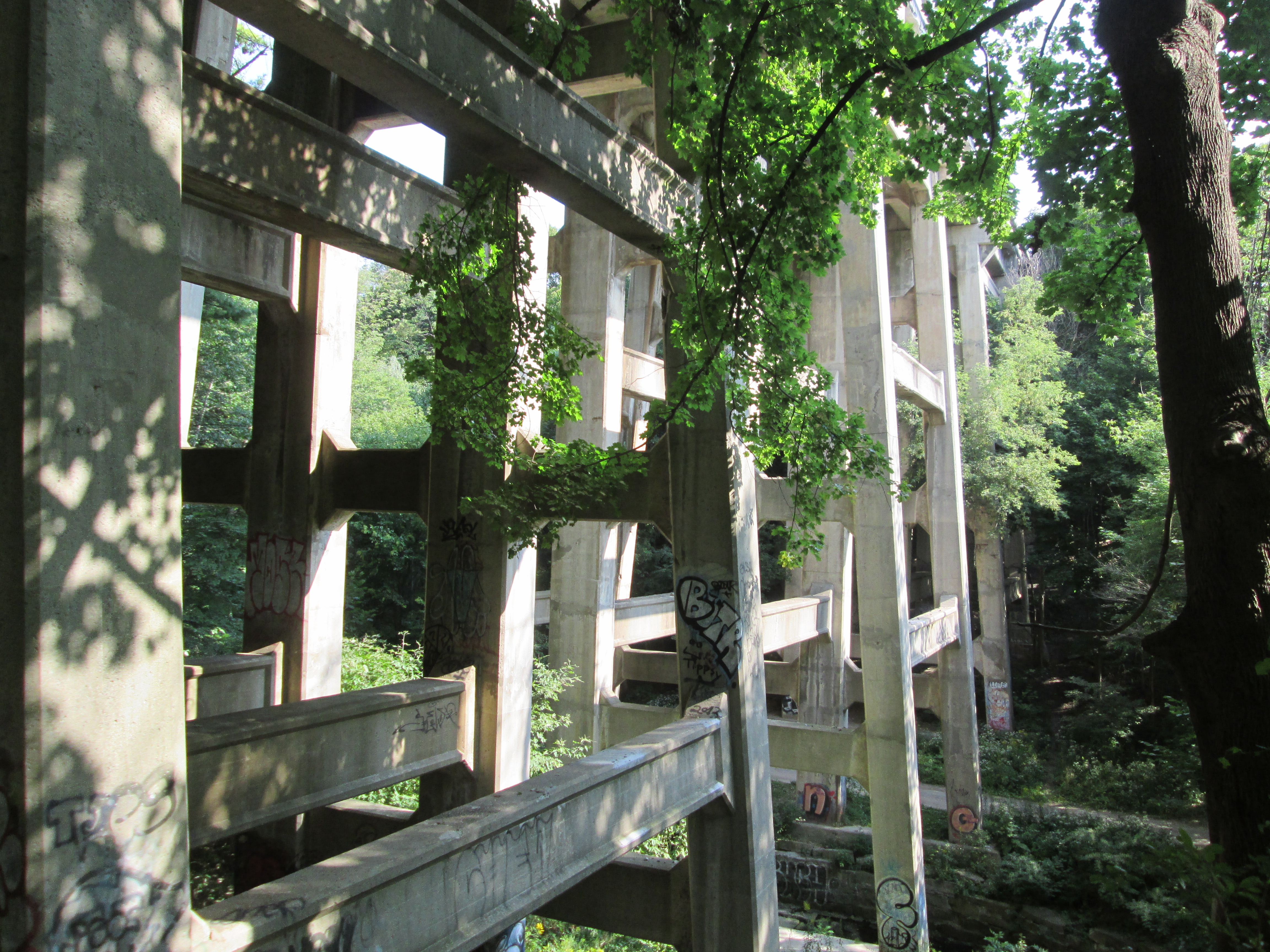
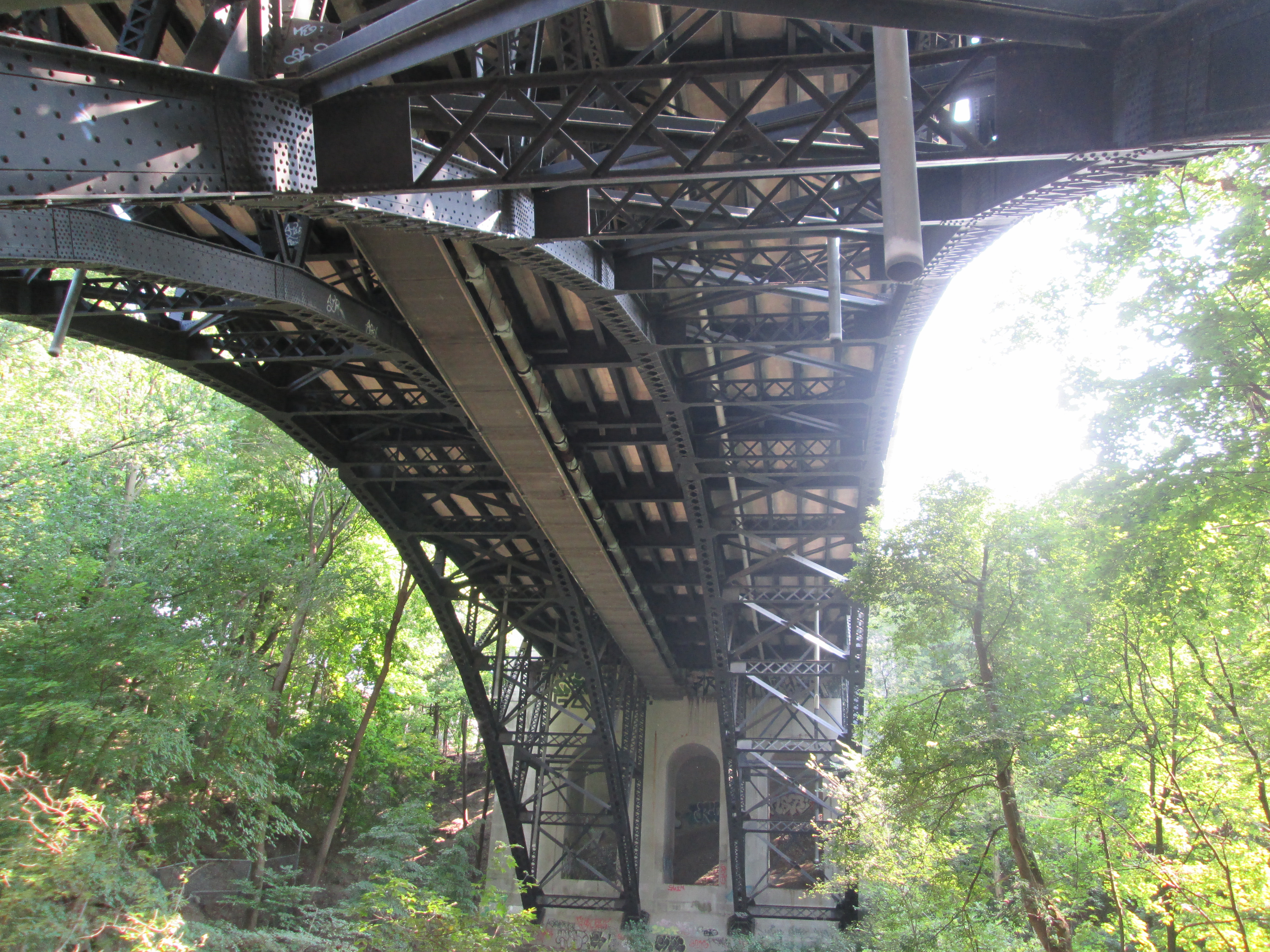
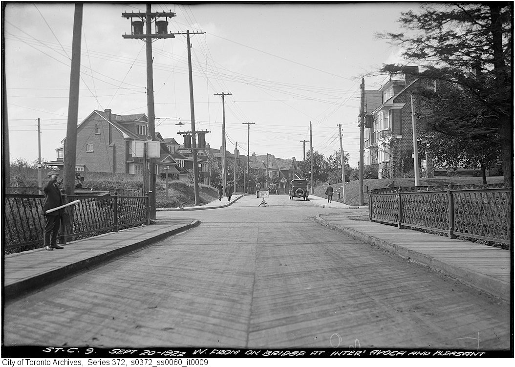
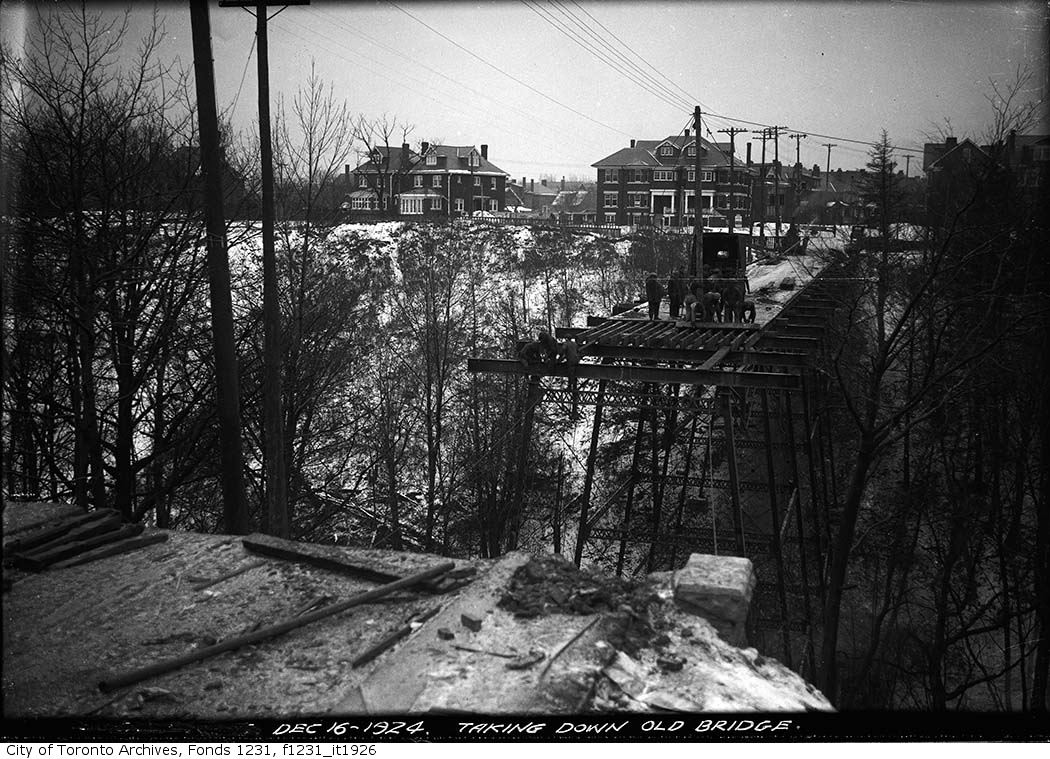
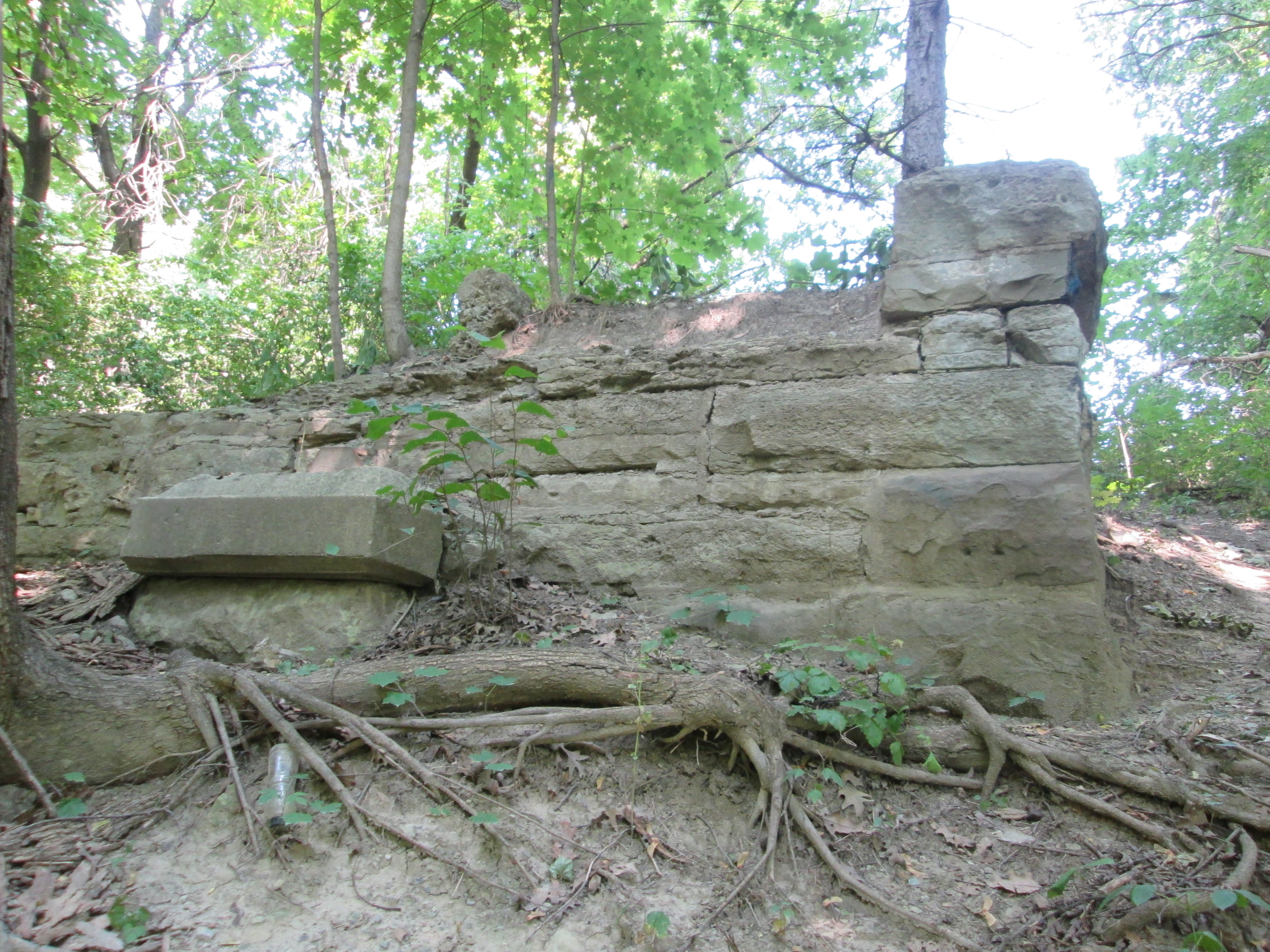
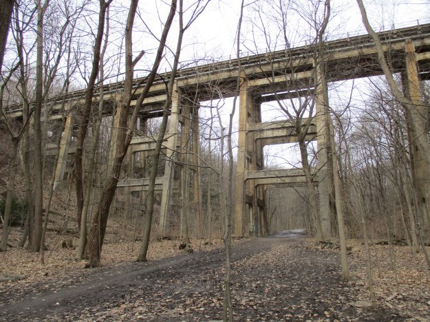
The North Toronto subdivision of the Canadian Pacific Railway (CPR) was the main line between Toronto and Montreal. It passes over both the Vale of Avoca and the Belt Line railway and prior to construction of the Half Mile Bridge, trains had to back from Toronto Junction into downtown. When the North Toronto Station was built at Yonge Street passenger traffic increased greatly and it was decided to double track the line. In 1918 old steel trestles were replaced over both of these ravines with concrete ones which were built of similar construction. The bridge over Mud Creek is 386 feet long and 80 feet high.
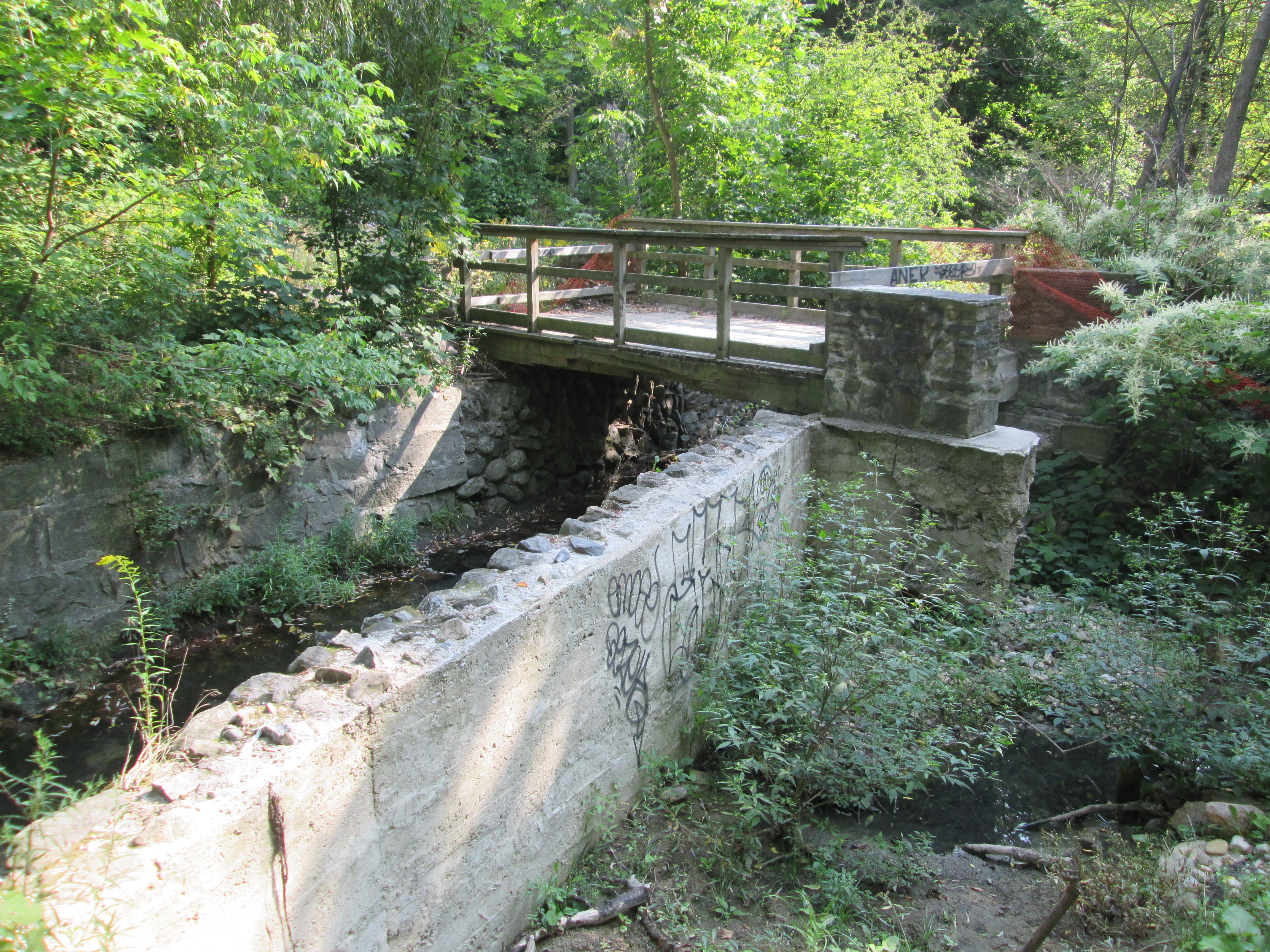
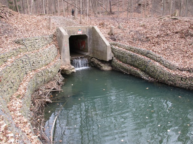
Gabion is a word we borrowed from the Italian language and it means cage. We use it as a term to describe a civil engineering feature that is used to control erosion. A wire cage is filled with stones and placed along the banks of a stream. In this case along Mud Creek the gabion on the right hand side of the picture is already drooping into the stream because the dirt has eroded away below it.
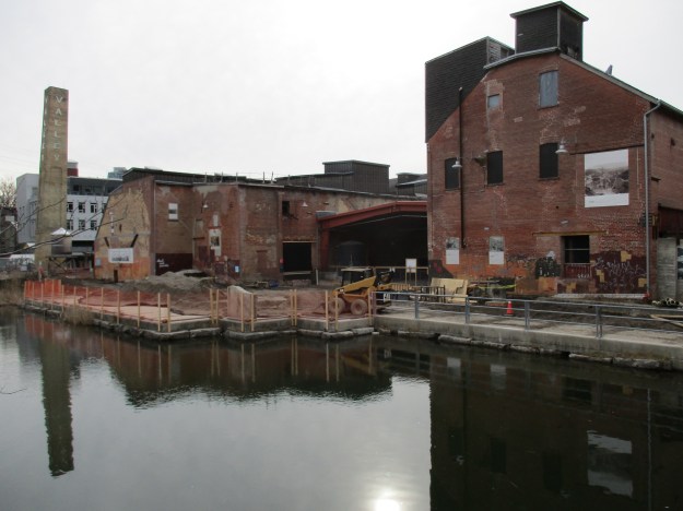
Mud Creek was redirected from it’s natural course to flow through the Don Valley Brick Works to provide a source of water for use in the brick making industry. Many of the bricks used in historic Toronto were manufactured at this site with clay that was dug out of the rear of the property. When the clay was exhausted the factory was closed and left abandoned. Recent efforts to rehabilitate the property have resulted in the partial filling in of the huge hole left from the open pit clay mine. It has been turned into a park with ponds where people can walk and enjoy the wildlife that has made itself home here.
The trail leads to the Don Valley Brick Works buildings which have been transformed into a farmer’s market, heritage museum and parkland.
Beyond the Brick Works the trail connects to Milkman’s Lane.
Google Maps link: Belt Line Trail
Getting there by transit: From Davisville Station walk two blocks south past Merton to the trail. The south end is accessible via route 28 which also runs from Davisville Station.
Like us at http://www.facebook.com/hikingthegta