Monthly Archives: March 2015

Silverthorne Grist Mill – Meadowvale

Saturday March 28, 2015

(Revised March 31st)

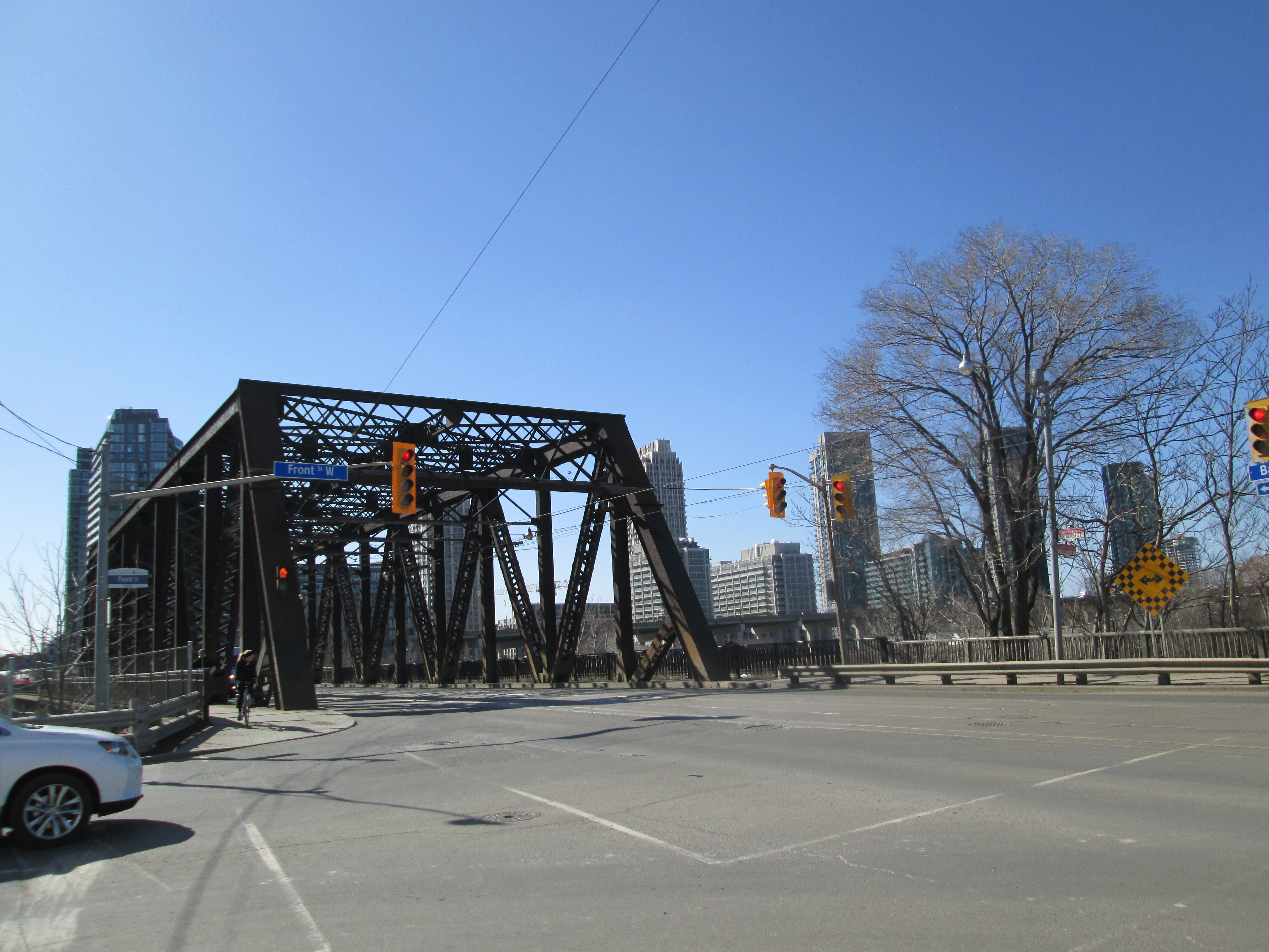
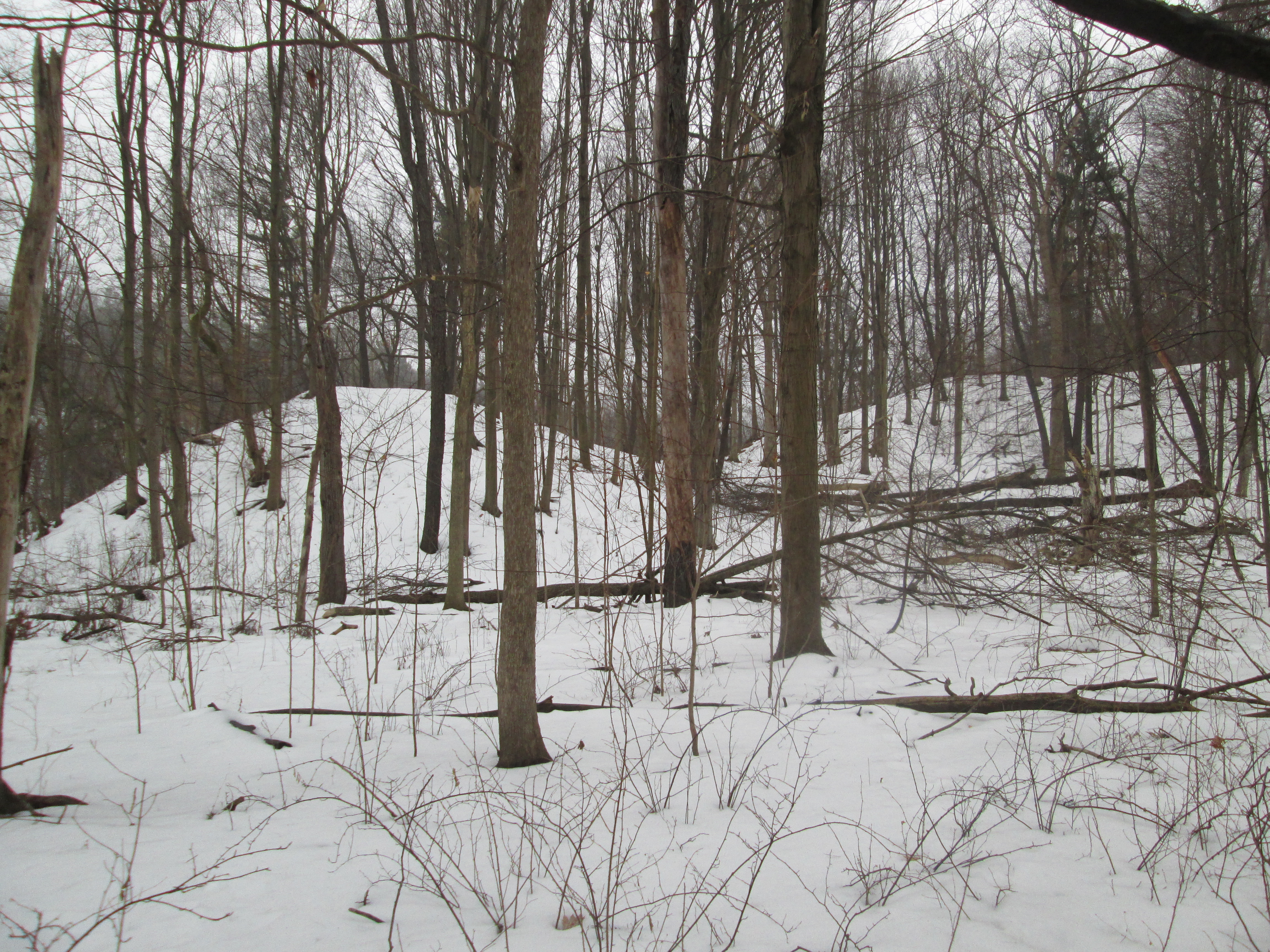
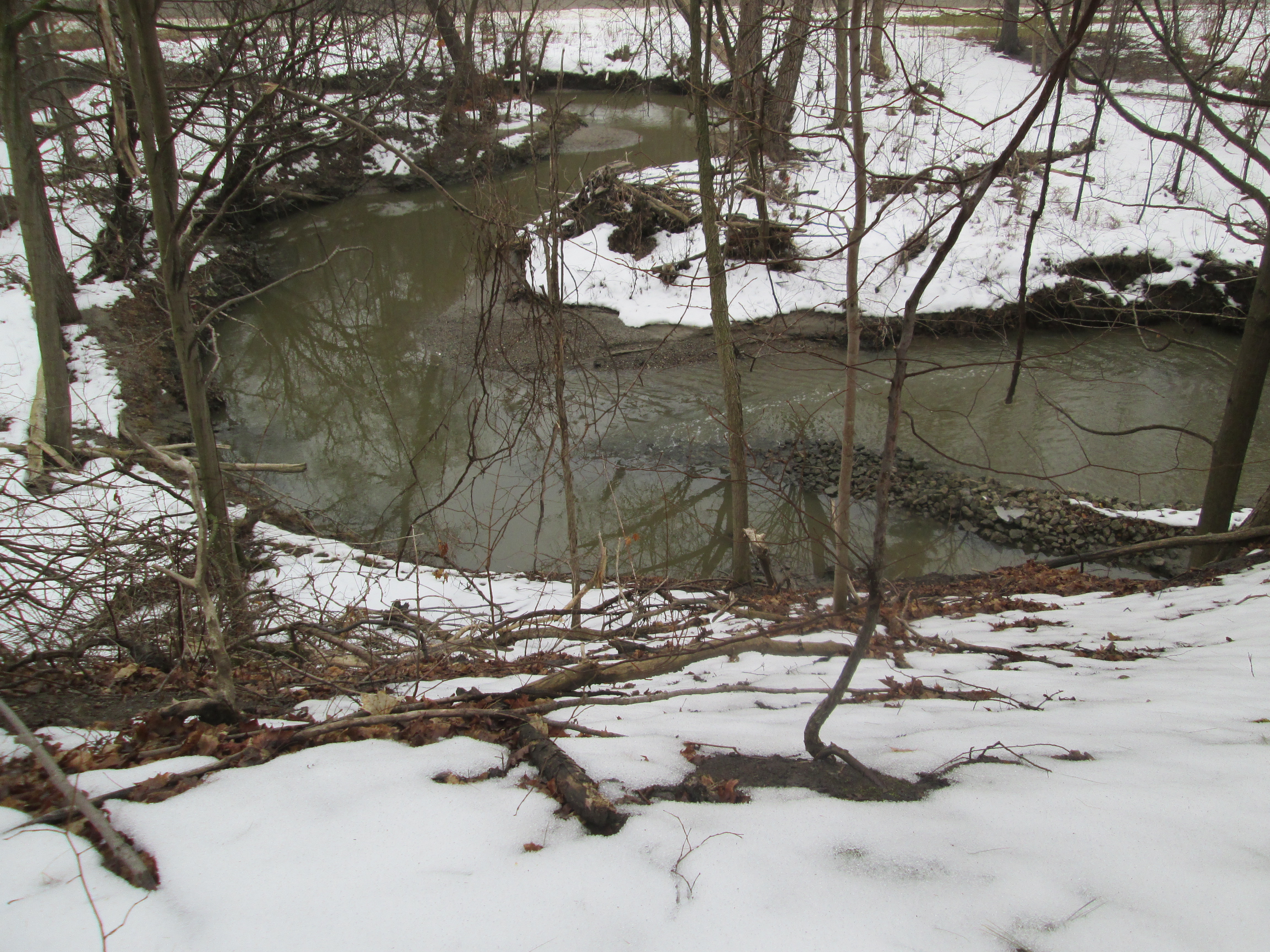
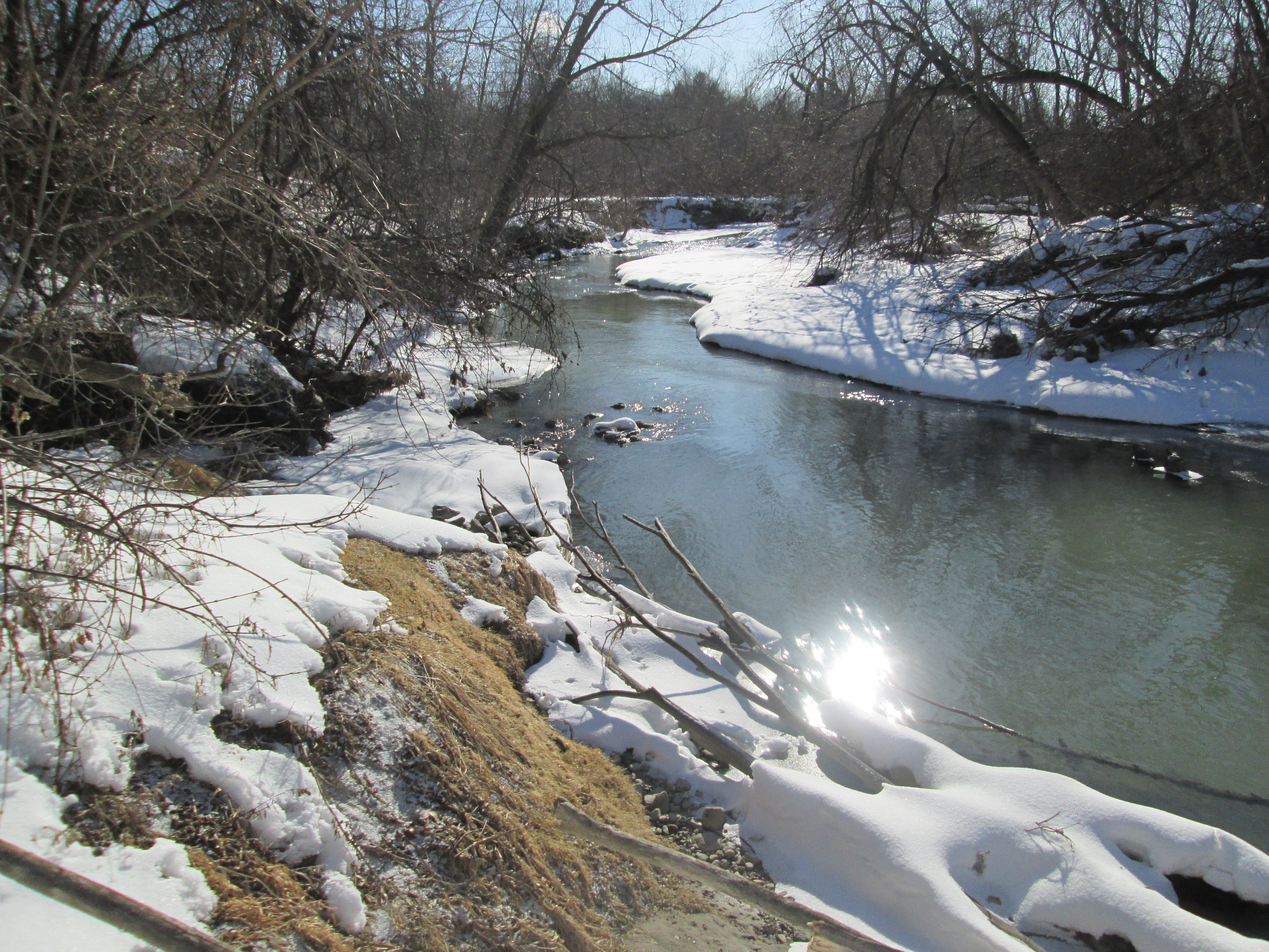
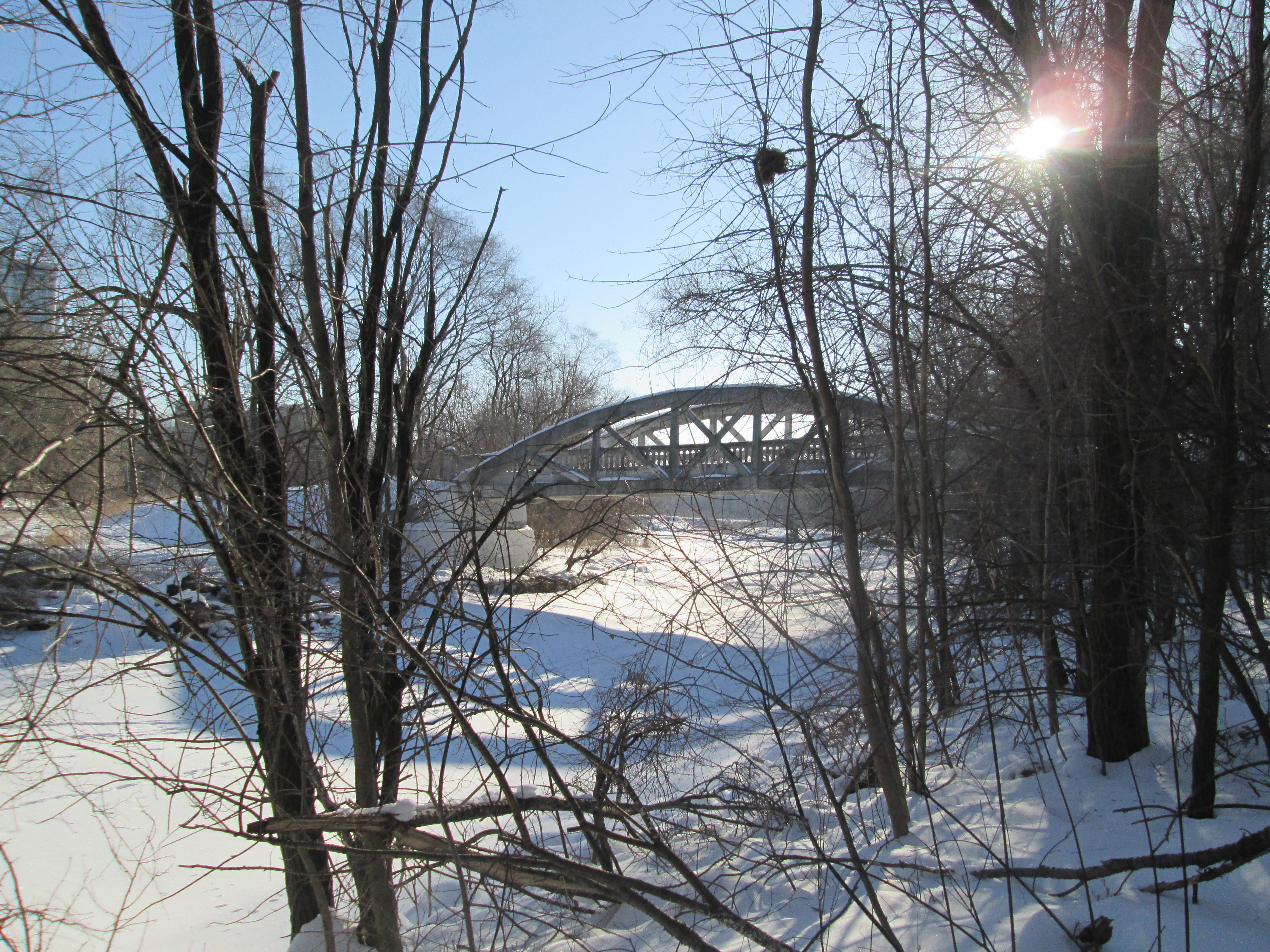
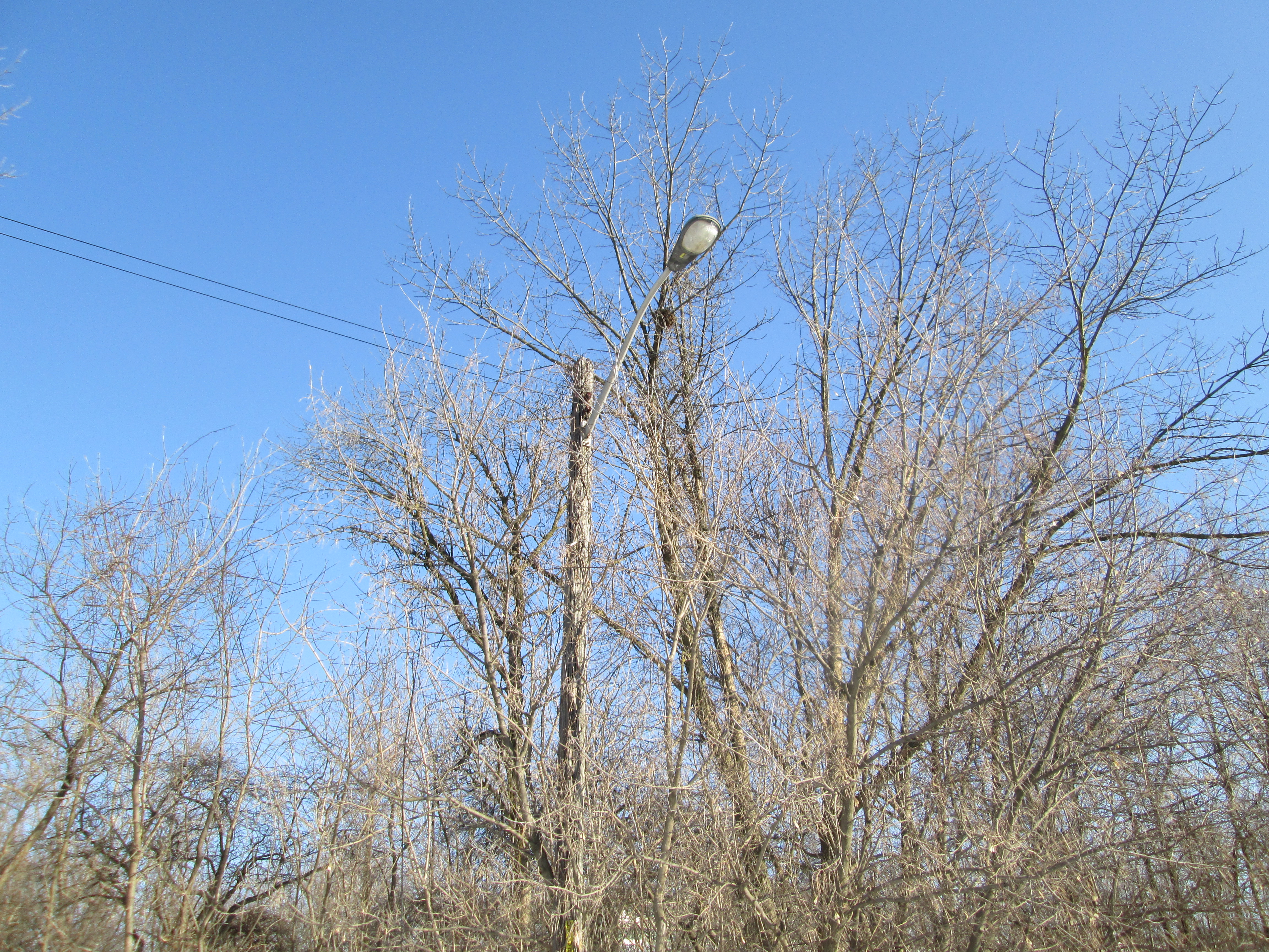
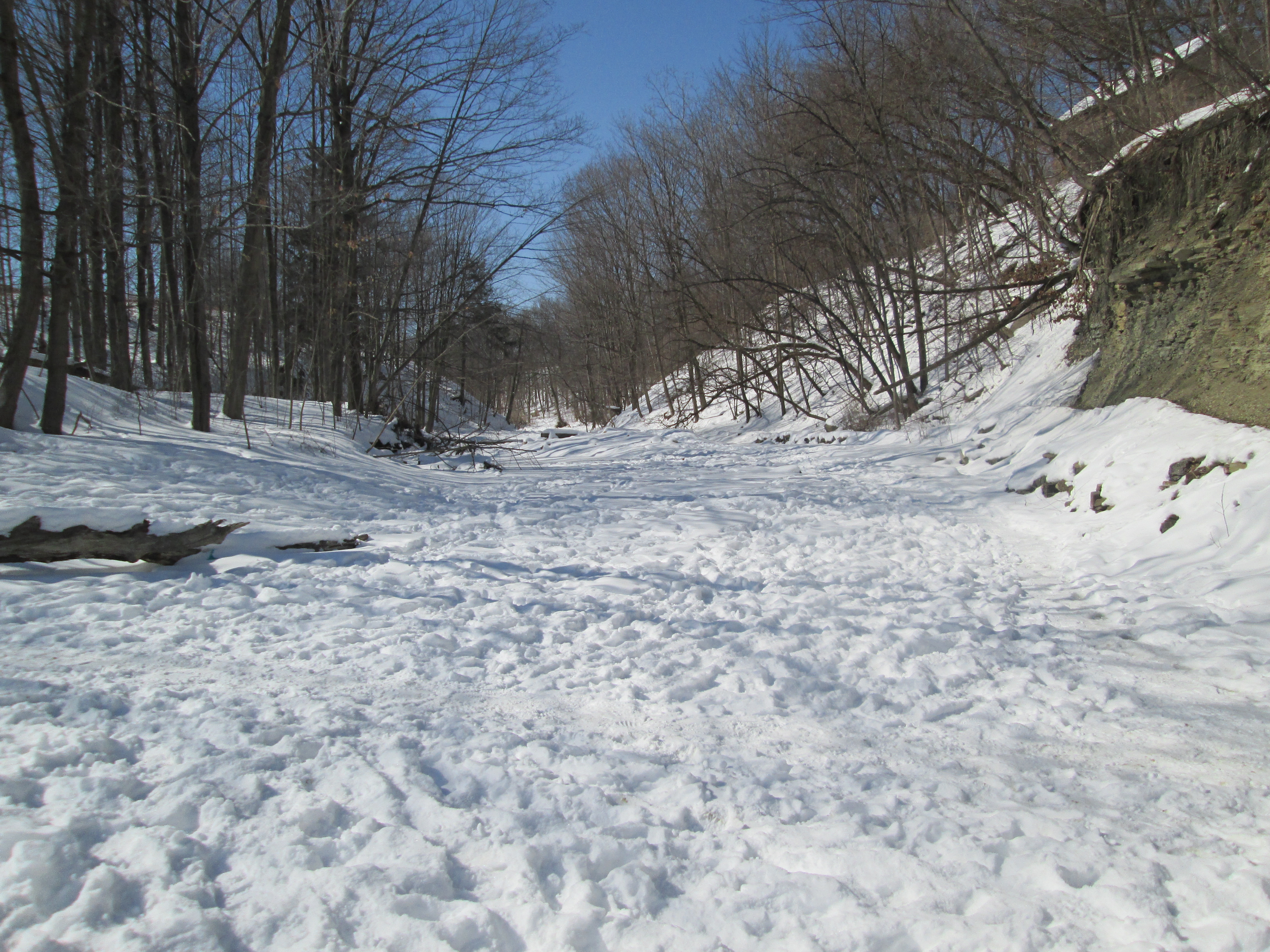
It was minus 10 with a wind chill of minus 18.  This was one of the coldest morning hikes of the year, in spite of the date on the calendar.  We parked in the Meadowvale Conservation Area parking lot where the Second Line dead ends south of the new Derry Road.  We crossed under the bridge and walked north where the Meadowvale mill pond once connected with the river.

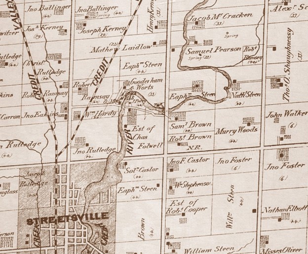
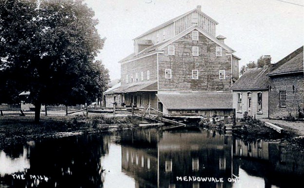
When John Beatty arrived in 1819 he brought the first settlers to the area.  He built mills along the Credit River and founded Meadowvale.  In 1831 Beatty sold his mills to James Crawford who opened saw and carding mills to compete with John Simpson who operated mills on lot 10 south of  Derry Road.  By 1836 Meadowvale had reached village status.  In 1844 Francis Silverthorne took over from Crawford and greatly expanded the mill complex building a saw mill.  In 1845 he added a large grist mill.  When it burned in 1853 he got backing from the Bank of Upper Canada and rebuilt.  During the Crimean War the price of flour had jumped from $1.50 per barrel to $3.00.  Silverthorne stockpiled grain in an effort to take advantage but when the war ended in 1860 the price fell to $1.00 per barrel.  When the Bank of Upper Canada foreclosed on his loan, William Gooderham, who was in charge of the bank, bought the property.  Gooderham and Worts had also purchased Alpha Mills, north of Streetsville, the same year.  Silverthorne retired to the family mansion, Cherry Hill.

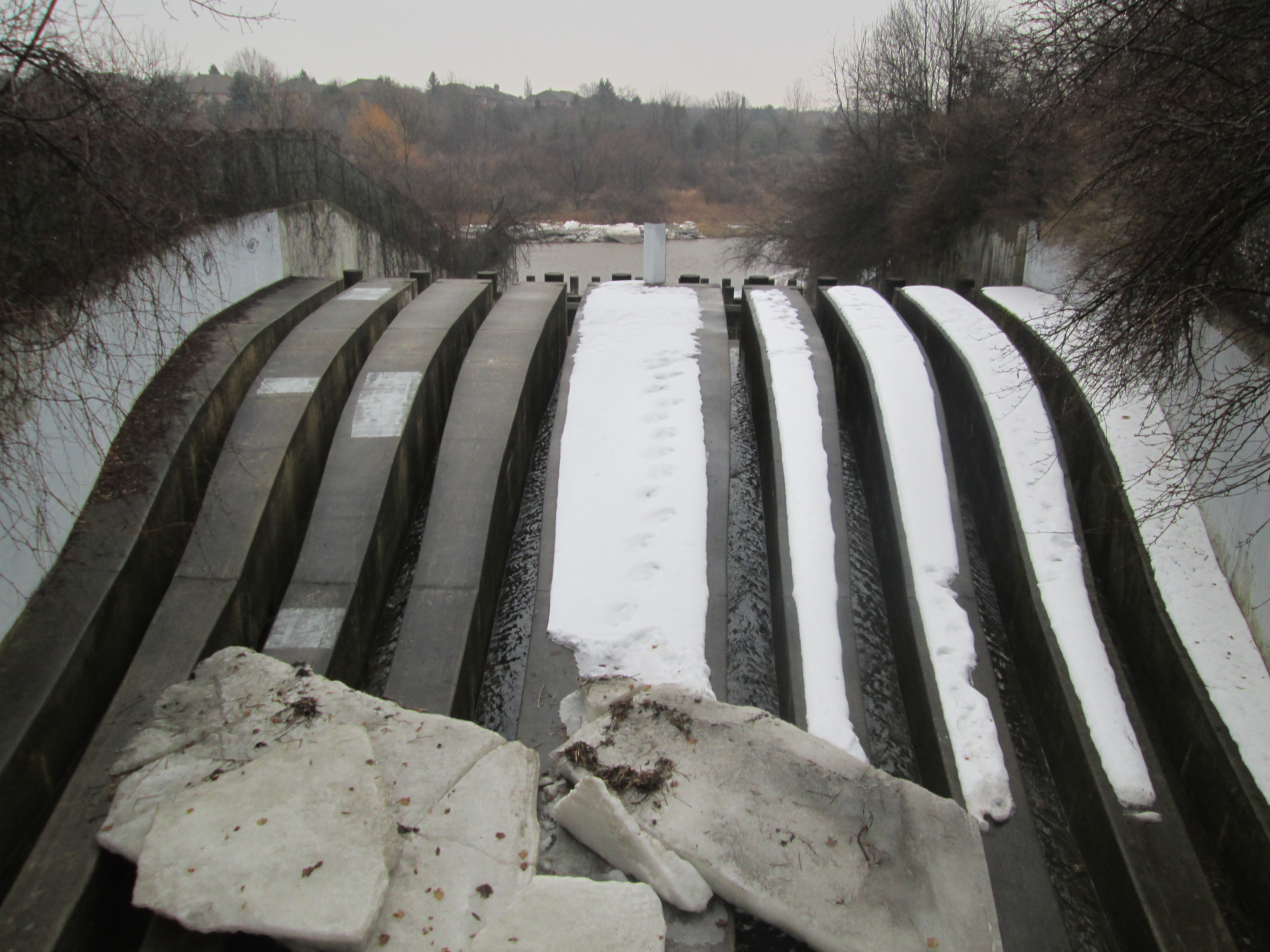
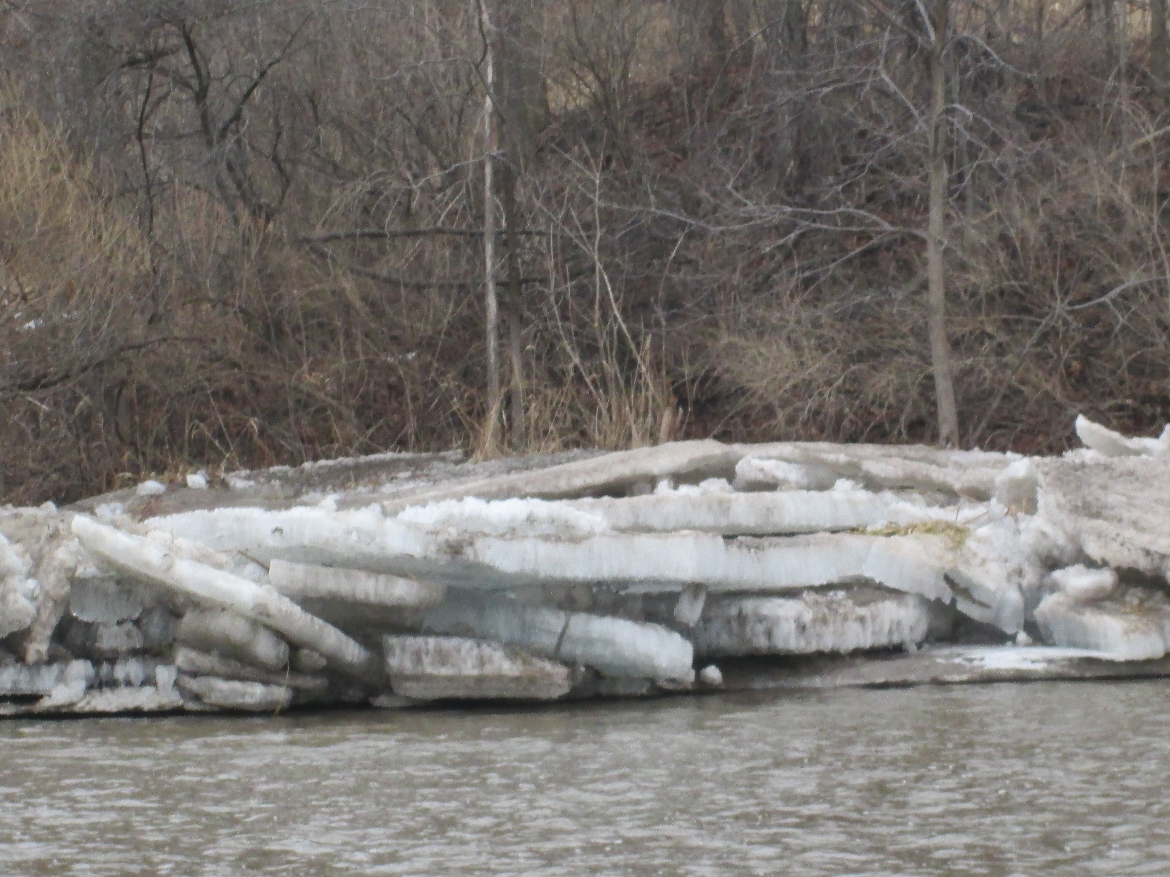
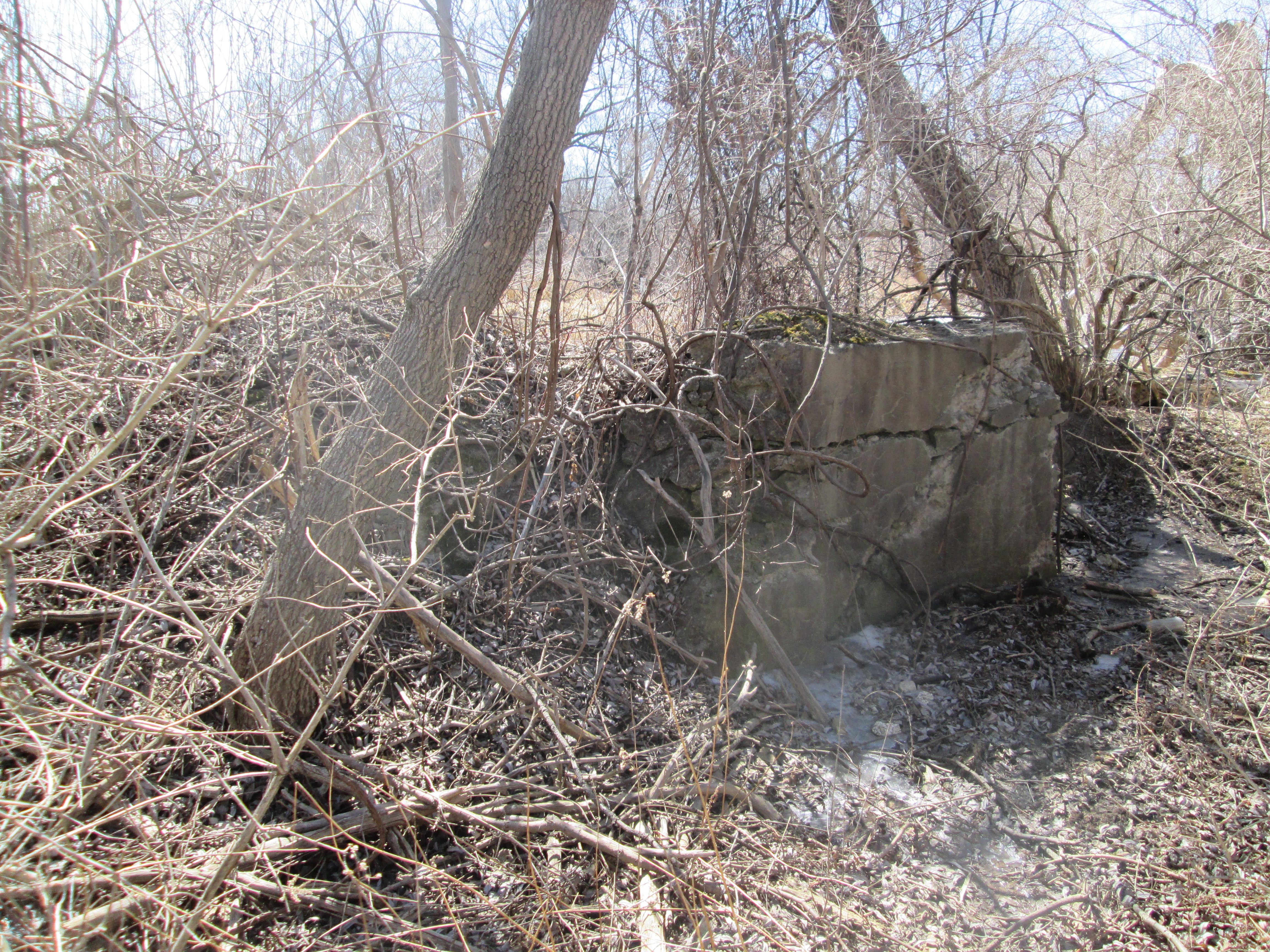
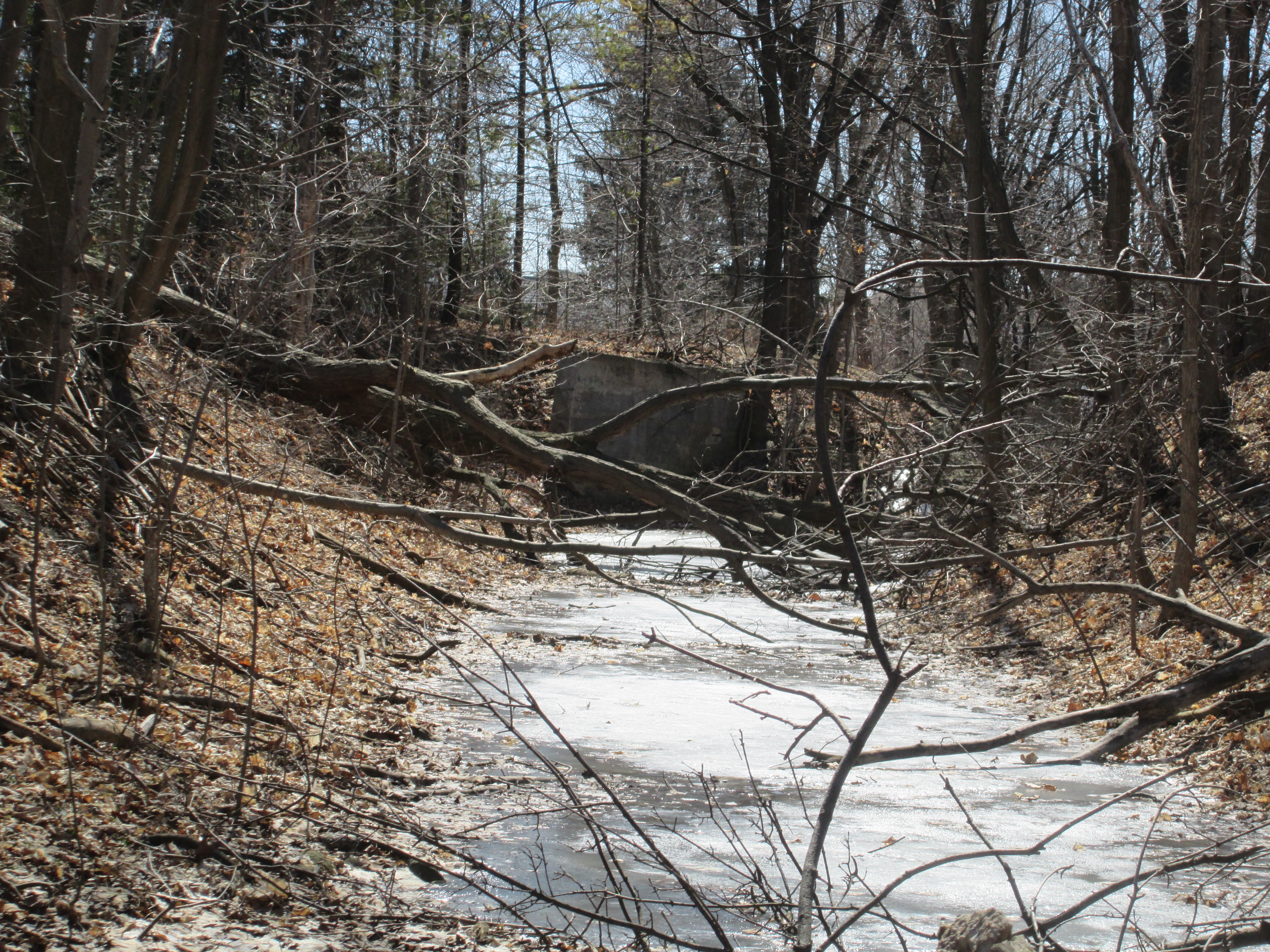
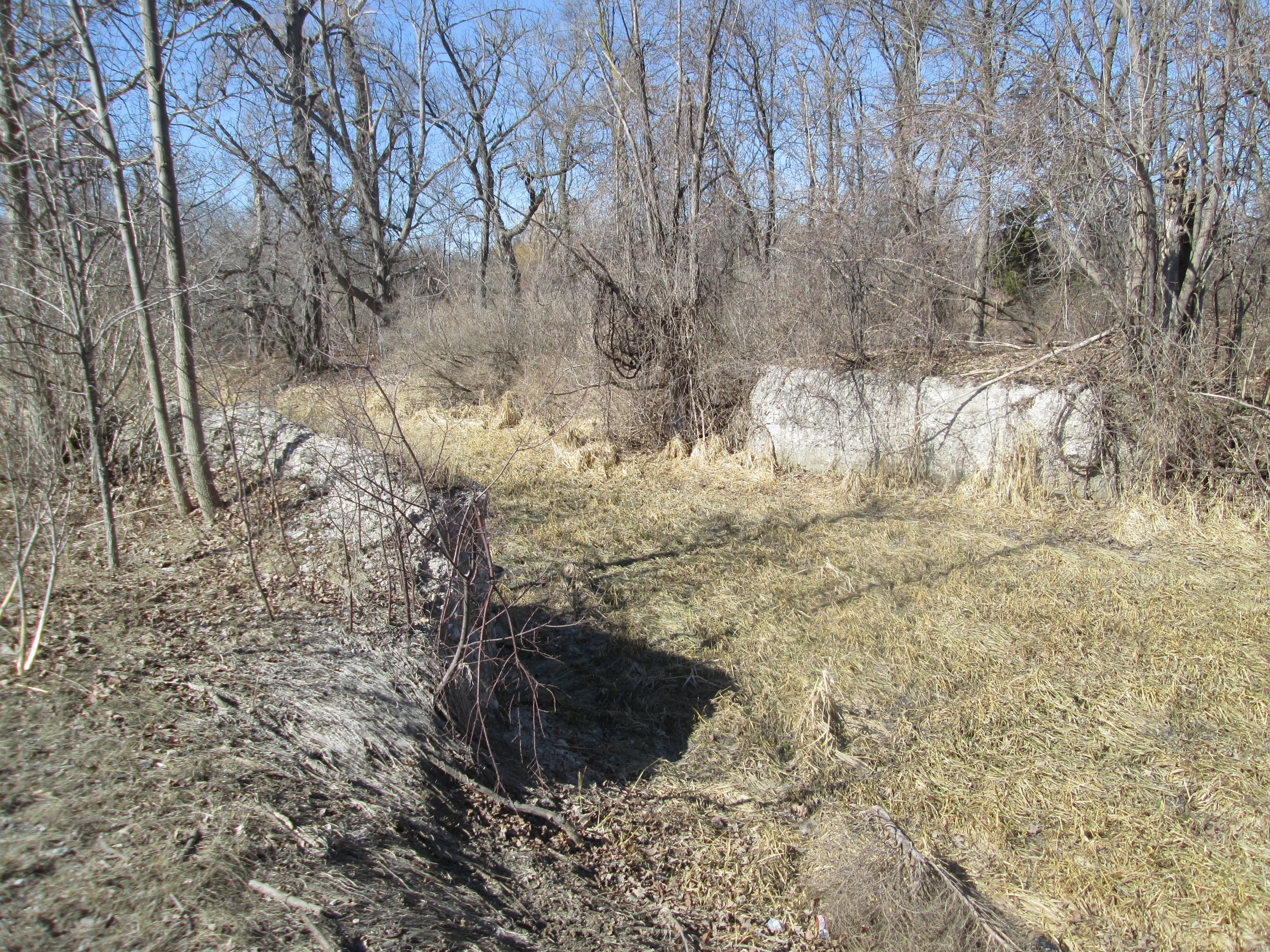
After the Gooderhams the mill was owned by the Wheelers until 1895 when it was sold to Henry Brown.  Henry restored the mill and returned it to full production.  In 1906 he set about developing Meadowvale into a tourist attraction.  The first step was to increase the size of the mill pond and create what came to be known as Willow Lake.  He built a larger dam further north on the Credit to allow more water to be retained.  By following the western wall of the former Willow Lake we were able to locate the remnants of this dam.  Concrete remains can be found on both sides of the Credit River.

IMG_3079

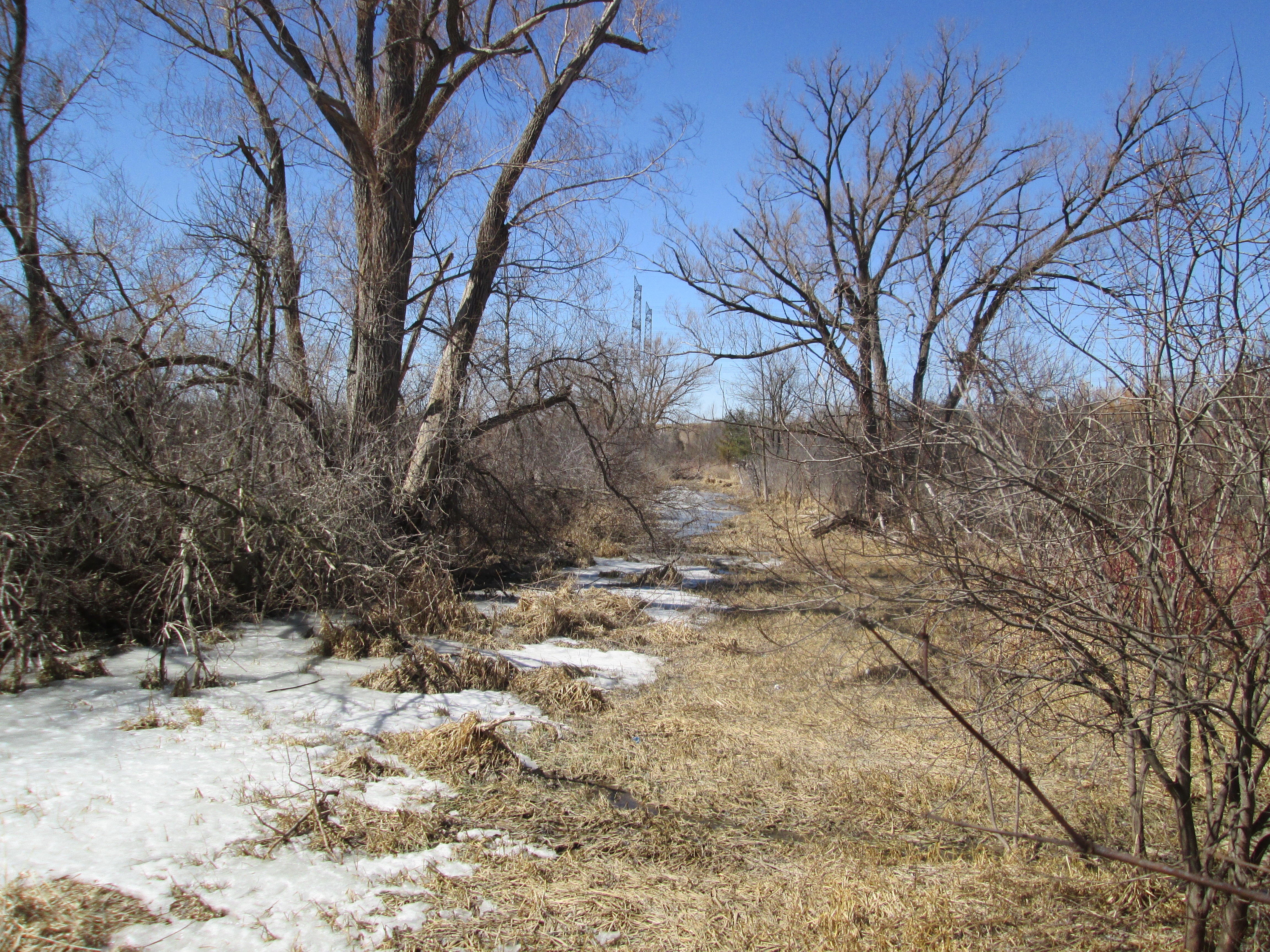
Water is held in the western most parts of the old Willow Lake as we made our way along the berm toward the old mill.  The land along the western side of the old lake has been scooped out to create a retaining wall for the mill pond.

IMG_3077


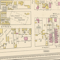
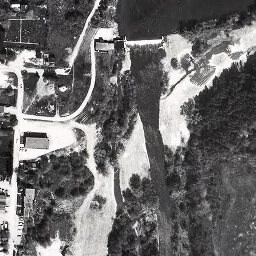
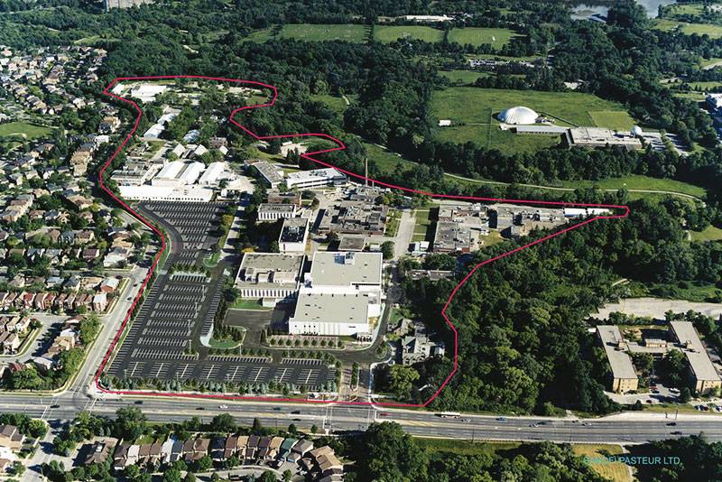
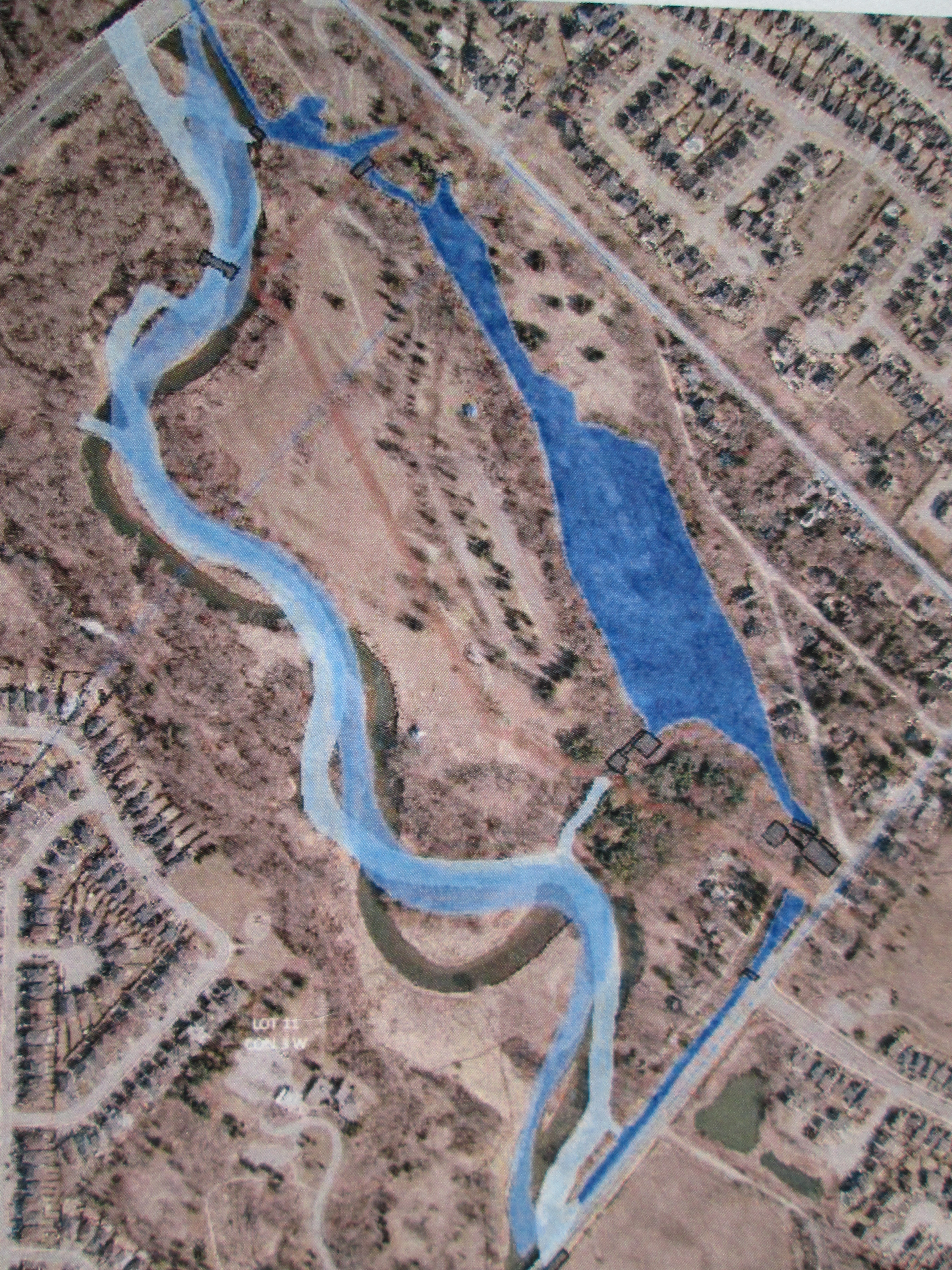
After publishing this post I came across the following picture in the heritage assessment of 2014.  It shows an aerial view of Meadowvale with the old mill pond drawn in with dark blue and previous courses of the river in light blue.  Derry Road runs across the lower right corner and second line across the upper right corner.  Silerthorne’s grist mill is sketched in where the mill pond approaches Derry Road then follows along it in dark blue as the tail race.  His saw mill is drawn in a little above there where an old tail race returns to the river.

IMG_0101

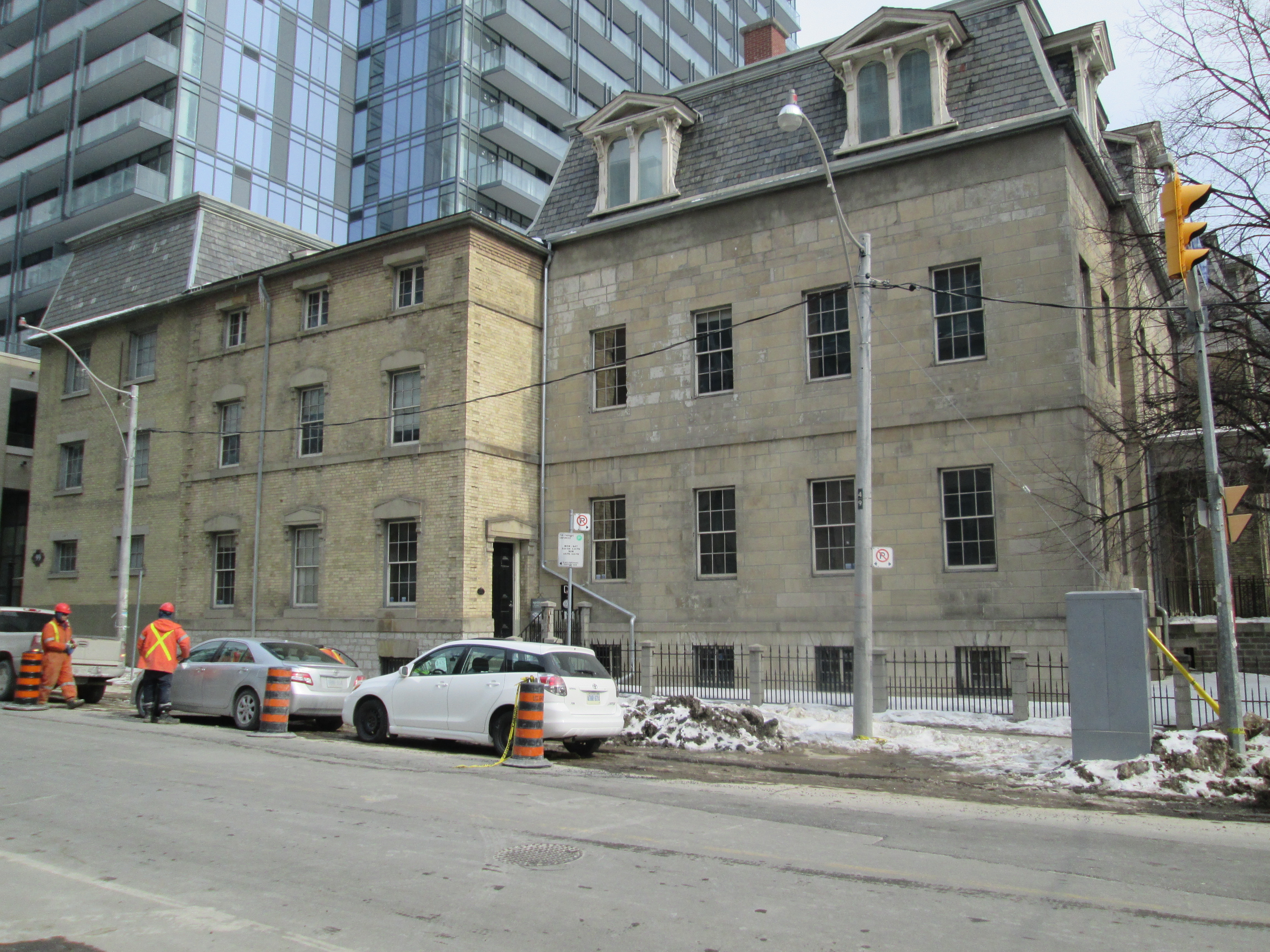
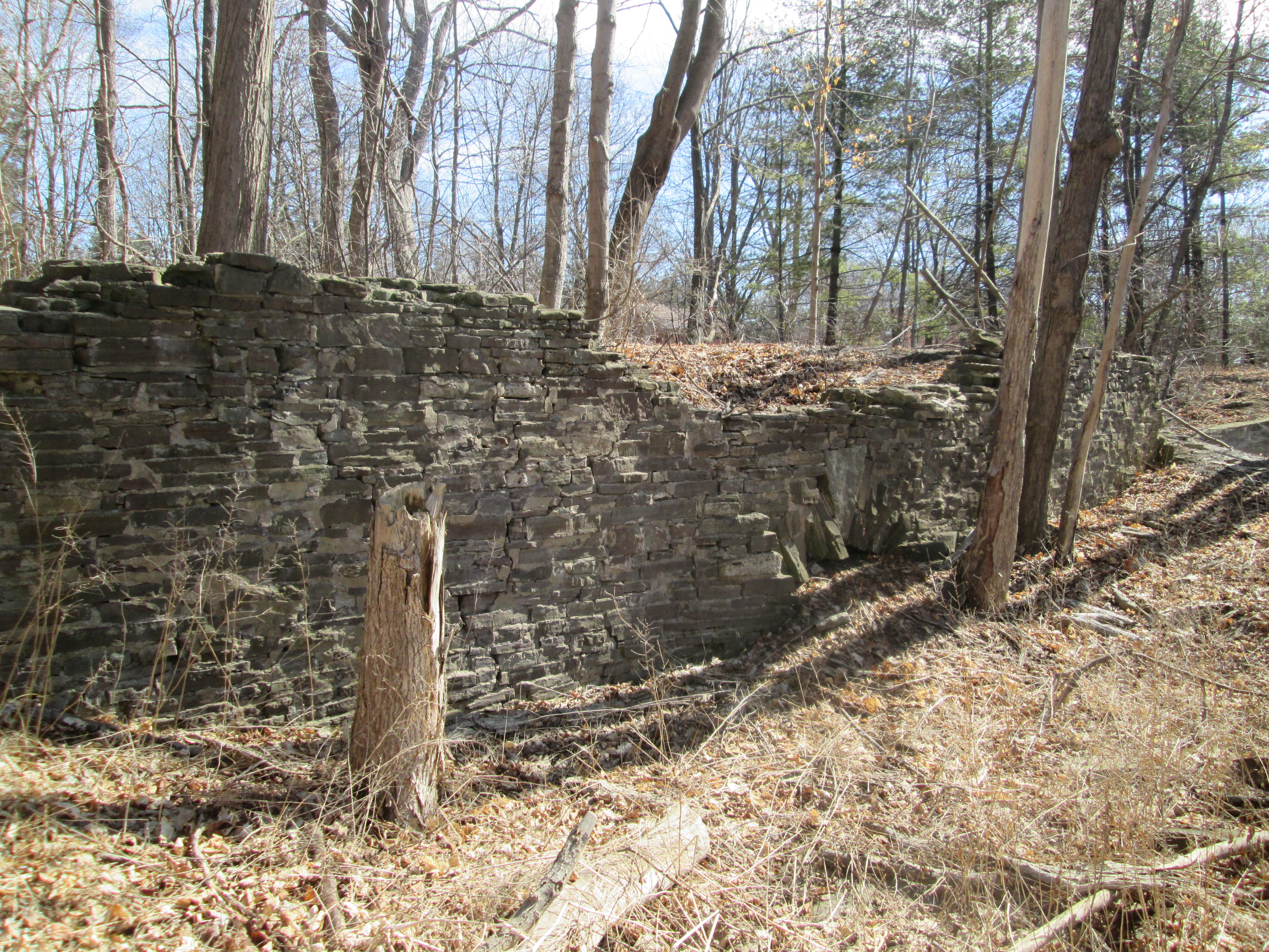
As you approach old Derry Road concrete structures from the mill come into view.

IMG_3068

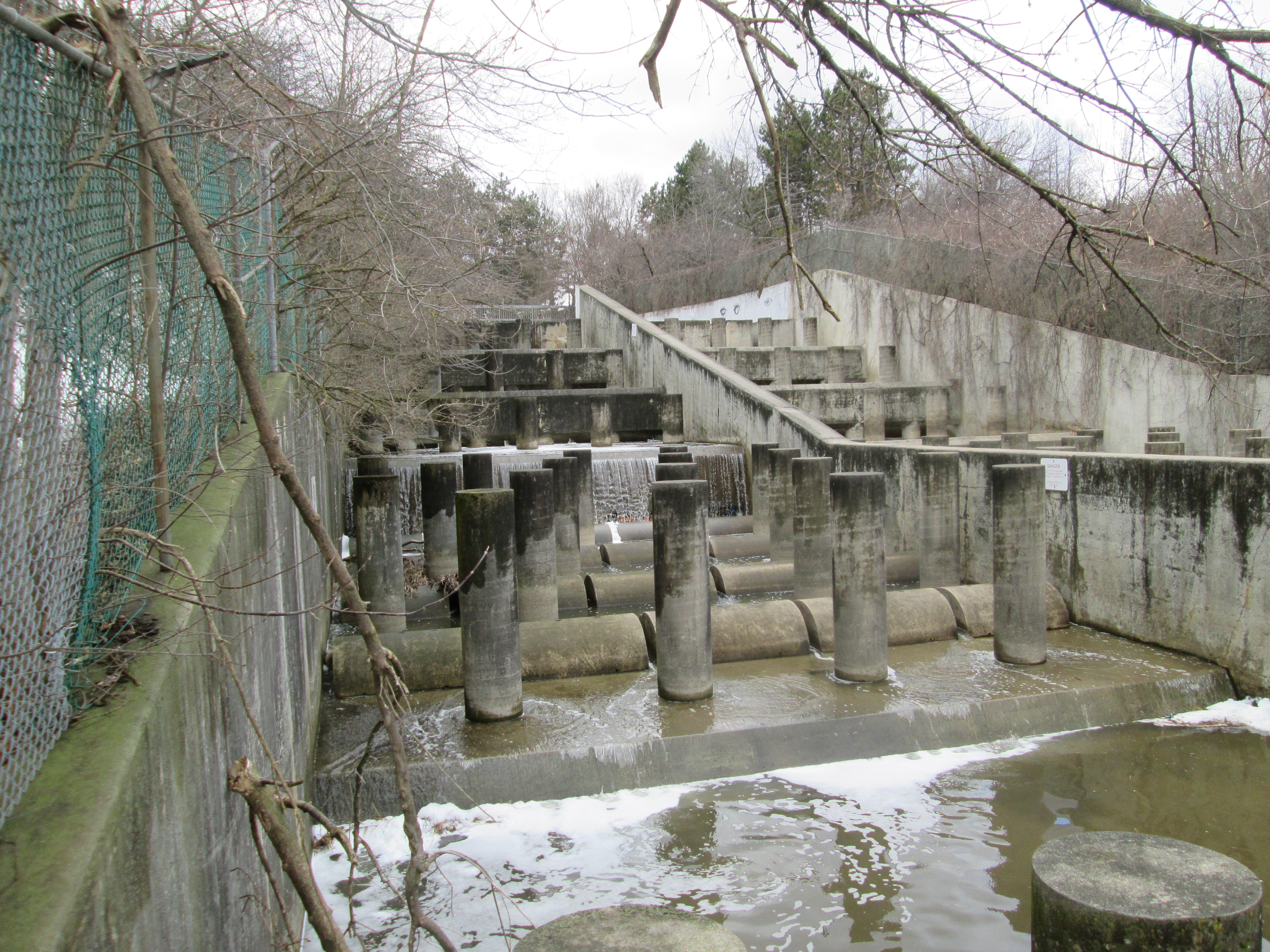
The mill stretched over both sides of the millway with the water wheel, and later the turbine, generating power to turn the grinding wheels to produce flour.

IMG_3030

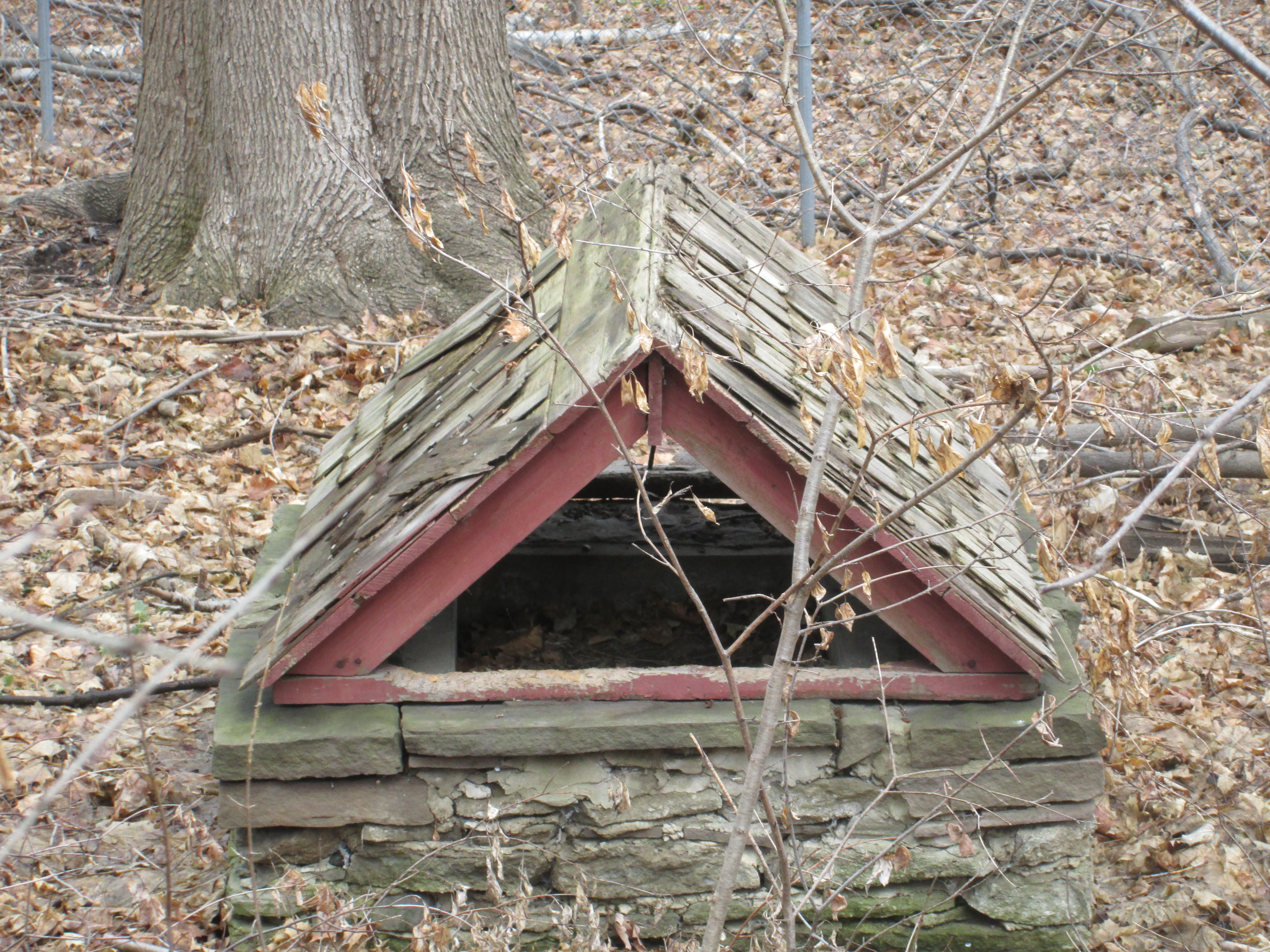
The foundations on the west side of the millrace are pictured below.  Notice the stonework in the middle at ground level that marks a former water tunnel through the wall.

IMG_3137

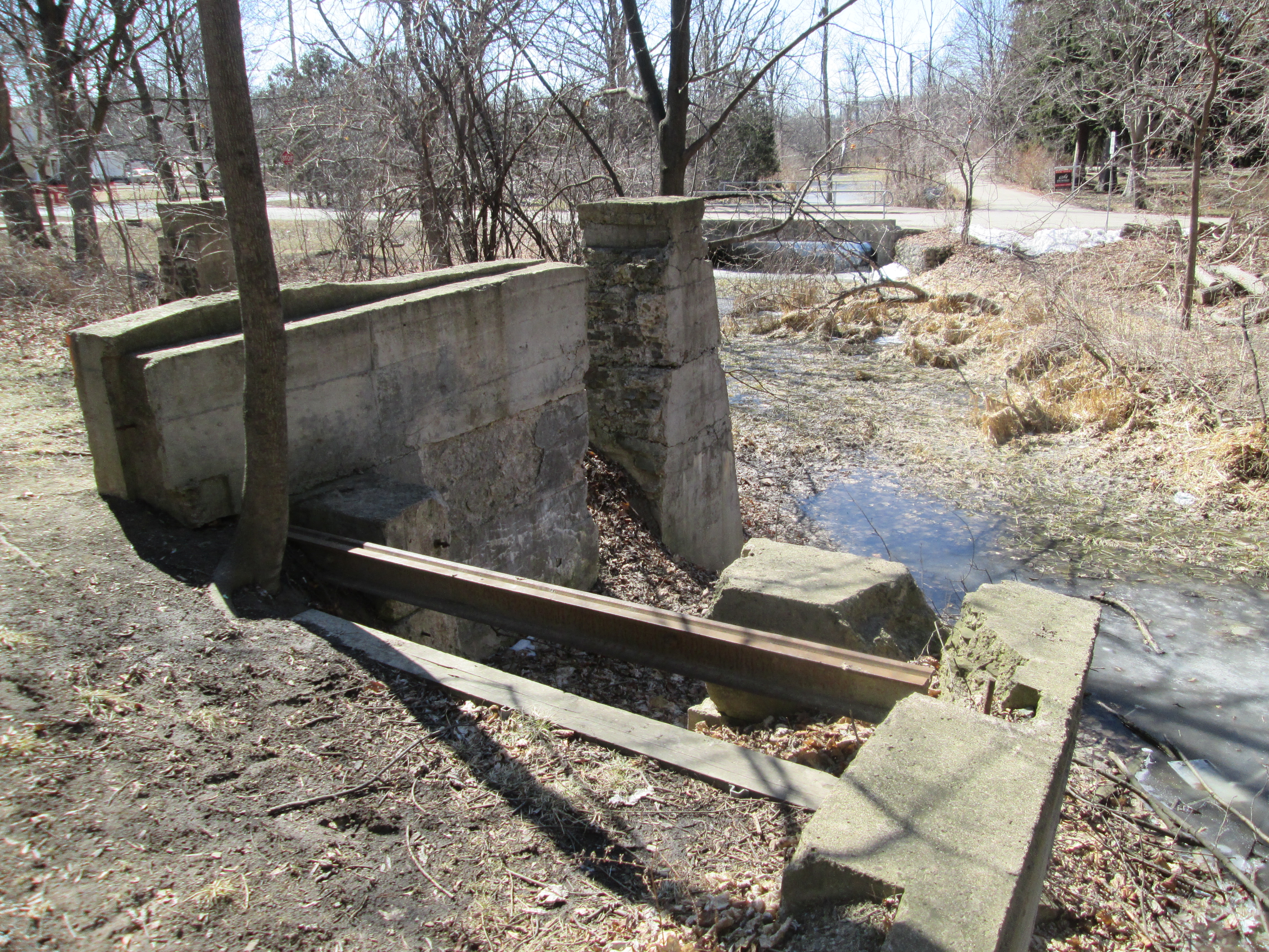
This picture shows the main foundations for the water wheel.  Notice the bridge in the background where the tail race leads out along Willow Lane on it’s way back to the Credit River.

IMG_3064

The mill changed hands several times until it went out of production in 1950.  The Emersons owned the mill at the time and kept it for storage.  Fire is a common fate for grist mills and the community became concerned about its safety.  The wood was 100 years old, dry and full of a century of flour dust.  When Luther Emmerson was told he had to demolish it he did so himself.  Smashing it up in a fury and leaving the pieces where they fell.  The wood was carried away and the rest settled and was filled in.  They say the old turbines are still buried in the basement.

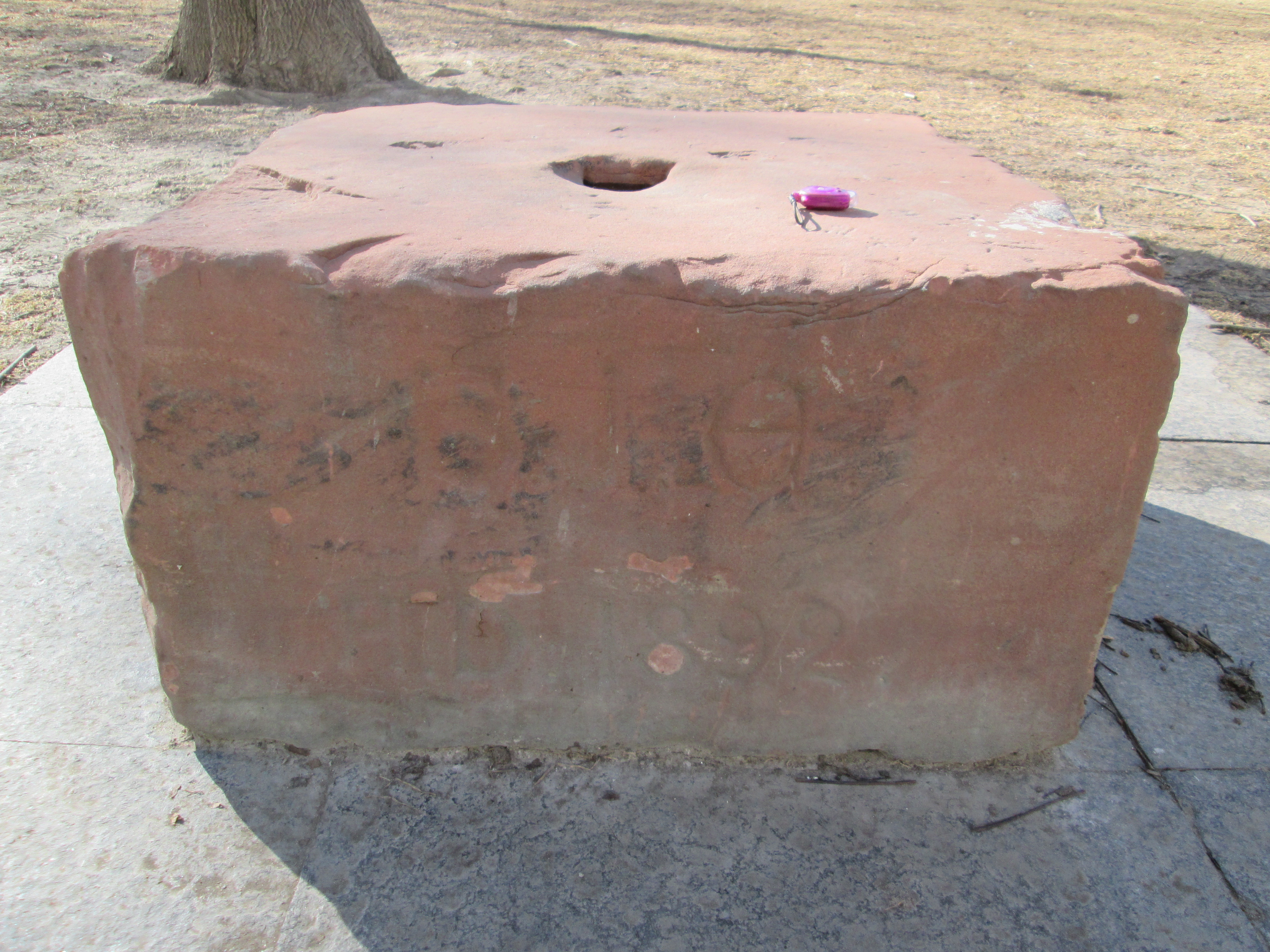
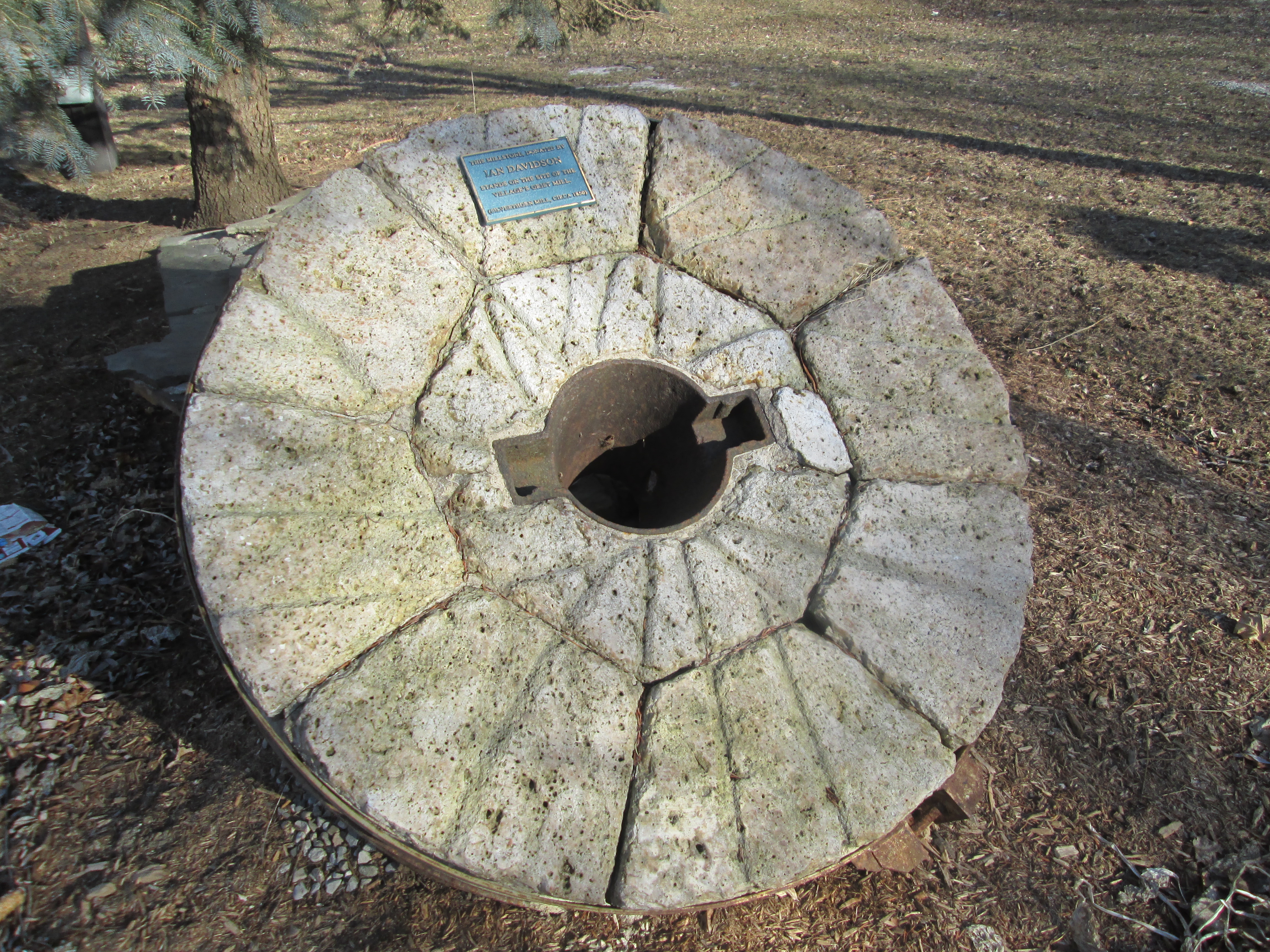
The mill stone has been preserved on the site of the Silverthorne Mill.  Mill stones come in pairs. The lower stone is stationary and is called the bedstone.  The upper stone, or runner, spins and does the actual grinding.  The grooves serve to channel the flour to the outside of the stones for collection.  The grain is fed through the eye in the centre of the runner stone to be ground between them.  Both upper and lower stones are preserved here.

IMG_2985

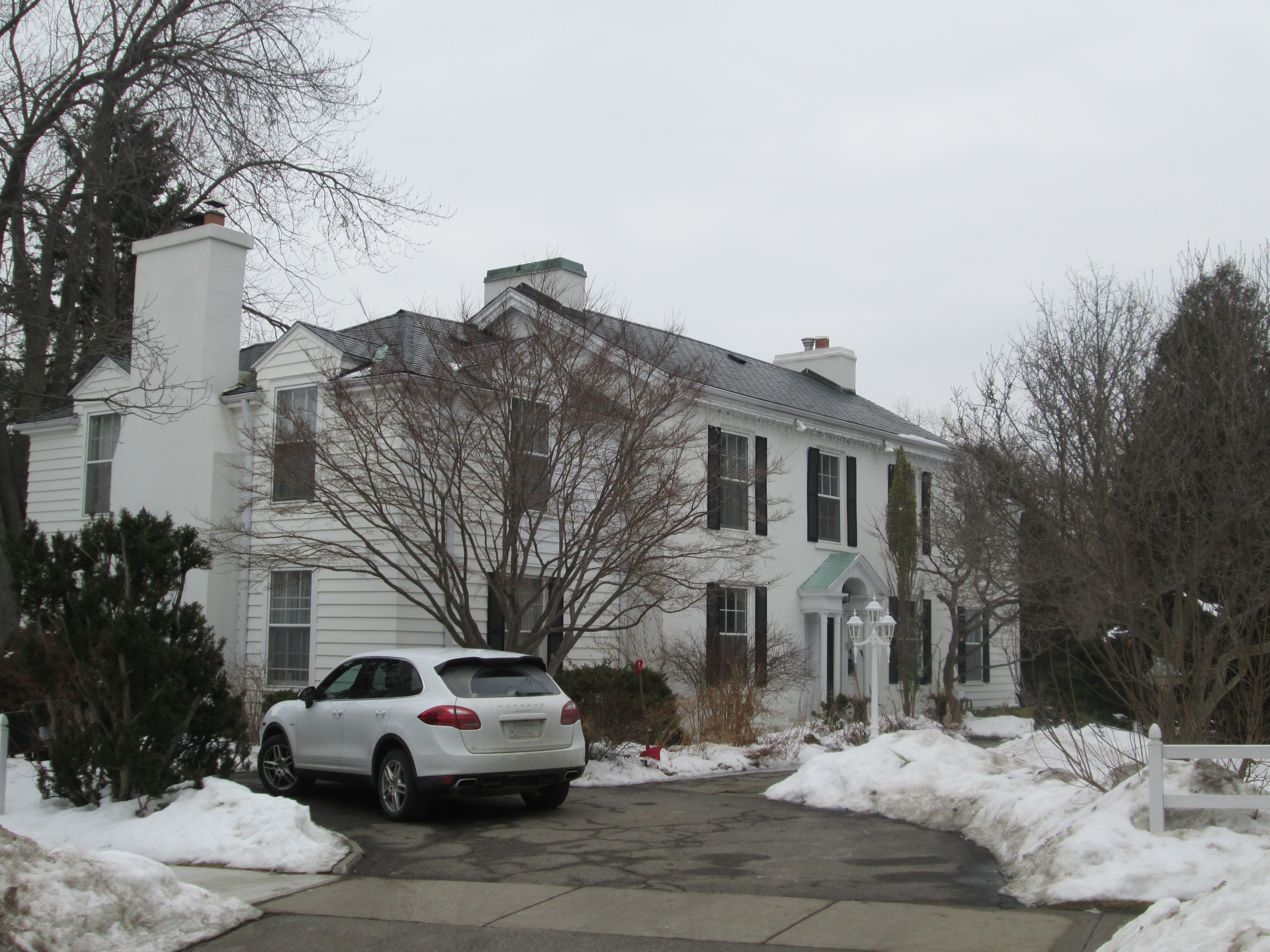
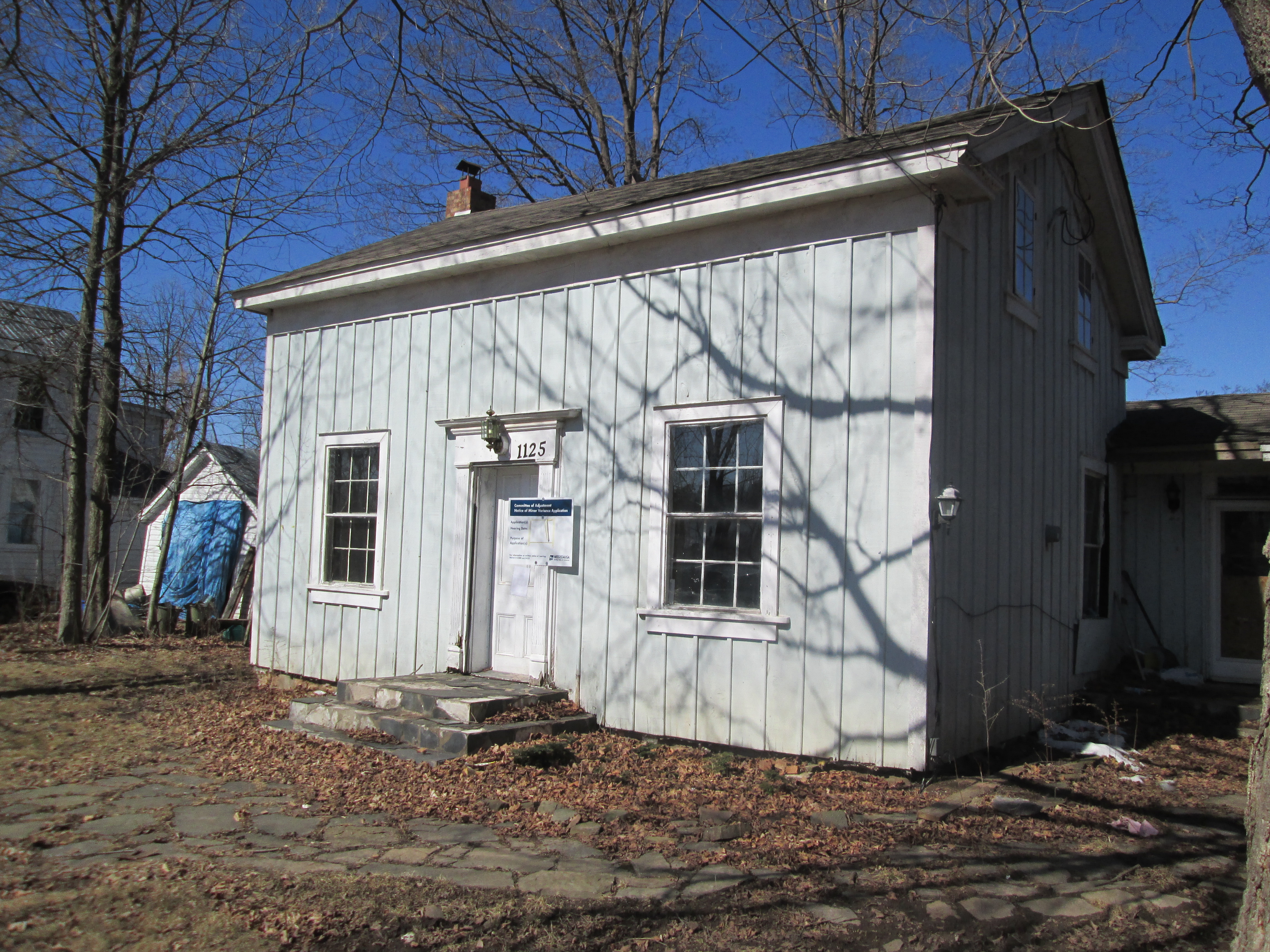
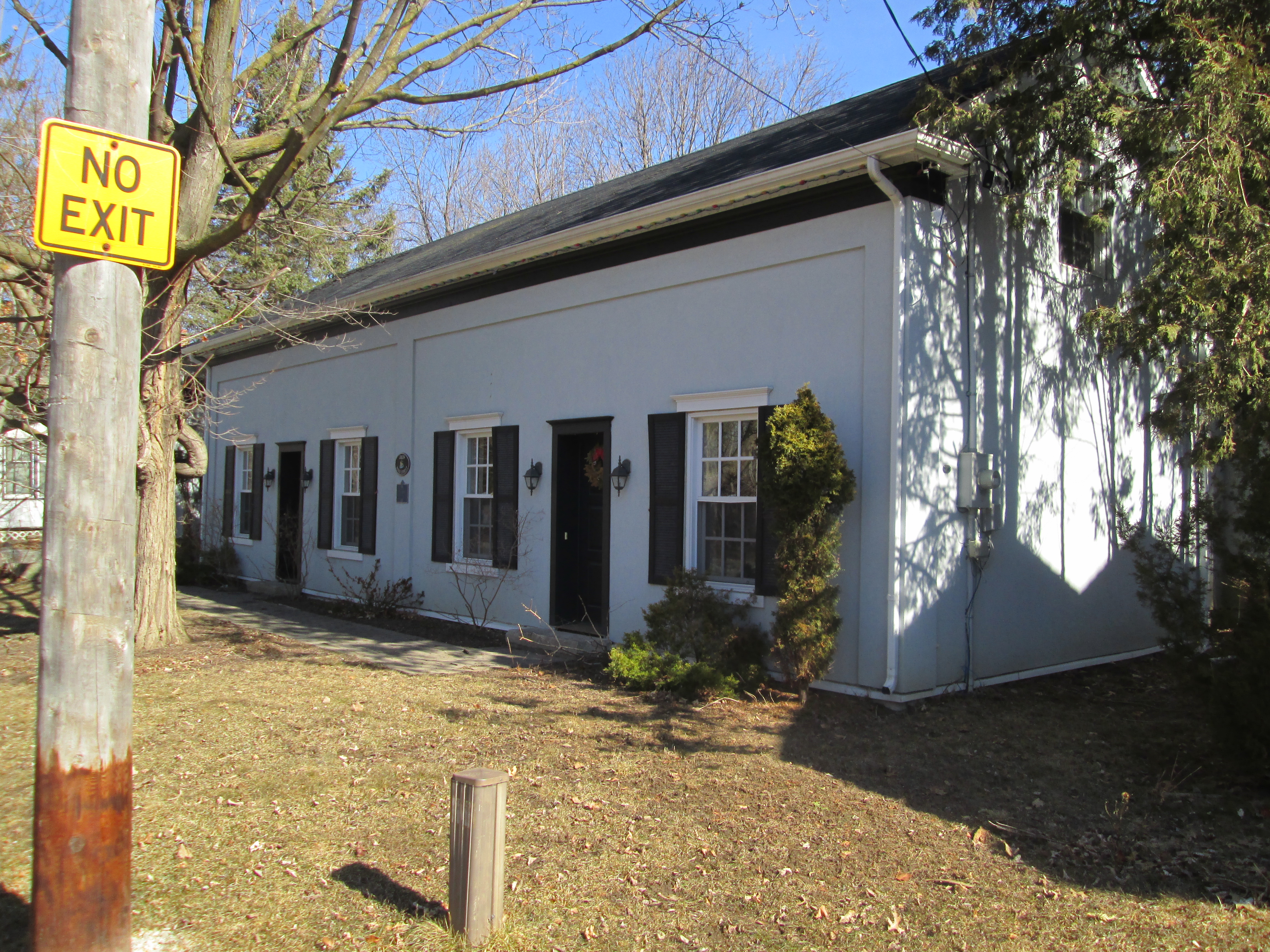
Willow Lane used to be known as Water Street and is home to some of the oldest houses in the village.  The house at 1125 Willow Lane is the oldest remaining building in town having been constructed in 1825 by John Beatty.  It later belonged to Crawford, Silverthorne and Gooderham as it seems to have changed hands with the ownership of the mills.

IMG_3058

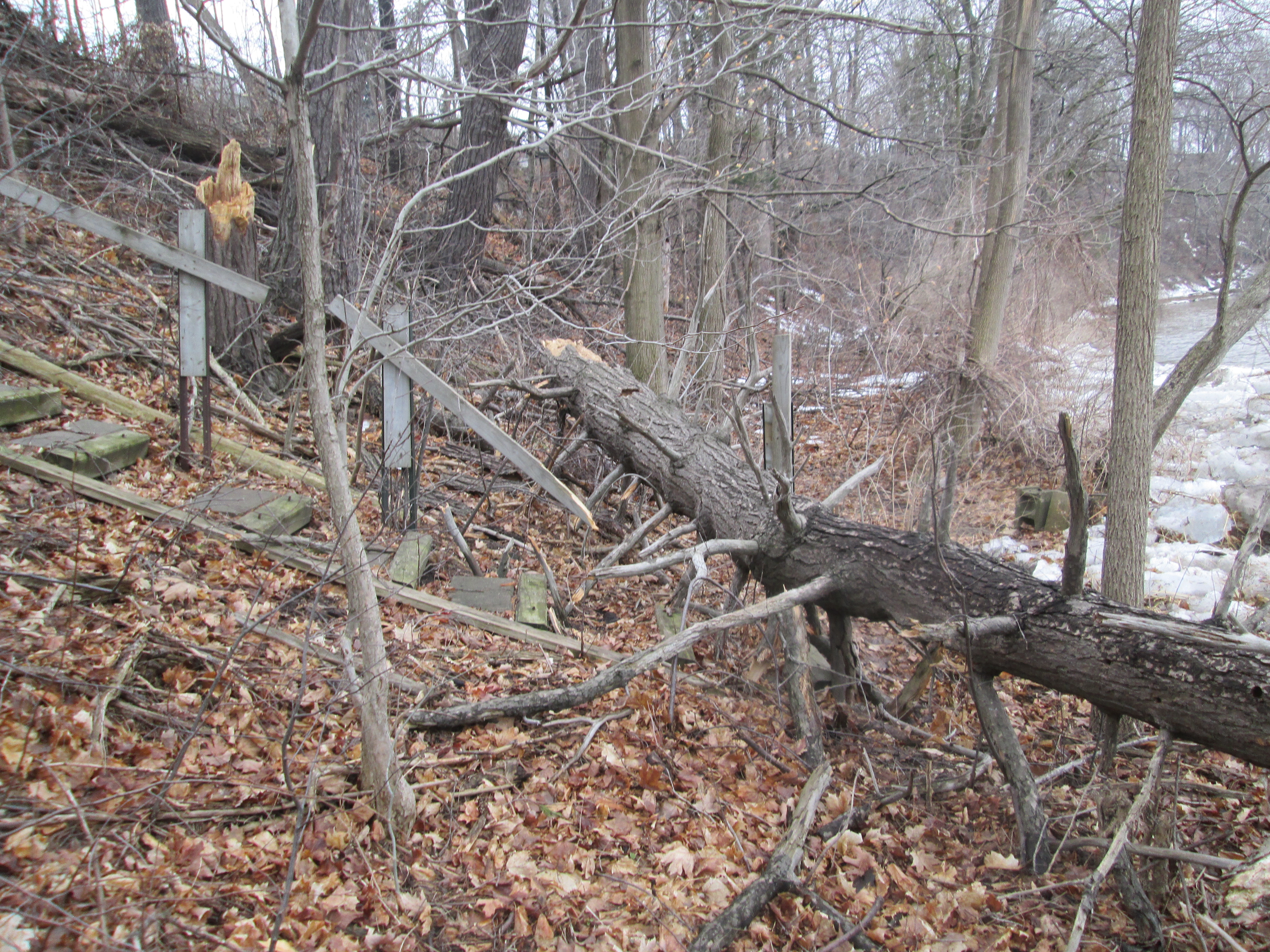
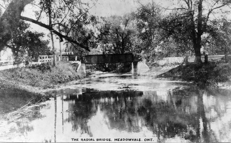
By 1917 Guelph was linked to Toronto via the Toronto Suburban Railway line.  It ran from Lambton to Guelph, passing through Meadowvale.  The line ran from 1917 until it was shut down in 1931 when travel between Guelph and Toronto had switched to bus and car on highway 7.  The tail race from Silverthorne’s mill ran between Derry road and Willow Lane. The foundations of the old suburban railway line remain but are badly crumbling.

IMG_3041

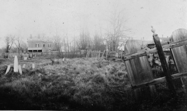
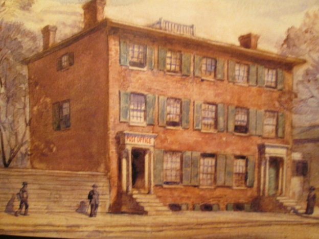
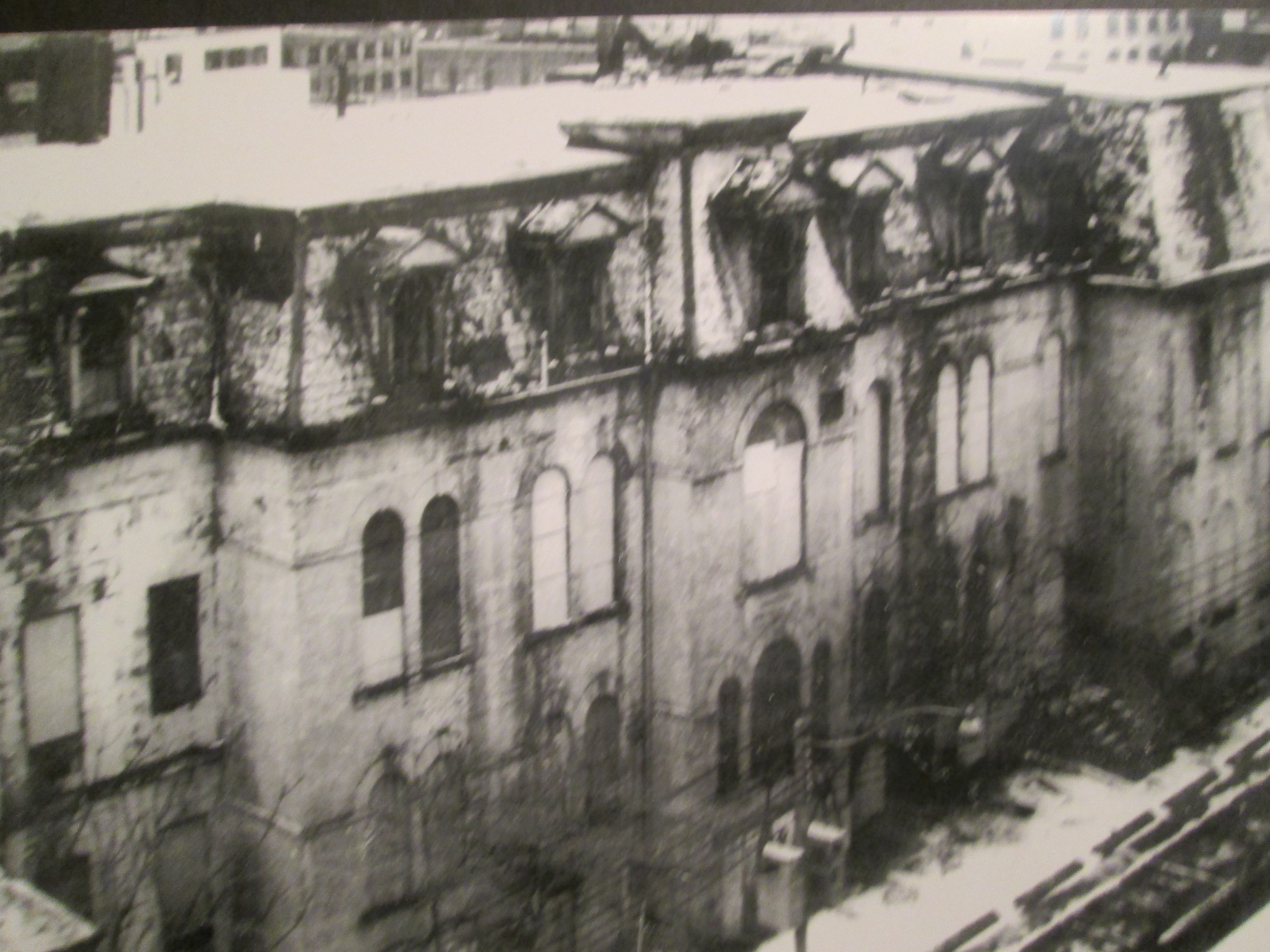
The picture below shows the railway bridge over the tail race in 1915.  The past 100 years have taken their toll on the bridge.  The route of the train is even less easily distinguished as a flood control pond has been built on the old right of way south of Derry road.

Radial Railway Bridge, Meadowvale, c1915

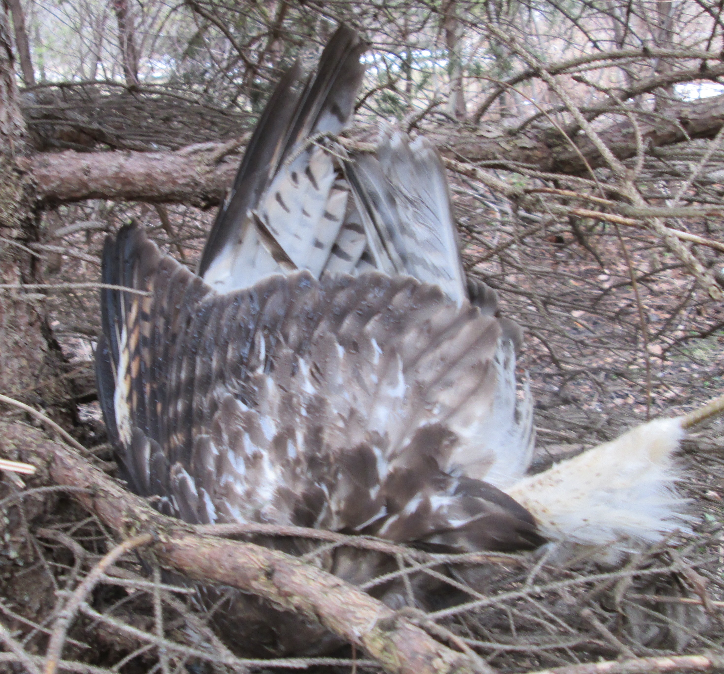
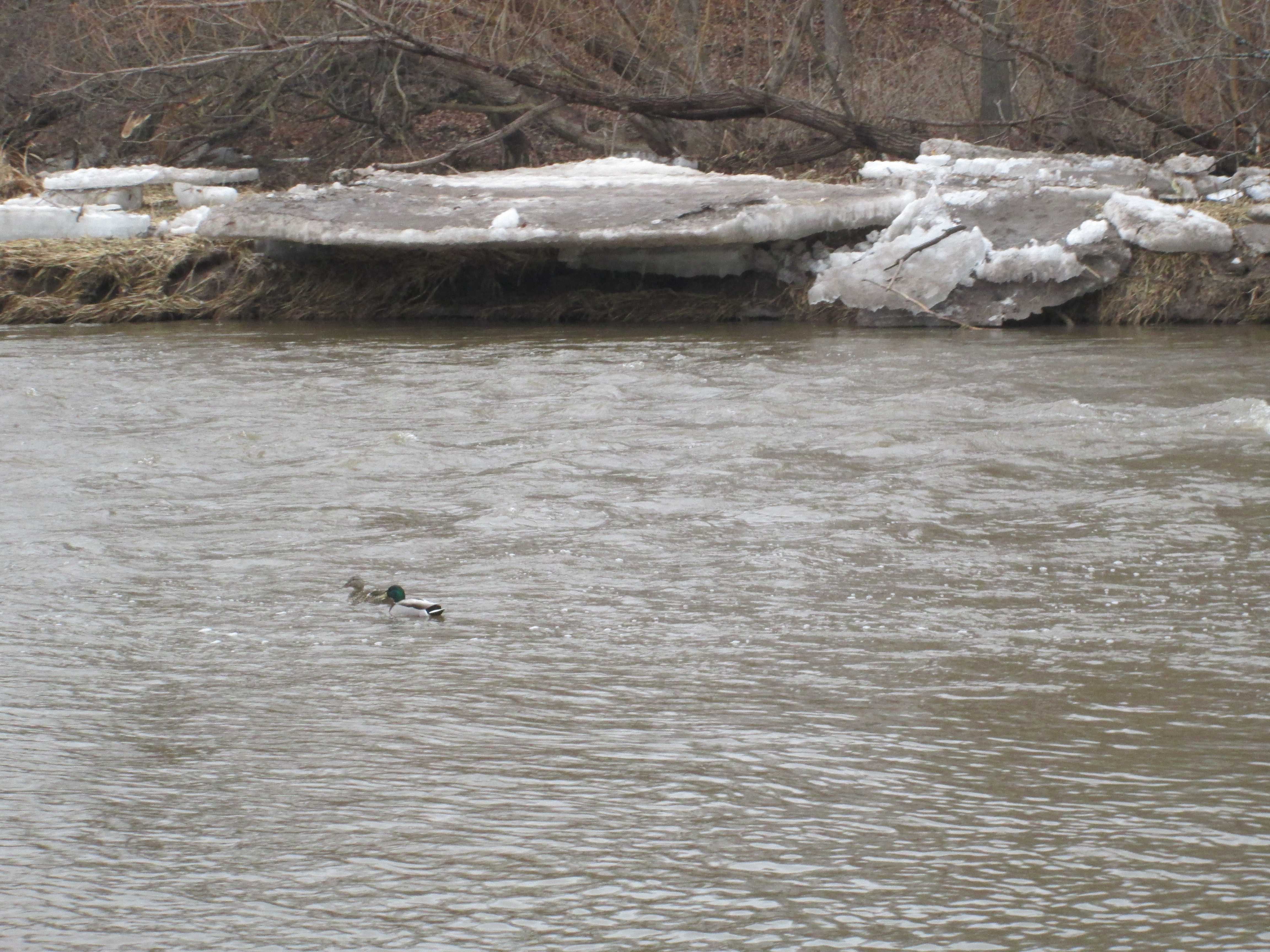
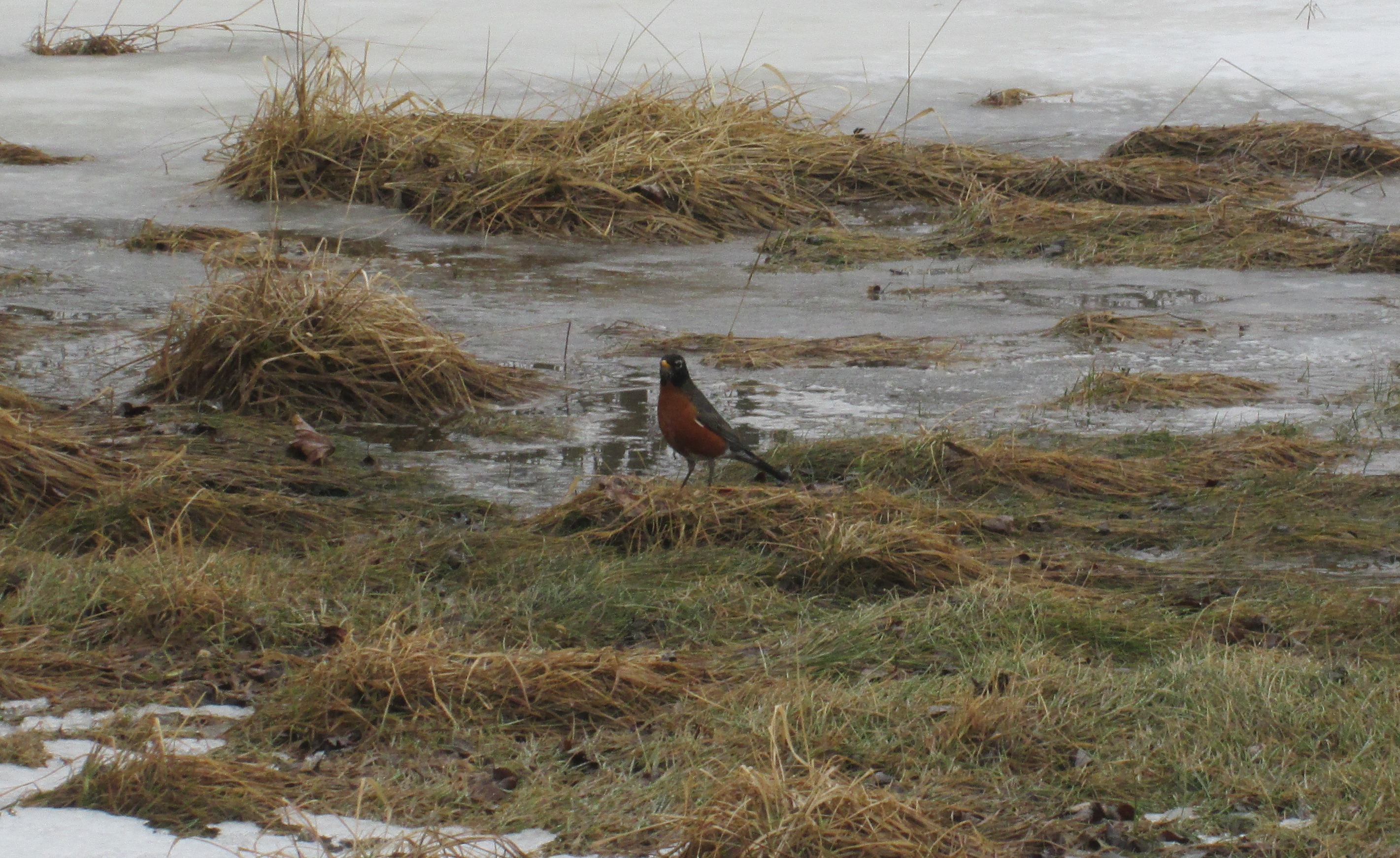
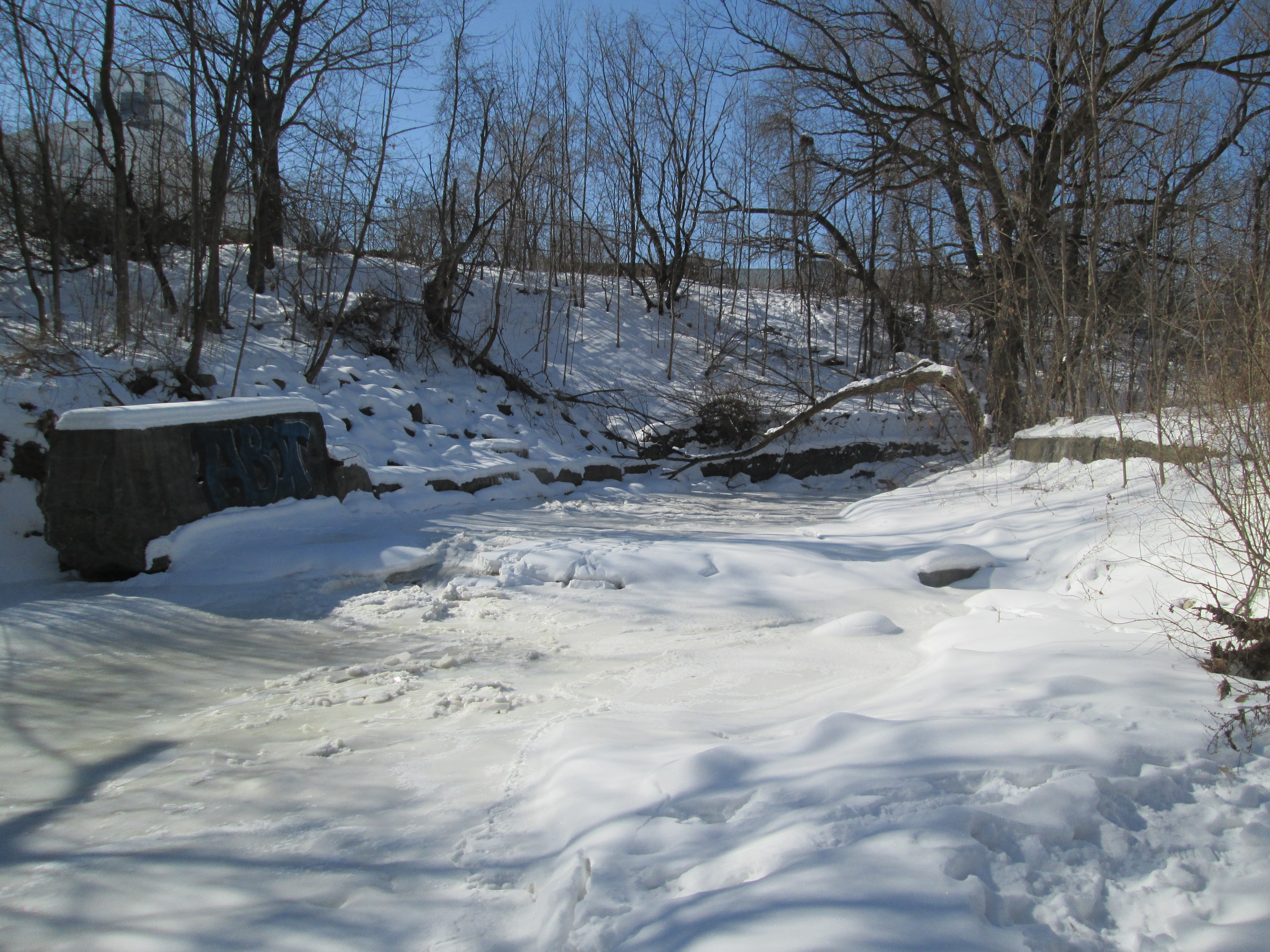
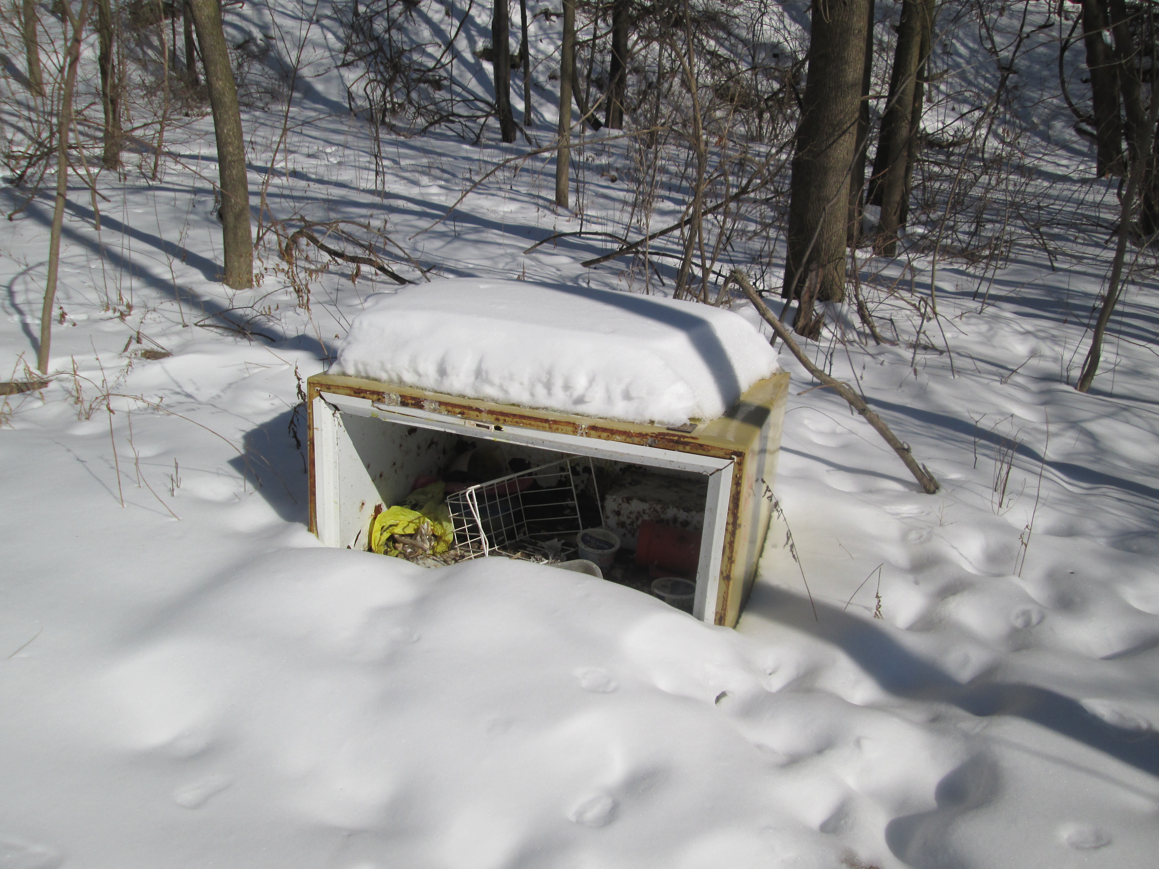
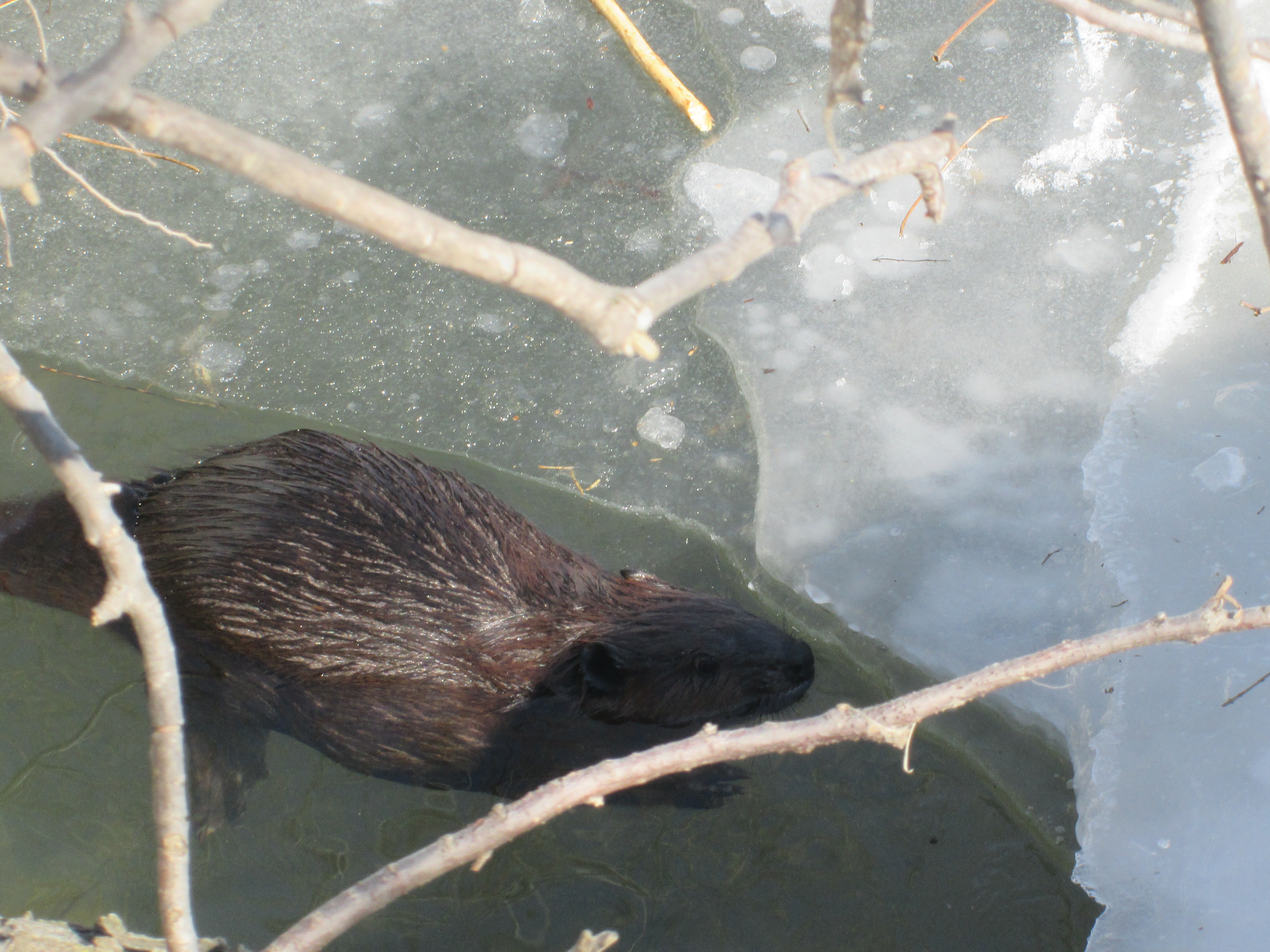
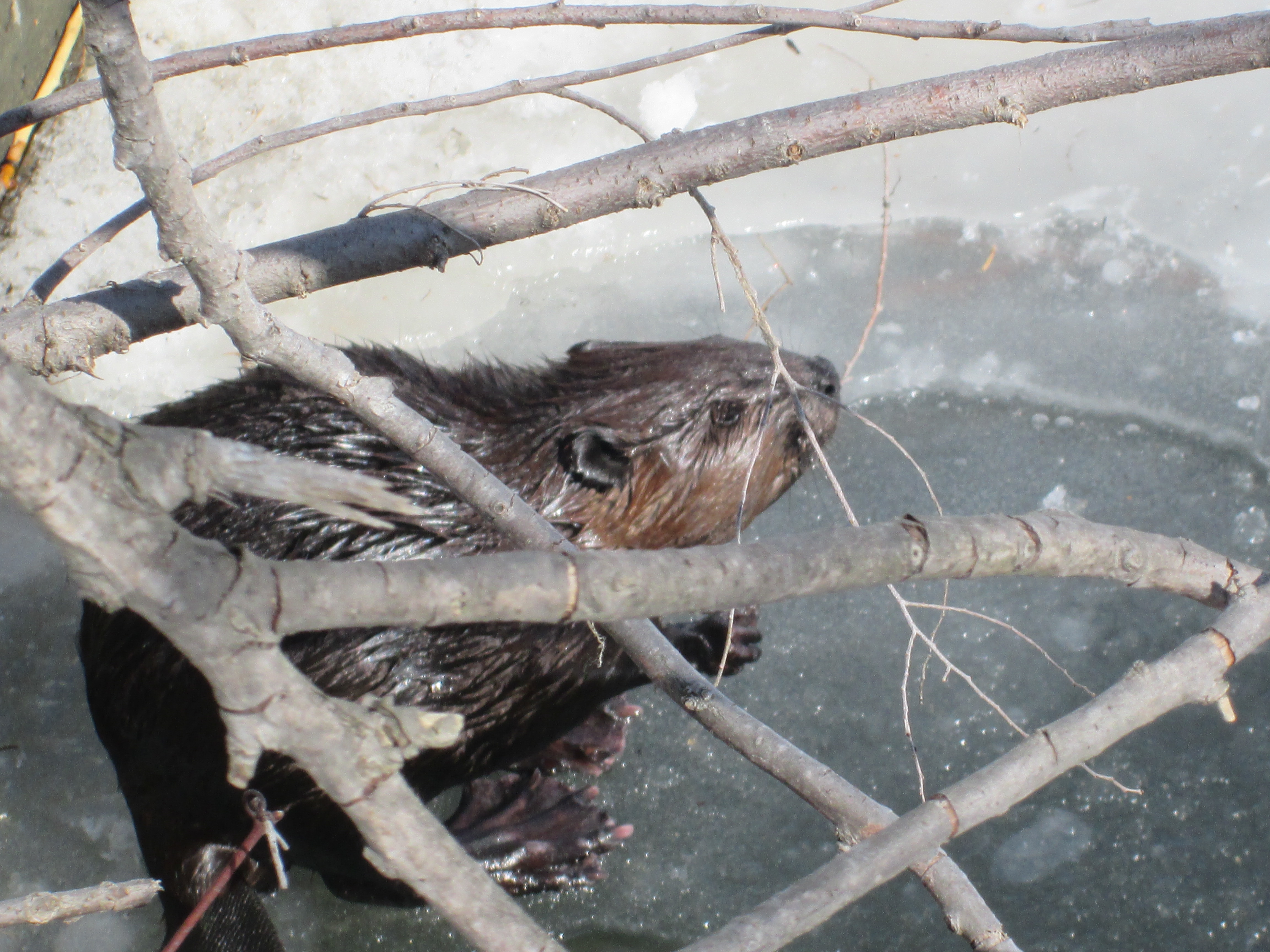
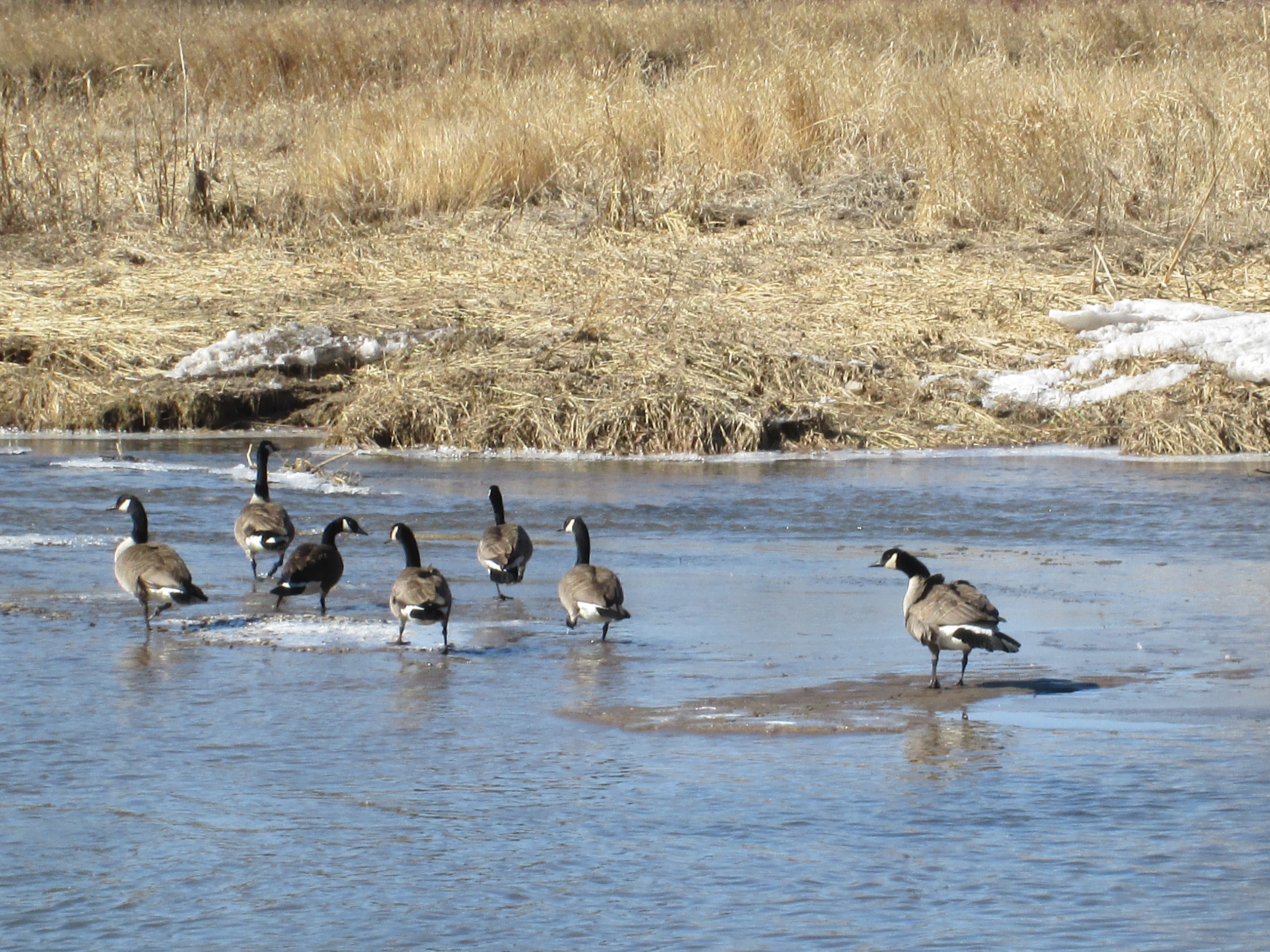
Walking along the river back to the car you could hear the rustle of slush in the river as it rubbed along the river bank.  We weren’t the only ones hiking up the Credit River.

IMG_3024


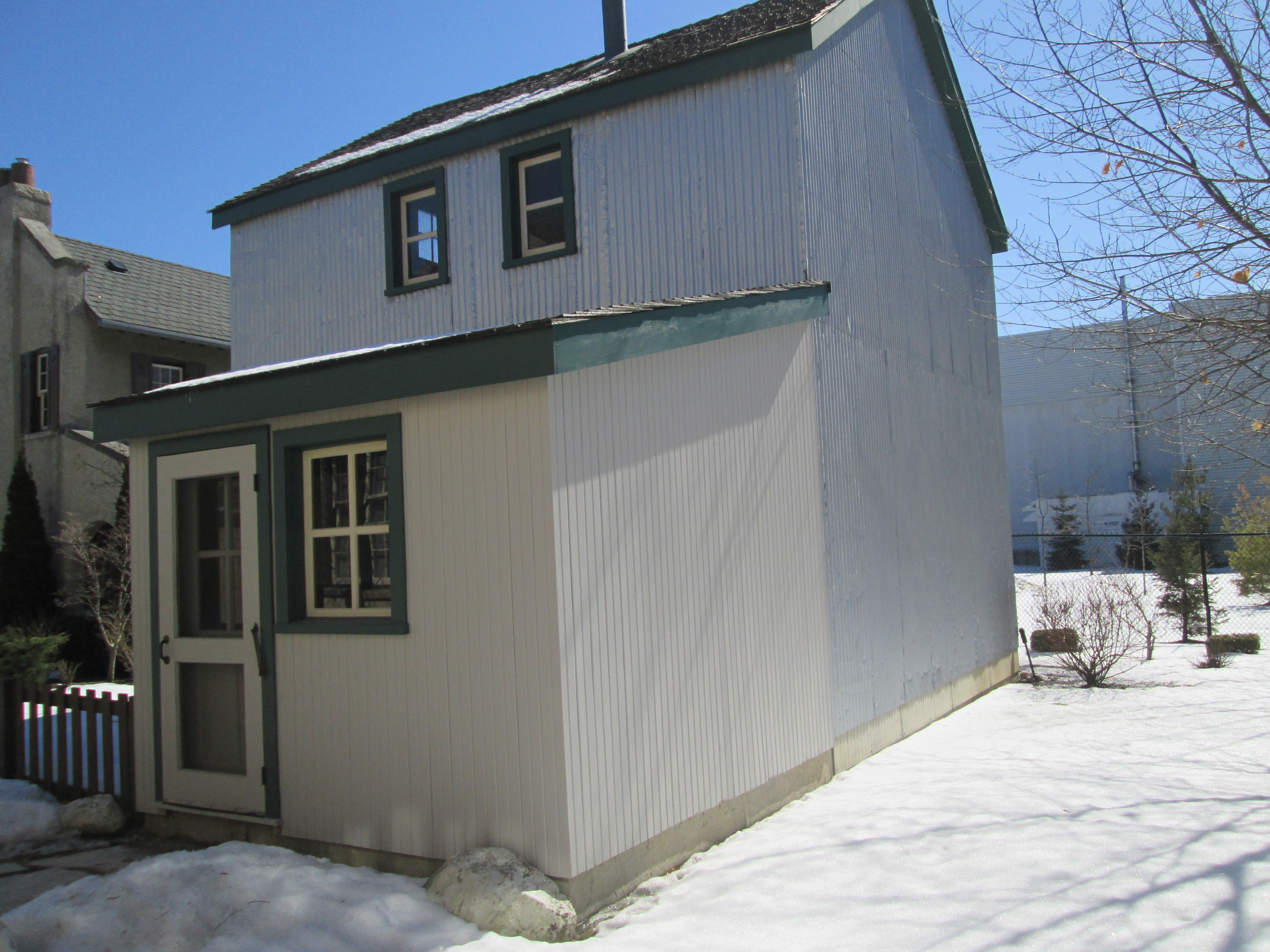
By 1856 the mill was a major employer in the village and Silverthorne built cottages for his mill workers at 7077 and 7079 Pond Street.

IMG_3124

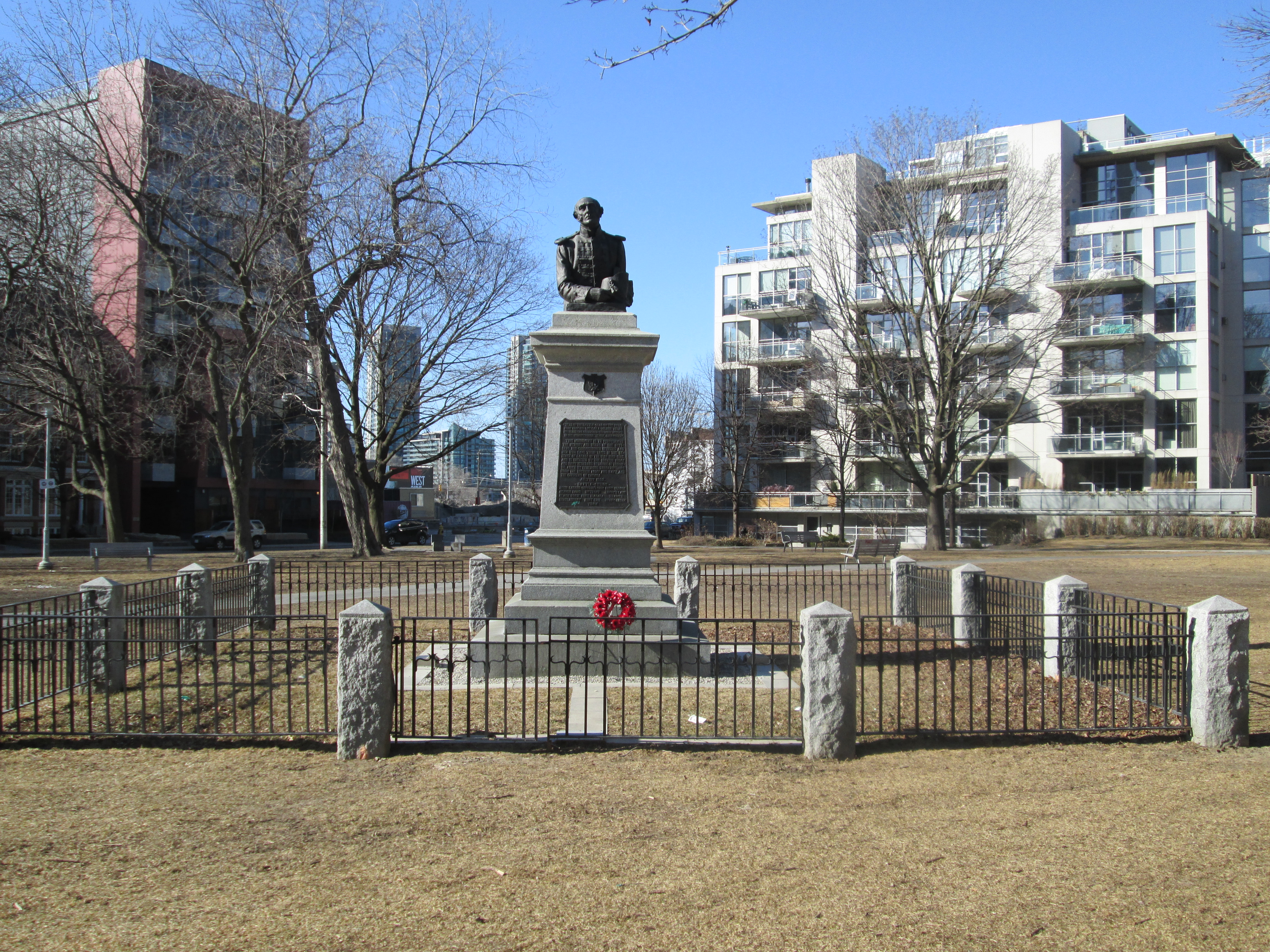
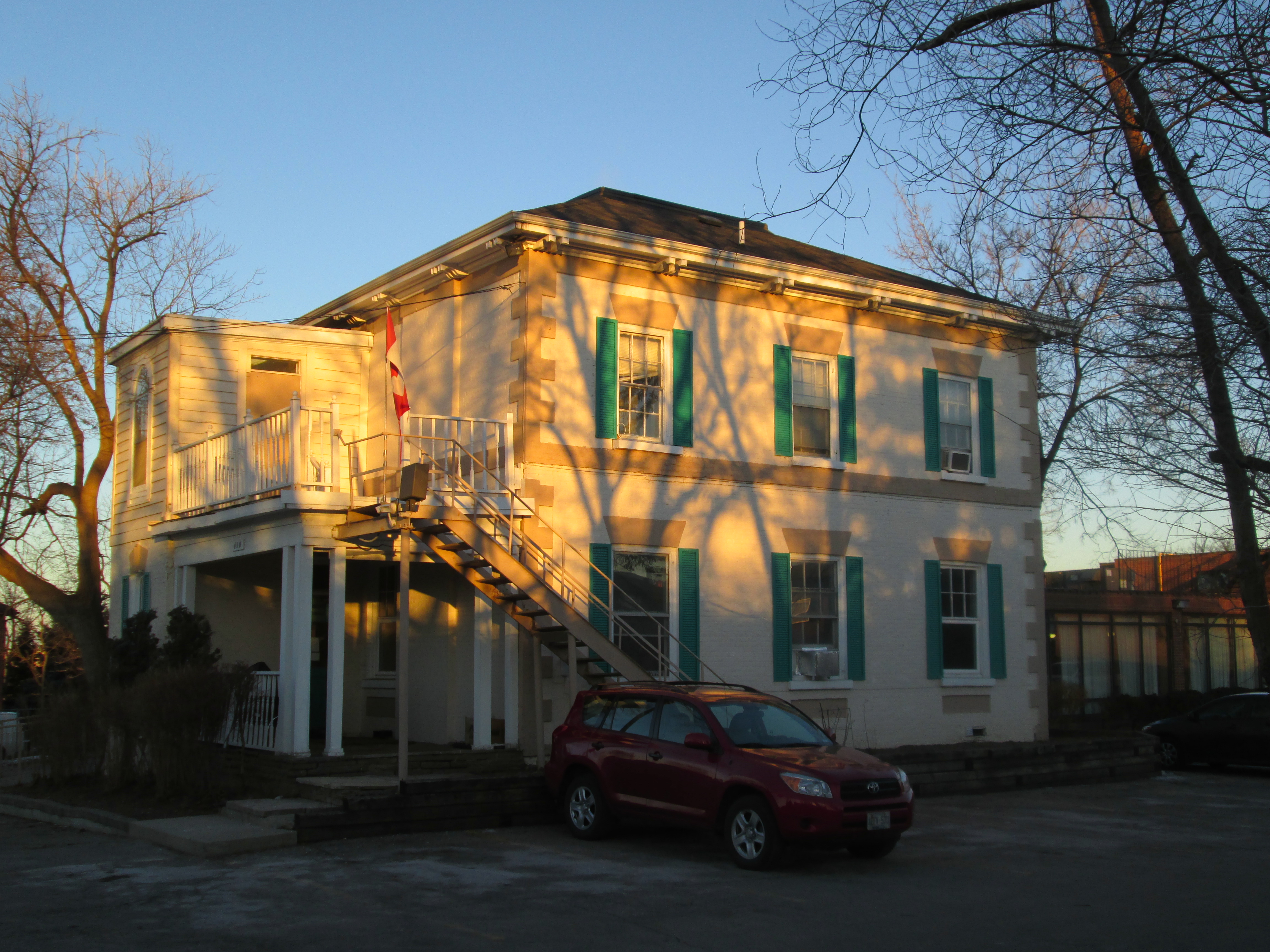
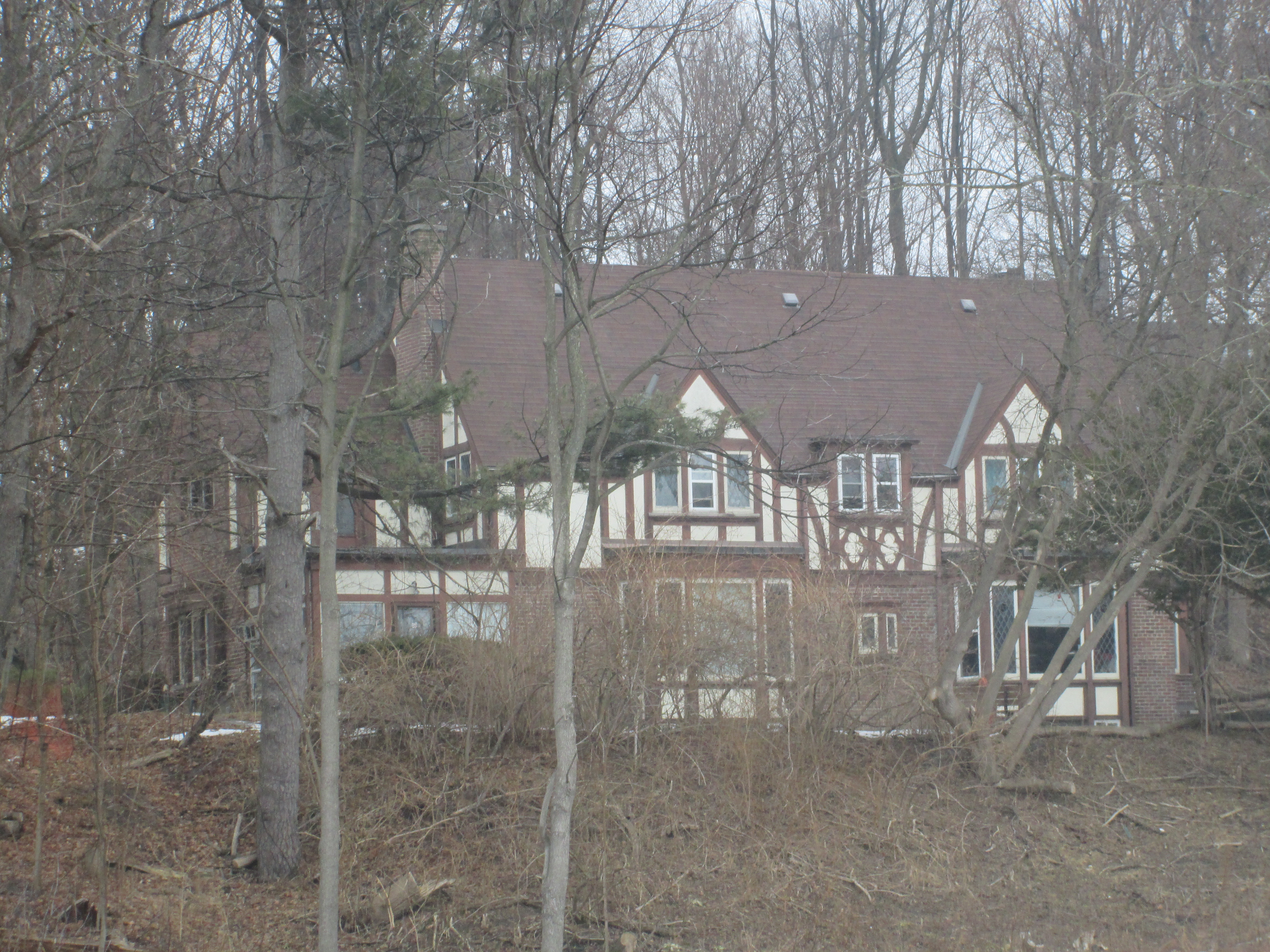
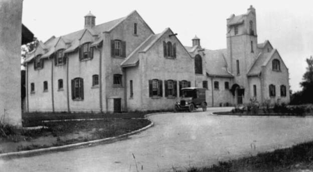
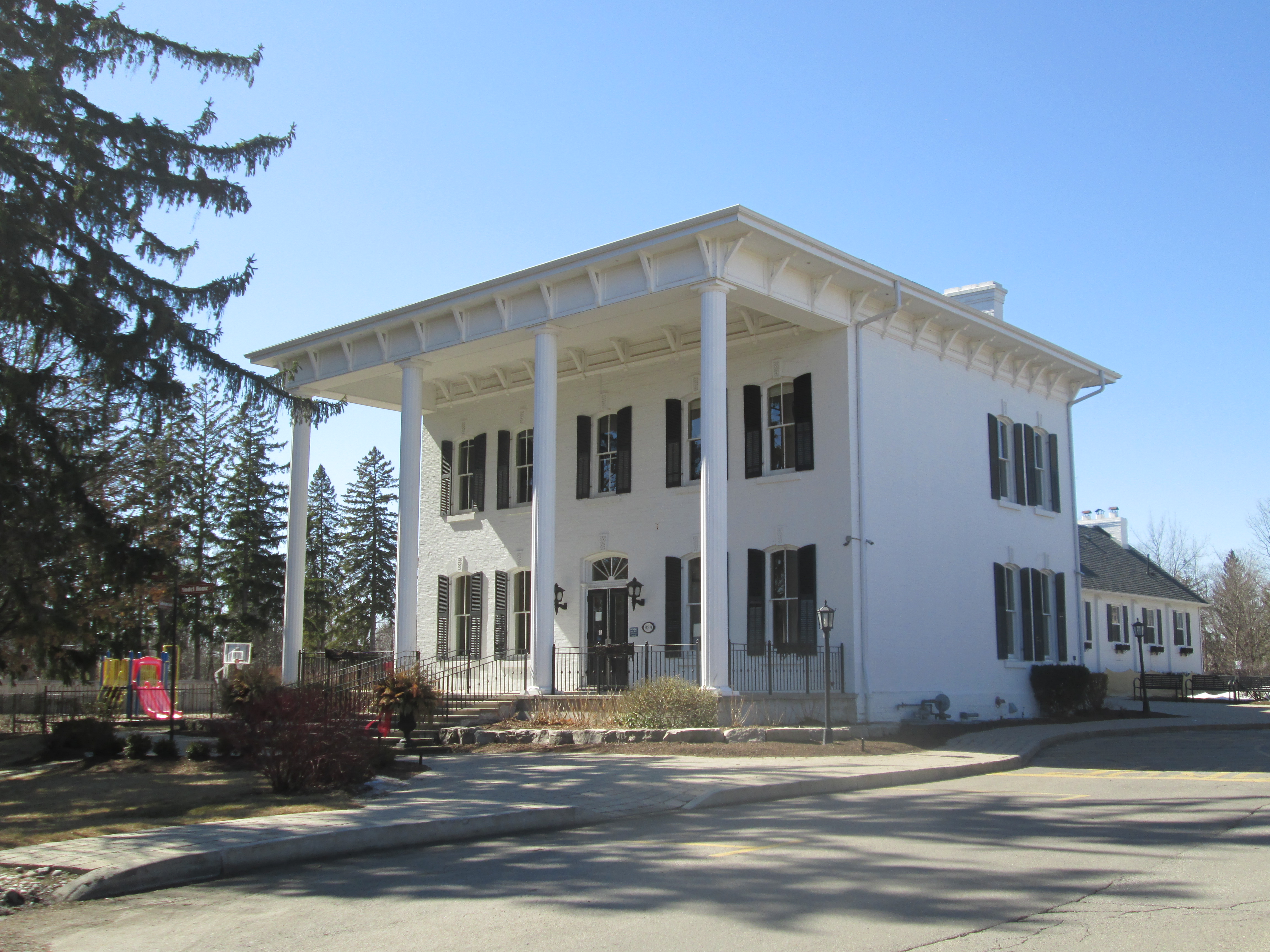
Charles Horace “Holly” Gooderham came to Meadowvale to run the mills on behalf of his father William Gooderham of Gooderham and Worts in Toronto.  In 1870 he commissioned a 21 room mansion that cost him $30,000.  The Gooderhams ran the mills, a cooperage and the general store in town.  When William Gooderham died in 1881 Holly left for Toronto and the estate was sold.  During the 1920’s it belonged to Samuel Curry whose brother, Walter, was a Member of the Legislative Assembly in Ontario from 1919-1923.  The house received several modifications over the years, including the oversized front portico and the white siding in the late 1970’s.

IMG_3094

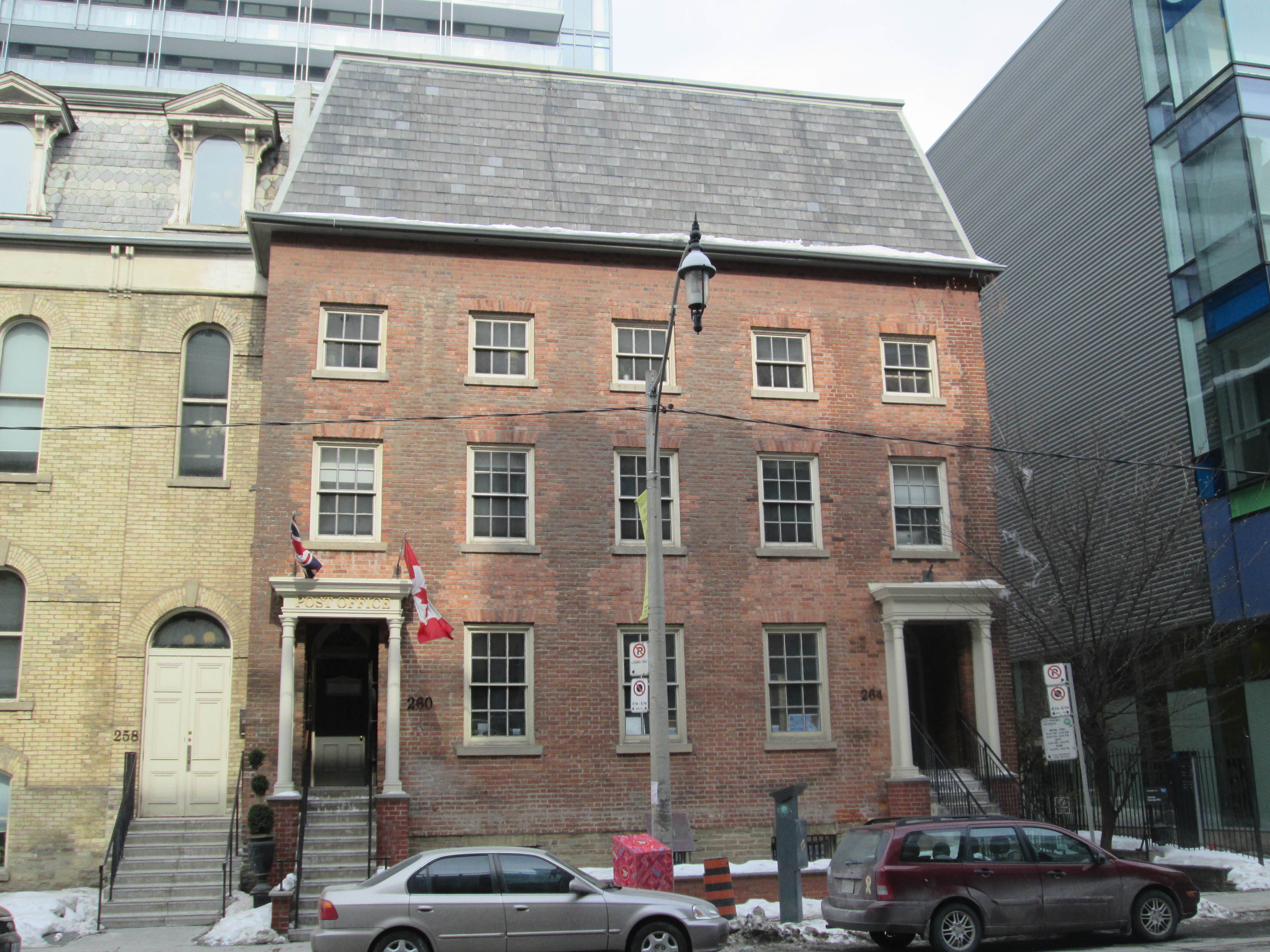
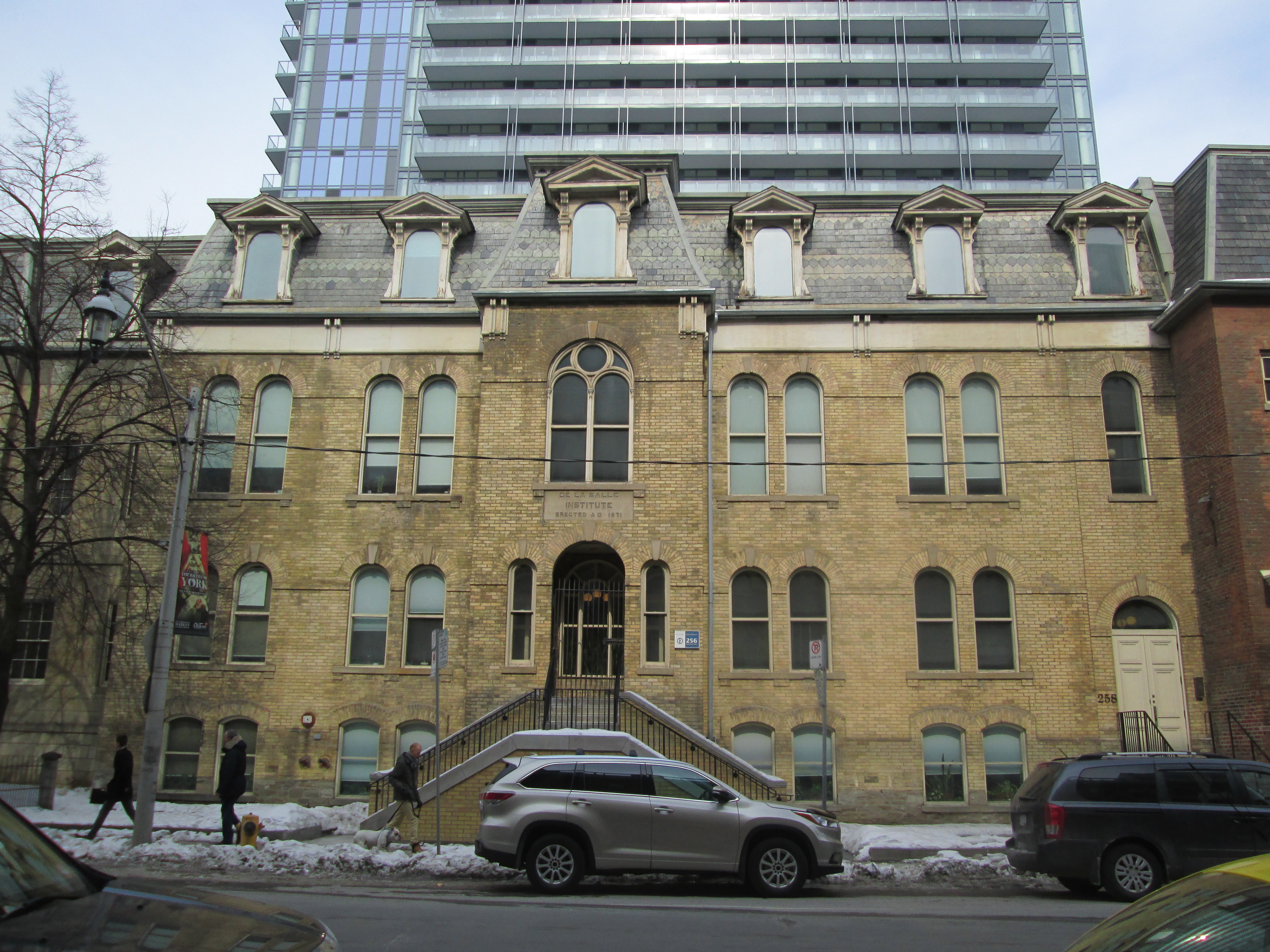
Meadowvale was the first community to be honoured with the designation “Heritage Conservation District“.  The original community survives, largely intact, complete with it’s narrow streets designed for horse and carriage.  There are many historic buildings in town which will form the basis of a companion post.


Military Burying Grounds

Sunday, March 22, 2015

It was minus 7 but sunny and not much like spring at all.  Having been at John and Richmond I had a short walk to Portland and Wellington to visit Victoria Memorial Park.

On July 29, 1793, a detachment of The Queen’s Rangers under the guidance of Lieutenant Governor John Graves Simcoe arrived from Newark (Niagara-On-The-Lake) and began work on Fort York. This was the founding act of what would become the city of Toronto.  Simcoe brought with him his wife Elizabeth and their seven children.  They lived in a tent near Fort York until their home at Castle Frank was built.  Katherine Simcoe was their youngest daughter, born on January 16, 1793, in Newark.  By Good Friday in 1794 Katharine had been feverish for two days while she was cutting teeth.  Before the day was over she would pass away.  On Easter Monday, April 19 she was laid to rest in a small clearing hacked out of the bushes a little north of their tent.  This was the first burial in the town of York (later Toronto).  This small burial grounds would become the garrison burial grounds until it was deemed full in 1863 and closed. Casualties of the Battle of York on April 23, 1813, are likely buried here.  Following the Battle of Stoney Creek in June of that year, the town of York became the hospital for anyone injured in the Niagara peninsula.  John Strachan had become the civilian leader of York after the retreat of the British and the occupation of the town by the Americans.  He presided over half a dozen burials a day in the summer of 1813.  After the cemetery was closed it remained British Military property but was left abandoned and forgotten.  In 1883 it was decided to transfer ownership to the city on condition that it be maintained as a public park. The cover picture shows the run down condition of the cemetery in 1884.

The Military Burying Ground is shown on Goads 1880 Fire Map but although Victoria Memorial Square Park is shown on subsequent maps the cemetery is omitted.  The cemetery was laid out facing magnetic east so that the occupants could rise facing the sun on judgement Day.

Military

The old cemetery is marked with a row of paving stones that run at an angle to the sidewalk within the modern park.

IMG_2958

As early as 1883 there was a plan to put a cenotaph in the middle of the park to honour those who had given their lives in service to the military.  A petition was made to local residents to identify any known burials in the cemetery as well as the regiments and companies represented.  (The most unusual claim is that LTE. Col. Francis Battersby brought the horses he used in the Battle of Burlington Heights on July 13, 1813, to the garrison burial grounds and shot them.  He preferred to bury them with honour than have them end up at a glue factory.)  It took until 1902 before a statue was started and it wasn’t finished until 1907. The sculpture on top is called The Old Soldier and was created by Walter Seymour Allward.  Allward would later commemorate Canadian war dead in France with his Vimy Memorial.

IMG_2952

Known as the Garrison Church, the Anglican Church of St. John the Evangelist was constructed in 1858 overlooking the burial ground.  It was replaced in 1892 with a red brick building which stood until 1963 when it was demolished.  The church was originally on the military lands but when Wellington Street was extended it cut the church off from the park.  All of the literature I can find as well as the interpretive sign in the park date the church to 1893.  The date stone is all that remains of the church and is a couple of feet from the sign that says 1893 but the stone clearly says AD 1892.  I think we should take the one carved in stone as being correct.

IMG_2957

Broad Arrow symbols once marked the four corners of Victoria Memorial Square Park claiming it as British Military property.  As a youth, Sir Sandford Fleming had surveyed Victoria Memorial Square Park and the military reserve around Fort York.  Fleming went on to become the Chief Engineer of the Canadian Transcontinental Railway and invented our modern system of 24 time zones.

IMG_2961

I walked from the park down Bathurst street to visit the military cemetery that was used after this one was closed.  The steel girder bridge on Bathurst near Front street was built in 1903 to span the Humber River but has been located here since 1916.  The chasm it spans contains more than what meets the eye.  Under the bridge, and running along the east edge of Fort York, is Garrison Creek.  The creek was the largest water course between the Humber and the Don rivers.  Pollution and sewage led the city to bury part of Garrison Creek in the 1880’s. By 1920 the entire creek had been forced into the sewer system and much of the ravine above it was filled in.  The bridge is named Sir Isaac Brock Bridge after the General who fell in the Battle of Queenston Heights on October 13th,1812.

IMG_2980

From Sir Issac Brock Bridge you can see one of the Community Canoe Gardens.  This project aims to re-purpose 12 old canoes and turn them into bee friendly garden planters.  The canoes are to be located along the former water course of Garrison Creek.  This one is where the creek used to flow along the edge of Fort York.

IMG_2978

From the bridge, you can also see the east gates of Fort York.

IMG_2965

When the Military Cemetery at Victoria Memorial Square Park was considered full a new burial ground was selected near the New Fort on the CNE grounds.  After less than a dozen burials this site was closed and the bodies removed to a location near Strachan Avenue at the west end of the Garrison Commons.  This had been the site of the American advance against Fort York on April 23, 1813, when the fort was captured and held for 6 days.  This cemetery was used to bury the military and some of their families.  It was closed in 1911 and the view below is from 1926 with the buildings of Fort York in the background.

Fort York Burying Ground 1926

The view from a similar position today has an entirely different backdrop although Fort York is still there.

IMG_2977

Today, the two sites in Toronto where our fallen soldiers lie are largely forgotten by the people who enjoy the freedom that they gave their everything to preserve.

Google Maps links: Victoria Memorial Square Park, Garrison Common

Like us at http://www.facebook.com/hikingthegta

Follow us at http://www.hikingthegta.com

Alpha Mills

Saturday Mar. 21, 2015

Spring officially started last night at 6:45 local time.  This morning was cloudy and dull with a wind that made the two degrees feel more like minus six.  A winter hang-over I guess.  We parked at the end of Alpha Mills Road where a walkway leads to the Credit River off Plainsman Road.

In 1825 Christopher Row(e) built a mill on lot 7 Concession IV where the river curves to the east, just north of Streetsville.   When J. Deady took over running the mill he renamed it Alpha Mills. It can be seen near the centre in the cover picture from the 1877 Peel County Atlas on property shown as belonging to Gooderham and Worts.  By 1877 there were 30 mills on the Credit River with 10 of them being textile related.  This was a localized industry that included the Barbertown Mills.

By the mid 1850’s Gooderham and Worts (G&W) had become the largest distillery in Canada and today their downtown manufacturing empire is preserved as 40 heritage buildings.  It is the largest collection of Victorian era industrial architecture in North America.  G&W began adding other mills to their holdings including Norval in 1845 and Hillsburgh in 1850.  In 1860 they acquired Alpha Mills and branded it as Alpha Knitting Mills.  G&W operated the mill until around the turn of the 20th century. William Gooderham’s grandson Albert would go on to purchase and gift a piece of property for Connaught Labs to the University of Toronto in 1917.  The 1971 aerial photo below shows the mill pond as the flat black area in the upper right corner.  The mill dam and water fall stretch across the river with the Alpha Knitting Mill building standing to the left just beside the dam.

Alpha

Not long after the photo above was taken the buildings and dam were removed and one of the most detailed diversion weirs I’ve ever seen was built in it’s place.  Storm water flows out of a buried channel and into these eight slots.  The concrete is curved upward to prevent things from washing over the edge and choking the system below, in this case it is this winter’s ice sheets.  The curve of the concrete gives the optical illusion that the water is flowing up hill.

IMG_2861

From the bottom of the storm drain looking back up there are 8 rows of concrete pillars with half-round steps in between.  For most of the length they are divided down the middle by a concrete wall.

IMG_2930

The long cold stretch of below freezing weather throughout February of this year froze the Credit River to a depth of up to two feet,  When the snow finally started to melt, the water level in the river increased under the ice, snapping it into large sheets which then washed up on the shore.  In the picture below they are stacked up four high.

IMG_2902

As we walked north up the west side of the river we crossed large chucks of river ice.  The piece of wood in the picture below has been trimmed clean by the local beaver.  It is rounded at both ends and all the bark removed.  Rather than construction material, this has been a food source for an example of Canada’s largest rodent. Once on shore, the river ice tends to melt in one of two ways.  The example in the picture below shows a slab of ice cut through by hundreds of small holes.

IMG_2905

In other places the ice is full of thousands of fine cracks that cause it to shatter into little shards. Either way, the ice is melted much faster than if it just melted along the exposed surfaces.

IMG_2904

I don’t usually post pictures of dead animals, although we see all kinds of them, but this Kestrel was wedged upside down in a pine tree.  There was no obvious cause of death and it appeared to have happened very recently.  Quite possibly it flew into the tree in the dark and broke it’s neck although this kind of accident must be quite rare.  It is considered rare, but birds do suffer heart disease, making this another possible explanation.  Or this kestrel might simply have been doing it’s impersonation of Kessel.

???????????????????????????????

Having made our way to Creditview road we crossed on the bridge and started back up the other side. While walking along the river at this time of year it is important not to walk on any shelf of ice that might be close to the river edge.  I suspect that, had we stepped on this shelf when we passed, we wouldn’t have enjoyed the water quite as much as the two ducks in the picture below.  Like these ducks, it was obvious that the bird kingdom has started to count itself off into breeding pairs.  Cardinals, Buffleheads and Canada Geese were also seen to be paired up.

IMG_2908

There is only a short stretch of the east river bank that is safely passable at this time of the year. The bank of the river on this side is full of new growth and bramble.  At one time several of the homes on top of the ravine had built wooden or concrete stairs to access the river side.  The tree that has taken out this abandoned set of stairs looked like fair warning and so we returned to Creditview Road.  Sir Monty Drive provides a short cut back to the park without having to walk too far on roads.

IMG_2909

The park on the east side of the river is accessed from Sir Monty Drive and has a maintained trail on it.  This part of the river is known as River Run Park.  Large clusters of teasels grow along the trail.

IMG_2916

Someone has taken the time to cover this old well with a roof but the current dwelling is at the top of the ravine.  Perhaps an earlier home stood closer to this water source making the task of bringing water to the hill top unnecessary.

IMG_2917

Visit us at http://www.facebook.com/hikingthegta for a gallery of additional photos.


Downsview Dells

Saturday March 14th, 2015

It was a couple of degrees above freezing when we parked in the Downsview Dells parking lot south of Sheppard.  With one week left before the official start of spring, there are finally some signs that it is coming.

Bartholomew Bull bought a farm on lot 8 concession 3 (west of Keele between Lawrence and Wilson) in 1830 and gave it to his 2 year old son, John Perkins Bull. When John got married in 1844 he settled on the farm and named it Downs View.  He opened his house up as a place for religious services and during the 35 years he spent as Justice of the Peace he held court in his house and locked the convicts up in the cellar.  The house is currently in use as North Park Nursing Home.  Hopefully they don’t lock up the patients in the old jail.

IMG_2860

When this park was created in 1960 it was named Black Creek Park.  The name was soon changed to prevent confusion with Black Creek Pioneer Village.  Black Creek flows from its headwaters in Vaughan to where it empties into the Humber River in the middle of Lambton Golf and Country Club.  Golf balls are a frequent sight along Toronto’s parks and ravines.  A golf ball will have between 300 and 500 dimples on it, with the number 366 being used frequently. Early in the history of golf, players noticed that older balls with nicks and bruises on them went further. These marks create turbulence in the layer of air closest to the ball and increase the distance the ball travels.  The dimples on the ball are there to act as turbulators. We found a Lambton golf ball that wouldn’t be out of place a few kilometers south of here.

IMG_2857

As we headed south down the west side of the creek we found ourselves climbing in and out of little valleys and hills.  A dell is a small treed valley.  When the name was changed from Black Creek Park to Downsview Dells it was certainly appropriate.  The cover photo shows the entrance to the park in 1963.

IMG_2821

One of the first sure signs of a change in the weather is the revival of those creatures that hibernate.  Not all spiders hibernate.  Many of them produce an egg sac and then die in the fall. Others build a nest inside the bark of a tree or in a rock pile.  At one point we found a split in a rock and dozens of tight little spiders nests inside.  When the weather warms up in the spring they hatch or wake up.  We saw this little spider hanging from a sumac tree.  Later we saw another spider of a different variety.  It was very tiny and perhaps a new hatchling.

???????????????????????????????

The American Robin migrates south and returns along with the warmer weather.  We saw a large flock of them making their way along the muddy ground listening for worms.  With the ground still frozen below the surface the worms are not yet accessible but at least the spiders are.

???????????????????????????????

A further sign of spring is the open water on the creeks and rivers in the city.  Two weeks ago we were able to cross at will.  The water has not crested yet and it will continue to rise until the snow is melted and the ground thaws out.  With the slow melt this year we may avoid some of the more serious flooding that a quick melt can cause.

IMG_2822

This giant paper wasp nest is about the size of a soccer ball.  Notice the buds on the tree which are starting to open.

IMG_2846

In the 1930’s the Great Depression resulted in many homeless men drifting through Toronto looking for work.  The original Seaton House was built in 1931 to provide food and shelter for some of these men.  In it’s current facilities since 1959, it has housed up to 900 men at a time, making it the largest homeless shelter in the city.  Seaton House also operates Downsview Dells.  This drug and alcohol rehab centre is tucked within the northern end of the park.  It houses 30 men who are referred there from Seaton House.  The house has a no trespassing sign on the side but is clearly visible from the park.

IMG_2843

Perhaps the high success rate is due to the Ent who stands guard near the drive way to the rehab centre.

IMG_2797

Connaught Labs

Thursday March 12, 2015

Thanks to my friend James, who hooked me up with historian Christopher Rutty, I was able to have a lunch hour tour of the museum at Sanofi Pasteur.  I have worked at Dufferin and Steeles for 17 years and often wondered about the history of the fancy old buildings near the south east corner.

Fisherville was named after the Fisher family.  Jacob Fisher emigrated from Pennsylvania with 22 members of his family in 1797. They were granted lots 25 and 26 which were on both sides of Steeles, east of Dufferin street. They ran a saw mill on the West Don River and later a grist mill which operated with different owners until about 1912.  By the 1870’s the property had been divided and was under several owners with the Fisher house and mill in the hands of G. H. Appleby.

John G. Fitzgerald was born in 1882 in Drayton Ontario.  He attended the University of Toronto medical school where he graduated at the young age of 21.  In 1913 he became the professor of hygiene  at the university.  Using his wife’s inheritance money he built a back yard stable on Barton street and acquired a couple of horses.  He began to produce the antitoxin for diptheria which he sold to the Canadian Government at cost for free distribution.  The university decided to back him and in 1914 the Antitoxin labs were opened.  The original stable was in danger of being demolished and has been moved to the Fisherville site. One side of the stables has no windows because it used to stand against another building in it’s original location.

IMG_2787

Inside, the old stable has been restored and served as a museum to celebrate the 90th anniversary of the antitoxin labs.

IMG_2785

Albert Gooderham was the grandson of William Gooderham of Gooderham and Worts distillery and served as chairman of the Ontario branch of the Red Cross.  With the outbreak of World War 1 there was a shortage of tetanus shots for the soldiers.  In order to increase production, space was required to increase the number of horses that could be cared for.  Albert took John G. Fitzgerald for a country drive one day in 1915 and ended up at the old Fisher farm, now abandoned, but still complete with the mill and pond.  Albert bought the property and built the labs and stables which were opened on October 25, 1917.  The Connaught Antitoxin Laboratories and University Farm was named after the Duke of Connaught, Canada’s governor general during WW1.

The cover photo was borrowed from the Sanofi Pasteur Canada Centenary Facebook page which I highly recommend for additional information on this historical site.  It shows the antitoxin labs with the company truck, also donated by Gooderham, which made the 20 mile trip back and forth to the university a couple times per week.  The photo below shows the labs today.  The middle section between the two towered ends of the right hand building contained stables while labs and production facilities were located in the rest of the two original buildings. The original 1913 stable has recently been relocated between the two 1916 buildings to form a heritage square.

IMG_2793

Horses were essential to the production of antitoxins.  Horses can be safely injected with small amounts of toxins that have no negative effect on the animal.  Their bodies produce an antitoxin that can be removed and administered to a human to make the person immune to the toxin. Horses were bought by Fitzgerald that were headed for the glue factory and given new life as living antitoxin producers.  For example, one horse could produce enough tetanus serum for 15,000 soldiers during WW1.  The picture below is from a January 25, 1928 Macleans article, but taken from the same Facebook page as the cover photo, describing how this horse and one other produced enough meningitis serum for all of Canada.

10415675_716544785058280_2051002745778299447_n

Prior to the discovery of insulin a person who had diabetes pretty much had a death sentence. In 1920 Dr. Frederick Banting had the idea that led to the discovery of Insulin.  He brought the idea to the University of Toronto where a small experiment was set up using dogs.  When human trials were successful a large scale production method needed to be perfected. Connaught Labs had the ability and in 1923 they began a sixty year history of supplying all the insulin used in Canada.  The historical insulin vials in the picture below are on display at the museum.

IMG_2781

Fitzgerald passed away on June 20th 1940.  His desk, chair and an early ledger have been preserved in the heritage museum.  The picture above the desk shows the early days of Connaught Labs and he kept it above his desk at the university.

IMG_2779

Connaught Labs pioneered the process of growing the poliovirus in rocking glass bottles that became known as the Toronto Method.  It involved culturing the virus using a purely synthetic tissue culture known as “Medium 199”. In 1962 Connaught Labs licensed the Sabin oral polio vaccine.  I was likely among the first people to be administered this vaccine.  Connaught Labs also played a key role in the eradication of small pox.  Povitsky bottles used for the Toronto Method are seen in the lower right of the display below.

IMG_2782

In 1972 the University sold Connaught Labs to the Canadian Development Corporation making it a “for profit” company for the first time.  Mergers and expansions in 1989, 1999 and 2004 resulted in the formation of Sanofi Pasteur which employs 1,100 people in it’s Toronto facility. Over the past 100 years they have played a key role in the development of public health in Canada and have a vision of a world in which no one suffers or dies from a vaccine preventable disease.  Nearly a hundred buildings, including research facilities, have been constructed on the compound which can be seen outlined in red in the recent photo below.  The two buildings that started it all are in the lower right of the property.

10616072_747052018674223_20829204398845157_n

The farm where Jacob Fisher settled his family and built his mill has been used to save the lives and reduce the suffering of countless millions of people around the world.  I think Mr. Fisher would be very proud of how the farm he worked so hard to clear over 200 years ago is being used today.

Old Cummer Road

Sunday, March 8th, 2015.

It was the first bright sunny day of plus temperatures at an enjoyable 2 degrees.  With the clear blue sky, sunshine and melting snow you could start to believe that spring might actually come after all.  I parked on Pineway Blvd where Old Cummer used to cross.

Jacob Cummer (Kummer) was born in 1767 and married 16 year old Elizabeth Fisher in 1791. They came to Upper Canada in 1797 and made their way north from York.  Jacob built a log house at Yonge and Eglinton where his wife and 3 children spent the first winter.  The following year they took possession of 300 acres about 6 miles further north.  The Cummers were the first settlers in what would be known as Kummer’s Settlement and later as Willowdale.

Jacob established himself on lot 22 (the second lot north of Finch).  His lot ran from Yonge Street east to half way between the first line (Bayview) and the second line (Leslie).  In 1819 he built a saw mill on the East Don River that five generations of Cummers would operate.  Jacob had a store on Yonge Street where he ran the first post office in the area.  He donated land for the Methodist church and is buried in it’s graveyard.  To allow people to access his mill he built a road along the north edge of lot 22 from Yonge Street to Leslie Street which we call Cummer Road today.  A grist mill was built to the north on lot 23 and a woolen mill was added as well. A large industrial site grew up along the river because of his road.  From where I parked the old road runs a short way east to the Old Cummer GO train station which further commemorates the founder of the neighbourhood.  The road no longer crosses the train tracks but continues east of here to Leslie Street as Old Cummer Road, home to a subdivision.

IMG_2742

As you descend the ravine toward the East Don River you come into view of the old Cummer Road bridge.  The view below is taken from a similar vantage point to the cover photo.  The road curves to the right of the hydro tower which stands about where the barn used to be.

IMG_2770

The old bridge was a single arch and decorated with a series of “X’s” along each side.

IMG_2747

Behind the old homestead the road climbs a small hill which has been cut away to reduce the steepness of the incline.  This was not likely done in the early days when the mill served the local community.  More likely, it was part of a road improvement that came with the advent of automobile traffic.

IMG_2767

In 1941 Ontario Hydro bought the property to construct a series of hydro towers.  The old farm house was occupied until 1958 and all the buildings were removed in the mid-1960’s.  Two other buildings on Old Cummer road, just north of the homestead, stood until the 1980’s.  In the 1950’s the portion of the old Cummer property south of the road and east of Bayview was still farmer’s fields.  By the 1960’s it was being sub-divided for a subdivision and the old one lane bridge was no longer adequate for the increased traffic.  The road was realigned to cross a new, 4 lane bridge that was completed in 1968.  After crossing the new bridge the road takes a turn north and leads out to Leslie.  Cummer’s mill road became Old Cummer Road and traffic was diverted off of it.  When the last of the buildings on the road were removed, access was closed by putting a row of large boulders across the entrance.  The view in the picture below is looking from Cummer Road where it used to turn south and head to the mills.

IMG_2759

Returning to the old bridge I crossed and made my way up the east side of the river.  Between the old bridge and the new one there are deer tracks and coyote tracks everywhere.  I didn’t see any wildlife though, likely because the wet snow made it impossible to walk quietly.  The sun was bright and where it was shining on the river it really made me think of spring.

IMG_2748

Jacob Cummer was a self trained doctor and veterinarian as well as a retailer and industrialist. He built what was known as a given road which now bears his name as does the Go station on his former property.  Of all the works that the Cummer family built only one house remains. The house at 44 Beardmore Drive would have been overlooking the river and the grist mill.  It has been altered over the years but stands out among the 1960’s cookie-cutter homes in the area.

IMG_2778

Toronto’s First Post Office

Saturday March 7, 2015

Toronto turned 181 yesterday.  On Thursday March 6, 1834 the town of York ceased to exist and was incorporated as the City of Toronto.  At that time there were about 9,000 people in the city.  That day the fourth post office of the town of York became the first post office of Toronto. The building has quite a history so I decided to go and check it out.  It was minus 5 and sunny promising to get above freezing later in the day.  I parked on Adelaide almost across the street.

The Bank of Upper Canada was chartered in 1821 and was instrumental in the development of York as the financial heart of the colony.  In 1827 they opened their second home in a new building on the corner of George and Duke (Adelaide) streets in the centre of the town.  The front portico was added around 1844 by John Howard, who owned Colborne Lodge.  An expansion was added to the rear of the bank in 1851.  The building in the picture below has a mansard roof dating to 1876.

IMG_2675

In 1833  the bank sold Postmaster James Scott Howard 60 feet on the east end of Town Lot #6. Here he built a new post office and closed the one around the corner on George street.  The cover photo shows a painting by Owen Staples called “Fourth York Post Office 1833-39”  At this time the postal service was part of the British Royal Mail and being postmaster was by appointment.  Having been born in Ireland in 1798 Howard had come to York in 1820.  He became postmaster in 1828.  Howard resided in the top of the building which originally had a flat roof.  The picture below shows the restored building today.

IMG_2671

Among James Scott Howard’s papers was a receipt from a contractor detailing the size and number of post boxes.  This allowed for a more accurate restoration inside the building.

IMG_2725

While I was there I bought a “penny ink well”.  These were made in the thousands and used for writing along with a pen made of a flight feather of a large bird, also known as a quill. Quills were kept sharp with a pen (pocket) knife.

IMG_2741

Howard would have stood behind a counter similar to the one below until the Rebellion of 1837 caused him to lose his position.  William Lyon Mackenzie and the rebels had set out to march down Yonge Street, attack the Bank of Upper Canada next door, and steal the gold stored there. Howard was falsely accused of aiding the rebels and his job was taken away and given to Charles Albert Berczy.  Charles was the son of pioneer Wiliam Berczy who founded the settlement of German Mills in 1794

IMG_2728

In 1839 Berczy moved the post office to Front street and Howard sold the building to a hardware merchant who lived there until 1870.  In 1871 it was sold to the Christian Brothers, a Catholic teaching school, who had bought the former Bank of Canada building in 1870.  They immediately built the De La Salle Institute building between the two.   Five years later they modified the windows with arches and realigned the floors to match the new building next door.

IMG_2673

It served as an educational facility until 1926 when the United Farmer’s Co-operative bought the three buildings.  They proceeded to brick those arched windows up and install floors that intersected them, turning the old post office building into a cold storage plant for eggs and dairy.  They operated a food processing plant and kept their offices in the other two parts of the old school. After being abandoned in 1971 it was struck by a fire on June 30, 1978.  By this time the early history of Toronto’s First Post Office was forgotten and the building slated for demolition.

IMG_2702

The painting in the cover photo led to the decision to restore the building to it’s 1833 configuration and open it as an historic post office.  Today it functions as a post office and free museum.  It is the only existing British Royal Mail Building in Canada.  By the time Canada Post was created in 1851 and the Three Pence Beaver stamp issued, the post office had moved from this location. The restored block with the post office on the right, school in the middle and Bank of Upper Canada building on the left.

IMG_2670

Looking at the west end of the Bank of Upper Canada you can see three distinct phases of construction.  The original bank building of 1827 stands at the front.  In the middle, with the flat roof, is the 1851 addition to the bank.  The rear portion with the mansard roof was added by the Farmer’s Co-operative in 1926.

IMG_2677

Directly across the street from the old post office stands the 1874 building of Christie, Brown and Co., Canada’s largest manufacturer of biscuits.  The original 3 story building was enlarged over the years finally being used in the mid 1950’s for a greeting card and paper company.  In 1971 George Brown College bought the building.  They kept the exterior walls and built a new educational facility inside.  Today, the tradition of education started a hundred years earlier by the Christian Brothers in the old post office carries on in the historical building across the street.

IMG_2731

Google Maps Link: Toronto’s First Post Office

Like us at http://www.facebook.com/hikingthegta

Follow us at http://www.hikingthegta.com

Etobicoke Valley Park

Saturday Feb. 28, 2015

It was a bright sunny morning starting out at -17 without a wind chill.  With only 3 weeks left until the first day of spring it is unusual for it to be so cold, but the sun had a nice warming effect on the skin.  We parked on Sherway Drive, formerly known as Middle Road, where it now dead-ends at the 1909  Middle Road Bridge.  In the 1880’s the property belonged to James Alderson who sold half an acre in 1864 for the construction of the Weslyan Methodist church. His daughter married into the Silverthorne family who were founders of near by Summerville. Today this area is known as Etobicoke Valley Park.

The single lane bridge in the photo below at one time served as a main route between Toronto and Hamilton.  The Etobicoke Creek is frozen solid as it passes under the old bridge.

IMG_2559

Crossing the bridge we followed the old road for a short distance before returning to the west side of the creek and heading north.  Middle road’s lamp posts are fading into the bushes along side of what was once a busy highway.

IMG_2560

The Etobicoke Creek was frozen solid and many animals and humans had been passing over freely.  As we walked up the west side of the creek we heard the yip and howl of coyote in what sounded like a multi-animal attack on some poor beast.  Curiosity led us to back track and eventually cross the river to see if we could see what was happening.  We came to a site that had a lot of snow trampled down, urine all over the place and spots of blood.  An area of fur chunks, some glistening with fresh blood, told a different tale.  Female coyote come into heat for 10 days, only once per year.  This season runs from the end of January until early March. Coyote are monogamous but if she isn’t in heat, she will fend of her partner with teeth and claws.  With the cold weather running late this year the breading season may be a little late as well.  It is likely that we had heard, and were now looking at the aftermath, of this seasonal encounter.

IMG_2574

Just north of the Queensway bridge the Little Etobocoke Creek joins the Etobicoke Creek.  There are a lot of old metal objects along the valley of both creeks.  Among them was this door from a 1978-1982 Chevy Corvette.  We identified the year range and model from the part number on the tire inflation label on the end of the door.

IMG_2586

The foundations of an old bridge on Little Etobicoke creek may mark the site of what appears to be an old mill on the 1971 aerial photographs.

IMG_2615

Even though it wasn’t plugged in this 1958 RCA Custom freezer was working perfectly. Everything inside it was frozen solid.  Retailing at $388, and still working after 57 years, it looks like it was quite a bargain.  It was a pretty cool find on a cold day.

IMG_2628

After hiking up Little Etobicoke Creek we returned to where it empties into the main flow of the Etobicoke Creek.  The view below is taken from standing in the middle of Etobicoke Creek looking back up Little Etobicoke Creek.

IMG_2642

Just south of the Queensway bridge on our return trip we found this round hole in the ice. Based on the chewed up trees and the little trail of footprints leading down the embankment and across the ice we concluded that it is an access hole for a beaver family.

IMG_2646

When Europeans realized that North America was not the spice rich orient they set their sights on other natural resources.  The beaver numbered up to 200 million and in the late 1600’s and early 1700’s the demand for fur top hats made beaver pelts a valuable resource.  The Hudson’s Bay Company was founded in 1670 and incorporated four beavers on a crest for their logo. Under the crest was written “Pro Pelle Cutem” (Skin For Leather).  During the peak of the fur trade 100,000 beaver pelts per year were  being shipped to Europe.  Much of the fighting in early Canadian history was over control of the fur trade.  Fortunately, silk hats came into style just in time to prevent beaver from becoming extinct.  Just down stream we found a beaver near a storm drain entrance where the water was being kept ice free.

IMG_2663

In 1851 Sir Sandford Flemming was asked to create a design for Canada’s first postage stamp. He chose the beaver and the stamp has become known as the three pence beaver, as seen in the cover photo for today’s story.  It was the first animal stamp issued anywhere in the world and today one in fine condition is worth $120,000.  In 1937 when Canada was updating it’s coins the beaver was chosen for the 5 Cent coin.  In 1975 the beaver was finally chosen as the official symbol of Canada.  This beaver doesn’t seem to mind the cold water and perhaps that’s why their fur made such popular hats.

IMG_2667

Along the trail heading back to the car someone has set up a number of stolen newspaper boxes.  At the time the Sun box was stolen a daily newspaper would have cost you ten of those little coins with the beaver on them.

IMG_2576

Winter hiking often reveals places that show great promise for discoveries when the snow is gone.  This is one of those places.