Saturday Mar. 21, 2015
Spring officially started last night at 6:45 local time. This morning was cloudy and dull with a wind that made the two degrees feel more like minus six. A winter hang-over I guess. We parked at the end of Alpha Mills Road where a walkway leads to the Credit River off Plainsman Road.
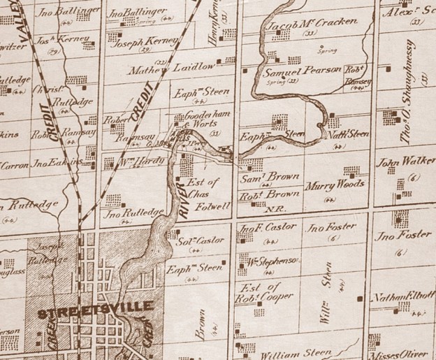
In 1825 Christopher Row(e) built a mill on lot 7 Concession IV where the river curves to the east, just north of Streetsville. When J. Deady took over running the mill he renamed it Alpha Mills. It can be seen near the centre in the cover picture from the 1877 Peel County Atlas on property shown as belonging to Gooderham and Worts. By 1877 there were 30 mills on the Credit River with 10 of them being textile related. This was a localized industry that included the Barbertown Mills.
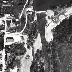
By the mid 1850’s Gooderham and Worts (G&W) had become the largest distillery in Canada and today their downtown manufacturing empire is preserved as 40 heritage buildings. It is the largest collection of Victorian era industrial architecture in North America. G&W began adding other mills to their holdings including Norval in 1845 and Hillsburgh in 1850. In 1860 they acquired Alpha Mills and branded it as Alpha Knitting Mills. G&W operated the mill until around the turn of the 20th century. William Gooderham’s grandson Albert would go on to purchase and gift a piece of property for Connaught Labs to the University of Toronto in 1917. The 1971 aerial photo below shows the mill pond as the flat black area in the upper right corner. The mill dam and water fall stretch across the river with the Alpha Knitting Mill building standing to the left just beside the dam.
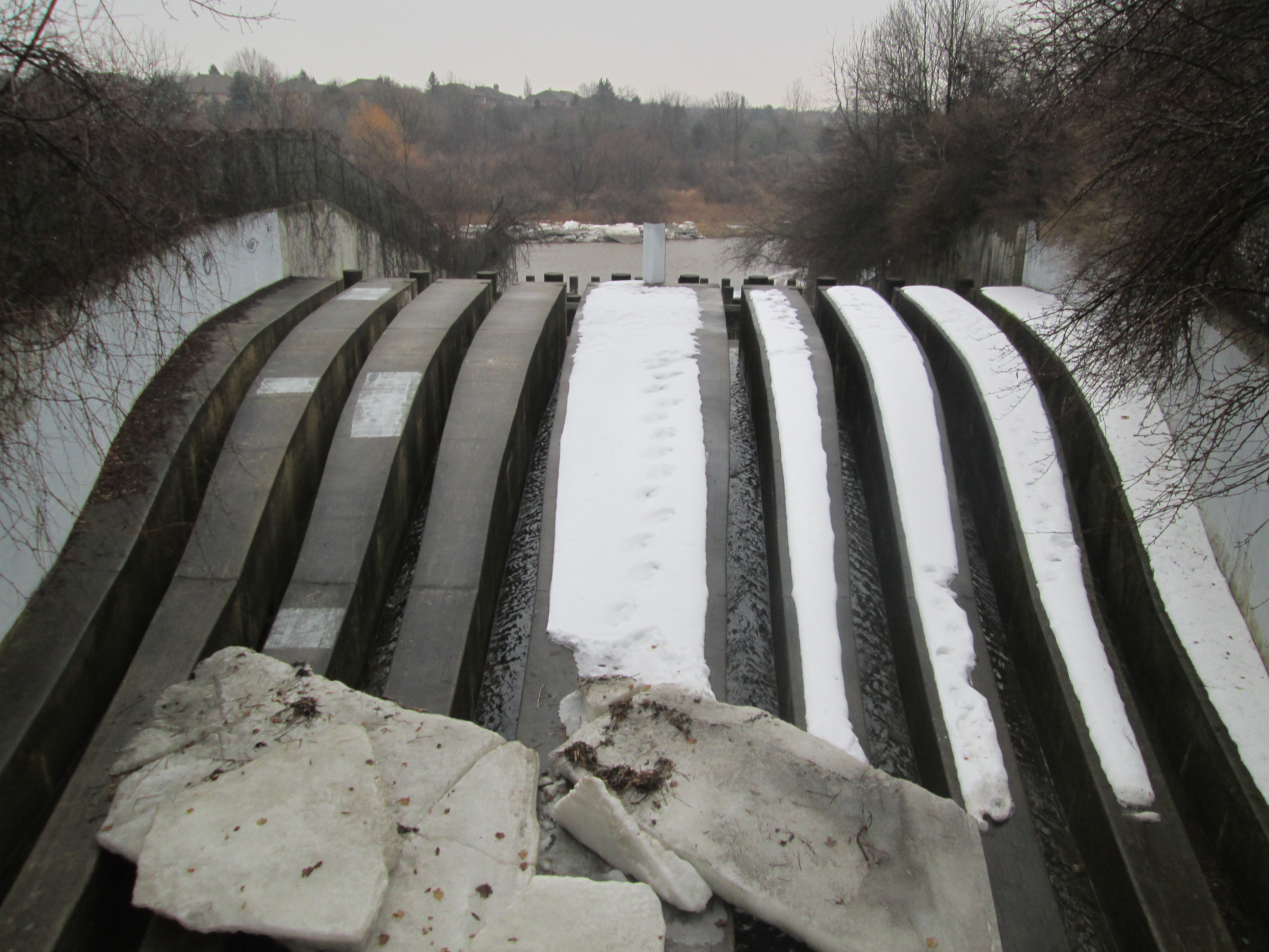
Not long after the photo above was taken the buildings and dam were removed and one of the most detailed diversion weirs I’ve ever seen was built in it’s place. Storm water flows out of a buried channel and into these eight slots. The concrete is curved upward to prevent things from washing over the edge and choking the system below, in this case it is this winter’s ice sheets. The curve of the concrete gives the optical illusion that the water is flowing up hill.
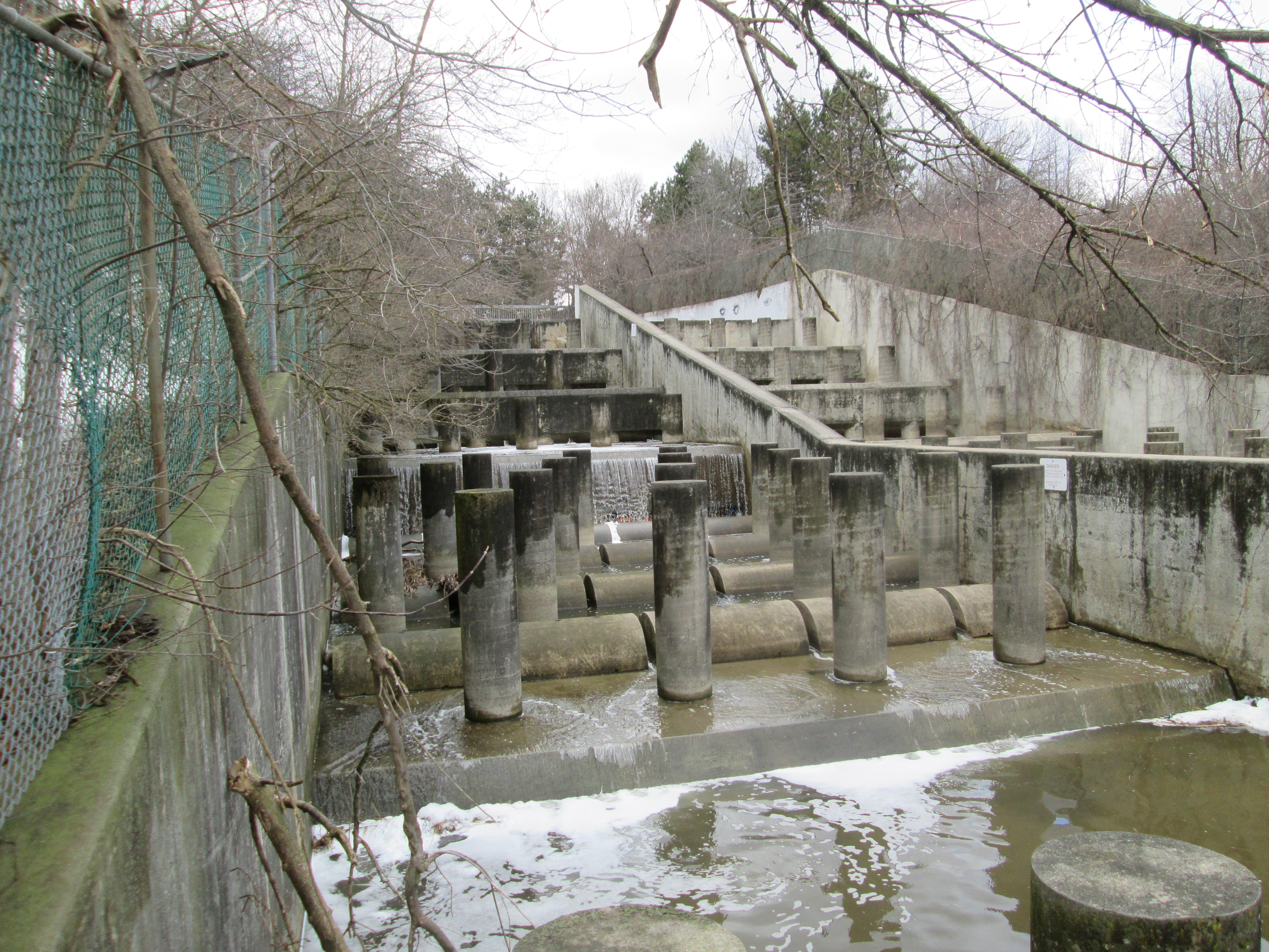
From the bottom of the storm drain looking back up there are 8 rows of concrete pillars with half-round steps in between. For most of the length they are divided down the middle by a concrete wall.
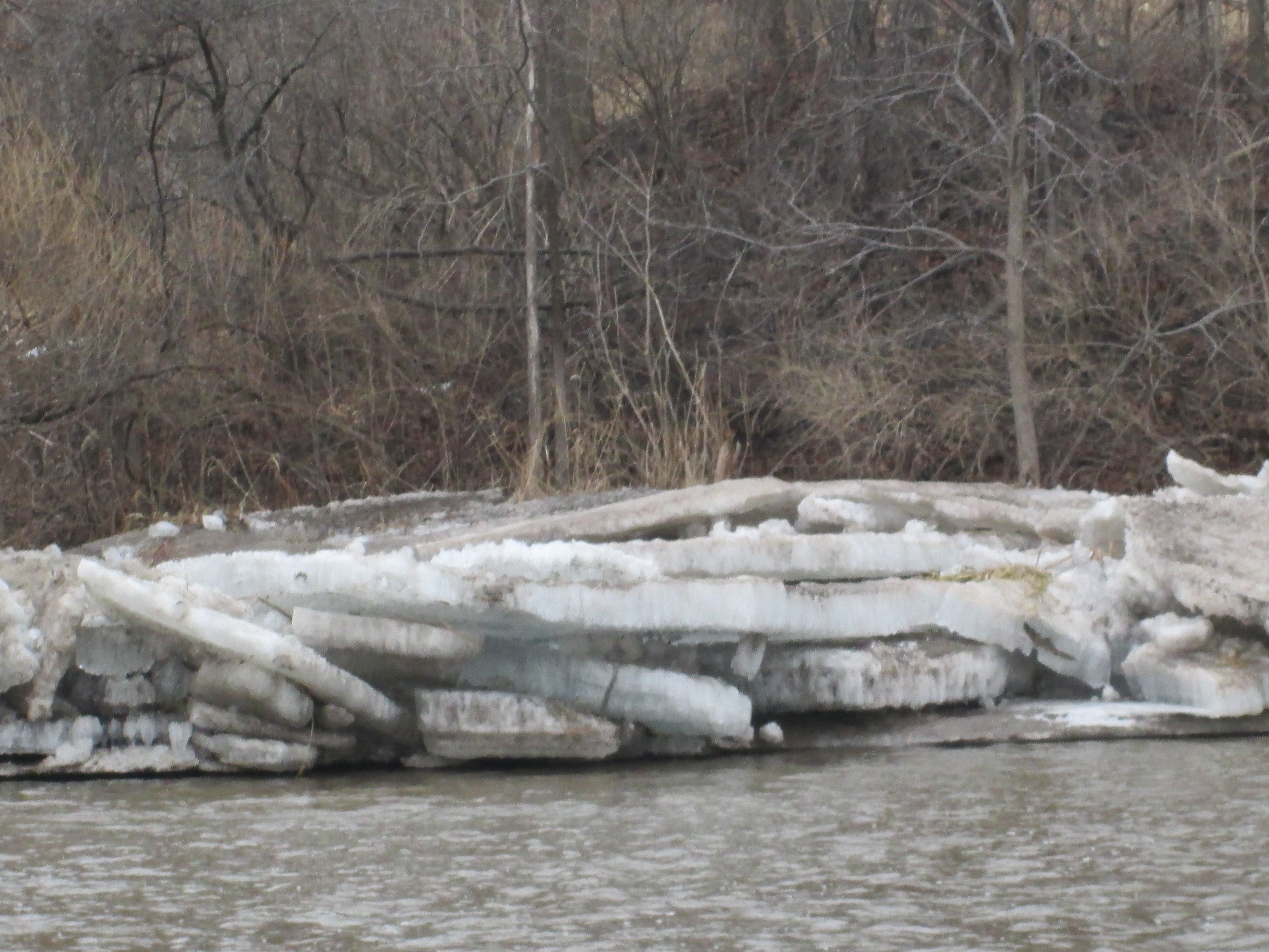
The long cold stretch of below freezing weather throughout February of this year froze the Credit River to a depth of up to two feet, When the snow finally started to melt, the water level in the river increased under the ice, snapping it into large sheets which then washed up on the shore. In the picture below they are stacked up four high.
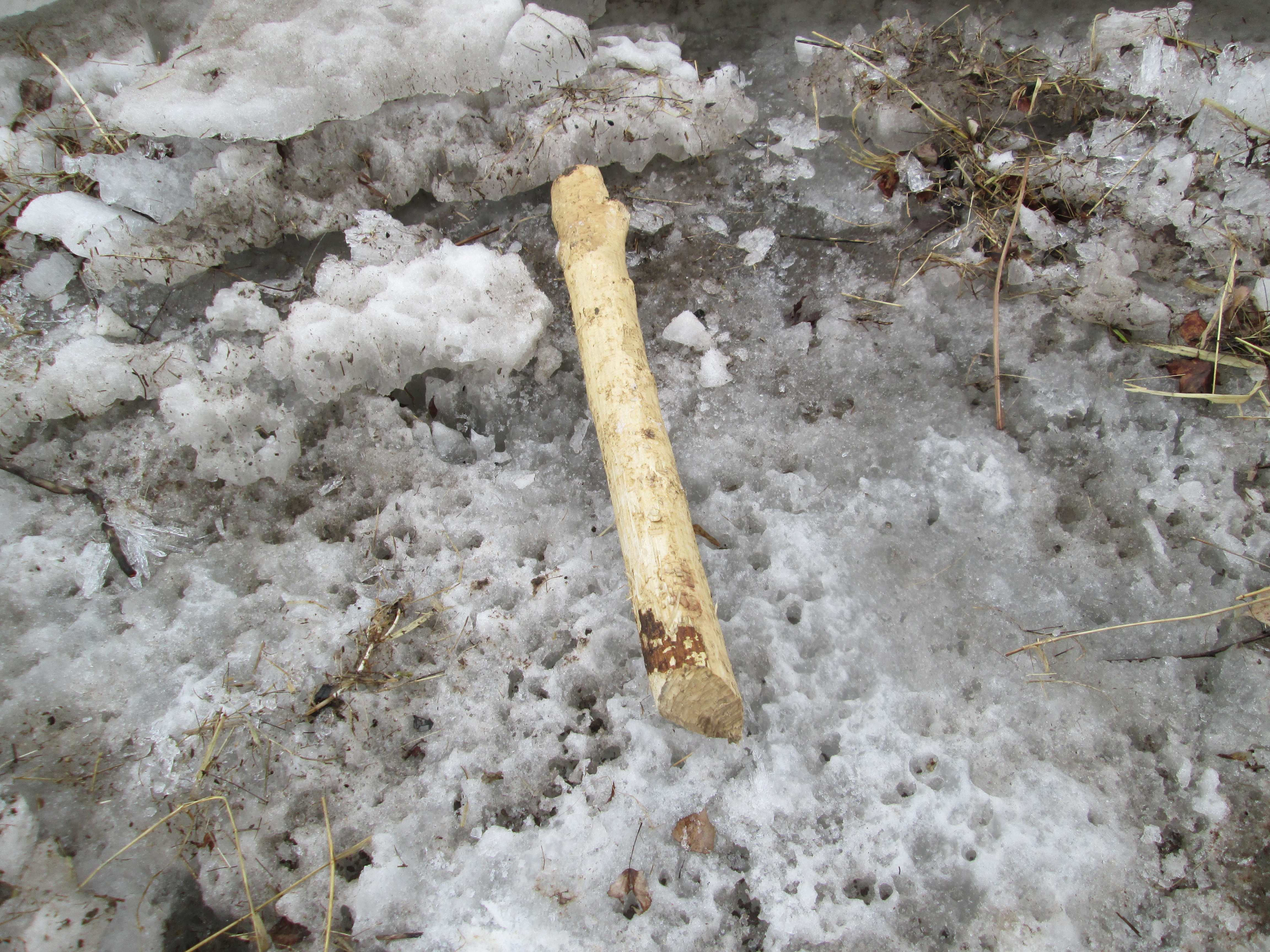
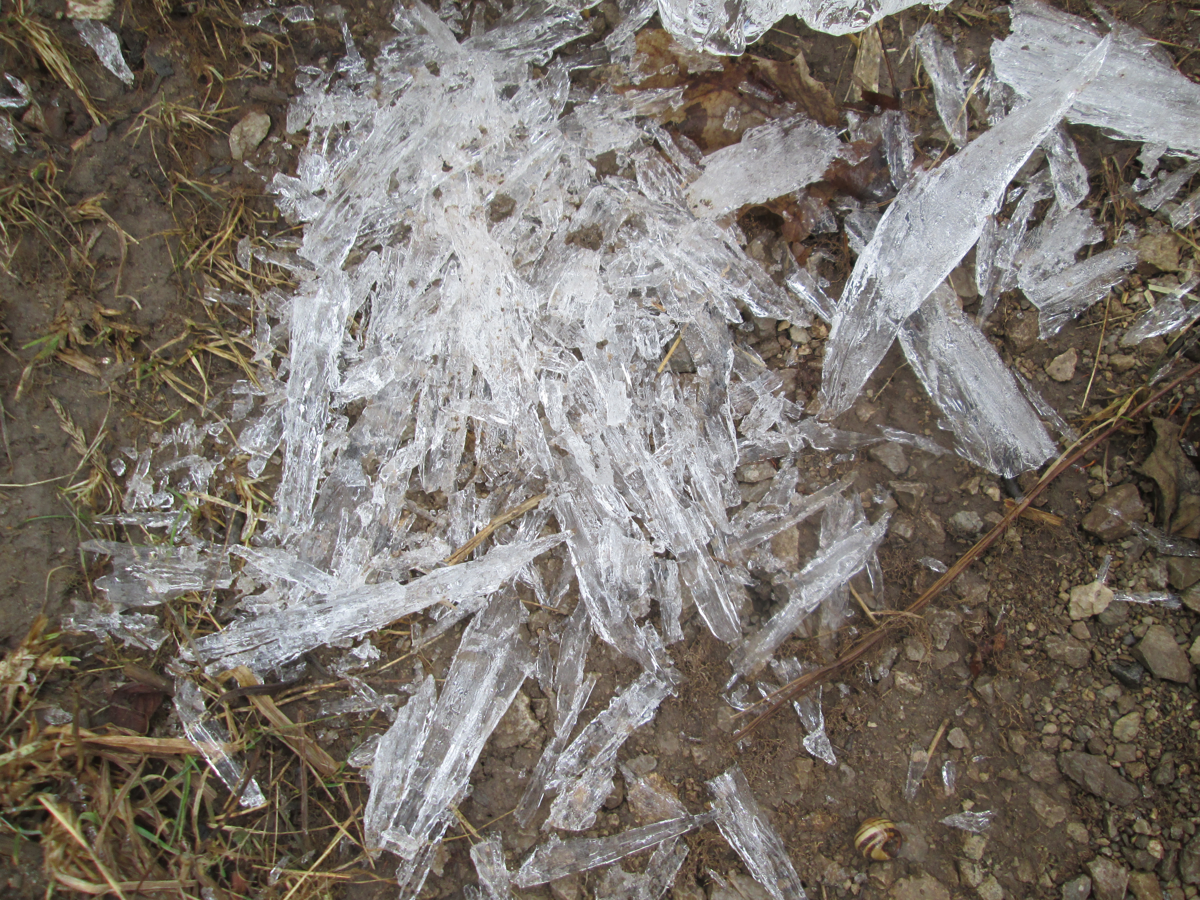
As we walked north up the west side of the river we crossed large chucks of river ice. The piece of wood in the picture below has been trimmed clean by the local beaver. It is rounded at both ends and all the bark removed. Rather than construction material, this has been a food source for an example of Canada’s largest rodent. Once on shore, the river ice tends to melt in one of two ways. The example in the picture below shows a slab of ice cut through by hundreds of small holes.
In other places the ice is full of thousands of fine cracks that cause it to shatter into little shards. Either way, the ice is melted much faster than if it just melted along the exposed surfaces.
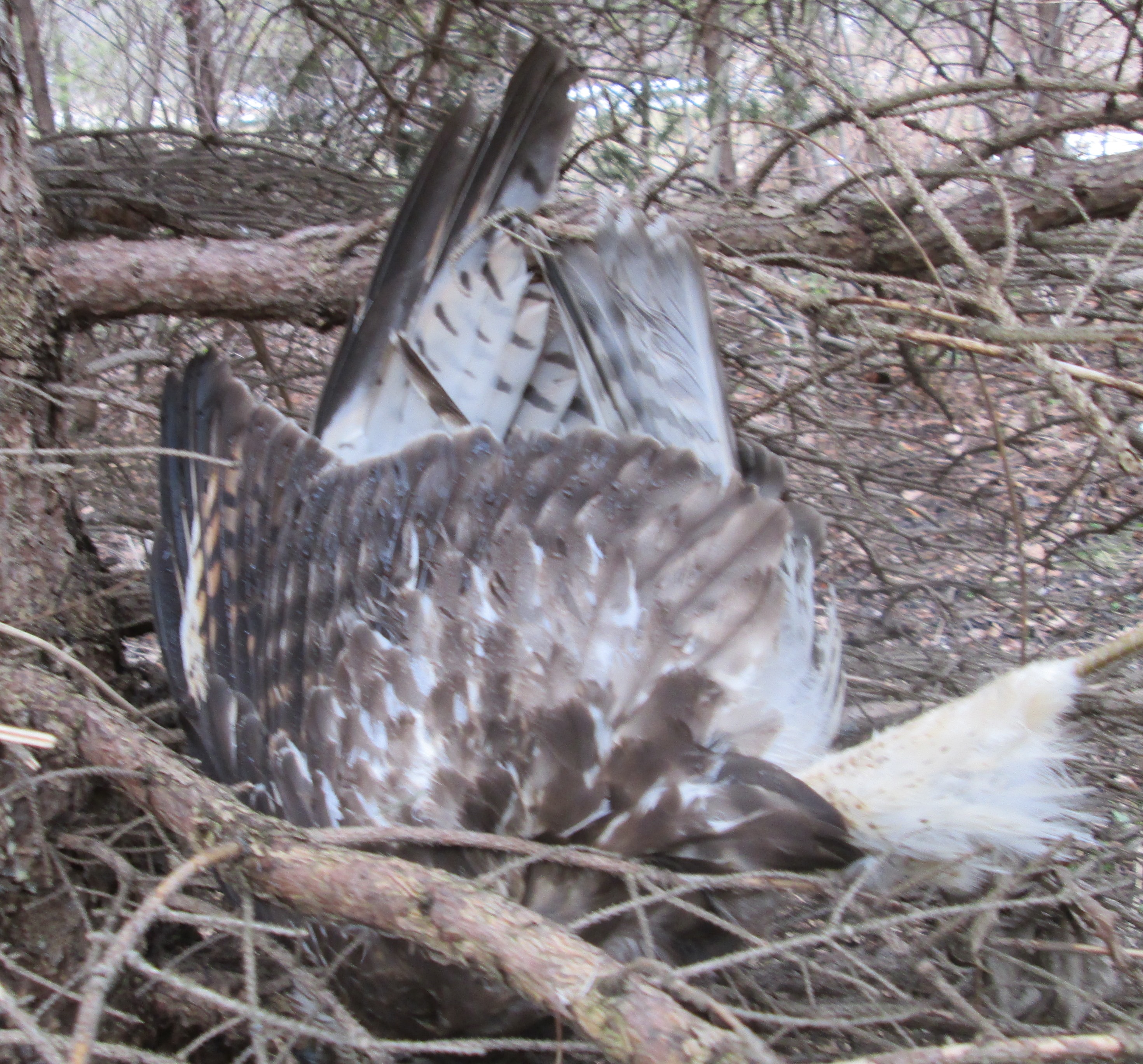
I don’t usually post pictures of dead animals, although we see all kinds of them, but this Kestrel was wedged upside down in a pine tree. There was no obvious cause of death and it appeared to have happened very recently. Quite possibly it flew into the tree in the dark and broke it’s neck although this kind of accident must be quite rare. It is considered rare, but birds do suffer heart disease, making this another possible explanation. Or this kestrel might simply have been doing it’s impersonation of Kessel.
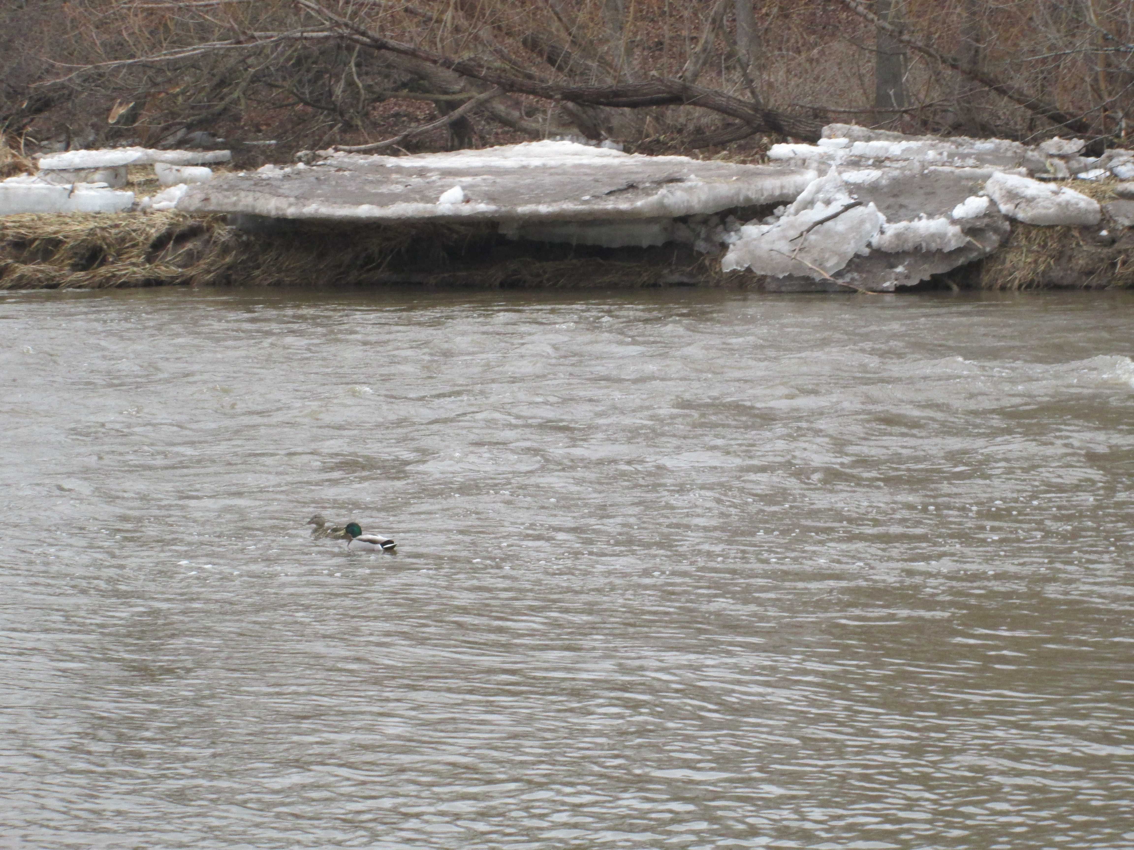
Having made our way to Creditview road we crossed on the bridge and started back up the other side. While walking along the river at this time of year it is important not to walk on any shelf of ice that might be close to the river edge. I suspect that, had we stepped on this shelf when we passed, we wouldn’t have enjoyed the water quite as much as the two ducks in the picture below. Like these ducks, it was obvious that the bird kingdom has started to count itself off into breeding pairs. Cardinals, Buffleheads and Canada Geese were also seen to be paired up.
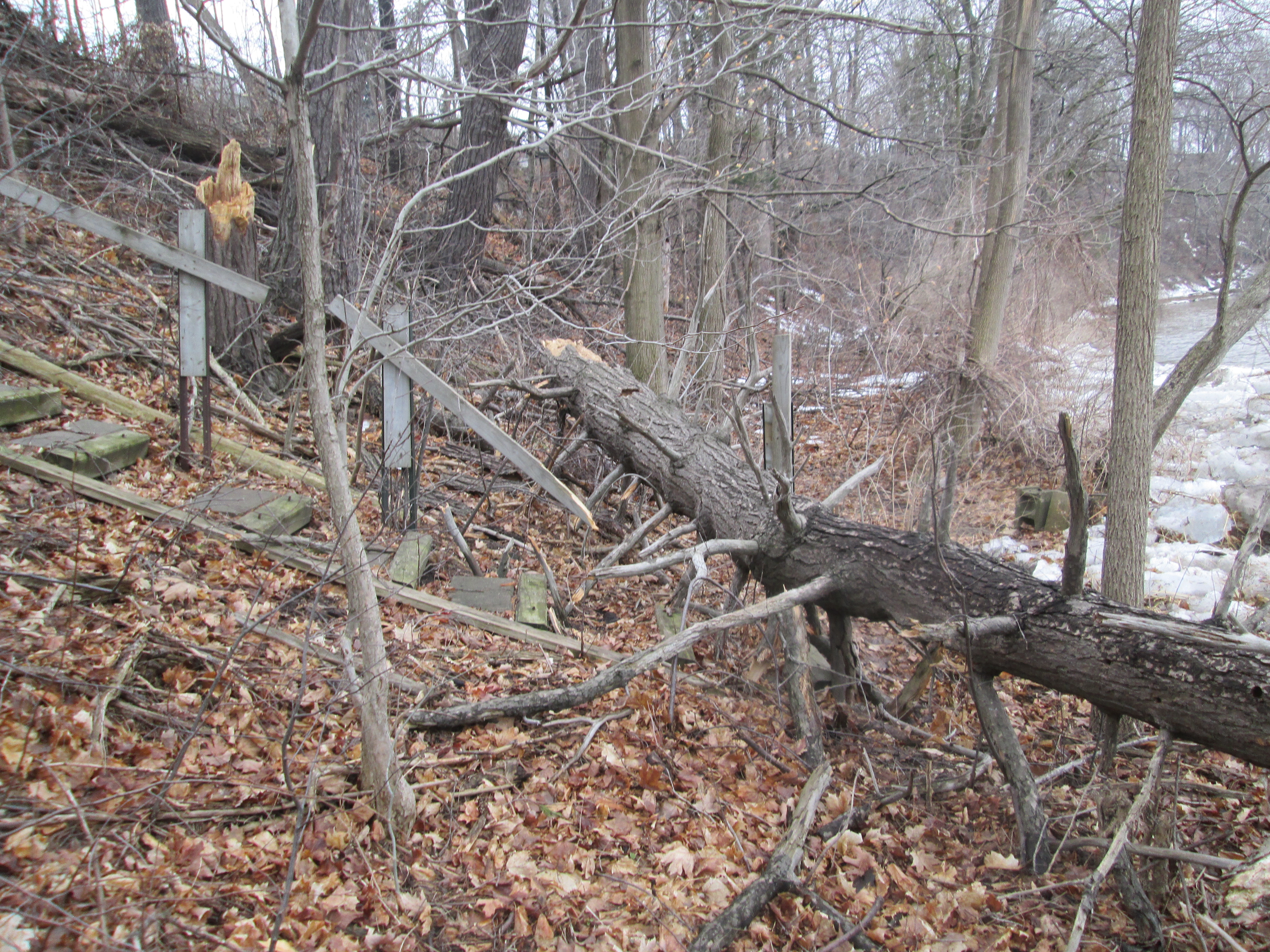
There is only a short stretch of the east river bank that is safely passable at this time of the year. The bank of the river on this side is full of new growth and bramble. At one time several of the homes on top of the ravine had built wooden or concrete stairs to access the river side. The tree that has taken out this abandoned set of stairs looked like fair warning and so we returned to Creditview Road. Sir Monty Drive provides a short cut back to the park without having to walk too far on roads.
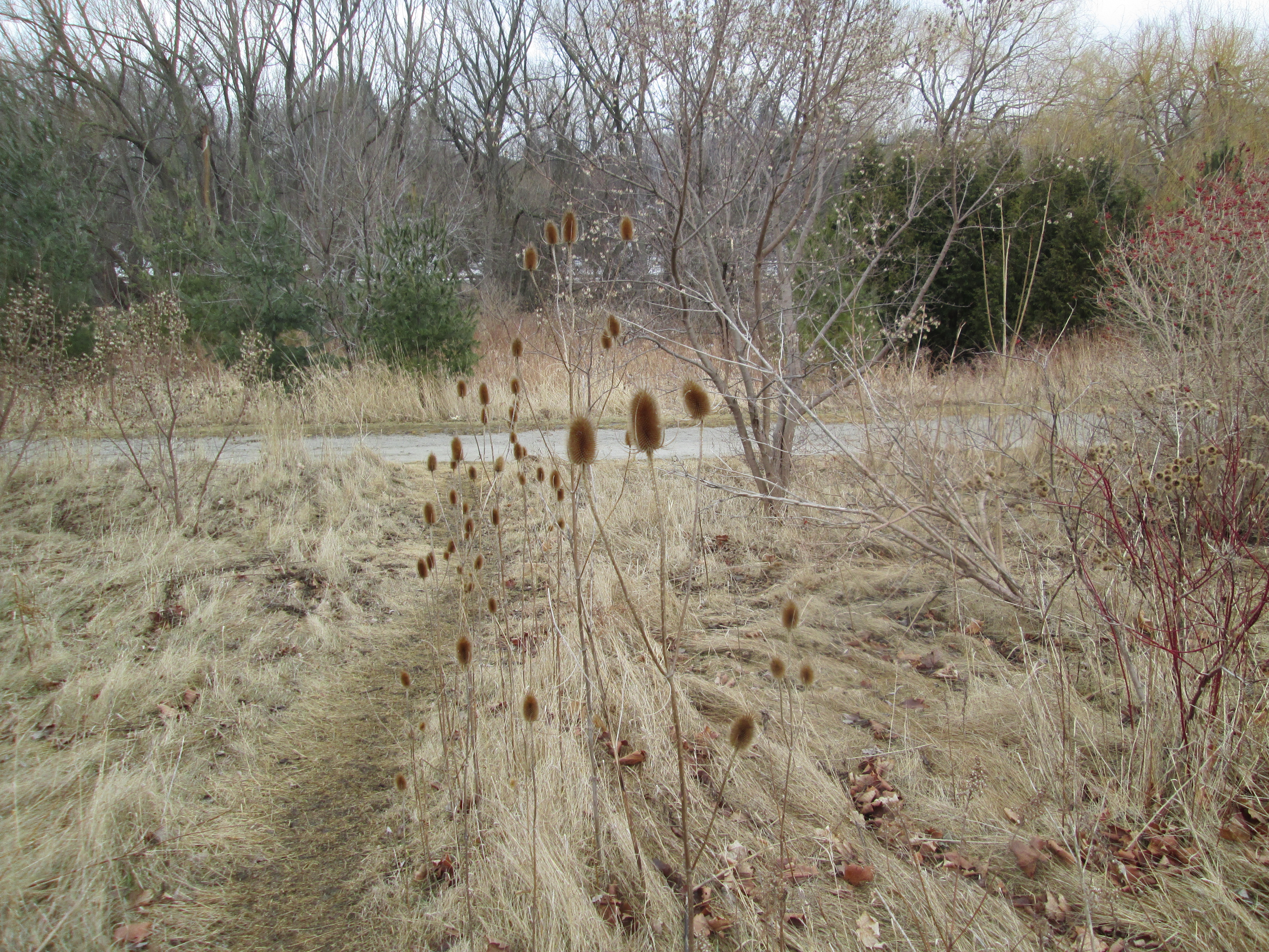
The park on the east side of the river is accessed from Sir Monty Drive and has a maintained trail on it. This part of the river is known as River Run Park. Large clusters of teasels grow along the trail.
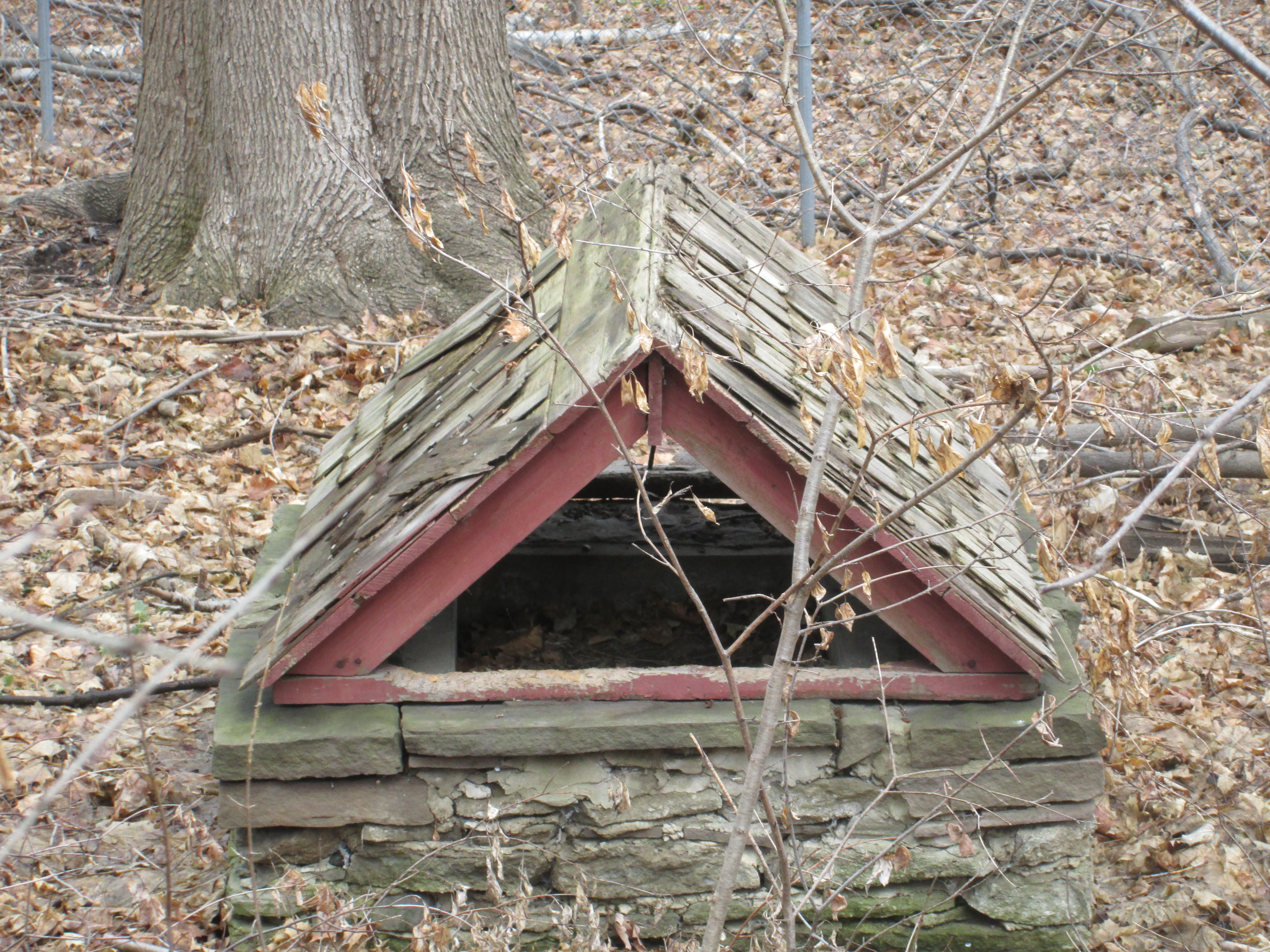
Someone has taken the time to cover this old well with a roof but the current dwelling is at the top of the ravine. Perhaps an earlier home stood closer to this water source making the task of bringing water to the hill top unnecessary.
Visit us at http://www.facebook.com/hikingthegta for a gallery of additional photos.

Pingback: Silverthorne Grist Mill – Meadowvale | Hiking the GTA
Pingback: Norval on the Credit | Hiking the GTA
Pingback: Streetsville – Timothy Street | Hiking the GTA
Very interesting history of Streetsville. We lived on Plainsman Rd. and Falconer Drive in Streetsville. Also, Queen Street, Thomas Street and Vista Drive since 1956. Loved Streetsville in its day, but now it is sad to see it has grown so huge and taken over by numbers. Miss the old village style Streetsville.
Pingback: Timothy Street – Pioneers of the GTA | Hiking the GTA