Tag Archives: Credit River

The Credit River – Georgetown

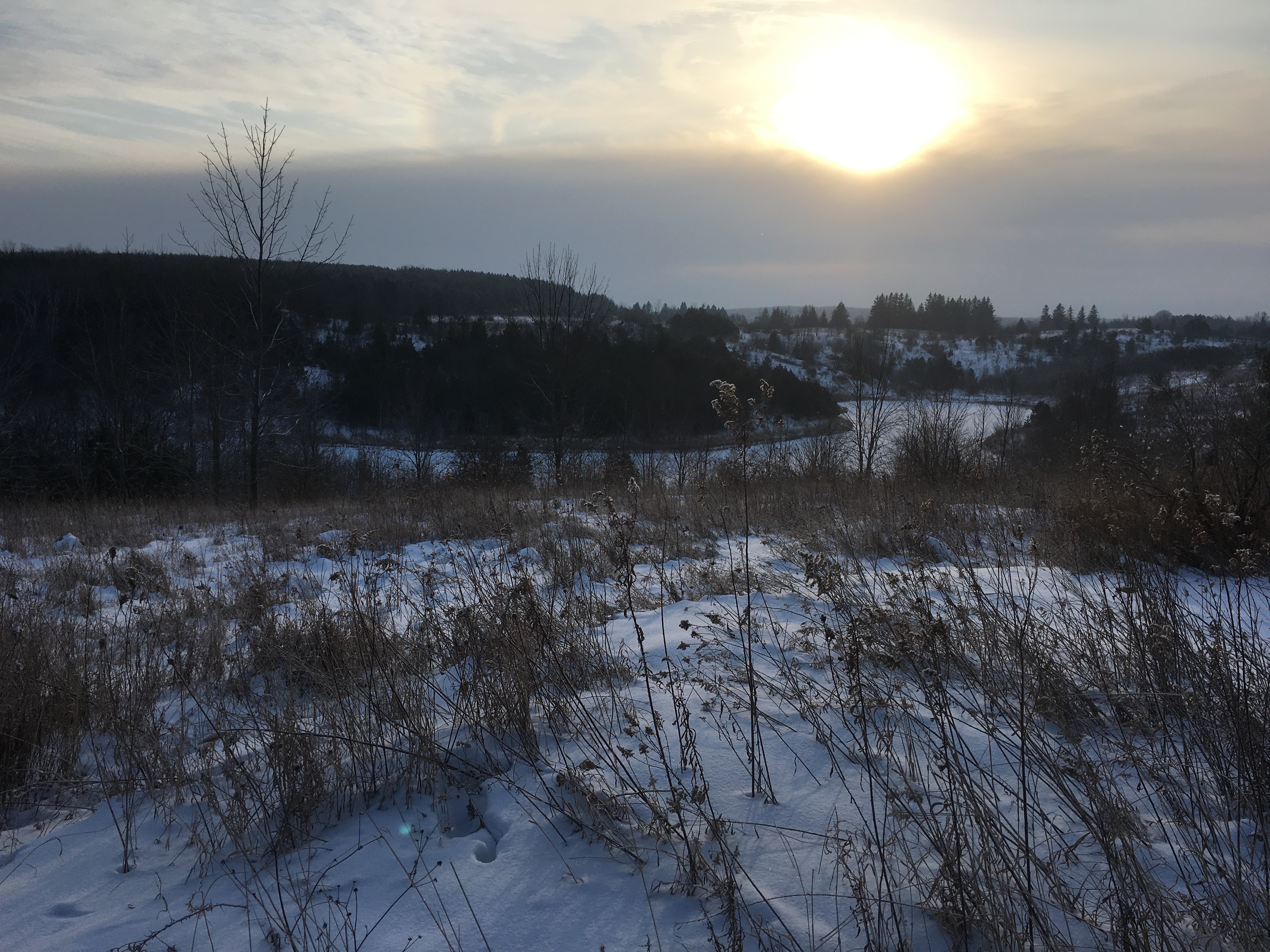
Saturday, September 26, 2020

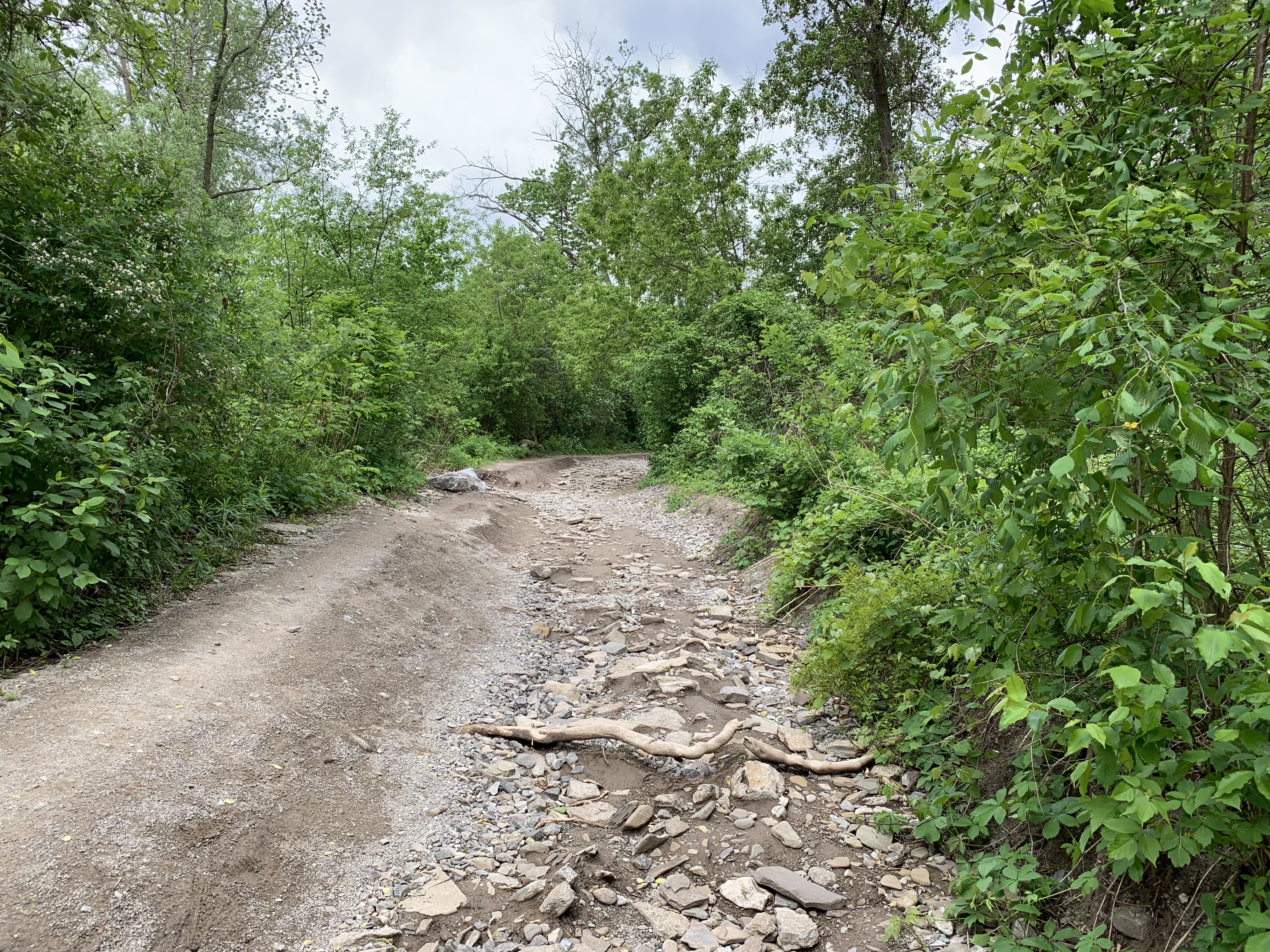
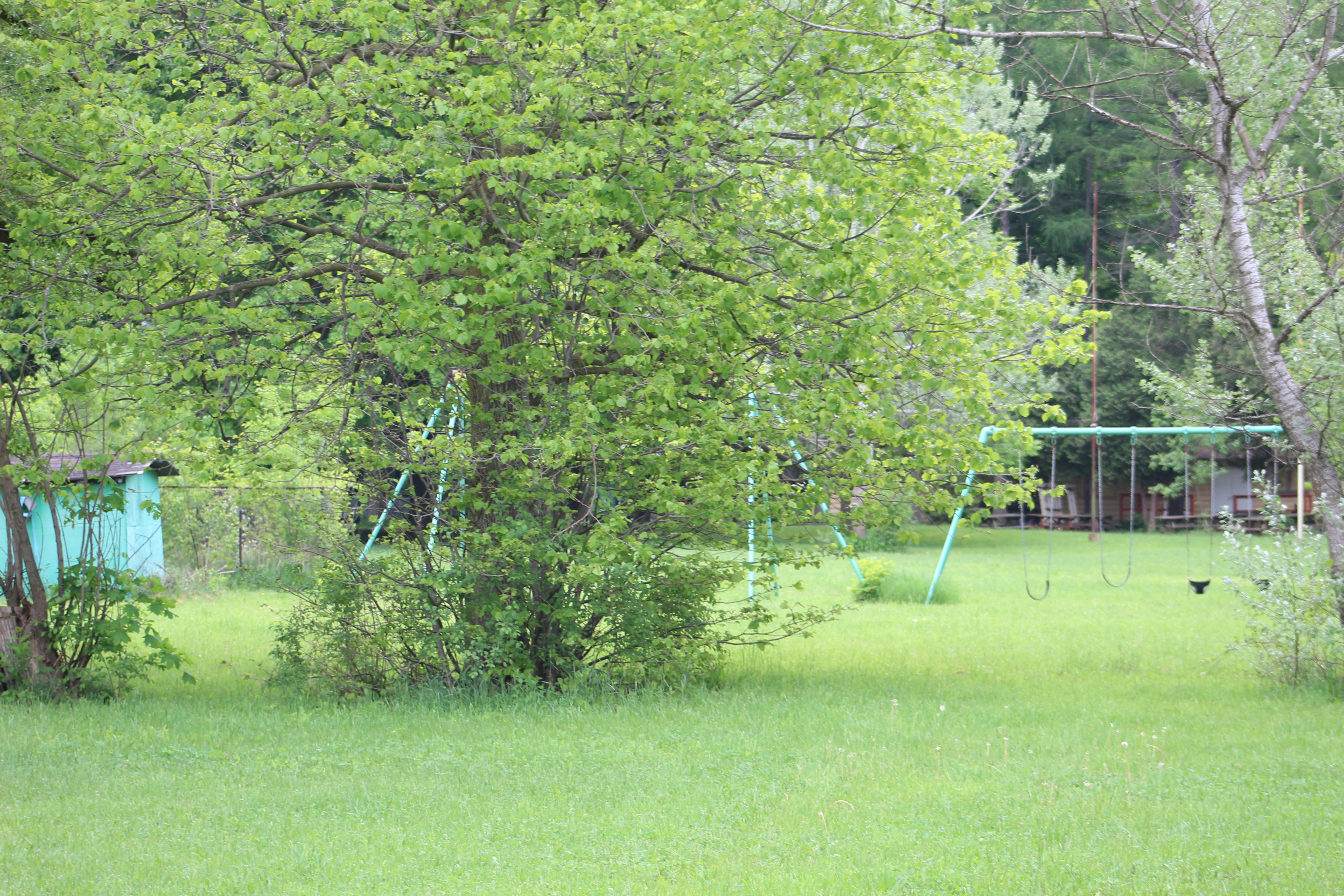
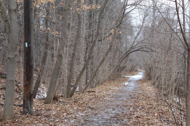
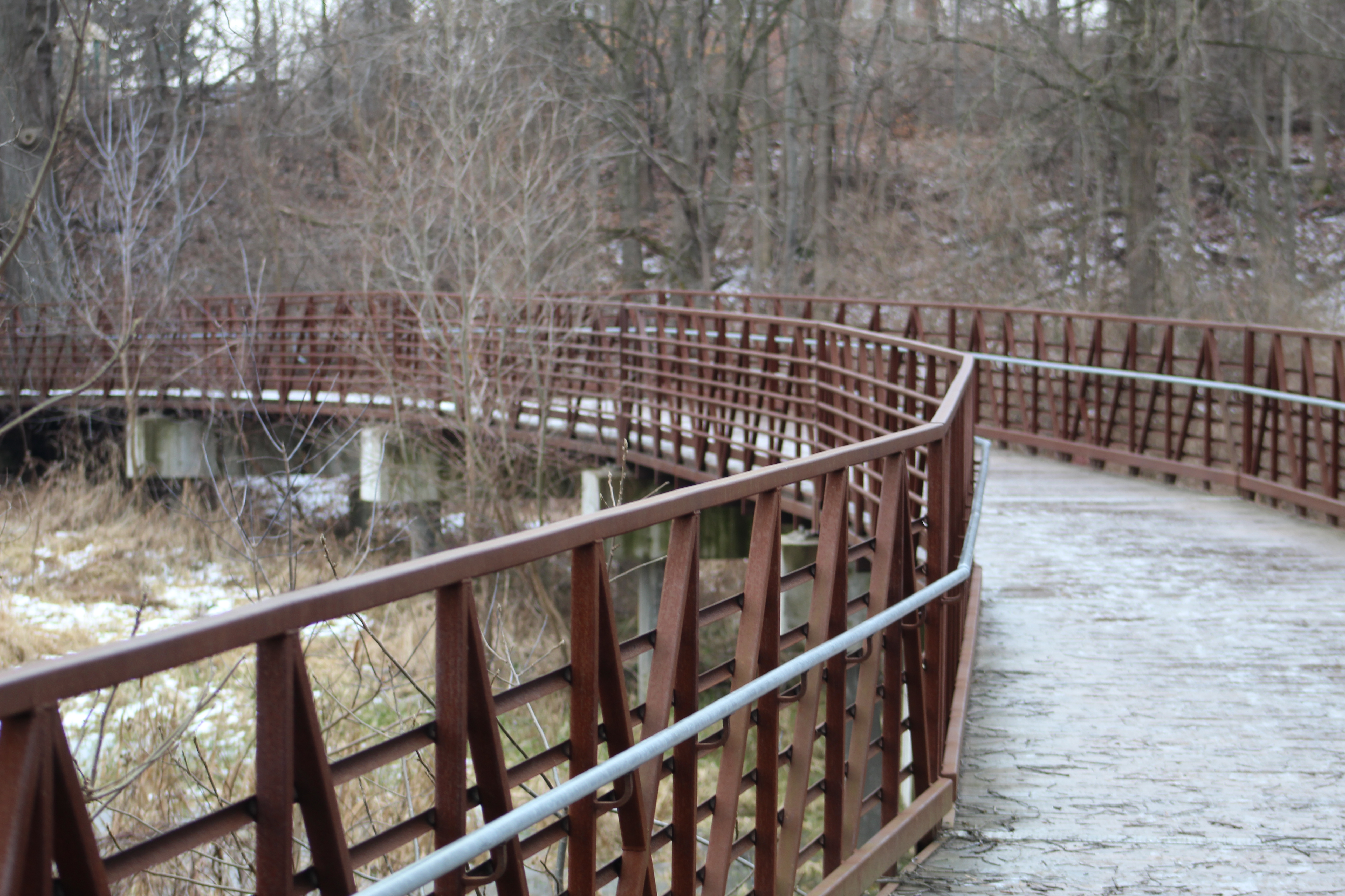
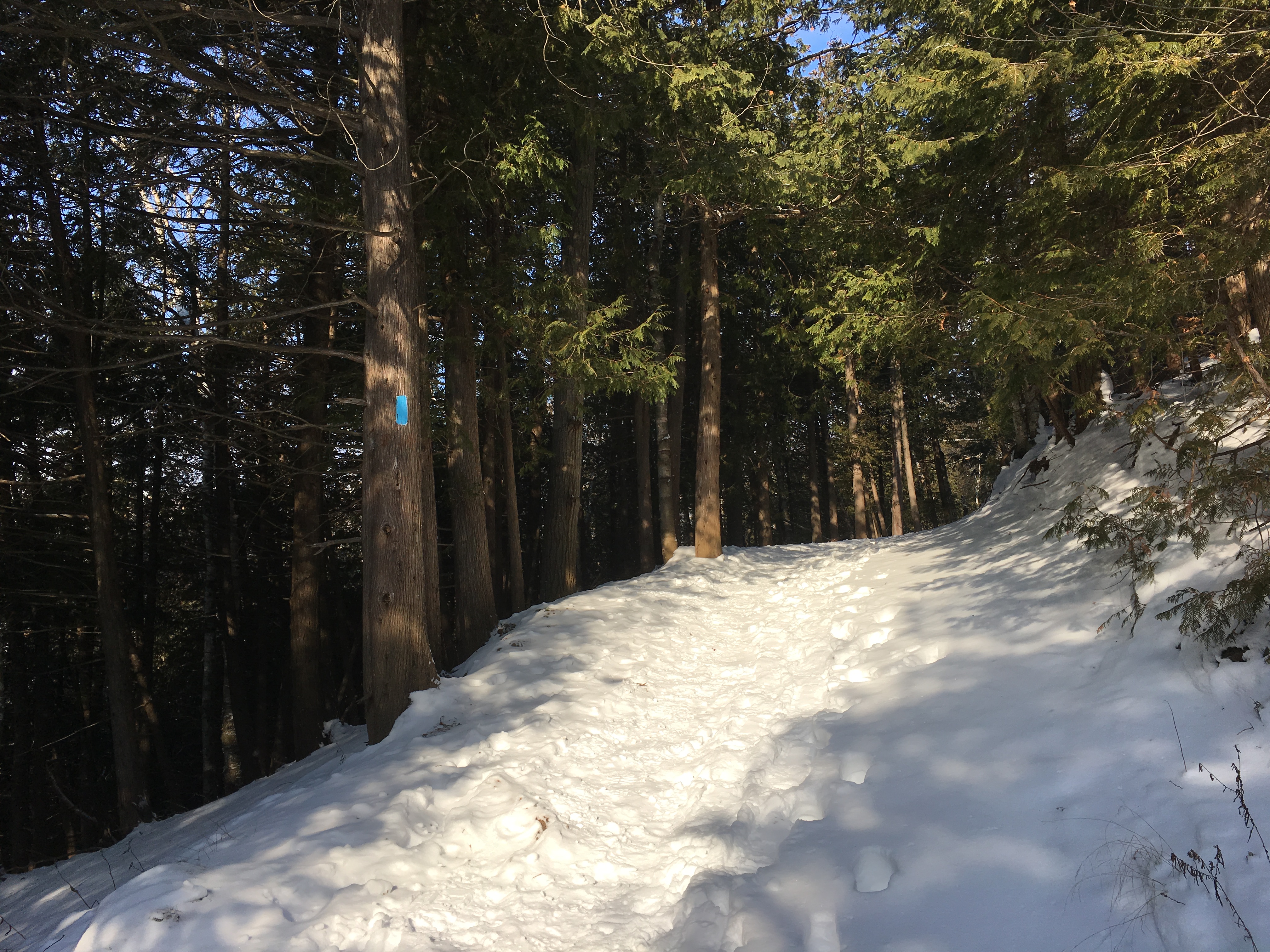
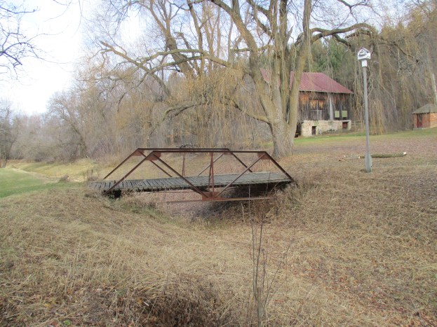
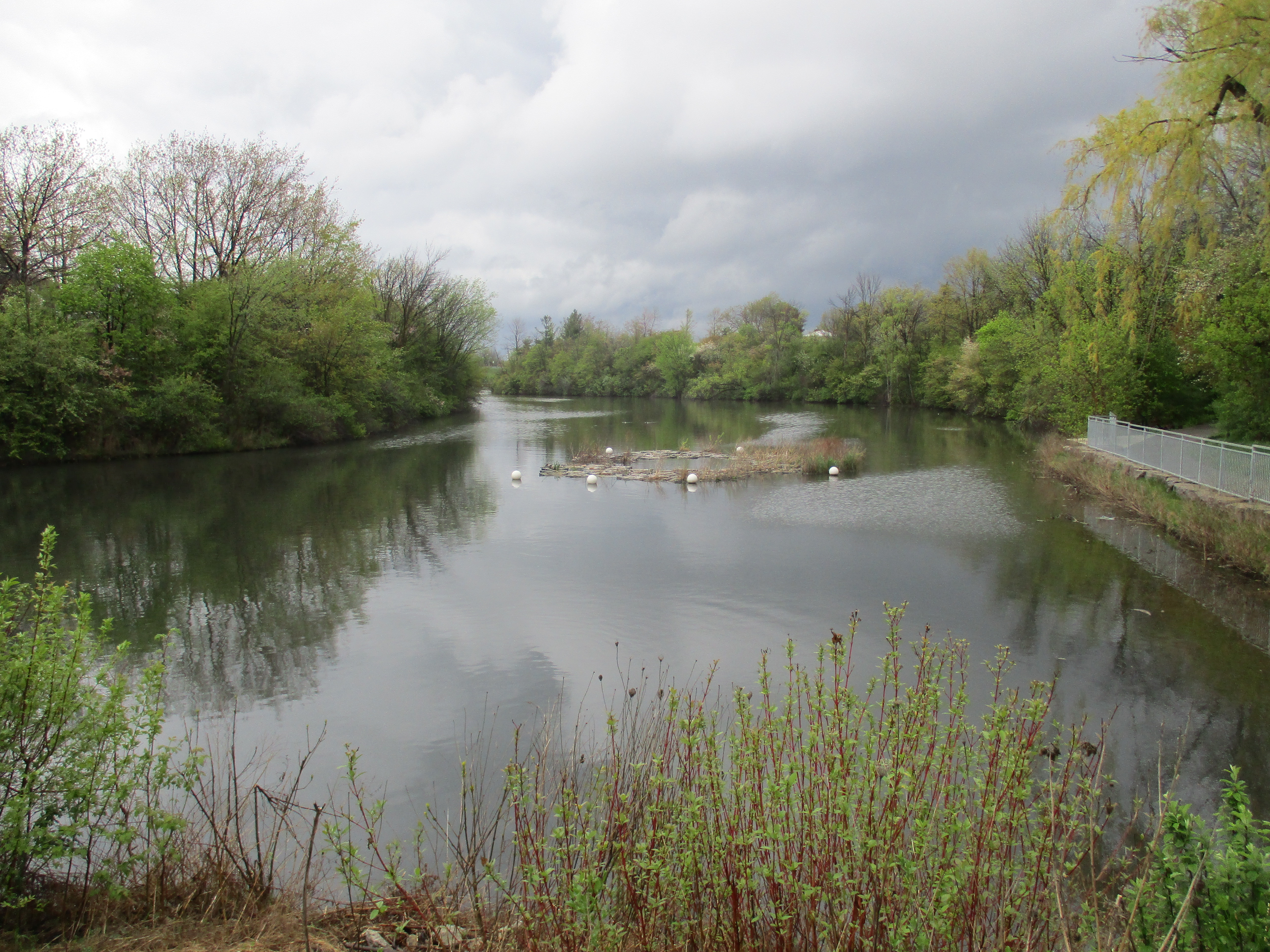
The section of the Credit River north of Georgetown is one of my favourite places to hike and I’ve returned here a few times over the past thirty years. We typically park on Maple Avenue near River Drive. Once you cross the Credit River on the bridge you can follow the Credit Valley Footpath north to Terra Cotta or south to the Barber Dynamo. This is a side trail to the Bruce Trail and is marked with blue blazes.

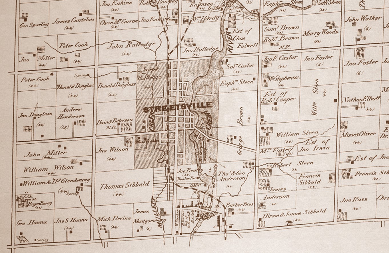
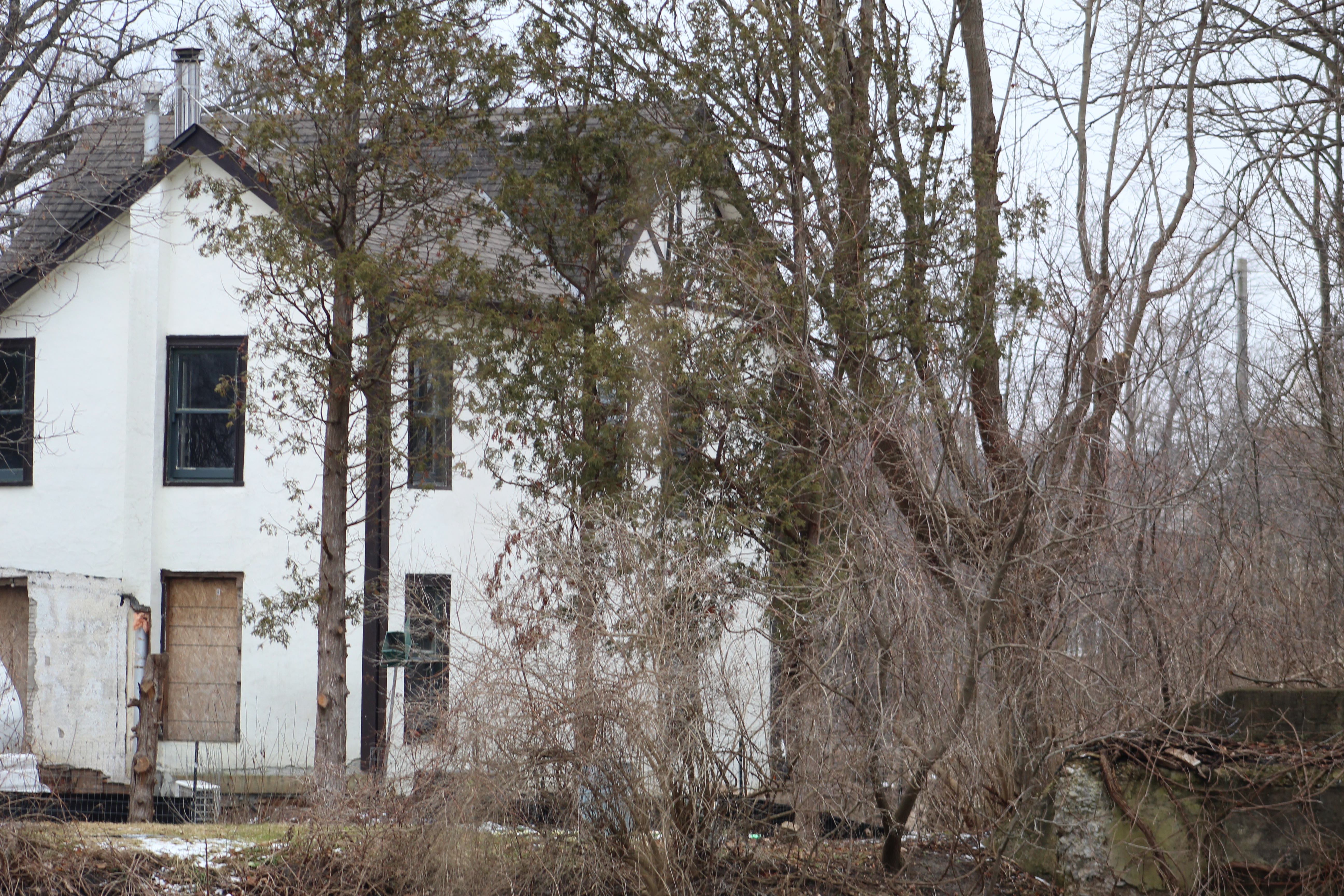
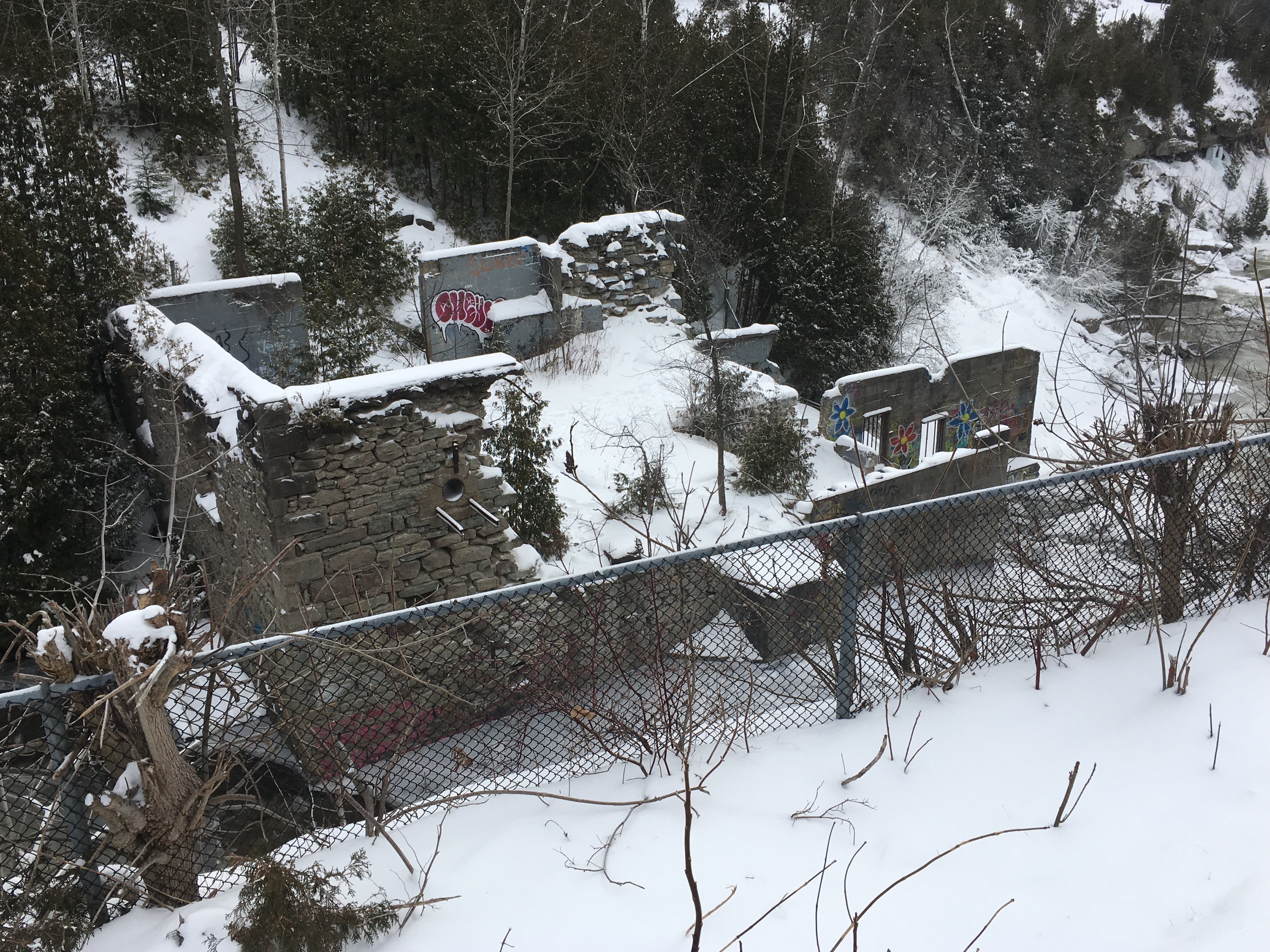
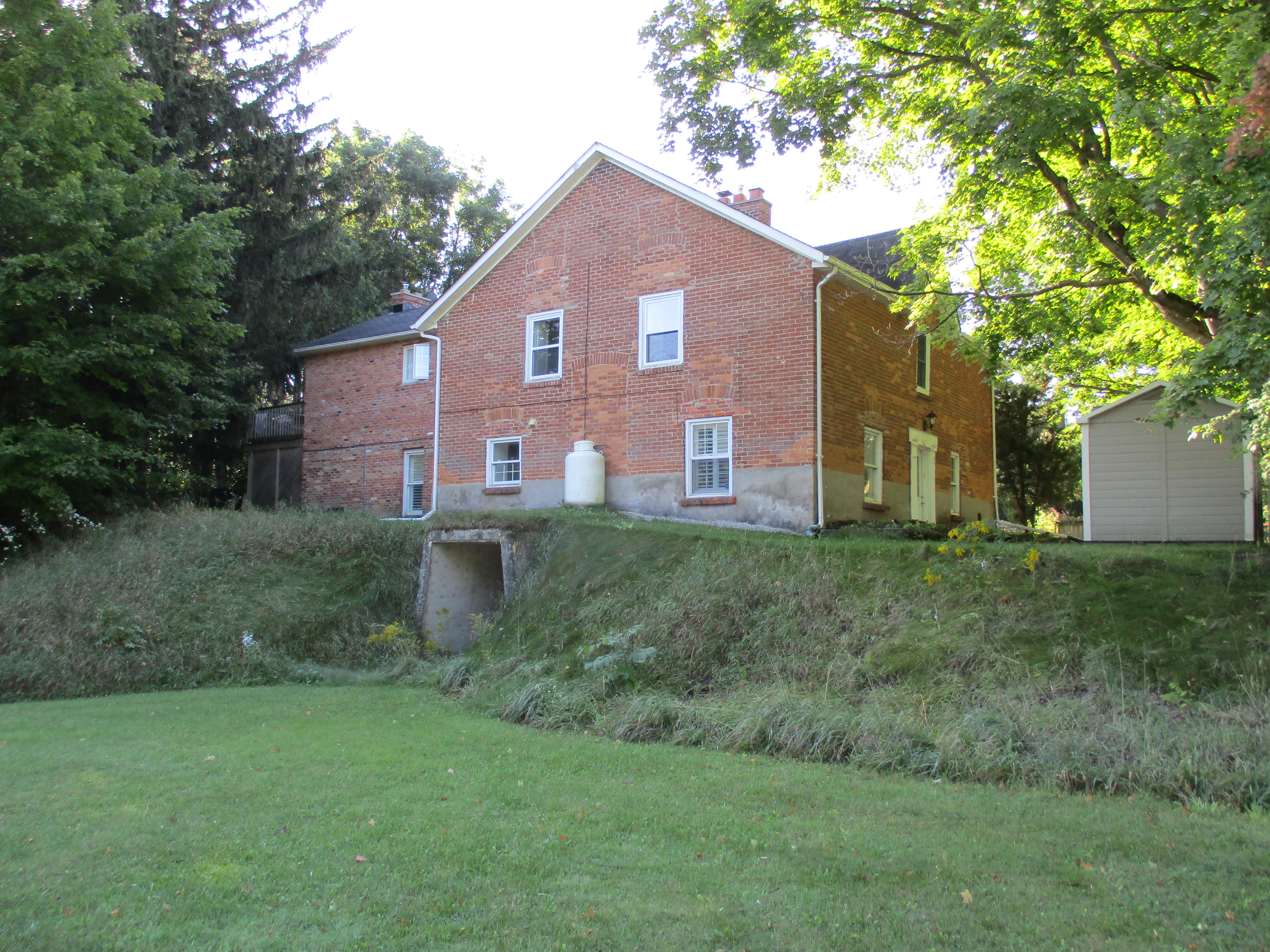
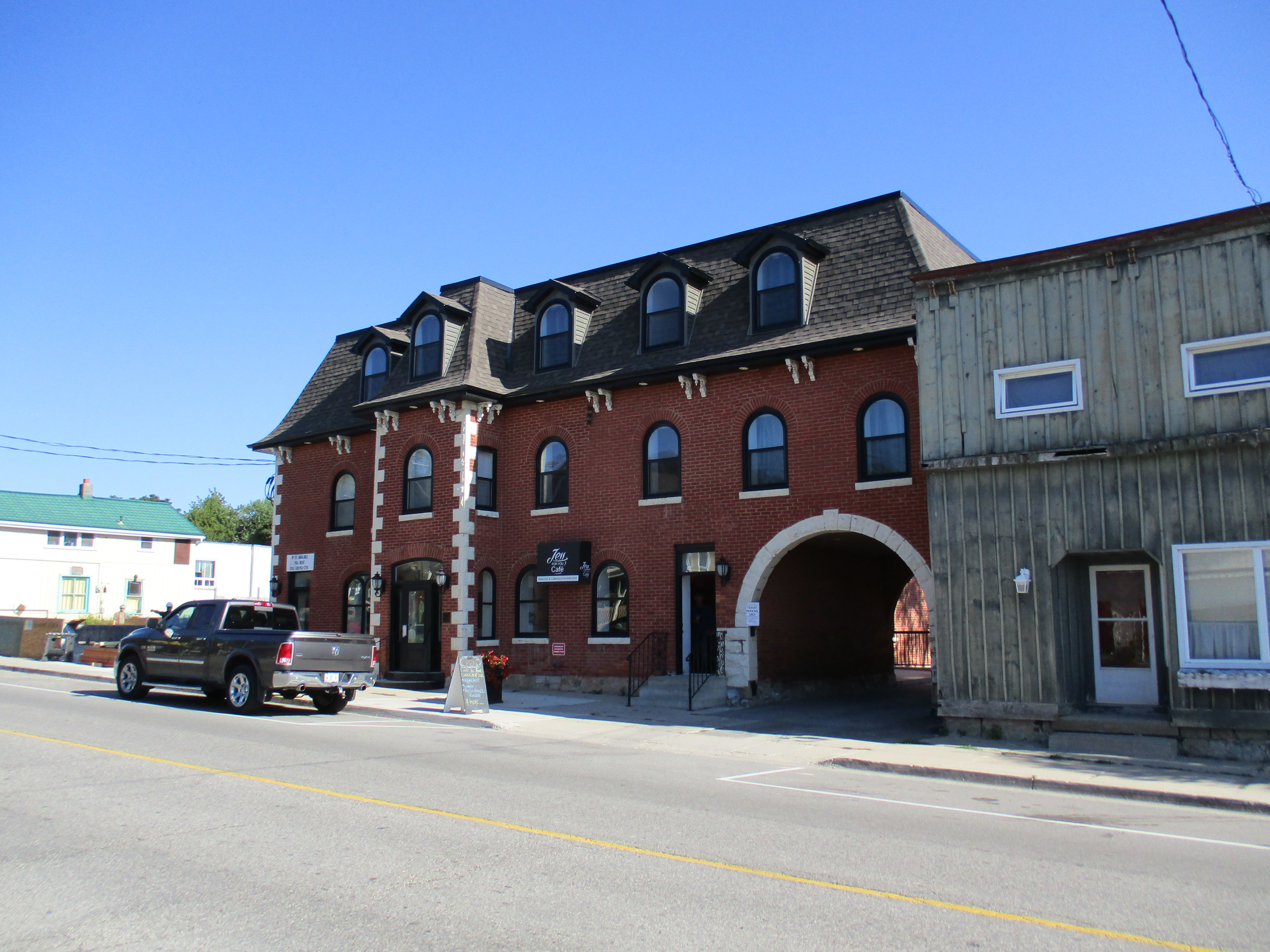
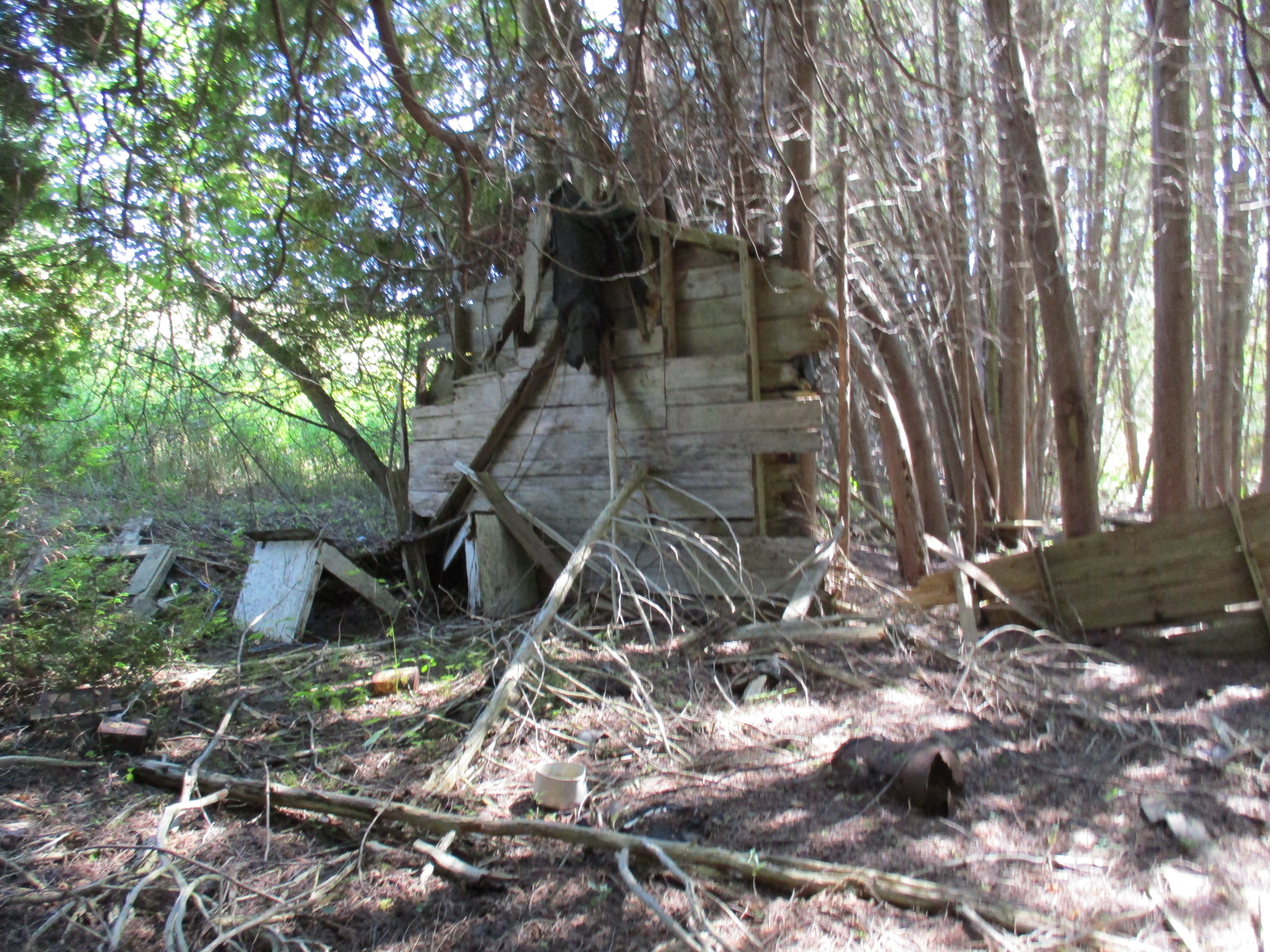
The first point of interest is the site of the Barber Paper Mills. These historic Victorian era industrial buildings have sat vacant for over four decades. Several proposals for redevelopment and preservation have been left unfulfilled over the years and the fate of one of Heritage Canada’s 2015 top 10 most endangered sites remains unknown.

The roof on the former paper rolling building, built in 1852, is deteriorating quickly. When we released the feature story Barber Paper Mills in June of 2015 the roof was largely intact on the river side. The side of the roof facing the road was already collapsing at that time. An updated picture was featured in March of 2018 in our story Credit Valley Footpath at which time there were two small holes in the roof on the side facing the river. Today, the roof is collapsing and at least one beam has fallen in as well. Nature is relentless.

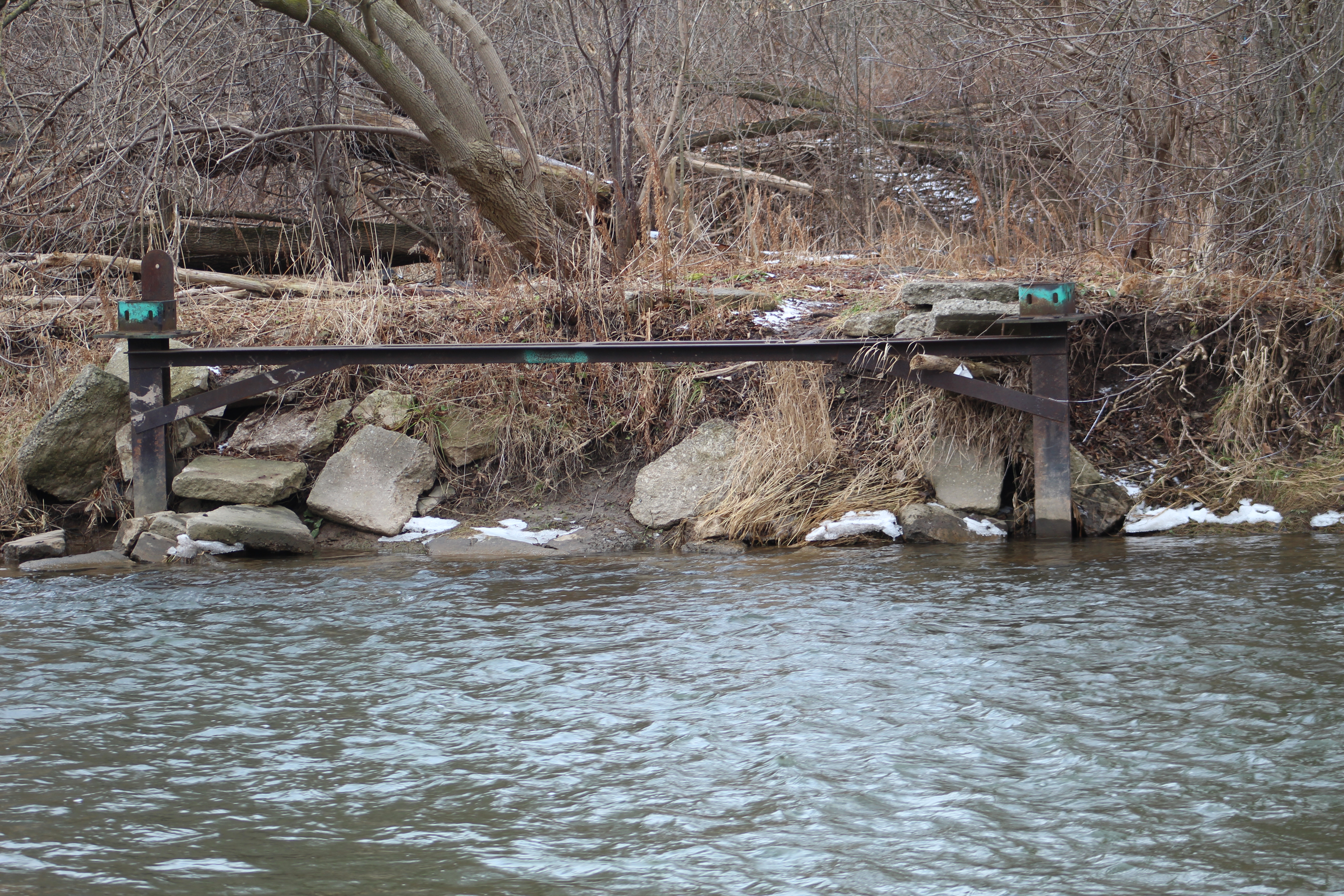
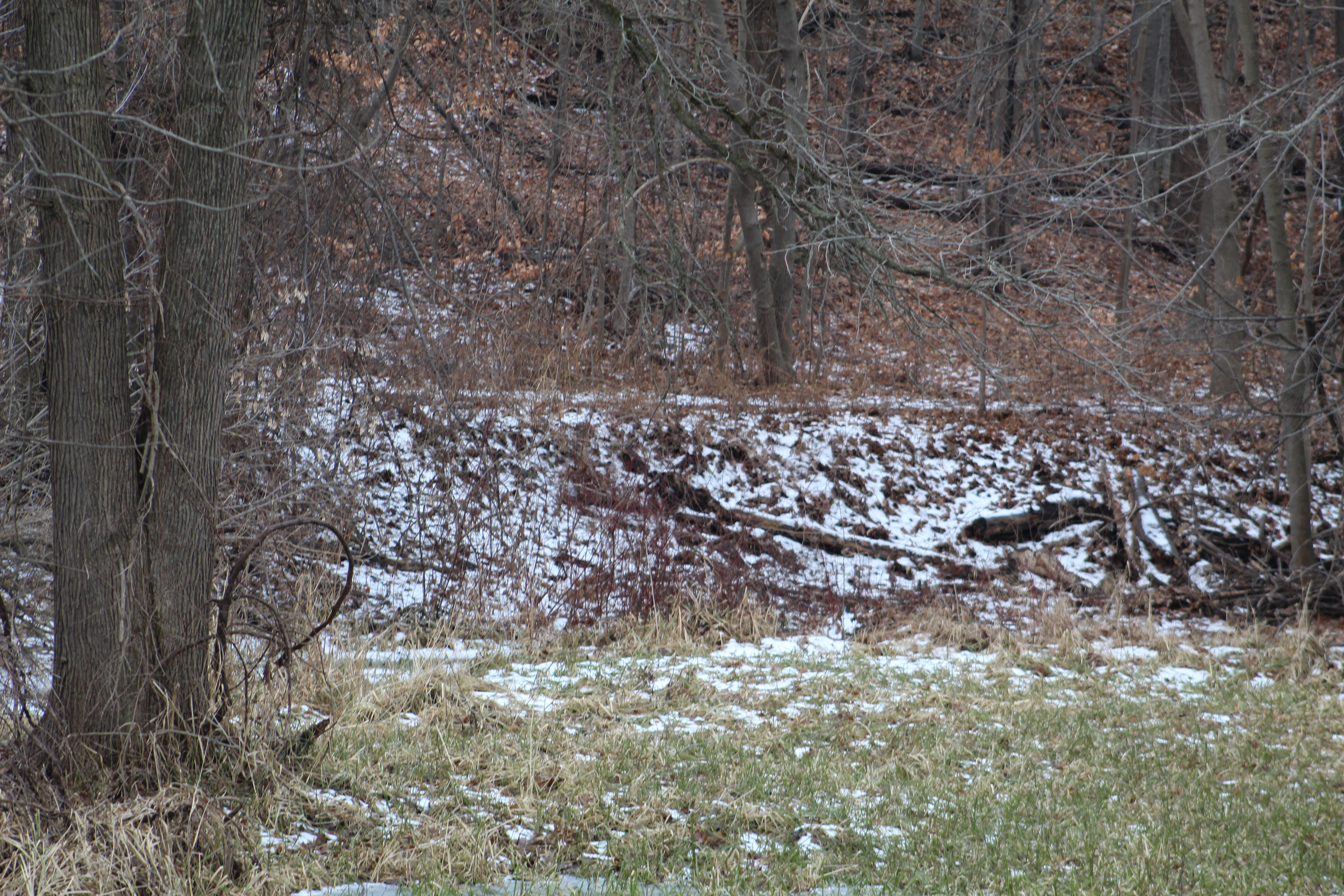
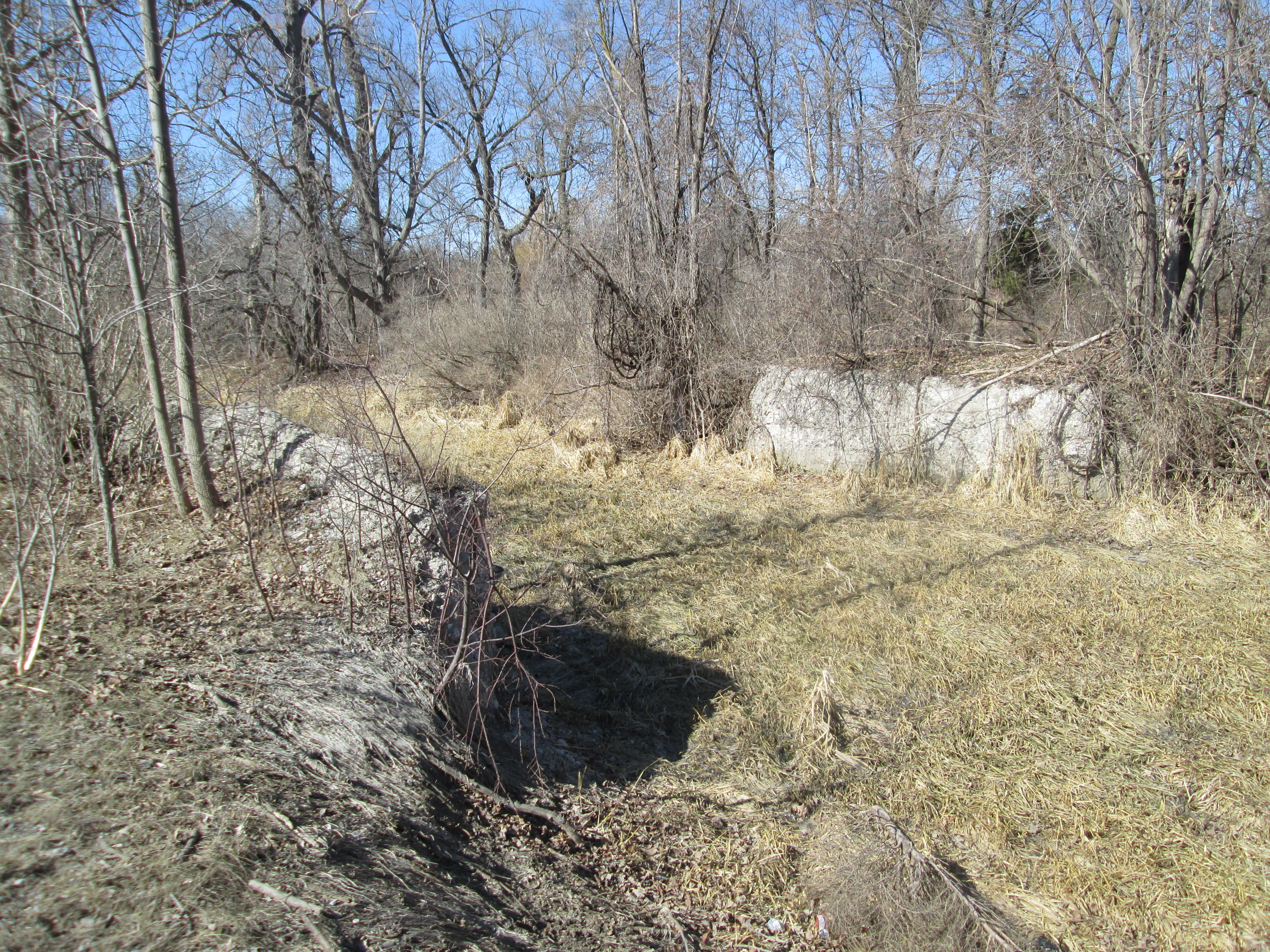
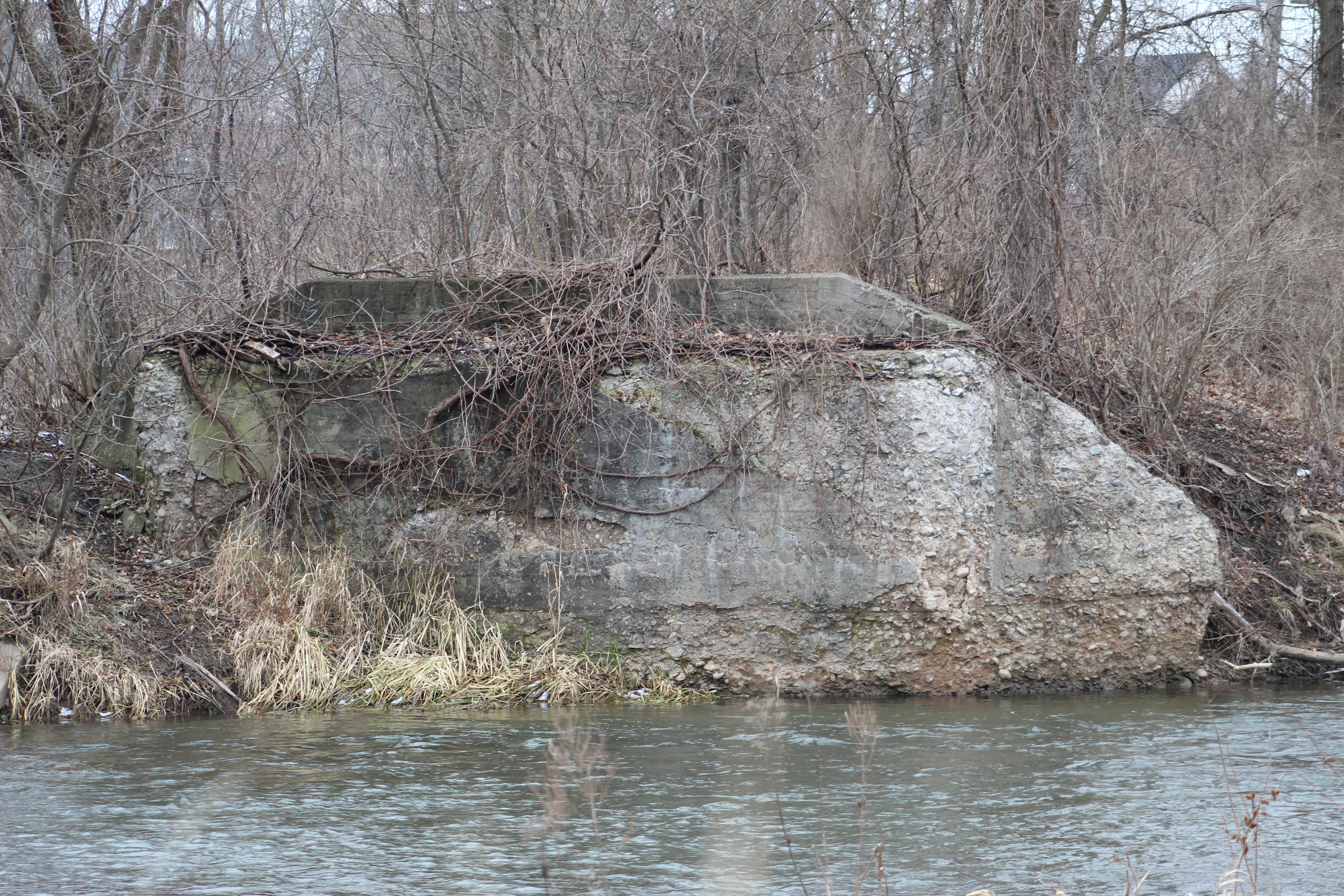
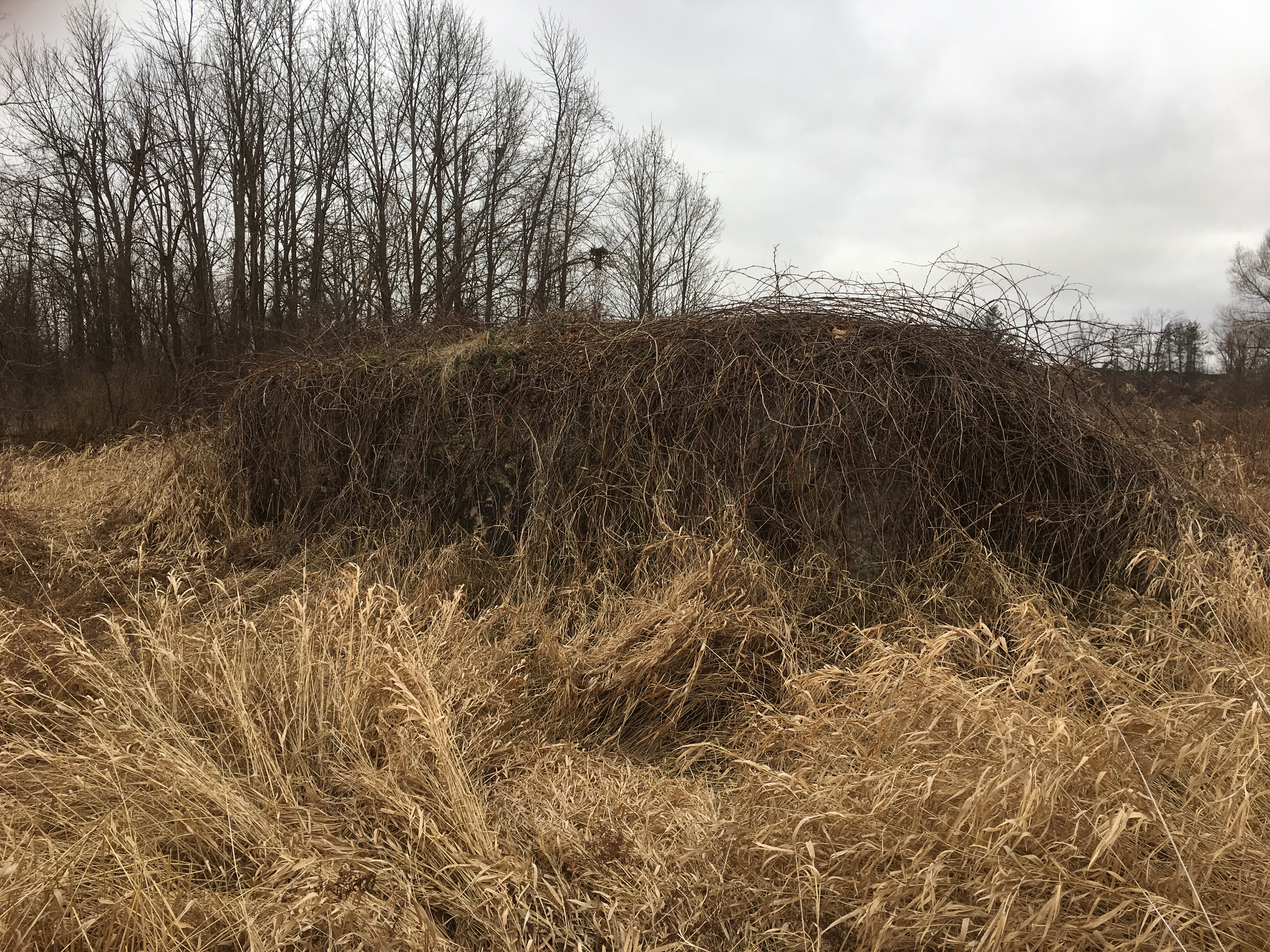
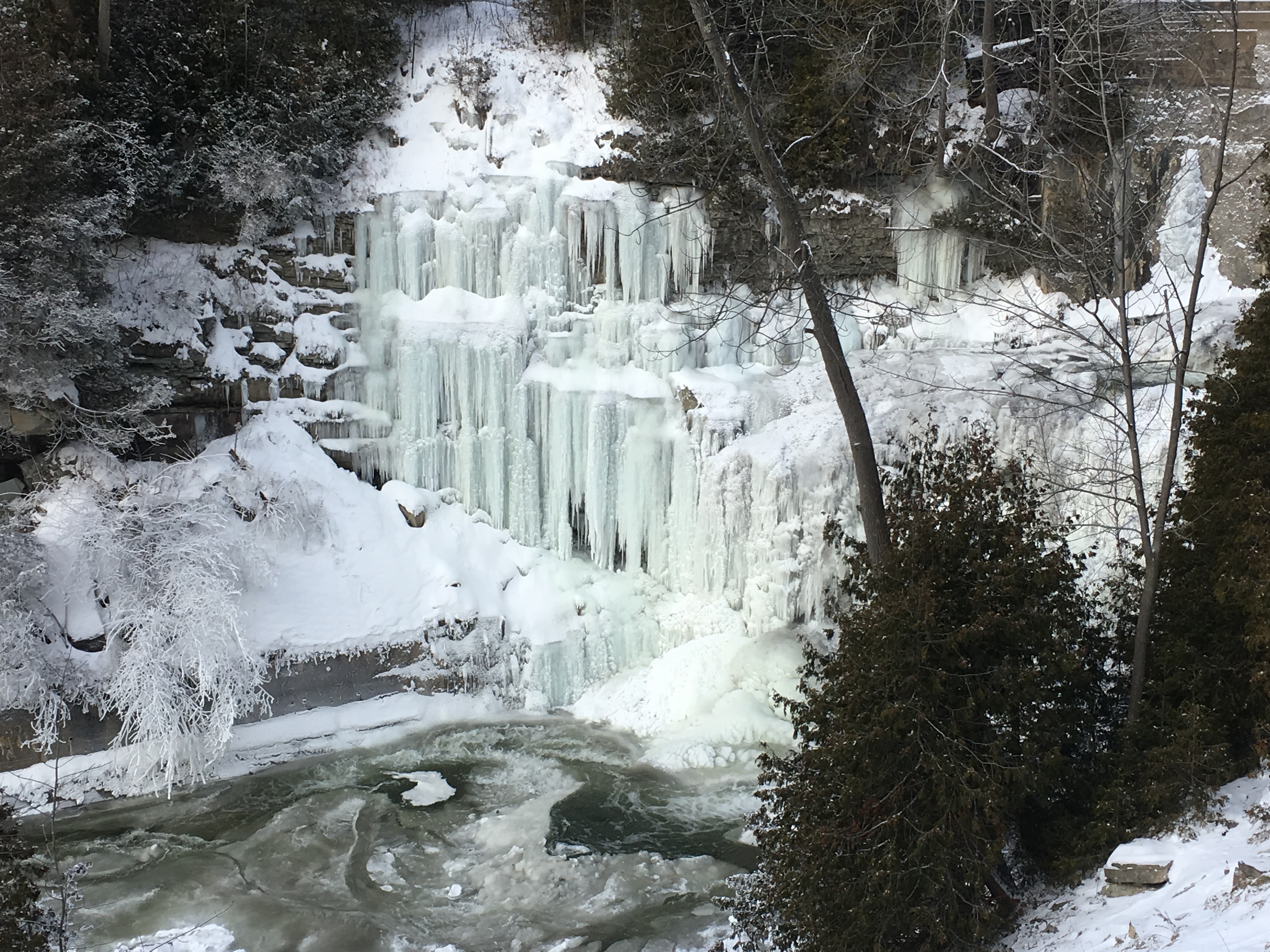
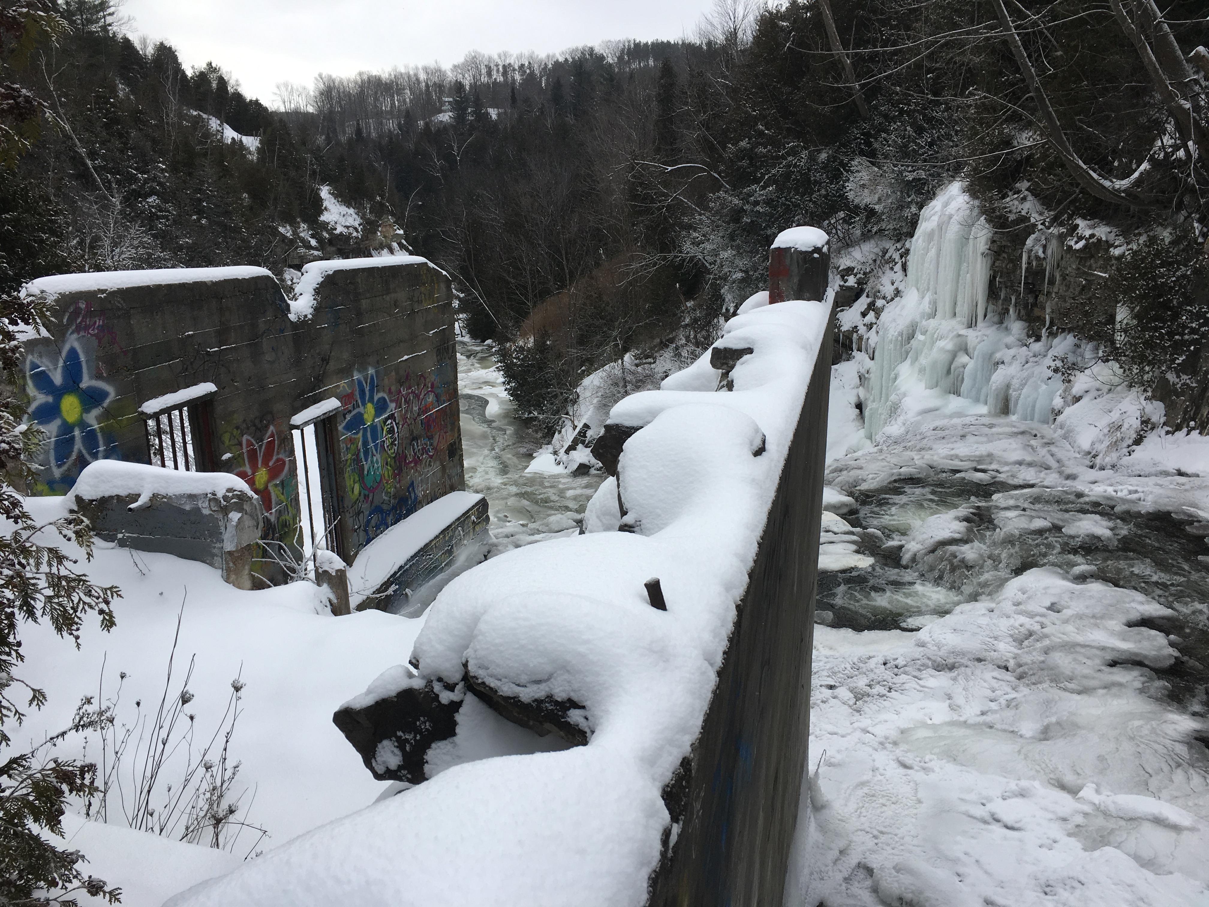
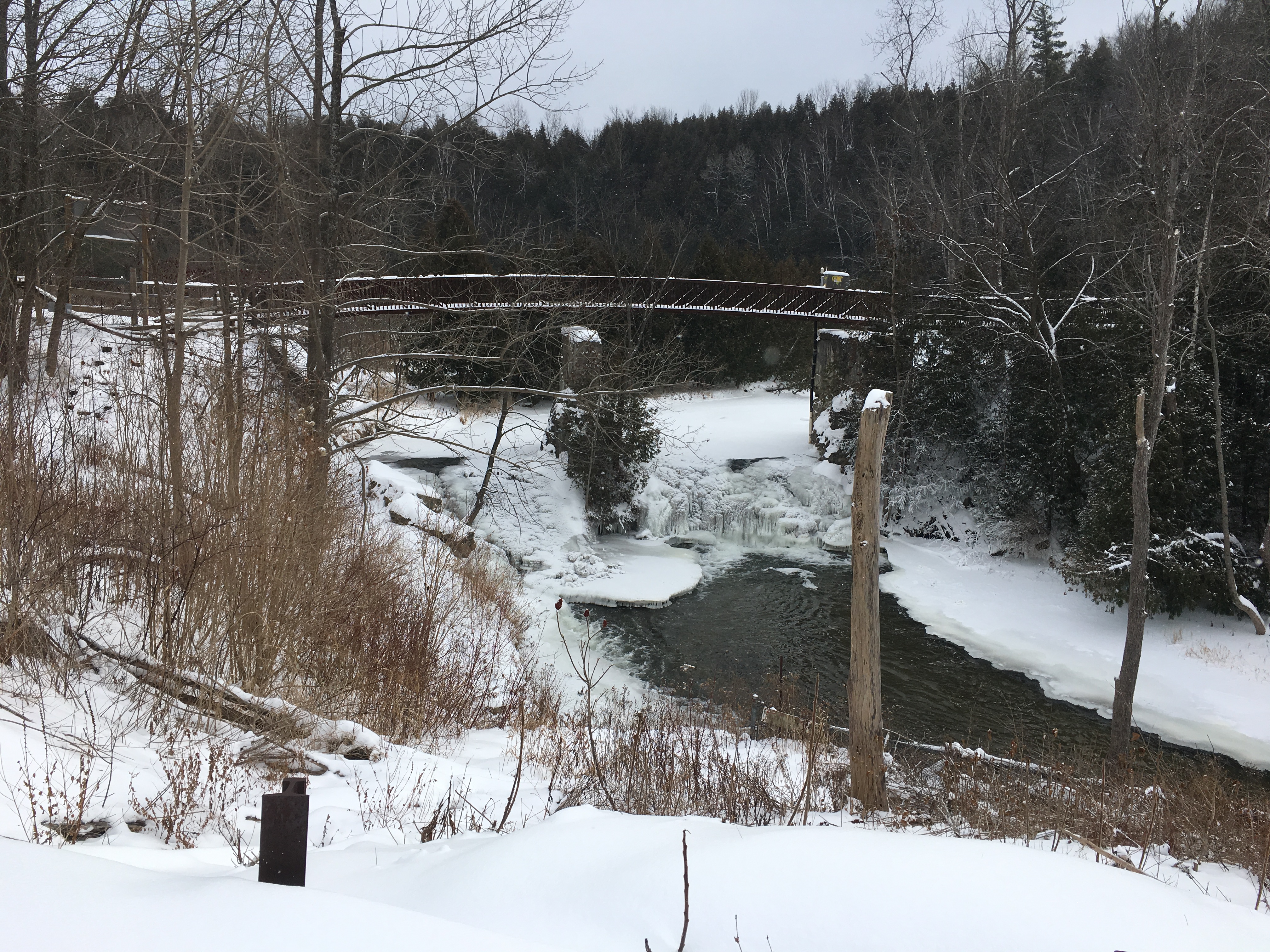
The dam that served the Barber Paper mills was replaced with a concrete one that still spans the river below the River Drive bridge. We initially followed the small trail close to the river but it doesn’t go very far past the remains of the old paper mill. You are forced to return to the formal trail and make your way into the forest that lines the sides of the ravine.

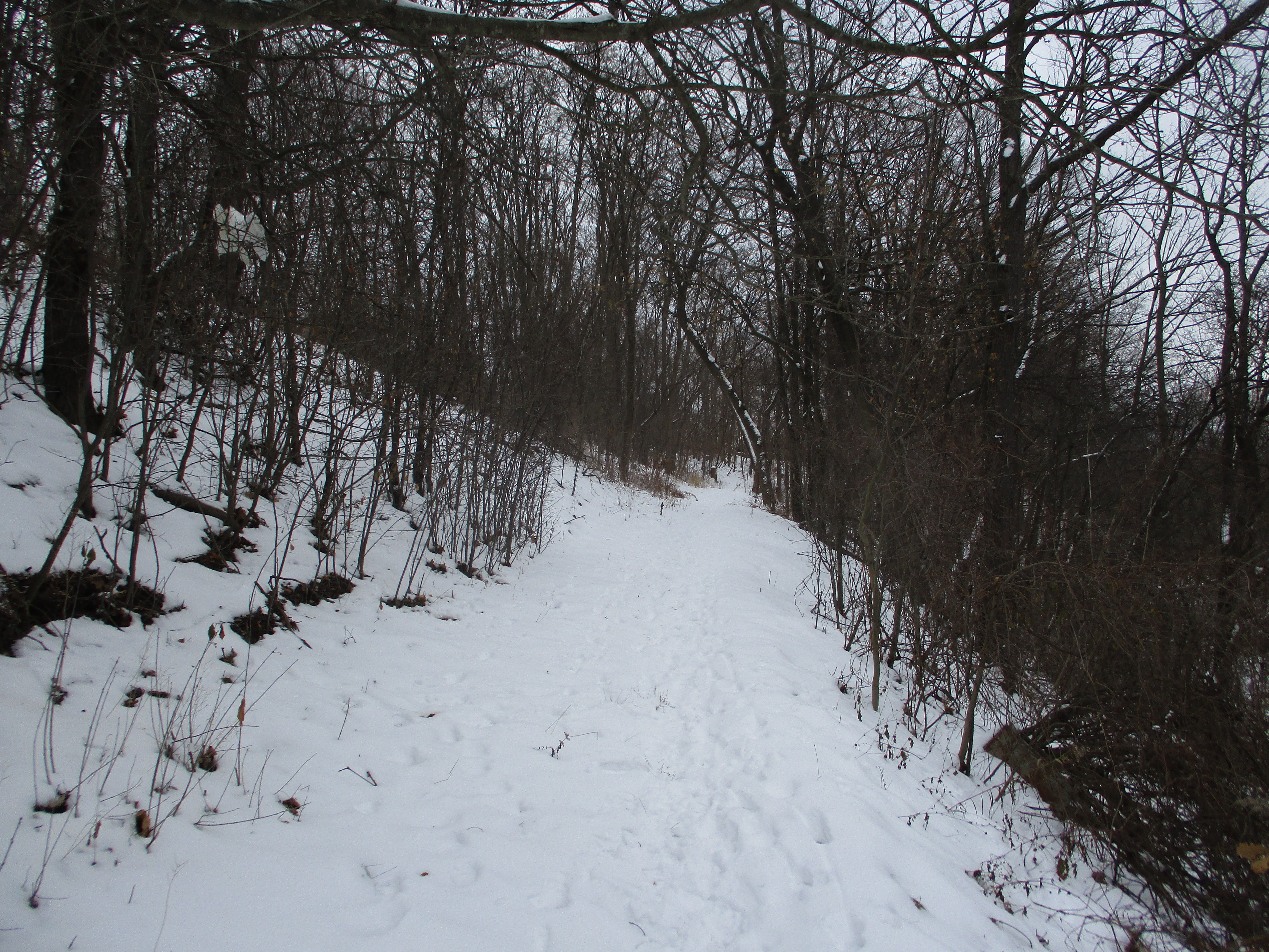
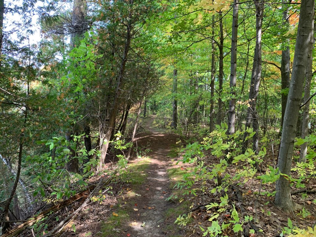
The trail follows the river and climbs the ravine three times between the road and the Barber Dynamo. There is one section that climbs a few steps and then follows the root system of the trees along the edge of the ravine. That part of the trail could be challenging in wet or snowy conditions.

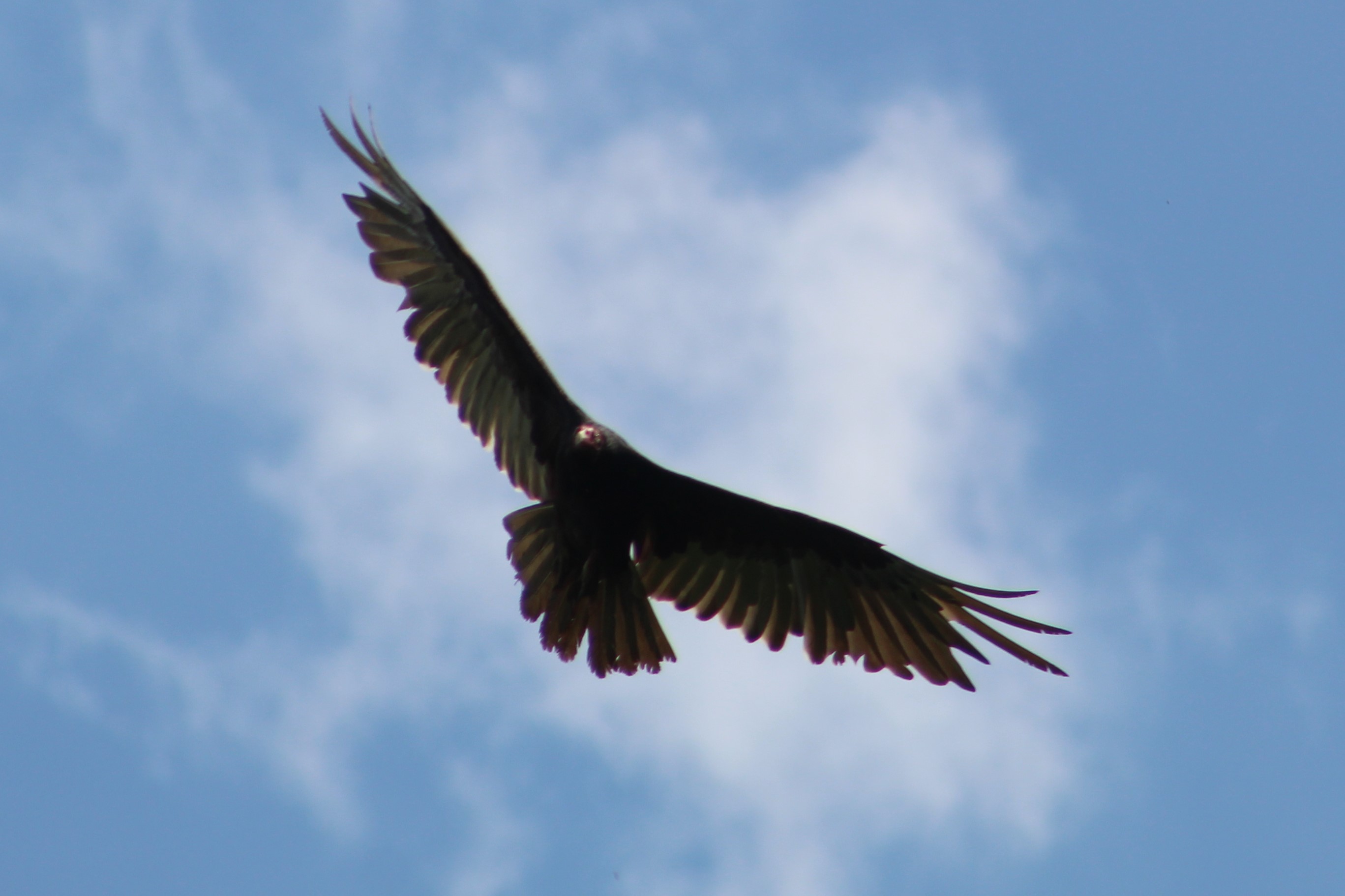
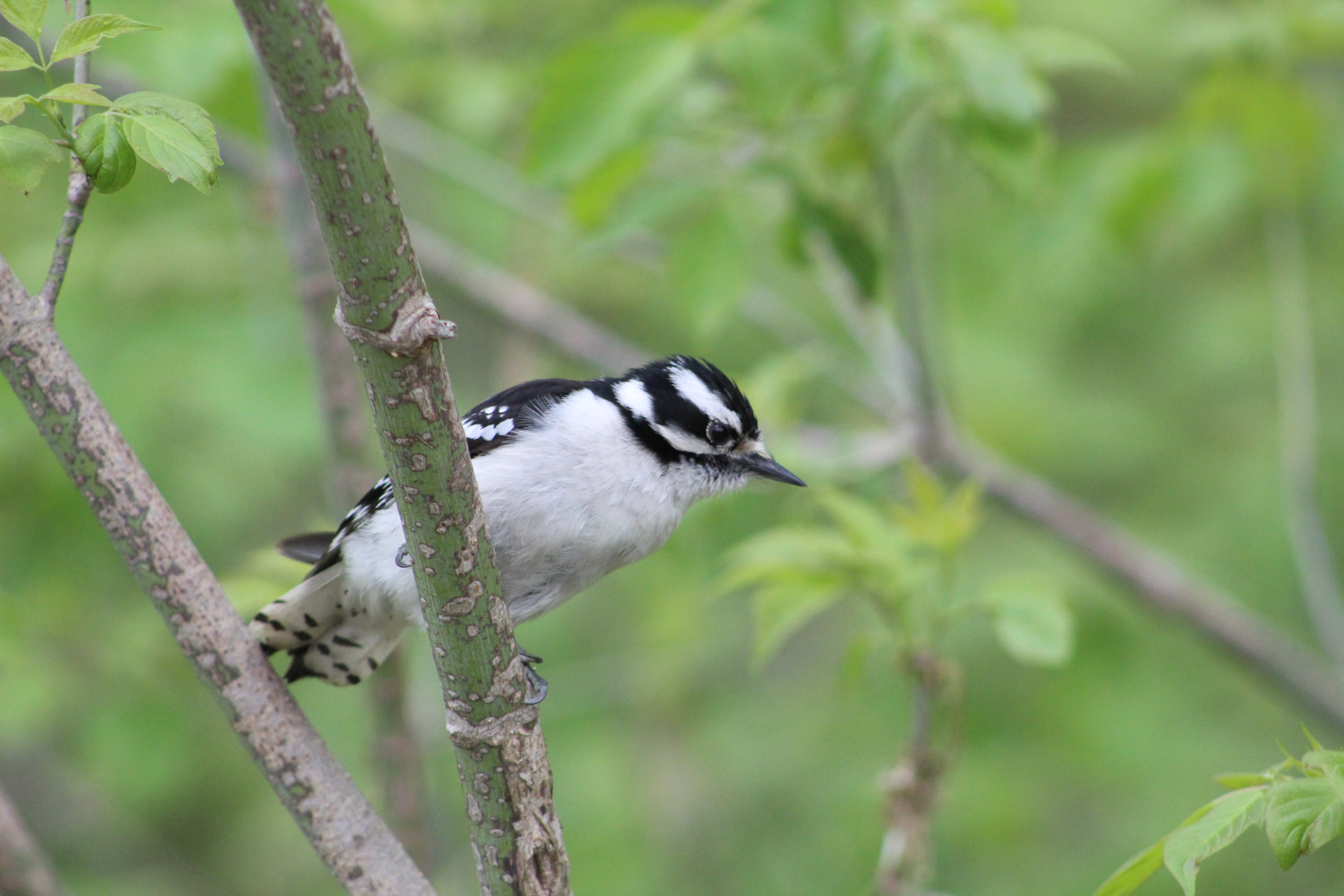
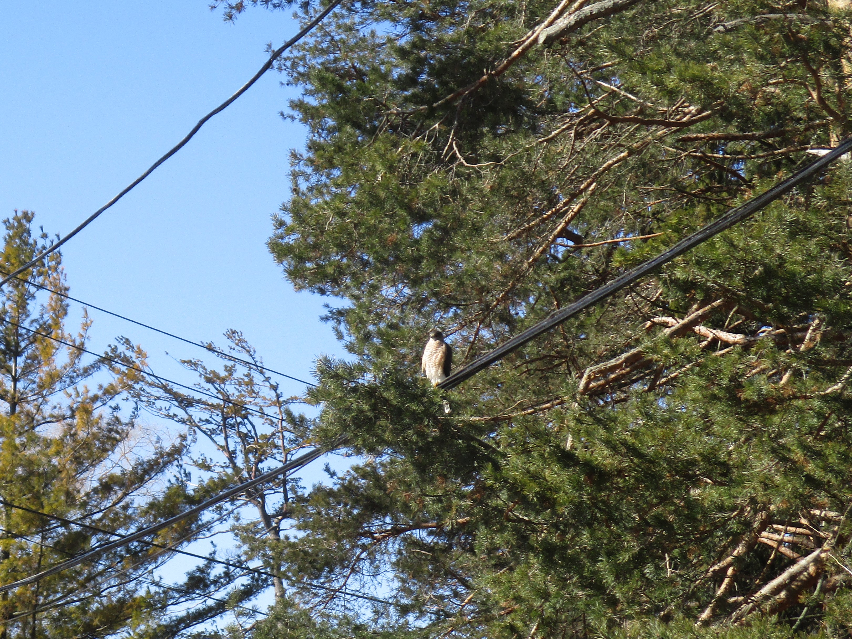
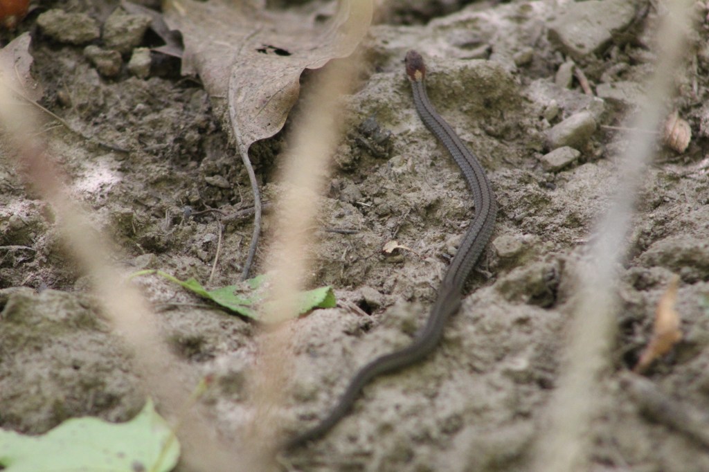
The DeKay’s Snake is also known simply as a Brown Snake and has two distinct rows of black black spots running down each side of the back. With the colder weather coming on we may not see anymore snakes this year, but we’re always watching. I should have been watching a little closer because I almost stepped on this one before it slithered off the trail.

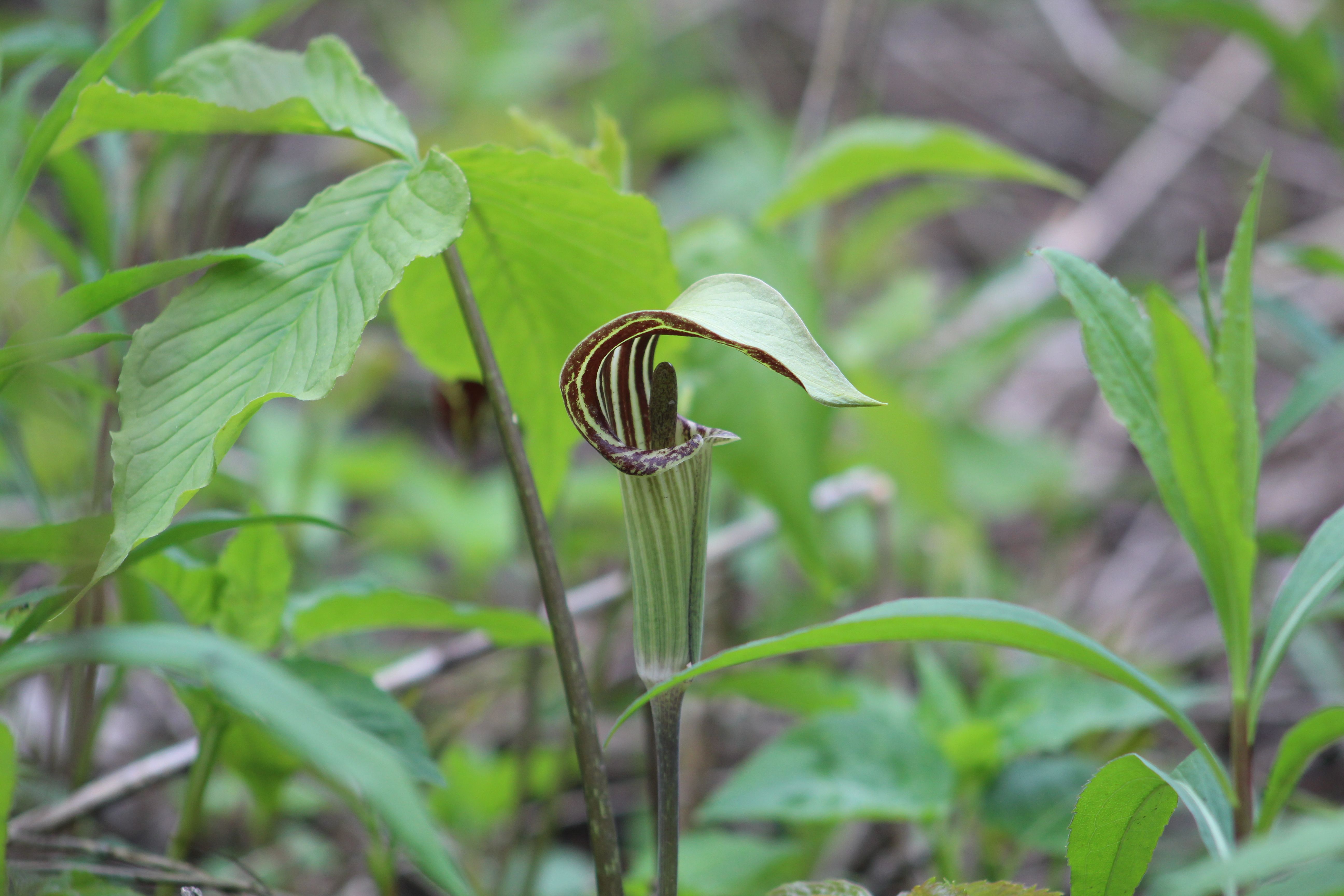
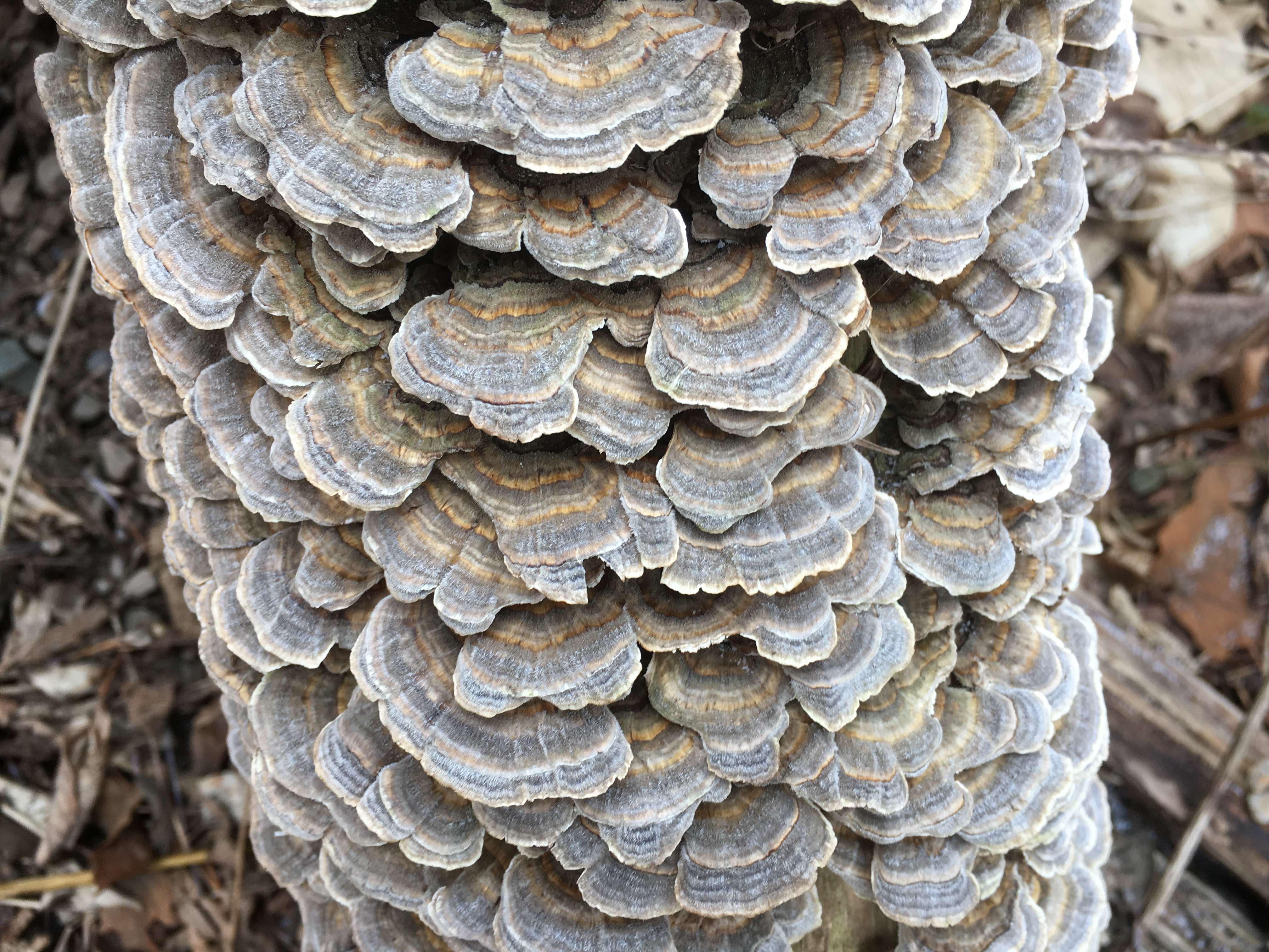
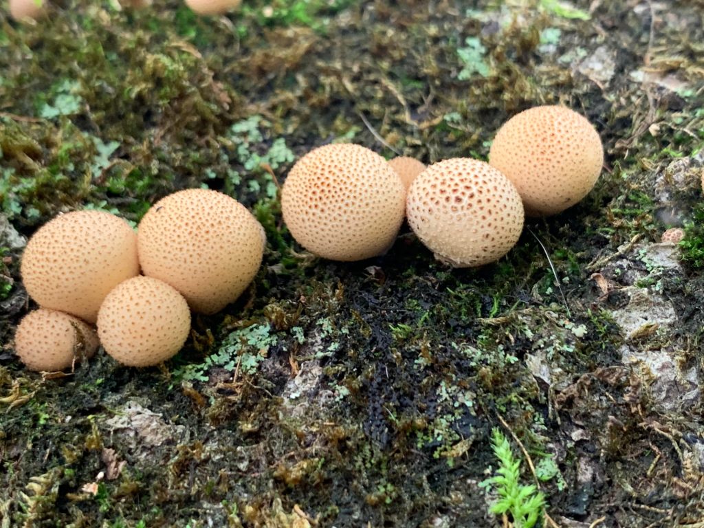
The Common Earthball is also known as Pigskin Poison Puffball. However, unlike other puffballs, earthballs do not have a single opening at the top but rather split open to release their spores.

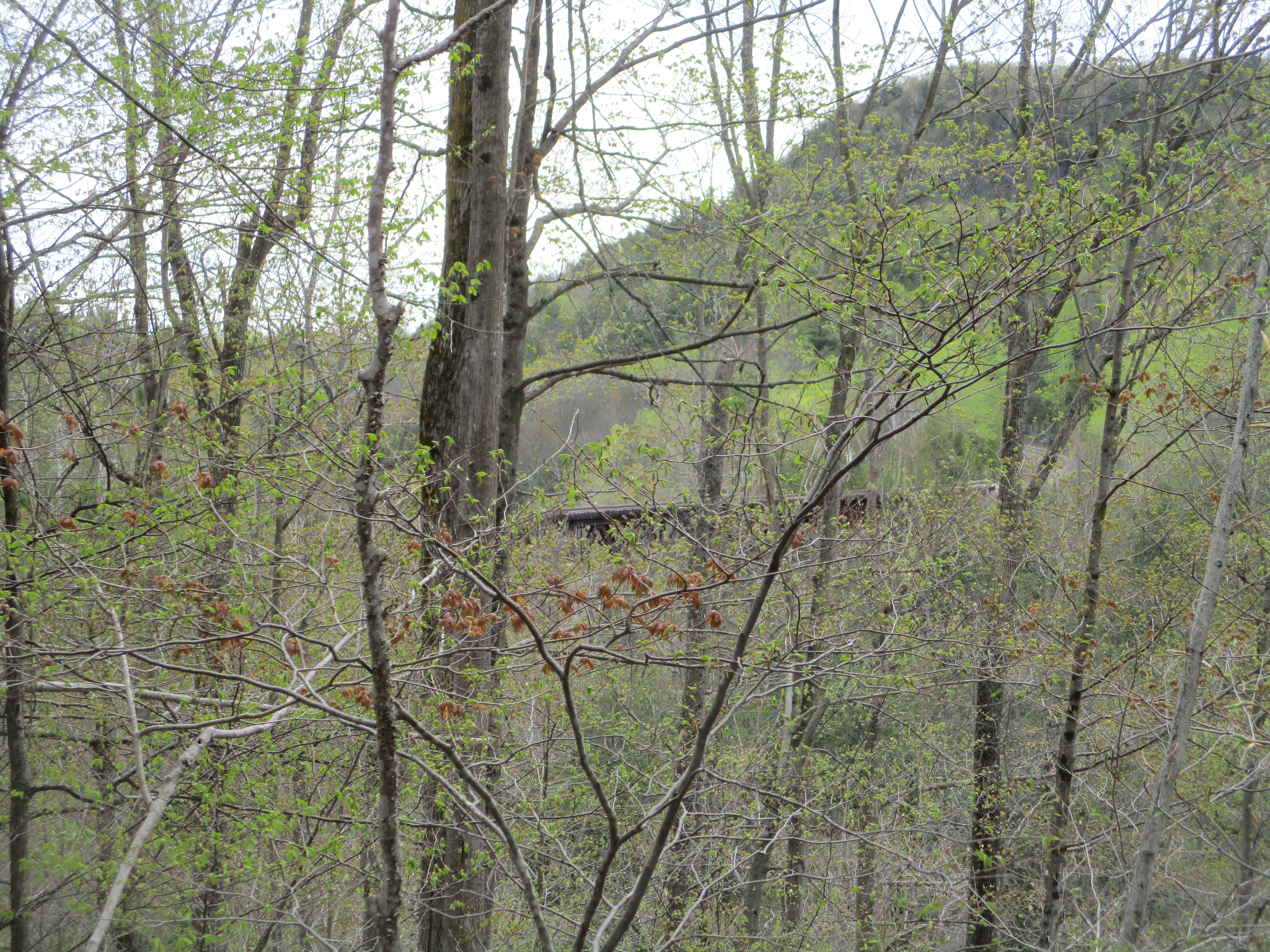
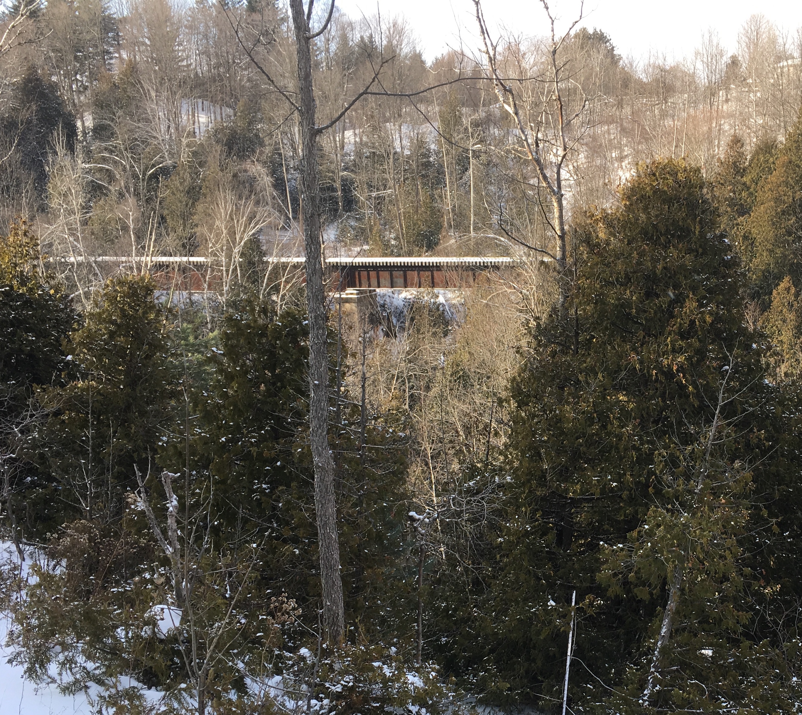
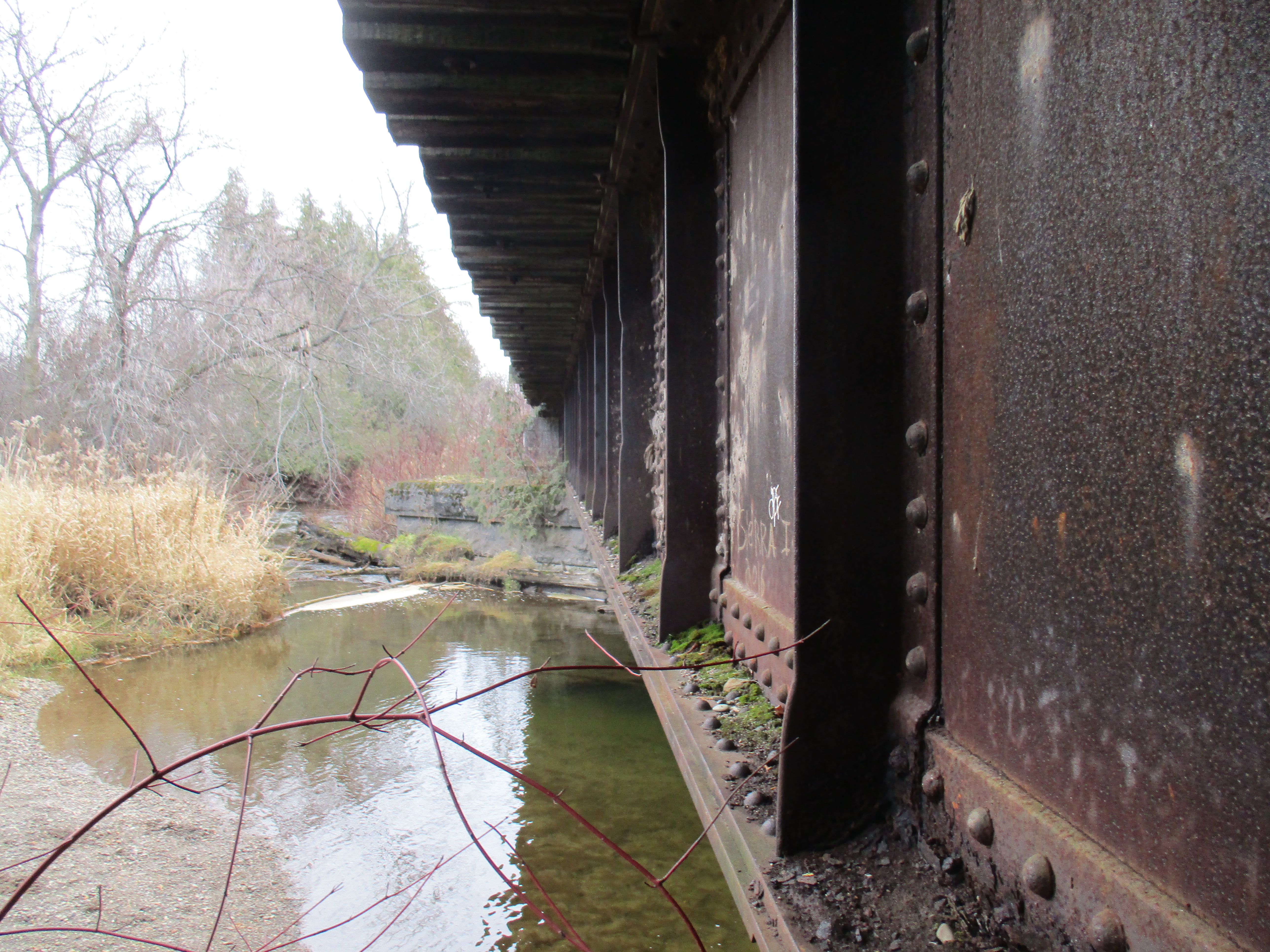
The Grand Trunk Railway Bridge was built in 1855 and earned the nick-name the Iron Bridge. It crosses the 2000 foot wide river valley using 8 spans of 96 feet each and extensive berms on either side. The bridge rises 115 feet above the river. It was expanded in 2010 to accommodate a double track as part of GO Transit’s expansion of services.  Provision has been made for a third track in the future. 

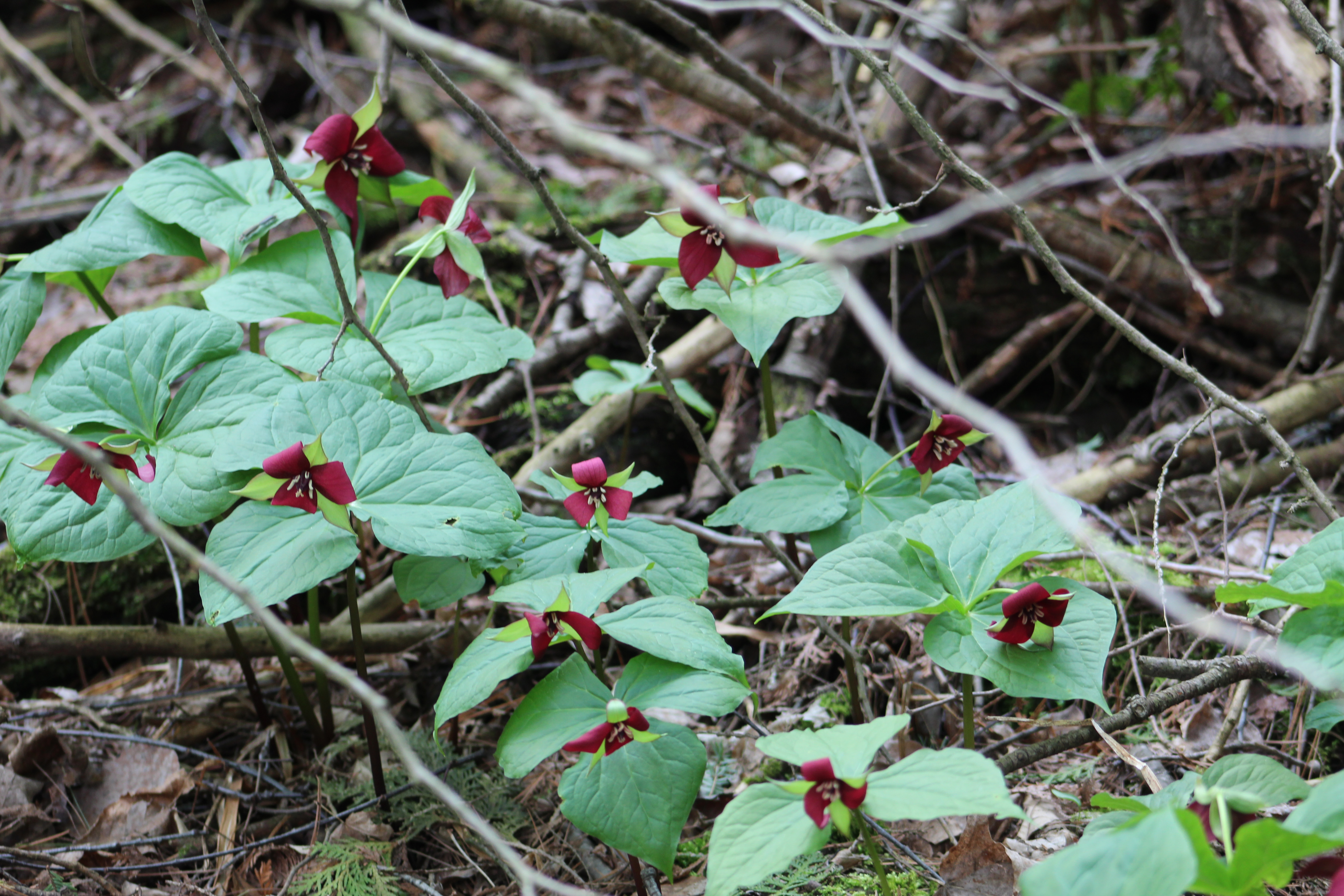
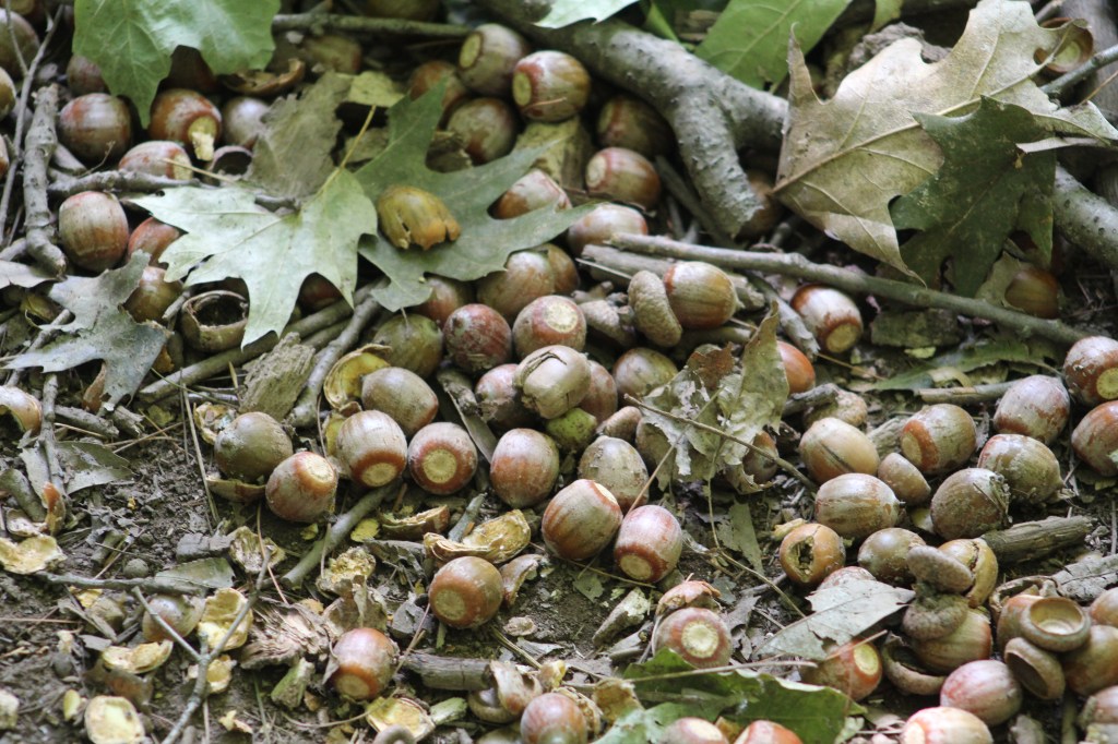
Part of the trail runs through a forest of red oak trees. The weight of nuts or fruit in a forest is known as its “mast” and this year would be known as a big mast year because of the high volume of acorns produced. To have a big mast requires three factors, the first of which is sufficient rain in the fall to prepare the tree for a good spring flowering. Secondly, there can’t be a frost during the week that the female flowers are open in the spring. Lastly, once the acorns are growing they need to avoid summer droughts that can cause fungal problems. The acorns were dropping almost continually in the forest as we passed through, making it the first time we had to hike in acorn rain.

Positive identification of mushrooms can be difficult sometimes and these bright yellow mushrooms were not featured in my field guide or clearly singled out on line. The scales on the caps may indicate that they are poisonous. We don’t harvest mushrooms on our hikes, and recommend you don’t either, so it doesn’t make a whole lot of difference if they are edible or not.

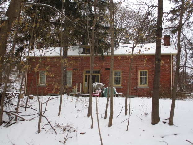
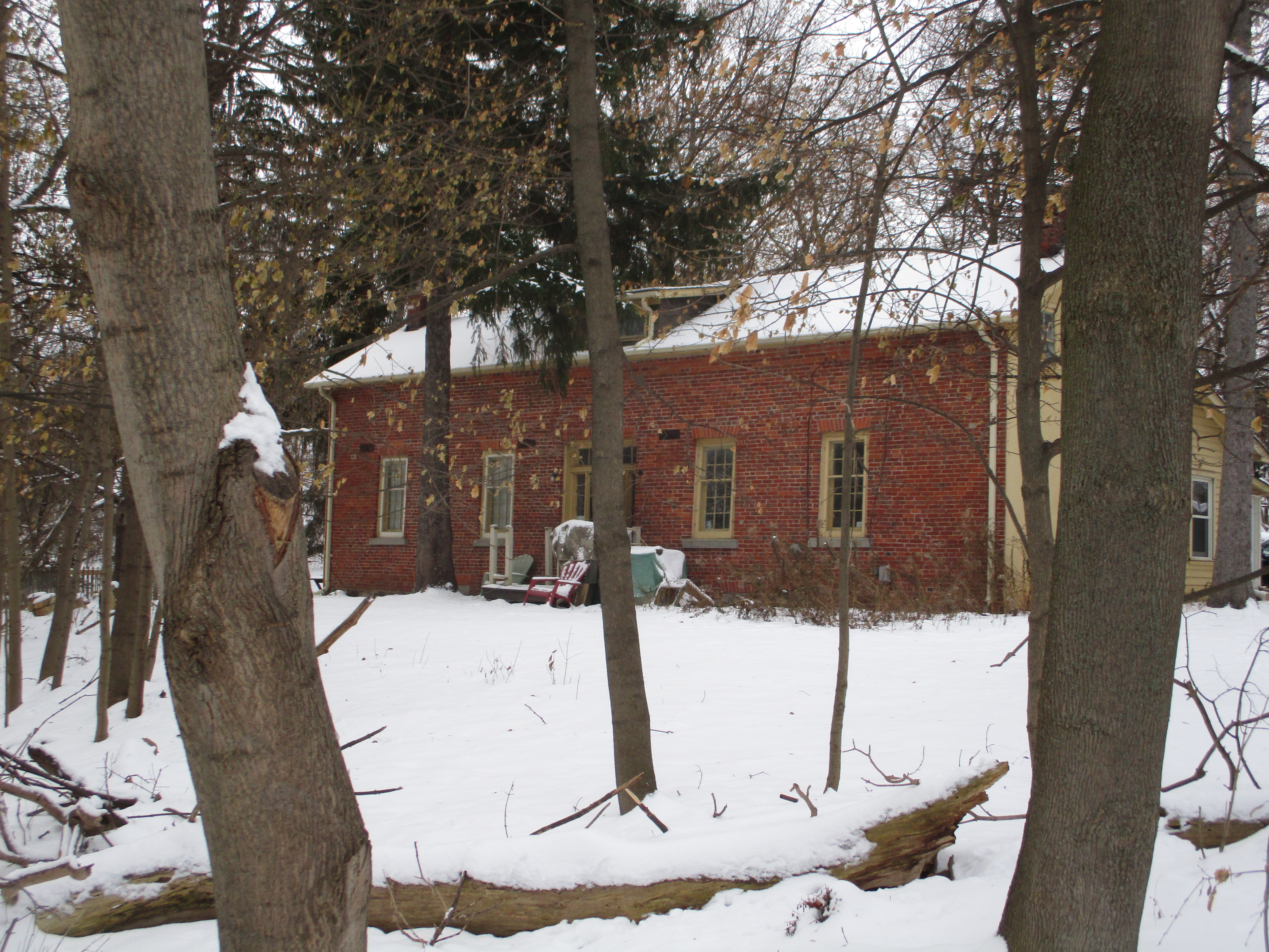
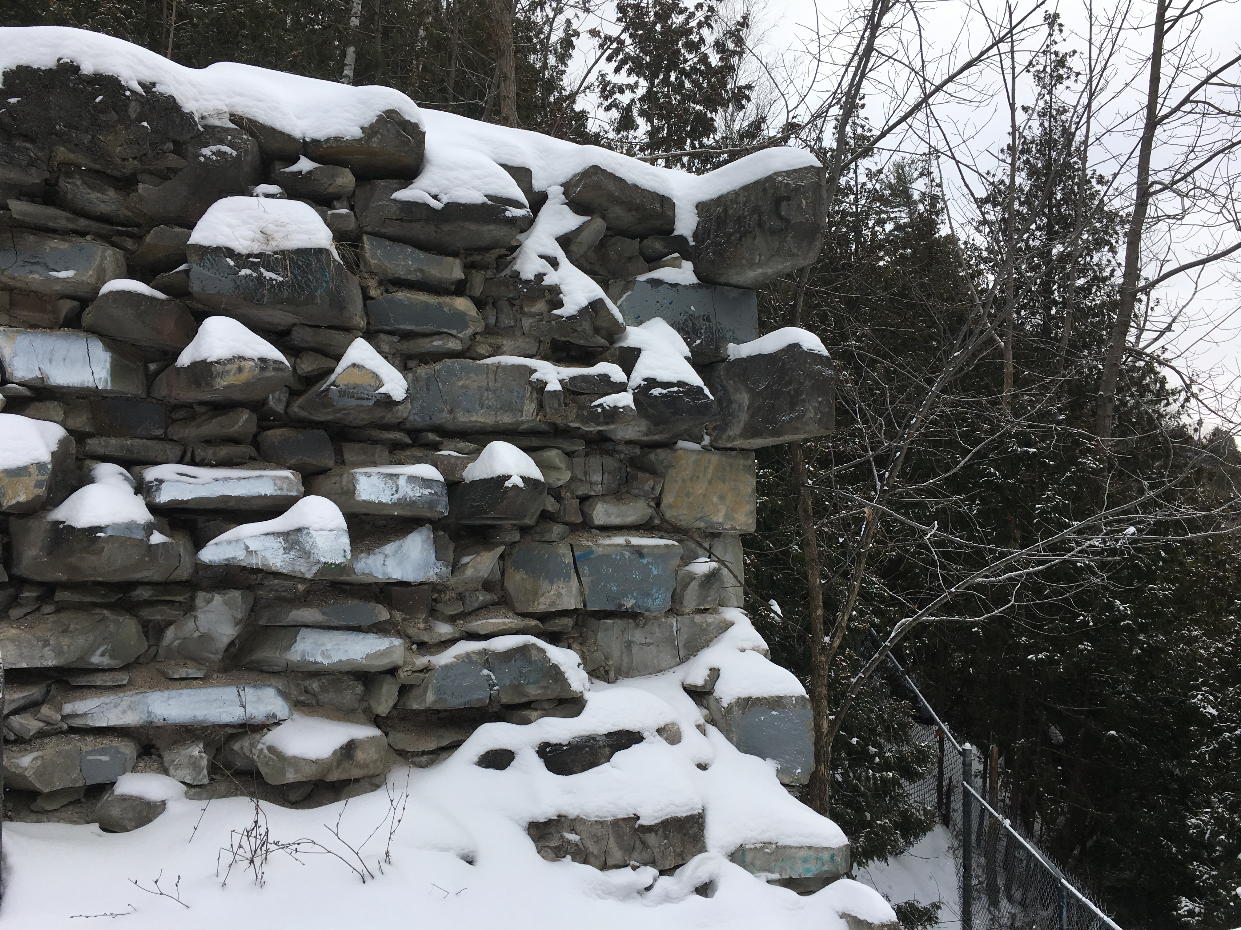
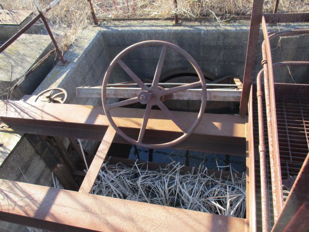
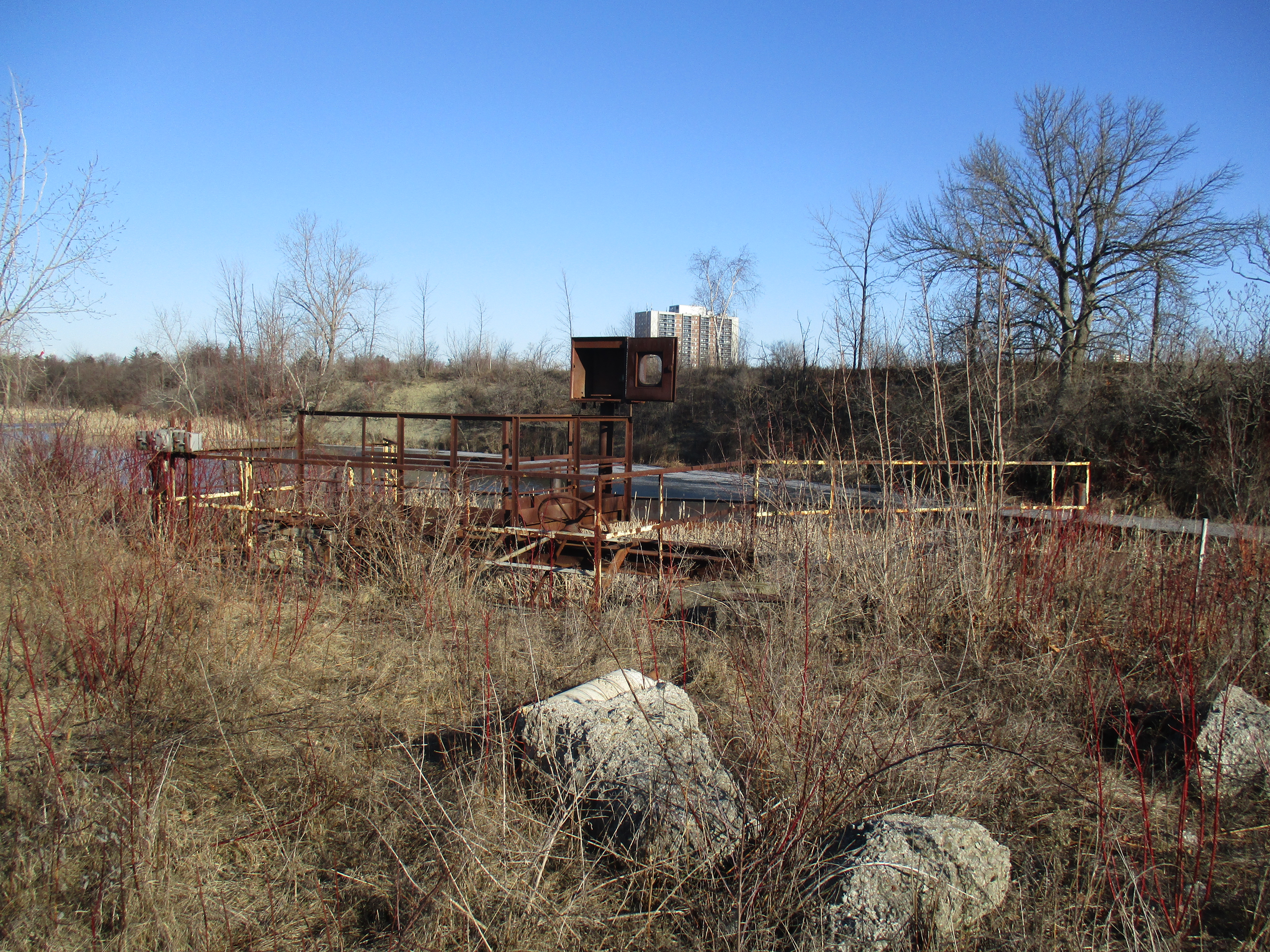
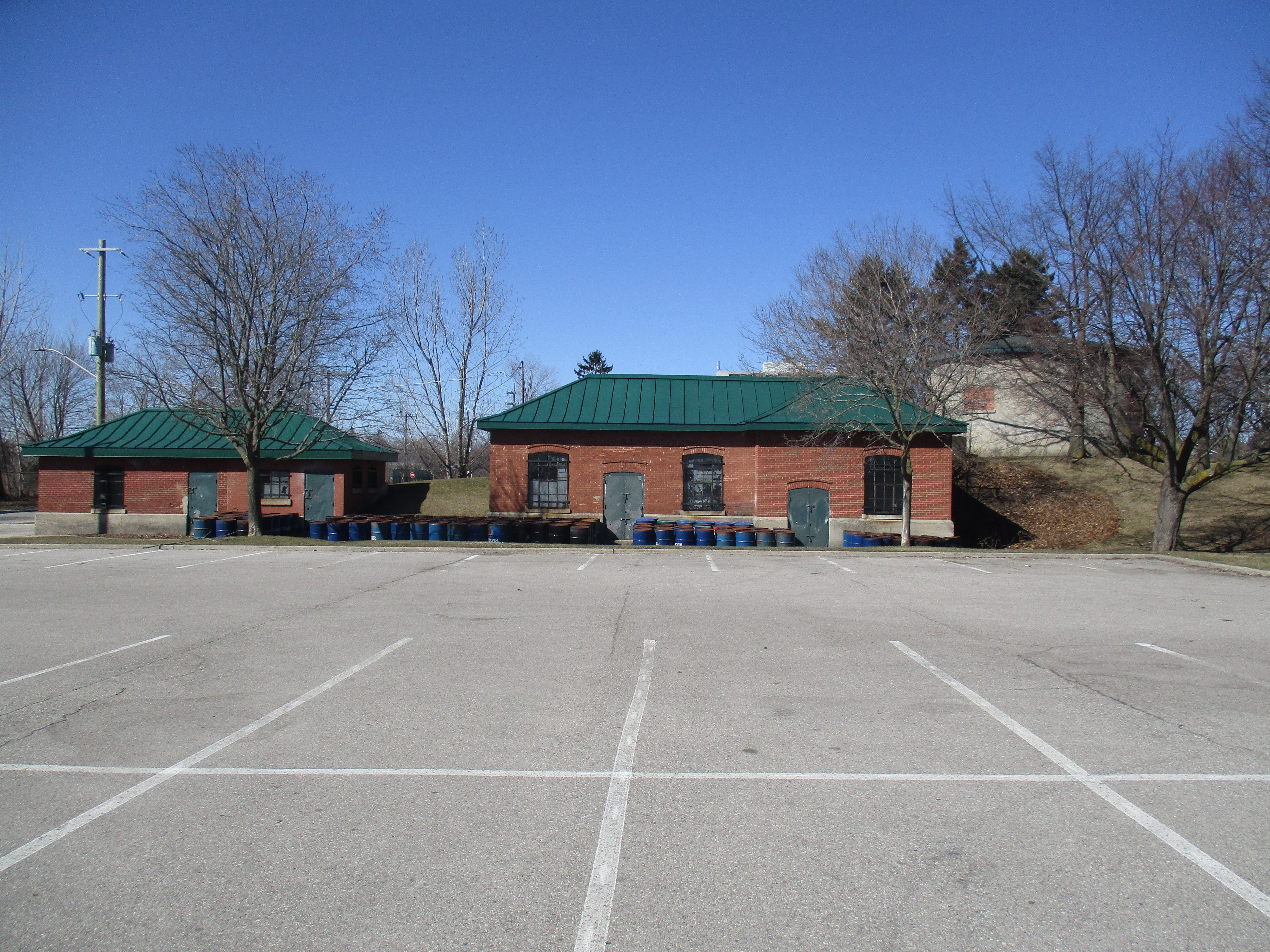
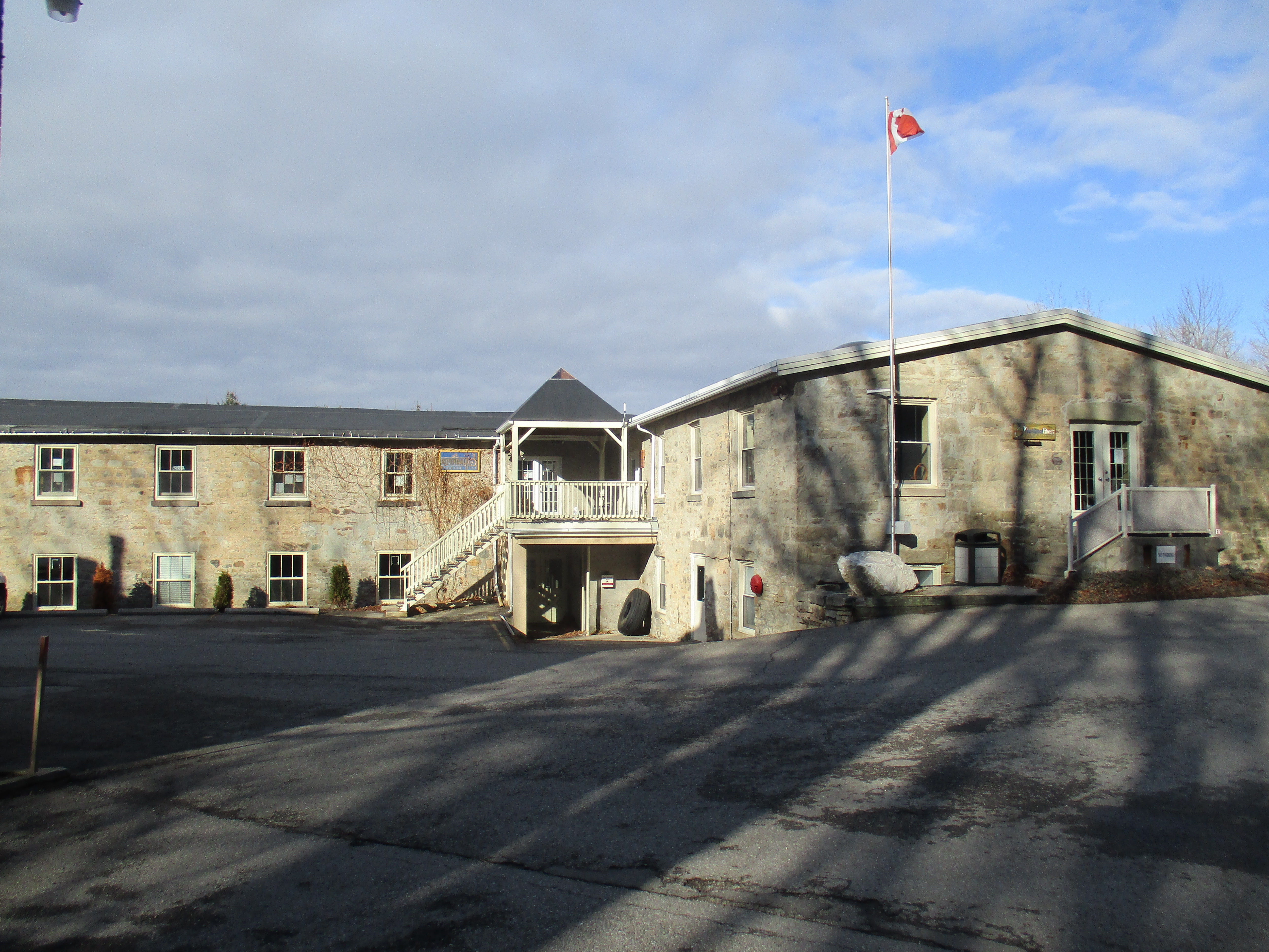
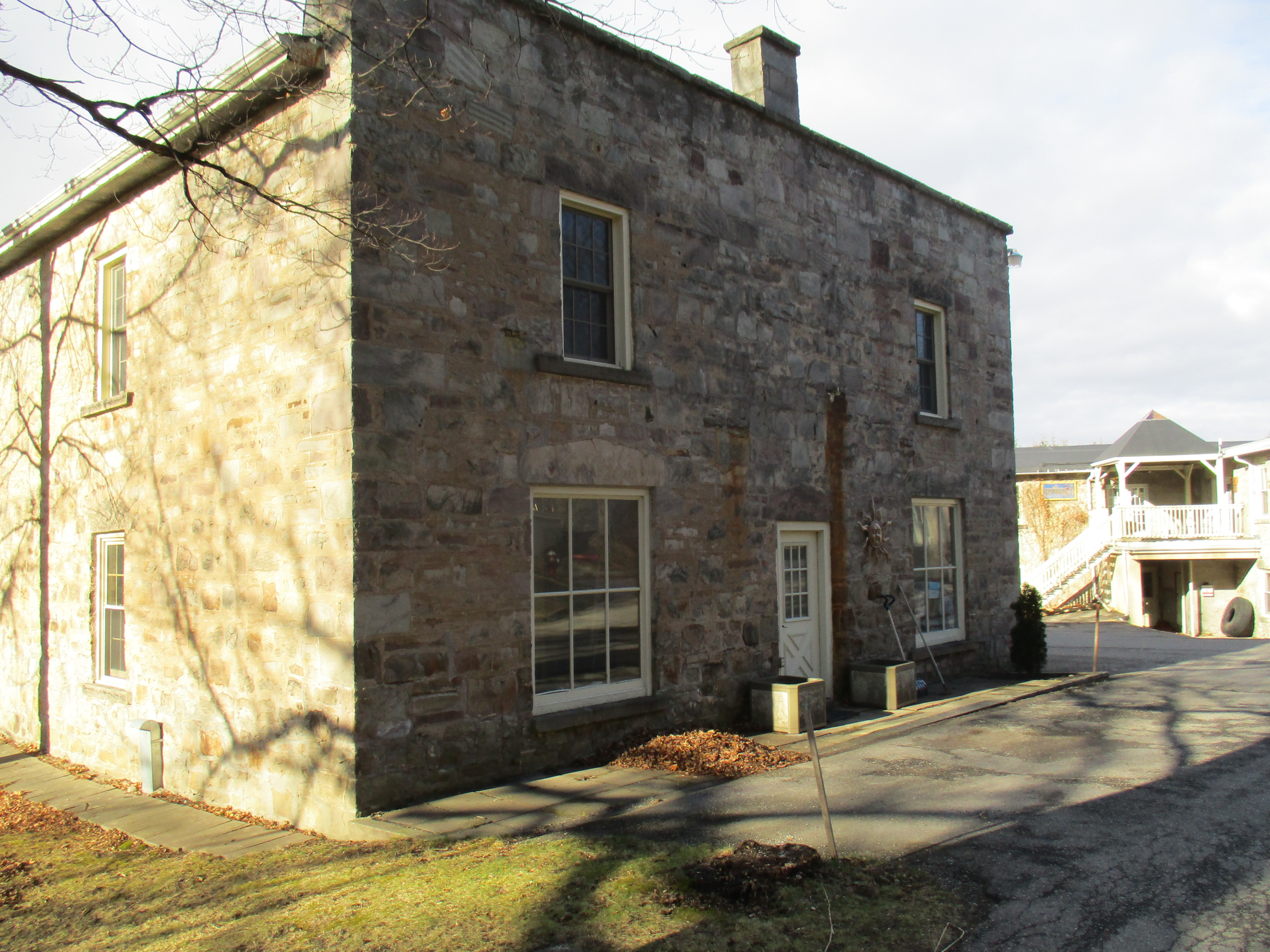
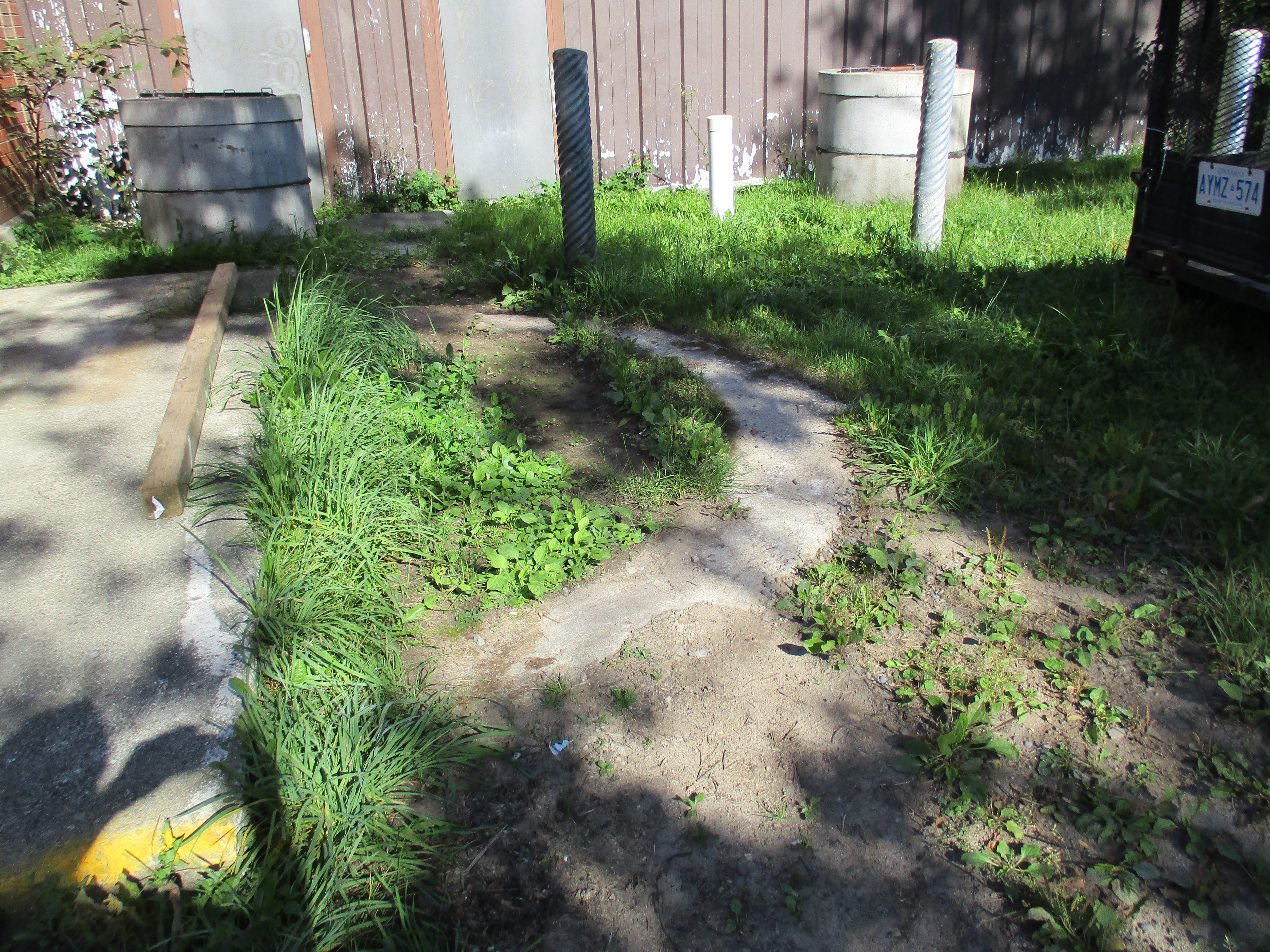
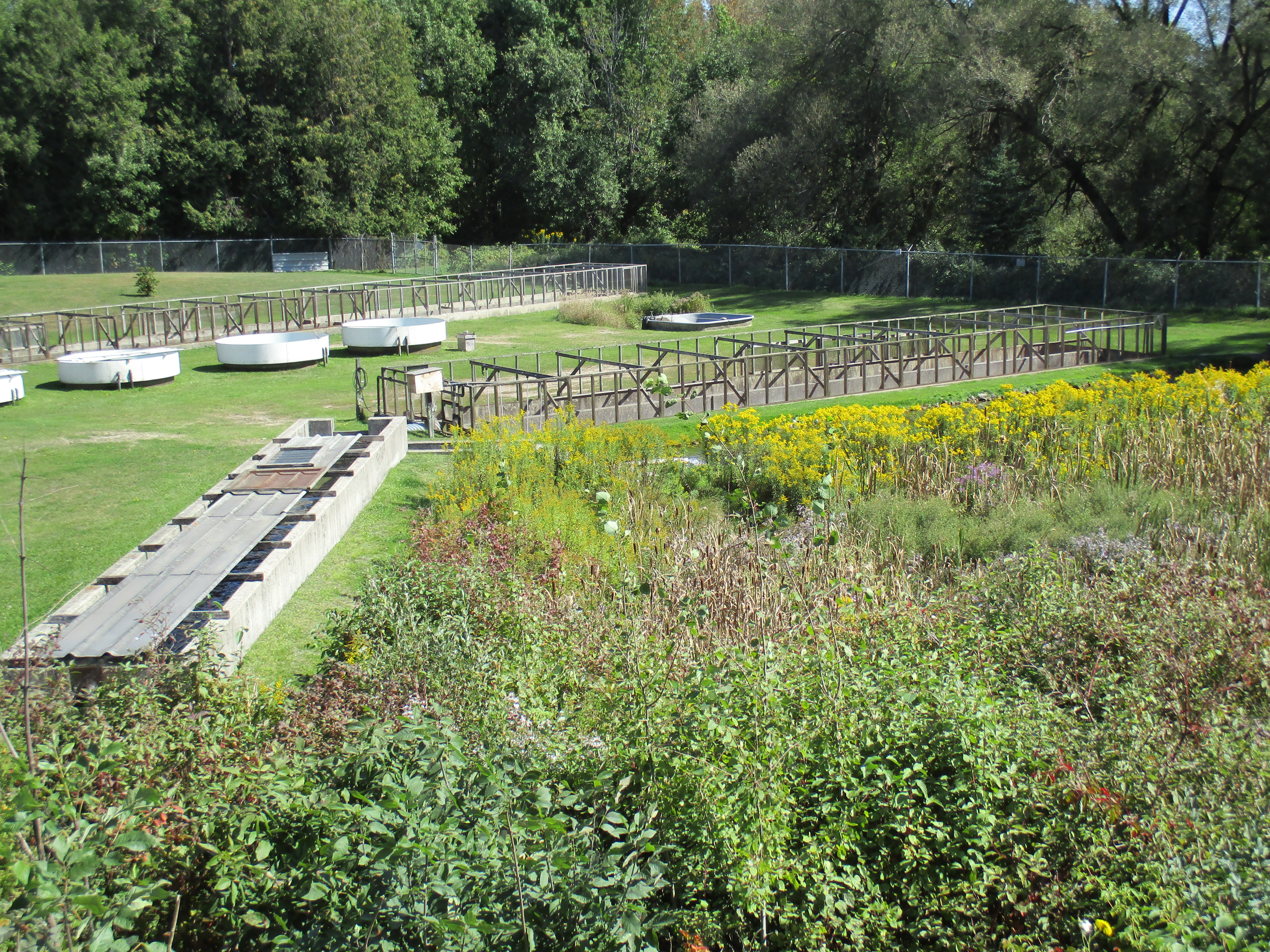
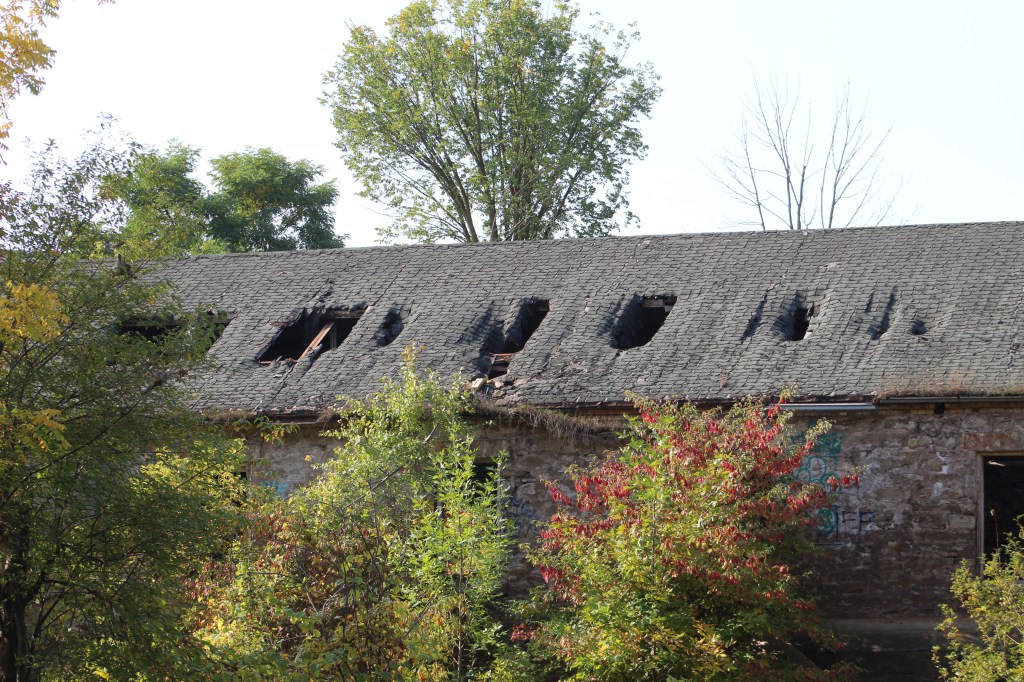
The Barber Dynamo is one of our favourite places to visit in the GTA and we have previously told the story of the building. Each time we take a new set of pictures there is some level of deterioration in the old stone building. Unfortunately it looks like we will eventually lose what remains of the first electrical generating plant to transmit power over wires for the operation of a mill. More details can be found in our feature story on the history of the Barber Dynamo.

The walls are starting to sag in various places and will collapse if steps are not taken to support them, perhaps in a manner similar to the work being done at Goldie Mill in Guelph.

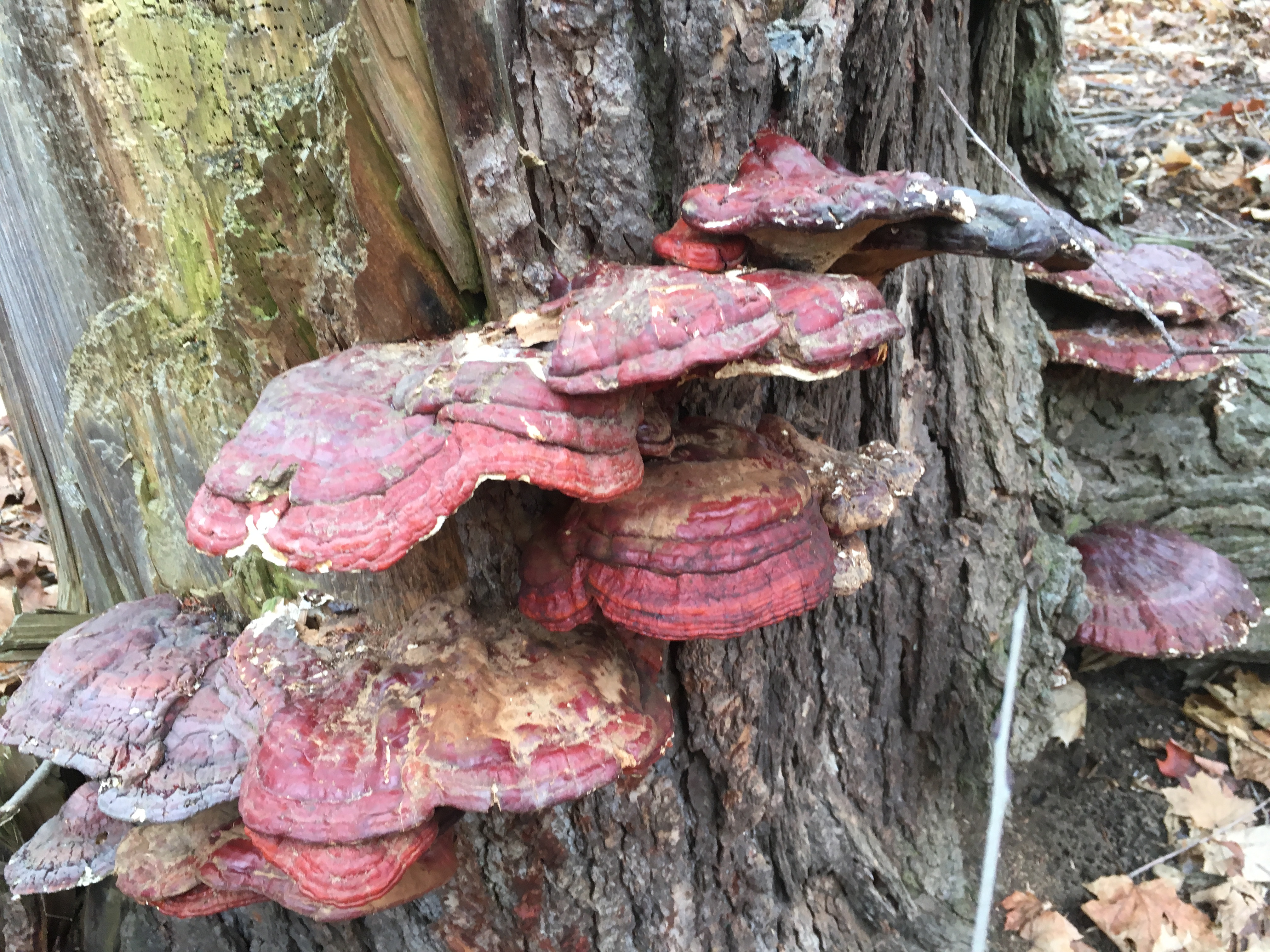
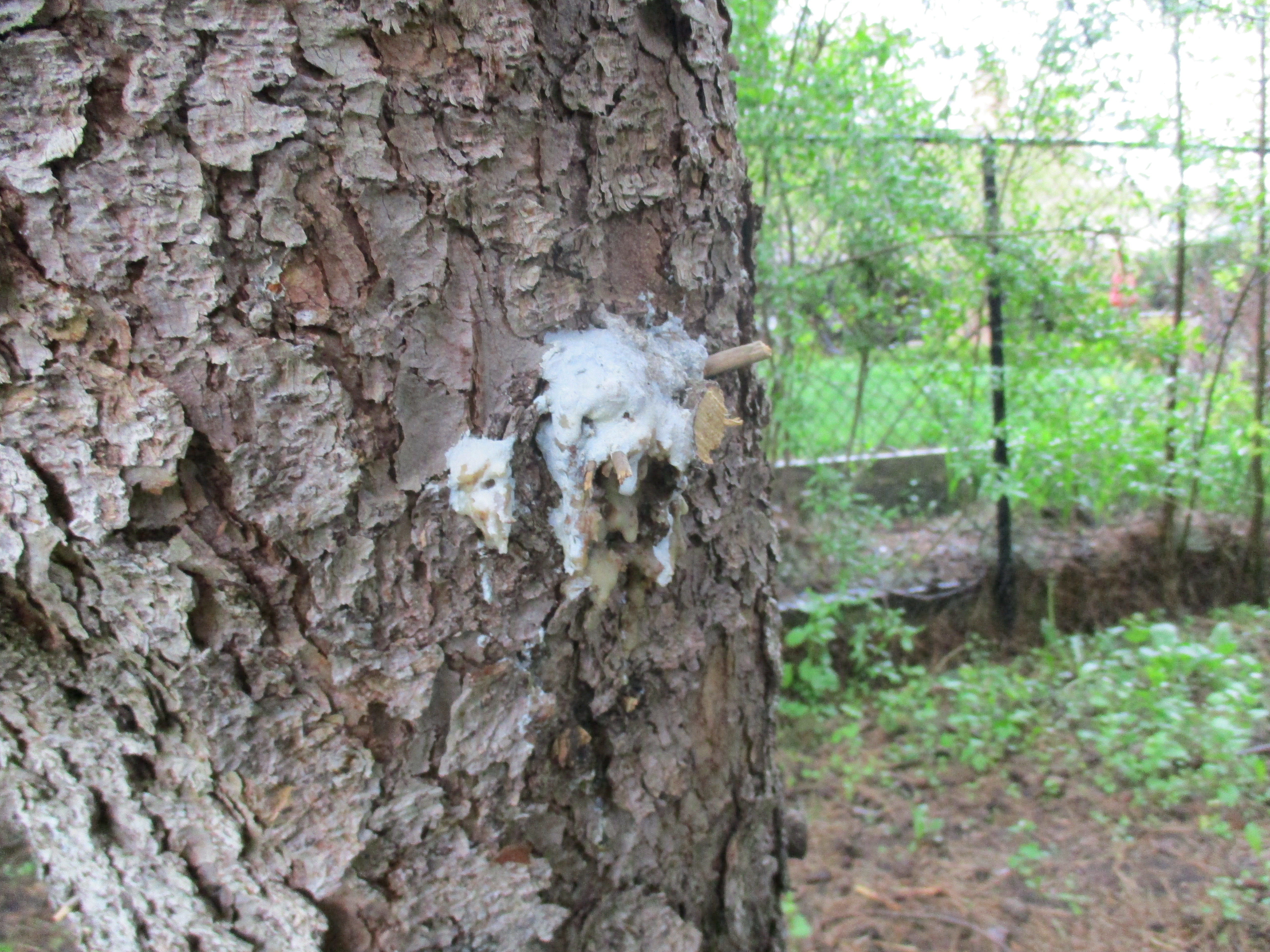
Wolf’s Milk Slime is also known as Toothpaste Slime because of the consistency it has when it first comes out. If the balls are punctured before the spores are ready they will ooze a pink slime. Wolf’s Milk Slime grows between June and November on well rotted logs.

The Credit Valley Footpath continues out to the Tenth Line which could provide a less strenuous hike should you wish to visit the Dynamo. Perhaps we’ll use that end of the trail in the future as we continue to keep an eye on this heritage site over the coming years.

Google Maps Link : Barber Paper Mill

Like us at http://www.facebook.com/hikingthegta

Follow us at http://www.hikingthegta.com

Also look for us on Instagram

Koliba Park

Saturday, May 30, 2020

There is an interesting enclave in Mississauga in the area of Barbertown and Streetsville.  In 1945 three Slovakian farmers were returning to Canada after serving in World War 2 and together they purchased 10 acres of land just north of Eglinton Avenue.  The little park they established was given the nick named “Midgetville”.  There is no parking close by and so we parked some distance down river and made our way north toward the site.  The trail along the river has become quite naturalized through the section known as Hewick’s Meadows.

IMG_3133 (1)

Heavy rains have caused the Credit River to flood its banks and divert a large flow of water onto the walking trail.  This has led to some major erosion of the path.

IMG_3146

On the north side of Eglinton Avenue you join Barbertown Road to make your way toward Koliba Park.  Barbertown Road used to contain many houses built for the people who worked in the various mills in Barbertown.  Most of these old workers cottages have been replaced with modern homes but there are still a couple remaining from the mid-1800’s.  The picture below shows a typical duplex of the era, although it has been covered up with siding.

IMG_3175

A little farther along Barbertown Road you will find another small abandoned home that housed a single family. Likely a new home will fill this site in the near future.

IMG_3171

Koliba is a Slovak word that means “Shepherd’s Hut” and it suits the small cottages that were built in the valley at the bottom of Barbertown Road.  Over the years most of the 10 acres of the original property was sold of and has been developed but the small park with its cottages and playgrounds has been retained.  It hosts several Slovak events each year as well as being rented out by Slovakian churches for their services in the summer months.  Due to the fact that the site is isolated there has been a number of cases of vandalism over the years and so the gates are kept locked.  We were forced to take our pictures through the fencing.

IMG_0129

Under normal circumstances the park hosts an opening weekend banquet on the first Saturday in May but that was cancelled this year due to the pandemic.  The Slovak Canada Day picnic that normally happens at the end of June will likely not happen either.  Instead of the park being filled with weekend campers the swing sets sit idle this year.

IMG_0134

The Barbertown bridge was originally built to bring the mill workers from the houses on Barbertown Road to the mills that still line the east side of the river as it flows though Streetsville.  More information on the mills can be found in our post on Barbertown.  We decided to stay on the west side of the Credit River to see if we could make our way upstream to the Streetsville Dam.

IMG_0128

Oyster Mushrooms are one of the most commonly harvested wild mushrooms in Ontario.  During the First World War the Germans began to cultivate Oyster Mushrooms for food and today they are commonly cultivated around the world.

IMG_0096

As we made our way along the river bank we disturbed a family of Canada Geese with their five goslings.   The jumped in the water and began to cross the river with the two adults keeping the little ones safe between them.

IMG_0144

Along the side of the river we found a dead Sea Lamprey.  Their mouth is as large or larger than the head and has no jaw.  The circular rows of teeth and suction cup mouth allow it to attach itself to fish where it slowly kills the fish by draining its blood.  Lampreys spawn in fresh water after which the adults die.  The larvae burrow in the silt at the bottom of the river and live in fresh water for several years.  They then undergo a metamorphosis that allows them to switch to salt water and they migrate to the sea.  A year and a half later they return to the fresh water rivers to span and die.

IMG_3205

The view inside the Lampreys mouth is like something out of an old horror movie.

IMG_3202

A pair of Turkey Vultures were circling above the river.  Perhaps one of them will eat the remains of the Lamprey.

IMG_0151

We reached a point where the river flows beside a steep embankment where we were forced to turn back.  It might be interesting to return to Koliba Park when they are participating in Doors Open Mississauga so that we can get a look inside the buildings.

Google Maps Link: Koliba Park

Like as at http://www.facebook.com/hikingthegta

Follow us at http://www.hikingthegta.com

Look for us on Instagram

Timothy Street – Pioneers of the GTA

Saturday, December 7, 2019

The founder of Streetsville was born in New York in 1777 and emigrated to Upper Canada in 1801 after marrying Abigail Smith.  They lived near Niagara for twenty years and in 1818-1819 Timothy financed the survey of Toronto Township and was compensated with 4500 acres of land that would become the town of Streetville.  We decided to go and explore some of the legacy he left behind.  We parked on Mill Street beside his historic home.  The county atlas below shows how large Streetsville had become by 1877 when it was released.

Streetsville (2)

Timothy founded a milling empire and in 1825 built the house that still stands at the end of Mill Street near his mills.  He first built a grist mill around 1822 and soon added a lumber and saw mill.  He continued to expand by adding a tannery, distillery and clothing mill.  The brick house he constructed is considered to be the first brick house to be built in Peel County and remains the oldest one.  It is a story and a half and has been added to at least twice partly to accommodate the 12 children he raised along with Abigail.

IMG_8641

Timothy needed water to power his mills and so he built a dam across the Credit River just north of the mills.  He found a narrow place where an earthen berm could be built to retain the mill pond.  Originally the dam would have consisted of a wooden crib across the river that was filled with stones.  This type of dam required constant repairs, some of which could be quite dangerous.  Many millers lost their lives trying to save their mill dams from being washed away in the raging spring waters.

IMG_8645

In 1824 Timothy Street deeded an acre of his land to the Presbyterian Church for the purposes of establishing a Protestant cemetery.  Five of his own children would die in their youth and be buried in this cemetery.

IMG_8660

Timothy Street died an January 31, 1848 and was buried in the cemetery where his children were interred.

IMG_8661

From the pioneer cemetery the silos of the Barbertown mills can be seen.  The milling community of Barbertown was located at the Credit River and Eglinton Avenue.  It included what was the largest woolen mill in Ontario during the middle of the 1800’s.

IMG_8664

The trails along the sides of the Credit River through Streetsville form part of the Culham Trail and will eventually be part of the Credit Valley Trail.

IMG_8656

By 1890 the pioneer cemetery was reaching capacity and land for a new cemetery was donated to the town by Timothy Street’s daughter.

IMG_8650

A new study has found that squirrels use the local birds to help them determine if it is safe to go outside their nests.  Squirrels will listen to the tweets of birds in the area to help them understand if there could be red-tailed hawks near by.  When the birds are chattering away in normal fashion the squirrels go about their usual business of gathering nuts.  When the birds go silent the squirrels interpret this to mean danger and they take cover.

IMG_8654

The first high school in Peel County was built in Streetsville in 1851.  It was enlarged in 1877 when the two rooms in the front were added along with the Italianate tower.  It served as the school for 115 years before being converted to the town hall in 1966.  By 1974 it had been converted to be the local police station before its present tenant, the Kinsmen Senior Citizens Centre.

IMG_8667

Streetsville is one of the truly unique places where the city has surrounded a small town but failed to absorb it.  As a result Streetsville still has a lot of its small town charm and we have visited several times.

Further reading about Streetsville: Alpha Mills, Streetsville’s Forgotten Foundations, Hyde Mill, Barbertown

Google Maps Link: Mill Street Streetsville

Like us at http://www.facebook.com/hikingthegta

Follow us at http://www.hikingthegta.com

Also look for us on Instagram

The Crows Nest Side Trail

May 18, 2019

The Forks of the Credit has a lot of interesting history, much of which can be easily accessed from The Bruce Trail or one of several side trails in the area.  Parking is very limited along the side of Forks of the Credit Road near Dominion Street.  Our intention was to cover both the Trimble Side Trail and the Crow’s Nest Side Trail as well as having another look at the Stonecutter’s Dam.  The map below comes from the Belfountain Conservation Area Management Plan and shows the Trimble Trail in brown and the Crow’s Nest Trail in Blue.  It also shows the location of many of the historical features of the Willoughby Property.

Stonecutter

We saw several people going down the road on skateboards with a vehicle following them to take them back to the top for another joy ride down the hill and around the hairpin turn.  The Trimble Trail enters the Willoughby Property beside the river.  There is a great deal of local history on the property which had been explored and described in our previous post called Stonecutter’s Dam.  Therefore we won’t go into much of that detail again here.  From the vantage of the trail you can see the curving trestle of the Credit Valley Railway that was instrumental in developing the market for the sandstone that was being quarried in this area.  We looked at that trestle and an old lime kiln ring in our post on The Devil’s Pulpit.

IMG_3793

One of the ways to tell a Downey Woodpecker from the slightly larger Hairy Woodpecker is by the size of their bill.  A Downey Woodpecker bill is small and thin and only about half as long as the head of the bird.  The Hairy Woodpecker has a thicker bill that is at least as long as its head.  The Downey pictured below is a female bird as it lacks the characteristic red marking on the head that is unique to the male.

IMG_4196

Jack-in-the-pulpit is one of the longest lived perennial plants as the corm can survive for up to 100 years.  The plant contains oxides in the form of raphides that cause a burning sensation if ingested.  Under magnification they resemble tiny shards of glass.  One folklore tale suggest certain native people would poison meat with the cut up corm of the plant and leave it for their enemies to find and consume.

IMG_4227


At one time there were literally hundreds of dams strung across the rivers and creeks in the GTA.  Early ones were often wood cribs filled with rocks and required annual repairs that were often quite dangerous.  Earthen berms were built across the floodplains and later concrete dams were constructed.  Through disasters like Hurricane Hazel and then flood control projects most of these have been removed.  Perhaps the oldest surviving dam is a masonry one on the West Credit River that has come to be known as The Stonecutter’s Dam.  The area was known for quarries and this resource was put to good use here as this bit of workmanship has outlasted many newer dams.

IMG_3796

The penstock was also made of blocks of cut stone and has been churning away for decades since it last supplied power to a local industry.  There remains no plans to restore this dam and it has become inaccessible due to erosion along the end.  It is now posted to keep people from finding their way onto it.  More pictures of the dam can be seen in our earlier post The Stonecutter’s Dam.

IMG_3798


The Crow’s Nest Side Trail is a 1.1 kilometre loop that takes you around some test pits from the old quarry but avoids the original site.  It leads off the Trimble Trail on a boardwalk but soon turns into a dirt path.

IMG_3807

Dryad’s Saddle can grow to be up to 12 inches across and can be found from May until about November.  They are considered edible and we found places where people had recently harvested them.  Also known as Pheasant’s Back the soft edge parts of the cap can be sauteed and eaten.

IMG_4205

The trails were remarkably empty considering how nice the day was.  That is usually a good thing if you are hoping to see the local wildlife.  The Trimble Trail had people coming and going from the conservation area but the Crows Nest Trail was deserted.

IMG_3815

A fence line separates the Crows Nest Trail from a steep drop onto Forks of the Credit Road.  In many places this fence has become secured to the trees which have grown around it.  The picture below shows one of the trees with a fence roughly in the middle of the tree.

IMG_4079

There were white trilliums scattered throughout the woods but the red ones were somewhat more elusive.  Finally we came across a large patch of them as we approached Belfountain Conservation Area.  The red trillium does not have any nectar and so isn’t pollinated by the same assortment of bees and insects that visit the white ones.  They rely on flies that are attracted by the smell of rotting meat that is given ff by the leaves.  On close inspection the six stamen in the centre of the flower are different to the nectar bearing ones on the white flowers.

IMG_4072

We checked out a small trail beside the bridge and found that it led to an apiary.  With our bee colonies in severe decline we decided not to interfere in any way.  Although the trail may have gone further we didn’t.  Instead we made our way back to the car.

IMG_4102

The Willoughby Property is interesting because of the wealth of history that it holds.  It is the type of place that you can still find new things with subsequent visits.

Google Maps Link: Crow’s Nest Trail

Check out the top 20 posts from the first five years of Hiking the GTA at this link:

Back Tracks – The First Five Years

Like us at http://www.facebook.com/hikingthegta

Follow us at http://www.hikingthegta.com


Meadowvale Conservation Area

Saturday, January 5, 2019

Armed with the new camera I got for Christmas and the promise of a warm sunny day we set off for Meadowvale Conservation Area in Mississauga.  We have previously written about much of the history of the conservation area from the perspective of the various dams and berms associated with Silverthorne’s grist mill.  We won’t cover that again here and the link will be supplied again at the end of this story.  Today we were interested in the western side of the conservation area where the Toronto Suburban Railway used to run.  The Toronto Suburban Railway operated 5 electric commuter lines, including the one that ran up Yonge Street known as the Toronto & York Radial Railway   The line to Guelph was the longest in the system at 49 miles.  Stop 47 was a small station in Meadowvale after which the line crossed the Credit River and ran through the property that would become the conservation area.

When visiting the conservation area in the 1990’s there was quaint little suspension bridge that carried the pedestrian trail across the Credit River.  It was demolished in 2009 leaving only the metal posts on the river bank.  A decaying sign in the woods announces the removal of the bridge but it isn’t really needed any longer.  To see a picture of what the bridge looked like you can follow this link to a similar bridge in Warden Woods.

img_0364

My new camera allows me to get much better shots of birds and the cardinal in the photo below was only a small red spot to the naked eye.  I think I’m going to like having it along.

img_0417

The new bridge is a little farther south and considerably longer.  It crosses an area that is likely under water when the river is flooding.

img_0397

From the west end of the bridge there is a line that can be seen running horizontal through the woods.  This is the right of way for the former Toronto Suburban Railway.  The official opening of the railway came on April 14, 1917 and soon trains were running between Lambton and Guelph every two hours.  The trip lasted two and half hours and was very popular until the early 1930’s.  Rising costs, poor profits and a string of accidents coupled with a new love of the automobile led to the line being closed in August of 1931.  The tracks were removed in 1936 and in many urban areas the line has been built over with housing developments.

img_0400

The bridge that carries Old Derry Road over the Credit River was built in 1948.  It is known as a camelback truss bridge and is part of the Meadowvale Cultural Heritage District.

img_0420

The tail race for the Silverthorne grist mill joined the river just north of the bridge.  The tail race was crossed by the radial line near the last house on Willow Lane.  Both of the abutments are crumbling after 100 years with no maintenance.  This picture was taken at the time we explored the side of the conservation area with the mill foundations in it.

img_3041

The abutments for the crossing of the Credit River are still easy to locate a short distance north of the truss bridge.  The picture below shows the south abutment as seen from across the river.

img_0424

The last house on Willow Lane is undergoing a restoration.  The south abutment can be seen in the lower corner of the picture and the abutments for the crossing of the tail race are basically in the front yard.  With frequent passenger and cargo service this must have been a great place for train enthusiasts or a noisy place for anyone else.

img_0428

The abutment on the north side of the river has become completely overgrown with vines and must be all but hidden in the summer when the grass is full height.  Behind the vines the century old concrete is crumbling badly.

img_9384

Where the radial line ran through the park there are still about ten of the old electric poles standing.  The poles supported an overhead caternary system that delivered 1500 volt DC to power the cars.  They can be picked out because of their straight lines and flat tops.  In several cases the pole has a blue slash on it as can be seen on the extreme left in the cover photo.

img_0461

Fungus can still be found in the winter and it often adds colour and interesting patterns to what can be an otherwise drab landscape.  These turkey tail fungus entirely surrounded this old stump.

img_9394

The intersection of the radial line with the active Canadian Pacific Railway appears to lie somewhere under the six lanes of the new Derry Road.  North of Derry, the Samuelson Circle Trail continues on the old right of way.  The berm can be identified in many places along here because it rises a couple feet above the surrounding land.  Culverts allowed drainage from one side of the berm to the other and one can be found in this section.

img_0474

Cinnabar-red polypore can grow p to 14 centimetres in size and those pictured here are some of the larger specimens.  They grow all year and some will produce spores in the second and third years.  This fungus is not edible.

img_9398

Meadowvale Conservation Area is full of interesting historical artifacts for those who like to look for such things in the area in which they are hiking.  Many of these are associated with the Silverthorne Grist Mill which we covered in detail in a previous blog. The Guelph Radial Line has left only a few clues to the former right of way as it passed through the GTA.  A ghostly set of piers that cross the old mill pond in Limehouse is one example of interesting place to visit.

Google Maps Link: Meadowvale Conservation Area

Like us at http://www.facebook.com/hikingthegta

Follow us at http://www.hikingthegta.com

Forks of the Credit Provincial Park

Saturday, December 30, 2017

Forks of the Credit Provincial Park has many things to offer from hiking trails to closed roads and historic ruins.  A Niagara Escarpment study in 1968 made the recommendation that a park should be created near the Forks of the Credit.  The Government of Ontario accepted the proposal and in 1985 the Forks of the Credit Provincial Park was officially opened.  Official parking is found off of Mclaren Road but it is metered and $7.50 for 4 hours or $14.00 for the full day.  We roughly followed the route marked in green on the 1877 county atlas below.

Forks of Credit (2)

From the parking lot, you can follow the Meadow Trail past Kettle Lake, featured below, and on until you come to a washroom facility at the junction of the Dominion Trail.  Along the way, you will pass a short trail called Kettle Trail which links to the Trans Canada Trail.  To get to the falls you will use a portion of the Bruce Trail as a link.  It is good that someone has taken the time to mark the trails with little white signs “falls” and “return to parking” to make the direct route less confusing.

IMG_2018

The Credit River runs through the park as does The Bruce Trail.  From the south, the Bruce Trail follows old Dominion Road north from Forks of the Credit Road through the ghost town of Brimstone until it reaches the entrance to the park.  From this point the old road becomes Dominion Trail and the road is closed.  A portion of it was washed out in 1912 and never replaced.  There are also blue Bruce Trail side trails that lead to the ruins at the cataract falls, making the park a great place to hike.

IMG_2040

In 1879 the Credit Valley Railway built a1,146-foot wooden trestle, 85 feet high to cross the valley.  At the time it was the longest curved trestle in Ontario but safety concerns led to much of it being filled in by dumping gravel through the trestle.  From there the line heads north through the area of the park.  It runs along the edge of the river and crosses it on the bridge shown below.

IMG_2044

Cataract Falls is 13 metres tall and 9 metres wide.  Like many waterfalls, it takes on a spectacular formation of ice in the winter months.  The falls appear to be much wider because there are so many cracks in the shale layers that seep water which adds to the majesty of the falls.

IMG_2052

A sawmill and two grist mills stood on this site before it was converted to the production of electricity.  The older parts of the mill were constructed of stone which was apparently quarried behind the waterfalls in the winter time.

IMG_2068

The foundations of the Cataract Electric Company stand on the crest of the falls.  This had been the site of mills since 1820 and the power company operated from 1899 until 1947 when it was deemed to be too inefficient to continue.  The frozen waterfalls can be seen to the right of the picture below.

IMG_2064

Cataract Lake was held behind the dam and was allowed to survive the closing of the electric power generating plant.  John Deagle was interested to increase the output of his power generating plant and so had begun to construct a tunnel from the lake to the mill wheel.  A major flood in 1912 washed out the dam and put an end to Deagles dreams of tunnelling.  A concrete dam was built as a replacement.    In 1953 the dam was destroyed by dynamite and the lake was drained.  The railway had been concerned that the lake was undermining the railway tracks.  The sluice gates remain from the old dam and are now used as abutments for the footbridge on the Ruins Trail.

IMG_2071

A better perspective of the old mill buildings can be gained from the footbridge.

IMG_2074

The Forks of the Credit Provincial Park has many trails and interesting things to see but parking fees apply.  It is perhaps better to park at the end of Dominion Road and walk in along The Bruce Trail.

Google Maps Link: Forks of the Credit Provincial Park

Like us at http://www.facebook.com/hikingthegta

Follow us at www.hikingthegta.com

Imperial Oil Lands

Saturday, March 4, 2017

J. C. Saddington Park sits between Mississauga Road and the mouth of the Credit River.  To the west of Mississauga Road, south of Lakeshore, lie the 73 acres of brown space known as the Imperial Oil Lands.  There is parking on at the end of Mississauga Road at J. C. Saddington Park, as can be seen on the Google Earth map below.  Key points from today’s exploration are also marked on the map.

oil-lands

Thomas Nightingale opened a brickyard on the west side of the Credit River in the 1880’s. The addition of a stone crusher increased production to the point that by 1900 there wasn’t enough local labour to run the brickyards.  A series of bunkhouses were constructed and Italian workers were brought in to meet the demand.  The archive photo below shows the Port Credit Brickyards in their prime.

port-credit-bricks

After the First World War, the clay was becoming exhausted and the yards started operating at a loss. By 1929 the brickyards were closed.  This brick was found on the property of the old brickyards where it was made, perhaps over 100 years ago.

img_6658

In 1933 the Lloyd Refining Company purchased part of the property to build a modern refinery capable of producing 1,500 barrels a day.  The refinery changed hands a few times including 1937 and 1946.  In 1955 the property was purchased by Texaco and their Canadian subsidiary McColl-Frontenac began operating the refinery.  In 1959 the name was changed to Texaco Canada Ltd.  Petrochemicals were produced here beginning in 1978 but by 1985 it was starting to be decommissioned.  The oil tank farm was removed first and by 1987 it was fully closed.  Only one small building remains on site along with a storage shed.

img_6656

The property has sat vacant for a couple of decades now and is highly contaminated from its years as an oil refinery.  As of March 2017, Imperial Oil is selling the property to a developer who plans to develop a waterfront park, mid-rise condos and affordable housing on the site.  Today the property is home to a large selection of wildlife.  Coyote scat is everywhere and rabbits and squirrels provide food for them as well as the hawks.  A white tailed deer was casually feeding just inside the fence from Mississauga Road.

img_6664

Roadways and concrete pads mark the locations of the former tanks and buildings.  The property is marked as no trespassing because of the numerous hazards that exist throughout.  This story is presented to preserve the site as it exists at this moment in time.  Soon it will change forever and this chapter will be lost.  Choosing to explore here is solely your responsibility.  A large man-made pond covers a section of the property and may feature in redevelopment plans for a central park within the community.  The pond is currently full of pipes that have started to break apart over the years of abandonment.

img_6644

The lower corner of the pond still has the dam and flood control devices intact.  Two sluice gates could be opened by turning handwheels.  The cover photo shows a closer look at the mechanics of the system.

img_6625

Outflow from the pond was transferred to a series of settling ponds to remove solids from the water.  From here it was carried through a concrete pipe and released into the lake.

img_6643

We made our way to the end of the concrete pipe that discharged the water from the pond on the Imperial Oil Lands.  The round concrete pipe has been encased in a concrete shell to protect it from the effects of the lake.

img_6676

The Waterfront Trail takes the name Imperial Oil Trail as it passes along the lake side of the property.  We followed it west to where you are forced briefly to follow the road.  That wasn’t such a bad thing as we were treated to a broad-winged hawk sitting on a hydro wire.  These birds usually winter in the south and I wonder if this one was noticing the -20-celsius wind and wishing it hadn’t come back yet.

img_6680

Ben Machree Park has some interesting wood carvings by Jim Menkin.  Jim has converted dead tree stumps into art with his chainsaw in many parts of Ontario including Orangeville and Mississauga.  This park features three wood carvings named “Sirens of Homer’s Odyssey”.

img_6705

We returned along the Imperial Oil Trail east toward the mouth of the Credit River.  Just east of the concrete drainage pipe from the oil lands is a lengthy finger pier extending out into Lake Ontario.  This pier provides great views to the west looking toward Rattray Marsh.  To the east, you can see the Ridgetown with the city of Toronto in the background. The ship is partially sunk at the mouth of the Credit River to provide shelter for the marina.  Our post on the Ridgetown contains its fascinating history.

img_6713

In the 1940’s Port Credit ended at Lake Street, of all places!  Today it extends out into the lake in the form of J. C. Saddington Park.  This park is built on a decommissioned dump that was in use from 1949 to 1970. A pond has been created for recreation and fishing and benches positioned around for relaxation. The pond has a thin layer of ice on it from the past two days of cold weather and a light dusting of snow.  A sliver of the moon can be seen above the trees in the middle of the picture.

img_6746

Three historic buildings stand in the corner of the parking lot. Dating from 1922 to 1923 the Port Credit Waterworks pumping station was a major advancement in the infrastructure of Port Credit.

img_6766

Swans, Canada Geese and several species of ducks were all to be seen in the lake today.  Of interest was the fact that they have gone back into pairs after spending the winter in groups.  Spring must be coming soon…

A 1973 Toronto Archive Aerial photo of the oil lands can be accessed here.

Our readers selected the top 15 stories for this special feature.

Google Maps Link: J. C. Saddington Park

Like us at http://www.facebook.com/hikingthegta

Follow us at http://www.hikingthegta.com


Inglewood

Saturday, December 3, 2016

By the time that Inglewood was getting started a lot of small communities in Ontario had already faded from prominence, including nearby Sligo.  Inglewood got started directly from the arrival of two railways.  To investigate this area, we left one car on Chingaucousy Road just north of Boston Mills Road where the Caledon Trailway (yellow below) crosses.  A second car was taken to Ken Whillans Resource Management Area where there is free Trailway parking and access.  The hike took roughly the green trail including wandering around in what would become Inglewood.

inglewood-map

A short trail connects the resource area with the former Hamilton & North Western Railway (H&NW) that was built through here in 1877.  The Trailway crosses the Credit River on the same bridge that the railway once used.

img_4908

A close look at the H&NW crossing reveals several railway construction methods.  Wood pilings can still be seen in the river from the earliest crossing.  Cut limestone has been used for the abutments and a central pier that supports the current steel bridge.  The upstream side of the central pier has been given a newer concrete facing and point to act as a spring ice breaker to reduce damage to the bridge.

img_4906

The Trailway heads west from here toward Inglewood.  The railway junction was created when the Credit Valley Railway (CVR) arrived in 1878.  The historical atlas above shows the junction as well as the woolen mills but the town was yet to get started.  Early names for the community were Sligo and Sligo Junction but these names didn’t last because it had already been used in the area.  The original Sligo had a post office which was located on Thomas Bell’s property a couple of concessions north.  I’ve indicated the location on the map with an arrow.  There was also a switchback on Centre Street (marked on the map) where a community named Sligo had once housed a population of 50.  The name was changed to Riverdale but when the post office was opened a new name was needed and Inglewood was chosen.

The two railway lines crossed on the west side of the street where you will also see the old General Store.  Built in 1886 by George Merry it has an interesting and highly decorative chimney.  The rear of the store housed a bake oven that outgrew the location and, after moving, supplied bread to the local towns until it was destroyed by fire in 1940.

img_4916

South of the railway junction is the railway hotel which now serves as a general store.  It was built around 1881.  The original industry predates the town and is still to be found on Maple Lane in the form of several stone buildings.  A short laneway, lined with mature trees, leads to the mill.  In 1834 the property was purchased by Thomas Corbett who built a dam, mill race and a small frame woolen mill known as Riverside Woolen Mills.  A larger mill was built downstream a few years later so that the work of fulling and spinning the wool could be done in the mill instead of in the local farmer’s homes by their wives.  In 1871 the mill was rebuilt in stone by Corbett’s son-in-law, David Graham.  That building is seen in the photo below.

img_4936

Just four years later the building was gutted by fire and leased to Ward and Algie who rebuilt the mill.  It grew and in 1890 the Grahams returned to running the mill.  The building seen below was added by them in 1896.

img_4935

The head race carried water from the river to the mill to power the machinery.  The Riverwood Mill raceway is an obvious trench that the local farmer now cuts for a crop of hay.  The cover photo shows the raceway with the farmer’s old steel bridge allowing him access to his property on the other side.

img_4945

At the upper end of the raceway is  a section of the river that has been protected with gabion baskets filled with rock.  There are at least two phases of the gabion as a lower one is badly corroded.  There are no signs of any original dam construction here.

img_4951

Inglewood is a good place for a short walk through town to observe some of its architectural heritage.  The house below is in the correct place to be the David Graham house on the historical atlas above.  The Cultural Heritage Landscapes Inventory suggests that it could be his home.  If so, it predates the building of the village.  This five-bay, one and a half story Regency Cottage has the elaborate doorway and large ceiling to floor windows that were popular between 1810 and 1840.  If this is the original Graham house, as it appears to be, then it contains a mystery.  It faces Louise Street and not 1st line west (McLaughlin Road) as one would expect.

img_4961

This house is also on David Graham’s property  and dates to around 1870 making it contemporary with the mill and not the town.  There is a stone building behind this house that was most likely used by workers at the mill.

img_4963

The Methodist Church was built in 1889 with a grand opening in 1890.  The Graham family was a key employer in the town and was also instrumental in the construction of this church building.  In 1925 the Methodist Church merged into the United Church.  This building is interesting in that it has a weathervane instead of a cross.

img_4921

The Trailway continues west out of Inglewood to where it crosses Old Base Line. Continuing, it passes through The Caledon Golf and Country Club.  Near Chingaucousy Road you will see a series of decaying chalets that used to belong to the country club.  They have been described in greater detail in a post called Caledon Country Club Chalets.

img_5014

The historic town of Inglewood and the Caledon Trailway make a great place to explore.

Google Maps Link: Inglewood

Like us at http://www.facebook.com/hikingthegta

Follow us at http://www.hikingthegta.com

Lakes Aquitaine and Wabukayne

Saturday May 14, 2016

Two man-made lakes hide among the mid-1970’s planned community of Meadowvale West. Lake Aquitaine and Lake Wabukayne form a beautiful green oasis in the middle of apartment buildings and townhouses.

On April 25, 1969 Markborough Properties Limited announced their plans to develop a 3,000 acre community that would include three levels of schools, a community centre, a major retail centre and a park with a lake.  A place where people could live, work, shop and play.  The new community in the Streetsville and Meadowvale area would provide the biggest growth in the history of the new city of Mississauga.  On Dec. 14, 1970 a tree was planted to mark the beginning of construction and to remind the contractors of the city in the country theme of the development.  In 1971 Streetsville Mayor, Hazel McCallion, presided over the opening of the information centre that started to sell the community. By 1973 Fletcher Switzer’s property had been developed for townhouses but the farms south of it were still clearly visible in aerial photographs.  By 1975 Isaac Wylie’s house had been removed and the section of the 5th line west coloured in yellow on the 1877 county atlas below had been closed and abandoned.

aquitaine

When the master plan was developed it was decided to include a large park with a man-made lake on it.  The former Isaac Wylie property was chosen because of the small creek that flowed just south of the apple orchards.  Excavation for the lake began in September 1976 and when completed in November 1977 a 41 acre piece of land had been transformed into a park. A 12 acre lake containing 37 million gallons of water had been created and it was surrounded by 28 acres of parkland.  A 1 acre settling pool was included to remove pollutants before local run-off water was released into the lake.  Lake Aquitaine is 460 feet wide and 1780 feet long and the depth of 14-16 feet is perfect for the 3,300 rainbow trout that were stocked in it.  Robins, Canada Geese and Mallard Ducks all have hatched their little ones around the lake.  This female Mallard has her brood of five new born ducklings and is going for a stroll along the boardwalk.

IMG_1527

This archive photo shows the lake during construction looking north.  A spillway was created to act as an overflow to control the level of the lake by allowing water to flow over the top if it rose too high.

Spillway

The picture below shows the Lake Aquitaine spillway as seen looking south today.  Notice how wetland grasses have taken over the sides of the lake.

IMG_1491

The trail continues past the spillway and along the shore of the lake.  Here, a rather sickly looking raccoon was hanging around listlessly at the water’s edge.  It is rare to see one so skinny in an urban environment where they have access to plenty of food.  This animal likely has canine distemper which is the same disease that dogs can get.

IMG_1507

Water flows over a small dam from the settling pond into Lake Aquitaine in the picture below.

IMG_1524

The residents of Meadowvale West have the luxury of a set of six exercise stations known as the Lake Aquitaine Exercise Circuit.  These stations provide sets of exercise equipment spaced along the 1.4 kilometer trail that loops around the lake.  Other residents, like a lady with a purse full of  peanuts, walk the loop daily.  This particular lady has a name for each of the local squirrels and stops to chat with them and throw them a peanut.  As a result the local population is healthy and very friendly.

IMG_1582

When Lake Aquitaine was nearing completion a massive landscaping project was initiated that included planting 1265 trees and over 15,000 shrubs.  130,000 square yards of sod were laid and the paved walkways were lined with benches and lanterns.  Over the last 40 years the park has taken on a more mature feel and there are places where the hillsides are covered with hundreds of small maple trees.  These will form the basis for a forest a couple of decades from now.

IMG_1546

The Lake Wabukayne Trail runs south from Lake Aquitaine and forms a 4.9 km loop around the second lake.  The trail was laid out in 1976 when the sewage system was set up for the new development.  Mature pine trees now line the trail along one section and the one pictured below is leaking pine resin.  This material, when collected and lit, makes an excellent candle that can burn for hours.

IMG_1542

The county atlas above shows that almost every farm in the area included a large orchard. Orchards are illustrated as rows of dots, usually near the larger square dot that represents the house.  Many apple trees remain in the parks and they are in blossom this weekend.

IMG_1541

Lake Wabukayne is named after Chief Wabukanyne of the Eagle Clan of the Mississauga Natives who lived at the Credit River.  His name appears on the “First Purchase”, the treaty of 1805 which sold much of the GTA to the British Government, and translates as White Snow.  In 1829 Henry Cook settled on Lot 6.  The farm stayed in the family with Peter being the owner at the time of the atlas above.  In the 1940’s Cecil Cook built a dam across Wabukayne Creek to create a cattle pond on the property.  When the planned community of Erin Mills was built the pond was converted to serve as flood control and was renamed after the creek that feeds it.  It has since regenerated and is home to many species of wild life.  Wabukayne Creek flows into Mullet Creek and eventually over a secret set of waterfalls before making it to the Credit River.  The picture below shows the dam that controls the water level in Lake Wabukayne.

IMG_1550

Lake Wabukayne includes a unique floating island.  This island provides a safe habitat for ducks and other wild life.  As well as providing protection from wind and wave erosion the roots from the floating plants also help to filter the lake.  The floating island can be seen in the picture below surrounded by a series of white buoys.

IMG_1568

The Meadowvale Community Centre officially opened on Jan. 23, 1982 and would have made a great place to park for a hike around the two lakes except the parking lot is not accessible at the moment.  After 3 years of planning, the 30 year old community centre was shut down in July 2014 for extensive updates and expansions.  It is scheduled to re-open on Oct. 22, 2016.  Parking is scarce in the neighbourhood but some can be found at the Meadowvale Town Centre.  This retail mall was opened on Jan. 25th 1978 to serve the planned community.

Like us at http://www.facebook.com/hikingthegta

Follow us at http://www.hikingthegta.com

Hermit Hollow – Hillsburgh

Tuesday Sept. 15, 2015

After having visited The Ghost Town Of Sixteen Hollow and Trout Hollow I wanted to complete the trilogy and visit the collapsed house in Hermit Hollow.  I parked off of Station Road where the old Credit Valley Railway station once stood.  I walked south on the old rail line then walked the length of the main street.

After the coming of the railway potato growing became an important part of the Hillsburgh economy.  In 1881 the first carload of 210 bags of potatoes was shipped from Hillsburgh to Toronto.  Before long up to 3,000 bags a day were being shipped.  For a few years the town even celebrated Potato Fest.  The cover photo shows a plastic button from the 1973 festival. Beside the railway station stood large potato sorting and storage sheds.  An underground potato storage facility near the railway station has been converted into a house.  Note the concrete storage entrance on the side of the house and the extensive berm for storage.  All of the windows have been reduced in height and bricked in and a doorway has been closed off where the propane storage tank stands.

IMG_0008

In 1821 William Howe bought lots 22 and 23 in the seventh concession of Erin township.  He built a general store and trading post on the 7th line.  His second, larger store, blew up due to careless smoking and storage of gunpowder. A third store was then built which operated into the 1970’s.  All of the old tin advertising for Coke, Black Cat Cigarettes and the Orange Crush door handle are all gone from the store front and now it survives as an office building.

IMG_0133

Nazareth Hill arrived a couple of years later and built a hotel on lot 25.  He surveyed his property for town lots and named the community after himself.  As Hillsburgh grew it swallowed Howville.  It was incorporated as a police village in 1899 with a population of 500.

The first school house dates to 1844 and survives today as a private residence.  A one room brick school was completed in 1864 with an addition for the juniors on the front in 1878. In 1960 six acres were purchased from the Nodwell farm and Ross R. McKay school was opened with four class rooms.  The picture below shows the old school which has served local farmers as Hillsburgh Feed since 1963.  The 1864 school room is hiding in the back beside the feed silos.

IMG_0015

William How is buried in the pioneer cemetery near the middle of town.  After many years of neglect the stones were gathered up and placed in a central location.

IMG_0018

William Nodwell came to Canada from Ireland in 1838 and settled on Lot 24.  His first log home burned down within a year.  Nodwell then sold half of the lot and constructed another log house and barns.  In 1868 the brick house shown below was built.  This view shows the front of the now abandoned house with it’s second story oriel window.  In 1895 the house at the corner of the lane was added for use by family members.  In 1926 Mungo Nodwell took over running the farm which was well known for the  potatoes he grew.  Today there is an open proposal to develop this farm for a subdivision and the electric fence that used to surround the school yard has been replaced with a row of trees.

IMG_0120

A second town hall was built in 1887.  The date stone is interesting because it has no “h” on the end of the town’s name.  Notice the two maple leaves above the date and the beaver below. The Beaver was the name of the town newspaper in 1887 and cost 25 cents per year, paid in advance.

IMG_0049

Six of Hillsburgh’s seven church buildings remain.  The first, and only missing, church was the Union Church and it stood beside the pioneer cemetery.  As each of the denominations grew they left the Union Church and got their own buildings.  From the south end of town is the Baptist Church (1862), Christian Church (1906) and St. Andrew’s Presbyterian (1869) which burned in 1965 and was rebuilt in the original walls.  Beside the river stands the United Church which was reassembled here in 1926 and the Anglican Church seen below.  It was built in the early 1890’s but closed in 1918 and served as a honey extracting plant after that.

IMG_0051

Hillsburgh didn’t have a fire hall until the church fire of 1965.  After that it had a two door building that stood beside the river.  When the arena was replaced it was moved to Station Road.  Today there is a semi-circle of concrete on the ground behind the arena to mark the tower where the fire hoses were hung to dry.

IMG_0056

The Exchange Hotel was built in 1883 and was one of three hotel buildings that remain in town. Until recently It had stables in the back for the traveler’s horses and lettering on the arch which said “Good Stabling”.  It is the only three story building in Hillsburgh.

IMG_0078

Church Street was home to the Methodist Church.  This was also the site of the town’s third cemetery which lies below the lawn.

IMG_0089

The Barbour house, dated 1889, is on Orangeville Street and is one of half a dozen houses in town which are dated in the 1880’s and 90’s on a diamond shape date stone.  These were built by Alexander Hyndman whose own 1879 house stands beside the Christian Church.

IMG_0128

On the south east corner of the 8th line and 27th side road lies one of the headwaters of the Credit River.  In 1906 this property belonged to the Caledon Trout Club and later was a fish hatchery.  From here the water flows through Hillsburgh’s three existing ponds and into the Credit River.  A little boat dropped in this trickle of water could eventually emerge in Lake Ontario at Port Credit beside the much larger ship The Ridgetown.

IMG_0127

Leaving town on the 7th line there are two large hills.  In the hollow on lot 18 stood an old shack covered with asphalt siding.  During the early 1970’s a hermit lived in this house.  It was already in a state of decay at that time and collapsed by the middle of the decade.  Today one wall remains leaning against a tree and the rest is in advanced decay on the ground.  In good hermit fashion the property is strewn with old tin cans and empty bottles.

IMG_0137

An old car from the 1940’s or early 1950’s lies rusting in the tall grass at the back of Hermit Hollow.

IMG_0150

Hillsburgh retains many historical buildings and is an interesting time capsule of rural Ontario.

Like us at http://www.facebook.com/hikingthegta