Saturday, March 4, 2017
J. C. Saddington Park sits between Mississauga Road and the mouth of the Credit River. To the west of Mississauga Road, south of Lakeshore, lie the 73 acres of brown space known as the Imperial Oil Lands. There is parking on at the end of Mississauga Road at J. C. Saddington Park, as can be seen on the Google Earth map below. Key points from today’s exploration are also marked on the map.

Thomas Nightingale opened a brickyard on the west side of the Credit River in the 1880’s. The addition of a stone crusher increased production to the point that by 1900 there wasn’t enough local labour to run the brickyards. A series of bunkhouses were constructed and Italian workers were brought in to meet the demand. The archive photo below shows the Port Credit Brickyards in their prime.

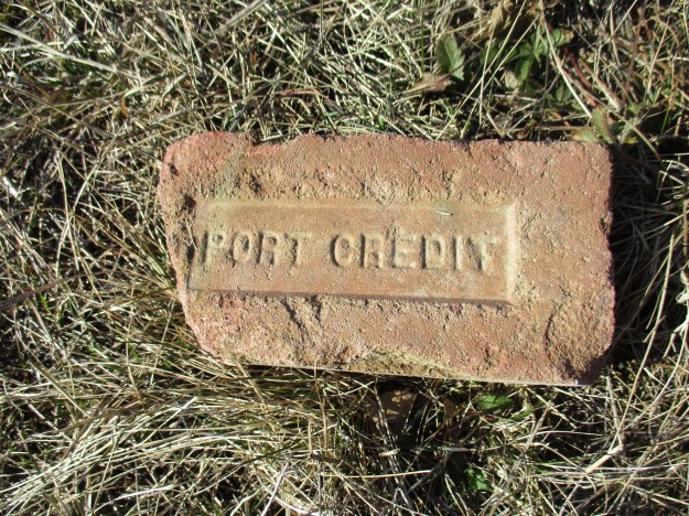
After the First World War, the clay was becoming exhausted and the yards started operating at a loss. By 1929 the brickyards were closed. This brick was found on the property of the old brickyards where it was made, perhaps over 100 years ago.
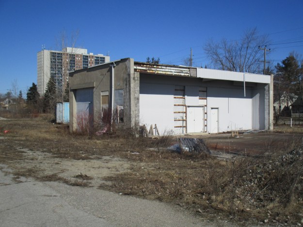
In 1933 the Lloyd Refining Company purchased part of the property to build a modern refinery capable of producing 1,500 barrels a day. The refinery changed hands a few times including 1937 and 1946. In 1955 the property was purchased by Texaco and their Canadian subsidiary McColl-Frontenac began operating the refinery. In 1959 the name was changed to Texaco Canada Ltd. Petrochemicals were produced here beginning in 1978 but by 1985 it was starting to be decommissioned. The oil tank farm was removed first and by 1987 it was fully closed. Only one small building remains on site along with a storage shed.
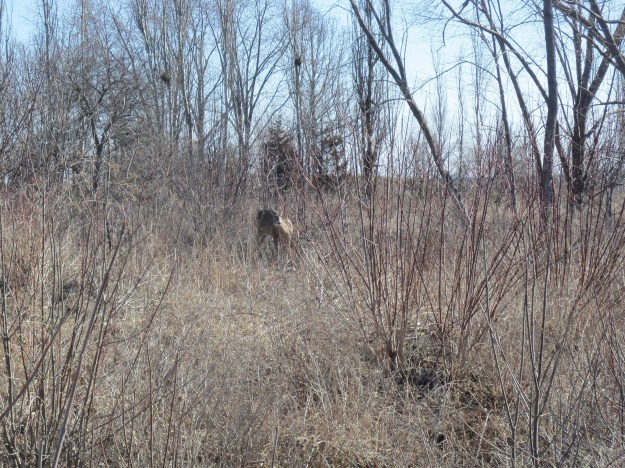
The property has sat vacant for a couple of decades now and is highly contaminated from its years as an oil refinery. As of March 2017, Imperial Oil is selling the property to a developer who plans to develop a waterfront park, mid-rise condos and affordable housing on the site. Today the property is home to a large selection of wildlife. Coyote scat is everywhere and rabbits and squirrels provide food for them as well as the hawks. A white tailed deer was casually feeding just inside the fence from Mississauga Road.
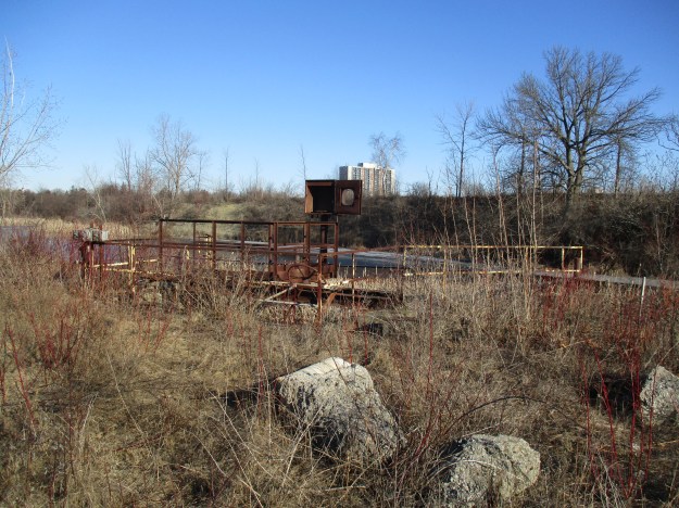
Roadways and concrete pads mark the locations of the former tanks and buildings. The property is marked as no trespassing because of the numerous hazards that exist throughout. This story is presented to preserve the site as it exists at this moment in time. Soon it will change forever and this chapter will be lost. Choosing to explore here is solely your responsibility. A large man-made pond covers a section of the property and may feature in redevelopment plans for a central park within the community. The pond is currently full of pipes that have started to break apart over the years of abandonment.
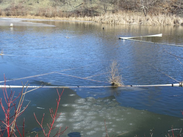
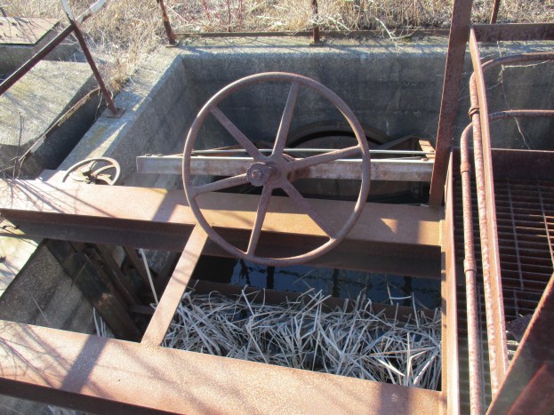
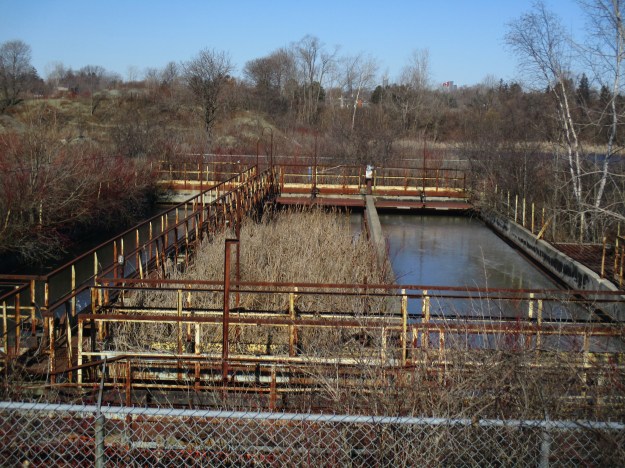
The lower corner of the pond still has the dam and flood control devices intact. Two sluice gates could be opened by turning handwheels. The cover photo shows a closer look at the mechanics of the system.
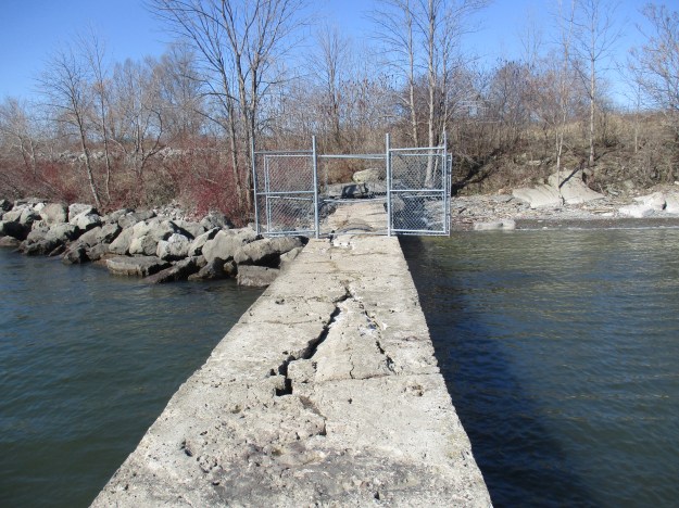
Outflow from the pond was transferred to a series of settling ponds to remove solids from the water. From here it was carried through a concrete pipe and released into the lake.
We made our way to the end of the concrete pipe that discharged the water from the pond on the Imperial Oil Lands. The round concrete pipe has been encased in a concrete shell to protect it from the effects of the lake.
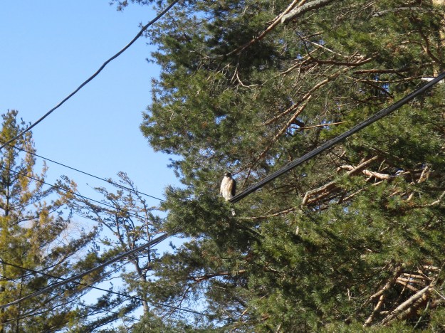
The Waterfront Trail takes the name Imperial Oil Trail as it passes along the lake side of the property. We followed it west to where you are forced briefly to follow the road. That wasn’t such a bad thing as we were treated to a broad-winged hawk sitting on a hydro wire. These birds usually winter in the south and I wonder if this one was noticing the -20-celsius wind and wishing it hadn’t come back yet.
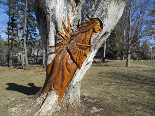
Ben Machree Park has some interesting wood carvings by Jim Menkin. Jim has converted dead tree stumps into art with his chainsaw in many parts of Ontario including Orangeville and Mississauga. This park features three wood carvings named “Sirens of Homer’s Odyssey”.
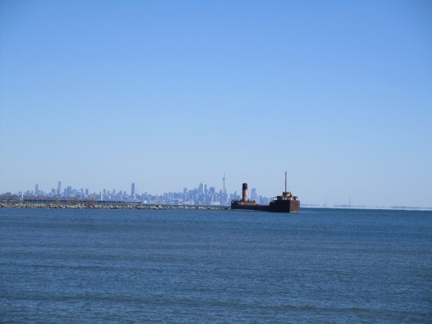
We returned along the Imperial Oil Trail east toward the mouth of the Credit River. Just east of the concrete drainage pipe from the oil lands is a lengthy finger pier extending out into Lake Ontario. This pier provides great views to the west looking toward Rattray Marsh. To the east, you can see the Ridgetown with the city of Toronto in the background. The ship is partially sunk at the mouth of the Credit River to provide shelter for the marina. Our post on the Ridgetown contains its fascinating history.
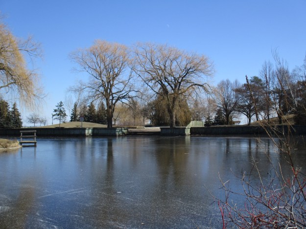
In the 1940’s Port Credit ended at Lake Street, of all places! Today it extends out into the lake in the form of J. C. Saddington Park. This park is built on a decommissioned dump that was in use from 1949 to 1970. A pond has been created for recreation and fishing and benches positioned around for relaxation. The pond has a thin layer of ice on it from the past two days of cold weather and a light dusting of snow. A sliver of the moon can be seen above the trees in the middle of the picture.
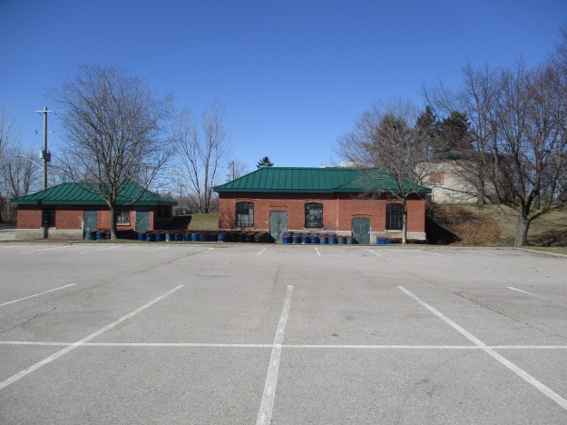
Three historic buildings stand in the corner of the parking lot. Dating from 1922 to 1923 the Port Credit Waterworks pumping station was a major advancement in the infrastructure of Port Credit.
Swans, Canada Geese and several species of ducks were all to be seen in the lake today. Of interest was the fact that they have gone back into pairs after spending the winter in groups. Spring must be coming soon…
A 1973 Toronto Archive Aerial photo of the oil lands can be accessed here.
Our readers selected the top 15 stories for this special feature.
Google Maps Link: J. C. Saddington Park
Like us at http://www.facebook.com/hikingthegta
Follow us at http://www.hikingthegta.com

Pingback: The Ridgetown – Port Credit | Hiking the GTA
Hi After reading the December 2016 article and notice about the sale of the ‘Imperial Oil Lands’ with the Port Credit West Village Partners. We were very disappointed to see the detailed possibilities that may be developed on that land without reading and information on the possibilities and suggestions that were actually submitted by the community and residents residing in and around that land. I do understand the sale allows the developers to project ideas and submit their plans to the city, however without obvious assumption, I with many others in the community were and will once again feel disregarded. As I have noticed lately the media seems to misinform or certain parties have put a misconception the we are looking for to build in development in port credit. We have attended the meetings and have witnessed and felt much of the contradictions and misinterpretations from the committee by describing the Port Credit Area and community as the oasis of mississauga. Not only an area of work live and play, but also an area where people can come from all over and enjoy the amenities of what the lake front has to offer such as parks and trails as well. But somehow it had and has always turned to this development fiasco that has the real estate community harboring into our community. Articles in ‘UrbanToronto’, ‘GlobeandMail’, ‘InSauga” and “BuzzBuzzHome” are some of the few. We keep hearing about the unmentioned names stating about preserving one of the last great waterfront areas that we have left, however they have already begun taking away from it. The old post office ‘new’ development design has already upset many people in the area and has put put such a massive unfortunate sour stake in the center of Port Credit which has nothing to do with the heritage and look of this area. Even the city has upset much of our community by allowing these massive homes being built in our area such as Benson Ave, Pine Ave, Maple Ave and Broadview Ave. As I have heard through neighbours, the city has chosen to ignore them as well by allowing builders develop these massive homes which are beyonds the mean of space giving an eyesore to the existing community. The community had discussed many times in the meetings about getting the city and ward committee to work on preserving more of greenspace and to develop more on the learning centres and outdoor/indoor entertainment, museums, cultural/history centre where focuses should be. But since this “imaginery” revenue loss keeps being the absurd justification to these developments in the Port Credit area, what Port Credit should really be we will unfortunately fail to see in the near future.
I like your comments with regard to the imperial oil lands, we are likeminded and should get together for pushback. We need more green land not asphalt and concrete. For the future children.
Phone me at 905 891 0431
Thank you for your research and wonderful history article.
Is there nothing we can do now?
Very sad and disappointing that the almighty dollar takes precedence over valued wildlife and the preservation of this unique natural space we call home.
Hi Kathryn McClure, I would like to speak to you. Don Julien 905 891 0431 7 Dec 17
Mississauga is owned and run by the developers and they will have carte blanche to do what they want regardless of what the local residents feel. I predict that in 10 years time Port Credit, Lakeview, Mineola, and Lorne Park will be unrecognizable. All those charming and lovely cottages, bungalows, and two-story houses will be demolished and replaced with either the gigantic plywood boxes that are popping up everywhere or those silly fake chateaux/castles.