Saturday, Sept. 19, 2015, and Monday, Sept. 11, 2017
Rattray Marsh contains fossils that help form it, abundant wildlife and 100-year-old abandoned structures. And that’s just in the corner we explored. We set out to enjoy the last Saturday of summer and decided to visit the Rattray Marsh. There is very little parking at the marsh and so we parked at the Bradley Museum.
James Rattray was born in 1887 and after having served in WW1 he made a fortune in the mining industry. He was friends with Percy and Ida Parker who owned the Riverwood Estate. In 1945 he bought the Fudger mansion along with 148 acres including the mouth of Sheridan Creek. The historical atlas shows that the creeks emptying into Lake Ontario along this stretch all had a marsh where they emptied into the lake. Today, the marsh on Sheridan Creek is the only one left between Toronto and Burlington. The rest of them have been filled in and when James Rattray died in 1959 developers started making plans to build homes on this one too. The Credit Valley Conservation bought the property in 1972 after local residents petitioned to have the marsh saved. It was opened as Rattray Marsh Conservation Area in 1975.
The shoreline along this part of the lake is made up of flat stones that have been rounded through years of wave action. They have been washed up on the beach in a wall known as a shingle bar. This rock barrier slowed and sometimes stopped, the flow of Sheridan Creek into the lake. The waters pooled behind this wall and silt settled on the bottom where aquatic plants took root forming the marsh over time. The picture below shows the mouth of Sheridan Creek and the rock barrier, or shingles bar, that maintains the marsh.

The threat to the marsh actually started long before the developers made specific plans to fill it in. Without realizing it they had already initiated a slow process that would do so. As development occurred on properties upstream the amount of sediment in the marsh increased. Buildings, roads, and parking lots don’t absorb water like fields and forests do. Water runs off quickly and carries soil and other dirt into the creek. The water slows down in the marsh where this silt settles and quickly buries the natural ecosystem. To restore the marsh some of this sediment was removed to expose the native soil and allow the seeds trapped inside to germinate. White carp have also invaded the marsh and are disturbing the sediment on the bottom through their feeding. This has destroyed plant life and the habitat it provided. The carp have been isolated and are now kept out by fences in the marsh like the one pictured below.
We did a little beach combing looking for interesting rocks and fossils. The wall of shingle stones along the shoreline is full of fossils. The remains of these long-gone creatures now serve to keep the creek out of the lake and helped the marsh to form. There were many small stones with multiple fossils of worms in them.
Along the lake shore at the creek mouth, there is a deteriorating break wall that was installed to help preserve the marsh from erosion. A little east of here a large concrete chamber stands looking out over Lake Ontario. The top is broken off and several small trees are taking root inside. This was likely built in 1918 when Fudger had the house built on the property, He was obsessed with fire protection and built his house out of concrete. This appears to be an old pump house, perhaps part of a fire suppression system.

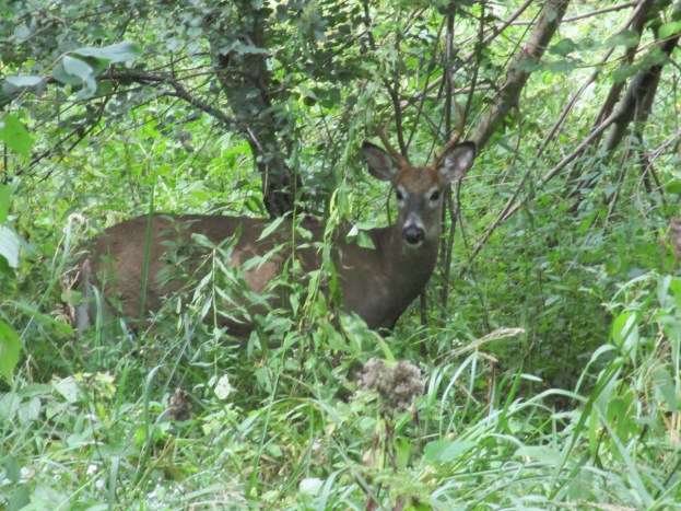
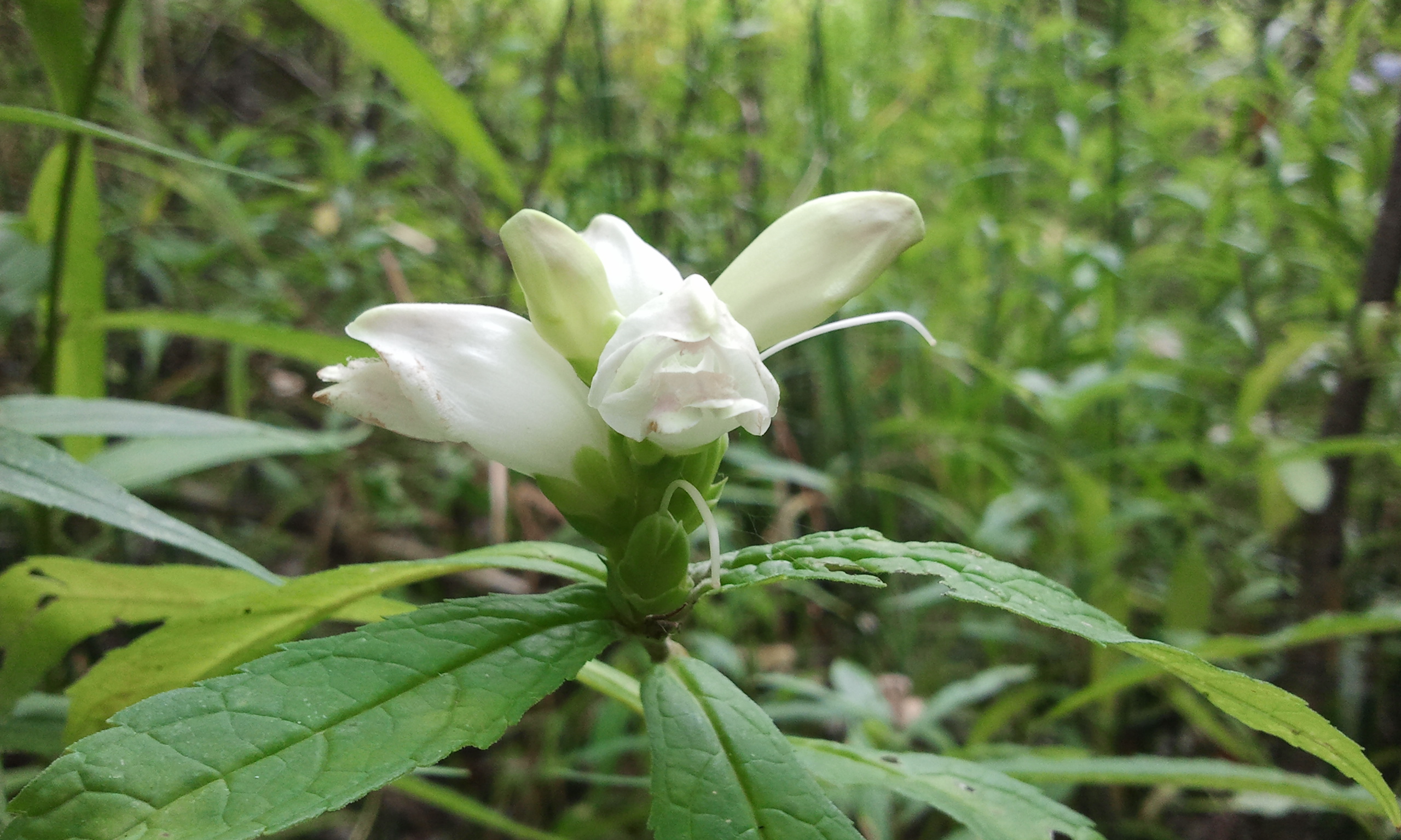
Turtlehead flowers grow in moist soil and bloom from late in August through to October. They get their name from the shape of their white, red or pink flowers which look like a turtle with its mouth open. Turtlehead flowers have been used in traditional medicines for centuries. They make an excellent remedy for skin sores as well as reportedly being used for birth control by some native tribes. They are a favourite food for white tailed deer like the young male featured in the cover photo.
Aside from carp, Rattray Marsh has also been invaded by the emerald ash borer. This little green insect kills 99.9% of all ash trees it comes into contact with. Unfortunately, most of the tree cover in the marsh and surrounding area is ash. The picture below shows trees with an orange mark on them. These are infested with the ash borer and will be cut down and replaced with new plantings. Trees that are not infected can be protected against the insect at a cost of about $200 per tree for an injection that must be repeated every two years. Injected trees have a little metal tag on them.

On Monday, September 11, 2017, we returned to the marsh to explore the boardwalks and see what the back half of the park holds.
The Trans Canada Trail and the Waterfront Trail pass through the 90-acre park on a common boardwalk. There is a secondary trail which is 1.8 km long and a small 0.3 km loop known as the Knoll Trail. Credit Valley Conservation has recently completed upgrades and replacements to much of the boardwalk around Sheridan Creek and they reopened on September 2, 2017.

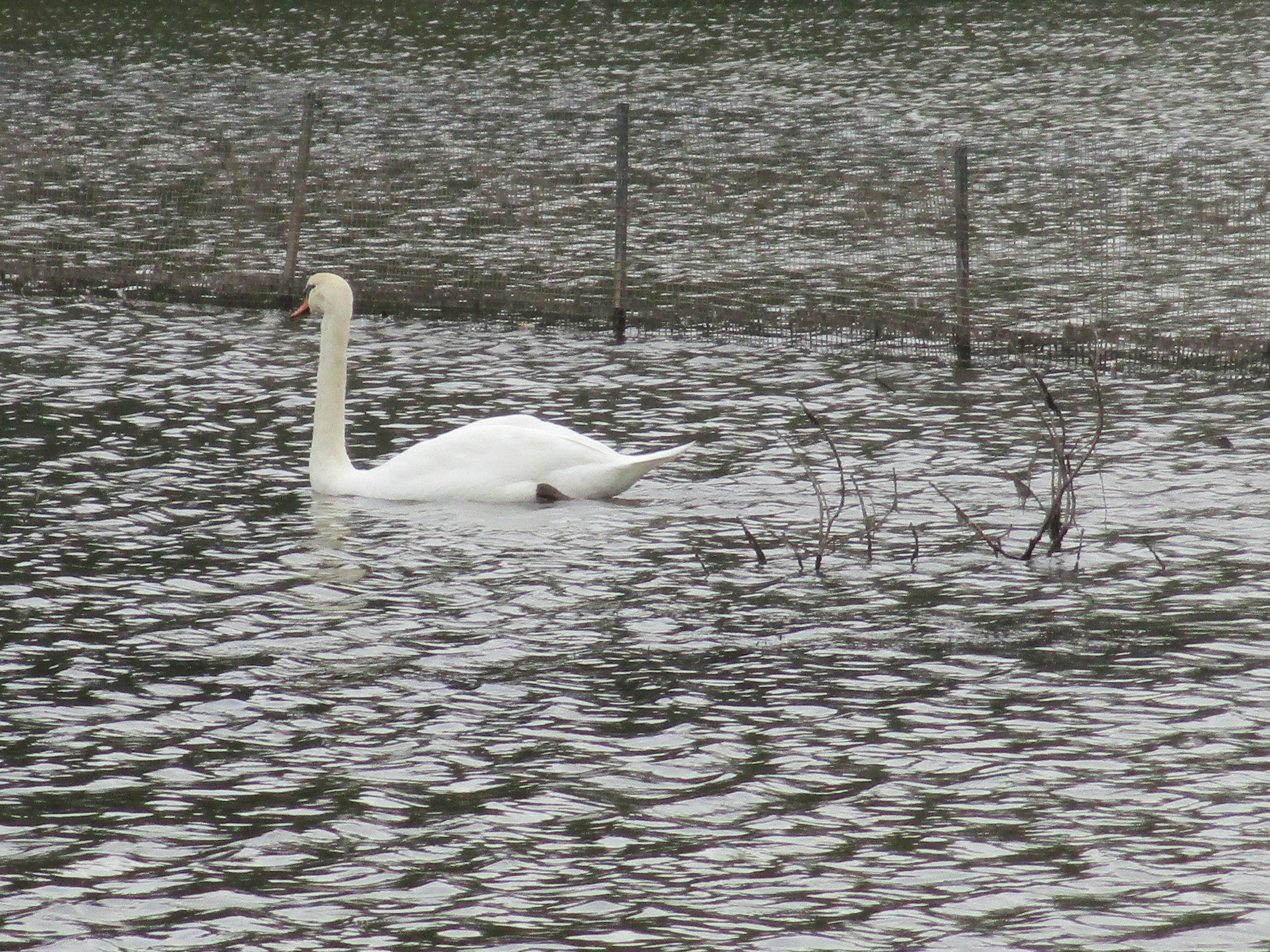
Rattray Marsh was rather low on water and we could see where it had been several feet deeper recently.

Google Maps Link: Rattray Marsh
Like us at http://www.facebook.com/hikingthegta
Follow us at http://www.hikingthegta.com

Pingback: “Long” Weekend Hikes | Hiking the GTA
Pingback: Imperial Oil Lands | Hiking the GTA
Pingback: Lakeside Park | Hiking the GTA
Pingback: Antlers | Hiking the GTA
Pingback: Bradley Museum and Watersedge Park | Hiking the GTA