Monthly Archives: April 2018

Old Major Mackenzie Drive

Sunday April 22, 2018

The Humber River in Vaughan Township has three historic concrete bowstring bridges, all designed by Frank Barber. All three are closed to vehicles and are in varying states of disrepair. Having previously featured both the Kirby Road Bridge and the Old Langstaff Road Bridge it seemed fitting to make a brief excursion to the third one as well.  The oldest of these three bridges is the one on Old Major Mackenzie as it was built in 1914.  The other two were built in 1923.

Frank Barber was born in Milton on Dec. 27, 1875.  In November 1908 Barber was appointed consulting engineer for the County of York.  He was later made engineer for York, Scarborough, Amaranth, Etobicoke, King and Vaughan.  He is best known as a bridge designer having built the bridge at The Old Mill as well as Middle Road Bridge.  One of Frank’s onnovations was the introduction of concrete into the construction of bridges.  This increased their lifespan dramatically compared to 20 years for a wooden bridge and is the primary reason we still have some of his work around 100 years later.

The north side of the bridge is in an advanced state of deterioration.  This gives a pretty clear idea of the wire skeleton inside the bridge.  I noticed that the reinforcing rods are not bound together either through welding or wire ties.

After crossing the bridge, Old Major Mackenzie Road climbed the side of the ravine on an angle.  The outline of the road can still be discerned just above the yellow line on the picture below.  A camera is mounted on the pole just below Vaughan – No Trespassing sign.  Rats, I’ll bet that old roadway would be an interesting climb.  Since the road has been closed the short access to the bridge and a couple of houses has been renamed Humber Bridge Trail.

img_3872

A little side excursion brought me to John Lawrie’s house.  This house was built in 1855 of field stone and is being preserved in spite of the large distribution centres being built in the former corn fields behind the house.

IMG_3879

Google Maps Link: Humber Bridge Trail

Like us at http://www.facebook.com/Hikingthegta.com

Follow us at http://www.hikingthegta.com

Boyd Conservation Area

April 21, 2018

Boyd Conservation area contains sections of two closed roads as well as the remains of an old mill dam.  There are several parking options but we chose to park in the lot on Rutherford Road just west of Pine Valley Drive, near the Kortright Centre for Conservation.  The East Humber River was flowing high and dirty in the wake of the past week of ice storms but the morning sunshine cast our shadows on the river.

IMG_3801

Lot 12, concession 7 (outlined in black) was owned by Samuel Smith in 1860, perhaps the same man that also owned the 1000 acre estate on Lakeshore Road that is now known as Colonel Samuel Smith Park.  We had parked in lot 16 and followed the trail south as it crossed the river twice on foot bridges.  We continued south in search of the historic bridge in Boyd Conservation Area and then followed Pine Valley Road north through the closed portion along lots 14 and 15.  Our route is marked in green on the county atlas below.

Boyd

Running through the middle of the property is the proposed route for the Toronto and Georgian Bay Ship Canal.  The canal was proposed as early as 1837 and surveys were made in the 1850’s to determine a possible route.  The canal was never built and but the proposal stayed open until 1906 when it was finally shut down.  A bridge abutment stands just downstream from Rutherford Road.  This is from an earlier alignment of the road and may have served as access for the grist mill shown at Elder Mills on the map.

IMG_3803

A small tributary flows out of Kortright centre and into the Humber River.  The water from the melting ice is running clear until the point where it mixes with the dirty water of the river.

IMG_3809

As we were watching, a beaver crawled out of the water on the far side of the river.  He had a look around and, deciding that he didn’t want to be in a blog, jumped back into the river.  It turns out that it was too late to avoid being published.

IMG_3810

The map shows the mill pond that supplied a steady flow of water to power the saw mill on Samuel Smith’s property.  The mill dam would have been made of a wooden crib filled with rocks and was replaced with a concrete dam sometime in the early 20th century.  The remains of the dam can be found on either side of the river.

IMG_3820

An old pump house stands beside the river near to the former right of way for Langstaff Road.

IMG_3824

Langstaff Road has had several bridges over the East Humber River.  The earliest ones were made of wood and lasted for twenty years or so before needing major repairs.  By 1923 the bridge was in need of replacing and renowned engineer Frank Barber was brought in to design a concrete replacement.  In 1914 he had designed the concrete bowstring bridge over the river at Major Mackenzie Drive.  In 1923 he also designed the bridge on Kirby Road.  The single lane bridge at Langstaff was closed in the 1970’s when the road was widened and moved a hundred metres south.  Today there are large pieces of the concrete missing and the underside drips rusty water from the exposed steel reinforcing rods.

IMG_3840

The bridge is closed to pedestrians because it has a large hole in the deck and is considered hazardous.  The bridge is listed as a property of interest on the heritage register and the intention is that it may eventually be given a full designation.  Extensive erosion immediately upstream from the bridge threatens the public works yard located there.  The stream has been rehabilitated following a 2014 assessment that showed damage from the 2013 flooding had placed both the public works yard and the historic bridge at risk.

IMG_3833

From the bridge we followed a small roadway out to Pine Valley Drive where we found a closed gate keeping us in.  After following the fence a short distance we came to the dividing line between Concession 7, lot 12 and 13.  We very often find square metal posts that mark the corners of the surveyed lots.  This was the second time that we found a limestone marker.

IMG_3843

The fence continued until a point where the maintained part of Pine Valley Drive ends and the former right of way continues along lots 14 and 15.  Boyd Conservation Area was created in 1957 and includes the right of way for the closed road.  Overlapping with the conservation area is an Area of Natural and Scientific Interest (ANSI) designated because of the pine forest habitat and the extensive wetlands.  The closed portion of Pine Valley Drive, pictured below, is little more than a trail in many places and has been badly eroded by water flowing down the middle of the roadway.

IMG_3850

Large patches of Coltsfoot were blooming along the trail, looking like dandelions without the leaves.

IMG_3857

Boyd Conservation Area is a favourite place for summer picnics as well as being a significant stopover for migratory birds as they pass through the city.

Google Maps Link: Boyd Conservation Area

Like us at http://www.facebook.com/hikingthegta

Follow us at http://www.hikingthegta.com


John Lawrie Heritage House

Saturday, April 21, 2018

While on a visit to Boyd Conservation Area we took a short side trip to photograph the historic John Lawrie house.  John Lawrie built his Georgian style house in 1855 at Lot 12, Concession 9 in Vaughan Township (outlined in green on the county atlas below).  The county atlases were notorious for spelling names incorrectly and changing them from edition to edition.  This map shows the spelling as Lowry.  It’s also possible that Gavin Lourie on lot 11 could be a son, with yet another spelling.

Lawrie

The original tree lined lane is part of the contextual heritage of the property and the home is set back from Highway 27 and originally had a workable field in the front.  The remains of corn stocks still stand on the sides of the house.  It has been  designated under Part IV section 27 of the Ontario Heritage Act and scored 85 of a possible 100 points on the heritage survey.  This defines it as having very significant heritage value.

IMG_3879

John Lawrie was the first of four generations who worked this farm and it was in the family for over 120 years.  John was instrumental in the construction of a community church and sat on the first Vaughan Township Council when rural municipal governments were established in 1849.  The house was constructed by a local stone mason named Henry Burton out of field stone collected on the property.  Burton built many local homes and was also responsible for one of the additions to Osgood Hall in Toronto.

IMG_3881

The stonework on the front of the home is squared and dressed while the sides and back are made of random sized stone.  The house is one and a half stories, the upper floor being partially restricted by the slope of the roof.  Two chimneys indicate a pair of fire places and finely tooled limestone quoins adorn the corners of the house.  There is a rear extension that was added around 1870, as the family grew.  A little side entrance to the cellar has a gabled roof and was designed to protect the cellar entrance.

IMG_3883

The house was still occupied as recently as 2005 but since being closed for a few years has suffered a bit of vandalism.  The street address is 8682 Highway 27 and now home to a new Costco distribution centre.  Costco paid $50,000,000 for the 95 acre property in 2015.  The house will be moved slightly to accommodate a flood control pond on the property and new landscaping done to model the historical setting.  I don’t suppose Lawrie ever thought his property would be worth 50 million dollars when he took possession and started making improvements such as clearing fields and building the house.

IMG_3878

Also see our story Boyd Conservation Area for one of the historic concrete bowstring bridges in the area.

Google Maps Link: 8682 Highway 27

Like us at http://www.facebook.com/hikingthegta

Follow us at http://www.hikingthegtacom

Buttermilk Falls

Saturday, April 7, 2018

The origin of the name Buttermilk Falls is one of speculation.  At the time of the county atlas in 1875 it was known as Inglis Falls after the landowner at the time.  David Inglis called his homestead “Burning Springs” but his primary occupation was as a Presbyterian pastor.  McNab Presbyterian Church lists Inglis as their first pastor, having served from 1855 – 1872.  It has been suggested that the farm had been used for dairy at one point and the falls were named after this.  Another idea is that the falls appear to resemble buttermilk at some times.  David Inglis owned Lot 1, Concession 6 in Barton Township.  James Cook owned Lot 1 in Concession 7 where Albion Falls is located.  The plan was to visit both falls by approaching from creek level.  There is free parking on Mountain Brow Boulevard near the crest of Buttermilk Falls at Oak Knoll Park.

Buttermilk 1875

Also shown on the county atlas above is the Hamilton & Lake Erie Railway as it passes near the top of the two water falls.  Built in 1869 and absorbed into the Hamilton & North Western Railway in 1875 this is the final year the railway would appear on the atlas under the original name.  The line eventually came into the Canadian National Railway fold and was eventually abandoned.  It was converted into the 32-kilometre Escarpment Rail Trail in 1993.

Although there was a small flow today it runs dry sometimes so this falls is best viewed in the spring or after a heavy rainfall. The size of the bowl that is cut in the limestone reveals a much larger volume of water at the end of the last ice age, 12,000 years ago.

IMG_3680

Mountain Brow Side Trail connects Buttermilk Falls to Albion Falls and provides some good views of the falls and the gorge it has cut.

IMG_3686

We followed the trail until there appeared to be a suitable place to descend the escarpment.  There are no trails and few places that are safe for anyone except an experienced hiker.

IMG_3691

Finding the bottom of the ravine we turned and made our way back up the creek toward Buttermilk Falls.  This creek has several little cascades between the falls and it’s confluence with Red Hill Creek.

IMG_3692

Buttermilk Falls is a 23-metre high plunge waterfall.  The escarpment face reveals the upper layers of the Niagara Escarpment.  The red Queenston Shale for which Red Hill Creek and Parkway are named is the bottom layer of the escarpment.  Harder layers of dolostone are interspersed with softer layers of limestone.  This has created an opportunity to walk completely behind the falls and out the other side.

IMG_3705

Red Hill Creek runs for 7 kilometres from Albion Falls to Hamilton Harbour.  Along with Albion Falls, two tributaries of Red Hill Creek carry waterfalls over the escarpment during that distance.  Having visited Buttermilk Falls we have yet to venture to nearby Felker’s Falls.

IMG_3723

We followed Red Hill Creek toward Albion Falls until we came to this sign.  It is said that they are actively passing out tickets, which aren’t on our list of priorities.

IMG_3724

This forced a retracing of our route until we were back at the top of the ravine.  From there you can follow the trail to Albion Falls.  This is one of the most beautiful falls in the area and well worth the visit.  On our previous hike to Albion Falls you could still access the bottom and there were dozens of people down there.  That story can be found at this link.

IMG_3725

Scarlet Elf Cap (or Cup), like many cup fungi grow in the late winter or early spring.  The fruit bodies are usually hidden under leaves and are not known for being edible.  The natives used the plant for medicinal purposes, applying the ground fruit bodies to the ends of umbilical chords that did not appear to be healing normally.  This example was growing in the ravine below Buttermilk Falls.

IMG_3700

The need to visit The Escarpment Rail Trail and Felker’s Falls will likely draw us back to this area at least a couple more times.

Google Maps Link: Buttermilk Falls

Like us at http://www.facebook.com/hikingthegta

Follow us at http://www.hikingthegta.com

Wonscotonach Parklands

Wednesday, April 11, 2018

On Tuesday, Toronto’s Parks and Environment Committee decided to recommend the various parklands of the Lower Don River be renamed as the Wonscotonach Parklands.  This initiates a process that will allow public consultation on the plan.  The Don River was known as Wonscontonach before the arrival of John Graves Simcoe in 1793.  Simcoe didn’t like native names and routinely changed them (Toronto was changed to York).  If approved the newly named mega-park would be part of a gesture of reconciliation to aboriginal people.  The combined parklands would feature a significant number of points of interest.  Here are a few that Hiking the GTA has visited.

The Don Narrows

From Corktown Common to Riverdale the park will stretch along the river where numerous bridges, new and abandoned, can be investigated.

img_3282

Riverdale Park

Riverdale Park is on both sides of the Don River but the west side also features Riverdale Farm.

img_2457

Half-Mile Bridge

The park will pass under the now abandoned Half-Mile Bridge.

img_2908

The Don Valley Brick Works

Several historic buildings and a reclaimed pit were the site of a complex that produced bricks for many of Toronto’s early buildings.

img_1073

Todmorden Mills

Just north of the Brick Works was one of three paper mills that also belonged to the Taylor Brothers.

img_2847

The Beechwood Wetlands

The Taylor house was moved from the family homestead to Todmorden but a kiln remains near a restored wetlands.

Taylor kiln

Crother’s Woods

Crother’s Woods has been reclaimed after a period of heavy industrial use and now has multiple trails along the ravine and through Sun Valley.

img_5166

Taylor Creek Park

Taylor Creek Park follows Taylor Massey Creek east from the confluence with the Don River and features several examples of public art.

img_1711

Abandoned Don Mills Road

The top end of the proposed park will feature an excellent example of a concrete bowstring bridge where the abandoned portion of Don Mills Road passed over the Don River.

img_7496

If the name change takes place Toronto will have a mega-park that it can be proud of that will reflect the people who lived here long before the first condo was built.

Like us at http://www.facebook.com/hikingthegta

Follow us at http://www.hikingthegta.com

Abandoned Kirby Road

Saturday, March 31, 2018

We had planned a visit to the Nashville Conservation Area near Kleinberg and found free parking near the intersection of Huntington Road and Kirby Road.  The Humber Valley Heritage Trail follows the old right of way for Kirby Road east from the intersection.  After a short walk you come to an abandoned bridge.  Kirby Road formerly crossed The Humber River on a bridge named after the landowner.  Lorne McEwen had owned the land since 1916.  This reinforced concrete bowstring arch bridge was built in 1923 and was designed by Frank Barber.  Barber had designed several bridges over the Humber River including the Old Mill Bridge.

IMG_3564

Kirby Road was closed in the 1970’s when sections were deemed unsafe due to excessive erosion. This left the bridge with no formal use until the Humber Valley Heritage Trail Association was founded in 1995 and began work on their trail.  The reinforced concrete bridge has never had any major restoration and is crumbling badly.  There are many places where the steel reinforcement is exposed.  The side of the bridge in the picture below has chipped away leaving all four rows of re-bar rusting.  The road deck is also in bad shape and was most recently patched with steel plates that sit uneven on the surface.

IMG_3556

From the bridge the trail leaves the old right of way so we decided to follow the road instead of the trail. The old road bed can be seen by the shape of the landscape.

IMG_3579

The section of Kirby Road that led to the closure of the bridge has since disappeared into the river below.  The two ends of the roadbed are marked with arrows on either side of the landslide.

Kirby Road

This is the view from the edge of the roadway down to the river below.  Obviously, closing the road to vehicles was a wise decision.  The only other option would have been the creation of a new road alignment roughly where today’s Humber Valley Heritage Trail runs above the former roadway.

IMG_3583

A recent study on the Humber River watershed identified 1250 crossings of some nature.  Wood, cut stone, steel and concrete have all been employed as construction materials over the years and each relates to a period in the development of Ontario.  McEwen Bridge is one of 33 that were identified as having heritage significance but not one of the five that have been designated under the Ontario Heritage Act.  It is, however, one of four others that have at least been listed.   Being designated provides legal protection to a heritage property while being listed does not.  A listed property can be demolished by the owner if they give 60 days notice.  The local council would then have time to designate the property if they wished to protect it.  This means that the old bridge on Kirby Road is actually in danger of being demolished.  A study is being undertaken to review the costs of preservation.  The bridge is marked on the map below, taken from Google Earth, as well as the site of the erosion and landslide that closed the road.  The road allowance is marked in yellow.

Kirby Road

The Nashville Conservation Area takes its name from the nearby community of Nashville.  Originally the community was known as East’s Corners after Matthew East, who became the first postmaster in 1881.  Later, Johnathan Scott came from Nashville, Tennessee and changed the name.  Nashville grew because of the railway station that was built there by the Toronto Grey and Bruce Railway.  The railway station was for Kleinberg but was located a short distance outside of Kleinberg and it became the nucleus for the community of Nashville.  Early settlers in Nashville were Presbyterian and services were held in local homes until a church could be constructed.  The brick Presbyterian Church in Nashville was built in 1909.

IMG_3609

Nashville grew as a railway town centered on the railway station.  Soon a saw mill and a grain elevator stood near the railway.  Milling grain creates a lot of dust which becomes a fire hazard.  Many grist mills and grain elevators were destroyed by fire and this was the fate of the original grain elevator in Nashville.  The first elevator burned on July 15, 1919 while a second one was destroyed in 1927.  That second fire is pictured in the archive photo below.

Nashville_Grain_Elevator_Fire_1927_M009.8___Gallery

A new grain elevator was built in Nashville in 1930 and still stands beside the tracks.  The siding on the right has been removed as the train no longer runs on that side of the building.

IMG_3614 (1)

Having been sidetracked from our visit to the Nashville Conservation area we shall have to leave that for another time.

Google Maps Link: Kirby Road

Like us at http://www.facebook.com/hikingthegta

Follow us at http://www.hikingthegta.com

Camp 30 – Bowmanville POW Camp

Wednesday, March 28, 2018

Until 1922 John H H Jury had owned a 300 acre farm north of Bowmanville which he called the Darch Farm.  He decided to donate it to the Ministry of Education for a school to house boys who were getting into trouble and considered to be “unadjusted”.  The school was to be known as the Ontario Training School for Boys.  Several buildings were constructed between then and 1927 when the site was completed and opened. Classes were started and continued at the school until April 1941 when the government announced that it was taking over the school for use as a Prisoner Of War camp.

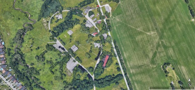
Hitler’s bombing campaign in England had raised the possibility that England could be invaded by the Nazis and the prisoners there set free to return to the battle.  The boys from the school were then sent to various homes throughout Bowmanville so that the camp could be converted.  Two rows of fences were constructed around the perimeter with 15 feet of grass in between to deter escape attempts.  Nine guard towers were built along with a set of barracks for the Canadian soldiers who would be the guards at the POW camp.  The Google Earth capture below shows the various buildings that survive today.  Several others have been demolished over the past few years.

Camp 30

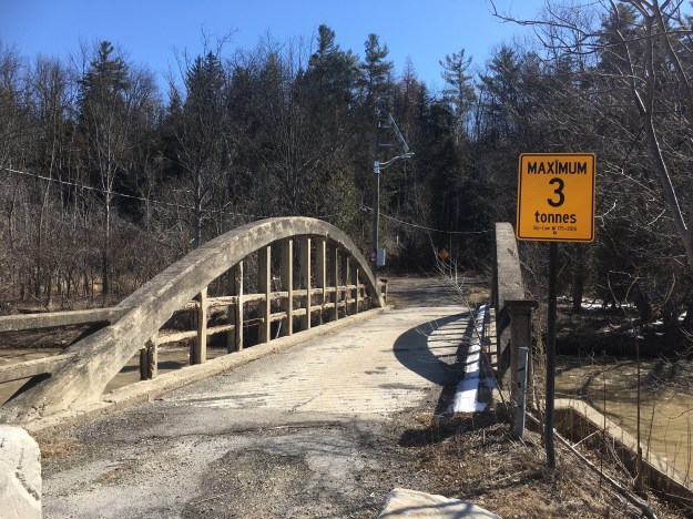
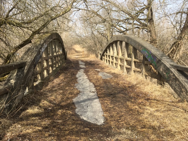
I parked up the road and walked back with the idea of scanning the property and taking pictures from the road.  There were several sports fields at the south end of the compound that were used by the school and the POW camp.  The gymnasium building also housed an indoor swimming pool but the POW’s were allowed to leave the camp for exercise.  As long as they promised not to try and escape they were allowed to go down to the lake in the summer to go swimming and for cross country ski trips in the winter.  Life in the camp was pretty good and relations with the guards were generally amicable.

IMG_3495

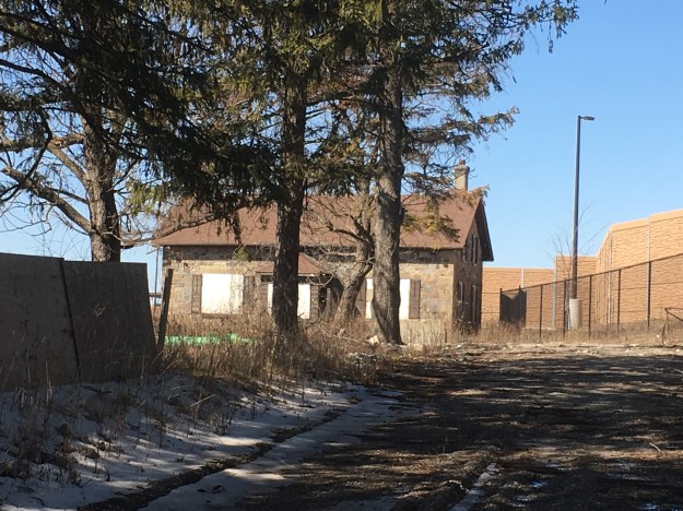
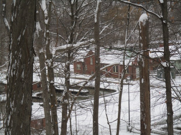
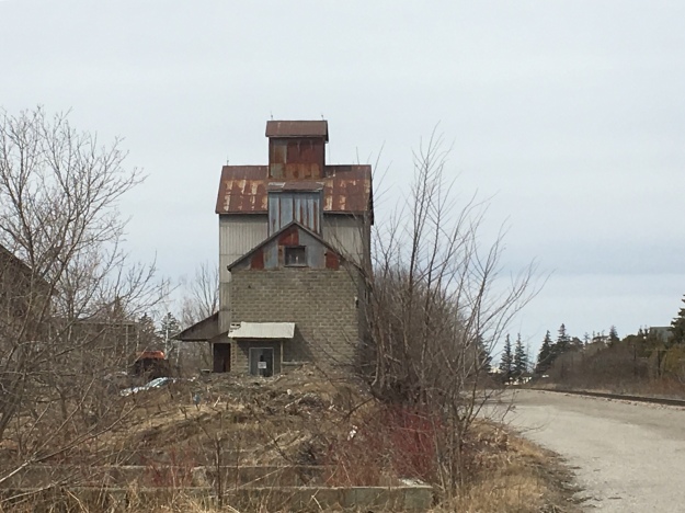
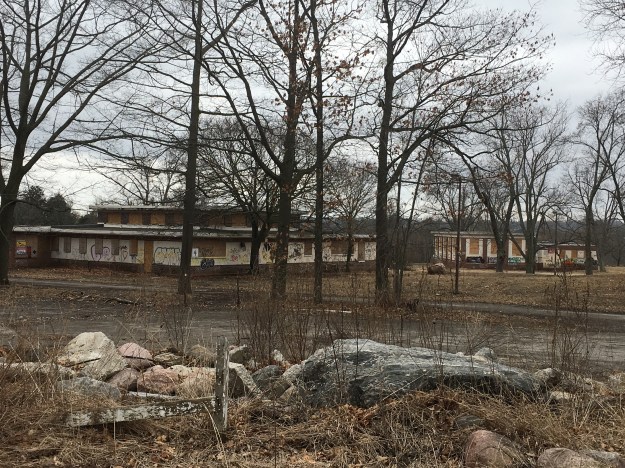
The first buildings you come to along the road are the two story dorms which were used as barracks for the POW’s.  Like all the buildings remaining on site, all the windows were broken before they were boarded up.  Graffiti covers the walls and the drywall inside is smashed up.  Most of the buildings have suffered some fire damage as people have started fires on the wooden floors during parties on the grounds.

IMG_3509

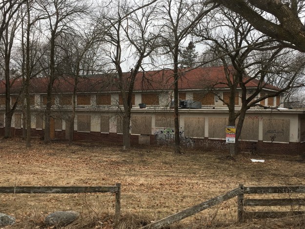
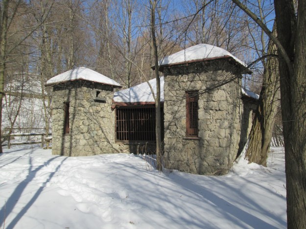
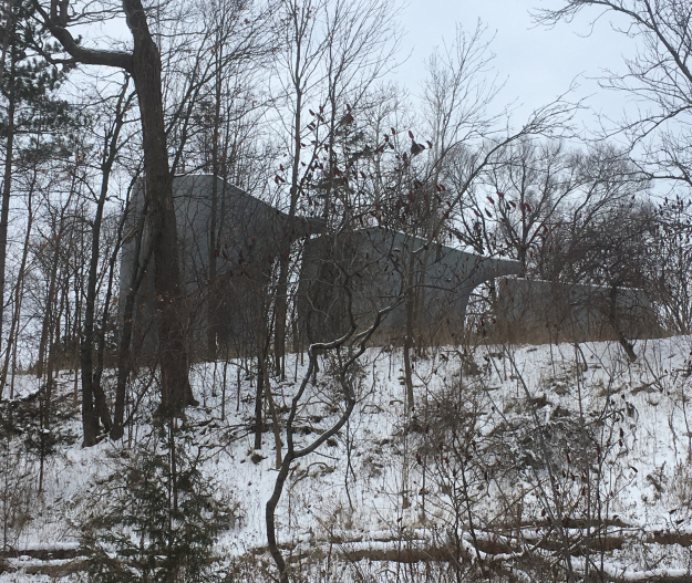
The hospital building is one of two with a peaked roof, along with the barracks above.

IMG_3518

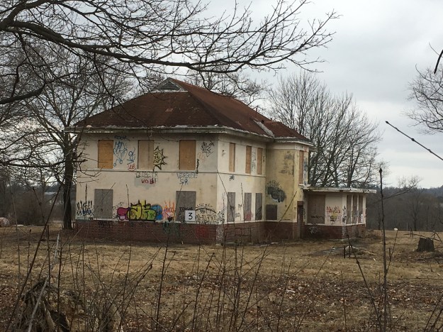
The hospital in relation to the mess hall.

IMG_3514

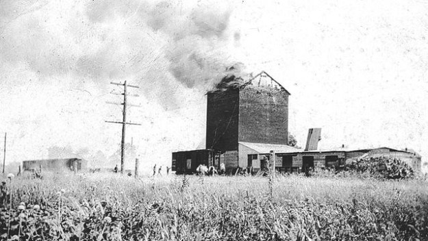
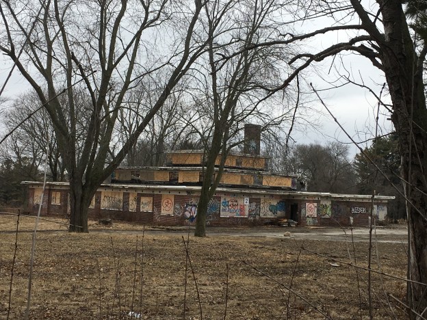
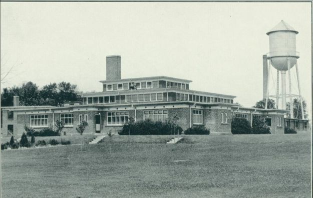
The historic photo below was taken from Wikipedia and shows the cafeteria building as it looked around 1930.

CAmp 30 cafeteria

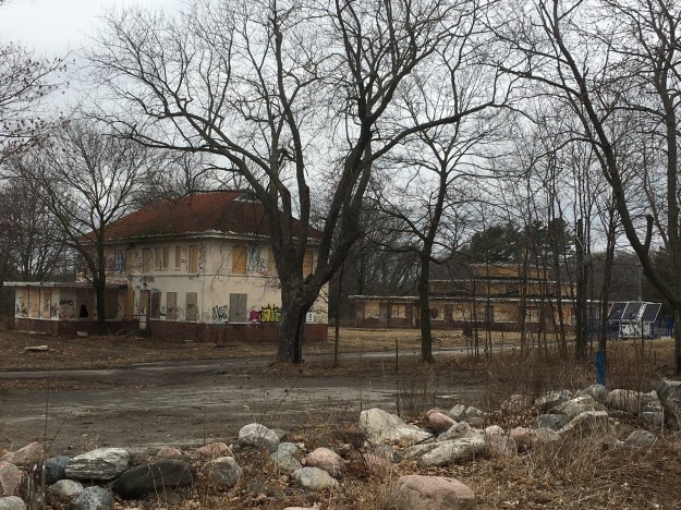
The cafeteria building became the mess hall when the POW camp was created here.  The building became the site of the infamous Battle of Bowmanville in October 1942.  In Europe, Hitler had ordered that Canadian POW’s be placed in shackles and in retaliation German POW’s were to be shackled too.  100 officers from Camp 30 were supposed to volunteer but instead barricaded themselves in the mess hall.  They gained access to hockey sticks as weapons and so the 100 soldiers brought in from Kingston stormed the hall armed with baseball bats.  We had to keep it fair!  The most serious injury was to a Canadian soldier who was hit in the head with a jar of jam.  Later, German soldiers who were holed up in the basement of the barracks were flushed out using high pressure water hoses.  After the stand off was over, the Germans were placed in shackles until December 11, 1942.  The mess hall is one of the buildings that remains on the site.

IMG_3520

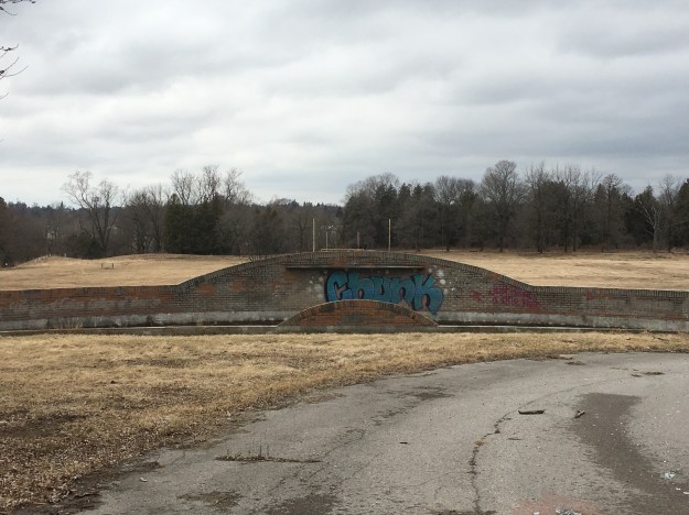
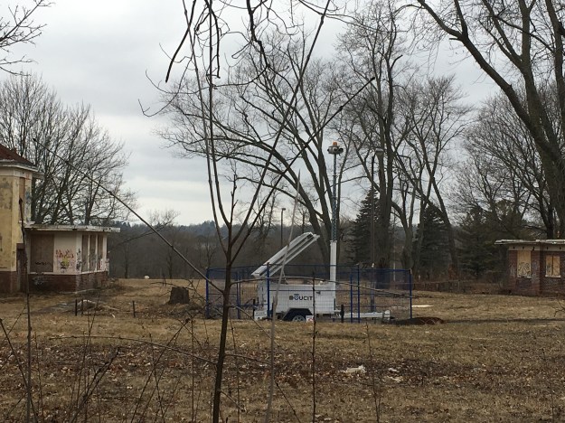
Two other buildings can be seen below, including the gymnasium in the background.

IMG_3516

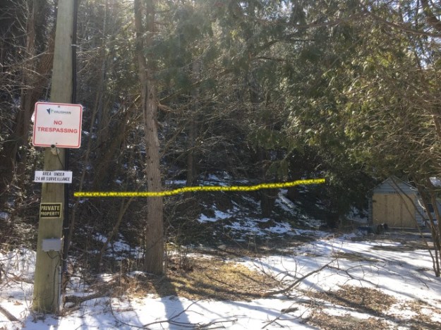
After the war was over the property was given back to the Ministry of Education and put back into use as the Pine Ridge Training School.  It operated in this capacity until 1979 when it was closed as a boys school.  It was used for various other educational uses until 2008 when it was finally closed for good.  Since that time it has deteriorated badly and has been the subject of much vandalism.  Several buildings have been lost to fire and a few were demolished in the past few months.  In 2013 the property was listed as one of the most endangered historical sites and was finally given a historical designation to attempt to preserve it.  Six buildings are to be restored and in the fall of 2017 they were boarded up again to keep the winter weather out.  Security cameras and foot patrols are in place to give trespassing tickets to those who are curious enough to enter the property.

IMG_3521

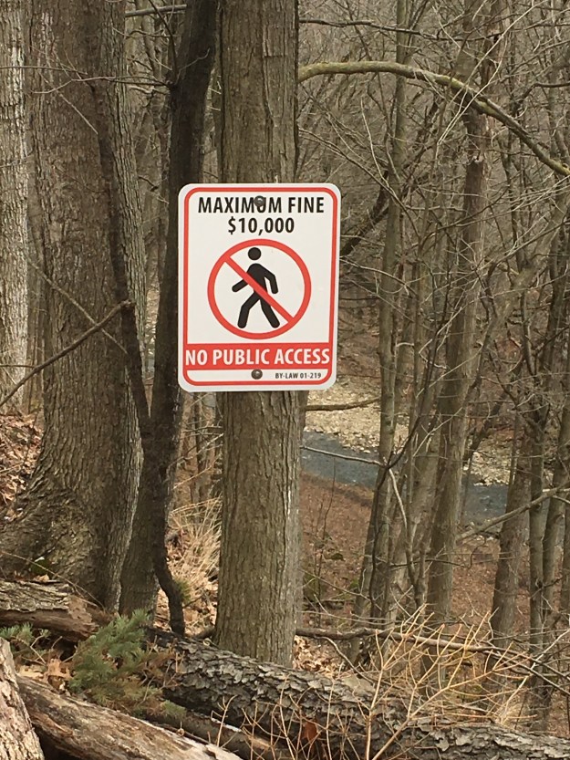
I was hoping, perhaps for the first time ever, that a security guard would show up.  I had planned to ask them if I could walk around the property with them if I didn’t leave the paved walkways.  Alas, no security guard when you really want one.  Many people have posted online about getting tickets for trespassing so beware.  There are several of these cameras set up on the site and they apparently alert the police when motion is detected.

IMG_3519

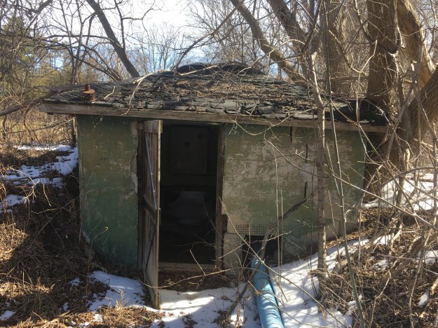
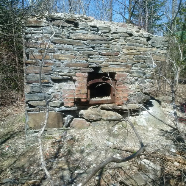
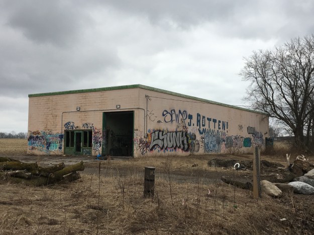
A further abandoned building can be found across Lambs Road from the camp.

IMG_3529

The original 300 acre site is planned for housing developments except for 66 acres that will form a park.  The theory is that the buildings will be restored for their historical value but the cost to repair the recent damage may be prohibitive.  We will have to wait and see what the final outcome will be.  Camp 20, known as Camp Calydor was located in Gravenhurst and a story on it can be found at this link.

Google Maps Link: Camp 30

Like us at http://www.facebook.com/hikingthegta

Follow us at http://www.hikingthegta.com