
Sunday, April 2, 2017
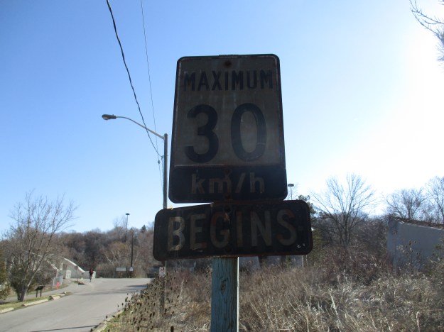
Don Mills Road, or part of it, played an important role in early York (Toronto) and has been under constant change ever since. The decision to make Don Mills Road a major thoroughfare led to a new alignment and the abandonment of a section in the heart of the city making it one of only a very few pieces of abandoned roadway in Toronto. Links to the others ones that we’ve investigated will be provided at the end. As you drive north on Don Mills Road, just north of the interchange for the Don Valley Boulevard (DVP) an unmarked road exits to the right. This is the old alignment of Don Mills Road. Follow it over the bridge to where there is free parking. An old sign, just off the new Don Mills Road suggests we slow down and see what’s around us.
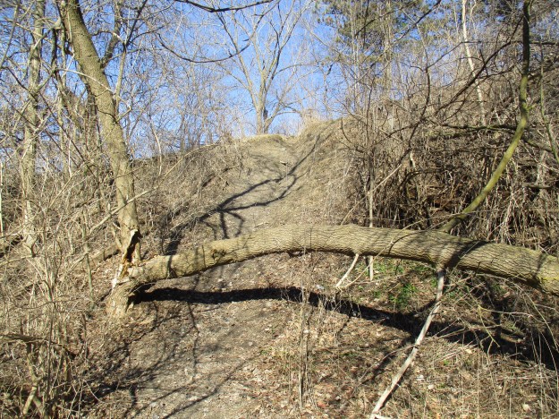
The mills at Todmorden on the Don River were the second to open in York after The Old Mill had opened on the Humber River. In the 1820’s a paper mill was built at Todmorden and in 1846 the Taylor Brothers added a paper mill to the saw and grist mills they owned at the Forks of The Don. This was the third paper mill along the river that belonged to the Taylors and was known as the upper mill. The Mill Road was built to join the mills and provide access for the public and workers. For a long time, the road only served the mills but the farmers to the north got together and extended the road to York Mills and south to the St. Lawrence Market. The road then became known as the Don Independent Road because it was built on land that was given by the property owners. In 1954 it was decided that Don Mills Road would become one of the major arteries in the city and it was widened to 4 lanes. It was given a new alignment through the Forks of the Don so that a new bridge could be built. The picture below shows the berm that the old road used to climb from the river valley to the tablelands above.
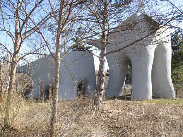
The elevated wetlands are a familiar site to people who use the DVP to get in or out of downtown Toronto as they have stood on either side of the highway since 1998. The three elephantine sculptures were created by Canadian Artist Noel Harding who works on large scale public art that has an environmental component. Harding, working in conjunction with the city and the Canadian Plastics Industry, created the wetlands. They are made from recycled plastics and serve to purify the water that flows through them. A solar panel on the rear sculpture pumps water from the river. That water flows into the next planter and finally into the third one before falling into a natural wetland in front. The cover photo shows another view of the elevated wetlands.
The rainbow arch bridge over the West Don River was built in 1921 to replace an earlier bridge. Toronto has several of these concrete bowstring bridges but this one is in particularly good condition with little or no restoration.
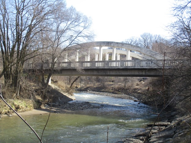
There are a couple of architectural features that make this bridge unique among the local bowstring bridges. First, each end of the bridge has extended parapets on it that are decorated with diamond patterns. Also, the last two panels on each end of the bridge are filled in to create a solid wall from the arch to the deck of the bridge. Concrete railings provide protection for pedestrians on either side of the bridge.

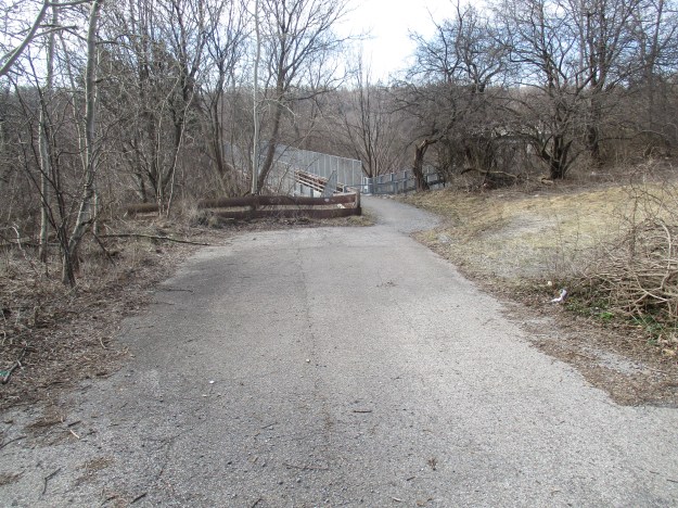
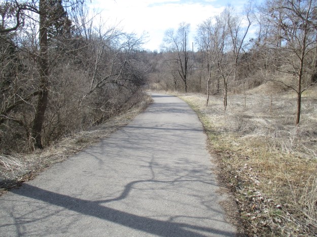
From the arch bridge looking north, the old roadway has been well maintained and is in use as a walking trail. There is a small parking lot on the side of the roadway, just south of where this picture was taken. The bridge over the Canadian Pacific tracks can be seen in the distance.

When the road was closed in 1961 the original bridge over the railway was removed. A new pedestrian bridge was installed in 1972 when the Lower Don Recreational Trail system was set up. The picture below shows the railway crossed by the pedestrian bridge with the new Don Mills Road bridge in the background. An elevated boardwalk joins the trails in ET Seton Park with the bridge over the rail line and the Lower Don Recreational Trail. This trail connects to a series of trails that will take you all the way to Lake Ontario.
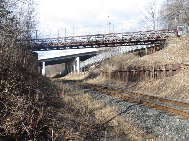
Just north of the bridge is the old railing that was installed for safety when the road was closed.
Looking back you can see that the new bridge is not in the same alignment as the earlier one. It ends at the same location on the southern abutment but starts slightly west of the original and runs on a different angle.
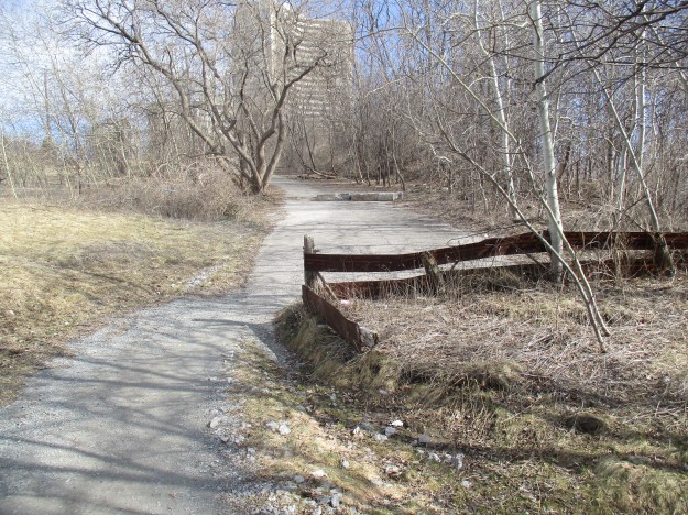
The section of the roadway north of the bridge has been overgrown in places by 50%. Grass, moss and sizeable trees sprout through the pavement on both sides of the road.

This large tree has burst through the asphalt pushing pieces of pavement up all around the tree.

The view looking south from near Gateway Boulevard. Behind here the traces of the old road have been obliterated by an apartment building.
Google Maps Link: Don Mills Road
Like us at http://www.facebook.com/hikingthegta
Follow us at http://www.hikingthegta.com

Interesting, didn’t know that this seciton was the old Don Mills Road – I have cycled it often from the Martin Goodman Trail up to Edward’s Gardens. Good workout.
One of my favourite sections of the river. It gets a great salmon run every fall.
Pingback: Wonscotonach Parklands | Hiking the GTA
Pingback: E. T. Seton Park | Hiking the GTA
They are digging it out now as part of an trail project.. there is a fantastic brick road under the asphalt. Would have been nice to see it in the day.
Thank you for sharing! I’m thinking that this would be lovely in the springtime!
The arch Bridge goes over the east branch of the Don not the west.
My only regret was not taking a piece of the old Don Mills road.