Monthly Archives: July 2021

Washago Coaling Tower

August 1, 2021

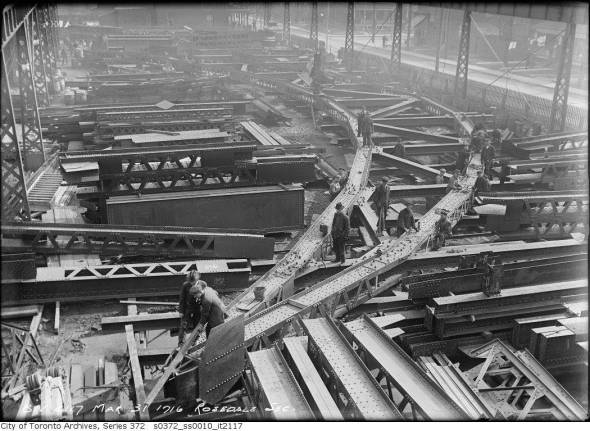
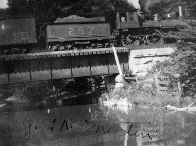
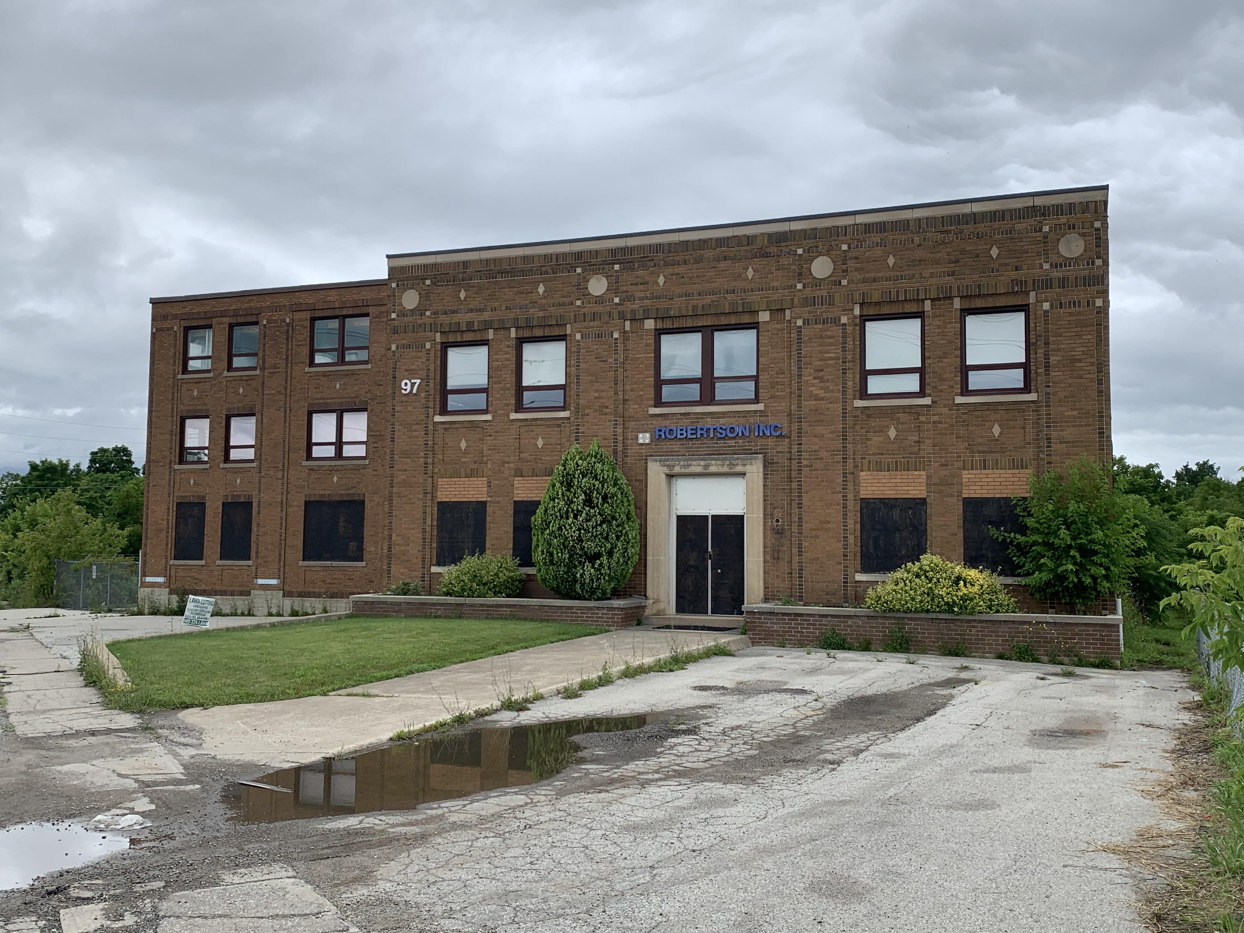
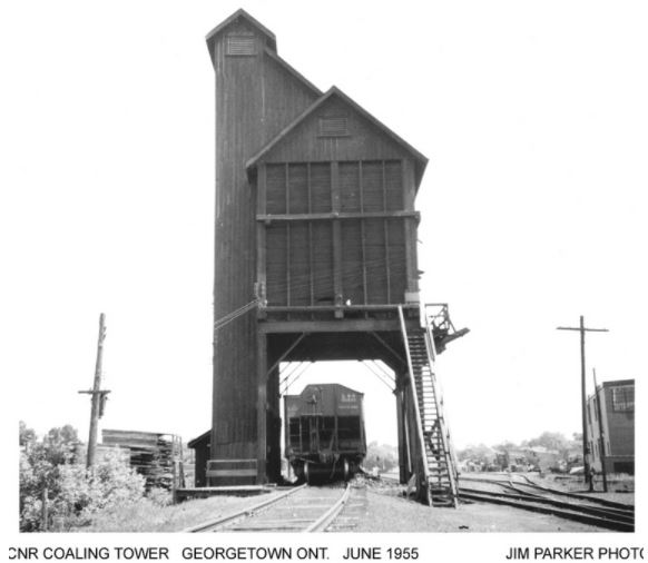
Early railways connected small communities with larger centres and allowed for the easy transfer of goods and people. Pioneer towns that had railway service often flourished while those without it ended up featured in our Ghost Towns series. For the first century of Canadian railway history, trains were powered by steam locomotives. These required two fuel sources, water and coal (or occasionally wood). Coal would be manually shoveled into the the firebox by the fireman, heating the water to boiling and creating the steam and pressure to move the huge pistons. It is said that about a pound of coal per second was required to keep a train moving at 60 miles per hour. The major stops along the railways became places to refuel with water and coal, both of which were stored in towers so they could be gravity fed into the waiting trains. All of the early coal towers were built of wood and required continual maintenance and replacement. The picture below shows the coal tower in Georgetown in 1955 and was taken from Trainweb.org.

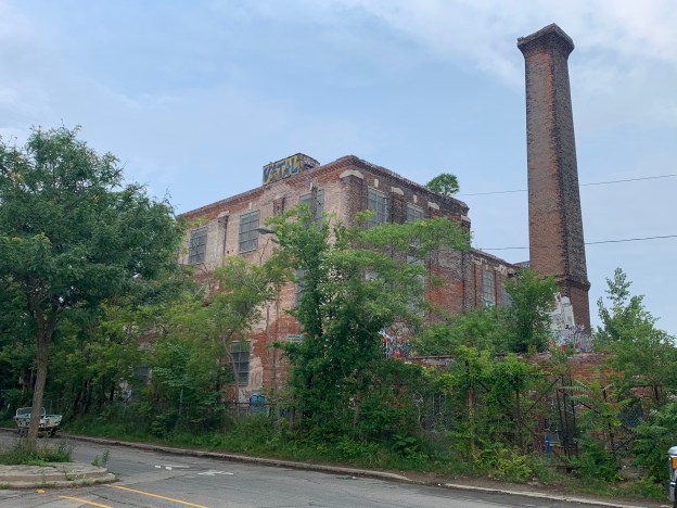
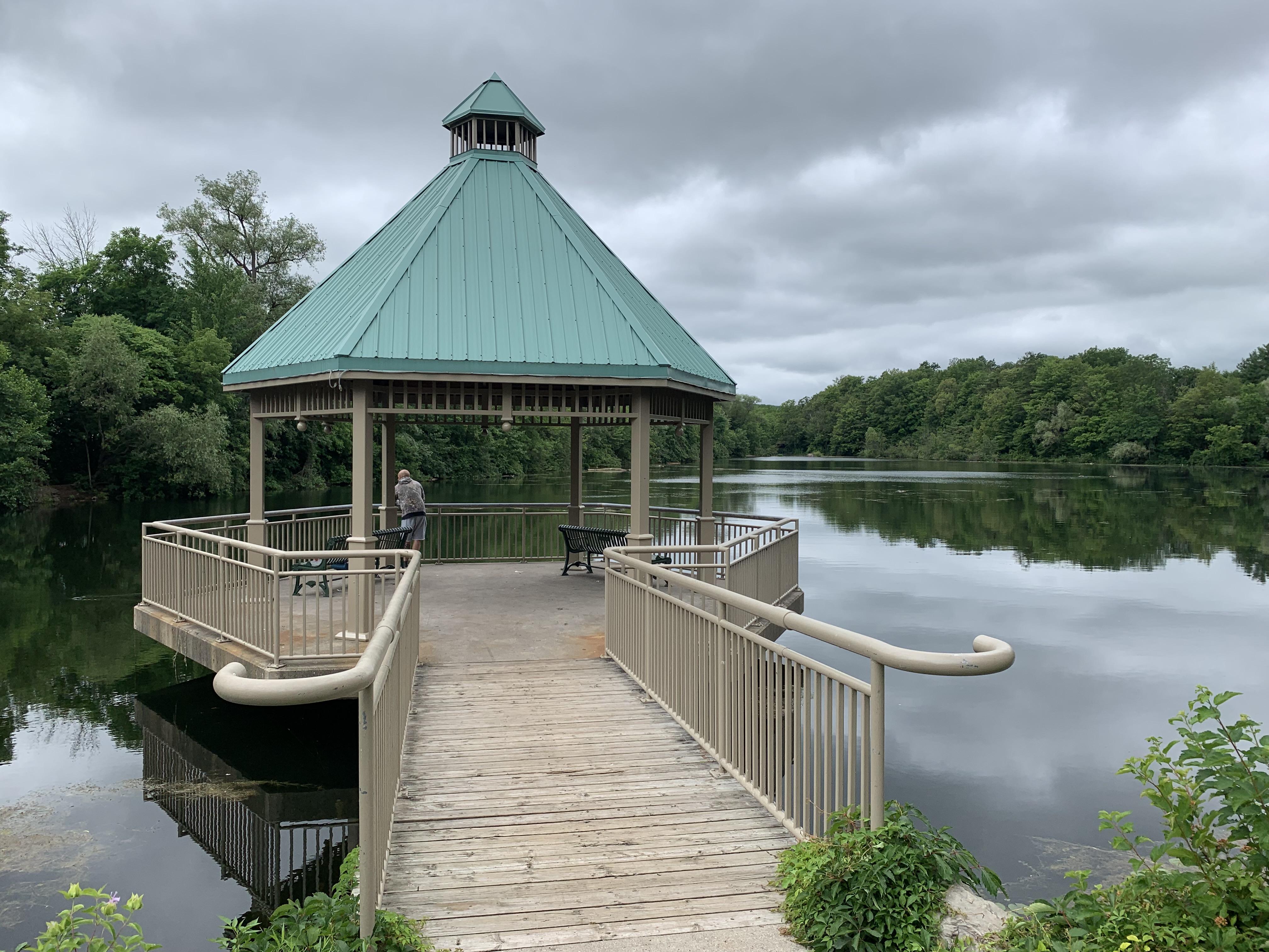
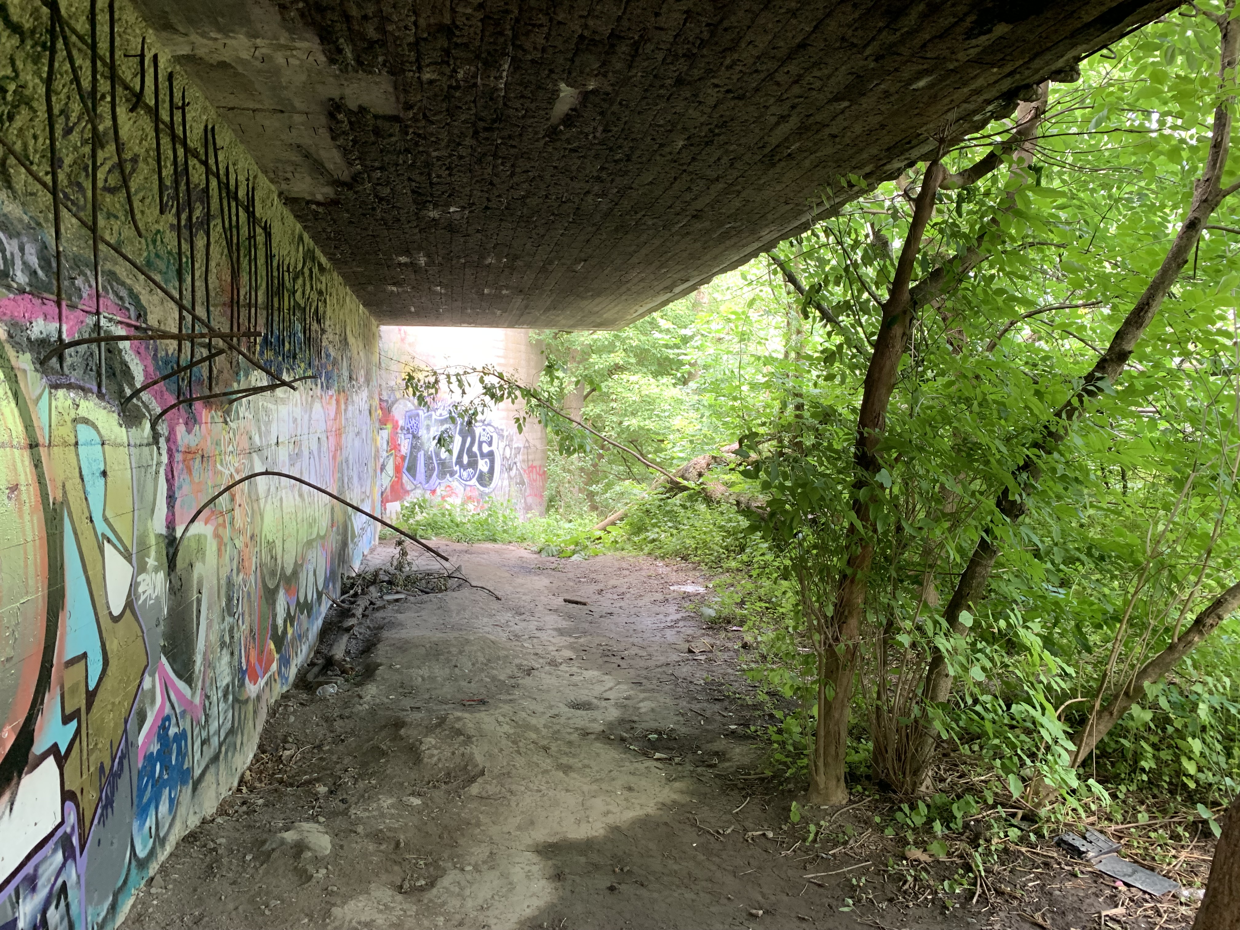
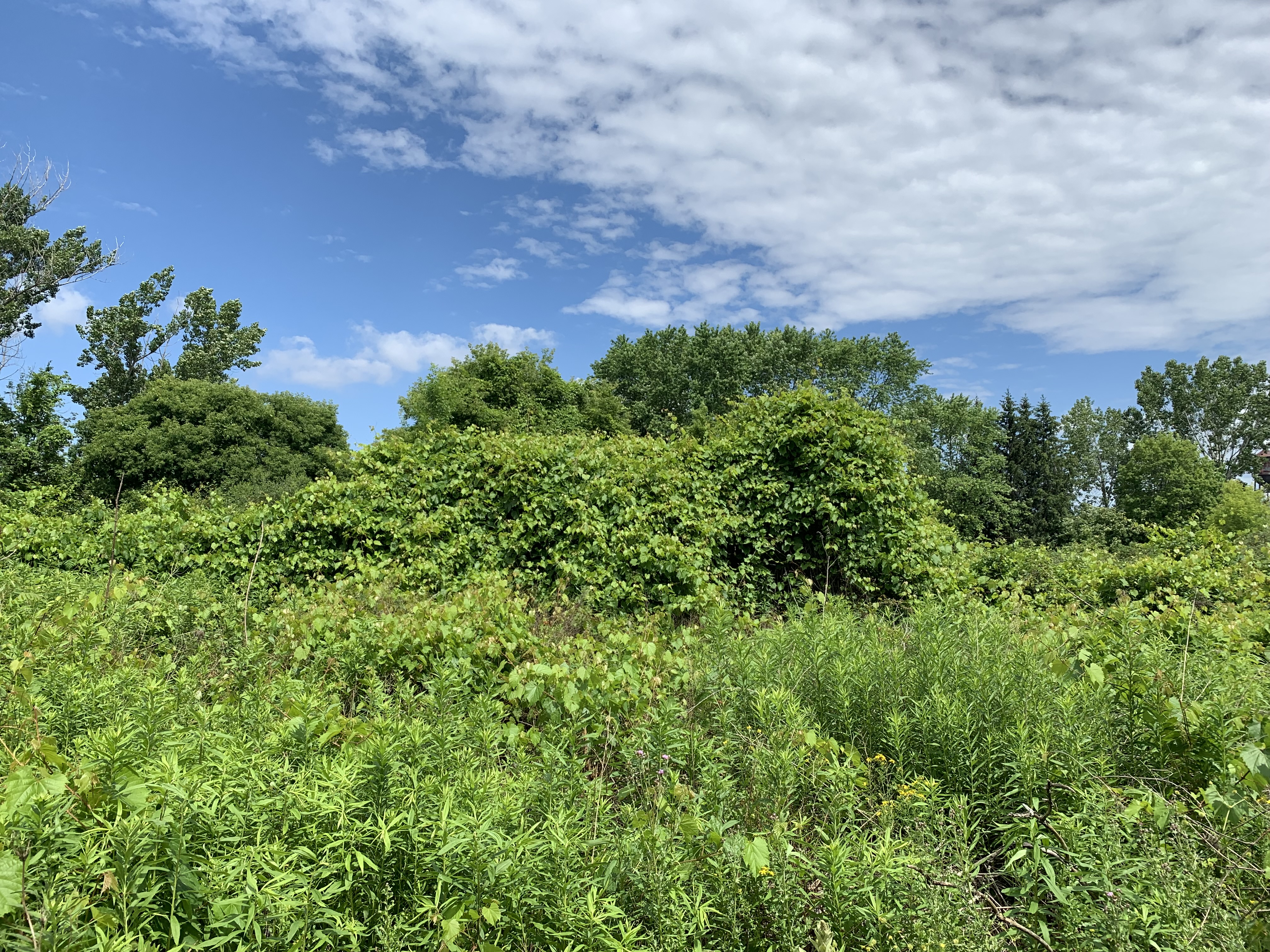
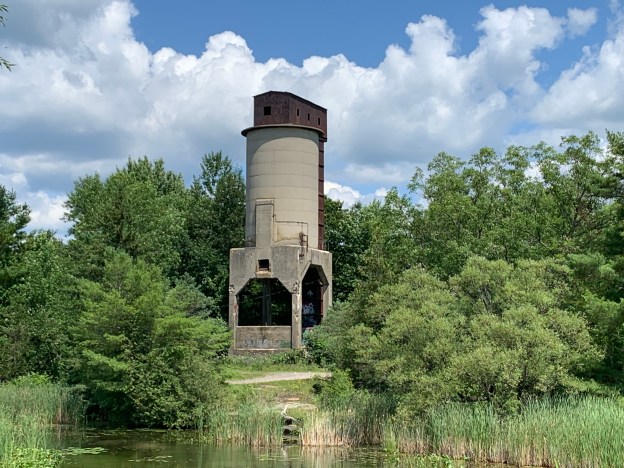
With my mother living in Gravenhurst there’s plenty of opportunity to visit historic sites that exist along the route. The Washago coaling tower had been in my sites for a couple of decades and it finally came time to check it out. I parked in Centennial Park where you can see the coaling tower across the river.

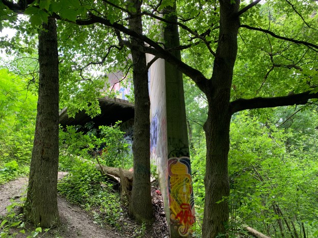
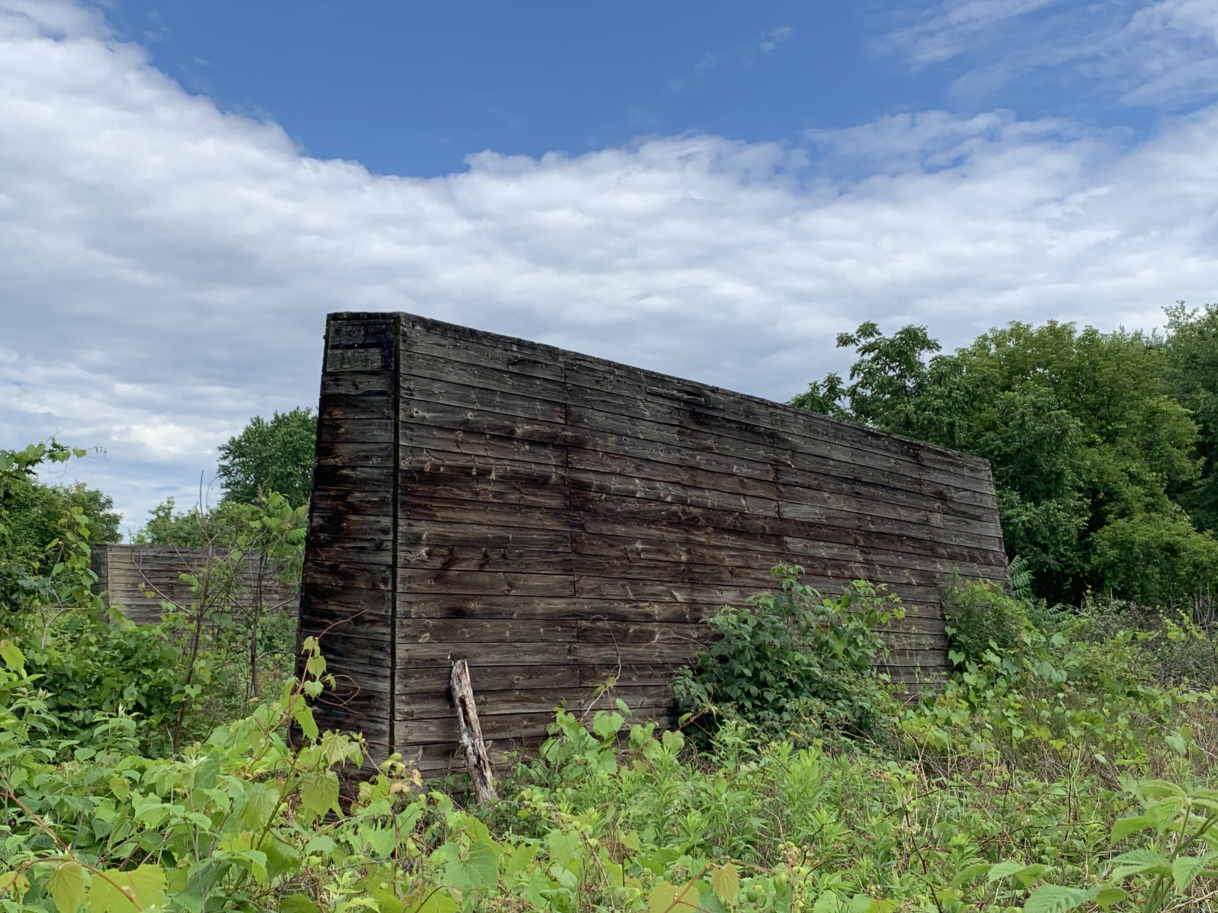
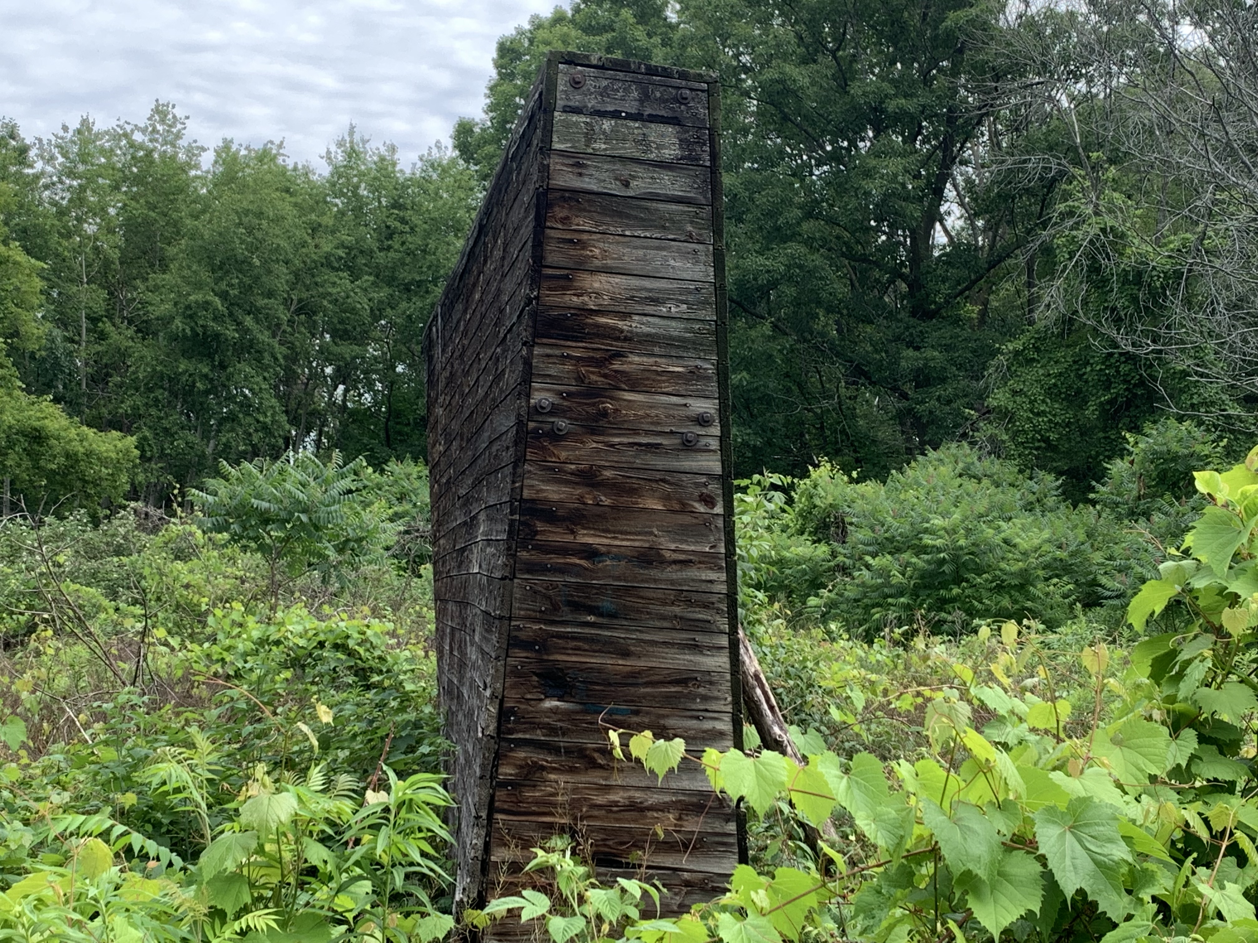
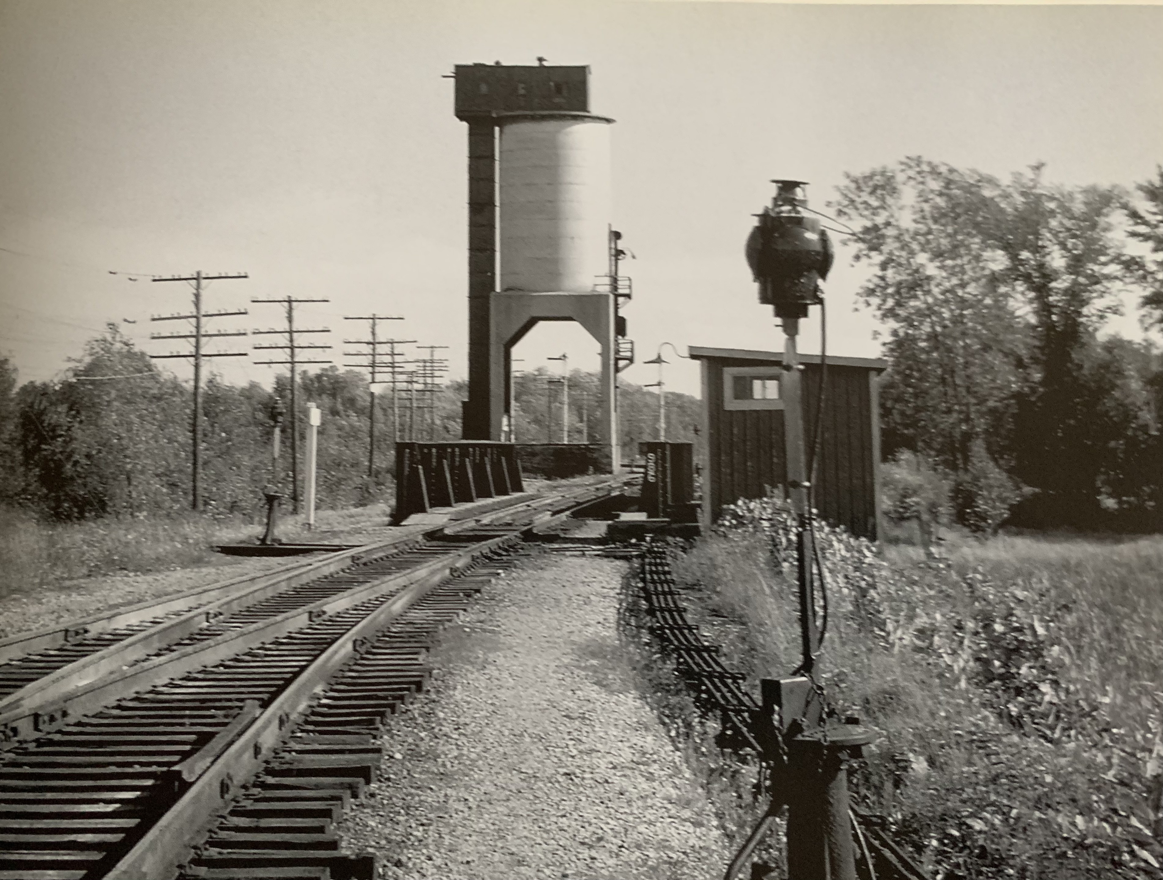
The concrete coaling tower in Washago was built in 1936 to replace an earlier wooden one. This picture from Ian Wilson’s book Steam at Allandale shows the coaling tower as it looked in the 1950’s.

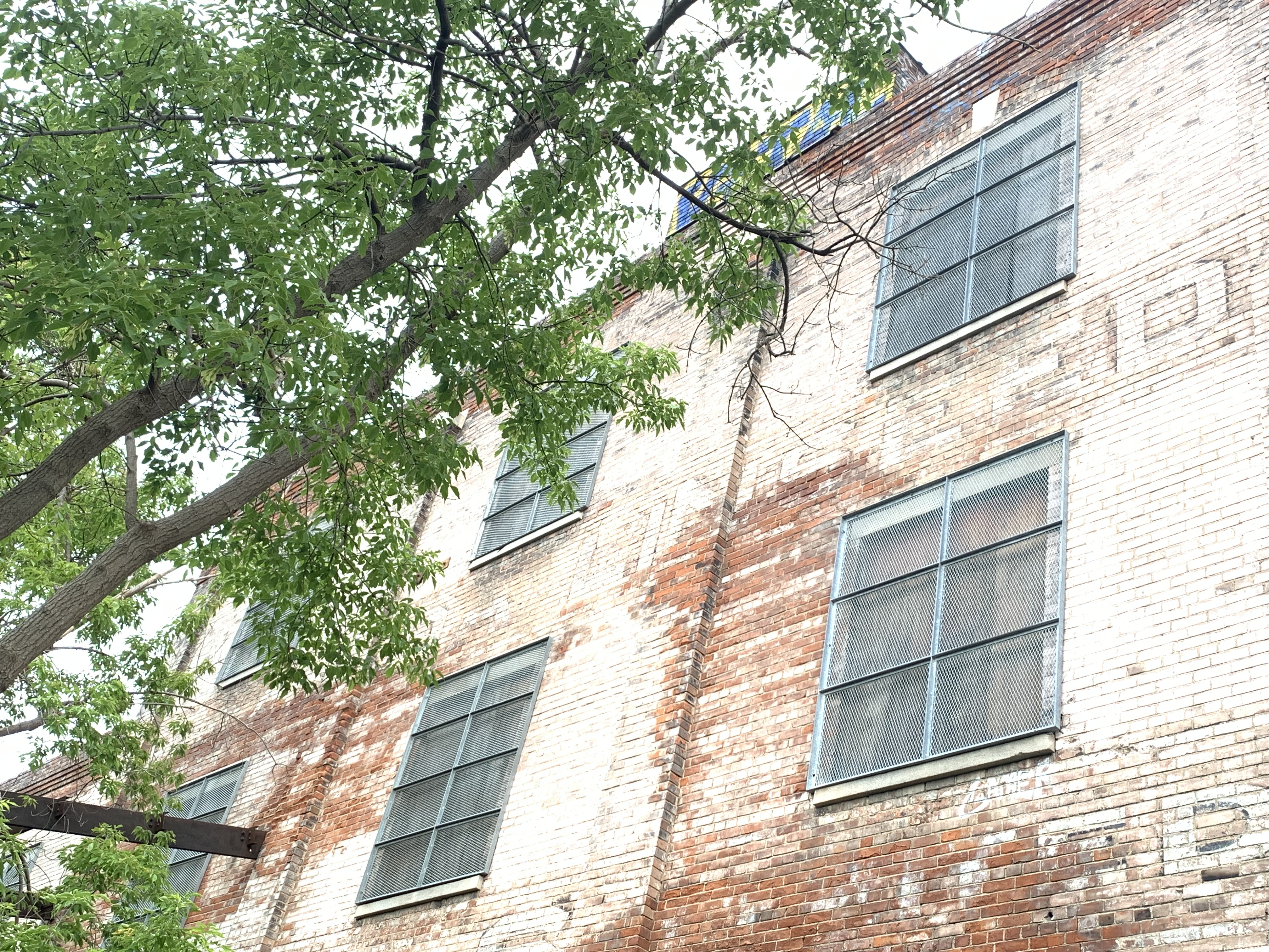
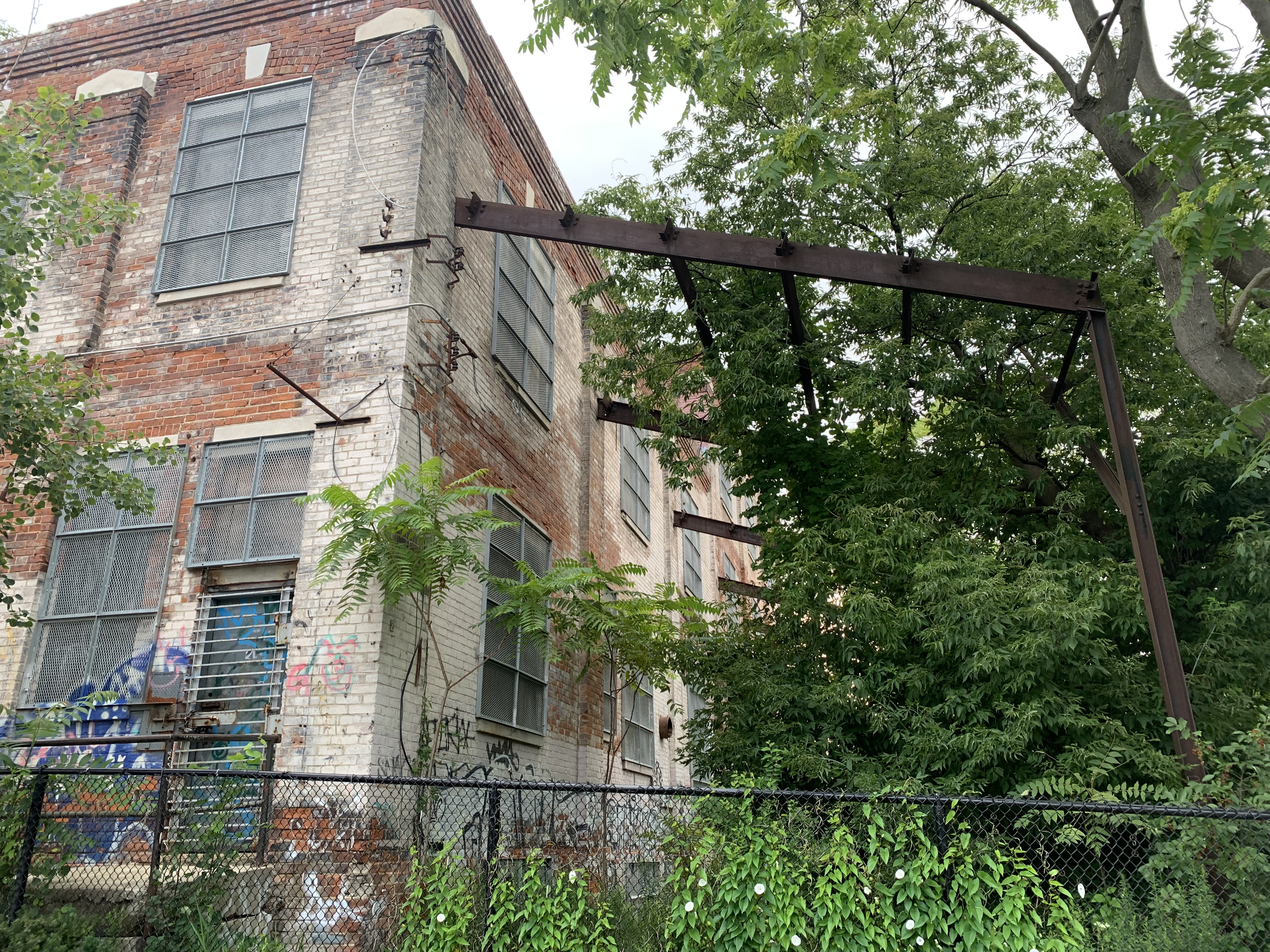
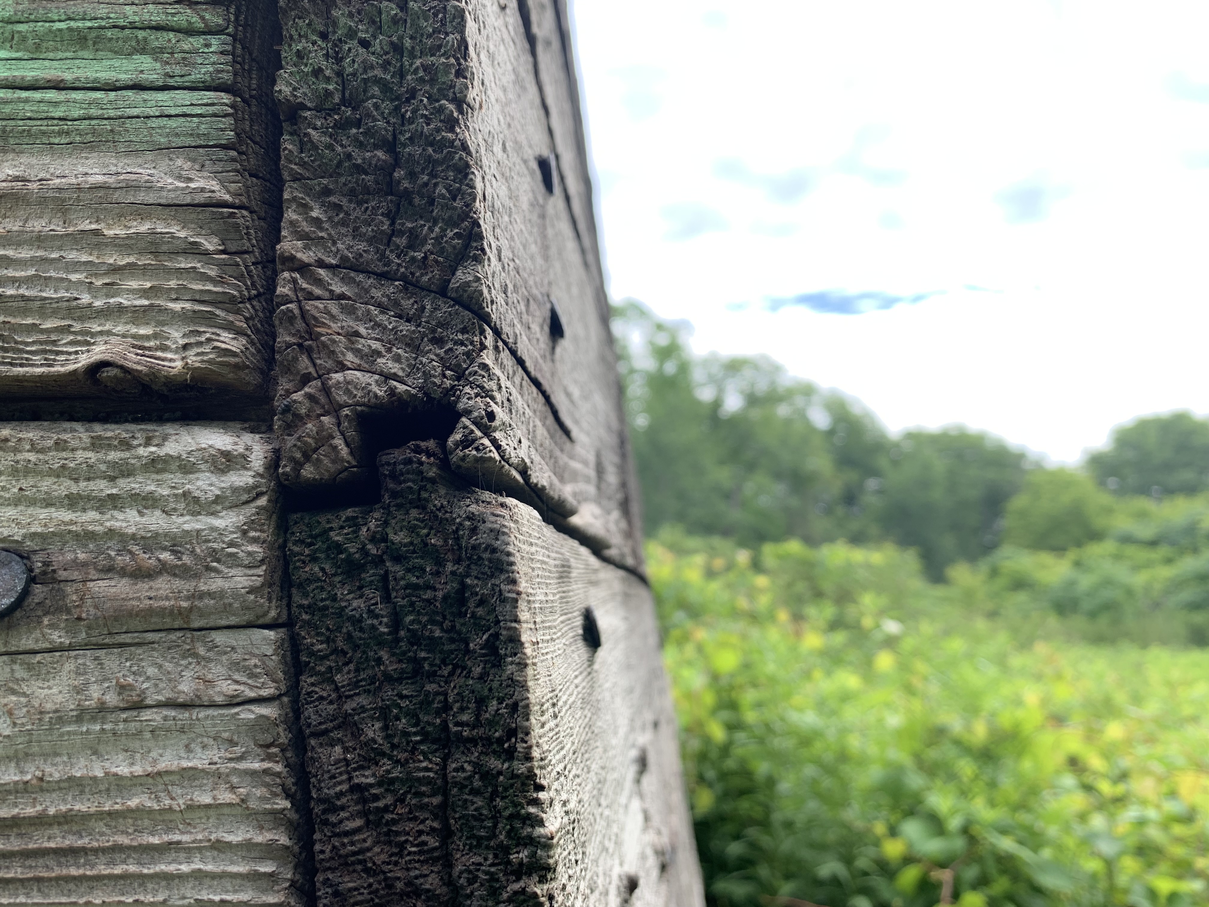
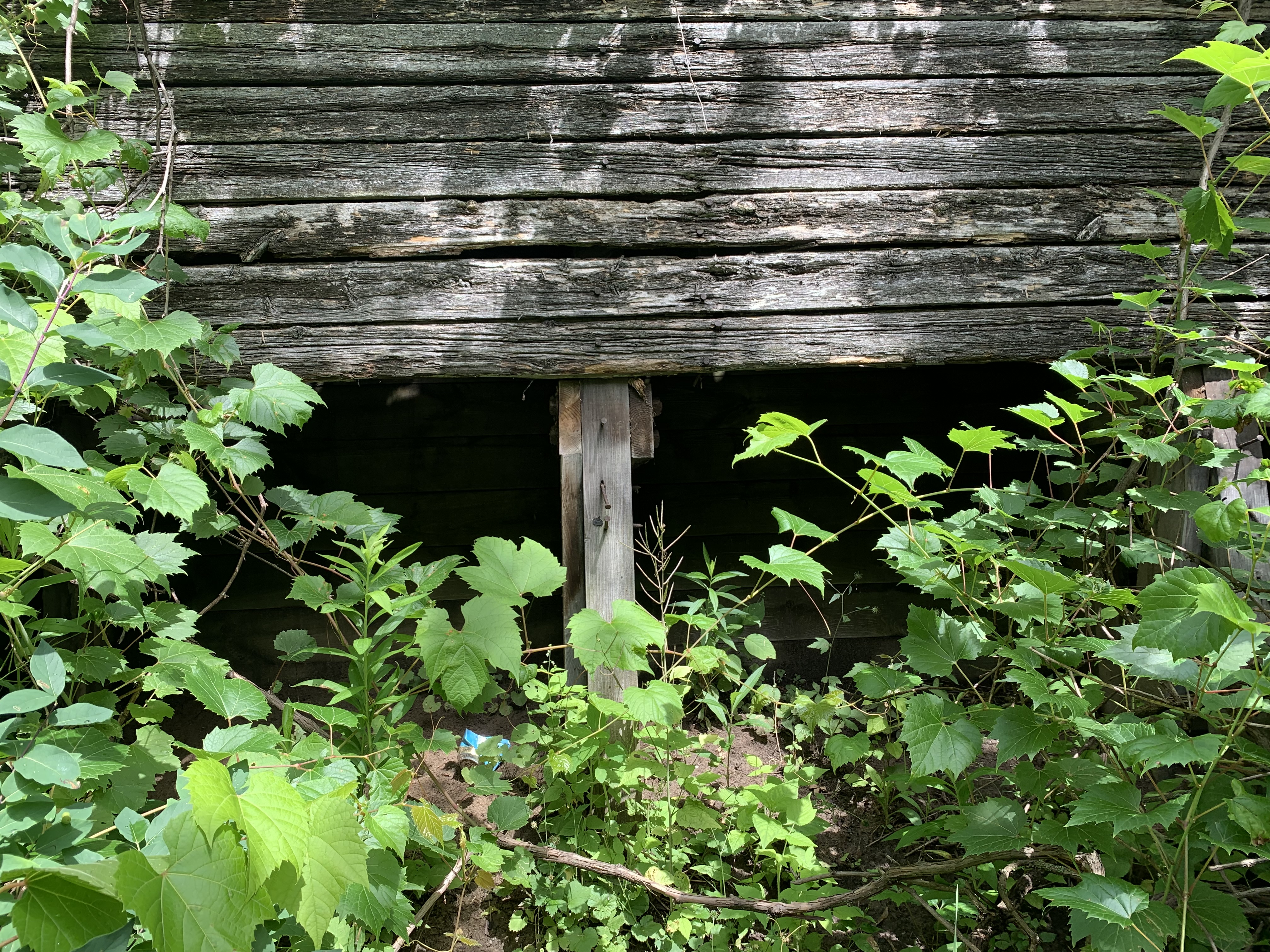
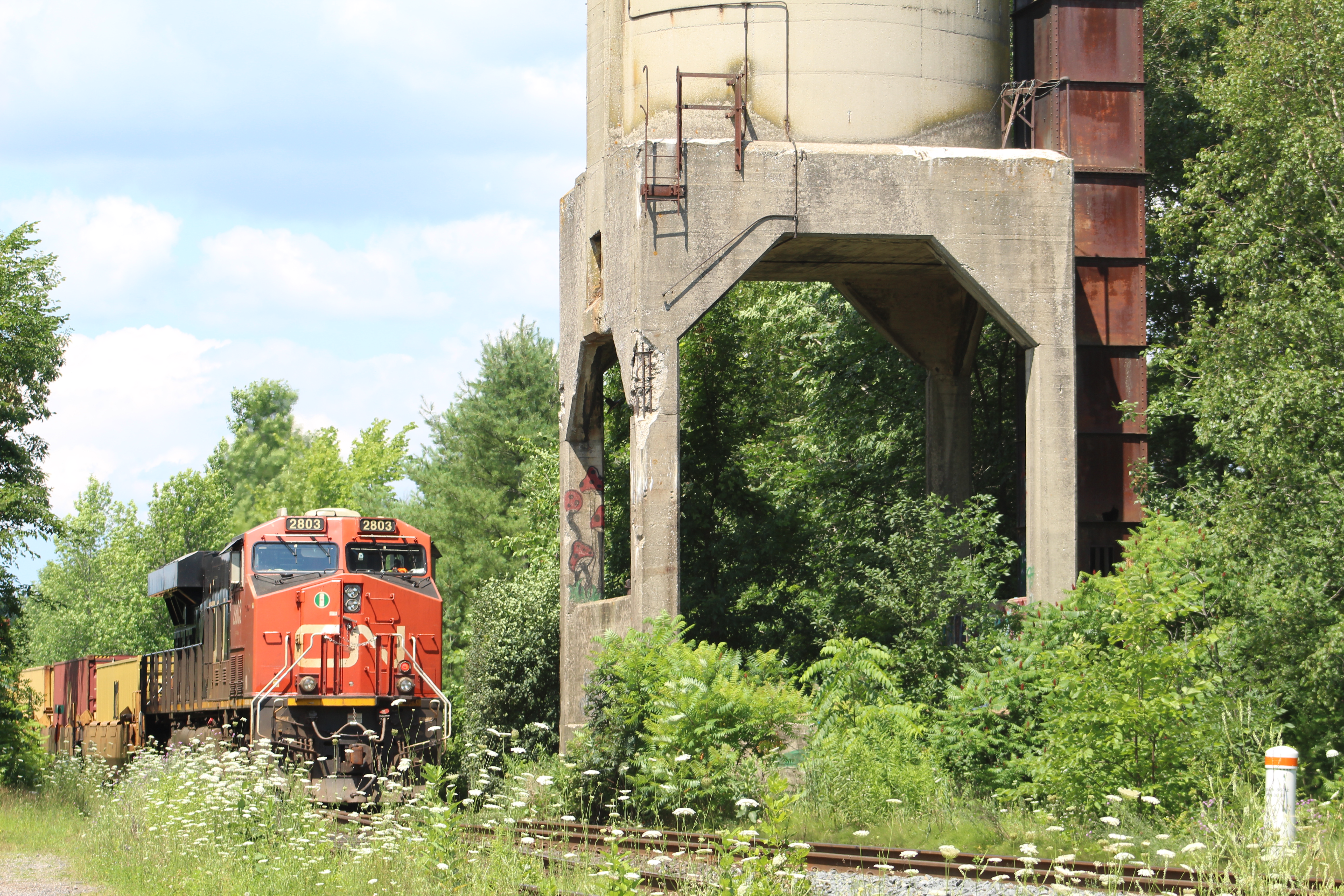
As railways converted to diesel locomotives the old coaling towers became obsolete and many of them were demolished. The Washago tower was left standing beside the rail line and it has been slowly deteriorating ever since. Today, there are small sections of concrete that are breaking away but it appears to be structurally sound all the same.

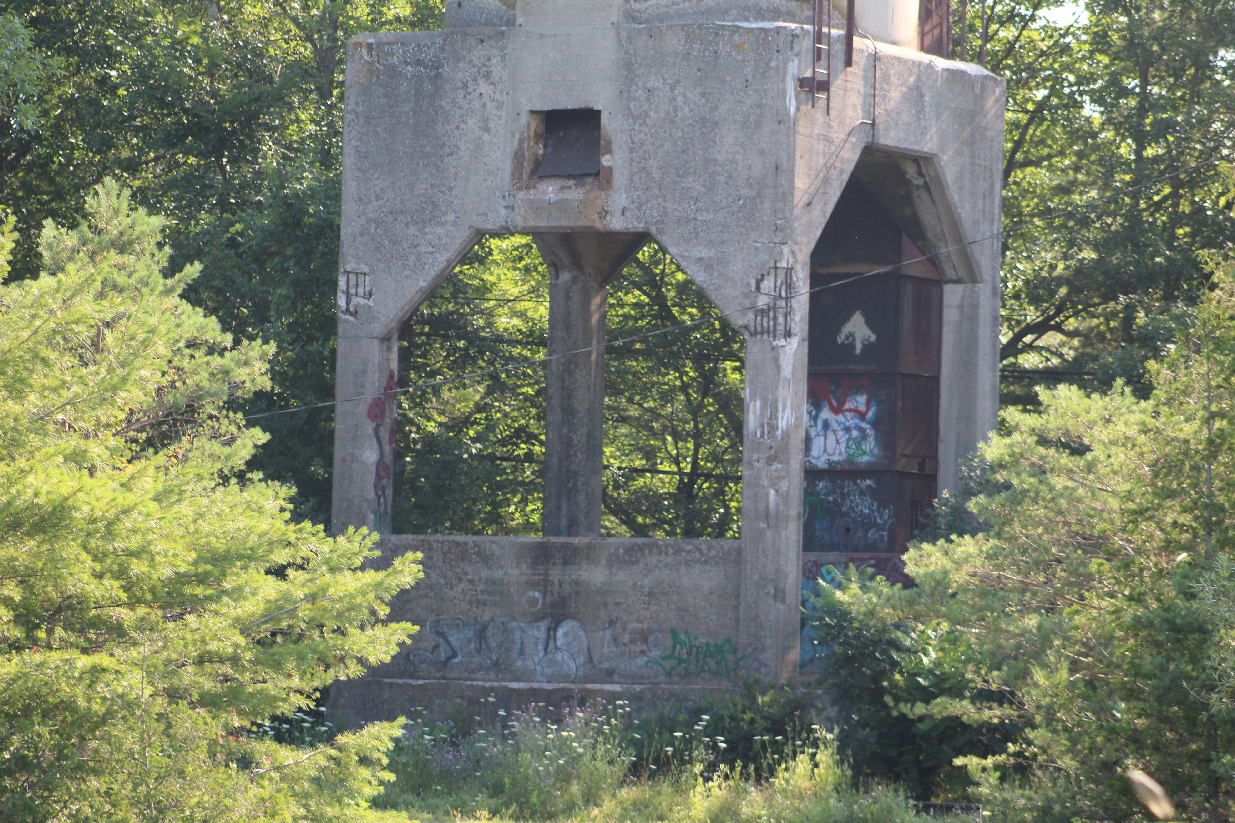
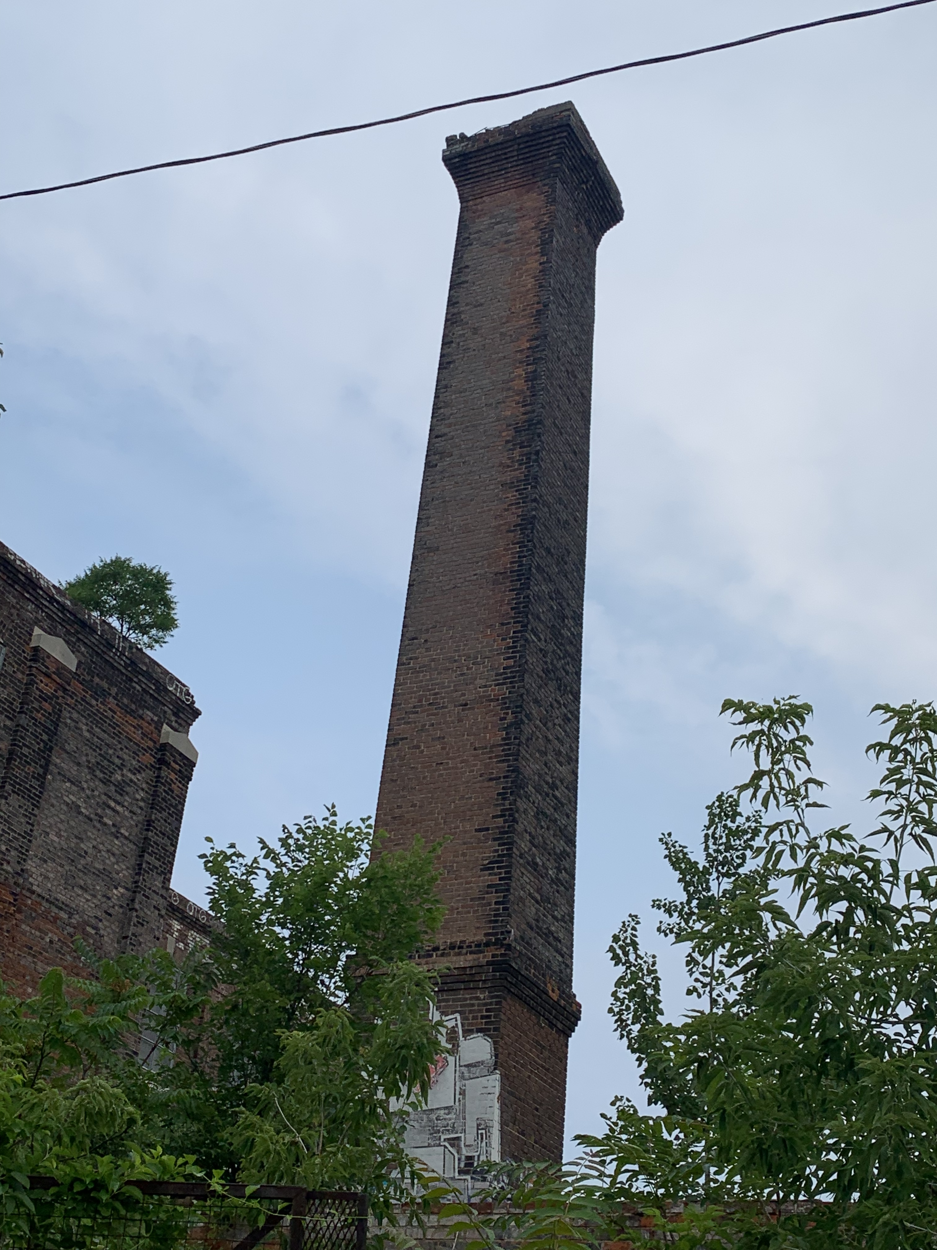
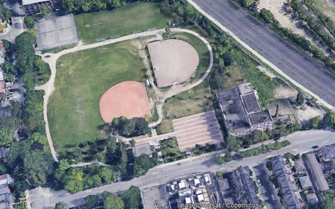
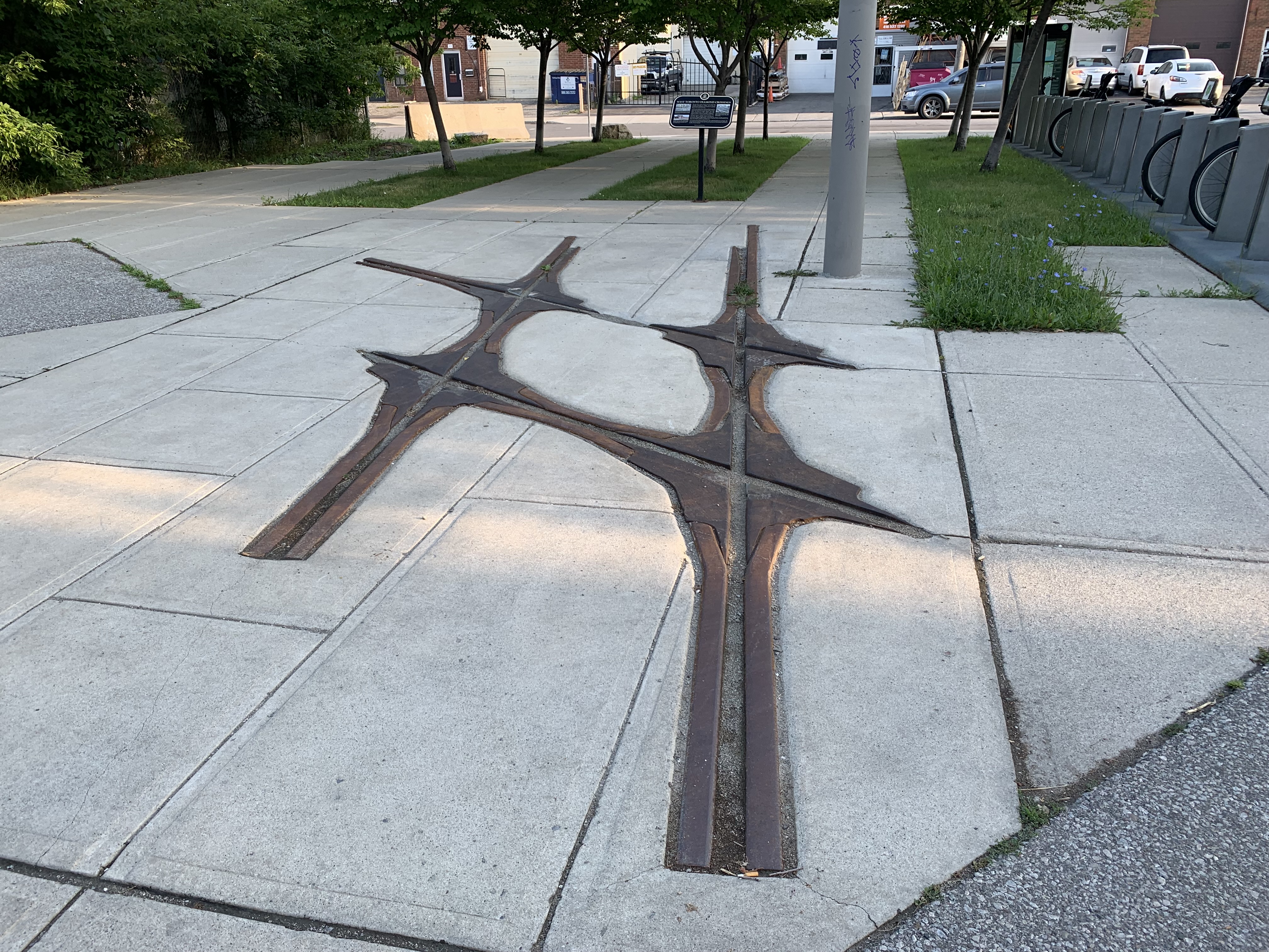
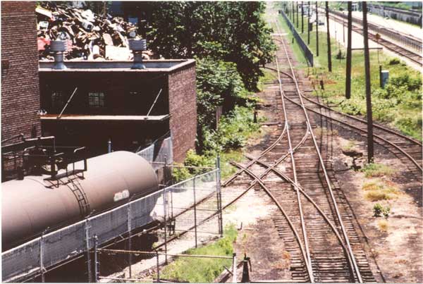
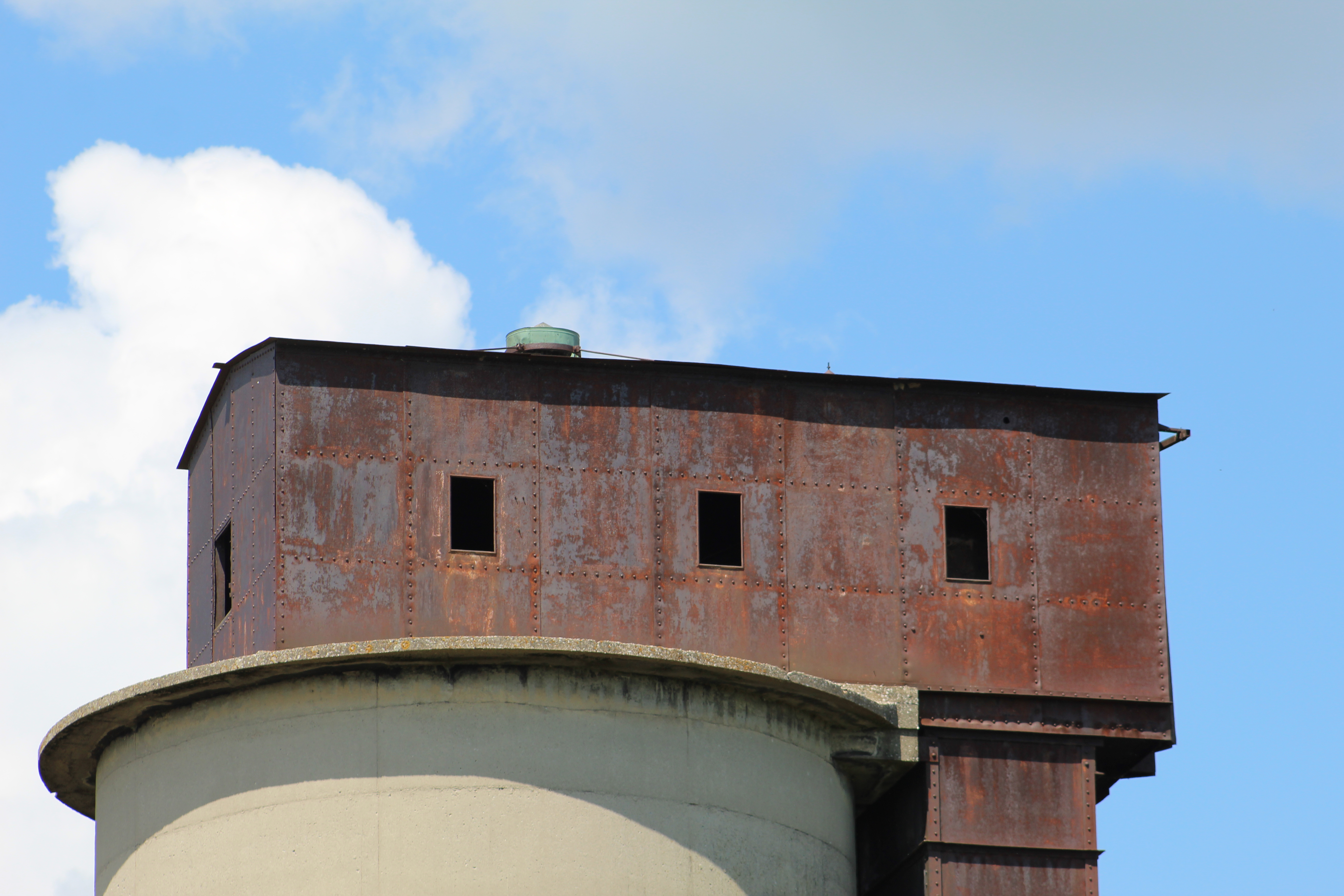
The steel top is showing some signs of rust but is otherwise still in good shape. I can’t find any heritage designation for the Washago coaling tower but there’s very few of them remaining. There’s a three-bay concrete coaling tower preserved in downtown Toronto at Roundhouse Park along with several other railway era artifacts including a water tower and train station.

If you are thinking about visiting the coal tower, be aware that it is on a very active rail line and that you would be trespassing on private property.

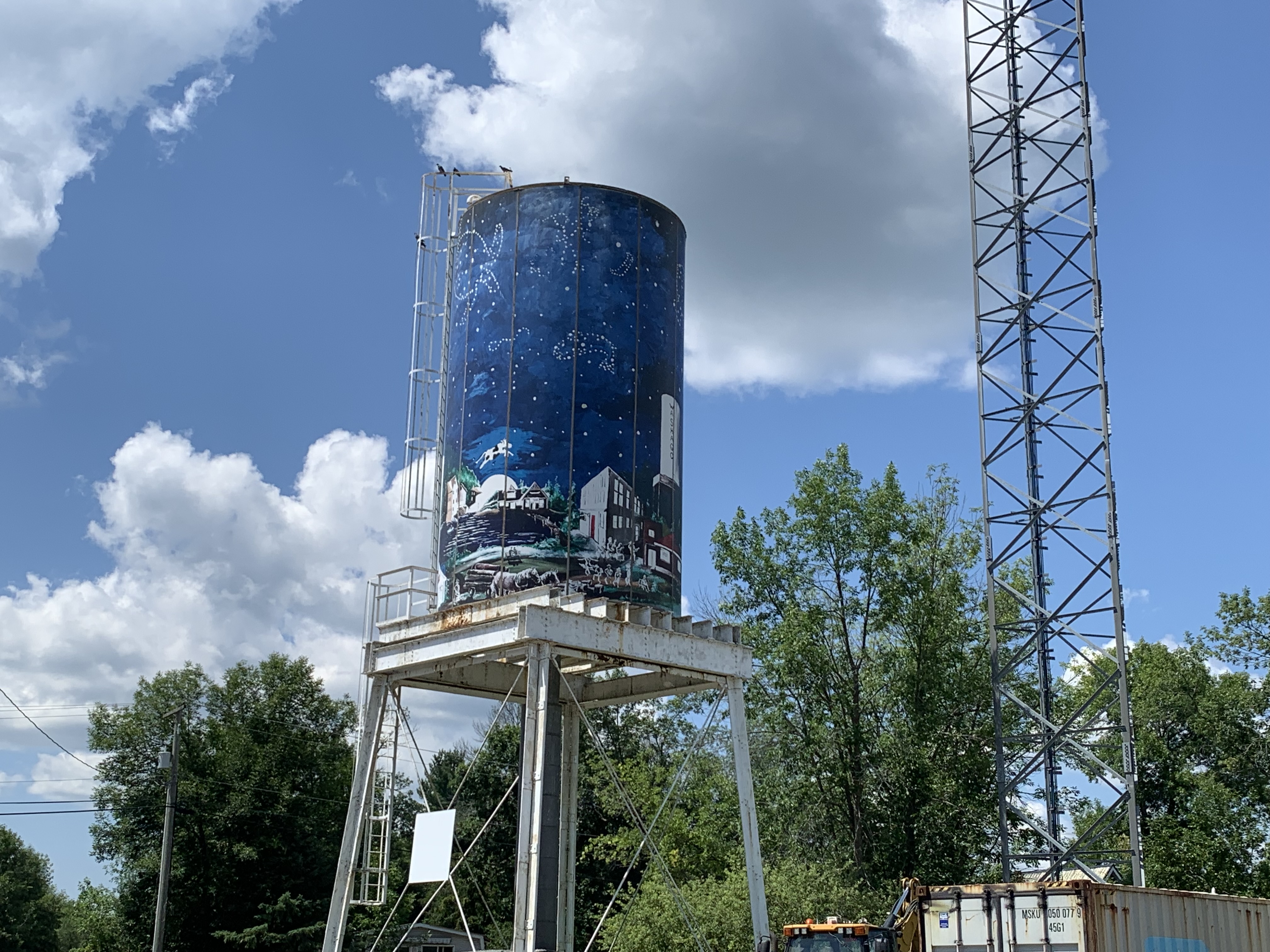
When the Washago water tower was no longer needed for railway purposes it was repainted and put into service as the town water tower.

The current railway station was built in 1906 for the Canadian Norther Railway and was located about 200 metres from its present location. It was originally behind the Washago Hotel but the Grand Trunk Station was destroyed around 1913 and it was relocated in 1922 to serve both rail lines in town.

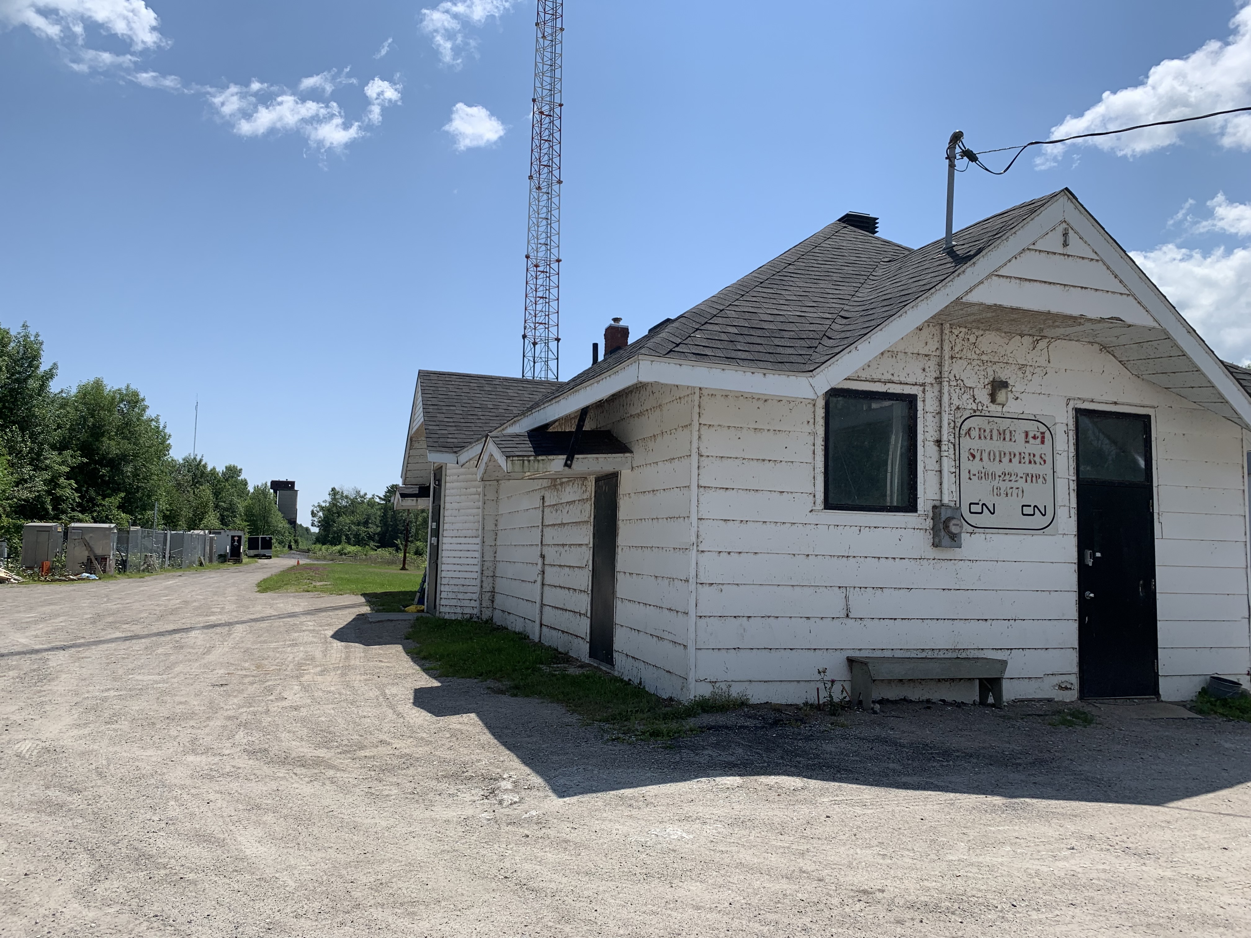
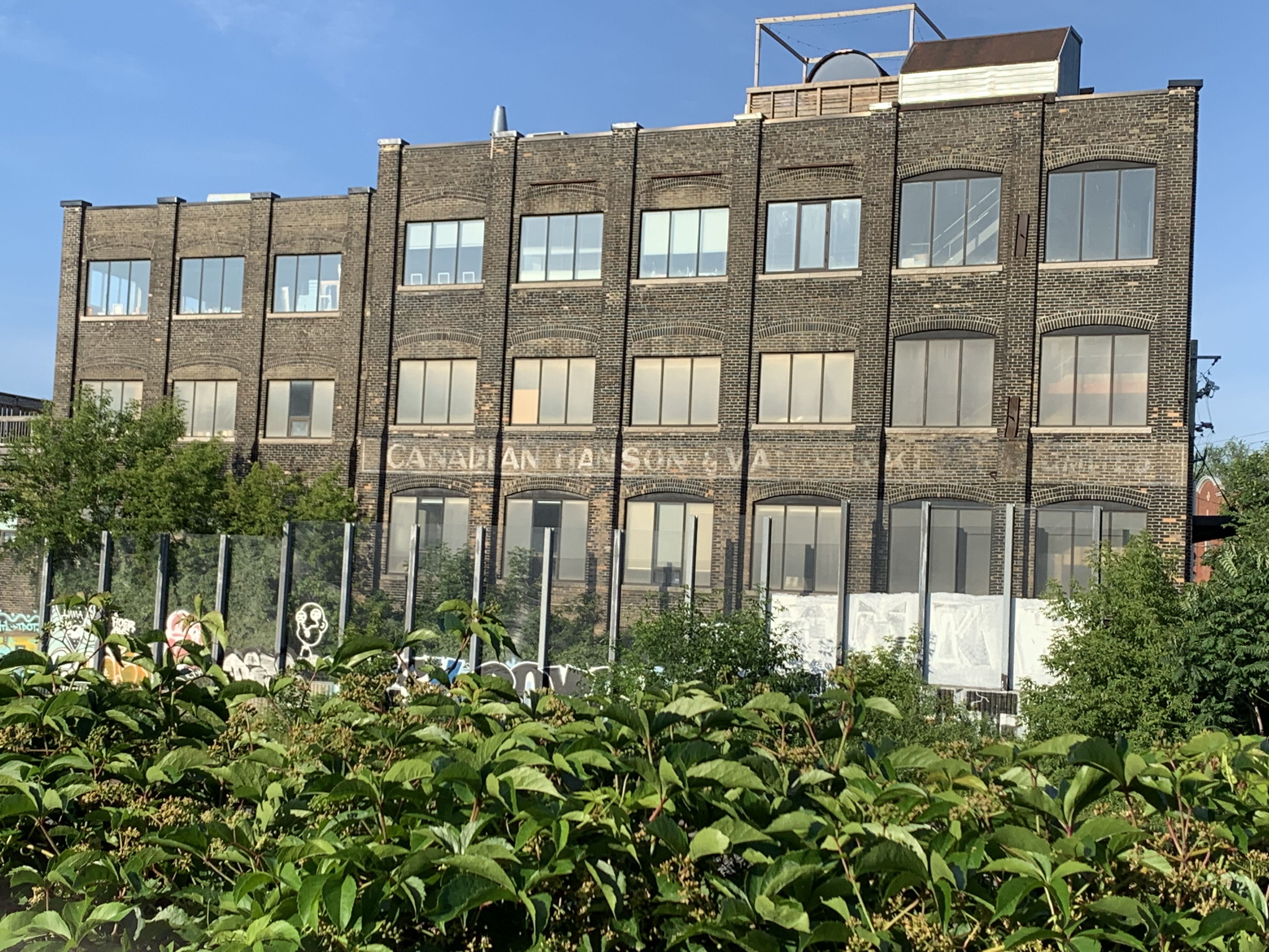
To accommodate the rail lines that passed on either side of the station a bay window was constructed on the back side of the station. Today, the building serves as maintenance space for CN employees.

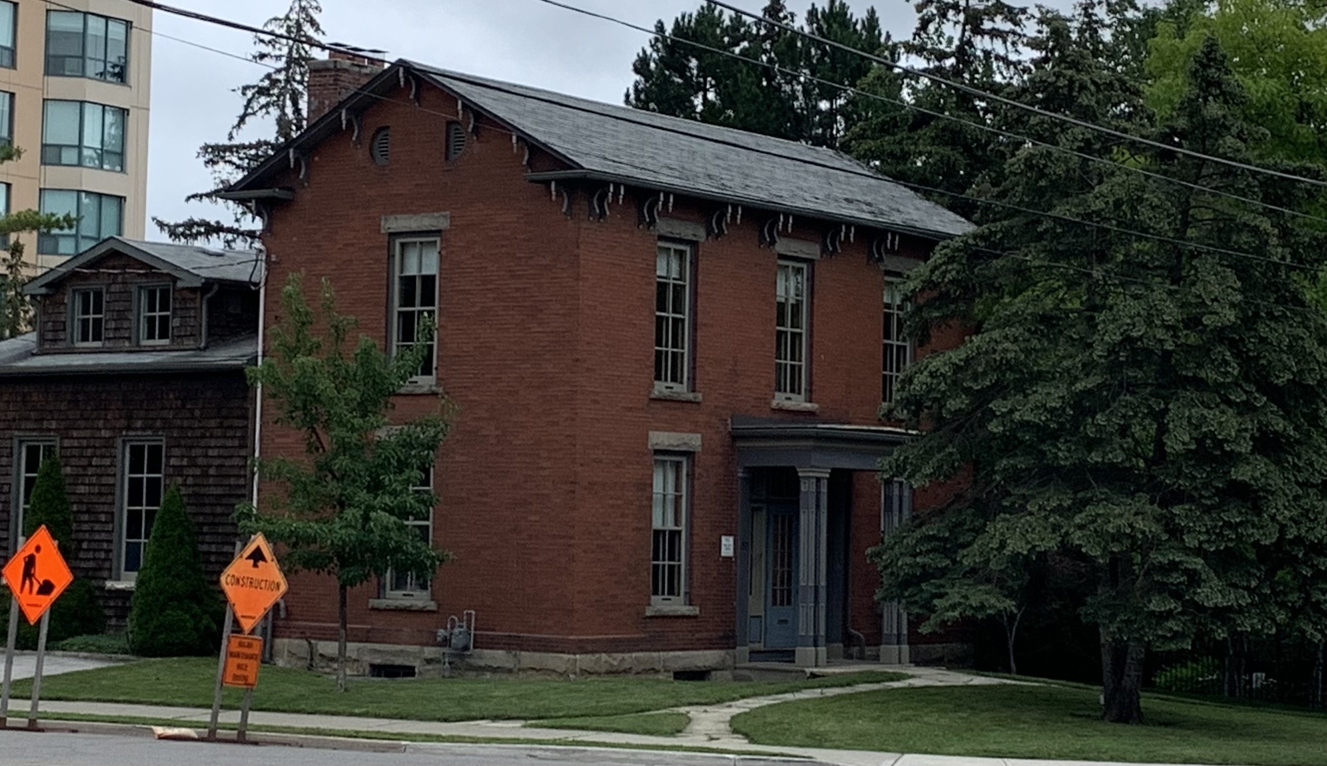
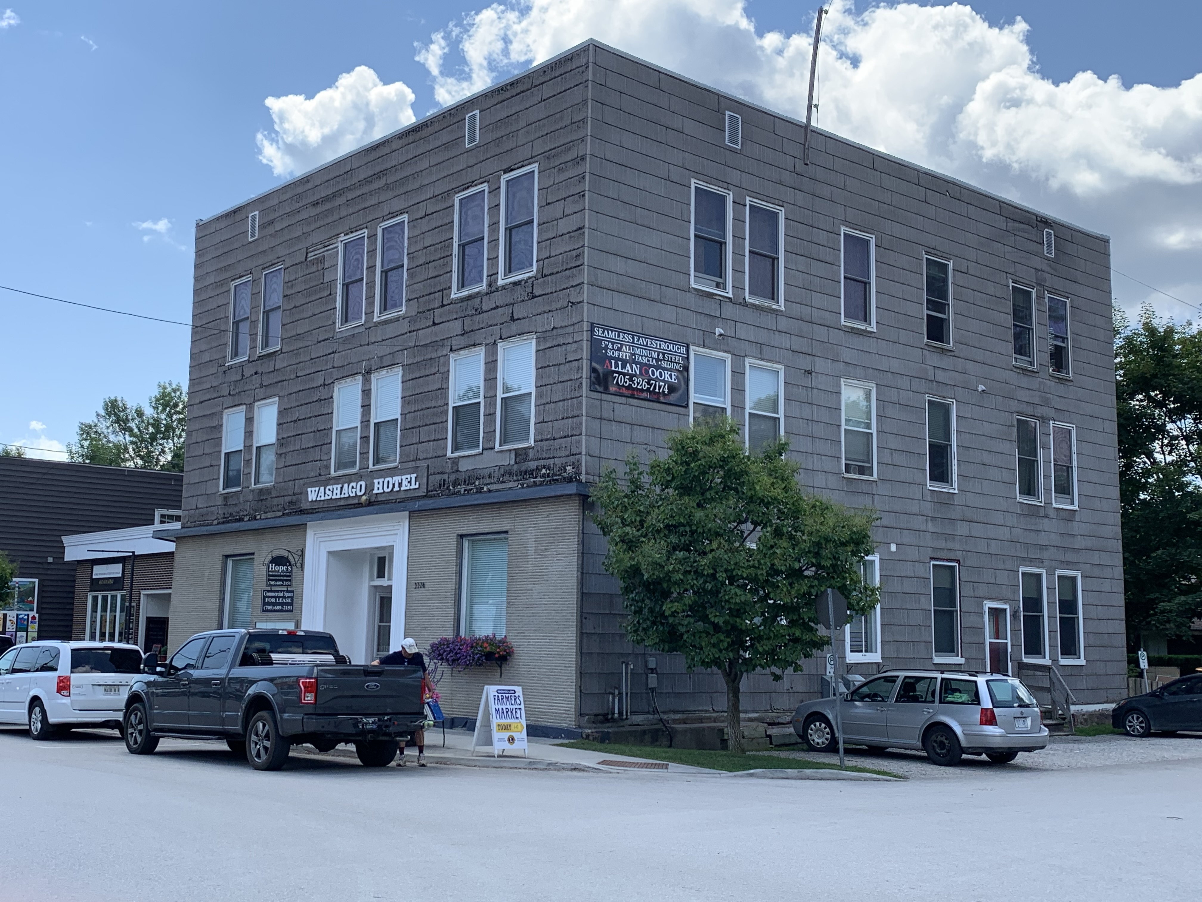
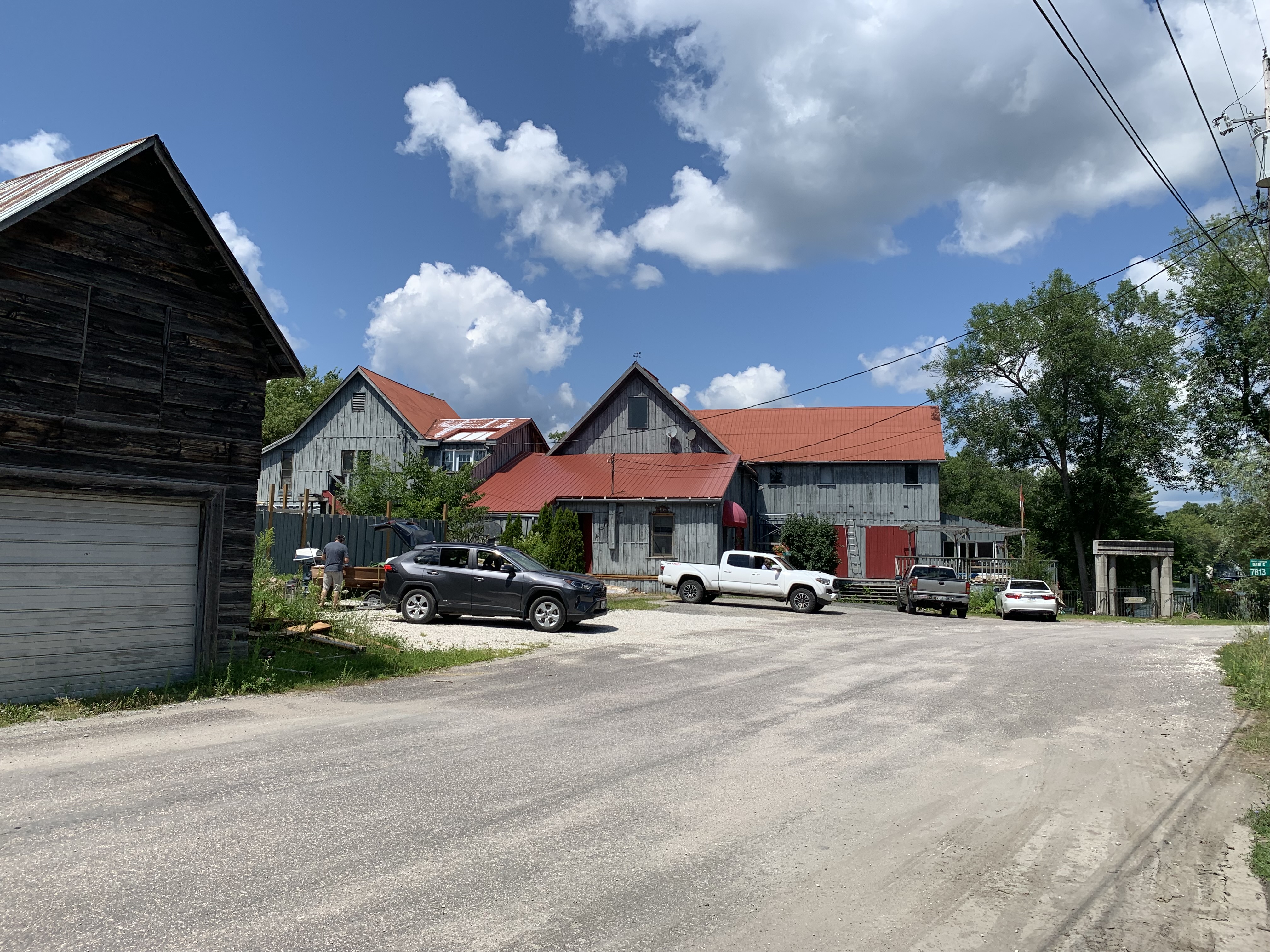
The Washago Hotel is a well kept secret. There’s very little information available on line to tell the story of this old structure.

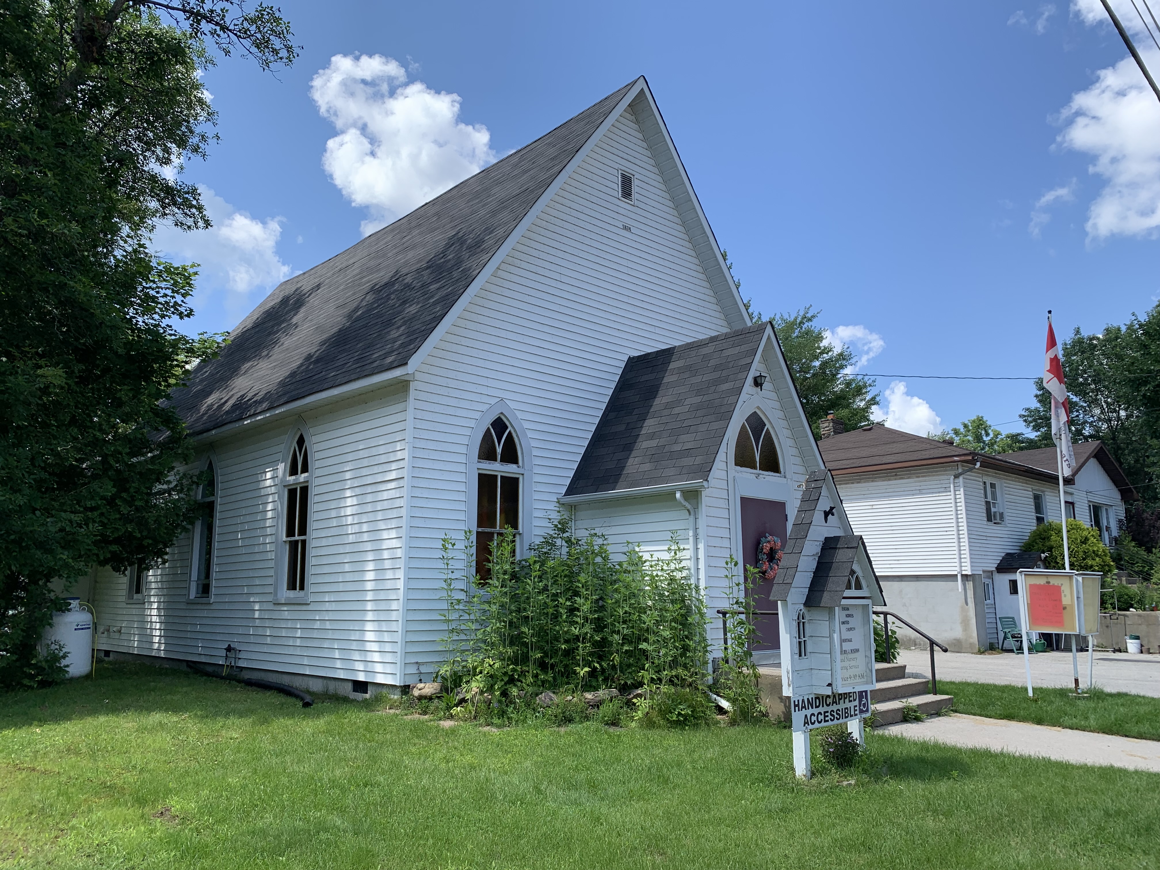
The Methodist congregation built a church in town in 1874 which has operated under the banner of the United Church since 1925.

A small building stands on Grist Mill Lane which looks to have been a coopers shop at one time. Many grist mills had a barrel maker in the immediate area to provide the barrels to ship flour to market in.

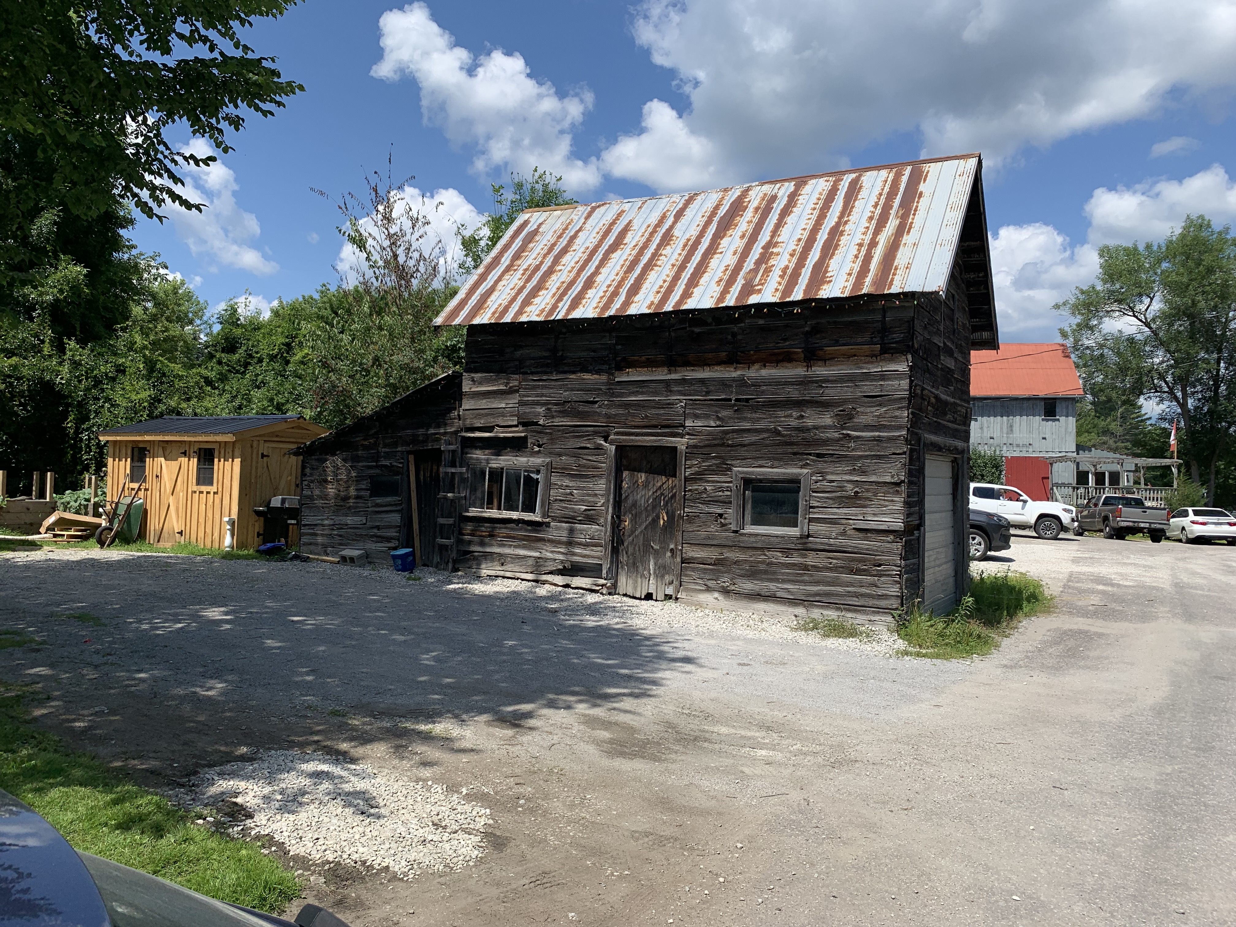
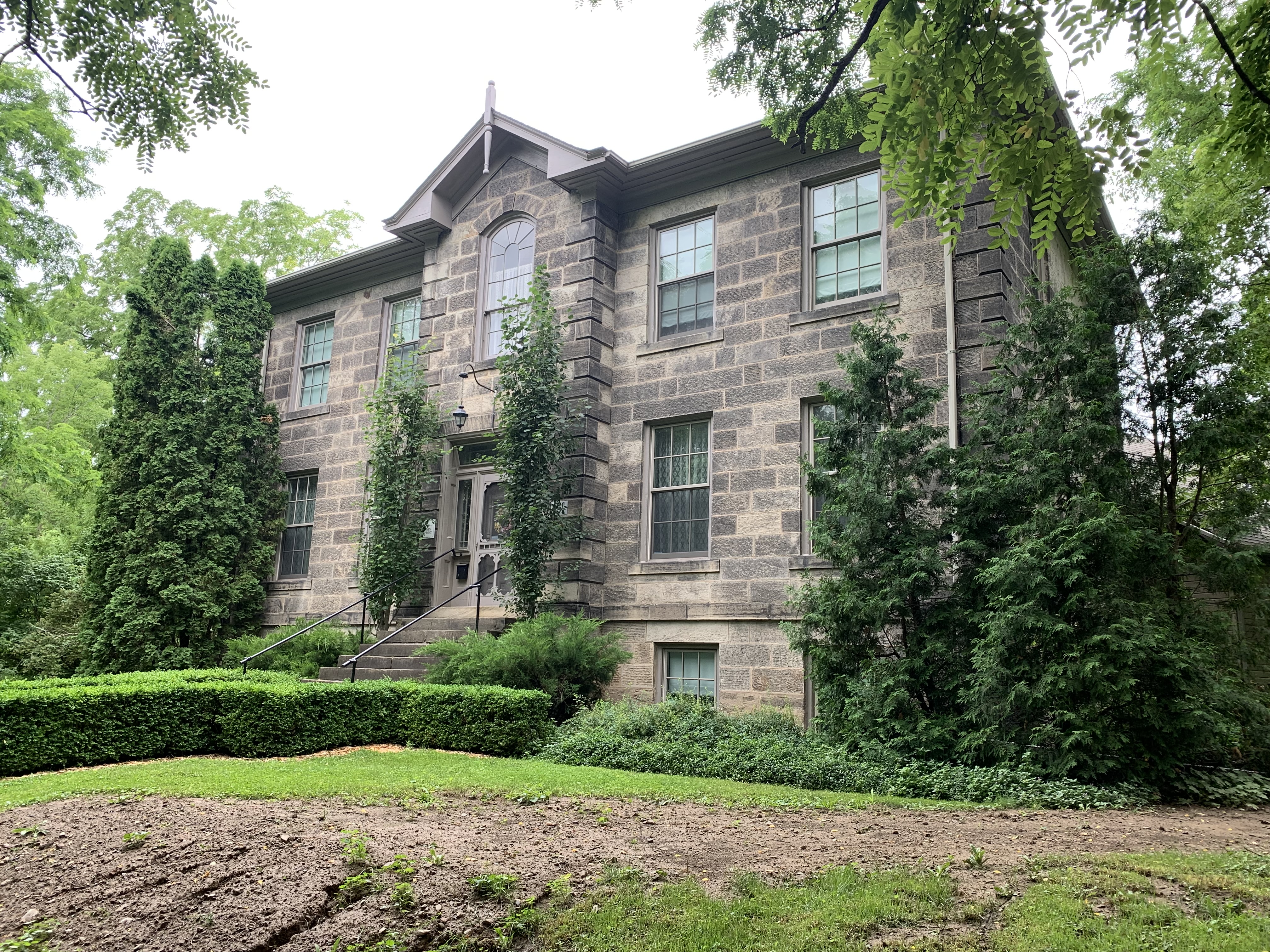
The grist mill in Washago was built in 1872 and operated until about 1970. Since then it has been used as a private residence.

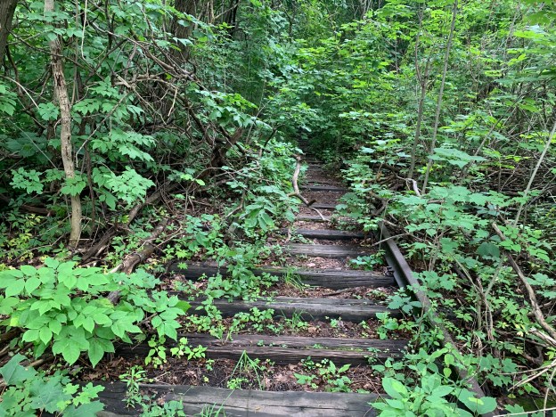
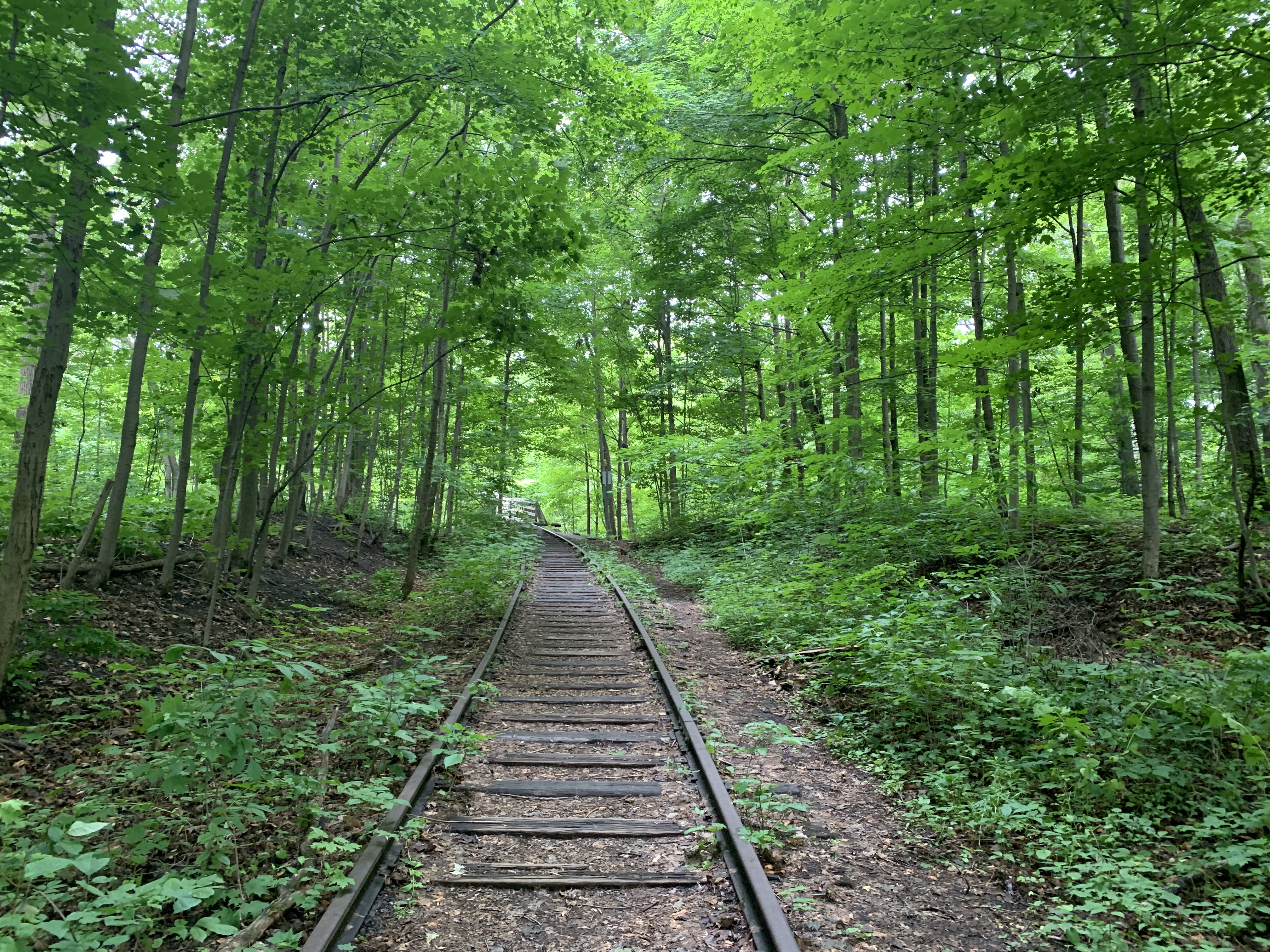
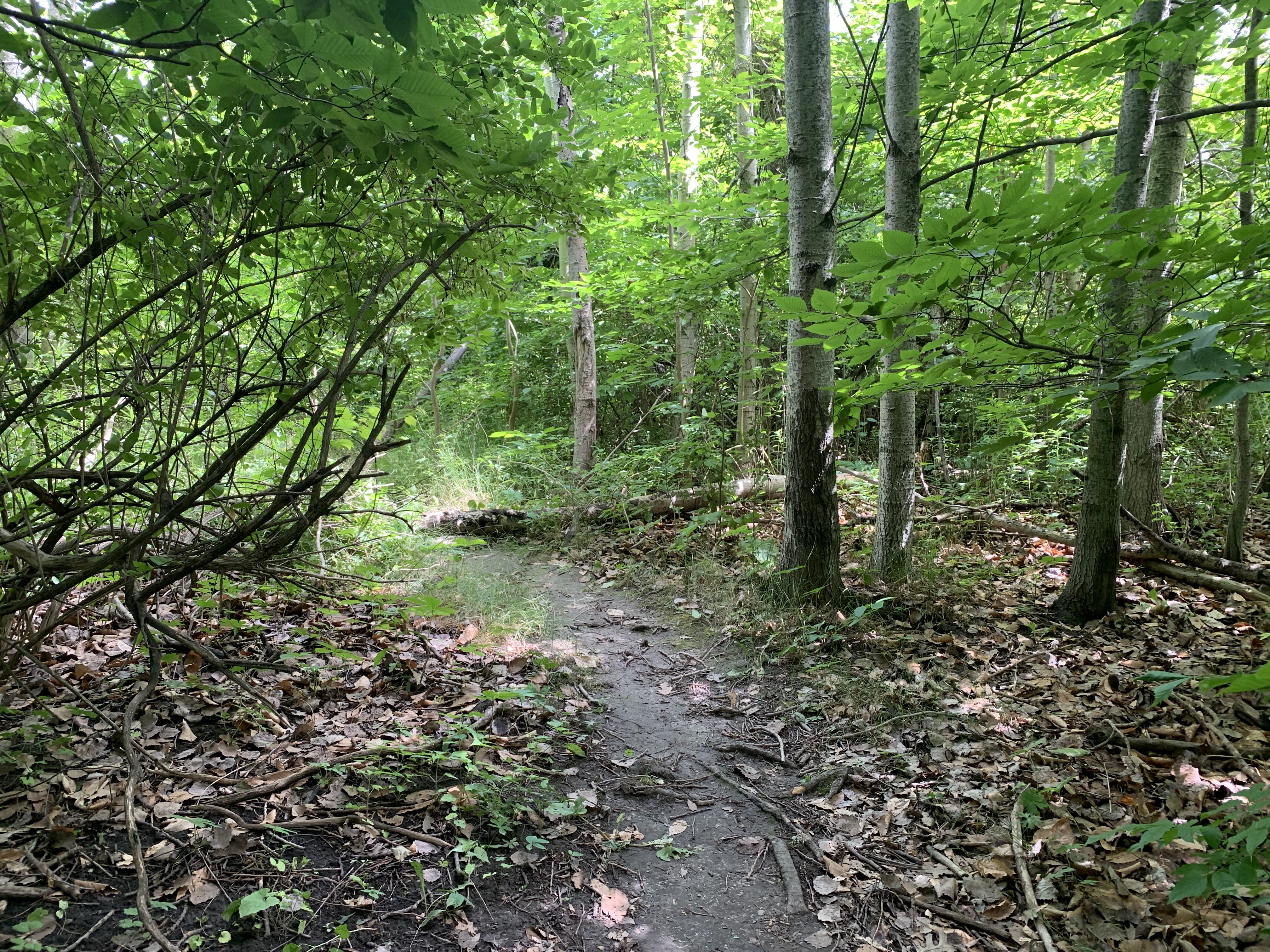
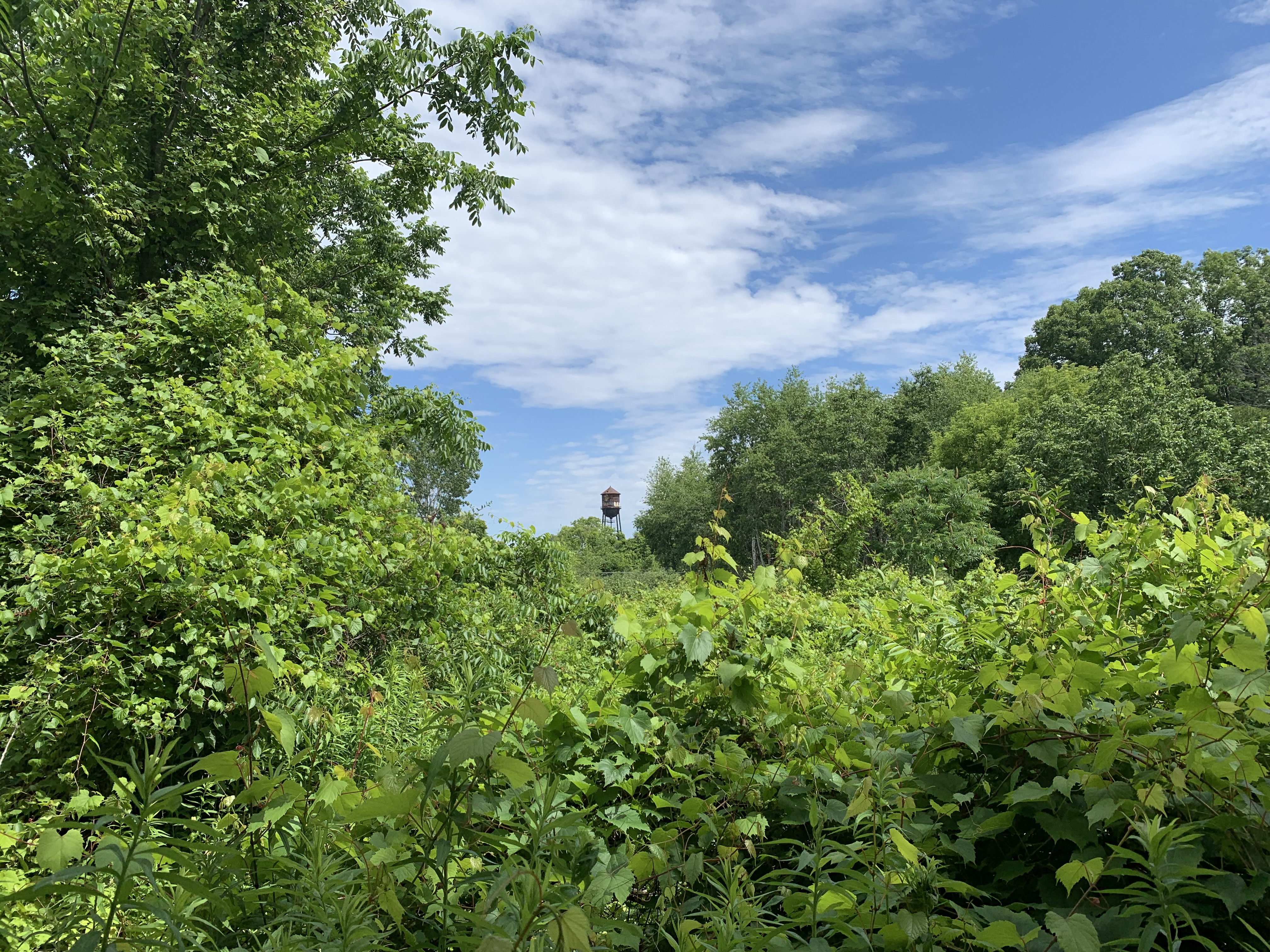
There’s a lot of history in Washago that needs to be investigated when I have more time. The old railway line going north out of town once had a swing bridge over the Severn River and now the abutments and piers are all that remain.

Also see our post on Roundhouse Park

Google Maps Link: Washago

Like us at http://www.facebook.com/hikingthegta

Follow us at http://www.hikingthegta.com

Also look for us on instagram

Canada Linseed Oil Mills

July 25, 2021

Linseed oil is also known as flaxseed oil because it is made from pressed flax seeds. It is a polymerizing agent which means that it has “drying” properties where it changes to a solid form when exposed to the oxygen in the air. For this reason, it became useful in the manufacture of paints and putties where its drying needed to be kept in check in sealed containers. Linseed oil was also developed into linoleum from which the product gets its name. The availability of a wide range of plastic polymers that don’t yellow with age has led to the decline of linseed oil production since the 1950’s.

Canada Linseed Oil Mills Limited had their first shareholder meeting in Montreal in 1901 and within the decade plans were made for an expansion of production into the Toronto market. A property was secured on Wabash Street adjacent to the one being developed by the Dominion Bridge Company who were expanding their Lachine, Quebec operation into the city. It was 1910 and industry was springing up in the junction along a rail corridor that originally served the Toronto Grey & Bruce Railway as well as the Credit Valley Railway both of which were now under the Canadian Pacific banner. The aerial photo below is from the Toronto Archives and shows the site and its proximity to the railway. The Canada Linseed Oil Mills site is outlined in green while the Dominion Bridge is outlined in blue. The orange buildings are the former grain elevator from the Linseed Oil Mills, now demolished. The small yellow building on the left is the former office and has now been repurposed while the buildings in yellow on the right remain to be potentially restored and turned into a new community centre.

Construction of the buildings was completed in the spring of 1915 and the elevator and buildings were boasted as being fireproof. This was important because linseed oil is very flammable and old rags soaked in it have been known to spontaneously combust. The building is now over 100 years old and the ghost sign advertising the business is barely visible. The word “linseed” can be made out in the image below.

The business was served by a rail spur that ran up Wabash Avenue and delivered flax seed to the elevator and took finished products to the market.

Within a year of the start-up of Canada Linseed Oil Mills, Lowe Brothers Paint and Varnish opened up across the street. Supplying the paint industry across the road as well as the oil cloth industry at Scythes and Company just up the tracks gave them a considerable local market and the proximity to the railway gave them an international market as well. The chimney is showing its age and in several places the bricks are giving away but plans are in place to restore it..

The image below is from promotional materials that the company produced to help market some of its products.

Canada Linseed Oil Mills developed livestock feed called oil cake meal which was made from the leftover plant material after the oils were pressed out. This was sold to farmers for feeding horses and cattle. There were some perfectly good uses for the linseed oil and its by-products but there were also some questionable ones as well. Dr. Chase’s Syrup of Linseed and Turpentine for children’s cough being one of them. The National Drug and Chemical Company marketed a product for children’s cough which contained Licorice, Linseed and Chlorodyne (laudanum, cannabis and chloroform). I guess knocking them out reduced the children’s coughing fits.

With the closure of the factory in 1969 the building has sat vacant for over half a century but its story may be far from over. The city bought the structure for $2 million in the year 2000 and approvals have been made to covert the site into a community centre as a final phase of the Sorauren Park development. Plans call for the retaining and restoration of the chimney and walls and the creation of an indoor pool, gymnasium and a wide variety of community use spaces.

The archive picture below shows the Dominion Steel Company making the girders that continue to hold up the King Edward Viaduct (Bloor Street Viaduct).

This Google Earth capture shows the site of the Canada Linseed Oil Mills as it is today. During World War 2 the Dominion Bridge Company made parts for the military and after the war they closed the factory. It served as the TTC Parkdale bus barns for many years until vacated in 1980. The next plan was to use it for storage of garbage trucks and road equipment but this idea was resisted by the local residents. The community lobbied to turn the site into a park and this was eventually realized after the buildings were demolished around 1990. In 1995 the first phase of the park opened with soil being dumped over the remaining concrete pad from the buildings. This was the easiest way to remediate the site but it has created problems with drainage and plant growth. The two-story former office building for the oil mills was restored and turned into The Fieldhouse in 2008 and has a fully equipped kitchen and washrooms. The site of the former elevators was turned into the Town Common in 2014 which features seating and water permeable paving stones.

With construction of the Wabash Community Recreation Centre scheduled for spring 2023 with a 2026 opening, there’s hope that these buildings will have a future role in the community that’s worthy of their past.

While in the area be sure to visit The West Toronto Rail Path that runs on the former Toronto Grey & Bruce Railway right of way.

Related Blogs: Bloor Street Viaduct , West Toronto Rail Path

Google maps link: Canada Linseed Oil Mills

Like us at http://www.Facebook.com/hikingthegta

Follow us at http://www.hikingthegta.com

Also look for us on Instagram

Milton Mill Pond

Sunday, July 18, 2021

Milton was founded in 1821 by Jasper Martin who had emigrated from Northumberland, England earlier in the year with his wife Sarah and their two sons. They settled on a property along 16-Mile Creek where they built a grist mill. The community was first known as Martin’s Mills but when it got its first post office it took the name Milton from the English poet John Milton, who was a personal favourite of Jasper Martin. A new stone mill was built in 1856 which survived until 1963 when it burned down. At that time the mill was being operated by Robin Hood Flour who donated the property to the town for a park after the fire. The town developed the park as a Centennial Project to mark the 1967 anniversary of Confederation.

This County Atlas map of 1878 shows the town as it used to be, centred on the mill pond. I’ve marked the approximate route of this hike in green and the waterways in blue.

A restoration of the pond took place in 2000 with invasive plants being removed. The gazebo was built in 2001 and has become a popular place to get wedding photos taken.

There’s a nice trail that runs along a narrow berm between the south side of the mill pond and 16-Mile Creek. There’s plenty of great views out over the pond where people have created small paths so that they could go fishing. It’s interesting to contemplate the importance of this berm to the early millers who were responsible for maintaining the waterway for a mile upstream and downstream. They had to remove fallen trees and other blockages that could cause a sudden surge of water taking out their dam or one downstream somewhere. Jasper Martin scooped this berm up from the bottom of the pond and then would have walked it regularly to keep an eye on things.

The Mill Pond has been stocked with trout but it doesn’t provide a suitable habitat to sustain their populations. People as well as the local heron fish in the pond for carp and panfish and there were several places along the trail where people were fishing. I stopped to watch two young boys fishing and was rewarded with the sight of a heron sitting on a rail on the other side of the pond.

A Painted Turtle was taking in the afternoon sunshine on a log in the middle of the pond. This was a fairly large specimen indicating that it is likely getting fairly old. The Painted Turtle shell is made up of 13 plates or scutes. As the turtle grows it sheds the outer layer of its plates and grows new ones. These plates exhibit growth rings like those on a tree and can be counted to determine the age of the turtle. But, you have to catch him first.

The trail passes under an old rail bridge that provides a pedestrian path across the creek and mill pond. It can be accessed from the park on Mill Street or from the north side of the mill pond but not from the walking trail between the two. We’ll look at the history of this railway later in the article.

This 1911 photo from Milton Images shows a Grand Trunk Railway train crossing the bridge at the mill pond.

Once you pass below the old train bridge you can continue to follow the trail with the creek on one side and the inflow to the mill pond on the other. You will come to concrete blocks which mark the start of the pond and after that the curve of 16-Mile Creek. Crossing over the creek on a small foot bridge you come to a larger forested area which featured several different types of mushrooms. These Oyster mushrooms were growing in large numbers in one small area beside the creek and are considered to be a delicacy by some.

Milton was bypassed by early railways and didn’t get the first one in town until 1876 when the Hamilton & North-western Railway arrived running north-south through town and across the mill pond on the bridge we saw earlier. The Credit Valley Railway arrived the next year running east-west just north of the mill pond. The Hamilton & North-western became the Northern & North-western before being bought by the Grand Trunk Railway late in the century. In 1923 the Grand Trunk became part of the Canadian National Railway and they operated the passenger service on the line until 1973 when the tracks were realigned and service discontinued. I followed the tracks to where they end a little north of the mill pond and also in the other direction to where they used to cross Bronte Road.

Several areas of the forest floor were covered in clusters of White Worm Coral fungus which grows between July and September and is considered edible. The white fingers are quite brittle but become almost translucent when wet.

As you make your way around the far end of the mill pond you come to the John Sproat House which was built in the Georgian style in 1857. This stone home was originally built as a Ladies Seminary Educational Residence but was later used as a private residence. One prominent owner of the house was P. L. Robertson who was the inventor of the Robertson Head Screw.

Orange Mycena mushrooms grow in tight little clusters on deciduous wood and are quite common in Southern Ontario. While this species might have some antibacterial properties, it is also known to be a mutagen which can cause genetic mutations that result in cancer.

Founding father Jasper Martin built his house across the street from the mill in 1821 making it the oldest building in town. This home has paired brackets under the eves and an ornate doorway but little other decoration. The Milton historical society has done a great job of identifying historic homes and putting small white plaques on them describing the original owner and date of construction.

I included this house which stands across the street from the mill pond because I love the style of architecture. The round tower with domed cap is Romanesque and all the accents have been done with terra cotta panels giving the home a unique look. It was built in 1892 for Richard L. Hemstreet the Presbyterian Church bought it to house their various pastors between 1924 and 1970.

The little side excursion along the old railway line towards Bronte Road leads past the rear of the P. L. Robertson Manufacturing Company. Formed in Hamilton in 1907 the factory relocated to Milton the following year and began marketing an industrial screw with a unique square drive, the first socket head screw available. The Robertson Screw was quickly implemented by Canadian manufacturing while the Phillips drive became popular in the United States. The Robertson building and properties are now vacant.

Bronte Pioneer Cemetery is a short walk north of the Robertson factory and was opened in 1824 as the final resting place of many of Milton’s pioneers. Jasper Martin, the town’s founder was buried here when he passed away in 1833. The cemetery is partially forested and has several stones hiding in a rear corner of the grounds. Many of the earliest stones have been collected into a cairn to preserve what remains of them.

The historic mill pond is a great place to go for a quiet walk with plenty of things to see and is reported to be an excellent place to see the fall colours.

Google Maps Link: Milton Mill Pond

Like us at http://www.facebook.com/hikingthegta

Follow us at http://www.hikingthegta.com

Also look for us on instagram

Long Branch Rifle Range

Sunday, July 11, 2021

The story of the long abandoned Long Branch Rifle Range begins with Confederation in 1867. As soon as the British North America Act came into effect on July 1st, the new Dominion of Canada was charged with taking a lead role in its own defence. The following year the Militia District of Ontario established the Ontario Rifle Association. With the Garrison Common Rifle Ranges in operation in 1869 citizens were practicing at Fort York but this soon proved to be dangerous. The Industrial Exhibition (Later the C.N.E.) was bringing more people into the area and a new passenger wharf at the foot of Dufferin Street led the city to ask the militia to move. In 1891 the Federal Government bought land on the west side of Etobicoke Creek and established the Long Branch Rifle Ranges. The site was immediately important, training volunteer militiamen between 1899 and 1902 for service in the Boer War. The range was operated from 1893 to 1910 by the Ontario Rifle Association when it was bought by the Department of Militia and Defence (Renamed Department of National Defence in 1922). In 1910 they constructed thirty wooden baffles on the firing range, two of which can be seen in the picture below. The are the oldest surviving military baffles in the province.

The rifle range can be seen in this 1962 aerial photograph from the Toronto Archives. Sixty years ago the grass was still kept short and there were no trees anywhere on the rifle range. Much has changed in the intervening years.

Baffles were built to dampen the sound and also to stop stray bullets from doing any damage. They varied in size from 4 to 6 feet high and were between 4 and 10 feet long.

The baffles were built with a wooden frame covered with tongue and groove boards. The tops were left open until they could be filled with sand and small stones taken from the shore of the lake.

Only sixteen of the baffles remain and some of them are in poor shape.

In 1925 two concrete backstops were built, each 15 feet high and 35 feet long. An archery or shooting target range is known as a butt and these two were built at 300 yards and 600 yards from the shooting gallery. The end of the 300 yard butt can be seen below as well as the concrete overhang that kept bullets from ricocheting wildly.

The 300 yard butt is pock marked with hundreds of bullet holes across the entire face. The vast majority of the Lee & Enfields 303 munitions that were fired at the butt were aimed at targets below the protective overhang. The concrete here is chewed away to expose the rebar inside and the wooden roof has also been blasted away.

Applewood Creek flows behind the butt and separated the rifle range from Canada’s first aerodrome which was opened by the Curtis Company in 1915. The eastern section of the lot was used to train pilots until 1919 when the Royal Flying Corp discontinued using it and the buildings were demolished.

The rifle ranges were used to train soldiers for the Boer War, the Great War and the Second World War. The A-25 Small Arms School (later S-3 Canadian Small Arms School) held shooting matches here with up to 300 participants from across the country. Between 1939 and 1945 the Long Branches Rifle Ranges were used by the Department of National Defence to train infantry prior to deployment overseas. With its proud history of serving Canadas military its sad to see the baffles warped, broken and overgrown.

The proliferation of vegetation at the site has the benefit of providing habitat for birds, insects and various mammals. Seen below, Banded Hairstreak is one of the more common hairstreak butterflies in Ontario. They can have a fair range of variation in the pattern of the orange and silver spots on the underside of the wing but the brown bands with white borders are a defining feature. They lay their eggs on host branches where they overwinter, hatching in the spring. Banded Hairstreaks have one flight per year in late June or early July.

There are two baffles in the picture below but the river grapes and dog-strangling vines have run wild, engulfing everything.

Ebony Jewelwing Damselflies were darting everywhere and a male is pictured below. He has a green body and plain black wings. They eat mosquitoes, fleas and small insects and are a welcome sight. In turn, they provide meals for turtles, frogs and fish who like to snap them out of the air.

Female Ebony Jewelwings have a brownish body and smoky coloured wings. Their wings also have a small white patch at the tips. The female will mate in the early summer and lays her eggs in aquatic plants. When the naiads are hatched they eat small aquatic insects until they become fully grown. Then they crawl out of the water and molt into their adult form.

The water tower in the distance was built in 1941 to supply water for the Small Arms Manufacturing plant. At the time, it stood in the middle of the manufacturing compound and there were no trees between it and the firing range.

From closer up, the water tower can be seen to also be in a state of deterioration. When we visited here in 2016 the central water pipe was still surrounded by a wooden crib but all of this is now gone. The pipe has also become disconnected a short distance below the platform under the water tank.

This 1957 aerial photo from the Toronto Archives shows the site when all the buildings were still intact. All that remains of the manufacturing complex is the water tower which stands alone in a field of rubble and overgrown roadways. The G. E. Booth Water Treatment plant had not yet been built and the 600 yard backstop was still in place. It was demolished in 1972 to make way for the water treatment plant. All of the original baffles are also still standing at this time.

Two small flood control ponds have been created on the old arsenal lands and the larger of them has become home to painted turtles. On this morning we found 7 of them sunning themselves on various rocks and logs. All of them were small, perhaps a few years old at most. Painted turtles can live 20 to 30 years but some have been known to reach 50 years of age.

Every time I visit this site I always leave with the feeling that something should be done to bring awareness to this bit of local history and I’m even more certain now. Mississauga carried out a Cultural Heritage Assessment in September 2013 but the site has continued to deteriorate in the 8 years since then. It remains to be seen what the future holds for this overlooked bit of our military heritage.

Also see our related blogs; The Arsenal Lands, Small Arms Testing Site and Marie Curtis Park

Google Maps Link: Arsenal Lands

Like us at http://www.facebook.com/hikingthegta

Follow us at http://www.hikingthegta.com

Also look for us on Instagram

West Toronto Railpath

Sunday, July 4, 2021

The West Toronto Railpath is currently 2.1 kilometers long and runs along the former right of way of the Toronto Grey and Bruce Railway. The County Atlas below shows the area as it looked around 1877. Several railways have already been built through The Junction and more would follow over the next decade. On the map I’ve coloured the Toronto Grey & Bruce in blue with the section on the rail path being green. The Grand Trunk Railway is yellow while the Credit Valley Railway is orange. To the right, The Northern Railway is red.

Before mergers began, there were five railways that intersected in West Toronto, or The Junction. These would eventually become three lines of Canadian Pacific Railway and two of the Canadian National Railway. The crossed each other on a complicated set of tracks known as the West Toronto Diamond Crossings. The archive picture below shows crews working on the diamond in 1924 and is part of an information plaque at the northern end of the rail path.

When the crossings were rebuilt with grade separations, which were much safer, the diamonds were no longer required. The last one was relocated to the trailhead and preserved as part of the information installation.

The Toronto Grey & Bruce Railway was incorporated on March 4, 1868 with the official sod turning ceremony being held in Weston in October of the following year. To save money, the railway was built to a narrow gauge of 3’6″ instead of the standard (or Provincial) gauge of 5’6″. This allowed construction to proceed for $5,100 per mile instead of the $8,100 required for the standard gauge. It formally opened on November 3, 1871 with the first train making it to Owen Sound in 1873. The picture below shows a nearly deserted railpath early on a Sunday morning but it filled up quickly with a variety of dog walkers, cyclists and joggers.

There are several works of art along the railpath including murals on a few buildings. One building has been painted in blue and green with the shapes of the vegetation along the building being left white. This allows for a visual growth indicator as the trees and vines continue to grow onto the painted sections. Four steel sculptures have also been erected along with various places to sit and pause as you walk the trail. Other buildings have extensive murals on them.

Railway sidings ran along the track side of most of the industrial buildings in the Junction Triangle. Although the rails are gone the sidings can be spotted by looking for doors that open a couple of feet off the ground. These would have been at the right level to load and unload the rail cars.

The Toronto Grey & Bruce Railway was converted to standard gauge in 1881 to make the interchange between its freight trains and those of other lines easier because the cars could just be moved from one line to the other. In 1883 it was leased to the Ontario & Quebec Railway and was taken over by the CPR the following year. By the 1950s the line was known locally as the Old Bruce and when it stopped serving the local industry it was closed for good. The line was dismantled in 1996 and the right of way was purchased by the city for a railpath which opened in 2009.

Catalpa Bignonioides is a flowering tree that is native to the southern states but has adapted to northern climates including parts of Canada. There are some of them in flower along the side of the trail and they produce a powerful scent. The flowers will turn into long beans that hang from the branches. This is just one of the many flowering plants that line both sides of the trail making it a great place to see butterflies and other pollinators.

The Junction hydro substation is tucked in along the rail corridor and has a date stone that reads 1920. For some reason several on line resources, including the Toronto Architectural Conservancy, list the building as having been completed in 1911. Perhaps the 1920 date above the large door refers to an expansion.

By 1883 there were five railways passing through the area and getting around them safely was starting to become a problem for the communities that surrounded the tracks. Workers had to cross the busy rail lines to get to the various industries where they worked. In 1907 a temporary pedestrian bridge was built as the first project designed by the Ontario Bridge Company. It is one of only a few multi-span steel Warren pony truss bridges in the province. It connects Wallace Street with Dundas Street West and was only intended to be in use until two underpasses were created on Dupont and Bloor Street. The bridges that were built over those underpasses are dated 1925 and one of them is featured in the cover photo.

The picture below is looking south from the Wallace Avenue Footbridge in July 1985 and was taken from “Old Time Trains” web page. The tracks would be removed in April 1996.

Milkweed grows in great numbers along the sides of the pathway however I didn’t see any Monarch Butterflies nor any caterpillars. Both seem to be a little scarce so far this season but this will be a great place to see them when they are in full flight.

“Ghost sign” is a term that is sometimes applied to faded lettering or images on the sides of old buildings. Also known as brickads, they were common between 1890 and 1960 with most of them being from the 1920s and earlier. Advertising for Coke was often painted on the sides of convenience stores and for industry it was common practice to paint your company name and perhaps a list of products or services right on your building. Canadian Hanson & Van Winkle erected their building in 1917 on the west side of the rail corridor where they produced equipment for the electroplating, polishing and buffing industries.

Scythes and Company Limited opened their company in the Junction in 1910. Aside from cloth and canvas products the building was also home to the manufacture of pickles, sauces and catsup. Ghost signs adorn all four sides of the building but the side facing the railpath has been freshly painted to restore the original brickads on the building.

The Toronto Grey & Bruce Railway passed through the city and headed north through Cardwell Junction which is now only marked by a set of bridge abutments where two former rail lines once crossed. From there it went a short distance north to where it climbed the escarpment on a long horseshoe shaped curve. This was the location of a tragic derailment on September 3, 1907 known as the Horseshoe Curve Rail Disaster.

Approval has been made to extend the trail another 2 kilometers with an agreement between Metrolinx and the city to complete it in 2022. A third phase could see the trail extended to Strachan Avenue.

This is a convenient trail because of all the places where there is access and it’ll be interesting to come back and check out the extension when completed.

Other Rail Trails in Toronto: Leaside Spur Trail, the Beltline Railway is described in three parts: Kay Gardner Beltline, Moore Park Beltline and York Beltline Trail.

Other Toronto Grey & Bruce Blogs: Cardwell Junction, Horseshoe Curve Rail Disaster

Google Maps Link; West Toronto Rail Path

Like us at http://www.facebook.com/hikingthegta

Follow us at http://www.hikingthegta.com

Also look for us on Instagram