Sunday, January 29, 2017
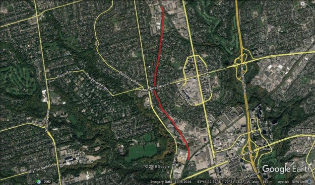
The Leaside Spur ran from just north of Eglinton to just south of York Mills for a distance of about 3 kilometres. It once connected the Canadian Pacific (CP) Belleville Subdivision in the south with the Canadian National (CN) Bala Division in the north. There are a few street parking spots on Overland Drive off of Leslie Street.
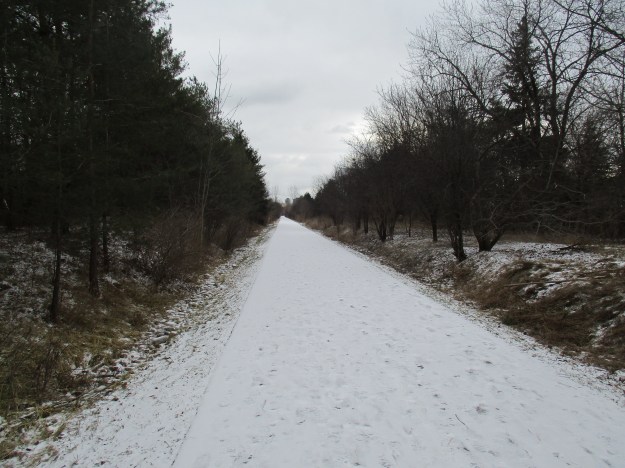
Until the 1950’s the line ran through an area that consisted of about twenty farms contained between the East and West Don Rivers. All that changed rapidly between 1952 and 1965 when it was developed as an 835-hectare residential community. It was the first planned community in Ontario. Residential, commercial, industrial and retail areas were all planned out as well as schools and parks. Watercourses were left in their natural condition rather than putting them in concrete channels as was done with Taylor-Massey Creek to the east of there. From where I was parked the trail runs to a dead end to the south and I decided to go that way first. There is a brief section where the trail passes through a residential community before entering an industrial area.
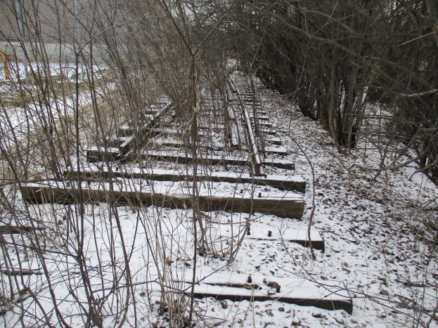
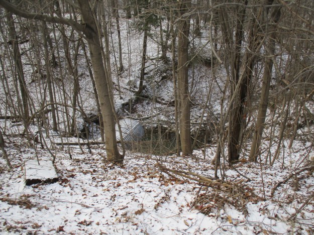
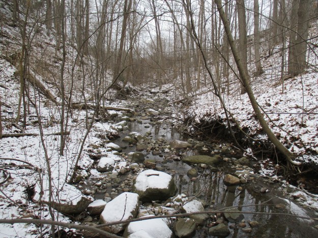
From the old aerial photographs, it appears that there were at least 5 sidings that serviced factories in this section. The cover photo shows the one remaining section with rails on it. This short siding allowed for two cars to be placed at the rear docks of a building which is currently used by Canadian Tire. The industrial section is split by a ravine carrying a tributary of Wilket Creek. The rail line passed over the ravine on a trestle which has since been filled in and the creek fed into a new culvert. There is a deep plunge pool on the downside of the culvert suggesting that there is a significant flow of water through here at times.
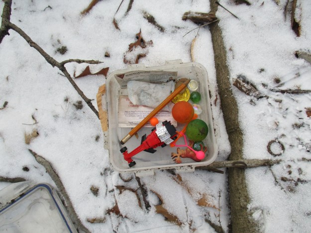
Although I spend many hours outside in prime geocaching locations I have never actually met anyone who is actively looking for a cache. I tend to stumble across geocaches every few months and this one had tumbled out of it’s hiding spot. There is a pencil but no log book so I just closed it up and put it back where I thought it had come from.
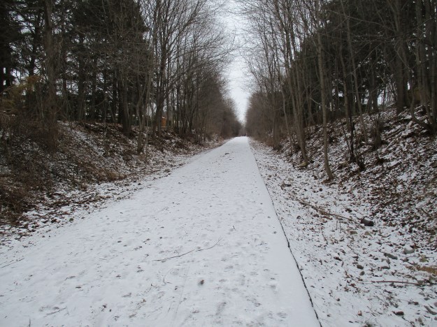
When this area was farmer’s fields the ravine was cleared of trees. Following the industrial development of the local area, the ravine was left to grow over with new trees. It is an unusually secluded spot in the city where there were plenty of small animal tracks to which I added the only fresh human ones.
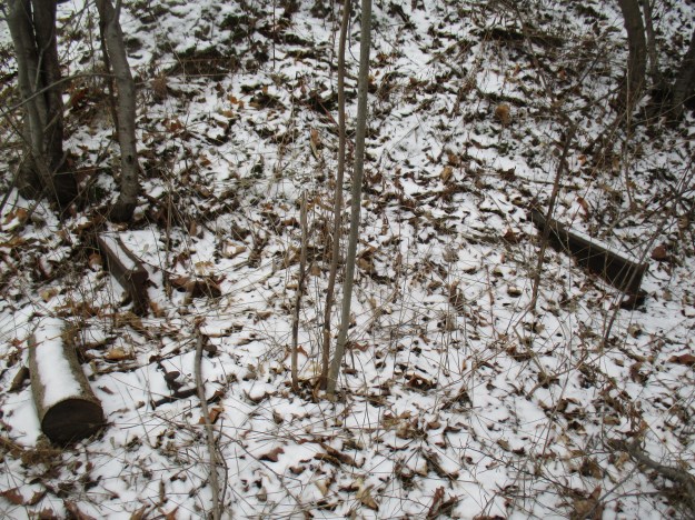
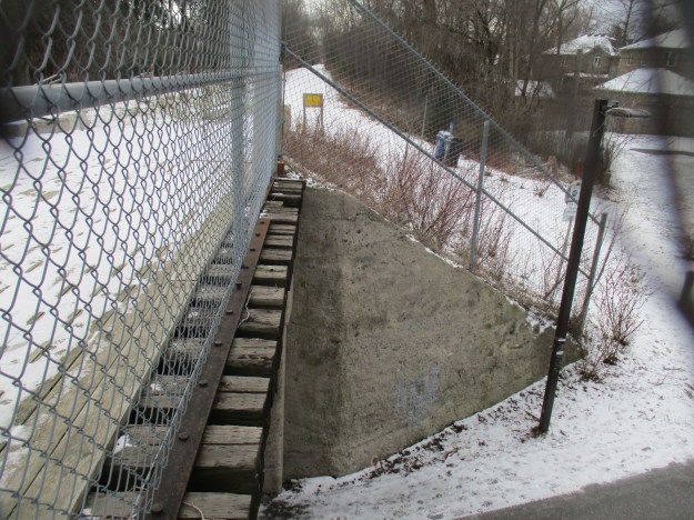
Some of the former sidings have been removed while others have been buried under fresh fill. The last siding on the west side prior to the connection to the CPR tracks is one of the ones that was buried. The ends of the two rails protrude from the bank of earth that was intended to hide them forever.
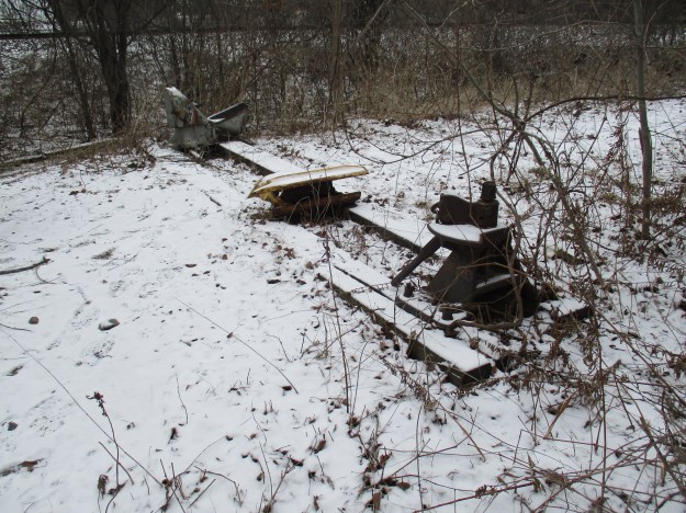
There are still pieces of switching equipment at the end of the trail where it connects to the CPR tracks. The switching equipment was installed in 1963 and manufactured by the General Railway Signal Company in Rochester, New York. The connection to the CPR was most likely cut at this time.
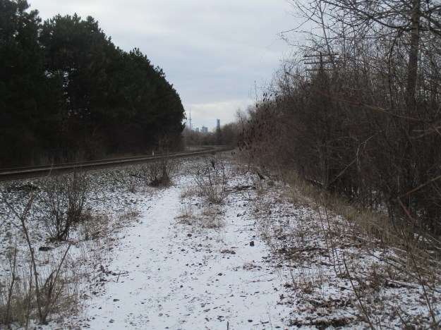
The siding connects to the CPR Bellville subdivision just north of Eglinton Avenue. The CN Tower and Aura at College Park can be seen in the distance.
Backtracking, you will arrive at Lawrence Avenue where there is a Tim’s, how convenient! The former level crossing at Lawrence Avenue has now been turned into a bicycle and pedestrian crossing with signals. North of Lawrence the trail passes through residential areas where many residents have made their own access to the trail.
Don Mills was shaped by the railways which surrounded it. There is currently no heritage designation on any of the railway properties in the area. The rail bridge over Bond Street was built in 1912 and was in danger of being torn down during the construction of the trail. The north abutment was to be removed to allow the roadway into the park to be straightened and a blind curve to be removed. The trail would have made a slight deviation to cross Bond Street on a new pedestrian bridge. The abutment would have been replaced with signage describing the missing heritage bridge. For now, it looks like the bridge has been saved but it needs the heritage designation to help ensure it’s long-term future.
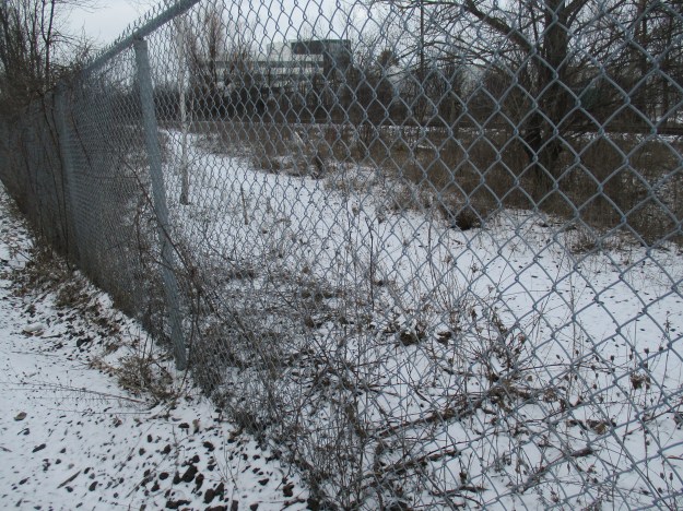
Bond Park, with five ball diamonds and six tennis courts, can be seen from the trail. It is set in a 6.8-hectare triangular piece of land, or gore, between the Leaside Spur and the CN Bala Division and north of Bond Street. The northern tip of the park is defined by the meeting of the spur line with the main line. The fence on this end has been recently repaired to keep people from trespassing but the old right of way can be seen as it connects to the CN line.
The trail has now been completed from this point to York Mills Road and there are plans to connect it to the East Don Trail in the future.
Our fifteen most popular stories have been collected here for easy reference.
Google Maps Link: Leaside Spur Trail
Like us at http://www.facebook.com/hikingthegta
Follow us at http://www.hikingthegta.com

Pingback: West Toronto Railpath | Hiking the GTA
Pingback: Scarborough Railpath Trail | Hiking the GTA
Thank you. As one of a group of kids from Leaside, back in the forties and fifties, I remember this area well. As a connection between CP and CN mainlines [at the time], it was used on what seemed like a daily basis [at least, in my memory].
The photo you took of the switch and derail at the south end is interesting. Both were there for decades before abandonment. The slight downward slope of the track meant that the derail was necessary to prevent errant boxcars from venturing out onto the CP. Rail crews had to stop and manually flip it when they travelled in either direction. The 1963 date on that equipment was a renewal, not the end. As late as the eighties, I encountered a short train, moving quietly through the weeds at about 8KPH, northbound.