Monthly Archives: February 2017

Devil’s Falls

Saturday, February 25, 2017

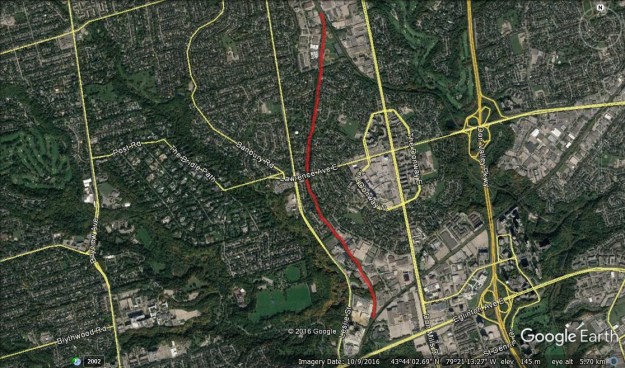
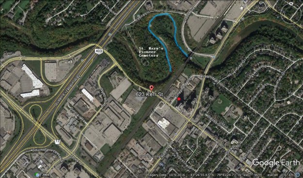
Devil’s Creek plunges 12 metres over the side of the Grand River cliffs and joins the river on its way toward Lake Erie. There are stories of smoke that used to be seen coming from a cave on the cliffs just north of the creek.  Parents told their children that a devil lived in the cave to keep them from exploring the dangerous cliffs.  In no time the little creek near Cambridge had taken on the name Devil’s Creek (Google Maps link).

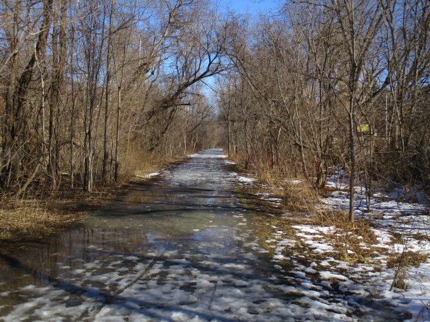
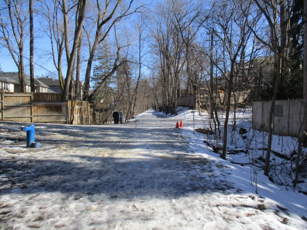
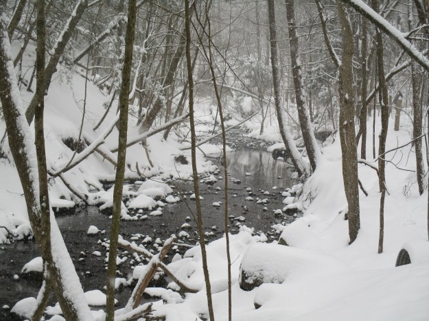
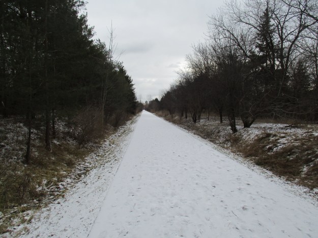
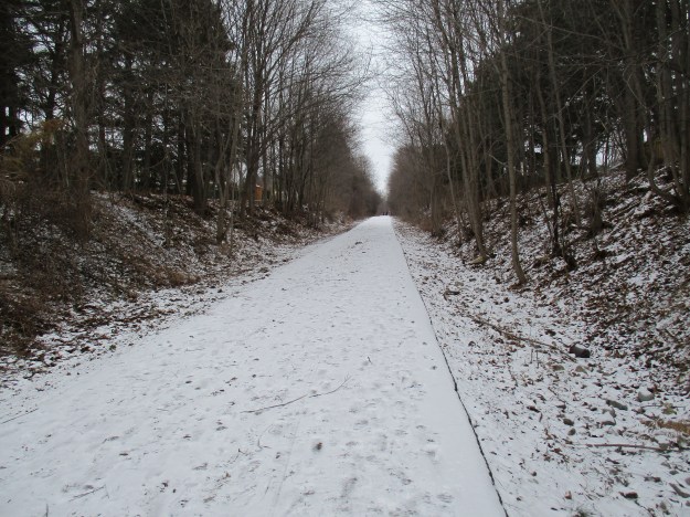
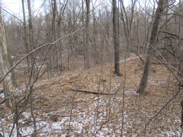
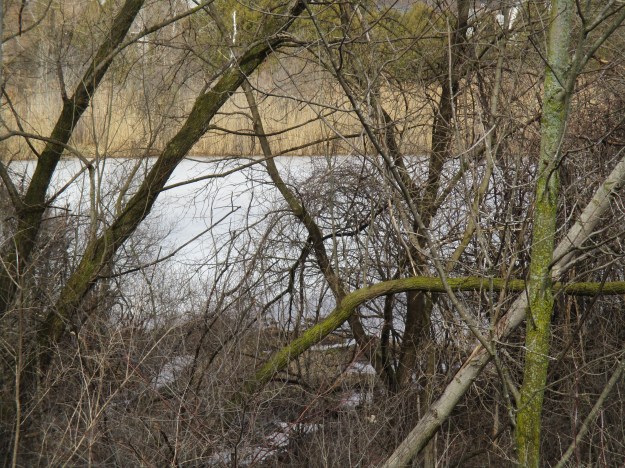
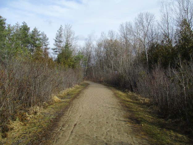
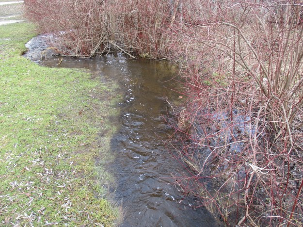
Devil’s Creek Trail runs for 1.6 kilometres along the lower section of the creek.  Devil’s Creek is only 2.8 kilometres long and starts near Devil’s Creek Pond.  It is fed by springs making it a rare example of a cold water aquatic environment in an urban setting.  There is parking in a small park along Blair Road for those who want only a short walk to the falls. Devil’s Creek Drive has street parking and allows for a visit to Grandview Pond and a longer walk to the falls.  Grandview Pond is spring fed but also accepts a large amount of runoff and storm water.  It fills up quickly but drains into Devil’s Creek to keep it running all year long.  Unlike a deeper lake, sunlight reaches the bottom of the pond.  The vegetation that this supports gives shelter to small mouth bass, painted turtles and leopard frogs.

img_6499

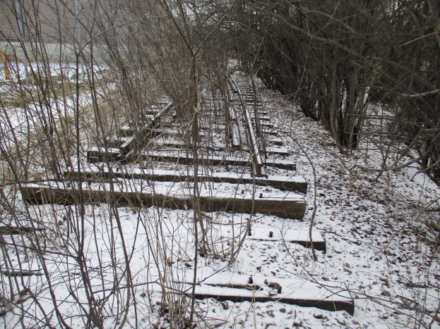
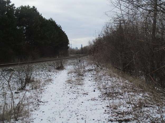
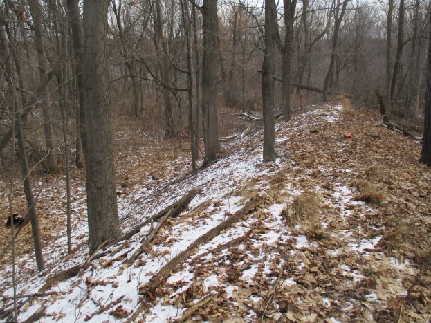
In 1998 The Devil’s Creek Trail was completed north of the CPR tracks.  The trail follows the CPR tracks through extensive wetlands.

img_6506

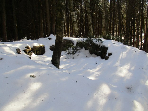
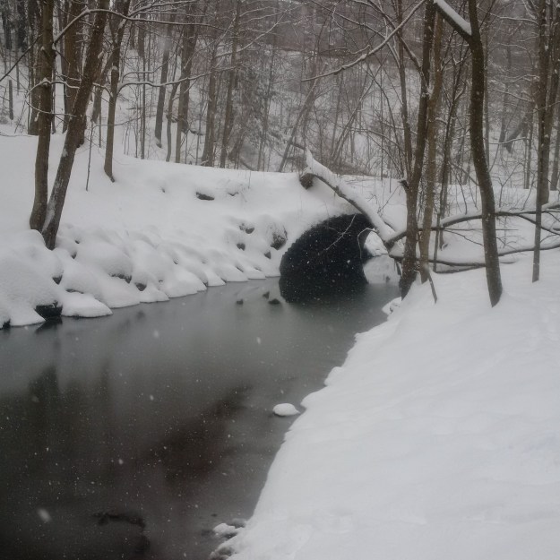
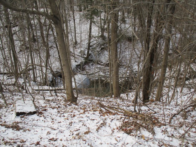
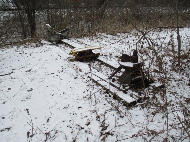
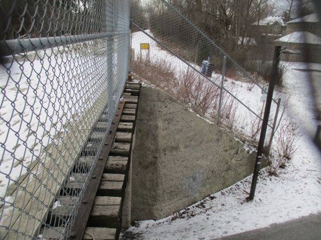
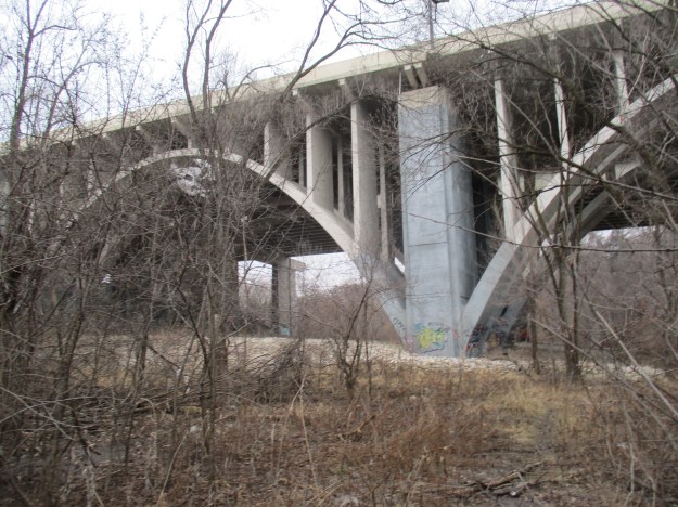
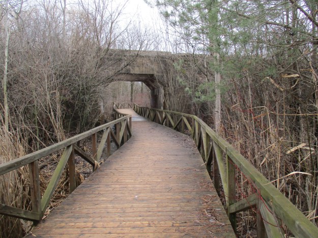
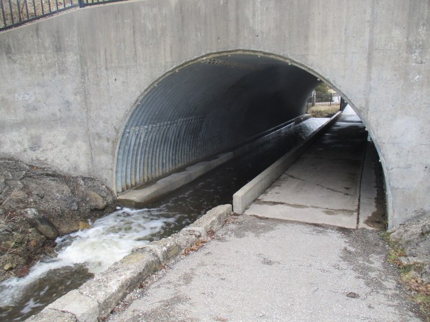
Work was completed on the next section of the trail during the winter of 2001/2002. Winter was chosen so the impact on the local environment would be lessened.  A boardwalk was constructed to carry the trail above the creek as it passes under the railway tracks.  The concrete bridge over Devil’s Creek replaces an earlier wooden trestle, of which the pilings can still be seen between the boardwalk and the concrete as you pass by.

img_6494

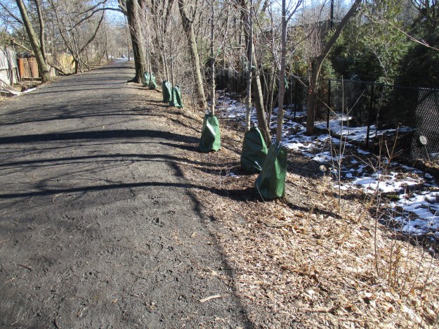
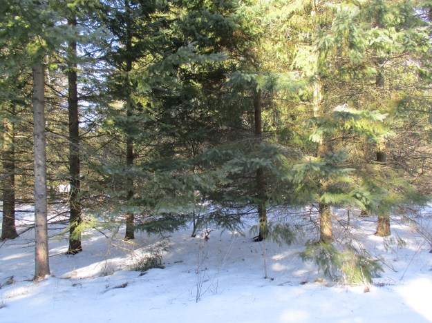
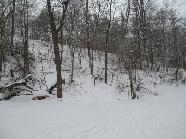
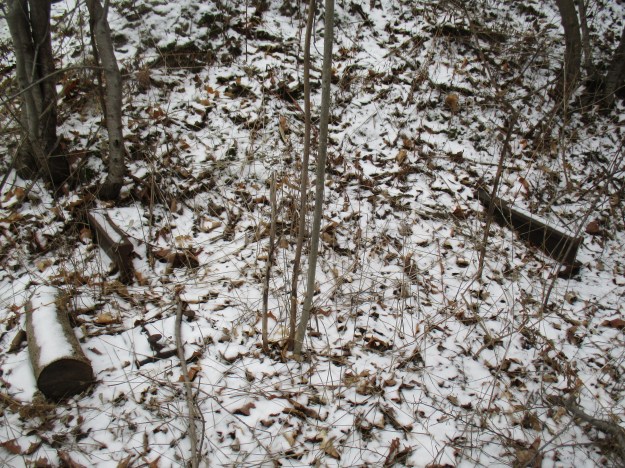
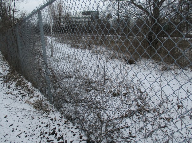
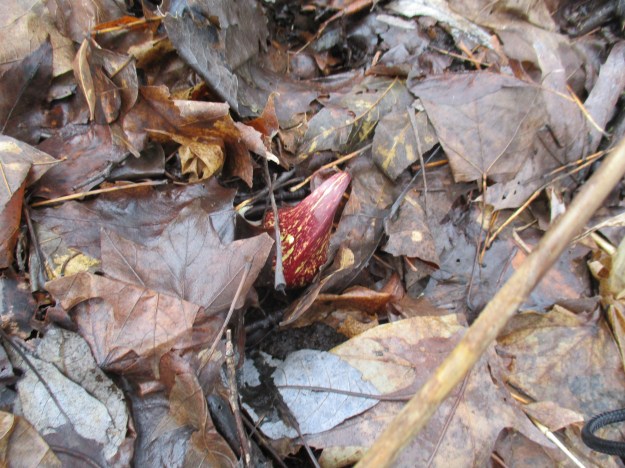
Both sides of the trail are marked as environmentally sensitive and hikers are asked to remain on the main trail.  Thirty rare plant species and the Jefferson Salamander are being protected in these woods.  Eastern Skunk Cabbage grows in wetlands and the woods along the trail support a large colony of plants.  Skunk Cabbage is one of only a few plants known for its thermogenesis properties.  It can produce temperatures from 15 to 35 degrees celsius above the surrounding air.  It literally melts its way through the frozen ground and often blooms through the snow.  The leaves do not surface until later in the spring.

img_6495

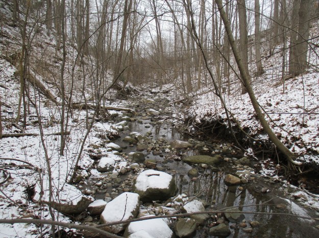
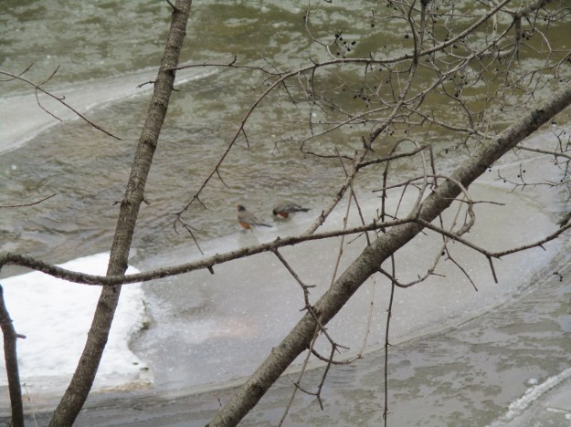
In the 1970’s the surrounding area was developed for a subdivision and the section of Devil’s Creek between the CPR tracks and Bismark Street was straightened and widened. This channel ran through a park where manicured lawns extended to the water’s edge. The creek was shallow and without shade, it was too warm to support fish.  By the 1990’s it was deemed that this section was a high priority for naturalization.  Devil’s Creek once again was given a curved path with several deeper pools to provide colder places to shelter brook trout.  Riffles were added to make the water gurgle over small rocks and pick up oxygen from the air in doing so.  A streamside pool was also added as a breeding place for frogs and newts.

img_6526

Riparian zones are patches of plant growth along the edges of a flow of water.  They provide shade and habitat for land and aquatic creatures alike.  The root systems help provide erosion control by stabilizing the stream banks.  Native trees and shrubs were planted through this reach, including Purple Flowering Raspberry, Staghorn Sumac and White Pine.

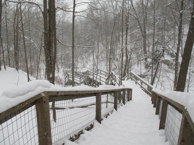
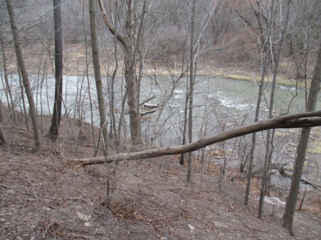
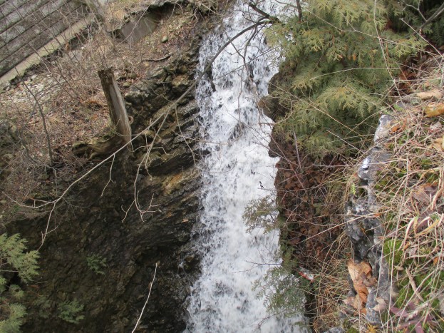
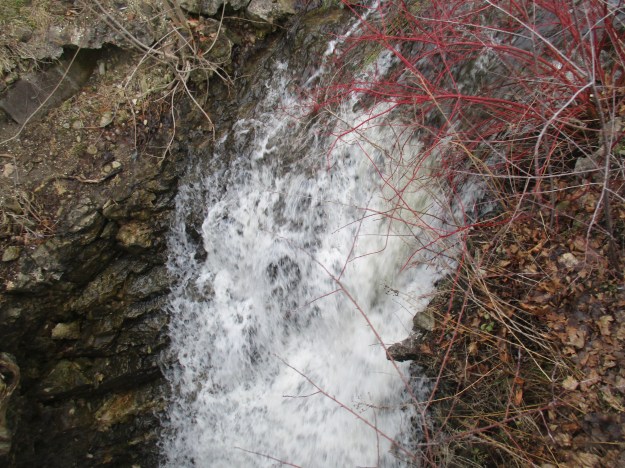
Devil’s Creek begins its decent toward the Grand River just before the bridge on George Street.  The creek flows over this small ledge of dolostone and then is forced into a short concrete channel as it flows under the bridge.  The 12 metre falls is immediately on the other side of the bridge.  This little waterfall was once the site of a footbridge that has since been washed away.  The trail on the right leads to an abandoned set of wooden stairs leading to a fence and a former access to the subdivision beyond.

img_6560

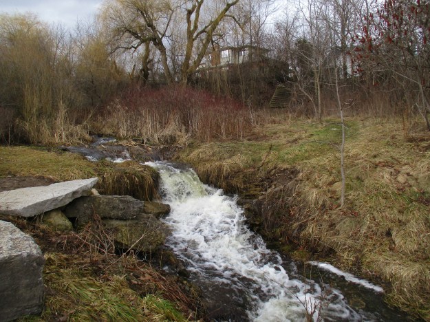
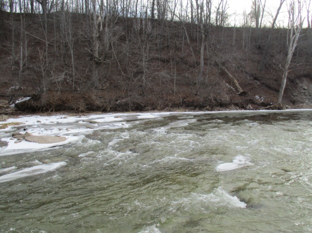
Devil’s Creek, and the Devil’s Creek Trail both pass under George Street before coming to their respective ends just beyond.  Devil’s Creek ends in a 12-metre cascade down to The Grand River below.  Devil’s Creek Trail ends at The Grand Trunk Trail which connects to several other trails in the neighbourhood.

img_6572

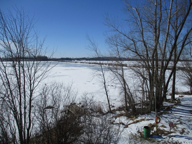
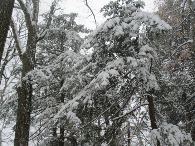
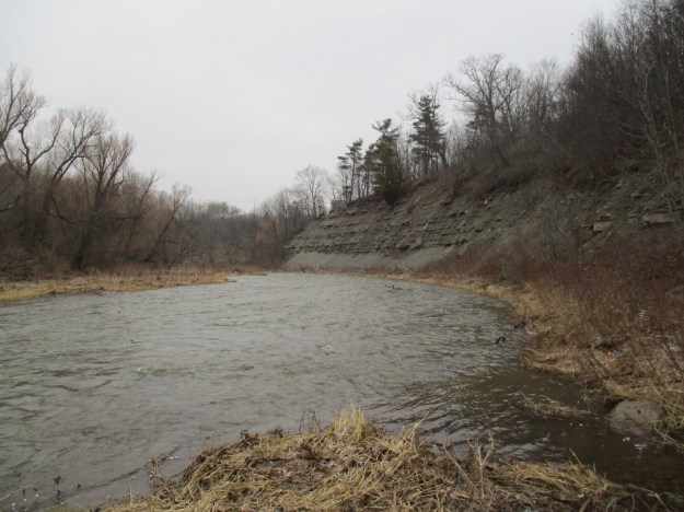
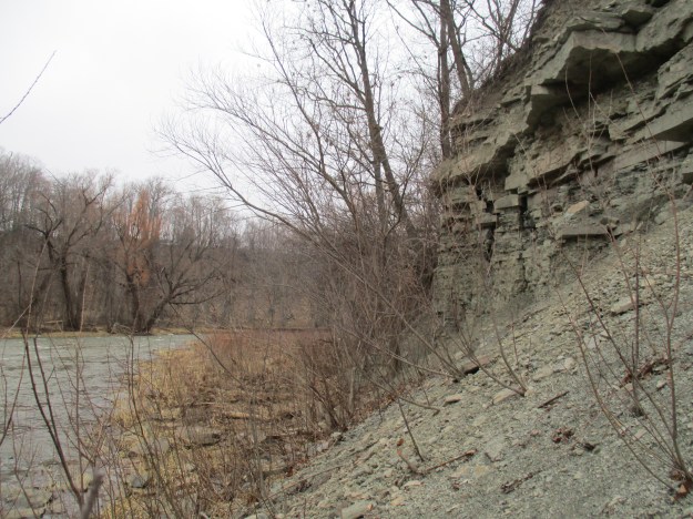
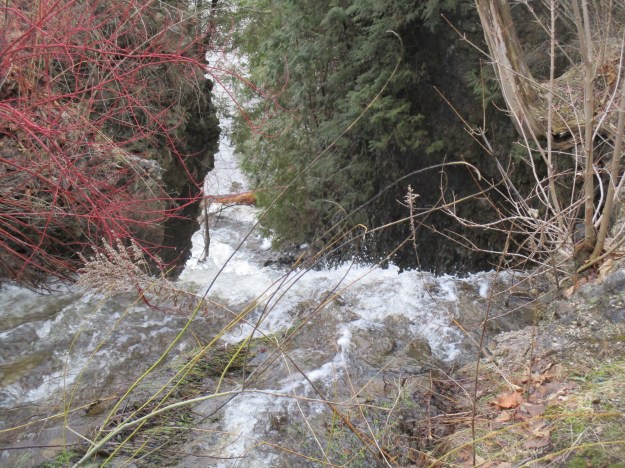
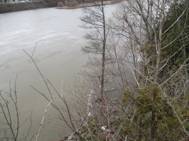
Devil’s Creek has cut a narrow channel through the limestone cliffs over the years.  From the crest of the waterfall, you can see down to the Grand River below.  The cedar trees pictured below are clinging to the side of the cliff above the falls.

img_6576

The limestone bluffs along the edge of the Grand River were formed 350 to 500 million years ago when this area was under the warm tropical Michigan Sea.  They run along the west side of the river while the east side has the Galt Country Club which is at river level.

img_6577

The Devil’s Creek waterfall empties almost directly into the river after spilling over the cliffs.  The white water curling away from the edge marks the confluence which is otherwise lost when the river is flooding and dirty.

img_6585

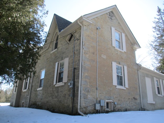
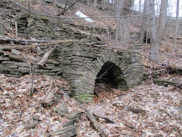
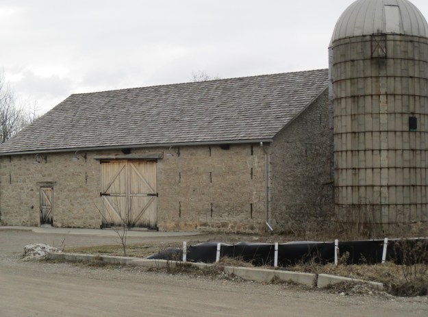
As you drive along Blair Road, returning to the 401, there is an unusual stone barn known as the Slit Barn.  It was built by William Young sometime around 1840.  This three bay barn was built in the traditional Scottish style but from the rear also incorporates elements of the Mennonite bank barns favoured by the German settlers in the area.  The three rows of slits were designed to provide ventilation so that the grain would not rot in storage.  The slits are three times as wide on the inside of the barn as they are on the outer wall.  This increases the amount of light in the barn while keeping the rain to a minimum.  The only other example of a stone barn with ventilation slits that we have featured so far was found at The Hermitage.

img_6614

Other stories in The-Devil-Made-Me-Do-It series: Devil’s Punchbowl,  Devil’s Pulpit, Devil’s Well

Our all-time top posts are featured in this special review.

Google Maps Link: Devil’s Falls

Like us at http://www.facebook.com/hikingthegta

Follow us at http://www.hikingthegta.com

Beltline Railway – Kay Gardner Beltline

Sunday, February 19, 2017

Toronto was experiencing a building boom in the 1880’s and land speculation was rampant.  A plan was put forward to develop a commuter railway to service new communities that would be opened for development.  By 1892 the rail line was up and running with 44 stops and one grand showpiece station.  However, a recession slowed the growth of the city at that time and the riders never arrived.  After only 28 months the passenger service was suspended and the line was used mainly to service industrial establishments for the next century.  The original line has since been cut into three sections, severed by Mount Pleasant Cemetery and Allen Road.  The archive picture below shows one of the period flyers advertising the railway.  The picture includes a sketch of the train crossing the bridge on Yonge Street.  This bridge is one of two originals remaining on the line and is featured as our cover photo.

the-highlands-of-toronto

Previously we explored both the northern section and the southern one.  Links to both of these are provided at the end of this story.  Much of the history of the railway is contained in the two previous stories and therefore I won’t cover it again here.  I parked on Newgate Road near Elm Ridge Drive to investigate the middle section with the plan to hike the 4 kilometres from Allen Road to Mount Pleasant Road.  This section of trail passes through Forest Hill which it was designed to serve in the days before personal automobiles. The trail was hard packed with ice and snow and the sunshine and mild temperatures were starting to melt everything.  Footing was slippery today but most of the year there is a hard packed gravel surface.  Although I saw plenty of evidence that the trail is used by dog walkers I didn’t see any other pedestrians until I reached Eglinton Avenue after which it was quite busy.

img_6418

Along the trail are several places where someone has been leaving seed for the birds and squirrels.  As a result, the squirrels have no fear of people and sit up to see what treats you may have.  In the wild a grey squirrel has a very short lifespan living for only 11 or 12 months.  In captivity, they have been noted as living up to 20 years.

img_6427

This is one of my favourite trails in the heat of the summer.  There are many places where the trees stretch over the trail from both sides making the trail well shaded.  It also has a grade of less than 4 percent which is typical for railways. Therefore there are no hills to climb in the heat of the day.  This is a multi-use trail and a speed limit of 15 kilometres per hour has been set so that cyclist won’t impact the enjoyment of dog walkers and people out for a casual stroll.

img_6430

The trail is well used by people walking their dogs but, unfortunately, there are many who do not clean up after their pets.  Both sides of this trail are covered with dog faeces to the point where you can hardly step between the piles in some places.  In colder climates, it can take up to a year for dog faeces to decompose, longer if the animal is eating primarily meat.  From an environmental standpoint, it is better to buy “flushable” poop bags rather than nonbiodegradable ones that sit in a landfill for years.  Either way, please remember this stuff doesn’t melt along with the snow.

img_6435

The Eglinton Avenue bridge over the Beltline railway has been replaced with a modern concrete structure when the road was widened.  This was the site of the Eglinton stop on the railway and the artwork on the underside of the bridge portrays some early railway scenes.

img_6444

Some of the stops on this early commuter service can still be clearly seen along the trail. There are places where there is an open space on either side of the tracks where a walkway or set of stairs provide access to the adjacent community.  Many of the stops on the railway were simply whistle stops and the train only stopped if passengers wanted to get on or off. The first one of these south of Eglinton is the site of today’s Robert Bateman Park. A renowned Canadian Artist, Robert Bateman spent his childhood exploring the beltline before it was reclaimed as parkland.  The picture below shows one of these former stops on the railway.

img_6447

Kay Gardner was a city councillor who in 1990 lobbied the city to buy the abandoned beltline lands for use as a linear park.  In May of 2000, the park was renamed Kay Garner Beltline Park in her honour.  The railway has been stripped of most of the clues to its former use.  A typical railway right of way is 100 feet wide.  This strip of land can be seen running between the two fences that border the trail.  In some places the rail bed can be seen as a raised berm and in others a cut embankment reveals the rail bed.  The picture below displays both.

img_6450

Since opening the trail the city has been busy restoring the strip of land.  Newly planted trees line the rail berm near Avenue Road.  Each new tree has a green treegator bag around the base.  These bags serve as water reservoirs for the transplanted trees.  They help reduce the shock to the tree and each bag holds 15 gallons of water.  They need to be filled about once per week.

img_6458

The trail crosses over the Davisville Subway Yards before it reaches Yonge Street.  When the TTC opened its first subway line in 1954 it ran between Union Station and Eglinton. The Davisville yards were the main carhouse and maintenance shops for the subway cars.  The first two subway cars were delivered to the Hillcrest Complex but after that, new cars were delivered to the Davisville yards via the Beltline Railway.  A temporary interchange was built on the north side of the Yonge Street beltline bridge.  These yards were used to store all TTC subway trains between 1954 and 1966 when the larger Wilson Yards were opened.

img_6464

The rail bridge on Yonge Street is one of two original structures remaining on the line.  The other one is located over Dufferin Street.  From 1970 until the 1990’s this bridge was closed to pedestrian traffic.

img_6467

The trail continues east from here across the top of Mount Pleasant Cemetery.  Turning south the trail reaches Moore Street which was the site of the elegant Moore Park station.

Other Sections of the Belt Line:  Moore Park in the south and York Belt Line Trail in the north.

Google Maps Link: Kay Gardner Beltline Trail

Like us at http://www.facebook.com/hikingthegta

Follow us at http://www.hikingthegta.com

Mountsberg

Saturday, February 18, 2017

Mountsberg Conservation Area covers 472 hectares of which 202 are covered with a water control reservoir.  Since 1994 the park has featured a Raptor Centre which is home to a collection of 15 birds of prey.  Horses and sheep call the farm home along with bison and elk.  There’s also a play barn for the kids to enjoy and a Maple Syrup festival in the spring. Sixteen kilometres of hiking trails criss-cross the park and allow you to experience the abundant wildlife.  There is a $7.50 fee per car and you have to put it into an envelope so be sure to bring correct change or plan to make a donation.

Archibald (Archabald on the County Atlas below) Cameron moved from Perthshire in Scotland in 1833 and settled on 100 acres of land.  His son, Duncan bought the property adjacent to his and Donald purchased two parcels of land next to these.

cameron-farm

Duncan Cameron purchased the 100 acres to the east of his father’s lot and started his homestead there.  In 1857 he built a stone house and a barn, both of which remain today. The house has an odd window on the second floor which was shaped like a simple diamond.  The county atlas shows how close to the house the Credit Valley Railroad was constructed when the Milton line was extended to Galt in 1879.  The Duncan house remained in the family until James Cameron, Duncan’s son, passed away in 1962.  The farm changed hands a couple of times and was purchased in 1964 by The Halton Region Conservation Authority.  They built the dam in 1966 and the Wildlife Centre in 1974.

img_6381

Near the barn is an observation tower which looks out over the Mountsberg Reservoir. Bronte Creek was dammed and the reservoir has since been stocked with fish.  Bass, Pike, Crappies, and Perch can all be caught in the shallow waters.  The former Credit Valley Railway crosses the reservoir on a berm that previously passed through a farm field.  The lower section of the reservoir has been drained for the winter.

img_6408

On the north side of the tracks, just east of the house are the remains of the family lime kiln.  It was built shortly after the house, likely around 1860, for the use of the family. Limestone was common in the area and settlers would load it into a set kiln like this one. Wood was packed around it and burned for several days until the limestone was broken down.  The limestone was broken into lumps around 2 inches in diameter and layered into the kiln along with the fuel.  It would take about a day to load the kiln and then it burned for three days.  After two days of cooling down, it could be unloaded and the lime separated from the waste.  Lime was used in the making of soap as well as construction materials.

img_6362

The first Earth day took place on April 22, 1970.  Since that time it has grown into an international event that takes place in 193 countries around the world.  In 1990 Earth Day 20 was celebrated and in Mountsberg Park the Plant-A-Tree program contributed the small forest on the north side of the train tracks, across from the Cameron House.  These trees are doing quite well a quarter century later.

img_6375

The Raptor Centre at the park is home to many birds that have been rescued locally and are incapable of survival in the wild.  The Great Horned Owl on the cover photo is one of two in the park.  These owls have a grip ten times as tight as that of a human and talons that can hold with as much as 200 pounds per square inch force.  They are known to take prey that is up to three times their weight and this includes skunks, opossums and even other raptors.

The Gyrfalcon, seen below, lives in arctic and sub-arctic regions and is rarely seen in Southern Ontario.  This is the largest of the falcon species with the females weighing up to two kilograms.  Their diet contains mostly of other birds including ducks, gulls, and geese but they also enjoy lemmings and hare.

img_6305

Rough-legged Hawks are the only hawks in Ontario that have feathers on their legs extending down to their feet.  It weighs about a kilogram, with the female being slightly larger. They are a northern bird and live mainly off of small rodents like voles and lemmings. They can be occasionally be seen in Southern Ontario during the winter.

img_6290

Broad Winged Hawks live in large forests and prefer small rodents for their prey as they only weigh about 500 grams themselves. They are relatively small among the hawk family but congregate in large flocks known as kettles in the fall to migrate south for the winter. A kettle of broad winged hawks can contain up to 1000 birds

img_6284

Takenya is one of two red-tailed hawks at the centre but she sits up and pays attention when you call her name.  One of the trainers suggested that the birds don’t actually know their names but as the picture below shows, she would turn her head and stare right at you when you call her.

img_6265

American Bison, often called Buffalo in error, are kept on the farm.  As we approached they moved across the field but soon returned to stand by the fence.  The largest of the five already had a broken horn and was clearly guarding the smaller ones.  It routinely stood between me and the smallest one so getting a picture was quite difficult.  I wasn’t sure if it was my red coat or the imminent arrival of the ladies with the food buckets that had their attention but after feeding they went for a run around the pen.  They can reach speeds up to 60 kilometres per hour.

img_6231

Mountsberg has extensive hiking trails as well as the dam that are yet to be explored.  This is a park that will require more than one visit.

Our top 15 stories are previewed here.

Google Maps Link: Mountsberg

Like us at http://www.facebook.com/hikingthegta

Follow us at http://www.hikingthegta.com


Sherwood Park – In White

Sunday, February 12, 2017

Winter scenes have been largely missing this year and so with light fluffy snow falling and 15 centimetres of fresh snow on the ground, it seemed like a good time to go for a walk in Sherwood Park.  There were children playing on the swings and teeter-totter in spite of the weather.  Isn’t Canada wonderful?  The fish in the children’s splash pad might not agree with those snow drifts piled up on their fins.

img_6194

Sherwood Park was previously covered in the post on Burke Brook so I won’t repeat that story here.  I’ll just provide a link at the end of this pictorial where you can get the history of this location.  For now, grab a seat in the park and have a look around.

img_6193

One of the features of Sherwood Park are the extensive stairs provide access from the ravine floor to the forests above.

img_6202

Burke Brook is beautiful as it babbles through the ravine.

img_6213

To facilitate crossing the steep ravine at Burke Brook the pioneers built Bayview Avenue along the side of the ravine so that it could reach the bottom with a slope other than 75 degrees straight down.  The former road allowance is currently used as the trail from Bayview into Sherwood Park.

img_6209

Bayview Avenue crossed Burke Brook near the water level on a wooden bridge prior to the installation of this culvert.  When Sunnybrook Hospital was built during the Second World War, Bayview Avenue was straightened and a large berm built over a much larger culvert. The berm reduces the ravine to a small dip in the road.  The original Bayview Avenue can be seen as it approaches this old bridge.

bayview-over-burke

There’s something very calming about a gentle snowfall in a forest when the trees have a fresh coating of undisturbed snow.

img_6218

Link to Burke Brook

A summary of the top 15 all-time posts can be found in this special feature.

Google Maps Link.  Sherwood Park

Like us at http://www.facebook.com/hikingthegta

Follow us at http://www.hikingthegta.com

Leaside Spur Trail

Sunday, January 29, 2017

The Leaside Spur ran from just north of Eglinton to just south of York Mills for a distance of about 3 kilometres.    It once connected the Canadian Pacific (CP) Belleville Subdivision in the south with the Canadian National (CN) Bala Division in the north.  There are a few street parking spots on Overland Drive off of Leslie Street.

leaside-spur-trail

Until the 1950’s the line ran through an area that consisted of about twenty farms contained between the East and West Don Rivers.  All that changed rapidly between 1952 and 1965 when it was developed as an 835-hectare residential community.  It was the first planned community in Ontario.  Residential, commercial, industrial and retail areas were all planned out as well as schools and parks.  Watercourses were left in their natural condition rather than putting them in concrete channels as was done with Taylor-Massey Creek to the east of there.  From where I was parked the trail runs to a dead end to the south and I decided to go that way first.  There is a brief section where the trail passes through a residential community before entering an industrial area.

img_6041

From the old aerial photographs, it appears that there were at least 5 sidings that serviced factories in this section.  The cover photo shows the one remaining section with rails on it. This short siding allowed for two cars to be placed at the rear docks of a building which is currently used by Canadian Tire.  The industrial section is split by a ravine carrying a tributary of Wilket Creek.  The rail line passed over the ravine on a trestle which has since been filled in and the creek fed into a new culvert.  There is a deep plunge pool on the downside of the culvert suggesting that there is a significant flow of water through here at times.

img_6057

Although I spend many hours outside in prime geocaching locations I have never actually met anyone who is actively looking for a cache.  I tend to stumble across geocaches every few months and this one had tumbled out of it’s hiding spot.  There is a pencil but no log book so I just closed it up and put it back where I thought it had come from.

img_6060

When this area was farmer’s fields the ravine was cleared of trees.  Following the industrial development of the local area, the ravine was left to grow over with new trees.  It is an unusually secluded spot in the city where there were plenty of small animal tracks to which I added the only fresh human ones.

img_6064

Some of the former sidings have been removed while others have been buried under fresh fill.  The last siding on the west side prior to the connection to the CPR tracks is one of the ones that was buried.  The ends of the two rails protrude from the bank of earth that was intended to hide them forever.

img_6081

There are still pieces of switching equipment at the end of the trail where it connects to the CPR tracks.  The switching equipment was installed in 1963 and manufactured by the General Railway Signal Company in Rochester, New York. The connection to the CPR was most likely cut at this time.

img_6086

The siding connects to the CPR Bellville subdivision just north of Eglinton Avenue.  The CN Tower and  Aura at College Park can be seen in the distance.

img_6101

Backtracking, you will arrive at Lawrence Avenue where there is a Tim’s, how convenient! The former level crossing at Lawrence Avenue has now been turned into a bicycle and pedestrian crossing with signals.  North of Lawrence the trail passes through residential areas where many residents have made their own access to the trail.

img_6113

Don Mills was shaped by the railways which surrounded it.  There is currently no heritage designation on any of the railway properties in the area.  The rail bridge over Bond Street was built in 1912 and was in danger of being torn down during the construction of the trail. The north abutment was to be removed to allow the roadway into the park to be straightened and a blind curve to be removed.  The trail would have made a slight deviation to cross Bond Street on a new pedestrian bridge.  The abutment would have been replaced with signage describing the missing heritage bridge.  For now, it looks like the bridge has been saved but it needs the heritage designation to help ensure it’s long-term future.

img_6115

Bond Park, with five ball diamonds and six tennis courts, can be seen from the trail. It is set in a 6.8-hectare triangular piece of land, or gore, between the Leaside Spur and the CN Bala Division and north of Bond Street.  The northern tip of the park is defined by the meeting of the spur line with the main line.  The fence on this end has been recently repaired to keep people from trespassing but the old right of way can be seen as it connects to the CN line.

img_6119

The trail has now been completed from this point to York Mills Road and there are plans to connect it to the East Don Trail in the future.

Our fifteen most popular stories have been collected here for easy reference.

Google Maps Link: Leaside Spur Trail

Like us at http://www.facebook.com/hikingthegta

Follow us at http://www.hikingthegta.com

The Old Dam – Oakville

Saturday, February 4, 2017

Last week we explored Sixteen Mile Creek on the west side looking for evidence of the old tunnel through the Hog’s Back.  We found an old stone structure that looked like a tunnel entrance that had been filled in.  Owing to the fact that it wasn’t in the location we expected, we determined that it was not the tunnel we sought.  Having circumnavigated the hog’s back we had determined that the openings on either side had been closed off, either intentionally for safety or through a mud or talus slide.  This week we returned to have a look on the east side of the creek for the remains of the old dam.  The post card below is over 100 years old and shows Sixteen Mile Creek with the dam intact on the left of the photo.  The earth and stone berm can be seen running out toward the creek where the water spills over the dam.  The creek flows around the hog’s back and then under the railway bridge.  The wood stave flume passes under the railway bridge on its way toward the mill.

mill-dam

William Chisholm purchased 960 acres of land at the mouth of Sixteen Mile Creek in 1827 with the plan to create ship building yards there.  Another of William’s early ventures was the construction of saw and grist mills both of which were completed by 1833.  The grist mill was located downstream from the Hog’s Back but the mill pond was on the opposite side of this geological feature. The solution was to bring the water through the hog’s back in a tunnel.

mill-sketch

St. Mary’s Pioneer Cemetery contains the city’s earliest founders including William Chisholm.  There are a few parking places on Lyons Lane near the entrance to the cemetery.  Just inside the gate there is an opening in the fence and a small path.  It is possible to descend to the creek level but caution is required as the footing is loose.  The large “S” that Sixteen Mile Creek forms as it rounds the hog’s back makes directions a little odd when you reach the creek.  You are on the east side of the creek but west of it.  You’ll walk south toward Lake Ontario as you make your way upstream toward the old dam.  The dam can be seen in the picture below as the white line running horizontal through the trees in the middle of the photo.

img_6123

Looking back along the dam you can see where it met the embankment with St. Mary’s Pioneer Cemetery at the top of the hill.

img_6128

The dam stands eight to ten feet off of the creek floodplain.  A cross section of the dam can be seen by walking out to the end and climbing down the side.  Large pieces of dolostone were layered to form a sturdy wall.  A layer of soil was scooped up off the floodplain to deepen the mill pond and provide a covering for the dam.  A wooden crib filled with stone was used to span the creek.  The dam was built in the winter when water levels were low and maintenance was also done during these months.  The dam has been removed from the creek to help prevent flooding and reduce the danger downstream should it eventually fail.

img_6129

Tracing the line of the old dam to the creek’s edge you can see the stone in the water and on the far embankment that marked the dam’s east end at the hog’s back.  The dam met the hog’s back at the extreme left in this photo. The now closed entrance to the water tunnel would have been along the embankment in this picture, perhaps near the large tree with the platform in it.

img_6151

Following the dam back to where it meets the ravine side you will find a small path that leads back up to the cemetery.  The picture below shows how obvious the dam is when seen from above, once you know that it is there.

img_6153

Keep your eyes open as you walk through places where there is a lot of limestone because it can often be found with fossils in it.  The piece pictured below has fossil worms and twigs and what appears to be a moth near the middle.

img_6154

The woods near Sixteen Mile Creek were alive with robins.  Groups of birds are not always called flocks and a group of robins is known as a “round”.  In England, they are also known as a breast and in the USA they are called a wave.  Perhaps this is where the term “round-robin” comes from.  The round of robins by the creek was fat and obviously well fed. It is most likely that these birds have returned from their migration south, perhaps pushed north by storms below them.  Two robins stop for a drink from the creek in the picture below.

img_6158

Our fifteen all-time most popular hikes are featured in this special presentation.

Google Maps Link: St. Mary’s Pioneer Cemetery Oakville

Like us at http://www.facebook.com/hikingthegta

Follow us at http://www.hikingthegta.com

Hog’s Back Park – Oakville

Saturday, January 28, 2017

A hog’s back is a narrow ridge of steeply inclined rock strata that is resistant to erosion. In Oakville, the Sixteen Mile Creek forms a hog’s back at St. Mary’s Pioneer Cemetery. The Google Earth picture below shows how the hog’s back is surrounded on three sides by water (blue).  Following a story last year on the east side of Sixteen Mile Creek we received a tip about an artifact on the other side.  The entrance to a tunnel that used to run under the hog’s back aparently still remained on the west side of the creek across from St. Mary’s Cemetery. Initially, it was used to carry a wooden flume which supplied water to power the first mills in Oakville.  There is limited parking in the area and in some places, you risk towing.  We found limited free street parking on Kerr Street south of the 403. Access to the bottom of the ravine can be gained off of Kerr Street adjacent to the highway bridge.

623-kerr

The bridge replaces an earlier crossing at river level.  Today’s Kerr Street used to have a switchback that led down to the ravine floor and this was eliminated when the high-level bridge was installed in the 1930’s.  There is still an obvious roadway that has been cut down the side of the ravine although it is becoming overgrown with hawthorn and other first generation growth.  There were signs that going down this way wasn’t a good idea, due to trees that had fallen across the roadway and so we returned and descended beside the bridge.

Two types of bridge construction can be seen from the ravine floor.  In the foreground are the graceful arches of the earlier bridge of the Middle Road Highway.  When it opened in 1937 between Toronto and Burlington it was the first inter-city divided highway in North America.  The lamp posts featured “ER” in wrought iron for Elizabeth Regina or Queen Elizabeth, giving the highway the longest stretch of illumination in the world at the time. The second bridge, on straight pillars in the background, was opened in 2011 when the addition of HOV lanes required that a second structure was built to cross the creek. Notice how the new construction was built with room for another expansion in the future.

img_5991

The west creek bank has an open floodplain until you reach the major curve in the river near the railway tracks.  At this point, the creek edges up against the ravine wall.  Before the curve extensive work has been done on the embankment with shale.  We found the opening with its crude arch that can be seen in the photo below.  The embankment is shored up with additional shale to support the entrance to a tunnel which has recently been filled in.  The bottom of a wheelbarrow remains in the opening to attest to the deed and give an indication of scale.

img_6004

On the top of the ravine above this inlet are the remains of some extensive stonework. Arches and columns support other arches and these, in turn, support the deck of a more modern house.  Following the creek ceases to be an option at this point and you are forced to retreat or climb the side of the ravine.

img_6016

Stonehooking was performed between about 1830 and World War 1.  Shale was collected from the lake bottom and used in construction projects.  Two examples of this kind of construction formerly stood on Kerr Street just south of the railway tracks.  They have since been moved onto Shepherd Road to make space for the highrise building that can be seen in the corner of the picture below.  The two houses were built in 1911 and 1930 respectively.  Three triangular dormers grace the two-story 1911 home which has been restored with new cedar shingles.  The story-and-a-half 1930 home can be seen on the left in this photo.  Their location has been marked with a red asterisk on the Google Earth picture above where they sit in the shadow of the building that they were moved to accommodate.

img_6018

At the end of Shepherd Road is a small park that has a sign welcoming you to West River Community.  Here, contrary to trespass laws, an obvious trail leads across a triple-tracked and very active railway line.  This trail leads out onto the top of the hog’s back.  In an effort to fully explore this section of the creek we had to descend back to creek level.

img_6025

Backtracking upstream, it was confirmed that there is just a short section along the base of the railway line that cannot be traversed safely at water level.  The view south from here reveals the layers of shale that make up the hog’s back.  Extensive talus slopes at water level contain the loose clay, sand and shale that has fallen from the cliff face.  A thin strip of vegetation along the edge of the water gives a faint hope of being able to get past.

img_6027

It turns out that there were sufficient places to step to allow us to slowly work past all the talus. Rapidly changing water levels could make this quite dangerous at times.

img_6029

At the end of the hog’s back we found a camp site.  We are either very early or much too late for breakfast.

img_6030

Once around the tip of the hog’s back, we saw two GO trains pass each other in opposite directions on the rail bridge over Sixteen Mile Creek.  The 1877 county atlas shows the rail line (yellow below) passing through Oakville as the H & T Branch of the Great Western Railway (GWR).  In 1834 the GWR was the first railway in Canada West (Ontario) to receive a charter, as the London and Gore Railway.  It was rechartered in 1845 as the GWR.  When it opened in 1853 it connected Niagara Falls with Windsor.  In 1855 the line was extended with the Hamilton & Toronto (H&T) branch.  The rail bridge over Sixteen Mile Creek was built of cut blocks of limestone.  When it was triple-tracked the new section was made of poured concrete with a pattern that mimics the cut stone blocks beside it.

img_6034

The historical atlas below shows the journey starting at the parking spot which is marked with a star.  The trail is marked in red and the end is marked with a diamond.  Having hiked all the way around the hog’s back at creek level we are forced to conclude that the shale structure featured in the cover photo is the only candidate to be the remains of the mill flume intake tunnel.

oakville-3

Google Maps link: Hog’s Back Park

Like us at http://www.facebook.com/hikingthegta

Follow us at http://www.hikingthegta.com