Tag Archives: Red Tailed Hawk

Bronte Bluffs Park

Saturday, November 28, 2020

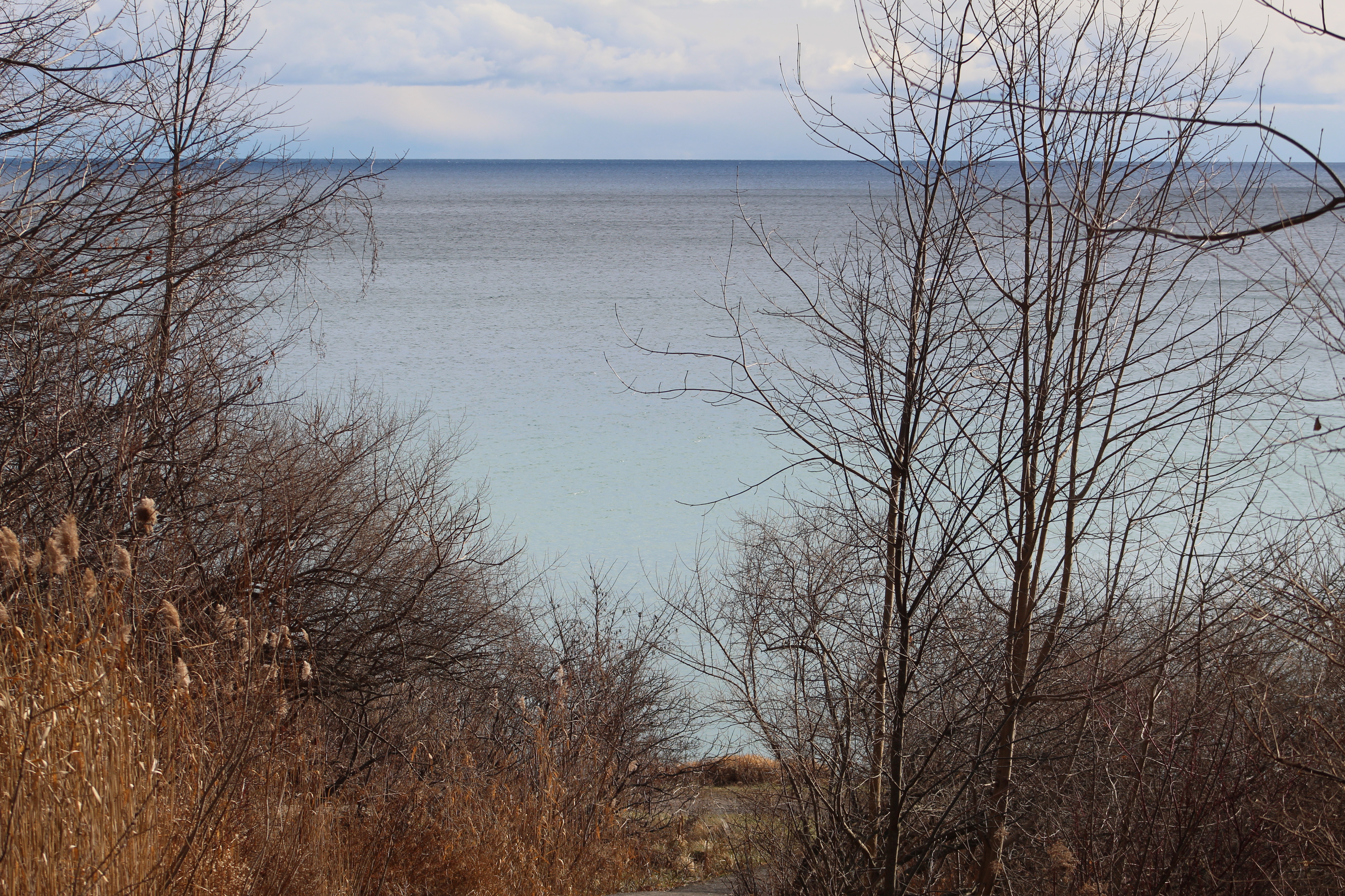
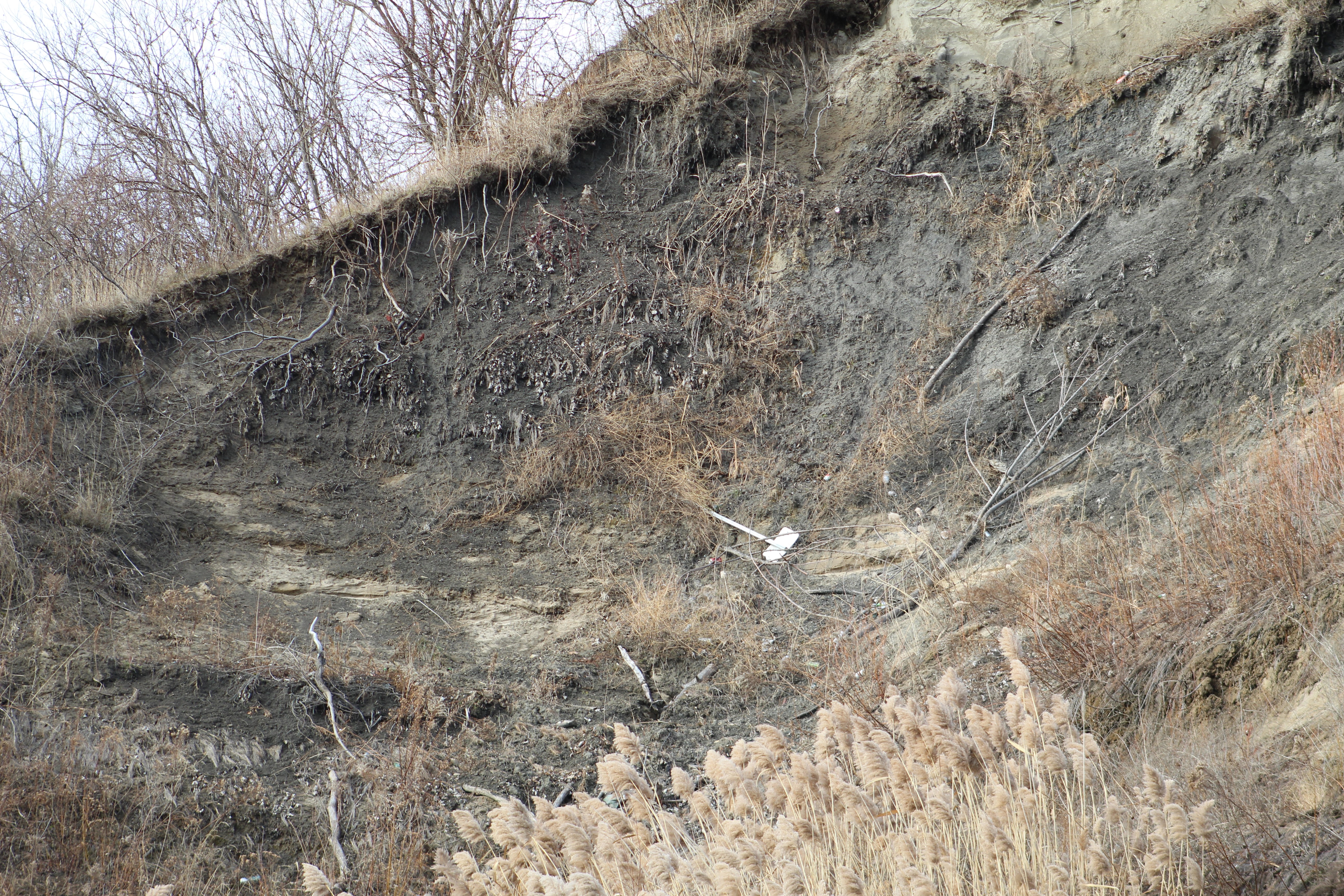
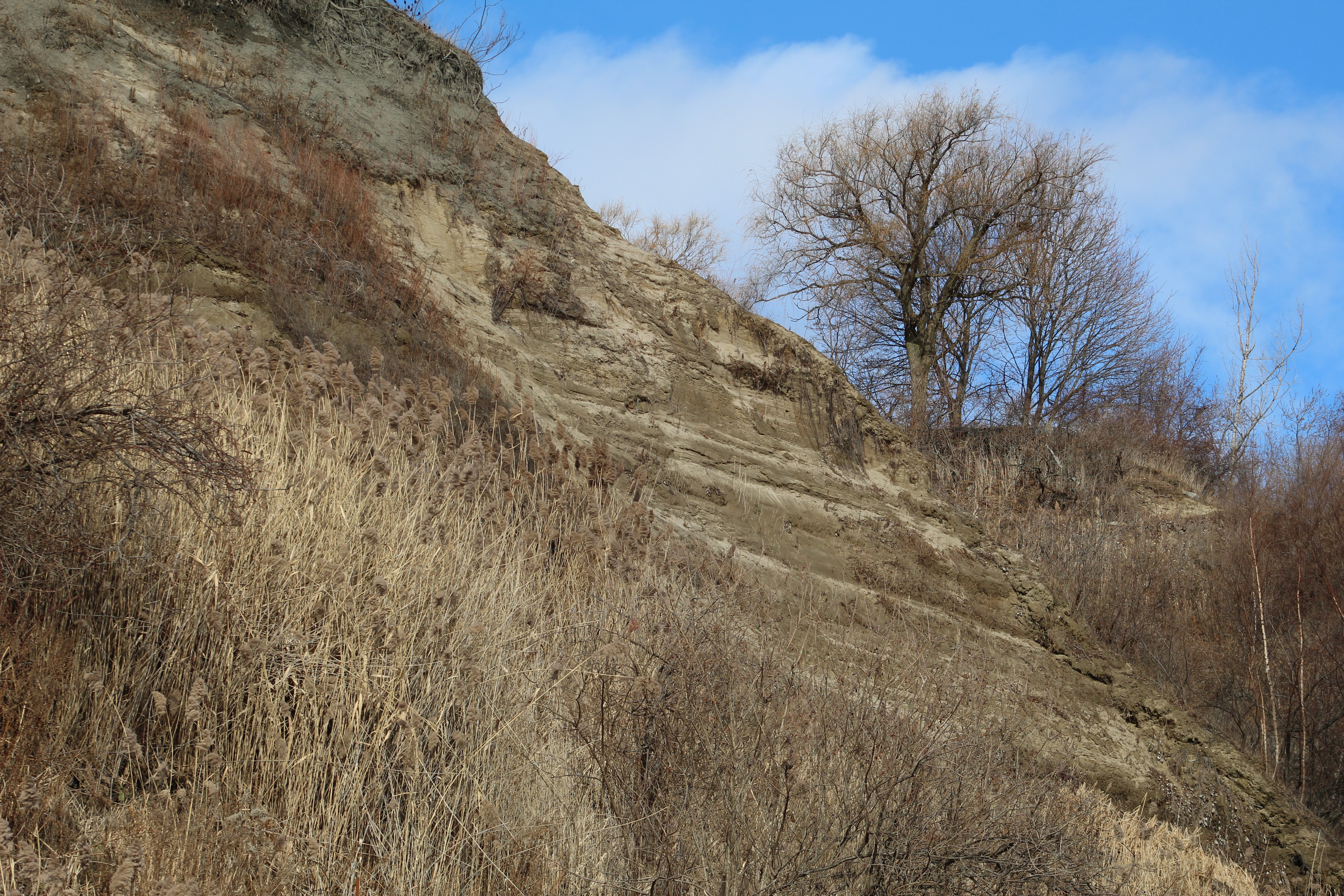
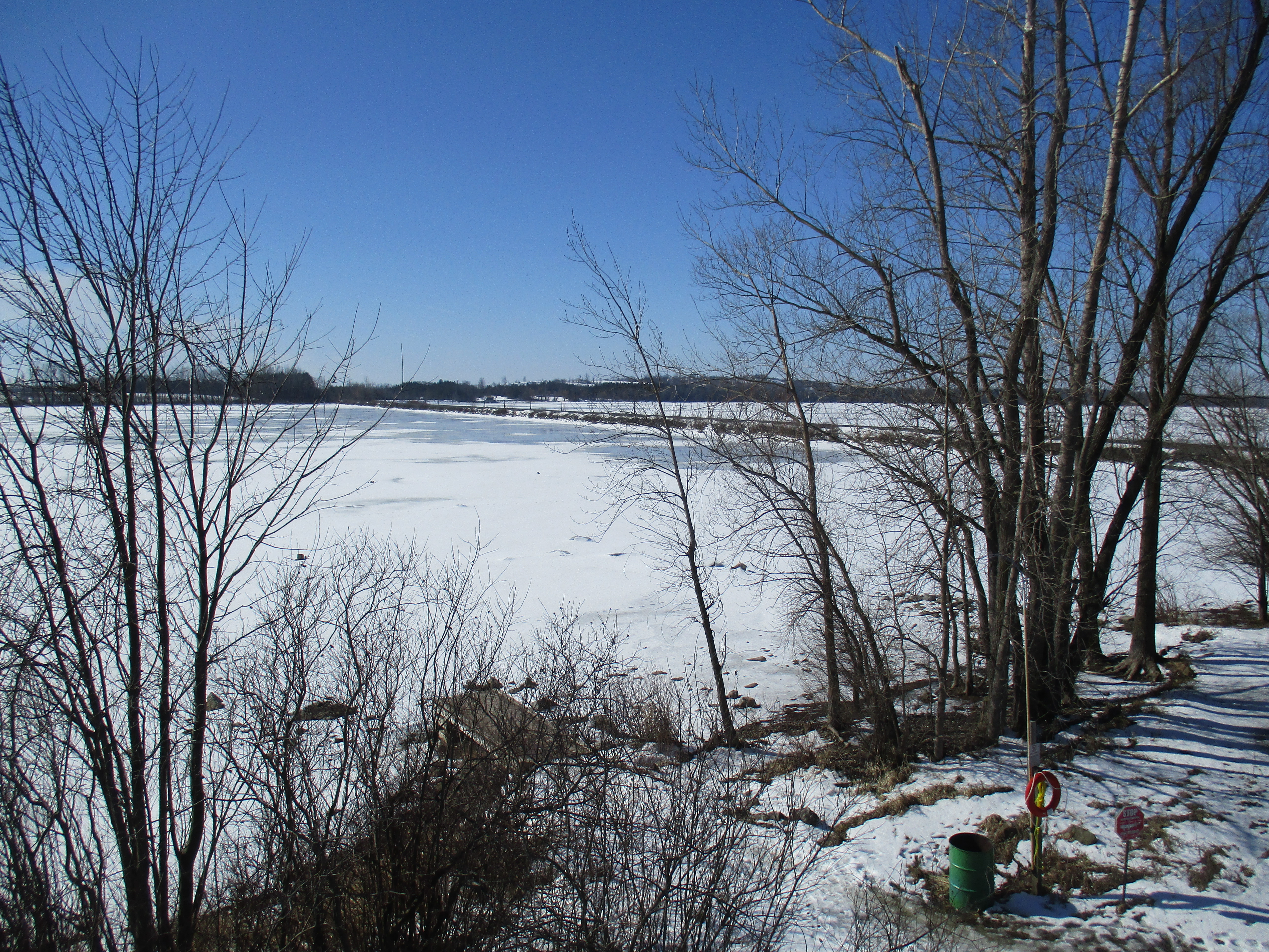
Just west of the mouth of Bronte Creek is a geological feature that dates back 13,000 years to the end of the last ice age. At that time, the lake level was about 100 feet higher than today and that version of Lake Ontario is referred to as Glacial Lake Iroquois. It is responsible for various land formations all around the lake including the Scarborough Bluffs and Iroquois Shoreline Woods Park. We decided to go and see this feature and explore the area and we used free parking in one of the lots on West River Street.

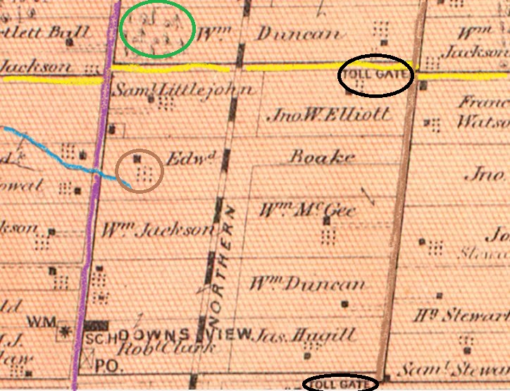
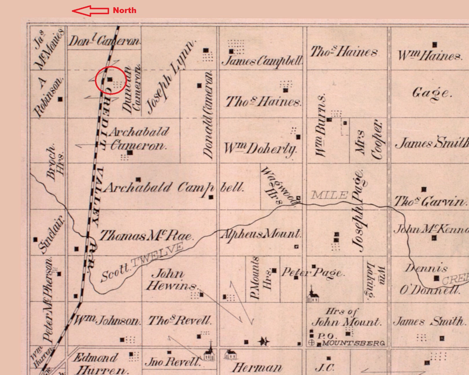
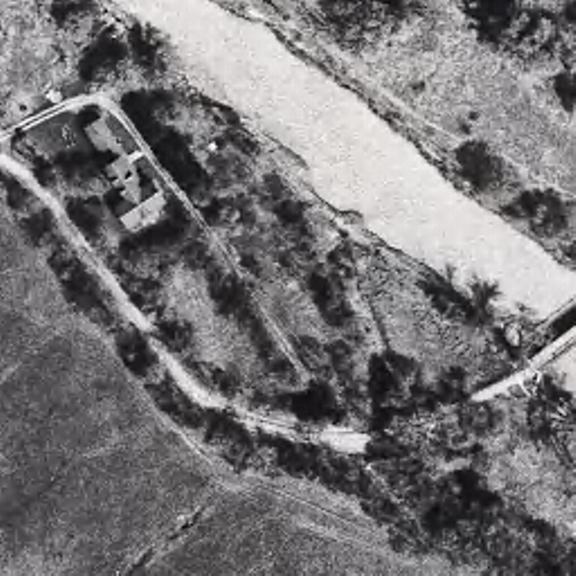
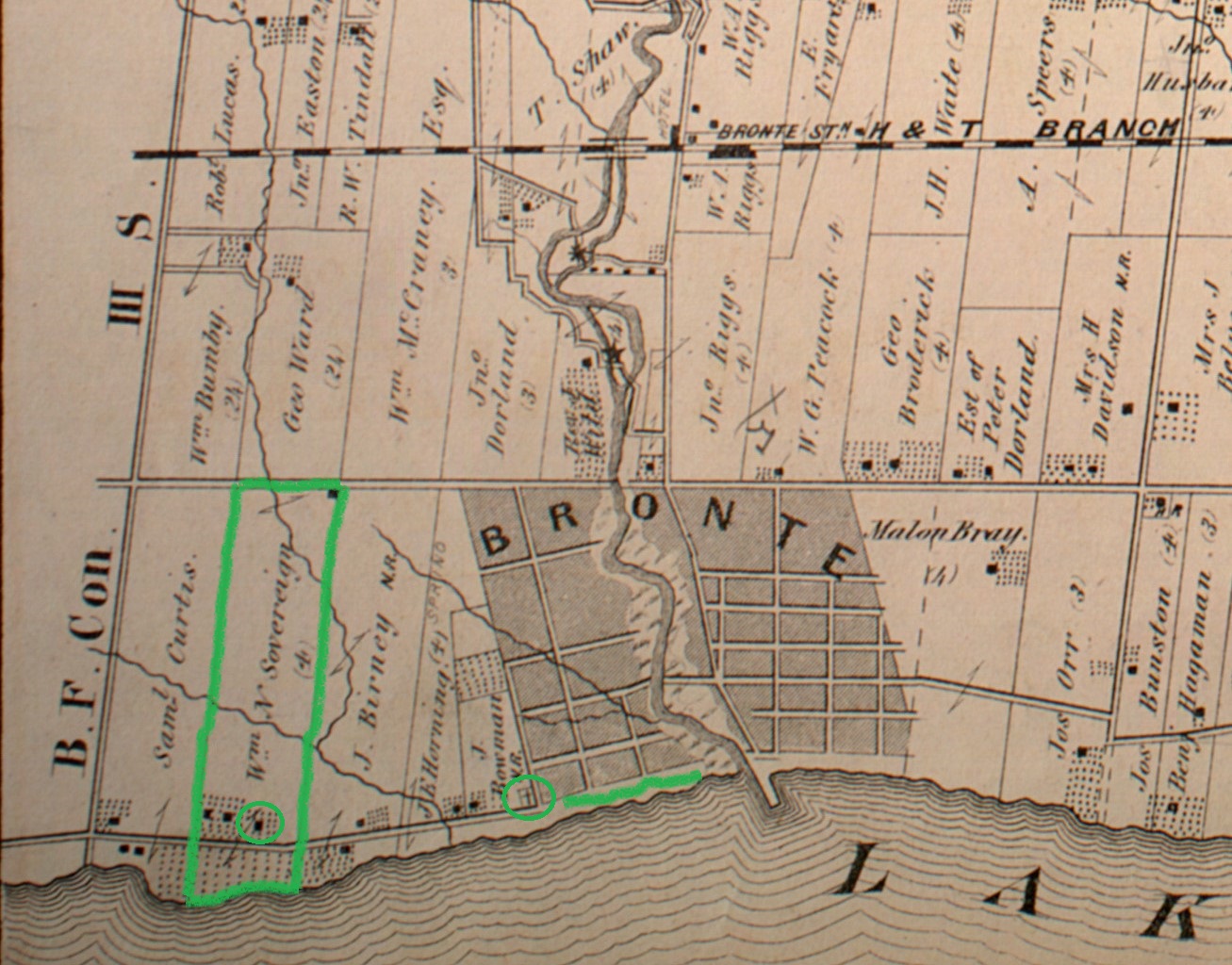
The map below shows the area as it was in 1877 including the Sovereign property which originally stretched all the way to Bronte Creek. The Sovereign House featured below is one of the three at the end of the property by the lake, possibly the one circled. Also circled is the site of the Bronte Cemetery which was on land donated by the family.

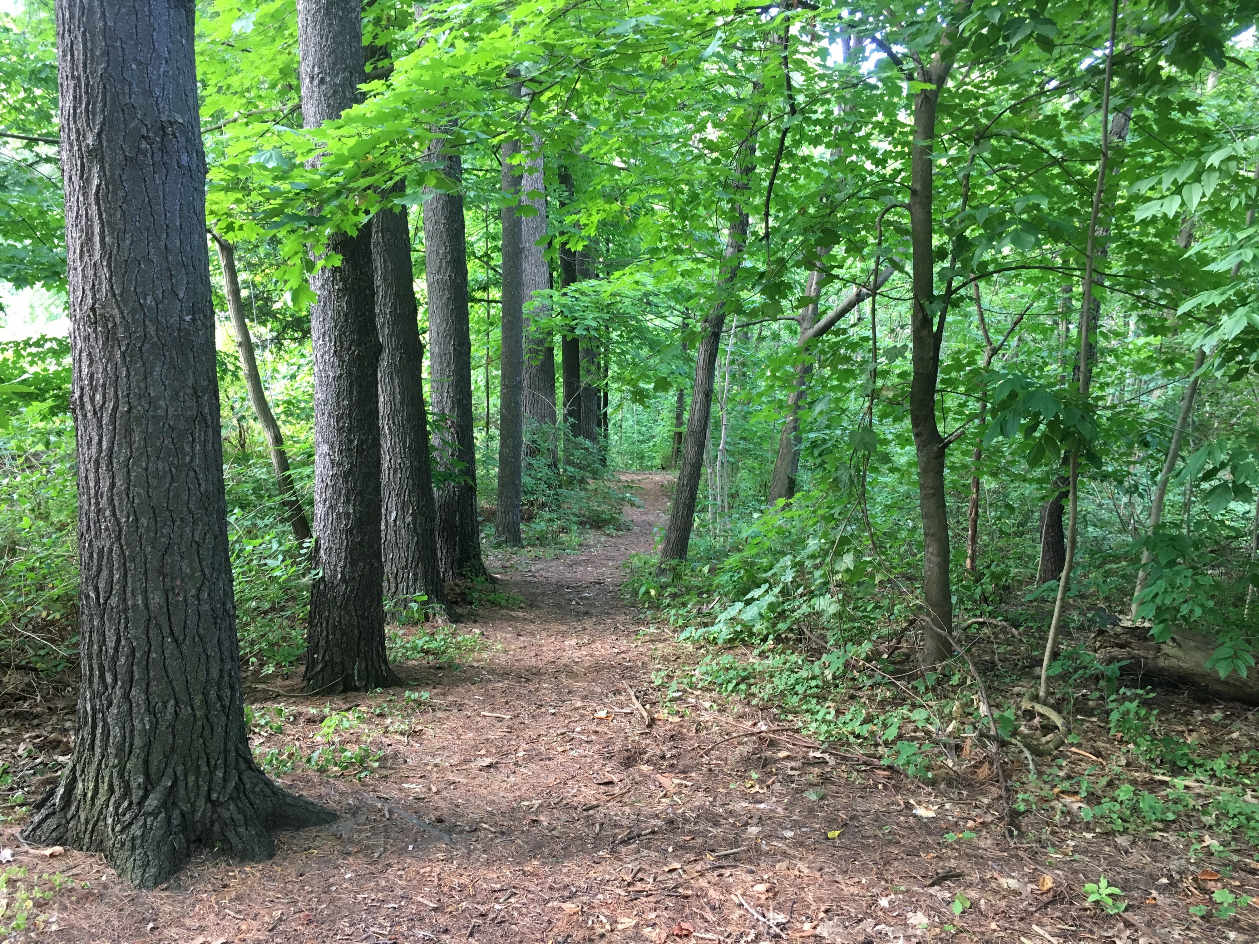
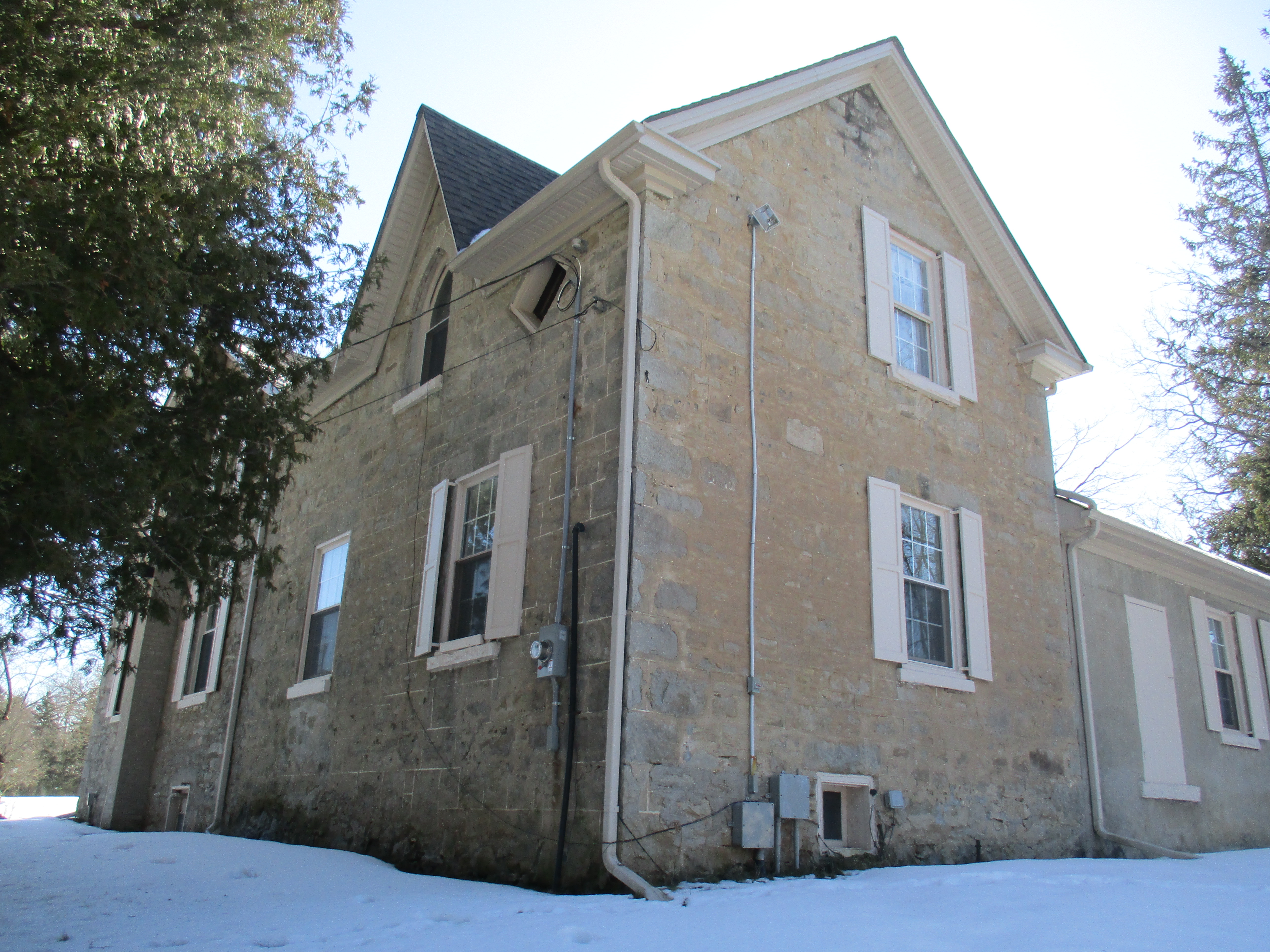
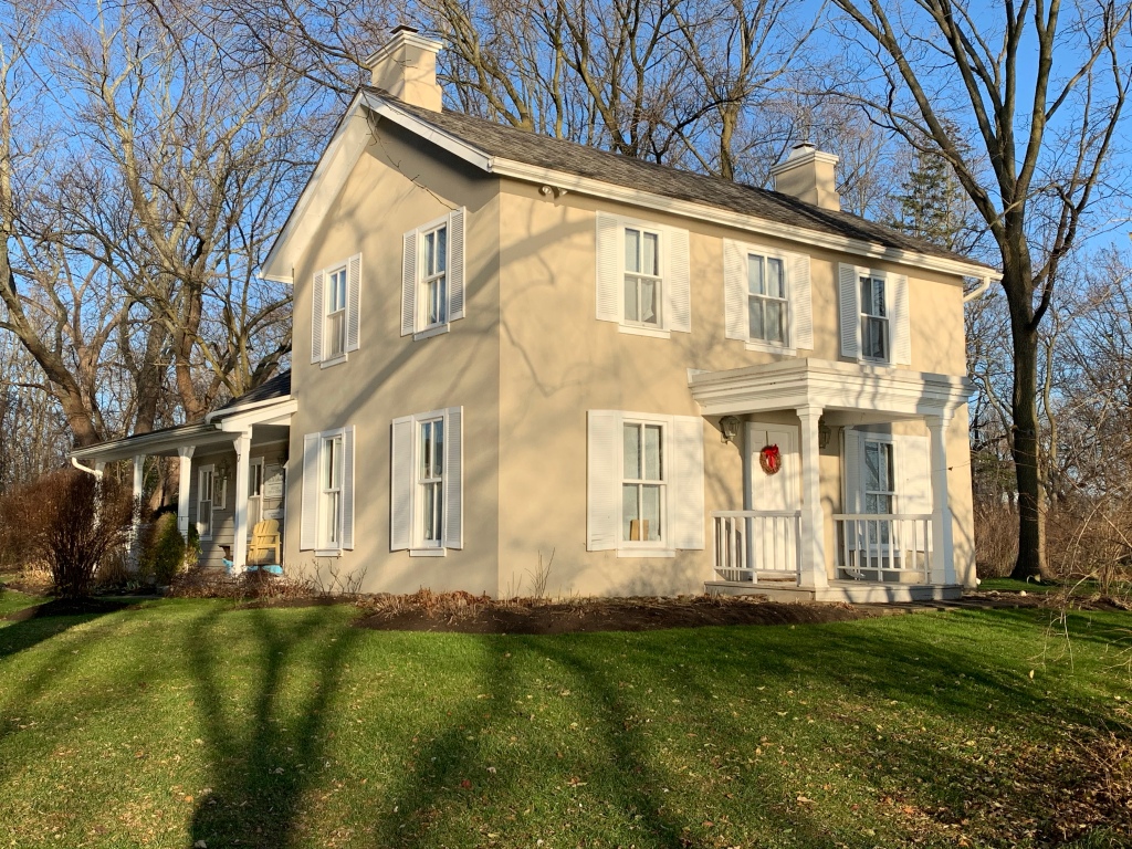
Philip Sovereign was one of the first settlers on Twelve Mile Creek, now known as Bronte Creek, when he arrived in 1814. His property on the west side of the creek mouth would be the site of the first school house in the community when he had a small log building erected the following year. His son Charles would be the teacher in the school by the time he was 17. The Sovereign family was instrumental in the early development of Bronte and their house was built in 1825. After Charles passed away in 1885 the house had several tenants the most notable being in the years 1911-1914. During this time Mazo de la Roche lived here. She was the author of the “Jalna” series of books whose 16 novels were among the most popular of the era. The house was moved on Aug. 23, 1988 to Bronte Bluffs Park where it was restored and now houses the Bronte Historical Society. Several trails run east from the house along the bluffs and lead to stairs that provide access to the beach.

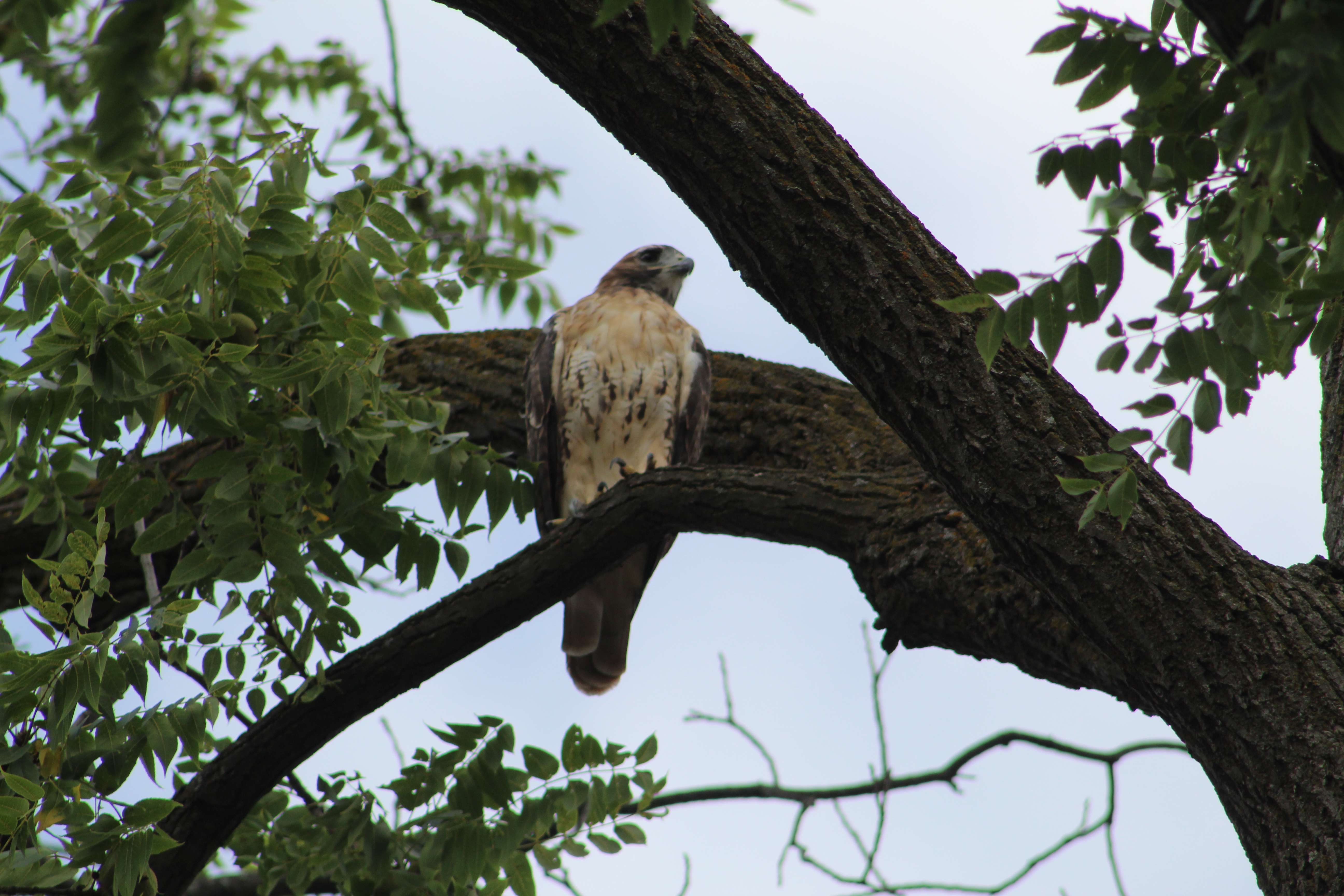
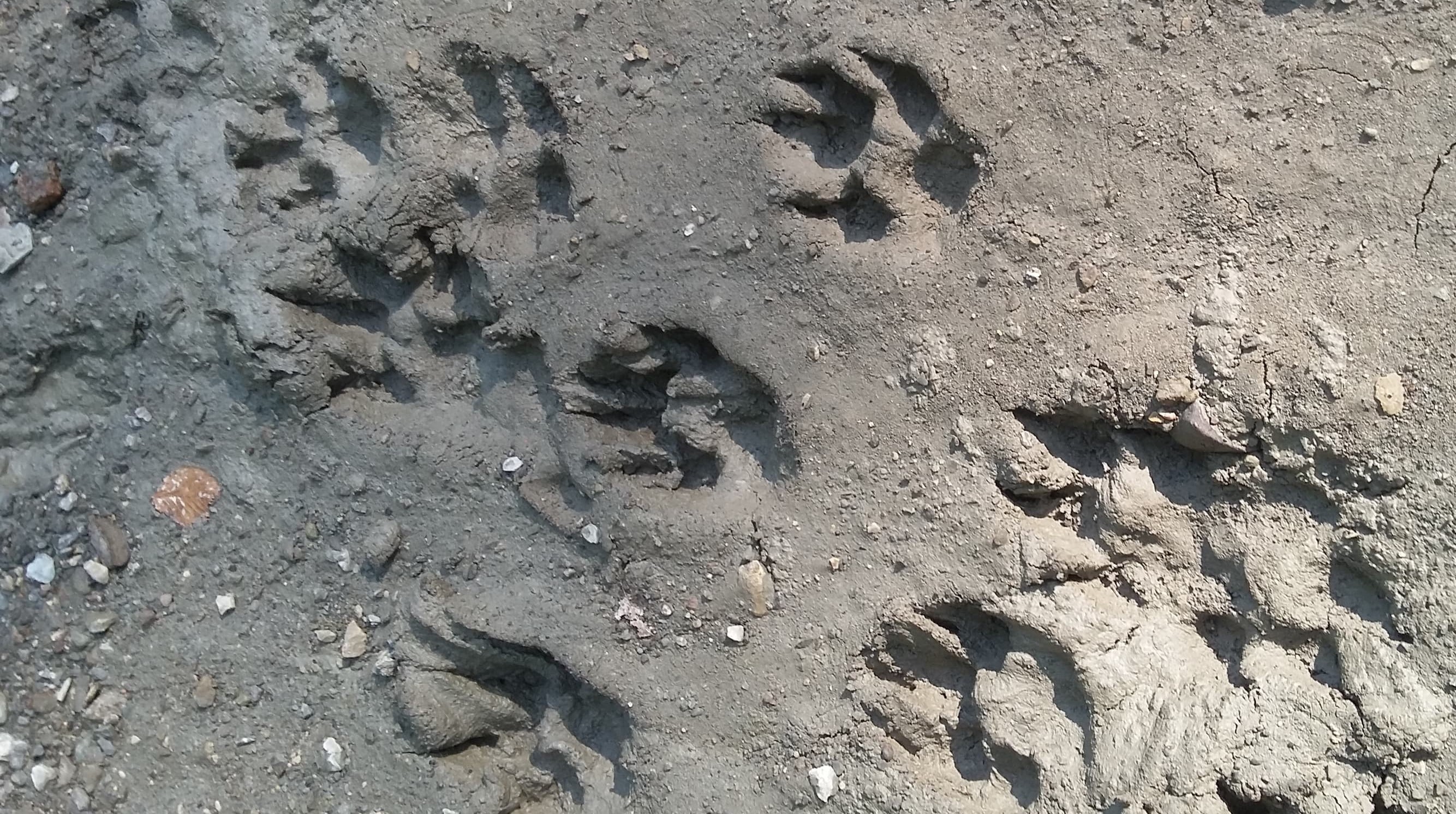
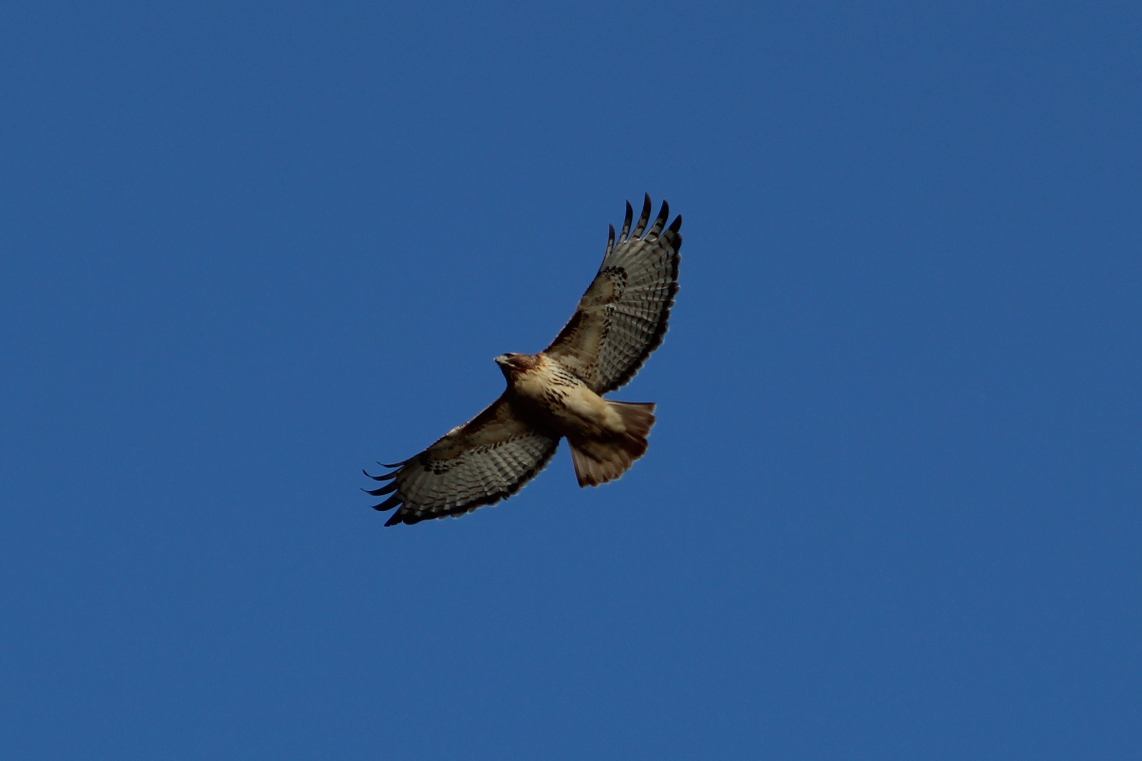
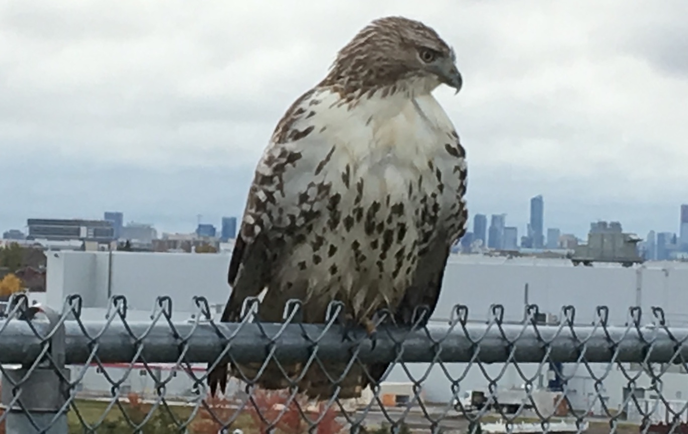
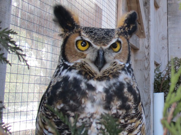
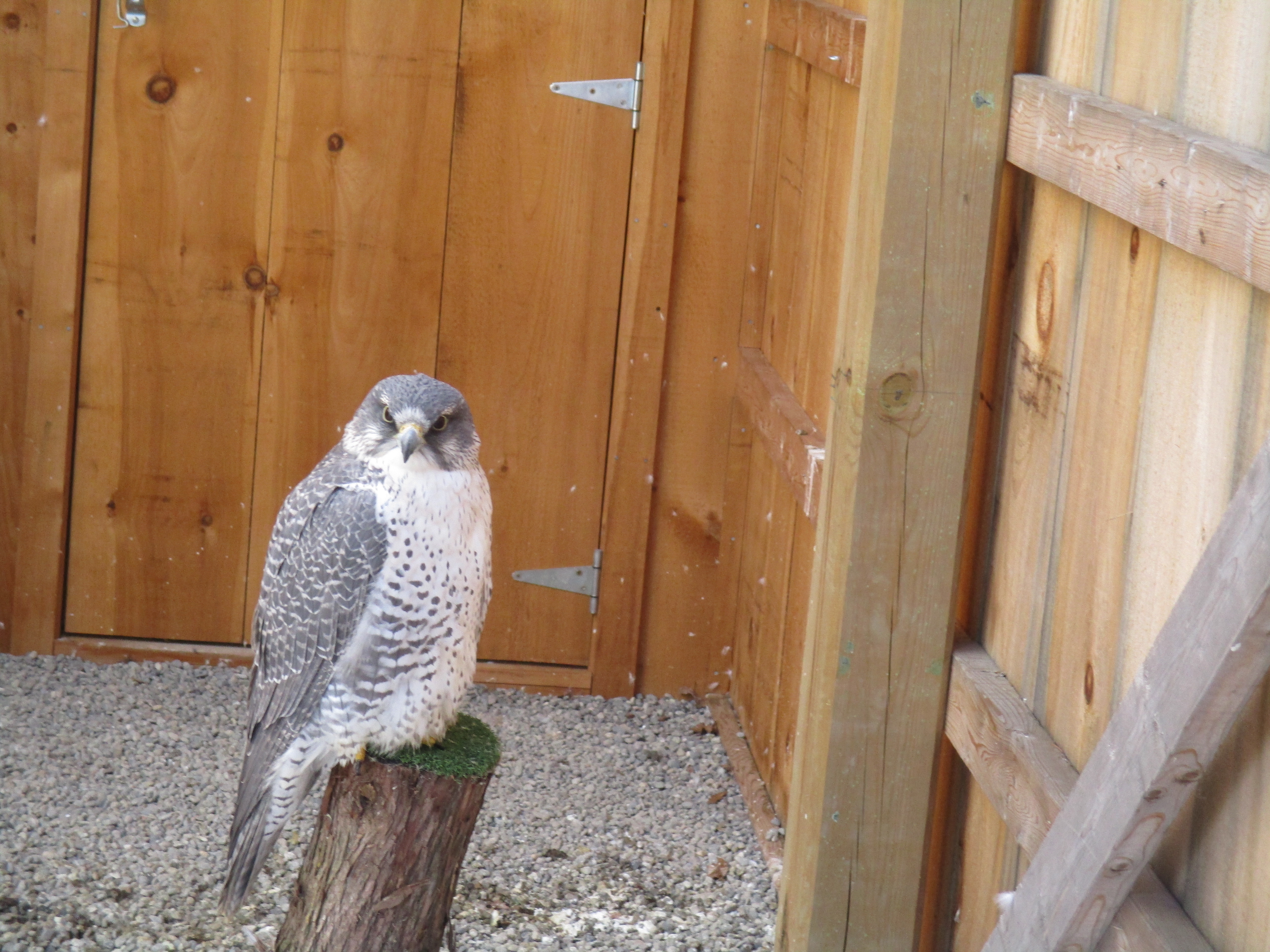
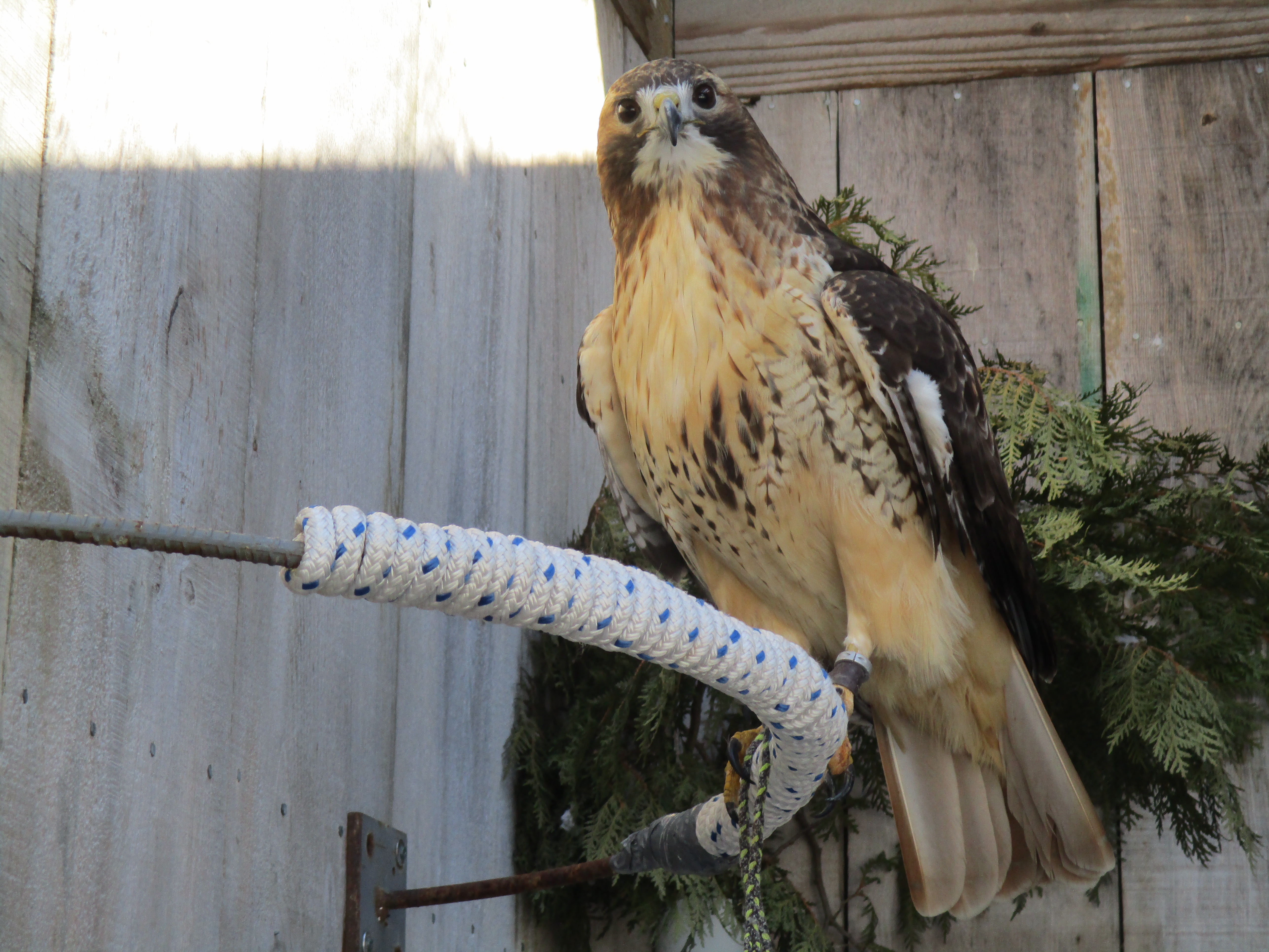
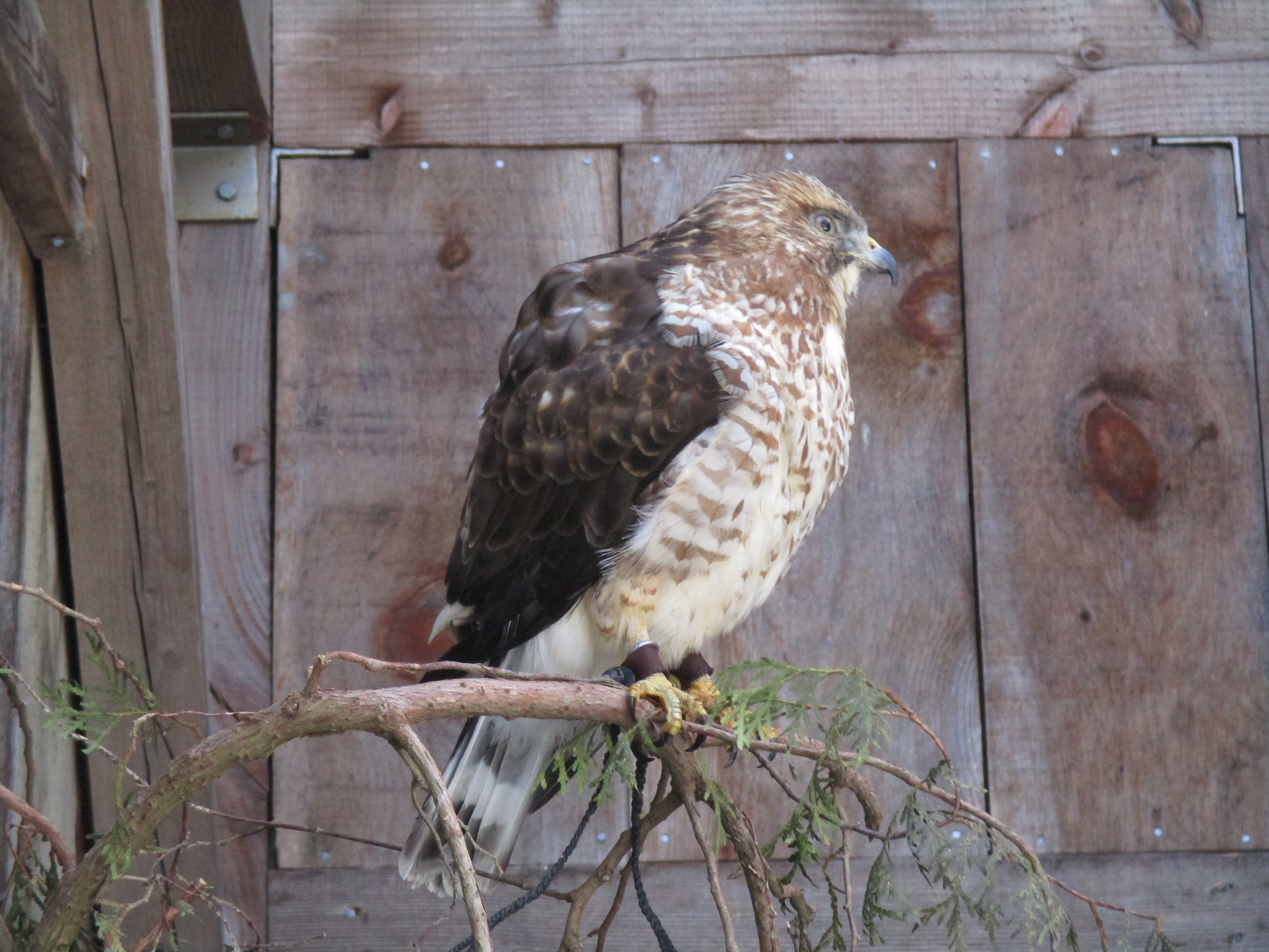
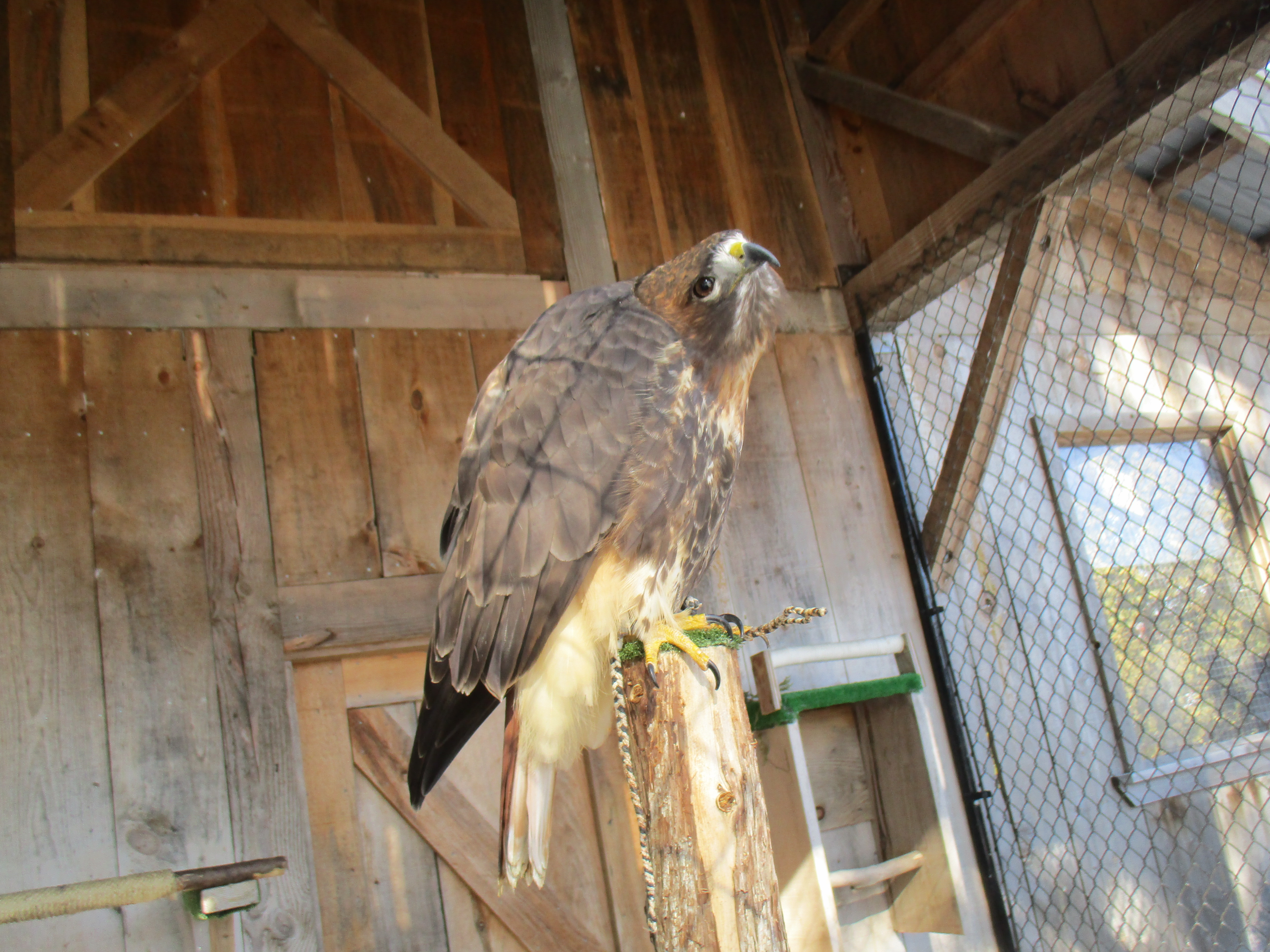
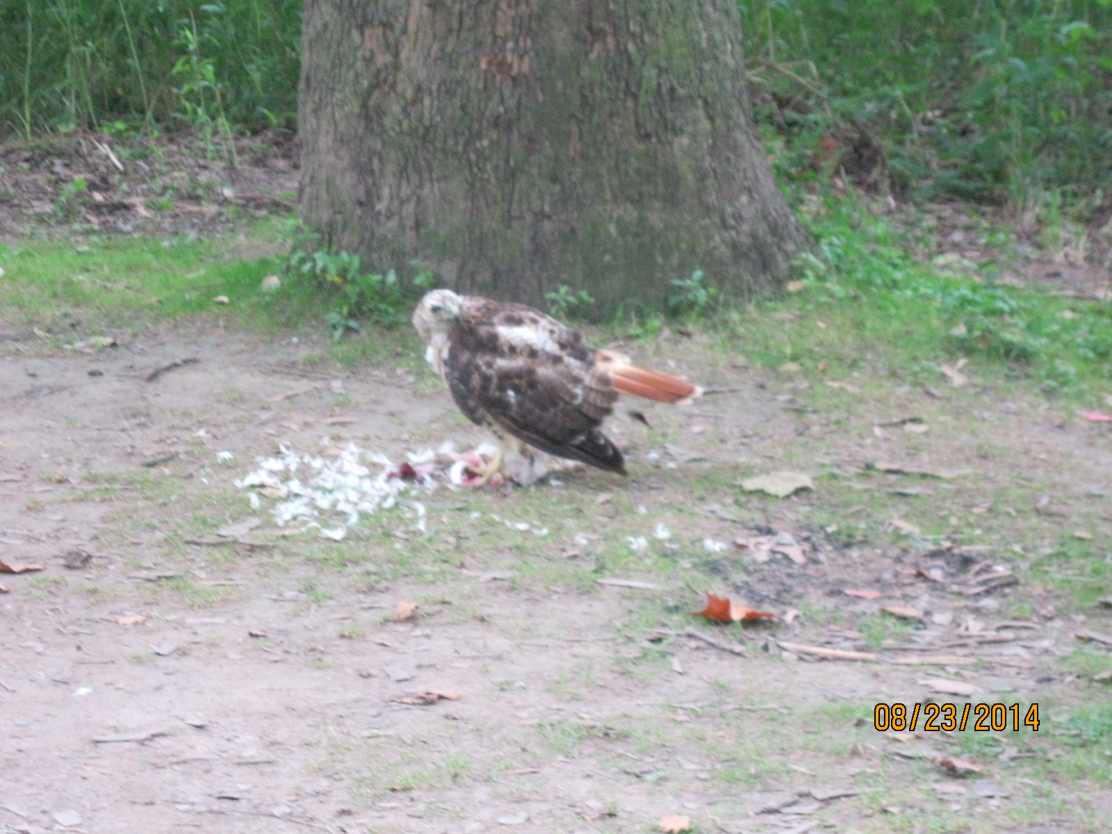
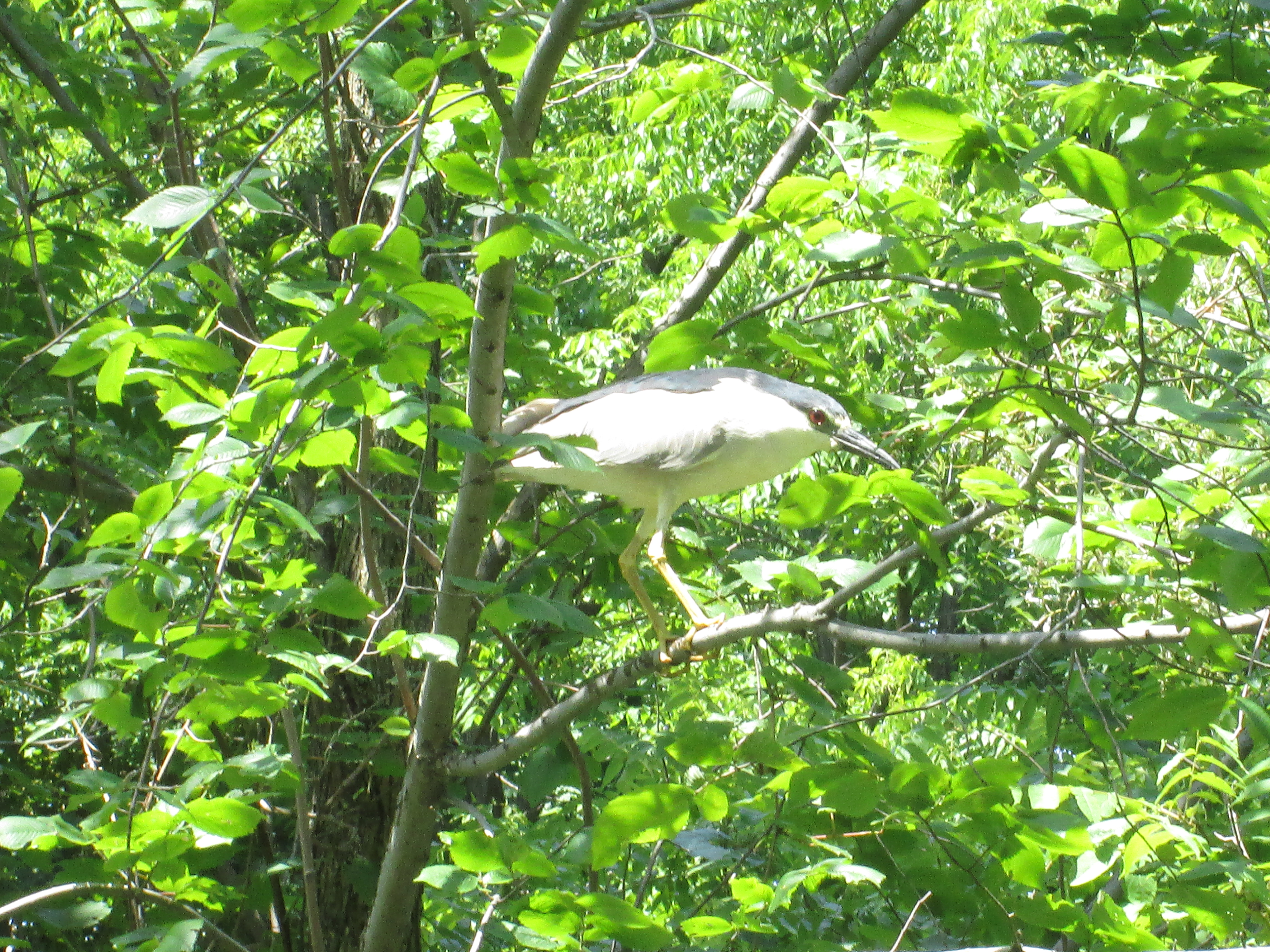
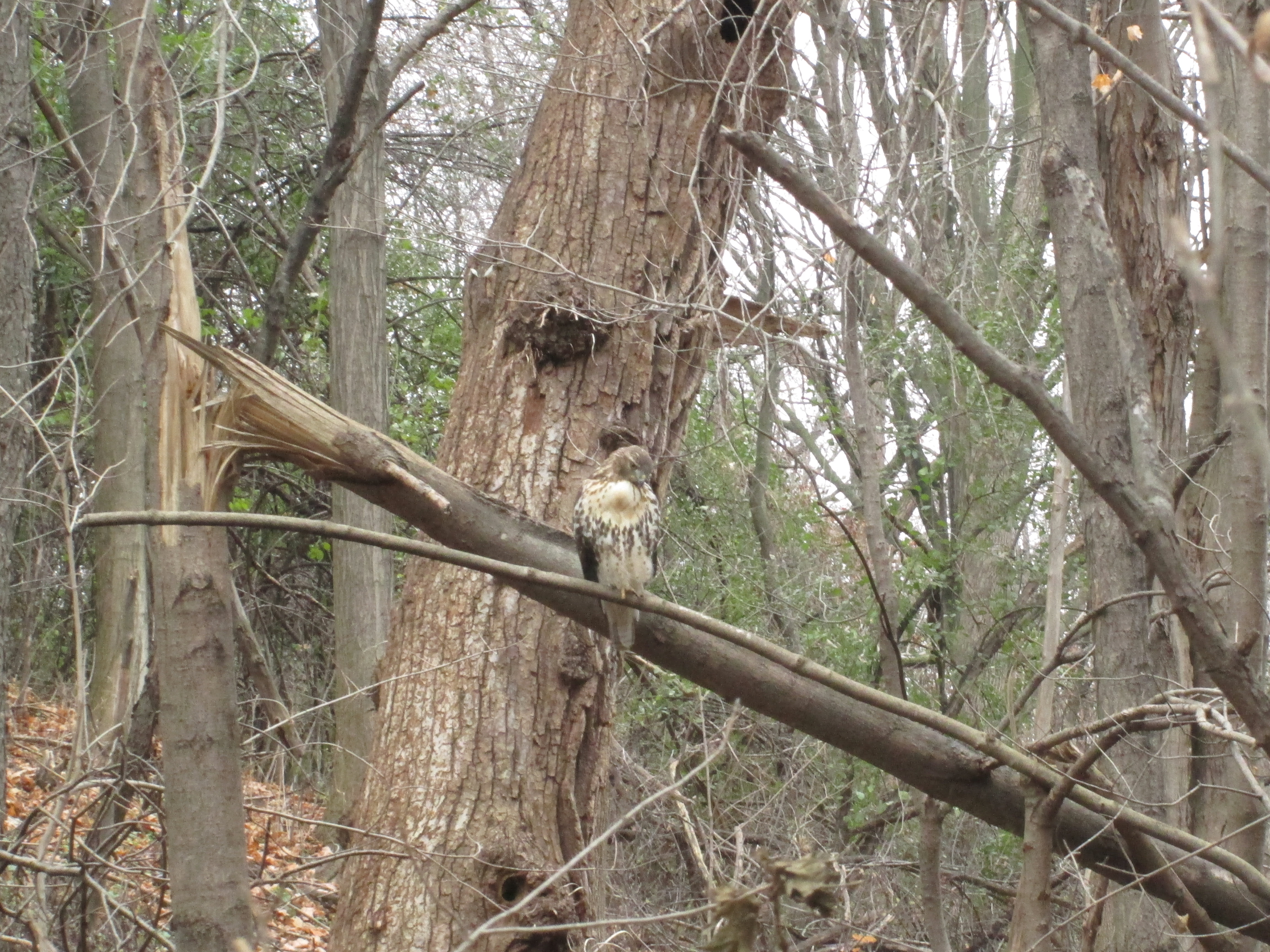
Hawks are one of the few animals with colour receptors in their eyes making them incredible hunters even at great distances. Their keen eyesight also allows them to be diurnal, hunting during both the day and night hours. They can take their prey from the air as well as off the ground and can dive at speeds up to 150 miles per hour to capture it. The one sitting in a large tree outside of Sovereign House allowed me to get pretty close before pooping in my general direction and flying off. Such attitude!

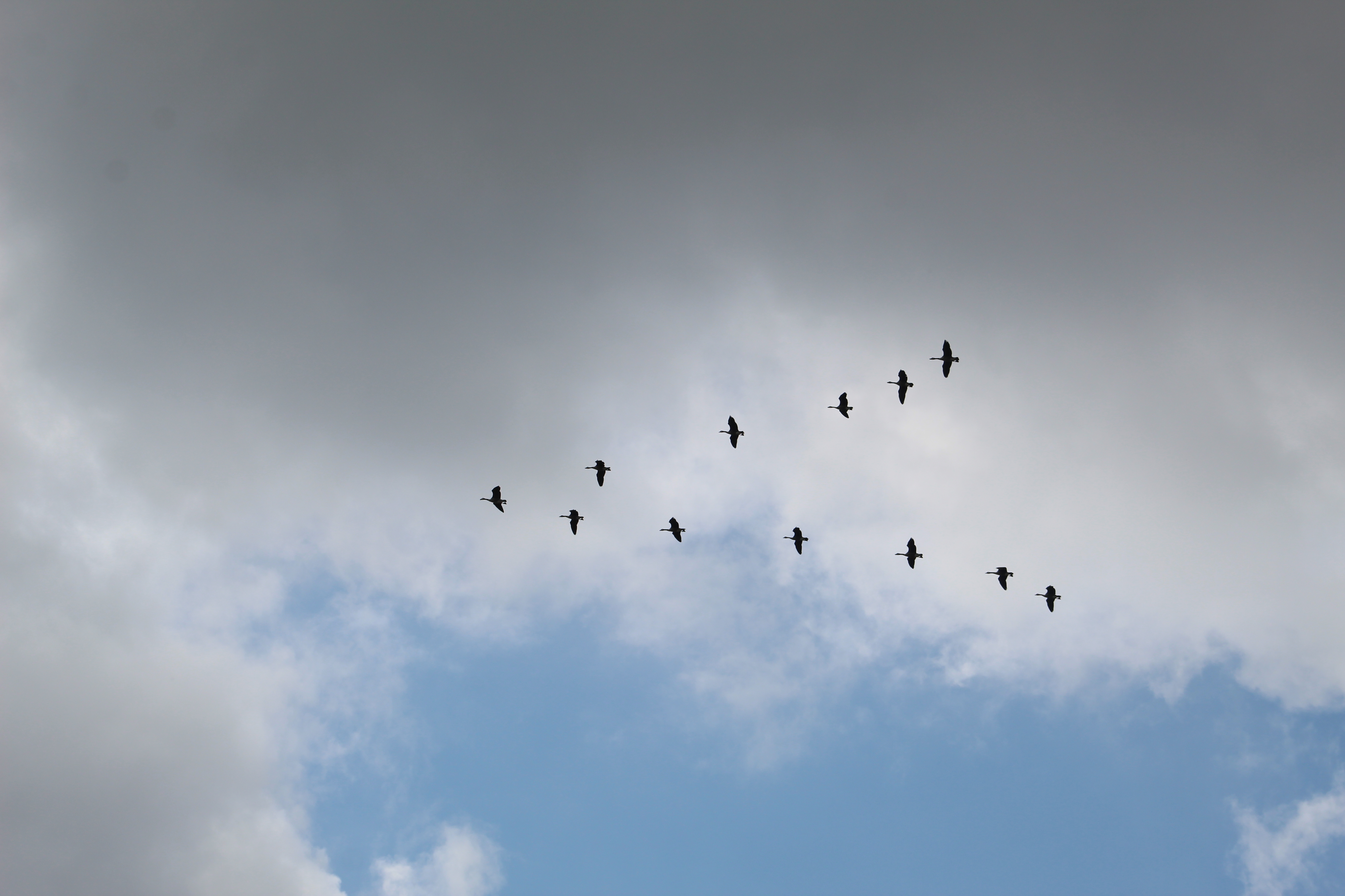
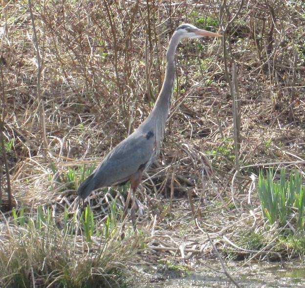
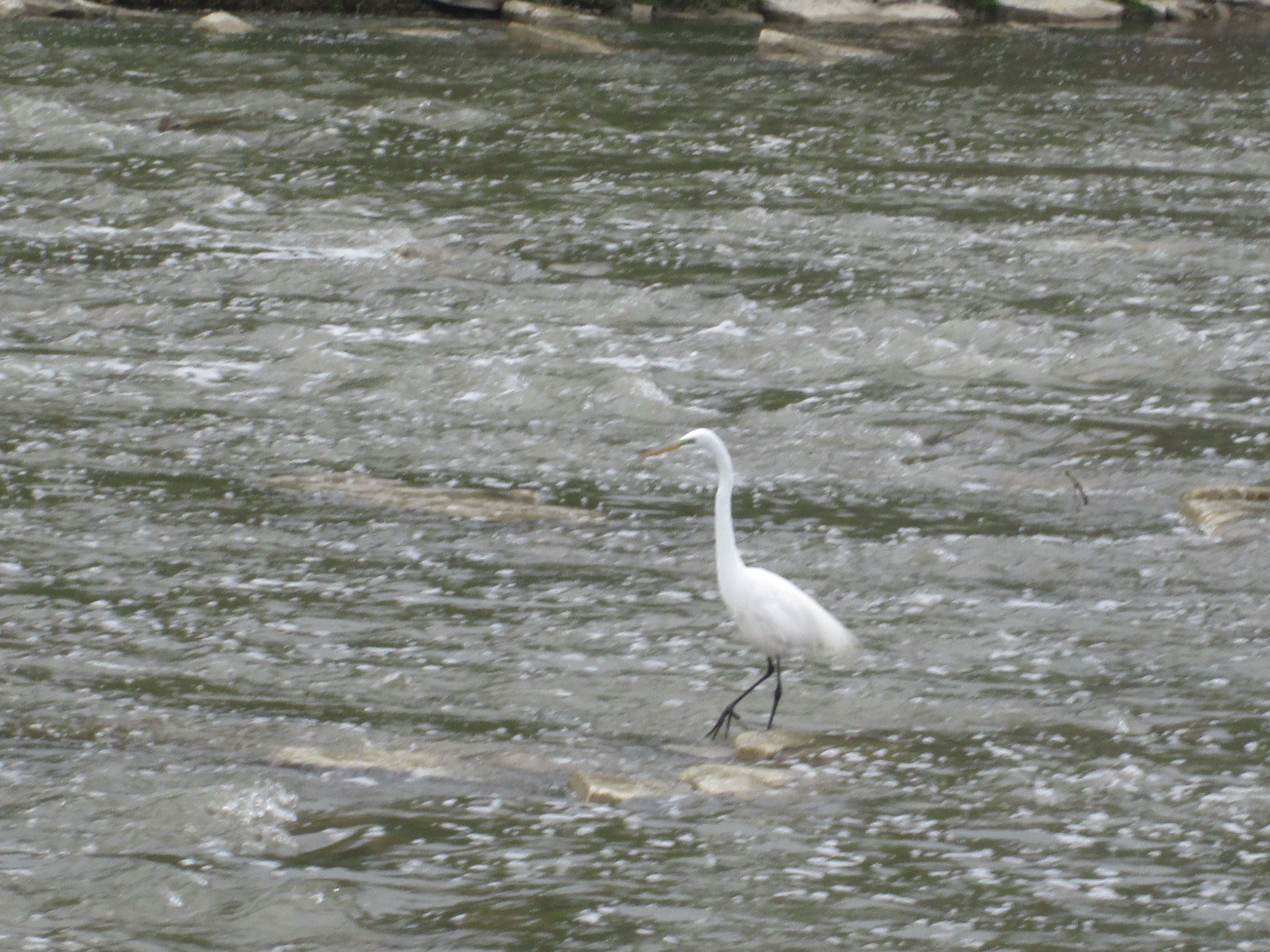
There were several swans on the lake and three of them were an obvious family unit. The cygnet, or baby swan, was still grey in colour and slightly smaller than its parents. Swans are not very graceful when they take off as they need about 30 yards just to become airborne and about that much again to achieve a safe height above the land or water. The picture below shows one just as it is landing.

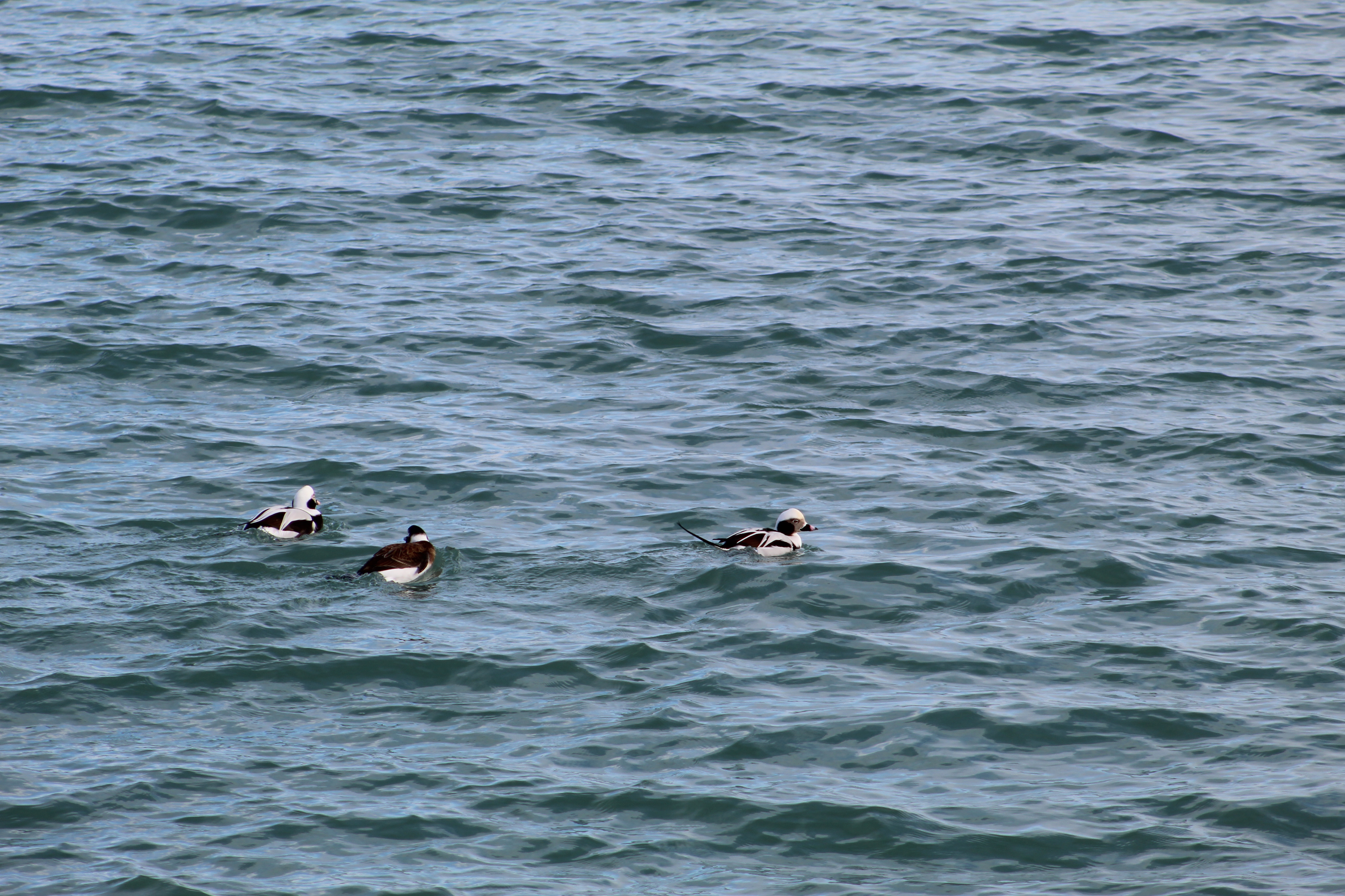
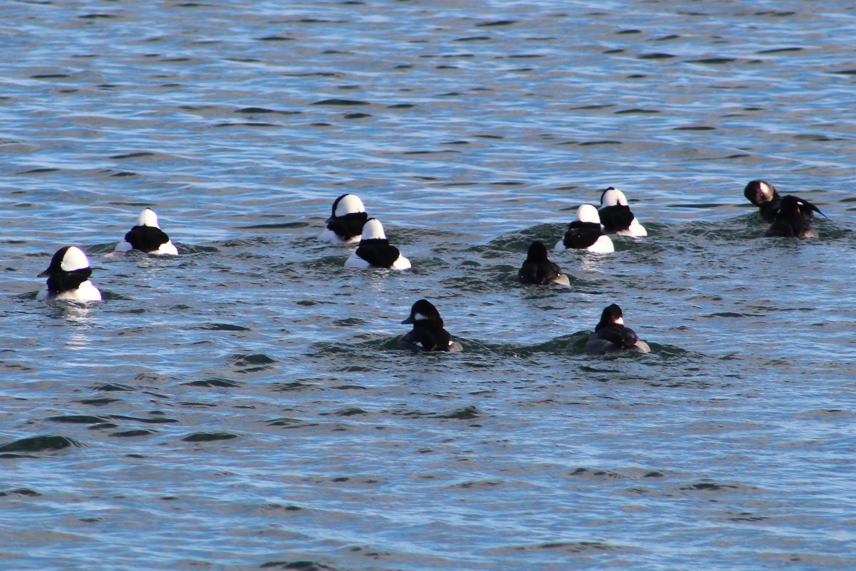
There was a small flock of Bufflehead ducks on the lake. These birds dive for their food and at times the entire group would disappear at the same time. The males have the large white patch that wraps around the back of the head while the females have a smaller white patch on the cheek.

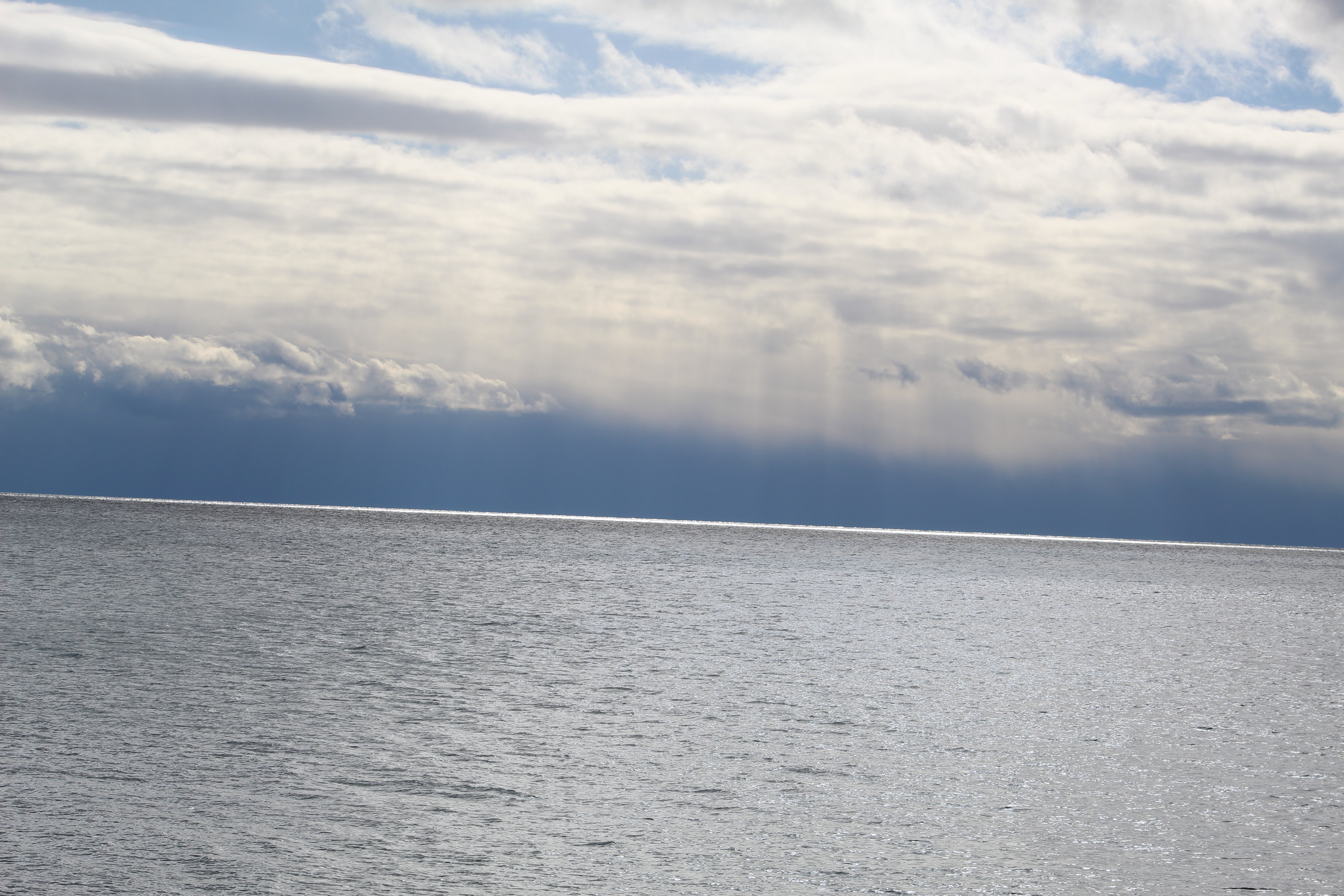
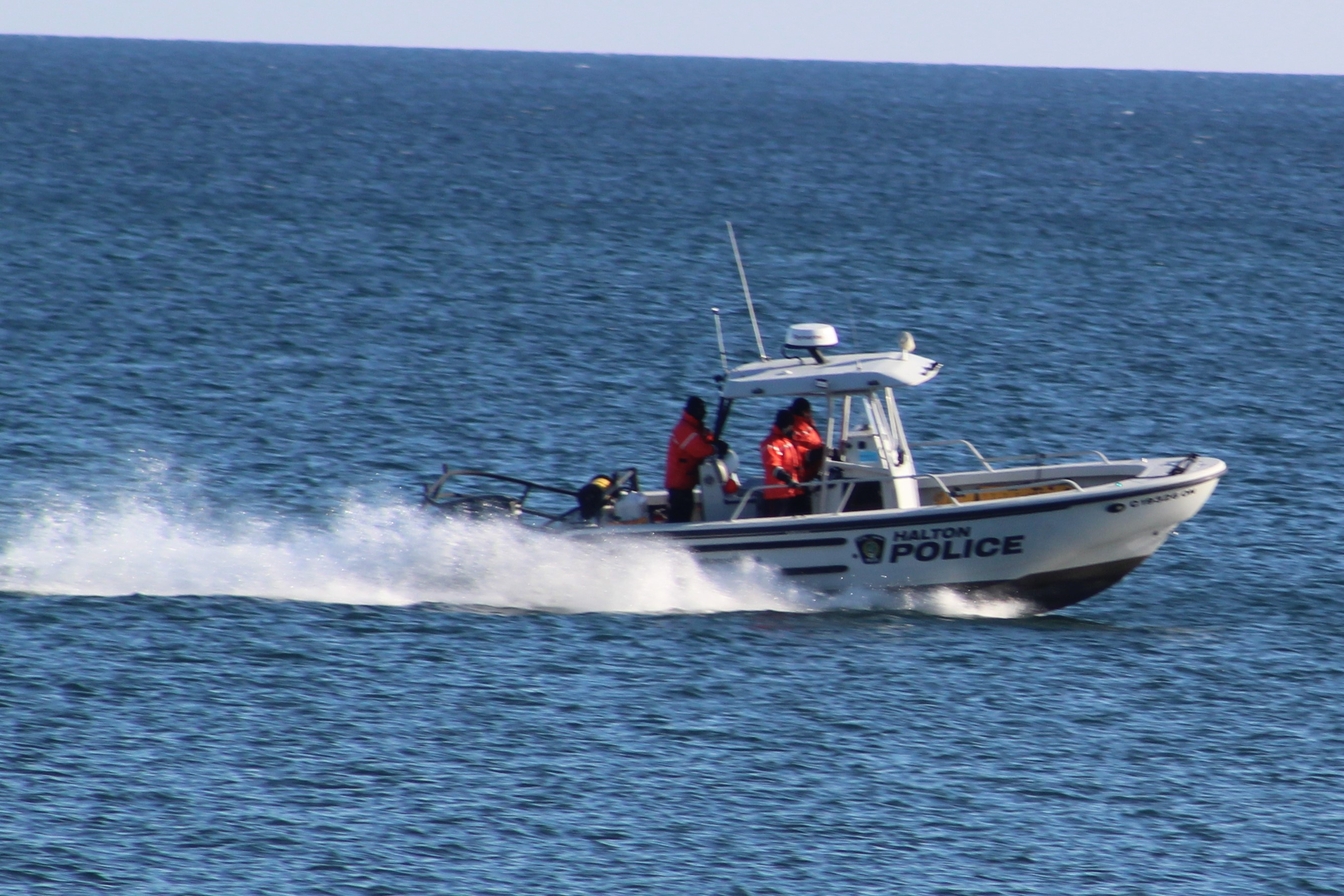
While we were watching from the top of the bluffs a young couple appeared on the beach below. They both dashed into the water but she only went about knee deep. He didn’t hesitate, diving in and getting completely wet. Except for those two people there was no one else enjoying the lake on this sunny day. Even so, the Halton Police were still out on patrol, perhaps looking for those people who froze while swimming.

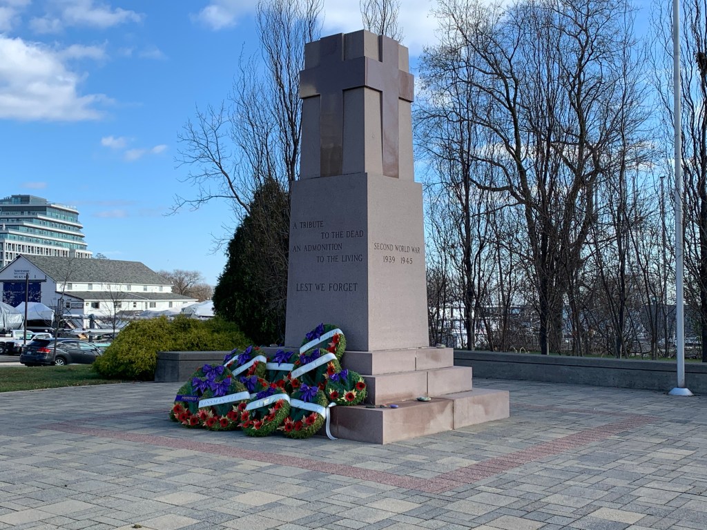
Chris Vokes Memorial Park is named after Major General Christopher Vokes who served Canada during the Second World War. He was from Oakville and passed away there in 1985. The war memorial in the park is dedicated to the soldiers who died in two World Wars plus the Korean War. It is actually the second war memorial to be built in Bronte, the first one being placed in 1956 at 2457 Lakeshore Road West.

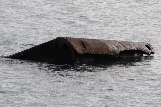
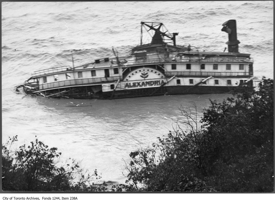
Bronte harbour was home to fishermen and stone hookers who provided much of the early industry in the town. Lake Trout, Whitefish and Herring were cleaned at the docks and packed into ice for shipping to the large city markets. Up to 22 fishing boats operated out of the harbour until the 1950’s by which time most of the fish stocks had been depleted. The stone hooking industry ended after 1910 when portland cement replaced stone as a primary building material for foundations. There are several information signs around Bronte describing the local history and there is one dedicated to the fishing industry as well.

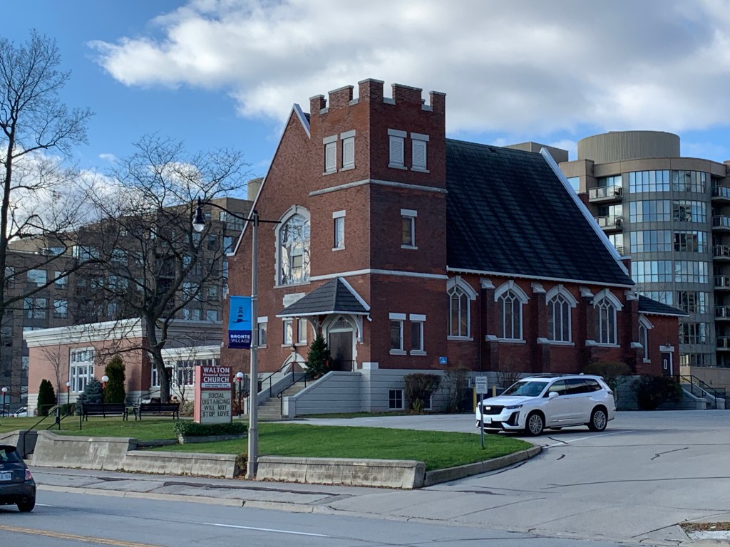
The Methodist Church sent missionaries to Upper Canada as both Primitive Methodists and Episcopal Methodists, often competing to both start a church in a community. The Episcopal church formed in Bronte and built a white structure of wood on the south side of Lakeshore. The two Methodist groups united in 1884 and a period of growth followed. By 1912 the church had outgrown its building and the next year a new brick building was opened across the street. Since this building was a gift from the Walton Family in memory of their father the church became known as Walton Memorial church. It has been part of the United Church since 1925.

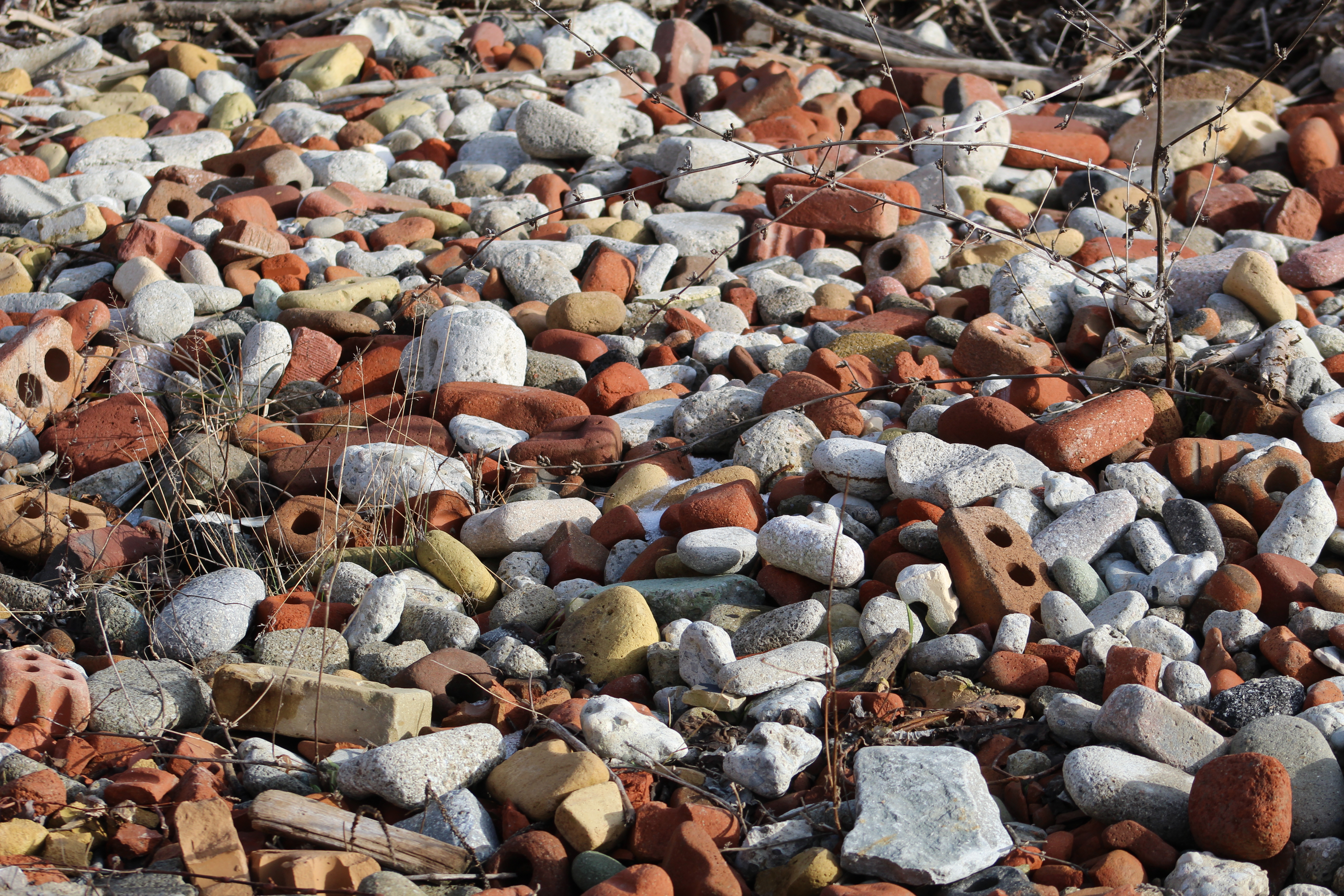
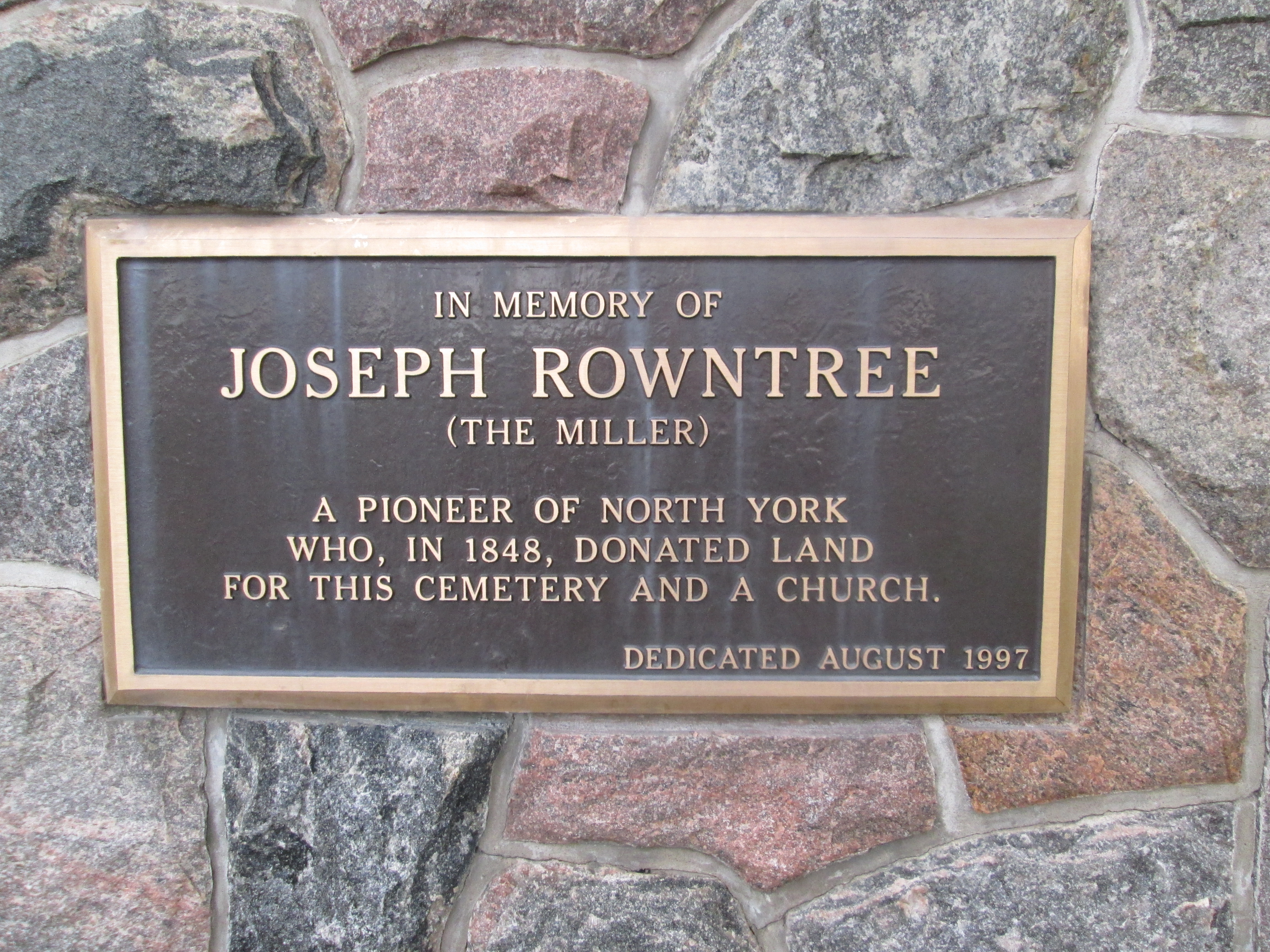
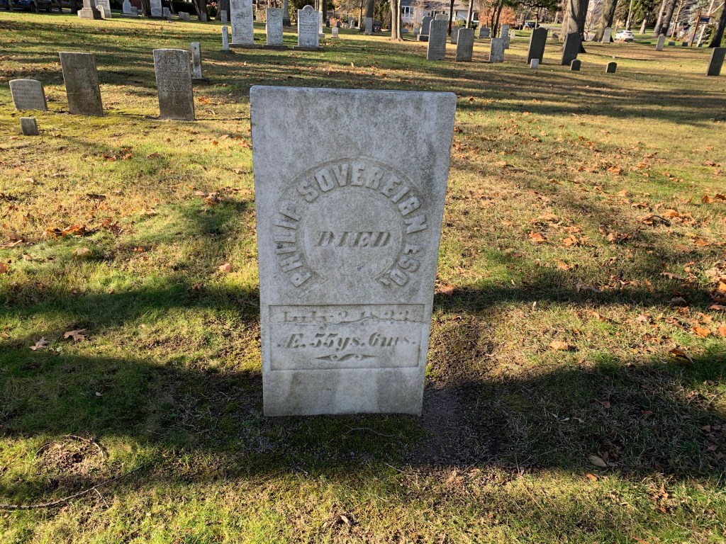
Bronte Cemetery is located on land that was owned by Philip Sovereign and both he and his son Charles are buried here. A large portion of the headstones in Bronte Cemetery commemorate those who drowned working in the fishing and stone hooking industries along the lakeshore. Ironically, some of those who drowned and were later recovered and buried may be among those whose remains have subsequently been lost to the lake. Over the years about 70 feet of the cemetery has been eroded into the lake as it relentlessly beats on the shore

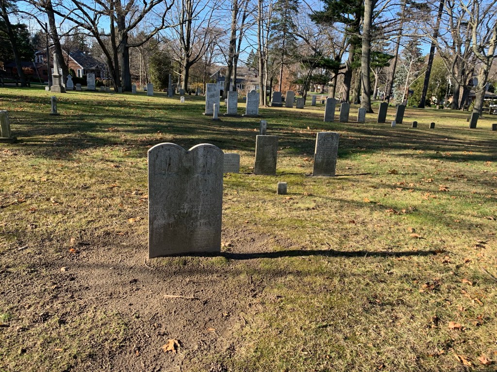
Philip Sovereign died in 1833 and was laid to rest in the cemetery he donated to the community.

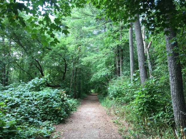
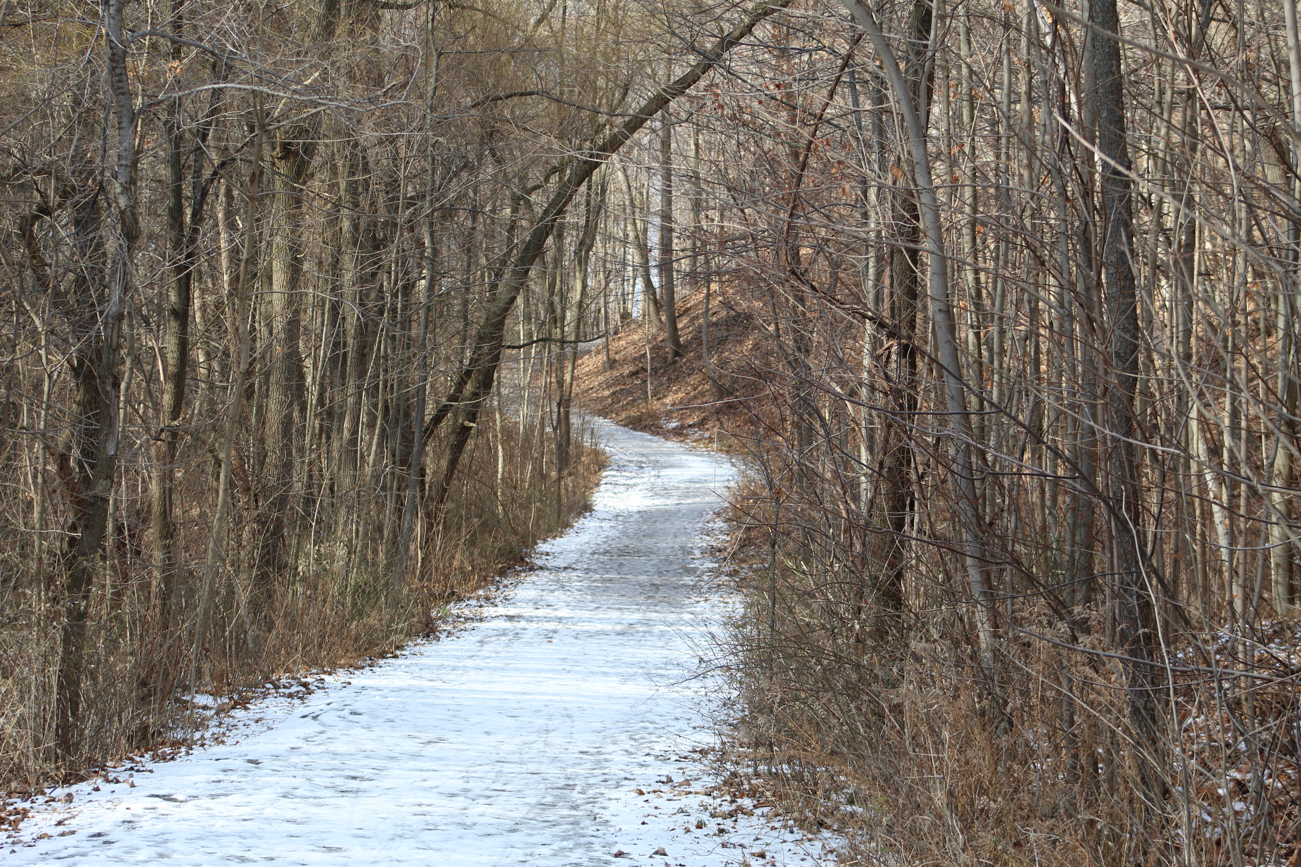
Bronte Bluffs Park made for an interesting visit and somehow you get the feeling that you may have just scratched the surface of all that is to be seen. Hmmm…

Related blogs: Scarborough Bluffs and Iroquois Shoreline Woods Park

Google Maps link: Bronte Bluffs Park

Like us at http://www.facebook.com/hikingthegta

Follow us at http://www.hikingthegta.com

Also look for us on Instagram

Cooksville Creek

Monday, September 1, 2019

Cooksville Creek in Mississauga has its entire watercourse within the city and in fact it even flows under Square One Shopping Centre.  Over the years it has come under great stress as a result of the changing nature of the watershed development.  With so much of the surrounding areas now paved over and developed the flash flooding of the creek has become a serious problem leading to erosion and property damage.  There are 304 buildings in the lower watershed that are subject to flooding in a 100-year event like Hurricane Hazel.  The city is currently implementing new flood control measures including widening of the creek bed south of Mississauga Valley Boulevard.  We found free parking at the Mississauga Valley Community Centre.  From there we went to explore the construction of the flood controls on the creek.

IMG_6500

The main flow of Cooksville Creek has been diverted into a pipe while they widen and deepen the channel.

IMG_1762

The woodlands on either side of the ravine are home to a large population of squirrels.  There is a constant food supply for them in the cone and nut trees and both black and red squirrels can be seen collecting food for their winter supply.  Having a good food supply for one species means that they will become a good food source for another predator.  We saw this red-tailed hawk sitting in a tree keeping an eye open for breakfast.

IMG_6621

The danger exists in the air from the hawks and on the ground from the coyotes.  The mud in the exposed creek bed has been crossed over many times with coyote tracks.

IMG_1763

The river grapes are starting to ripen along the sides of the trail.  The crop this year looks to be doing very well with lots of fruit for the wild animals to feed on.  Coyote feces that we see along the trail seems to contain a lot of seeds and fruit husks and this isn’t unusual in the summer and fall as they supplement their diet.

IMG_6602

The lower part of this reach was reworked a couple of years ago to increase stability of the sides and create retaining pools to hold the water during flood events.

IMG_6581

The transition point between the section that was completed and that which has not been touched recently.  Although some sections appear to be quite naturalized they have in fact all been subject to more than one repair since the creek was urbanized in the 1940’s.  Of the 14.9 kilometres of creek there are only 1.2 kilometres that are natural while there are a full 35 kilometres of gabion baskets which are failing.  The flood water has washed in behind them in places causing them to collapse into the creek, further diverting the flow and causing more erosion.

IMG_6584

The mallard ducks that were born this spring have now become fully grown.  We were enjoying watching them walk up the little waterfall in the creek.  Over the years the repairs to the stream have reduced most of the natural pools and riffles in the watercourse.  This is one of the places where the water gets oxygenated.

IMG_6597

It’s the last weekend of the Canadian National Exhibition which always features the famous air show.  On the way back home I would be treated to a squadron flying in formation on their way back to the airport.  Just as the airshow marks the end of the CNE and the unofficial end of summer, nature’s air show marks the return of fall.  We saw a gaggle of geese flying in the “V” formation that they use when flying south,  The strongest birds fly in front while the weaker ones follow in their wind currents.

IMG_6613

There are sections that have not been subject to heavy equipment in recent years.  The undergrowth in these areas is first generation of trees.  There are no large oak or maple trees that one would find in a succession forest.  Where the work was completed in the past few years there are newly planted trees that may some day provide a mature forest.  For now the trees are stripped back away from the edge of the creek so that there is no shade over the water.  This leads to higher water temperatures and destroys the habitats.  Cooksville Creek is essentially a dead creek with nothing but a few water skimmers in the upper reaches.  This loss of riparian vegetation is a contributing factor to the decline of the Red-Sided Dace in the past 30 years.  At one time they would have been populous in Cooksville Creek as they were in most GTA waterways.

IMG_6493

At this time you can’t walk the entire course of Cooksville Creek due to the construction work.  We went through anyway and although it was a holiday Monday there was someone on site who ignored us.  Once you get south of the railway tracks there is a large green space that was formerly occupied by several homes.  This is an interesting place where you can find foundations and driveways that are being overtaken by the new growth of vegetation.

IMG_6499

This area was accessed by Given Road which we have previously described in a post that can be found at the link above.

IMG_1684

Cooksville Creek is a real mess today and you wonder how it can ever recover.  However, if you look closely, every ravine has a set of sewer access points that are dated from the 1950’s and up.  These remind us that there has been heavy equipment in the ravines before and since the infrastructure below will need maintenance at some point, there will be again.

Google Maps Link: Cooksville Creek

Like us at http://www.facebook.com\hikingthegta

Follow us at http://www.hikingthegta.com

The Alexandria

Sunday, January, 6, 2019

There are estimates that over 6,000 ships have sunk in the Great Lakes.  Lake Ontario seems pretty calm but it has claimed over 200 ships since the arrival of Europeans.  One of those lies near the shore at the foot of the Scarborough Bluffs.  As it is the only one that can be easily located, it makes a great place to connect with a piece of our local history.

There weren’t very many birds out on this day but I did see a couple of  red-tailed hawks. One of them was hunting along the edge of the bluffs, riding the wind as it looked for food.

img_0569

The Doris McCarthy Trail runs from free parking on Ravine Drive down to Lake Ontario.  It descends about 90 metres over a length of 900 metres, making it a fairly steep trail.  The trail runs through a ravine known as Gates Gully which has a number of historical features, including the allure of buried treasure.  The trail gives great views of the lake as you make your approach to the beach.

img_0520

Sections of the beach trail can be pretty muddy but I think that is preferable to a shingle beach of eroded bricks.

img_0523

The Alexandria was a steamer built in Hull, Quebec in 1866.  The 508 ton vessel was over 170 feet long and 30 feet wide.  It was built as a freighter and later had passenger decks added in Montreal.  It worked the route along the north shore of Lake Ontario, occasionally making trips to Rochester, New York.  On this fateful night the ship was carrying 300 tons of sugar, beans, vinegar and tomatoes.

Wreck of the ferry Alexandria, Scarborough Bluffs. - August 2, 1915

On the afternoon of August 3rd, 1915 there was a storm raging with heavy winds blowing along the shore of the lake.  The steamer was blown closer and closer to the Scarborough Bluffs until it ran aground 200 yards from shore and began to sink.  Her crew of 22 was rescued and led to safety up Gates Gully.   The remains of the Alexandria are rusting badly and you can now see through several layers of metal near the waterline.  Eventually the parts of the ship that remain above water will rust away and slip into the lake leaving little trace of the majestic ship that lies below.

img_0539

For the next two days souvenir hunters scoured the beach carrying away anything that could be put to use.  Many people were able to fill up their pantry with food from the wreck.  Due to the extreme damage the ship had taken it was decided that there was no point in doing any kind of salvage work.   There is a lot of ship still below the waterline and in the 1930’s it was very popular to go diving around the wreck looking for artifacts.

img_0550

Waterbirds are common along the shore of the lake.  Mallards and Canada Geese can be seen on almost every visit.  Sometimes you get to see some of the less common ducks and there was a trio of long-tailed ducks swimming near the sunken steamer.

img_0540

This section of the bluffs is continuing to erode and the shore line has not been completely modified with armour stone.  This is one of the few remaining “natural” sections of the bluffs and we hope that current plans to modify it don’t come to pass.  Near the top of the bluffs a sign warning people to keep back from the edge because it isn’t stable, has itself fallen over the edge.

img_0534

The sky looked like our neighbours on the south side of the lake might not be having quite as nice of a day as we were.

img_0547

The view along the side of the bluffs is always interesting and ever changing.  It makes it worth returning time and again.

img_0561

The thing about visiting a site at the bottom of a hill is the certainty that you will have to climb back up.  With the slippery footing this was an interesting challenge.  In the summer this trail is a great place to jog or bike uphill to increase your stamina.

img_0577

The Scarborough Bluffs are a unique geological feature that we get to enjoy in the GTA and one of my favourite places to pass a few hours and enjoy being outside.

Google Maps Link:  Gates Gully

Like us at http://www.facebook.com/hikingthegta

Follow us at http://www.hikingthegta.com

Downsview Park


Saturday, November 3, 2018

One of the GTA’s newer parks, Downsview Park is 291 acres of the former Royal Canadian Air Force Station Downsview.  Last weekend we had investigated William Baker Park where a housing community had been built by the military.  The woodlot has been preserved and can be seen as a rare original woodlot on the county atlas map below where it is circled in green.  A detailed history of the military operations at the site can be found in a link at the end of this post.  Many of the properties seen on the 1877 map were taken over for the air base including the property  which is shown as Edward Boake (spelled Roake on the atlas).  His homestead is circled in brown and shows the headwaters for the small creek that was used to form the lake in the new park.  The atlas also shows two tollgates on what would become Dufferin Road.  These tolls were levied on users of the plank road that had been built along this concession.  More on the plank road can be found in this post.  Beginning in 1995 plans were developed to turn the former air force base into a series of new residential communities and a new urban park to be called Downsview Park.

Downsview Map

Several generations of the Boakes family farmed the family homestead before having it expropriated by the military for the air force base.  The home stood until around 1962 when it was demolished.  A few lines of mature trees in the new urban forest mark the outline of the front yard of the home.

IMG_8432

Forty-five acres are planned for urban forest in the park.  The heart of this is the Boakes Grove which contains many mature trees but is not a mature forest.  Most of the area around the Boakes home was open fields with just a few trees along the lane and fence lines.  Silver Maples, Walnut and Black Locust are common here but most of the trees are very small and will mature into a nice forest over the next couple of decades.

IMG_8438

The soil in the park was heavily compacted and full of pollutants and needed remediation before planting could begin.  The soil was churned-up to a depth of 60 centimetres to loosen it up and provide aeration.  Then, a 10-centimetre layer of composted leaves was spread on top to provide nutrients for growing the urban forest.  Volunteers and community groups have planted thousands of trees in the park.   There are 45 acres of parkland set aside for the urban forest which will mature over the next 40 years becoming a dynamic biosystem.

IMG_8454

At the very heart of Downsview Park is a 9-acre lake that has been built as an integral part of the water system in the park.  The lake is the final step in a water purification system to ensure the water is clean before it is discharged into Black Creek.  The park has been graded to direct the flow of storm water and slow it down so the ground has time to naturally filter the water.  It passes through a series of bioswales and filtration ponds.  Finally it flows into the pond which is normally about 3-metres deep but which can rise and additional metre during storm events.  The lake has a circuit path that allows you to stroll around the edge as you watch for the multitude of birds that call the park home.  The lake sits on the headwaters of a tributary of Black Creek and can be seen marked in blue on the county atlas above.

IMG_8443

A row of mature maple trees in the middle of a field has a story to tell.  The lake is brand new and most of the other trees are very young.  When this was an active farm run by generations of Boakes trees didn’t grow in the middle of crop fields.  Fence lines always provided a few feet of growing room and trees that got started there were left to grow.  This particular line of trees marked the southern property line of the Boakes farm.

IMG_8461

The orchard in Downsview Park is rather recent compared to the one that is shown on the property in the county atlas.  Many of the original settlers planted orchards to help feed their families.  Many of these early orchards still exist, at least in part.  One of the better preserved ones can be found in Erindale.  The original orchard on the Boakes property was, as usual, close to the house.  The community orchard in Downsview Park was started in 2012 when 200 fruit trees were planted.  A second major planting in 2017 has brought the total to over 400 trees.  Apples, plums, apricots and pears now grow here to educate the community.  Other gardens are scattered around the pavilion including a patch of blueberries that are not very common in the GTA.

IMG_8467

The land was originally chosen by de Havilland because it was flat and therefore suitable for aircraft manufacture because it could support a runway.  Flying aircraft from the facility to their new owners is the most practical way to deliver the product to the end user.  A large mound has been made, partially with soil excavated in the construction of the lake.  An unofficial path leads up the side of the mound.

IMG_8474

Climbing the mound gives you a panoramic view of the park and the city.  Lake Ontario can be seen in the distance as you look south.  The picture below looks toward Keele Street and the man-made lake.

IMG_8475

There is plenty of wildlife in Downsview Park.  This red-tailed hawk was seen along with a Cooper’s Hawk and a dozen smaller birds as we made our way around the park.  Deer, coyote and a host of smaller mammals can be found throughout the woods and grasslands.  This picture was taken the day before and shows the industrial buildings in the south of the park.

IMG_8312

A gaggle of geese has gathered on the open field near the old central heating plant.  Most of these geese will fly south for the winter but in this era of milder winters we are seeing more birds remain behind.  Sometime they have a real struggle for food in the winter however, please don’t feed ducks and geese with bread.  They don’t digest it and it bloats in their stomachs.  This fills them up and prevents them from eating food which they can get nutrition from.

IMG_8482

For the smaller children a new playground has been added with several aviation themed toys including a small airplane.  The concrete pad around the playground has been painted to simulate a runway.  Windsocks are commonly used at airports to provide visual clues to pilots concerning wind direction and strength.  According to Transport Canada regulations the design of a windsock should cause it to perform consistently.  A wind speed of 15-knots should fully extend a windsock.  At 10-knots the sock should be about 5 degrees below horizontal, as the ones pictured below are.  If the sock is 30 degrees below horizontal it means the wind speed is 6-knots.

IMG_8508

This concludes our current series on Downsview Park.  Click on the link for the story of the officer’s housing and the William Baker Woodlot.  For the history of RCAF Downsview before the creation of the park you can click on the link above.

Google Maps Link: Downsview Park

Like us at http://www.facebook.com/hikingthegta

Follow us at http://www.hikingthegta.com

Mountsberg

Saturday, February 18, 2017

Mountsberg Conservation Area covers 472 hectares of which 202 are covered with a water control reservoir.  Since 1994 the park has featured a Raptor Centre which is home to a collection of 15 birds of prey.  Horses and sheep call the farm home along with bison and elk.  There’s also a play barn for the kids to enjoy and a Maple Syrup festival in the spring. Sixteen kilometres of hiking trails criss-cross the park and allow you to experience the abundant wildlife.  There is a $7.50 fee per car and you have to put it into an envelope so be sure to bring correct change or plan to make a donation.

Archibald (Archabald on the County Atlas below) Cameron moved from Perthshire in Scotland in 1833 and settled on 100 acres of land.  His son, Duncan bought the property adjacent to his and Donald purchased two parcels of land next to these.

cameron-farm

Duncan Cameron purchased the 100 acres to the east of his father’s lot and started his homestead there.  In 1857 he built a stone house and a barn, both of which remain today. The house has an odd window on the second floor which was shaped like a simple diamond.  The county atlas shows how close to the house the Credit Valley Railroad was constructed when the Milton line was extended to Galt in 1879.  The Duncan house remained in the family until James Cameron, Duncan’s son, passed away in 1962.  The farm changed hands a couple of times and was purchased in 1964 by The Halton Region Conservation Authority.  They built the dam in 1966 and the Wildlife Centre in 1974.

img_6381

Near the barn is an observation tower which looks out over the Mountsberg Reservoir. Bronte Creek was dammed and the reservoir has since been stocked with fish.  Bass, Pike, Crappies, and Perch can all be caught in the shallow waters.  The former Credit Valley Railway crosses the reservoir on a berm that previously passed through a farm field.  The lower section of the reservoir has been drained for the winter.

img_6408

On the north side of the tracks, just east of the house are the remains of the family lime kiln.  It was built shortly after the house, likely around 1860, for the use of the family. Limestone was common in the area and settlers would load it into a set kiln like this one. Wood was packed around it and burned for several days until the limestone was broken down.  The limestone was broken into lumps around 2 inches in diameter and layered into the kiln along with the fuel.  It would take about a day to load the kiln and then it burned for three days.  After two days of cooling down, it could be unloaded and the lime separated from the waste.  Lime was used in the making of soap as well as construction materials.

img_6362

The first Earth day took place on April 22, 1970.  Since that time it has grown into an international event that takes place in 193 countries around the world.  In 1990 Earth Day 20 was celebrated and in Mountsberg Park the Plant-A-Tree program contributed the small forest on the north side of the train tracks, across from the Cameron House.  These trees are doing quite well a quarter century later.

img_6375

The Raptor Centre at the park is home to many birds that have been rescued locally and are incapable of survival in the wild.  The Great Horned Owl on the cover photo is one of two in the park.  These owls have a grip ten times as tight as that of a human and talons that can hold with as much as 200 pounds per square inch force.  They are known to take prey that is up to three times their weight and this includes skunks, opossums and even other raptors.

The Gyrfalcon, seen below, lives in arctic and sub-arctic regions and is rarely seen in Southern Ontario.  This is the largest of the falcon species with the females weighing up to two kilograms.  Their diet contains mostly of other birds including ducks, gulls, and geese but they also enjoy lemmings and hare.

img_6305

Rough-legged Hawks are the only hawks in Ontario that have feathers on their legs extending down to their feet.  It weighs about a kilogram, with the female being slightly larger. They are a northern bird and live mainly off of small rodents like voles and lemmings. They can be occasionally be seen in Southern Ontario during the winter.

img_6290

Broad Winged Hawks live in large forests and prefer small rodents for their prey as they only weigh about 500 grams themselves. They are relatively small among the hawk family but congregate in large flocks known as kettles in the fall to migrate south for the winter. A kettle of broad winged hawks can contain up to 1000 birds

img_6284

Takenya is one of two red-tailed hawks at the centre but she sits up and pays attention when you call her name.  One of the trainers suggested that the birds don’t actually know their names but as the picture below shows, she would turn her head and stare right at you when you call her.

img_6265

American Bison, often called Buffalo in error, are kept on the farm.  As we approached they moved across the field but soon returned to stand by the fence.  The largest of the five already had a broken horn and was clearly guarding the smaller ones.  It routinely stood between me and the smallest one so getting a picture was quite difficult.  I wasn’t sure if it was my red coat or the imminent arrival of the ladies with the food buckets that had their attention but after feeding they went for a run around the pen.  They can reach speeds up to 60 kilometres per hour.

img_6231

Mountsberg has extensive hiking trails as well as the dam that are yet to be explored.  This is a park that will require more than one visit.

Our top 15 stories are previewed here.

Google Maps Link: Mountsberg

Like us at http://www.facebook.com/hikingthegta

Follow us at http://www.hikingthegta.com


Hiking the GTA #100 – Amazing Animals

April 28, 2014 to July 18, 2015

Presented below is a gallery of animal pictures taken during the first 100 hikes on the Hiking the GTA adventure.

On July 21, 2015 I published my 100th post in this blog under the title Hiking the GTA #100 – Greatest Treks.  That post looked back at the creation of Hiking the GTA and listed the top 15 hikes as determined by activity on WordPress.  This post presents some of the amazing animals that we encountered along the way.  By hiking quietly and keeping off of the beaten path you have the opportunity to come face to face with some of the wide variety of wildlife we share our parks with.  Most of the animals are more afraid of you than you are of them and will disappear quickly.  In reality some of the plants in our parks are more dangerous than the wildlife.  The following pictures are in the order in which I took them except that I saved my personal favourite for last.  Links to the related articles are provided where additional descriptions of the animals are presented.

This White Tail Deer buck was following me through the woods along Wilket Creek on June 22, 2014.  This was the only creature I saw all year that made me nervous as I’m usually the one doing the following.

IMG_2389

The little baby Cross Orb Weaver spiders in this picture are just hatching and look like grains of pepper leaving the egg sac.  The mother spider had previously brought a Daddy Long Legs spider into the web to provide a breakfast to the hatchlings.  Seen near Middle Road Bridge on Aug. 16, 2014

IMG_2944

This Red Tailed Hawk was feasting near Barbertown on Aug. 23, 2014.

IMG_3098

Also seen in Barbertown was this Dekay’s Brown Snake on Aug. 23, 2014

IMG_3021

The Monarch Butterfly below was seen at the forks of the Don on Sept. 14, 2014.

IMG_3361

Spadina House has it’s own resident fox as photographed on Dec. 21, 2014.

Spadina 74

This Snowy Owl was seen at the Adamson Estate on Jan. 24, 2015

IMG_2092

This coyote was photographed in West Deane Park on Jan. 31, 2015

???????????????????????????????

The beaver in this picture was seen in Etobicoke Valley Park on Feb. 28, 2015

IMG_2663

This White Egret was fishing near the dam at The Old Mill on May 10, 2015.

IMG_4287

The Red Breasted Grosbeak below was photographed in Norval on May 16, 2015.

IMG_4404a

This Trumpeter Swan, complete with tracking tag, was seen at the mouth of the Credit River and featured in The Ridgetown – Port Credit on May 23, 2015.

IMG_4755

This Black-crowned Night Heron was published in The Forks of the Credit – The Stone Cutter’s Dam on July 18, 2015.  Unlike the Great Blue Heron in the cover photo it does not have long legs and neck.

IMG_6600

Hiding in plain sight in the picture below is a new born White Tail Deer Fawn.  This is my favourite picture of the past year and was taken near the Barber Paper Mills on June 6, 2015.

IMG_5361

This is just a sample of the some of the amazing animals we saw on our journeys in the first 100 hikes in this blog.  Many others were featured and many more will yet be photographed on future hikes.

visit us at http://www.facebook.com/hikingthegta

Rowntree Mills

Saturday, Nov. 8, 2014

It was overcast and 5 degrees with occasional light drizzle.  Parking is available on Hathor Crescent just before Rowntree Mills Road descends the hill to the river.  The road is closed at the bottom of the hill and from here the bridge across the Humber river can be seen.  The bridge is a steel girder construction and has been fitted with new wood decking to convert it into a safe pedestrian bridge.  It’s construction likely dates to around 1900.  The bridge can be seen crossing the river in the lower corner of the cover photo, which is an aerial shot from 1953. The photo below of the bridge is taken from the west bank of the river.

IMG_0923

Joseph Rowntree arrived in Canada from England in 1830 and set himself up in an area known as Pine Ridge, just outside of Thistletown.  In 1843 he built a saw mill on the east side of the Humber river and in 1848 he built a grist mill on the west side.  A road was built to access the mill which we now call Rowntree Mills road.  A bridge was built across the river and he named it all Greenholme Mills.  In 1870 Joseph added the Humberwood Mills, a mile down river, to the family holdings.  The cover photo shows the grist mill as it appeared in 1953. Rowntree Mills road crosses the bridge and passes to the west of the mill.  A laneway completes the loop on the river side of the mill.  Today the area where the mill stood 60 years ago has become completely overgrown.  All that could be found was this square area of concrete in the woods and many piles of bricks, stone and concrete.

IMG_1017

From the east side of the river the former mill site can be identified by the row of pine trees that ran along side of the lane way that lies between the mill and the river.  They show up as the dark strip to the right of the road, adjacent to the mill, in the cover photo.  I can picture Joseph planting these pines along the ridge in honour of the community of Pine Ridge where he lived. The mill stood about 20 feet above the current water level of the river.  It isn’t immediately obvious how Joseph used the water power from the river to turn the grinding wheels in his grist mill.  It may have initially been an undershot wheel sticking out into the river.

IMG_1024

It was a morning full of various birds.  At one point a migration of cardinals passed through but none sat still long enough to get their picture taken.  There were also flickers, herons, and large birds of prey.  Some of the trees in the area display the straight rows of tiny holes that are typical of a yellow-bellied sap sucker.  These woodpeckers drill little holes from which they feed on the sap that flows out.  The tree in the picture below had these rows of holes extending for as far up the tree as the eye can see.

IMG_0930

This plant is known as tall thimbleweed.  The single head on a tall stem contains tiny nubs that make it look like a thimble.  When the seed heads burst open they look and feel like cotton. Native peoples used the plants for medicinal purposes but we now know that the leaves are toxic in large doses and so the plant is used mainly for decoration.  The picture below shows both a closed pod and one that has blown open to spread its seeds to the wind.

IMG_0937

This very large red tailed hawk didn’t seem to mind posing for the camera.

IMG_0993

Rowntree Mills Park and the surrounding ravines have been taken over by white tail deer.  In one spot I was able to see 8 females at one time plus at least one male.  Mating season is known as rutting season for these deer.  Males begin their part of the rut in the fall when the velvet is falling off of their antlers.  In North America this lasts for several weeks with the peak being on average, November 13th.  The male’s part in the reproductive act lasts for exactly one thrust.  Ho-Hum.  Females go into rut for periods of up to 3 days at a time and can do so 7 times over the rutting season, or until they conceive. The picture below has at least 4 deer looking at the camera plus 4 others hiding in the background.

IMG_1005

In October 1954 the area on the east bank of the river just north of Rowntree Mills road was home to a small community of houses.  On the morning of October 16, 1954, there were 12 less of them there because Hurricane Hazel had swept them away.  Two people died in this area as well when they were trapped in their car as the river washed it down stream.  Today the area has been cleaned up and there is no trace, other than in old aerial photos, to show where the homes were. Rowntree Mills Park was named after Joseph in 1969 but was closed in 2009 due to wild parties that trashed the park.  Today it is basically abandoned although the grass is cut and the leaves are cleaned up.  The picture below is taken from the front yard of one of these former homes looking along the street where others once stood.

IMG_1023

At the corner of Rowntree Mills Road and Islington Avenue is a pioneer cemetery.  This land was donated in 1848 by Joseph Rowntree to be used for Pine Ridge Methodist Church and its cemetery.  There are many grave markers in here that commemorate the lives of various members of the Rowntree family.  Although it seems likely that Joesph was laid to rest here, I was unable to locate his grave marker.

IMG_1026

Google Maps link: Rowntree Mills Park

Like us at http://www.facebook.com/hikingthegta

Follow us at http://www.hikingthegta.com