Sunday, January, 6, 2019
There are estimates that over 6,000 ships have sunk in the Great Lakes. Lake Ontario seems pretty calm but it has claimed over 200 ships since the arrival of Europeans. One of those lies near the shore at the foot of the Scarborough Bluffs. As it is the only one that can be easily located, it makes a great place to connect with a piece of our local history.
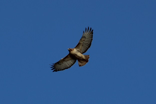
There weren’t very many birds out on this day but I did see a couple of red-tailed hawks. One of them was hunting along the edge of the bluffs, riding the wind as it looked for food.
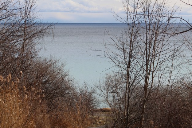
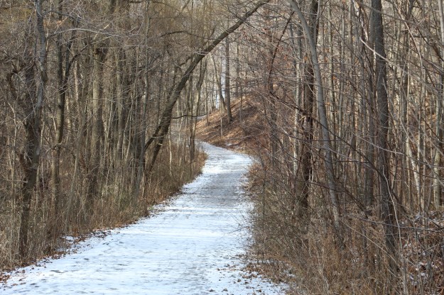
The Doris McCarthy Trail runs from free parking on Ravine Drive down to Lake Ontario. It descends about 90 metres over a length of 900 metres, making it a fairly steep trail. The trail runs through a ravine known as Gates Gully which has a number of historical features, including the allure of buried treasure. The trail gives great views of the lake as you make your approach to the beach.
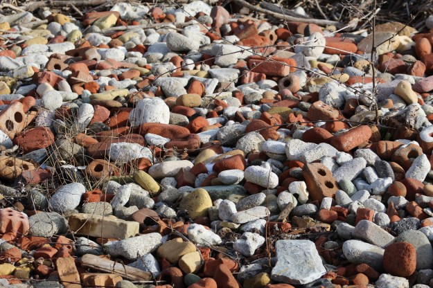
Sections of the beach trail can be pretty muddy but I think that is preferable to a shingle beach of eroded bricks.
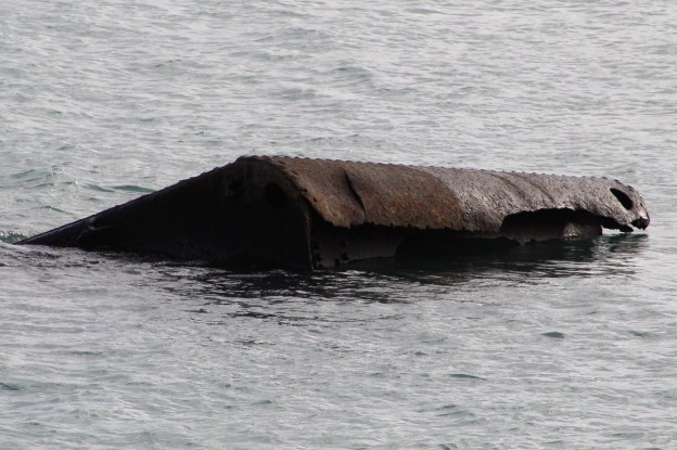
The Alexandria was a steamer built in Hull, Quebec in 1866. The 508 ton vessel was over 170 feet long and 30 feet wide. It was built as a freighter and later had passenger decks added in Montreal. It worked the route along the north shore of Lake Ontario, occasionally making trips to Rochester, New York. On this fateful night the ship was carrying 300 tons of sugar, beans, vinegar and tomatoes.
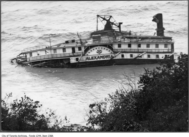
On the afternoon of August 3rd, 1915 there was a storm raging with heavy winds blowing along the shore of the lake. The steamer was blown closer and closer to the Scarborough Bluffs until it ran aground 200 yards from shore and began to sink. Her crew of 22 was rescued and led to safety up Gates Gully. The remains of the Alexandria are rusting badly and you can now see through several layers of metal near the waterline. Eventually the parts of the ship that remain above water will rust away and slip into the lake leaving little trace of the majestic ship that lies below.

For the next two days souvenir hunters scoured the beach carrying away anything that could be put to use. Many people were able to fill up their pantry with food from the wreck. Due to the extreme damage the ship had taken it was decided that there was no point in doing any kind of salvage work. There is a lot of ship still below the waterline and in the 1930’s it was very popular to go diving around the wreck looking for artifacts.

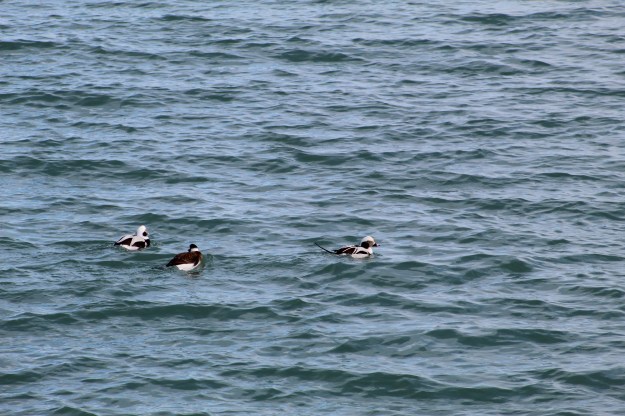
Waterbirds are common along the shore of the lake. Mallards and Canada Geese can be seen on almost every visit. Sometimes you get to see some of the less common ducks and there was a trio of long-tailed ducks swimming near the sunken steamer.
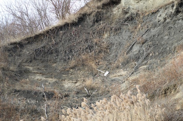
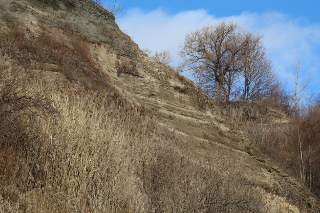
This section of the bluffs is continuing to erode and the shore line has not been completely modified with armour stone. This is one of the few remaining “natural” sections of the bluffs and we hope that current plans to modify it don’t come to pass. Near the top of the bluffs a sign warning people to keep back from the edge because it isn’t stable, has itself fallen over the edge.
The sky looked like our neighbours on the south side of the lake might not be having quite as nice of a day as we were.

The view along the side of the bluffs is always interesting and ever changing. It makes it worth returning time and again.
The thing about visiting a site at the bottom of a hill is the certainty that you will have to climb back up. With the slippery footing this was an interesting challenge. In the summer this trail is a great place to jog or bike uphill to increase your stamina.
The Scarborough Bluffs are a unique geological feature that we get to enjoy in the GTA and one of my favourite places to pass a few hours and enjoy being outside.
Google Maps Link: Gates Gully
Like us at http://www.facebook.com/hikingthegta
Follow us at http://www.hikingthegta.com

Great article. My grandmother had a year round home right on Lake Ontario, Henderson Harbor. Beautiful place!
Very cool piece,
Have been reading your blog for the last two or three months with interest. I live not far from The Bluffs and honestly had no idea about this!
Pingback: The Hilarious House of Frightenstien | Hiking the GTA
about 4 miles or so from that spot there’s one hell of a large bolder out of the water,they called it sigals island because thats where they all fly out to for the night
Pingback: 114. The South Scarborough Loop – Team Colin Blog
Lake Ontario is one of the five Great Lakes of North America. It is surrounded on the north, west, and southwest by the Canadian province of Ontario, and on the south and east by the American state of New York, whose water boundaries meet in the middle of the lake. Ontario, Canada’s most populous province, was named for the lake. Many of Ontario’s most populous cities, including Toronto, Canada’s most populous city, and Hamilton, are on the lake’s northern or western shores. In the Huron language, the name Ontarí’io means “Lake of Shining Waters”. Its primary inlet is the Niagara River from Lake Erie. The last in the Great Lakes chain, Lake Ontario serves as the outlet to the Atlantic Ocean via the Saint Lawrence River.
Pingback: Back Tracks – 8 Years of Trails | Hiking the GTA
When the Alexandria went down my great uncle Joe Innes Chamberlain owned the land at the top of the bluffs above which is now Sylvan Park. He and my grandfather Charles Chamberlain set up winch system from his property with cables to help the company save some cargo after the crew was saved.