Saturday May 7, 2016
Gates Gully runs from Kingston Road to Lake Ontario and provides one of the few places where there is access down the side of the Scarborough Bluffs. Over the years it has been home to natives, smugglers, soldiers and rebels. The Bellamy Ravine Creek flows through the bottom of the ravine where it makes a 90 meter drop from the table lands to the lake. The picture below shows the ravine where it starts at Kingston Road. The ravine provided a gentle enough grade to bring goods from the lake shore up to Kingston Road via carts and so a community developed at this point. Jonathan Gates built an tavern and the ravine became known as Gates Gully.
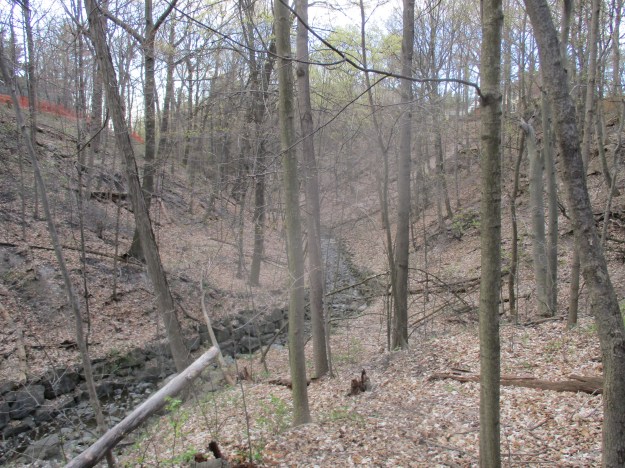
The Scarborough Bluffs were exposed when Glacial Lake Iroquois suddenly drained about 12,200 years ago. The change in climate caused the natives to modify their hunting and gathering practices and new tools were invented. Scientists call this period the Archaic Period and the early portion ran from 10,000 to 8,000 years ago. Artifacts have been found in the ravine from this time period indicating that the natives were using it as an access to the lake shortly after the end of the ice age. The ravine has changed a lot over the years from both land filling and erosion. The west side of the ravine has a set of stairs that used to lead to the ravine floor but now the steps slant at an odd angle and then end in loose sand and mud hiding under a layer of dead leaves.

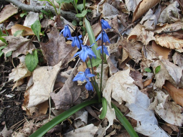
On April 27, 1813 the Americans attacked Fort York and captured it from the British. When General Sheaffe determined that the Battle of York was lost he ordered the army to retreat to Kingston, which they did, using Kingston Road. Legend has it that some of the soldiers hid the money they were carrying in the gully. Treasure hunters have been seeking it for the past two hundred years and if it ever existed, it is apparently still there. One of the beautiful things about spring time is the fact that there are new flowers in the woods almost every day. The Scilla provides a splash of blue to the forest floor but is not native.
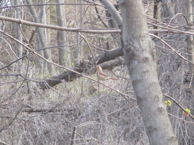
The ravine is a migratory route for over 100 species of birds. The woods were alive with the sounds of bird calls on this sunny morning. The wetlands are now under the protection of the male red-winged blackbirds. They have started their usual tactics of swooping near your head to let you know that you are too close to the nest. Bright red male cardinals were everywhere singing their songs to attract the less colourful females. The picture below shows a female cardinal who was playing hard to get with a couple of males.
Smugglers found it easy to bring goods from the United States into Canada through Gates Gully. This practice was prominent in the 1830’s as merchants sought to avoid paying import taxes. Gates Tavern became famous for the part it played in the Rebellion of 1837. When William Lyon McKenzie started to rally his rebel forces at Montomery’s Tavern on the night of Dec. 5, 1837 the Scarborough militia started to gather at Gates Tavern. Ironically, it is said that McKenzie hid for awhile at the Annis home, one of the first settlers in the area of Gates Gully and the property just to the east. On August 3, 1915 the steamship Alexandria was wrecked near the entrance to the gully. The Alexandria was built in 1866 and served both as a passenger ship and a cargo ship. On this night it was bringing 300 tons of beans and tomatoes when it was blown too close to the shore and was grounded. All passengers were brought to safety and led up the bluffs through Gates Gully. The hull of the steamship remains in the lake 100 years later, just to the east of the gully. The archive picture below shows the wrecked ship.

As you reach the bottom of the ravine you find a steel sculpture named Passage. Designed to look like the rib cage of both a fish and a canoe, it commemorates one of the first people who took up residence on the edge of the bluffs. In 1939 Doris McCarthy purchased 12 acres on the top of the bluffs on the west side of Gates Gully. Doris became a famous Canadian painter and her mother dubbed her home on the ravine as Fool’s Paradise because she thought the purchase was too extravagant.
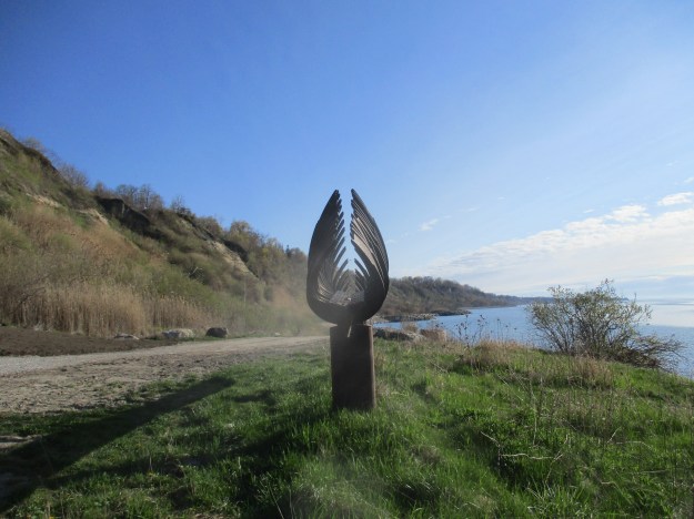
Fools Paradise stands on top of the bluffs, just out of site in this picture. To commemorate the life and work of Doris McCarthy the trail through Gates Gully has been named after her.
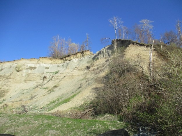
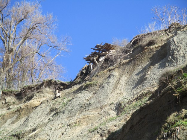
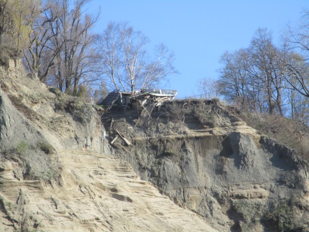
Following Doris McCarthy’s lead, other people came to settle on the top of the bluffs. The section of bluffs to the west of Gates Gully are on the former McCowan estate, after whom McCowan Road is named. The bluffs are eroding every year and many homes that were built too close to the edge have already fallen over. The picture below, and the cover photo, show a home that has been slowly being torn apart as the sand disappears from beneath it. The sand embankment below the former house is now filled with wood scraps, doors and tiles.
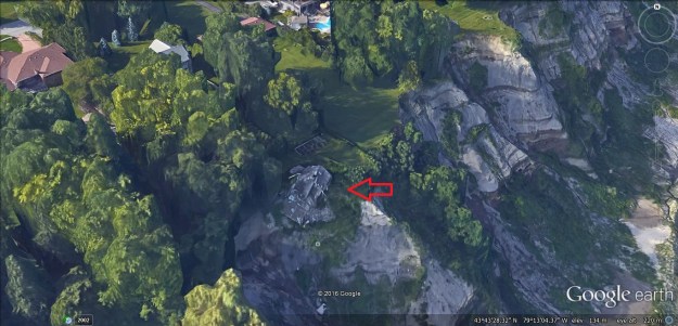
The image below from Google Earth was taken on May 22, 2015 and the house can be seen near the red arrow. It appears that about half of the house was standing a year ago, but there isn’t very much left any more.
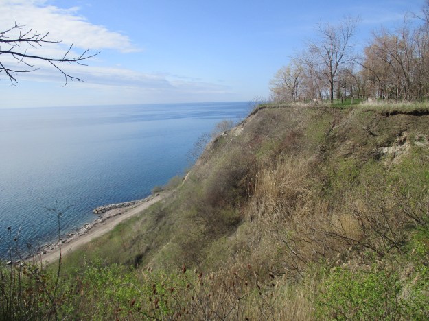
In 1986 it was decided to initiate erosion control in Gates Gully and along the beach. The shore was lined with stone and break waters were built extending into the lake in a manner similar to the Leslie Street Spit. The photo below was taken from the end of one of these erosion control forms.

After climbing to the top of the bluffs you are treated to an amazing view of the lake and the cliff faces. Sylvan Park is on the top of the bluffs on the east side of Gates Gully and can be seen on in the distance in the picture below. This park is on the former Annis property.
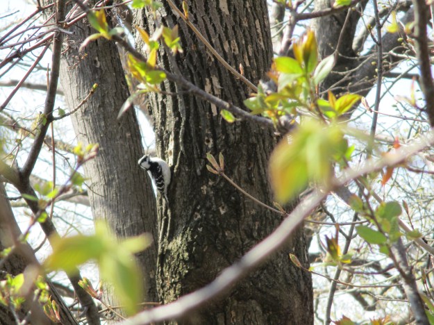
This downy woodpecker was one of several that was looking for lunch in Sylvan Park. It prefers beetles and ants but will eat suet at back yard feeders as well.
Meadowcliffe Drive on the top of the bluffs leads to the site of Fool’s Paradise. It is on private property but a historic marker is placed on the end of the driveway.

Google maps link: Gates Gully
Like us at http://www.facebook.com/hikingthegta
Pingback: Glen Stewart Ravine | Hiking the GTA
Pingback: South Marine Drive Park | Hiking the GTA
Pingback: Hiking the GTA #200 – Greatest Treks 2 | Hiking the GTA
Pingback: Beachcombers – Scarborough Bluffs | Hiking the GTA
Great read.
Pingback: The Alexandria | Hiking the GTA
Pingback: The Hilarious House of Frightenstien | Hiking the GTA
Pingback: 114. The South Scarborough Loop – Team Colin Blog
What an interesting read. I used to live in Scarborough
Pingback: The Scarborough Bluffs | Hiking the GTA
Pingback: Five Facts That Will Change The Way You Look At The Scarborough Bluffs - Storeys
Thank you for your informative info about Gate’s Gully. We’ve often hiked through Gates Gully with our energetic Beagle who loved this somewhat steep grade hike down to the lake and back again – outdoing us every time. My dad joined us on one walk saying “Come on what are you, a little old lady” as he demonstrated how fast he could run up the scree past me. He was 84 at the time! (W.W.2 RAF veteran). Beautiful Indigo Buntings nest here. They like to sing at the top of tallest trees. Also, Great Blue Herons have nests in the area.
Having grown up two blocks north of the Bluffs on Livingston Road, I greatly enjoyed this article. We moved from the Beaches to a converted cottage in 1946. My brothers and I were introduced to “bluff climbing” as tots and after the first climb did it on our own every summer. It makes me shudder at the thought as people became victims of unpredictable landslides of sand and clay from time to time. As natives of the area know, we were fortunate to find warm water in late July or early August. Now I live in the Kawarthas overlooking Cameron lake from atop an esker. The lowland below me once carried the waters of Lake Algonquin (now Huron basically) to Lake Iroquois (now Lake Ontario). The shorelines of post glacial Lake Iroquois can now be seen near those great bluffs of Scarborough.
Pingback: Back Tracks – 8 Years of Trails | Hiking the GTA
Great read. I lived in Guildwood for years and we were all over the bluffs. That Steamship looked more like a barge when I was a kid. Many beach parties because the cops wouldn’t dare come down there. And we’d jump off the bluffs in areas where it was sandy and sand ski down. I never realized the history of this area then again what kid or teenager really cares about that stuff. # Loved Guildwood.