Saturday, January 7, 2017
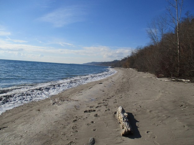
The beach along the Scarborough Bluffs is an ever changing environment. It is eroded by wind, rain and waves. Objects are washed ashore, washed down the bluffs or dumped here. As such it is a great place to look for treasures, each of which has a story to tell or a little bit of history to reveal.
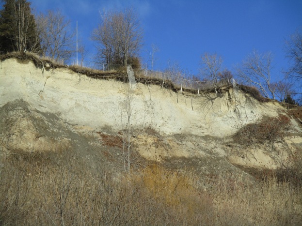
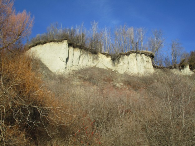
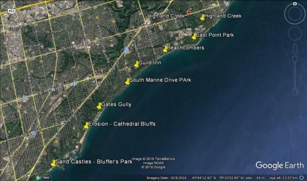
This hike set out to investigate the Scarborough Bluffs, specifically the section from The Guild Inn through to East Point Park. There is a small parking lot for The Guild Inn at the end of Galloway Road and Guildwood Parkway that will provide access to the beach via an old construction road which was used to harden the shore west of here in an attempt to prevent erosion. The picture below shows the view from the top of The Bluffs looking west.
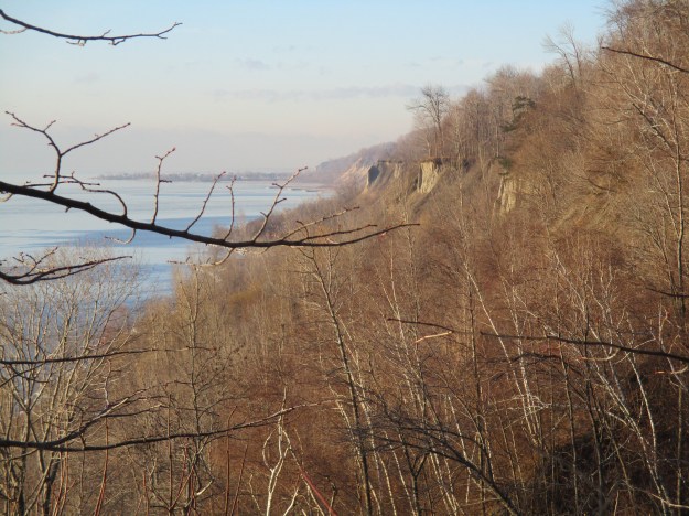
The morning was bright and sunny but the beach was virtually deserted.
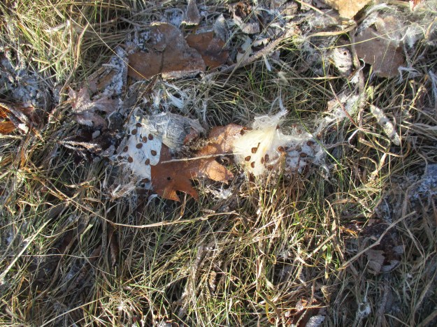
East Point Park is one of the places that is known for its Monarch Butterfly migrations. Milkweed is essential to the lifecycle of this species of butterflies and it is encouraging to see milkweed seeds scattered along the bluffs. The flat brown oval seeds are attached to the white fluff that helps them to be spread by the wind.
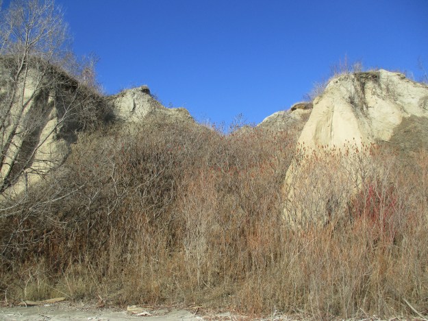
The vegetation on the top of the bluffs slows erosion down but doesn’t stop it. The roots are holding a thin layer of soil above where the sand has vanished below. Walking along the top of the bluffs it is, therefore, necessary to stay back from the edge so that you don’t have the ground disappear below your feet. The cover photo shows a fence that was installed to keep people away from the edge. The fence is now falling over the edge itself.
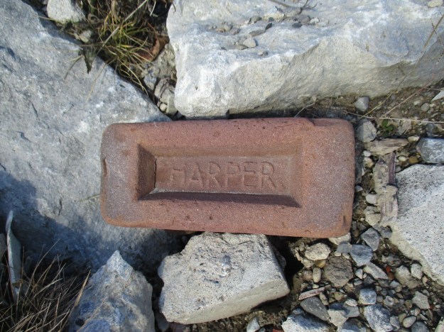
The area of Leslieville was situated on clay deposits that were excellent for brick making. As a result, Greenwood Avenue in 1914 had seven brickyards including that of Albert Wagstaff. When Wastaff died in 1931 he left the brickyards to his drinking buddy Albert Harper who operated the brickyards while the family contested the will. When the will was found to be valid he closed the yards down and the pit was turned into the town dump. The name Harper on the brick below was his way of stating his claim to the company while the will was being reviewed.
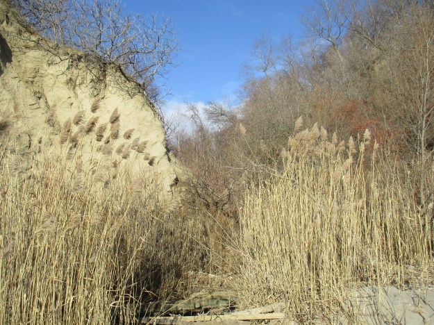
The ravine at Greyabbey Park is one of the places where there is a flow of water from the top of the bluffs to the bottom. Tall invasive phragmites grow in wetlands all along the sides of the bluffs, sometimes as much as half way up. These ravines provide homes for the white-tailed deer, coyotes and other animals that call the bluffs home.
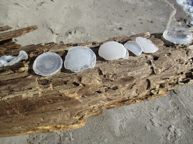
As we walked along the beach we met a local couple who walk there daily. We noted that they were combing the beach looking for interesting objects, as were we. They collect antique bottles and glass and display them on an Instagram account. Their treasures can be seen at this location. The picture below shows several pieces of glass, including a couple of Coke bottle bottoms, that have been tumbled by the water and sand until they are well rounded.
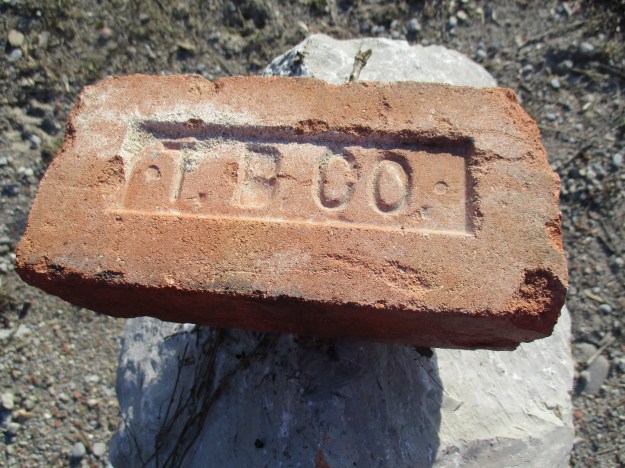
The Toronto Brick Company was stamped onto bricks produced at The Don Valley Brick Works, one of Toronto’s largest manufacturers. Their bricks may also read TPB Co for Toronto Pressed Brick Company. Much of the early Toronto skyline was made of buildings constructed using bricks from this brickyard. Much of the beach along The Bluffs is also made up of bricks from this brickyard now that old construction debris has been used for fill and for hardening the shoreline.
Rose hips provide a splash of colour in the winter and can also be eaten if you avoid the seeds. It is said that they help to reduce inflammation and they contain 50% more vitamin C than oranges do.

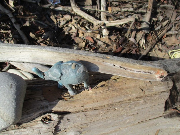
It’s hard to say where this plastic elephant got tossed away at because the lake may have carried it a long distance before depositing it here. It may also have come from the top of the bluffs. Unlike some of the glass on the beach, plastic has little chance of being taken home.
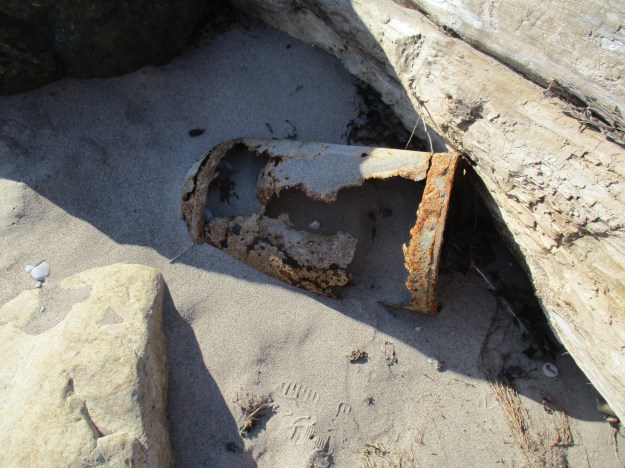
The rusting remains of a milk chum, or milk can, lie behind a log on the beach. Starting in the 1850’s metal cans were introduced for milk collection so it could be taken to the dairy. By the 1970’s collection was converted to tanker trucks and the cans became collected for their antique value.
There is a movement to pave a trail along this section of the bluffs and add armour stone to the shore to slow down the erosion of the bluffs. Nature will continue to have its way and the bluffs will continue to recede. The vegetation that is growing along the shoreline and up the sides of the bluffs will go a long way toward slowing the process down.
This post brings the total along the Scarborough Bluffs to 8 which cover much of the distance between Bluffer’s Park and Highland Creek. From the west to the east the adventure began with Sand Castles in Bluffer’s Park. That story looks at the geology of the bluffs. Erosion investigates the effect of the lake, the wind and rain on the bluffs. Gates Gully is the most famous ravine along the bluffs with a sunken ship and stories of buried treasure. South Marine Park Drive follows the lakeshore between the sunken Alexandria and The Guild Inn. The Inn is a former artist guild and preserves some of Toronto’s early architecture. This post fills the gap between the Inn and East Point Park where there is a Monarch Butterfly migration point. Highland Creek is the eastern most point of The Bluffs.
There’s still Greyabbey Park on the top of the Bluffs to be explored at some time in the future.
Google Maps link: The Bluffs
Like us at http://www.facebook.com/hikingthegta
Follow us at http://www.hikingthegta.com

Very interesting. I had no idea that the bluffs ever look the way that they do.