Monthly Archives: October 2021

Parkdale Pumping Station

Sunday, October 31, 2021

As Toronto grew and its rivers and lakefront became increasingly polluted the city understood that it needed to ensure a good supply of clean water. In 1913 the newly appointed Commissioner of Public Works R. C. Harris presented his plan. It was called the “Report of the Commissioner of Works on Additions and Extensions to the Toronto Waterworks Pumping and Distribution Plant.” The plans were put on hold for the First World War and not revived until 1926 when the need was becoming increasingly urgent. The revised report called for the construction of a new water works at Victoria Park complete with filtration, reservoir and pumping facilities. We know it today as The R. C. Harris Filtration Plant. A large filtered water tunnel across the lakefront would link it to a pumphouse and surge tower at John Street and another set in Parkdale. A reservoir at St. Clair and Spadina with an overhead storage tank was proposed to serve the city as it expanded northward. Most of this work would be completed between 1930 and 1955 and although we’ve visited most of the infrastructure, and parkland that was created in the process, we’ve not looked at the Parkdale Pumping Station.

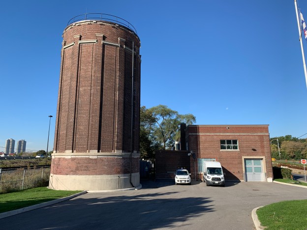
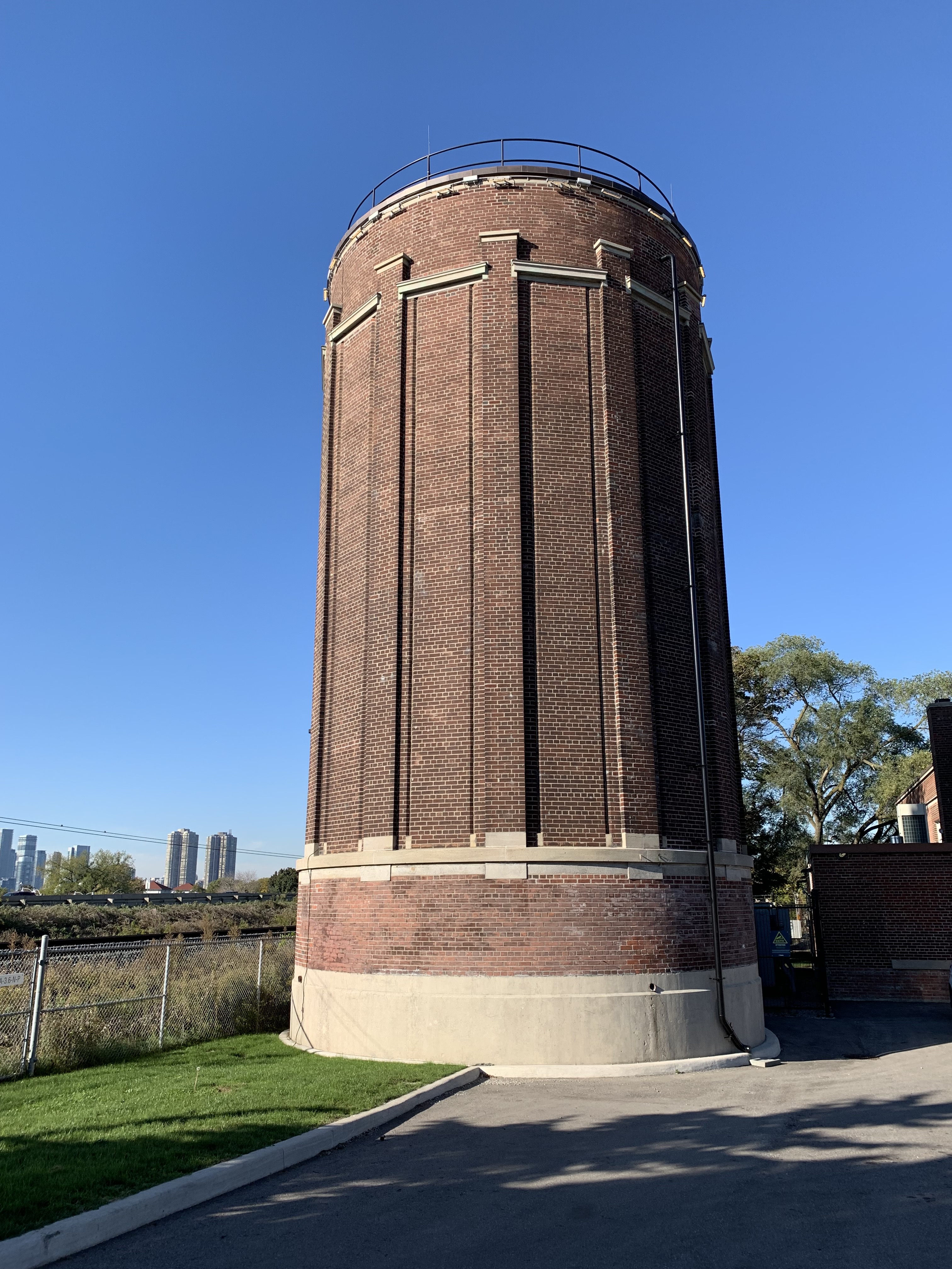
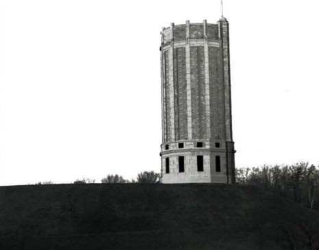
The dominant feature of the Parkdale Pumping Station is the Surge Tower. Thousands of people pass the tower on the Gardiner Expressway or Lake Shore Boulevard every day and at one time or another they’ve likely wondered about the Neo-Classical tower that stands just east of High Park. Two surge towers were built but only the Parkdale one survives. The one on John Street was octagonal in design but was demolished to make way for Skydome to be constructed in the 1980s. It has been replaced with an unimaginative structure which along with the Parkdale surge tower is used to maintain a constant pressure on the main water line. The round Parkdale tower is seen below and in the cover photo.

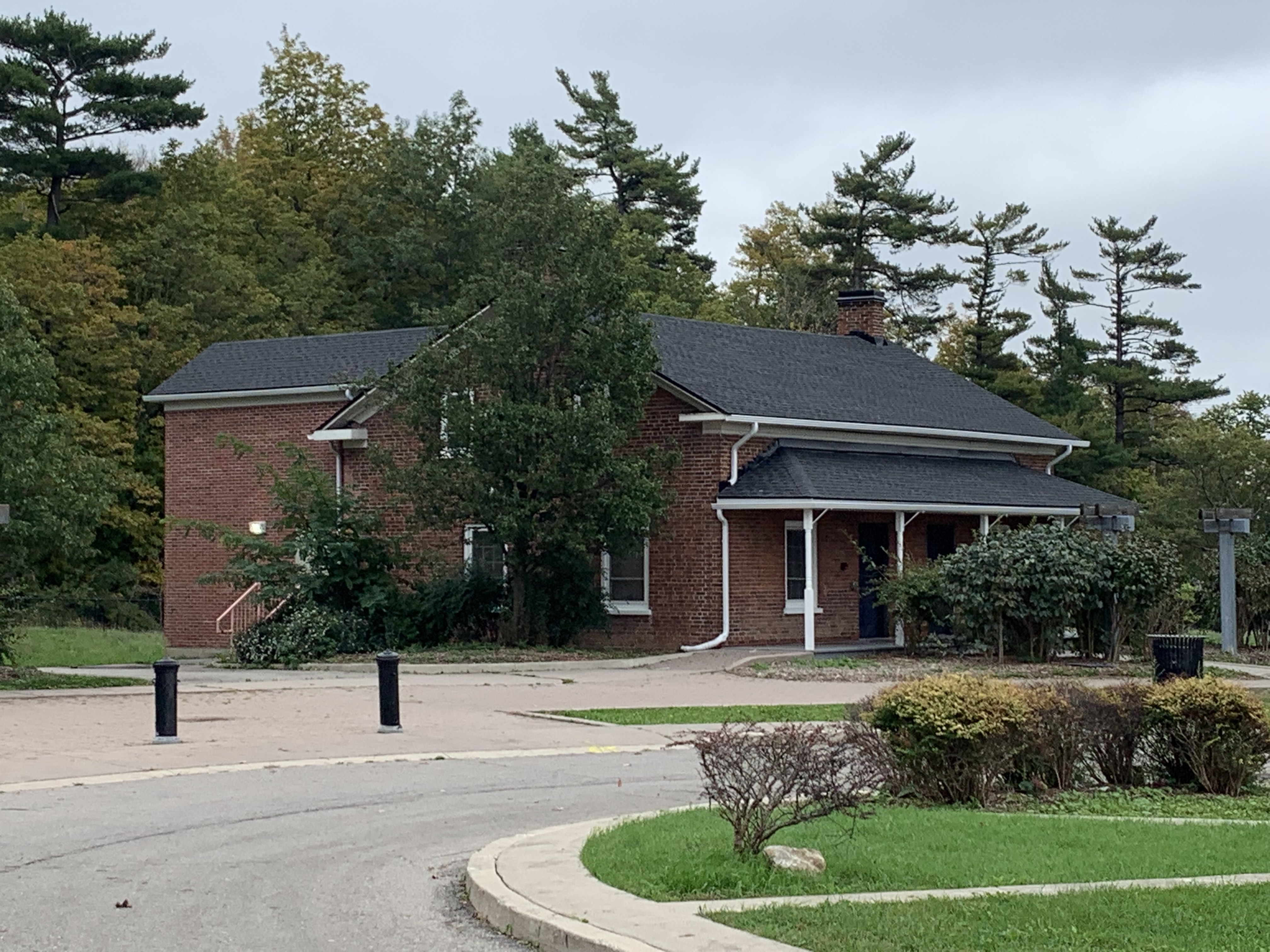
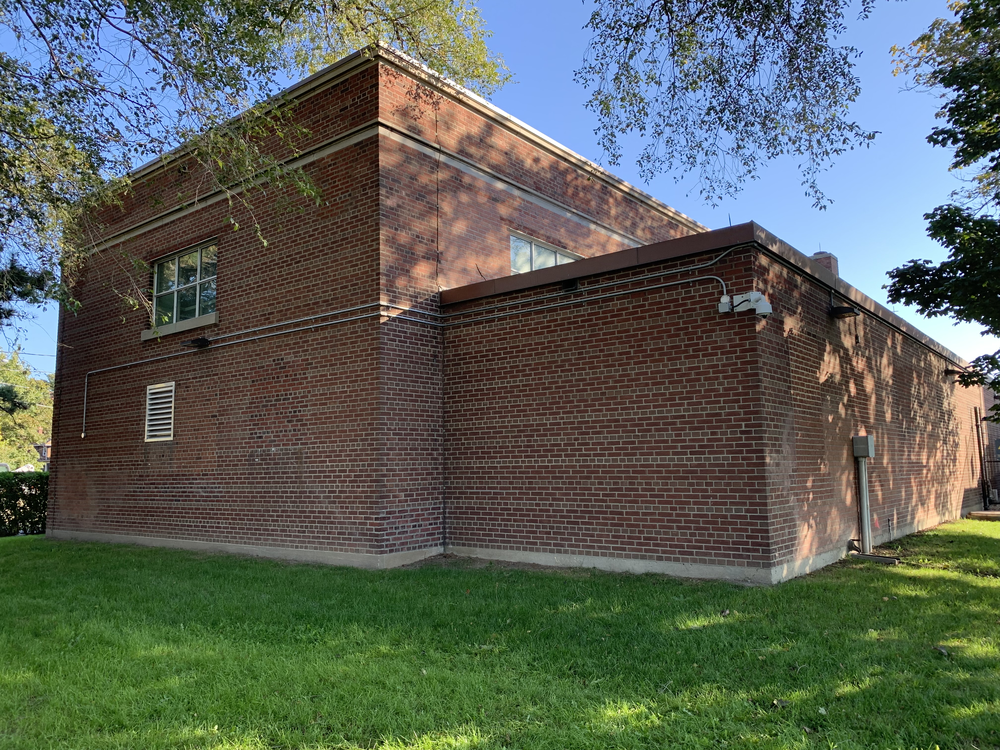
The pumphouse building in Parkdale is purely functional without a lot of ornamentation.It was completed in 1952 when city planners were driven by costs and public works were not seen as atristic statements.

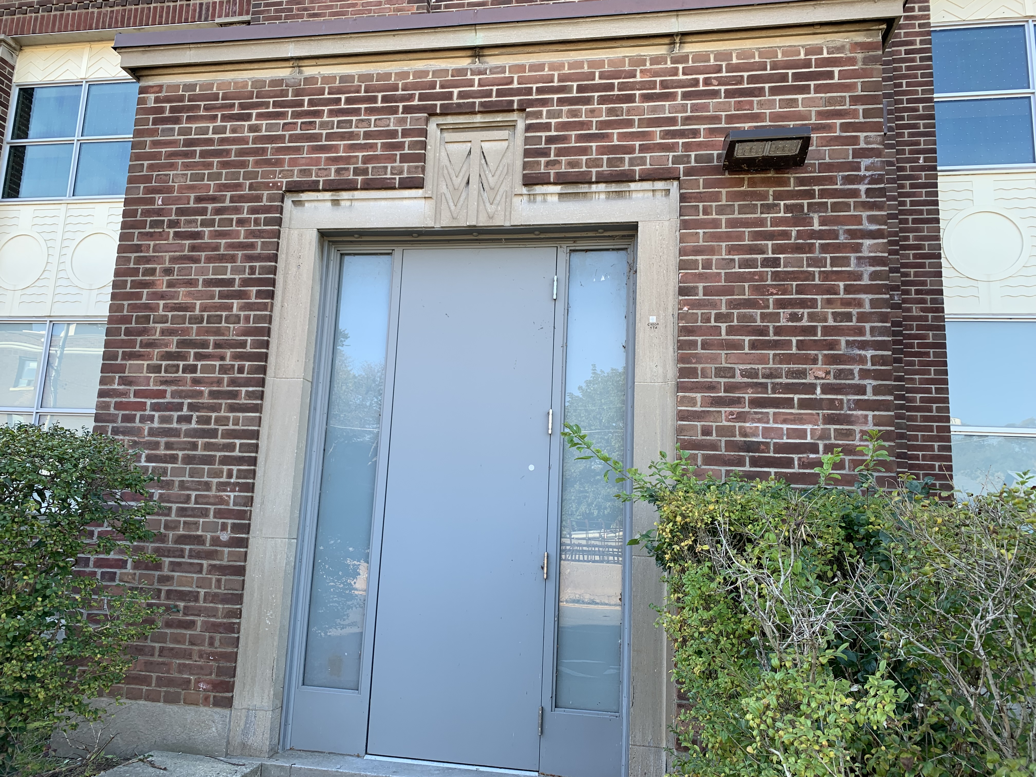
A stylized TWW (Toronto Water Works) adorns the main entrance to the pump house.

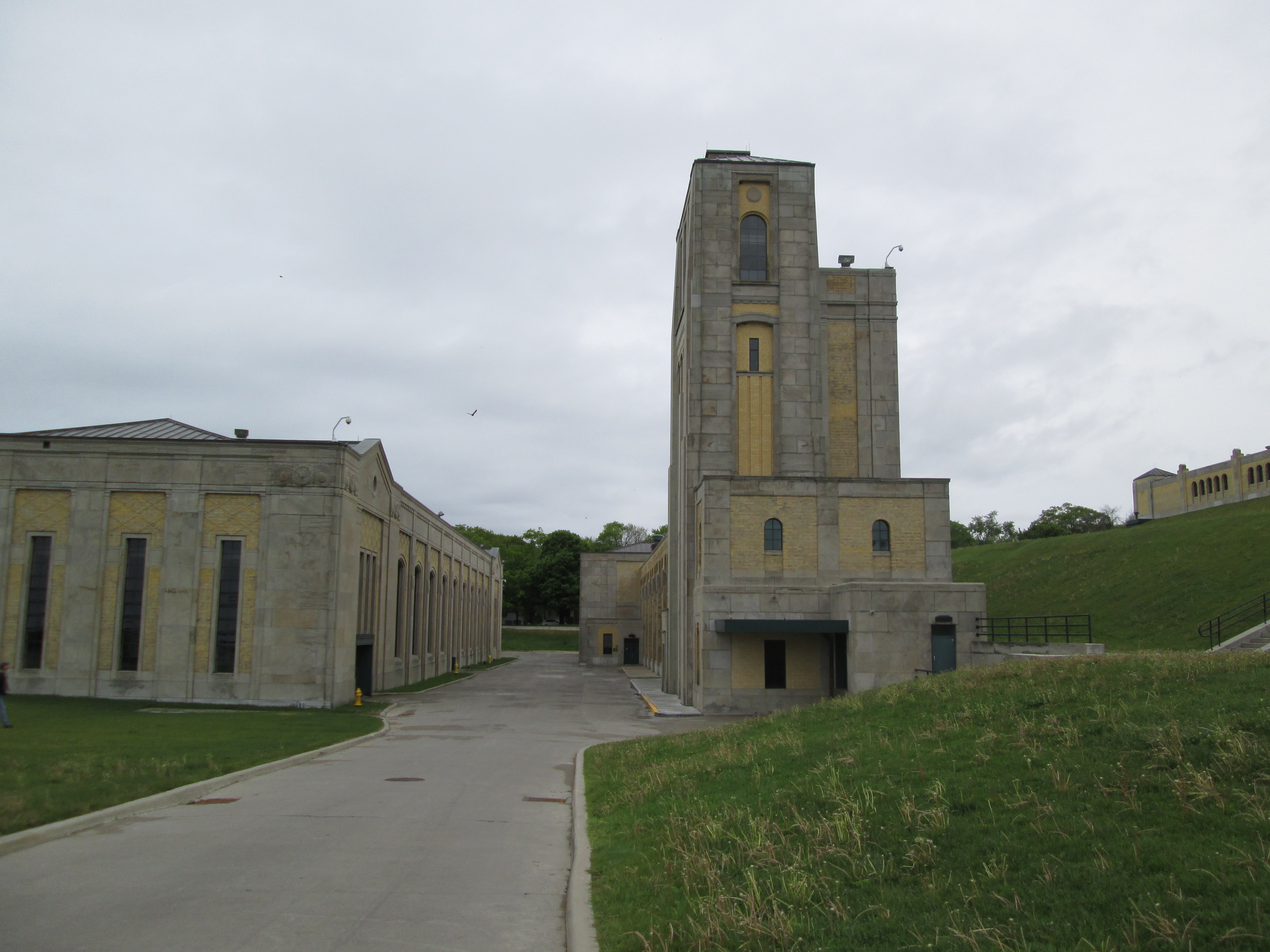
The heart of the water system is the R. C. Harris Filtration Plant at the foot of Victoria Park Avenue. Four towers were designed on the network with the one here being known as the Alum Tower. Water passing under the tower has alum dropped into it which causes any contaminant to settle out in a process known as flocculation. More about the filtration plant and its architecture can be found at the link above and also at the end of this article.

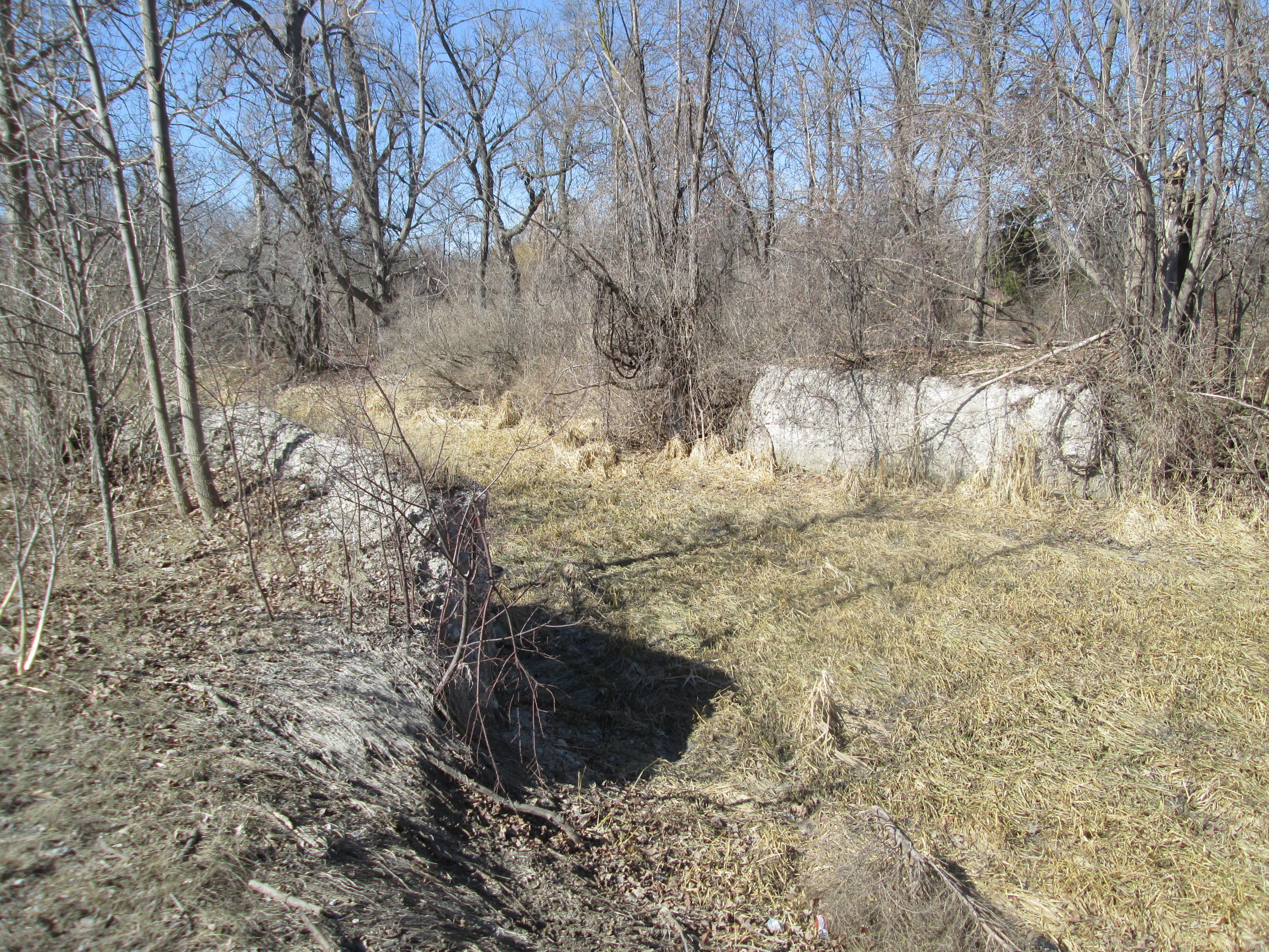
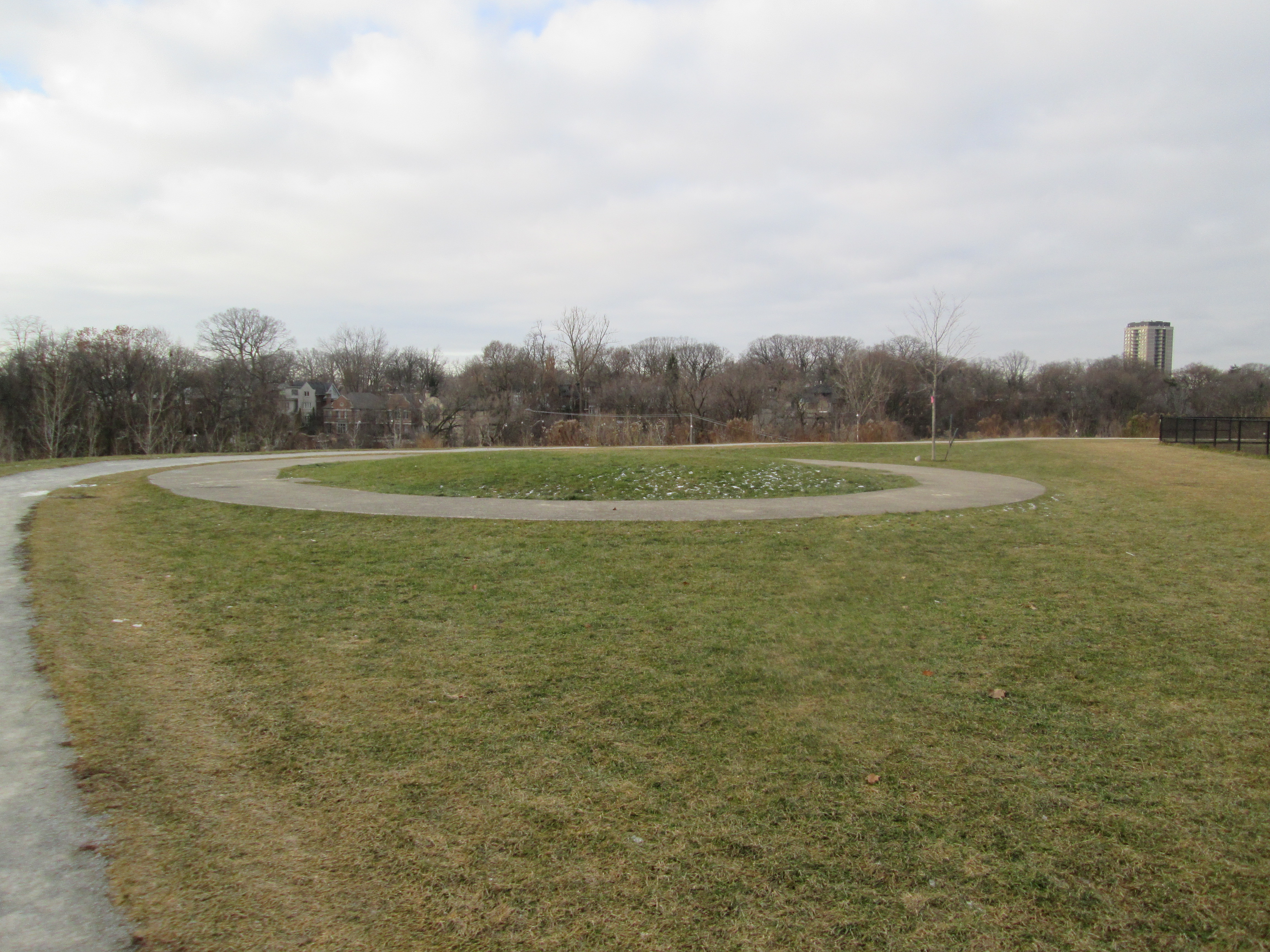
Water is pumped to one of several reservoirs located around the city. The Spadina Reservoir was the first part of the Toronto Water Works Extension to be completed with work finishing in 1930. At the time, a water tower was planned so that water pressure could be maintained during a power outage. Cutbacks brought on by the Depression meant that the tower was never built, however the footings were constructed and now form a circle in the park land on the top of the reservoir.

The image below was drawn in CAD using the original design documents and shows what the tower would have looked like if constructed. It was taken from “Toronto’s Tower Of Pure Water” by Steven Mannell.

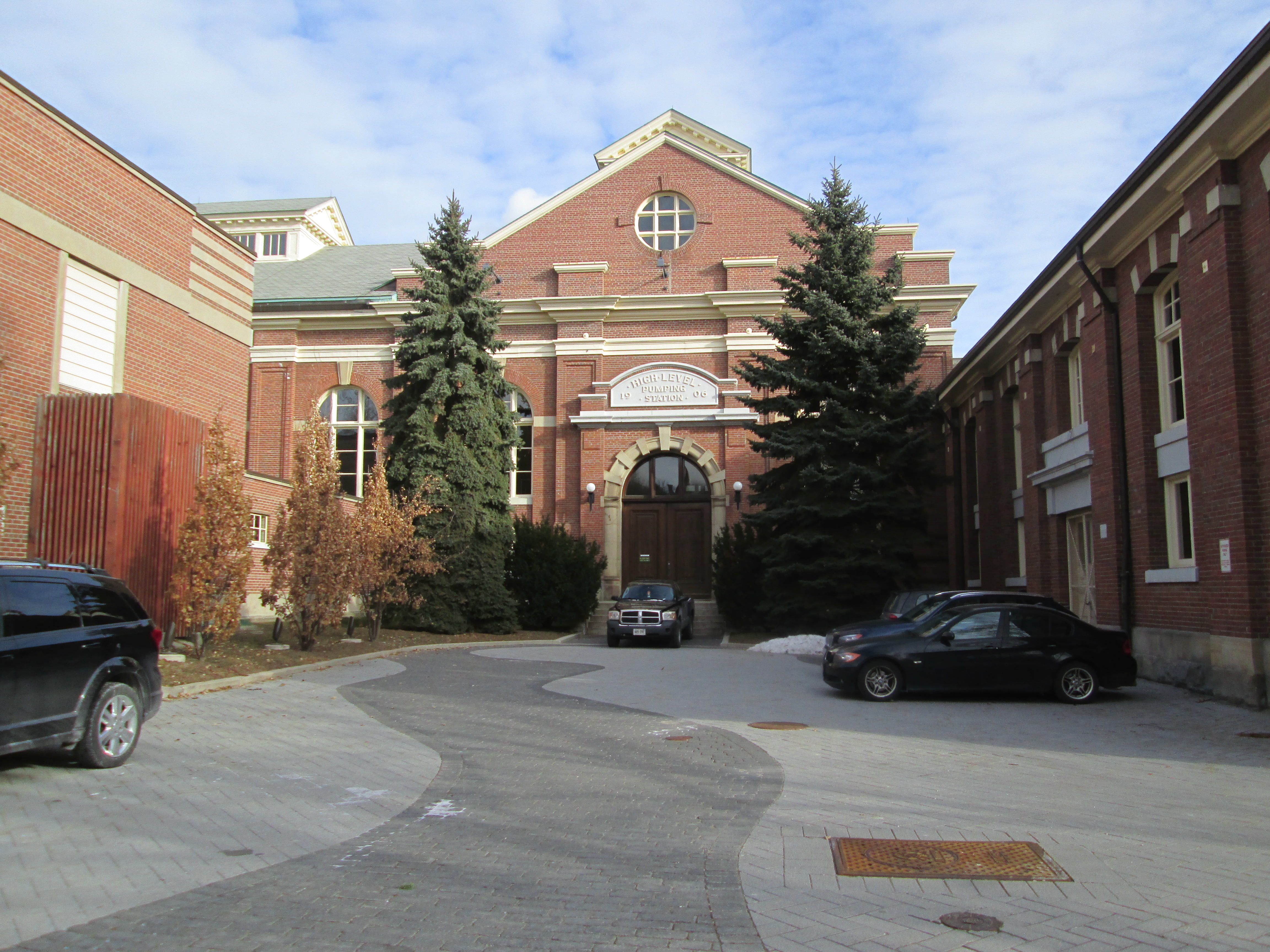
The Yorkville Water Works originally supplied water to the small community just to the north of Toronto. When Yorkville was amalgamated with the city, the water works were expanded and renamed the High Level Pumping Station. In 1952 it was expanded again, this time to become the control centre for the entire city network. It controls the water from 4 water treatment plants, 18 pumping stations, 10 underground reservoirs and 4 water towers.  These in turn supply water to over 3 million people. To read how a small town water supply became the organizational heart of the Toronto Water Works Expansion check out the link above.

The Parkdale Surge Tower is a visible reminder of the ambitious public works project that now supplies water to nearly 20% of the people in Ontario. The tower doesn’t have a large public park like other parts of the water delivery system, but High Park and Sir Casimir Gzowski Park are nearby.

Related Blogs: R. C. Harris Filtration Plant, Spadina Reservoir, Yorkville Water Works

Google Maps Link: Parkdale Pumping Station

Like us at http://www.facebook.com/hikingthegta

Follow us at http://www.hikingthegta.com

Also look for us on instagram

Toronto’s Oddest Architecture

October 24, 2021

Toronto has more than enough “cookie-cutter” houses but it also has some rather odd examples of private homes. This post collects some of them from various parts of the city and includes a Google Maps link to each one of them. Which one would you live in if you had the choice?

Leslieville is an area on the east side of the Don River which was formerly one of the industrial areas of the city. There are a lot of small side streets lined with working-class homes. The home at 37 Bertmount Avenue stands out from the rest because of the collection of toys, dolls, and collectibles that adorn the front lawn. The collection started as a hobby when the lady of the house lost her husband over 20 years ago. The collection is ever-changing as she adopts various holiday themes. Halloween items have taken prominent positions in the display.

The items on the front lawn appear to be mostly children’s toys and dolls leading to the nickname “The Doll House”. If you take the time to look carefully you just might see one that looks like something you used to own yourself.

The house at 157 Coxwell Avenue has had a makeover and what formerly looked like a mixed-up Rubik’s Cube is only slightly less out of place among its neighbours. The three-story tower was built in 2003 on four stilts that are sunk 48 feet into the ground. Designed by architect Rohan Walters the house takes full advantage of the 23-foot wide lot. Each floor is 16 feet wide and parking is provided under the house. There’s an open patio on the roof and the front door is reached across a private bridge. It was recently sold and the new owners have remodeled the outside to get rid of the blue, red, yellow, and green plywood panels that made it impossible to miss.

The house at 469 Broadview Avenue has the distinction of being the oldest, continually inhabited house in the city. The earliest section of the home was built prior to 1807 for John Cox who owned a store in the town of York. Alterations and additions over the years have hidden the original log structure. An electrician working in the home in 1995 discovered the original log home hiding inside the walls. This house now looks completely out of place surrounded by larger, more modern homes. There are a couple of log homes in the city that might be a few years older but this is the oldest one that still stands in its original location.

Just 8 feet wide, the house at 363 Shuter is the narrowest detached home in the city, although it isn’t the smallest. That honour goes to a home which is also featured in this article. The original home on this lot was built in 1880 and was just a single story. Renovations over the years have hidden the original home and added two more floors. The home is filled with light and has a finished basement and landscaped backyard. It was recently on the market for $750,000.

Bright Street is a small residential street in the old Corktown area of the city. This working-class Irish enclave was named after Thomas Bright who owned the land until his death in 1857. After that, it was sold off into building lots. The intersection of Bright Street and Queen Street was adjusted, leaving all the lots on the street with irregular shapes. In the 1860s the victorian Bay and Gable terraces on either side of number 32 Bright Street were built but the rights to the lot where the little bungalow stood weren’t secured for development. With the angle of the roadway changed the bungalow sits at a funny angle to the street and its neighbours.

Toronto also has a what appears to be half of a house. It is actually one sixth of a row of Victorian row houses each featuring the Toronto signature “Bay and Gable” design. They were built in the early 1890s and a land developer began buying them up in the 1950s. By the 1970s five of them had been bought up but the sixth one was owned by someone who refused to sell. five of them were demolished leaving 54 1/2 St. Patrick Street looking like half of a duplex.

Cube houses were developed in the Netherlands in the 1970s. It takes a cube shape and stands it on an angle atop a small podium. They were designed to optimize space and the first three were built in 1974. Forty were built in Rotterdam and another 39 in Helmond. It was a short-lived fad and no more would be built until 1996. That is when 3 were built at 1 Sumach St. in Toronto. These three homes are now in the way of a 35 story tower and their fate is unknown. It was originally thought that they could be moved somewhere but there are currently no plans. I guess we’ll see what happens to the only 3 cube houses in the world, outside of the Netherlands.

Known as the Herman Heintzman House it was built in 1891 with part of the Heintzman Piano fortune. Located at 166 High Park Avenue the home features a round tower that hides the staircase to the secod floor. The tower has an open air gallery at the top.

The Parashos family has turned their home at 1016 Shaw Street into a showpiece for their Greek heritage. Columns, urns, and sculptures all adorn this house whose red clay tile roof is lined with statues.

128 Day Avenue has the distinction of being the smallest house in the city at just 2.2 metres wide and 14.3 metres long. It has a living room, kitchen and small sleeping area on the main floor and a small basement. Originally the lot was intended to be a laneway but the city wouldn’t cut the curb for vehicle access. Therefore, in 1912 Mr. Weeden decided to build a small house there. He lived there with his wife for 26 years before selling it. It’s had several owners since then and sold for $180,000 in 2010.

From the smallest to one of the largest and best examples of a Gothic Revival home in the city. The house is known as Oaklands and was built in 1860 with the tower added in 1869. The home is now part of De La Salle college.

Toronto has a wide variety of different architectural styles but there’s plenty of places that have a style all their own. These are just a few of the better-known ones.

Like us at http://www.facebook.com/hikingthegta

Follow us at http://www.hikingthegta.com

Also, look for us on Instagram

Toronto Suburban Railway – Guelph

Sunday, October 17, 2021

Several electric railway lines radiated out of Toronto in the early 20th century but the longest was the one that ran from Toronto to Guelph. It covered 49 miles (79 kilometres) and passed through several towns where it conveyed passengers and provided an express service. The right of way was almost exclusively privately owned and included several major bridges that had to be constructed to carry the line across the ravines and waterways along the route. Among them was the 711 foot (213 meter) long steel trestle bridge that carried the train 86 feet (26 meter) above the Humber River. It is featured in the archive picture used as a cover photo for this article. Although the line was surveyed in 1911 and 41.5 miles (67 kilometres) of track was laid west of Islington in 1914 this bridge wouldn’t be ready until 1916 because they had problems setting the footings. The railway itself wouldn’t open to the public until April 14, 1917.

The 1925 schedule below for the suburban railway shows each of the major stops and the transit time between them.

The car sheds and maintenance shops were located just west of Scarlett Road and tucked in between the Canadian Pacific Railway (CPR) and Dundas Street. These remained in use by other companies after the failure of the rail line until the 1980s. They were then demolished to create room for a townhouse development. From the maintenance yards a 200 foot (61 meter) wooden trestle was built as an approach to the bridge over the Humber River. The trestle was filled in when the 1925 extension to the Junction was built. At this time the line was re-routed under the CPR tracks to follow the power corridor. The underpass has been filled in but can still be identified by the cut on either side of the CPR mainline. The picture below looks along the filled in trestle toward the Humber River.

The piers and abutments for the bridge (see cover photo) are all that remains as the steel bridge works were removed for salvage. The river level piers have been repurposed for the pedestrian bridge on the Humber River Trail. The original bridge brought the railway across the river at about the same level as the CPR tracks beside it.

The railway stayed on the south side of the CPR as it approached Mimico Creek where it crossed on an 80 foot (24 meter) long bridge. The walkway that leads from behind Central Arena down into Tom Riley Park follows the cut in the embankment that was made by the railway. Once across the creek, the right of way passed under the CPR tracks and then turned west again. Central Park Roadway now follows the old alignment.

Islington is a village which has paid tribute to its heritage with a series of murals depicting the towns past. A beautiful mural of a radial car has been painted on the side of the building which the train ran behind. Initially there were 6 cars but two were destroyed by fire before they were even delivered. The remaining four cars were 60 feet long and had centre doors on either side. Two more cars were added in the mid 1920s (these with the standard door at the front) and service was increased to every two hours between Guelph and Toronto. For more about Islington and pictures of their other murals check our our post Islington – Village of Murals.

The line roughly followed Dundas Street through Dixie and on toward Cooksville before cutting off on an angle toward Meadowvale. It ran roughly northwest until it reached Highway 7 and then followed it into Guelph. Meadowvale is the next stop along the line where there are still remains to be found.  The rail line crossed over the tail race for Silverthorne’s Grist Mill and the crumbling bridge abutments remain as reminders to a different era.

Meadowvale

Three substations were built to power the line. The Islington and Georgetown ones were put into service but the Guelph station never was. It was intended to power an extension to Kitchener but the partially built line was scrapped during World War 1. Although there were 100 official stops only three passenger stations were ever built, these being at Acton, Georgetown and Guelph. Some of the stops had small waiting shelters while others were simply a road crossing where one could wave at the train to get it to stop. From Meadowvale the line ran through Churchville and then on to Eldorado Park the most popular destination on the route on summer weekends. Eldorado Park was a 128 acre amusement park created by the railway in 1925 as an attraction that was intended to provide passenger business. Eventually it did this to the extent that multiple car picnic excursions ran to the park, being powered by the railways freight locomotive. The image below shows a rail car dropping passengers off at the park to enjoy a day of fun before jumping on a later car to return to the city.

You can locate the old line through the park by finding the swimming pool. It ran right past the edge of the place where the pool would be built.

Following the old right of way will lead you to the place where most of it has slipped down the embankment and into the river. So much for daily service along this line.

There were 16 sets of sidings constructed to allow trains to pass each other going in opposite directions. Three Wyes were built to allow the train to turn around using a three-point turn. Lambton, Georgetown and Guelph each had one but when the line was extended to The Junction no Wye was built there due to space limitations. In The Junction the car had to travel up a side street to an existing loop to turn before making the trip back to Guelph. Heading west the line passed through Huttonville and Norval before reaching Georgetown. From Georgetown the line carried on moving northwest until it passed through Limehouse. Here it had a wooden trestle over the mill pond in what has become the conservation area before crossing the Second Line where there was a small shelter on the west side of the road. The image below shows the railway trestle piers that remain in the now dry mill pond. You can read more about Limehouse and the kilns from the lime industry in our post entitled Limehouse.

East of Acton sections of the old right of way have been converted into the Guelph Radial Trail. This trail name is easily confused with the Guelph Radial Railway which operated within the city of Guelph. In many places the old railway berm is still clearly visible. For more on this section of the trail see our post Guelph Radial Trail – Action East.

The Guelph Radial trail lets people follow the old right of way from Limehouse to Guelph. The trail has been marked with orange blazes. More can be read about this section of the trail in our feature story Guelph Radial Trail – Acton Section.

The Halton County Radial Railway Museum is on Guelph Line and uses some of the original right of way for short tourist excursions. They provide a home to a lot of electric railway artifacts including the waiting shed for stop 47 along the route. This is the stop which was located at Meadowvale. At the roadside is this car from the London & Port Stanley railway.  It operated as an electric railway from 1913-1957.

The next stop was Eden Mills and then on to Guelph. The line was never a financial success and it had very little end-to-end traffic. The timing was poor as it had to compete with the growth of automobile traffic. By 1920 there were 150,000 cars in Ontario which gave people a greater range of freedom than riding the rails could provide. Within a year of opening, the line was turned over to the Canadian Northern Railway and then in 1923 it became part of the recently created Toronto Transportation Commission. The addition of an express department which charged 40 cents to move 100 pounds of goods from one end of the line to the other did little increase revenue. In 1925 it was operating with a loss of 45 cents on the dollar. By 1931 the line was serving only 300 passengers per day and it was closed for good on August 15, 1931.

Aside from the relics featured above there’s likely a few others to be discovered on future expeditions.

Associated Blogs: Islington – Village of Murals, Eldorado Park, Limehouse, Guelph Radial Trail – Acton East, Guelph Radial Trail – Acton Section,

Like us at http://www.facebook.com/hikingthegta

Follow us at http://www.hikingthegta.com

Also look for us on Instagram

Sugarbush Heritage Park

Sunday, October 10, 2021

When Jonathon Baker and his wife arrived on their new property in Vaughan in 1816 the land was covered with huge pine trees interspersed with smaller maple trees. They cut the pine trees for wood to build their home and barns and left the maple trees to mature in their place. From the beginning, they started tapping a few trees for maple sugar and maple syrup. These were the only sources of sugar that were readily available. They cleared half of their two hundred acre allotment and left 80 acres on the east end of the property and another 20 on the west end. In the year 2000, the City of Vaughan bought the eastern wood lot to preserve it because it was one of the largest remaining in the quickly expanding city. It was opened in 2011 and is now protected by heritage designations. There’s parking for several cars in a free parking lot at the park.

The two wood lots remain with the east one on Bathurst having been turned into the Sugarbush Heritage Park. The one at Dufferin and Langstaff is largely untouched except for flood control ponds that have been created on the edge of the forest. The 1877 county atlas below shows the Baker farm outlined in green. This farm had been in the family since 1816 when Jonathon Baker Sr. purchased it. By this time it was being operated by Jonathon Baker Jr.

After starting with a tapping a few trees for personal use, the wood lot was slowly turned into a profit centre. They continually added more trees to the collection process, going from 70 in 1870 to over 8000 by the year 1980.

The aerial photo below is from the 1975 survey and was taken from the Toronto Archives. It shows the Baker Sugar Bush outlined in green while the rest of the property is outlined in blue. The woodlot on the west end of the property was also used as a sugar bush and remains undeveloped until this time. It has been marked with an orange line. The Baker house is seen in its original position but it has since been moved near the entrance of the wood lot. In the upper left the Cober cemetery is circled in green and is the final resting place for many of the Baker family.

Before the sap started running the family had to go through the woodlot and blaze the trees. This involved inspecting each tree and selecting a new location for that years spiles. A small area of the outer bark was removed with a hatchet to make a smooth spot to bore the holes. This was important after the metal spiles were introduced because it allowed the spile to fit tightly and let the bucket hang straight. A brace and bit was used to bore the holes for 150 years until a tree tapper was bought in 1956. As you walk the trails you can step up to any one of the big old maple trees and look for the old bore holes. There’s lots of them between 5 and 6 feet off the ground. Some trees have dozens of visible holes because they were tapped for decades. It is reported that some of the trees from 1816 were still being tapped in the 1980s.

In the early days a 12″ long wooden spile was used to tap the trees. The wooden sap buckets sat on small benches near the base of each tree and the spile had to be long enough to reach out past the bottom of the tree which sloped outward. By around 1900 the spiles were replaced with tin ones that allowed the pail to be hooked on the spile. Then, around 1959 the spiles started to be replaced again with smaller plastic ones that worked with tubing instead of buckets. A careful eye might still identify a spile or two laying on the forest floor.

In 1959 forty trees were tapped using a new method of collecting the sap and transporting it using tubing that ran between the trees. Eventually this process would expand until almost every tree was connected with tubing. A few trees were still collected using the old tin buckets so that roadways could be left open to allow the tractor to pass through. There is still some tubing left lying around the forest floor in a few places.

Children will enjoy the Story Walk that has been set up along the trails. There are seventeen panels that tell the story of a panda and a parrot and what they learn about friendship and the joy of the world around them. Although there are 2.4 kilometers of trails in the park the Story Walk is set up on a shorter loop so the little ones don’t have to complete the entire thing.

A healthy forest will have several different types of fungi which serve to break down the wood of dead trees. One of the less common ones is Wolf’s-Milk Slime Mold which grows on large dead logs between June and November. When they’re young, if the tiny balls are popped a pinkish orange slime oozes out. Because this is about the consistency of toothpaste, this slime is also known as Toothpaste Slime. As they age the interior will harden and become ochre in colour. Wolf’s-Milk Slime Mold fruiting bodies are only a few millimeters across at the biggest and sometimes there could be only a single one which makes spotting them tricky. Several of the old maple logs lying on the forest floor are covered with this mold so it is a good place to look for it if you haven’t seen it before.

Turkey Tail Mushroom is also known as Tramentes Versicolor because of its multi-coloured appearance. It has been used for centuries in traditional medicines to relieve respiratory ailments. More recent studies show that it can improve the efficiency of chemotherapy in patients with colon or breast cancer.

The City of Vaughan operates several types of gardens where residents can grow their own fruits and vegetables. Allotment Gardens are ones in which people can rent a small plot on a yearly basis. There is only one in the city and it is located at Sugarbush Heritage Park where there are 20 plots available and a waiting list to get one.

The second house on the property replaced the original log home around 1863. As seen in the aerial photo above, it formerly stood central to the property with access from Langstaff Road. It was moved near the edge of the sugarbush so that it could be used for community purposes.

The other house on the property also belonged to the Baker family and was moved from its original location on Bathurst Street. It was repaired after years of vandalism and turned into the park washrooms.

In 1839 Peter Cober donated a small parcel of land on his property at Lot 12, Concession 2 in Vaughan Township for a cemetery.  Today it is known as the Baker-Cober Cemetery because the land was donated by the brothers-in-law Peter Cober and Michael Baker.

I’m looking forward to returning here in a couple weeks time to see the forest with its fall colours on full display but it makes a great place to go for a walk at any time of the year.

Google Maps Link: Sugarbush Heritage Park

Like us at http://www.facebook.com/hikingthegta

Follow us at http://www.hikingthegta.com

Also look for us on Instagram

Hagerman’s Corners – Ghost Towns of the GTA

Sunday, October 3, 2021

Hagerman’s Corners developed around the intersection of modern day Kennedy Road and 14th Avenue in Markham, just south of Unionville and north of Milliken. In fact, one of the four corners of Hagerman’s Corners was owned by Benjamin Milliken who donated land for the local school. By the time of the county atlas in 1877 the land was owned by William Milliken. The town had been founded in 1803 by Nicholas Hagerman who bought the property on the north west corner of the intersection.

Hagerman’s Corners never grew larger than a few buildings centred around the intersection. The post office was opened in 1873 and it was joined by a wagon maker’s shop, a hotel and a tavern as well as two churches and a handful of houses. The County Atlas below has green circles around the surviving structures which are featured in this article.

Hagerman’s Corners got its first school in 1858 but the wooden building burned down on April 11, 1888. They immediately set about replacing it with a unique brick schoolhouse. The building was designed by E.J. Lennox who is famous for designing Casa Loma. Rather than having an entrance that faced the street, this school had one on either side. One for boys and the other for girls. In 1966 the last classes were held in the school and it sat empty until 1985. That is when George and Patricia Zarafonitis bought the building and converted it into a restaurant.

Benjamin Milliken II was the son of the founder of Milliken and he built this home in 1855. The Milliken family attended the Presbyterian Church in Hagerman’s Corners and several of the grave markers in that cemetery bear their names.

Almost directly across the street from the Milliken house is the former home of Jesse Noble which was built in 1855. Ambrose Noble had purchased the property in 1826 and granted it to his son Jesse in 1864. The house was renovated and expanded in 1880. Today it serves as part of a bridal shop.

This home was lived in recently enough to have a satellite dish on the roof. It appears to be of 1850s or 1860s construction and could likely be returned to use with a little love and a pile of cash.

There’s only a few 19th century houses left in town and it appears that two of them may have had the same builder. There are two second empire style houses complete with the identifying mansard roof. While not identical, they stand out among the other historic homes.

The second mansard roof is only a couple houses away on the same side of the street. It’s possible that the houses in between were later additions and these homes were once neighbours. A pair of white two story, two bay houses with their imposing roofs.

The hotel in town was known as The Bee Hive Hotel and stood on the north east corner of the intersection. John and Jane Webber ran the hotel before moving their operation to Unionville where they owned The Queens hotel. In 1877 the property belonged to James Fairless who built the house pictured below, which is turned to face the former hotel.

The Presbyterian Church was built almost across the street from the Methodist one. Worship services were held in the little church on the east side of Kennedy Road until the Presbyterian congregation elected to join the United Church in 1925. They merged with the congregation at the newly named Ebenezer United Church at Brimley Road and Steeles Avenue in Milliken. Their original building was demolished shortly thereafter and the 1839 cemetery is now known as Hagerman Cemetery East.

The Hagerman family cemetery was located on the original family farm on the north west corner of the intersection. The family were committed to the Wesleyan Methodist faith and in 1849 land was donated for the use of a cemetery and the construction of a wood framed church building. The original church was replaced with a brick one in 1874 and it stood on the south west corner of the present cemetery lot. The cemetery was recently mapped with ground penetrating radar prior to work on expanding Kennedy Road. The foundations of the old structure showed up on the radar. The cemetery is now known as Hagerman Cemetery West and was founded in 1838.

The Hagerman family were members of the Wesleyan Methodist Church and there’s a large section of memorials to them in this cemetery. In general, there are less of the older pioneer limestone tombstones in this cemetery than there are across the road.

In 1876 Robert Armstrong bought a property on the north edge of town from Nicholas Hagerman. The following year he built a story and a half Gothic Revival house on the property and began working the farm. His son Leslie took over the farm in 1903 and most recently the Government of Ontario purchased the property so they could build Highway 407. The house and property are now owned by infrastructure Ontario and the house is listed on the Markham heritage register.

Across from the new high school on Kennedy Road is another original home which belonged to John B Smith. The story and a half house has a full length front porch which was the family entertainment centre in the early days. There’s room for sitting after dinner and watching the world go by, or to have a chat with the neighbours.

Although the area has been highly developed over the past few decades there is a surprising number of buildings remaining that were shown on the county atlas 144 years ago. The same can’t be said for a lot of the ghost towns we’ve visited.

Related Blogs: Milliken Park, Union Mills – Unionville, Unionville – Dating By Design

Google Maps Link: Hagerman’s Corners

Like us at http://www.facebook.com/hikingthegta

Follow us at http://www.hikingthegta.com

Also look for us on Instagram