Sunday Dec. 21, 2014
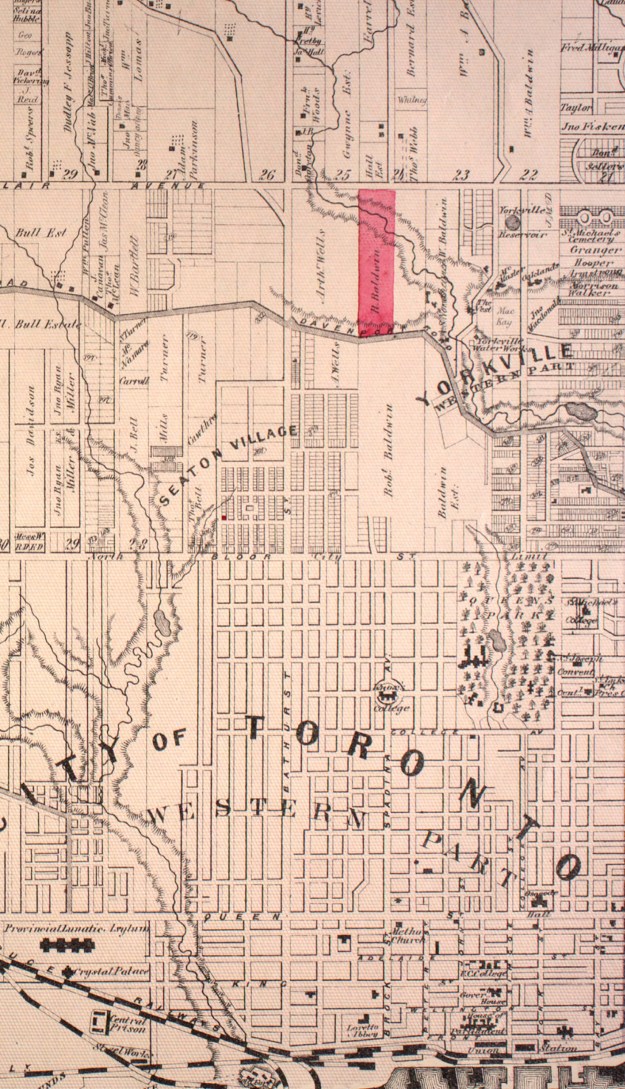
Following Queen Victoria’s coronation in 1837 Lot Street was renamed Queen Street. The original name Lot Street was due to it’s use as the base line for the land survey in the town of York (Toronto). William Warren Baldwin bought a 200 acre land grant running north from Lot Street. He named his estate Spadina after the native word for hill or sudden rise of land. This rise of land is part of an ancient shoreline from when Lake Ontario was larger and known as Lake Iroquois. The Scarborough Bluffs are also part of this shoreline. Here he built the first Spadina house in 1818 and laid out Spadina Avenue to link it to the city. He set a trend for York’s wealthy to establish large estates along the crest of the bluffs overlooking Davenport Road. This became the wealthiest neighbourhood in the city by 1900. Baldwin and his son, Robert, are credited with bringing government reform to Canada. While the Rebellion of 1837 failed to overthrow the Family Compact that was running the government, the Baldwins worked within the system to bring about change. The former Spadina estate with it’s various modern uses was the subject of today’s exploration. It is marked in red on the 1877 county atlas below. The sun was shining and it was a couple of degrees above freezing as I parked on Spadina just north of St. Clair.
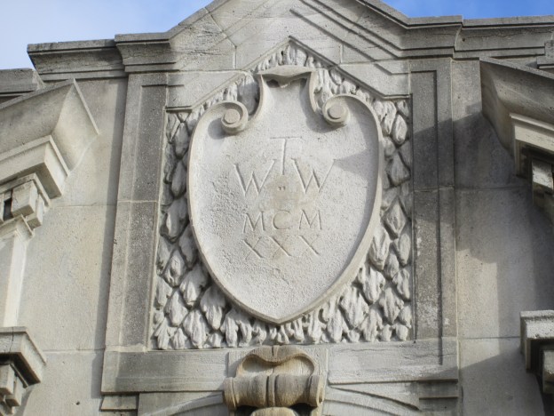
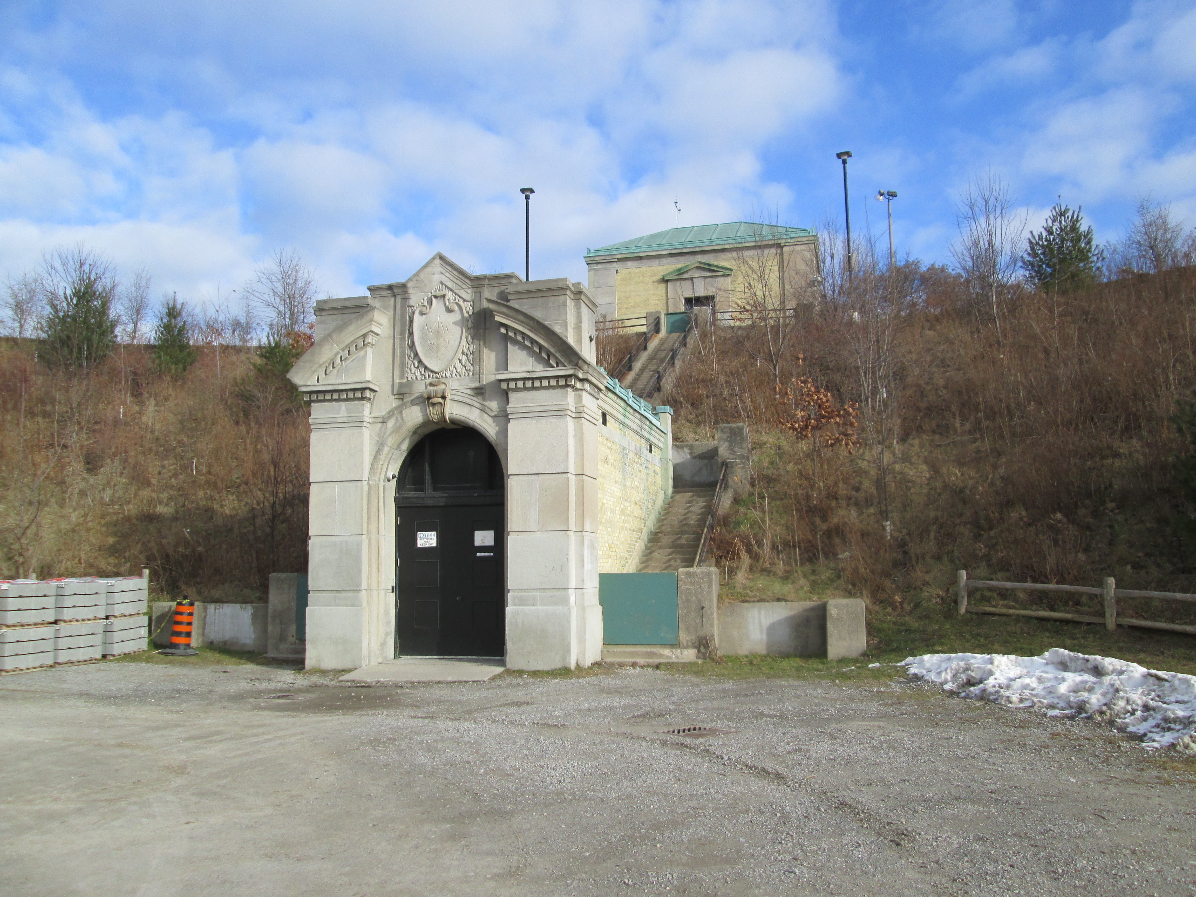
The St. Clair reservoir is located on the south east corner on property that was sold to the city in 1913. The reservoir was part of a larger project of public works planned and developed by R. C. Harris in the 1920’s. The R.C. Harris Filtration Plant on Victoria Park was the first part of the Water Works system to be built. After the Lake Ontario water had been purified it was pumped to reservoirs throughout the city for storage and delivery. The reservoir at St. Clair was the first to be completed in 1930. The cover photo shows the date stone with it’s inscription TWW (Toronto Water Works) and MCMXXX (1930). The picture below shows the valve house at the top of the reservoir and the pipe tunnel portal below. A grand staircase climbs the reservoir between them.
When the reservoir was designed there was a fear that power failures could cause loss of water to the homes north of the reservoir. Harris envisioned a water tower that would provide a 30 minute supply of water to homes in district 3. The steel water tower would have cost $43,000 but Harris also designed a $70,000 neo-classical cladding for the outside to match with the pump houses. With the great depression deepening city council didn’t approve the water tower. Harris built the foundations for the water tower in the hopes that it would later get approved. Improvements in the delivery of electrical power made the water tower obsolete and in the end it was never built. On the south corner of the reservoir there is a mysterious concrete circle, the foundations for the planned water tower.

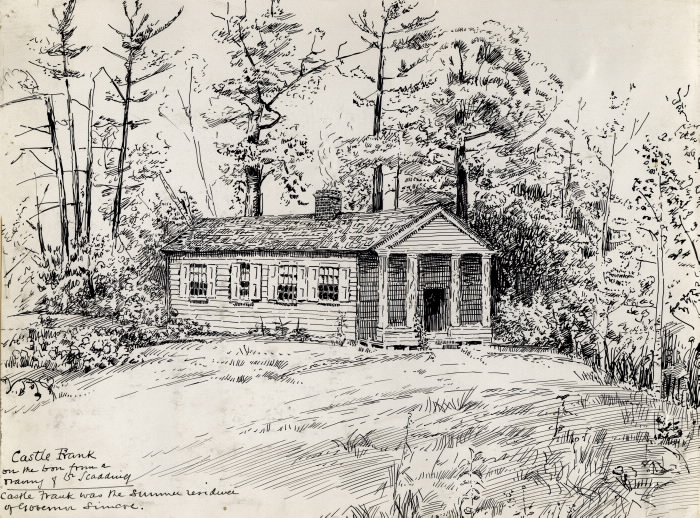
The reservoir overlooks Nordheimer Ravine. Samuel Nordehimer emigrated to Canada from Bavaria in 1844. Along with his brother Abraham they opened a piano factory in The Junction. A & S Nordheimer became one of Canada’s best known piano manufacturers. Castle Frank Brook flows through the ravine on it’s way to join the Don River. Castle Frank Brook is named after the home of Lieutenant-Governor John Graves Simcoe and his wife Elizabeth. Constructed in 1793, Castle Frank was the first of many grand estates built north of the town of York. The sketch below shows what the home of the Simcoes looked like.
Castle Frank Brook was buried in the 1970’s when the Spadina subway line was extended. It now flows through a sewer pipe under the ravine. As I walked along the ravine I saw a rather unique tree house. This one has a smiley face cut in the side for windows.

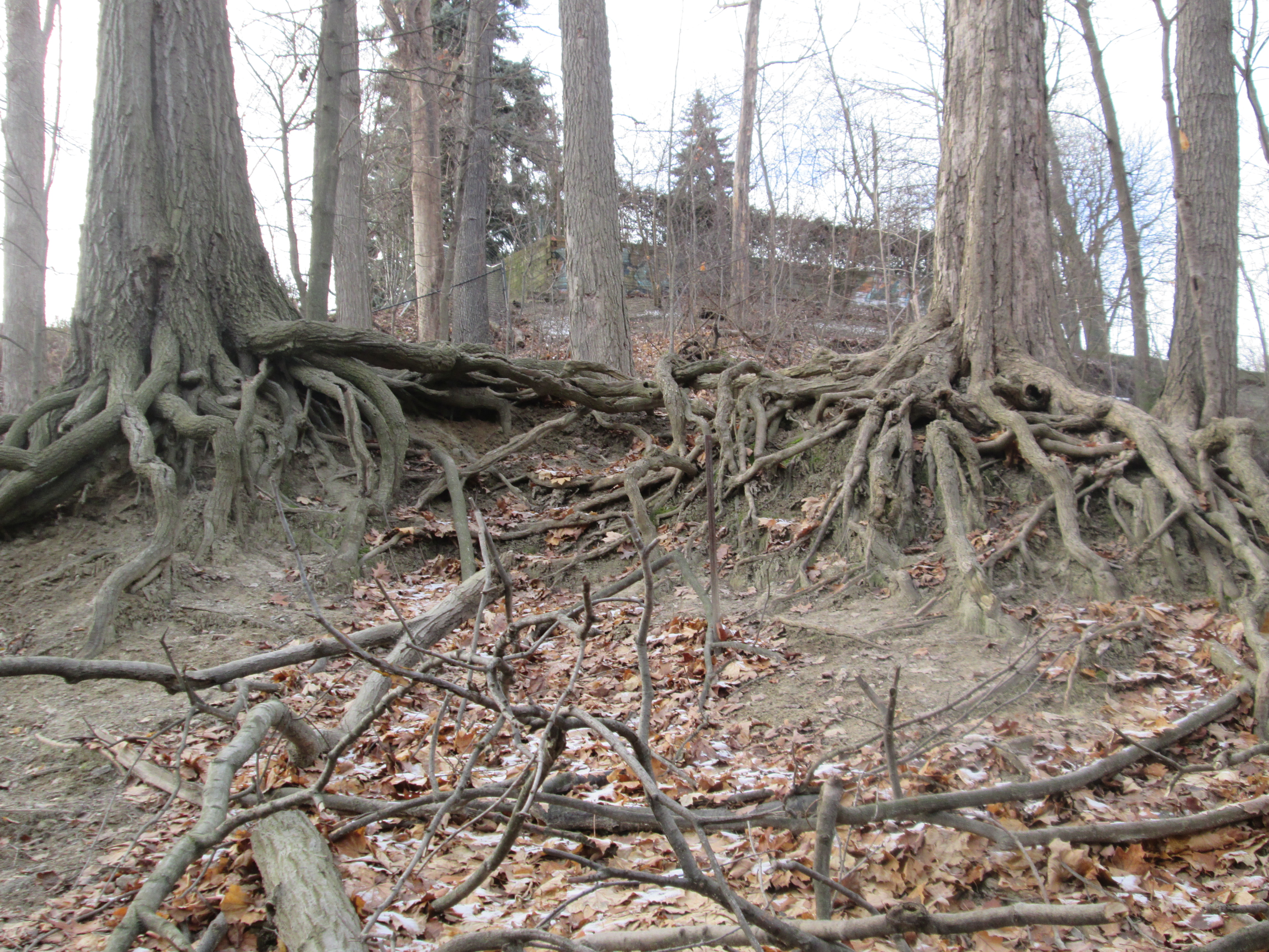
Soil erosion on the hillsides has left a lot of tree roots exposed. The root system of a plant is normally close enough to the surface to take advantage of nutrient and water availability. However, where water is scarce, roots have been known to extend over 60 meters into the ground.
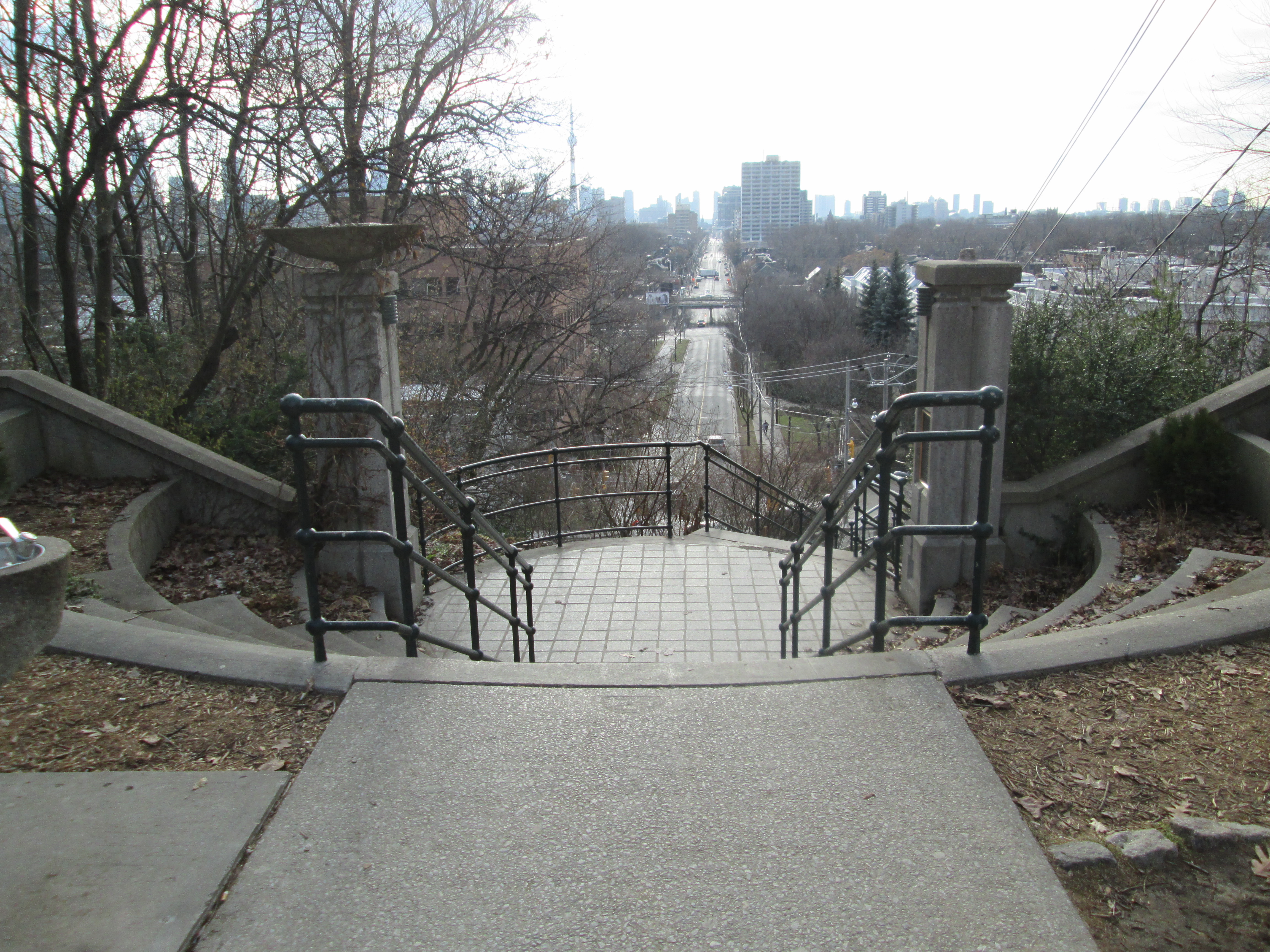
The bridge across Nordheimer ravine was built in 1929 as part of the infrastructure improvements that went along with construction of the reservoir. An earlier wooden bridge was replaced with the current one which is modeled after the Bloor Street Viaduct, also built by R.C. Harris. Crossing the bridge and continuing south you quickly come to the edge of an old escarpment looking out across the downtown core of the city. Spadina Road was designed as a grand thoroughfare between Queen Street and Davenport Road.
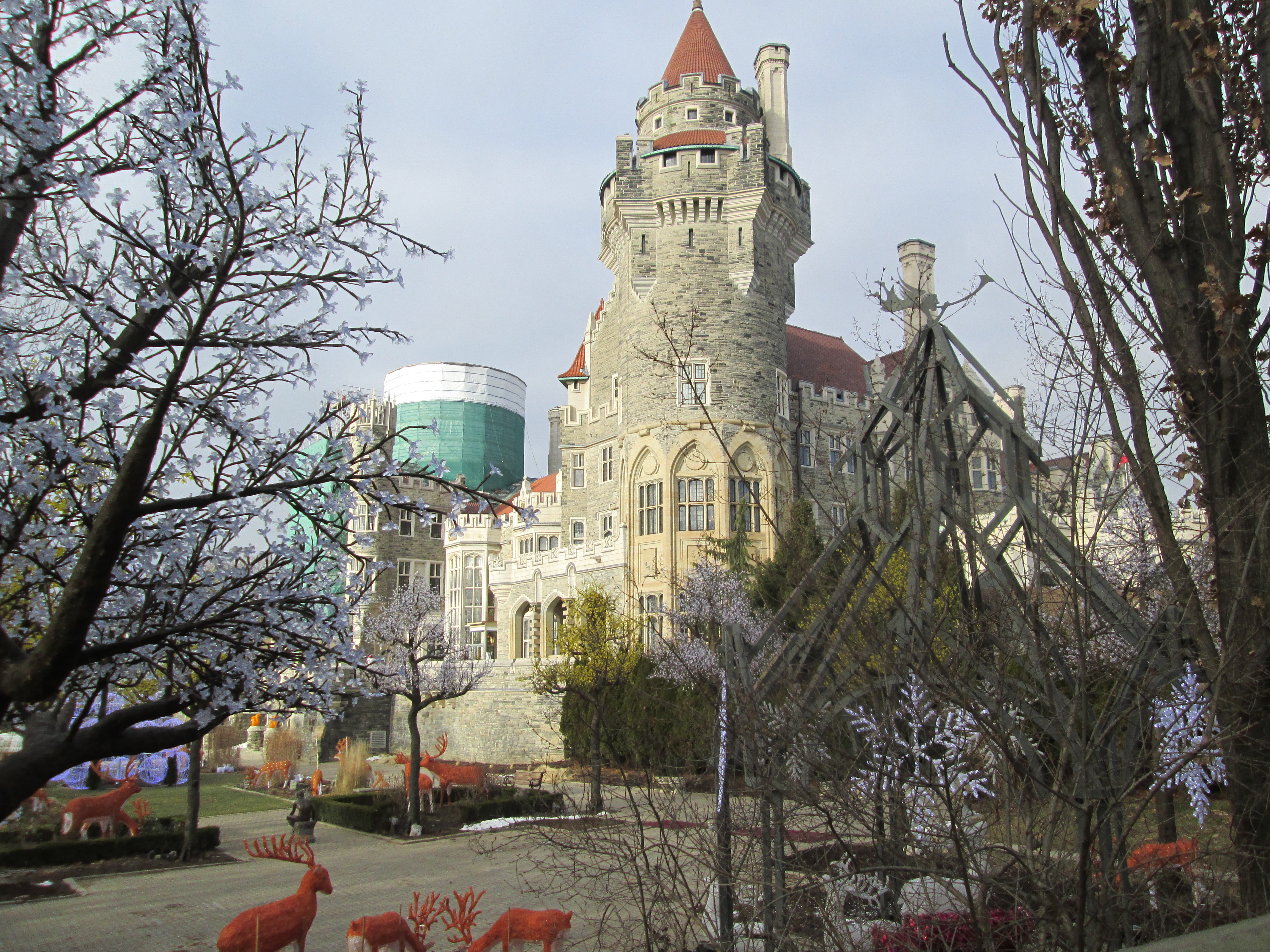
With 98 rooms the largest private home ever built in Canada is Casa Loma. It was constructed between 1911 and 1913 for Henry Pellatt. Henry had made his fortune by developing Niagara Falls for electrical production and bringing hydro to the city of Toronto. We had found the remnants of his power corridor while hiking Humber Bay to Bloor Street on May 24. The front lawn was laid out for Christmas.
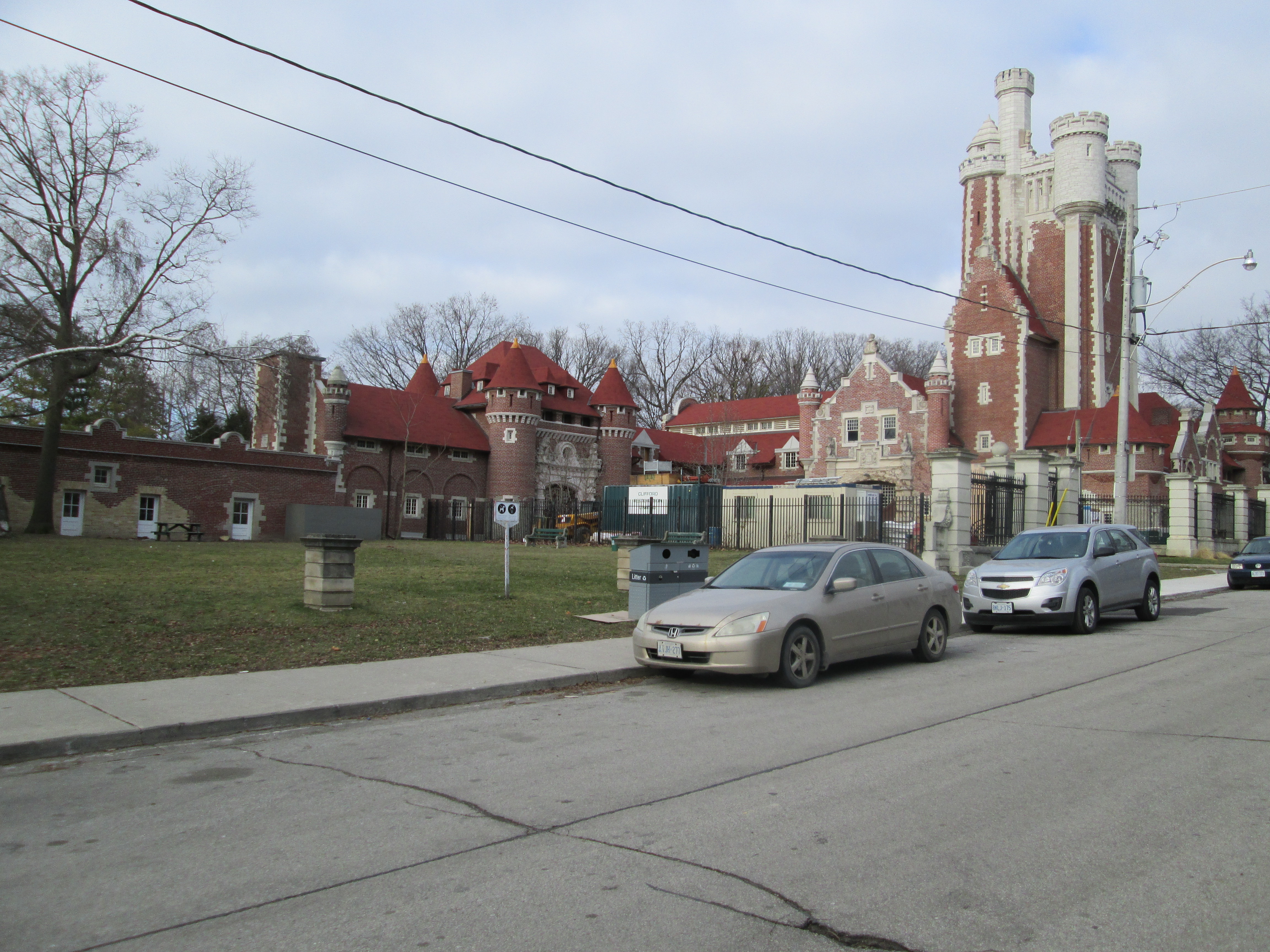
When Pellatt was envisioning Casa Loma he was also thinking about his horses. He had elegant stables built in 1905 in anticipation of building his castle. He lived here while the castle was under construction. There was an 800 foot tunnel built underground from the stables to Casa Loma. During the second world war a top secret installation here assembled ASDIC, an early version of sonar that was to prove key in winning the war in the Atlantic.
William Warren Baldwin built the third house to stand on the Spadina property in 1866 completing it in 1913. Spadina house was donated to the city in 1982 and opened as a museum in 1984. It has been decorated to showcase life in the 1920’s.

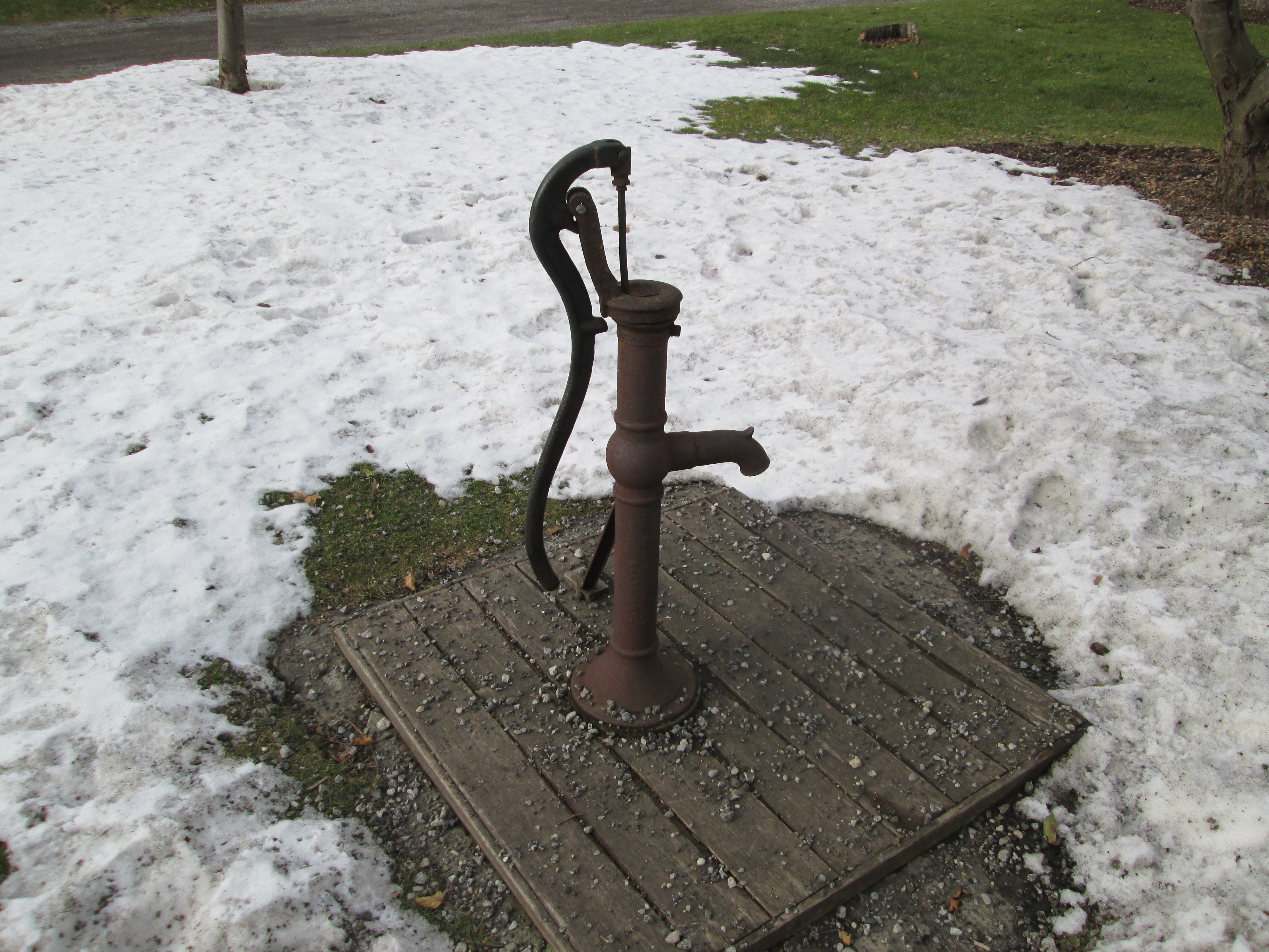
While exploring Earl Bales Park on July 19th an old water pump made by R. McDougall & Co. in Galt was found in the woods. One of their water pumps was installed at Spadina house where it served the needs of the house for several decades.
A set of gardens is laid out in the back of the house similar to the 1905 gardens. A smaller garden near the house grows plants that would have been cultivated there in 1880. After having walked once around the rear gardens of the home I returned to find a red fox walking across the front lawn. Normally a nocturnal hunter, this specimen appeared to be quite comfortable as long as he could keep a distance between us. A hundred years ago Pellatt and his friends might have been out with their fox-hounds chasing this guy’s ancestors.

Like us at http://www.facebook.com/hikingthegta

Pingback: Yorkville Water Works | Hiking the GTA
Pingback: Adamson Estate | Hiking the GTA
Pingback: Cheltenham | Hiking the GTA
Pingback: Hiking the GTA #100 – Amazing Animals | Hiking the GTA
Pingback: Sand Castles – Scarborough Bluffs | Hiking the GTA
thank you for informative and enjoyable accounts, Very nice to vicariously hike with you!
Or Henry Pellatt may have been up at his cottage on Marylake north of King City on Keele Street. I hope you go up for a hike there one day and see the old delapatated barn that is very similar to the barn at Casa Loma. The Oak Ridge Moraine runs through the present day Augustinian Monastery which use to be Henry Pellatts cottage where he raised elk. You can still see some of the original fences that kept the elk in, the cottage us now home to the nuns that cook for the monastery. Lots of similarities to be seen on the property to Casa Loma. After the Pellatts left Marylake, the Toronto Archdiocese ran the property as a farm for the poor and then the Augustinians ran it as a farm fir many years.
Are there guided tours for these posts? If yes, how can one join?
No, not so far anyway but it is possible next year that we may start something.
The Spadina house is absolutely amazing all the furniture is original to the house and the tour guides sure know there stuff
We have the same pump for our well
Pingback: Fascinating history of Casa Loma | 2ns4u
Pingback: Iroquois Shoreline Wood Park | Hiking the GTA
Pingback: Graffiti Alley | Hiking the GTA
Pingback: Toronto Historic Places | Hiking the GTA
Pingback: Cedarvale Park | Hiking the GTA
Pingback: Parkdale Pumping Station | Hiking the GTA
Pingback: Time Travel in Toronto | Hiking the GTA
Pingback: Eaton Hall | Hiking the GTA
Pingback: Eversley – Ghost Towns of the GTA | Hiking the GTA
Pingback: Back Tracks – 8 Years of Trails | Hiking the GTA
Pingback: Casa Loma | Hiking the GTA
Pingback: Inside Casa Loma | Hiking the GTA
Pingback: Oaklands | Hiking the GTA