Saturday, July 20, 2019
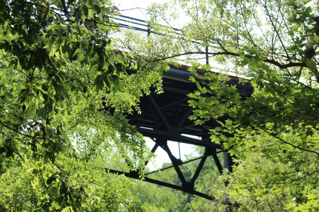
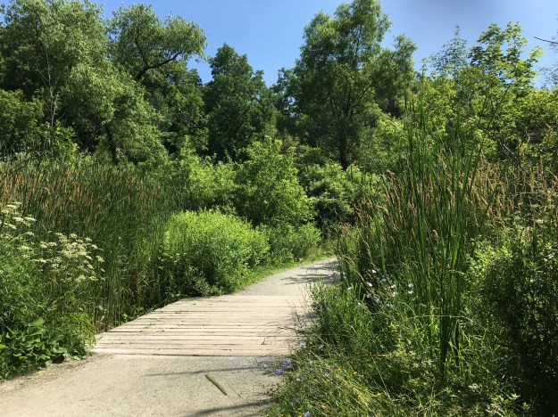
Cedarvale Park spans the ravine which Castle Frank Brook originally ran in. The park runs basically from Eglinton Avenue to St. Clair Avenue. It takes its name from the neighbourhood in which it is found. We decided to visit the park and found that parking near the south end of Glen Cedar Bridge allowed access to the ravine by a set of stairs.
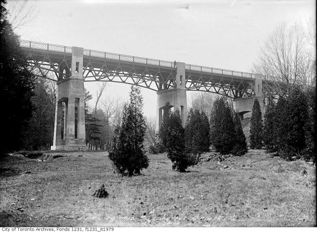
The community of Cedarvale was envisioned by Sir Henry Pellat who owned Casa Loma and the 300 acre property south of Eglinton and west of Bathurst. The plan was to build homes for the wealthy in two subdivisions with the Castle Frank Brook Ravine dividing the two. Connaught Avenue was to be the central roadway and would cross the ravine on a grand bridge which we now know as Glen Cedar Bridge. The historic photo of the bridge below is from the city archives and was taken in April 1915.
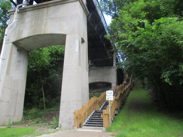
The plan was very ambitious but was disrupted by the depression and only the southern section of Cedarvale was built until many years later. The set of stairs which provides access to the trails in the ravine descends at the north end of the bridge.
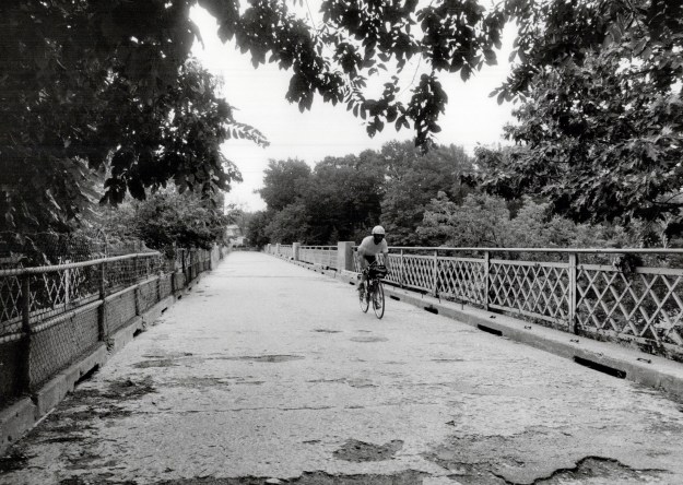
By 1973 the bridge was no longer considered safe and it was designated as a pedestrian bridge. It continued to deteriorate and by the end of the decade the city decided to demolish it. The picture below from Toronto Public Library is dated 1987 and shows the condition of the road bed.
Members of the community rallied together and saved the bridge which has led to restoration as an ongoing pedestrian and bicycle bridge.

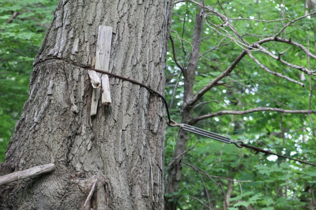
The sides of the ravine are covered with mature trees and several of the houses have had steps built into the slopes to provide access to the park. One of the oddities we found was this cable that has been strung between two trees that are only a few feet apart. The original use is not readily apparent.
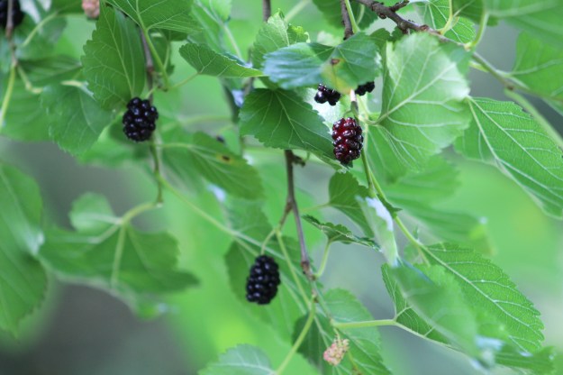
Mulberry bushes grow in several places in the park. Many people don’t realize that these berries are edible, not that we’re advocating eating the fruit in your local park. Mulberries have a very high level of protein and iron compared to a lot of fruit. They are also full of antioxidant and fibre as well as vitamin C.
Even though the park was cleared through the centre in 1975 to facilitate subway construction the sides of the ravine contain a few mature trees. The side trails are regenerating with trees that have been planted by countless volunteers over the decades.
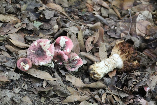
Blackish-red Russula is also known as brittlegill. It is an edible mushroom and is said to be mild tasting compared to some of the hot Russula species. It is best to eat this one cooked although some sites don’t recommend it at all.
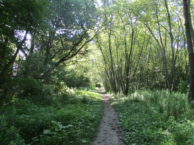
It was one of those hot summer days when the open areas in the park were uncomfortable for hiking through. A highly controversial plan to build The Spadina Expressway would have seen the ravine and the park become an expressway. Allen Road is a section of the Spadina Expressway that was actually built and it ends at Eglinton Avenue. From there the highway would have run through the ravine to meet up with Spadina in a similar manner to how the Don Valley Parkway dominates that rivers ravine.
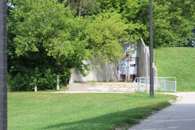
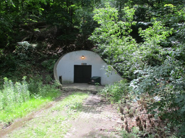
Toward the north end of the park is a large off-leash area for dogs. The rest of the park is considered to be on-leash although it would be impossible to tell that from the dogs running around loose. Adjacent to the dog park is a concrete structure with a doorway that is built into the side of a hill. This is an emergency entrance/exit to the Spadina Subway line that runs underneath the park. With the cancellation of the exressway through the park, it became a prime candidate for the alignment of the subway which was to run under Allen Road as far as Sheppard Avenue. In the mid-1970’s the park was completely disrupted by the construction of the subway line. The tunnels were built using the cut and cover method which dug a trench through the park and later covered it over and replanted trees and wetlands.
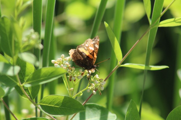
The subway tunnel follows the path of Castle Frank Brook which is also buried beneath the park. Above ground wetlands have reformed where the creek once flowed. Butterflies, such as this red admiral can be seen throughout the park.
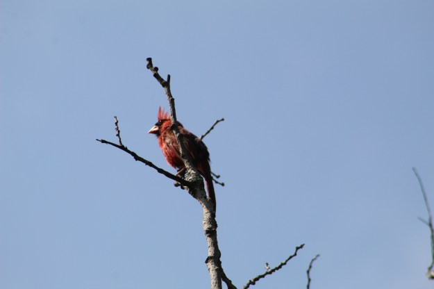
This cardinal is showing signs that it is well past the mating season. His bright red colour has faded somewhat and his crest appears to be poorly groomed. Cardinals molt their feathers in late summer or early fall making them look a little unkempt. It is possible to find them during the peak of the molt looking bald as they may lose all of their crest feathers at once.
At the south end of the park a section of the ravine lies below a housing development. The ravine continues south of St. Clair as Nordheimer Ravine. The subway tunnel continues below the park and this is the site of the most famous accident in the history of the subway system in Toronto. On August 11, 1995 one train had stopped on the line for a transit signal. A second train was coming from behind and being unaware of the stopped train in front of it collided at full speed. Three people were killed and thirty were taken to the hospital with over 100 later filing claims of injury. The Russell Hill emergency access is located just west of the Spadina Reservoir and was used to rescue the victims and evacuate the tunnel.
Cedarvale Park is a hidden jewel in the heart of the Forest Hill area but it is possible to forget the city moves all around and even under the park.
Google Maps Link: Cedarvale Park
Like us at http://www.facebook.com/hikingthegta
Follow us at http://www.hikingthegta.com

Just beautiful!!
A gift of God to Toronto…
Pingback: Back Tracks – 8 Years of Trails | Hiking the GTA