Category Archives: Toronto Historical Buildings

Gooderham Architecture

Sunday, July 18, 2020

Three generations of the Gooderham Family made their mark on Toronto through the distillery of Gooderham and Worts.  Their factory is remarkably well preserved in The Distillery District but they also left their mansions and some major projects, including the King Edward Hotel built in 1903.

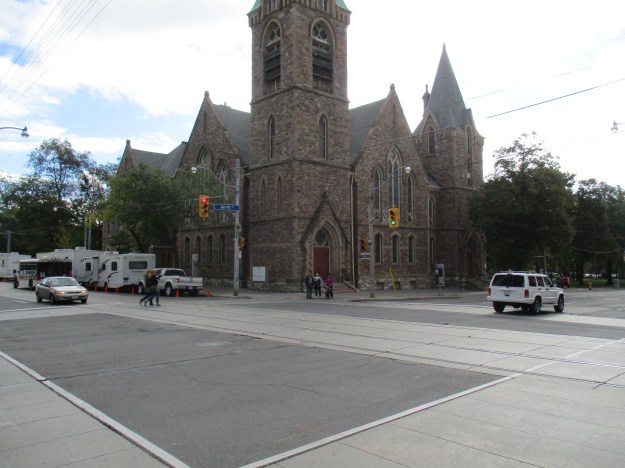
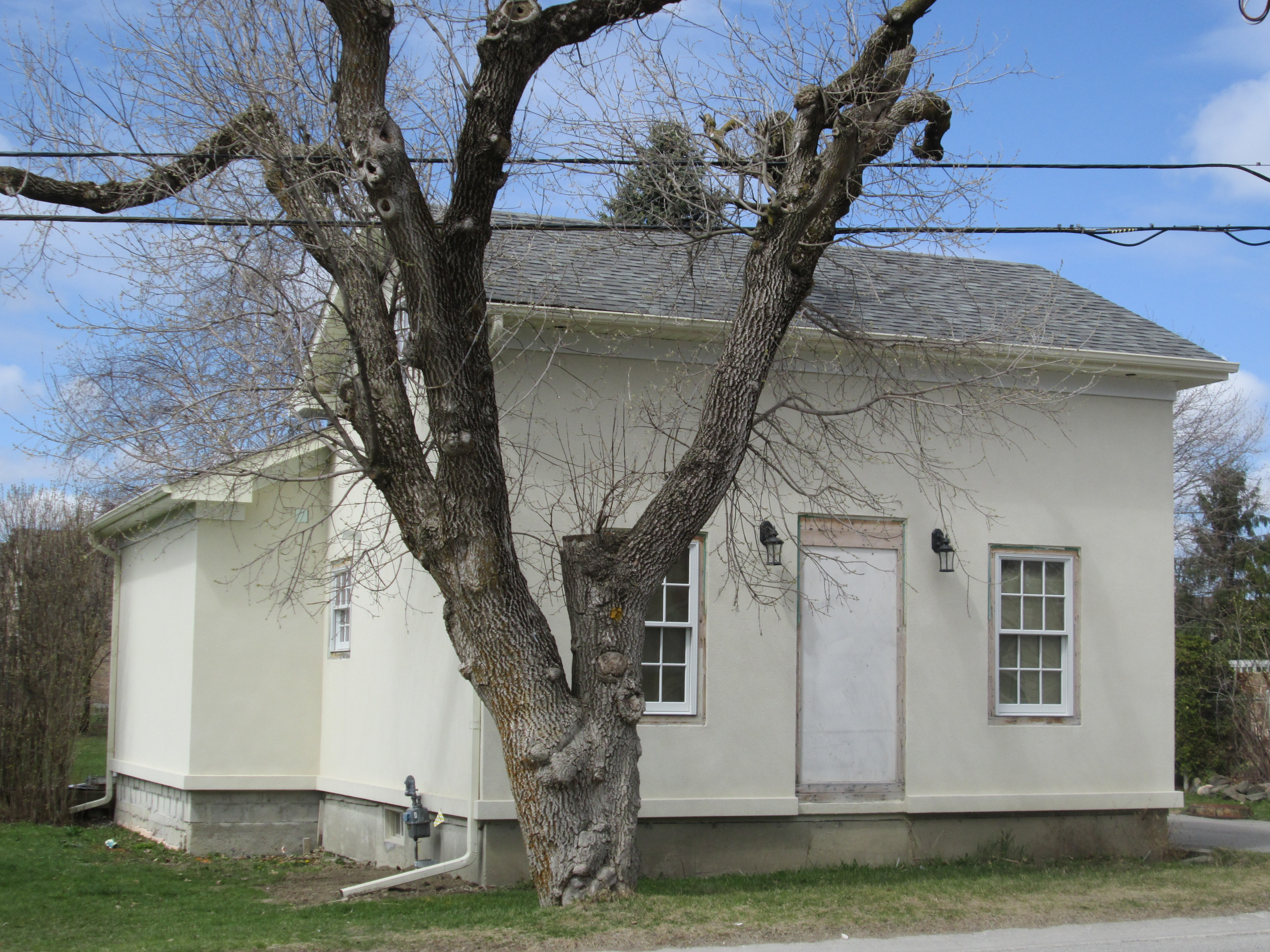
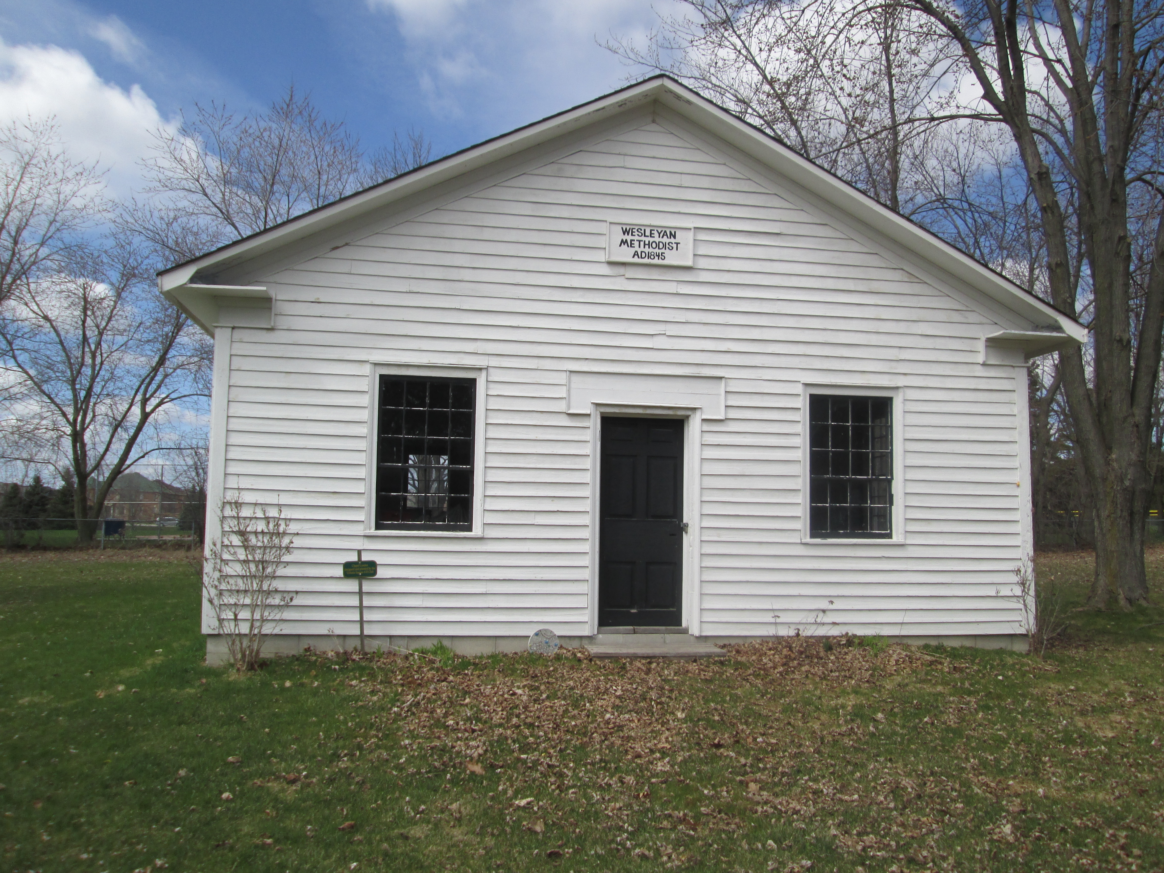
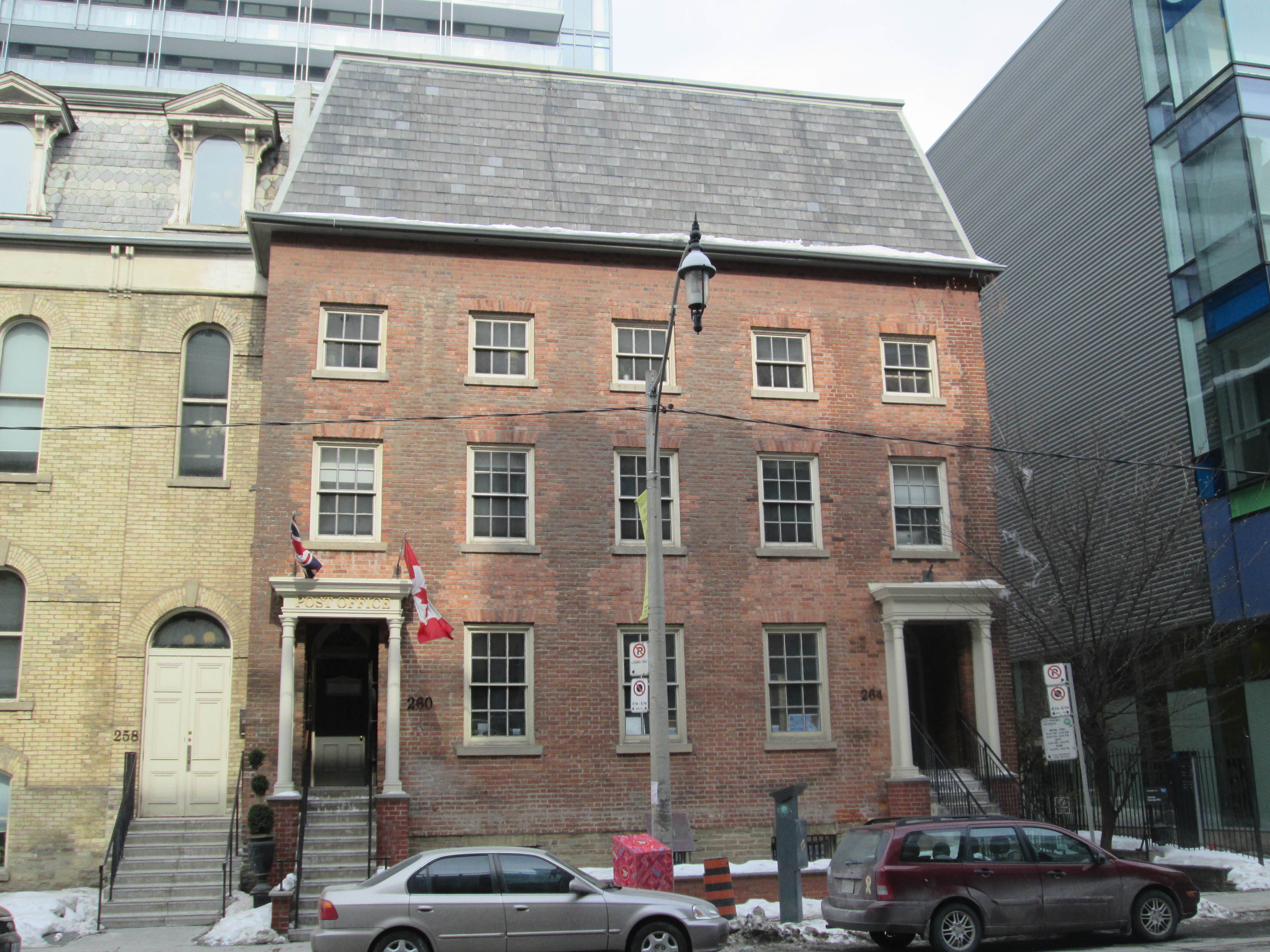
The oldest surviving architecture that can be attributed to the Gooderham Family is the church at 245 King Street East.  Situated just a little north of the Gooderham and Worts distillery the church was founded because many of the factory workers and others in the community couldn’t afford to pay pew fees to attend Bishop Strachan’s Anglican Church.  With the assistance of these two families the Little Trinity Church was built in 1843.

IMG_4359

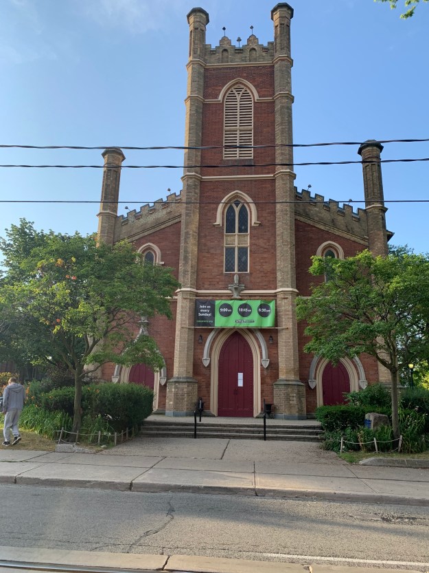
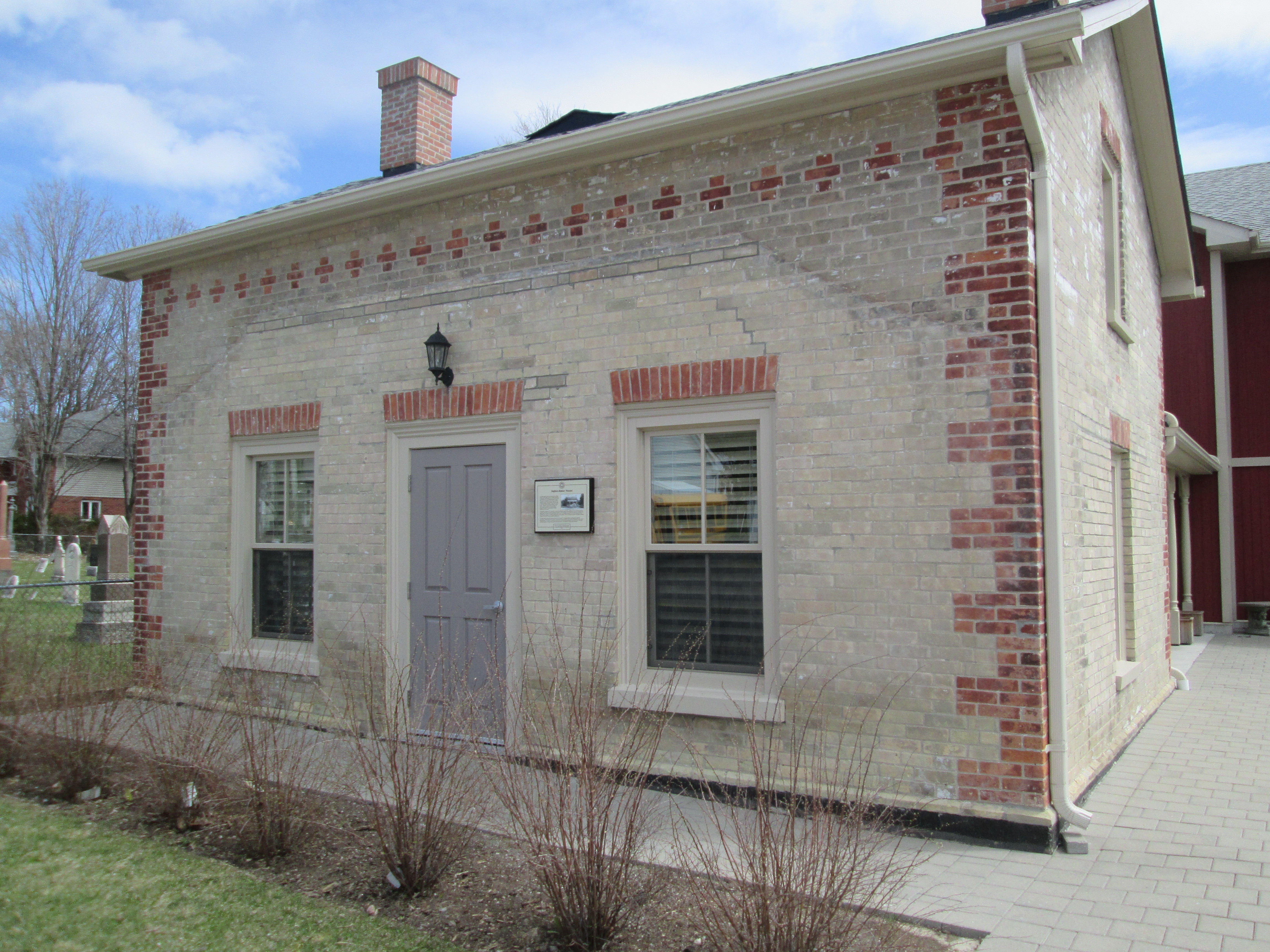
The four buttresses that form the corners of the bell tower are repeated at the rear of the original church.

IMG_4362 (1)

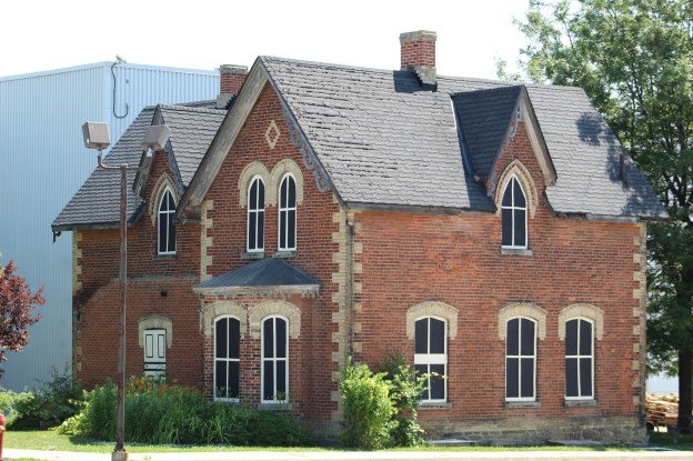
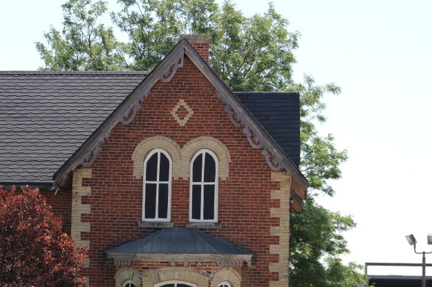
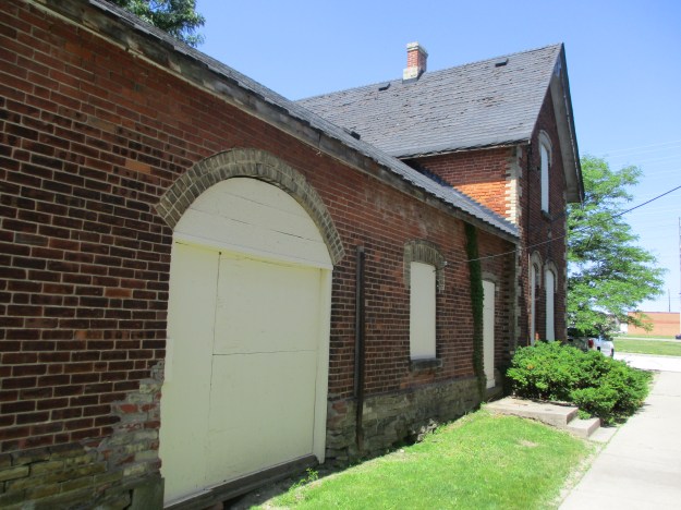
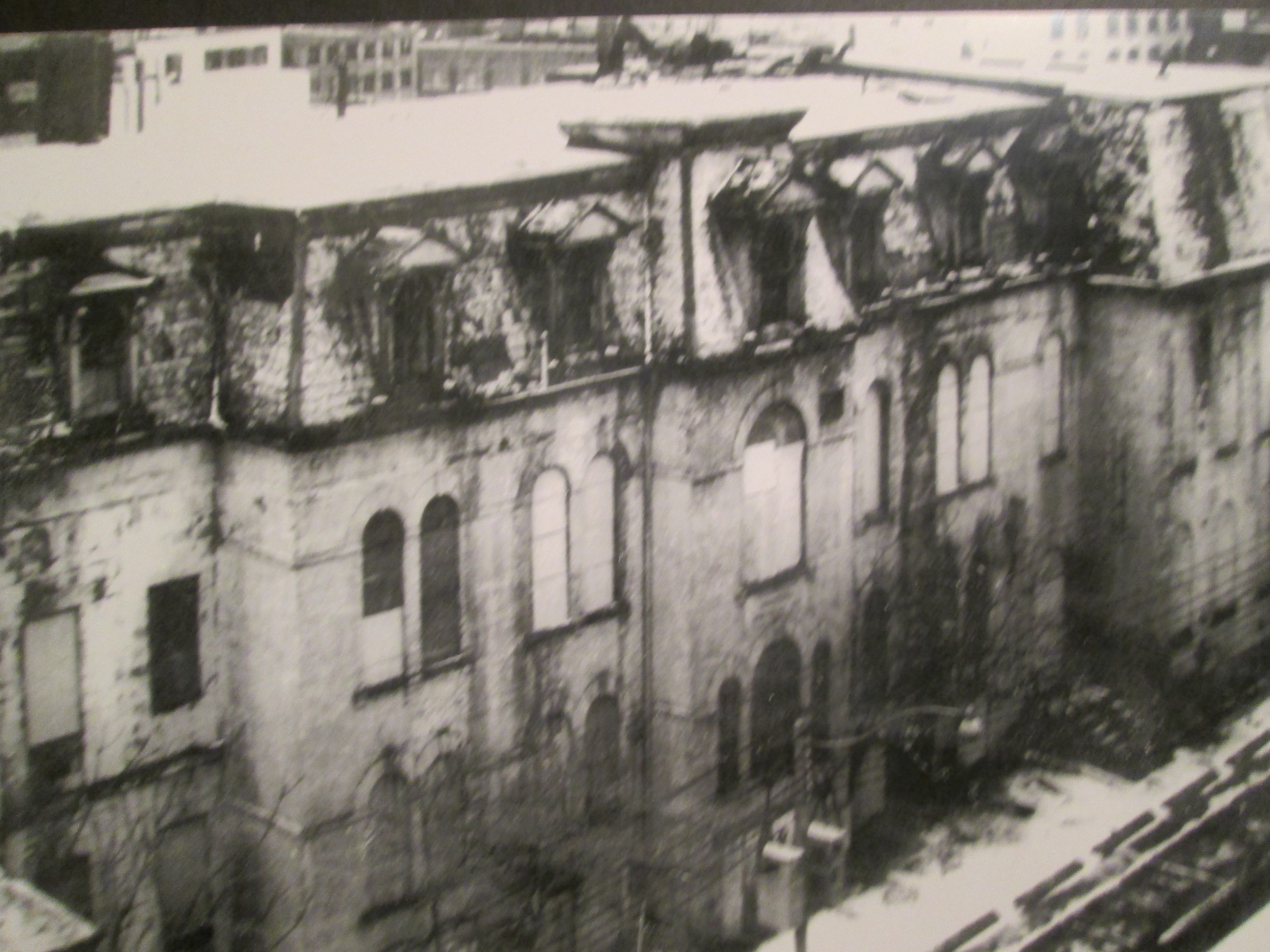
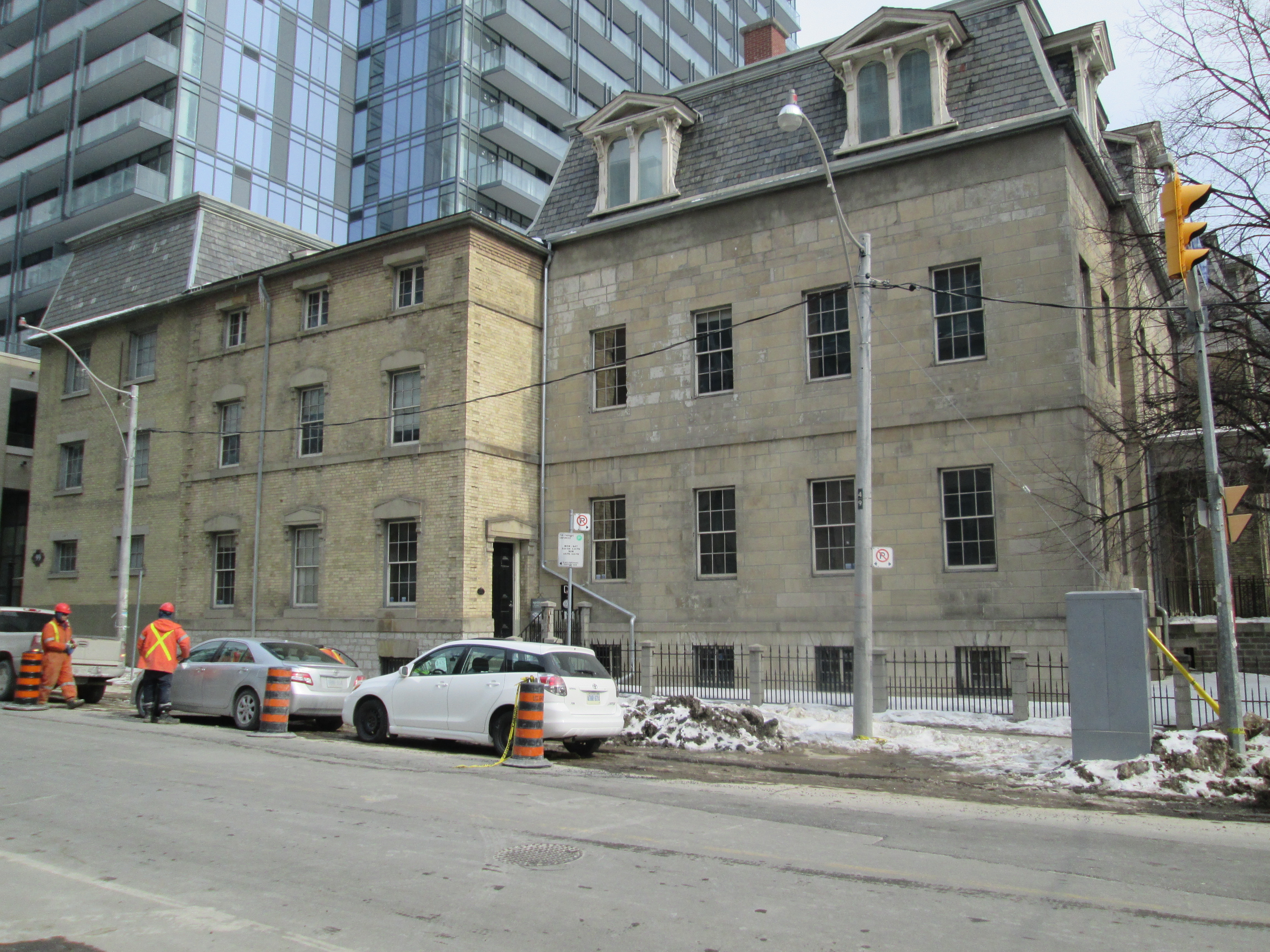
Beside the church stands the rectory that was home to the priests who served the congregation over the years.  The rectory was built in 1853 and is an example of Romanesque and Gothic Revival architecture combined.

IMG_4369

Charles H Gooderham was the eighth, and youngest son of William Gooderham and in 1882 he had a home built at 592 Sherbourne Street.

IMG_4355

George Horace Gooderham built the house at 504 Jarvis Street in 1891 in the Romanesque Revival style that was popular with the family architect David Roberts.  Roberts and his son would design the majority of the buildings at Gooderham and Worts Distilery. George H. was the grandson of the company founder and added his home to a growing list of The Mansions of Jarvis Street.

IMG_4075

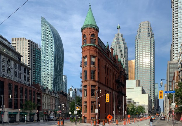
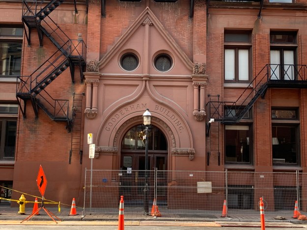
The Gooderham Building is one of the best known structures from the early days of Toronto.  It is also known as the Flatiron Building after the more famous one in New York City.  Interestingly, the Gooderham Building predates the NYC one by a decade.  It was built to house the offices of Gooderham and Worts when the business was booming and had outgrown the offices at the distillery.

IMG_4372

George Gooderham took the office in the top of the five story building where he had a commanding view east along Front Street toward the distillery and the Don River.

IMG_4378 (1)

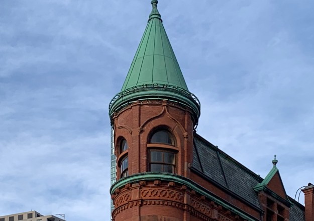
The Gooderham Building was completed in 1892 and was adorned with plenty of carved stone.  It was built for $18,000 and served as the offices Gooderham and Worts until 1952.  It has been protected by a heritage easement since 1977.  Heritage easements are agreements that are placed onto the title for a property and set out details of building which must be maintained in perpetuity.  They may also spell out conditions for renovations.

IMG_4386 (1)

The Flatiron Building has one central window on each floor on the back end of the building.  In 1980 a Canadian artist named Derek Besant won a competition to create a public mural for the building.  He chose to paint a reflection of the Perkins Block across the street which gives the building the appearance of having more windows that it actually does.

IMG_4390 (1)

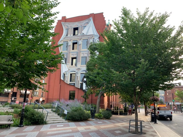
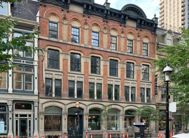
The Perkins Block was designed as a warehouse extension and storefront for a wholesale grocer named Frederick Perkins.  It was completed in 1875 and faced the original three story building named The Coffin Block that stood where the Gooderham Building would be constructed.  Notice the Italianate brickwork with multiple arches on the fourth floor windows.  These can be seen on the Flatiron Building mural.

IMG_4389 (2)

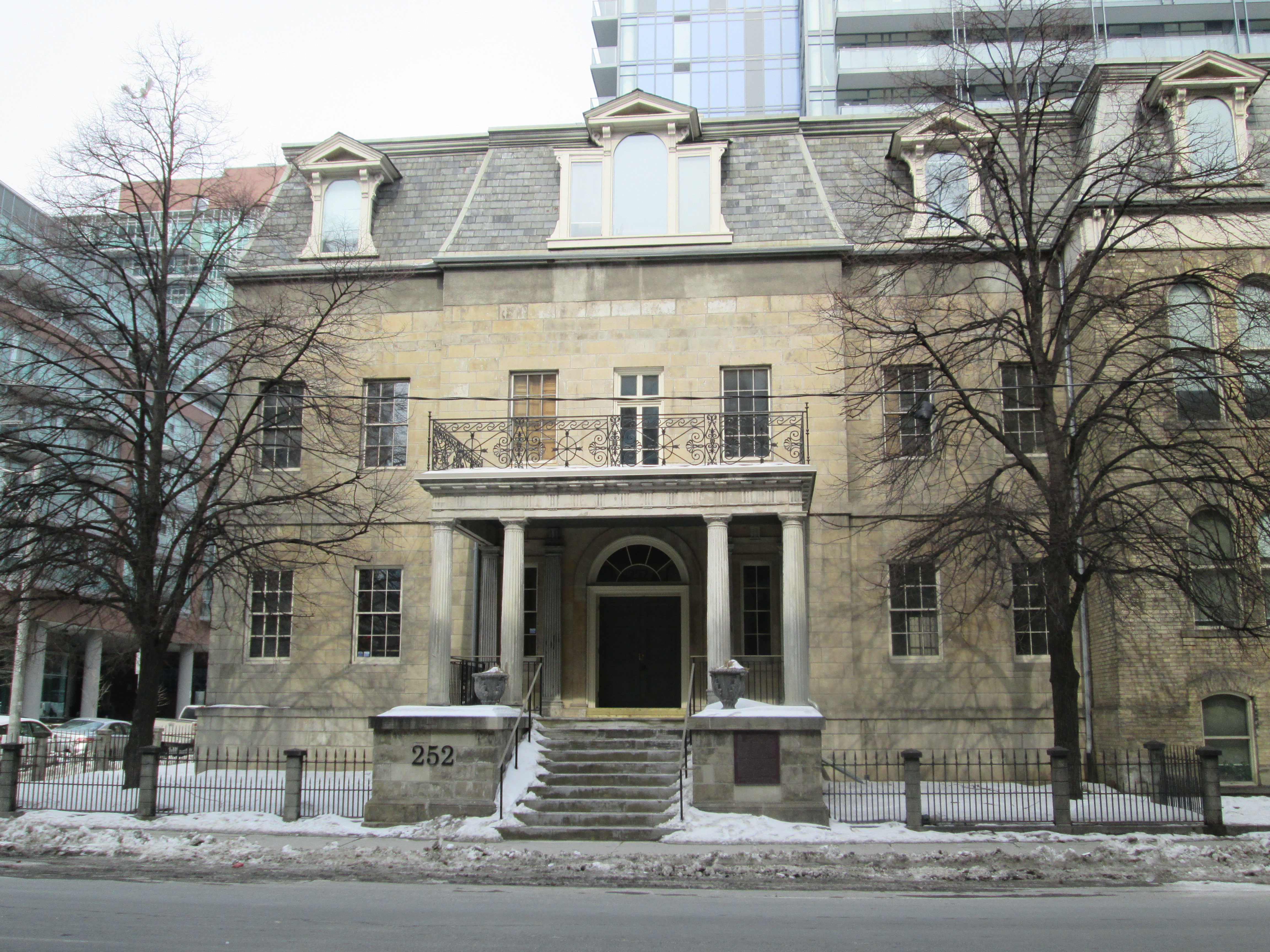
Between 1890 and 1892 George Gooderham built an imposing mansion on the corner of Bloor Street and St. George Street.  He had inherited the distillery when his father passed away in 1881 and was involved in the world of finance.  He founded the Bank of Toronto which is now the TD Bank.

IMG_4401

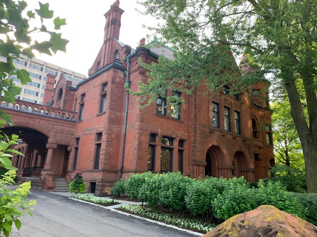
The house features a domed witch-hat tower, similar to the one on the Gooderham building.  Fancy brickwork on the chimney is complimented by the carvings around the tower base.  When George passed away in 1905 his widow Harriet sold the house and it has been home to The York Club since 1910.

IMG_4408

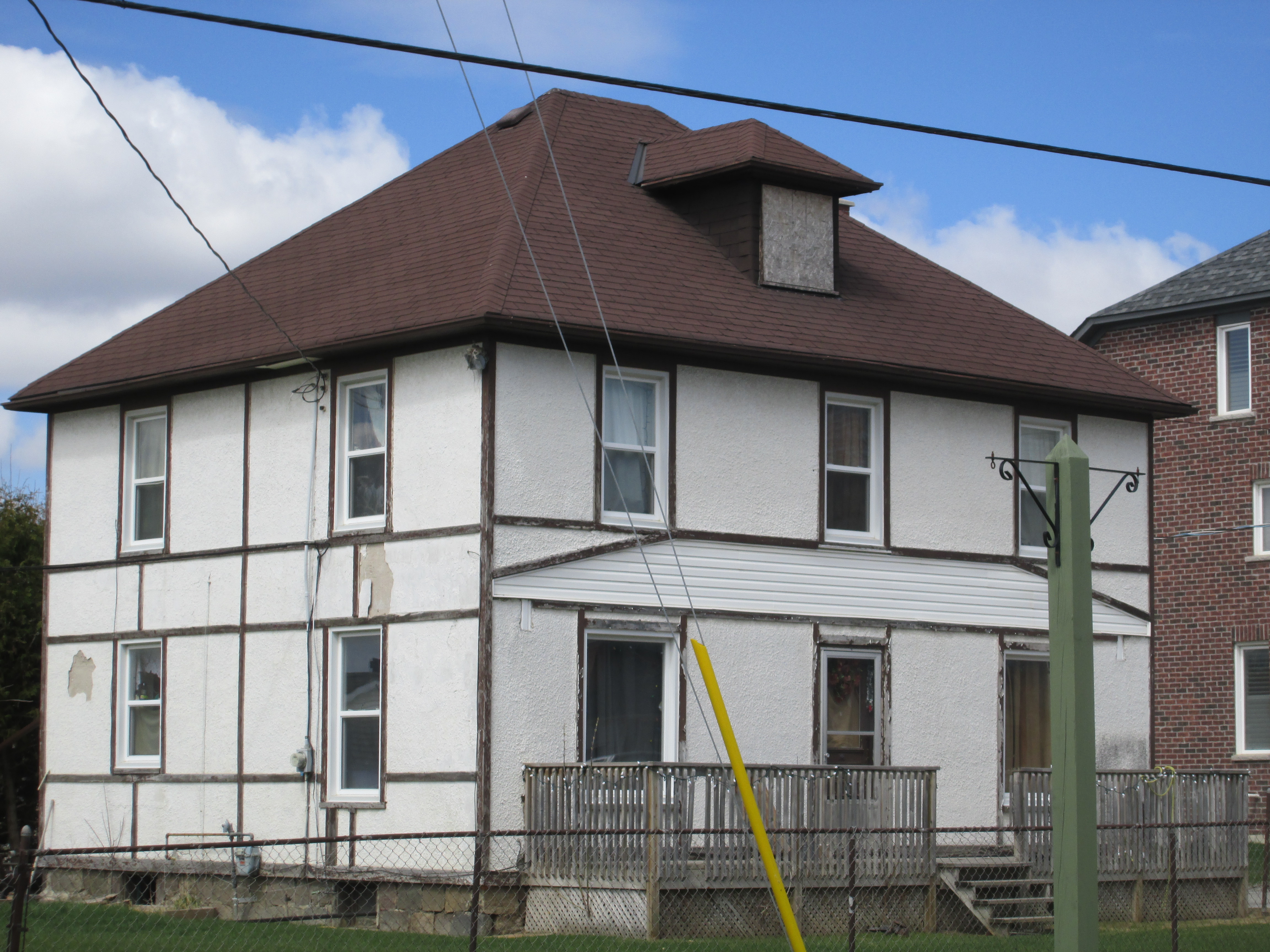
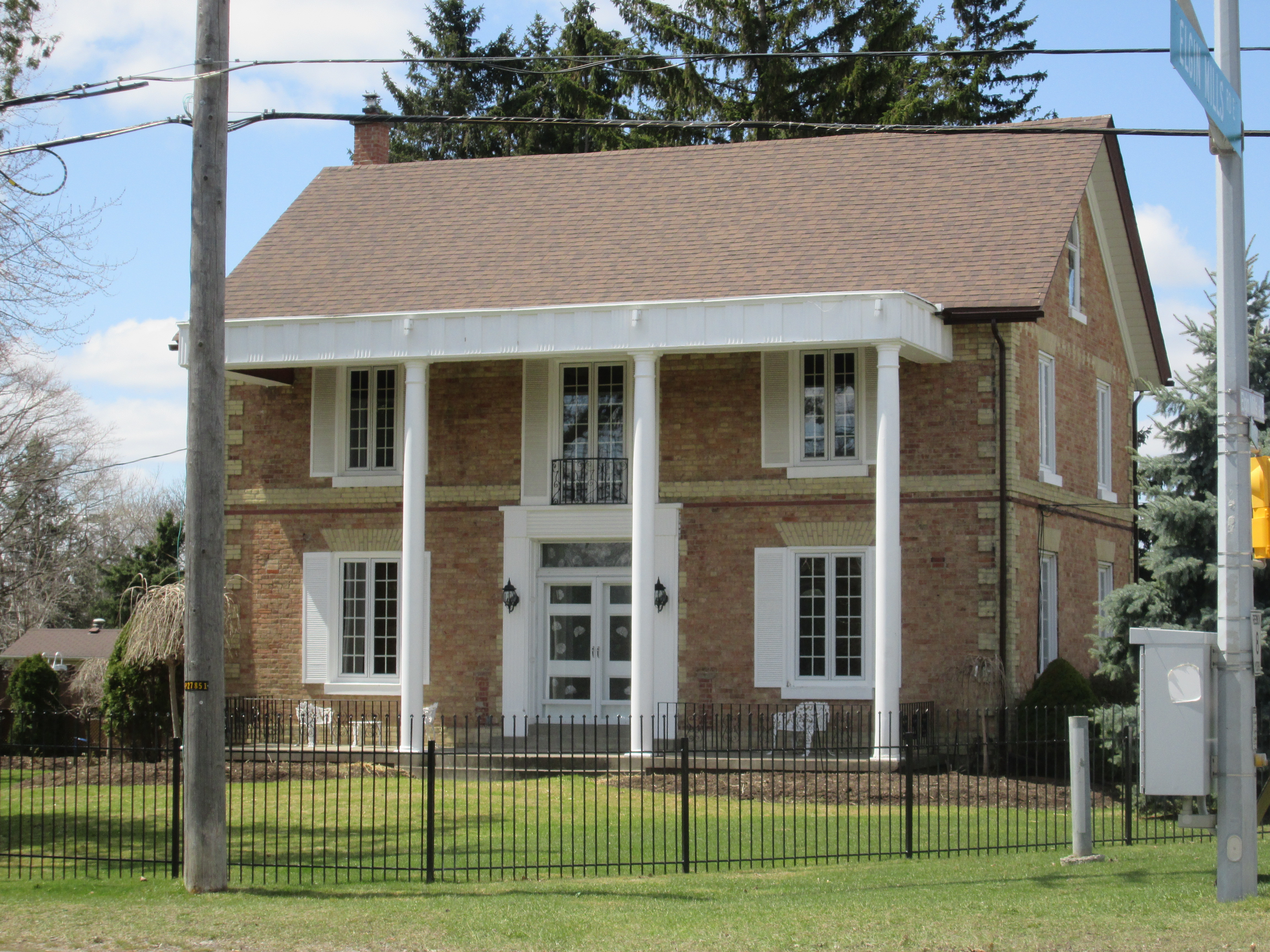
By the turn of the century the affluent neighbourhood had moved north of Bloor Street and the area of Rosedale became home to the new rich families in the city.  Edward D. Gooderham was one of the sons of William George Gooderham and he built his home in 1907 on Sherbourne Street North among the mansions of Rosedale.

IMG_4418

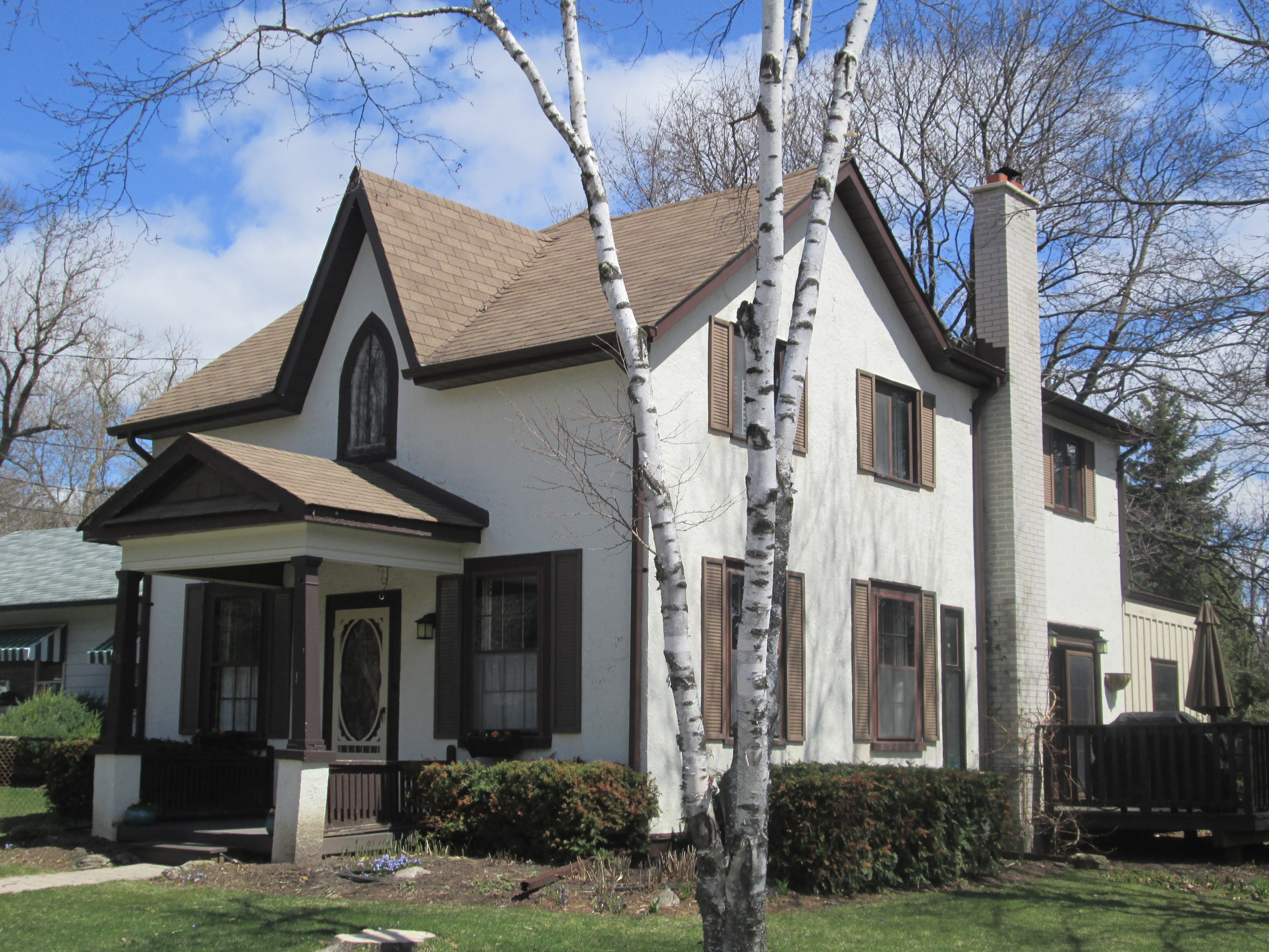
Built in 1908 the home at 112 Waren Road in Forest Hill represented a presence for the  Gooderham Family in the next wealthy neighbourhood.  The house features seven bedrooms in its two and a half storys.

IMG_4415

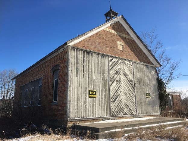
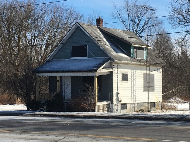
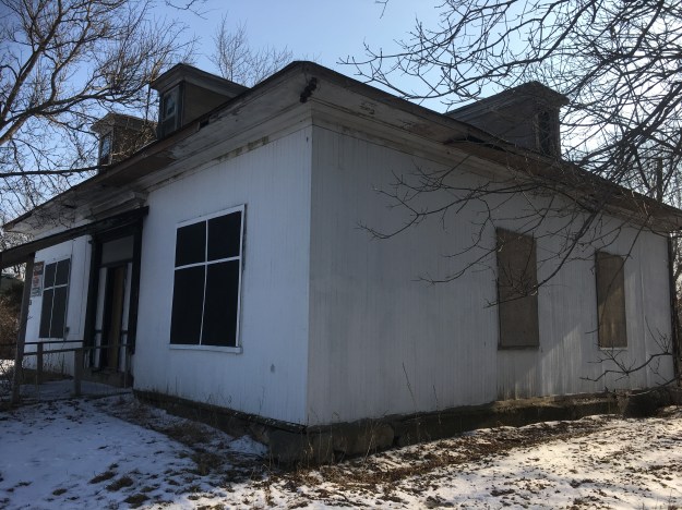
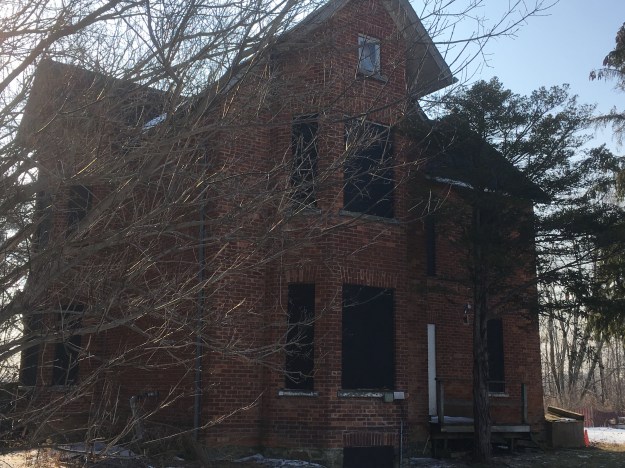
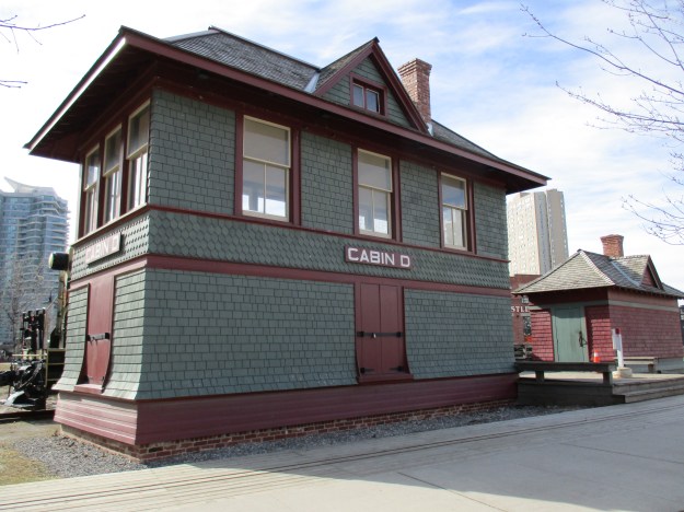
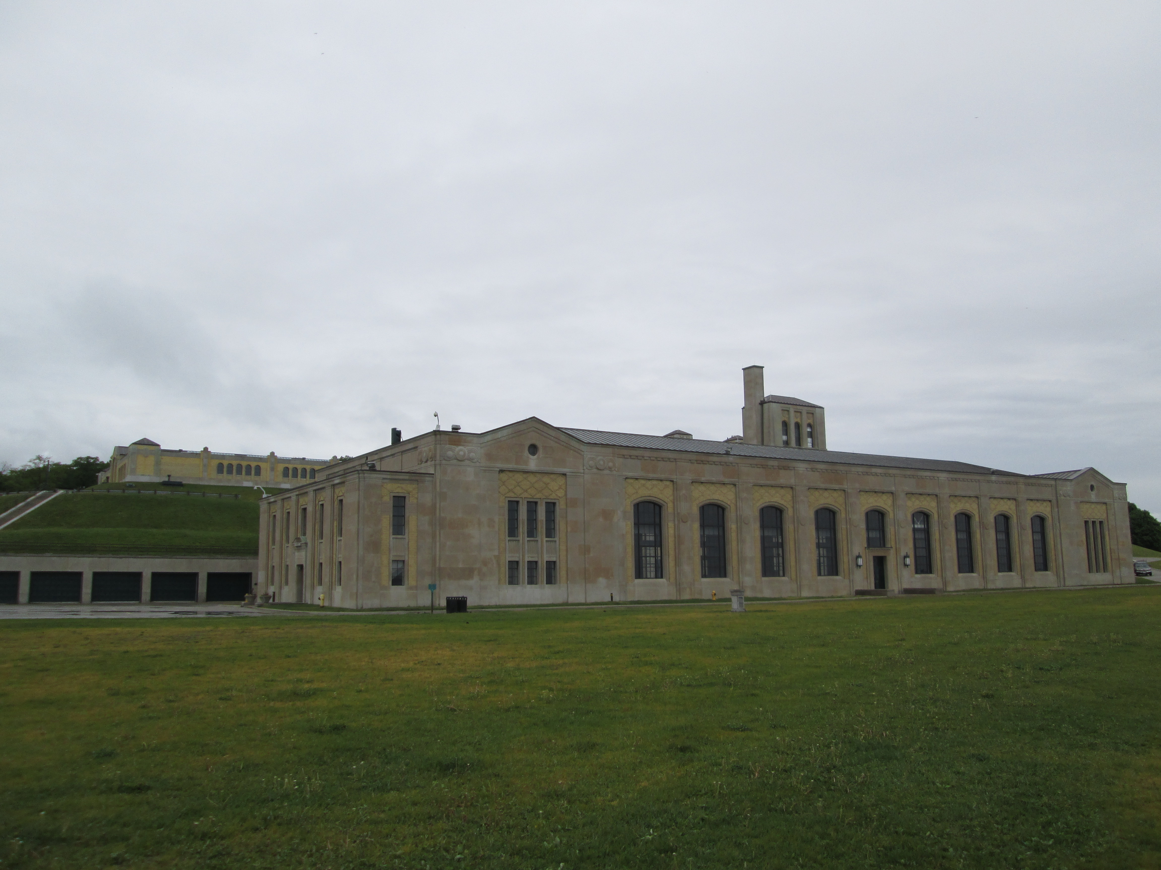
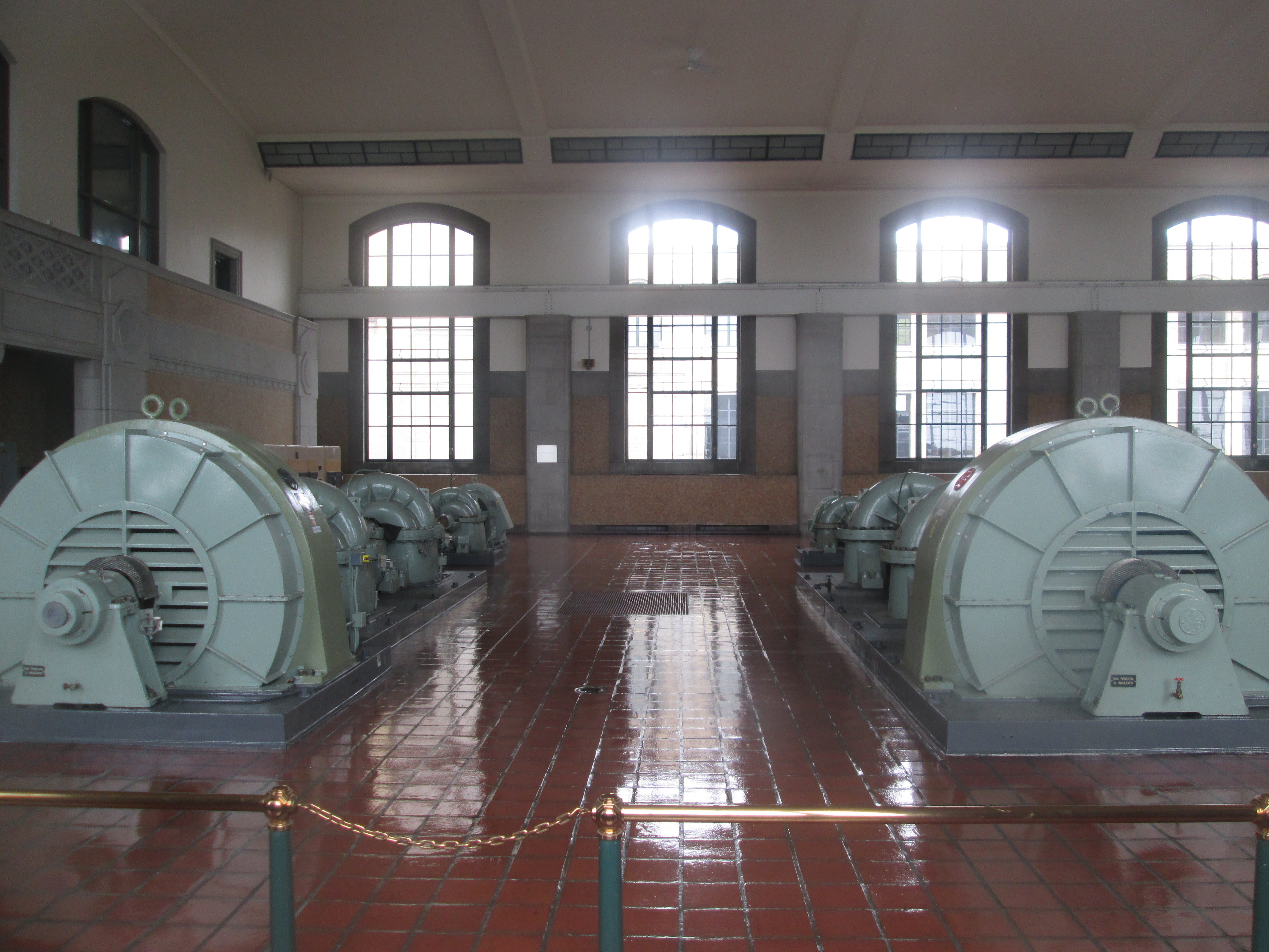
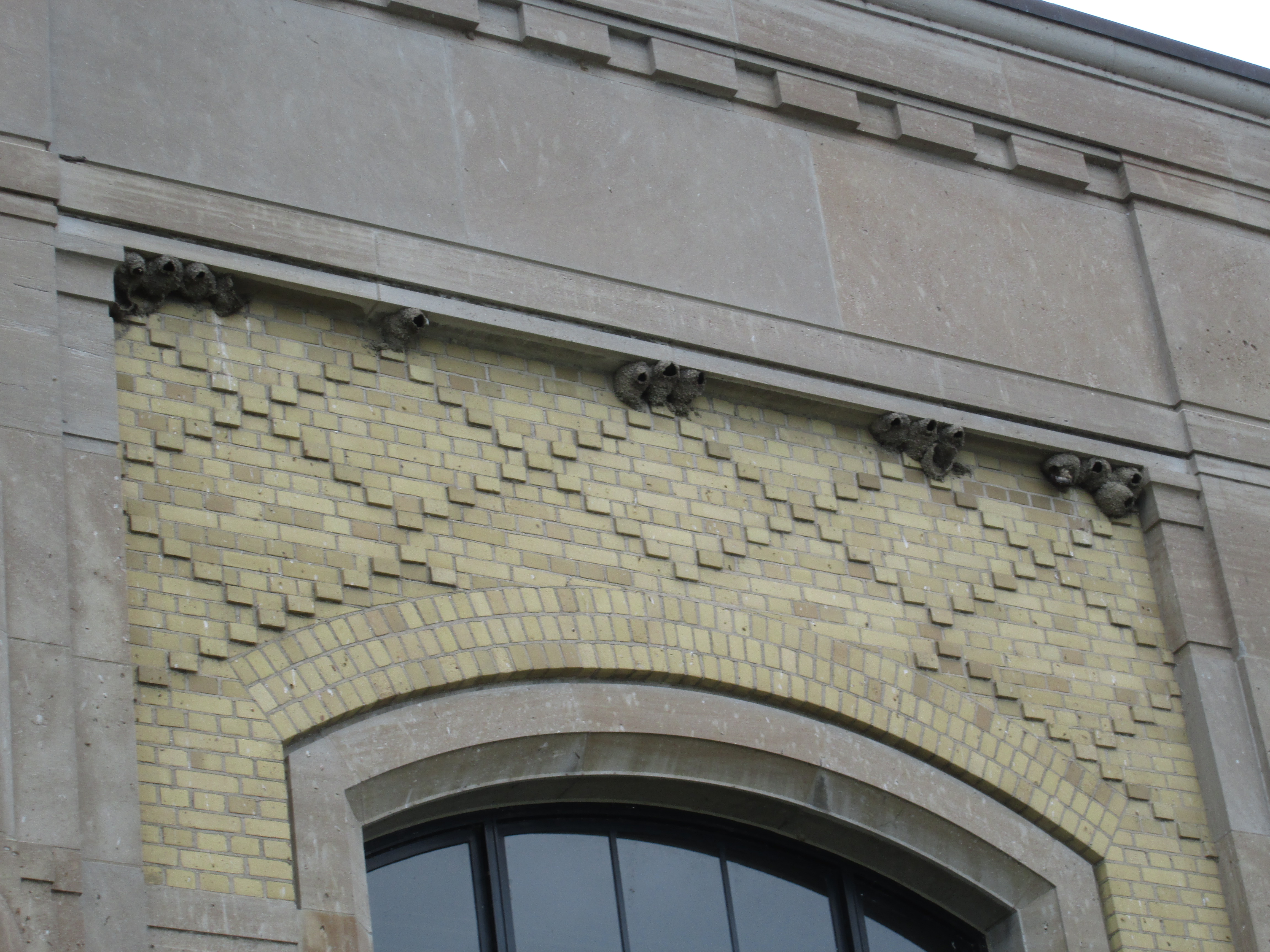
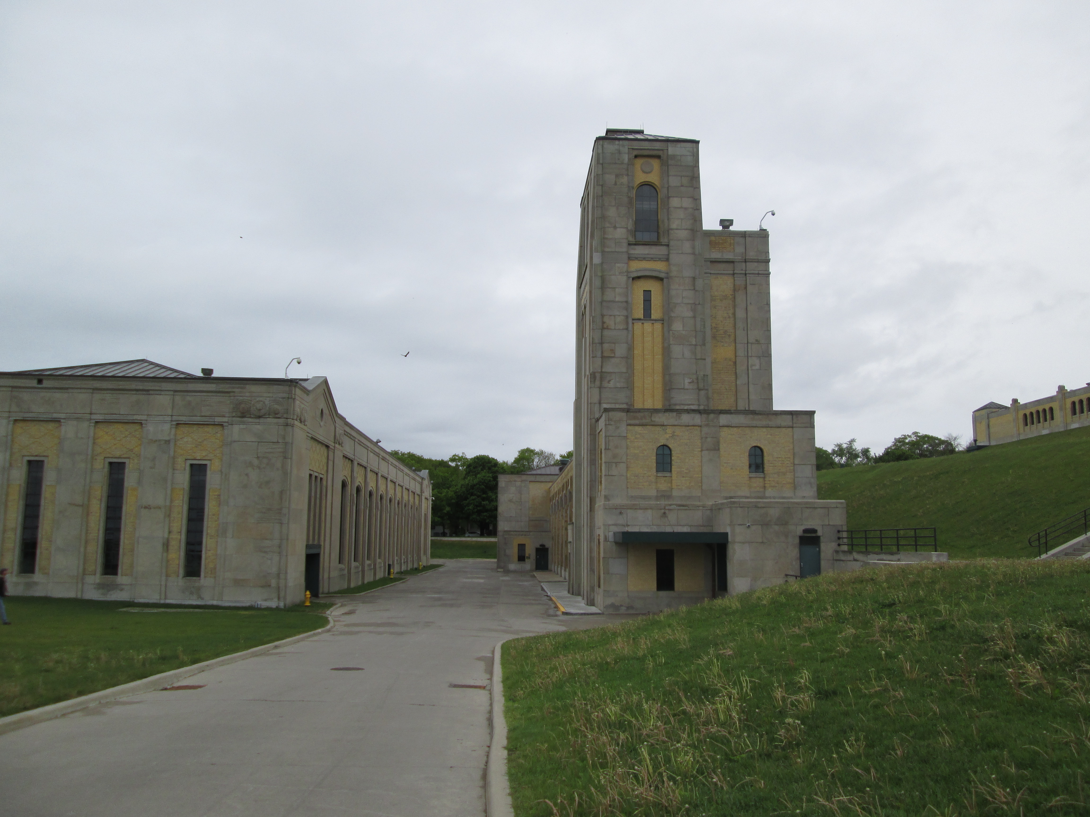
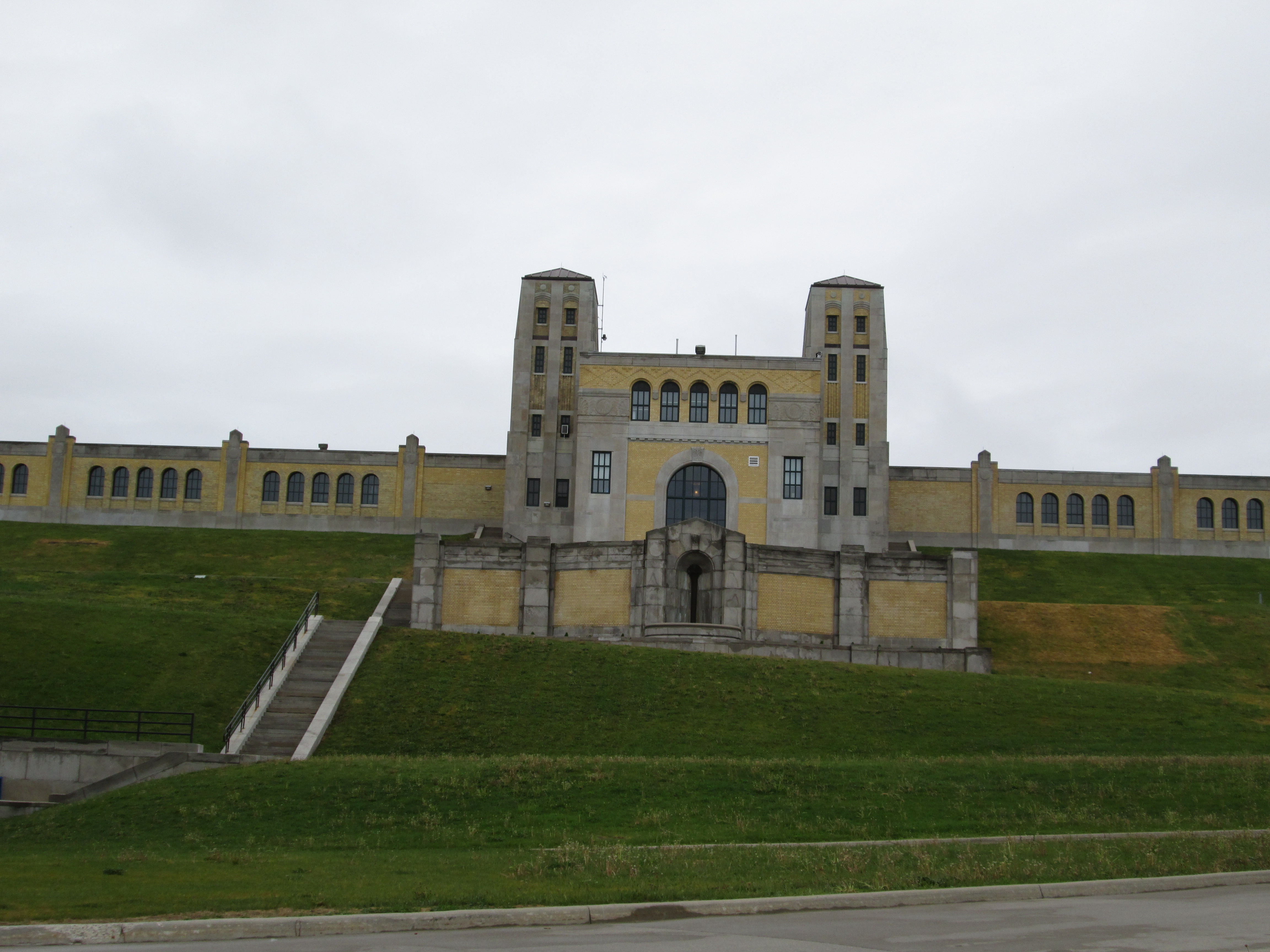
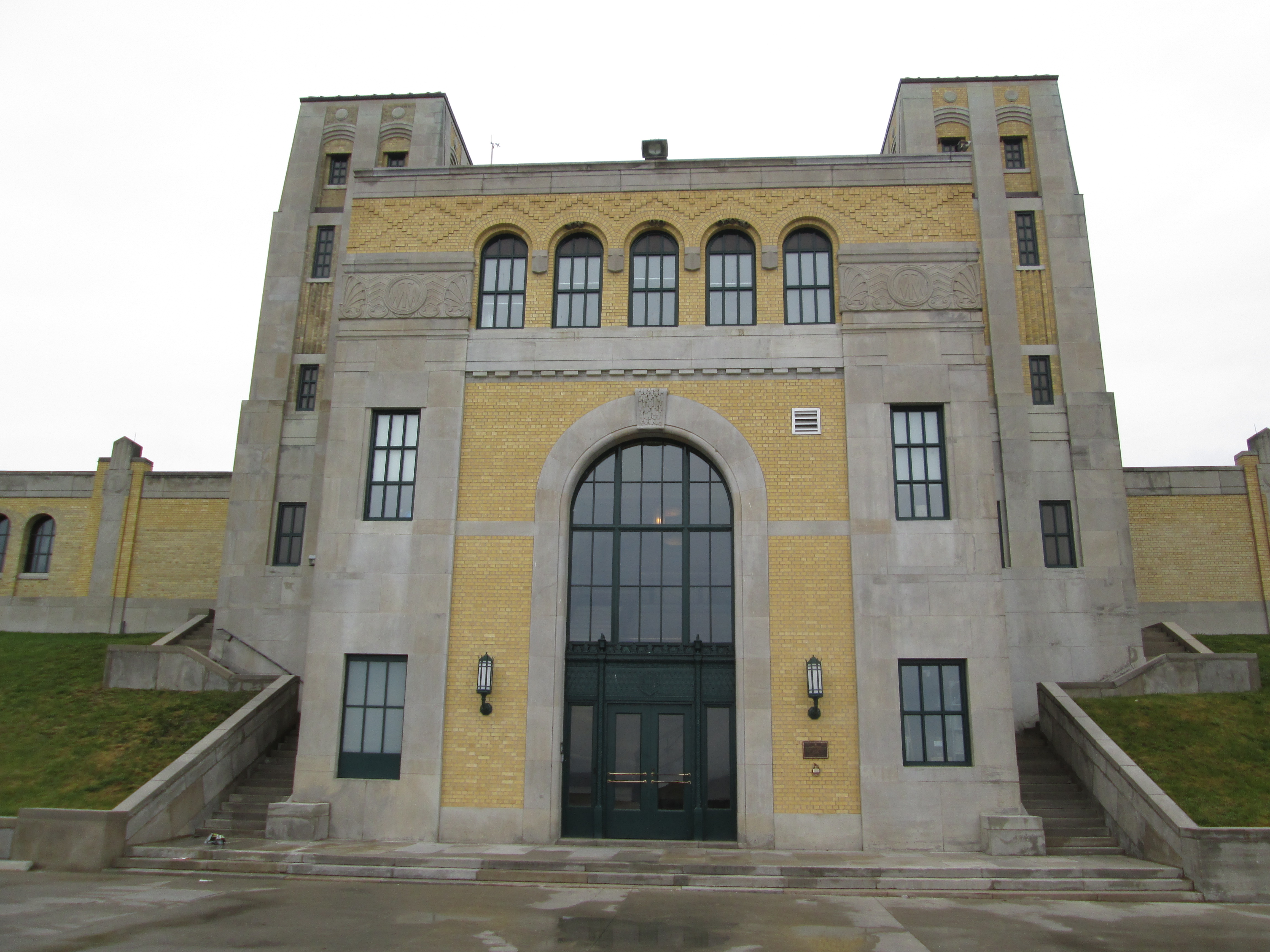
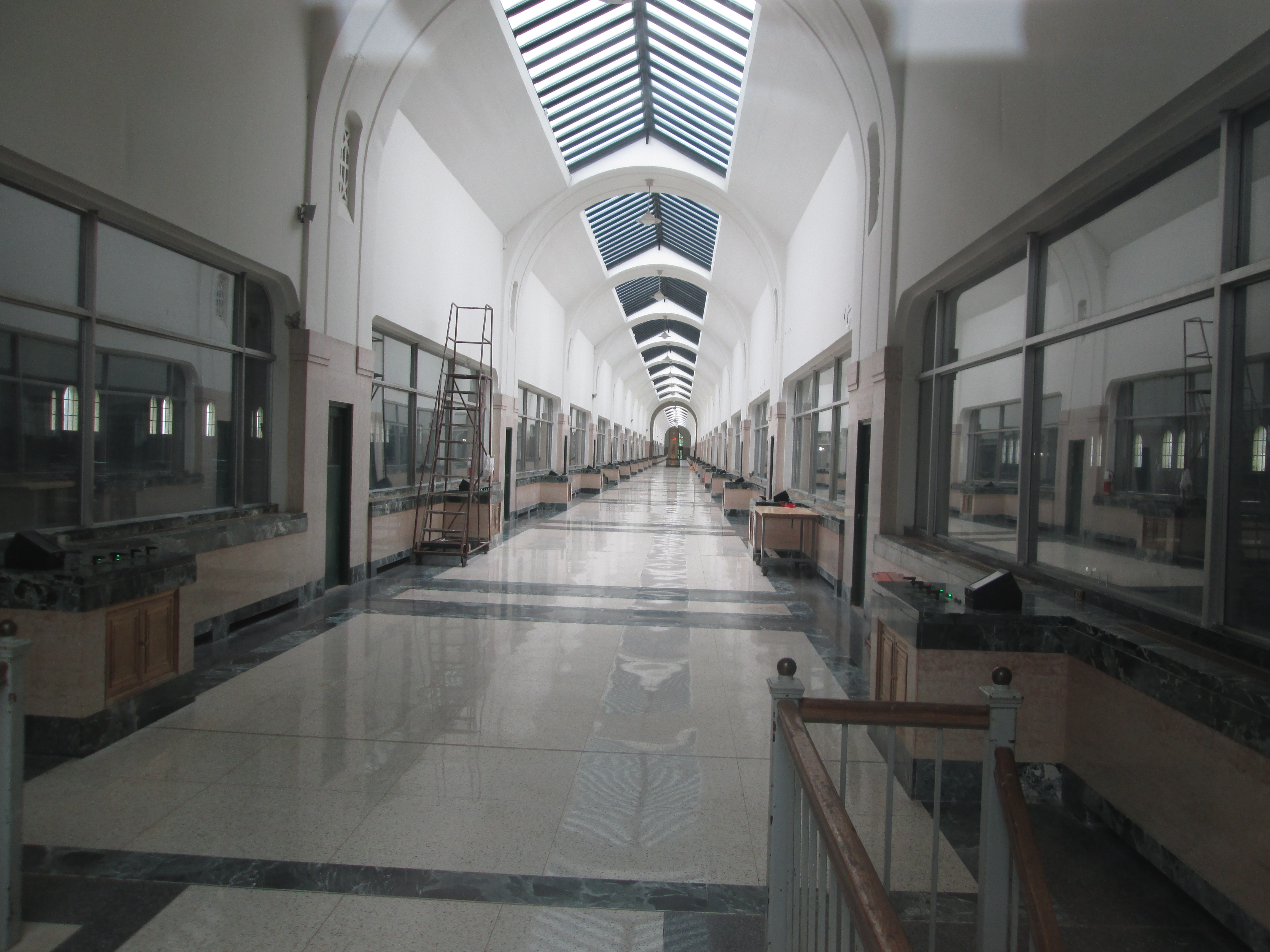
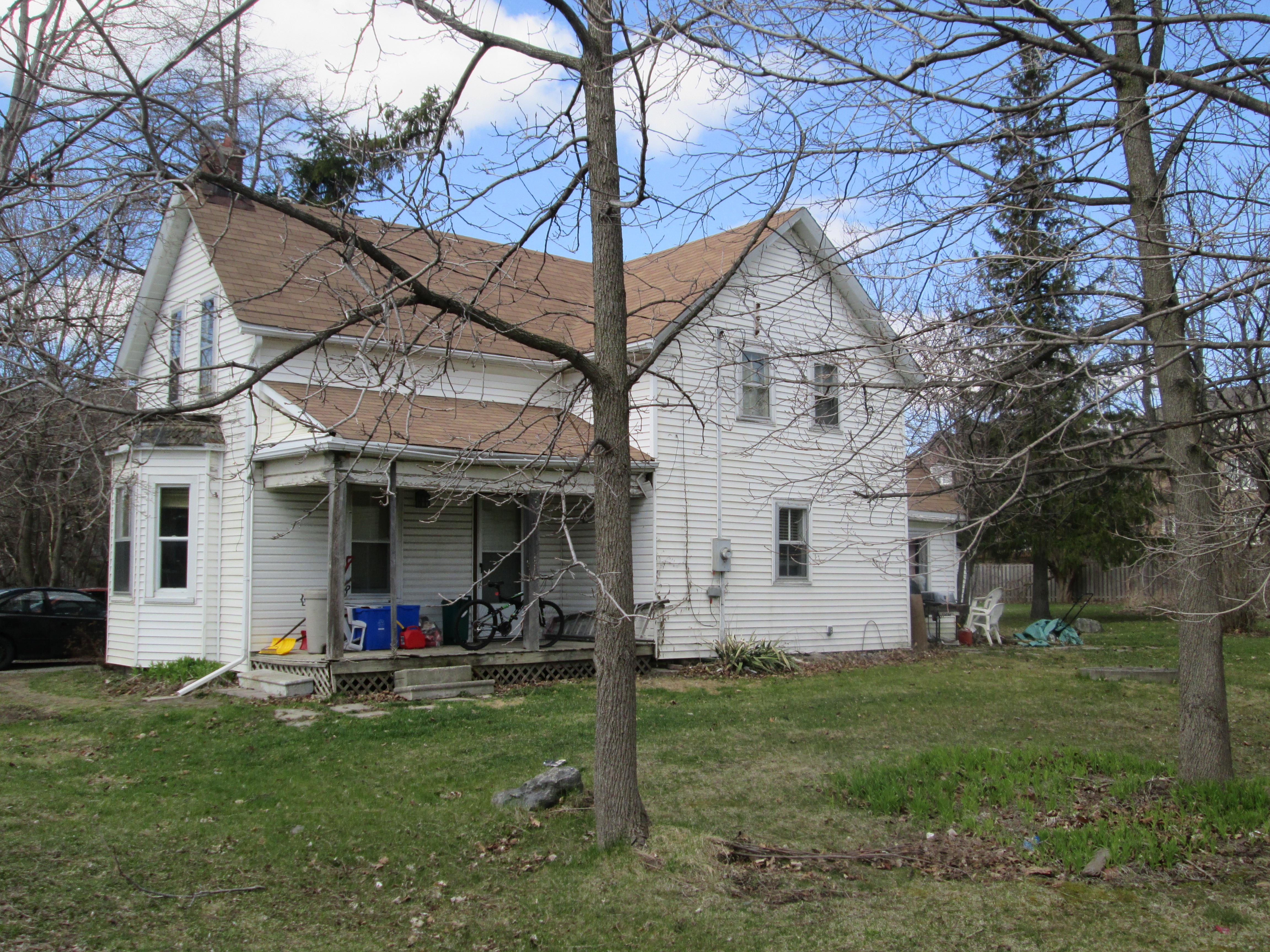
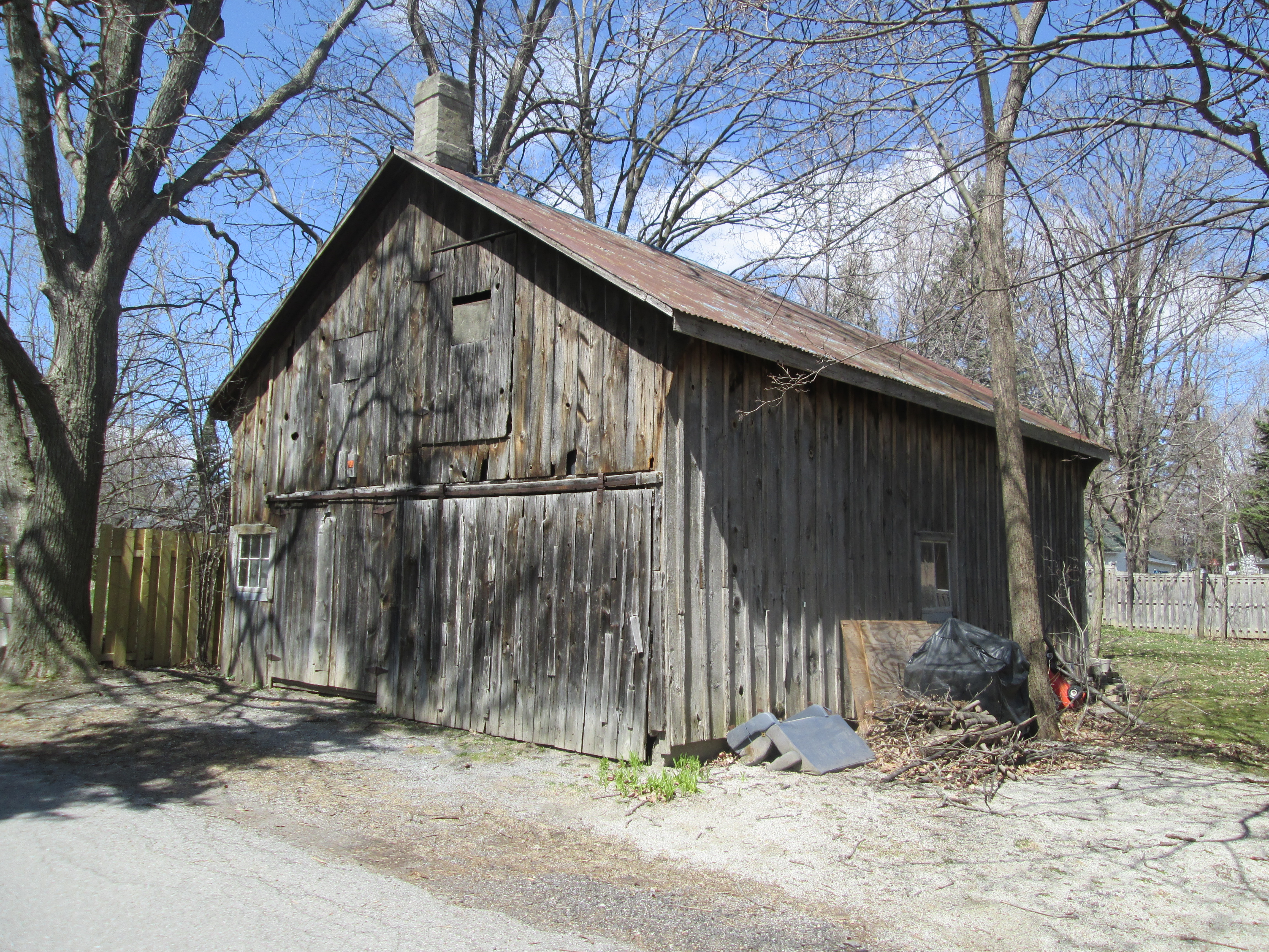
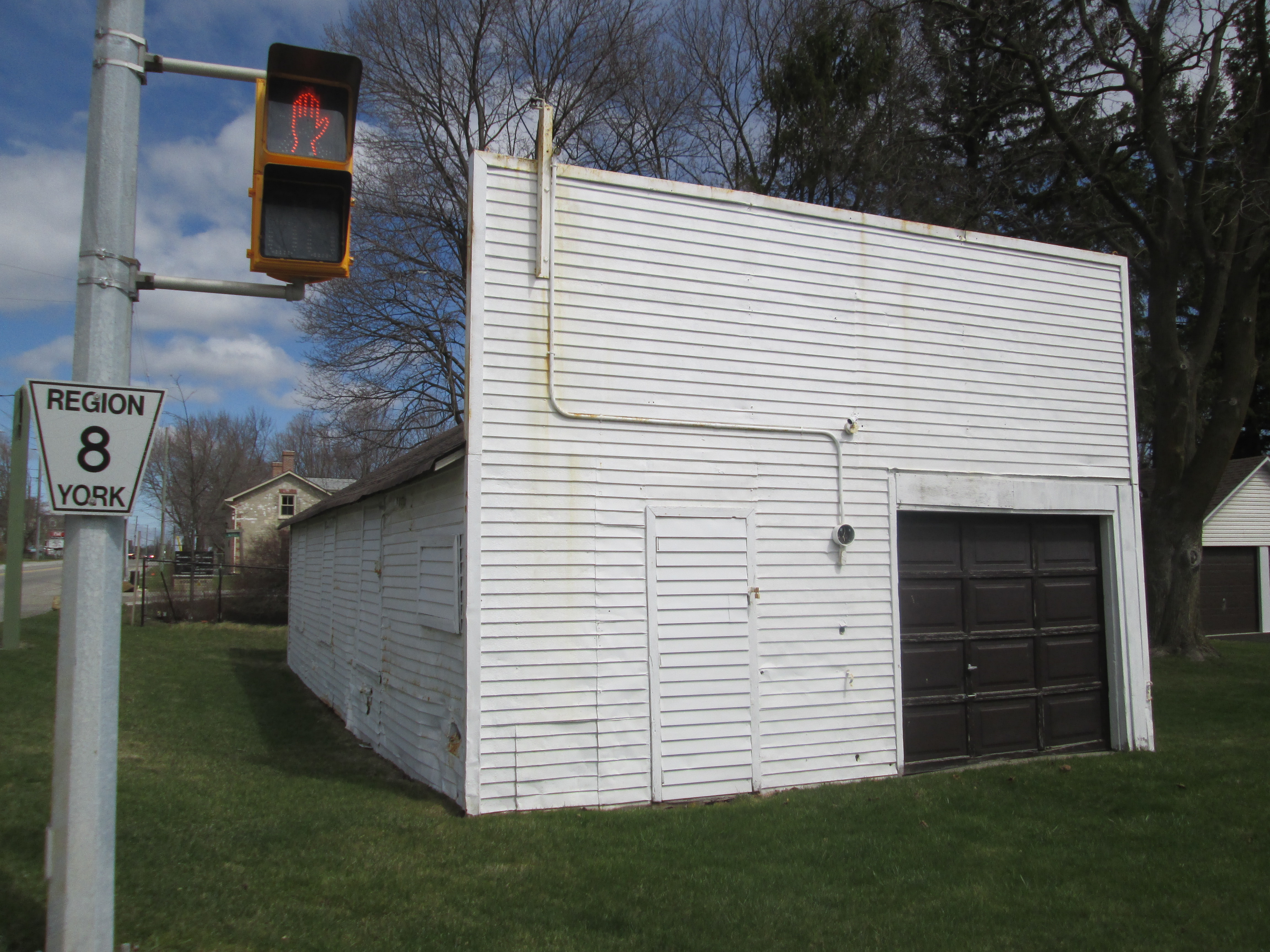
Albert Edward Gooderham was a grandson of the founder and had joined Gooderham and Worts as a clerk in 1879 at the age of 18.  When his father passed away in 1905 he became the Managing Director. In 1915 he bought 85 acres at Dufferin and Steeles.  Here he built and equipped Connaught Labs to produce tetanus antitoxin.  The labs later became the production facility for Toronto Insulin which benefited countless diabetics.  The buildings below are part of the Gooderham architectural legacy.

img_2793

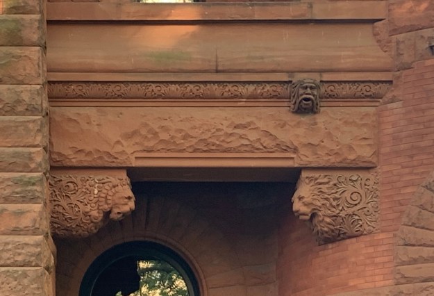
Both the buildings that George Gooderham completed in the early 1890’s are adorned with conical towers but also fantastic details that present little surprises as you study them.  The red stone from The Credit Valley has been intricately carved such as this example above a window opening on George’s home.  A pair of lion heads and the head of a man who looks a little surprised to see them there.

IMG_4412

The Gooderham Family has made a lasting impact on the architecture of the city with another forty-five buildings in The Distillery District that bear exploration.

Like us at http://www.facebook.com/hikingthegta

Follow us at http://www.hikingthegta.com

Also look for us on Instagram

John Robinson House – 1877

Sunday, July 7, 2019


My brother had observed a house on Derry Road in Mississauga that he believes should be included in our post of surviving homes from the town of Mount Charles – Ghost Towns of The GTA.  Having been in the area checking out the historic town of Malton, it seemed like a good idea to visit this home as well.

Below is the county atlas for 1877 which shows the house as belonging to John Robinson, one lot east of the community of Mount Charles.  Formally known as lot 10, Con 4 East Half Side it was a 100 acre lot.  The dots between the house and Derry Road indicate the orchard that once grew there.

Robinson

The house was built in 1877 and replaced an earlier log structure on the property.  It stayed in the Robinson family until 1902 when the farm was sold to Fred Clarke.  The Clarke family continued to farm here until the 1960’s.

IMG_5249

The house is listed on the heritage register as Victorian Gothic Revival.  The north side of the home has the pointed arch window in the upper floor that is traditional for the gothic revival.  The three windows on the first floor have more of a rounded arch typical of the Italianate style that had been popular since the 1840’s.  Victorian homes often mix styles and pay little attention to symmetry.  Notice the three windows on the lower floor are not spaced equally.

IMG_5278

The gingerbread is falling off but at one time the house was decorously trimmed.  Each of the windows has a small row of brick cut in opposing angles running across the top and extending a couple of inches beyond the face of the wall.

IMG_5272

Someone has taken the time to paint the window boarding black with white trim to simulate the windows behind and make the house look a little more appealing.  The windows at the rear of the house have not been painted in the same manner.

IMG_5250

The front of the house had two doors, one facing east and one facing north.  The wall above the east facing door has cracked and shifted considerably.  The bricks were laid in a stretcher bond where the long side of each brick is exposed.  The outer layer is starting to fall away revealing the inner one beside the top of the door.  A large front porch was removed from the house but its outline is still clearly visible.

IMG_5255

The rear of the house had an addition at some point in which a kitchen was added as well as a drive shed.  The rear opening would have allowed the tack to be brought into the building.  Above the door the theme of extended stonework above the lintel is continued but it has not been done above the drive shed opening.  The mix of architectural styles is interesting.

IMG_4178

There is a single window at the back of the drive shed portion of the house.

IMG_5280

The north elevation of the house shows a door into the kitchen area of the extension.  A metal post is bolted to the wall on both sides of the building.  This looks to be beside the section of the extension that represents the drive shed.  These type of metal plates suggest that the structure had to be supported and strengthened.  It makes me wonder if the house was moved from a location deeper on the property.

IMG_5285

The difference in construction between the original house and the extension can be seen in the brickwork above the windows.  While the original windows were quite ornate and the quoins on the corners were made of lighter bricks.  The dichromate brick colouring appears to have been abandoned for the extension except for the east side in which it was carried on.

IMG_5247

The house was built on a foundation of field stones collected on the farm.  The county atlas appears to show it farther from the road but that may just be a reflection of the fact that the road was only two lanes as wide back in 1877 instead of the six lanes it carries today.

IMG_5274

The picture below was taken in 1989 before the two large warehouses were erected on either side of the house.  Even 30 years ago this house was abandoned and the roof was starting to cave in.  Notice that there is a bell cote on the top of the drive shed that is missing the bell.  The bell cote has been removed from the house and a few minor repairs have been made to the roof to keep the house from deteriorating further.

Robinson House 1989

The house is listed on the heritage register for Mississauga but it is unclear what the future holds for this historic house from the community of Mount Charles.

Google Maps Link: Mount Charles

Like us at http://www.facebook.com/hikingthegta

Follow us at http://www.hikingthegta.com


Ontario Place

July 15, 2018

Ontario Place was a jewel on the Toronto waterfront for 40 years before declining attendance caused the government to shut it down in October 2011 for the last time.  Plans were immediately announced that major renovations were planned and the park would re-open in time for Canada 150 in July 2017.  This didn’t happen and a change of provincial governments threatens to derail the project further.  I decided to take a walk around the park and see what is going on these days.

IMG_5271

Ontario Place was designed by Toronto architect Eberhard Zeidler.  A large part of the concept for Ontario Place came from the idea to have large display pods built over the water.  The idea likely was inspired by Expo 67 where Pods were built over the Saint Lawrence River in Montreal.  Three artificial islands were created in the harbour that are connected to the mainland by three bridges.  The central bridge connects to the set of pods which make up the middle island.  The five elevated pods are interconnected as they stand above Lake Ontario.  Each pod is a three story structure that encloses 743 square metres of space.  Originally used for multimedia exhibitions, they were intended to be flexible and accommodate other uses over the years.

IMG_5275

This is the seventh season that Ontario Place has been largely abandoned although it does appear to be open as I was not challenged by the staff I passed on the bridge.  The entire time that I spent walking through the park I met less than twenty other people.  It truly felt like walking through a ghost town.

IMG_5278

In the 1980’s over 3 million people per year visited the park but by 2010 the number was down to only 10% of that.  The log flume on the west island was always sure to soak the riders, a welcome treat on a hot day.

IMG_5286

The park was in a continual state of development with new attractions being added as the years went by.  The original pods were not the raving success that was envisioned but the idea of showcasing the northern part of the province was seen as a way of potentially attracting professionals to relocate north where there was a shortage of people.  In 1980 silos were constructed that resemble farm silos that stand across rural Ontario.  The wildlife displays didn’t do as well as expected and the silos were eventually converted into additional rides.

IMG_5290

The Cinesphere showcased the world’s first permanent IMAX projector on a screen that was 24 metres wide and 18 metres high.  The dome is 35 metres wide and when it opened in 1971 it became the icon of Ontario Place.  It was so successful that there was a regular line-up to get in.  On a school trip we saw a movie called Snow Day in which it felt like we were in a school bus running out of control on snowy roads.  A good choice for kids who had arrived via school bus.  Cinesphere was closed in 2012 along with the rest of the park but in 2014 the dome was given a cultural heritage designation.  As of 2017 the theater is open again on a full time basis with state of the art equipment.

IMG_5299

March of 1969 saw the first activity in the building of Ontario Place and it opened just over two years later on May 22, 1971.  Construction of the Cinesphere and the pods is seen in this 1970 photograph from the Toronto Archives.

20120201constructionview

The design called for display pods suspended over the water to display the scientific and technological wonders of Ontario.  Constructing the pods over open water became an engineering problem and the costs mounted to the point of consuming the budget.  To reduce the costs a protective break wall was designed using three obsolete lake freighters.  They were sunk and filled with concrete to create a safe harbour for a marina.  The ships can be walked out to the end where one of the bridges is open for exploration.  The three ships anchors are also preserved on the third ship.  The picture below shows the outline of two of the ships where they meet.

IMG_5302

The 1970 photo below shows the three ships, reported to be the The Shaw, The Houghton and The Victorious in their positions with the west island being formed out of lake fill.

Ships

The pods are now underutilized and the iconic sets of stairs on the outside are peeling and no longer ring with the sounds of crowds filled with laughter.

IMG_5321

The water park covered much of the east island and went under the name Soak City.  A series of coloured water slides was installed in the 1990’s and was a popular attraction until the park closed.  The slides remained in place until May of 2016 when they were disassembled to prevent a potential injury to people who insisted on climbing up and even rollerblading down them.  Today the central support tower is all that’s left except for a few abutments to mark the site of the water park.

IMG_5341

Trillium Park, containing the William G.  Davis Trail is the first part of Ontario Place to get a completely new lease on life.  This area was formerly a 7.5 acre parking lot.  Today it has been converted into a lush green space with a 1.3 kilometre trail named after Bill Davis who was premier in Ontario in 1971 when Ontario Place first opened.  The trail passes through an artificial ravine and contains the Moccasin Marker.  The carvings on either side of the ravine are intended to remind us of those who were here before us.

IMG_5350

I picked a good time to visit as the Indy was on and parts of Lakeshore Avenue were closed for the race.  I decided to park at Budapest Park and walk part of the Martin Goodman Trail to reach Ontario Place.  I used the Bruce Trail App to track my walk which came out to 10.4 kilometres.  By parking at Ontario Place you can explore the area with three or four kilometres worth of walking.   Be sure to make the walk along along the three sunken ships that is represented by the tail extending out into the lake on the map below.

Ontario Place

Having visited the park in 1972 or 1973 with my aunt and uncle, both of whom have passed on, I have fond memories of an Ontario Place that was vibrant and full of people.  It’s sad to see what has become of our waterfront park especially when there is no clear timeline for completion of the renovations.

As a parting thought, would you have wanted this job building the Cinesphere?

Cinesphere

Google Maps Link: Ontario Place

For additional places to explore visit our recent Greatest Treks 3 post.

Like us at http://www.facebook.com/hikingthegta

Follow us at http://www.hikingthegta.com

Ringwood – Ghost Towns of the GTA

Jan. 21, 2018

George Fockler bought 200 acres of land at the intersection of the Markham-Stouffville Townline (Stouffville Road) and the 8th concession (Highway 48, Markham Road) and moved his family from Pennsylvania in the late 1790’s.  George owned the northwest corner of the intersection and later his son Sam bought the north east corner lot and built a hotel there.  Revere House opened in 1809 and stood until 1957 when it was demolished to allow for road widening.  The original crown survey created a system of road allowances that were 1 chain (66 feet) wide and this was suitable for the horse and buggy system that was in place at the time.  Stores and hotels were often built close to the road and countless numbers of these structures have disappeared across Ontario as roads get widened to four lanes.  This late Victorian house is for sale and looks like it wouldn’t take too much to fix it up and make it livable again.

IMG_2277

Ludwig Wideman arrived in Ringwood along with his parents in 1805.  Thirty years later when William Lyon Mackenzie was fomenting rebellion, the area of Whitchurch Stouffville was firmly on Mackenzie’s side.  Ludwig joined up with the rebels at Montgomery’s Tavern and became one of the casualties there when the rebellion failed on Dec. 7, 1837.  The picture below shows one of a dozen abandoned homes in the former core of Ringwood.

IMG_2328

George Sylvester came from Ringwood, England to the growing community and opened a general store on the north west corner of the intersection.  In 1856 the new post office in town was located in his general store and he named the town Ringwood after his hometown.  The name stuck but the residents took to calling the town Circle City in jest.  The post office survived until 1970 when the population had decreased to just 40 and it was replaced with mail boxes, one of which stands where the Revere House used to be.

IMG_2270

According to the Annual Report of the Bureau of Industries for the Province of Ontario, A. B. Grove operated a cheese factory in town in the early 1890’s, one of two at the time.  A Chevrolet dealership was established in town by 1928 and was run by the McKenzie family and employed 7 people.    This barn still stands in what was once downtown Ringwood and would have been behind the Revere House Hotel, before it was demolished.  It may have served as stables at one time.

IMG_2327

The Lehman house was built around 1870 and there is most likely is a patterned brick house hiding behind the veneer of siding that was been added at a later date.

IMG_2287

At the peak, Ringwood had two of many of the standard small town professionals, 2 hotels as well as two general stores, shoe shops, carriage makers, cheese makers, sawmills and blacksmiths.  By the 1850’s a plank road had been built between Stouffville and Richmond Hill and it was served by a stagecoach that would stop at Ringwood to take on passengers.  This sprawling Victorian house once stood among these vanished businesses on the main street of town.

IMG_2274

One of the last businesses to close in Ringwood was the diner.  It is reported to have become a biker hangout in the last days of operation.  It stands at the corner of Markham Road and Stouffville Road, which used to have a slight jog in it.  This was where the surveys in the two townships on either side of the road didn’t quite align and an adjustment was made.  When the roadway was widened and straightened in 1957 one of the hotels, a harness shop, several homes and two garages were demolished.

IMG_2280

The one room Ringwood school was built in 1838 and was known as a union school section because it served students from two townships.  This is because Ringwood sat on both sides of the town line.  As the town grew the school became too small and was replaced with this dichromate brick building in 1887.  The town population had swelled to 300 by this time.  Twenty years later there were less than 200 people in town and by 1939 there were just 13 students enrolled in the school.  That was the year that the school trustees voted against installing electric lights or hiring a dedicated music teacher.  The $1200 salary for the one teacher was already more than the budget would allow.  The school closed in 1971 and then was used by the Bethel Pentecostal Assembly as a church building.  Today it sits empty with an unknown future.

IMG_2325

With the arrival of the Toronto and Nippising Railway and also the Lake Simcoe Junction Railway in Stouffville, the decline of Ringwood began.  The railway provided access to markets and the businesses of Ringwood packed up and moved down the road.  The picture below shows the view looking from the main intersection into Ringwood where the once bustling main street now has only a few boarded up houses.

IMG_2279

West of the main intersection a strip of original Ringwood remains in use, although there is a development sign here too.    The Christian Church was built in 1868 but has recently been converted into an interesting looking residence.  This lovely little 1860’s house should be preserved, in my opinion, along with several others that are still inhabited, but endangered by the Ringwood Secondary Plan.  It calls for mixed use commercial / residential in this area.

IMG_2282

There is a new master plan for the redevelopment of Ringwood that will likely see the removal of most of the buildings in this post within the next two years.  I’m glad I got to visit before this happens.


Google Maps Link: Ringwood

Like us at http://www.facebook.com/hikingthegta

Follow us at http://www.hikingthegta.com

Allan Gardens

Sunday, October 9, 2016

George William Allan was born in the town of York in 1822 on his father’s Park Lot and would go on to be an important figure in Canadian politics.  Allan served with the Bank Rifle Corps during the 1837 Rebellion and became a Toronto Alderman in 1849.  He was Toronto’s 11th Mayor serving from 1855 to 1858 when he became a member of the Legislative Council.  Following Confederation, in 1867 he became one of the first members of the Senate.  Allan was a member of the Upper House until his death in 1901.

On March 24, 1819, George Allan (sr) purchased Park Lot 5 which was one of the 100 acre lots that ran from Lot (Queen) Street to Bloor Street.  These long narrow lots (660 feet wide by 6,600 feet long) were generally given to men of importance and this lot had originally been granted to Cheif Justice William Osgood who lost the land patent for failing to build a house and live on the land.  Lieutenant Governor John Graves Simcoe had planned the lots as a means of attracting an upper class to help manage the town of York.  Unlike most settlers, these men had only to built a home and live there or rent it out to gain ownership. The grounds around Allan Gardens contain some of the downtown core’s mature trees.

img_4054

The city grew quickly and soon these Park Lots became prime development sites with each property owner able to do pretty much whatever they wanted to.  They could build roads across their lots where they desired and this is the reason that most of the east-west streets in this section of town only run a few blocks and then end.  George Allan built a palatial home on the south end of the lot that became known as Moss Park because of all the moss that grew on it.  The desire for profit led to the quick development of most of the Park Lots with the result that there were very few areas set aside for public parks.  In 1858 George Allan donated 5 acres of land to the Toronto Horticultural Society to create what has become one of Toronto’s oldest parks.  The use of symmetry extends from the greenhouses to the grounds themselves and a pair of walkways enter from opposing corners to meet in front of the greenhouses.

img_4065

In April 1854 Allan had released his plans for the development of Moss Park with villa style lots.  The area that would become Allan Gardens was laid out with four homes on each side and a large oval park in the middle.  Two years later the Toronto Horticultural Society had been given use of 5 acres to develop as public gardens which they would later expand to 11 acres.  September 11, 1860, marked the official opening of the Horticultural Gardens with the Prince of Wales on hand for the ceremony.  A pavilion had been built that year for the opening ceremonies and a second pavilion was built in 1879 however, it burned down in 1902.  It was replaced in 1910 by the Palm House which is seen in the cover photo.  The picture below shows the inside of the Palm House, looking up.

img_4076

This Toronto Archives picture of the Palm House from 1913 shows the building shortly after construction and without any of the additional greenhouses that now flank it north and south.

f1231_it0541

A photo of the building today shows a much different skyline in the background.  Also of interest is the change in the location of the doors.  Gone is the single central door which has been replaced with two doors located on either portico.  The four corinthian columns across the front have also been removed.

img_4064

George Allan died on July 24, 1901, after which the park was renamed Allan Gardens in his honour.  Today there are six greenhouses with a combined area of over 16,000 square feet. A seasonal display pays tribute to the harvest with this statue which is out of its gourd for a fancy dress.

img_4078

The tropical house was moved from Exhibition Park to this location in the 1950’s and has a chrysanthemum display as a feature this month.  The ‘pumpkin’ below will continue to bloom and will create a colourful display as the month progresses.

img_4081

Additional greenhouses were built in 1924 and 1956 to expand the conservatory’s collection of plants and flowers.

img_4092

The Arid House (Cactus House) was also moved from Exhibition Park in the 1950’s and contains many different species of cactus.  The Golden Barrel Cactus, also known as Mother-In-Law’s Cushion, is native to Mexico where it is endangered in the wild.  Mature plants can live for 30 years and will only begin to have flowers after about 20 years.  The small yellow flowers that grow near the centre turn into a fruit that contains seeds for the next generation of plant.  These cacti also spread through a root system and corms. Allen Gardens has several of these cacti that are quite large but none that are near the one-meter size that they can attain.

img_4102

Allan was a strong supporter of the arts and was a champion for Paul Kane and James Audubon in the years before they became popular.  It is fitting that the park he created is home to a statue of Robert Burns which was erected in 1902.

img_4053

Allan Gardens originally did not extend to Jarvis Street and that side of the property was built up by the late 1870’s.  Two historic churches remain one on either corner of the grounds, with the Baptist Church being on the corner of Carlton and Jarvis.  This Gothic Revival church was built in 1874 from Queenston Shale and opened in 1875.  This is the third building to be occupied by this congregation which had organized in 1829 on Lombard Street.  The lone remaining house in this block is now used as the Toronto Baptist Seminary and is next door to the church.

img_4110

A couple of other houses and a Collegiate Institute have been removed and now St. Andrew’s Church stands alone on the north corner.  It was built in 1878 of Credit Valley Stone and was used by the Presbyterian Congregation that moved here from their old building at Church and Adelaide.  Estonian and Latvian refugees acquired the church in 1951 after being displaced during World War II.

img_4113

The Allan Gardens greenhouses are open year around from 10 am to 5 pm every day.  They have seasonal features that make repeated visits enjoyable.

Google Maps link: Allan Gardens

Like us at http://www.facebook.com/hikingthegta

Follow us at http://www.hikingthegta.com

Gates Gully Scarborough

Saturday May 7, 2016

Gates Gully runs from Kingston Road to Lake Ontario and provides one of the few places where there is access down the side of the Scarborough Bluffs.  Over the years it has been home to natives, smugglers, soldiers and rebels.  The Bellamy Ravine Creek flows through the bottom of the ravine where it makes a 90 meter drop from the table lands to the lake. The picture below shows the ravine where it starts at Kingston Road.  The ravine provided a gentle enough grade to bring goods from the lake shore up to Kingston Road via carts and so a community developed at this point.  Jonathan Gates built an tavern and the ravine became known as Gates Gully.

IMG_1317

The Scarborough Bluffs were exposed when Glacial Lake Iroquois suddenly drained about 12,200 years ago.  The change in climate caused the natives to modify their hunting and gathering practices and new tools were invented.  Scientists call this period the Archaic Period and the early portion ran from 10,000 to 8,000 years ago.  Artifacts have been found in the ravine from this time period indicating that the natives were using it as an access to the lake shortly after the end of the ice age.  The ravine has changed a lot over the years from both land filling and erosion.  The west side of the ravine has a set of stairs that used to lead to the ravine floor but now the steps slant at an odd angle and then end in loose sand and mud hiding under a layer of dead leaves.

IMG_1318

On April 27, 1813 the Americans attacked Fort York and captured it from the British.  When General Sheaffe determined that the Battle of York was lost he ordered the army to retreat to Kingston, which they did, using Kingston Road.  Legend has it that some of the soldiers hid the money they were carrying in the gully.  Treasure hunters have been seeking it for the past two hundred years and if it ever existed, it is apparently still there.  One of the beautiful things about spring time is the fact that there are new flowers in the woods almost every day.  The Scilla provides a splash of blue to the forest floor but is not native.

IMG_1327

The ravine is a migratory route for over 100 species of birds.  The woods were alive with the sounds of bird calls on this sunny morning.  The wetlands are now under the protection of the male red-winged blackbirds.  They have started their usual tactics of swooping near your head to let you know that you are too close to the nest.  Bright red male cardinals were everywhere singing their songs to attract the less colourful females.  The picture below shows a female cardinal who was playing hard to get with a couple of males.

IMG_1335

Smugglers found it easy to bring goods from the United States into Canada through Gates Gully.  This practice was prominent in the 1830’s as merchants sought to avoid paying import taxes.  Gates Tavern became famous for the part it played in the Rebellion of 1837. When William Lyon McKenzie started to rally his rebel forces at Montomery’s Tavern on the night of Dec. 5, 1837 the Scarborough militia started to gather at Gates Tavern. Ironically, it is said that McKenzie hid for awhile at the Annis home, one of the first settlers in the area of Gates Gully and the property just to the east.  On August 3, 1915 the steamship Alexandria was wrecked near the entrance to the gully.  The Alexandria was built in 1866 and served both as a passenger ship and a cargo ship.  On this night it was bringing 300 tons of beans and tomatoes when it was blown too close to the shore and was grounded.  All passengers were brought to safety and led up the bluffs through Gates Gully.  The hull of the steamship remains in the lake 100 years later, just to the east of the gully.  The archive picture below shows the wrecked ship.

1297734209869_ORIGINAL

As you reach the bottom of the ravine you find a steel sculpture named Passage. Designed to look like the rib cage of both a fish and a canoe, it commemorates one of the first people who took up residence on the edge of the bluffs.  In 1939 Doris McCarthy purchased 12 acres on the top of the bluffs on the west side of Gates Gully.  Doris became a famous Canadian painter and her mother dubbed her home on the ravine as Fool’s Paradise because she thought the purchase was too extravagant.

IMG_1347

Fools Paradise stands on top of the bluffs, just out of site in this picture.  To commemorate the life and work of Doris McCarthy the trail through Gates Gully has been named after her.

IMG_1348

Following Doris McCarthy’s lead, other people came to settle on the top of the bluffs.  The section of bluffs to the west of Gates Gully are on the former McCowan estate, after whom McCowan Road is named.  The bluffs are eroding every year and many homes that were built too close to the edge have already fallen over.  The picture below, and the cover photo, show a home that has been slowly being torn apart as the sand disappears from beneath it.  The sand embankment below the former house is now filled with wood scraps, doors and tiles.

IMG_1356

The image below from Google Earth was taken on May 22, 2015 and the house can be seen near the red arrow.  It appears that about half of the house was standing a year ago, but there isn’t very much left any more.

House on bluffs

In 1986 it was decided to initiate erosion control in Gates Gully and along the beach.  The shore was lined with stone and break waters were built extending into the lake in a manner similar to the Leslie Street Spit.  The photo below was taken from the end of one of these erosion control forms.

IMG_1367

After climbing to the top of the bluffs you are treated to an amazing view of the lake and the cliff faces.  Sylvan Park is on the top of the bluffs on the east side of Gates Gully and can be seen on in the distance in the picture below.  This park is on the former Annis property.

IMG_1386

This downy woodpecker was one of several that was looking for lunch in Sylvan Park.  It prefers beetles and ants but will eat suet at back yard feeders as well.

IMG_1397

Meadowcliffe Drive on the top of the bluffs leads to the site of Fool’s Paradise.  It is on private property but a historic marker is placed on the end of the driveway.

IMG_1406

Google maps link: Gates Gully

Like us at http://www.facebook.com/hikingthegta

Roundhouse Park

Sunday March 20, 2016

In the 1850’s the era of steam locomotives arrived in Toronto.  At that time the name “Front Street” applied to the street that ran along the water front.  Wanting access to the harbour, the railways decided to create land by in-filling, a process that continued for another 70 years until the corner of Front and John Streets was half a mile from the water. Running for two miles from Strachan Avenue to Yonge Street this new land became known as the railway lands.  The picture below shows the railway lands with Spadina Street Bridge crossing near the middle.  The Canadian National (CN) Spadina roundhouse can be seen just above it with the Canadian Pacific Railway (CPR) John Street roundhouse near the top of the picture.

IMG_0537

The first railway to enter Toronto was the Ontario, Simcoe and Huron in 1853.  They built a station near the current Union Station.  Soon the Grand Trunk Railway (GTR) and the Great Western arrived in town.  The first Union Station was built by the GTR in 1873 and served the growing needs of the railway lands.  In 1888 the CPR brought a new level of competition and they soon outgrew the Union Station.  By 1900 plans were in place for a new Union Station with construction beginning in 1915 but it didn’t open until 1927.  In 1923 the GTR went bankrupt and was merged into the CN.

IMG_0614

When the CPR was completed it passed through Leaside and over the Vale of Avoca and the Belt Line Railway ravine and bypassed downtown Toronto.  The CPR was finally granted permission to access downtown via the Don Valley and they constructed the Half-Mile Bridge. They built a station named Don Station at the corner of Queen Street in 1896.  The station remained in use until 1967 when it was closed.  From 1969 until 2008 it was housed at Todmorden Mills.  In 2008 it was moved to Roundhouse Park where it was restored and opened as a visitor’s centre.  The restored Don Station is seen in the cover photo.

Servicing and repairing trains became a major function of the rail yards and the best way to store locomotive engines was in a circular building or roundhouse.  The John Street Roundhouse was built in 1929 and had 32 bays.  Each of these was accessed by a set of tracks that linked up with the turntable.

IMG_0550

Locomotives were usually operated in one direction and the turntable was used to turn them around.  This is a twin span turntable and in this photo it is shown with the Reinhard Vinegar wood tank car on it.

IMG_0560a

The picture below from 1973 shows the CPR John Street roundhouse on the upper left. Notice that the coal towers are located east of the roundhouse, almost out of the photograph.  The coal tower has since been relocated to the west end of the roundhouse. The footings for the CN tower are just rising above grade level in the middle of the shot. On the right the CN Spadina roundhouse, built in 1928, can be seen.

1024px-CN_Tower_footings_1973

As the area around Union Station became busier the control of the signal lights and track switches became more complicated.  The GTR built five control towers lettered A to E with cabin D located just west of Bathurst Street where several tracks converged.  Switch tenders manually set the track switches according to directions broadcast from the cabin. When the other cabins were replaced with modern structures in 1931 Cabin D was left in operation.  It used this manual system until 1983 when the cabin was moved to Roundhouse Park.  Beside Cabin D is it’s tool shed as seen below.

IMG_0580

The coaling tower at the roundhouse has been relocated and is currently sheltering some of the museum’s pieces.  Coaling towers were used to elevate coal above the train so that it could be gravity fed via a chute into the steam engine tender.  The picture below shows the black Canadian National Vanderbilt cylindrical tender that was coupled with the museum’s CNR 6213 steam locomotive.  It would have been loaded with coal at a tower such as this.

IMG_0536

The Toronto, Hamilton and Buffalo (TH&B) was originally chartered in 1884 and began operations is 1892.  In 1895 the CPR and the New York  Central Railroad bought the TH&B and jointly operated it.  They never built the railway into either Toronto or Buffalo and so the name is a bit misleading.  The steel sheathed, wood sided caboose below was built in 1921.  A caboose was intended to provide a home-away-from-home for the rail crew.  The cupola on the roof was designed to allow the crew to observe the performance of the train in front of them and apply emergency brakes if required.  In the mid 1950’s it was painted yellow and black after the colours of the Hamilton Tiger Cats.  It has now been fully restored and added to the Toronto Railway Museum, a city in which it never served.

IMG_0573

One of the more unusual pieces of rolling stock that the museum has is RVLX 101 which is a rare wooden tank car.  It was originally built in 1938 and acquired by Reinhart Vinegars in Stayner in 1964.  They used it for the next 12 years to ship vinegar to Dallas, Texas.  It has been in museums since 1976.

IMG_0554

The wooden box car was the most common piece of stock used by the railways.  The CPR owned over 33,000 of them and this example was built in 1917.

IMG_0557

One of the newest operations in the roundhouse is Steam Whistle Breweries.  They occupy the first 14 bays in the roundhouse and opened for business in 2000.  The three founders were former employees of Upper Canada Brewing and have the code 3FG embossed on the bottom of their bottles as a reference to the fact that they were 3 Fired Guys.  The photo below shows the rear of the roundhouse and a number of Steam Whistle vehicles.  The former roundhouse water tower is in the background, painted in the Steam Whistle colours.  The truck in the foreground is a 1957 Chevrolet 3100 Apache.

IMG_0601

The CN Spadina roundhouse was demolished in 1986 to make room for Skydome (now Rogers Centre).  When the stadium was built they created a monument to the Chinese workers who helped build the CPR and unite the country.  Between 1880 and 1885 there were 17,000 men who came to work on the railway through the rocky mountains in Alberta and British Columbia.  Over 4,000 of the Chinese workers lost their lives and many others had no way to get back to China when the work was finished.  This memorial is in appreciation of all those people whose names have been lost to history.

IMG_0608

One of the newest tenants of Union Station is the Union Pearson Express.

IMG_0604

The John Street roundhouse was renovated in the 1990’s and opened as Roundhouse Park in 1997.

Google Maps link: Roundhouse Park

Like us at http://www.facebook.com/hikingthegta

R. C. Harris Filtration Plant

Sunday May 31, 2015

It was cloudy with occasional light rain.  Having been downtown I decided to drive east to visit the so called Palace of Purification.  Otherwise known as the R. C. Harris Filtration Plant.

Roland Caldwell Harris became Toronto’s Commissioner of Works in 1912.  One of Harris’ first projects was the Prince Edward Viaduct which spans the Don River and connects Bloor Street to the Danforth.  Harris’ vision for the bridge included adding a lower deck for rail transport.  It was an addition that saved the city millions when the TTC opened the Bloor-Danforth line in 1966.  In 1913 Harris presented a vision for the Toronto Water Works Extension which was basically clean, safe drinking water for everyone.  The project got delayed due to the First World War and subsequent budget restraint. The city by-law to expropriate the Victoria Park site was repealed and the land didn’t come under city control until 1923.  When Harris saw the drawings for the buildings in February 1928 he declared them to be plain and unattractive.  The reworked design is what we have today and was recognized in 1992 as a National Historic Civil Engineering Site.  It is a grand civil structure built in the popular Art Deco style and set in a terraced park.  Built between 1932 and 1941 it had a major addition in the 1950’s.

Lake Ontario has about 1% of the earth’s surface fresh water.  It is Toronto’s only source of drinking water, but unfortunately, is frequently polluted by run-off and waste.  For this reason Harris envisioned an intake well out in the lake, 2.6 km from the shore.  Water is then bought in through the centre of the site by the pumps in the pump house.  Built in 1935 this building is the closest to the lake.

IMG_5027

Inside the pump house the original pumps remain.

IMG_5029

Outside, the swallows have built dozens of nests in the shelter of the stonework.

IMG_5039

The service building with it’s alum tower stands just north of the pump house.  Water passes under the alum tower on its way to the filtration plant on the next terrace up the hill.  Alum is dropped into the water to help contaminants floc so that they will drop to the bottom of settling pools or be more easily filtered out in the filtration plant.

IMG_5081

The picture below shows the terrace with it’s niche and bronze fountain.  Harris designed his architecture to be viewed and this is meant to be lined up with the long filtration plant on the terrace behind.

IMG_5045

The main entrance to the filtration plant.  A stylized TWW (Toronto Water Works) adorns the wood right above the main door.  It also appears on either side of the arched windows.  The wing on the left was built in 1932 and was in use when the plant opened in 1941.  The wing on the right was added in the 1950’s.  Unlike most public buildings, the style wasn’t changed with the addition as a means of cost cutting.  Harris had supplied pipes and connections so that capacity could be easily doubled to nearly 1 billion litres per day.  Inside this building are 40 filtration beds where water is cleaned before being pumped to a network of reservoirs and water towers throughout the city.

IMG_5019

Inside the filtration plant.  It’s no wonder it got the nick-name Palace of Purification.

IMG_5007

Seawall construction in 1933.

water-april1933

Along the front of the facility there is a seawall that meets Lake Ontario.  It has a curved lip at the top to direct large waves back into the lake.

IMG_5064

Just to the east the mouth of a storm drain opens onto the beach.  The concrete slabs that look like teeth are disipators designed to release energy from the water before dumping it on the beach.

IMG_5092

Early Toronto had several grand parks that attracted people out for an afternoon’s leisure. Victoria Park was set on rolling hills at the water’s edge at the end of the street that bears its name. In the late 1870’s ferries from downtown began bringing passengers to enjoy the gardens. There were different rides available such as a steam powered carousel, donkeys and tethered balloons. A small zoo, dancehall and waterfront trails along with tight-rope walking displays completed the attraction to the park. It was bought out in 1899 and for a while there was an outdoor school and camp operated here. In 1927 the city bought the site and later chose it for its new water filtration plant. Aerial photos show a building on the beach at the east end of the site that was already in disrepair in 1947. By the 1980’s it had been demolished leaving only a few walls standing. The shot below looks out through a second story window opening onto the foundations on the beach below.

IMG_5101

Meant to be viewed from the lake, the R.C. Harris Filtration plant can be seen with the 10 bays of the east wing stretching out to the right.

IMG_5058


Don’t forget to visit http://www.facebook.com/hikingthegta


Victoria Square

April 26, 2015

It was mostly sunny and 10 degrees and I decided to investigate the proposed cultural heritage site of Victoria Square.  Unlike many of the communities in rural Ontario that grew up around a mill site, Victoria Square was established in 1805 as Reid’s Corners at a crossroads and served the local farmers. The 1901 census shows 117 people, most of them farmers or retired farmers and children.  The businesses in town tended to be those that supported that local industry. The cover photo shows the hamlet around 1900.

It was centered around two churches, both of them Methodist.  In the historical county atlas shown below they are shown as PM (Primitive Methodist) and WM (Weslyan Methodist).  The Methodist congregation had split in 1807 over the issue of Calvinism vs Arminianism a theological issue which centres around free will vs predestination. (Did they split of their own free will or did they do it because it was predestined to happen?  Hmmm…)

Victoria Square

The Primitive Methodists built their church north of Elgin Mills road on the east side of Woodbine Avenue around 1830.  Their cemetery remains but the church is gone.  William Hatton was the first leader of the congregation and built his first house at 10754 Woodbine avenue in the 1830’s when the road was known as 3rd line.

IMG_3894

About 1850 Hatton built the house at 10761 Woodbine road.  A carpenter named Jacob Baker owned the house in the 1880’s and he added a veneer of patterned brickwork as well as a veranda.  He replaced the original 6 over 6 windows that were typical of mid-1800’s small panes of glass to the 2 over 2 windows.  During the mid-20th century Gord Mortson operated a bus line from this location.  The outline of the veranda can still be seen in the picture below.

IMG_3897

The Weslyan Methodists built their first building on the west side of Woodbine, south of Elgin Mills road around 1845.  After a new building was constructed this was sold to William Frisby who used it as his blacksmith shop for many years.  It now stands at the back of the cemetery where it is being restored.

IMG_3876

In 1880 a new brick church was built and the old one moved off site.  In 1925 the Methodists were part of a four church merger that created the United Church.  This is how both cemeteries in town came to be under the control of the United Church.

IMG_3884

Victoria Square was typical of small cross-roads communities that served their local farmers. People lived there for generations and everyone knew everyone else (and their business). William Boynton is shown in the 1901 census as the town butcher.  William’s youngest son Charles Stanley would carry on in his father’s business renaming it C.S. Boynton and Sons. William and Donald bought the business when C.S. retired and their children also worked there. After four generations of Boyntons worked there the business was sold and a butcher still continues to operate it today.  The picture below shows the first Boynton house built by William in the 1850’s or 60’s and was occupied by the family into at least the 1980’s.  The buildings of the butcher shop were expanded in the 1960’s and can be seen in the rear of the photo.

IMG_3905

This house is also in front of the butcher shop and was built by William’s oldest son Herman, likely in the early 1900’s.  Charles Stanley lived here for a time and eventually it was split into two apartments, both of which were occupied by Boynton families.

IMG_3907

The property on the south east corner of town is lot 25 con. 4 and was owned by Thomas Frisby (b. 1851).  His father, John (Thomas) Frisby (b. 1822), had emigrated in 1850 and farmed the lot before retiring.  Their house and drive shed are shown on the historical atlas above and stand today on Victoria Street.

IMG_3942

The building of a barn was also a community social event where the structure would be raised in a matter of days.  All the men in town would gather to build the barn and their wives would prepare food and swap stories.  The picture below is of a barn raising on the Klink property just south of town.  Notice the near identical form of the house to the Frisby one in the previous picture.  Take away the chimneys and veranda’s and you have twin houses.  The town carpenter’s handiwork.

Barn_raising_supper_at_the_Klinck_home_in_Victoria_Square,_Markham_Township,_Ontario,_Canada

William Frisby (b. 1855) left the farm to his brother Thomas and became the town blacksmith, a position he held for forty years. His business was so successful he hired another blacksmith who lodged with him and was paid $276 in 1901,  Frisby’s shop was located at 2992 Elgin Mills and his house remains in use today.

IMG_3953

John Rowbotham was the town carriage maker at the turn of the century.  Like many local businesses his son worked for him as a carriage painter earning $240 in 1901.  Their business was at 2972 Elgin Mills where the shop stood in the open space beside the house.

IMG_3954

True to it’s small town heritage Victoria Square has several barns in what would have been it’s downtown.  This one was William Macey’s workshop.

IMG_3937

This house has had many uses over the years.  In 1853 Thomas Farmer operated a cobbler shop here.  James Stoutenberg bought it in 1860 and converted it to a general store where the post office would later be housed.

IMG_3950

The farms to the north of town are being developed for townhouses including the property of George and Isabelle Pear.  Their late 1840’s home is slated for restoration.

IMG_3910

An old garage which formerly contained two gas pumps stands at the main intersection.   This was Louis Stoutenberg’s garage and his house stands beside it.  It sports a false square front and evidence of several car impacts on the side of the building.

IMG_3892

There are 22 buildings in Victoria Square which are either listed or being considered for heritage preservation.  Thanks to Deborah Boynton Robbilard who’s great grandfather William was the butcher at the turn of the last century.  Her insights into the community were invaluable in preparing this brief history.

Other pictures of heritage properties will be posted at http://www.facebook.com/hikingthegta


Toronto’s First Post Office

Saturday March 7, 2015

Toronto turned 181 yesterday.  On Thursday March 6, 1834 the town of York ceased to exist and was incorporated as the City of Toronto.  At that time there were about 9,000 people in the city.  That day the fourth post office of the town of York became the first post office of Toronto. The building has quite a history so I decided to go and check it out.  It was minus 5 and sunny promising to get above freezing later in the day.  I parked on Adelaide almost across the street.

The Bank of Upper Canada was chartered in 1821 and was instrumental in the development of York as the financial heart of the colony.  In 1827 they opened their second home in a new building on the corner of George and Duke (Adelaide) streets in the centre of the town.  The front portico was added around 1844 by John Howard, who owned Colborne Lodge.  An expansion was added to the rear of the bank in 1851.  The building in the picture below has a mansard roof dating to 1876.

IMG_2675

In 1833  the bank sold Postmaster James Scott Howard 60 feet on the east end of Town Lot #6. Here he built a new post office and closed the one around the corner on George street.  The cover photo shows a painting by Owen Staples called “Fourth York Post Office 1833-39”  At this time the postal service was part of the British Royal Mail and being postmaster was by appointment.  Having been born in Ireland in 1798 Howard had come to York in 1820.  He became postmaster in 1828.  Howard resided in the top of the building which originally had a flat roof.  The picture below shows the restored building today.

IMG_2671

Among James Scott Howard’s papers was a receipt from a contractor detailing the size and number of post boxes.  This allowed for a more accurate restoration inside the building.

IMG_2725

While I was there I bought a “penny ink well”.  These were made in the thousands and used for writing along with a pen made of a flight feather of a large bird, also known as a quill. Quills were kept sharp with a pen (pocket) knife.

IMG_2741

Howard would have stood behind a counter similar to the one below until the Rebellion of 1837 caused him to lose his position.  William Lyon Mackenzie and the rebels had set out to march down Yonge Street, attack the Bank of Upper Canada next door, and steal the gold stored there. Howard was falsely accused of aiding the rebels and his job was taken away and given to Charles Albert Berczy.  Charles was the son of pioneer Wiliam Berczy who founded the settlement of German Mills in 1794

IMG_2728

In 1839 Berczy moved the post office to Front street and Howard sold the building to a hardware merchant who lived there until 1870.  In 1871 it was sold to the Christian Brothers, a Catholic teaching school, who had bought the former Bank of Canada building in 1870.  They immediately built the De La Salle Institute building between the two.   Five years later they modified the windows with arches and realigned the floors to match the new building next door.

IMG_2673

It served as an educational facility until 1926 when the United Farmer’s Co-operative bought the three buildings.  They proceeded to brick those arched windows up and install floors that intersected them, turning the old post office building into a cold storage plant for eggs and dairy.  They operated a food processing plant and kept their offices in the other two parts of the old school. After being abandoned in 1971 it was struck by a fire on June 30, 1978.  By this time the early history of Toronto’s First Post Office was forgotten and the building slated for demolition.

IMG_2702

The painting in the cover photo led to the decision to restore the building to it’s 1833 configuration and open it as an historic post office.  Today it functions as a post office and free museum.  It is the only existing British Royal Mail Building in Canada.  By the time Canada Post was created in 1851 and the Three Pence Beaver stamp issued, the post office had moved from this location. The restored block with the post office on the right, school in the middle and Bank of Upper Canada building on the left.

IMG_2670

Looking at the west end of the Bank of Upper Canada you can see three distinct phases of construction.  The original bank building of 1827 stands at the front.  In the middle, with the flat roof, is the 1851 addition to the bank.  The rear portion with the mansard roof was added by the Farmer’s Co-operative in 1926.

IMG_2677

Directly across the street from the old post office stands the 1874 building of Christie, Brown and Co., Canada’s largest manufacturer of biscuits.  The original 3 story building was enlarged over the years finally being used in the mid 1950’s for a greeting card and paper company.  In 1971 George Brown College bought the building.  They kept the exterior walls and built a new educational facility inside.  Today, the tradition of education started a hundred years earlier by the Christian Brothers in the old post office carries on in the historical building across the street.

IMG_2731

Google Maps Link: Toronto’s First Post Office

Like us at http://www.facebook.com/hikingthegta

Follow us at http://www.hikingthegta.com